The Sipsey Fork of the Black Warrior River is Alabama's only federally designated Wild and Scenic River. The small, sandy waterway's clean waters flow through a narrow gorge in the northwestern section of Bankhead National Forest in western Alabama. While the river itself may be a bit tame, you'll encounter several different waterfalls on its tributaries, and some of the rock outcroppings - most importantly the Tunnel of Borden - are astounding. This hike occurred on Saturday, May 9th, 2015. My plan was to start my hike at the Randolph Trailhead. I would combine several well-known hikes with more secluded sections of trail. I would first take Randolph Trail to the Sipsey Fork. Then, I would ford the Sipsey Fork and take the Sipsey River Trail downstream to Borden Creek. Following a ford of Borden Creek, I would take the Borden Creek Trail upstream to the Borden Creek Trailhead. Next, I would take the Bunyan Hill Trail to Bee Ridge Trail, and the Bee Ridge Trail back down to the Sipsey River Trail, with a short diversion along the way to East Bee Branch Falls and The Big Tree on the East Bee Branch Trail. Once I got back to the river, I would take the Sipsey River Trail upstream, ford the river one more time, and break the rim, reaching the Rippey Trail. I would finish by following the Rippey Trail back to the trailhead.
R/T Length of Trail: 21.8 Miles
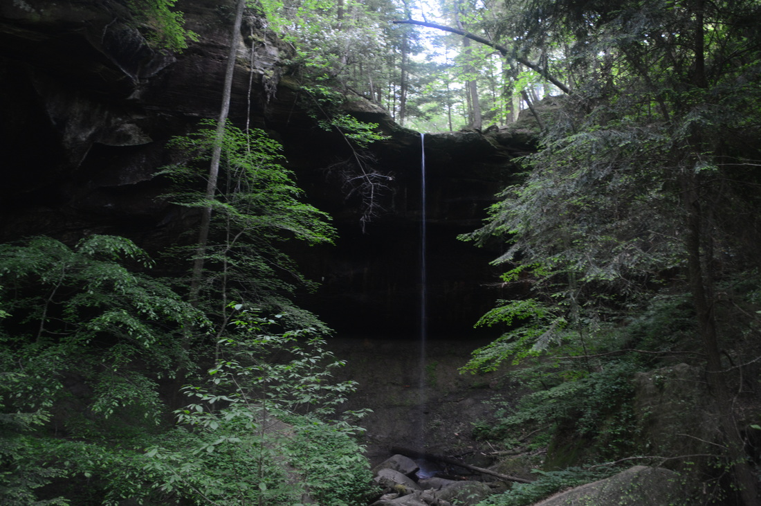
Duration of Hike: 12:15 Type of Hike: Loop Difficulty Rating: 8 out of 10 Pros: 70% of the hike is generally easy; numerous campsites; largest tree in Alabama Cons: Extremely buggy during the hot season (and ticky during tick season); most water features are best seen after periods of rain; rough stretches of trail on the upper part Sipsey River Trail; steep ascent that follows a slippery wet-weather streambed near the upper end of Sipsey River Trail Scenic Views: None Water Features: Fall Creek Falls - 7 stars; East Bee Branch Falls - 5 stars (it is located in a beautiful setting and would probably be much better after periods of rain or a heavy thunderstorm) Trail Blaze Color(s): None Best Season(s) to Hike: Late Winter and Early Spring Beginning Point: Randolph Trailhead Directions: From Double Springs, AL: Take US Highway 278 West for 0.2 miles. Then, turn right onto AL State Route 195 West for 9.1 miles until Kinlock Road (County Road 60). Turn right and follow Kinlock Road for 1.1 miles until Cranal Road. Turn right onto Cranal Road and follow it until the Randolph Trailhead, reached after 1.5 miles, on the left.
If you've been following this blog for a bit, you have probably figured out by now that I have significantly increased my day hiking limit over the past several months to half-year. But you know, there's a limit to everything. I would say that this was my all-time hardest hike, although it happened to be that due to a couple of unprecedented reasons that hopefully won't affect you - thus, I am not giving it a higher difficulty rating. The hike itself isn't that hard with only about 1000 feet of cumulative elevation gain. Even with the long mileage, this is a fairly doable hike, and easier than a couple others listed on this website. There are two main reasons this hike got me. The first was that somehow the first two fords left me with blisters, which is quite bizarre, as I have forded rivers of this type dozens of times before with no side effects. This slowed my pace to less than 1 MPH in the last several miles of the hike. The second problem was that I got thrown off-guard by the well-maintained first 14 miles of the hike, and happened to get to the most confusing and least-traveled section of the hike in the dark: Bee Ridge Trail and East Bee Branch Trail. The East Bee Branch Trail is an unofficial trail that is very confusing and undependable below The Big Tree and East Bee Branch Falls. Bee Ridge Trail is one of the least-traveled official trails in the Sipsey Wilderness and can get nearly completely overgrown in summer, especially in a 0.1-mile section that is nearly choked by mountain laurel. Do not get caught off-guard by the good quality of the trails in nearly all of the hike.
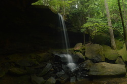
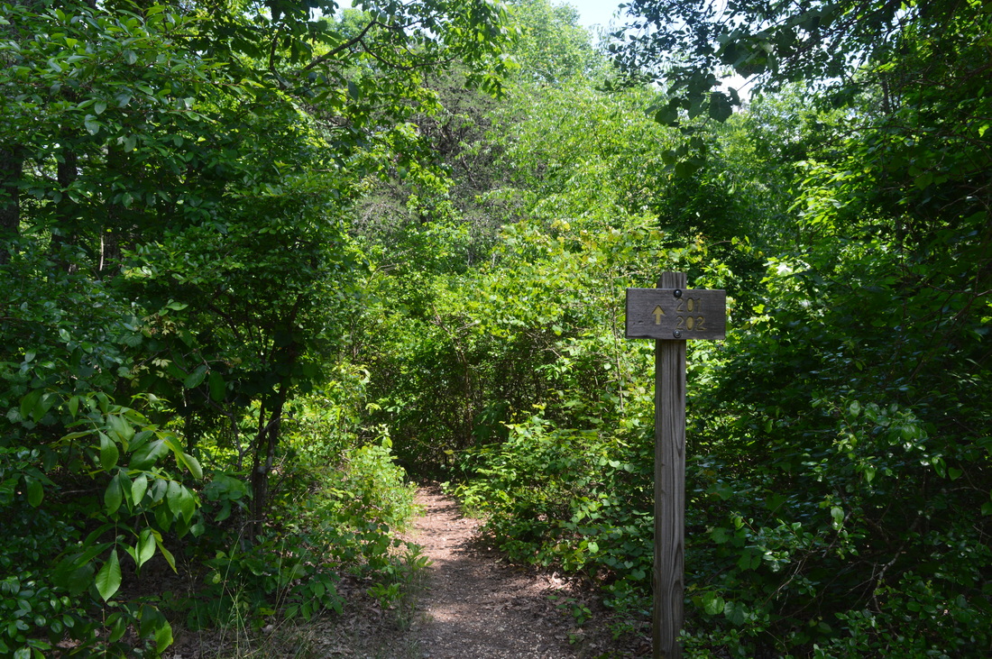
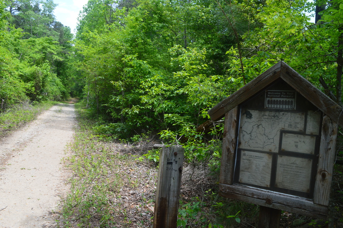
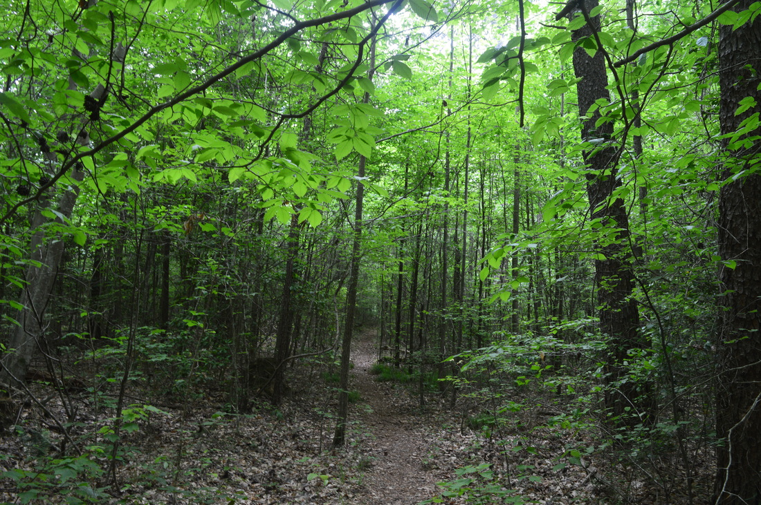
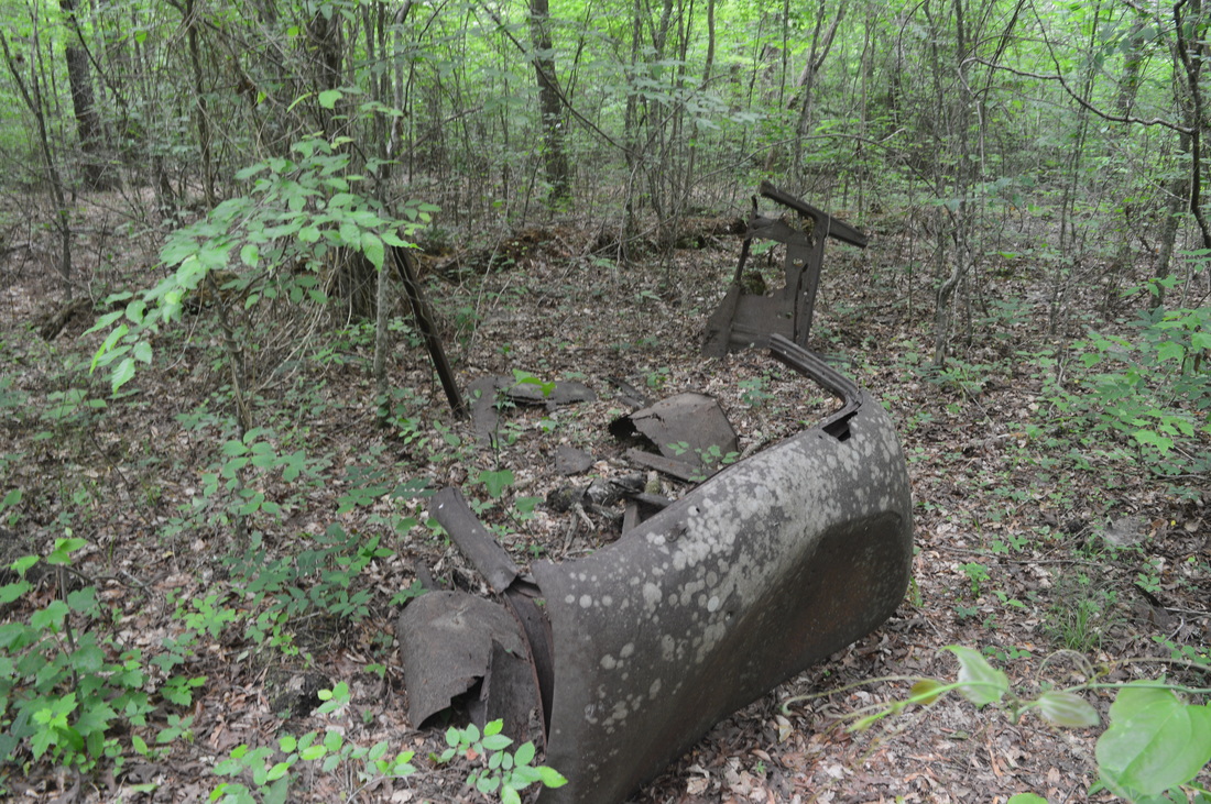
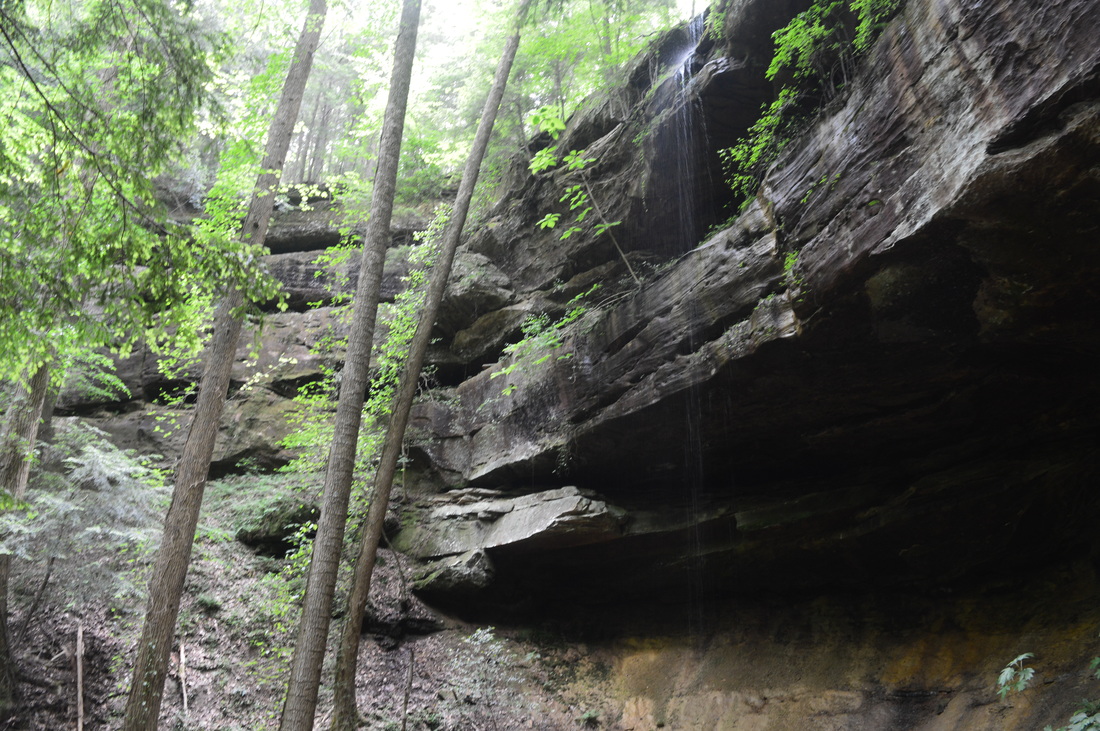
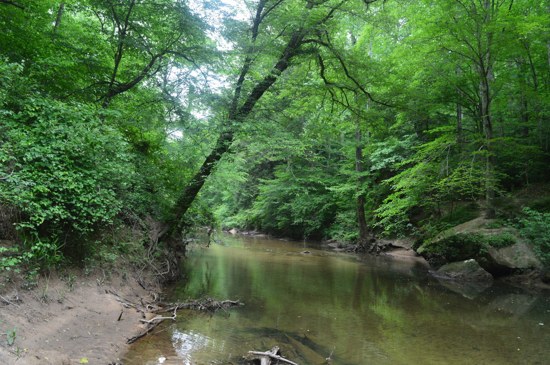
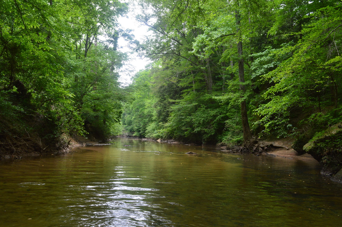
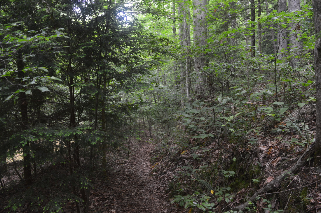
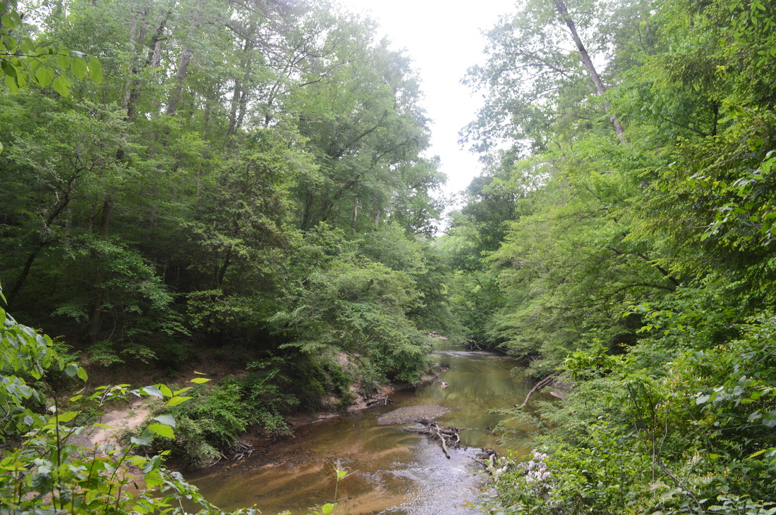
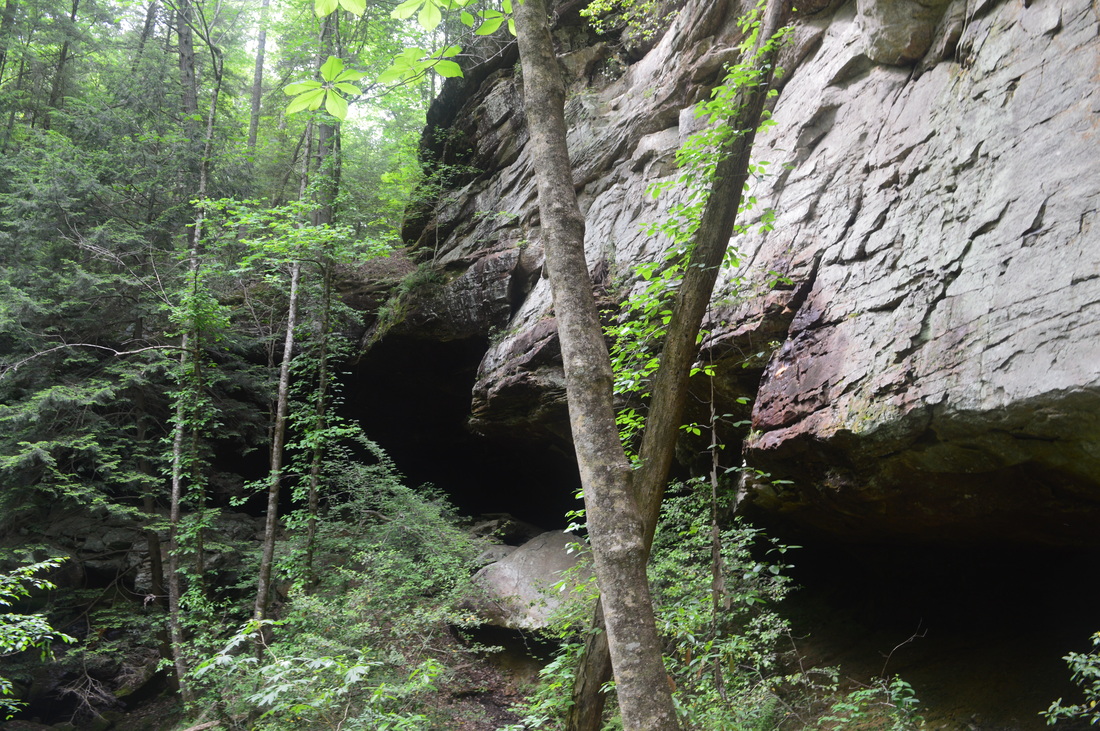
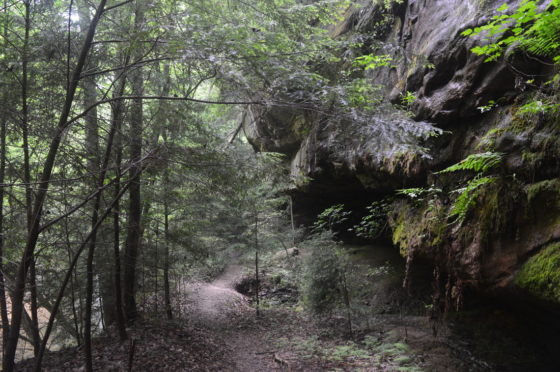
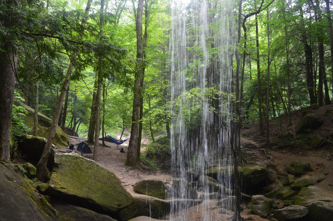
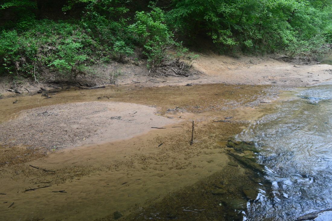
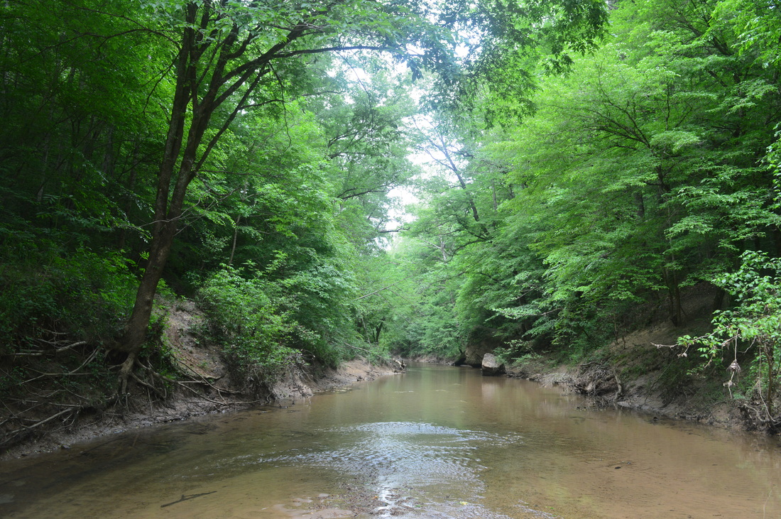
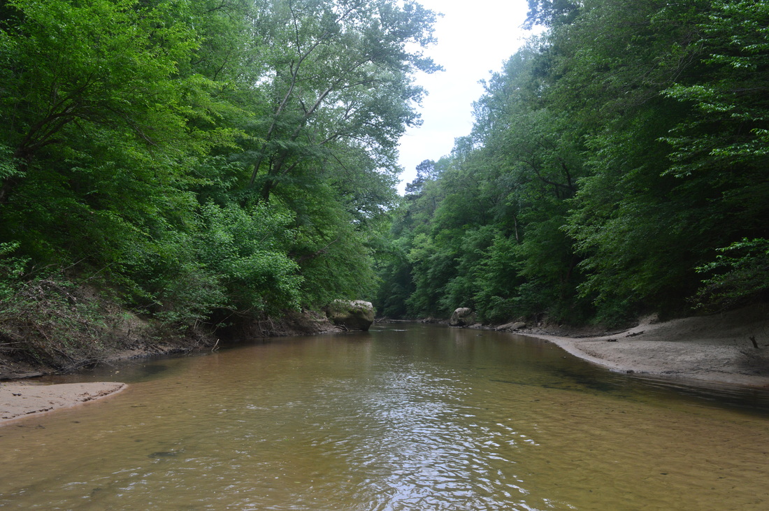
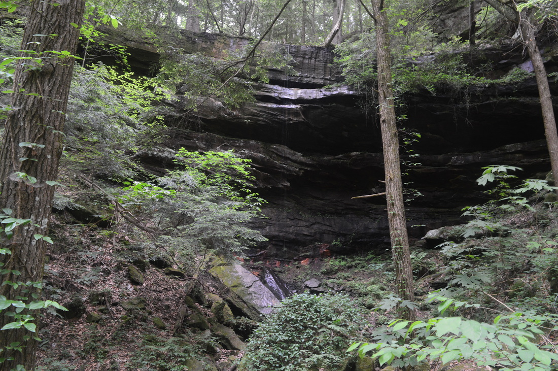
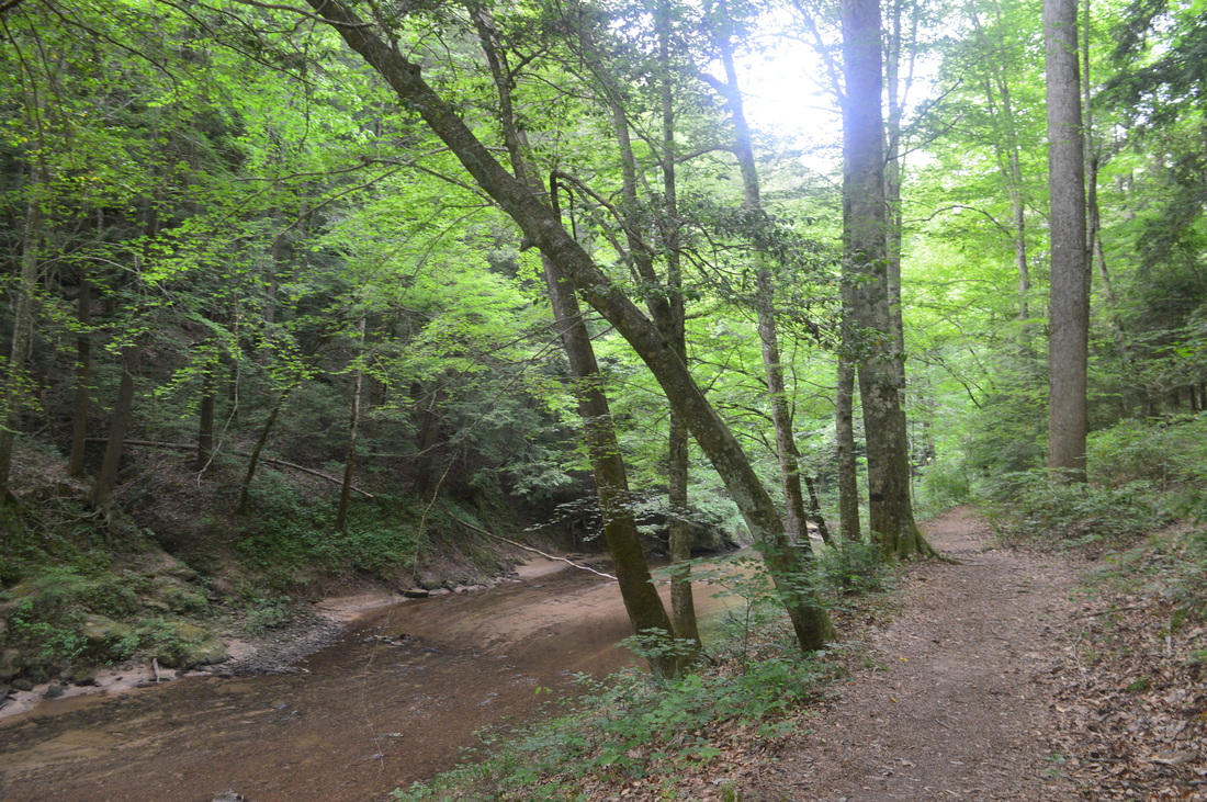
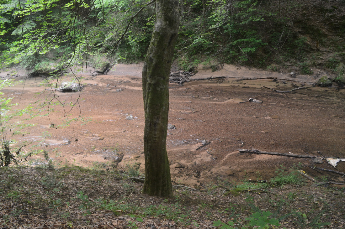
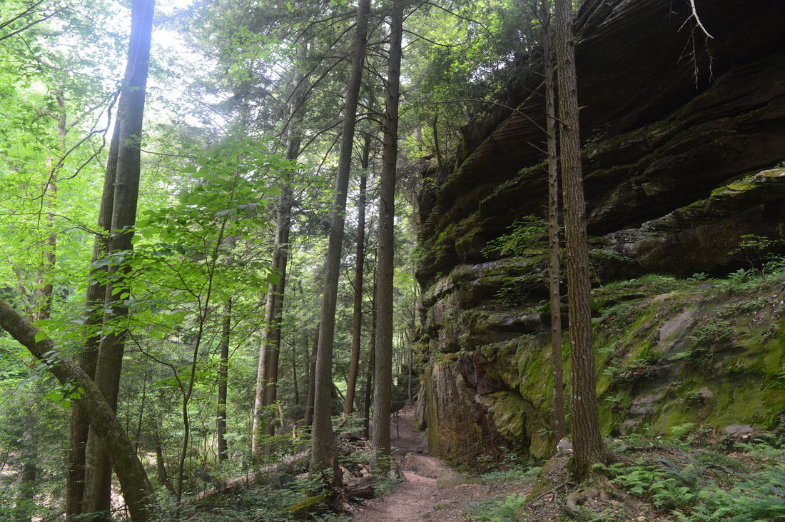
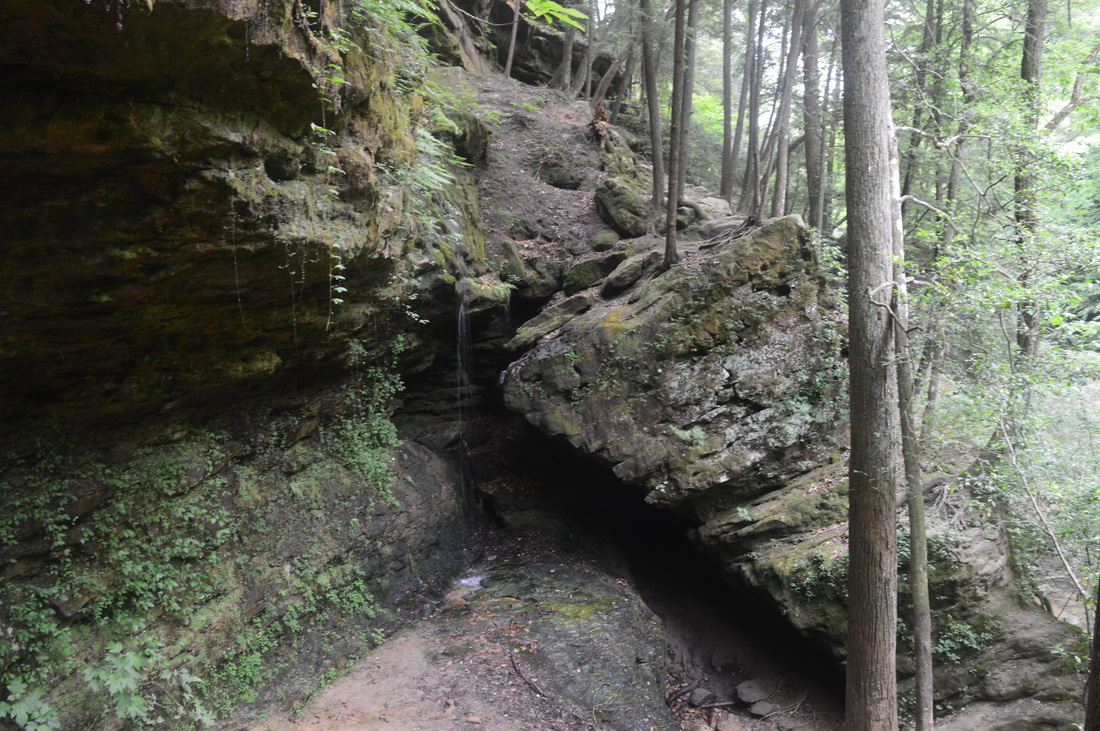
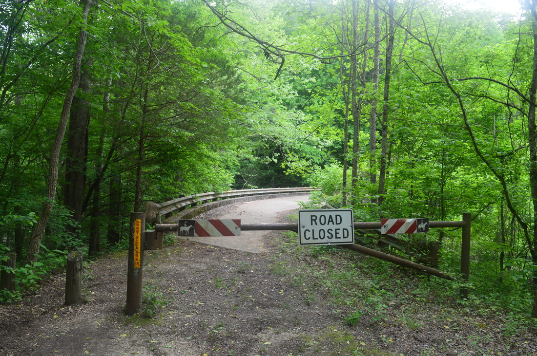
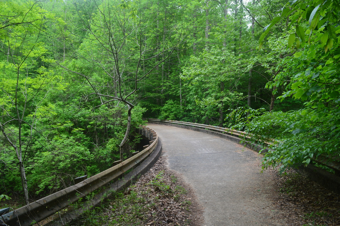
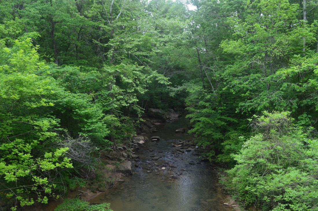
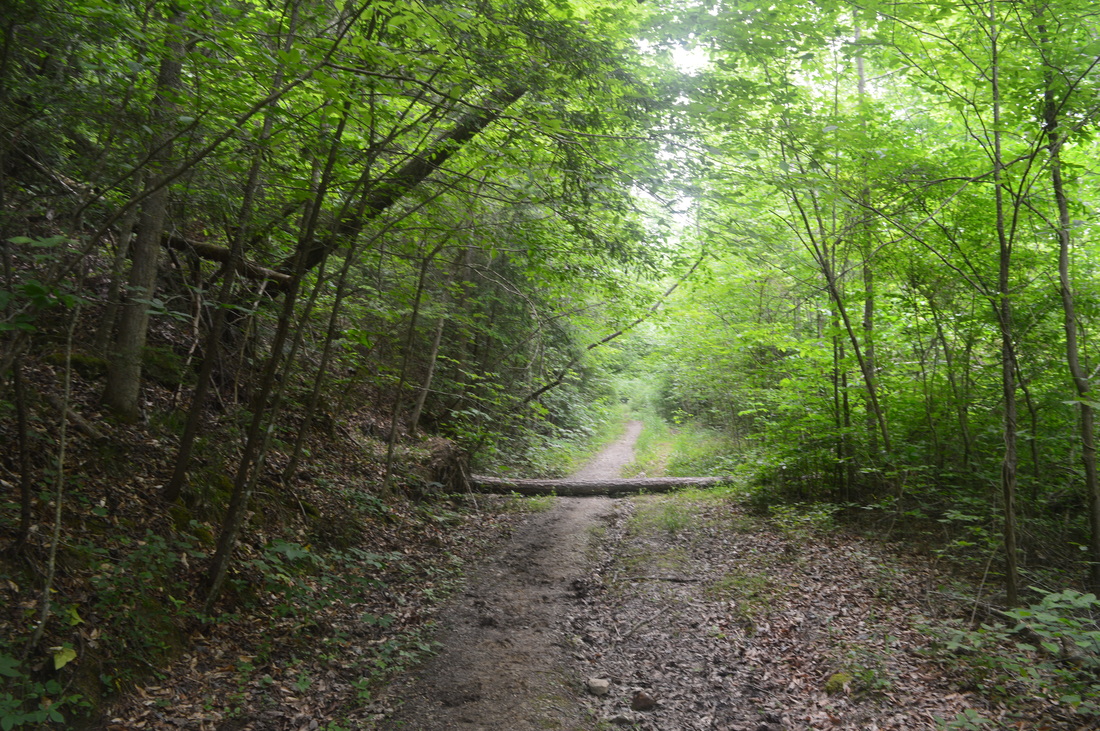
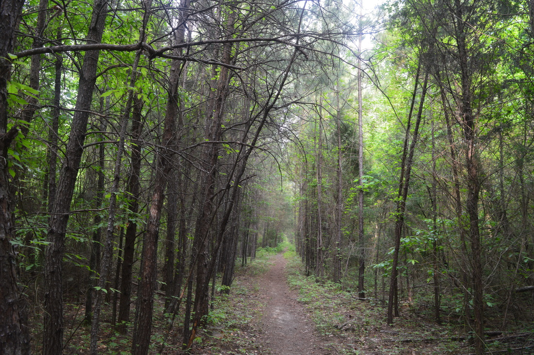
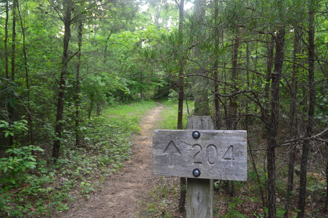
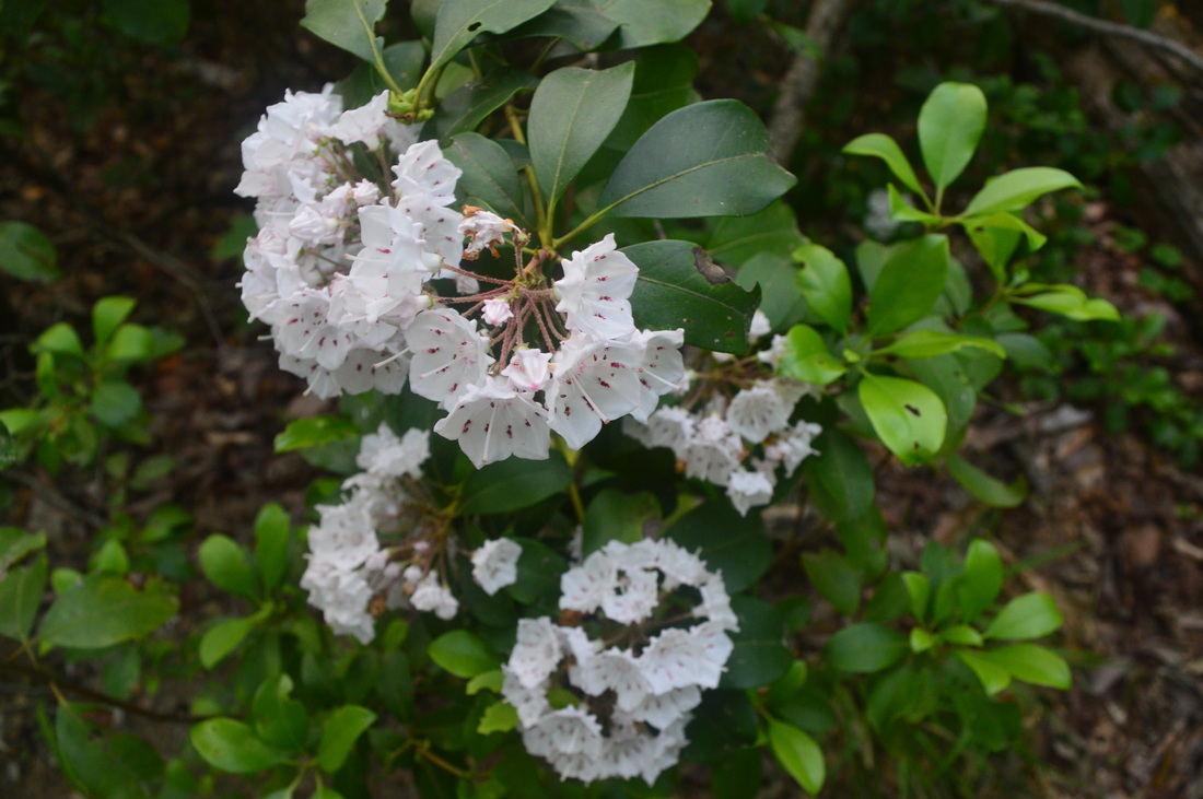
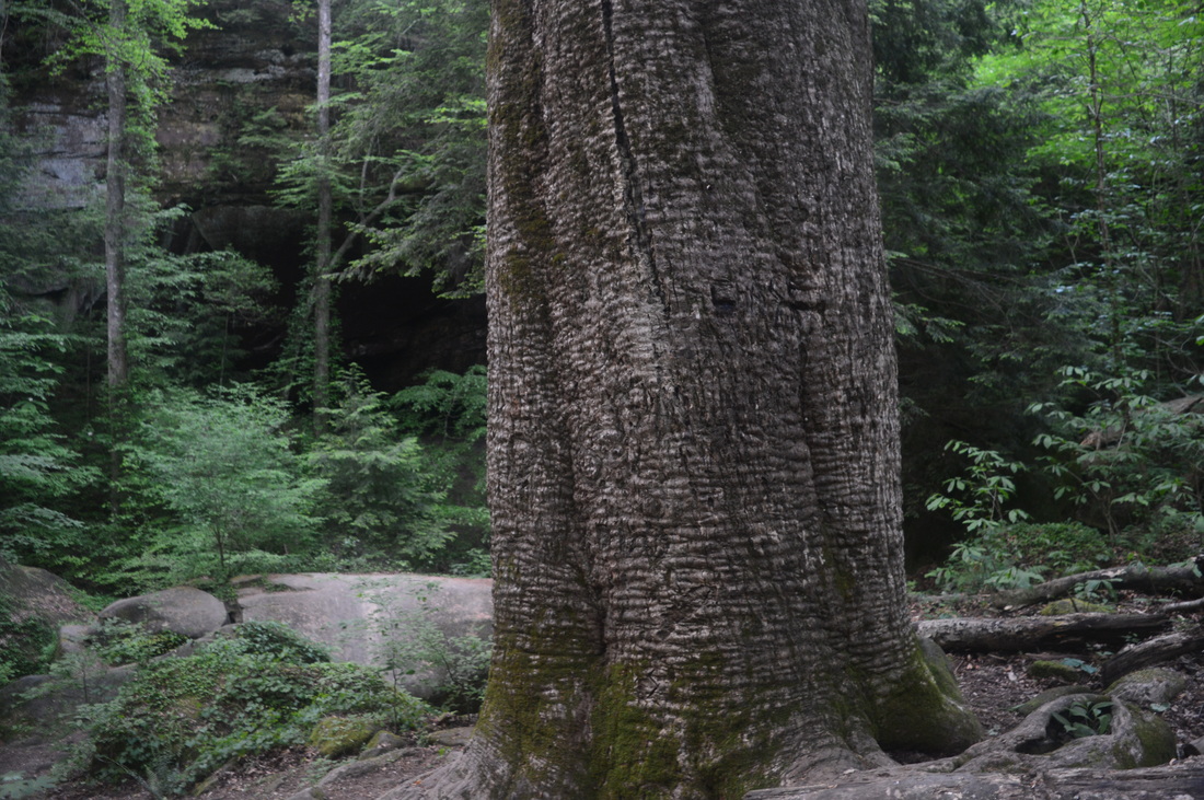
Trails #201 and #202 (Rippey Trail and Randolph Trail, respectively) share the first 0.3 miles together. To the left of the trailhead, you can see a gated old road. The trail will join that road shortly, but for now, take the trail by the kiosk, marked by a sign "201/202". The trail starts as a well-defined single track path descending gently downhill. There may be a few winter views here, but I cannot guarantee they are there. At 0.2 miles, reach the old road that started near the trailhead. The road is in excellent condition, and I suspect it may get some use until Johnson Cemetery. At the old road, take a right turn onto it. There is a small kiosk here with some trail information. At 0.3 miles, a tenth of a mile after the right turn, reach the start of the loop at a junction where the Rippey and Randolph Trails separate. Continue straight - you'll be back at this point 21 long miles later. The Randolph Trail follows a wide dirt road, wider than a typical forest road a trail would follow, reaching the Johnson Cemetery at the top of a small hill at 1.1 miles. The Cemetery is split in half. There is a smaller area on the left and a larger area on the right, where the wide old road ends. These two areas are known as Johnson Cemetery West and East, respectively. I only visited the East side, the larger part. Some of the tombstones date back to the 19th century! Following the cemetery, the trail narrows to a single-track path, although there are numerous traces of this being once a road. The trail generally undulates across wooed hills around 900 feet high. At 1.6 miles, the main trail bears right while an overgrown roadbed continues straight. According to maps, that roadbed eventually dead-ends near the rim of the Sipsey Fork gorge. At 2.4 miles, reach a huge oak on the left along with some car ruins. This is the site of an old homestead. This spot also marks the start of a descent, sometimes steep, into the Sipsey Fork gorge. The descent is with few switchbacks although the gorge walls are not very steep, so it could've been worse. The depth of the gorge soon comes into view on the left, and now you can actually tell that you are not in a completely flat area. At 2.7 miles, turn right, while a campsite is on the left. Continue your descent into the gorge, past tall cliffs to a wet-weather waterfall at 3 miles. A short spur trail leads to the waterfall. This waterfall is quite tall as it drops off the cliff, but it was barely a trickle when I was here - it might be better after some rain. The trail turns left at this water feature, following a tiny stream. Reach a campsite on the right - this may be a point of confusion. There is a path on the right, but keep left on a slightly better-defined path. The path on the right may lead to another place to ford the Sipsey Fork. At 3.2 miles, reach the Sipsey Fork. A tree stump with the engraving "202 ^" (pointing the direction you came from) marks the end of the Randolph Trail. The Sipsey River Trail (#209) lays across the river, but in between the two, there is a ford. The hardest part of the ford is to get down to it, and in fact, you'll learn this is the case with all three fords on this hike. There are several approaches to the ford but I didn't choose the best one. The one that continues straight from the engraving-sign is probably the hardest approach. I followed a slim path on the right that led to an eroded, sandy/muddy descent to the river. This approach probably wasn't' any better than the first one. Later, when I forded, I figured that the easiest approach would have been by turning left at the engraving-sign, and fording just a bit upstream. For low-water periods, there are even some stepping stones over there. Most of them were underwater on this day. Where I forded, the water was about ankle-deep to knee-deep in a few spots, but it's very shallow at the place where the stones are. After fording, climb up the steep bank with the help of some roots to hold to. Once above the Sipsey Fork, there will be a sign marked "<209>", assuming you've forded at the right spot. The route of this hike turns right (downstream). Also, Feather Hawk Branch ties into the Sipsey Fork just upstream from the ford. An off-trail ramble up the feeder branch will lead to Feather Hawk Falls. The Sipsey River Trail is a rather uneventful trail, as ti follows the Sipsey Fork the entire time. The trail generally stays flat near the river, with occasional streambed crossings that involve steep, muddy approaches. There are a few wet-weather waterfalls along the way, falling off cliffs on the left, but they are all generally unimpressive. They will certainly look better after a good rain. At 5.9 miles, reach Fall Creek Falls, the only waterfall with good flow on this hike (East Bee Branch Falls had low flow too, although slightly more robust then most of the unnamed wet-weather waterfalls mentioned). Fall Creek Falls is actually a fairly photogenic, single-drop waterfall located on Fall Creek. There is a huge sheltered area behind and to the left of the falls under a rock overhang. You can walk behind the falls, although you may get muddy. Cross Fall Creek below the falls on huge boulders and pass a large campsite. Climb away from Fall Creek and pass some cliffs on the left, before reaching a potential point of confusion at 6.4 miles. Here, the Sipsey River Trail to ford Borden Creek. However, there is no sign marking the turn, as a very well-used path continues straight up the west bank of Borden Creek. This path, while an unofficial trail, is sometimes called West Borden Creek Trail. According to what I've read, the trail is easily followed all the way to the Borden Creek Bridge and the Borden Creek Trailhead. This trail is used as a bypass for the ford of Borden Creek if coming from the west. However, I chose to follow the official, and more scenic, Borden Creek Trail, which was to be found just across the creek. This ford by itself is the easiest of the three, but it involves another steep, muddy approach. Make sure to not slip on one of the muddy wooden planks that are placed here. The ford itself was very shallow, even dry in some places, when I was here. It is easy to wade into the middle of the Sipsey Fork for a last look down the river. Across from the ford, reach the terminus of the Sipsey River Trail. The terminus is the junction with the Borden Creek Trail (#200). If turning right onto the Borden Creek Trail, it is 0.4 miles to the Sipsey River Recreation Area and Trailhead. The hike continues with a left turn. As the trail follows Borden Creek upstream, yo may notice tat Borden Creek's water is very clear. Pass wet-weather waterfalls at 6.5 miles and 6.9 miles. The trail will cross numerous small feeder branches, and when it does so, it will veer away from the main stream, but otherwise, it closely parallels Borden Creek. At times, there will be cliffs on the right side of the trail. At 7.9 miles, reach the Tunnel of Borden. For me, this is the highlight of the hike. The trail seems to reach a dead-end, with the most obvious route being a path of sorts heading to the right up a steep slope. While this route seems somewhat practical from here, the descent back down on the other side of it looked very difficult to me. The better (and funner) route is to continue straight ahead into the Tunnel of Borden. The trail seemingly ends at a large boulder, but while it's not immediately obvious, the well-defined path continues into a crack in the boulder. At first, I thought "how do you even go in?" But it's actually easy. Continue into the cave. Shortly, the tunnel turns left, and this is the narrowest stretch. Come out of the tunnel shortly in a very muddy area. There is a wet-weather waterfall here, as well as a side path down to Borden Creek. The trail widens after this, and there are some indications of horses using this part of the trail, even though horse use is prohibited on the Borden Creek Trail. At 8.3 miles, reach the end of Borden Creek Trail at the Borden Creek Trailhead and the end of the open section of Forest Service Road 224. Borden Creek Trailhead is an important trailhead. The Borden Creek Trail is one of four trails that leaves (or ends) here. Two trails leave the trailhead together northward: Lookout Trail (#203) and Braziel Creek Trail (#210). They separate shortly. Finally, former Bunyan Hill Road/Lawrence County Road 7, now closed and known as Bunyan Hill Trail (#224), leaves the trailhead westward across a closed road bridge over Borden Creek. This is the route this hike takes. Turn left and cross Borden Creek on the closed road bridge. The bridge is still in surprisingly good condition. There is a good view of Borden Creek upstream. Following the bridge, start an ascent onto a dry ridge, away from the creeks. In fact, there won't be any water until over 4 miles later. The Bunyan Hill Trail is the only trail on this hike that's open to horses, and even though it's often somewhat overgrown, you'll still see plenty of horse traces. The trail starts with a steady uphill, but it soon changed into a mainly flat (with occasional insignificant elevation changes) route along a wide ridge, somewhat resembling the Randolph Trail. There is nothing worthy of attention the next 3.7 miles, although I am curious about two overgrown paths that head off to the left marked by "no horses" signs. Maps give little clue as to where they could lead. At 12 miles, after a seemingly endless stretch of straight trail, reach a junction with the Bee Ridge Trail (#204). This junction is simply marked by a sign "^204". Bee Ridge Trail is the least-used trail on this hike, and I was unlucky to hike the latter portions of it in darkness. After turning left onto the Bee Ridge Trail, you will be on Bee Ridge, although it's often hard to notice that you're walking on a ridge in this low terrain. At 12.8 miles, reach a potential confusing spot. Bee Branch Trail (#204A) heads of to the right. I am still somewhat confused about Bee Branch Trail. Even though it is listed on official maps, it is not considered as an official trail, but it gets a fair amount of use. My original plan was to take the Bee Branch Trail down to the Sipsey River Trail, but due to confusion, I never made it below East Bee Branch Falls, so instead, I decided to continue straight on Bee Ridge Trail down to the river (even though it was longer). In other words, to follow my hike route, turn right onto East Bee Branch Trail to East Bee Branch Falls and The Big Tree, and then retrace your steps to this junction. I also spotted some wild hogs near the junction. The Bee Branch Trail passes some campsites and then heads gently downhill, descending into the East Bee Branch gorge. At 13.1 miles, make a steep switchback to a rocky area and potential campsite. This is actually the top of East Bee Branch Falls. East Bee Branch Falls was barely more than a trickle on the day I went, although it's in a photogenic setting and may look much better after periods of rain. Following the top of the falls, continue on the path along the side of the gorge (still above East Bee Branch). It is easy to lose your way here. If you're on the right path, you'll pass some rock cliffs on the left and shortly afterwards reach a steep path leading right, downhill. I still don't know if the actual trail goes down there (but more likely it does), but that is the way to The Big Tree and the base of East Bee Branch Falls. There is also a large fallen tree at this path. Later on, I continued straight beyond the path, and I eventually reached a dead-end amidst a rock jumble and tall cliffs, so I suspect the trail is more likely to be down near the creek. In any case, make the scramble down the steep path, and then turn right (a path heading left might be a continuation of East Bee Branch Trail). At 13.2 miles, reach The Big Tree, a massive tulip poplar. It is the largest tree in the state of Alabama. East Bee Branch Falls is just ahead. Again, I think it might be best to view this falls (and to be honest, to do the whole hike) after substantial rainfall. The best thing to do from here is to retrace your steps back to Bee Ridge Trail, unless you want to try the Bee Branch Trail downstream. If you find it, feel free let me know where it is! Otherwise, retrace your steps to reach the Bee Ridge Trail at 13.6 miles, and take a right turn to continue following it. While Bee Branch Trail was confusing, I didn't expect the Bee Ridge Trail to have issues too. While the path was more or less evident the entire time, there were overgrown sections and some confusing sections too. It is 1.5 miles from the Bee Branch Trail junction to Sipsey River Trail. At first, you will be gently descending along the ridge. The best views of the hike will be on this section. There are some limited summer views and possibly decent winter views. The trail will be choked with mountain laurel in spots here. Then, the trail will hop off the ridge and begin to descend more steadily towards the river. It will cross some drainages and head steeply down in several spots. There will be a small confusing area where you go through a muddy spot and then descend steeply down past some small rock outcroppings. If all goes well, you will reach the Sipsey River Trail at 15.1 miles. A left turn will take you to Randolph Trail in 1.2 miles, but I turned right to continue the loop (although turning left would be a shorter option). You will be following the Sipsey Fork upstream, and there will be many campsites scattered throughout the rest of the trail along the river. At 15.8 miles, reach an unmarked junction with Bee Branch Trail (#204A). If you can find the way, the map indicates it's 0.8 miles to East Bee Branch Falls up Bee Branch Trail. The Sipsey River Trail turns right here, so make to not turn right. If you are unsure whether this is the junction or not, you should be able to see a sandy (and later muddy) descent to a small stream (Bee Branch) on the left. In any case, don't make any unclear right turns and you should be fine. Shortly cross Bee Branch on a well-placed log. This may be a wet crossing after periods of rain. There is an extremely muddy area promptly after the crossing, and so is the climb up from the crossing. Take care here. After following the river for a while, reach a very important junction at 18.1 miles. Trail #209 turns left to ford the Sipsey River, while a very well-defined trail continues straight. This is an unofficial trail that goes through a private property area and eventually reaches Thompson Creek Trail (#206). When I hiked this trail, the junction was marked with a decaying sign "<209". This sign may not be here by the time you do this hike, so be very careful to not continue straight (unless you want to see the rapids on the Sipsey Fork and Ship Rock/Eye of the Needle). The junction is also marked by a nail in a tree, which seems to grow horizontally across and above the trail before turning vertical. Following the left turn, descend steeply to a fairly shallow and rockier ford of the Sipsey Fork. Following the ford, steeply climb up the other bank, and then, turn right. There will be another nail here. At 18.2 miles, reach another turn. Another path continues straight along the river, into the private property, while the main trail turns left. There is an undecipherable, decaying sign here. Make sure to not miss this left turn. The trail is ultimately confusing over the next 0.6 miles, but try to stay with the main path. There will be a path leaving right marked by wooden poles and red tape - do not go there. It's probably the route to the cabin that is on the private property. There will be another sign for Trail #209 shortly, along with a path coming in from the left - I have no idea where that one came from. Then, continue a steep ascent along a very slippery sreambed to break the cliff line. Recross the stream several more times before leaving it. This is the last water for the rest of the hike. Reach a junction with two other trails at 18.8 miles. Here, the Sipsey River Trail ends at its northern terminus. The Thompson Creek Trail (#206) turns right towards Thompson Creek Trailhead, while the Rippey Trail (#201) turns left towards the Randolph Trailhead. Turn left - the rest of the hike is generally easy. The Rippey Trail is 2.7 miles long and mainly flat and straight. There is nothing much to describe about this trail. At 21.5 miles, reach the Randolph Trail. Turn right, and retrace the last 0.3 miles to the trailhead, reaching it at 21.8 miles. To summarize, this is a good hike for Alabama, but it is quite long and I suggest that you split it up into several shorter hikes or make it a backpacking trip. It is possible to do it all in one day, but you would need a very early start. Remember, if you don't have the issues I did with blisters and darkness, you are most likely to complete this hike in a shorter time period then I did. An additional suggestion is this hike would not be a good one for summer and late spring, especially May-June. It is very ticky and buggy. I can still go with the bugs, but the ticks (May/June is peak season) is something that is going to prevent me from ever going this time of year to low-elevation Alabama again.
2 Comments
2/2/2022 08:33:03 pm
Where does the Fall Line 6/1/2022 09:28:36 pm
I would like a map of Sipsey Wilderness and Bankhead National Forest for my family & I to do some short hiking of 5 to 10 miles, since my grandson is with the GAS BSA Council here in Marshall Co, Arab, Alabama in trying to complete the 50 miles requirements for an Eagle Scout later in years of merit badges. Leave a Reply. |
About MeMark Oleg Ozboyd Dear readers: I have invested a tremendous amount of time and effort in this website and the Georgia Waterfalls Database the past five years. All of the work that has gone in keeping these websites updated with my latest trip reports has almost been like a full-time job. This has not allowed me to pick up a paid job to save up money for college, and therefore, I I've had to take out loans. If you find the information on this website interesting, helpful, or time-saving, you can say "thanks" and help me out by clicking the button above and making a contribution. I will be very grateful for any amount of support you give, as all of it will apply toward my college tuition. Thank you!

Coming in 2022-2023?
Other Hiking WebsitesMiles HikedYear 1: 540.0 Miles
Year 2: 552.3 Miles Year 3: 518.4 Miles Year 4: 482.4 Miles Year 5: 259.9 Miles Archives
March 2021
Categories
All
|


 RSS Feed