HIKING THE APPALACHIANS AND BEYOND
  • Home
  • Trail Reports
    • Best Hikes
    • Hikes with Scenic Views
    • Hikes with Water Features
    • Alabama
    • Georgia
    • Florida
    • North Carolina
    • South Carolina
    • Tennessee
    • Vermont
    • Virginia
  • Map
  • Hike List
  • Testimonials
  • Resources
  • Contact Us
  • Southeast Nature Society
    • Our Team
  • Georgia Waterfalls Database

Pinnacle Park: West Fork Trail to Blackrock and The Pinnacle, Sylva, North Carolina

11/7/2014

2 Comments

 
Picture
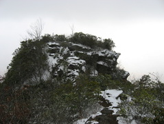
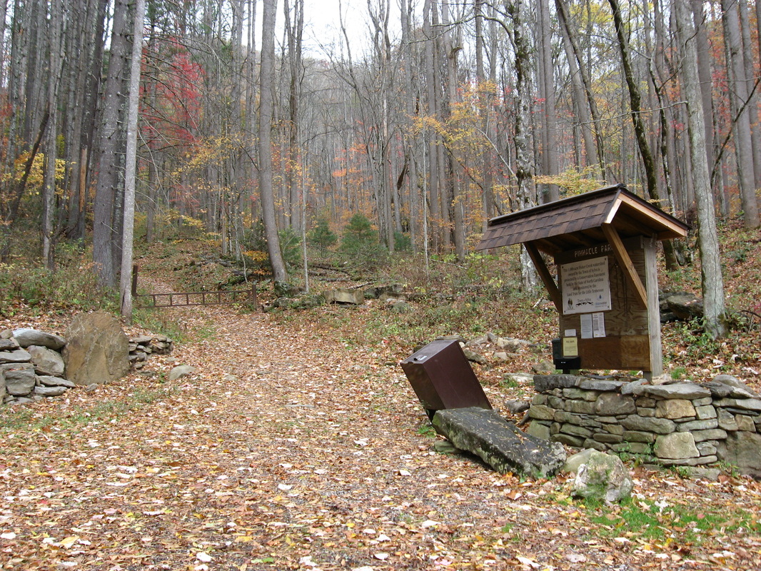
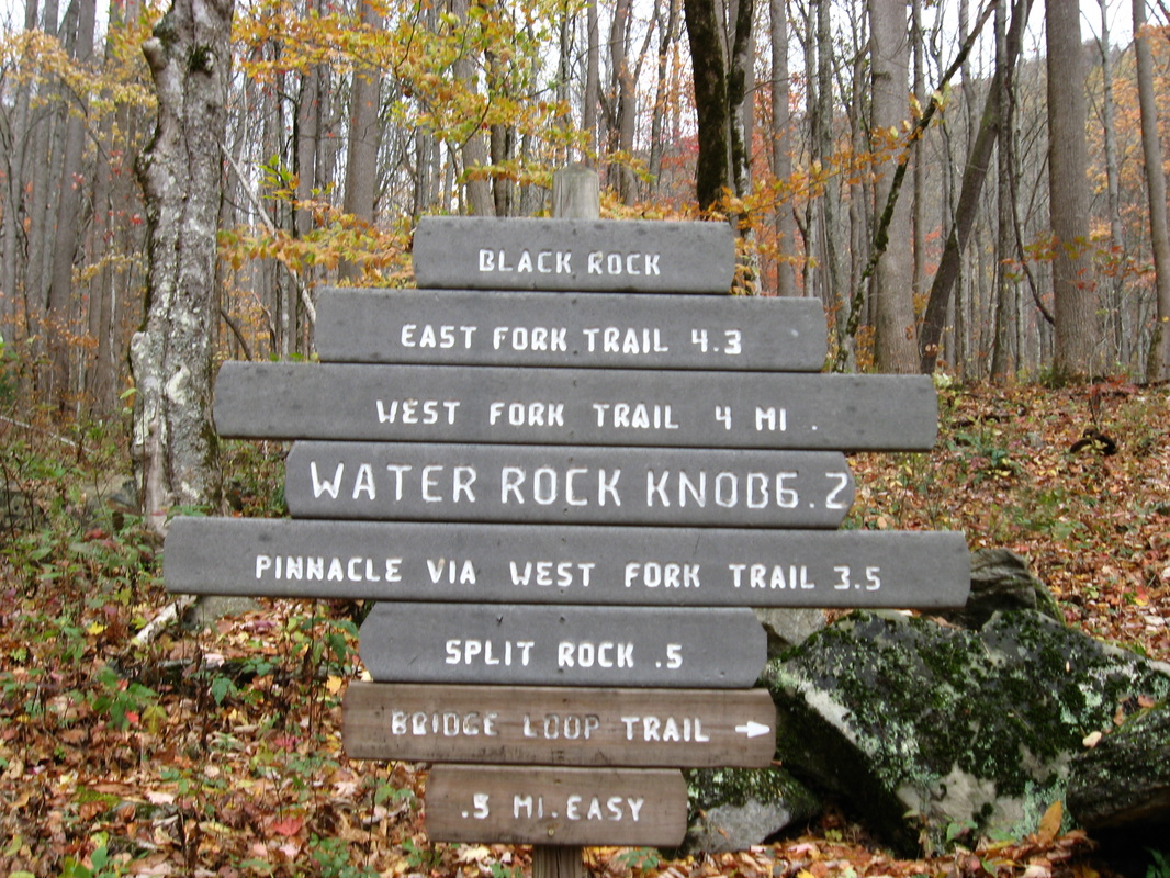
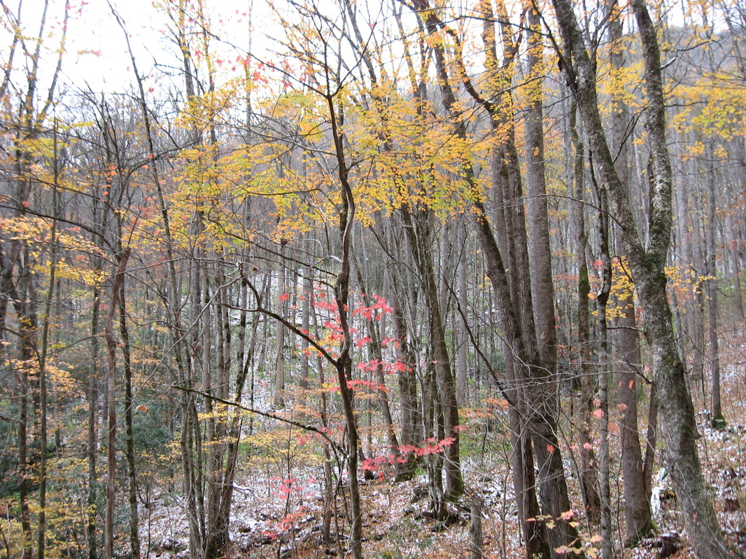
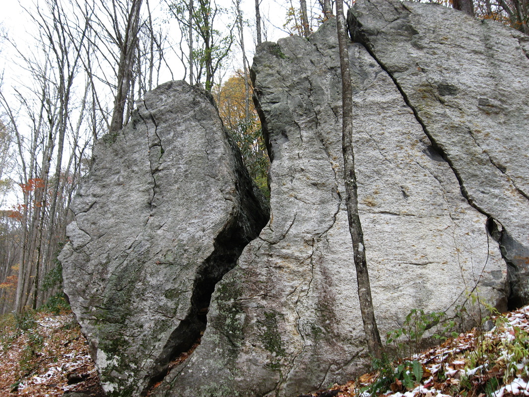
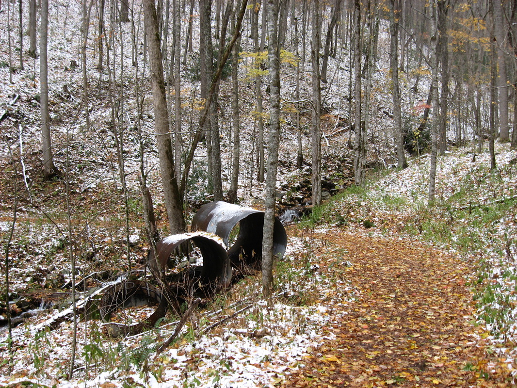
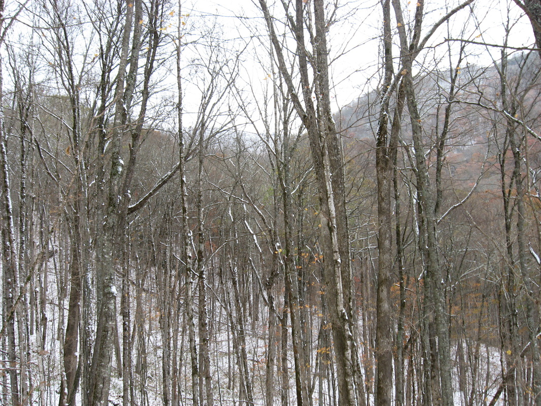
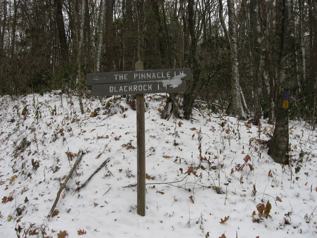
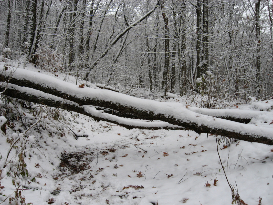
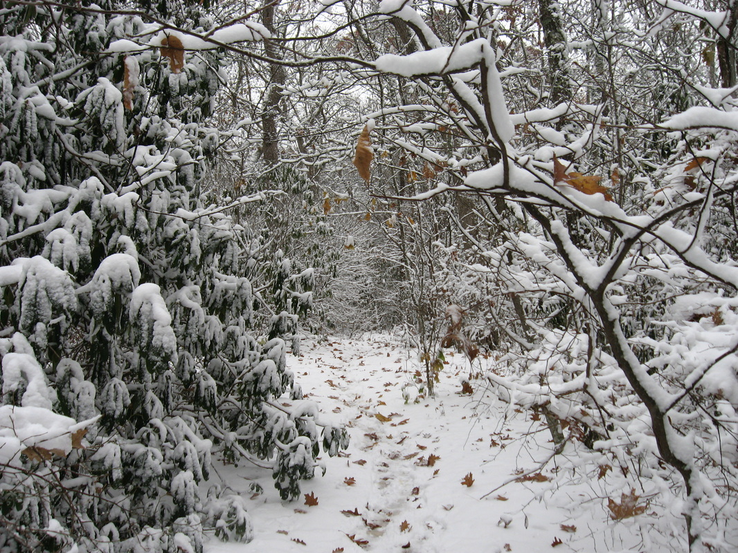
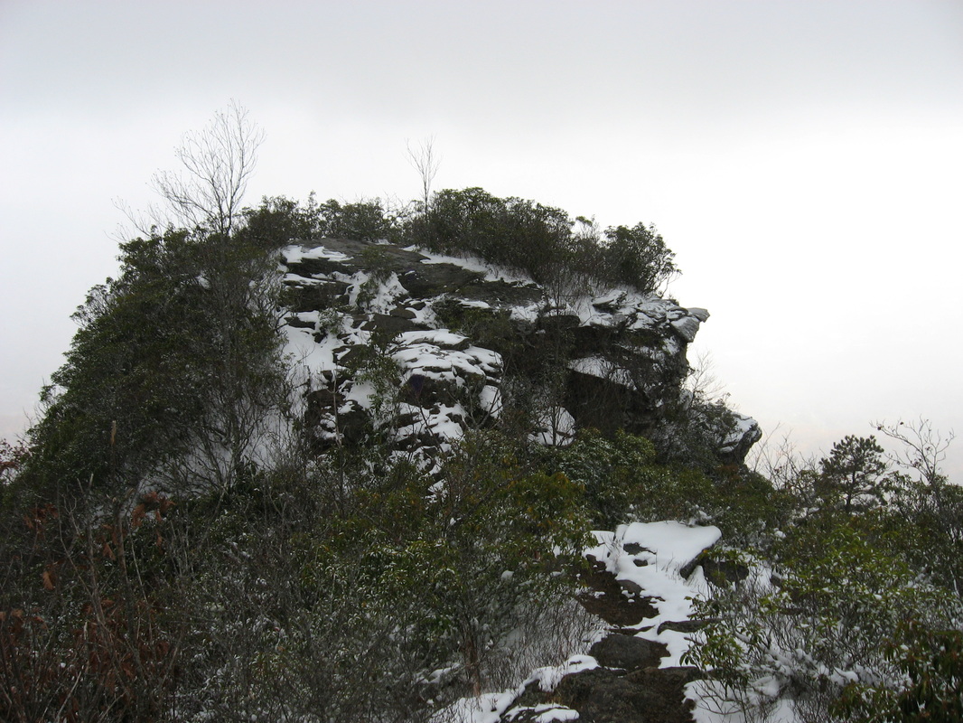
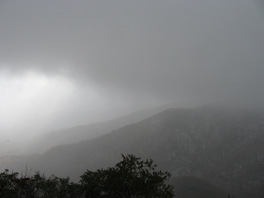
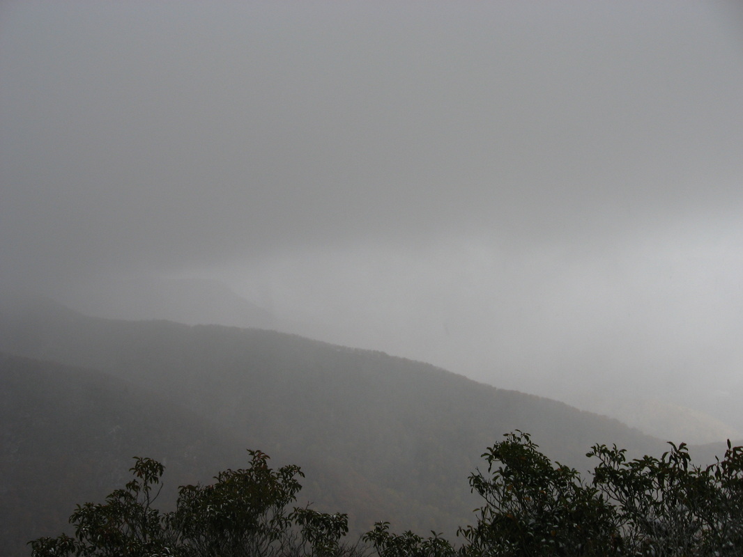
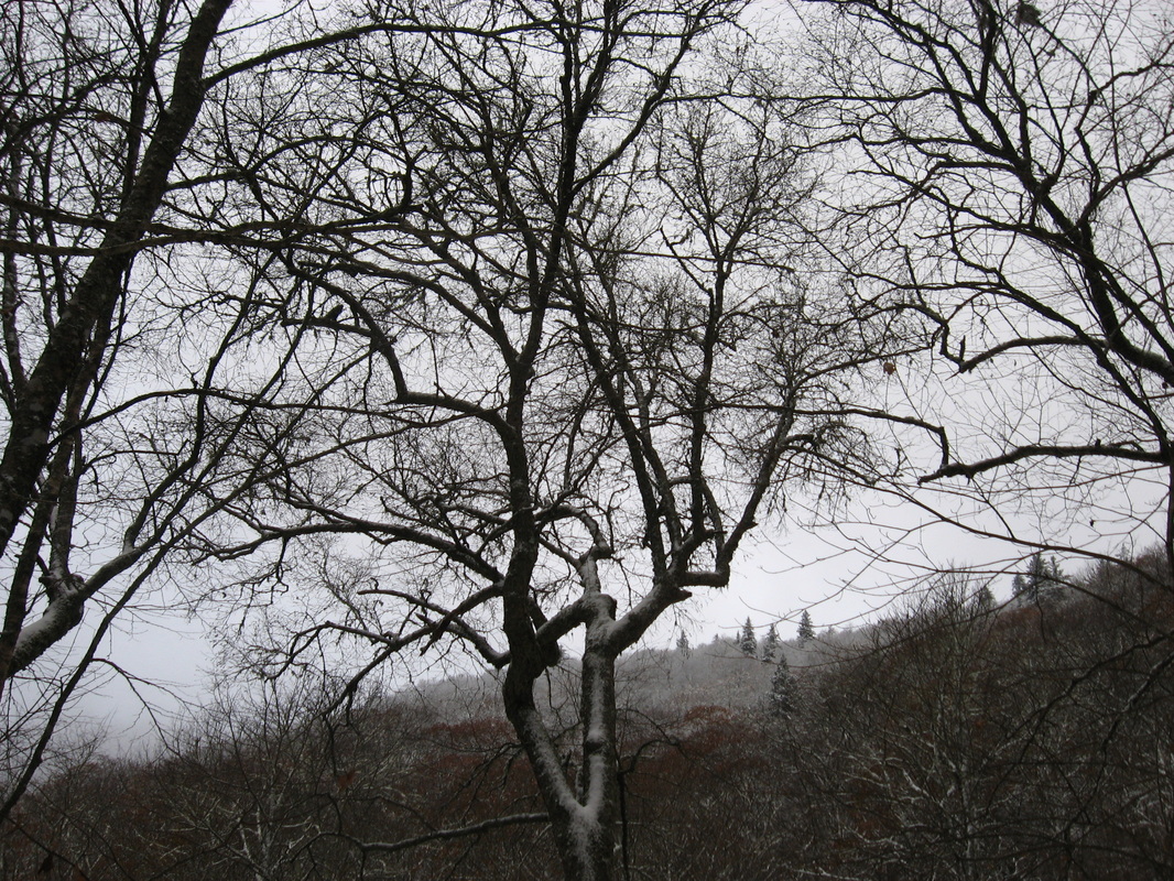
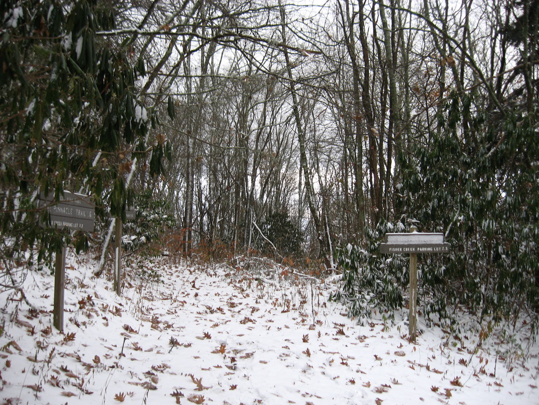
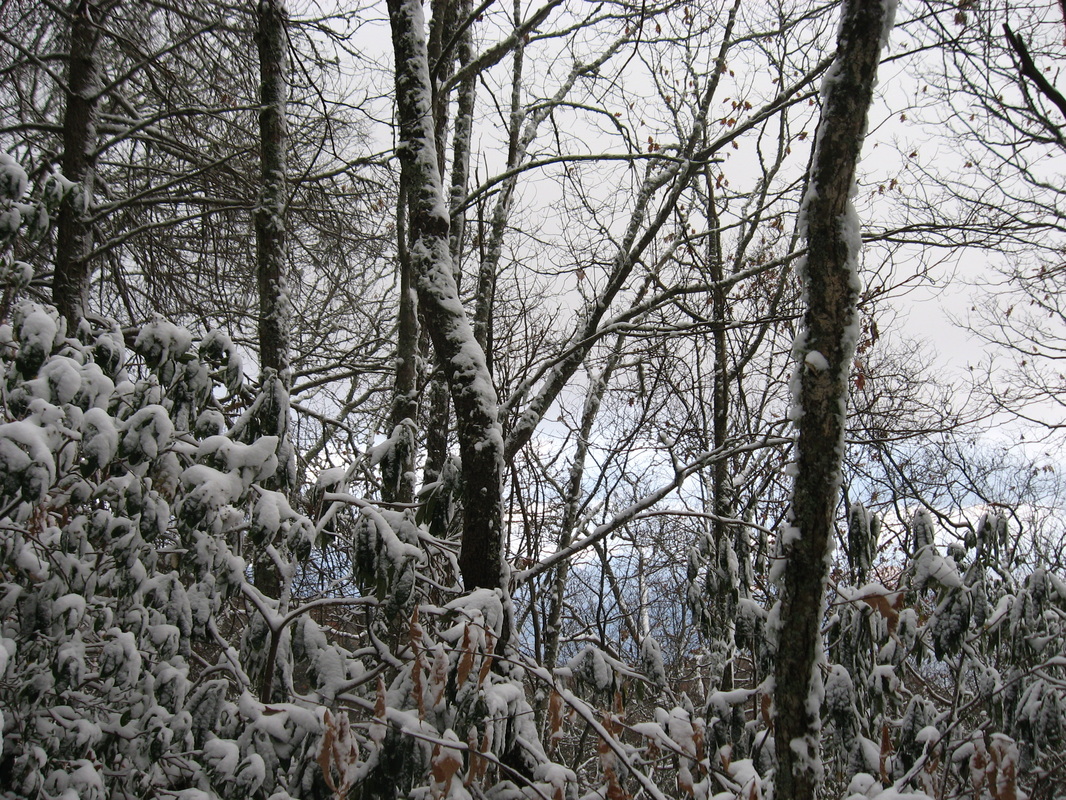
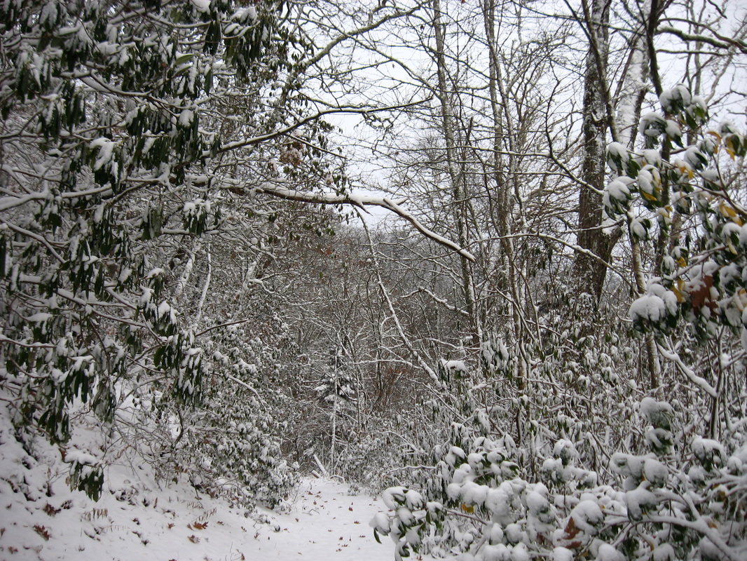
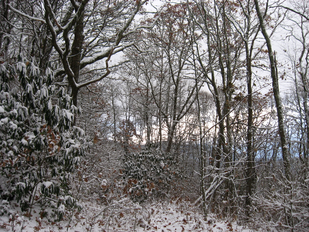
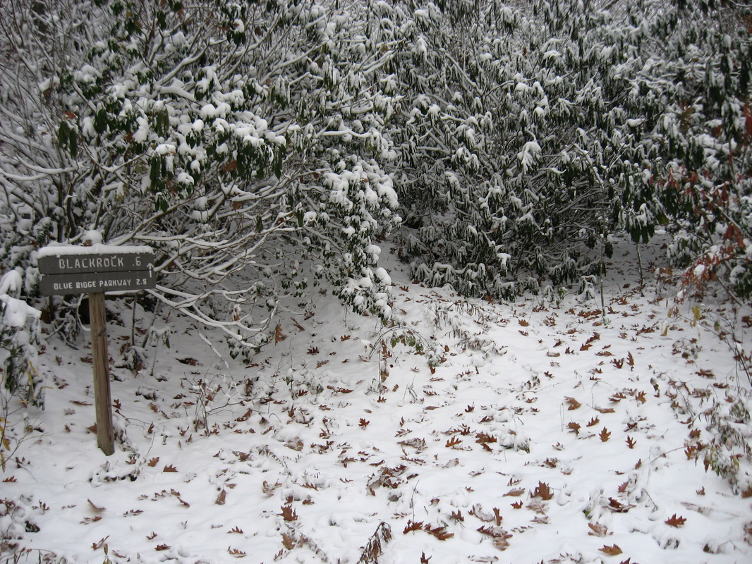
The Plott Balsam Mountains of Western North Carolina, sometimes considered part of the Great Smoky Mountains, is one of the most scenic areas along the southern Blue Ridge Parkway. A long history exists behind the land covering the western Plotts. Until 1991, the area now called Pinnacle Park was a watershed providing the town of Sylva's residents' water. Then, Sylva's residents were in need of a better water supply, and the watershed was transformed into a public park maintained by The Pinnacle Park Foundation. The main reason of this was to allow public access to the Pinnacle, a jagged rock outcrop on the very western end of the Plott Balsams, making for a sharp ending to the long ridgeline. Nearby, the exceptionally steep and rugged peak of Blackrock was previously on private land, until just a handful of years ago when the Blackrock Ridge Tract was purchased. Since then, these two features are fully connected to trails extending from the Blue Ridge Parkway. This hike occurred on Saturday, November 1st, 2014. My plan was to hike the West Fork Trail from the Pinnacle Park trailhead to the summit of Blackrock, and if time would permit, to Waterrock Knob. Along the way, I would take the side trail to The Pinnacle. 

R/T Length of Trail: 10.8 Miles
Duration of Hike: 7:15
Type of Hike: Out and Back with Spur
Difficulty Rating: 9 out of 10
Pros: Fantastic viewpoints; good trail signage
Cons: Old and very rocky roadbed; steep, tiring, and long scramble (almost off-trail) to Blackrock; some confusing trail blazes in Blackrock area
Scenic Views: The Pinnacle -  9 stars; Blackrock - N/A (fog and I didn't quite reach the official peak)
Best Season(s) to Hike: Winter (if you can make it through the wind and cold!)
Trail Blaze Color(s): West Fork Trail - Blue and Gold; The Pinnacle Trail - None
Beginning Point: Parking area at the end of Fisher Creek Road
Directions: From Sylva, NC: Take Allen Street North for 2.1 miles. Then, turn left onto Fisher Creek Road, and follow it for 2.2 miles to the parking area at the end. 
Do you like challenges? If you do, then one visit to Pinnacle Park will be enough for you to fall in love with it. This is simply that type of hike that you can't miss, especially the part on to Blackrock. It gets quite tough, but you should like it, if you like this type of hiking. 


From the parking area at Pinnacle Park, take the old road heading steeply up past the kiosk. There is a sign at the trailhead with some mileage information. Originally,I planned to go all the way to Waterrock Knob (and t's not impossible), but the plan had to be changed at Blackrock. The West Fork Trail follows an old road for the better part of its length, so it starts off rather steeply at the beginning. Near the beginning, intersect the Bridges Loop, the second end just a few dozen yards from the first one. At 0.2 miles, the West Fork Trail crosses West Fork Fisher Creek, and resumes climbing in earnest. At 0.3 miles, reach a junction with the East Fork Trail. If I come back here someday, and I probably will, I'll take the East Fork Trail that time. If you are not going to The Pinnacle, East For Trail is the best option, as it is a slightly shorter route to Blackrock following East Fork Fisher Creek. It may also be more scenic, as I have heard it has some small waterfalls, although I have not confirmed that. For the purpose of this listing, keep forward on the West Fork Trail. Your first landmark is at 0.5 miles - Split Rock, a large boulder with a big crack in the middle, almost splitting it in half. At 0.7 miles, the trail makes another crossing of West Fork at a particularly scenic spot, as West Fork spills down in cascades down the mountainside. Snow made an appearance in this area, progressively increasing in depth to around 2 inches at The Pinnacle Trail junction at 2.1 miles. Before the unction, the trail is sometimes steep, but mainly not - the main problem is the countless amounts of rocks, which are a big nuisance, especially on the way back down. 


At this junction, first take a left to visit the Pinnacle. It's about 1.4 miles from here, without much climbing involved. The trail does climb at first, but at around 2.5 miles, it levels out and starts heading downhill. All the trees were covered in snow, making for a beautiful scene. There will be one more brief but steep ascent at around 3 miles, before the trail resumes heading downhill. At 3.4 miles, the trail topped the ridge with some views. Then, it seemingly dead-ends - however, take the small path going diagonally left. This is a steep but short descent to The Pinnacle. Some places can be a bit sketchy in snow. However, when you come out onto The Pinnacle, the reward is amazing. Especially in this weather, this might have been one of the most beautiful and epic views I have experienced. Directly ahead, clouds were moving fast, although sun rays could be seen lighting up the valley far ahead near Sylva. And to the left and right, fog and clouds were skimming the tops of the ridges, with the wind blowing like crazy. The view certainly wasn't very good in terms of visibility, but it might have been better like this, being so epic. 


Many people end their hike at The Pinnacle, not continuing to Blackrock. I was one of the few who did. From The Pinnacle, return the way you came to the intersection with West Fork Trail, and then keep going up in the direction of Blackrock. At first, the trail will climb for a bit, crossing the now small West Fork. At around 5.5 miles, the trail enters a forest with more spruce and fir trees. They looked absolutely beautiful covered in snow. At 5.9 miles, reach a junction with East Fork Trail. This is the other end of it. Like I mentioned before, it is a shortcut to the West Fork Trail, if you're not going to The Pinnacle. I would also think that it is probably better to return by East Fork to avoid the rocky roadbed of West Fork. The snow kept getting deeper after this intersection, and also the the clouds lifted a little bit, opening some valley views through the trees. At 6.2 miles, the West Fork Trail makes a sharp turn (I think it might change names here but I have not found a confirmation. The old road continues forward (although not an official trail). However, looking at maps and talking to some people, it looks like you can follow that road to Peter Branch, where it comes out onto another access to the trails. I'm not sure if it's private property though, or if you're allowed to park there. I may check it out sometime. Meanwhile, the "trail" turns left. There's a sign "Blackrock 0.6 ^". Sounds fast and close, eh? Not so fast. 


The trail starts off right away incredibly steep up the mountain. There's some areas where you need to crawl on all fours, and most areas require tree trunks to get yourself up. This was especially harder in the snow. At first, it's more or less manageable, but it gets more confusing after 6.4 miles. Blazes are seldom, and it's not often clear where the trail goes, especially in snow. One thing is clear - it's the most prolonged stretch of so steep trail I have ever hiked. The closest comparison is Pinnacle Mountain, South Carolina, but the section there was only 0.1 - 0.2 miles. At around 6.5 miles, there is a very confusing place. There's a large tree on the left with a blaze on it. It would SEEM like the trail goes left, but it doesn't. I probably lost 15-20 minutes here wandering around past the blaze only to return to this same spot later and find out that the trail just continues forward! Please don't make the same mistake I did! The more obvious trail keeps climbing upward after this incredibly confusing blaze. The steepest stretch comes around 6.6 miles. There are few trees to hold to, and in snow, there was nothing much to do besides climbing up on all fours. This is a very slow section - allow ample time to complete it, especially during winter weather! Right after the steepest section, the trail reached what I think is Blackrock. Some people scramble straight up the rock - the trail turns left and goes down under a rock overhang and then back upwards. I decided to make this turnaround point. This section was taking way too much time and I could tell that there was some more steep climbing ahead. I would come out to the top of the rock in bitter wind, dusk, and in the middle of a cloud. Plus, the snowfall depth was at least 4 inches by now. What's the point? I would rather get back down the bad part before complete dark, and that's what I did. 


No matter what, I will definitely come back to here and make it to Waterrock Knob too. I will just need much more time than I had for this hike. Obviously, my 7 hours weren't enough. I'll be back - there's no way I can not finish this hike in the future! If you do this hike, please heed my advice and be careful. See some of my pictures and a video below. 
2 Comments
Valerie Connor
5/2/2016 12:15:04 pm

Hi, Mark. I enjoyed your report and the photos/video. I've been hiking the NC mountains since the mid-80's (got a few years on ya!) and always feel spiritually restored when I do so. Unfortunately, making a living and personal responsibilities keep me off trail too, too much.
Happy trails to you and I hope you keep sharing your experiences with us.

Reply
Edirne baymak servisi link
8/4/2022 06:07:24 am

Edirne baymak servisi için hemen websitemize göz at! https://www.edirneklimaservisi.com/edirne-baymak-servisi/

Reply


Leave a Reply.

    About Me

    Mark Oleg Ozboyd
    I'm an avid outdoor explorer and a hobbyist landscape photographer. I'm 21 years old and have been hiking since 2011. Originally based out of Atlanta, Georgia, I started out by occasionally hiking short trails throughout well-known Georgia State Parks. During 2012 and 2013, I began to expand my trips into adjacent states, as well as into the wilder National Forest areas rather than just State Parks. Throughout the years that followed, as I slowly ran out of popular hiking trails in my area, I began to search for and hike in more seldom-visited areas. Today, you can find me out in the woods every weekend, whether it's on an official trail or bushwhacking through cross-country terrain without any paths. I now attend Washington & Lee University and am exploring Virginia and West Virginia. My other hobbies include chess, science, old music, and meteorology. I have 3 years of amateur weather forecasting experience, having studied a lot of meteorology basics over the years. I am also a student at European School of Music where I learned that music and nature have a lot in common. Listening to good music inspires me to capture nature's beauty on the camera in different aspects that also make me recall many beautiful music pieces that I've heard.​


    Dear readers: I have invested a tremendous amount of time and effort in this website and the Georgia Waterfalls Database the past five years. All of the work that has gone in keeping these websites updated with my latest trip reports has almost been like a full-time job. This has not allowed me to pick up a paid job to save up money for college, and therefore, I I've had to take out loans. If you find the information on this website interesting, helpful, or time-saving, you can say "thanks" and help me out by clicking the button above and making a contribution. I will be very grateful for any amount of support you give, as all of it will apply toward my college tuition. Thank you! 

    Enter your email address to subscribe for trail reports:

    Delivered by FeedBurner


    Picture
    Coming in 2022-2023?

    Other Hiking Websites

    DWHike's Adventures
    Florida's Natural Wonders
    Florida Trailblazer
    Meanderthals
    Mountain Images
    by Bernie Boyer

    North Carolina Waterfalls with
    ​Kevin Adams
    Take-a-Hike!
    Tennessee Landforms
    Waterfall Page
    Waterfall Adventurer
    Zach's Mild Adventures

    Miles Hiked

    Year 1: 540.0 Miles
    Year 2: 552.3 Miles
    ​Year 3: 518.4 Miles
    Year 4: 482.4 Miles
    Year 5: 259.9 Miles

    Archives

    March 2021
    February 2021
    January 2021
    November 2019
    October 2019
    September 2019
    August 2019
    July 2019
    June 2019
    February 2019
    January 2019
    December 2018
    November 2018
    October 2018
    August 2018
    July 2018
    June 2018
    May 2018
    April 2018
    March 2018
    February 2018
    January 2018
    December 2017
    November 2017
    October 2017
    September 2017
    August 2017
    July 2017
    June 2017
    May 2017
    April 2017
    March 2017
    February 2017
    January 2017
    December 2016
    November 2016
    October 2016
    September 2016
    August 2016
    June 2016
    May 2016
    April 2016
    March 2016
    January 2016
    December 2015
    November 2015
    October 2015
    September 2015
    August 2015
    July 2015
    June 2015
    May 2015
    April 2015
    March 2015
    February 2015
    January 2015
    December 2014
    November 2014
    October 2014
    September 2014
    August 2014
    July 2014
    June 2014
    May 2014
    April 2014
    March 2014
    February 2014

    Categories

    All
    Adel
    Adirondack Park
    Alabama
    Alfred A. Ring Park
    Allegheny Trail
    Amicalola Falls State Park
    Anniston Area
    Apalachicola Bluffs And Ravines Preserve
    Apalachicola National Forest
    Apalachicola/Port St. Joe Area
    Apopka
    Appalachian Trail
    Appling
    Art Loeb Trail
    Aska Trail System
    Bakersville
    Balm-Boyette Scrub Preserve
    Balsam Lake Recreation Area
    Bankhead National Forest
    Bartow County Parks
    Bartram Trail
    Basinger
    Beersheba Springs
    Benton
    Benton Mackaye Trail
    Berry College Trail System
    Best Hike
    Big South Fork National Recreation Area
    Black Bear Wilderness
    Black Rock Mountain State Park
    Blairsville
    Blakely
    Blood Mountain Wilderness
    Blowing Rock
    Blue Ridge
    Blue Ridge Parkway
    Boone
    Bradenton
    Bradenton Beach
    Brasstown Bald
    Brasstown Wilderness
    Brevard
    Bryson City
    Buchanan
    Bucks Pocket State Park
    Bulow Creek State Park
    Bulow Plantation Ruins State Park
    Caesars Head State Park
    Caladesi Island State Park
    Calhoun
    Camel's Hump State Park
    Cashiers
    Caspersen Beach Park
    Catfish Creek State Park
    Caves
    CC Putnam State Forest
    Cedar Point Environmental Park
    Chatsworth
    Chattahoochee National Forest
    Chattanooga
    Chattanooga Valley
    Chattooga National Wild And Scenic River
    Cheaha Wilderness
    Cherohala Skyway
    Cherokee
    Cherokee National Forest
    Chiefland Area
    Chillhowee Recreation Area
    Chipley
    Chunky Gal Trail
    Circle B Bar Reserve
    Citico Creek Wilderness
    Citrus Wildlife Management Area
    Clarkesville
    Clayton
    Cleevland
    Cleveland
    Cloudland Canyon State Park
    Cohutta Wilderness
    Collier-Seminole State Park
    Cordele
    Cornelia
    Covington
    Crestview Area
    Crew-land-and-water-trust
    Cullowhee
    Cumberland Trail
    Dahlonega
    Dalton
    Dawson Forest Wildlife Management Area
    Dawsonville
    Dayton
    De Soto National Memorial
    DeSoto State Park
    Dillard
    Double Springs
    Ducktown
    Duncan Ridge Trail
    Dunlap
    Eagle's Rest Park
    Eastpoint
    Econfina Creek Wildife Management Area
    Eglin Air Force Base
    Elizabethton
    Elkins
    Elk Knob Game Lands
    Elk Park
    Ellicott Rock Wilderness
    Ellijay
    Emerson Point Preserve
    Englewood Area
    Enota Retreat
    Erwin
    Falling Waters State Park
    Fayetteville
    Fires Creek Recreation Area
    Fire Tower
    Flint River
    Florence Area
    Florida
    Florida Caverns State Park
    Florida Trail
    Foothills Trail
    Fort Mountain State Park
    Fort Myers Area
    Fort Payne
    Fort Payne Area
    Fort Yargo State Park
    Franklin
    Franklin Delano Roosevelt State Park
    Franklin-Marion State Forest
    Frozen Head State Park
    Gainesville
    Gainesville Area
    Gatlinburg
    George Washington National Forest
    Georgia
    Georgia Veterans Memorial State Park
    Glasgow
    Gorges State Park
    Grandfather Mountain State Park
    Great Smoky Mountains National Park
    Greeneville
    Green River Game Lands
    Gruetli-Laager
    Grundy Forest State Natural Area
    GTM Reserve
    Guana River Wildlife Management Area
    Hayesville
    Helen
    Hiawassee
    High Falls State Park
    Highlands
    Highlands Scenic Highway
    Hillsborough River State Park
    Hinson Conservation & Recreation Area
    Historic Sites
    Honeymoon Island State Park
    Hot Springs
    Huntington
    Inverness Area
    Jackson
    Jasper
    Jefferson National Forest
    Joan M. Durante Park
    Jonathan Dickinson State Park
    Jones Gap State Park
    Joyce Kilmer Slickrock Wilderness
    Joyce Kilmer - Slickrock Wilderness
    Juniper Prairie Wilderness
    Kelly Park
    Keown Falls Recreation Area
    Kolomoki Mounds State Park
    LaFayette
    Lake City Area
    Lake George Wild Forest
    Lake June-in-Winter State Park
    Lakeland Area
    Lake Placid
    Lake Russell Wildlife Management Area
    Lake Wales Ridge State Forest
    Laurel Fork North Wilderness
    Leffis Key Preserve
    Leon Sinks Geological Area
    Lexington
    Lineville
    Linville
    Linville Gorge Wilderness
    Lithia Springs
    Little Frog Wilderness
    Little Manatee River State Park
    Little River Canyon National Preserve
    Longboat Key
    Long Trail
    Lookout Mountain
    Lookout Mountain Battlefield
    Lovingston
    Lula Lake Land Trust
    Lumpkin
    Maggie Valley
    Manatee Springs State Park
    Marianna Area
    Mark Trail Wilderness
    Marlinton
    Mccaysville
    McMinville
    Mentone
    Middlesex
    Mistletoe State Park
    Monongahela National Forest
    Montreat
    Mountain Bridge Wilderness Area
    Mountain City
    Mountains To Sea Trail
    Mountains-to-Sea Trail
    Mount Rogers National Recreation Area
    Myakka River State Park
    Myron B. Hodge City Park
    Nantahala National Forest
    Naples
    Naples Area
    Natural Bridge State Park
    Neal Preserve
    New Castle
    Newport
    New River Gorge National Park
    New York
    North Carolina
    Ocala Area
    Ocala National Forest
    Ocean-to-Lake Trail
    Oconee State Park
    Oconee Station Historic Site
    Okaloacoochee Slough State Forest
    Oldsmar
    Oneida
    Orlando Area
    Ormond Beach
    Oscar Scherer State Park
    Oxford
    Palatka
    Palmetto Trail
    Panama City Area
    Panthertown Valley
    Parrish
    Paynes Creek Historic State Park
    Peaks Of Otter Recreation Area
    Pigeon Crockford Mountain Wildlife Management Area
    Pigeon-Crockford Mountain Wildlife Management Area
    Pigeon-Crockford Wildlife Management Area
    Pine Mountain
    Pinhoti Trail
    Pinnacle Park
    Pisgah Civitan Park
    Pisgah National Forest
    Pittman Center
    Pond Mountain Wilderness
    Ponds/Lakes
    Prentice Cooper State Forest
    Providence Canyon State Park
    Pumpkintown
    Quick Point Nature Preserve
    Raven Cliffs Wilderness
    Reed Bingham State Park
    Reliance
    Rice Creek Conservation Area
    Riverview Pointe Preserve
    Robbinsville
    Robinson Preserve
    Rock Creek Gorge Scenic Area
    Rock Island State Park
    Rome
    Rosman
    Sale Creek
    Salem
    Salt Springs
    Saluda
    Santa Rosa Beach
    Sarasota
    Sarasota Area
    Savage Gulf State Natural Area
    Scenic Views
    Scottsboro Area
    Sebring Area
    Sewanee
    Sheltowee Trace Trail
    Shining Rock Wilderness
    Signal Mountain
    Sipsey Wilderness
    Sky Valley
    Smithgall Woods State Park
    Snowbird Backcountry Area
    Soddy Daisy
    Soddy-Daisy
    Sopchoppy
    South Carolina
    South Cumberland State Park
    Southeastern Cave Conservancy
    Southern Nantahala Wilderness
    Sparta
    Sprewell Bluff Park
    Spring City
    Spring Hill
    Springs
    Spruce Pine
    Standing Indian Backcountry Area
    St. Augustine
    St. George Island State Park
    St. Joseph Bay State Buffer Preserve
    St. Marks Area
    St. Marks National Wildlife Refuge
    Stone Mountain
    Stone Mountain Park
    Suches
    Sumatra
    Sumter National Forest
    Suwannee River
    Swallow Creek Wildlife Management Area
    Sweetwater Creek State Park
    Sylva
    Talladega National Forest
    Tallahassee Area
    Tallulah Falls
    Tallulah Gorge State Park
    Tampa Bay Area
    Tate City
    Tate's Hell State Forest
    Tea Creek Wildlife Management Area
    Tellico Plains
    Tennessee
    Thomaston
    Toccoa
    Topsail Hill State Park
    Torreya State Park
    Townsend
    Tracy City
    Tray Mountain Wilderness
    Trenton
    Triple Creek Preserve
    Troutdale
    Unaka Mountain Wilderness
    Upper Tampa Bay County Park
    Venice
    Vermont
    Virgin Falls State Natural Area
    Virginia
    Virginia Outdoors Foundation
    Vogel State Park
    Wakulla Springs State Park
    Waleska
    Walhalla
    Wartburg
    Water Features
    Waynesville
    Weedon Island Preserve
    Weeki Wachee Preserve
    Wekiwa Springs State Park
    West Palm Beach Area
    West Virginia
    Whitehall
    White Springs
    Winder
    Withlacoochee State Forest
    Young Harris

    RSS Feed

TRAIL REPORTS

Hikes in Alabama
​Hikes in Florida
Hikes in Georgia
Hikes in North Carolina
Hikes in South Carolina
Hikes in Tennessee
Hikes in Virginia

Hiking Resources

Alabama Resources
​
Florida Resources
Georgia Resources
North Carolina Resources
​South Carolina Resources
​
Tennessee Resources

Other

Contact
Map of Hikes
Alphabetical List of Hikes
Southeast Nature Society
© COPYRIGHT 2014-2024
​ALL RIGHTS RESERVED.
Important: I disclaim any responsibility for any damage or personal injury that may occur as a result of the activities and information found on this website. All outdoor activities, especially off-trail hiking, are done at your own risk. Never hike or head into that area that may be above your fitness or experience level.
  • Home
  • Trail Reports
    • Best Hikes
    • Hikes with Scenic Views
    • Hikes with Water Features
    • Alabama
    • Georgia
    • Florida
    • North Carolina
    • South Carolina
    • Tennessee
    • Vermont
    • Virginia
  • Map
  • Hike List
  • Testimonials
  • Resources
  • Contact Us
  • Southeast Nature Society
    • Our Team
  • Georgia Waterfalls Database