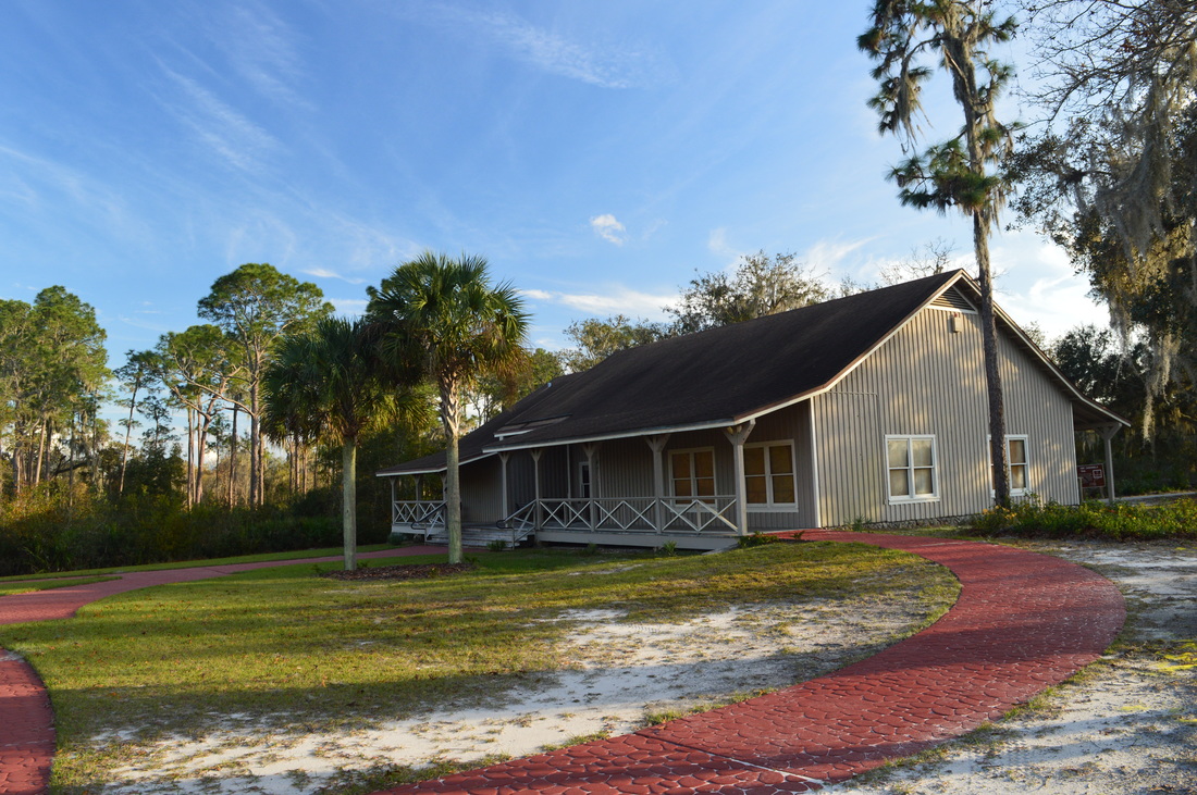
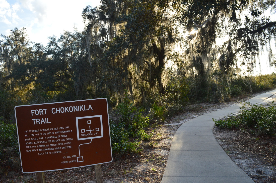
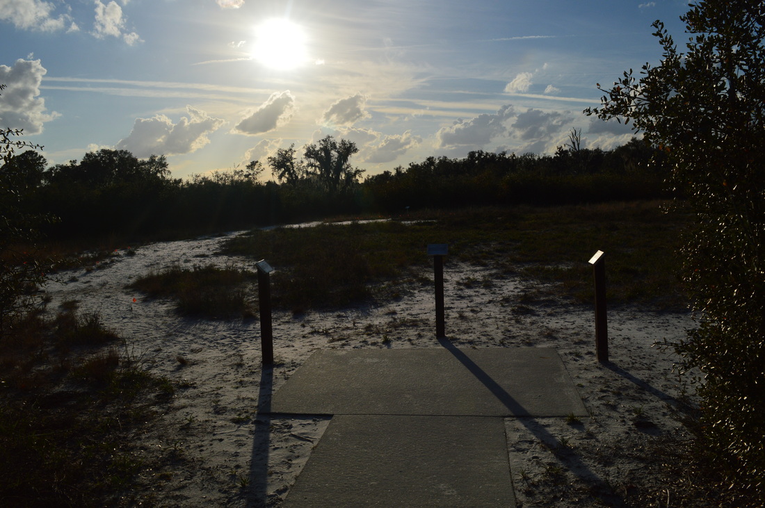
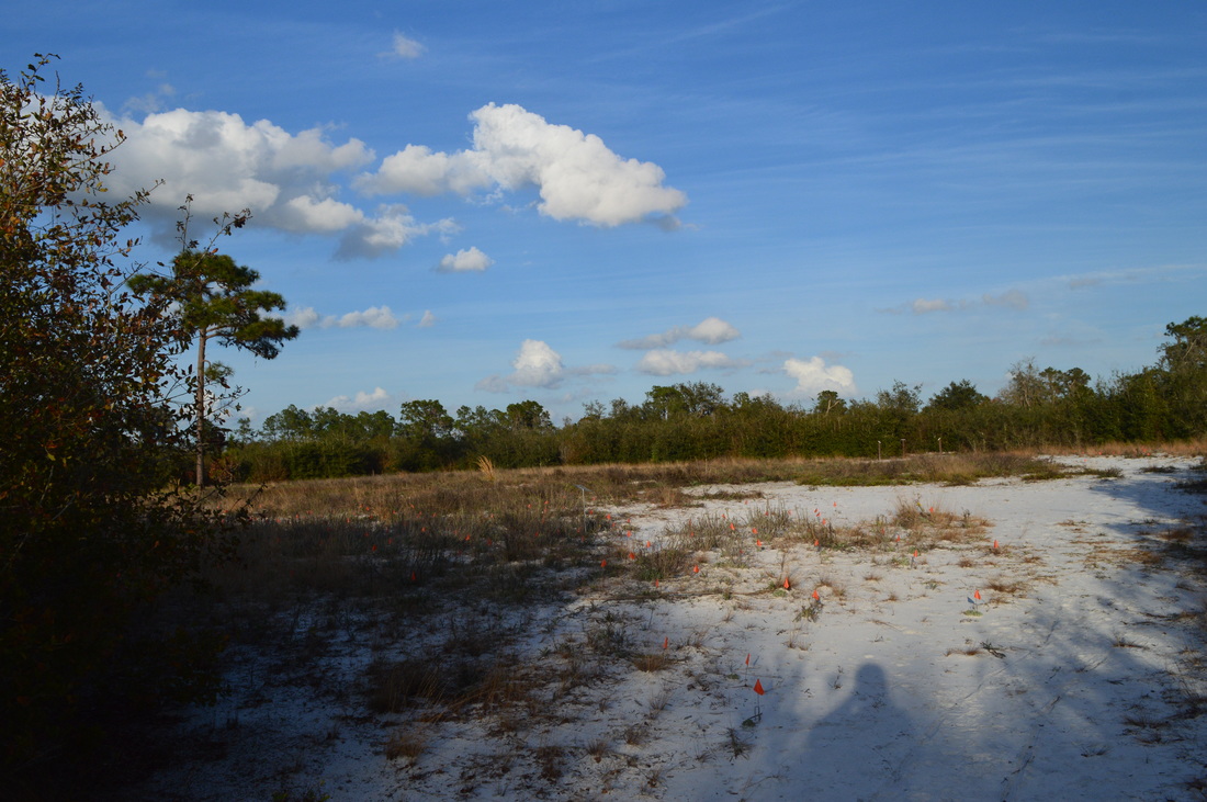
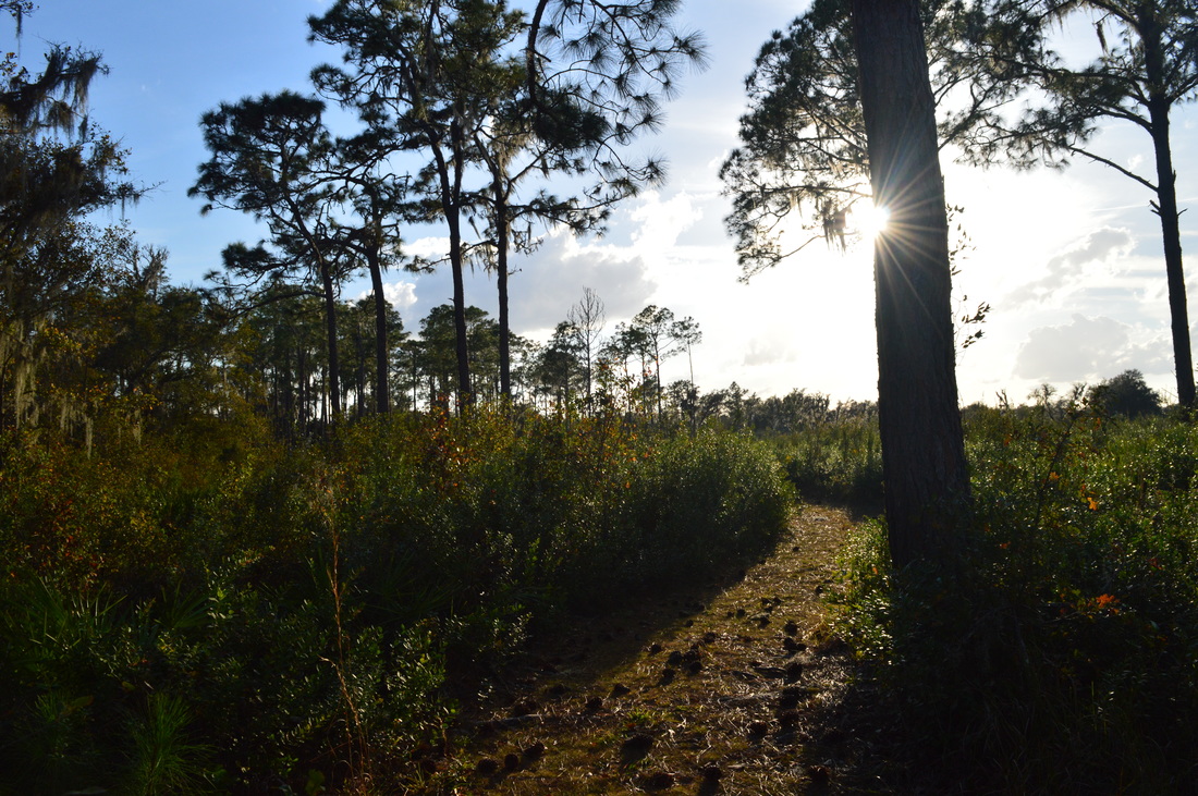
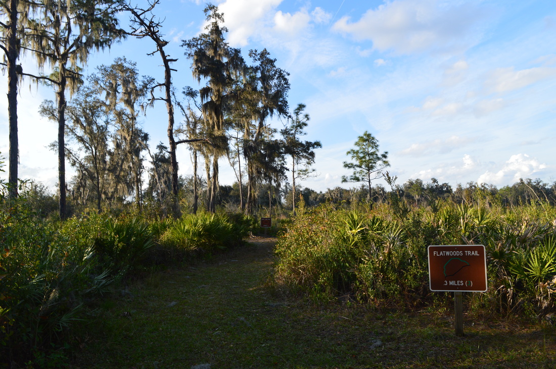
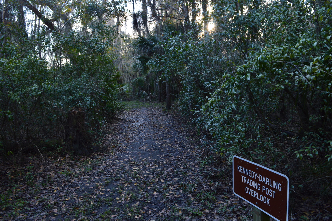
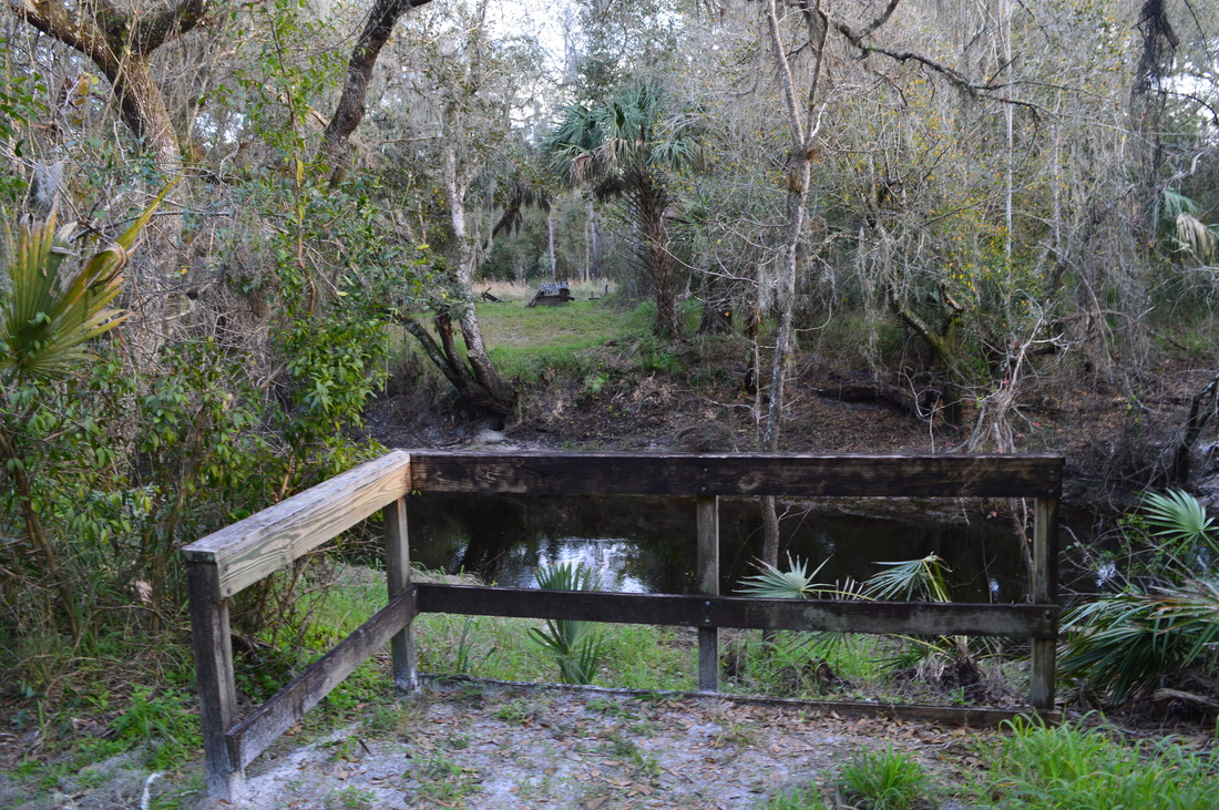
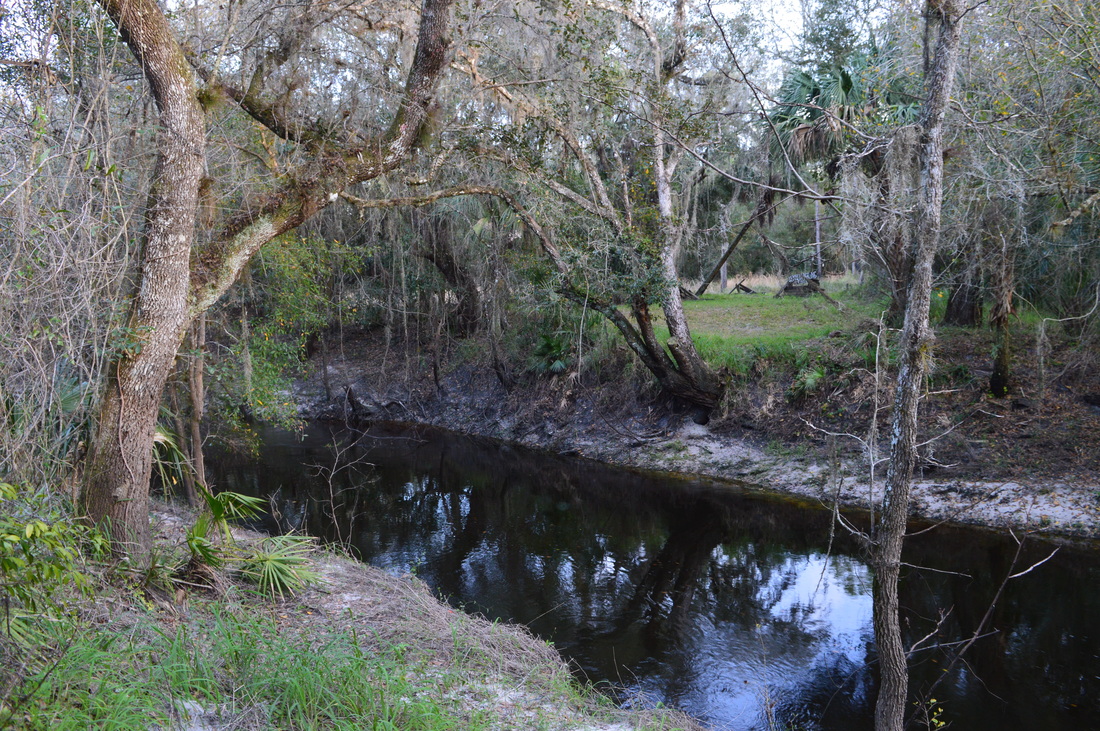
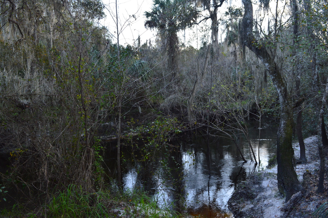
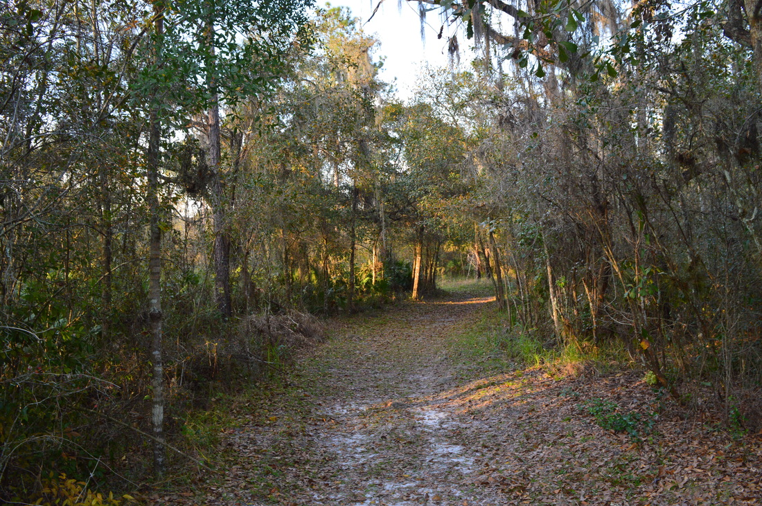
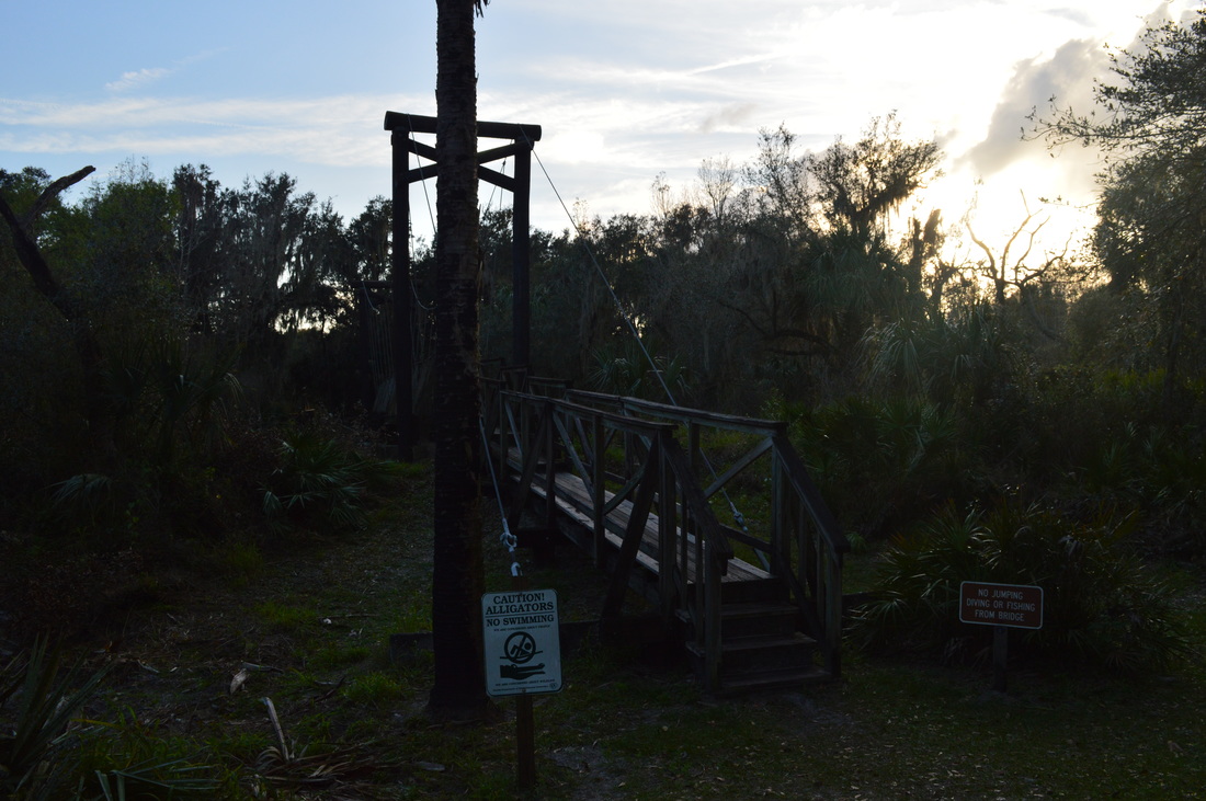
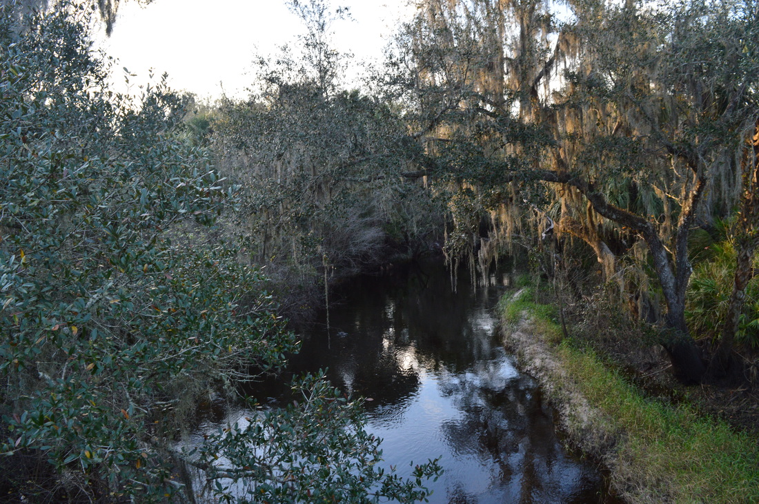
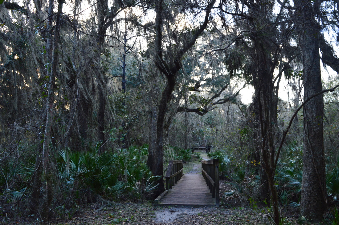
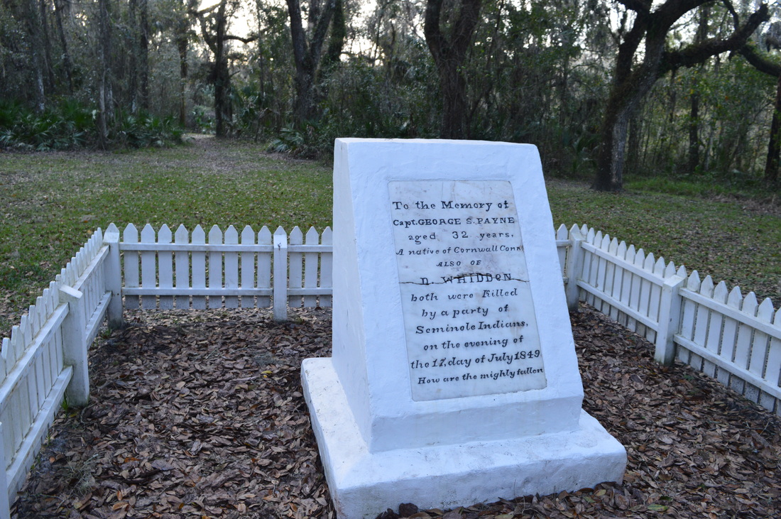
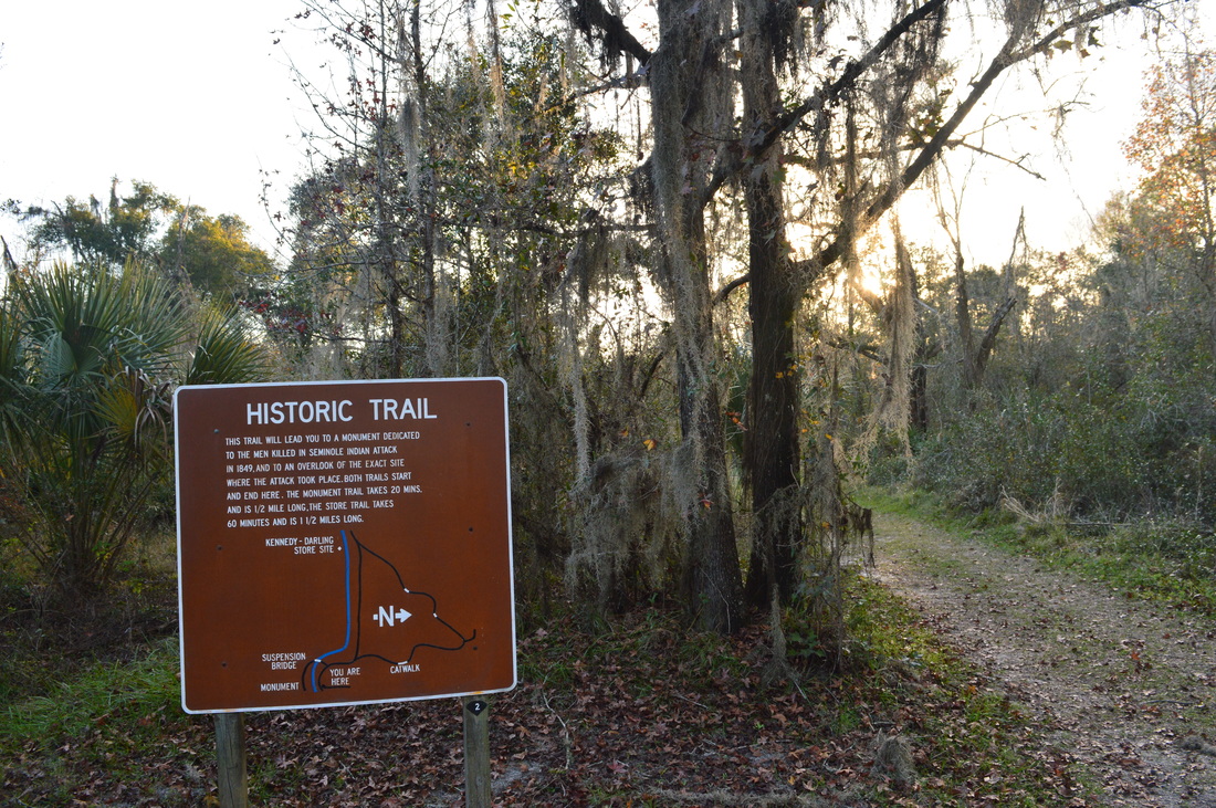
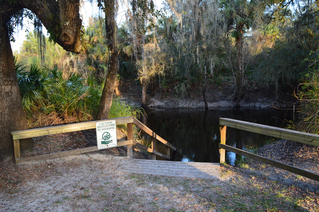
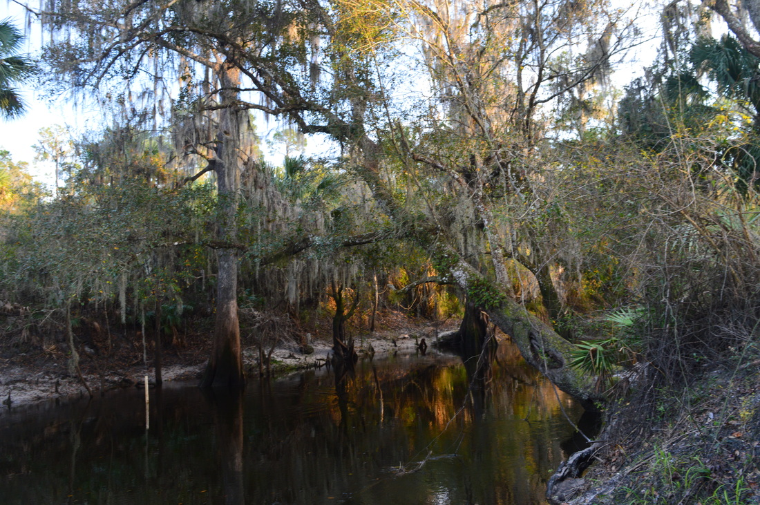
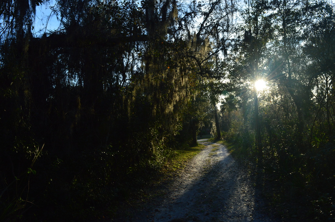
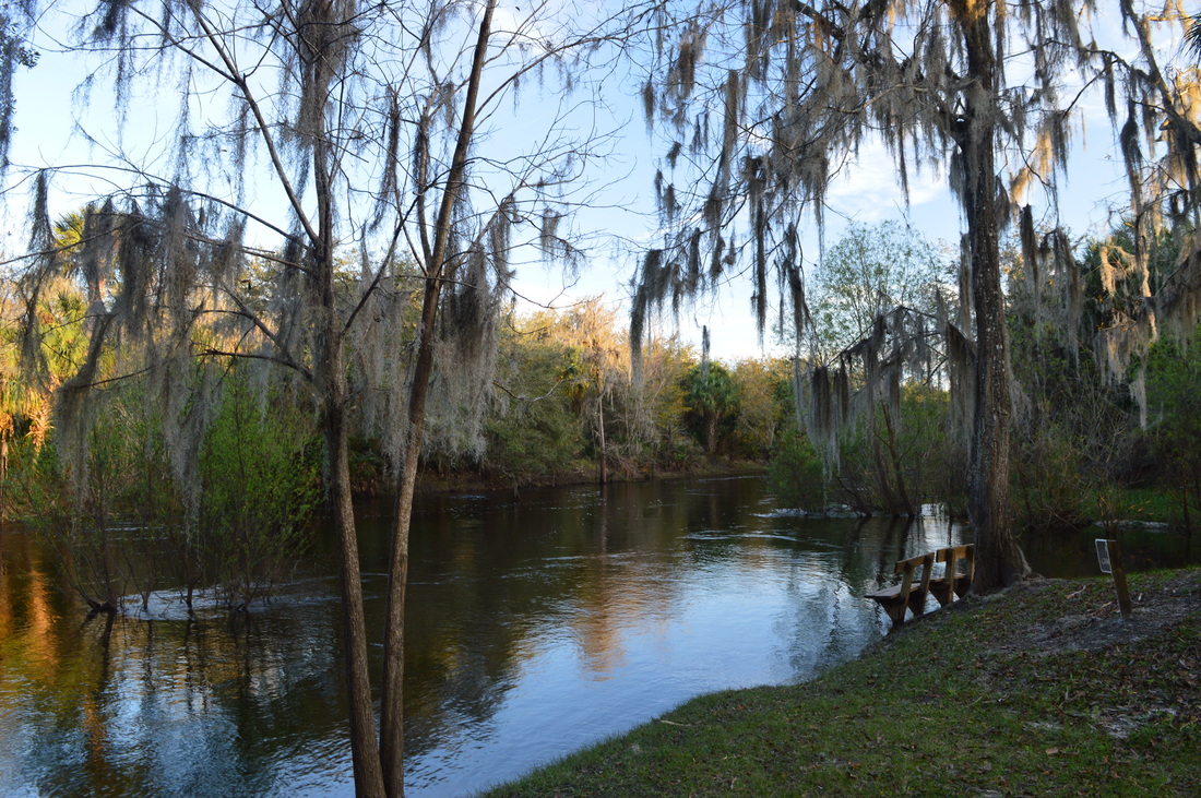
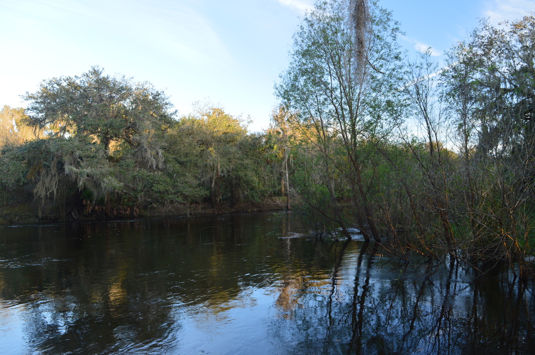
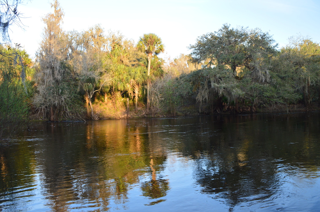
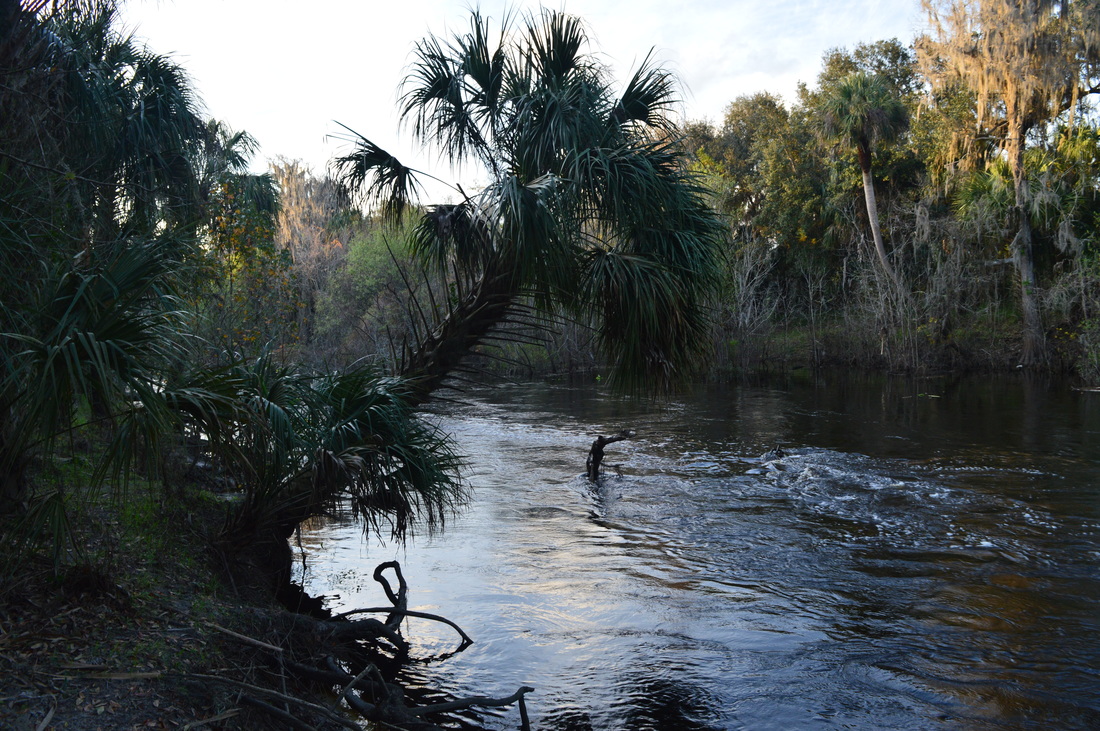
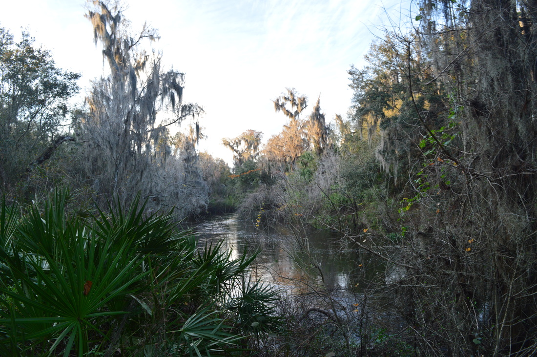
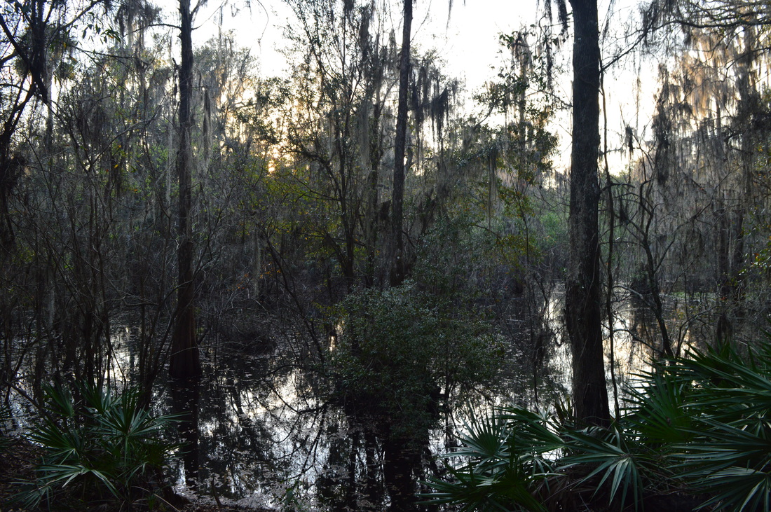
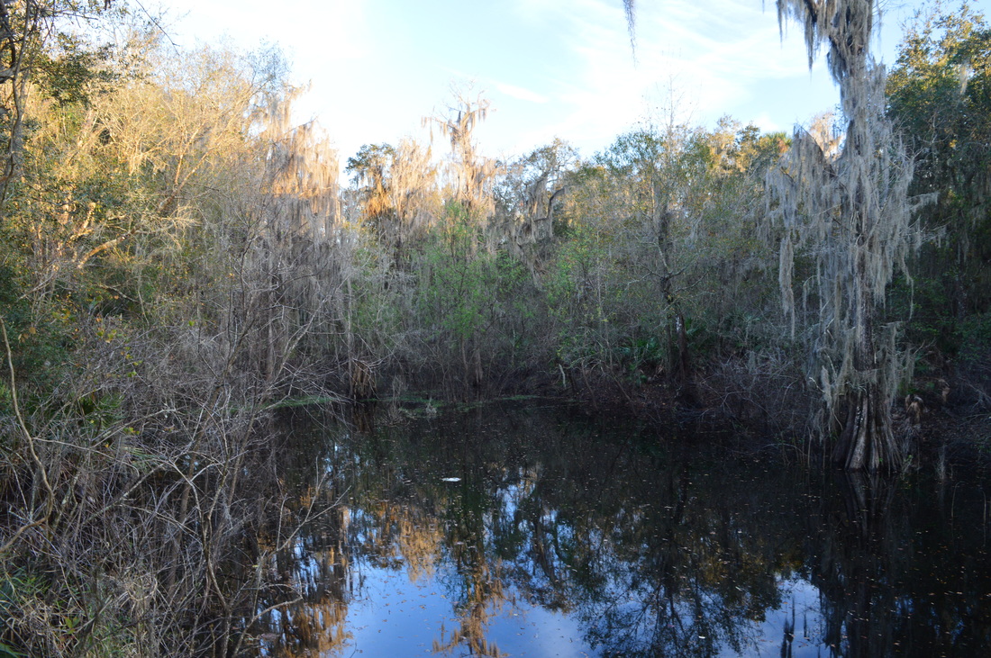
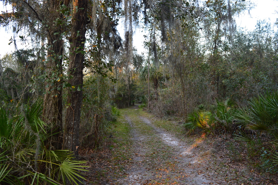
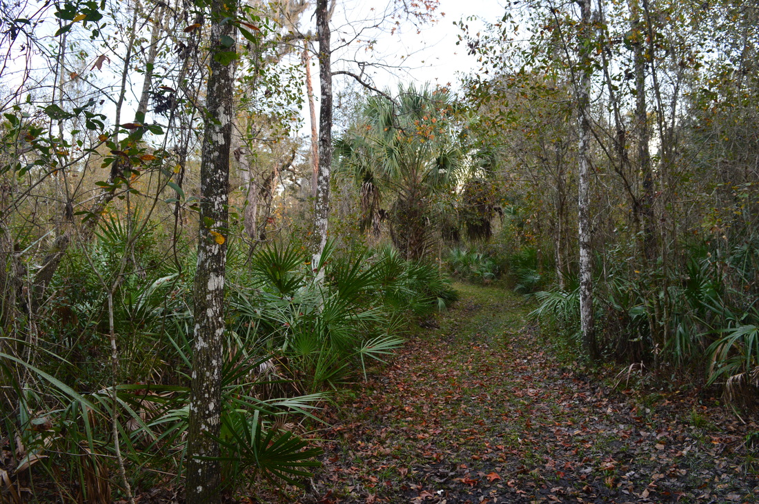
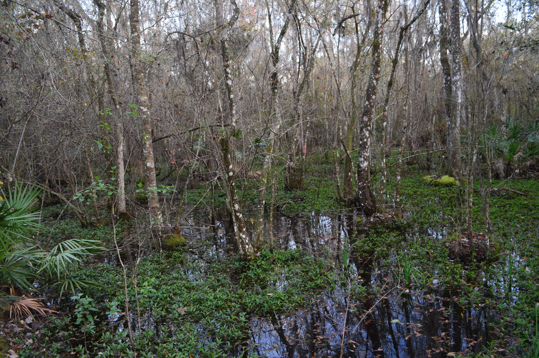
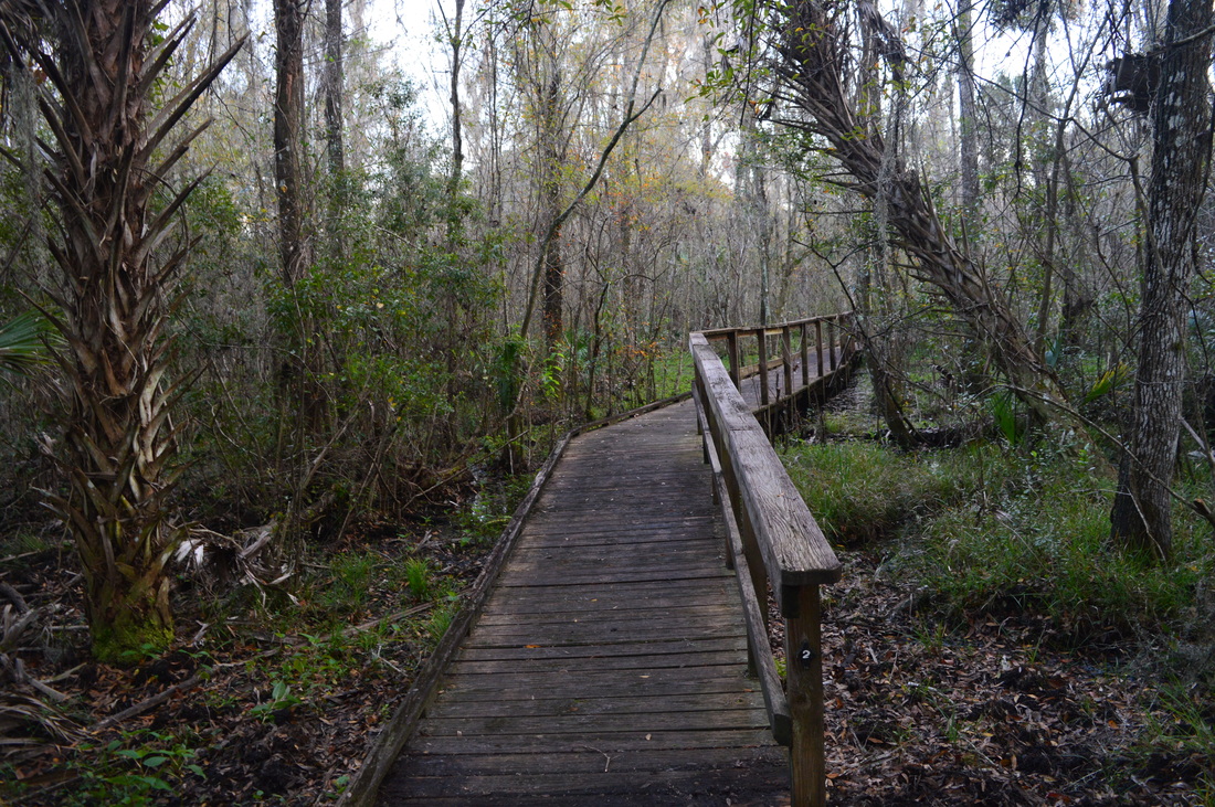
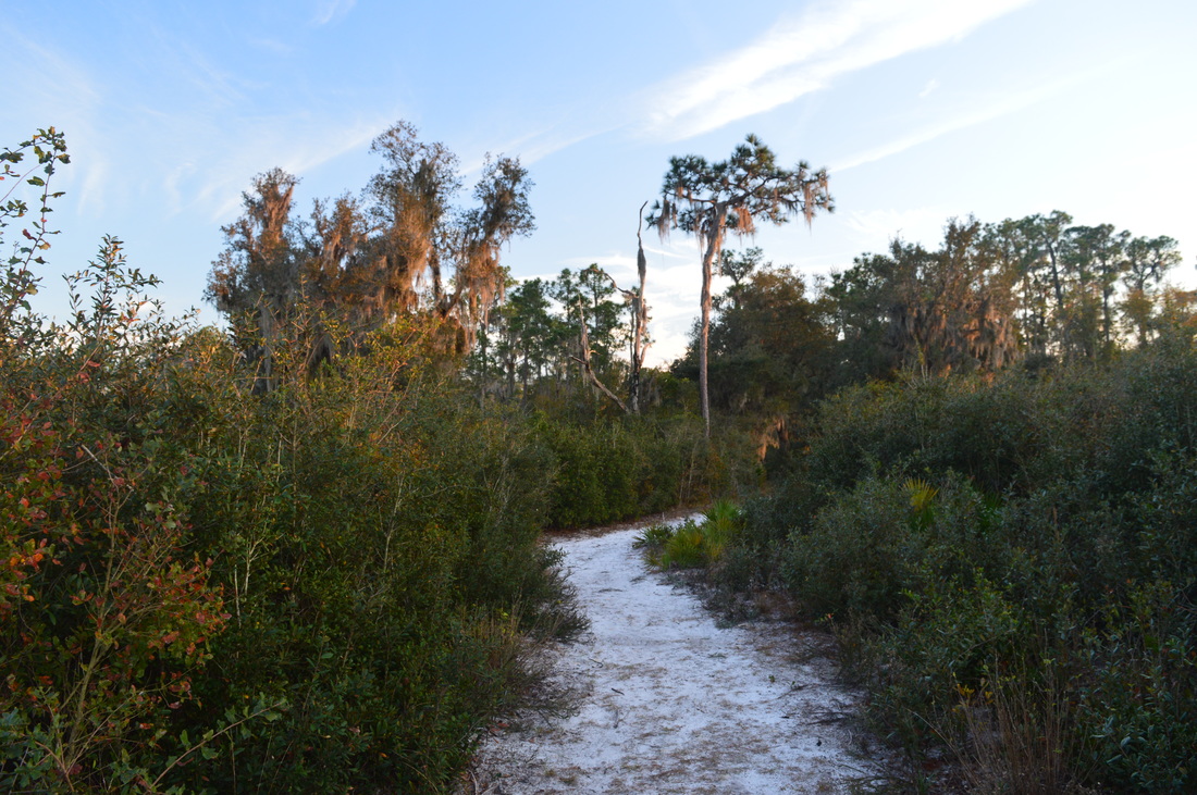
Paynes Creek Historic State Park: Historic Trail and Peace River Trail, Bowling Green, Florida4/8/2016  Paynes Creek Historic State Park is home to the site of Fort Chokonikla, one of several forts that were built in central Florida to control the Seminole Indians. Today, the historical side of Paynes Creek Historic State Park is not as visible as it once was, with nothing remaining of the fort. Other historical sites in the park include the site of a trading post and a monument. For hikers, the park has several miles of trails to offer, with rewards such as a suspension bridge across Paynes Creek and a view of the Peace River. Some of the park's trails also traverse uplands and pine flatwoods near the site where Fort Chokonikla once stood. This hike occurred on Wednesday, February 3rd, 2016. My plan was to hike the Historic Trail and Peace River Trail. If I had additional time to spare, I would also hike the Mary Jane Trail. SummaryR/T Length of Trail: 3 Miles Duration of Hike: 1:05 Type of Hike: Double Loop Difficulty Rating: 1 out of 10 Total Elevation Gain: Minimal Pros: Many views of Paynes Creek and Peace River Cons: The trail system may be groomed a bit too well but otherwise none Points of Interest: Site of Fort Chokonikla; Site of trading post; The monument; Suspension bridge across Paynes Creek; The mouth of Paynes Creek at Peace River; Views of wetlands near the Peace River Trail Blaze Color(s): None Best Season(s) to Hike: Summer Fees: There is an admission fee of $3 per vehicle to Paynes Creek Historic State Park. There is a $2 fee for pedestrians and bicyclists. Beginning Point: Visitor Center at Paynes Creek Historic State Park Directions: From Bowling Green, FL: Follow East Main Street for 0.4 miles, and then turn right onto Lake Branch Road. Continue for 1.1 miles. The entrance to Paynes Creek Historic State Park will be on the right. Once you enter the park, continue for 0.2 miles. Then, turn right and shortly afterwards reach the large parking area at the visitor center. MapA map and some other information regarding this hike can be viewed here. DetailsThere are several ways to hike the trail system at Paynes Creek Historic State Park, but this trail report describes it from the Visitor Center. The Visitor Center is conveniently situated near the site of Fort Chokonikla, so people that are out for just a short walk can still see where the fort once stood. Follow the paved path behind the Visitor Center. In a couple of minutes, you will reach a junction. Here, a sandy path goes left, while the paved path turns right. This is the start of the first (upper) loop. Turn right. The paved path ends shortly afterwards at the site of Fort Chokonikla at 0.1 miles. Fort Chokonikla was built in 1849 as the first fort in a chain of forts that were built to try to control the Seminole Indians. While the fort was never attacked, the army was almost defeated by mosquitoes. Today, all that remains is just a large clearing where the fort once stood. Continue across the clearing. There are many paths and trails that traverse the area around the site of the fort, and it is easy to get confused... as that is what happened to me. You're following a double-track trail that is the Historic Trail. At 0.25 miles, come to a T-type intersection. There is a sign here that says "<-- Nature Trail:, although it does not mention the name of the trail. Regardless, turn left, as the service road to the right goes out of the park. At 0.3 miles, reach an unmarked junction with another double-track route. I had no idea what to do here, as I forgot to take with me a trail map. As it turned out, both routes lead to about the same place. If you turn left, you will be continuing on the Historic Trail, while if you turn right, you will be on the Flatwoods Trail. I had intended to hike the Flatwoods Trail, but since I wasn't sure where to go, I turned left, and I ended up on the Historic Trail. At 0.35 miles, reach another intersection that may cause confusion, since it is also unmarked. To the left goes a connector that leads back to the Visitor Center. Continue on the Historic Trail by turning right. Until now, you have been traversing a prairie with lots of saw-palmetto, but you will now approach the edge of the prairie and enter a pine forest. Also, after this, you can breathe freely - all of the other intersections are marked well. The Historic Trail follows the edge of the prairie for a while, before reaching the other end of the Flatwoods Trail at 0.5 miles. Turn left here to continue on the Historic Trail. Just to the right is also the start of the Mary Jane Trail, a loop that is 0.8 miles long. I had been hoping to hike the Mary Jane Trail as well, but I arrived into the park only about an hour before sunset, and the ranger was very insistent on us not staying there too long. In fact, I had been forced to hike three miles per hour to finish in time, and if you have been following this blog for a while, you probably know that I'm not a big fan of hiking too fast. After the junction with the Flatwoods Trail, the trail leaves the uplands and descends (yes, there's actually some slight elevation change) into much denser and moister forest near Paynes Creek. There are some seasonally muddy spots here as you approach Paynes Creek. At 0.65 miles, a spur trail bears right away from the main trail. Take the spur trail - it ends at 0.7 miles at a view of Paynes Creek, On the other side of the creek is the site of the trading post with a few wooden ruins of unclear origin. The trading post was established during the 1840s, as tensions between the Florida settlers and the Seminole Indians had forced authorities to open a trading post that was away from the Seminole Indians and in the interior. The trading post had been constructed by Captain George Payne and Dempsey Whidden, both of whom were killed later in the year by five Seminole Indians. The Indians then burned the trading post and everything that was in the store. Today, the creek that flows by the site of the trading post is known as Paynes Creek, named after the Captain. On some maps, the creek is labeled as Payne Creek. Return to the main trail, and turn right onto it at 0.75 miles. The trail closely parallels Paynes Creek, and you will see the creek many times. At 0.9 miles, reach an intersection. Here, the other side of the Historic Trail comes in from the left, thus ending the upper loop. You will hike that part of the Historic Trail later. At this moment, continue straight. At 1 mile, reach another junction. To the right is the suspension bridge across Paynes Creek. This is a spur trail to the monument that was erected in memory of Captain Payne. Turn onto the spur trail and cross the creek on the bridge. This is one of the best views of Paynes Creek on the hike - you can see the creek well in both directions. On the other side of the creek, turn sharply left and parallel the creek downstream for a bit. You can see the park boundary just to the right. At 1.2 miles, reach the monument. The monument was erected as a memorial to Captain George Payne and Dempsey Whidden who were killed at the trading post in 1849. From the monument, retrace your steps back across the suspension bridge and to the main trail at 1.4 miles. Turn right onto the main trail. At 1.45 miles, you will reach the end of the Historic Trail. To the left is the picnic area, pavilion, playground, and the point where many hikers start at. To the right is a set of steps that leads to what is apparently an observation deck at Paynes Creek. On this day, it was hard to say, though, because the last few steps and the deck were under water. Continue straight across the clearing to the start of the Peace River Trail. This trail resembles the Historic Trail in the fact that it is also double-track. You will continue to parallel Paynes Creek. At 1.6 miles, reach the start of the second (lower) loop on this hike. Continue straight. There will be a few more views of Paynes Creek until you reach the Peace River at 1.9 miles. To me, this is the biggest highlight of the hike. This is a location of high beauty. The waters of the smaller Paynes Creek spill into the waters of the larger Peace River, and the sound of a few small rapids penetrates the atmosphere. The shore of the river is shaded by trees draped in Spanish moss. The sloped banks of the Peace River reminded me the Suwannee River and an excellent hike that I did on the Florida Trail in the Suwannee River valley in July 2015. In fact, the confluence of Paynes Creek and Peace River on this hike has a lot in common with the confluence of Robinson Creek and Suwannee River on that hike. At the confluence of Paynes Creek and the Peace River, the Peace River Trail turns sharply left and briefly parallels the Peace River with several more views of the river. The last view of the river is at a bend at 2 miles. Then, the double-track trail leaves the river and heads back westward. At 2.1 miles, there is an observation deck on the left with a view of a marshy pond. At 2.2 miles, make a sharp left turn - to the right is a service road. At 2.25 miles, finish the lower loop and turn right. You have hiked this section of the trail before. Return to the picnic area at 2.4 miles. Continue retracing your steps along the Historic Trail until you reach the upper loop junction at 2.6 miles. Here, turn right to hike the east side of the upper loop.. This part of the Historic Trail is noticeably narrower than trails on the rest of the hike, but it is still wider than single-track. At 2.7 miles, reach the catwalk, a short boardwalk across a swampy area. At the end of the catwalk, during the wet season, it will be slightly wet and muddy, but this should not present a problem, because nearly right after the catwalk, the trail ascends out of the swampy area and back into the piney uplands. At 2.9 miles, bear right as the trail widens - the double-track route that comes in from the left is the connector that you saw near the beginning of the hike. At 2.95 miles, reach the paved path. After turning right, conclude the hike at the Visitor Center at 3 miles. Mileage0.0 - Paynes Creek Historic State Park Visitor Center 0.1 - Site of Fort Chokonikla 0.25 - Left turn to stay on Historic Trail 0.3 - Junction with Flatwoods Trail, left turn to stay on Historic Trail 0.35 - Right turn to stay on Historic Trail 0.5 - Junction with Flatwoods Trail, left turn to stay on Historic Trail 0.65 - Right turn onto spur trail 0.7 - View of Paynes Creek and old trading post site 0.75 - Return to main trail, turn right 0.9 - Junction with east side of Historic Trail loop, continue straight 1.0 - Right turn onto spur trail to monument, cross suspension bridge 1.2 - The monument 1.4 - Return to main trail, turn right 1.45 - Pass picnic area, continue straight onto Peace River Trail 1.6 - Peace River Trail loop starts, continue straight 1.9 - Reach Peace River, beautiful views 2.0 - Last view of Peace River 2.1 - Observation deck with view of marshy pond 2.2 - Sharp left turn 2.25 - End of loop, turn right 2.4 - Pass picnic area 2.6 - Turn right onto east side of Historic Trail 2.7 - The catwalk 2.9 - Bear right 2.95 - Right turn onto paved path 3.0 - Paynes Creek Historic State Park Visitor Center VariationsDo a short loop to and around the fort site - 0.5 Miles Hike just the Historic Trail Loop - 1.3 Miles Hike just the Historic Trail and the trail to the monument - 1.95 Miles Bonus StopsCheck out the nearby Hardee Lakes County Park in the community of Fort Green. There are many other hiking opportunities heading eastward toward Sebring and Frostproof. PicturesVideos
0 Comments
Leave a Reply. |
About MeMark Oleg Ozboyd Dear readers: I have invested a tremendous amount of time and effort in this website and the Georgia Waterfalls Database the past five years. All of the work that has gone in keeping these websites updated with my latest trip reports has almost been like a full-time job. This has not allowed me to pick up a paid job to save up money for college, and therefore, I I've had to take out loans. If you find the information on this website interesting, helpful, or time-saving, you can say "thanks" and help me out by clicking the button above and making a contribution. I will be very grateful for any amount of support you give, as all of it will apply toward my college tuition. Thank you!

Coming in 2022-2023?
Other Hiking WebsitesMiles HikedYear 1: 540.0 Miles
Year 2: 552.3 Miles Year 3: 518.4 Miles Year 4: 482.4 Miles Year 5: 259.9 Miles Archives
March 2021
Categories
All
|


 RSS Feed