HIKING THE APPALACHIANS AND BEYOND
  • Home
  • Trail Reports
    • Best Hikes
    • Hikes with Scenic Views
    • Hikes with Water Features
    • Alabama
    • Georgia
    • Florida
    • North Carolina
    • South Carolina
    • Tennessee
    • Vermont
    • Virginia
  • Map
  • Hike List
  • Testimonials
  • Resources
  • Contact Us
  • Southeast Nature Society
    • Our Team
  • Georgia Waterfalls Database

Nantahala National Forest: Yellow Mountain Trail, Highlands, North Carolina

12/23/2014

3 Comments

 
Picture
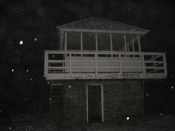
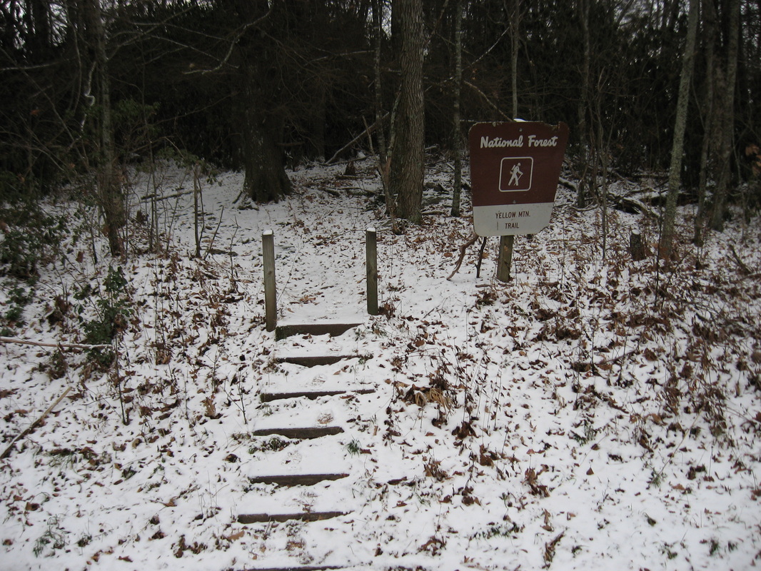
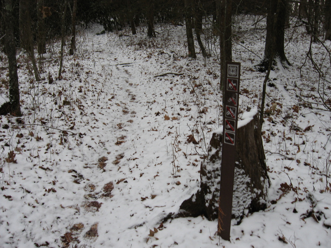
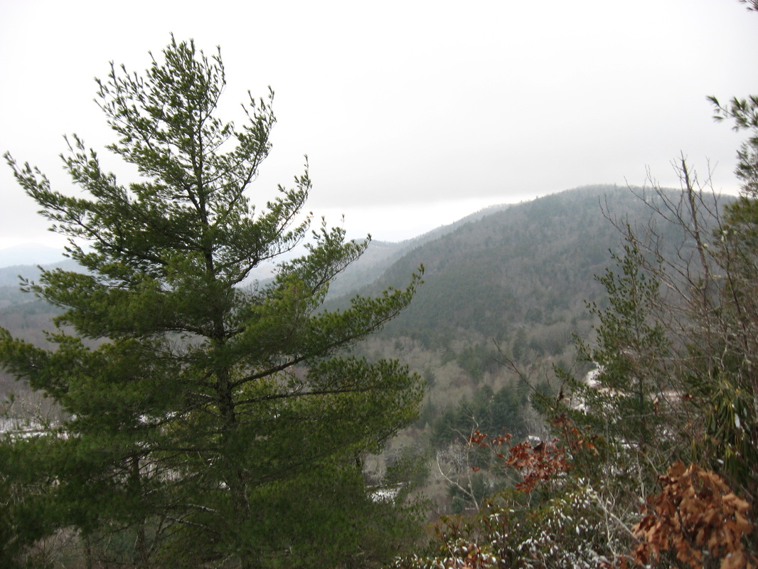
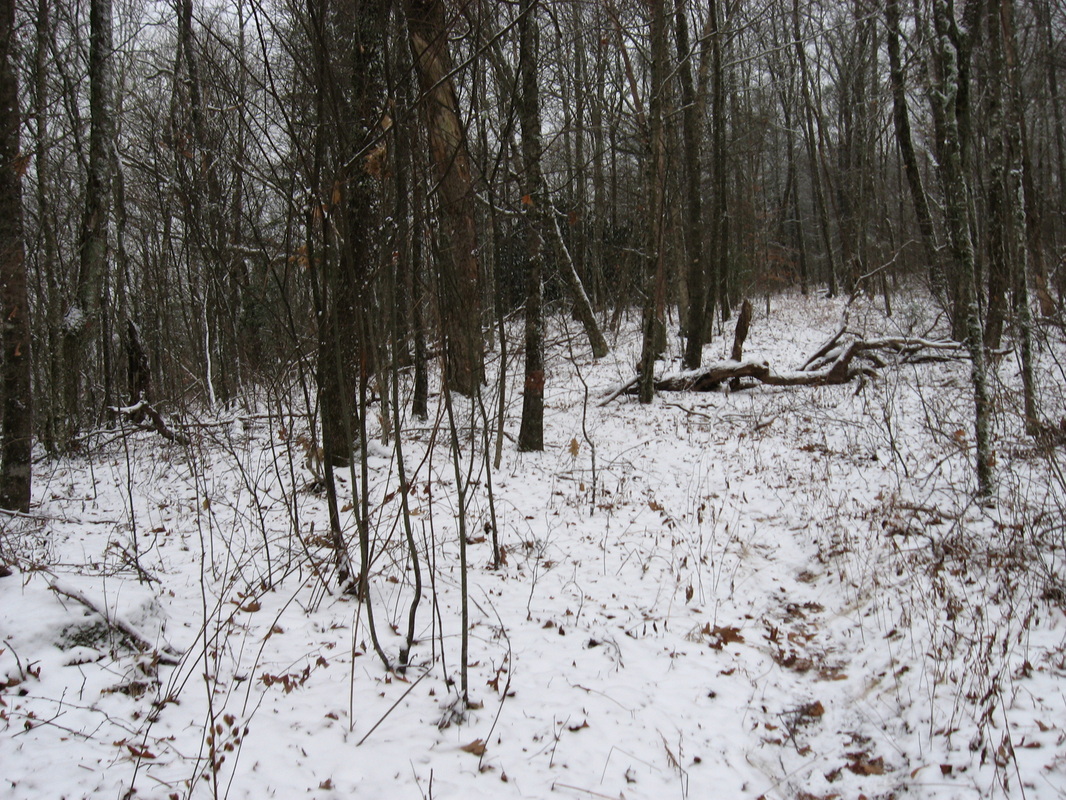
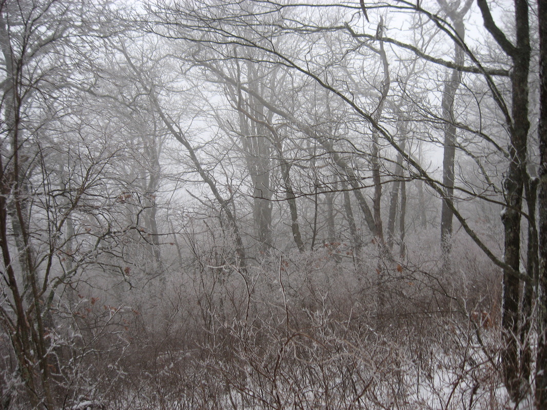
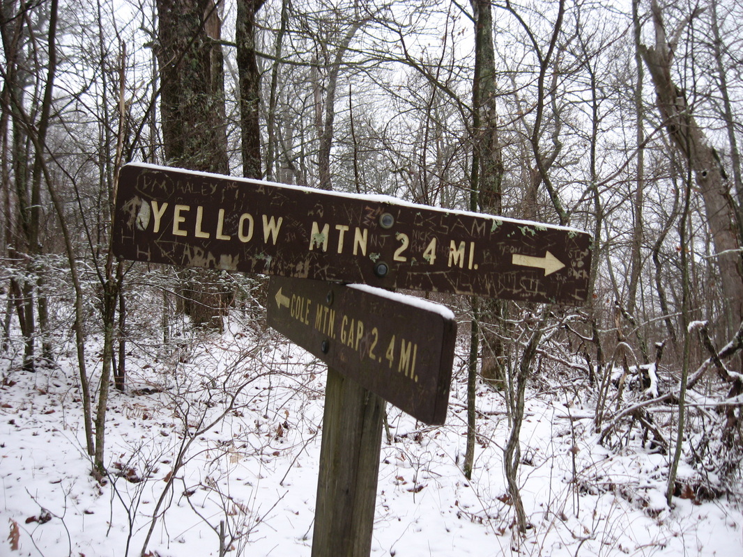
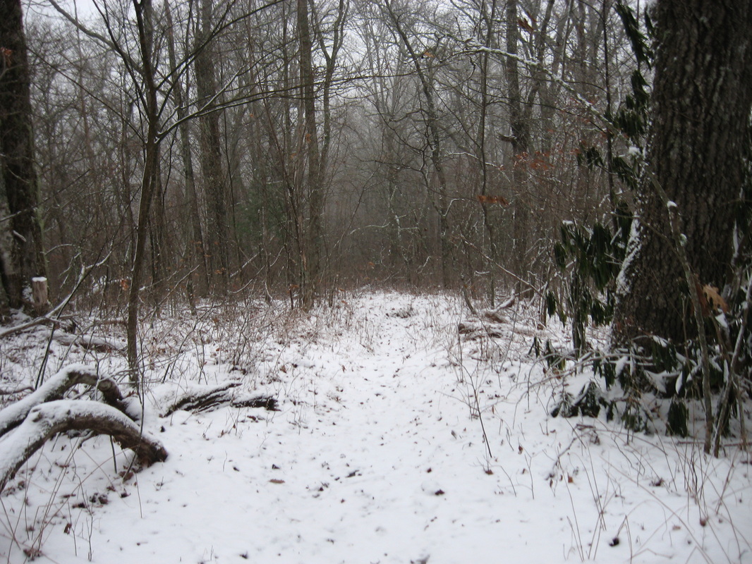
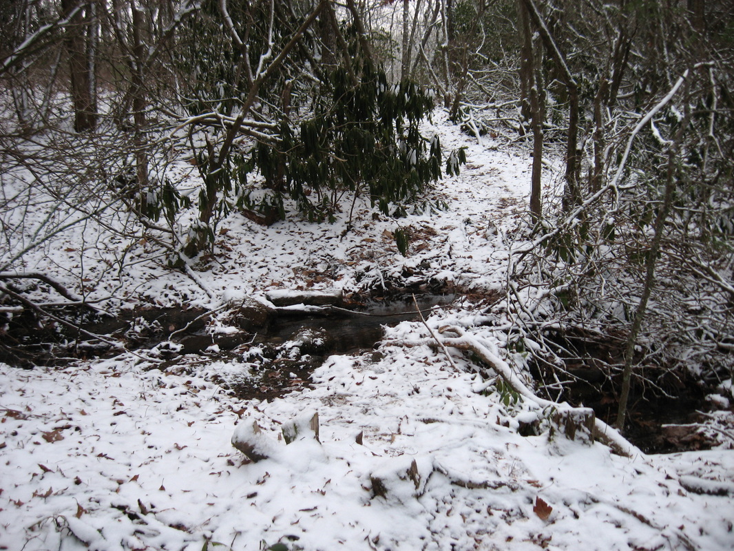
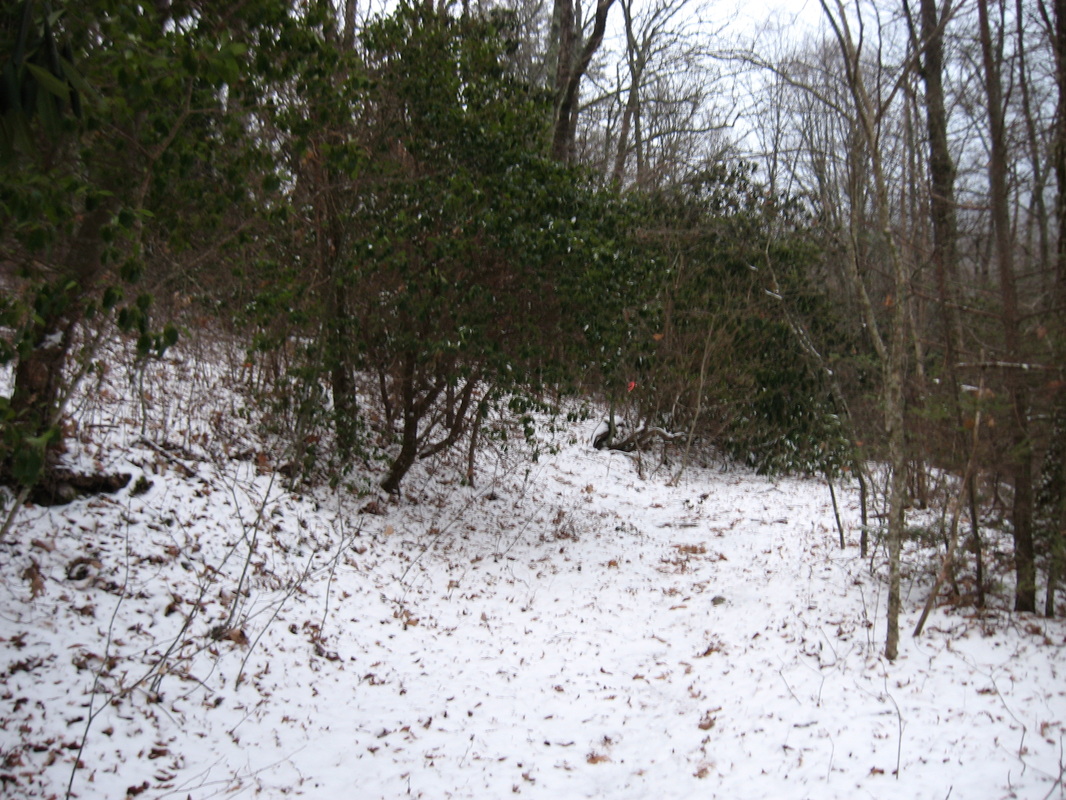
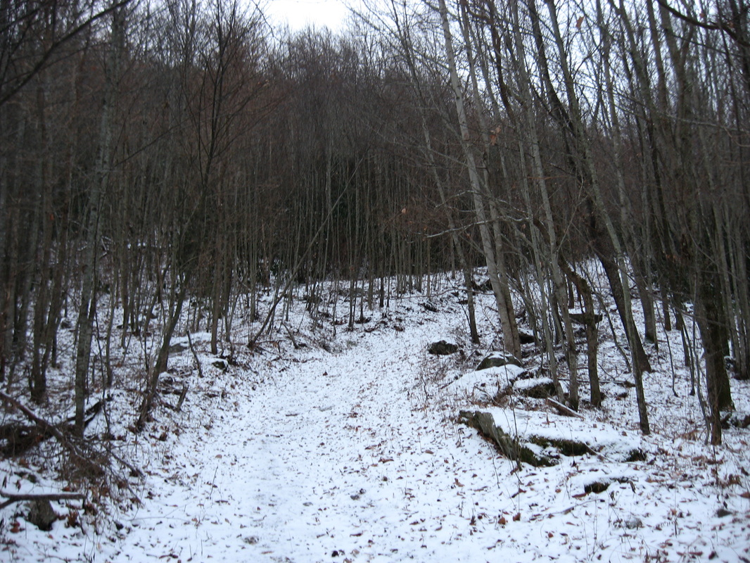
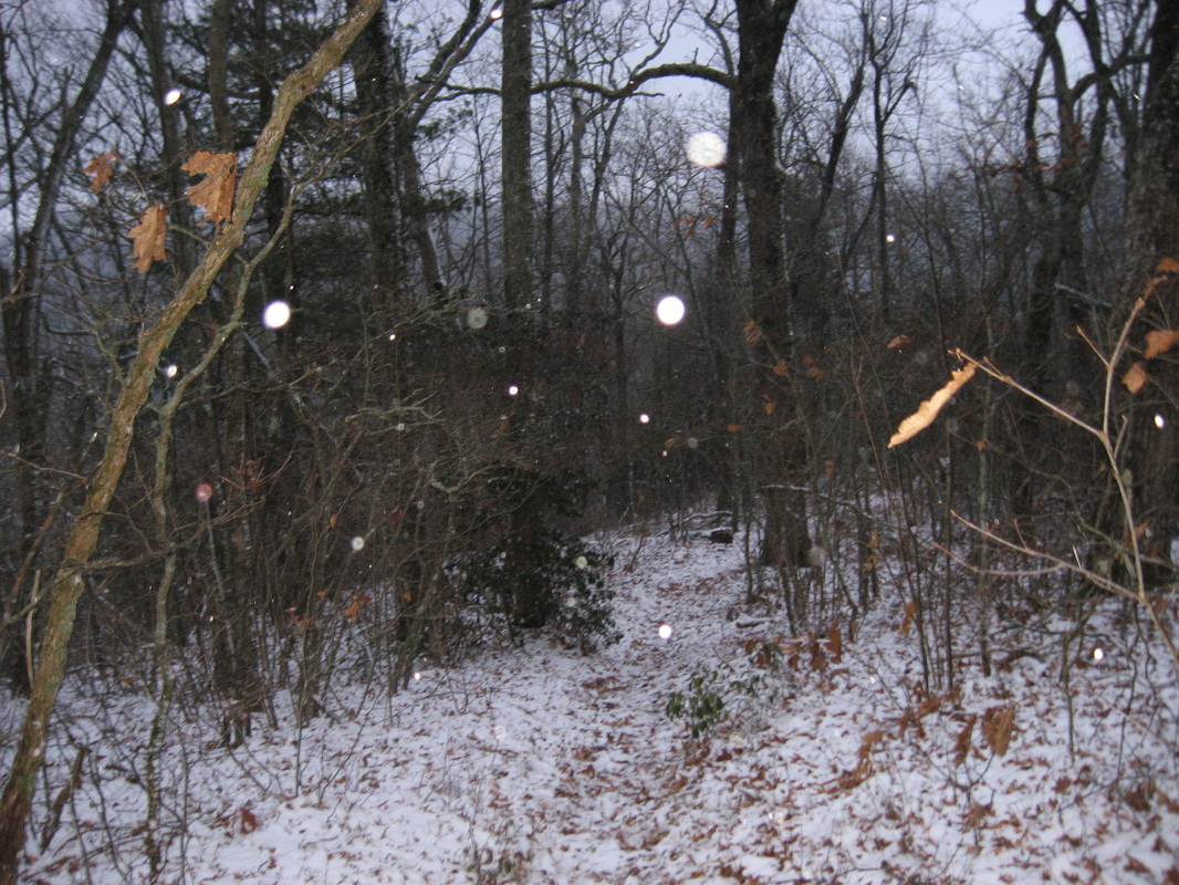
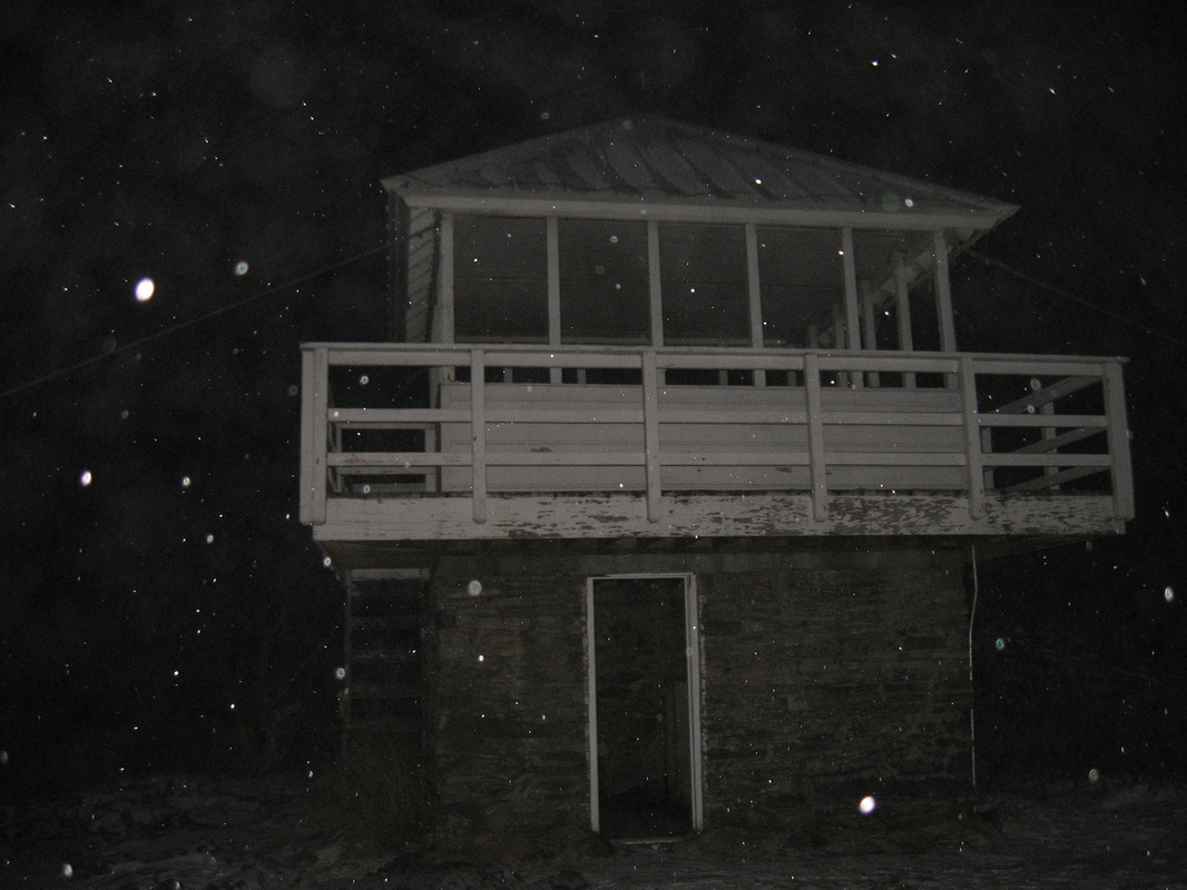
The Cowee Mountains is the highest mountain range in the Highlands-Cashiers area, with many mountains approaching 5000 feet. This hike leads to the highest point in the Cowee Mountains as well as the highest point in the entire Highlands-Cashiers area, Yellow Mountain. Yellow Mountain rises to 5127 feet, and has a historic, renovated fire lookout. You'll also pass over several other mountains with great winter views and some viewpoints as well. Chances are you will be tired by the time you make it back to the trailhead at Cole Gap, and although the fact that the route back is almost as hard as the way in is pretty major, the rewards will sill be worth it, especially on a clear day. This hike occurred on Thursday, November 27th, 2014. My plan was to hike the Yellow Mountain Trail from Cole Gap to Yellow Mountain, and then return the same way. 

R/T Length of Trail: 9.6 Miles
Duration of Hike: 5:00
Type of Hike: Out and Back
Difficulty Rating: 7 out of 10
Pros: Amazing panoramic views from Yellow Mountain Fire Tower (in good weather)
Cons: Steep grades from Shortoff Mountain to Yellow Mountain Gap; major climbing on the way back; confusing signage in some places 
Scenic Views: Cole Mountain Overlook - 3 stars; Yellow Mountain - N/A (See text below) 
Water Features: None
Best Season(s) to Hike: Winter
Trail Blaze Color(s): Yellow Mountain Trail - None
Beginning Point: Cole Mountain Gap on Buck Creek Road
Directions: From Highlands, NC: Follow US Route 64 East for about 2.9 miles to Buck Creek Road. Bear left onto Buck Creek Road at a hairpin turn on US-64. Follow Buck Creek Road for 2.1 miles to Cole Gap. The gated Forest Service Road 4535 will be on the left - park on the side of the road but don't block the gate. 
There's about a handful of fire towers left across western North Carolina. Some are tall; some are locked down; some have been rehabilitated; and some can be more simple lookouts, like this one. Being the highest peak in the area, Yellow Mountain has a historic fire lookout that is open to the public, provided they do a nearly 10 mile roundtrip hike. You can also access the tower on car via the gravel road that goes up there, but that is only for people who know the code to the gate for Yellow Mountain Preserve. 


The hike starts from Cole Gap (also known as Cole Mountain Gap) on Buck Creek Road. The trail starts across from the designated parking area (see directions above). It starts climbing right off the bat, coming to a trailhead kiosk shortly. Then, the ascent steepens. This first ascent isn't that long - only 0.5 miles. At 0.4 miles, an unmarked side trail goes left leading to a nice overlook. Some pine trees are in the way, but even with those, the view still gives a good perspective of the valley below, especially when Yellow Mountain is fogged in and you reach in twilight, which is what happened to me on this day. At 0.5 miles, the Yellow Mountain Trail finishes climbing Cole Mountain, and then after turning east, descends and ascends briefly several small hills on the ridge. At 1.2 miles, the trail starts ascending Shortoff Mountain. There are a lot of switchbacks that ease the climb somewhat. When I hiked this trail, there was a fallen tree halfway up the climb that was tricky to climb over. Towards the top of the climb, a side trail heads right to a small view. Meanwhile, as the switchbacks end, the climb ends, skimming the peak of Shortoff Mountain just to the left. Or did it? Shortoff Mountain is one long ridge, and after a brief descent into a gap, the trail begins to climb again toward the "second peak" of Shortoff Mountain. This climb is more gradual. There were a couple side trails near the top, but I didn't check them out, because the mountain was fogged in. Perhaps these side trails lead to viewpoints. 


On the other side of Shortoff Mountain, the trail begins to descend at around 2 miles. The descent is pretty steep in places, and then there's a large sign at 2.4 miles. This sign marks the halfway point, showing 2.4 miles back to Cole Gap and 2.4 miles to Yellow Mountain. Turn left here; an unmarked side trail continues forward. The ascent steepens - in fact very steep for a short time. What I'm about to tell you is going to hurt your spirit - you'll have to climb ALL the way back up here. It is a slow and steep climb. Anyway, around 2.6 miles, the trail reaches a small flat area below Goat Knob. Then, instead of climbing up Goat Knob, it suddenly jumps off to the left and makes several muddy, steep switchbacks. In the snow on this day, they were pretty slippery. After this, the trail levels and follows the slopes of Goat Knob, before crossing a small stream at 2.9 miles. At 3 miles, the trail exits onto an old roadbed. Turn right here. The roadbed stays flat for a bit, but after passing another old road going right, it starts a steep descent at 3.2 miles. At 3.4 miles, a confusing turn happens. Here, there is a sign that says "Yellow Mountain ^ <----". In other words, it seems to show that Yellow Mountain is both the way you came from and also turning right. If you turn right, you'll find another sign shortly, saying "Yellow Mountain ^". In reality, all of these signs mean "Yellow Mountain Trail", not Yellow Mountain. So turn right at the first sign. The old road that continues forward eventually leads out to Buck Creek Road. After turning right, the trail will descend to Yellow Mountain Gap at 3.5 miles. Signs on the right indicate property - a path beyond the signs leads to Yellow Mountain Preserve, a private neighborhood positioned on the slopes of Yellow Mountain. 


After Yellow Mountain Gap, the Yellow Mountain Trail begins climbing Yellow Mountain. The ascent is not very hard. There are some switchbacks as it ascends up Yellow Mountain. At 4 miles, the trail climbs onto a ridge which is part of Yellow Mountain's upper reaches. At 4.3 miles, the first of several paths go right onto the gravel road that leads to the top of Yellow Mountain. It's a faster alternative to reach the top of Yellow Mountain, so I used it. The distance is the same as on the trail, but I heard the trail can be overgrown in places there. because most people use the road. At 4.4 miles, the gravel road dead ends in a T-type intersection with a bigger gravel road. Keep left here. There will be some house lots for sale on the right, with views into the valley below. At 4.7 miles, the road dead-ends near the top of Yellow Mountain. A wide path continues forward. Shortly pass the Yellow Mountain Trail coming in from the left. The path ends at the Yellow Mountain Fire Tower at 4.8 miles. I heard the fire tower has an amazing 360 degree view, but it was twilight when I got here, and the views were nonexistent due to the snow and fog. It was also bitterly cold with strong winds blowing across the tower. Maybe pne day I will return to it in better weather conditions. I really don't want to do this trail with all the climbing on the way back again. I need to research the other route from the old road that exits onto Buck Creek Road. Judging by the pictures I have seen from others, I think it is worth it to see the views from the fire tower though. 


Below are my pictures from this hike.
3 Comments
Bill
12/13/2015 11:12:01 pm

Thanks for posting the most detailed description of this trail I've come across. I intend to hike it this winter (2015-16). I noticed on Google Earth that there is a hanging valley like area on the north side of Shortoff, often an indication of a mountain bog area. I did see the dirt road you mentioned, which appears to lead to a wildlife opening on the west shoulder of Goat Knob. Nice that some local volunteers keep this trail maintained.

Reply
Mary Katz
7/15/2019 10:17:17 am

This trail has been modified and is quite longer than reported here. It's now more than 12 miles round trip, probably closer to 15. It's beautiful with mountain laurel thickets, occasional meadows, and is well marked with new blazes. The walk back is more difficult than the earlier ascent because of long climbs. Nothing technical. I'd call it difficult but worth it if you're fit.

Reply
Kim
3/27/2022 10:07:27 am

You can indeed get to this tower in a much shorter hike. Parking at a hairpin curve that Google maps recognizes as 199 Cloud Catcher Lane, you’ll find a really beautiful 2 mile total (out & back) trail to the tower.

Reply


Leave a Reply.

    About Me

    Mark Oleg Ozboyd
    I'm an avid outdoor explorer and a hobbyist landscape photographer. I'm 21 years old and have been hiking since 2011. Originally based out of Atlanta, Georgia, I started out by occasionally hiking short trails throughout well-known Georgia State Parks. During 2012 and 2013, I began to expand my trips into adjacent states, as well as into the wilder National Forest areas rather than just State Parks. Throughout the years that followed, as I slowly ran out of popular hiking trails in my area, I began to search for and hike in more seldom-visited areas. Today, you can find me out in the woods every weekend, whether it's on an official trail or bushwhacking through cross-country terrain without any paths. I now attend Washington & Lee University and am exploring Virginia and West Virginia. My other hobbies include chess, science, old music, and meteorology. I have 3 years of amateur weather forecasting experience, having studied a lot of meteorology basics over the years. I am also a student at European School of Music where I learned that music and nature have a lot in common. Listening to good music inspires me to capture nature's beauty on the camera in different aspects that also make me recall many beautiful music pieces that I've heard.​


    Dear readers: I have invested a tremendous amount of time and effort in this website and the Georgia Waterfalls Database the past five years. All of the work that has gone in keeping these websites updated with my latest trip reports has almost been like a full-time job. This has not allowed me to pick up a paid job to save up money for college, and therefore, I I've had to take out loans. If you find the information on this website interesting, helpful, or time-saving, you can say "thanks" and help me out by clicking the button above and making a contribution. I will be very grateful for any amount of support you give, as all of it will apply toward my college tuition. Thank you! 

    Enter your email address to subscribe for trail reports:

    Delivered by FeedBurner


    Picture
    Coming in 2022-2023?

    Other Hiking Websites

    DWHike's Adventures
    Florida's Natural Wonders
    Florida Trailblazer
    Meanderthals
    Mountain Images
    by Bernie Boyer

    North Carolina Waterfalls with
    ​Kevin Adams
    Take-a-Hike!
    Tennessee Landforms
    Waterfall Page
    Waterfall Adventurer
    Zach's Mild Adventures

    Miles Hiked

    Year 1: 540.0 Miles
    Year 2: 552.3 Miles
    ​Year 3: 518.4 Miles
    Year 4: 482.4 Miles
    Year 5: 259.9 Miles

    Archives

    March 2021
    February 2021
    January 2021
    November 2019
    October 2019
    September 2019
    August 2019
    July 2019
    June 2019
    February 2019
    January 2019
    December 2018
    November 2018
    October 2018
    August 2018
    July 2018
    June 2018
    May 2018
    April 2018
    March 2018
    February 2018
    January 2018
    December 2017
    November 2017
    October 2017
    September 2017
    August 2017
    July 2017
    June 2017
    May 2017
    April 2017
    March 2017
    February 2017
    January 2017
    December 2016
    November 2016
    October 2016
    September 2016
    August 2016
    June 2016
    May 2016
    April 2016
    March 2016
    January 2016
    December 2015
    November 2015
    October 2015
    September 2015
    August 2015
    July 2015
    June 2015
    May 2015
    April 2015
    March 2015
    February 2015
    January 2015
    December 2014
    November 2014
    October 2014
    September 2014
    August 2014
    July 2014
    June 2014
    May 2014
    April 2014
    March 2014
    February 2014

    Categories

    All
    Adel
    Adirondack Park
    Alabama
    Alfred A. Ring Park
    Allegheny Trail
    Amicalola Falls State Park
    Anniston Area
    Apalachicola Bluffs And Ravines Preserve
    Apalachicola National Forest
    Apalachicola/Port St. Joe Area
    Apopka
    Appalachian Trail
    Appling
    Art Loeb Trail
    Aska Trail System
    Bakersville
    Balm-Boyette Scrub Preserve
    Balsam Lake Recreation Area
    Bankhead National Forest
    Bartow County Parks
    Bartram Trail
    Basinger
    Beersheba Springs
    Benton
    Benton Mackaye Trail
    Berry College Trail System
    Best Hike
    Big South Fork National Recreation Area
    Black Bear Wilderness
    Black Rock Mountain State Park
    Blairsville
    Blakely
    Blood Mountain Wilderness
    Blowing Rock
    Blue Ridge
    Blue Ridge Parkway
    Boone
    Bradenton
    Bradenton Beach
    Brasstown Bald
    Brasstown Wilderness
    Brevard
    Bryson City
    Buchanan
    Bucks Pocket State Park
    Bulow Creek State Park
    Bulow Plantation Ruins State Park
    Caesars Head State Park
    Caladesi Island State Park
    Calhoun
    Camel's Hump State Park
    Cashiers
    Caspersen Beach Park
    Catfish Creek State Park
    Caves
    CC Putnam State Forest
    Cedar Point Environmental Park
    Chatsworth
    Chattahoochee National Forest
    Chattanooga
    Chattanooga Valley
    Chattooga National Wild And Scenic River
    Cheaha Wilderness
    Cherohala Skyway
    Cherokee
    Cherokee National Forest
    Chiefland Area
    Chillhowee Recreation Area
    Chipley
    Chunky Gal Trail
    Circle B Bar Reserve
    Citico Creek Wilderness
    Citrus Wildlife Management Area
    Clarkesville
    Clayton
    Cleevland
    Cleveland
    Cloudland Canyon State Park
    Cohutta Wilderness
    Collier-Seminole State Park
    Cordele
    Cornelia
    Covington
    Crestview Area
    Crew-land-and-water-trust
    Cullowhee
    Cumberland Trail
    Dahlonega
    Dalton
    Dawson Forest Wildlife Management Area
    Dawsonville
    Dayton
    De Soto National Memorial
    DeSoto State Park
    Dillard
    Double Springs
    Ducktown
    Duncan Ridge Trail
    Dunlap
    Eagle's Rest Park
    Eastpoint
    Econfina Creek Wildife Management Area
    Eglin Air Force Base
    Elizabethton
    Elkins
    Elk Knob Game Lands
    Elk Park
    Ellicott Rock Wilderness
    Ellijay
    Emerson Point Preserve
    Englewood Area
    Enota Retreat
    Erwin
    Falling Waters State Park
    Fayetteville
    Fires Creek Recreation Area
    Fire Tower
    Flint River
    Florence Area
    Florida
    Florida Caverns State Park
    Florida Trail
    Foothills Trail
    Fort Mountain State Park
    Fort Myers Area
    Fort Payne
    Fort Payne Area
    Fort Yargo State Park
    Franklin
    Franklin Delano Roosevelt State Park
    Franklin-Marion State Forest
    Frozen Head State Park
    Gainesville
    Gainesville Area
    Gatlinburg
    George Washington National Forest
    Georgia
    Georgia Veterans Memorial State Park
    Glasgow
    Gorges State Park
    Grandfather Mountain State Park
    Great Smoky Mountains National Park
    Greeneville
    Green River Game Lands
    Gruetli-Laager
    Grundy Forest State Natural Area
    GTM Reserve
    Guana River Wildlife Management Area
    Hayesville
    Helen
    Hiawassee
    High Falls State Park
    Highlands
    Highlands Scenic Highway
    Hillsborough River State Park
    Hinson Conservation & Recreation Area
    Historic Sites
    Honeymoon Island State Park
    Hot Springs
    Huntington
    Inverness Area
    Jackson
    Jasper
    Jefferson National Forest
    Joan M. Durante Park
    Jonathan Dickinson State Park
    Jones Gap State Park
    Joyce Kilmer Slickrock Wilderness
    Joyce Kilmer - Slickrock Wilderness
    Juniper Prairie Wilderness
    Kelly Park
    Keown Falls Recreation Area
    Kolomoki Mounds State Park
    LaFayette
    Lake City Area
    Lake George Wild Forest
    Lake June-in-Winter State Park
    Lakeland Area
    Lake Placid
    Lake Russell Wildlife Management Area
    Lake Wales Ridge State Forest
    Laurel Fork North Wilderness
    Leffis Key Preserve
    Leon Sinks Geological Area
    Lexington
    Lineville
    Linville
    Linville Gorge Wilderness
    Lithia Springs
    Little Frog Wilderness
    Little Manatee River State Park
    Little River Canyon National Preserve
    Longboat Key
    Long Trail
    Lookout Mountain
    Lookout Mountain Battlefield
    Lovingston
    Lula Lake Land Trust
    Lumpkin
    Maggie Valley
    Manatee Springs State Park
    Marianna Area
    Mark Trail Wilderness
    Marlinton
    Mccaysville
    McMinville
    Mentone
    Middlesex
    Mistletoe State Park
    Monongahela National Forest
    Montreat
    Mountain Bridge Wilderness Area
    Mountain City
    Mountains To Sea Trail
    Mountains-to-Sea Trail
    Mount Rogers National Recreation Area
    Myakka River State Park
    Myron B. Hodge City Park
    Nantahala National Forest
    Naples
    Naples Area
    Natural Bridge State Park
    Neal Preserve
    New Castle
    Newport
    New River Gorge National Park
    New York
    North Carolina
    Ocala Area
    Ocala National Forest
    Ocean-to-Lake Trail
    Oconee State Park
    Oconee Station Historic Site
    Okaloacoochee Slough State Forest
    Oldsmar
    Oneida
    Orlando Area
    Ormond Beach
    Oscar Scherer State Park
    Oxford
    Palatka
    Palmetto Trail
    Panama City Area
    Panthertown Valley
    Parrish
    Paynes Creek Historic State Park
    Peaks Of Otter Recreation Area
    Pigeon Crockford Mountain Wildlife Management Area
    Pigeon-Crockford Mountain Wildlife Management Area
    Pigeon-Crockford Wildlife Management Area
    Pine Mountain
    Pinhoti Trail
    Pinnacle Park
    Pisgah Civitan Park
    Pisgah National Forest
    Pittman Center
    Pond Mountain Wilderness
    Ponds/Lakes
    Prentice Cooper State Forest
    Providence Canyon State Park
    Pumpkintown
    Quick Point Nature Preserve
    Raven Cliffs Wilderness
    Reed Bingham State Park
    Reliance
    Rice Creek Conservation Area
    Riverview Pointe Preserve
    Robbinsville
    Robinson Preserve
    Rock Creek Gorge Scenic Area
    Rock Island State Park
    Rome
    Rosman
    Sale Creek
    Salem
    Salt Springs
    Saluda
    Santa Rosa Beach
    Sarasota
    Sarasota Area
    Savage Gulf State Natural Area
    Scenic Views
    Scottsboro Area
    Sebring Area
    Sewanee
    Sheltowee Trace Trail
    Shining Rock Wilderness
    Signal Mountain
    Sipsey Wilderness
    Sky Valley
    Smithgall Woods State Park
    Snowbird Backcountry Area
    Soddy Daisy
    Soddy-Daisy
    Sopchoppy
    South Carolina
    South Cumberland State Park
    Southeastern Cave Conservancy
    Southern Nantahala Wilderness
    Sparta
    Sprewell Bluff Park
    Spring City
    Spring Hill
    Springs
    Spruce Pine
    Standing Indian Backcountry Area
    St. Augustine
    St. George Island State Park
    St. Joseph Bay State Buffer Preserve
    St. Marks Area
    St. Marks National Wildlife Refuge
    Stone Mountain
    Stone Mountain Park
    Suches
    Sumatra
    Sumter National Forest
    Suwannee River
    Swallow Creek Wildlife Management Area
    Sweetwater Creek State Park
    Sylva
    Talladega National Forest
    Tallahassee Area
    Tallulah Falls
    Tallulah Gorge State Park
    Tampa Bay Area
    Tate City
    Tate's Hell State Forest
    Tea Creek Wildlife Management Area
    Tellico Plains
    Tennessee
    Thomaston
    Toccoa
    Topsail Hill State Park
    Torreya State Park
    Townsend
    Tracy City
    Tray Mountain Wilderness
    Trenton
    Triple Creek Preserve
    Troutdale
    Unaka Mountain Wilderness
    Upper Tampa Bay County Park
    Venice
    Vermont
    Virgin Falls State Natural Area
    Virginia
    Virginia Outdoors Foundation
    Vogel State Park
    Wakulla Springs State Park
    Waleska
    Walhalla
    Wartburg
    Water Features
    Waynesville
    Weedon Island Preserve
    Weeki Wachee Preserve
    Wekiwa Springs State Park
    West Palm Beach Area
    West Virginia
    Whitehall
    White Springs
    Winder
    Withlacoochee State Forest
    Young Harris

    RSS Feed

TRAIL REPORTS

Hikes in Alabama
​Hikes in Florida
Hikes in Georgia
Hikes in North Carolina
Hikes in South Carolina
Hikes in Tennessee
Hikes in Virginia

Hiking Resources

Alabama Resources
​
Florida Resources
Georgia Resources
North Carolina Resources
​South Carolina Resources
​
Tennessee Resources

Other

Contact
Map of Hikes
Alphabetical List of Hikes
Southeast Nature Society
© COPYRIGHT 2014-2018
​ALL RIGHTS RESERVED.
Important: I disclaim any responsibility for any damage or personal injury that may occur as a result of the activities and information found on this website. All outdoor activities, especially off-trail hiking, are done at your own risk. Never hike or head into that area that may be above your fitness or experience level.
  • Home
  • Trail Reports
    • Best Hikes
    • Hikes with Scenic Views
    • Hikes with Water Features
    • Alabama
    • Georgia
    • Florida
    • North Carolina
    • South Carolina
    • Tennessee
    • Vermont
    • Virginia
  • Map
  • Hike List
  • Testimonials
  • Resources
  • Contact Us
  • Southeast Nature Society
    • Our Team
  • Georgia Waterfalls Database