HIKING THE APPALACHIANS AND BEYOND
  • Home
  • Trail Reports
    • Best Hikes
    • Hikes with Scenic Views
    • Hikes with Water Features
    • Alabama
    • Georgia
    • Florida
    • North Carolina
    • South Carolina
    • Tennessee
    • Vermont
    • Virginia
  • Map
  • Hike List
  • Testimonials
  • Resources
  • Contact Us
  • Southeast Nature Society
    • Our Team
  • Georgia Waterfalls Database

Nantahala National Forest: Bearpen Gap Trail to Albert Mountain and Long Branch Trail, Franklin, North Carolina

1/7/2016

1 Comment

 
Picture
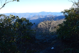
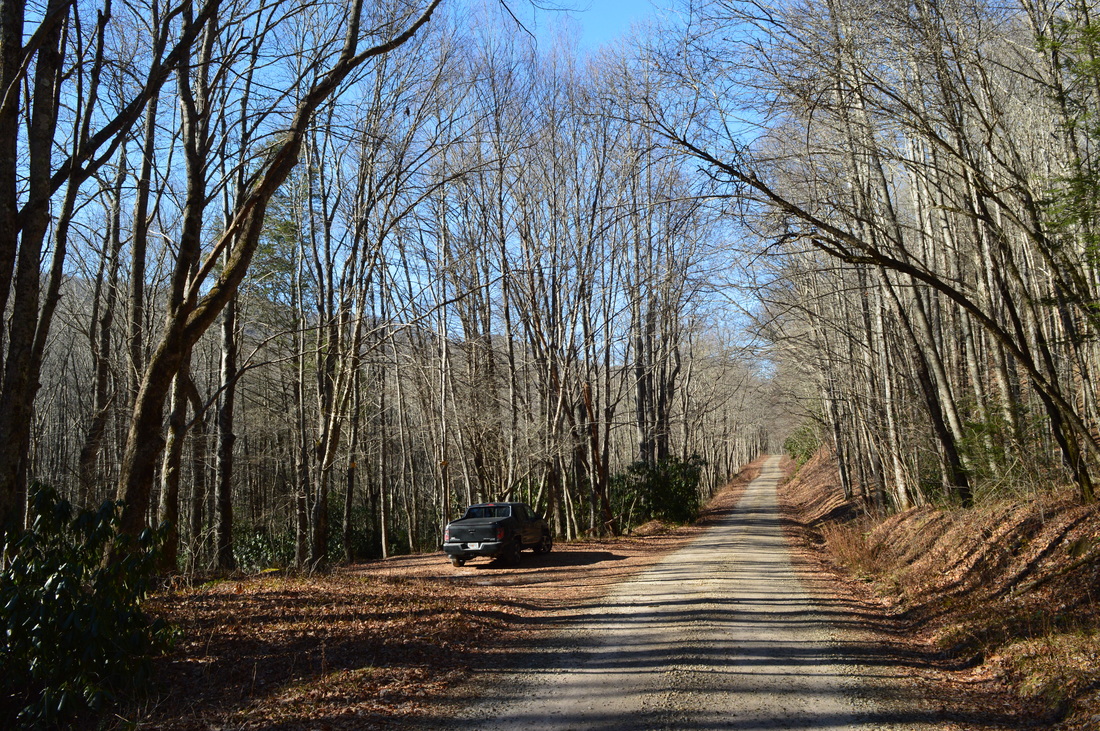
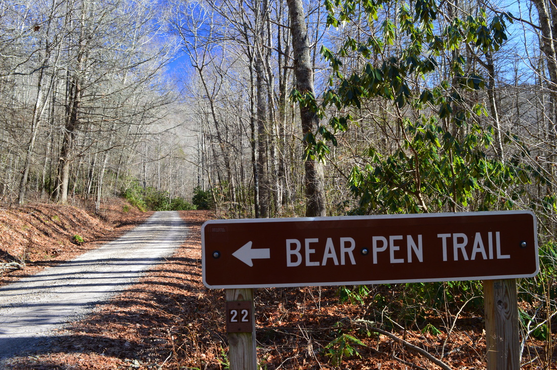
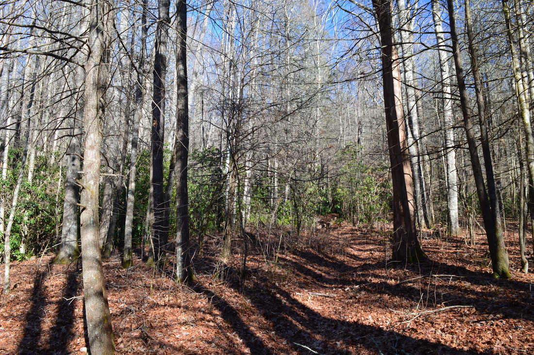
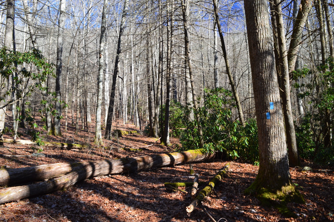
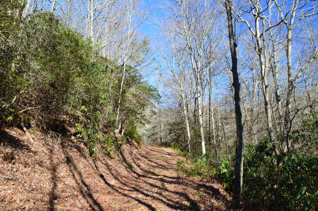
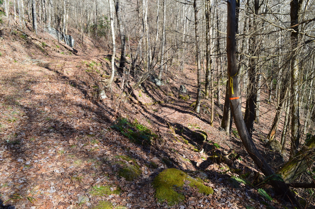
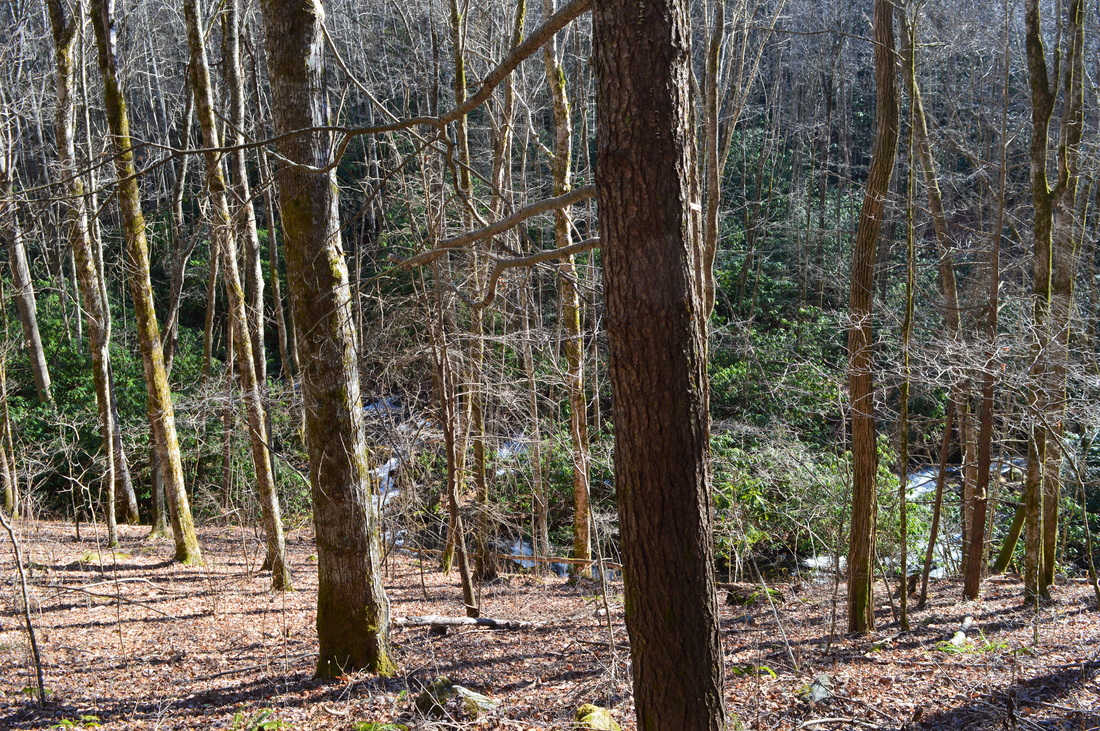
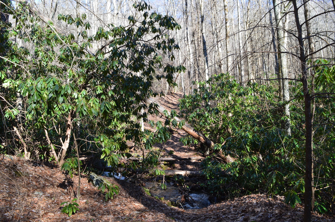
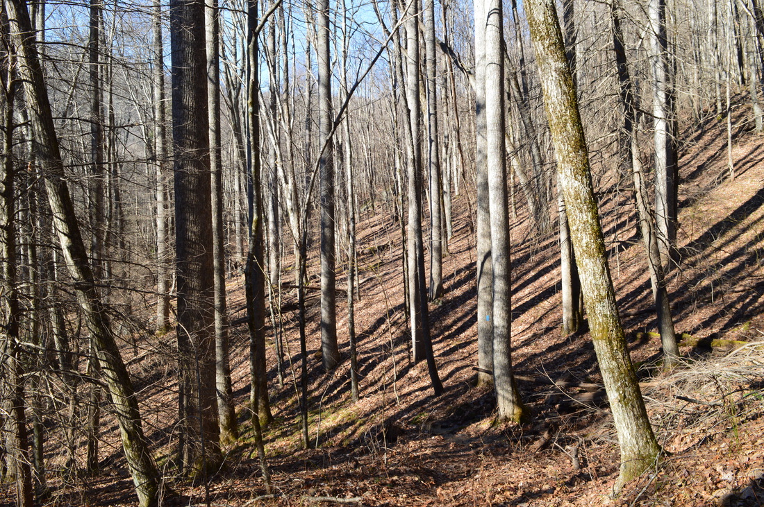
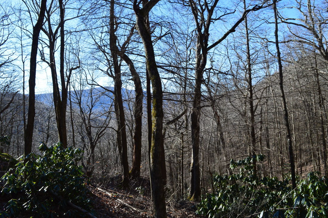
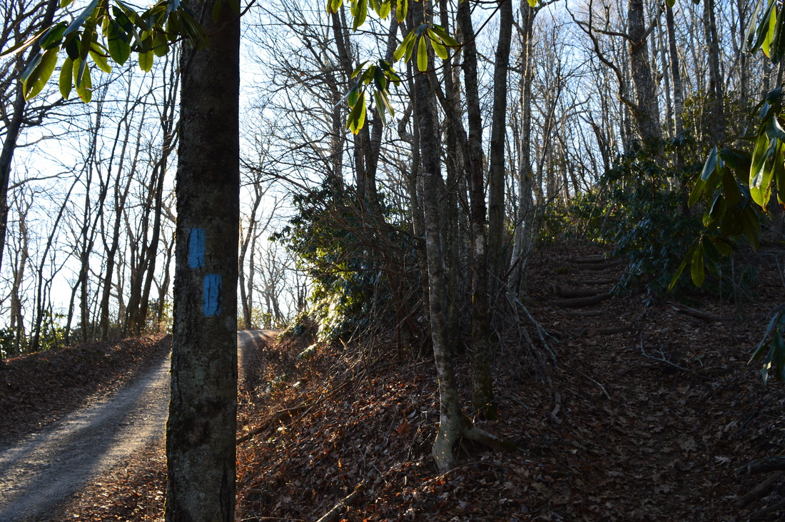
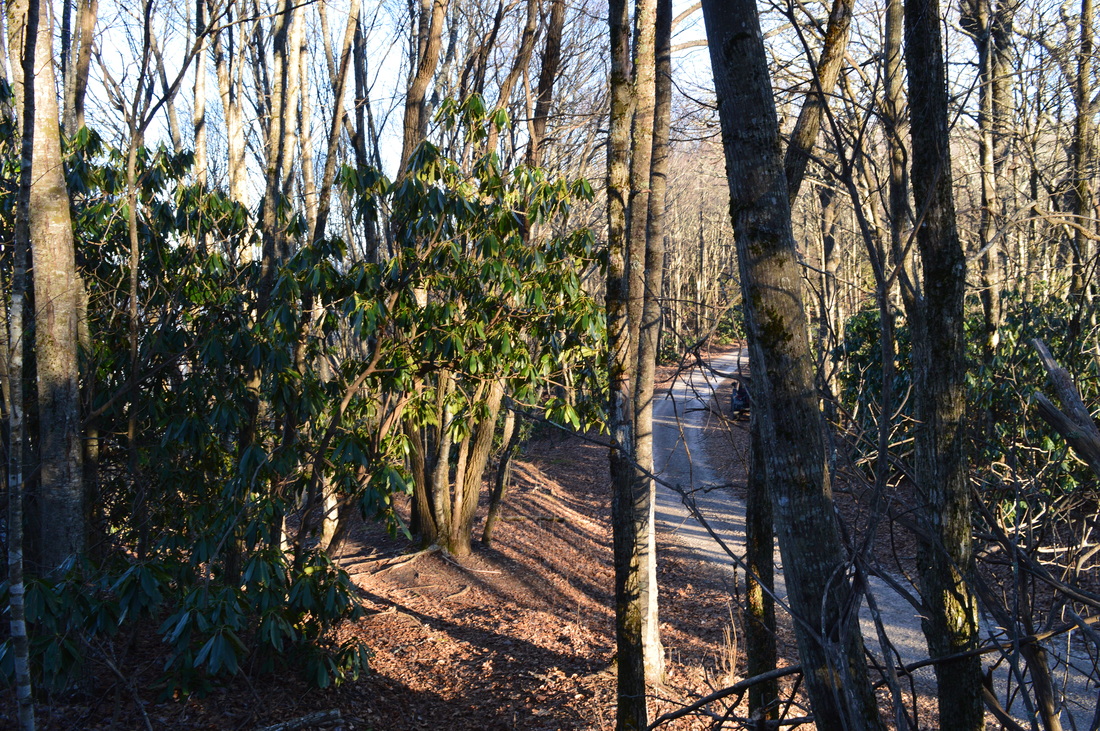
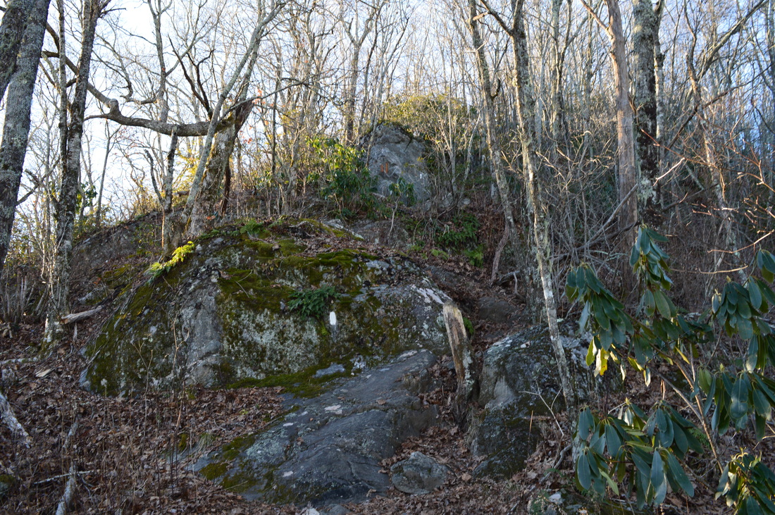
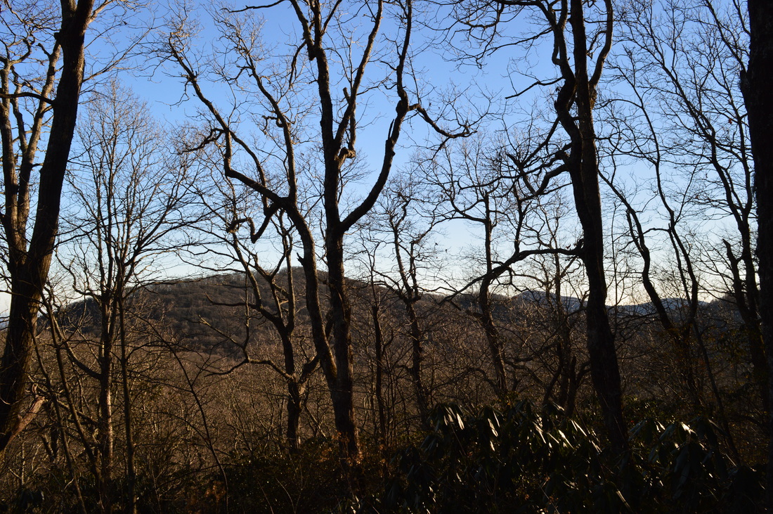
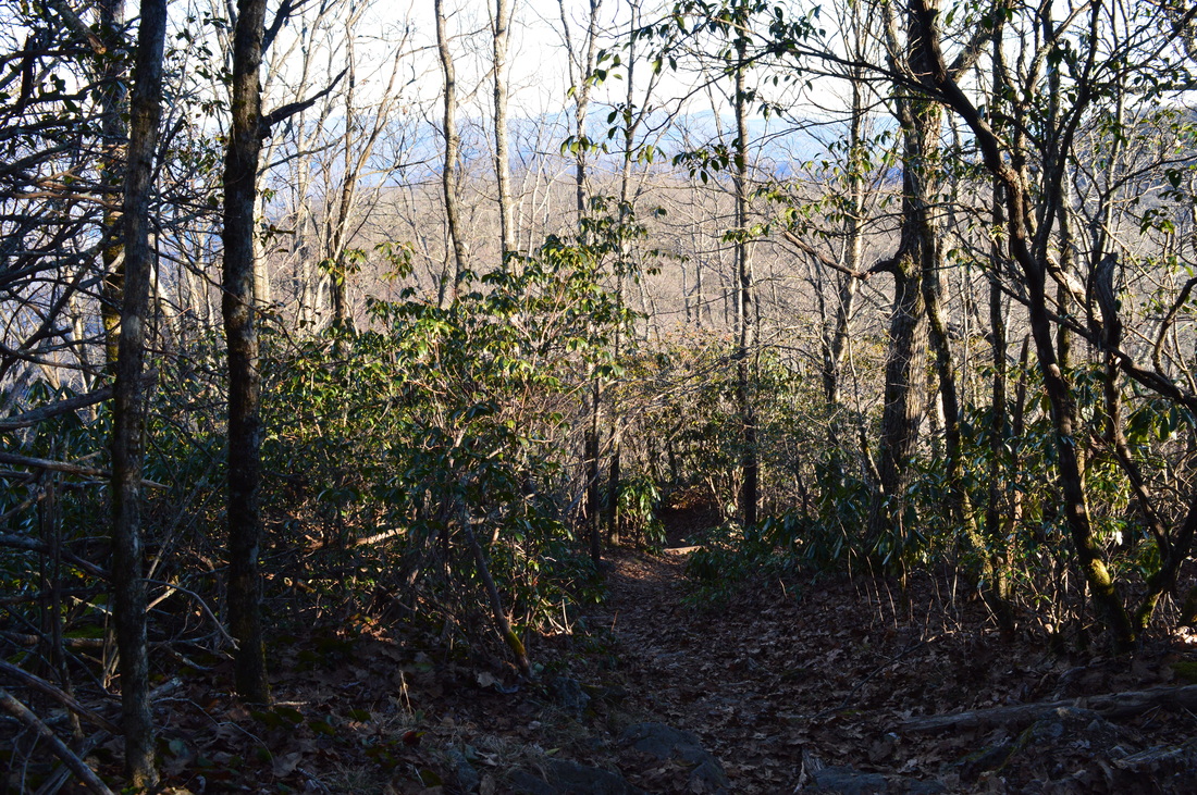
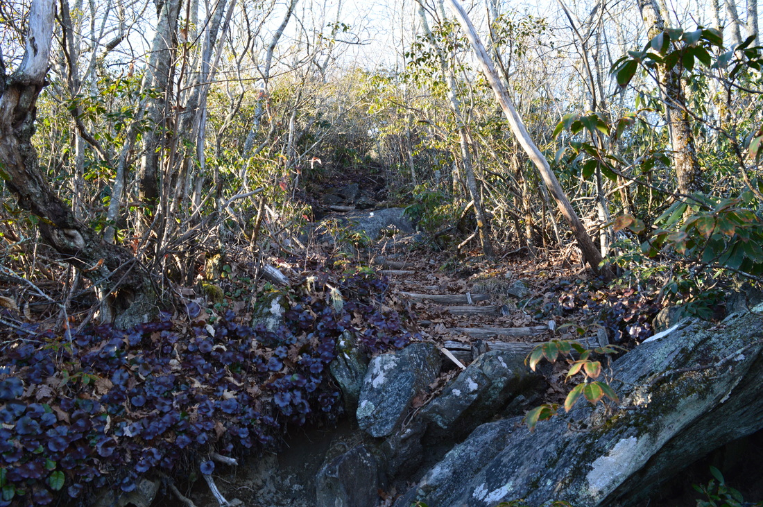
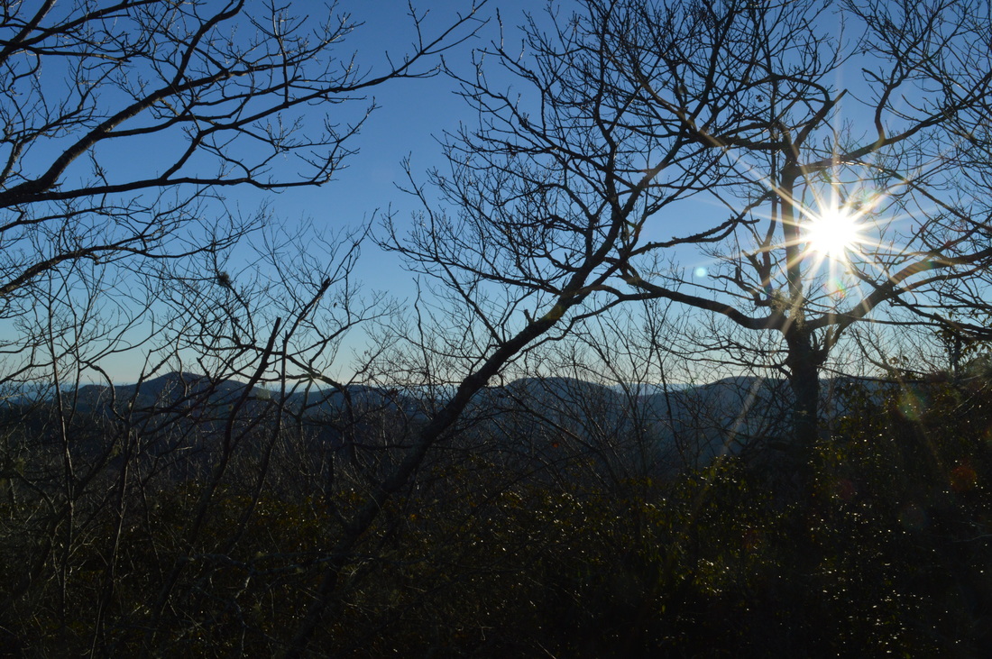
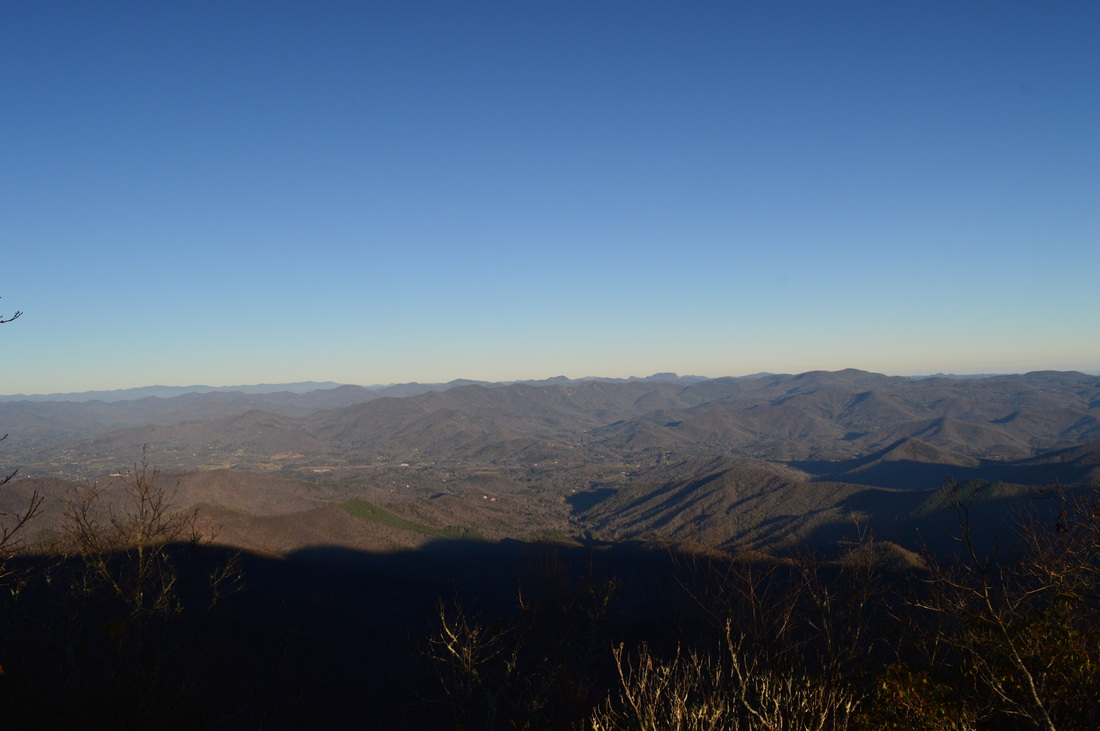
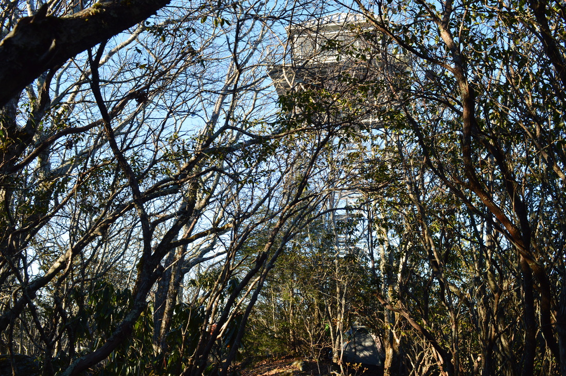
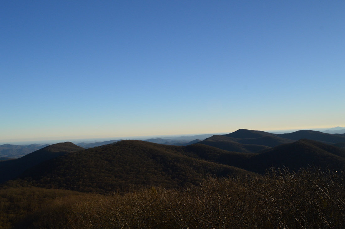
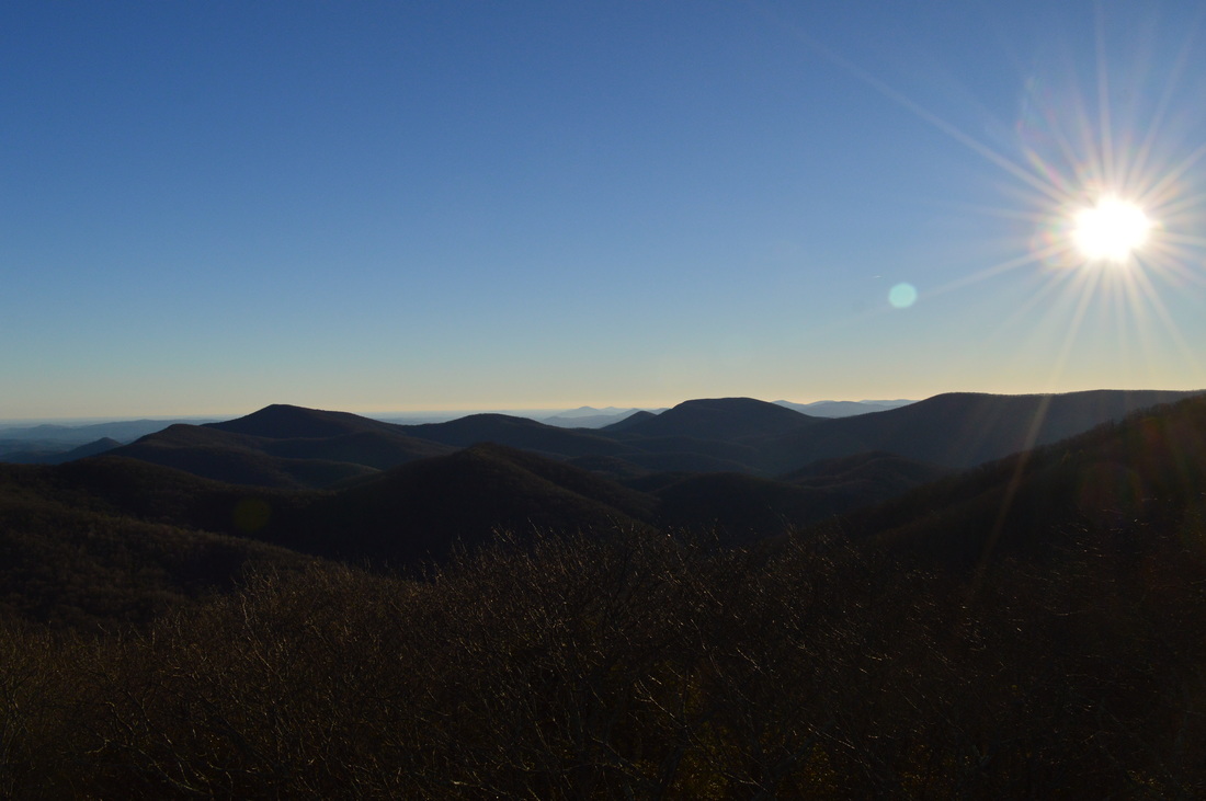
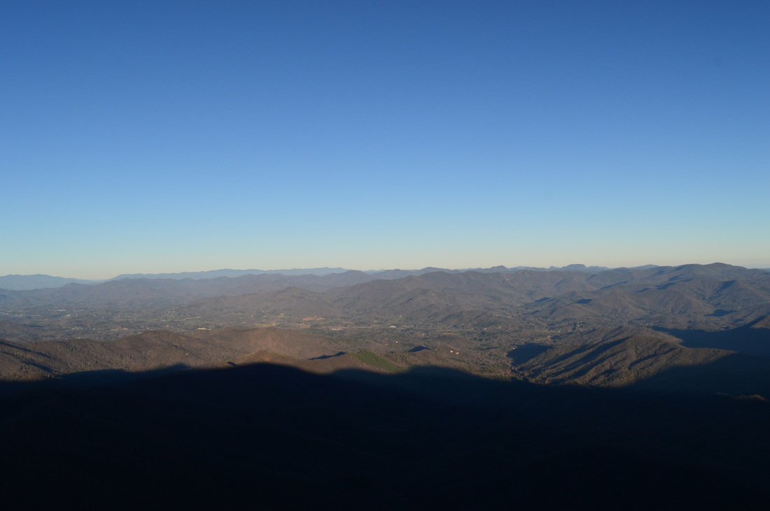
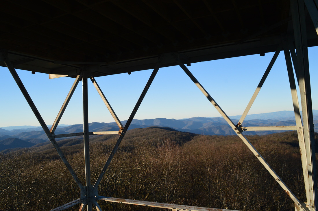
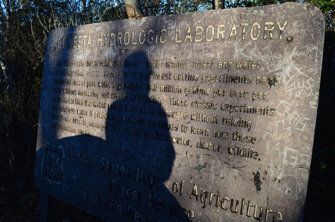
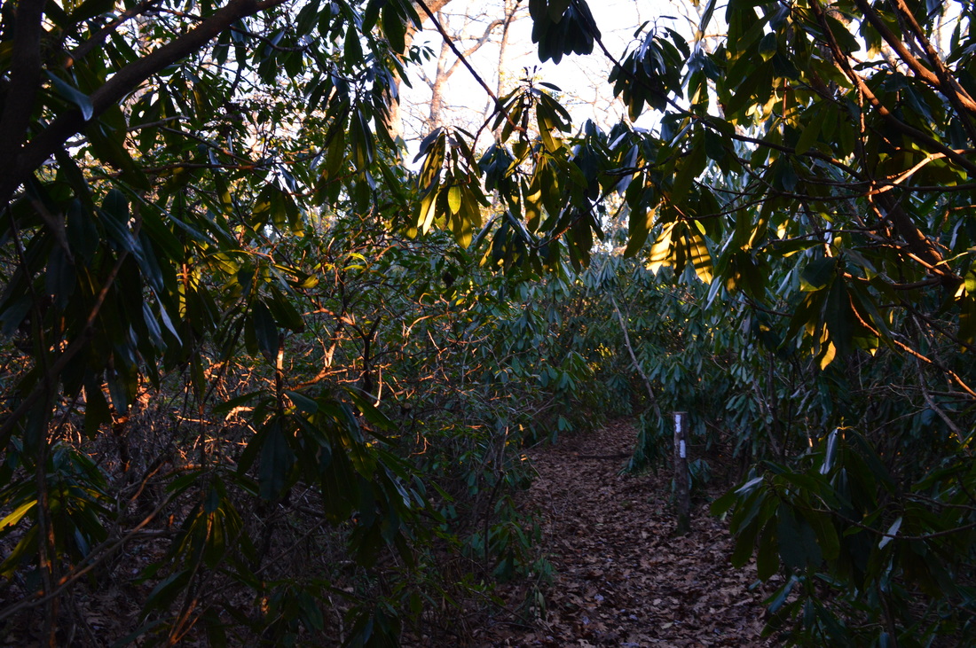
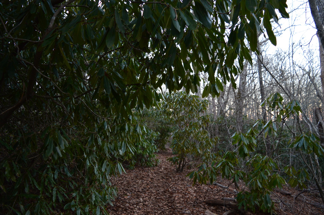
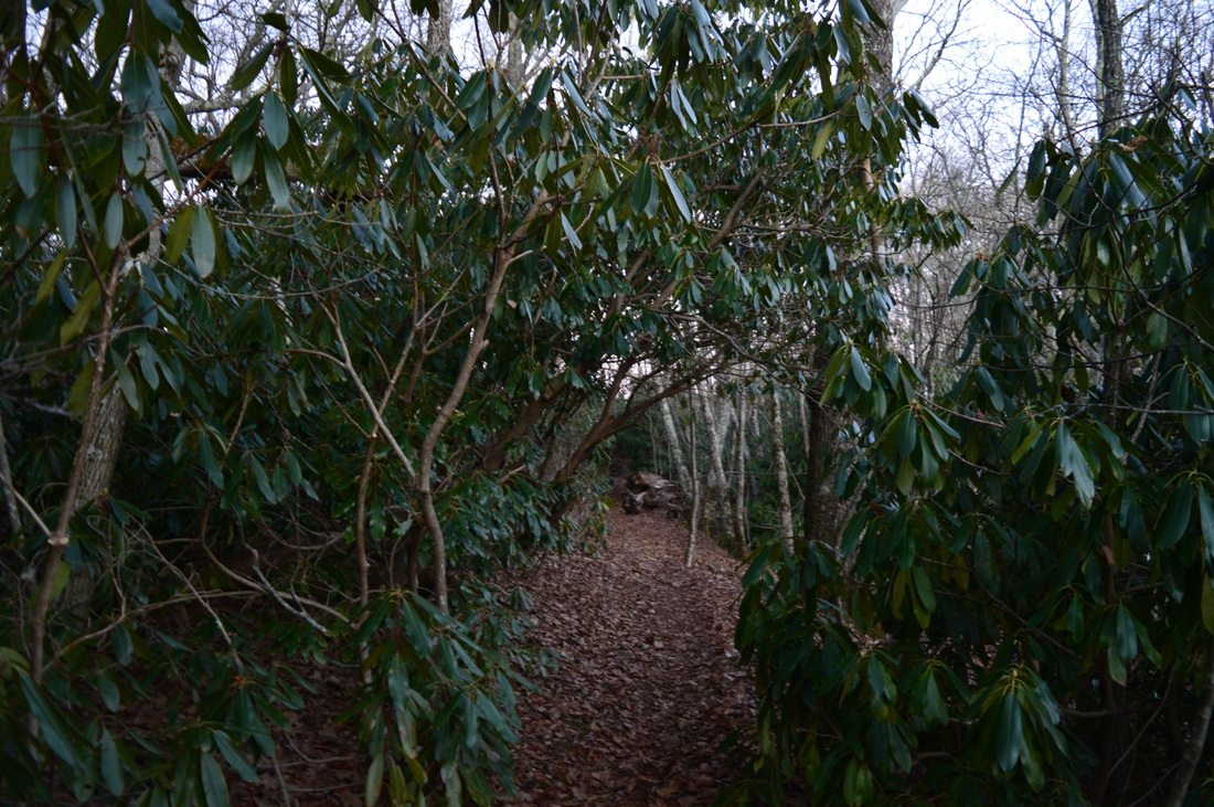
The Standing Indian Backcountry Area and the Southern Nantahala Wilderness comprise one unbroken tract of mountains and deep river valleys near the town of Franklin. The headquarters of Nantahala River, one of North Carolina's best-known rivers, are located here. Dozens of miles of hiking trails weave through the area. Two mountains are the key destinations in the region: Albert Mountain and Standing Indian Mountain. On this hike, you'll have the opportunity to use seldom-traveled trails in a loop or shuttle hike that visits the summit of Albert Mountain. This hike occurred on December 5th, 2015. My plan was to hike the Bearpen Gap Trail from the lower end near the Nantahala River to the upper end at the Appalachian Trail. From there, I would follow the Appalachian Trail up and over Albert Mountain to the Long Branch Trail. Using the Long Branch Trail, I would return to FS 67 and the Nantahala River area. I would finish by walking FS 67 back to the Bearpen Trail.

Summary

R/T Length of Trail: 12.1 Miles
Duration of Hike: 6:35
Type of Hike: Loop
Difficulty Rating: 6 out of 10
Total Elevation Gain: 2153 feet
​Pros: All of the trails on this hike, despite receiving little use, are well-marked and maintained. 
Cons: The platform at the top of the Albert Mountain fire tower is off-limits to the public.
Points of Interest: Views from Albert Mountain/Albert Mountain Fire Tower - 9 stars
Trail Blaze Color(s): Bearpen Gap Trail - Blue; Appalachian Trail - White; Long Branch Trail - Blue

Best Season(s) to Hike: Winter
Fees: None
Beginning Point: Lower Bearpen Gap Trailhead
Directions: From Franklin, NC: Follow US Route 441 South for 8.5 miles. Then, turn right onto Coweeta Lab Road. Follow Coweeta Lab Road for 3.1 miles, and then, continue straight onto Forest Service Road 83 that is now gravel. Continue for 6.7 miles. Then, turn left onto Forest Service Road 67 (if you turn right at the same intersection, you will end up at a parking lot near the summit of Albert Mountain - you'll be able to access the summit by a short trail from there). Continue on FS 67 for 4.3 miles. There will be a sign "Bearpen Trail" at the trailhead. The parking is a pullout with space for 4-5 cars on the left side of the road. Please note that the gravel roads leading to the trailhead are generally in good condition and passable by most passenger vehicles.

Map

A map and some other information regarding this hike can be viewed here.

Details

Most people who  see Albert Mountain will come the easy way from either one of the two trailheads at the upper end of Forest Service Road 67. However, the route detailed in this trail report is a more remote and harder way to see Albert Mountain. 

The hike starts on the Bearpen Gap Trail that is also simply known as Bearpen Trail. The trail begins by ascending up an obscure path from the road. At 0.15 miles, the trail reaches an old road. Turn left onto the old roadbed and ascend gradually. At 0.2 miles, a horse trail comes in from the left, and turns left onto another old road immediately afterwards. Meanwhile, the Bearpen Gap Trail bears right on the old road. As the road gradually rounds a corner, Bearpen Creek becomes audible and soon swings into view. At 0.5 miles, don't miss the double blaze as the trail turns right off the old road onto a single-track footpath. This valley is pretty wide and open - in winter, the bare trees will open far-reaching views. Bearpen Creek Trail is often close to the trail to your right. After periods of rain, the creek will come alive with numerous cascades and rapids. The trail will cross numerous small tributaries of Bearpen Creek, but most of the time, these small crossings should not present any challenge. The ascent is generally easy with a few moderate sections. At about 1.5 miles, the valley steepens and narrows, and so does the trail. The next 0.2 miles are steep uphill with only a few switchbacks at the end. After this uphill ends, you cross a side ridge - where the winter views are excellent down the valley - and descend slightly, approaching Bearpen Creek again. The trail stays easy for a while, but not forever. At 2.3 miles, the next steep ascent begins. The trail climbs out of the upper end of the Bearpen Creek drainage at a steep pace with no switchbacks. At 2.8 miles, cross an old road and continue ascending steeply.

At 2.9 miles, reach the eastern terminus of the Bearpen Gap Trail at FS 67. This is a location on FS 67 much higher than where your trailhead is. The junction is located on in a gap on the narrow ridge - winter views are splendid both east and west from this ridge, and the views continue increasing all the way as you hike to the summit of Albert Mountain. 

Turn left on the Appalachian Trail. This is the steepest section of the ascent to Albert Mountain, but it is not as difficult as advertised. The ascent is steep, but not the steepest I've been on. White blazes are plentiful as you scramble over some rock formations and ascend between large boulders. From the upper end of the Bearpen Trail to the summit of Albert Mountain, you gain about 350 feet of elevation in a matter of 0.4 miles. At 3.1 miles, the ascent begins to moderate and the winter views keep widening. At 3.2 miles, reach a rock outcrop with a splendid view eastward toward the Cullasaja River Gorge, Cowee Mountains, and beyond. ​The Albert Mountain fire tower is visible. At 3.3 miles, reach the summit of Albert Mountain and the fire tower. There is another eastward view from a rock outcrop. However, to gain the full 360-degree panorama, climb the steps of the fire tower to the last platform before the cabin  and upper platform. The cabin and upper platform are locked by a trapdoor and are off-limits to the public. The view from the fire tower is excellent in all directions - the entire expanse of the Standing Indian Backcountry Area is visible. The Albert Mountain fire tower was built in the 1950s as a replacement to an older wooden fire tower on Standing Indian Mountain. The fire tower on Standing Indian Mountain has since been dismantled.

Once you have enjoyed the summit view, continue on the Appalachian Trail northward. The descent is not as steep as the ascent - it is also longer. At 3.5 miles, in a small gap, a blue-blazed side trail leaves the AT to the left. This side trail reaches the parking area at the upper end of FS 67 in a quarter-mile. This is the easy way that most people use to access Albert Mountain. ​My hike continued on the AT. The AT ​bears left off the ridge to avoid ascending a small knob, before reaching Big Spring Gap at 4 miles. This is the old location of Big Spring Shelter. The shelter has been dismantled to allow restoration of the location. Water is still available at a spring to the trail's left at the headwaters of Hurricane Creek. In place of the Big Spring Shelter, a new shelter is now located near Long Branch. From Big Spring Gap, the trail ascends slightly to regain the ridge. After this short ascent, the descent continues and winter views are extensive to the west. At 4.4 miles, the trail leaves the ridge for good and begins descending in earnest into the Long Branch valley. At 6 miles, two miles north of Big Spring Gap, reach the spur trail to the new Long Branch Shelter. The spur trail continues straight while the AT turns right and switchbacks several times. Between 6.1 and 6.3 miles, cross several small streams that form Long Branch further down. At 6.8 miles, reach Glassmine Gap. The Appalachian Trail continues north towards Rock Gap, Wallace Gap, and eventually Winding Stairs Gap. This hike turns left onto the Long Branch Trail, a blue-blazed side trail.

The Long Branch Trail starts off with a moderate descent on a narrow trail​ into the Long Branch valley. Long Branch soon becomes audible. At 7 miles, enter a large flat that can be used as a camping area. Long Branch is clearly visible to the left of the trail. The trail proceeds down along Long Branch before crossing it at 7.1 miles. During normal water flow, this can be rock-hopped. During times of higher flow, you can use some well-placed logs and branches to cross dry, although I'm not sure exactly how much water is needed to have the logs underwater too. The trail stays parallel to Long Branch for a short time and then crosses an old road before gradually drawing away from Long Branch. At 7.3 miles, cross the Blackwell Gap Horse Trail. The Long Branch Trail stays level for some time and then continues descending down the Long Branch valley. Although Long Branch is audible much of the time, the trail doesn't approach it. Between 8.4 miles and 8.8 miles, the trail has several steeper descent sections. Finally, at 8.8 miles, the Long Branch Trail ends at FS 67. Across the road is the Backcountry Information Center, as well as a trail that leads to Standing Indian Campground. This is a good place to have a second car for your hike. If you do not have a second car, turn left and walk FS 67 for 3.3 miles. Most of the roadwalk is level or slightly uphill, but there are a few brief downhill sections. Also, be aware that the road fords Hurricane Creek at 11 miles via a concrete slab - there is no bridge at this location. I was unaware of this ford and had to get my feet wet on a frigid December evening! You will finish the hike at 12.1 miles upon returning to the Bearpen Gap Trailhead.

Variations

Hike to Albert Mountain out and back from the upper end of the Bearpen Gap Trail -
0.6 Miles
Hike to Albert Mountain out and back from the trailhead at the upper end of FS 67 -
0.9 Miles
Hike to Albert Mountain out and back via Bearpen Gap Trail - 6.6 Miles
Complete this hike as a shuttle hike with a second car at the Long Branch Trailhead - 8.8 Miles

Bonus Stops

Mooney Falls near FS 67 is but a short (and steep) walk from the road and can work as a bonus stop for this hike. 

Pictures

Videos

1 Comment
Edirne baymak servisi link
8/4/2022 06:17:16 am

Edirne baymak servisi için hemen websitemize göz at! https://www.edirneklimaservisi.com/edirne-baymak-servisi/

Reply


Leave a Reply.

    About Me

    Mark Oleg Ozboyd
    I'm an avid outdoor explorer and a hobbyist landscape photographer. I'm 21 years old and have been hiking since 2011. Originally based out of Atlanta, Georgia, I started out by occasionally hiking short trails throughout well-known Georgia State Parks. During 2012 and 2013, I began to expand my trips into adjacent states, as well as into the wilder National Forest areas rather than just State Parks. Throughout the years that followed, as I slowly ran out of popular hiking trails in my area, I began to search for and hike in more seldom-visited areas. Today, you can find me out in the woods every weekend, whether it's on an official trail or bushwhacking through cross-country terrain without any paths. I now attend Washington & Lee University and am exploring Virginia and West Virginia. My other hobbies include chess, science, old music, and meteorology. I have 3 years of amateur weather forecasting experience, having studied a lot of meteorology basics over the years. I am also a student at European School of Music where I learned that music and nature have a lot in common. Listening to good music inspires me to capture nature's beauty on the camera in different aspects that also make me recall many beautiful music pieces that I've heard.​


    Dear readers: I have invested a tremendous amount of time and effort in this website and the Georgia Waterfalls Database the past five years. All of the work that has gone in keeping these websites updated with my latest trip reports has almost been like a full-time job. This has not allowed me to pick up a paid job to save up money for college, and therefore, I I've had to take out loans. If you find the information on this website interesting, helpful, or time-saving, you can say "thanks" and help me out by clicking the button above and making a contribution. I will be very grateful for any amount of support you give, as all of it will apply toward my college tuition. Thank you! 

    Enter your email address to subscribe for trail reports:

    Delivered by FeedBurner


    Picture
    Coming in 2022-2023?

    Other Hiking Websites

    DWHike's Adventures
    Florida's Natural Wonders
    Florida Trailblazer
    Meanderthals
    Mountain Images
    by Bernie Boyer

    North Carolina Waterfalls with
    ​Kevin Adams
    Take-a-Hike!
    Tennessee Landforms
    Waterfall Page
    Waterfall Adventurer
    Zach's Mild Adventures

    Miles Hiked

    Year 1: 540.0 Miles
    Year 2: 552.3 Miles
    ​Year 3: 518.4 Miles
    Year 4: 482.4 Miles
    Year 5: 259.9 Miles

    Archives

    March 2021
    February 2021
    January 2021
    November 2019
    October 2019
    September 2019
    August 2019
    July 2019
    June 2019
    February 2019
    January 2019
    December 2018
    November 2018
    October 2018
    August 2018
    July 2018
    June 2018
    May 2018
    April 2018
    March 2018
    February 2018
    January 2018
    December 2017
    November 2017
    October 2017
    September 2017
    August 2017
    July 2017
    June 2017
    May 2017
    April 2017
    March 2017
    February 2017
    January 2017
    December 2016
    November 2016
    October 2016
    September 2016
    August 2016
    June 2016
    May 2016
    April 2016
    March 2016
    January 2016
    December 2015
    November 2015
    October 2015
    September 2015
    August 2015
    July 2015
    June 2015
    May 2015
    April 2015
    March 2015
    February 2015
    January 2015
    December 2014
    November 2014
    October 2014
    September 2014
    August 2014
    July 2014
    June 2014
    May 2014
    April 2014
    March 2014
    February 2014

    Categories

    All
    Adel
    Adirondack Park
    Alabama
    Alfred A. Ring Park
    Allegheny Trail
    Amicalola Falls State Park
    Anniston Area
    Apalachicola Bluffs And Ravines Preserve
    Apalachicola National Forest
    Apalachicola/Port St. Joe Area
    Apopka
    Appalachian Trail
    Appling
    Art Loeb Trail
    Aska Trail System
    Bakersville
    Balm-Boyette Scrub Preserve
    Balsam Lake Recreation Area
    Bankhead National Forest
    Bartow County Parks
    Bartram Trail
    Basinger
    Beersheba Springs
    Benton
    Benton Mackaye Trail
    Berry College Trail System
    Best Hike
    Big South Fork National Recreation Area
    Black Bear Wilderness
    Black Rock Mountain State Park
    Blairsville
    Blakely
    Blood Mountain Wilderness
    Blowing Rock
    Blue Ridge
    Blue Ridge Parkway
    Boone
    Bradenton
    Bradenton Beach
    Brasstown Bald
    Brasstown Wilderness
    Brevard
    Bryson City
    Buchanan
    Bucks Pocket State Park
    Bulow Creek State Park
    Bulow Plantation Ruins State Park
    Caesars Head State Park
    Caladesi Island State Park
    Calhoun
    Camel's Hump State Park
    Cashiers
    Caspersen Beach Park
    Catfish Creek State Park
    Caves
    CC Putnam State Forest
    Cedar Point Environmental Park
    Chatsworth
    Chattahoochee National Forest
    Chattanooga
    Chattanooga Valley
    Chattooga National Wild And Scenic River
    Cheaha Wilderness
    Cherohala Skyway
    Cherokee
    Cherokee National Forest
    Chiefland Area
    Chillhowee Recreation Area
    Chipley
    Chunky Gal Trail
    Circle B Bar Reserve
    Citico Creek Wilderness
    Citrus Wildlife Management Area
    Clarkesville
    Clayton
    Cleevland
    Cleveland
    Cloudland Canyon State Park
    Cohutta Wilderness
    Collier-Seminole State Park
    Cordele
    Cornelia
    Covington
    Crestview Area
    Crew-land-and-water-trust
    Cullowhee
    Cumberland Trail
    Dahlonega
    Dalton
    Dawson Forest Wildlife Management Area
    Dawsonville
    Dayton
    De Soto National Memorial
    DeSoto State Park
    Dillard
    Double Springs
    Ducktown
    Duncan Ridge Trail
    Dunlap
    Eagle's Rest Park
    Eastpoint
    Econfina Creek Wildife Management Area
    Eglin Air Force Base
    Elizabethton
    Elkins
    Elk Knob Game Lands
    Elk Park
    Ellicott Rock Wilderness
    Ellijay
    Emerson Point Preserve
    Englewood Area
    Enota Retreat
    Erwin
    Falling Waters State Park
    Fayetteville
    Fires Creek Recreation Area
    Fire Tower
    Flint River
    Florence Area
    Florida
    Florida Caverns State Park
    Florida Trail
    Foothills Trail
    Fort Mountain State Park
    Fort Myers Area
    Fort Payne
    Fort Payne Area
    Fort Yargo State Park
    Franklin
    Franklin Delano Roosevelt State Park
    Franklin-Marion State Forest
    Frozen Head State Park
    Gainesville
    Gainesville Area
    Gatlinburg
    George Washington National Forest
    Georgia
    Georgia Veterans Memorial State Park
    Glasgow
    Gorges State Park
    Grandfather Mountain State Park
    Great Smoky Mountains National Park
    Greeneville
    Green River Game Lands
    Gruetli-Laager
    Grundy Forest State Natural Area
    GTM Reserve
    Guana River Wildlife Management Area
    Hayesville
    Helen
    Hiawassee
    High Falls State Park
    Highlands
    Highlands Scenic Highway
    Hillsborough River State Park
    Hinson Conservation & Recreation Area
    Historic Sites
    Honeymoon Island State Park
    Hot Springs
    Huntington
    Inverness Area
    Jackson
    Jasper
    Jefferson National Forest
    Joan M. Durante Park
    Jonathan Dickinson State Park
    Jones Gap State Park
    Joyce Kilmer Slickrock Wilderness
    Joyce Kilmer - Slickrock Wilderness
    Juniper Prairie Wilderness
    Kelly Park
    Keown Falls Recreation Area
    Kolomoki Mounds State Park
    LaFayette
    Lake City Area
    Lake George Wild Forest
    Lake June-in-Winter State Park
    Lakeland Area
    Lake Placid
    Lake Russell Wildlife Management Area
    Lake Wales Ridge State Forest
    Laurel Fork North Wilderness
    Leffis Key Preserve
    Leon Sinks Geological Area
    Lexington
    Lineville
    Linville
    Linville Gorge Wilderness
    Lithia Springs
    Little Frog Wilderness
    Little Manatee River State Park
    Little River Canyon National Preserve
    Longboat Key
    Long Trail
    Lookout Mountain
    Lookout Mountain Battlefield
    Lovingston
    Lula Lake Land Trust
    Lumpkin
    Maggie Valley
    Manatee Springs State Park
    Marianna Area
    Mark Trail Wilderness
    Marlinton
    Mccaysville
    McMinville
    Mentone
    Middlesex
    Mistletoe State Park
    Monongahela National Forest
    Montreat
    Mountain Bridge Wilderness Area
    Mountain City
    Mountains To Sea Trail
    Mountains-to-Sea Trail
    Mount Rogers National Recreation Area
    Myakka River State Park
    Myron B. Hodge City Park
    Nantahala National Forest
    Naples
    Naples Area
    Natural Bridge State Park
    Neal Preserve
    New Castle
    Newport
    New River Gorge National Park
    New York
    North Carolina
    Ocala Area
    Ocala National Forest
    Ocean-to-Lake Trail
    Oconee State Park
    Oconee Station Historic Site
    Okaloacoochee Slough State Forest
    Oldsmar
    Oneida
    Orlando Area
    Ormond Beach
    Oscar Scherer State Park
    Oxford
    Palatka
    Palmetto Trail
    Panama City Area
    Panthertown Valley
    Parrish
    Paynes Creek Historic State Park
    Peaks Of Otter Recreation Area
    Pigeon Crockford Mountain Wildlife Management Area
    Pigeon-Crockford Mountain Wildlife Management Area
    Pigeon-Crockford Wildlife Management Area
    Pine Mountain
    Pinhoti Trail
    Pinnacle Park
    Pisgah Civitan Park
    Pisgah National Forest
    Pittman Center
    Pond Mountain Wilderness
    Ponds/Lakes
    Prentice Cooper State Forest
    Providence Canyon State Park
    Pumpkintown
    Quick Point Nature Preserve
    Raven Cliffs Wilderness
    Reed Bingham State Park
    Reliance
    Rice Creek Conservation Area
    Riverview Pointe Preserve
    Robbinsville
    Robinson Preserve
    Rock Creek Gorge Scenic Area
    Rock Island State Park
    Rome
    Rosman
    Sale Creek
    Salem
    Salt Springs
    Saluda
    Santa Rosa Beach
    Sarasota
    Sarasota Area
    Savage Gulf State Natural Area
    Scenic Views
    Scottsboro Area
    Sebring Area
    Sewanee
    Sheltowee Trace Trail
    Shining Rock Wilderness
    Signal Mountain
    Sipsey Wilderness
    Sky Valley
    Smithgall Woods State Park
    Snowbird Backcountry Area
    Soddy Daisy
    Soddy-Daisy
    Sopchoppy
    South Carolina
    South Cumberland State Park
    Southeastern Cave Conservancy
    Southern Nantahala Wilderness
    Sparta
    Sprewell Bluff Park
    Spring City
    Spring Hill
    Springs
    Spruce Pine
    Standing Indian Backcountry Area
    St. Augustine
    St. George Island State Park
    St. Joseph Bay State Buffer Preserve
    St. Marks Area
    St. Marks National Wildlife Refuge
    Stone Mountain
    Stone Mountain Park
    Suches
    Sumatra
    Sumter National Forest
    Suwannee River
    Swallow Creek Wildlife Management Area
    Sweetwater Creek State Park
    Sylva
    Talladega National Forest
    Tallahassee Area
    Tallulah Falls
    Tallulah Gorge State Park
    Tampa Bay Area
    Tate City
    Tate's Hell State Forest
    Tea Creek Wildlife Management Area
    Tellico Plains
    Tennessee
    Thomaston
    Toccoa
    Topsail Hill State Park
    Torreya State Park
    Townsend
    Tracy City
    Tray Mountain Wilderness
    Trenton
    Triple Creek Preserve
    Troutdale
    Unaka Mountain Wilderness
    Upper Tampa Bay County Park
    Venice
    Vermont
    Virgin Falls State Natural Area
    Virginia
    Virginia Outdoors Foundation
    Vogel State Park
    Wakulla Springs State Park
    Waleska
    Walhalla
    Wartburg
    Water Features
    Waynesville
    Weedon Island Preserve
    Weeki Wachee Preserve
    Wekiwa Springs State Park
    West Palm Beach Area
    West Virginia
    Whitehall
    White Springs
    Winder
    Withlacoochee State Forest
    Young Harris

    RSS Feed

TRAIL REPORTS

Hikes in Alabama
​Hikes in Florida
Hikes in Georgia
Hikes in North Carolina
Hikes in South Carolina
Hikes in Tennessee
Hikes in Virginia

Hiking Resources

Alabama Resources
​
Florida Resources
Georgia Resources
North Carolina Resources
​South Carolina Resources
​
Tennessee Resources

Other

Contact
Map of Hikes
Alphabetical List of Hikes
Southeast Nature Society
© COPYRIGHT 2014-2024
​ALL RIGHTS RESERVED.
Important: I disclaim any responsibility for any damage or personal injury that may occur as a result of the activities and information found on this website. All outdoor activities, especially off-trail hiking, are done at your own risk. Never hike or head into that area that may be above your fitness or experience level.
  • Home
  • Trail Reports
    • Best Hikes
    • Hikes with Scenic Views
    • Hikes with Water Features
    • Alabama
    • Georgia
    • Florida
    • North Carolina
    • South Carolina
    • Tennessee
    • Vermont
    • Virginia
  • Map
  • Hike List
  • Testimonials
  • Resources
  • Contact Us
  • Southeast Nature Society
    • Our Team
  • Georgia Waterfalls Database