HIKING THE APPALACHIANS AND BEYOND
  • Home
  • Trail Reports
    • Best Hikes
    • Hikes with Scenic Views
    • Hikes with Water Features
    • Alabama
    • Georgia
    • Florida
    • North Carolina
    • South Carolina
    • Tennessee
    • Vermont
    • Virginia
  • Map
  • Hike List
  • Testimonials
  • Resources
  • Contact Us
  • Southeast Nature Society
    • Our Team
  • Georgia Waterfalls Database

Chattahoochee National Forest: Hemlock Falls Trail to Hemlock Falls and Upper Moccasin Creek Falls, Clayton, Georgia

3/28/2017

0 Comments

 
Picture
The Hemlock Falls Trail is one of Georgia's most popular streamside trails, and for good reason: the trail follows beautiful Moccasin Creek, which is a constant run of whitewater nearly all of its length, culminating in Hemlock Falls, a pretty 15-foot waterfall with a pool. Above Hemlock Falls, however, lies a much less-visited world. Above Hemlock Falls, a remote and unmaintained footpath crosses the creek and continues through a picturesque gorge with many cascades and slides, before terminating at Upper Moccasin Creek Falls, a 40-foot waterfall that is widely considered to be one of Georgia's most beautiful waterfalls. This hike occurred on Saturday, March 4th, 2017. My plan was to hike the Hemlock Falls Trail and the unmaintained footpath that follows from the Moccasin Creek Trailhead to Upper Moccasin Creek Falls and back, passing Hemlock Falls on the way. 

Summary

R/T Length of Trail: 3.4 Miles 
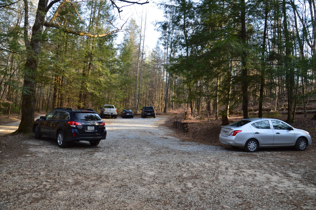
Duration of Hike: 2:40 
Type of Hike: Out and Back 
Difficulty Rating: 3 out of 10 
Total Elevation Gain: 629 Feet
Pros: Very family-friendly trail up to Hemlock Falls 
Cons: Much more primitive trail beyond Hemlock Falls 
Points of Interest: Hemlock Falls - 2 stars; Upper Moccasin Creek Falls - 8 stars
Trail Blaze Colors: Hemlock Falls Trail - Lime Green; None for continuation of trail beyond Hemlock Falls 
Best Seasons to Hike: Spring 
Fees: None 
Beginning Point: Hemlock Falls Trailhead
Directions from Clayton, GA: From the intersection of US 23/441 and US 76 West in downtown Clayton, follow US 76 West (Savannah Street) for 11.0 miles, before turning left onto GA 197 and continuing for 3.7 miles. Then, turn right onto Andersonville Lane (directly across from the entrance to Moccasin Creek State Park) and follow it for 0.6 miles to the trailhead parking area. 

Map

Picture
Click here to download a track of this hike. 

Details

The hike to Hemlock Falls is among the most popular waterfall hikes in Georgia. You're not likely to find yourself alone on that stretch, which is why I had been holding off on doing this hike. However, one evening when I was in the area, I decided the time had come. While I was not alone, the late hour of the day had already sent most folks home. Furthermore, I continued past Hemlock Falls, where much fewer people hike. 

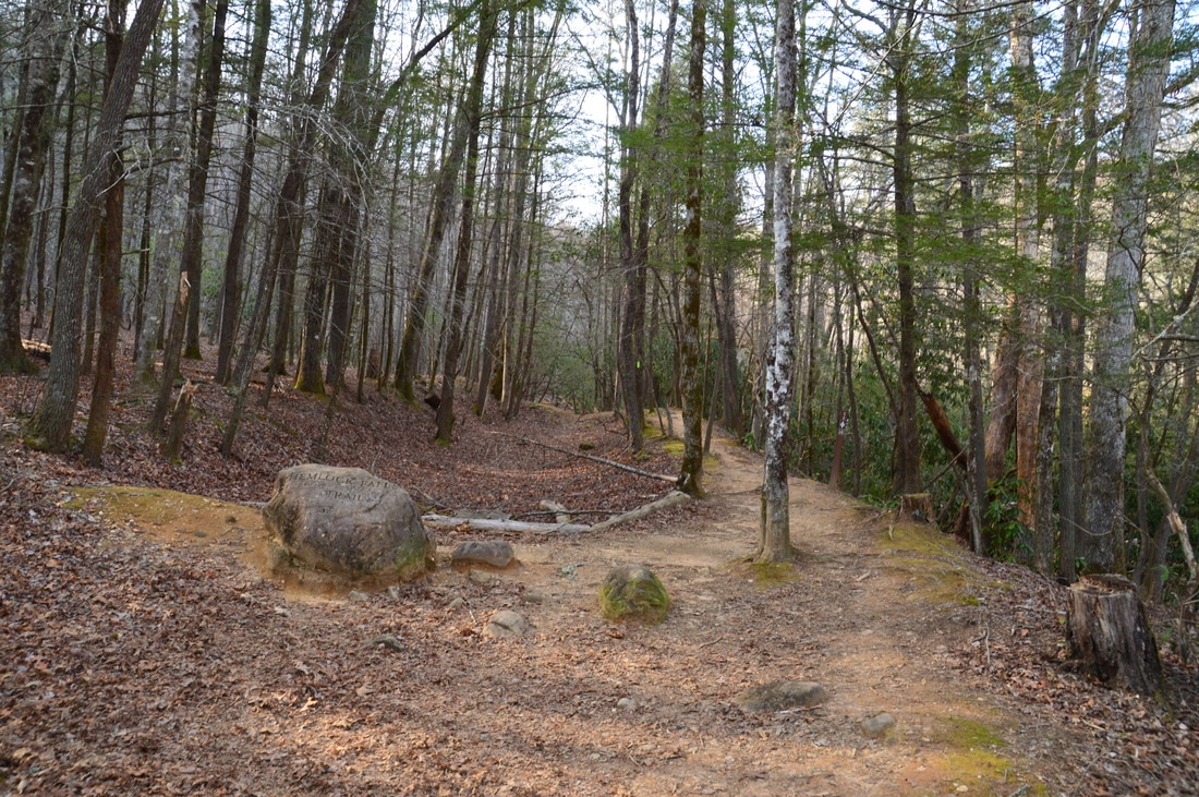
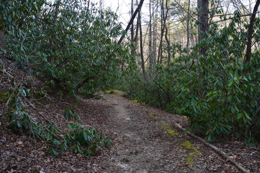
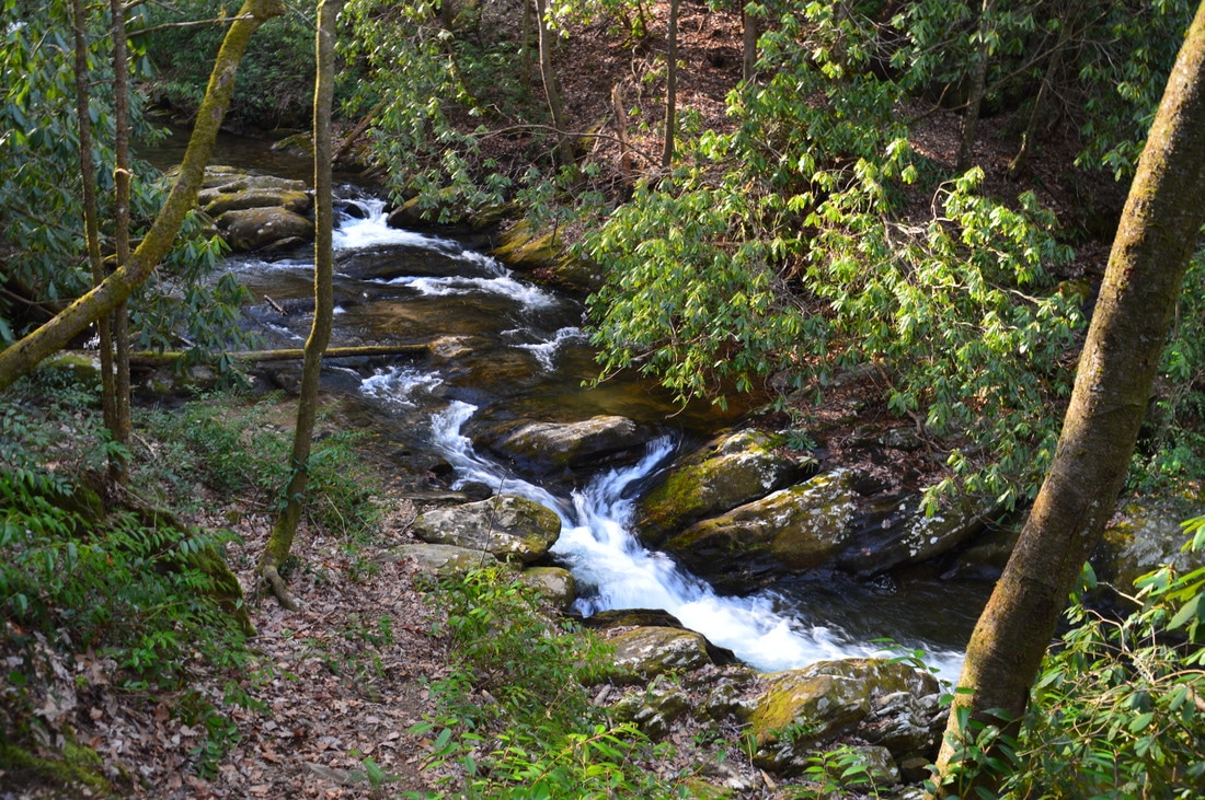
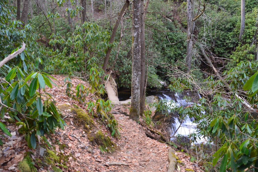
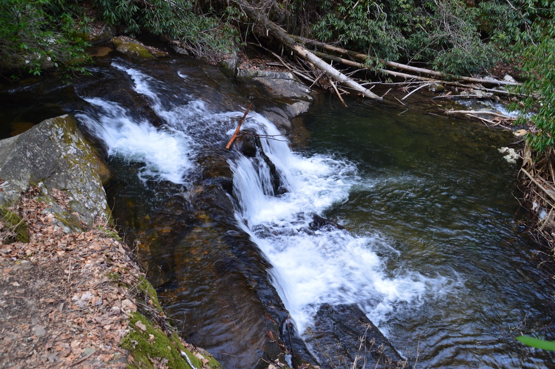
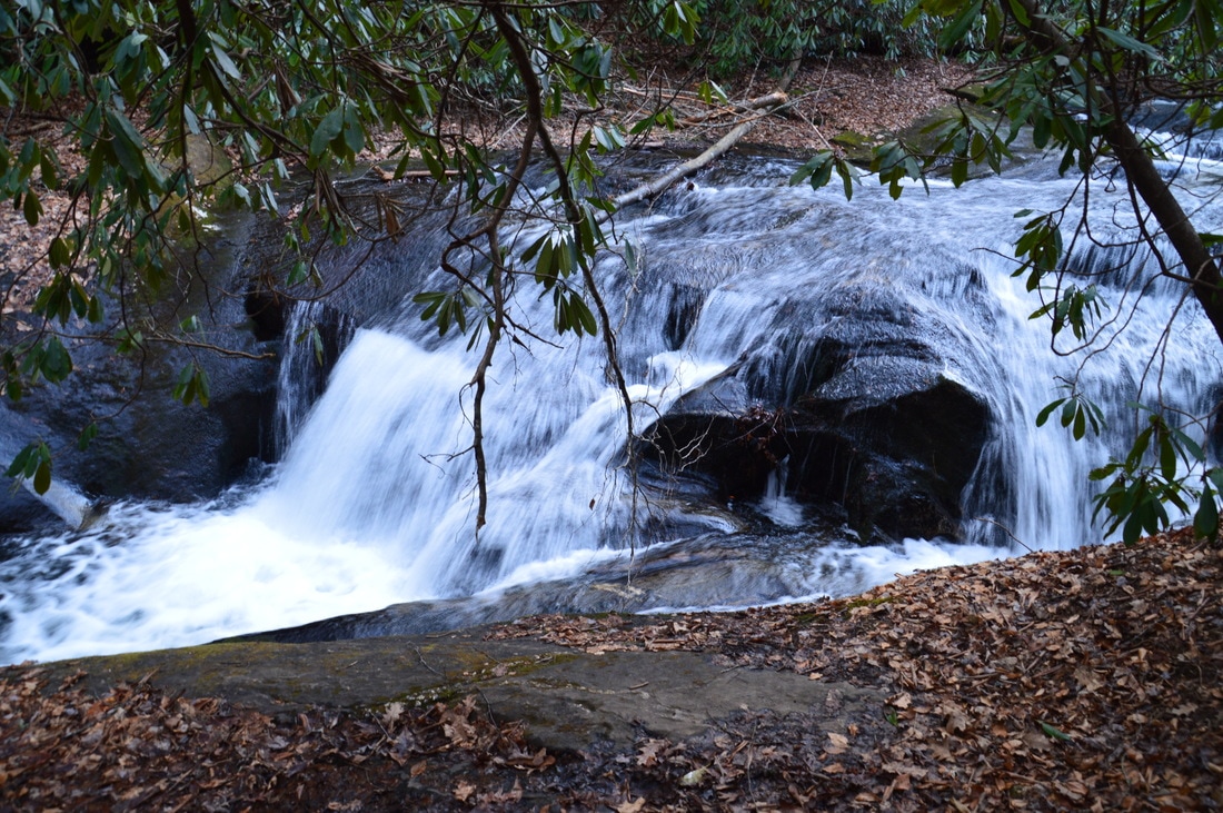
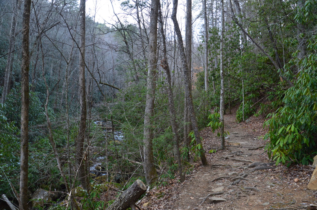
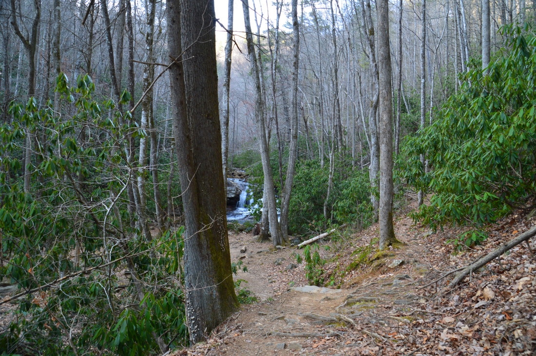
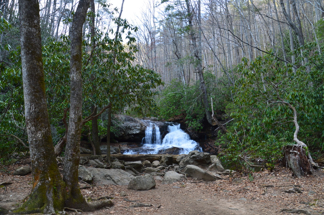
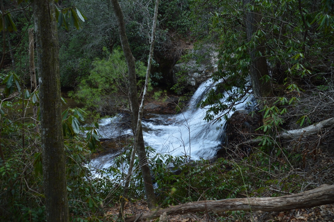
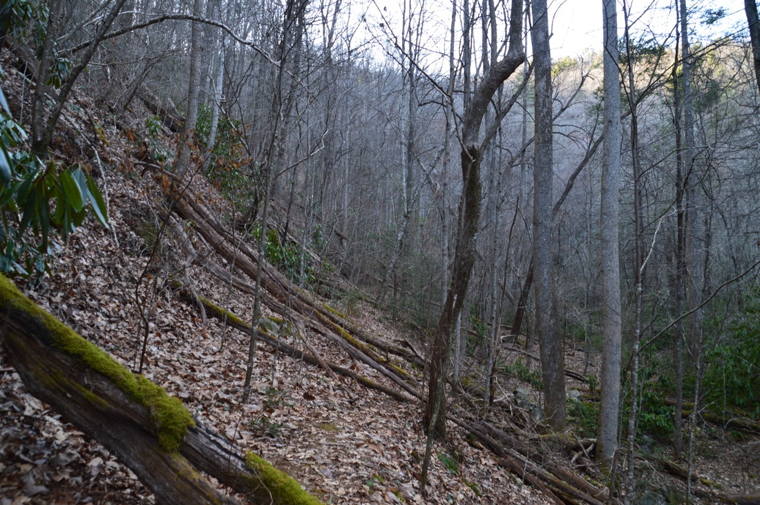
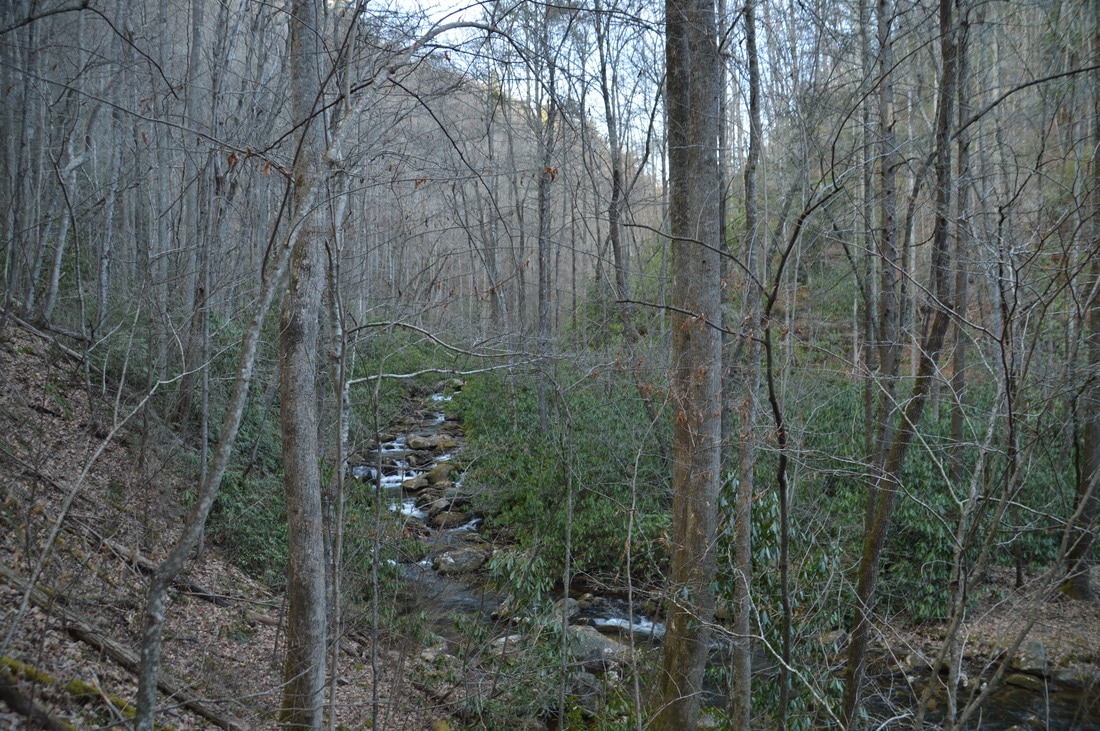
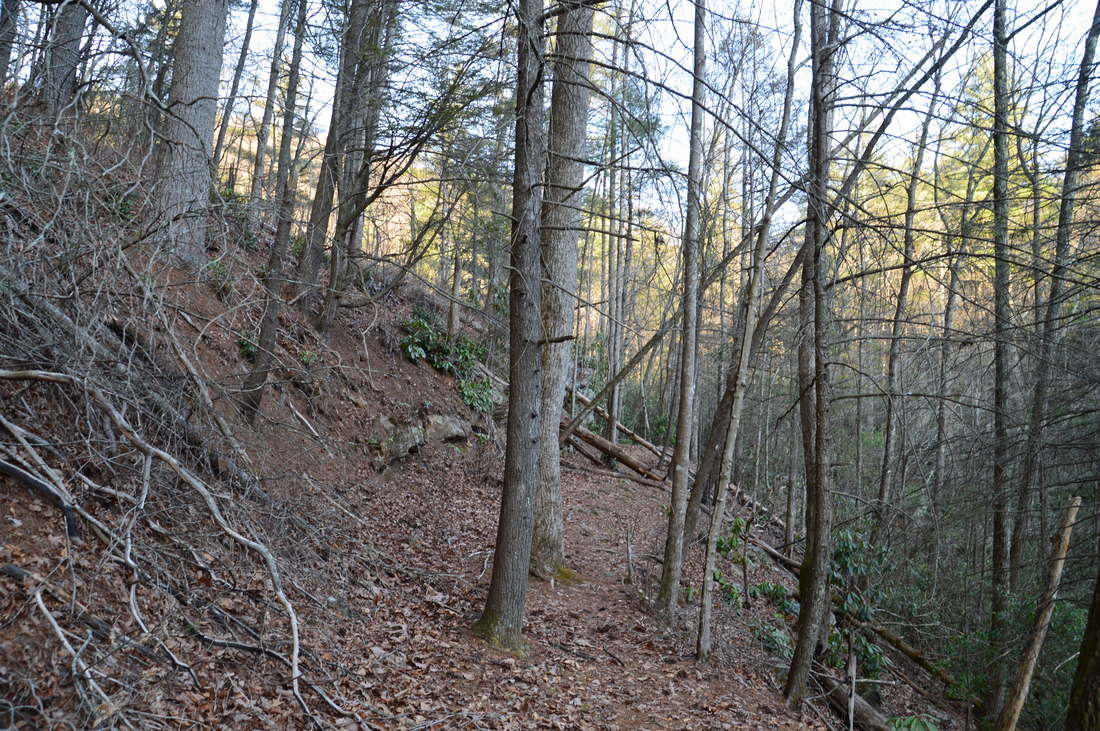
The hike begins at the far of the trailhead parking area. An inscribed boulder reads "Hemlock Falls Trail" at the trailhead. The well-worn trail initially begins on a small berm alongside an old railroad grade, before dropping down to the grade itself. At 0.2 miles, the trail comes alongside Moccasin Creek, which it follows for pretty much the rest of the hike. Moccasin Creek is a very beautiful mountain stream, with continuous cascades, slides, and whitewater in general. Some of the cascades/slides that you pass technically qualify as waterfalls (and they are listed in Jim Parham's book), but they did not stand out to me due to how the whole creek was one continuous waterfall. After passing some cliffs to the left where there is sometimes a waterfall after heavy rain, and after passing a wet-weather tributary waterfall visible across the creek, the trail crosses Moccasin Creek via a footbridge at 0.8 miles just above a small but pretty waterfall. 

On the other side of the creek, stone steps take the trail up the bank, after which the trail passes a  large slide in the creek. The creek is always visible from the trail along this stretch, At 1.0 miles, there is a split in the trail. A wide path bears left down to a large clearing and flat at Hemlock Falls, while a narrower path bears right to Upper Moccasin Creek Falls. This is the end of the official Hemlock Falls Trail. This means that the rest of the trail is not maintained. However, enough people have hiked it that it is a very obvious path, and its only issue is a large amount of blowdowns. First, take the short side trail to Hemlock Falls. This 15-foot waterfall drops down a wide rock ledge and into a beautiful dark pool. 
Picture
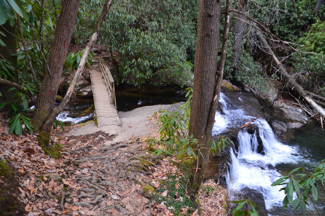
0.8 miles into the hike, you will cross beautiful Moccasin Creek via a footbridge just above an impressive cascade.
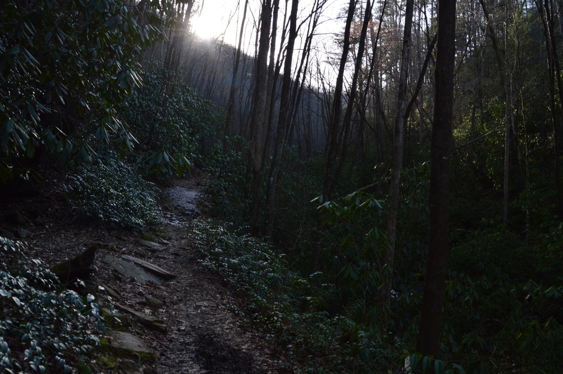
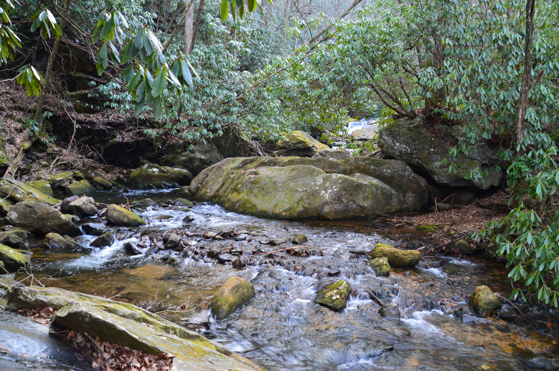
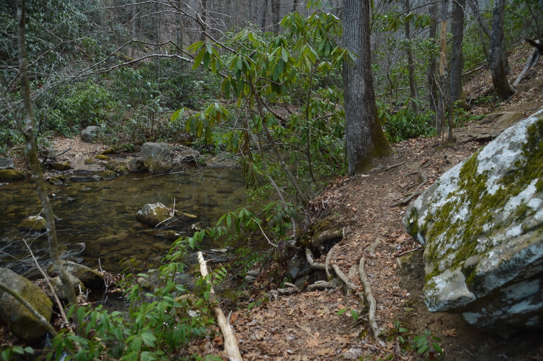
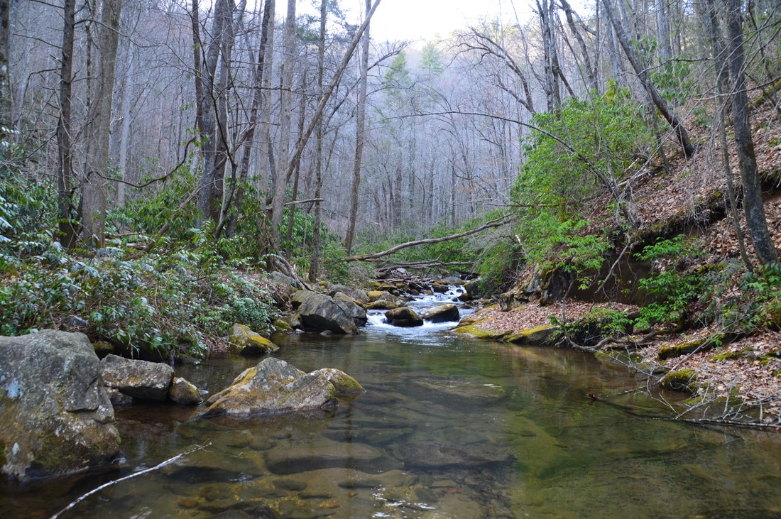
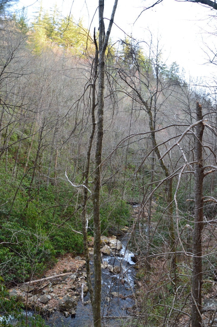
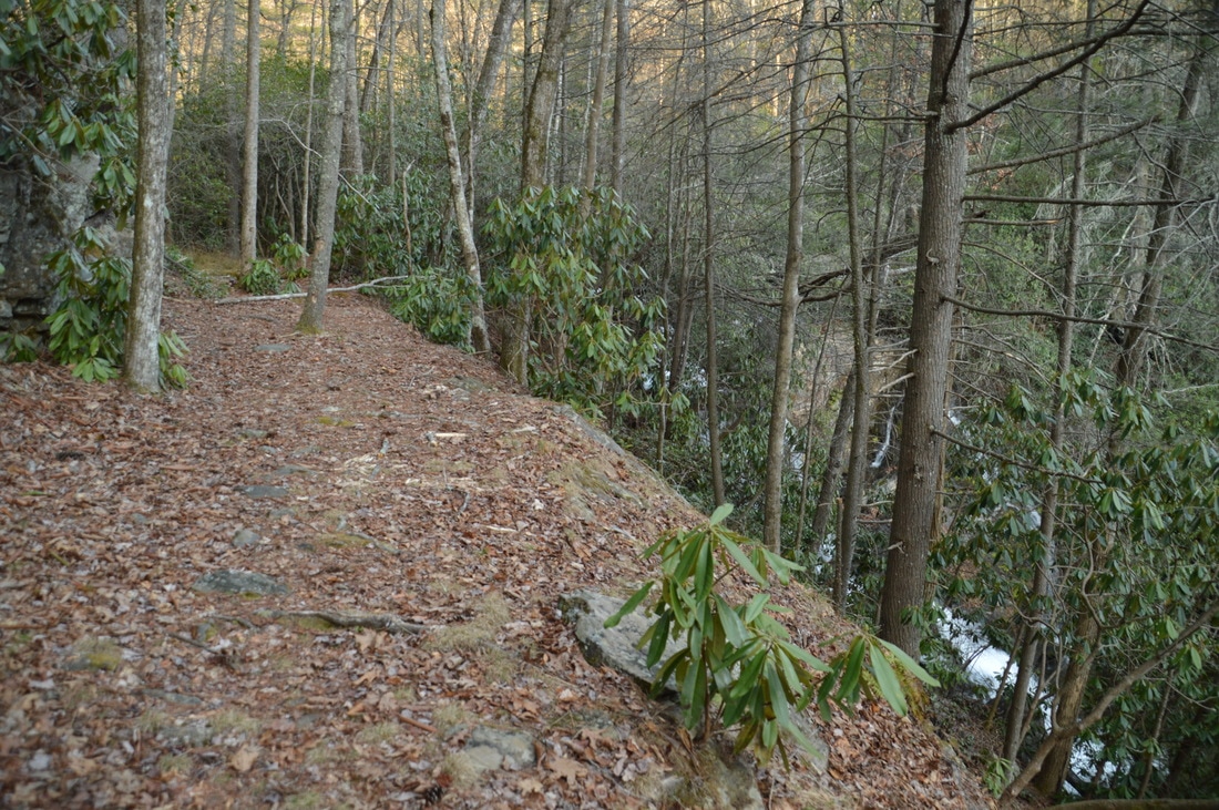
From Hemlock Falls, take the right-hand path at the split. The path immediately becomes more rugged, passing along the side of and above Hemlock Falls. Near the top, there was a large blowdown when I did this hike. Just past the top of the falls, around 1.1 miles, bear left and ford Moccasin Creek. This spot is easy to miss, because the more obvious trail continues straight. There is a large boulder to the right of the trail at the ford. The ford is always a wade, and on this day (in drought conditions), it was knee-deep. From the ford, some shoals are visible upstream. On the other side of the creek, pick up a narrower footpath that bears right and passes through a small clearing, which looks like it may be used as a campsite. Beyond the clearing, the path ascends up a steep slope and rejoins the same old railroad grade that you were following much earlier. Most of the rest of the trail to the falls follows the grade, and for the most part, it stays above the creek, although all of the cascades are still visible. The path is not overgrown at all and easy to follow, although the constant downed trees are obstacles that can significantly slow things down. 

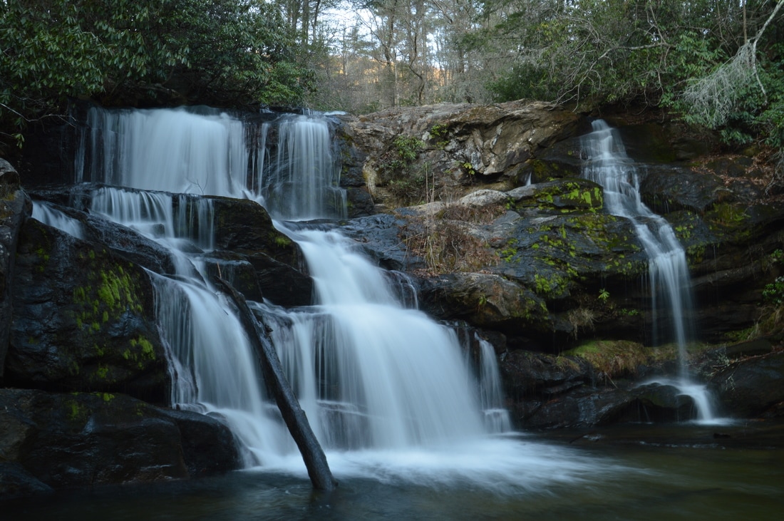
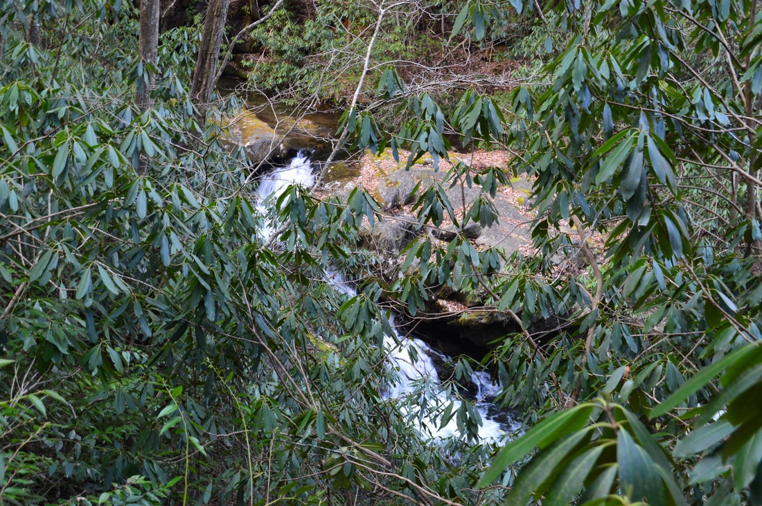
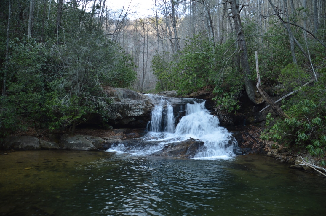
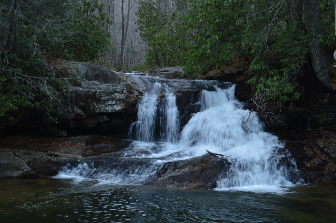
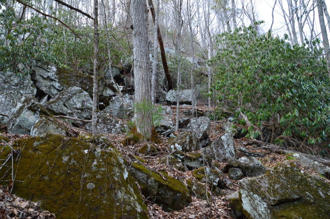
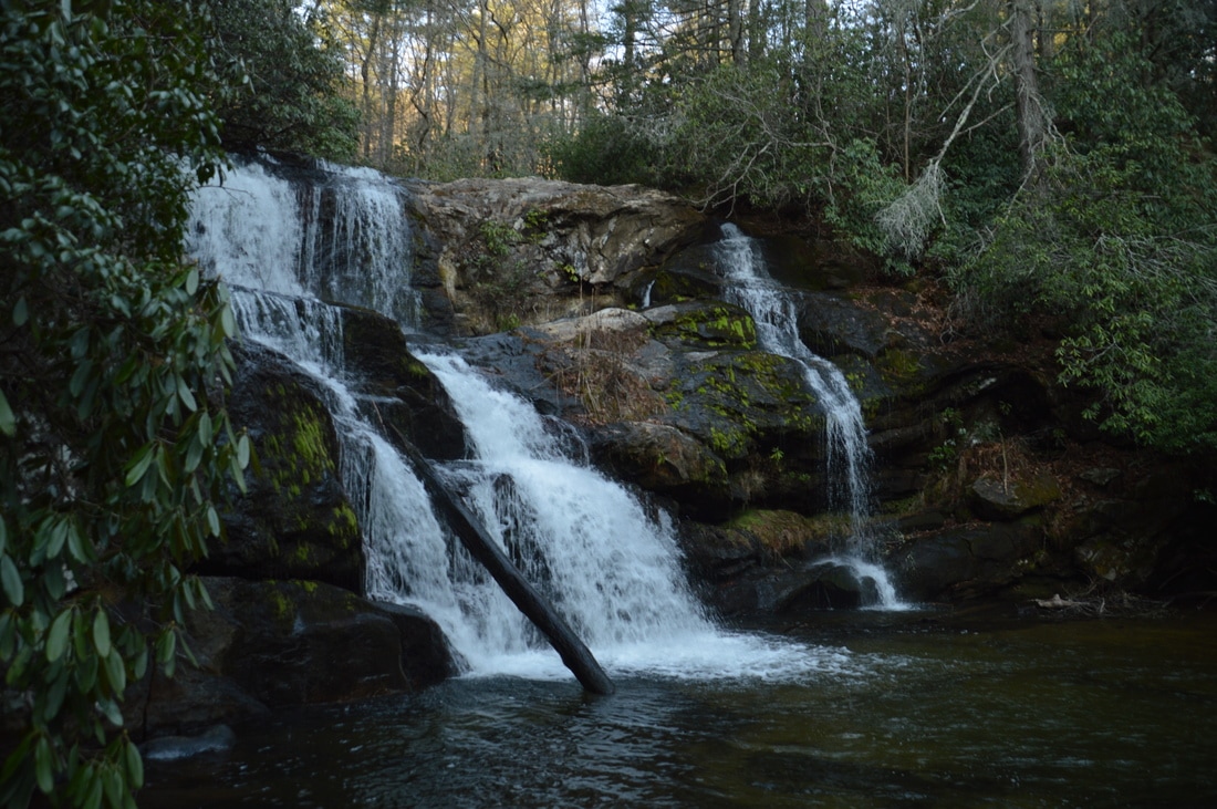
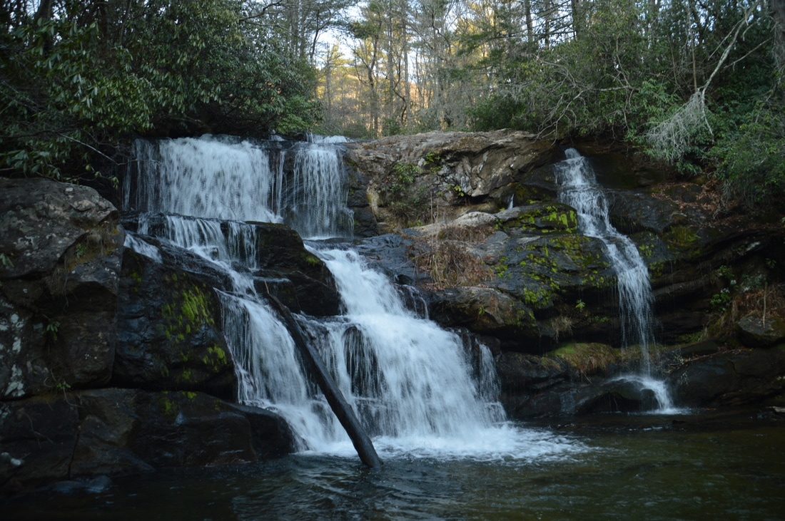
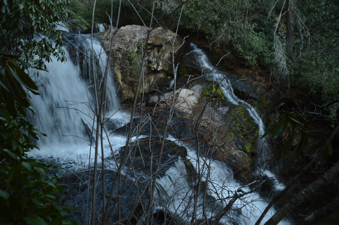
At 1.25 miles, the trail drops into a ravine with a small feeder stream. Scrambling across a log is required in the ravine, followed by a steep pitch back up to the old railroad grade. Keep in mind that ravines such as this one were once spanned by trestles, but these trestles are long gone. Soon afterwards, the trail passes a huge boulder field to the left, just as Moccasin Creek enters a scenic gorge with many small waterfalls below to the right. At 1.65 miles, the trail reaches the top of Upper Moccasin Creek Falls, clearly audible and partially seen through the trees. To reach the base, turn right onto a steeply descending pathway. Near the bottom, there is a small ledge that you have to lower yourself down (although it is possible to bypass it to the right). Reach the edge of the pool at the base of the falls at 1.7 miles.

Upper Moccasin Creek Falls is a beauty. Here, Moccasin Creek falls 40 feet down a multi-tiered rock ledge, and the creek splits into two channels: one with more flow on the left side of the ledge and one with less flow at the right side of the ledge. During dry conditions, the right side may not be flowing, so it is best to see the falls at normal flow, as it becomes greatly much more photogenic with the second ribbon of water. This waterfall receives much fewer visitors than Hemlock Falls and is in a pristine setting. 
Picture
The maintained portion of the trail ends at Hemlock Falls, a 15-foot waterfall on Moccasin Creek with a large pool.
There is a large camping area above Upper Moccasin Creek Falls, with several great campsites near the creek. It is a great place to spend the night. I have read that the Moccasin Creek Trail continues along Moccasin Creek all the way to Wildcat Creek Road. I made a brief reconnaissance of the continuation. An old roadbed does continue above the creek past the camping area, but it is fairly overgrown. It may be possible to follow the roadbed or stay near it along Moccasin Creek all the way to Wildcat Creek Road, but I did not see evidence of many people doing so. There are very remote 20-foot waterfalls some distance farther on North Fork of Moccasin Creek. Folks experienced in off-trail navigation will be able to get to these waterfalls. However, for more casual hikers, the best thing to do is to simply retrace your steps from Upper Moccasin Creek Falls back to the trailhead, concluding the hike at 3.4 miles.

I am classifying this hike as a "Best Hike". This really is one of Georgia's best short streamside hikes, with accompanying whitewater nearly the entire length. Two waterfalls are seen on this hike, both of which are not difficult to reach, and Upper Moccasin Creek Falls is a very pretty waterfall that is a worthwhile destination on any hike, let alone one as good as this one. 
Best Hike!

Mileage

0.0 - Hemlock Falls Trailhead
0.8 - Footbridge 
1.0 - Hemlock Falls 
1.1 - Ford 
1.7 - Upper Moccasin Creek Falls 

Variations

Hike out and back to Hemlock Falls - 2.0 Miles

Bonus Stops

Several short waterfall hikes are available nearby. Two of them are to Angelica Falls on Plumorchard Creek and to Timpson Creek Falls. In fact, I did both of these hikes in addition to the waterfalls of Moccasin Creek on the same day. 

Pictures

Videos

0 Comments


Leave a Reply.

    About Me

    Mark Oleg Ozboyd
    I'm an avid outdoor explorer and a hobbyist landscape photographer. I'm 21 years old and have been hiking since 2011. Originally based out of Atlanta, Georgia, I started out by occasionally hiking short trails throughout well-known Georgia State Parks. During 2012 and 2013, I began to expand my trips into adjacent states, as well as into the wilder National Forest areas rather than just State Parks. Throughout the years that followed, as I slowly ran out of popular hiking trails in my area, I began to search for and hike in more seldom-visited areas. Today, you can find me out in the woods every weekend, whether it's on an official trail or bushwhacking through cross-country terrain without any paths. I now attend Washington & Lee University and am exploring Virginia and West Virginia. My other hobbies include chess, science, old music, and meteorology. I have 3 years of amateur weather forecasting experience, having studied a lot of meteorology basics over the years. I am also a student at European School of Music where I learned that music and nature have a lot in common. Listening to good music inspires me to capture nature's beauty on the camera in different aspects that also make me recall many beautiful music pieces that I've heard.​


    Dear readers: I have invested a tremendous amount of time and effort in this website and the Georgia Waterfalls Database the past five years. All of the work that has gone in keeping these websites updated with my latest trip reports has almost been like a full-time job. This has not allowed me to pick up a paid job to save up money for college, and therefore, I I've had to take out loans. If you find the information on this website interesting, helpful, or time-saving, you can say "thanks" and help me out by clicking the button above and making a contribution. I will be very grateful for any amount of support you give, as all of it will apply toward my college tuition. Thank you! 

    Enter your email address to subscribe for trail reports:

    Delivered by FeedBurner


    Picture
    Coming in 2022-2023?

    Other Hiking Websites

    DWHike's Adventures
    Florida's Natural Wonders
    Florida Trailblazer
    Meanderthals
    Mountain Images
    by Bernie Boyer

    North Carolina Waterfalls with
    ​Kevin Adams
    Take-a-Hike!
    Tennessee Landforms
    Waterfall Page
    Waterfall Adventurer
    Zach's Mild Adventures

    Miles Hiked

    Year 1: 540.0 Miles
    Year 2: 552.3 Miles
    ​Year 3: 518.4 Miles
    Year 4: 482.4 Miles
    Year 5: 259.9 Miles

    Archives

    March 2021
    February 2021
    January 2021
    November 2019
    October 2019
    September 2019
    August 2019
    July 2019
    June 2019
    February 2019
    January 2019
    December 2018
    November 2018
    October 2018
    August 2018
    July 2018
    June 2018
    May 2018
    April 2018
    March 2018
    February 2018
    January 2018
    December 2017
    November 2017
    October 2017
    September 2017
    August 2017
    July 2017
    June 2017
    May 2017
    April 2017
    March 2017
    February 2017
    January 2017
    December 2016
    November 2016
    October 2016
    September 2016
    August 2016
    June 2016
    May 2016
    April 2016
    March 2016
    January 2016
    December 2015
    November 2015
    October 2015
    September 2015
    August 2015
    July 2015
    June 2015
    May 2015
    April 2015
    March 2015
    February 2015
    January 2015
    December 2014
    November 2014
    October 2014
    September 2014
    August 2014
    July 2014
    June 2014
    May 2014
    April 2014
    March 2014
    February 2014

    Categories

    All
    Adel
    Adirondack Park
    Alabama
    Alfred A. Ring Park
    Allegheny Trail
    Amicalola Falls State Park
    Anniston Area
    Apalachicola Bluffs And Ravines Preserve
    Apalachicola National Forest
    Apalachicola/Port St. Joe Area
    Apopka
    Appalachian Trail
    Appling
    Art Loeb Trail
    Aska Trail System
    Bakersville
    Balm-Boyette Scrub Preserve
    Balsam Lake Recreation Area
    Bankhead National Forest
    Bartow County Parks
    Bartram Trail
    Basinger
    Beersheba Springs
    Benton
    Benton Mackaye Trail
    Berry College Trail System
    Best Hike
    Big South Fork National Recreation Area
    Black Bear Wilderness
    Black Rock Mountain State Park
    Blairsville
    Blakely
    Blood Mountain Wilderness
    Blowing Rock
    Blue Ridge
    Blue Ridge Parkway
    Boone
    Bradenton
    Bradenton Beach
    Brasstown Bald
    Brasstown Wilderness
    Brevard
    Bryson City
    Buchanan
    Bucks Pocket State Park
    Bulow Creek State Park
    Bulow Plantation Ruins State Park
    Caesars Head State Park
    Caladesi Island State Park
    Calhoun
    Camel's Hump State Park
    Cashiers
    Caspersen Beach Park
    Catfish Creek State Park
    Caves
    CC Putnam State Forest
    Cedar Point Environmental Park
    Chatsworth
    Chattahoochee National Forest
    Chattanooga
    Chattanooga Valley
    Chattooga National Wild And Scenic River
    Cheaha Wilderness
    Cherohala Skyway
    Cherokee
    Cherokee National Forest
    Chiefland Area
    Chillhowee Recreation Area
    Chipley
    Chunky Gal Trail
    Circle B Bar Reserve
    Citico Creek Wilderness
    Citrus Wildlife Management Area
    Clarkesville
    Clayton
    Cleevland
    Cleveland
    Cloudland Canyon State Park
    Cohutta Wilderness
    Collier-Seminole State Park
    Cordele
    Cornelia
    Covington
    Crestview Area
    Crew-land-and-water-trust
    Cullowhee
    Cumberland Trail
    Dahlonega
    Dalton
    Dawson Forest Wildlife Management Area
    Dawsonville
    Dayton
    De Soto National Memorial
    DeSoto State Park
    Dillard
    Double Springs
    Ducktown
    Duncan Ridge Trail
    Dunlap
    Eagle's Rest Park
    Eastpoint
    Econfina Creek Wildife Management Area
    Eglin Air Force Base
    Elizabethton
    Elkins
    Elk Knob Game Lands
    Elk Park
    Ellicott Rock Wilderness
    Ellijay
    Emerson Point Preserve
    Englewood Area
    Enota Retreat
    Erwin
    Falling Waters State Park
    Fayetteville
    Fires Creek Recreation Area
    Fire Tower
    Flint River
    Florence Area
    Florida
    Florida Caverns State Park
    Florida Trail
    Foothills Trail
    Fort Mountain State Park
    Fort Myers Area
    Fort Payne
    Fort Payne Area
    Fort Yargo State Park
    Franklin
    Franklin Delano Roosevelt State Park
    Franklin-Marion State Forest
    Frozen Head State Park
    Gainesville
    Gainesville Area
    Gatlinburg
    George Washington National Forest
    Georgia
    Georgia Veterans Memorial State Park
    Glasgow
    Gorges State Park
    Grandfather Mountain State Park
    Great Smoky Mountains National Park
    Greeneville
    Green River Game Lands
    Gruetli-Laager
    Grundy Forest State Natural Area
    GTM Reserve
    Guana River Wildlife Management Area
    Hayesville
    Helen
    Hiawassee
    High Falls State Park
    Highlands
    Highlands Scenic Highway
    Hillsborough River State Park
    Hinson Conservation & Recreation Area
    Historic Sites
    Honeymoon Island State Park
    Hot Springs
    Huntington
    Inverness Area
    Jackson
    Jasper
    Jefferson National Forest
    Joan M. Durante Park
    Jonathan Dickinson State Park
    Jones Gap State Park
    Joyce Kilmer Slickrock Wilderness
    Joyce Kilmer - Slickrock Wilderness
    Juniper Prairie Wilderness
    Kelly Park
    Keown Falls Recreation Area
    Kolomoki Mounds State Park
    LaFayette
    Lake City Area
    Lake George Wild Forest
    Lake June-in-Winter State Park
    Lakeland Area
    Lake Placid
    Lake Russell Wildlife Management Area
    Lake Wales Ridge State Forest
    Laurel Fork North Wilderness
    Leffis Key Preserve
    Leon Sinks Geological Area
    Lexington
    Lineville
    Linville
    Linville Gorge Wilderness
    Lithia Springs
    Little Frog Wilderness
    Little Manatee River State Park
    Little River Canyon National Preserve
    Longboat Key
    Long Trail
    Lookout Mountain
    Lookout Mountain Battlefield
    Lovingston
    Lula Lake Land Trust
    Lumpkin
    Maggie Valley
    Manatee Springs State Park
    Marianna Area
    Mark Trail Wilderness
    Marlinton
    Mccaysville
    McMinville
    Mentone
    Middlesex
    Mistletoe State Park
    Monongahela National Forest
    Montreat
    Mountain Bridge Wilderness Area
    Mountain City
    Mountains To Sea Trail
    Mountains-to-Sea Trail
    Mount Rogers National Recreation Area
    Myakka River State Park
    Myron B. Hodge City Park
    Nantahala National Forest
    Naples
    Naples Area
    Natural Bridge State Park
    Neal Preserve
    New Castle
    Newport
    New River Gorge National Park
    New York
    North Carolina
    Ocala Area
    Ocala National Forest
    Ocean-to-Lake Trail
    Oconee State Park
    Oconee Station Historic Site
    Okaloacoochee Slough State Forest
    Oldsmar
    Oneida
    Orlando Area
    Ormond Beach
    Oscar Scherer State Park
    Oxford
    Palatka
    Palmetto Trail
    Panama City Area
    Panthertown Valley
    Parrish
    Paynes Creek Historic State Park
    Peaks Of Otter Recreation Area
    Pigeon Crockford Mountain Wildlife Management Area
    Pigeon-Crockford Mountain Wildlife Management Area
    Pigeon-Crockford Wildlife Management Area
    Pine Mountain
    Pinhoti Trail
    Pinnacle Park
    Pisgah Civitan Park
    Pisgah National Forest
    Pittman Center
    Pond Mountain Wilderness
    Ponds/Lakes
    Prentice Cooper State Forest
    Providence Canyon State Park
    Pumpkintown
    Quick Point Nature Preserve
    Raven Cliffs Wilderness
    Reed Bingham State Park
    Reliance
    Rice Creek Conservation Area
    Riverview Pointe Preserve
    Robbinsville
    Robinson Preserve
    Rock Creek Gorge Scenic Area
    Rock Island State Park
    Rome
    Rosman
    Sale Creek
    Salem
    Salt Springs
    Saluda
    Santa Rosa Beach
    Sarasota
    Sarasota Area
    Savage Gulf State Natural Area
    Scenic Views
    Scottsboro Area
    Sebring Area
    Sewanee
    Sheltowee Trace Trail
    Shining Rock Wilderness
    Signal Mountain
    Sipsey Wilderness
    Sky Valley
    Smithgall Woods State Park
    Snowbird Backcountry Area
    Soddy Daisy
    Soddy-Daisy
    Sopchoppy
    South Carolina
    South Cumberland State Park
    Southeastern Cave Conservancy
    Southern Nantahala Wilderness
    Sparta
    Sprewell Bluff Park
    Spring City
    Spring Hill
    Springs
    Spruce Pine
    Standing Indian Backcountry Area
    St. Augustine
    St. George Island State Park
    St. Joseph Bay State Buffer Preserve
    St. Marks Area
    St. Marks National Wildlife Refuge
    Stone Mountain
    Stone Mountain Park
    Suches
    Sumatra
    Sumter National Forest
    Suwannee River
    Swallow Creek Wildlife Management Area
    Sweetwater Creek State Park
    Sylva
    Talladega National Forest
    Tallahassee Area
    Tallulah Falls
    Tallulah Gorge State Park
    Tampa Bay Area
    Tate City
    Tate's Hell State Forest
    Tea Creek Wildlife Management Area
    Tellico Plains
    Tennessee
    Thomaston
    Toccoa
    Topsail Hill State Park
    Torreya State Park
    Townsend
    Tracy City
    Tray Mountain Wilderness
    Trenton
    Triple Creek Preserve
    Troutdale
    Unaka Mountain Wilderness
    Upper Tampa Bay County Park
    Venice
    Vermont
    Virgin Falls State Natural Area
    Virginia
    Virginia Outdoors Foundation
    Vogel State Park
    Wakulla Springs State Park
    Waleska
    Walhalla
    Wartburg
    Water Features
    Waynesville
    Weedon Island Preserve
    Weeki Wachee Preserve
    Wekiwa Springs State Park
    West Palm Beach Area
    West Virginia
    Whitehall
    White Springs
    Winder
    Withlacoochee State Forest
    Young Harris

    RSS Feed

TRAIL REPORTS

Hikes in Alabama
​Hikes in Florida
Hikes in Georgia
Hikes in North Carolina
Hikes in South Carolina
Hikes in Tennessee
Hikes in Virginia

Hiking Resources

Alabama Resources
​
Florida Resources
Georgia Resources
North Carolina Resources
​South Carolina Resources
​
Tennessee Resources

Other

Contact
Map of Hikes
Alphabetical List of Hikes
Southeast Nature Society
© COPYRIGHT 2014-2018
​ALL RIGHTS RESERVED.
Important: I disclaim any responsibility for any damage or personal injury that may occur as a result of the activities and information found on this website. All outdoor activities, especially off-trail hiking, are done at your own risk. Never hike or head into that area that may be above your fitness or experience level.
  • Home
  • Trail Reports
    • Best Hikes
    • Hikes with Scenic Views
    • Hikes with Water Features
    • Alabama
    • Georgia
    • Florida
    • North Carolina
    • South Carolina
    • Tennessee
    • Vermont
    • Virginia
  • Map
  • Hike List
  • Testimonials
  • Resources
  • Contact Us
  • Southeast Nature Society
    • Our Team
  • Georgia Waterfalls Database