HIKING THE APPALACHIANS AND BEYOND
  • Home
  • Trail Reports
    • Best Hikes
    • Hikes with Scenic Views
    • Hikes with Water Features
    • Alabama
    • Georgia
    • Florida
    • North Carolina
    • South Carolina
    • Tennessee
    • Vermont
    • Virginia
  • Map
  • Hike List
  • Testimonials
  • Resources
  • Contact Us
  • Southeast Nature Society
    • Our Team
  • Georgia Waterfalls Database

Chattahoochee National Forest: Mill Shoals and Big Shoals on Stekoa Creek, Clayton, Georgia

4/6/2017

2 Comments

 
Picture
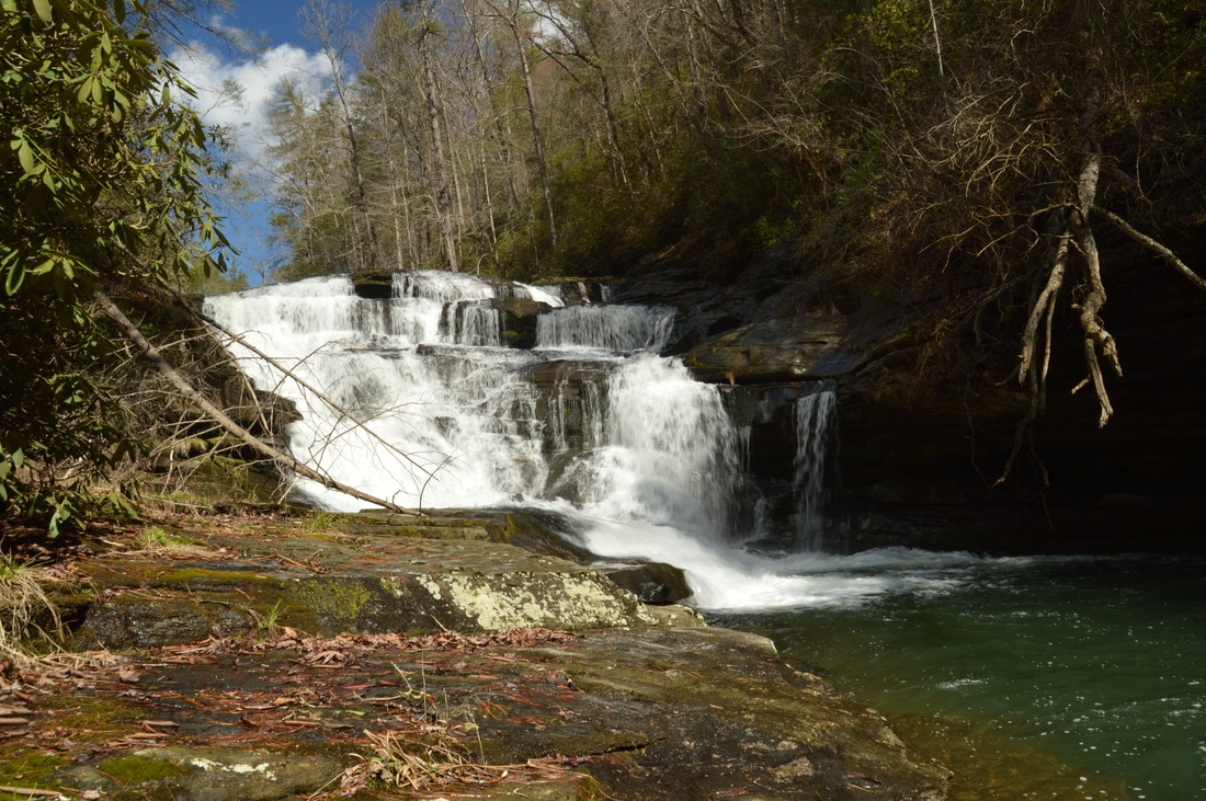
Stekoa Creek is one of the largest tributaries of the Chattooga River, flowing through the town of Clayton and the lower elevations of Rabun County. Most of the creek - including several of its notable waterfalls - is on private land. However, the lower mile and a half of Stekoa Creek flows through mostly National Forest property. In this public stretch of the creek, there are two notable waterfalls - Mill Shoals and Big Shoals - with respective heights of 27 feet and 35 feet, and getting to the waterfalls is fairly easy. Unfortunately, a headline bigger than waterfalls for Stekoa Creek is its poor water quality, due to drainage issues in Clayton. This hike occurred on Saturday, March 18th, 2017. My plan was to hike out and back from Wolf Creek Church Road to Mill Shoals and then Big Shoals on Stekoa Creek. 

Summary

R/T Length of Trail: 3.1 Miles
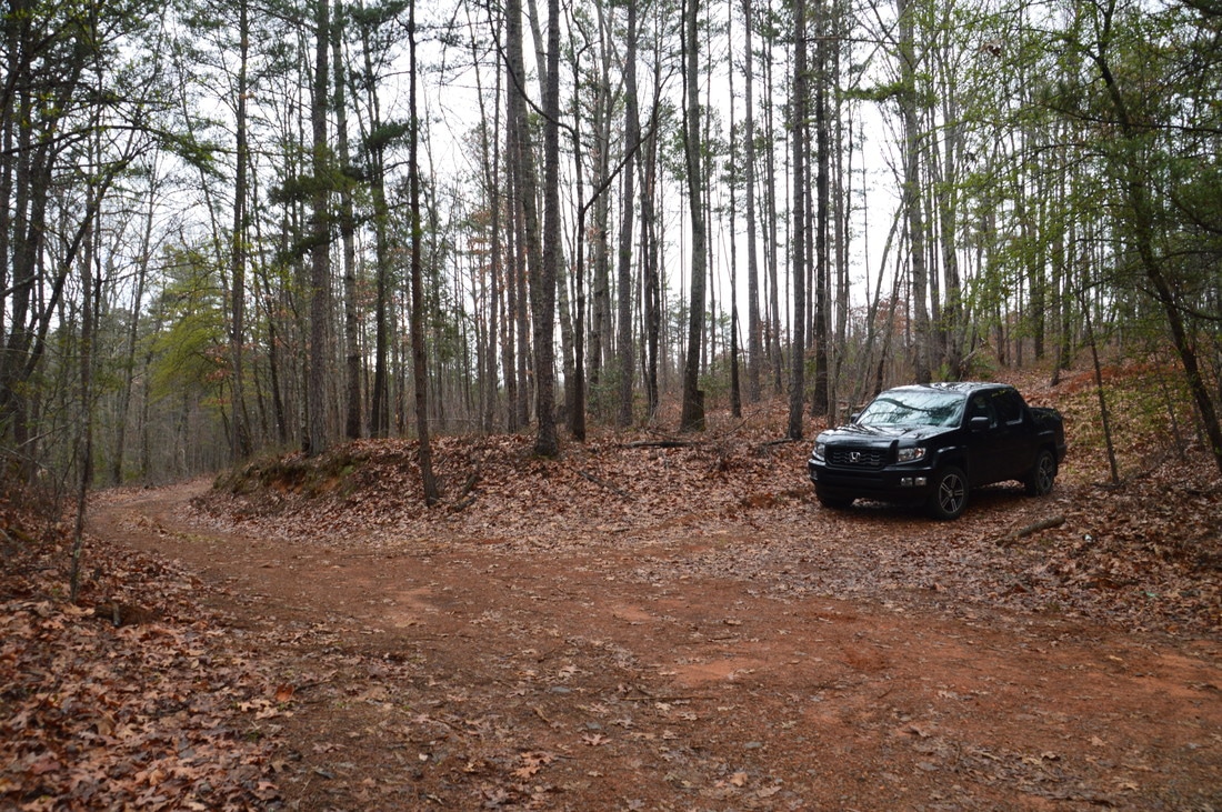
Duration of Hike: 2:40 
Type of Hike: ​Out and Back
Difficulty Rating: 3 out of 10 
Total Elevation Gain: 795 Feet
Pros: None
Cons: Poor water quality
Points of Interest: Mill Shoals on Stekoa  Creek - 4 stars; Big Shoals on Stekoa Creek - 7 stars
Trail Blaze Colors: None
Best Seasons to Hike: Year-round 
Fees: None 
Beginning Point: Turnaround at end of spur forest road off Wolf Creek Church Road 
Directions from Clayton, GA: From the intersection of US 23/441 and US 76 West (Savannah Street) in downtown Clayton, follow US 23/441 South for 7.1 miles, and then, turn left onto (East) Wolf Creek Road. Follow Wolf Creek Road for 3.7 miles, and then, turn right onto Wolf Creek Church Road. In 0.6 miles, you'll pass Wolf Creek Church on the right, after which the road turns into FS Road 515. This road is in good shape and passable by all passenger vehicles. 0.9 miles past Wolf Creek Church, or 1.5 miles from Wolf Creek Road, there is a split, where an unmarked, narrower, and more rustic forest road bears slightly to the left. This road is not show on any maps or GPS devices. While it is passable by most vehicles, you can park at the split, if you're uncomfortable driving up this road. Otherwise, bear left onto the narrower road. Follow it for 0.1 miles to a turnaround with a gate just ahead. This is the trailhead; park here. There is space for at least four to five cars here, without blocking the gate. 

Map

Picture
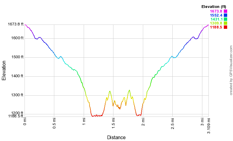
Click here to download a track of this hike. 

Details

Stekoa Creek is surprisingly not known for its waterfalls, despite their abundance throughout the waterway's course. Unfortunately, some of the best waterfalls on the creek are off-limits and on private land. After some research, I put together an easy route to two publicly accessible waterfalls on Stekoa Creek that are surprisingly little-visited. However, there is a fly in the ointment. An oddly-shaped 1-acre piece of private property, without houses or road access, lies in between Mill Shoals and the more impressive Big Shoals. Trespassing is strictly not allowed, so to reach Big Shoals, you will have to follow my instructions farther below to bypass the private property. Otherwise, this is a great hike, leading to two great waterfalls without too much effort. 

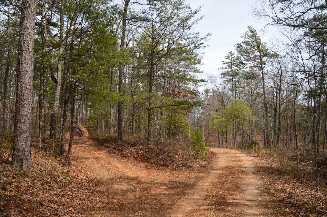
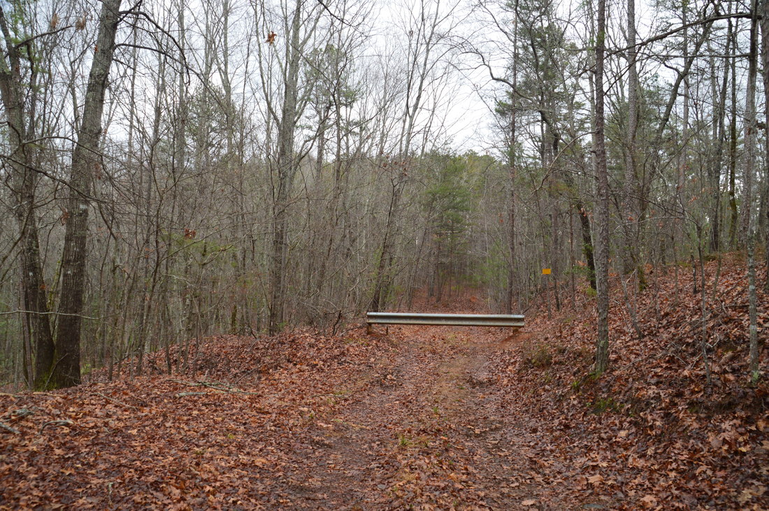
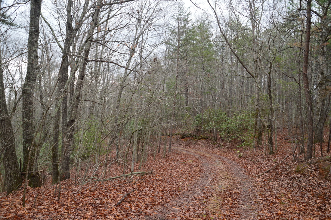
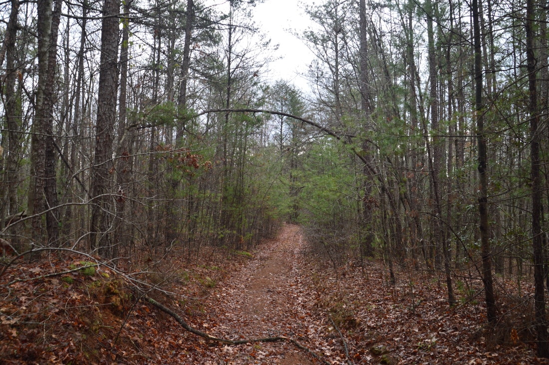
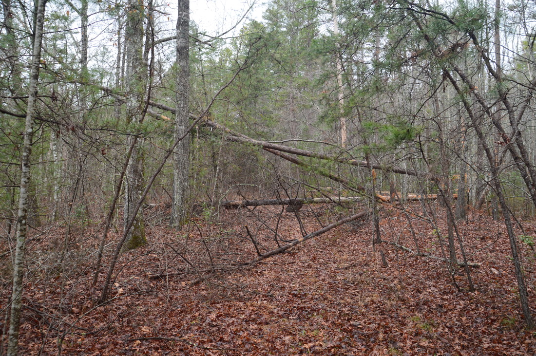
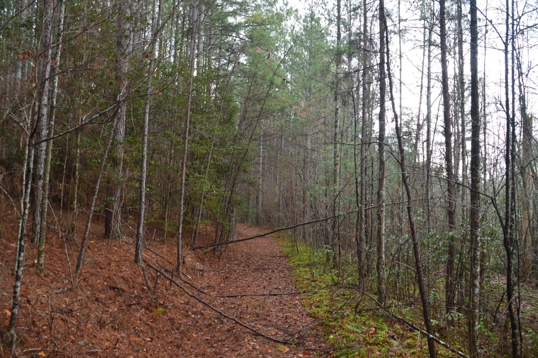
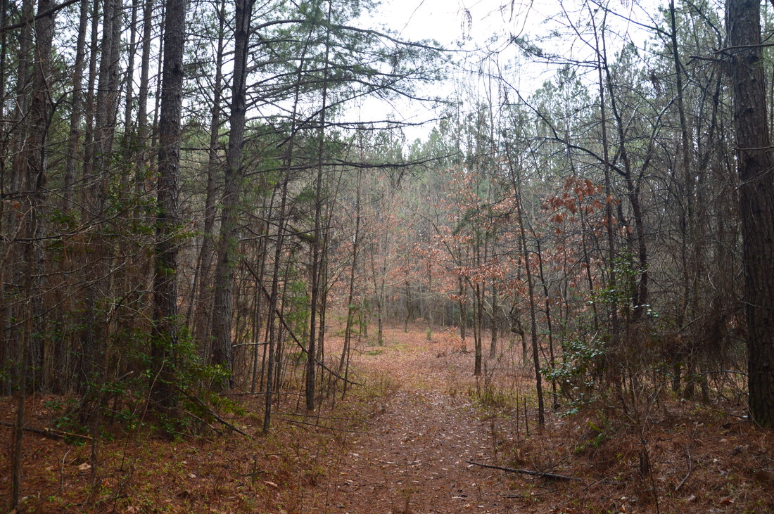
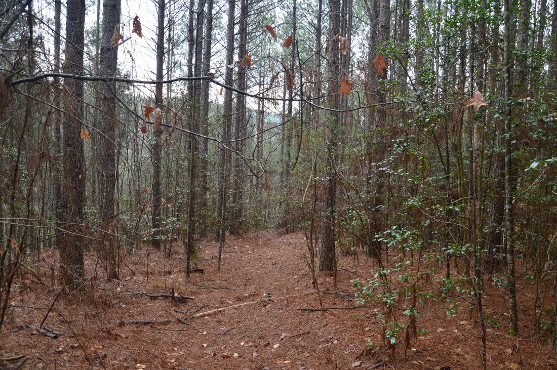
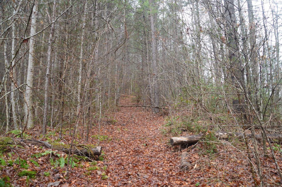
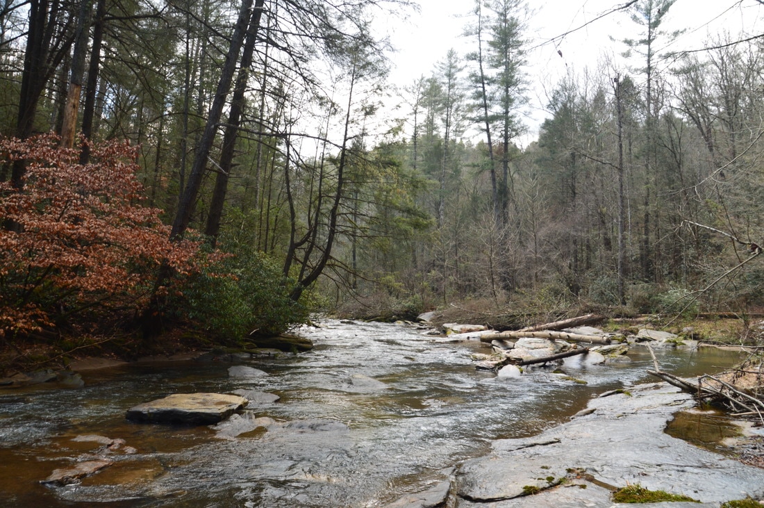
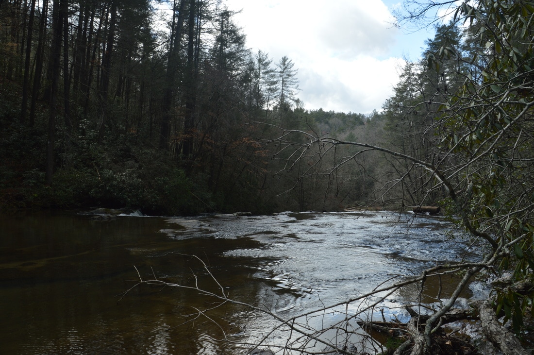
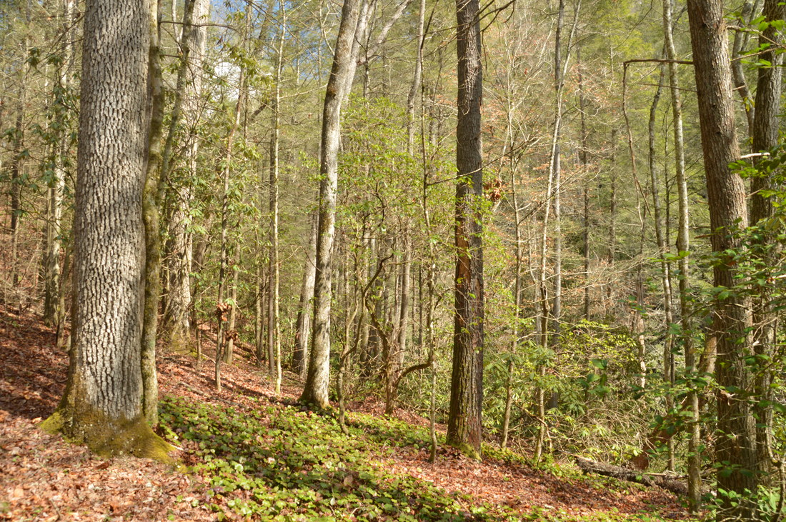
The hike begins at the gate, located at the turnaround at the end of a rustic road that splits off from Wolf Creek Church Road. The gate is not a typical Forest Service gate, but rather, it is a piece of guardrail attached to a post. Walk around the gate and follow the wide forest road - which is strictly closed to any form of vehicular traffic - east and downhill. At 0.2 miles, the road levels out, and there is a fork here. To reach the waterfalls, do not continue straight on the main, wide road. Instead, bear right onto a narrower and older forest road. This road is still easily followed as it continues to descend at an easy grade. After passing some rutted areas, reach a second fork at 0.5 miles. Bear right on the main forest road here (an obscure forest road bears left but you do need to go there). Shortly afterwards, there is a series of minor blowdowns, after which the road enters a stand of yellow pine around 0.65 miles. At 0.8 miles, the road passes through a recovering clearing. Bear left through the clearing and pick up the slightly narrower road on the far end. The road begins a more moderate descent that turns into a very steep descent into the Stekoa Creek gorge around 0.95 miles. In just a quarter-mile (from 0.9 to 1.15 miles), the road descends about 250 feet! Make sure to continue following the widest and most distinct road on the descent and ignore any side paths. 

The road bottoms out in broad flats near Stekoa Creek at 1.15 miles. A path to the right leads to the edge of the creek. However, to access Mill Shoals and Big Shoals, turn left onto the wide and obvious path that stays in a flood-prone area near the creek. At one place, there is a wooden path put along the path, as this area can get muddy. At 1.2 miles, reach a small feeder stream, just as Mill Shoals on Stekoa Creek comes into view. To reach Big Shoals, you'll have to turn left and away from Stekoa Creek on the other side of the feeder stream, but first, follow the bank of Stekoa Creek upstream for a closer look at Mill Shoals. There is some trash near the creek in this area - obviously delivered here by the creek itself - that is evidence of the poor drainage in downtown Clayton that causes trash to get picked up by Stekoa Creek. It is possible to follow the bank of Stekoa Creek along some very slick rock slabs all the way to the base of Mill Shoals at 1.3 miles. 
Picture
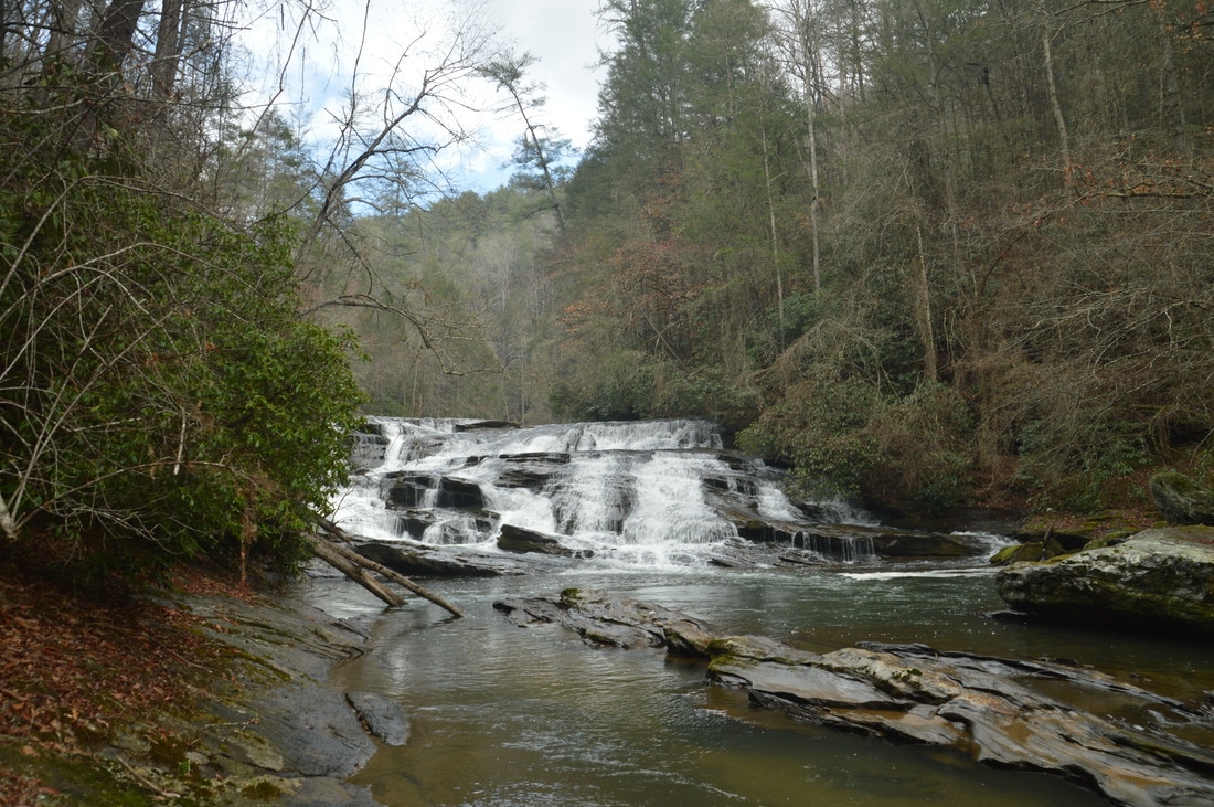
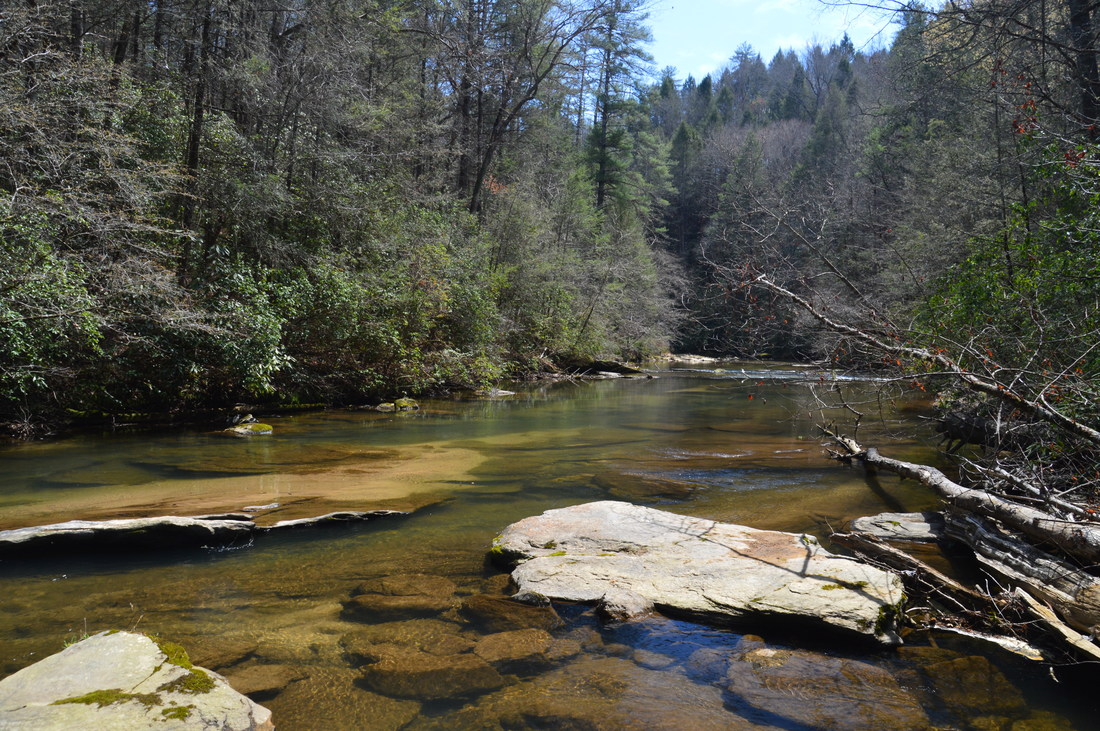
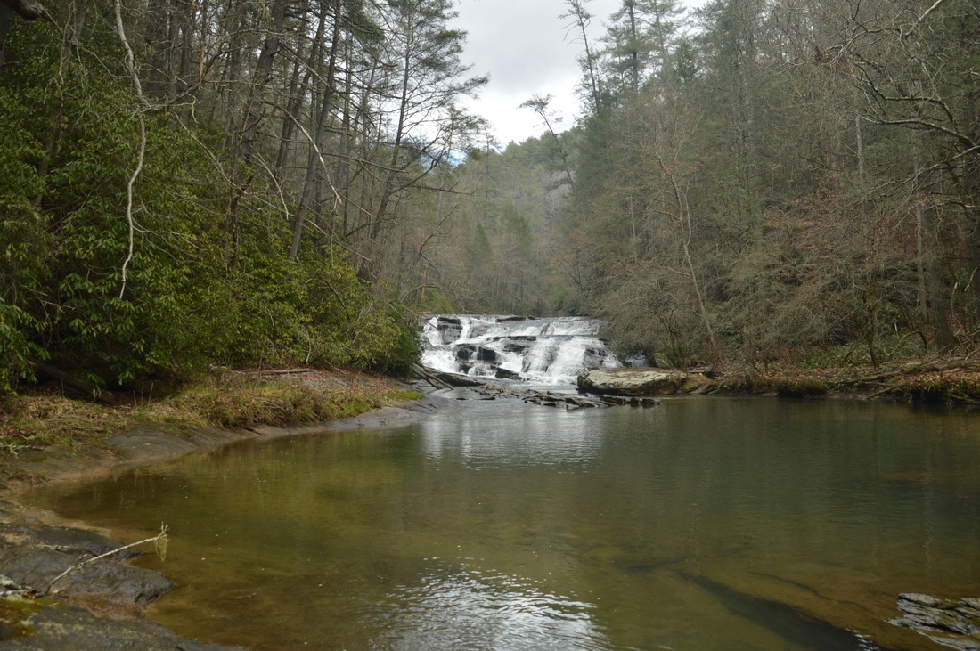
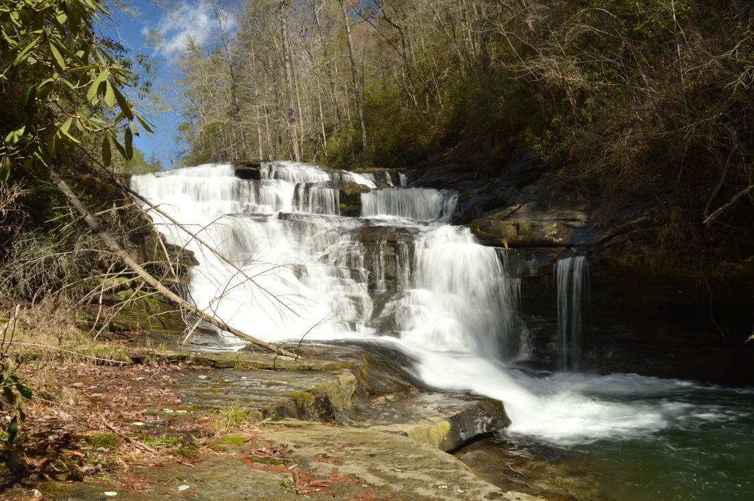
Mill Shoals on Stekoa Creek is a 27-foot block-type waterfall that consists of beautiful photogenic cascades with a deep pool in front.
Mill Shoals is a block-type waterfall about 27 feet high. It is quite pretty, as the entire wide creek cascades down a series of rock ledges into a deep pool speckled by several rock outcrops. During high water, the waterfall likely becomes one large mass of whitewater, as the rock ledges and outcrops vanish into the water. The area immediately above the creek on the left (west) side of Stekoa Creek at and just below Mill Shoals is private property, so when viewing and photographing Mill Shoals, make sure to stay at creek level. 

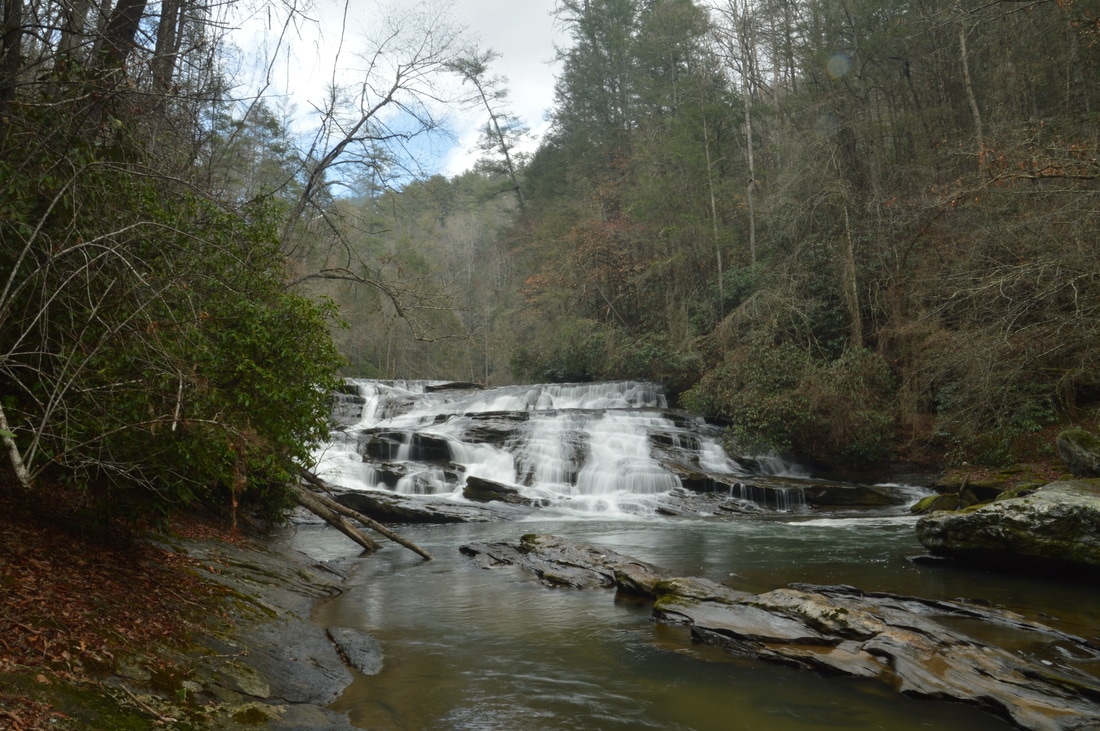
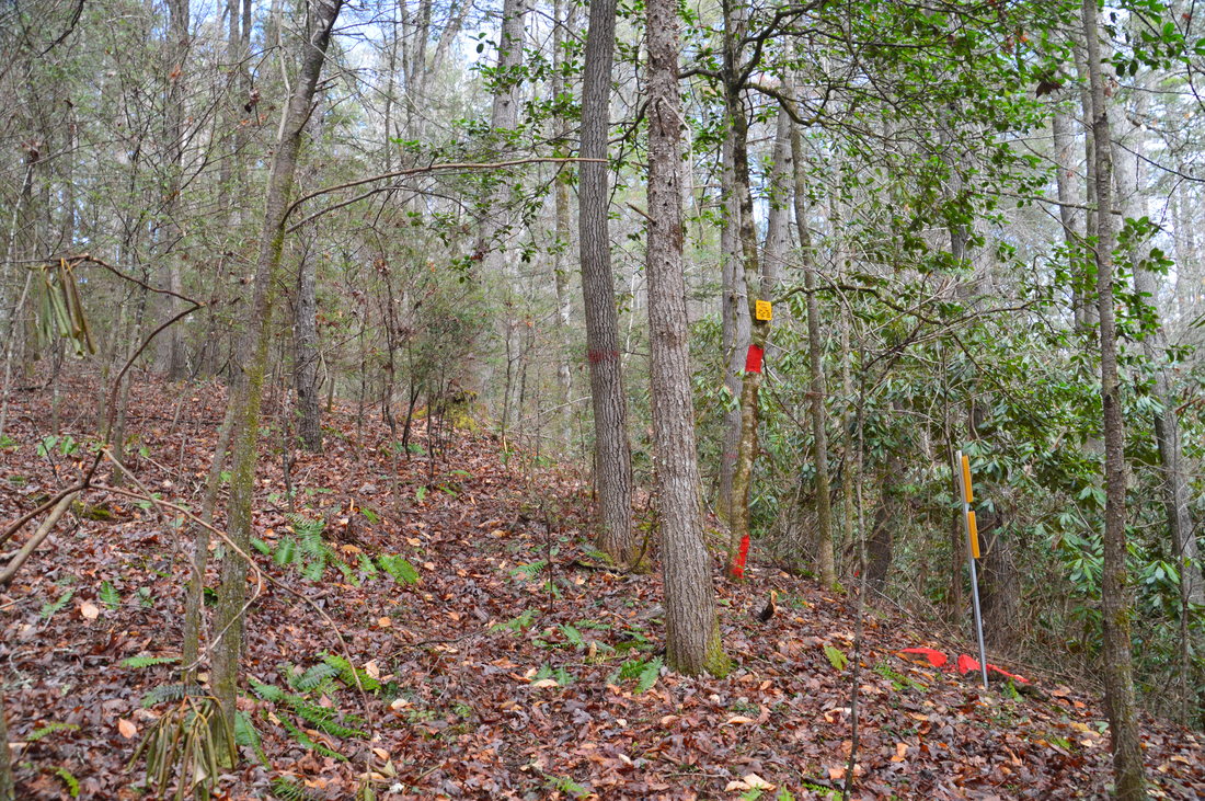
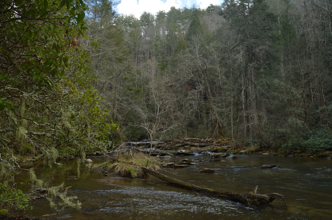
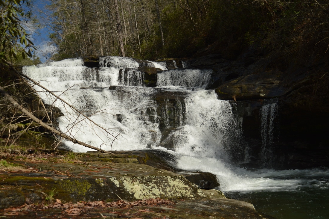
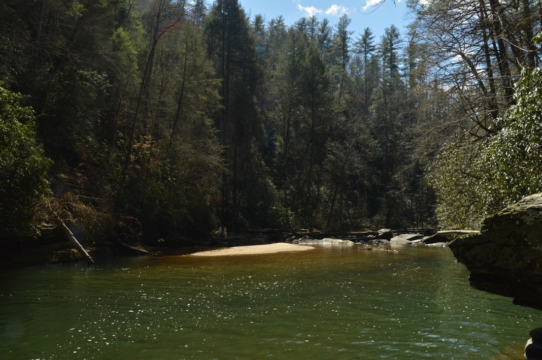
To reach Big Shoals, which is the more impressive waterfall, return to the feeder stream. From here, scramble up the slope with open woods that leads northwest (on the same side of the feeder stream), away from both the feeder stream and from Stekoa Creek. At 1.35 miles, only 150 feet from the feeder stream, reach a profusion of signs and red paint that indicate the private property boundary. While a path continues straight on private property, please do not follow it, as trespassing is strictly not allowed. Instead, follow my directions closely to stay legal and on public land: hike through the open woods northwest along the property boundary, marked with red paint. In 250 feet, at around the 1260-foot elevation, you can turn right and contour along the slope just above the oddly-shaped private property tract. In another 450 feet, after passing through a small ravine, you can turn right and downhill, once again staying just outside of the private property parcel. 200 feet afterwards, at 1.5 miles, return to the path, which is now back on public land, at a tree with a property boundary sign. One path goes down to Stekoa Creek, to the top of Mill Shoals. However, to reach Big Shoals, hike in the upstream direction (northeastward) through the open woods just above the creek. There is no distinct path, but the walking is easy.

In about 400 feet, the open woods end and the falls can be head or possibly seen just ahead. To reach the base of Big Shoals, scramble diagonally down to creek level through a small rhododendron thicket and to the right of a rock outcrop. At the creek, there is a large, flat rock slab that serves as a great viewing area for Big Shoals at 1.6 miles. This 35-foot waterfall is quite impressive due to the large volume of water. I did this hike during drought conditions, so during normal winter flow, the waterfall is likely to be even more powerful. Big Shoals consists of a multi-tiered drop down several rock ledges and into a huge and deep cliff-lined pool. The far end of the pool is punctuated by a massive sandbar. Unfortunately, I would not recommend swimming in this pool due to the poor water quality of Stekoa Creek, caused by drainage runoff in Clayton, as well as leakage from the pipes in Clayton's waste water treatment plant. While all of this is not reflected in the water in a way that the eye can see, just keep in mind that the water quality is very poor and unlike the water quality of most mountain streams. For this reason, I would not call the waterfalls on Stekoa Creek pristine. 
Picture
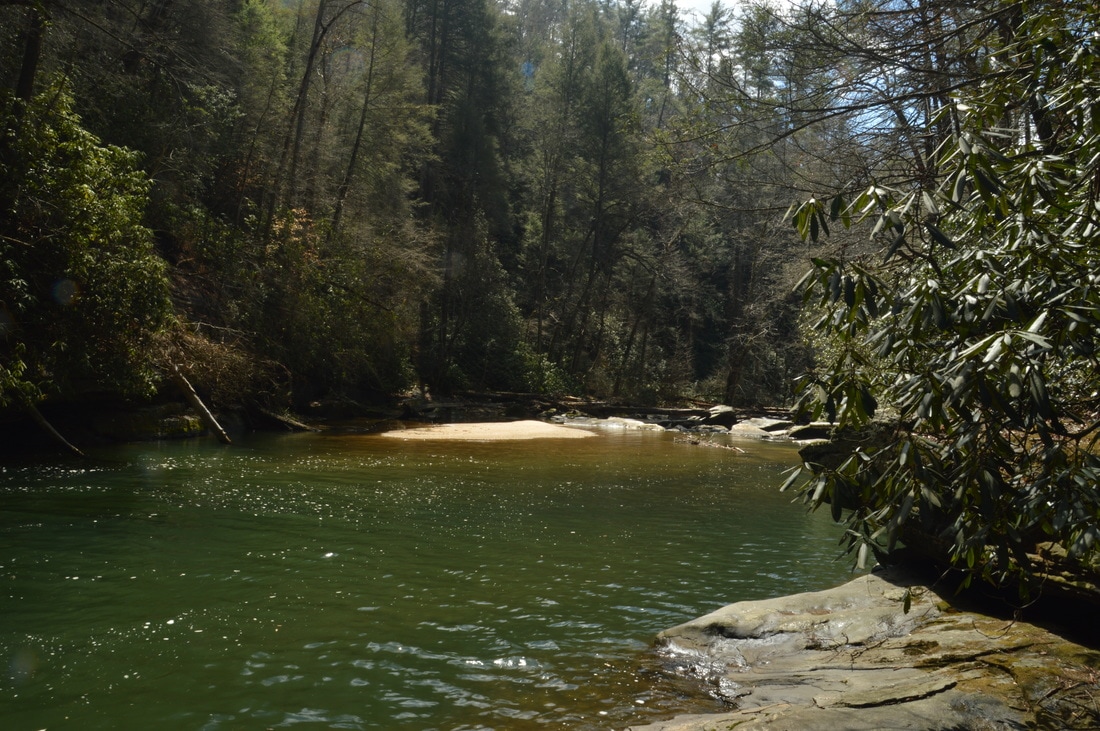
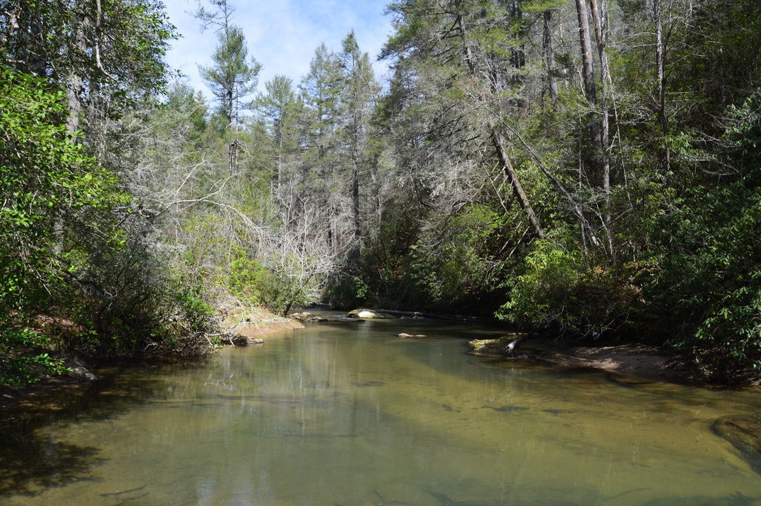
Just below Big Shoals on Stekoa Creek is a huge deep pool that is punctuated by a sandbar at the far end. If not the poor quality of Stekoa Creek, this pool would be very inviting on a hot summer day.
From Big Shoals, simply retrace your steps back to the trailhead. Make sure to avoid the private property tract on the way back. You will return to the trailhead at 3.1 miles, concluding the hike. 

Mileage

0.0 - Stekoa Creek Trailhead
0.8 - Clearing
1.15 - Stekoa Creek 
1.3 - Mill Shoals 
1.6 - Big Shoals 
3.1 - Stekoa Creek Trailhead

Variations

Hike out and back to Mill Shoals - 2.6 Miles

Bonus Stops

One nearby waterfall that can be added on to this hike is Cliff Creek Falls, accessed via a short bushwhack from Camp Creek Road. For more casual hikers, Tallulah Gorge State Park is located close-by. 

Pictures

Videos

2 Comments
Stephen
4/22/2019 09:47:12 am

Good detailed directions!

The link to the gpx track does not work.

Reply
Mike
6/20/2020 03:22:26 pm

Thank you for the detailed directions and the photos and videos. Hope to see this soon.

Reply


Leave a Reply.

    About Me

    Mark Oleg Ozboyd
    I'm an avid outdoor explorer and a hobbyist landscape photographer. I'm 21 years old and have been hiking since 2011. Originally based out of Atlanta, Georgia, I started out by occasionally hiking short trails throughout well-known Georgia State Parks. During 2012 and 2013, I began to expand my trips into adjacent states, as well as into the wilder National Forest areas rather than just State Parks. Throughout the years that followed, as I slowly ran out of popular hiking trails in my area, I began to search for and hike in more seldom-visited areas. Today, you can find me out in the woods every weekend, whether it's on an official trail or bushwhacking through cross-country terrain without any paths. I now attend Washington & Lee University and am exploring Virginia and West Virginia. My other hobbies include chess, science, old music, and meteorology. I have 3 years of amateur weather forecasting experience, having studied a lot of meteorology basics over the years. I am also a student at European School of Music where I learned that music and nature have a lot in common. Listening to good music inspires me to capture nature's beauty on the camera in different aspects that also make me recall many beautiful music pieces that I've heard.​


    Dear readers: I have invested a tremendous amount of time and effort in this website and the Georgia Waterfalls Database the past five years. All of the work that has gone in keeping these websites updated with my latest trip reports has almost been like a full-time job. This has not allowed me to pick up a paid job to save up money for college, and therefore, I I've had to take out loans. If you find the information on this website interesting, helpful, or time-saving, you can say "thanks" and help me out by clicking the button above and making a contribution. I will be very grateful for any amount of support you give, as all of it will apply toward my college tuition. Thank you! 

    Enter your email address to subscribe for trail reports:

    Delivered by FeedBurner


    Picture
    Coming in 2022-2023?

    Other Hiking Websites

    DWHike's Adventures
    Florida's Natural Wonders
    Florida Trailblazer
    Meanderthals
    Mountain Images
    by Bernie Boyer

    North Carolina Waterfalls with
    ​Kevin Adams
    Take-a-Hike!
    Tennessee Landforms
    Waterfall Page
    Waterfall Adventurer
    Zach's Mild Adventures

    Miles Hiked

    Year 1: 540.0 Miles
    Year 2: 552.3 Miles
    ​Year 3: 518.4 Miles
    Year 4: 482.4 Miles
    Year 5: 259.9 Miles

    Archives

    March 2021
    February 2021
    January 2021
    November 2019
    October 2019
    September 2019
    August 2019
    July 2019
    June 2019
    February 2019
    January 2019
    December 2018
    November 2018
    October 2018
    August 2018
    July 2018
    June 2018
    May 2018
    April 2018
    March 2018
    February 2018
    January 2018
    December 2017
    November 2017
    October 2017
    September 2017
    August 2017
    July 2017
    June 2017
    May 2017
    April 2017
    March 2017
    February 2017
    January 2017
    December 2016
    November 2016
    October 2016
    September 2016
    August 2016
    June 2016
    May 2016
    April 2016
    March 2016
    January 2016
    December 2015
    November 2015
    October 2015
    September 2015
    August 2015
    July 2015
    June 2015
    May 2015
    April 2015
    March 2015
    February 2015
    January 2015
    December 2014
    November 2014
    October 2014
    September 2014
    August 2014
    July 2014
    June 2014
    May 2014
    April 2014
    March 2014
    February 2014

    Categories

    All
    Adel
    Adirondack Park
    Alabama
    Alfred A. Ring Park
    Allegheny Trail
    Amicalola Falls State Park
    Anniston Area
    Apalachicola Bluffs And Ravines Preserve
    Apalachicola National Forest
    Apalachicola/Port St. Joe Area
    Apopka
    Appalachian Trail
    Appling
    Art Loeb Trail
    Aska Trail System
    Bakersville
    Balm-Boyette Scrub Preserve
    Balsam Lake Recreation Area
    Bankhead National Forest
    Bartow County Parks
    Bartram Trail
    Basinger
    Beersheba Springs
    Benton
    Benton Mackaye Trail
    Berry College Trail System
    Best Hike
    Big South Fork National Recreation Area
    Black Bear Wilderness
    Black Rock Mountain State Park
    Blairsville
    Blakely
    Blood Mountain Wilderness
    Blowing Rock
    Blue Ridge
    Blue Ridge Parkway
    Boone
    Bradenton
    Bradenton Beach
    Brasstown Bald
    Brasstown Wilderness
    Brevard
    Bryson City
    Buchanan
    Bucks Pocket State Park
    Bulow Creek State Park
    Bulow Plantation Ruins State Park
    Caesars Head State Park
    Caladesi Island State Park
    Calhoun
    Camel's Hump State Park
    Cashiers
    Caspersen Beach Park
    Catfish Creek State Park
    Caves
    CC Putnam State Forest
    Cedar Point Environmental Park
    Chatsworth
    Chattahoochee National Forest
    Chattanooga
    Chattanooga Valley
    Chattooga National Wild And Scenic River
    Cheaha Wilderness
    Cherohala Skyway
    Cherokee
    Cherokee National Forest
    Chiefland Area
    Chillhowee Recreation Area
    Chipley
    Chunky Gal Trail
    Circle B Bar Reserve
    Citico Creek Wilderness
    Citrus Wildlife Management Area
    Clarkesville
    Clayton
    Cleevland
    Cleveland
    Cloudland Canyon State Park
    Cohutta Wilderness
    Collier-Seminole State Park
    Cordele
    Cornelia
    Covington
    Crestview Area
    Crew-land-and-water-trust
    Cullowhee
    Cumberland Trail
    Dahlonega
    Dalton
    Dawson Forest Wildlife Management Area
    Dawsonville
    Dayton
    De Soto National Memorial
    DeSoto State Park
    Dillard
    Double Springs
    Ducktown
    Duncan Ridge Trail
    Dunlap
    Eagle's Rest Park
    Eastpoint
    Econfina Creek Wildife Management Area
    Eglin Air Force Base
    Elizabethton
    Elkins
    Elk Knob Game Lands
    Elk Park
    Ellicott Rock Wilderness
    Ellijay
    Emerson Point Preserve
    Englewood Area
    Enota Retreat
    Erwin
    Falling Waters State Park
    Fayetteville
    Fires Creek Recreation Area
    Fire Tower
    Flint River
    Florence Area
    Florida
    Florida Caverns State Park
    Florida Trail
    Foothills Trail
    Fort Mountain State Park
    Fort Myers Area
    Fort Payne
    Fort Payne Area
    Fort Yargo State Park
    Franklin
    Franklin Delano Roosevelt State Park
    Franklin-Marion State Forest
    Frozen Head State Park
    Gainesville
    Gainesville Area
    Gatlinburg
    George Washington National Forest
    Georgia
    Georgia Veterans Memorial State Park
    Glasgow
    Gorges State Park
    Grandfather Mountain State Park
    Great Smoky Mountains National Park
    Greeneville
    Green River Game Lands
    Gruetli-Laager
    Grundy Forest State Natural Area
    GTM Reserve
    Guana River Wildlife Management Area
    Hayesville
    Helen
    Hiawassee
    High Falls State Park
    Highlands
    Highlands Scenic Highway
    Hillsborough River State Park
    Hinson Conservation & Recreation Area
    Historic Sites
    Honeymoon Island State Park
    Hot Springs
    Huntington
    Inverness Area
    Jackson
    Jasper
    Jefferson National Forest
    Joan M. Durante Park
    Jonathan Dickinson State Park
    Jones Gap State Park
    Joyce Kilmer Slickrock Wilderness
    Joyce Kilmer - Slickrock Wilderness
    Juniper Prairie Wilderness
    Kelly Park
    Keown Falls Recreation Area
    Kolomoki Mounds State Park
    LaFayette
    Lake City Area
    Lake George Wild Forest
    Lake June-in-Winter State Park
    Lakeland Area
    Lake Placid
    Lake Russell Wildlife Management Area
    Lake Wales Ridge State Forest
    Laurel Fork North Wilderness
    Leffis Key Preserve
    Leon Sinks Geological Area
    Lexington
    Lineville
    Linville
    Linville Gorge Wilderness
    Lithia Springs
    Little Frog Wilderness
    Little Manatee River State Park
    Little River Canyon National Preserve
    Longboat Key
    Long Trail
    Lookout Mountain
    Lookout Mountain Battlefield
    Lovingston
    Lula Lake Land Trust
    Lumpkin
    Maggie Valley
    Manatee Springs State Park
    Marianna Area
    Mark Trail Wilderness
    Marlinton
    Mccaysville
    McMinville
    Mentone
    Middlesex
    Mistletoe State Park
    Monongahela National Forest
    Montreat
    Mountain Bridge Wilderness Area
    Mountain City
    Mountains To Sea Trail
    Mountains-to-Sea Trail
    Mount Rogers National Recreation Area
    Myakka River State Park
    Myron B. Hodge City Park
    Nantahala National Forest
    Naples
    Naples Area
    Natural Bridge State Park
    Neal Preserve
    New Castle
    Newport
    New River Gorge National Park
    New York
    North Carolina
    Ocala Area
    Ocala National Forest
    Ocean-to-Lake Trail
    Oconee State Park
    Oconee Station Historic Site
    Okaloacoochee Slough State Forest
    Oldsmar
    Oneida
    Orlando Area
    Ormond Beach
    Oscar Scherer State Park
    Oxford
    Palatka
    Palmetto Trail
    Panama City Area
    Panthertown Valley
    Parrish
    Paynes Creek Historic State Park
    Peaks Of Otter Recreation Area
    Pigeon Crockford Mountain Wildlife Management Area
    Pigeon-Crockford Mountain Wildlife Management Area
    Pigeon-Crockford Wildlife Management Area
    Pine Mountain
    Pinhoti Trail
    Pinnacle Park
    Pisgah Civitan Park
    Pisgah National Forest
    Pittman Center
    Pond Mountain Wilderness
    Ponds/Lakes
    Prentice Cooper State Forest
    Providence Canyon State Park
    Pumpkintown
    Quick Point Nature Preserve
    Raven Cliffs Wilderness
    Reed Bingham State Park
    Reliance
    Rice Creek Conservation Area
    Riverview Pointe Preserve
    Robbinsville
    Robinson Preserve
    Rock Creek Gorge Scenic Area
    Rock Island State Park
    Rome
    Rosman
    Sale Creek
    Salem
    Salt Springs
    Saluda
    Santa Rosa Beach
    Sarasota
    Sarasota Area
    Savage Gulf State Natural Area
    Scenic Views
    Scottsboro Area
    Sebring Area
    Sewanee
    Sheltowee Trace Trail
    Shining Rock Wilderness
    Signal Mountain
    Sipsey Wilderness
    Sky Valley
    Smithgall Woods State Park
    Snowbird Backcountry Area
    Soddy Daisy
    Soddy-Daisy
    Sopchoppy
    South Carolina
    South Cumberland State Park
    Southeastern Cave Conservancy
    Southern Nantahala Wilderness
    Sparta
    Sprewell Bluff Park
    Spring City
    Spring Hill
    Springs
    Spruce Pine
    Standing Indian Backcountry Area
    St. Augustine
    St. George Island State Park
    St. Joseph Bay State Buffer Preserve
    St. Marks Area
    St. Marks National Wildlife Refuge
    Stone Mountain
    Stone Mountain Park
    Suches
    Sumatra
    Sumter National Forest
    Suwannee River
    Swallow Creek Wildlife Management Area
    Sweetwater Creek State Park
    Sylva
    Talladega National Forest
    Tallahassee Area
    Tallulah Falls
    Tallulah Gorge State Park
    Tampa Bay Area
    Tate City
    Tate's Hell State Forest
    Tea Creek Wildlife Management Area
    Tellico Plains
    Tennessee
    Thomaston
    Toccoa
    Topsail Hill State Park
    Torreya State Park
    Townsend
    Tracy City
    Tray Mountain Wilderness
    Trenton
    Triple Creek Preserve
    Troutdale
    Unaka Mountain Wilderness
    Upper Tampa Bay County Park
    Venice
    Vermont
    Virgin Falls State Natural Area
    Virginia
    Virginia Outdoors Foundation
    Vogel State Park
    Wakulla Springs State Park
    Waleska
    Walhalla
    Wartburg
    Water Features
    Waynesville
    Weedon Island Preserve
    Weeki Wachee Preserve
    Wekiwa Springs State Park
    West Palm Beach Area
    West Virginia
    Whitehall
    White Springs
    Winder
    Withlacoochee State Forest
    Young Harris

    RSS Feed

TRAIL REPORTS

Hikes in Alabama
​Hikes in Florida
Hikes in Georgia
Hikes in North Carolina
Hikes in South Carolina
Hikes in Tennessee
Hikes in Virginia

Hiking Resources

Alabama Resources
​
Florida Resources
Georgia Resources
North Carolina Resources
​South Carolina Resources
​
Tennessee Resources

Other

Contact
Map of Hikes
Alphabetical List of Hikes
Southeast Nature Society
© COPYRIGHT 2014-2018
​ALL RIGHTS RESERVED.
Important: I disclaim any responsibility for any damage or personal injury that may occur as a result of the activities and information found on this website. All outdoor activities, especially off-trail hiking, are done at your own risk. Never hike or head into that area that may be above your fitness or experience level.
  • Home
  • Trail Reports
    • Best Hikes
    • Hikes with Scenic Views
    • Hikes with Water Features
    • Alabama
    • Georgia
    • Florida
    • North Carolina
    • South Carolina
    • Tennessee
    • Vermont
    • Virginia
  • Map
  • Hike List
  • Testimonials
  • Resources
  • Contact Us
  • Southeast Nature Society
    • Our Team
  • Georgia Waterfalls Database