HIKING THE APPALACHIANS AND BEYOND
  • Home
  • Trail Reports
    • Best Hikes
    • Hikes with Scenic Views
    • Hikes with Water Features
    • Alabama
    • Georgia
    • Florida
    • North Carolina
    • South Carolina
    • Tennessee
    • Vermont
    • Virginia
  • Map
  • Hike List
  • Testimonials
  • Resources
  • Contact Us
  • Southeast Nature Society
    • Our Team
  • Georgia Waterfalls Database

Chattahoochee National Forest: Mill Creek Falls Trail, Chatsworth, Georgia

9/20/2017

1 Comment

 
Picture
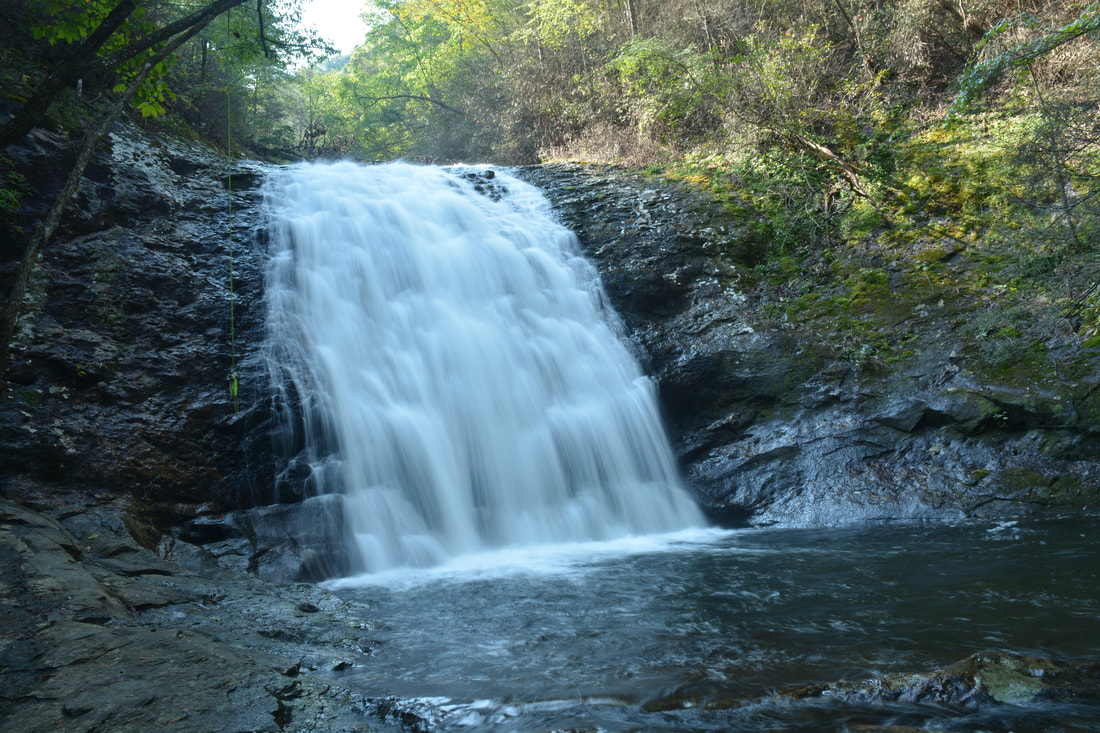
Mill Creek is one of the most scenic small streams in the Cohutta Mountains of Northwest Georgia. In a little more than a half-mile, the creek comes over four waterfalls and many smaller cascades, and an easy unofficial trail follows the creek with access to all of the gorgeous scenery. The third and largest waterfall, in particular, is a beautiful steep slide that drops over 30 feet into a sparkling pool. The last part of the trail is a steep scramble to the base of the third falls, but it still definitely is doable to most folks and well worth the effort. This hike occurred on Saturday, September 16th, 2017. My plan was to hike the Mill Creek Trail out and back from Hickey Gap Campground past the 1st Falls and 2nd Falls to the 3rd Falls on Mill Creek. I would also make a short creek scramble to the 4th Falls from the 3rd Falls. 

Summary

R/T Length of Trail: 1.4 Miles 
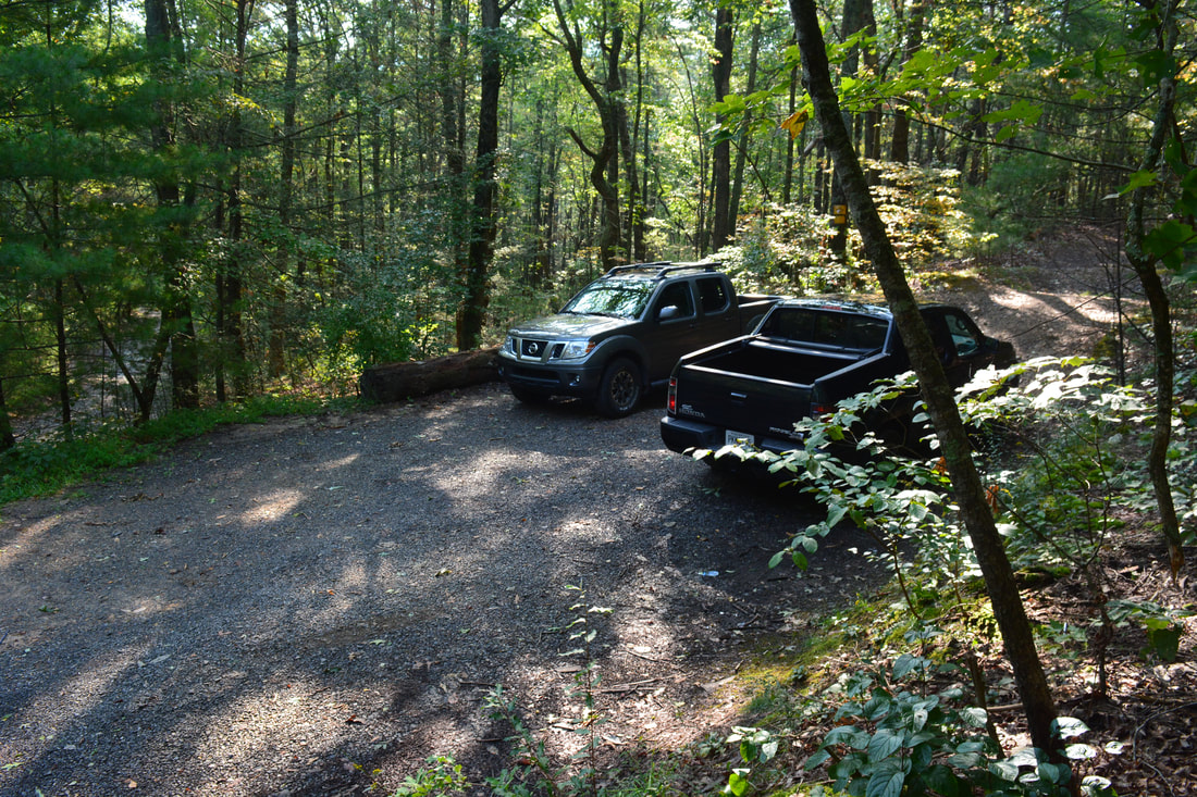
Duration of Hike: 2:00 (about one hour of stopping and photography) 
Type of Hike: Out and Back 
Difficulty Rating: 3 out of 10 
Total Elevation Gain: 287 Feet 
Pros: Four waterfalls in a short hike 
Cons: Lots of trash at the base of the 3rd Falls
Points of Interest: 1st Falls on Mill Creek - 4 stars; 2nd Falls on Mill Creek - 2 stars; 3rd Falls on Mill Creek - 7 stars; 4th Falls on Mill Creek - 3 stars
Trail Blaze Colors: None (not an official trail) but none needed 
Best Seasons to Hike: Spring 
Fees: None 
Beginning Point: Hickey Gap Campground Day Use Parking 
Directions from Chatsworth, GA: From the intersection of US 411 (3rd Avenue) and US 76/GA 52 West (G I Maddox Parkway) north of downtown Chatsworth, follow US 411 North for 5.8 miles, and then, turn right onto Grassy Street in the community of Crandall. In 0.4 miles, turn right onto Crandall-Ellijay Road after crossing the railroad tracks, and 0.1 mile farther, turn left onto Mill Creek Road. Mill Creek Road, which quickly turns into unpaved FS 630, remains in great shape suitable for all passenger vehicles. After 6.5 miles, Mill Creek Road passes through Hickey Gap. Here, a side road leaves right and downhill to Hickey Gap Campground. The signed "Day Use Parking" is right at the intersection in the gap. Park here - there is space for several cars.

Map

Picture
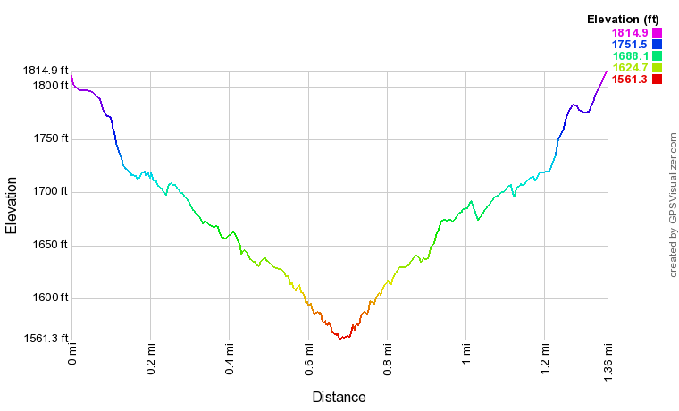
Click the link below to download a .GPX file with a track of this hike. 
mill_creek_falls__cohutta_wma_.gpx
File Size: 58 kb
File Type: gpx
Download File

Details

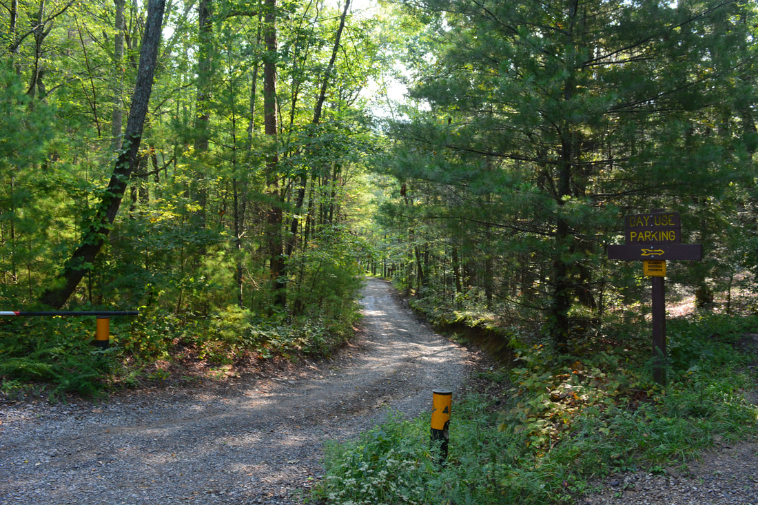
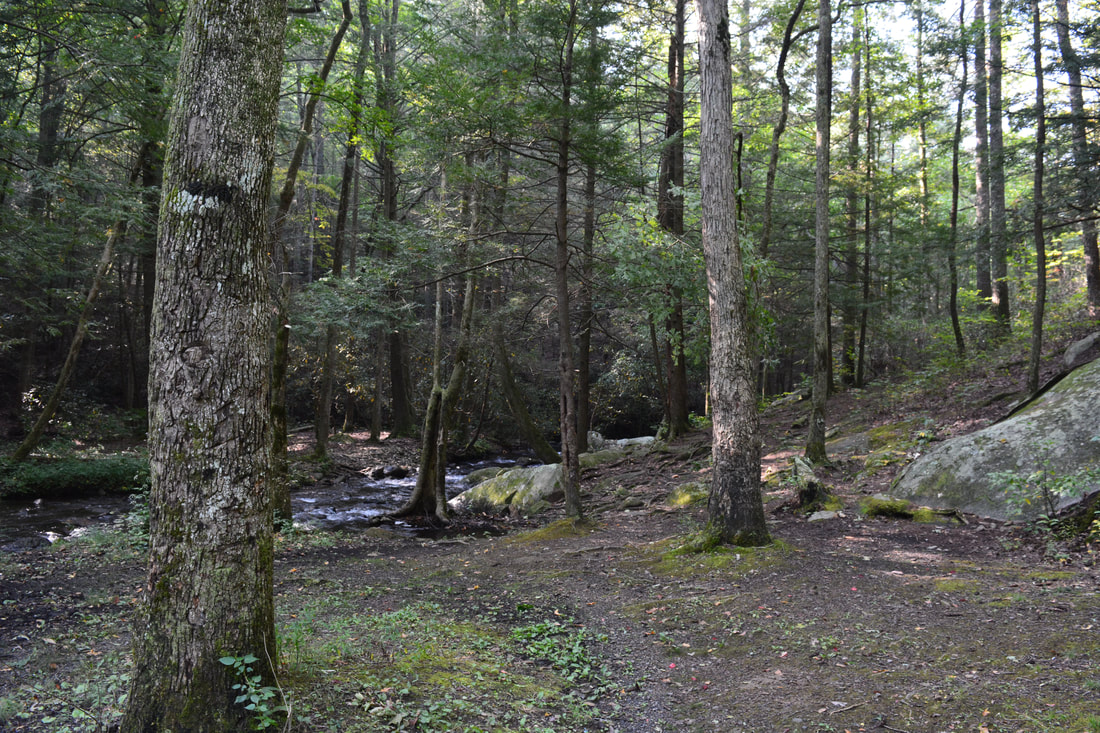
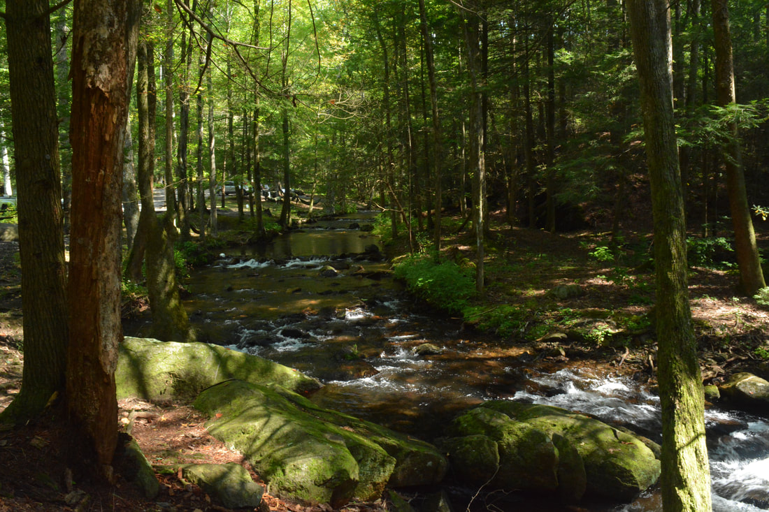
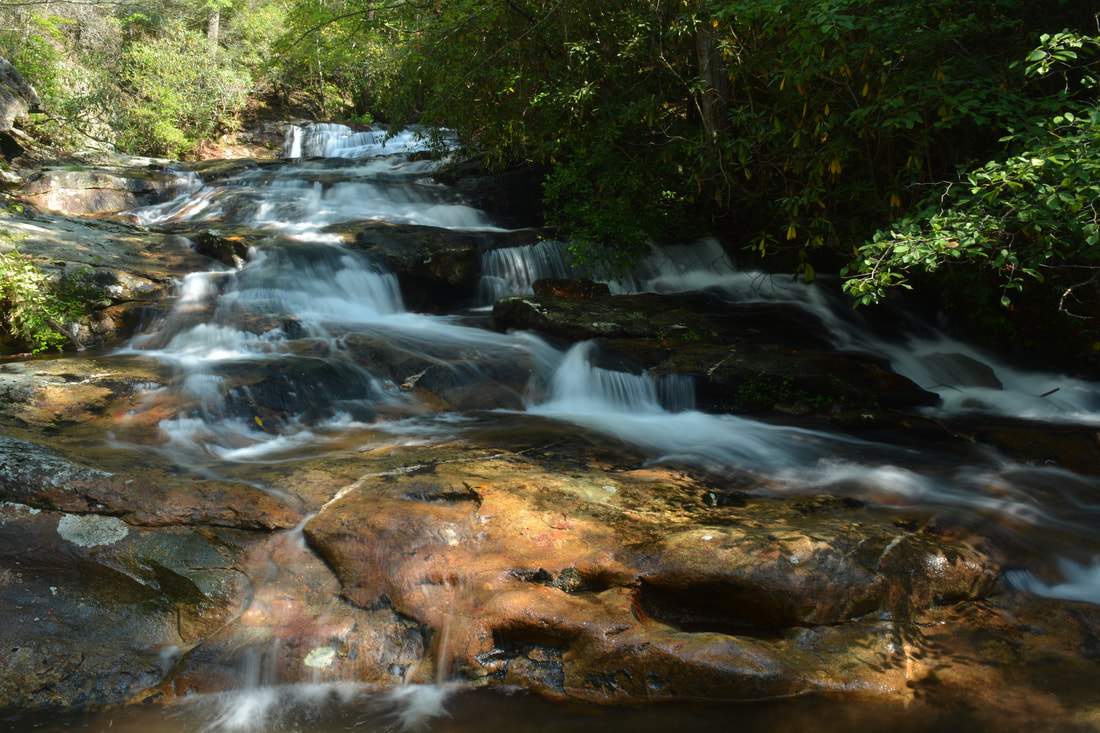
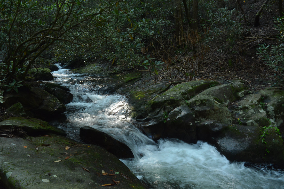
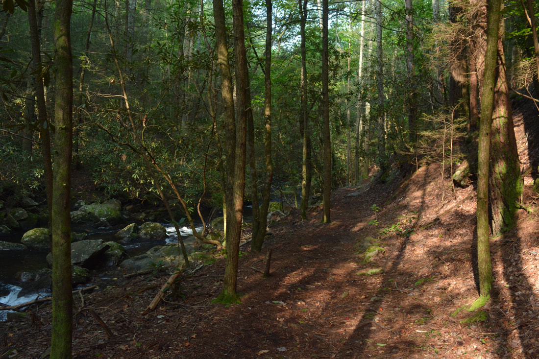
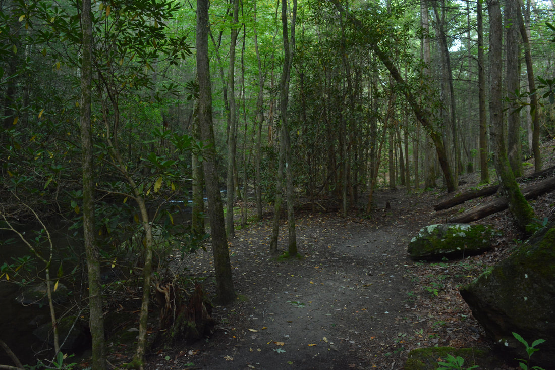
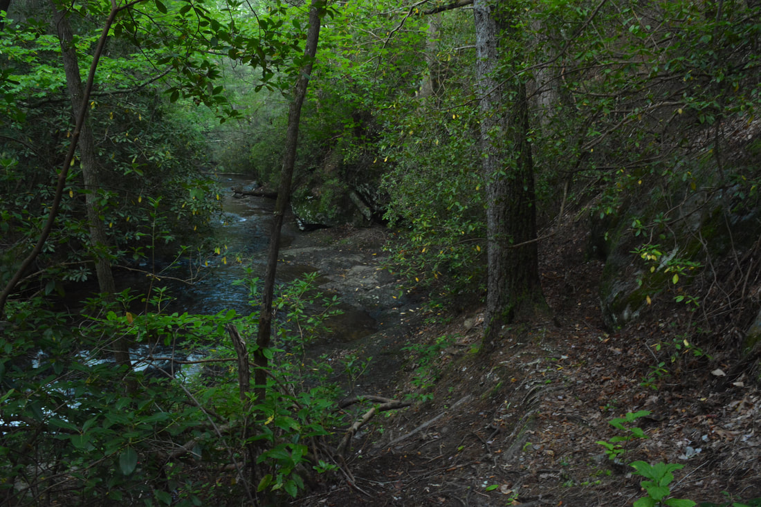
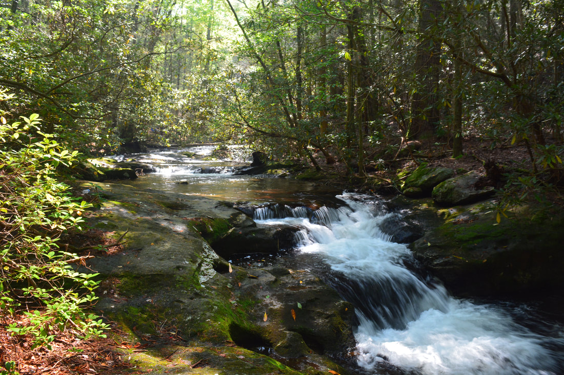
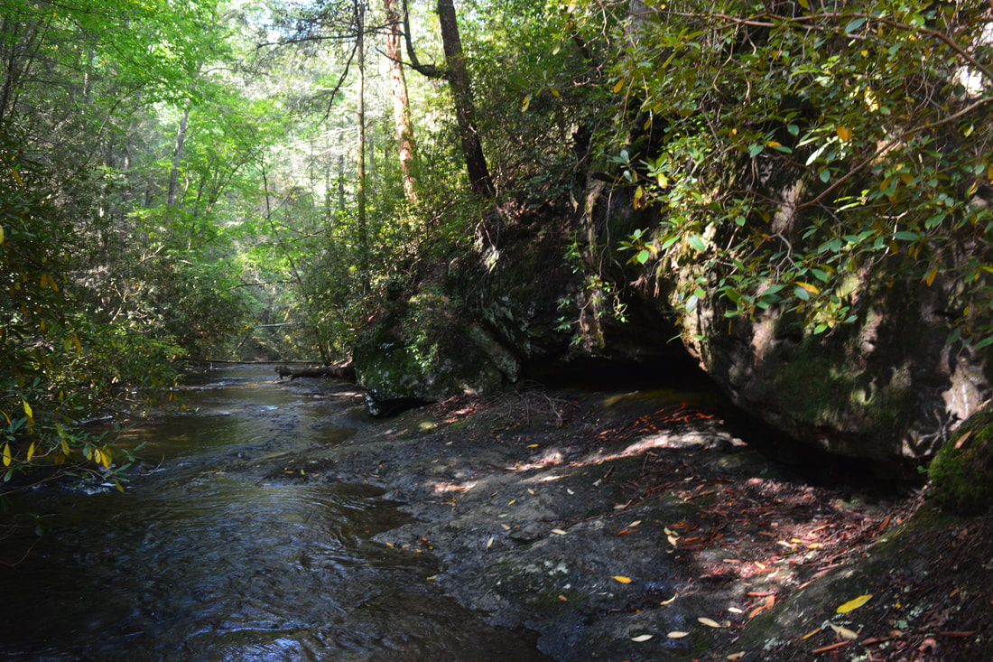
The waterfalls of Mill Creek are special because there are few waterfalls in the Cohutta Mountains when related to other parts of the North Georgia Mountains. The waterfalls that do exist in the Cohuttas are generally found alone, while on this short stretch of Mill Creek, there are a whole four waterfalls, including two that are significant! To reach the Mill Creek waterfalls, begin hiking down the gravel road that east-southeast from the day use parking area at Hickey Gap off FS 630. In 0.1 miles, the road reaches the Hickey Gap Campground. Turn right and walk to Mill Creek past the restrooms. At Mill Creek, an unsigned but well-defined trail begins, heading in the downstream direction along the same side of the creek. Even though the map above seems to imply that the trail crosses the creek a few times, there are no creek crossings all the way to the base of the 3rd Falls. After a flat start, the trail approaches the top of the long cascading 1st Falls on Mill Creek at 0.15 miles. Stay on the main path as it hugs the steep slope alongside the 1st Falls. Ignore the first side path (which leads to a mediocre midpoint view of the falls). The second and third side paths on the left lead to the base of 1st Falls at 0.2 miles. 1st Falls on Mill Creek is a very picturesque set of cascades, slides, and short drops where the creek loses about 30 feet in elevation spread out over several hundred feet. 1st Falls is fairly far from the other three waterfalls, so it is also known as Upper Mill Creek Falls. 

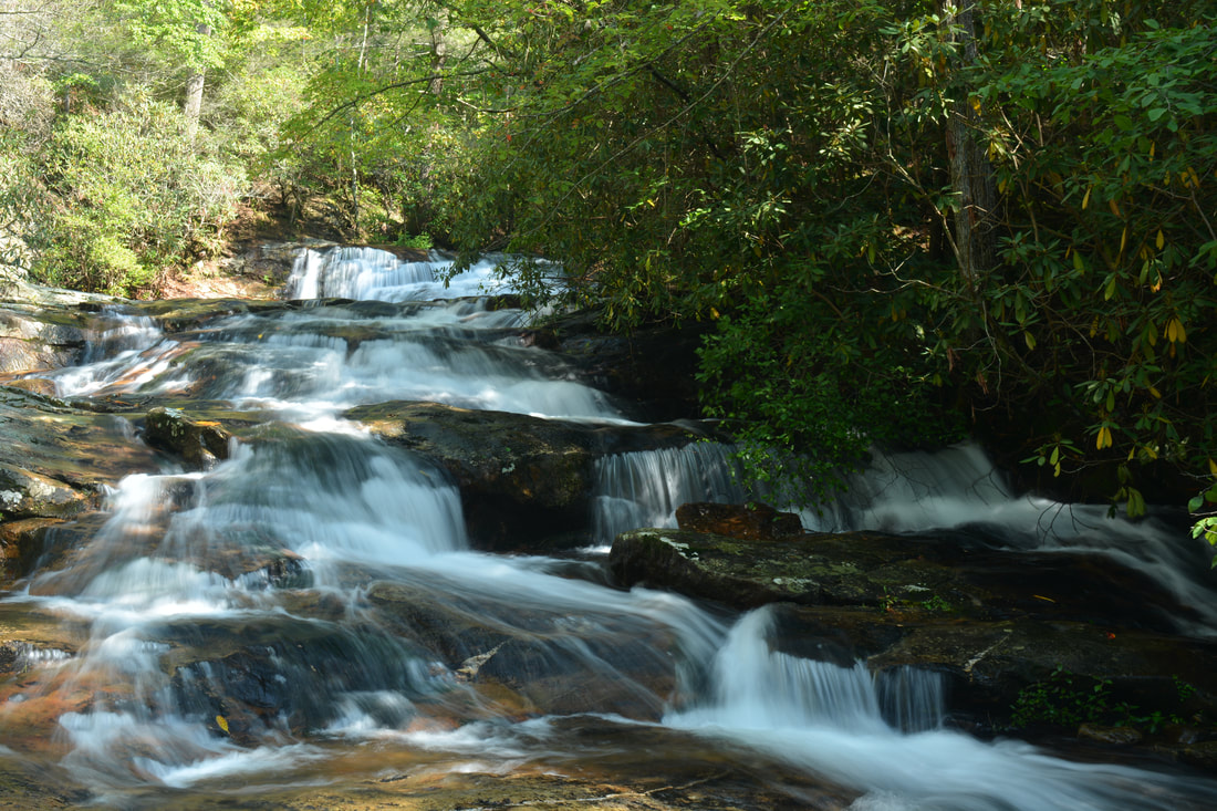
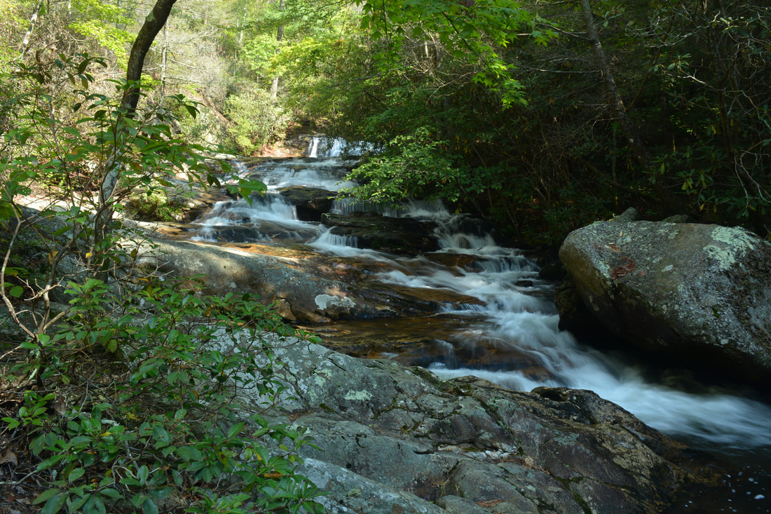
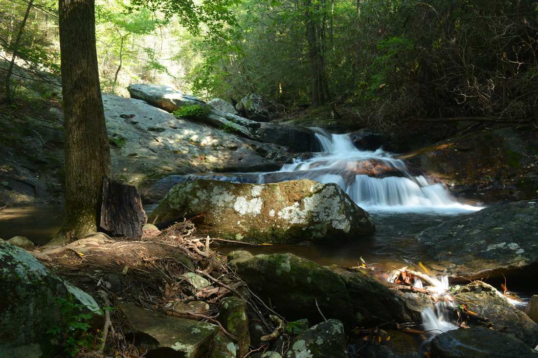
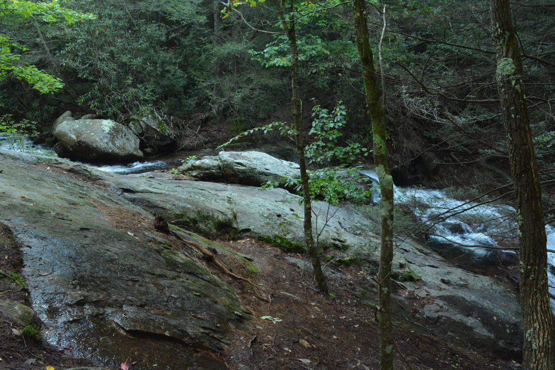
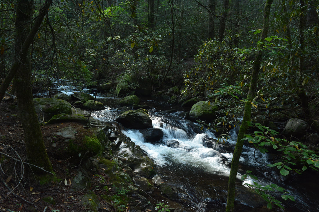
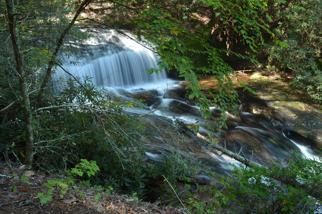
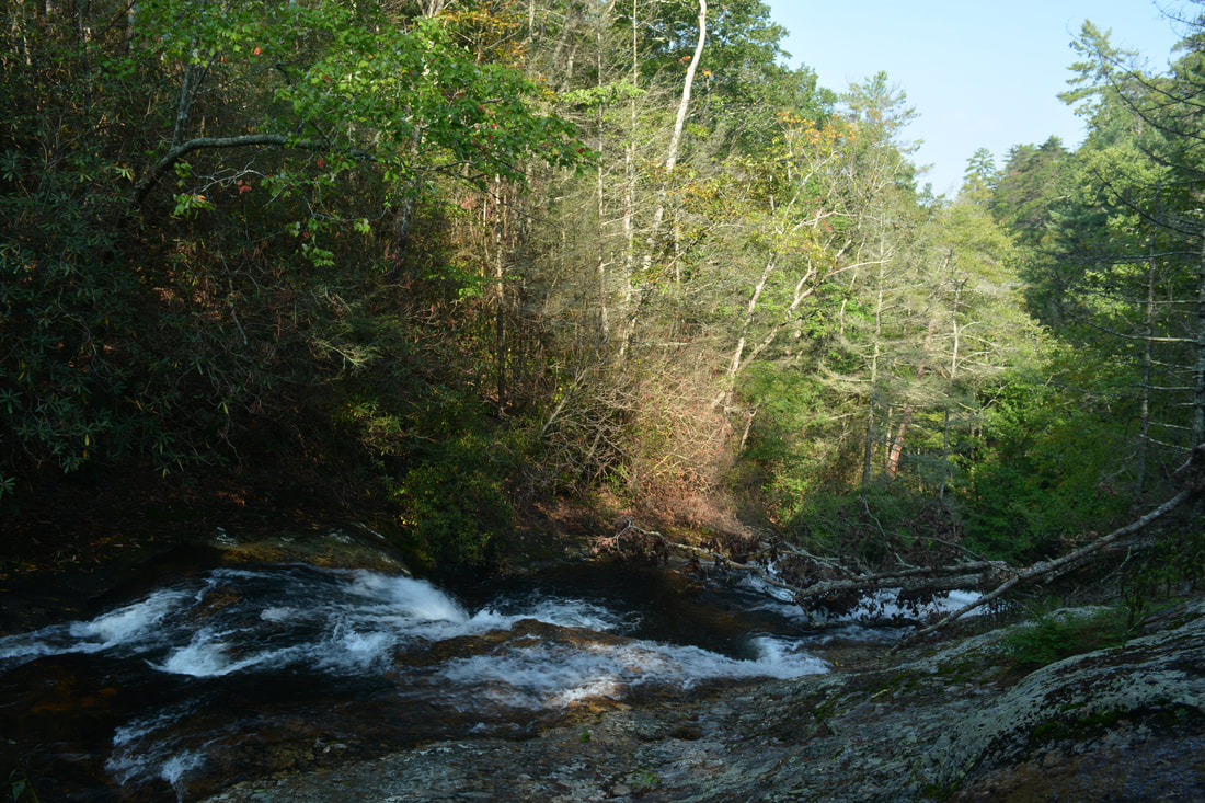
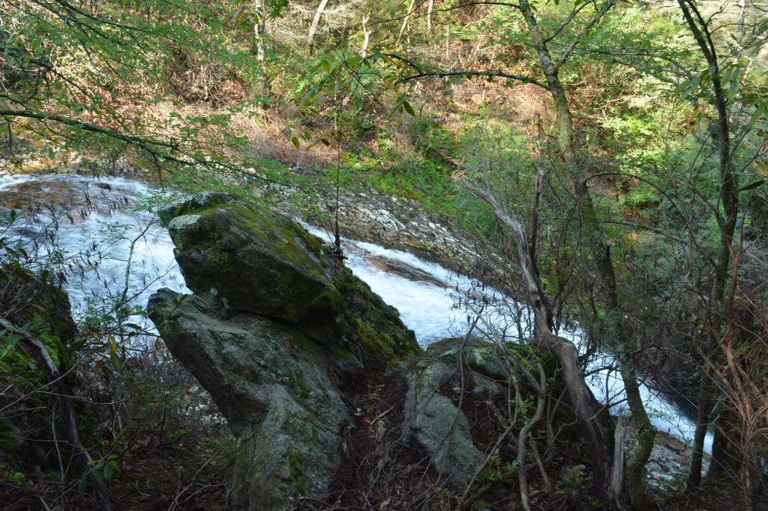
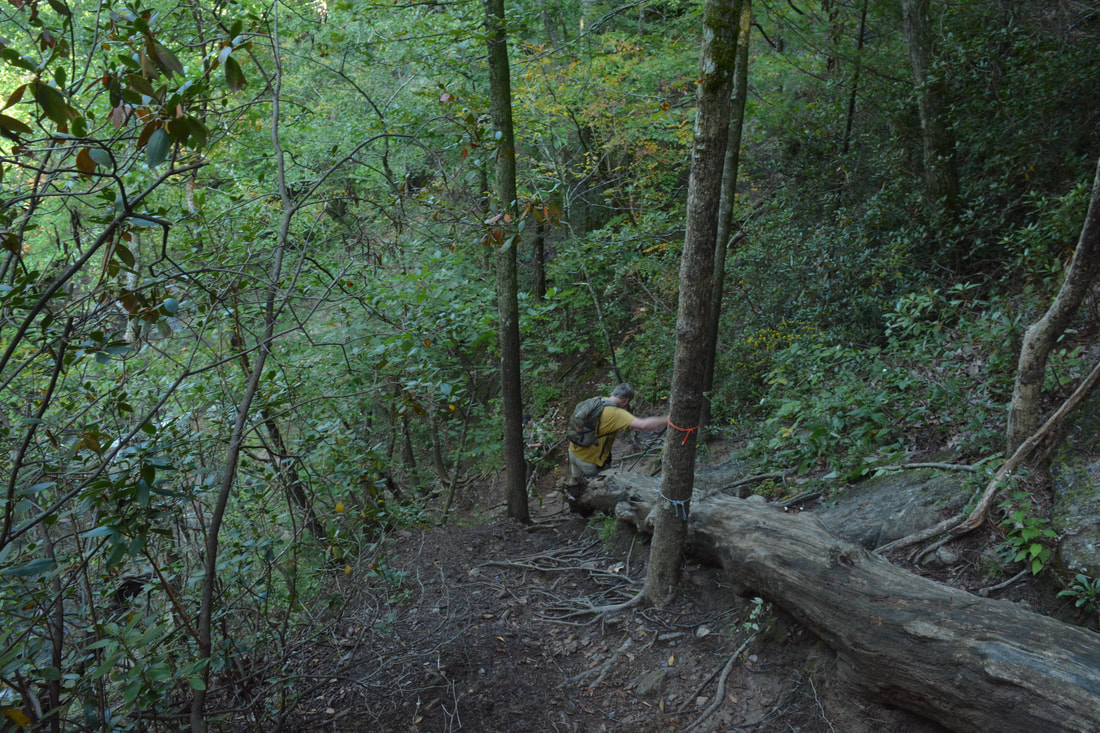
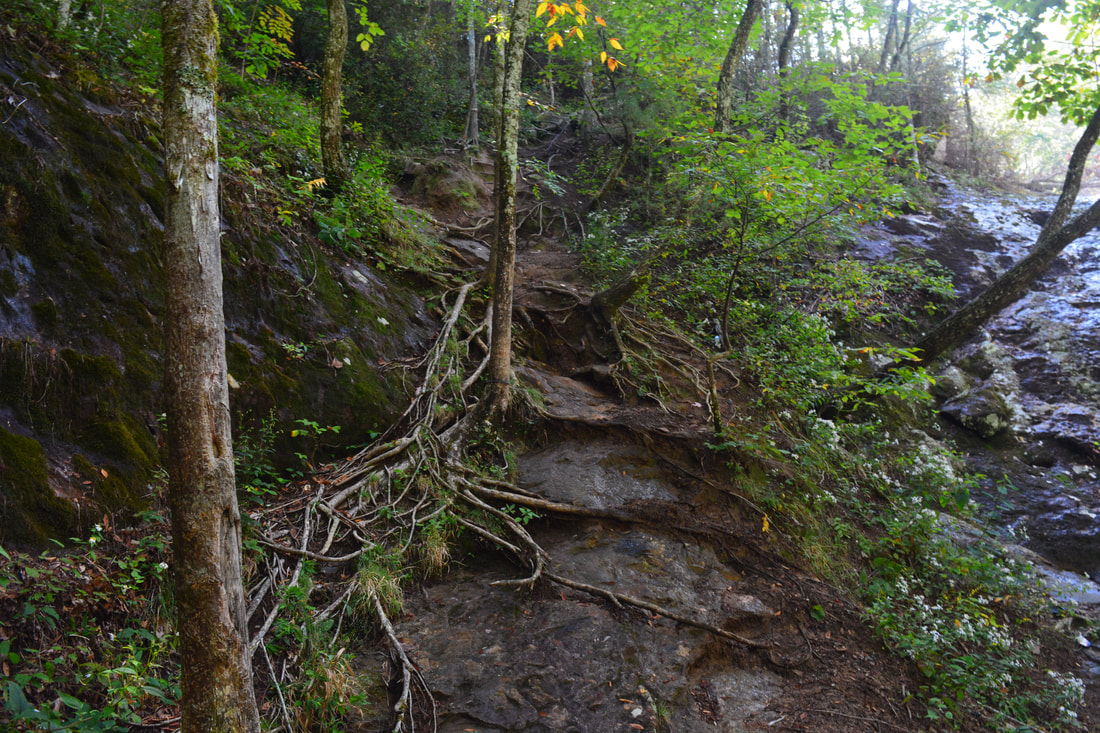
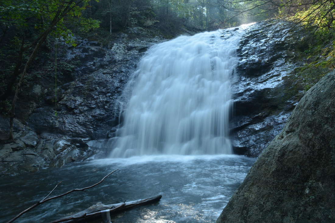
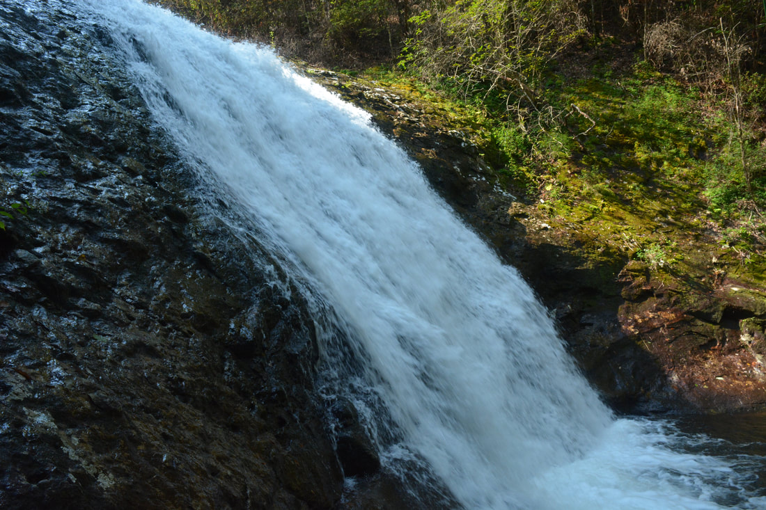
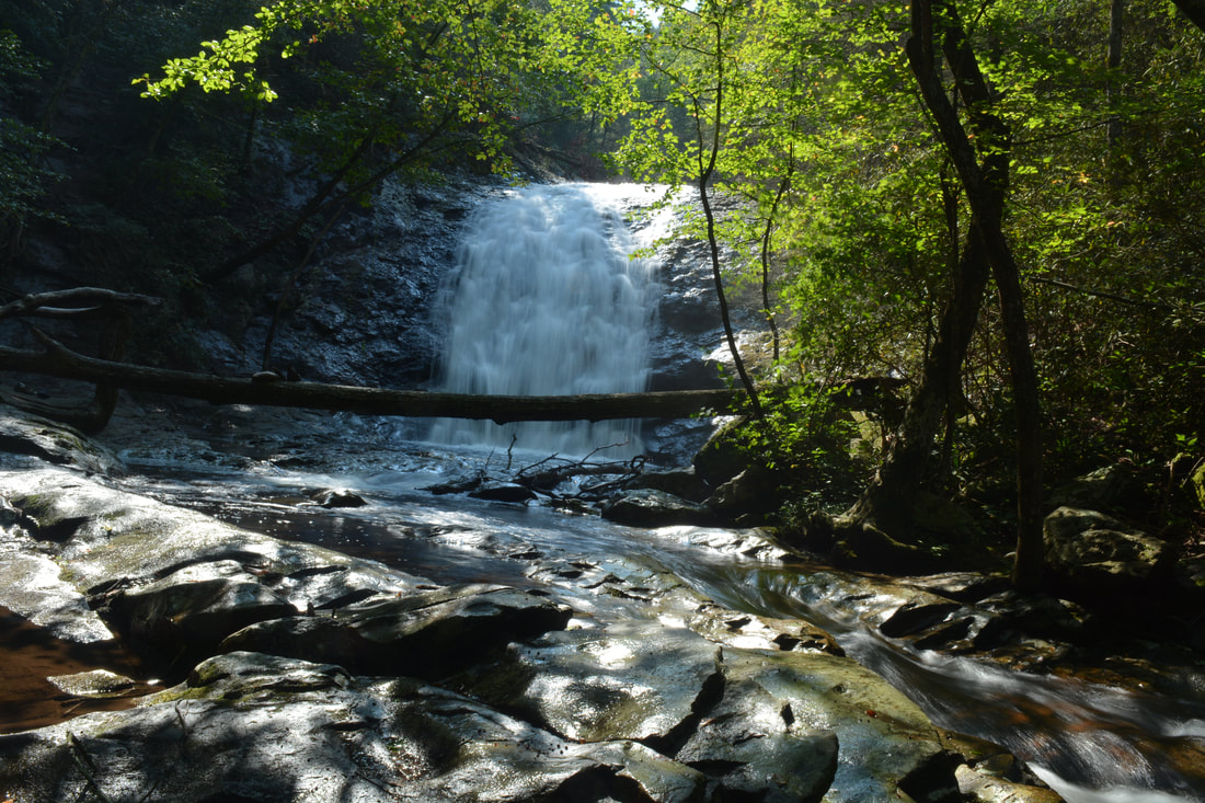
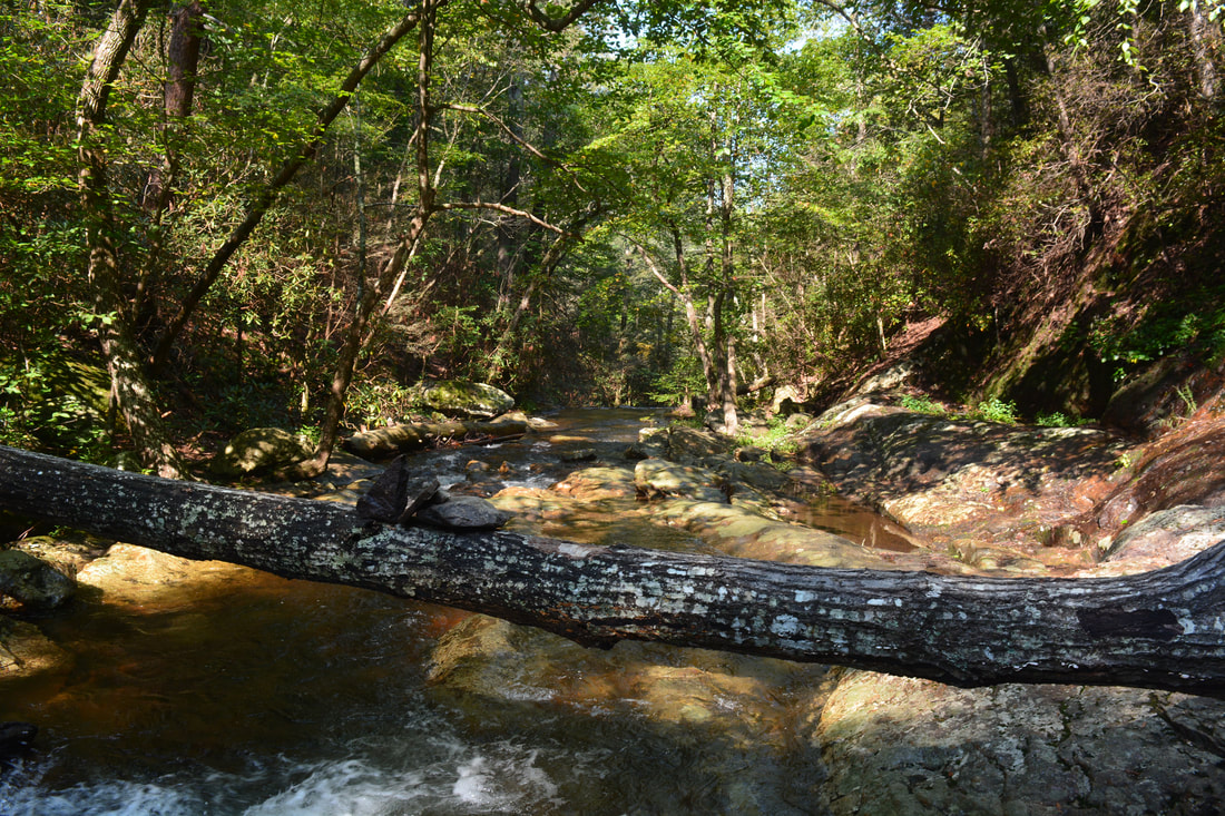
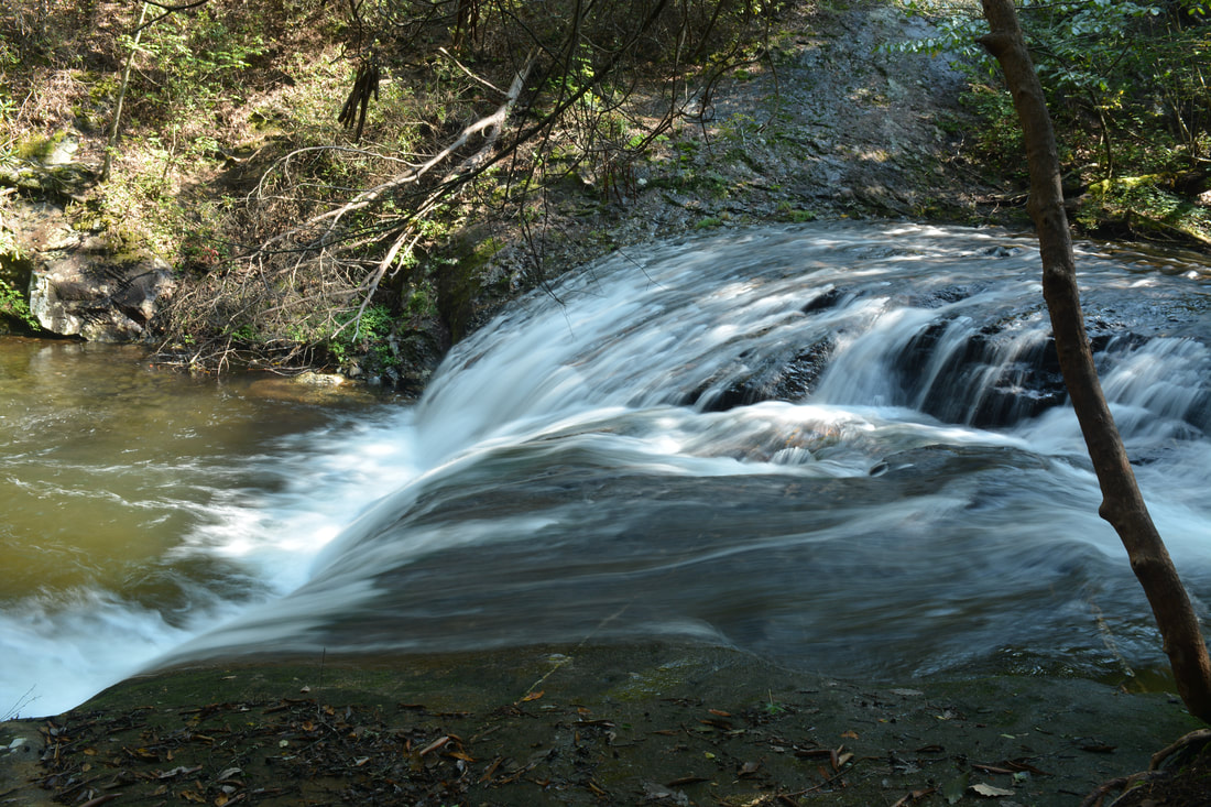
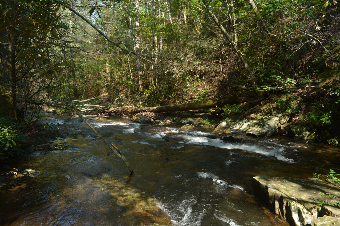
The trail continues to follow the cascading Mill Creek closely, soon coming to a nice campsite. Just past the campsite is a split at 0.45 miles. One path bears left and down to the creek. The route then follows exposed bedrock along the creek for about 200 feet. During very high water levels, the bedrock may be underwater though, so the path that bears  right at the split serves as a steep bypass. During normal water levels, you can stay left as I did and follow the edge of the creek past a neat bluff. Once the paths rejoin at about 0.5 miles, the main trail bears left and passes above the small 2nd Falls at 0.6 miles. A short rock scramble leads to the base. 2nd Falls on Mill Creek is only about 10 feet high but the sheer drop is still pretty. 2nd Falls is very close to 3rd Falls, and in fact, the outflow of 2nd Falls quickly turns into the beginning of 3rd Falls.  The trail briefly comes out onto sloping bedrock near the top of the 3rd Falls - be careful here. A few feet farther, as the trail begins plunging down to the base of 3rd Falls, there is a great view of the impressive slide that forms the waterfall. Meanwhile, to reach the base, the trail descends down an ultra-steep slope on the north side of the falls. The route is very obvious, but it is also more difficult than anything else on this otherwise easy hike due to how steep it is. At times, the rocks on the scramble can also be slick. I hear that there used to be several ropes that aided with the descent, but today, all but one of them were missing. The trail reaches the base of 3rd Falls at 0.65 miles. 

3rd Falls on Mill Creek is by far the largest of the four waterfalls on the creek. For this reason, it is often simply called "Mill Creek Falls", because some folks simply fail to recognize the other three drops as legit waterfalls due to 3rd Falls overshadowing them. The total height of 3rd Falls on Mill Creek is probably in the vicinity of 50 feet, but you can see only about 30 to 40 feet of it from the base due to the increasingly steeper angle of the sliding drop. During the high flow of winter and spring, this waterfall is especially scenic as the creek slides down the cliff in a froth of white that culminates in a sparkling symmetric pool. The setting is also scenic thanks to the cliffs and steep slopes that hem in the falls and pool. Unfortunately, at the time of my visit, there was a lot of trash in the vicinity of the waterfall - hopefully it will be cleaned up soon, because it currently is a major drawback of the waterfall. While the trail ends at 3rd Falls, it isn't hard to reach the base of 4th Falls, which lies only about 250 feet downstream. Rock hop along the same side of the creek until you approach the top of 4th Falls. Keep in mind that the rocks are extremely slick! When you near the top of the small 4th Falls about 200 feet below 3rd Falls, cross the creek at a calm spot and then scramble down the short goat path on the opposite side to the base of 4th Falls at 0.7 miles. 4th Falls on Mill Creek is a steeply-siding scenic waterfall of about 15 feet. In some ways, it is like a miniature version of 3rd Falls, with another deep sparkling pool at the base and a cliff on the north side. If there's a lot of people at the base of 3rd Falls (which is possible as the trail is well-known to locals and especially to folks who stay in the campground), then you can often bet on solitude at 4th Falls. 

From 4th Falls, simply retrace your steps past the other three waterfalls and to the parking area. You'll return to your car at Hickey Gap at 1.4 miles, concluding this short, fairly easy, and very rewarding hike. 

Mileage

0.0 - Hickey Gap Day Use Parking 
0.1 - Hickey Gap Campground 
​0.2 - 1st Falls on Mill Creek 
0.45 - High-Water Route Split 
0.6 - 2nd Falls on Mill Creek 
0.65 - 3rd Falls on Mill Creek 
0.7 - 4th Falls on Mill Creek 
1.4 - Hickey Gap Day Use Parking 

Variations

Hike out and back to 1st Falls - 0.4 Miles 
Hike out and back to 3rd Falls - 1.3 Miles

Bonus Stops

There are many trails in the nearby Cohutta Wilderness if you're interested in a longer hike following Mill Creek. Most of the trails do not provide suitable options for a day that already includes Mill Creek, but there are many backpacking options down to the Conasauga River. Another option is to hike to the Grassy Mountain Fire Tower near Lake Conasauga. 

Pictures

Videos

1 Comment
tim davis link
11/25/2017 06:03:34 pm

Thanks for doing such a great write up, we are hoping to visit here at the first of the year on our way to Blue Ridge Ga.

Reply


Leave a Reply.

    About Me

    Mark Oleg Ozboyd
    I'm an avid outdoor explorer and a hobbyist landscape photographer. I'm 21 years old and have been hiking since 2011. Originally based out of Atlanta, Georgia, I started out by occasionally hiking short trails throughout well-known Georgia State Parks. During 2012 and 2013, I began to expand my trips into adjacent states, as well as into the wilder National Forest areas rather than just State Parks. Throughout the years that followed, as I slowly ran out of popular hiking trails in my area, I began to search for and hike in more seldom-visited areas. Today, you can find me out in the woods every weekend, whether it's on an official trail or bushwhacking through cross-country terrain without any paths. I now attend Washington & Lee University and am exploring Virginia and West Virginia. My other hobbies include chess, science, old music, and meteorology. I have 3 years of amateur weather forecasting experience, having studied a lot of meteorology basics over the years. I am also a student at European School of Music where I learned that music and nature have a lot in common. Listening to good music inspires me to capture nature's beauty on the camera in different aspects that also make me recall many beautiful music pieces that I've heard.​


    Dear readers: I have invested a tremendous amount of time and effort in this website and the Georgia Waterfalls Database the past five years. All of the work that has gone in keeping these websites updated with my latest trip reports has almost been like a full-time job. This has not allowed me to pick up a paid job to save up money for college, and therefore, I I've had to take out loans. If you find the information on this website interesting, helpful, or time-saving, you can say "thanks" and help me out by clicking the button above and making a contribution. I will be very grateful for any amount of support you give, as all of it will apply toward my college tuition. Thank you! 

    Enter your email address to subscribe for trail reports:

    Delivered by FeedBurner


    Picture
    Coming in 2022-2023?

    Other Hiking Websites

    DWHike's Adventures
    Florida's Natural Wonders
    Florida Trailblazer
    Meanderthals
    Mountain Images
    by Bernie Boyer

    North Carolina Waterfalls with
    ​Kevin Adams
    Take-a-Hike!
    Tennessee Landforms
    Waterfall Page
    Waterfall Adventurer
    Zach's Mild Adventures

    Miles Hiked

    Year 1: 540.0 Miles
    Year 2: 552.3 Miles
    ​Year 3: 518.4 Miles
    Year 4: 482.4 Miles
    Year 5: 259.9 Miles

    Archives

    March 2021
    February 2021
    January 2021
    November 2019
    October 2019
    September 2019
    August 2019
    July 2019
    June 2019
    February 2019
    January 2019
    December 2018
    November 2018
    October 2018
    August 2018
    July 2018
    June 2018
    May 2018
    April 2018
    March 2018
    February 2018
    January 2018
    December 2017
    November 2017
    October 2017
    September 2017
    August 2017
    July 2017
    June 2017
    May 2017
    April 2017
    March 2017
    February 2017
    January 2017
    December 2016
    November 2016
    October 2016
    September 2016
    August 2016
    June 2016
    May 2016
    April 2016
    March 2016
    January 2016
    December 2015
    November 2015
    October 2015
    September 2015
    August 2015
    July 2015
    June 2015
    May 2015
    April 2015
    March 2015
    February 2015
    January 2015
    December 2014
    November 2014
    October 2014
    September 2014
    August 2014
    July 2014
    June 2014
    May 2014
    April 2014
    March 2014
    February 2014

    Categories

    All
    Adel
    Adirondack Park
    Alabama
    Alfred A. Ring Park
    Allegheny Trail
    Amicalola Falls State Park
    Anniston Area
    Apalachicola Bluffs And Ravines Preserve
    Apalachicola National Forest
    Apalachicola/Port St. Joe Area
    Apopka
    Appalachian Trail
    Appling
    Art Loeb Trail
    Aska Trail System
    Bakersville
    Balm-Boyette Scrub Preserve
    Balsam Lake Recreation Area
    Bankhead National Forest
    Bartow County Parks
    Bartram Trail
    Basinger
    Beersheba Springs
    Benton
    Benton Mackaye Trail
    Berry College Trail System
    Best Hike
    Big South Fork National Recreation Area
    Black Bear Wilderness
    Black Rock Mountain State Park
    Blairsville
    Blakely
    Blood Mountain Wilderness
    Blowing Rock
    Blue Ridge
    Blue Ridge Parkway
    Boone
    Bradenton
    Bradenton Beach
    Brasstown Bald
    Brasstown Wilderness
    Brevard
    Bryson City
    Buchanan
    Bucks Pocket State Park
    Bulow Creek State Park
    Bulow Plantation Ruins State Park
    Caesars Head State Park
    Caladesi Island State Park
    Calhoun
    Camel's Hump State Park
    Cashiers
    Caspersen Beach Park
    Catfish Creek State Park
    Caves
    CC Putnam State Forest
    Cedar Point Environmental Park
    Chatsworth
    Chattahoochee National Forest
    Chattanooga
    Chattanooga Valley
    Chattooga National Wild And Scenic River
    Cheaha Wilderness
    Cherohala Skyway
    Cherokee
    Cherokee National Forest
    Chiefland Area
    Chillhowee Recreation Area
    Chipley
    Chunky Gal Trail
    Circle B Bar Reserve
    Citico Creek Wilderness
    Citrus Wildlife Management Area
    Clarkesville
    Clayton
    Cleevland
    Cleveland
    Cloudland Canyon State Park
    Cohutta Wilderness
    Collier-Seminole State Park
    Cordele
    Cornelia
    Covington
    Crestview Area
    Crew-land-and-water-trust
    Cullowhee
    Cumberland Trail
    Dahlonega
    Dalton
    Dawson Forest Wildlife Management Area
    Dawsonville
    Dayton
    De Soto National Memorial
    DeSoto State Park
    Dillard
    Double Springs
    Ducktown
    Duncan Ridge Trail
    Dunlap
    Eagle's Rest Park
    Eastpoint
    Econfina Creek Wildife Management Area
    Eglin Air Force Base
    Elizabethton
    Elkins
    Elk Knob Game Lands
    Elk Park
    Ellicott Rock Wilderness
    Ellijay
    Emerson Point Preserve
    Englewood Area
    Enota Retreat
    Erwin
    Falling Waters State Park
    Fayetteville
    Fires Creek Recreation Area
    Fire Tower
    Flint River
    Florence Area
    Florida
    Florida Caverns State Park
    Florida Trail
    Foothills Trail
    Fort Mountain State Park
    Fort Myers Area
    Fort Payne
    Fort Payne Area
    Fort Yargo State Park
    Franklin
    Franklin Delano Roosevelt State Park
    Franklin-Marion State Forest
    Frozen Head State Park
    Gainesville
    Gainesville Area
    Gatlinburg
    George Washington National Forest
    Georgia
    Georgia Veterans Memorial State Park
    Glasgow
    Gorges State Park
    Grandfather Mountain State Park
    Great Smoky Mountains National Park
    Greeneville
    Green River Game Lands
    Gruetli-Laager
    Grundy Forest State Natural Area
    GTM Reserve
    Guana River Wildlife Management Area
    Hayesville
    Helen
    Hiawassee
    High Falls State Park
    Highlands
    Highlands Scenic Highway
    Hillsborough River State Park
    Hinson Conservation & Recreation Area
    Historic Sites
    Honeymoon Island State Park
    Hot Springs
    Huntington
    Inverness Area
    Jackson
    Jasper
    Jefferson National Forest
    Joan M. Durante Park
    Jonathan Dickinson State Park
    Jones Gap State Park
    Joyce Kilmer Slickrock Wilderness
    Joyce Kilmer - Slickrock Wilderness
    Juniper Prairie Wilderness
    Kelly Park
    Keown Falls Recreation Area
    Kolomoki Mounds State Park
    LaFayette
    Lake City Area
    Lake George Wild Forest
    Lake June-in-Winter State Park
    Lakeland Area
    Lake Placid
    Lake Russell Wildlife Management Area
    Lake Wales Ridge State Forest
    Laurel Fork North Wilderness
    Leffis Key Preserve
    Leon Sinks Geological Area
    Lexington
    Lineville
    Linville
    Linville Gorge Wilderness
    Lithia Springs
    Little Frog Wilderness
    Little Manatee River State Park
    Little River Canyon National Preserve
    Longboat Key
    Long Trail
    Lookout Mountain
    Lookout Mountain Battlefield
    Lovingston
    Lula Lake Land Trust
    Lumpkin
    Maggie Valley
    Manatee Springs State Park
    Marianna Area
    Mark Trail Wilderness
    Marlinton
    Mccaysville
    McMinville
    Mentone
    Middlesex
    Mistletoe State Park
    Monongahela National Forest
    Montreat
    Mountain Bridge Wilderness Area
    Mountain City
    Mountains To Sea Trail
    Mountains-to-Sea Trail
    Mount Rogers National Recreation Area
    Myakka River State Park
    Myron B. Hodge City Park
    Nantahala National Forest
    Naples
    Naples Area
    Natural Bridge State Park
    Neal Preserve
    New Castle
    Newport
    New River Gorge National Park
    New York
    North Carolina
    Ocala Area
    Ocala National Forest
    Ocean-to-Lake Trail
    Oconee State Park
    Oconee Station Historic Site
    Okaloacoochee Slough State Forest
    Oldsmar
    Oneida
    Orlando Area
    Ormond Beach
    Oscar Scherer State Park
    Oxford
    Palatka
    Palmetto Trail
    Panama City Area
    Panthertown Valley
    Parrish
    Paynes Creek Historic State Park
    Peaks Of Otter Recreation Area
    Pigeon Crockford Mountain Wildlife Management Area
    Pigeon-Crockford Mountain Wildlife Management Area
    Pigeon-Crockford Wildlife Management Area
    Pine Mountain
    Pinhoti Trail
    Pinnacle Park
    Pisgah Civitan Park
    Pisgah National Forest
    Pittman Center
    Pond Mountain Wilderness
    Ponds/Lakes
    Prentice Cooper State Forest
    Providence Canyon State Park
    Pumpkintown
    Quick Point Nature Preserve
    Raven Cliffs Wilderness
    Reed Bingham State Park
    Reliance
    Rice Creek Conservation Area
    Riverview Pointe Preserve
    Robbinsville
    Robinson Preserve
    Rock Creek Gorge Scenic Area
    Rock Island State Park
    Rome
    Rosman
    Sale Creek
    Salem
    Salt Springs
    Saluda
    Santa Rosa Beach
    Sarasota
    Sarasota Area
    Savage Gulf State Natural Area
    Scenic Views
    Scottsboro Area
    Sebring Area
    Sewanee
    Sheltowee Trace Trail
    Shining Rock Wilderness
    Signal Mountain
    Sipsey Wilderness
    Sky Valley
    Smithgall Woods State Park
    Snowbird Backcountry Area
    Soddy Daisy
    Soddy-Daisy
    Sopchoppy
    South Carolina
    South Cumberland State Park
    Southeastern Cave Conservancy
    Southern Nantahala Wilderness
    Sparta
    Sprewell Bluff Park
    Spring City
    Spring Hill
    Springs
    Spruce Pine
    Standing Indian Backcountry Area
    St. Augustine
    St. George Island State Park
    St. Joseph Bay State Buffer Preserve
    St. Marks Area
    St. Marks National Wildlife Refuge
    Stone Mountain
    Stone Mountain Park
    Suches
    Sumatra
    Sumter National Forest
    Suwannee River
    Swallow Creek Wildlife Management Area
    Sweetwater Creek State Park
    Sylva
    Talladega National Forest
    Tallahassee Area
    Tallulah Falls
    Tallulah Gorge State Park
    Tampa Bay Area
    Tate City
    Tate's Hell State Forest
    Tea Creek Wildlife Management Area
    Tellico Plains
    Tennessee
    Thomaston
    Toccoa
    Topsail Hill State Park
    Torreya State Park
    Townsend
    Tracy City
    Tray Mountain Wilderness
    Trenton
    Triple Creek Preserve
    Troutdale
    Unaka Mountain Wilderness
    Upper Tampa Bay County Park
    Venice
    Vermont
    Virgin Falls State Natural Area
    Virginia
    Virginia Outdoors Foundation
    Vogel State Park
    Wakulla Springs State Park
    Waleska
    Walhalla
    Wartburg
    Water Features
    Waynesville
    Weedon Island Preserve
    Weeki Wachee Preserve
    Wekiwa Springs State Park
    West Palm Beach Area
    West Virginia
    Whitehall
    White Springs
    Winder
    Withlacoochee State Forest
    Young Harris

    RSS Feed

TRAIL REPORTS

Hikes in Alabama
​Hikes in Florida
Hikes in Georgia
Hikes in North Carolina
Hikes in South Carolina
Hikes in Tennessee
Hikes in Virginia

Hiking Resources

Alabama Resources
​
Florida Resources
Georgia Resources
North Carolina Resources
​South Carolina Resources
​
Tennessee Resources

Other

Contact
Map of Hikes
Alphabetical List of Hikes
Southeast Nature Society
© COPYRIGHT 2014-2018
​ALL RIGHTS RESERVED.
Important: I disclaim any responsibility for any damage or personal injury that may occur as a result of the activities and information found on this website. All outdoor activities, especially off-trail hiking, are done at your own risk. Never hike or head into that area that may be above your fitness or experience level.
  • Home
  • Trail Reports
    • Best Hikes
    • Hikes with Scenic Views
    • Hikes with Water Features
    • Alabama
    • Georgia
    • Florida
    • North Carolina
    • South Carolina
    • Tennessee
    • Vermont
    • Virginia
  • Map
  • Hike List
  • Testimonials
  • Resources
  • Contact Us
  • Southeast Nature Society
    • Our Team
  • Georgia Waterfalls Database