HIKING THE APPALACHIANS AND BEYOND
  • Home
  • Trail Reports
    • Best Hikes
    • Hikes with Scenic Views
    • Hikes with Water Features
    • Alabama
    • Georgia
    • Florida
    • North Carolina
    • South Carolina
    • Tennessee
    • Vermont
    • Virginia
  • Map
  • Hike List
  • Testimonials
  • Resources
  • Contact Us
  • Southeast Nature Society
    • Our Team
  • Georgia Waterfalls Database

Lula Lake Land Trust: Lula Falls/High Adventure Trail/Middle Road Trail Loop, Chattanooga Valley, Georgia

8/9/2014

1 Comment

 
Picture
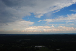
In a normal state park, or recreation area for that matter, you have a chance to visit it every day, whenever you want. In Lula Lake Land Trust, two days is how many days you have a chance to visit per month. Just two. Lula Lake Land Trust is a nonprofit organization that bought a small area of land of Lula Lake Road to protect Rock Creek and its watershed. Thank you for buying it. The area of land, while small, houses two waterfalls, a gorge, and a ridge with spectacular views. This is one of the best hikes in northwest Georgia, besides Cloudland Canyon State Park's trail system. The only major con is that much of the hike is on old roads, perhaps the only reason I won't classify it as a Best Hike. This hike occurred on Saturday, August 2nd, 2014. My plan was to hike down the Lula Lake Entrance Road from the parking area to the Old Railroad Grade Trail. From there, I would follow the Railroad Grade Trail past Lula Lake Falls to Lula Falls Trail. I would follow Lula Falls Trail to the base of the falls, and then return back and continue down the Old Railroad Grade Trail to the High Adventure Trail. From there, I would follow the High Adventure Trail to great views at the top of Eagle Cliff, and then take the Middle Road Trail down to the chestnut orchards. Next, from the Middle Road Trail, I would take the Turkey Trail to the Overbird Trail, the Overbird Trail back to the Middle Road Trail, and finally, the Middle Road Trail to the Middle Road Cutoff Trail, which would take me back to the parking area. 

R/T Length of Trail: 4 Miles
Duration of Hike: 2 Hours, 10 Minutes
Type of Hike: Loop with Short Spur
Difficulty Rating: 5 out of 10
Pros: Major water features; well-maintained trails generally and well-signed intersections; great views; chestnut orchards
Cons: Big crowds; steep ascent with help of cable on High Adventure Trail; much of the trail is on old roads
Best Season(s) to Hike: Year-round; possibly spring when there's more water
Trail Blaze Color(s): None and none needed
Beginning Point: Parking area on the road that goes through Lula Lake Land Trust
Directions: From Chattanooga Valley, GA: Take GA State Route 193 South to Nick-A-Jack Road. Follow Nick-A-Jack Road for 4 miles to GA State Route 157. Turn right and continue straight for about 2 miles until you see the entrance to Lula Lake Land Trust on the right. Remember, the gate is open from 9 Am to 5 PM only on the first and last Saturday of each month. 
Lula Lake Land Trust is a small area of land, but yet, has so many features that made this an almost excellent, textbook hike. But first, let's define land trust. A land trust has two definitions, but in this case, it would be a nonprofit, private organization that works to conserve land, by its stewardship of the aforementioned land. The Lula Lake Land Trust is open only two days per month, and that is the first and last Saturday of each month. Kudos to the Lula Lake Land Trust for having this place open to public, if only 24 days per year! 


The entrance can be unnoticed, because there's only a small sign. Once you enter, a steep gravel road will lead you down. It is asphalted i the steepest section. It's about a mile down to the parking lot. the parking lot is not a real parking lot. It's just a large grassy area where everyone can park. Before you start the hike, you have to sign in, and then you are good. The first 0.3 miles are on the exit road. Then, where you see the sign "Exit <---", keep forward on an old, closed road. This is the Old Railroad Grade Trail. The trail is easy and going slightly downhill. At 1 mile, there is a bridge over Rock Creek. You can see the precipice of Rock Creek into Lula Lake from here. Right afterwards, there's a picnic area, and a short but steep side trail that leads down to Lula Lake and Lula Lake Falls. This is a small but natural lake, formed by rock cliffs and the falls. The falls is a small cascade of about 30 feet. It was pretty powerful on the day I came. After viewing the falls, continue down the Old Railroad Grade Trail another 0.3 miles down to the Lula Falls Trail junction. The Lula Falls trail is a short but very steep trail. In just 0.2 miles, it descends nearly 200 feet. It is very rocky and rugged too. It seemed harder descending then ascending in a way. However, when you get to the base, it's well worth it. You can see the 100-foot drop of Lula Falls. Once you have finished spectating, ascend back up the Lula Falls Trail (which was easier than descending in this case). Reach the junction with the Old Railroad Grade Trail at 1.5 miles. Here, turn left and continue following it down for a bit until you reach an unsigned junction with the High Adventure Trail at 1.9 miles. If you continue forward, you will reach the property boundary right away, so turn right here.


The High Adventure Trail, as the name implies, is steep and challenging, albeit short. It ascends 250 feet in 0.3 miles, and the first 0.1 mile involves some rock scrambling and there were even cables  put there to help. Well, you could do it without the cables, if the cables were absent, but I took use of them just to make it easier, although they were not required. After the cable part ends, it gets easier, although the trail is still ascending. There were a few views to the Rock Creek gorge, before the trail turned back south to follow the edge of Eagle Cliff. There were some views to the east, but the main viewpoint was at 2.2 miles at the junction with the Middle Road Trail. Here, there was a picnic table, and an outstanding eastward view towards Chattanooga Valley and the southern Chattanooga metro. Looking to the far southeast, I could see some higher mountains, likely part of the Armuchee Ridges in the western portions of the Chattahoochee National Forest. From the junction, the Bluff Road trail continued forward, and the Middle Road Trail turned right. Ignore where the arrows on the sign point to - it appeared like the sign was flipped. Also, an unsigned old road continued diagonally back to the northwest. I wasn't sure where it led. Take the Middle Road Trail. Right away, you'll also pass the Bike Trail going away to the left. the Middle Road Trail is a gently descending old road, but it wasn't eroded at all and was quite sandy. Great for walking. It led to the junction with a connector trail that led back to the Old Railroad Grade Trail. Here, there was a viewing bench to view some of the chestnut orchards. At 2.8 miles, the trail reached the Turkey Trail. Turn left onto the Turkey Trail. All of the Turkey Trail ascent, but it's gentle. The turkey trail passes the Homestead Trail on the right at 3 miles, and reaches a junction with the Overbird Trail at 3.3 miles.


Turn right onto the Overbird Trail. This trail will descend to the Middle Road Trail at 3.6 miles. Turn right here again, and pass the Homestead Trail exit on the right at 3.7 miles. Turn right onto the Middle Road Cutoff Trail in a small gap at a sign "Footbridge and Parking Lot ^" at 3.8 miles. Then, turn right again at 3.9 miles onto a connector, and after going down the hill into another gap, turn left to the footbridge. The trail crossed Rock Creek on the footbridge and ended at 4 miles back at the parking area.


To summarize: while this hike did have some hard sections, it generally wasn't hard, and most hikers can do it. I'ts true that the old roads can get a bit boring, but the rewards overweigh that significantly. Below are some pictures and videos. Please excuse rain bleeks, as it was raining and there were raindrops on my lens.
1 Comment
Edirne ECA servisi link
8/3/2022 06:00:13 pm

Edirne ECA servisi için hemen websitemize göz at! https://www.edirneklimaservisi.com/edirne-eca-servisi/

Reply


Leave a Reply.

    About Me

    Mark Oleg Ozboyd
    I'm an avid outdoor explorer and a hobbyist landscape photographer. I'm 21 years old and have been hiking since 2011. Originally based out of Atlanta, Georgia, I started out by occasionally hiking short trails throughout well-known Georgia State Parks. During 2012 and 2013, I began to expand my trips into adjacent states, as well as into the wilder National Forest areas rather than just State Parks. Throughout the years that followed, as I slowly ran out of popular hiking trails in my area, I began to search for and hike in more seldom-visited areas. Today, you can find me out in the woods every weekend, whether it's on an official trail or bushwhacking through cross-country terrain without any paths. I now attend Washington & Lee University and am exploring Virginia and West Virginia. My other hobbies include chess, science, old music, and meteorology. I have 3 years of amateur weather forecasting experience, having studied a lot of meteorology basics over the years. I am also a student at European School of Music where I learned that music and nature have a lot in common. Listening to good music inspires me to capture nature's beauty on the camera in different aspects that also make me recall many beautiful music pieces that I've heard.​


    Dear readers: I have invested a tremendous amount of time and effort in this website and the Georgia Waterfalls Database the past five years. All of the work that has gone in keeping these websites updated with my latest trip reports has almost been like a full-time job. This has not allowed me to pick up a paid job to save up money for college, and therefore, I I've had to take out loans. If you find the information on this website interesting, helpful, or time-saving, you can say "thanks" and help me out by clicking the button above and making a contribution. I will be very grateful for any amount of support you give, as all of it will apply toward my college tuition. Thank you! 

    Enter your email address to subscribe for trail reports:

    Delivered by FeedBurner


    Picture
    Coming in 2022-2023?

    Other Hiking Websites

    DWHike's Adventures
    Florida's Natural Wonders
    Florida Trailblazer
    Meanderthals
    Mountain Images
    by Bernie Boyer

    North Carolina Waterfalls with
    ​Kevin Adams
    Take-a-Hike!
    Tennessee Landforms
    Waterfall Page
    Waterfall Adventurer
    Zach's Mild Adventures

    Miles Hiked

    Year 1: 540.0 Miles
    Year 2: 552.3 Miles
    ​Year 3: 518.4 Miles
    Year 4: 482.4 Miles
    Year 5: 259.9 Miles

    Archives

    March 2021
    February 2021
    January 2021
    November 2019
    October 2019
    September 2019
    August 2019
    July 2019
    June 2019
    February 2019
    January 2019
    December 2018
    November 2018
    October 2018
    August 2018
    July 2018
    June 2018
    May 2018
    April 2018
    March 2018
    February 2018
    January 2018
    December 2017
    November 2017
    October 2017
    September 2017
    August 2017
    July 2017
    June 2017
    May 2017
    April 2017
    March 2017
    February 2017
    January 2017
    December 2016
    November 2016
    October 2016
    September 2016
    August 2016
    June 2016
    May 2016
    April 2016
    March 2016
    January 2016
    December 2015
    November 2015
    October 2015
    September 2015
    August 2015
    July 2015
    June 2015
    May 2015
    April 2015
    March 2015
    February 2015
    January 2015
    December 2014
    November 2014
    October 2014
    September 2014
    August 2014
    July 2014
    June 2014
    May 2014
    April 2014
    March 2014
    February 2014

    Categories

    All
    Adel
    Adirondack Park
    Alabama
    Alfred A. Ring Park
    Allegheny Trail
    Amicalola Falls State Park
    Anniston Area
    Apalachicola Bluffs And Ravines Preserve
    Apalachicola National Forest
    Apalachicola/Port St. Joe Area
    Apopka
    Appalachian Trail
    Appling
    Art Loeb Trail
    Aska Trail System
    Bakersville
    Balm-Boyette Scrub Preserve
    Balsam Lake Recreation Area
    Bankhead National Forest
    Bartow County Parks
    Bartram Trail
    Basinger
    Beersheba Springs
    Benton
    Benton Mackaye Trail
    Berry College Trail System
    Best Hike
    Big South Fork National Recreation Area
    Black Bear Wilderness
    Black Rock Mountain State Park
    Blairsville
    Blakely
    Blood Mountain Wilderness
    Blowing Rock
    Blue Ridge
    Blue Ridge Parkway
    Boone
    Bradenton
    Bradenton Beach
    Brasstown Bald
    Brasstown Wilderness
    Brevard
    Bryson City
    Buchanan
    Bucks Pocket State Park
    Bulow Creek State Park
    Bulow Plantation Ruins State Park
    Caesars Head State Park
    Caladesi Island State Park
    Calhoun
    Camel's Hump State Park
    Cashiers
    Caspersen Beach Park
    Catfish Creek State Park
    Caves
    CC Putnam State Forest
    Cedar Point Environmental Park
    Chatsworth
    Chattahoochee National Forest
    Chattanooga
    Chattanooga Valley
    Chattooga National Wild And Scenic River
    Cheaha Wilderness
    Cherohala Skyway
    Cherokee
    Cherokee National Forest
    Chiefland Area
    Chillhowee Recreation Area
    Chipley
    Chunky Gal Trail
    Circle B Bar Reserve
    Citico Creek Wilderness
    Citrus Wildlife Management Area
    Clarkesville
    Clayton
    Cleevland
    Cleveland
    Cloudland Canyon State Park
    Cohutta Wilderness
    Collier-Seminole State Park
    Cordele
    Cornelia
    Covington
    Crestview Area
    Crew-land-and-water-trust
    Cullowhee
    Cumberland Trail
    Dahlonega
    Dalton
    Dawson Forest Wildlife Management Area
    Dawsonville
    Dayton
    De Soto National Memorial
    DeSoto State Park
    Dillard
    Double Springs
    Ducktown
    Duncan Ridge Trail
    Dunlap
    Eagle's Rest Park
    Eastpoint
    Econfina Creek Wildife Management Area
    Eglin Air Force Base
    Elizabethton
    Elkins
    Elk Knob Game Lands
    Elk Park
    Ellicott Rock Wilderness
    Ellijay
    Emerson Point Preserve
    Englewood Area
    Enota Retreat
    Erwin
    Falling Waters State Park
    Fayetteville
    Fires Creek Recreation Area
    Fire Tower
    Flint River
    Florence Area
    Florida
    Florida Caverns State Park
    Florida Trail
    Foothills Trail
    Fort Mountain State Park
    Fort Myers Area
    Fort Payne
    Fort Payne Area
    Fort Yargo State Park
    Franklin
    Franklin Delano Roosevelt State Park
    Franklin-Marion State Forest
    Frozen Head State Park
    Gainesville
    Gainesville Area
    Gatlinburg
    George Washington National Forest
    Georgia
    Georgia Veterans Memorial State Park
    Glasgow
    Gorges State Park
    Grandfather Mountain State Park
    Great Smoky Mountains National Park
    Greeneville
    Green River Game Lands
    Gruetli-Laager
    Grundy Forest State Natural Area
    GTM Reserve
    Guana River Wildlife Management Area
    Hayesville
    Helen
    Hiawassee
    High Falls State Park
    Highlands
    Highlands Scenic Highway
    Hillsborough River State Park
    Hinson Conservation & Recreation Area
    Historic Sites
    Honeymoon Island State Park
    Hot Springs
    Huntington
    Inverness Area
    Jackson
    Jasper
    Jefferson National Forest
    Joan M. Durante Park
    Jonathan Dickinson State Park
    Jones Gap State Park
    Joyce Kilmer Slickrock Wilderness
    Joyce Kilmer - Slickrock Wilderness
    Juniper Prairie Wilderness
    Kelly Park
    Keown Falls Recreation Area
    Kolomoki Mounds State Park
    LaFayette
    Lake City Area
    Lake George Wild Forest
    Lake June-in-Winter State Park
    Lakeland Area
    Lake Placid
    Lake Russell Wildlife Management Area
    Lake Wales Ridge State Forest
    Laurel Fork North Wilderness
    Leffis Key Preserve
    Leon Sinks Geological Area
    Lexington
    Lineville
    Linville
    Linville Gorge Wilderness
    Lithia Springs
    Little Frog Wilderness
    Little Manatee River State Park
    Little River Canyon National Preserve
    Longboat Key
    Long Trail
    Lookout Mountain
    Lookout Mountain Battlefield
    Lovingston
    Lula Lake Land Trust
    Lumpkin
    Maggie Valley
    Manatee Springs State Park
    Marianna Area
    Mark Trail Wilderness
    Marlinton
    Mccaysville
    McMinville
    Mentone
    Middlesex
    Mistletoe State Park
    Monongahela National Forest
    Montreat
    Mountain Bridge Wilderness Area
    Mountain City
    Mountains To Sea Trail
    Mountains-to-Sea Trail
    Mount Rogers National Recreation Area
    Myakka River State Park
    Myron B. Hodge City Park
    Nantahala National Forest
    Naples
    Naples Area
    Natural Bridge State Park
    Neal Preserve
    New Castle
    Newport
    New River Gorge National Park
    New York
    North Carolina
    Ocala Area
    Ocala National Forest
    Ocean-to-Lake Trail
    Oconee State Park
    Oconee Station Historic Site
    Okaloacoochee Slough State Forest
    Oldsmar
    Oneida
    Orlando Area
    Ormond Beach
    Oscar Scherer State Park
    Oxford
    Palatka
    Palmetto Trail
    Panama City Area
    Panthertown Valley
    Parrish
    Paynes Creek Historic State Park
    Peaks Of Otter Recreation Area
    Pigeon Crockford Mountain Wildlife Management Area
    Pigeon-Crockford Mountain Wildlife Management Area
    Pigeon-Crockford Wildlife Management Area
    Pine Mountain
    Pinhoti Trail
    Pinnacle Park
    Pisgah Civitan Park
    Pisgah National Forest
    Pittman Center
    Pond Mountain Wilderness
    Ponds/Lakes
    Prentice Cooper State Forest
    Providence Canyon State Park
    Pumpkintown
    Quick Point Nature Preserve
    Raven Cliffs Wilderness
    Reed Bingham State Park
    Reliance
    Rice Creek Conservation Area
    Riverview Pointe Preserve
    Robbinsville
    Robinson Preserve
    Rock Creek Gorge Scenic Area
    Rock Island State Park
    Rome
    Rosman
    Sale Creek
    Salem
    Salt Springs
    Saluda
    Santa Rosa Beach
    Sarasota
    Sarasota Area
    Savage Gulf State Natural Area
    Scenic Views
    Scottsboro Area
    Sebring Area
    Sewanee
    Sheltowee Trace Trail
    Shining Rock Wilderness
    Signal Mountain
    Sipsey Wilderness
    Sky Valley
    Smithgall Woods State Park
    Snowbird Backcountry Area
    Soddy Daisy
    Soddy-Daisy
    Sopchoppy
    South Carolina
    South Cumberland State Park
    Southeastern Cave Conservancy
    Southern Nantahala Wilderness
    Sparta
    Sprewell Bluff Park
    Spring City
    Spring Hill
    Springs
    Spruce Pine
    Standing Indian Backcountry Area
    St. Augustine
    St. George Island State Park
    St. Joseph Bay State Buffer Preserve
    St. Marks Area
    St. Marks National Wildlife Refuge
    Stone Mountain
    Stone Mountain Park
    Suches
    Sumatra
    Sumter National Forest
    Suwannee River
    Swallow Creek Wildlife Management Area
    Sweetwater Creek State Park
    Sylva
    Talladega National Forest
    Tallahassee Area
    Tallulah Falls
    Tallulah Gorge State Park
    Tampa Bay Area
    Tate City
    Tate's Hell State Forest
    Tea Creek Wildlife Management Area
    Tellico Plains
    Tennessee
    Thomaston
    Toccoa
    Topsail Hill State Park
    Torreya State Park
    Townsend
    Tracy City
    Tray Mountain Wilderness
    Trenton
    Triple Creek Preserve
    Troutdale
    Unaka Mountain Wilderness
    Upper Tampa Bay County Park
    Venice
    Vermont
    Virgin Falls State Natural Area
    Virginia
    Virginia Outdoors Foundation
    Vogel State Park
    Wakulla Springs State Park
    Waleska
    Walhalla
    Wartburg
    Water Features
    Waynesville
    Weedon Island Preserve
    Weeki Wachee Preserve
    Wekiwa Springs State Park
    West Palm Beach Area
    West Virginia
    Whitehall
    White Springs
    Winder
    Withlacoochee State Forest
    Young Harris

    RSS Feed

TRAIL REPORTS

Hikes in Alabama
​Hikes in Florida
Hikes in Georgia
Hikes in North Carolina
Hikes in South Carolina
Hikes in Tennessee
Hikes in Virginia

Hiking Resources

Alabama Resources
​
Florida Resources
Georgia Resources
North Carolina Resources
​South Carolina Resources
​
Tennessee Resources

Other

Contact
Map of Hikes
Alphabetical List of Hikes
Southeast Nature Society
© COPYRIGHT 2014-2018
​ALL RIGHTS RESERVED.
Important: I disclaim any responsibility for any damage or personal injury that may occur as a result of the activities and information found on this website. All outdoor activities, especially off-trail hiking, are done at your own risk. Never hike or head into that area that may be above your fitness or experience level.
  • Home
  • Trail Reports
    • Best Hikes
    • Hikes with Scenic Views
    • Hikes with Water Features
    • Alabama
    • Georgia
    • Florida
    • North Carolina
    • South Carolina
    • Tennessee
    • Vermont
    • Virginia
  • Map
  • Hike List
  • Testimonials
  • Resources
  • Contact Us
  • Southeast Nature Society
    • Our Team
  • Georgia Waterfalls Database