HIKING THE APPALACHIANS AND BEYOND
  • Home
  • Trail Reports
    • Best Hikes
    • Hikes with Scenic Views
    • Hikes with Water Features
    • Alabama
    • Georgia
    • Florida
    • North Carolina
    • South Carolina
    • Tennessee
    • Vermont
    • Virginia
  • Map
  • Hike List
  • Testimonials
  • Resources
  • Contact Us
  • Southeast Nature Society
    • Our Team
  • Georgia Waterfalls Database

Chattahoochee National Forest: Long Branch Trail and Green Mountain Trail, Blue Ridge, Georgia

3/7/2017

2 Comments

 
Picture
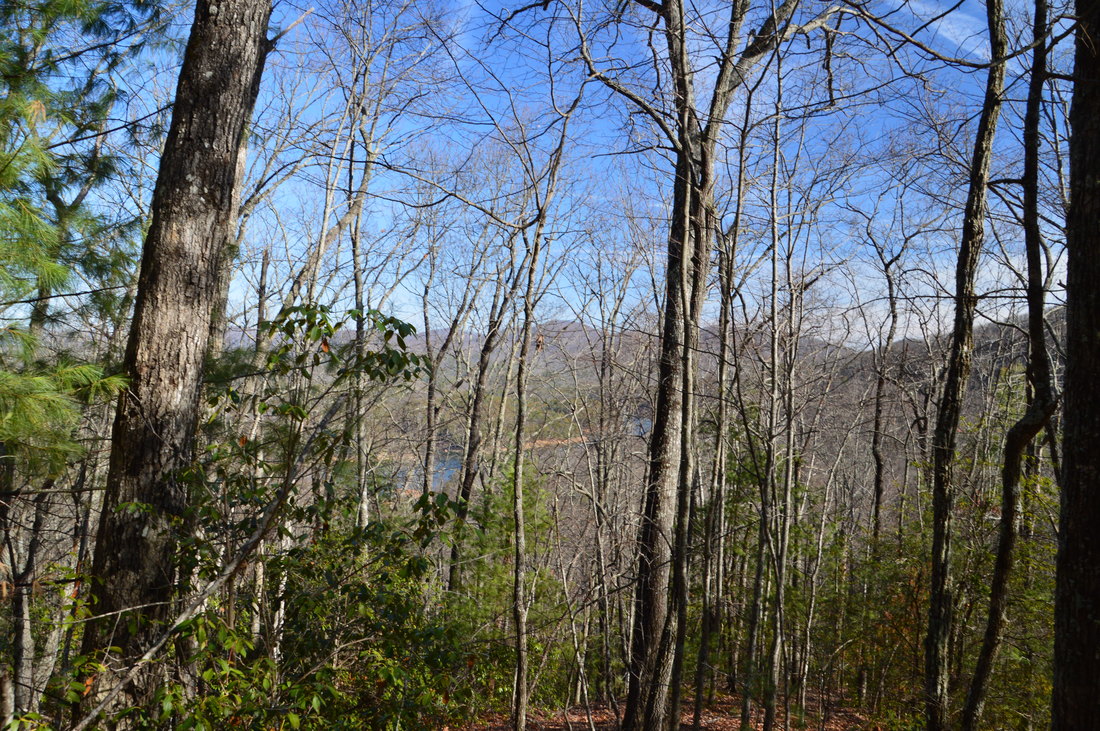
The Blue Ridge area is not known for hiking trails as well as other parts of north Georgia, due to the heavy development of the area (Blue Ridge has become a popular getaway for folks who own a second home in the area but live most of the time outside of the mountains). The Aska Trail System near Blue Ridge has the longest interconnected set of trails in the region, and in fact, these trails are open to bikers in addition to hikers. The Aska Trails meander across the slopes of Rocky Mountain, Davenport Mountain, and Green Mountain, providing good views when the leaves are off the trees. One of the trails also provides access to the shoreline of 3300-acre Lake Blue Ridge. This hike occurred on Saturday, February 4th, 2017. My plan was to hike the east side of the Long Branch Loop Trail and then the Long Branch Connector Trail to the Green Mountain Trail. From there, I would first hike the Green Mountain Trail east out and back to the Lake Blue Ridge Trailhead, and then, I would hike the Green Mountain Trail west to Deep Gap, looping it with the Lower Green Mountain Trail. I would conclude the hike by retracing my steps along the Long Branch Connector and following the west side of the Long Branch Loop. 

Summary

R/T Length of Trail: 10.5 Miles 
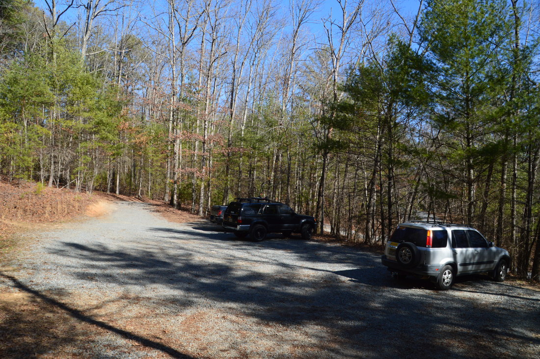
Duration of Hike: 6:00 
Type of Hike: Y-Configuration with Interior Loops 
Difficulty Rating: 5 out of 10 
Total Elevation Gain: 2284 Feet 
Pros: Well-signed trail junctions 
Cons: Mountain biking use can be disruptive; a portion of the Green Mountain Trail passes through a residential area; the upper (north) portion of the Green Mountain Loop is no longer maintained 
Points of Interest: Views of Lake Blue Ridge; Summit of Green Mountain with winter views 
Trail Blaze Colors: Long Branch Trail - Lime Green; Long Branch Connector - Lime Green; Green Mountain Trail - Lime Green (and Yellow Diamonds) 
Best Seasons to Hike: Winter 
Fees: None 
Beginning Point: Long Branch Trailhead 
Directions from Blue Ridge, GA: From the intersection of Old US 76 and Aska Road in Blue Ridge, follow Aska Road South for 5.9 miles. Then, turn left onto Shady Falls Road, and continue for 0.1 miles to the signed gravel parking area at the Long Branch Trailhead to the left. 

Map

Click ​here for more information and to download this trail map to view in Garmin Basecamp.

Details

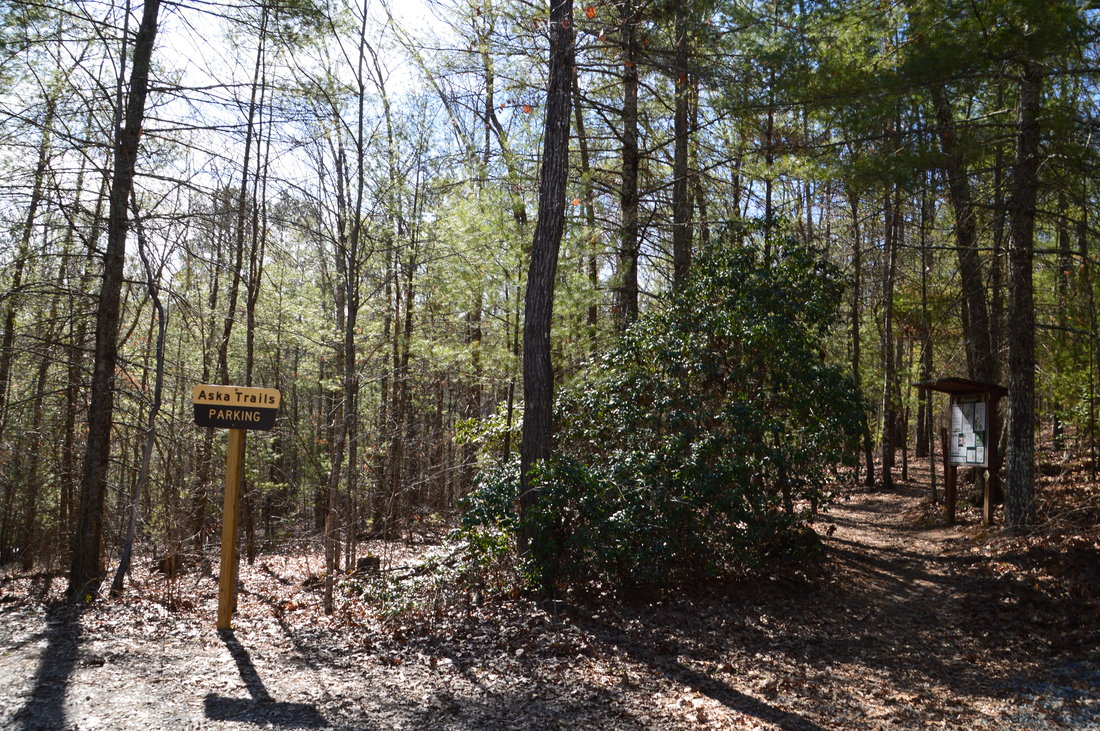
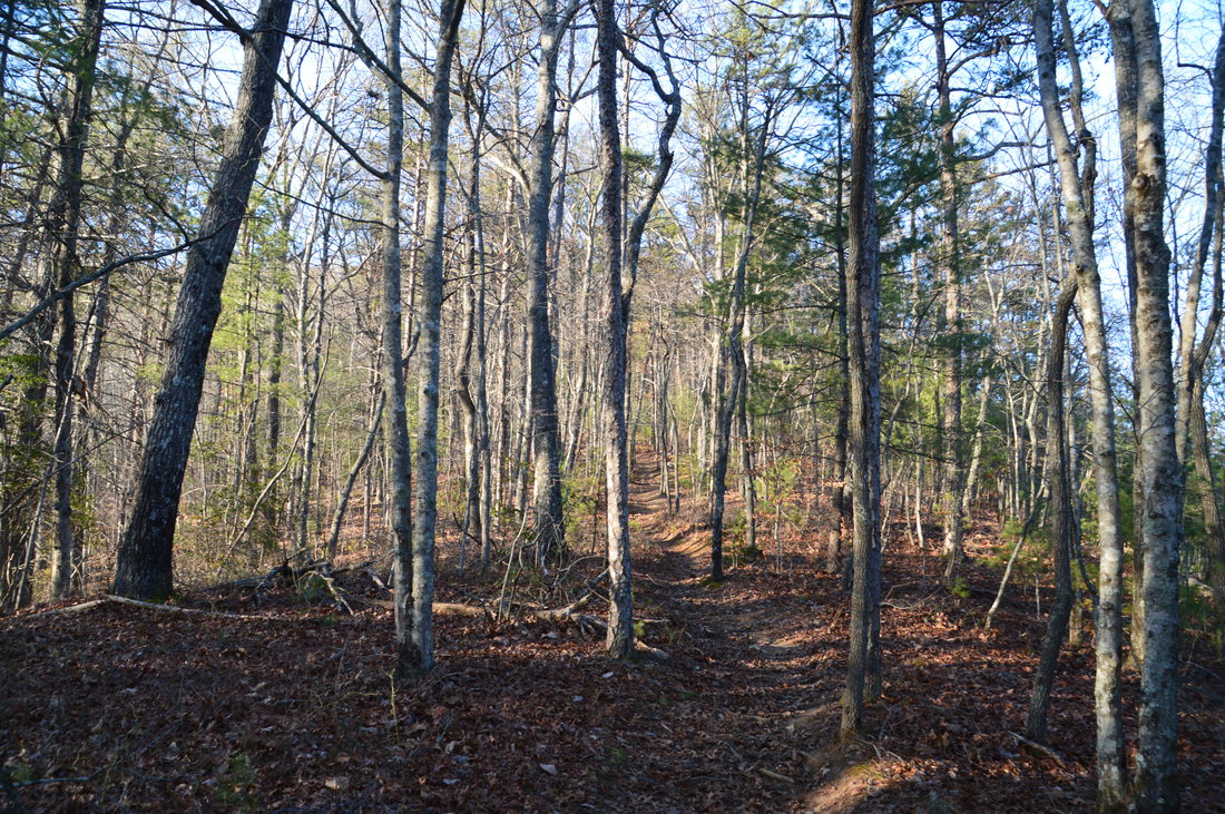
There are many ways to hike the trails in the Aska Trail System, and there are also numerous trailheads. The most common starting point is Deep Gap Trailhead, from where three trails - Green Mountain Trail, Stanley Gap Trail, and Flat Creek Loop - leave. My plan was to make my route more unique by beginning the hike at a less common starting point: Long Branch Trailhead. 

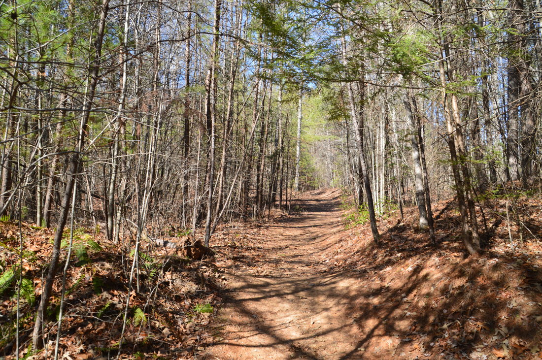
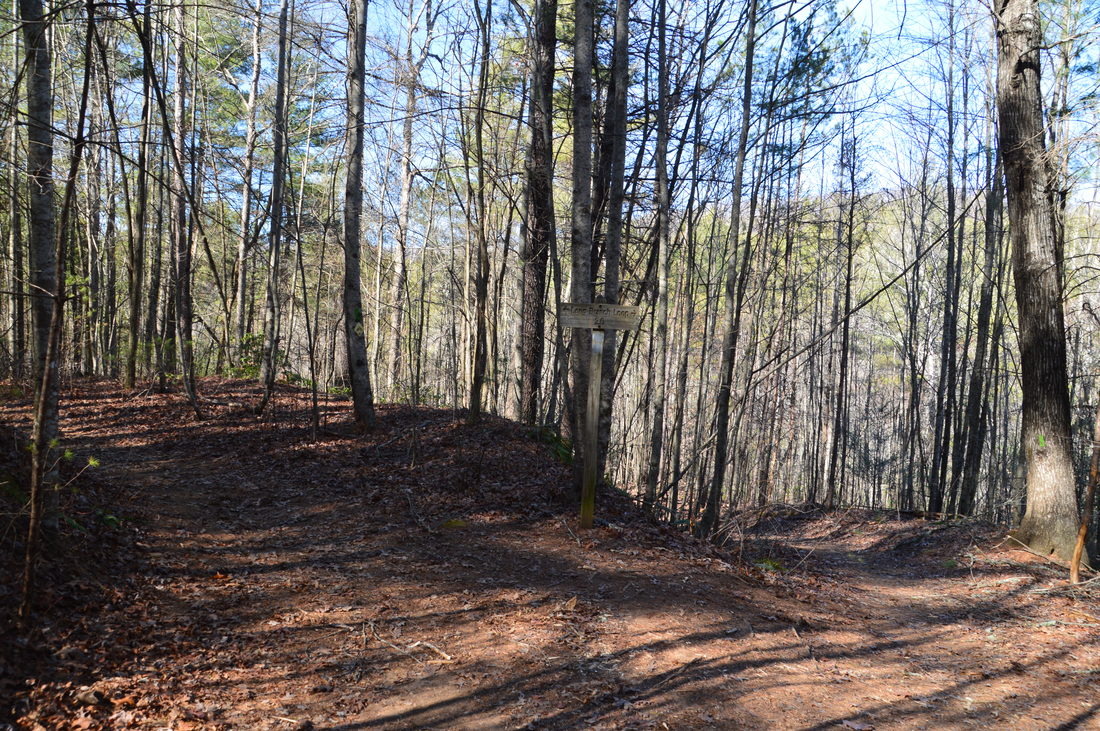
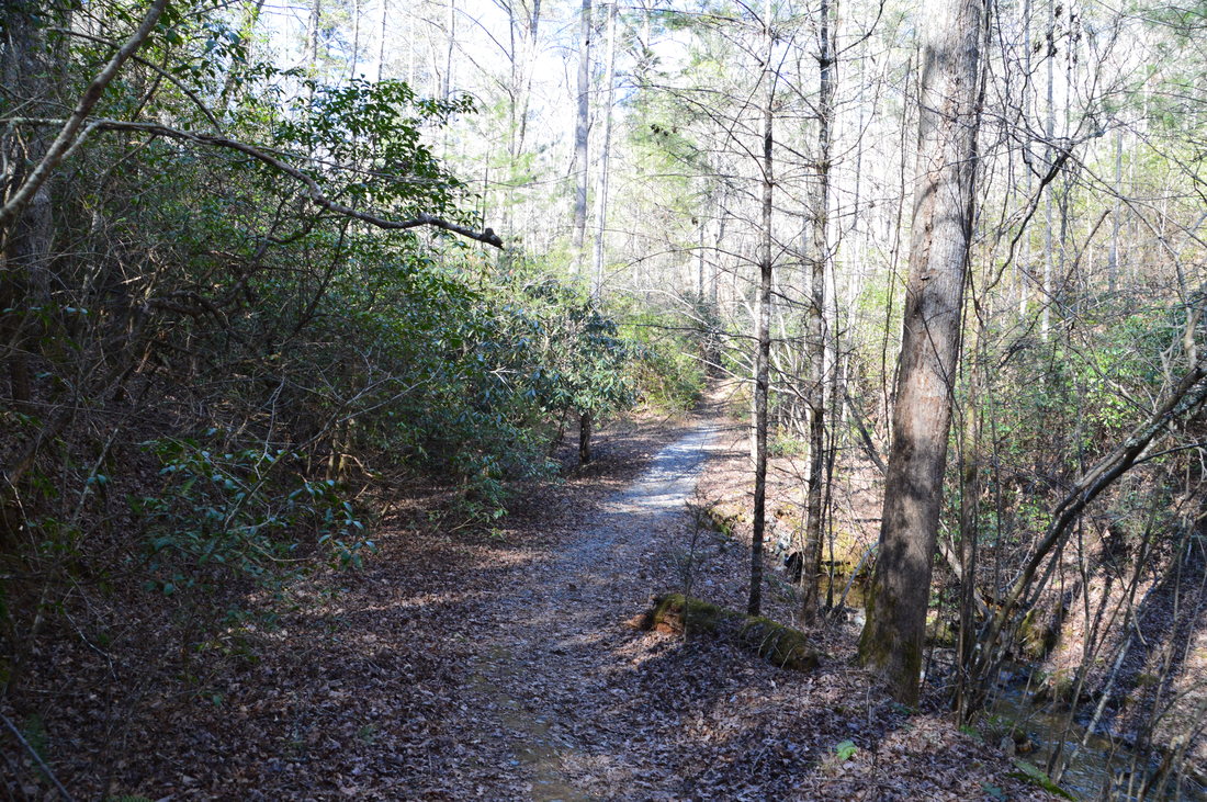
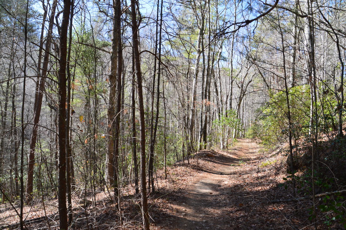
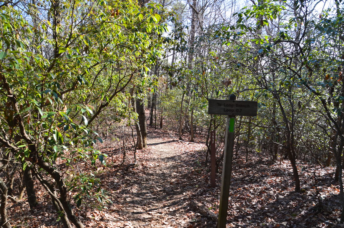
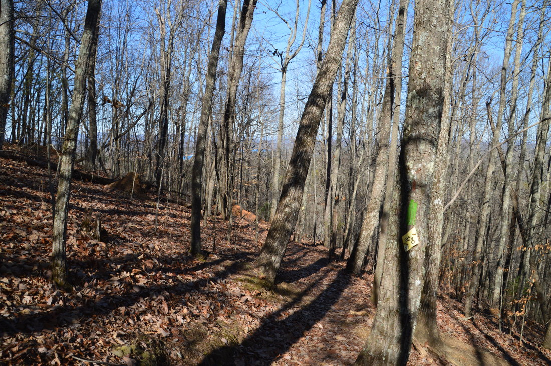
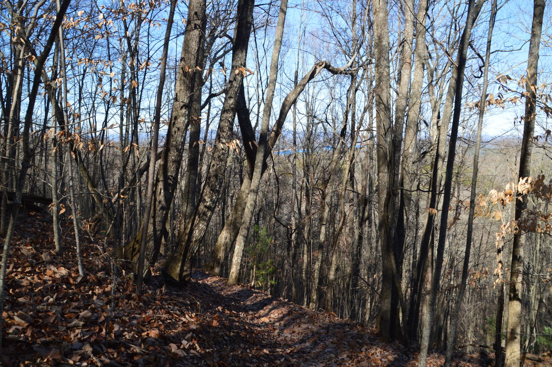
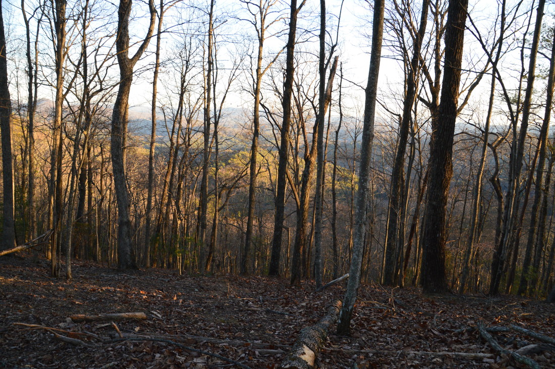
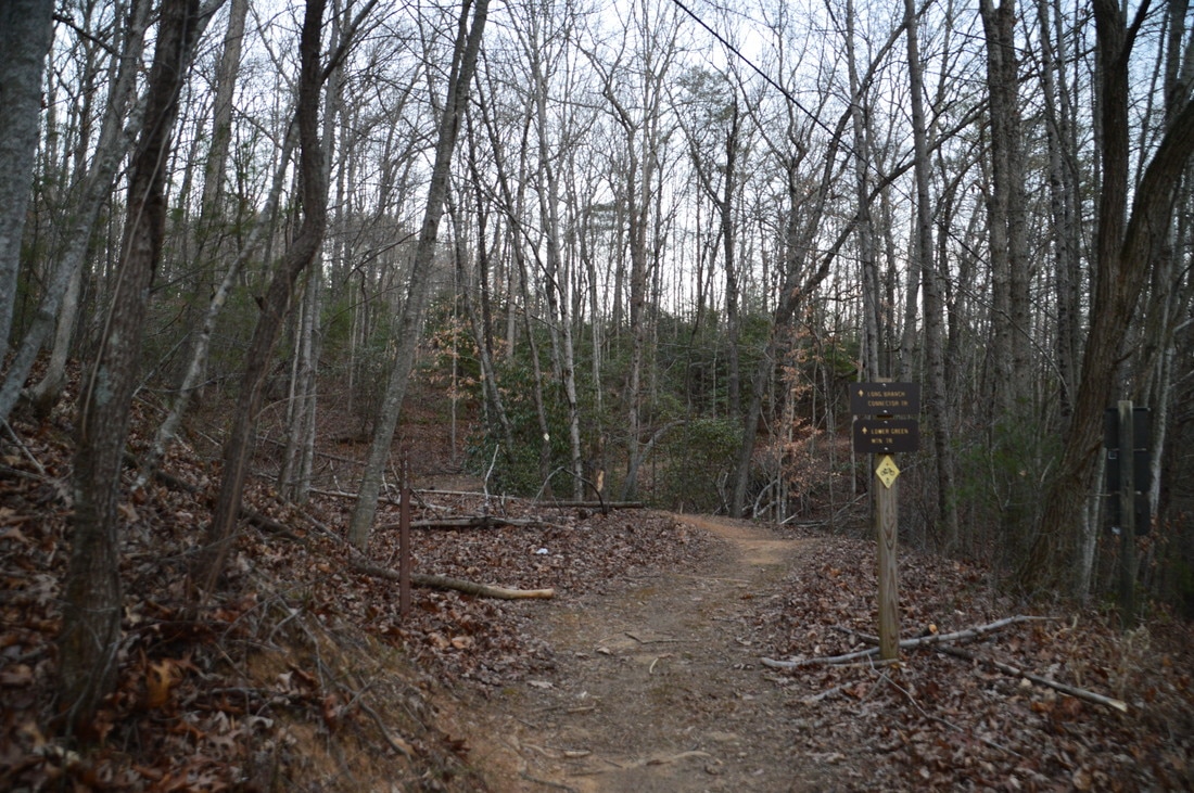
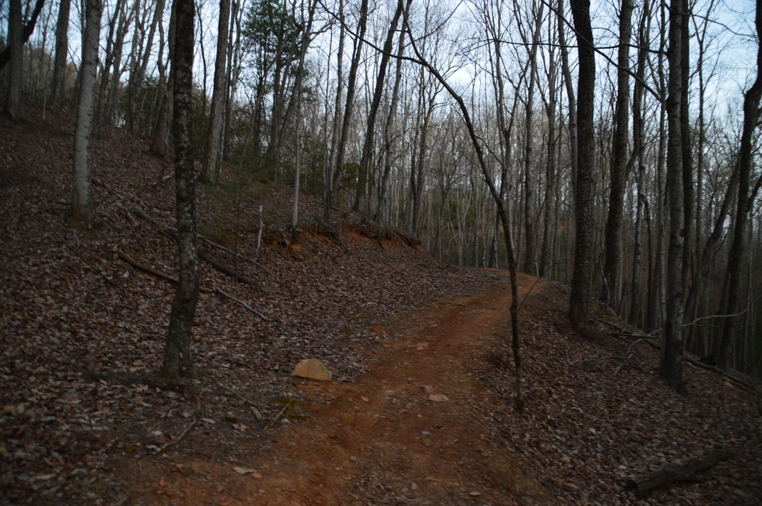
The only trail that leaves the Long Branch Trailhead is the Long Branch Trail.  Pick up the green-blazed trail beside a trailhead kiosk at the far end of the road. Before long, the trail picks up an old roadbed and reaches the signed beginning of the Long Branch Loop at 0.2 miles. To hike the east side of the loop first, bear right and downhill on the well-groomed trail. At 0.4 miles, the trail crosses Long Branch, which is a stream small enough to be culverted under the trail. After this, the trail begins an easy ascent east of Long Branch (generally out of sight of the creek), reaching the junction with the Long Branch Connector Trail at 0.9 miles. The Long Branch Loop bears left, but you'll hike it later; for now, to connect to the Green Mountain Trail, bear right on the connector trail. The connector trail ascends along the lower slopes of Green Mountain at easy to moderate grades, passing through some mountain laurel thickets. The connector trail ends at a signed intersection with the Green Mountain Trail at 1.35 miles. Note that the mileage sign, which indicates that the length of the connector is 0.7 miles, is inaccurate. Turning left on the Green Mountain Trail leads to the summit of Green Mountain and to Deep Gap, whereas turning right on the Green Mountain Trail leads to Lake Blue Ridge. I chose to turn right first. 

After the right turn, follow the Green Mountain Trail northeast and downhill towards Lake Blue Ridge. Initially, some of the best winter views on the hike will be to the right, facing south and east toward the Toccoa River and the south end of Lake Blue Ridge. At around 1.6 miles, there is also a great winter view northeastward, with portions of Lake Blue Ridge visible through the trees. After this, the trail descends into a residential area, where it appears that the trail is under conservation easement. At 1.8 miles, the trail crosses a forest road that leads to a large cabin, and then, the trail descends below the cabin, to the left of another cabin, and to a paved residential road at 1.85 miles. Pick up the trail across the road as it passes right next to and to the left of a third cabin, leaving the residential area shortly thereafter. 
Picture
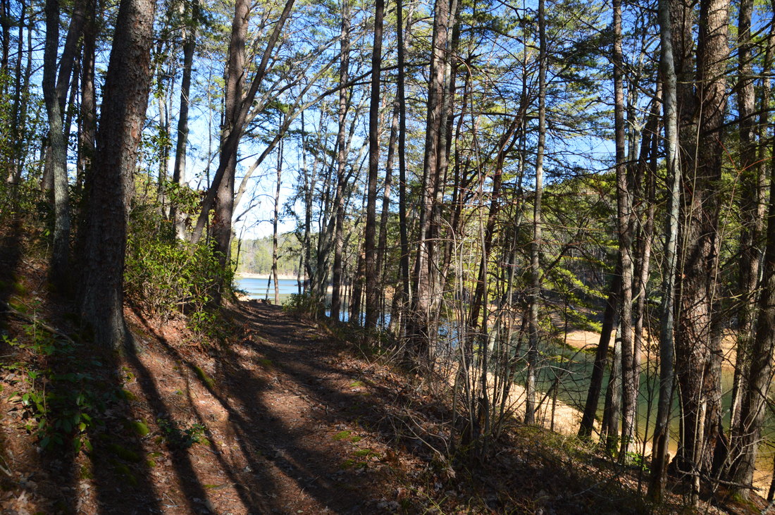
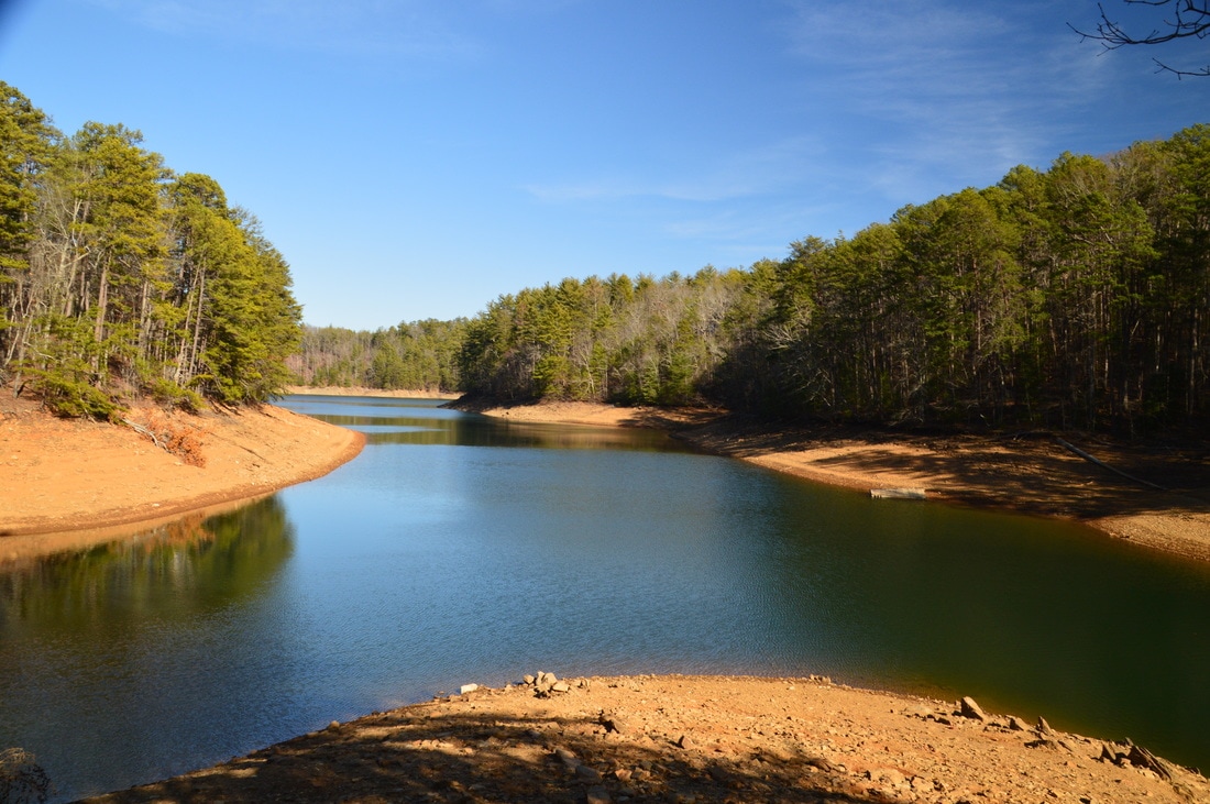
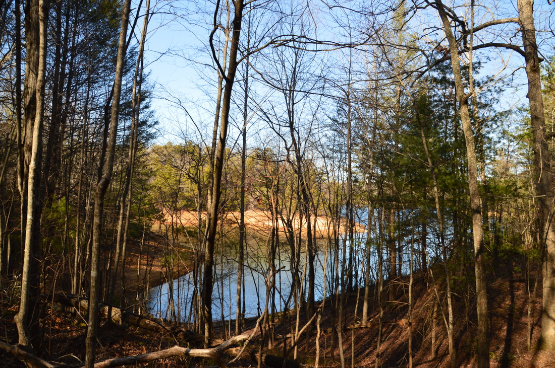
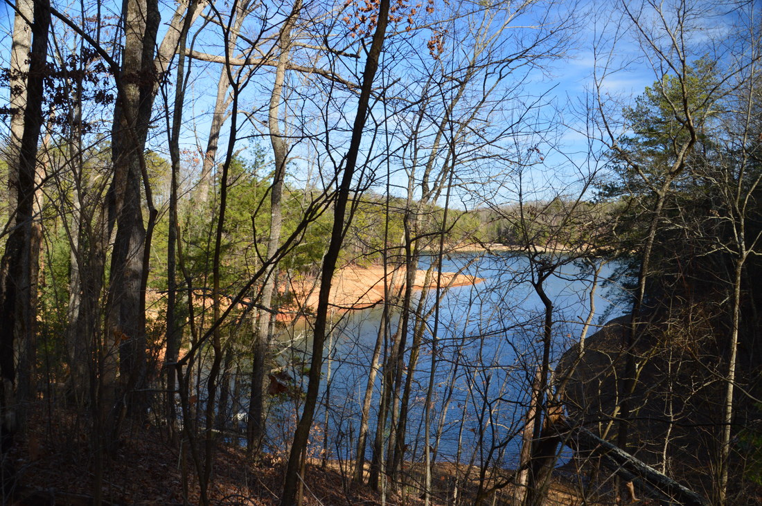
There are several views of Lake Blue Ridge throughout the lower portion of the Green Mountain Trail.
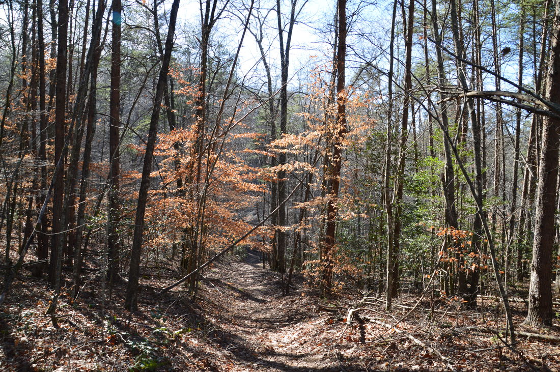
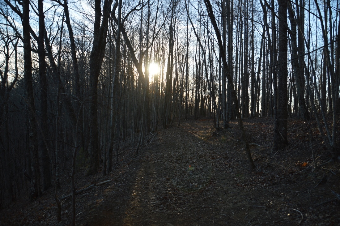
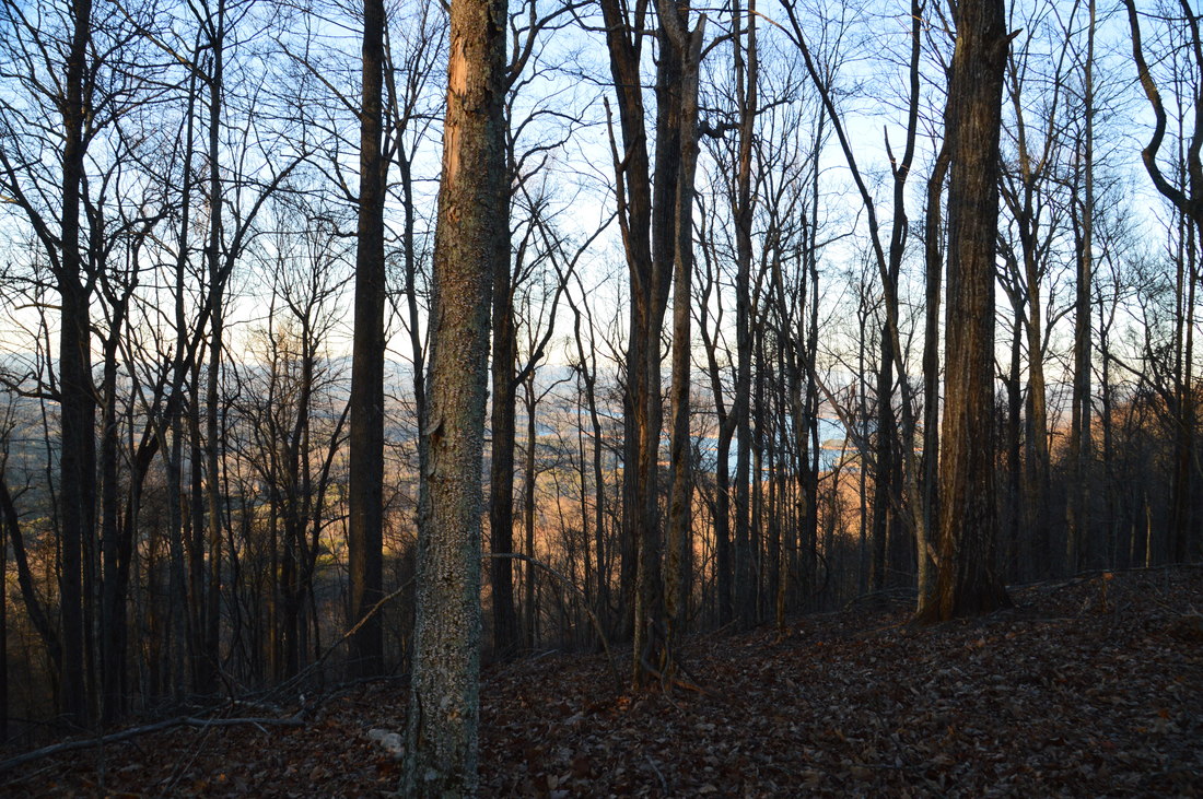
The trail follows a low ridge and then begins a moderate descent to Lake Blue Ridge at 2.2 miles. The descent ends at 2.5 miles, where the trail crosses a small stream. There are views of a finger of Lake Blue Ridge to the right. Next, the trail bears right and crosses an ATV road as an access trail to FS Road 711 goes straight. At 2.7 miles, the Green Mountain Trail reaches a campsite and a notable open view of Lake Blue Ridge at the meeting point of two lake fingers. This is the best view of the lake on the hike. After this, the trail meanders over small hills and in and out of drainages that feed into various fingers of the lake. Following several more lake views through the trees, the Green Mountain Trail ends at its lower (north) trailhead at FS 711 at 3.6 miles. There is room for several cars here, but this trailhead is used a lot less than any of the other trailheads for the Aska Trail System. 

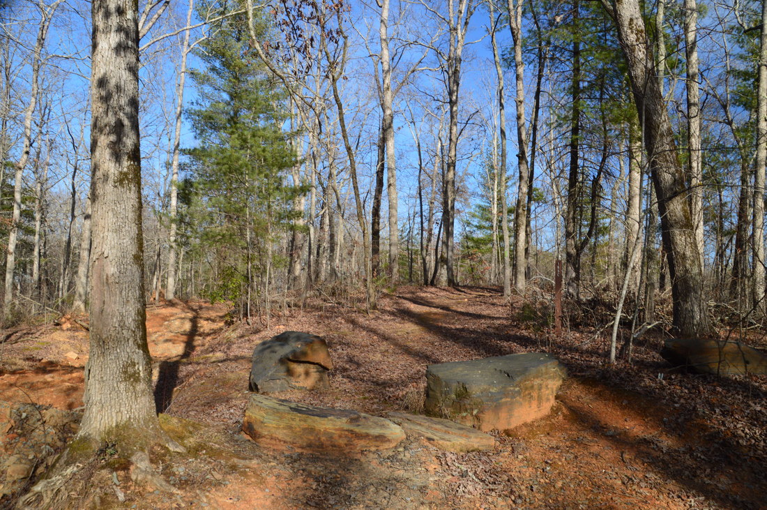
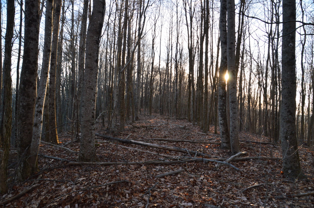
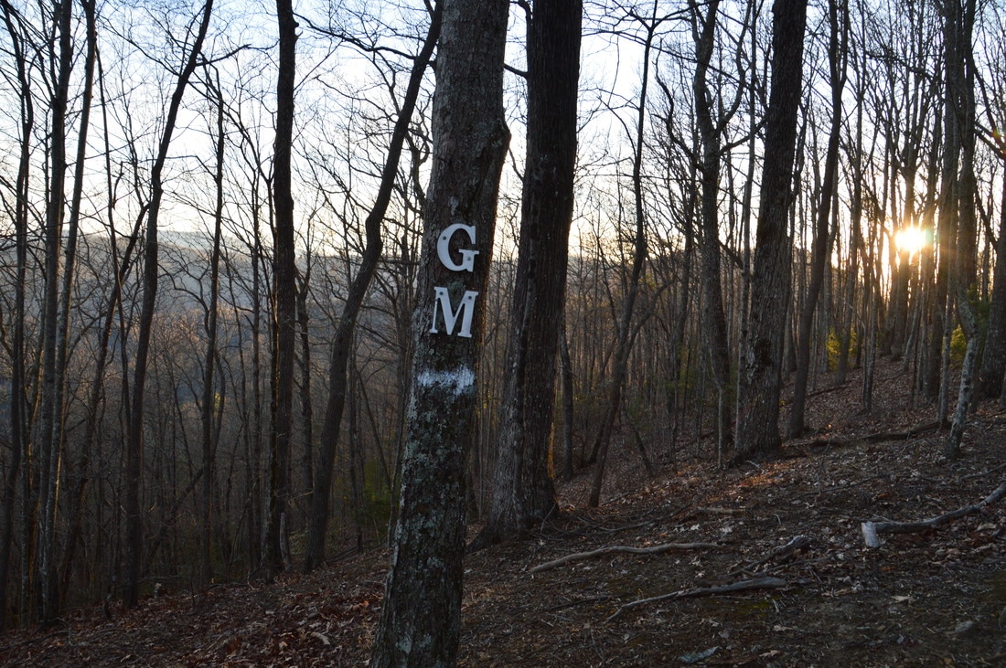
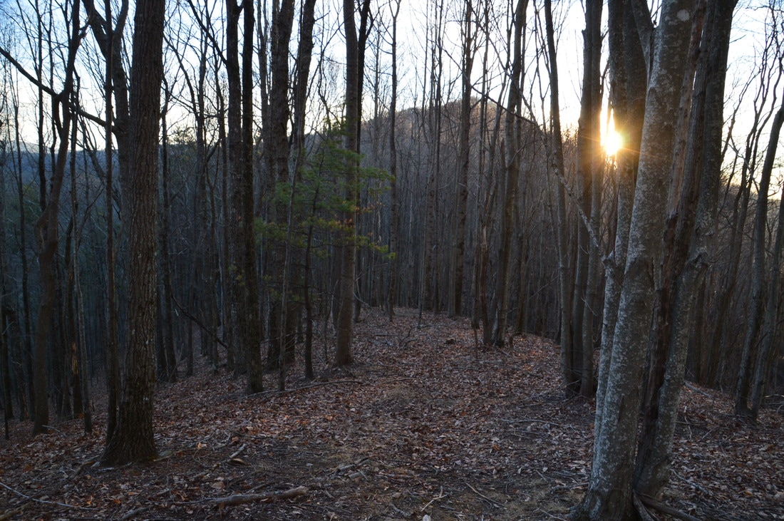
The end of the Green Mountain Trail is a good place to turn around; retrace your steps to the Long Branch Connector Trail junction, returning to it at 5.85 miles. If you're feeling like getting a few more miles in, continue straight on the Green Mountain Trail, ascending towards Green Mountain. The ascent becomes rather steep for a short period of time, before becoming easier towards the top of the ridge. At 6.35 miles, where the trail reaches the top of the ridge, there is an intersection. Here, the Lower Green Mountain Trail bears left and downhill, while the abandoned Upper Green Mountain Trail bears right. Even though it is no longer maintained, I still suggest hiking the Upper Green Mountain Trail at least to the summit of Green Mountain, from where there are great views both northward and southward in winter. I am not sure of the reason for the closure of the Upper Green Mountain Trail, although I suspect it might be due to private property concerns near Deep Gap. To hike to Green Mountain, pick up the abandoned Upper Green Mountain Trail, which follows the spine of the ridge westward. There are some trees felled across the trail, but the ridge is easily followed. Some old white blazes seem to mark the route to the top of Green Mountain. 

At 6.45 miles, the trail passes over a small knob. The letters "GM" are nailed to a tree on the knob. While these letters may stand for Green Mountain, this is not the true summit. Continue following the spine of the ridge, reaching the true summit of Green Mountain at 6.7 miles. In summer, there are few views from this point, but in winter, the views are fairly good. To the right (north), a portion of Lake Blue Ridge is visible far below. A "Green Mt" sign marks the summit. You will also know you're at the summit, when you see a thermometer attached to a tree at the summit (if the thermometer is still there). From the summit, there is also a good view of Davenport Mountain rising up ahead. 
Picture
In winter, there are good views both northward and southward from the summit of Green Mountain.
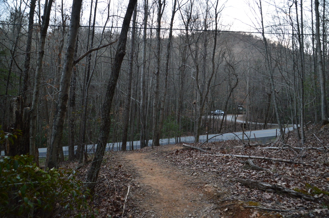
You can simply retrace your steps from the summit of Green Mountain - in fact, that is what I recommend doing - but it is also possible to continue to Deep Gap and then hike back along the Lower Green Mountain Trail. if you do so, make sure to avoid private property on the ridge near Deep Gap. Hiking toward Deep Gap, it is best to follow the ridge for about another quarter-mile, after which you should simply bushwhack (or try to locate the old trail) south-southwest down the slope of Green Mountain, without approaching the houses that are visible up on the ridge. If you follow this route, you'll reach Deep Gap and Aska Road at about 7.15 miles. The Deep Gap parking area is across the road, but to continue the hike, turn left onto the wide Lower Green Mountain Trail. This trail follows an old roadbed back up to the Upper Green Mountain Trail junction, ascending at an easy grade the entire time. You'll return to the junction at 8.2 miles. Here, continue straight on the Green Mountain Trail to the Long Branch Connector, and then follow the connector trail back down to the Long Branch Loop at 9.15 miles. 

To spice up the return route a bit, turn right onto the Long Branch Loop to hike its west side. The trail descends to and crosses Long Branch via a footbridge at 9.25 miles. On the other side of the creek, a brief ascent brings the trail to the same old roadbed that the trail followed closer to the Long Branch Trailhead. From this point onward, the trail follows the nearly level and mostly nondescript roadbed southward all the way to the end of the loop, closing the loop at 10.3 miles. From here, simply continue southward on the final leg of the Long Branch Trail, reaching the trailhead and concluding the hike at 10.5 miles. 

Mileage

0.0 - Long Branch Trailhead 
2.7 - Lake Blue Ridge Viewpoint 
3.6 - Lake Blue Ridge Trailhead 
6.7 - Green Mountain 
7.15 - Deep Gap Trailhead
10.5 - Long Branch Trailhead

Variations

Hike out and back to Green Mountain from Long Branch Trailhead (including both sides of Long Branch Loop) - 4.85 Miles 
Hike out and back to Green Mountain from Lake Blue Ridge Trailhead - 6.2 Miles
There are other hiking variations and possibilities in the Aska Trail System. The Aska Trails Map is a great tool for planning a hike here. 

Bonus Stops

One of the more notable points of interest along the Aska Trail System is Fall Branch Falls. This double-tier 30-foot waterfall is accessed from Stanley Creek Road via an easy half-mile hike along the Benton Mackaye Trail. 

Pictures

Videos

2 Comments
Malcolm Campbell
3/11/2017 07:37:27 am

This is awesome. I did much of this hike some years ago....I need to head back after reading this blog. Great job!

-Malcolm

Reply
Bart
6/1/2020 03:28:24 pm

This is a great post. I was just there. Love the upper green mountain portion but agree to turn back as there is no real path once you reach the houses. But makes for great walk. People you meet are friendly and yet not overly populated.

Reply


Leave a Reply.

    About Me

    Mark Oleg Ozboyd
    I'm an avid outdoor explorer and a hobbyist landscape photographer. I'm 21 years old and have been hiking since 2011. Originally based out of Atlanta, Georgia, I started out by occasionally hiking short trails throughout well-known Georgia State Parks. During 2012 and 2013, I began to expand my trips into adjacent states, as well as into the wilder National Forest areas rather than just State Parks. Throughout the years that followed, as I slowly ran out of popular hiking trails in my area, I began to search for and hike in more seldom-visited areas. Today, you can find me out in the woods every weekend, whether it's on an official trail or bushwhacking through cross-country terrain without any paths. I now attend Washington & Lee University and am exploring Virginia and West Virginia. My other hobbies include chess, science, old music, and meteorology. I have 3 years of amateur weather forecasting experience, having studied a lot of meteorology basics over the years. I am also a student at European School of Music where I learned that music and nature have a lot in common. Listening to good music inspires me to capture nature's beauty on the camera in different aspects that also make me recall many beautiful music pieces that I've heard.​


    Dear readers: I have invested a tremendous amount of time and effort in this website and the Georgia Waterfalls Database the past five years. All of the work that has gone in keeping these websites updated with my latest trip reports has almost been like a full-time job. This has not allowed me to pick up a paid job to save up money for college, and therefore, I I've had to take out loans. If you find the information on this website interesting, helpful, or time-saving, you can say "thanks" and help me out by clicking the button above and making a contribution. I will be very grateful for any amount of support you give, as all of it will apply toward my college tuition. Thank you! 

    Enter your email address to subscribe for trail reports:

    Delivered by FeedBurner


    Picture
    Coming in 2022-2023?

    Other Hiking Websites

    DWHike's Adventures
    Florida's Natural Wonders
    Florida Trailblazer
    Meanderthals
    Mountain Images
    by Bernie Boyer

    North Carolina Waterfalls with
    ​Kevin Adams
    Take-a-Hike!
    Tennessee Landforms
    Waterfall Page
    Waterfall Adventurer
    Zach's Mild Adventures

    Miles Hiked

    Year 1: 540.0 Miles
    Year 2: 552.3 Miles
    ​Year 3: 518.4 Miles
    Year 4: 482.4 Miles
    Year 5: 259.9 Miles

    Archives

    March 2021
    February 2021
    January 2021
    November 2019
    October 2019
    September 2019
    August 2019
    July 2019
    June 2019
    February 2019
    January 2019
    December 2018
    November 2018
    October 2018
    August 2018
    July 2018
    June 2018
    May 2018
    April 2018
    March 2018
    February 2018
    January 2018
    December 2017
    November 2017
    October 2017
    September 2017
    August 2017
    July 2017
    June 2017
    May 2017
    April 2017
    March 2017
    February 2017
    January 2017
    December 2016
    November 2016
    October 2016
    September 2016
    August 2016
    June 2016
    May 2016
    April 2016
    March 2016
    January 2016
    December 2015
    November 2015
    October 2015
    September 2015
    August 2015
    July 2015
    June 2015
    May 2015
    April 2015
    March 2015
    February 2015
    January 2015
    December 2014
    November 2014
    October 2014
    September 2014
    August 2014
    July 2014
    June 2014
    May 2014
    April 2014
    March 2014
    February 2014

    Categories

    All
    Adel
    Adirondack Park
    Alabama
    Alfred A. Ring Park
    Allegheny Trail
    Amicalola Falls State Park
    Anniston Area
    Apalachicola Bluffs And Ravines Preserve
    Apalachicola National Forest
    Apalachicola/Port St. Joe Area
    Apopka
    Appalachian Trail
    Appling
    Art Loeb Trail
    Aska Trail System
    Bakersville
    Balm-Boyette Scrub Preserve
    Balsam Lake Recreation Area
    Bankhead National Forest
    Bartow County Parks
    Bartram Trail
    Basinger
    Beersheba Springs
    Benton
    Benton Mackaye Trail
    Berry College Trail System
    Best Hike
    Big South Fork National Recreation Area
    Black Bear Wilderness
    Black Rock Mountain State Park
    Blairsville
    Blakely
    Blood Mountain Wilderness
    Blowing Rock
    Blue Ridge
    Blue Ridge Parkway
    Boone
    Bradenton
    Bradenton Beach
    Brasstown Bald
    Brasstown Wilderness
    Brevard
    Bryson City
    Buchanan
    Bucks Pocket State Park
    Bulow Creek State Park
    Bulow Plantation Ruins State Park
    Caesars Head State Park
    Caladesi Island State Park
    Calhoun
    Camel's Hump State Park
    Cashiers
    Caspersen Beach Park
    Catfish Creek State Park
    Caves
    CC Putnam State Forest
    Cedar Point Environmental Park
    Chatsworth
    Chattahoochee National Forest
    Chattanooga
    Chattanooga Valley
    Chattooga National Wild And Scenic River
    Cheaha Wilderness
    Cherohala Skyway
    Cherokee
    Cherokee National Forest
    Chiefland Area
    Chillhowee Recreation Area
    Chipley
    Chunky Gal Trail
    Circle B Bar Reserve
    Citico Creek Wilderness
    Citrus Wildlife Management Area
    Clarkesville
    Clayton
    Cleevland
    Cleveland
    Cloudland Canyon State Park
    Cohutta Wilderness
    Collier-Seminole State Park
    Cordele
    Cornelia
    Covington
    Crestview Area
    Crew-land-and-water-trust
    Cullowhee
    Cumberland Trail
    Dahlonega
    Dalton
    Dawson Forest Wildlife Management Area
    Dawsonville
    Dayton
    De Soto National Memorial
    DeSoto State Park
    Dillard
    Double Springs
    Ducktown
    Duncan Ridge Trail
    Dunlap
    Eagle's Rest Park
    Eastpoint
    Econfina Creek Wildife Management Area
    Eglin Air Force Base
    Elizabethton
    Elkins
    Elk Knob Game Lands
    Elk Park
    Ellicott Rock Wilderness
    Ellijay
    Emerson Point Preserve
    Englewood Area
    Enota Retreat
    Erwin
    Falling Waters State Park
    Fayetteville
    Fires Creek Recreation Area
    Fire Tower
    Flint River
    Florence Area
    Florida
    Florida Caverns State Park
    Florida Trail
    Foothills Trail
    Fort Mountain State Park
    Fort Myers Area
    Fort Payne
    Fort Payne Area
    Fort Yargo State Park
    Franklin
    Franklin Delano Roosevelt State Park
    Franklin-Marion State Forest
    Frozen Head State Park
    Gainesville
    Gainesville Area
    Gatlinburg
    George Washington National Forest
    Georgia
    Georgia Veterans Memorial State Park
    Glasgow
    Gorges State Park
    Grandfather Mountain State Park
    Great Smoky Mountains National Park
    Greeneville
    Green River Game Lands
    Gruetli-Laager
    Grundy Forest State Natural Area
    GTM Reserve
    Guana River Wildlife Management Area
    Hayesville
    Helen
    Hiawassee
    High Falls State Park
    Highlands
    Highlands Scenic Highway
    Hillsborough River State Park
    Hinson Conservation & Recreation Area
    Historic Sites
    Honeymoon Island State Park
    Hot Springs
    Huntington
    Inverness Area
    Jackson
    Jasper
    Jefferson National Forest
    Joan M. Durante Park
    Jonathan Dickinson State Park
    Jones Gap State Park
    Joyce Kilmer Slickrock Wilderness
    Joyce Kilmer - Slickrock Wilderness
    Juniper Prairie Wilderness
    Kelly Park
    Keown Falls Recreation Area
    Kolomoki Mounds State Park
    LaFayette
    Lake City Area
    Lake George Wild Forest
    Lake June-in-Winter State Park
    Lakeland Area
    Lake Placid
    Lake Russell Wildlife Management Area
    Lake Wales Ridge State Forest
    Laurel Fork North Wilderness
    Leffis Key Preserve
    Leon Sinks Geological Area
    Lexington
    Lineville
    Linville
    Linville Gorge Wilderness
    Lithia Springs
    Little Frog Wilderness
    Little Manatee River State Park
    Little River Canyon National Preserve
    Longboat Key
    Long Trail
    Lookout Mountain
    Lookout Mountain Battlefield
    Lovingston
    Lula Lake Land Trust
    Lumpkin
    Maggie Valley
    Manatee Springs State Park
    Marianna Area
    Mark Trail Wilderness
    Marlinton
    Mccaysville
    McMinville
    Mentone
    Middlesex
    Mistletoe State Park
    Monongahela National Forest
    Montreat
    Mountain Bridge Wilderness Area
    Mountain City
    Mountains To Sea Trail
    Mountains-to-Sea Trail
    Mount Rogers National Recreation Area
    Myakka River State Park
    Myron B. Hodge City Park
    Nantahala National Forest
    Naples
    Naples Area
    Natural Bridge State Park
    Neal Preserve
    New Castle
    Newport
    New River Gorge National Park
    New York
    North Carolina
    Ocala Area
    Ocala National Forest
    Ocean-to-Lake Trail
    Oconee State Park
    Oconee Station Historic Site
    Okaloacoochee Slough State Forest
    Oldsmar
    Oneida
    Orlando Area
    Ormond Beach
    Oscar Scherer State Park
    Oxford
    Palatka
    Palmetto Trail
    Panama City Area
    Panthertown Valley
    Parrish
    Paynes Creek Historic State Park
    Peaks Of Otter Recreation Area
    Pigeon Crockford Mountain Wildlife Management Area
    Pigeon-Crockford Mountain Wildlife Management Area
    Pigeon-Crockford Wildlife Management Area
    Pine Mountain
    Pinhoti Trail
    Pinnacle Park
    Pisgah Civitan Park
    Pisgah National Forest
    Pittman Center
    Pond Mountain Wilderness
    Ponds/Lakes
    Prentice Cooper State Forest
    Providence Canyon State Park
    Pumpkintown
    Quick Point Nature Preserve
    Raven Cliffs Wilderness
    Reed Bingham State Park
    Reliance
    Rice Creek Conservation Area
    Riverview Pointe Preserve
    Robbinsville
    Robinson Preserve
    Rock Creek Gorge Scenic Area
    Rock Island State Park
    Rome
    Rosman
    Sale Creek
    Salem
    Salt Springs
    Saluda
    Santa Rosa Beach
    Sarasota
    Sarasota Area
    Savage Gulf State Natural Area
    Scenic Views
    Scottsboro Area
    Sebring Area
    Sewanee
    Sheltowee Trace Trail
    Shining Rock Wilderness
    Signal Mountain
    Sipsey Wilderness
    Sky Valley
    Smithgall Woods State Park
    Snowbird Backcountry Area
    Soddy Daisy
    Soddy-Daisy
    Sopchoppy
    South Carolina
    South Cumberland State Park
    Southeastern Cave Conservancy
    Southern Nantahala Wilderness
    Sparta
    Sprewell Bluff Park
    Spring City
    Spring Hill
    Springs
    Spruce Pine
    Standing Indian Backcountry Area
    St. Augustine
    St. George Island State Park
    St. Joseph Bay State Buffer Preserve
    St. Marks Area
    St. Marks National Wildlife Refuge
    Stone Mountain
    Stone Mountain Park
    Suches
    Sumatra
    Sumter National Forest
    Suwannee River
    Swallow Creek Wildlife Management Area
    Sweetwater Creek State Park
    Sylva
    Talladega National Forest
    Tallahassee Area
    Tallulah Falls
    Tallulah Gorge State Park
    Tampa Bay Area
    Tate City
    Tate's Hell State Forest
    Tea Creek Wildlife Management Area
    Tellico Plains
    Tennessee
    Thomaston
    Toccoa
    Topsail Hill State Park
    Torreya State Park
    Townsend
    Tracy City
    Tray Mountain Wilderness
    Trenton
    Triple Creek Preserve
    Troutdale
    Unaka Mountain Wilderness
    Upper Tampa Bay County Park
    Venice
    Vermont
    Virgin Falls State Natural Area
    Virginia
    Virginia Outdoors Foundation
    Vogel State Park
    Wakulla Springs State Park
    Waleska
    Walhalla
    Wartburg
    Water Features
    Waynesville
    Weedon Island Preserve
    Weeki Wachee Preserve
    Wekiwa Springs State Park
    West Palm Beach Area
    West Virginia
    Whitehall
    White Springs
    Winder
    Withlacoochee State Forest
    Young Harris

    RSS Feed

TRAIL REPORTS

Hikes in Alabama
​Hikes in Florida
Hikes in Georgia
Hikes in North Carolina
Hikes in South Carolina
Hikes in Tennessee
Hikes in Virginia

Hiking Resources

Alabama Resources
​
Florida Resources
Georgia Resources
North Carolina Resources
​South Carolina Resources
​
Tennessee Resources

Other

Contact
Map of Hikes
Alphabetical List of Hikes
Southeast Nature Society
© COPYRIGHT 2014-2018
​ALL RIGHTS RESERVED.
Important: I disclaim any responsibility for any damage or personal injury that may occur as a result of the activities and information found on this website. All outdoor activities, especially off-trail hiking, are done at your own risk. Never hike or head into that area that may be above your fitness or experience level.
  • Home
  • Trail Reports
    • Best Hikes
    • Hikes with Scenic Views
    • Hikes with Water Features
    • Alabama
    • Georgia
    • Florida
    • North Carolina
    • South Carolina
    • Tennessee
    • Vermont
    • Virginia
  • Map
  • Hike List
  • Testimonials
  • Resources
  • Contact Us
  • Southeast Nature Society
    • Our Team
  • Georgia Waterfalls Database