Tray Mountain Wilderness: Waterfalls of Left Fork of Soquee River and Wolfpen Branch, Helen, Georgia5/9/2017 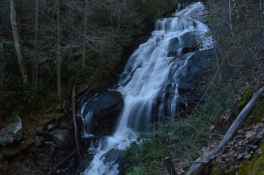
The southeast quadrant of the Tray Mountain Wilderness is home to the headwaters of the Soquee River. Numerous streams join to form the West, Middle, and East Prongs of the Left Fork of the Soquee River, and it is likely that all of the streams have undocumented waterfalls. The grandest of them all is the middle waterfall on the Left Fork: a powerful and remote multi-tier 75-foot waterfall with surprisingly easy access. On the hike to this waterfall, you will also visit the smaller but beautiful lower waterfall and have the options of visiting bonus waterfalls, such as Wolfpen Branch Falls and the upper waterfall on the Left Fork of the Soquee River. This hike occurred on Saturday, April 8th, 2017. My plan was to scout out the easiest route to the biggest waterfall on the Left Fork of Soquee River, described below.
Summary
R/T Length of Trail: 3.6 Miles
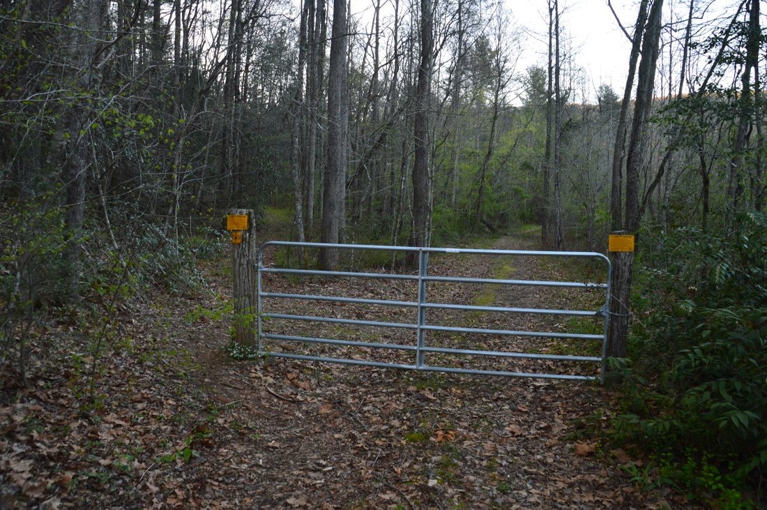
Duration of Hike: 2:30 Type of Hike: Out and Back Difficulty Rating: 3 out of 10 Total Elevation Gain: 430 Feet Pros: The waterfalls of the Left Fork Soquee River have good flow year-round Cons: The path to the waterfalls is faint in places Points of Interest: Lower Falls on Left Fork Soquee River - 5 stars; Middle Falls on Left Fork Soquee River - 10 stars; Wolfpen Branch Falls (optional side trip) - 4 stars Trail Blaze Colors: None Best Seasons to Hike: Spring Fees: None Beginning Point: Chimney Mountain Flats Trl Trailhead at Left Fork Soquee River Bridge Directions from Helen, GA: From the intersection of GA 356 and GA 75 north of downtown Helen, follow GA 356 east for 9.3 miles, and then, turn left onto Chimney Mountain Flats Trail. Continue on the road for 0.6 miles to the trailhead, which will be on the right immediately after a bridge across the Left Fork Soquee River. There is a gated forest road at the trailhead area, which has space for a few cars. Map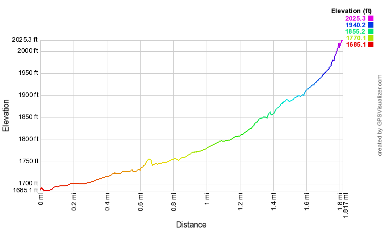
Note: The elevation profile above and the downloadable track below are for the one-way hike only.
Click here to download a track of this hike. Details
The details of my Left Fork Soquee River excursion are quite interesting. Having been led to believe that the approach from Chimney Mountain Flats Trl is a high-difficulty bushwhack, I decided to access the waterfalls via a supposedly easier route from FS Road 166 off Goshen Mountain Road. This turned out to be a mistake, as the hike was anything but easy, involving a steep bushwhack into the Wolfpen Branch valley and then one of the hardest segments of hiking that I've ever done, scrambling over and crawling under dozens of downed trees on the old road along Wolfpen Branch. At the Left Fork Soquee River, I ran into a trail of sorts, which I followed to the waterfalls, but on my way back, I decided to make a risky move: I decided to follow the "trail" downstream and see if it would come out at Chimney Mountain Flats Trl without passing through private land. I was pleasantly surprised when I was able to follow the trail all the way to the road and entirely through National Forest land, and when I reached the road, I walked a series of roads for several miles back to my car.
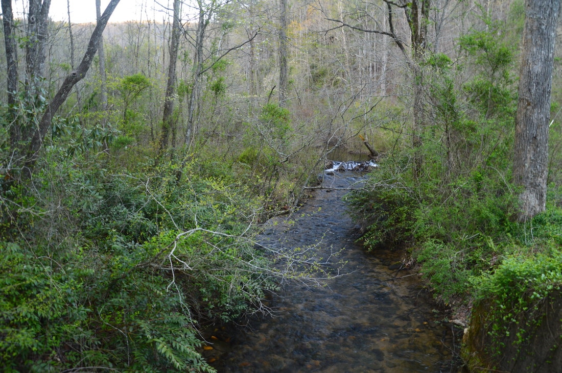
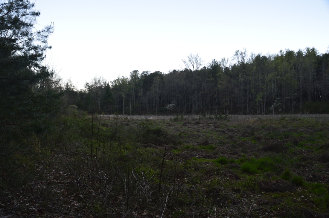
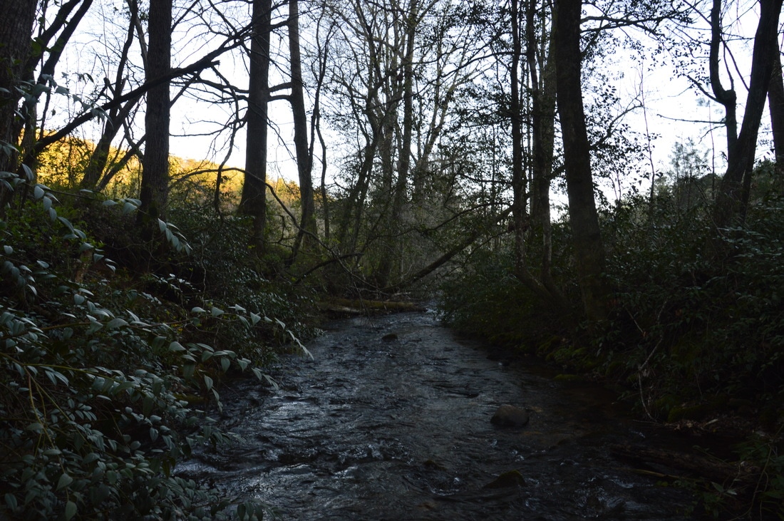
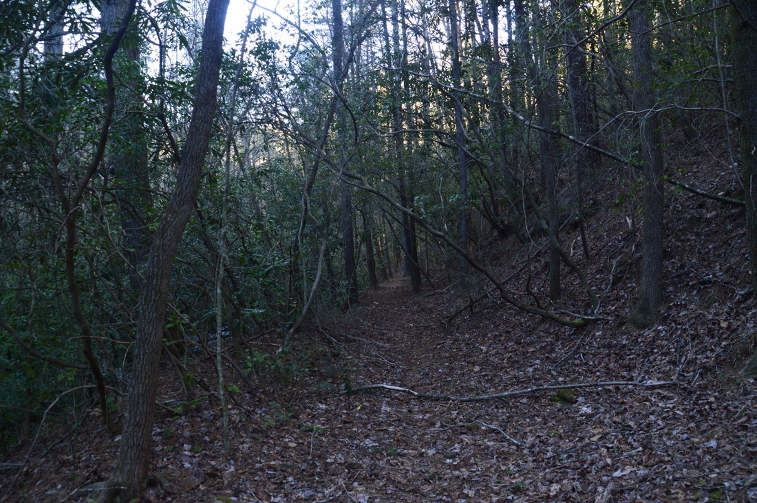
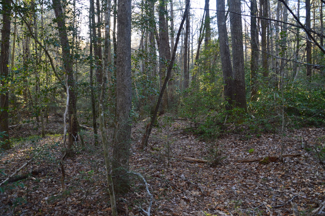
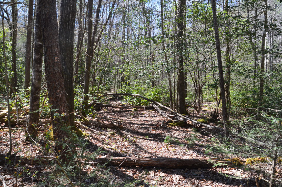
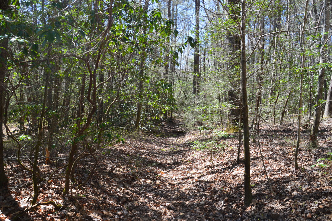
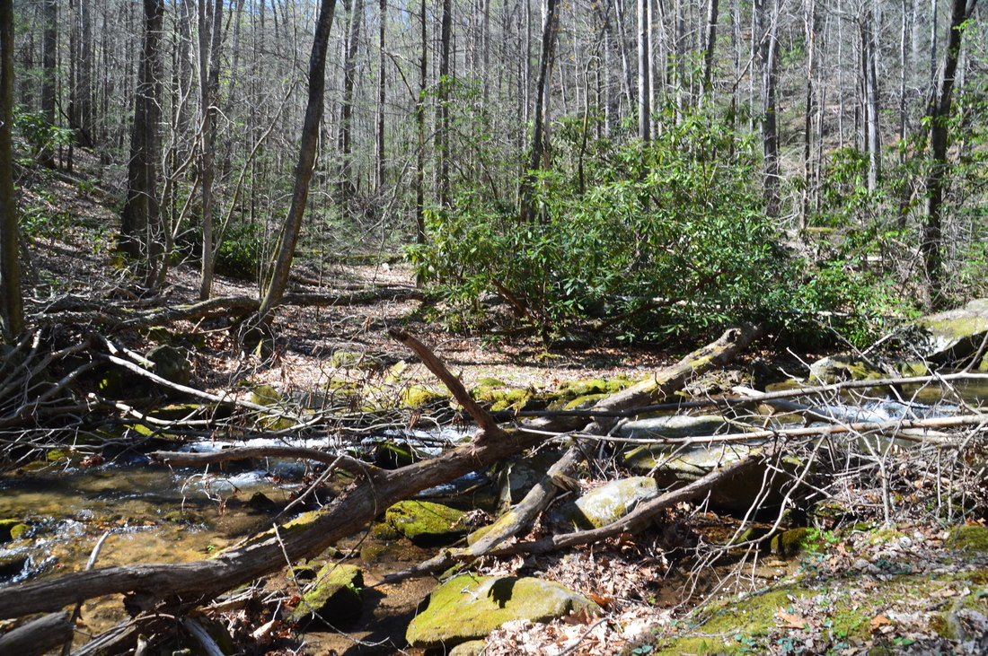
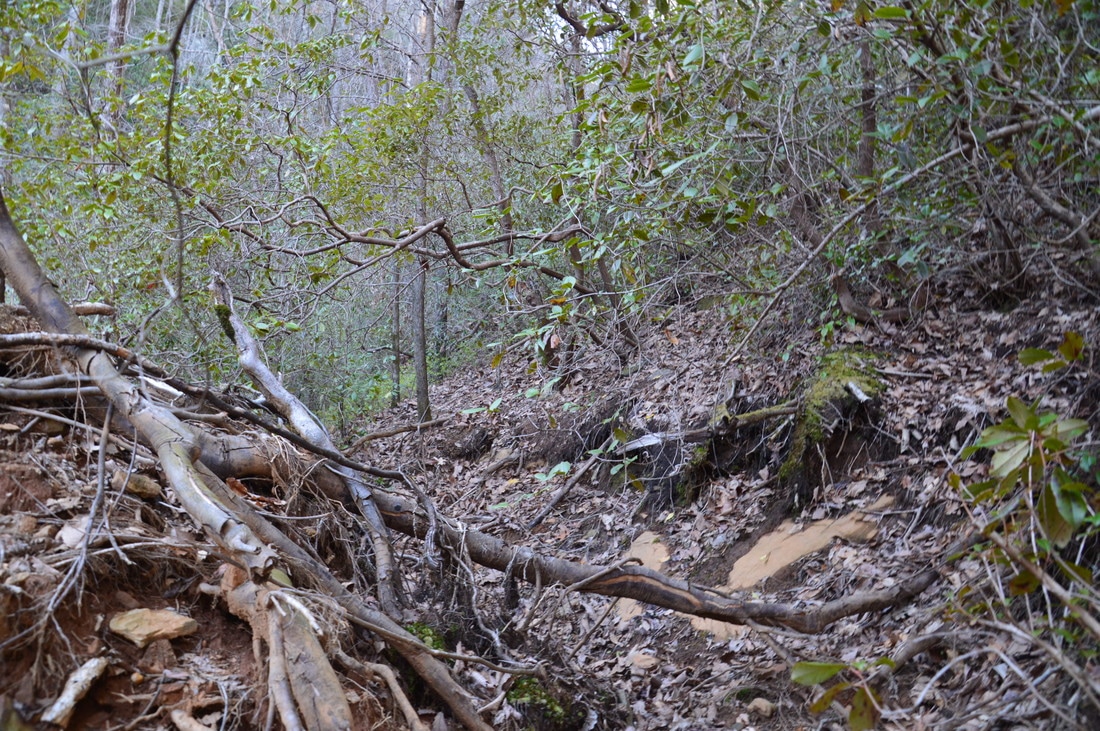
For the sake of simplicity, I am not going to describe the hike the way I did it - as I would not recommend my initial route to anyone - and instead, I will describe the quite easy route along the trail that I utilized on my way back, from Chimney Mountain Flats Trl to the waterfalls. Farther below in this trail report, there is a separate section regarding the difficult side trip along Wolfpen Branch to Wolfpen Branch Falls. The hike to the waterfalls of the Left Fork Soquee River begins at the gate next to the road bridge at the trailhead. Walk around the gate and begin following upstream the wide forest road that is on the right (do not take the narrower road that bears left). The flat road ends at a wildlife clearing that is 0.2 miles from the trailhead. This clearing can become an overgrown mess in the warmer months and can be a bit tricky to get around. I suggest turning right and following the southeast edge of the clearing to the Soquee River, and then following the northeast edge of the clearing upstream along the river. At the far end of the clearing, pick out a path that continues upstream for a few feet and then descends into a muddy gully. Turn right here and ford the Soquee River at 0.35 miles. Note the interesting tall banks of the river, which are uncommon for Southern Appalachian rivers. Today, this ford was below the waist, but it has potential to be deeper. On the other side of the river, a path leads up the steep bank. From here, hike in a beeline away from the river for about 150 feet until you reach a path that runs parallel to the river, and make sure to not trespass on the private fenced-in field just to the right. Once at the path, turn left and begin following it in the upstream direction (northwestward). Initially, the trail is somewhat faint, but remember to always follow the path of least resistance in the correct upstream direction, as it is always the right track. The trail remains easy and becomes a lot more distinct around 0.5-0.6 miles, as the gorge narrows. Around this point, the trail enters the Tray Mountain Wilderness. It seems that the trail is following an old logging grade here. The Soquee River also begins to take on a mountain character as rapids make their appearance. At 0.85 miles, the trail enters the flats around the confluence of Wolfpen Branch and Soquee River, and at 0.95 miles, the narrow path makes a crossing of Wolfpen Branch. The crossing was dry on this day, but it likely will be wet after heavy rain. The path becomes very faint in the wide flats after the crossing, so once again, the best thing to do is to follow the path of least resistance upstream, and the path will eventually reappear as the gorge narrows again. Also, just after the Wolfpen Branch crossing, an old logging road leaves to the right upstream along Wolfpen Branch. The difficult side trek to Wolfpen Branch Falls, described farther below, is best completed along this route. I suggest that only the most hardcore waterfallers make the side trip. 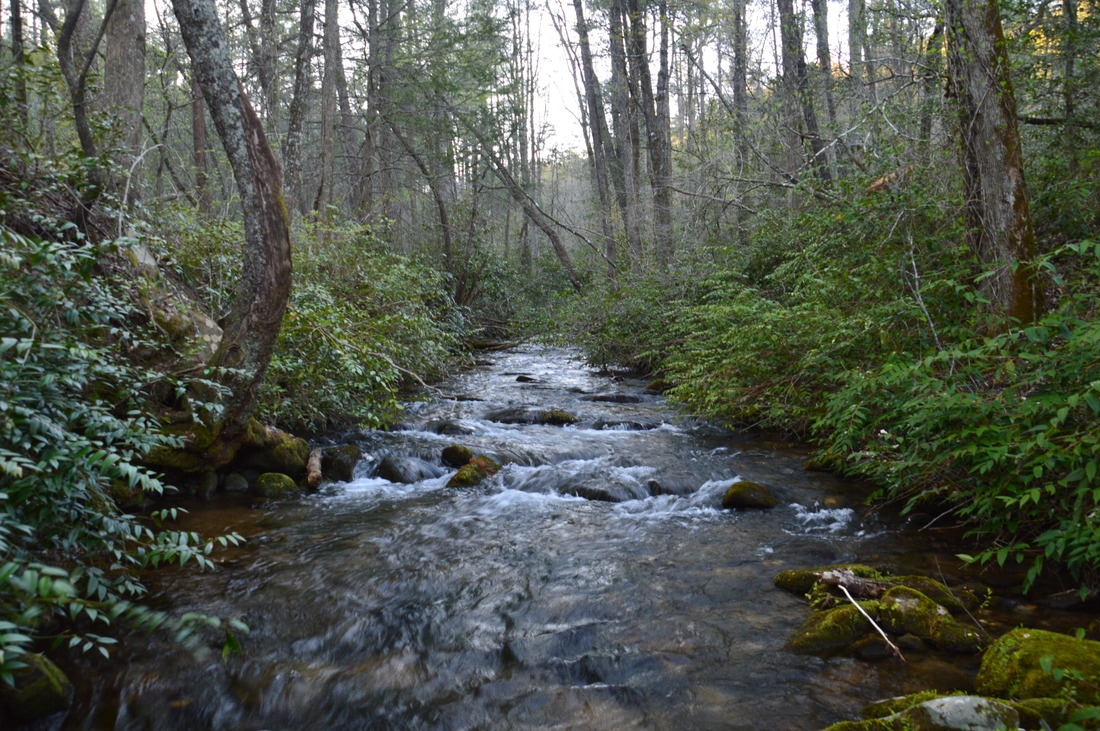
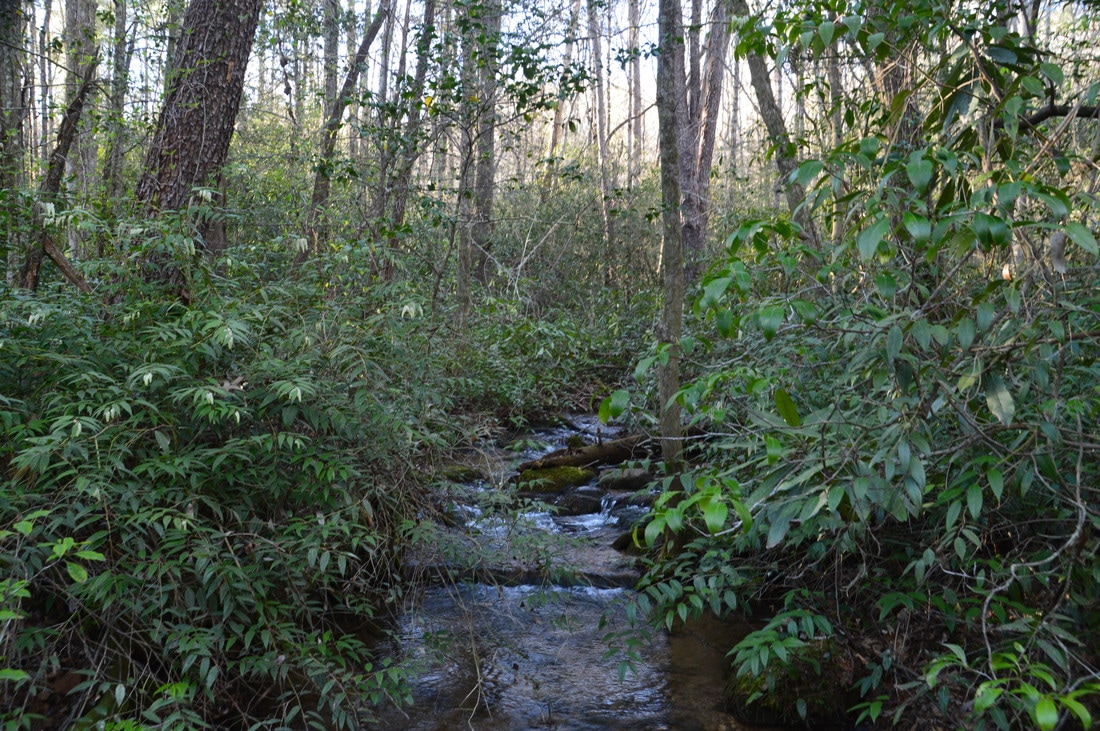
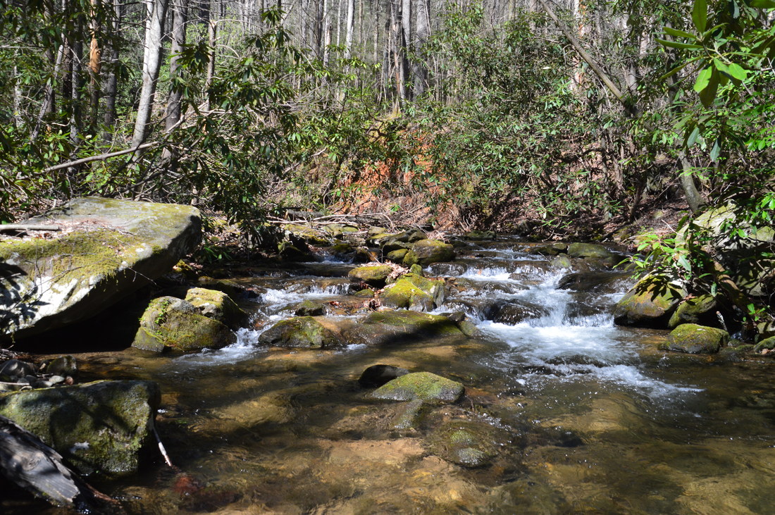
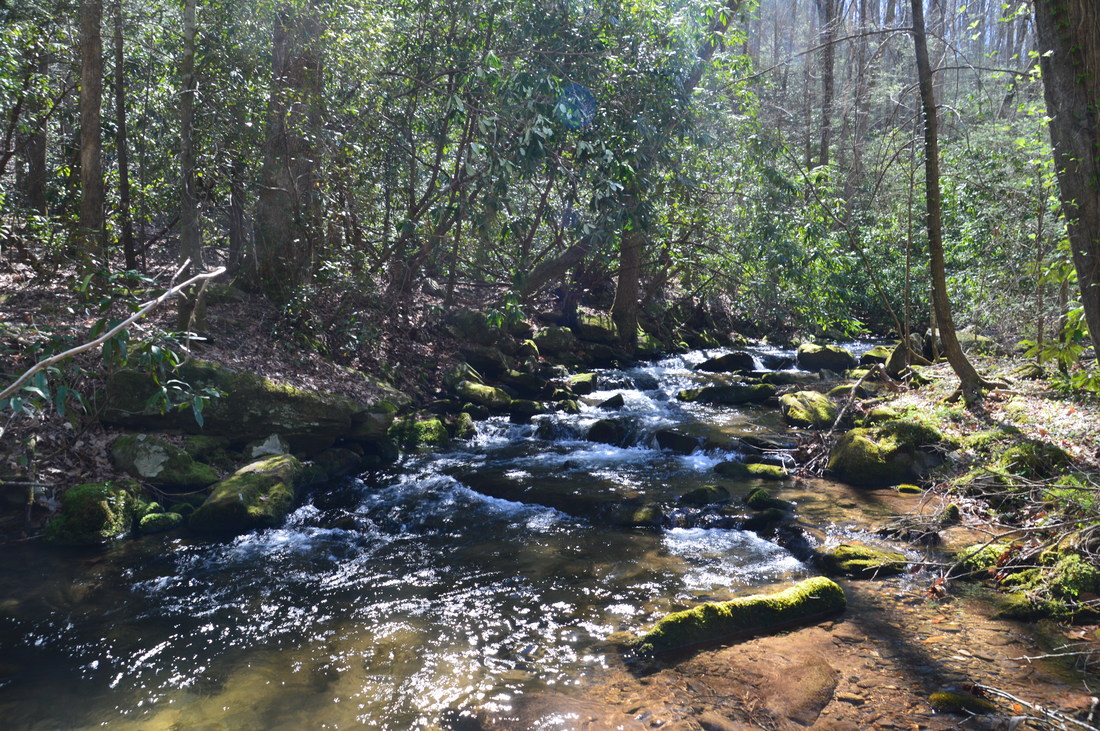
The Left Fork Soquee River is a beautiful mountain waterway that serves as a gateway into one of the most remote regions in Georgia.
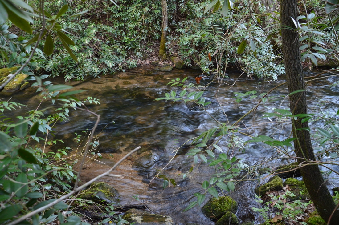
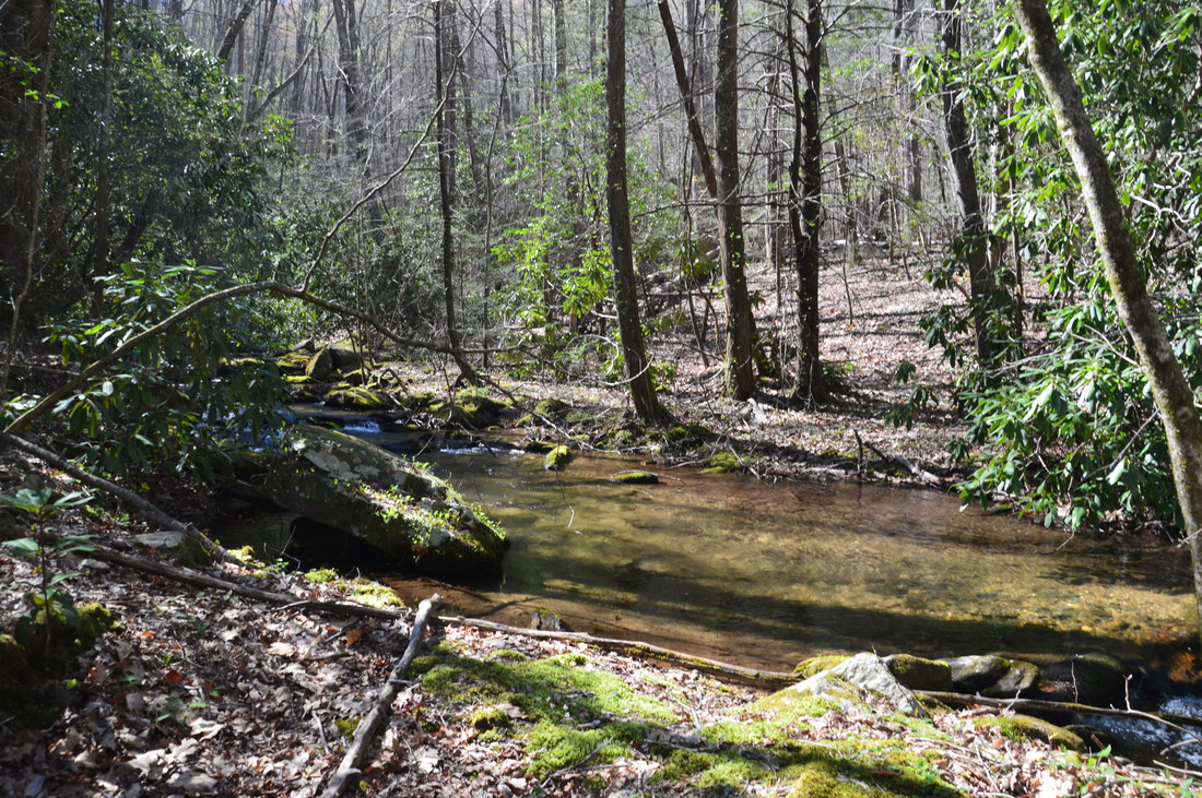
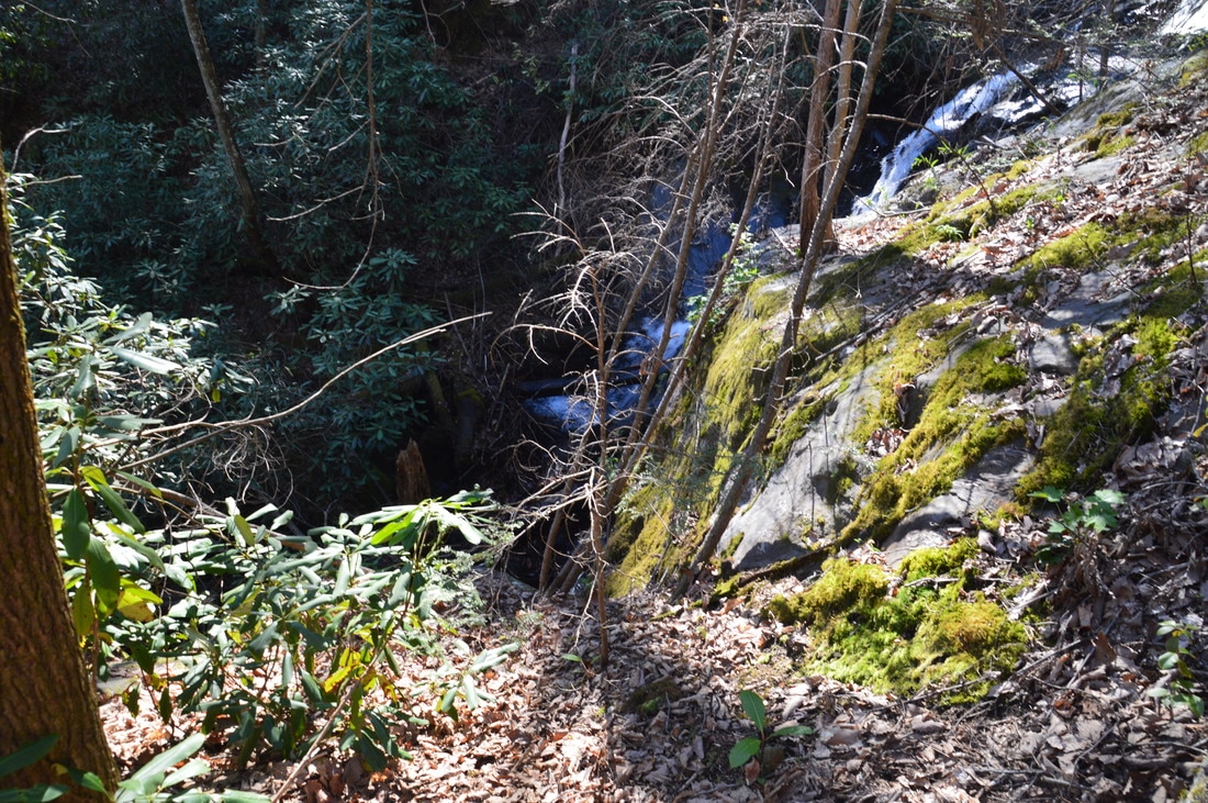
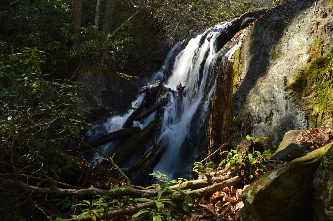
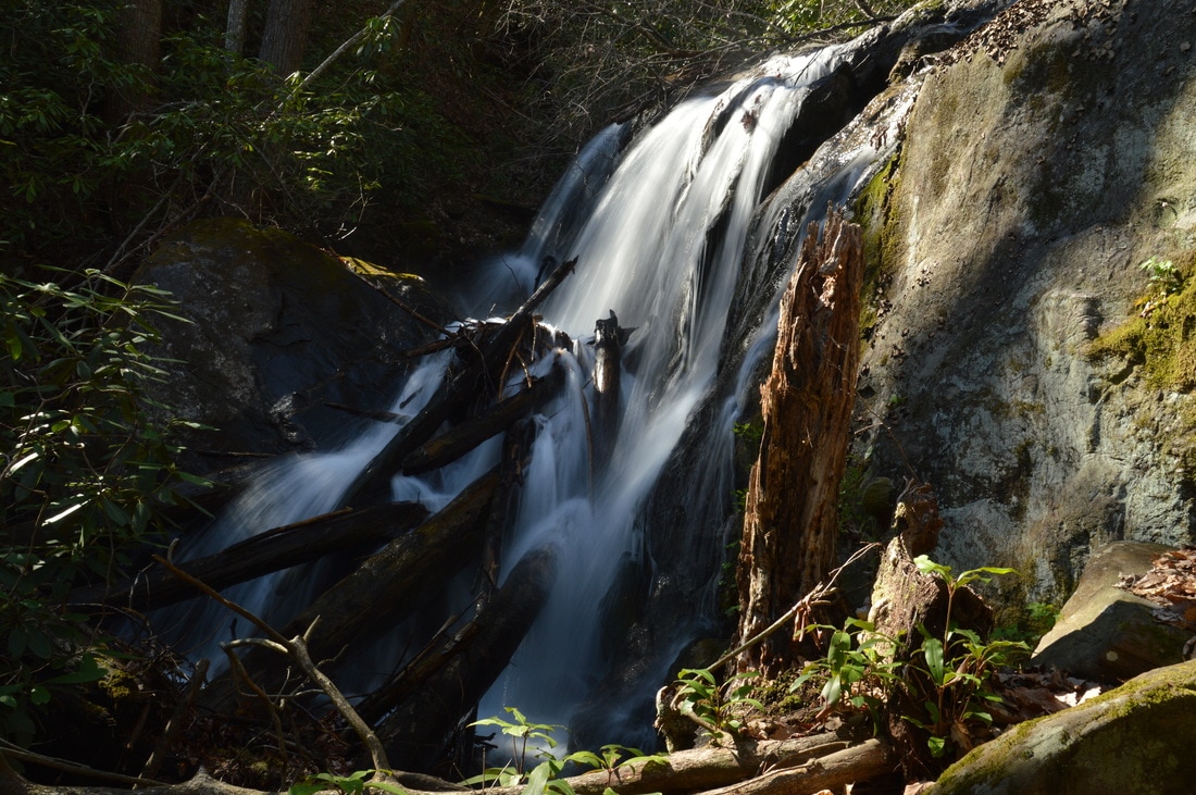
At 1.1 miles, the trail becomes a lot more distinct again, and there are even some signs of past maintenance. At 1.35 miles, there is a disorienting place, as the trail looks like it turns left and crosses the river. However, continue straight and do not cross the river yet. A few dozen feet later, cross a small tributary and then bear right onto the distinct logging road grade, which ascends gently. At 1.55 miles, reach a camping area just to the right of a trail, complete with a relic that appears to be an old moonshine still turned into a trash can. Just ahead is the second ford of the Soquee River, which was around knee-deep on this day. The best crossing point is just to the right of the boulders. On the other side of the river, the route is less distinct but still easy to see, although there is a number of downed trees. Then, at 1.65 miles, make the third and final ford of the Soquee River, just below the confluence of the Middle Prong Left Fork with the South Prong Left Fork. Note that both waterfalls described in this trail report are located on the Middle Prong. This ford was also knee-deep and quite easy. Across the river, the path is not clear but the woods are open. Simply follow the route of least resistance northwest, staying near the river and heading in the direction of the sound of crashing water. At 1.75 miles, reach the Lower Falls (First Falls) on the Left Fork Soquee River. A scramble path leads to the base of this unique 30-foot waterfall, and there is a small flat area near the base.
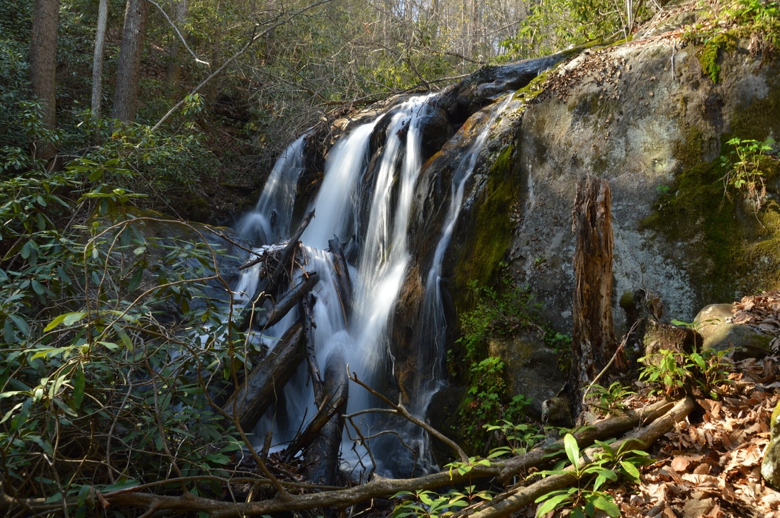
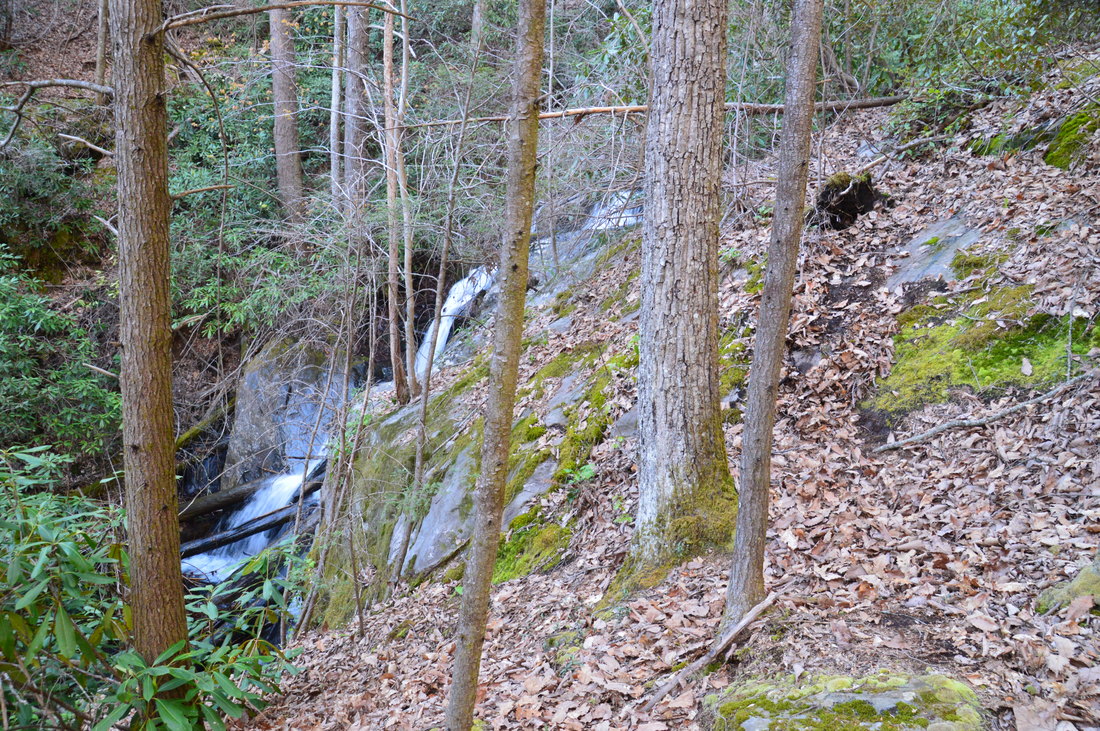
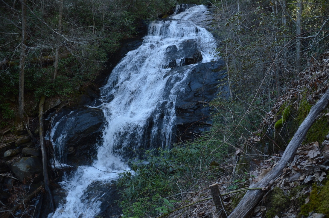
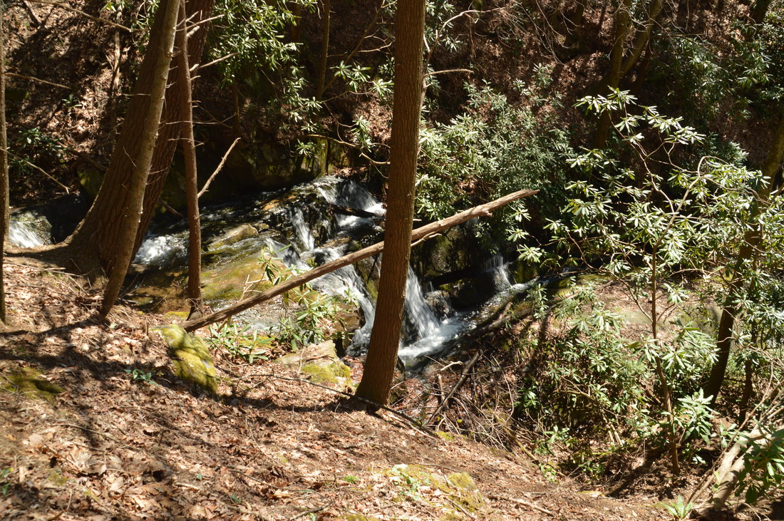
The Lower Falls is unique in the way that the water splits into four unique channels that fall steeply down the cliff. The setting of this waterfall is actually more scenic and remote than of the main waterfall (the Middle Falls), as the mossy cliff really adds to the scene. A large mass of dead wood marks the base of the Lower Falls. Getting to the main waterfall is a bit trickier. The easiest route begins with a scramble up the slanted rock to the right (east) of the Lower Falls. This part - which gets you to the flat area on top of the Lower Falls - is easy. From here, the best directions that I can provide are to keep moving upstream about 20 to 30 feet vertical feet above the river. There is no clear trail or path, but there are bits and pieces of one, and the route of least resistance is sortof obvious. At one point, I found it easy to scramble up a broad rock slab that can serve as a sort of landmark, but there is another route just below it that is equally good. Around 200 feet from the Lower Falls, the monstrous Middle Falls comes into view through the trees. Continue hiking straight toward the falls (although above the river). Just before the falls, the path becomes a little more obvious and ends at 1.8 miles at a viewing area of the falls to the left of a small rock outcrop. The Middle Falls on the Left Fork Soquee River is huge! It is about 75 feet high, although if anything, it looks even taller from the hillside vantage point. The entire waterfall is visible from the slope; the waterfall is a long and steep slide, interrupted by several small free-falls. A number of large boulders lie near the base of the falls, where there is also a pool. Getting to the very base of the waterfall is very difficult and not worth it, as the view from the slope is very good. Even though the setting of the waterfall is not particularly outstanding, the sheer size of the falls and the high water volume make it one of the best waterfalls in Georgia. Even though this is the main waterfall on the river, there are several more smaller waterfalls upstream. The most distinct waterfall, a single-tier 30-footer, is referred to as the Upper Falls. However, getting to the area above the Middle Falls requires the exertion of significantly more effort, and in my opinion, it is not worth it, considering how beautiful the Middle Falls is. Hardcore waterfallers may relish this optional extension though. 
The Lower Falls on the Left Fork Soquee River is an interesting 30-footer, where the water splits into multiple distinct channels that drop into a large log jam.
The viewing area for the Middle Falls is a good place to turn around. Simply retrace your steps back to the trailhead, reaching the car and concluding the hike at 3.6 miles.
Optional Side Trip: Wolfpen Branch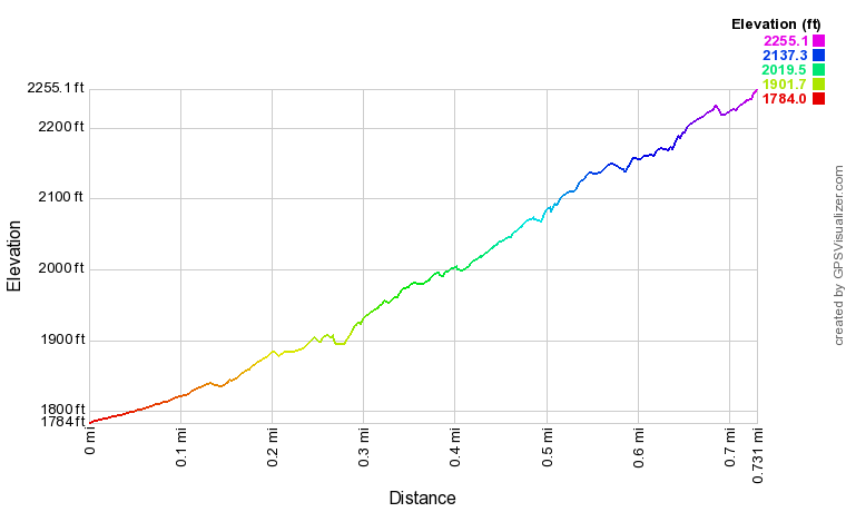
Note: The elevation profile above and downloadable track below are for the one-way hike only, illustrating the trek to Wolfpen Branch Falls from the Soquee River Trail.
Click here to download a track of this hike.
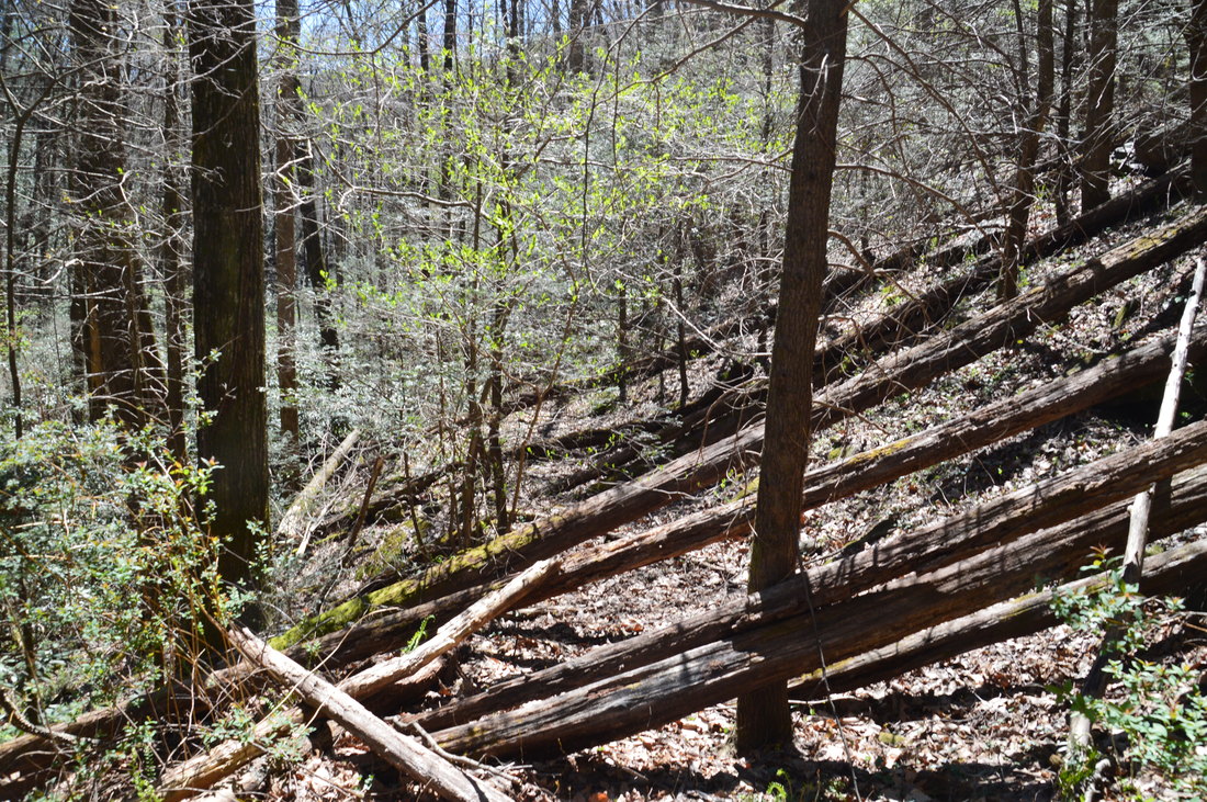
The 0.7-mile side trip to Wolfpen Branch Falls begins at the Soquee River Trail just west of the Wolfpen Branch crossing. Once again, this side trip is for hardcore waterfallers only who relish off-trail hiking. Hike through the flats upstream and pick up an old logging grade that follows the west side of Wolfpen Branch. The stream quickly enters a narrow gorge and the road becomes a lot more defined. Unfortunately, at the same time, the road also becomes nearly impassable. There are large trees fallen across the road every few feet, and scrambling across them is very time-consuming. If this wasn't enough, there are also several nasty greenbrier patches in open areas along the road. Thus, expect a very slow hike along Wolfpen Branch. Despite the obstacles, this is a beautiful area. 0.3 miles from the Soquee River Trail, you will pass the first of two small lower waterfalls on Wolfpen Branch. A portion of the waterfall is visible clearly from the old logging road. The second small waterfall is 0.65 miles from the trail. This is an interesting waterfall, as the creek flows next to a low cliff and splits into several ribbons over a small rock face.
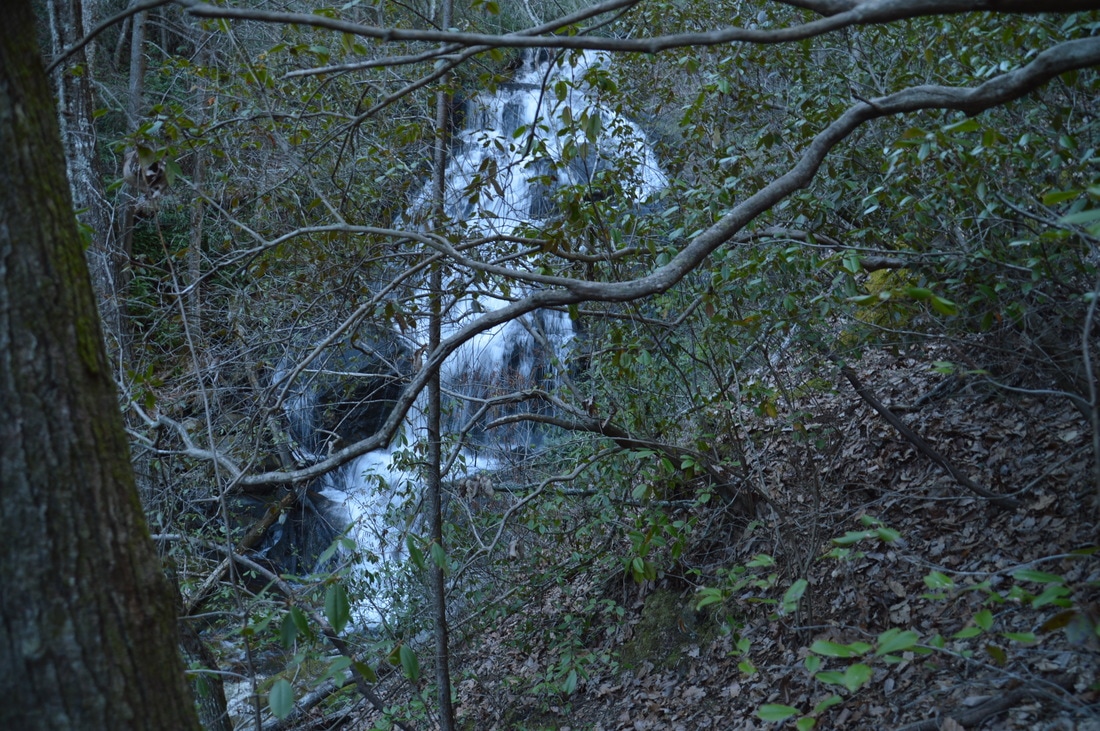
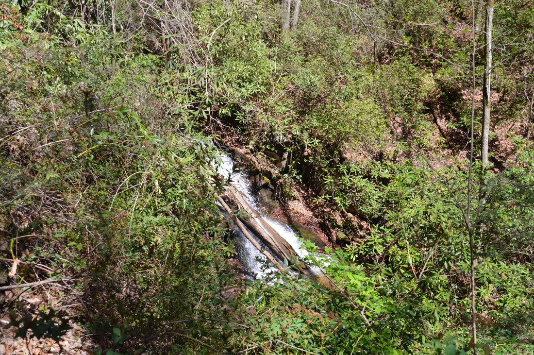
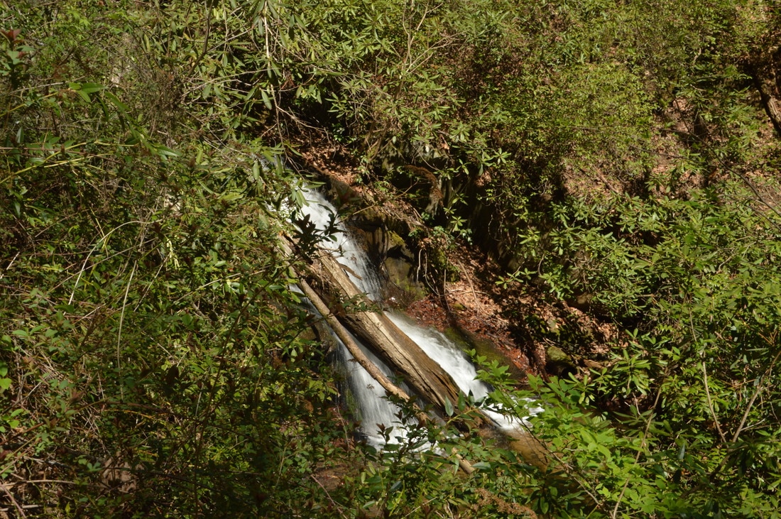
Then, finally, the road reaches 30-foot Wolfpen Branch Falls 0.7 miles from the trail. There is an impressive drop in the creek down a vertical cliff here. However, a major issue with Wolfpen Branch Falls is that getting to its base is extremely difficult, and in fact, I decided not to bother with the scramble. The south/west side of the creek next to the falls, where the road is, is so steep that there is no way to descend to the base without a rope. A somewhat better option would be to cross the creek above the falls and then scramble down the less steep opposite bank, but all of this would take a significant amount of time either way. On this day, I contented myself with the mediocre view of the waterfall from near the top and side. It is interesting to note the character of the rock slab that marks the very top of the cliff that forms the waterfall; this natural rock slab looks exactly like a concrete slab! Some maps show that the "trail" along Wolfpen Branch crosses the creek just above the falls and then heads northward to gated FS 166. This is incorrect though. I hiked the area where the trail was shown between Wolfpen Branch and the gated road, and I found nothing that resembled a trail. On the other hand, I believe that the old logging road which follows Wolfpen Branch may eventually connect to gated FS 166 some distance upstream. Also, based on Google Earth and Google Terrain views, I think that there is another large waterfall farther upstream. Since the existence of such a waterfall is not verified, the best thing to do is to turn around and return to the Soquee River Trail. 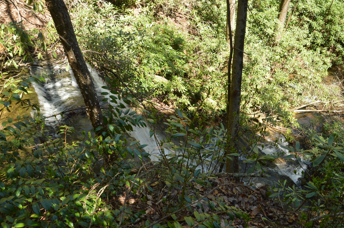
Wolfpen Branch Falls is a difficult-to-reach 30-foot waterfall.
Mileage
0.0 - Chimney Mountain Flats Trailhead
0.2 - Wildlife Clearing 0.35 - Ford 1 of Left Fork Soquee River 0.95 - Wolfpen Branch Crossing 1.55 - Ford 2 of Left Fork Soquee River 1.65 - Ford 3 of Left Fork Soquee River 1.75 - Lower Falls 1.8 - Middle Falls 3.6 - Chimney Mountain Flats Trailhead Variations
Include the side trip to Wolfpen Branch Falls - 5.0 Miles
Bonus Stops
PicturesVideos
5 Comments
Alex
9/19/2018 11:07:55 am
I attempted this hike in July 2018. I could not get past the wildlife clearing. Rather unwisely, I was wearing shorts and chaco's. I tried to go right and parallel the river but it was impossible in shorts. I ended up going left and paralleling the woods and ran into a honeybee habitat that made going that way just as dangerous. So I cut through the middle of the "clearing". My legs were cut by the blades of razor-like grass that my friend calls "sawgrass". By the time I reached the upper right edge of the clearing, I was done. I walked the river (careful to stay on the clearing side of it since the other side is private property) back to the beginning of the clearing and back to my car. I will be back in pants and hiking boots!
E. Lane Gresham
11/5/2018 10:25:51 am
I did this hike on Nov. 4, 2018 with two friends. Thank you for the good information and detail. It should be noted that there are LOTS of trees down along the trail. While much of the summer growth is diminished, it was still difficult to travel in several areas. The river crossings were as described and not too deep on the day we visited. With recent rains, the river and falls were moving lots of water. I've hiked to the source of the Soque River by hiking down from the top of Tray Mountain and I've been eager to see how the river builds as it travels south to Habersham County.
John Cantwell
5/26/2019 04:30:50 pm
Three of us did this hike today. Thanks for the excellent guidance. This hike is probably best for winter as the summer ground cover and foliage made following the trail nearly impossible at times.
Jim Fuller
4/12/2020 11:51:24 am
My buddy did this hike from the Appalachian trail in three hours. He said he does not and I mean DO NOT do that its dangerous.
John Stembel
7/18/2020 10:19:46 am
Did the hike this morning with my two super doggies. The dogs had no problems, the tree fall was a pain but doable. Got to the bottom of the bigger waterfall and took great photos. Alas, on the last ford, I slipped and my phone (already fixin' to die) took a quick dive and now is probably dead dead. Oh well. Thanks for all the great details. Great hike with nobody but the pups. Leave a Reply. |
About MeMark Oleg Ozboyd Dear readers: I have invested a tremendous amount of time and effort in this website and the Georgia Waterfalls Database the past five years. All of the work that has gone in keeping these websites updated with my latest trip reports has almost been like a full-time job. This has not allowed me to pick up a paid job to save up money for college, and therefore, I I've had to take out loans. If you find the information on this website interesting, helpful, or time-saving, you can say "thanks" and help me out by clicking the button above and making a contribution. I will be very grateful for any amount of support you give, as all of it will apply toward my college tuition. Thank you!

Coming in 2022-2023?
Other Hiking WebsitesMiles HikedYear 1: 540.0 Miles
Year 2: 552.3 Miles Year 3: 518.4 Miles Year 4: 482.4 Miles Year 5: 259.9 Miles Archives
March 2021
Categories
All
|


 RSS Feed