HIKING THE APPALACHIANS AND BEYOND
  • Home
  • Trail Reports
    • Best Hikes
    • Hikes with Scenic Views
    • Hikes with Water Features
    • Alabama
    • Georgia
    • Florida
    • North Carolina
    • South Carolina
    • Tennessee
    • Vermont
    • Virginia
  • Map
  • Hike List
  • Testimonials
  • Resources
  • Contact Us
  • Southeast Nature Society
    • Our Team
  • Georgia Waterfalls Database

Monongahela National Forest (Laurel Fork North Wilderness): Laurel River Trail to Stone Camp Run Junction, Elkins, West Virginia

1/31/2021

0 Comments

 
Picture
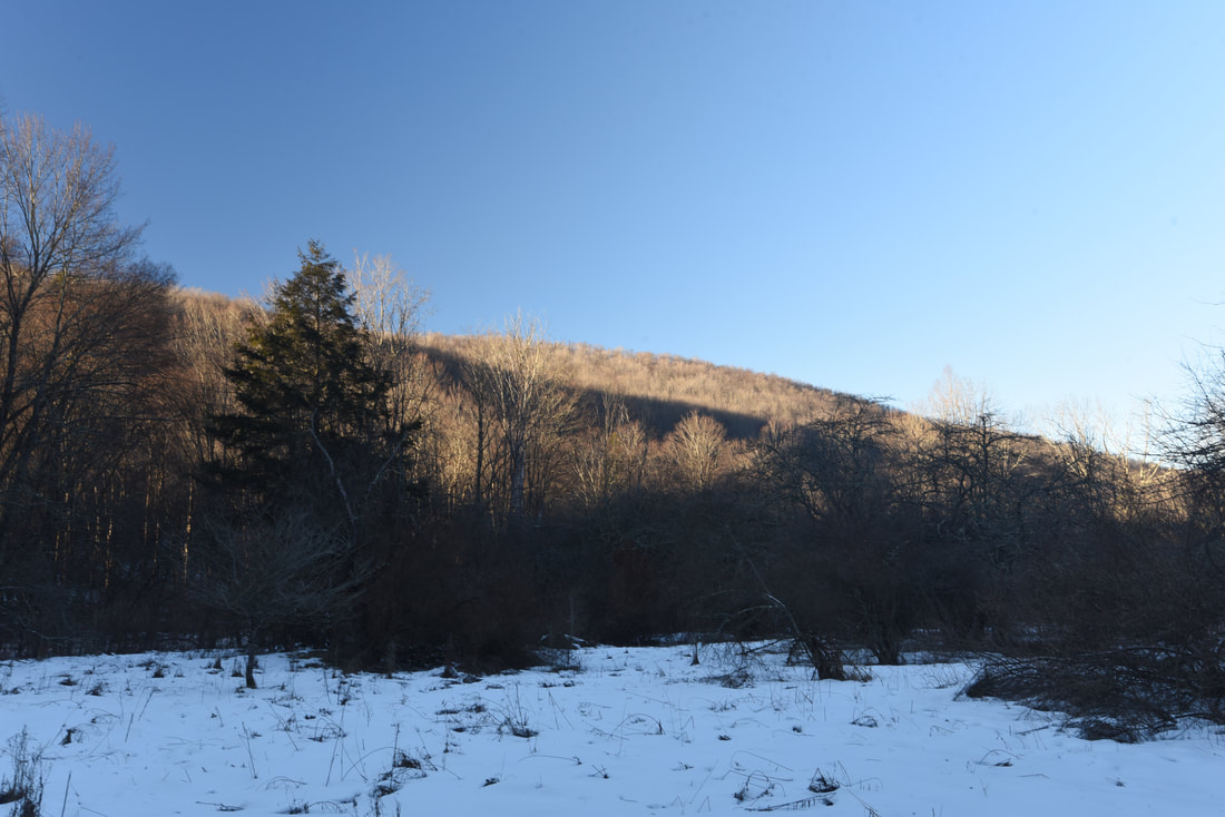
The Laurel Fork Wilderness is one of the least-travelled areas in Monongahela National Forest. The wilderness spans the length of the Laurel Fork of the Cheat River, an impressive waterway that winds through a remote area of the mountains east of the unincorporated community of Glady. You won't find any spectacular vistas or towering cascades here, but what you will find is a pristine river and a lovely (albeit sometimes faint) trail where solitude is guaranteed. The Laurel Fork Wilderness has been split into two halves by CR 40/FR 423, which crosses Laurel Fork at the Laurel Fork Campground. The report below describes an exploratory foray into the Laurel Fork North Wilderness. This hike occurred on Tuesday, January 12th, 2021. Starting at the campground, I traced the Laurel River Trail downstream through the broadening Laurel Fork valley to a junction with the Stone Camp Run Trail, and I then returned the same way. 

Summary

R/T Length of Trail: 8.8 miles
Duration of Hike: 3:40
Type of Hike: Out and back 
Total Elevation Gain: 621 feet
Difficulty Rating: 4 out of 10 
Pros: Numerous views of Laurel Fork and surrounding hillsides
Cons: The trail can be a little hard to find in places where it diverges from the old railroad grade 
Points of Interest: None in particular, as good views of Laurel Fork are spaced throughout the trail
Trail Blaze Colors: None - the Laurel River Trail is unblazed but occasionally marked by rock cairns 
Best Season(s) to Hike: Spring, Fall 
Fees: None
Beginning Point: Laurel Fork Campground
Directions from Elkins, WV: From the intersection of US 219/US 250 and US 33 near downtown Elkins, follow US 33 East for 12.0 miles. Then, turn right onto Glady Road (CR 27). In 9.4 miles, after entering the community of Glady, turn left onto Bemis Road (CR 22). Drive 2.2 miles and then continue straight onto FR 422. FR 422 is in good shape and suitable for all passenger vehicles, but keep in mind it does not appear maintained in winter. In another 2.4 miles, bear right on FR 14. Drive 0.3 mile, and then, bear left on FR 423 at a sign for Laurel Fork Campground. Continue 1.5 miles to Laurel Fork Campground. The trailhead at the far end of the north loop of the campground, which is on the left right after a bridge across Laurel Fork. 

Map

Picture
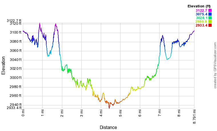
Click the link below to download a .GPX file with a track of this hike. 
laurel_fork_north_wilderness.gpx
File Size: 179 kb
File Type: gpx
Download File

Details

Having never hiked in the Laurel Fork Wilderness before, I was not sure which section of the Laurel River Trail to focus on for my first hike in the area. My research on the area seemed to show that Laurel Fork upstream from the campground is a relatively small river in a tighter gorge with numerous tributaries and wetlands, whereas downstream from the campground, it becomes a much larger river that flows through a broad valley, constantly threading between islands and multiple channels. For this hike, I decided to explore the river downstream from the campground, and save the upstream section for spring wildflower season. I felt like the Laurel River Trail would be particularly convenient for a wintertime river hike because it always follows the same side of Laurel Fork, without any wet fords. 

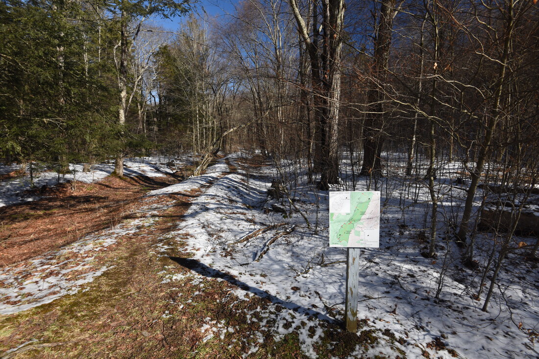
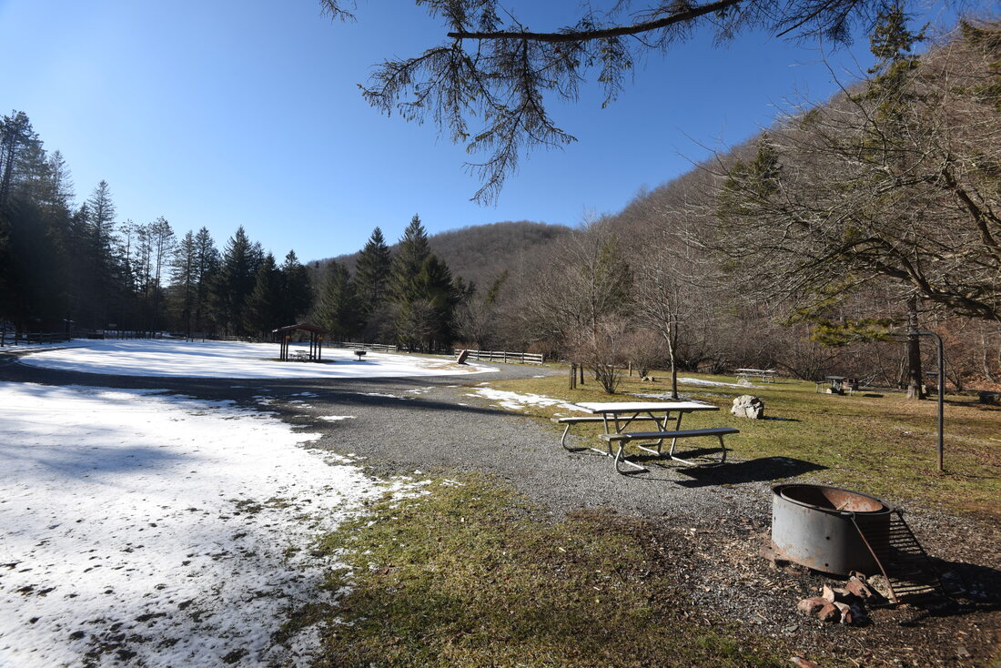
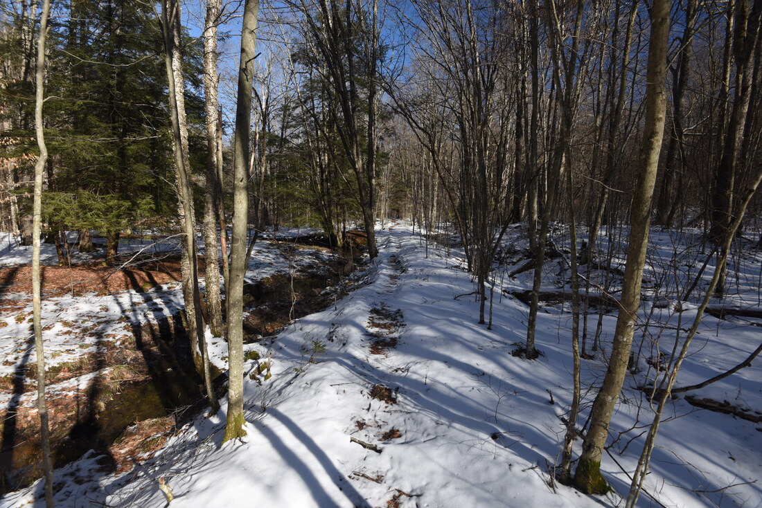
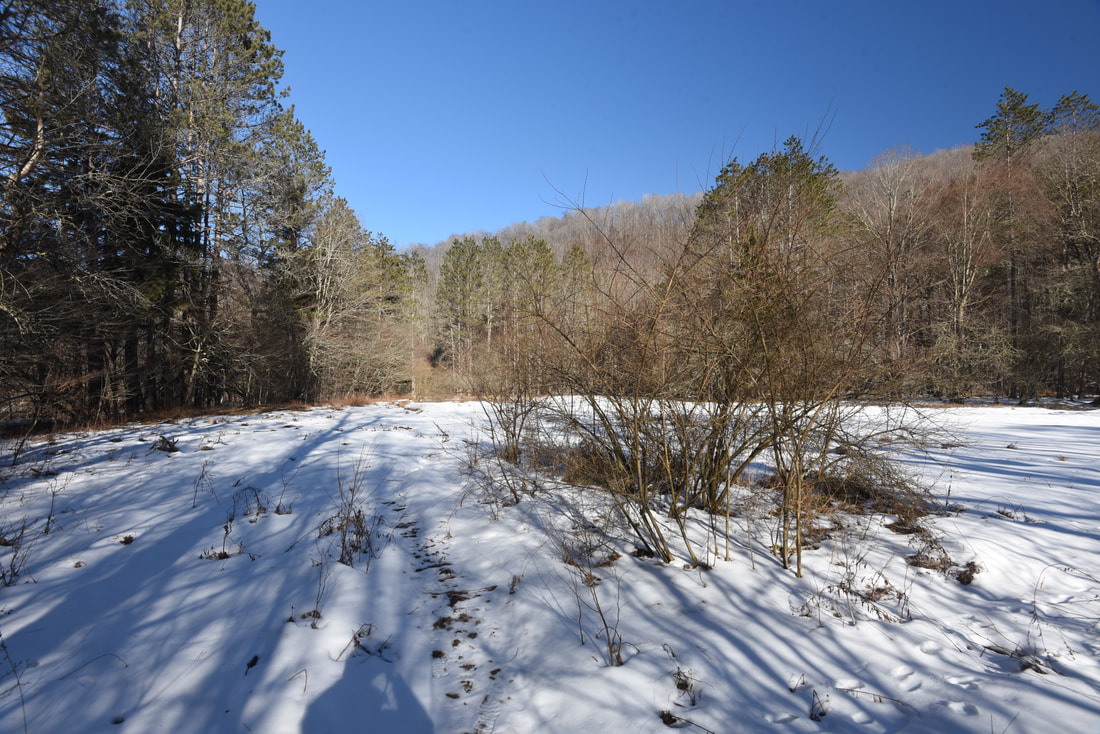
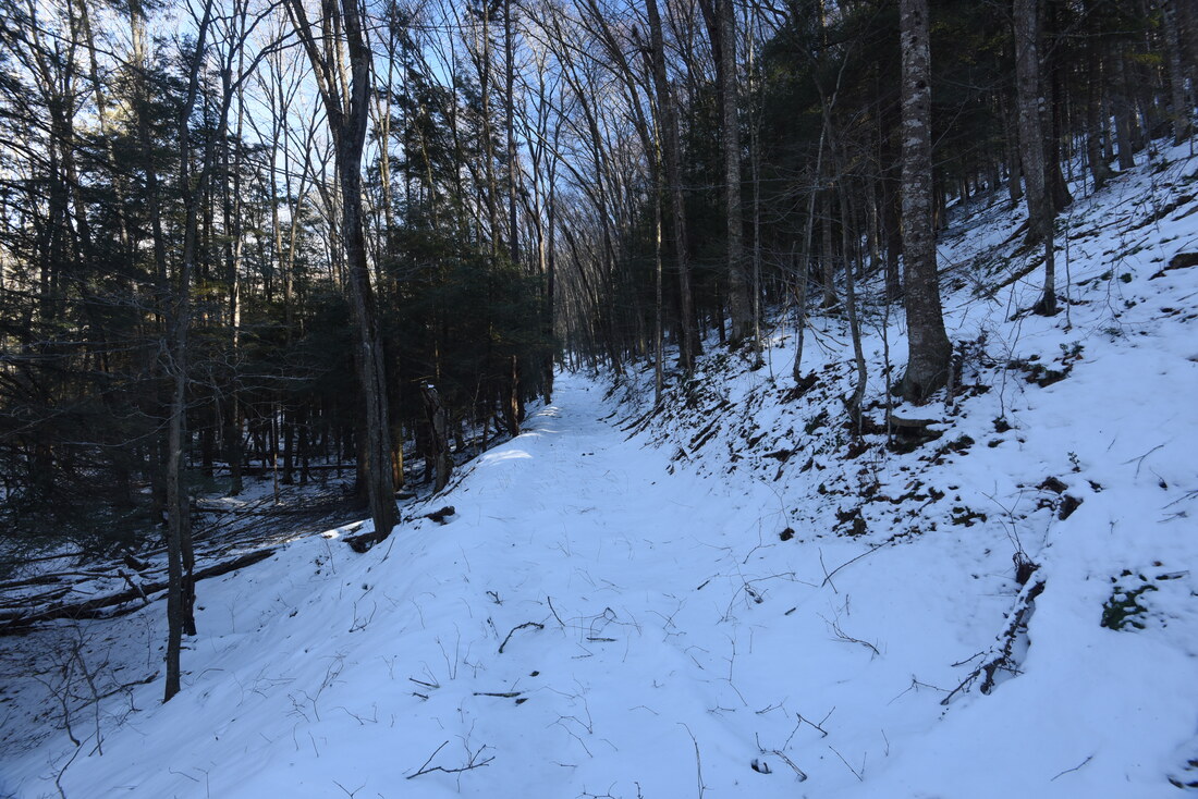
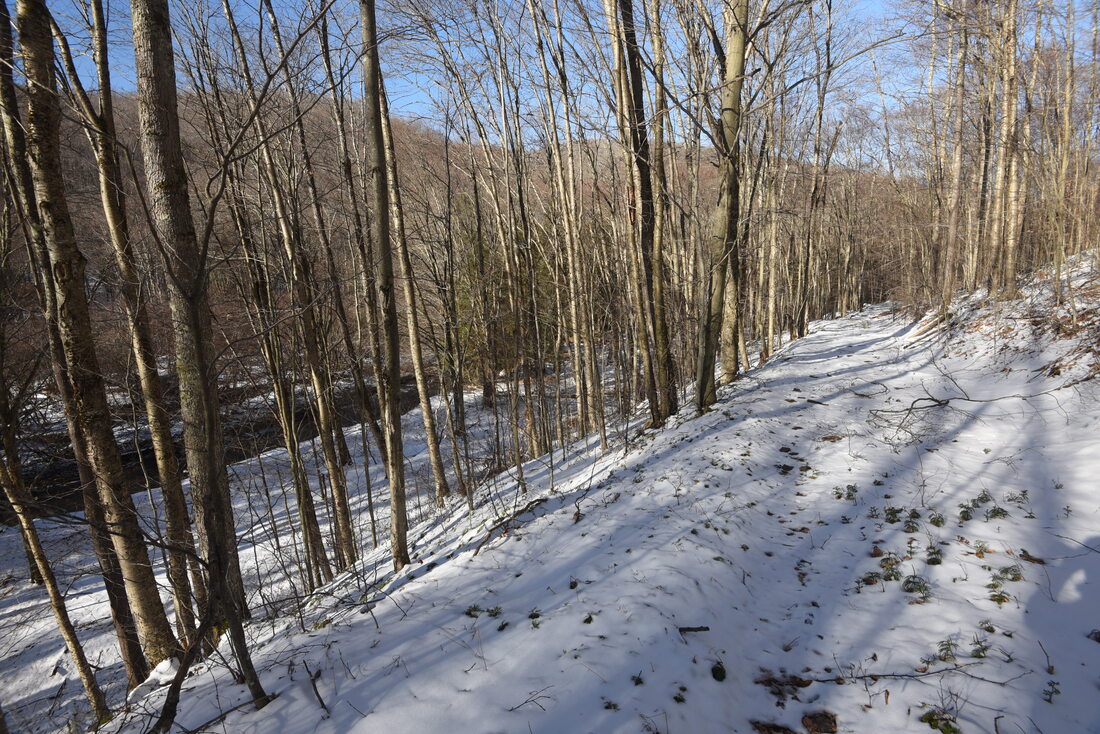
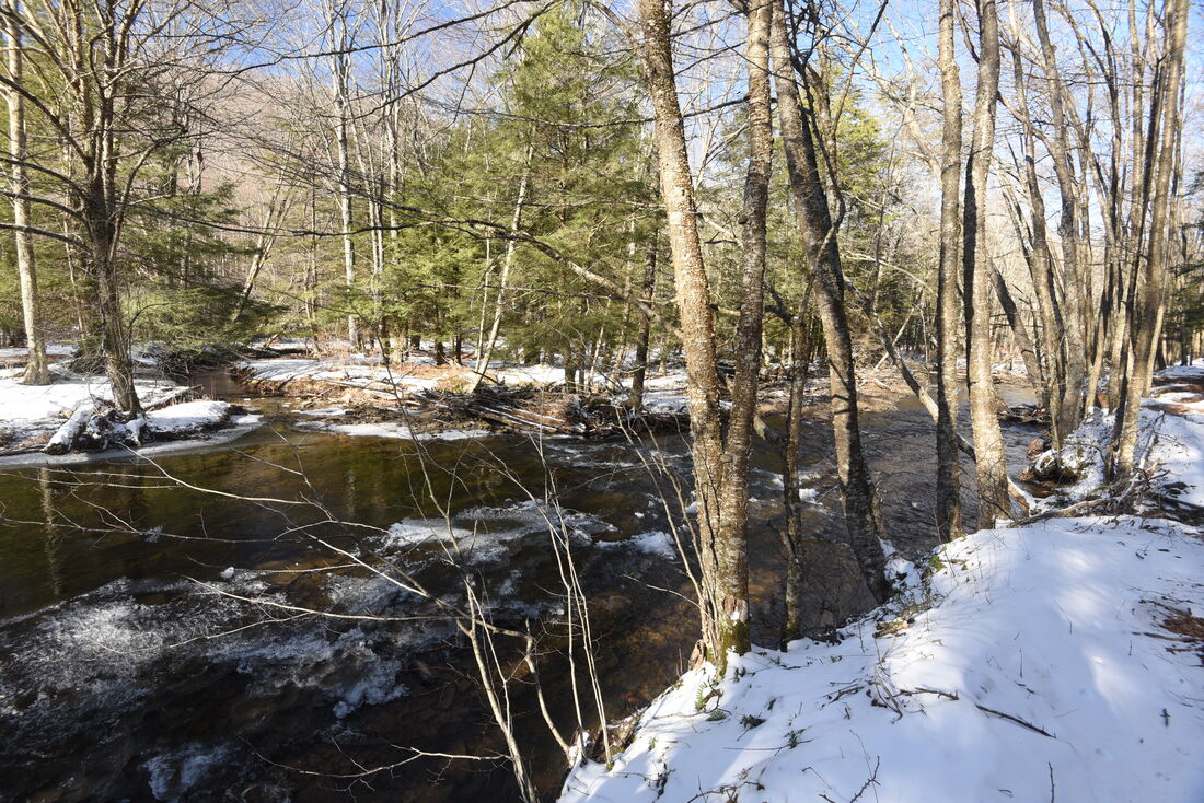
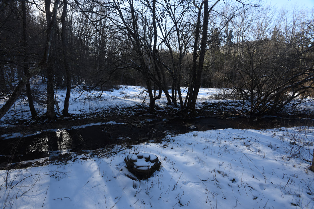
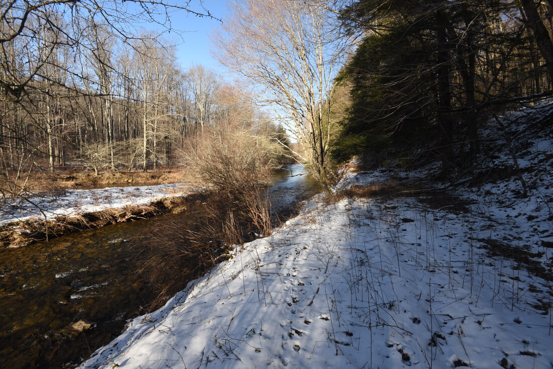
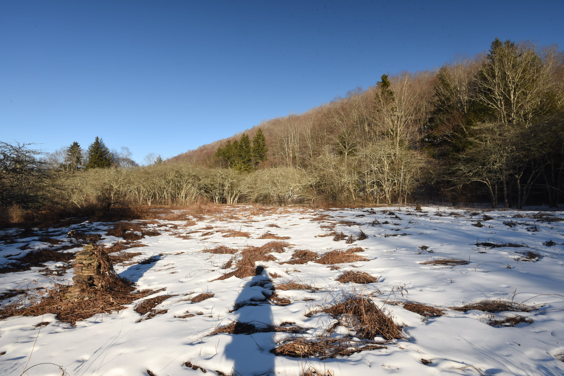
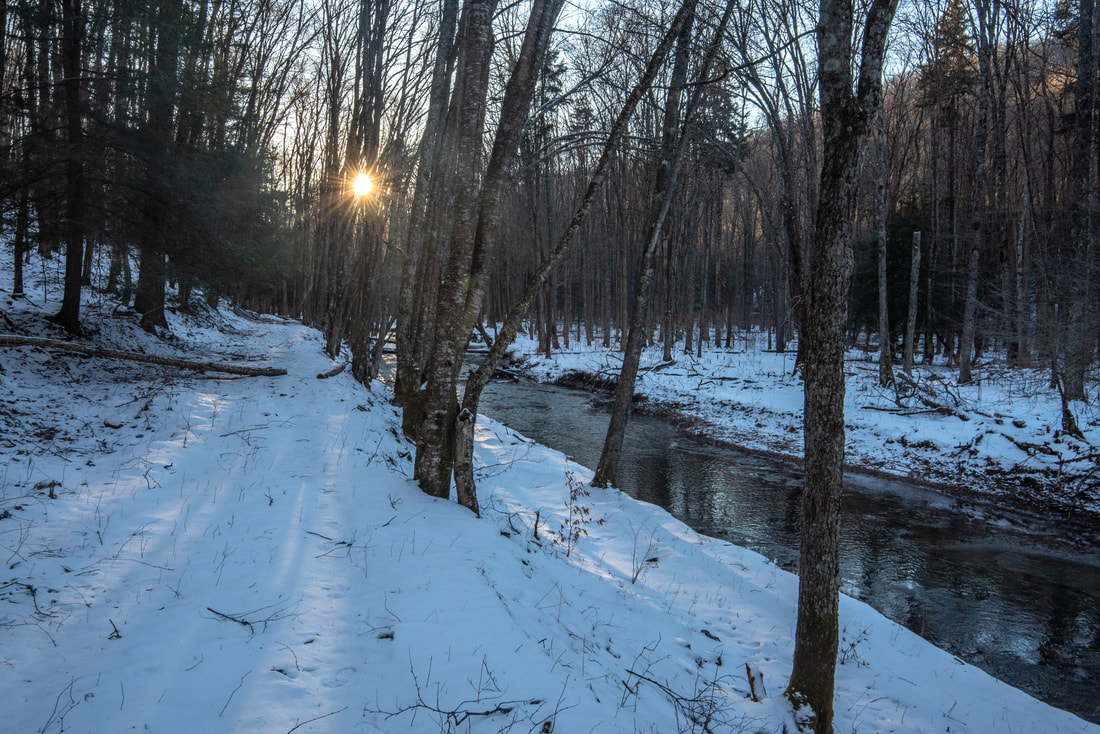
The hike begins rather inconspicuously along the Laurel River Trail at the far end of the north campground loop. The trail isn't denoted by any signs, so look for a small map of the Laurel Fork Wilderness that is posted by the pathway. The trail quickly enters the Laurel Fork North Wilderness and jumps onto an old logging grade that largely parallels the Laurel Fork the whole way. In just 0.1 mile, the trail makes an easy rock hop across Tingler Run. Laurel Fork is audible and partially visible through the trees to your left. At 0.3 mile, enter a grassy meadow and walk a straight line along its left edge. A large rock cairn at the far end confirms the trail's route as it re-enters the woods. Even though there are no blazes, rock cairns mark most key points of confusion along this trail. At 0.4 mile, the trail reaches Five Lick Run, a sizable tributary of Laurel Fork. This is the largest creek crossing on this hike, and it may be challenging for you to get across with dry feet if you aren't wearing boots.

The trail reaches an open view of a beautiful bend on Laurel Fork at 0.5 mile, where the river runs in a series of pleasant ripples. A towering hemlock crowns the far side of the river. Just ahead is a landslide, where the trail scrambles through a rock garden along the river's very edge. The trail continues to follow the riverside for a little longer before bearing right on the old railroad grade at 0.8 mile, gradually climbing above Laurel Fork. You won't return to the riverside again for over a mile. At 1.2 miles, the trail passes through a lush hemlock grove, the river now nearly 100 feet lower. Pass another scenic bend in Laurel Fork at 1.6 miles, partially visible through the trees below. The long-decommissioned Middle Mountain Trail from FR 14 once joined the trail here. A gradual descent along the old railroad grade ensues, and the trail finally returns to Laurel Fork at 2.0 miles. 
Picture
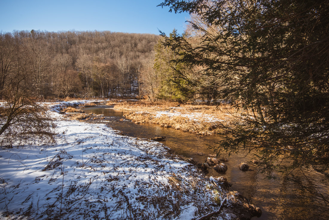
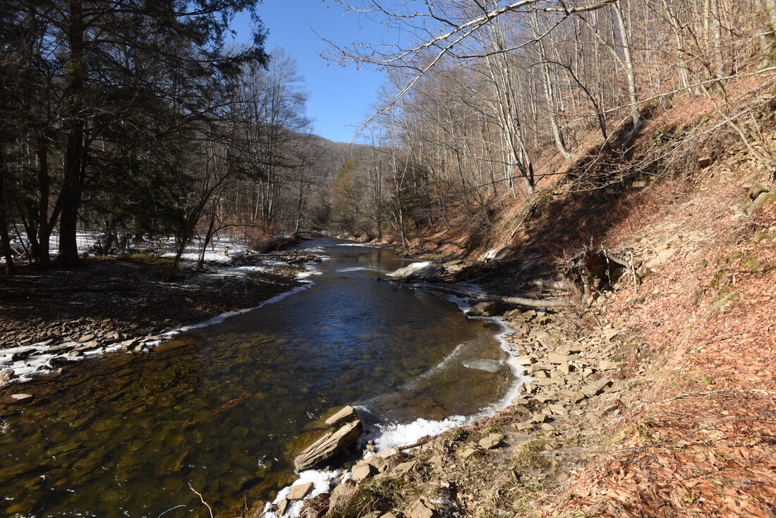
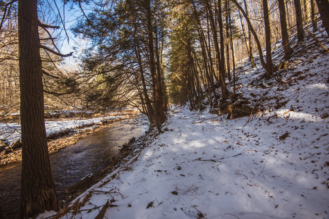
The Laurel River Trail features continuous views of Laurel Fork's twisting yet placid course
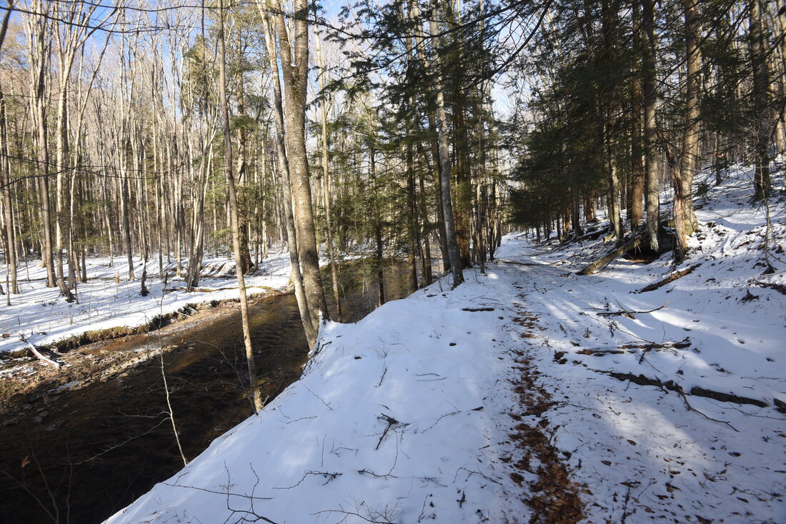
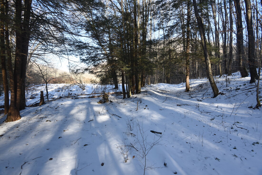
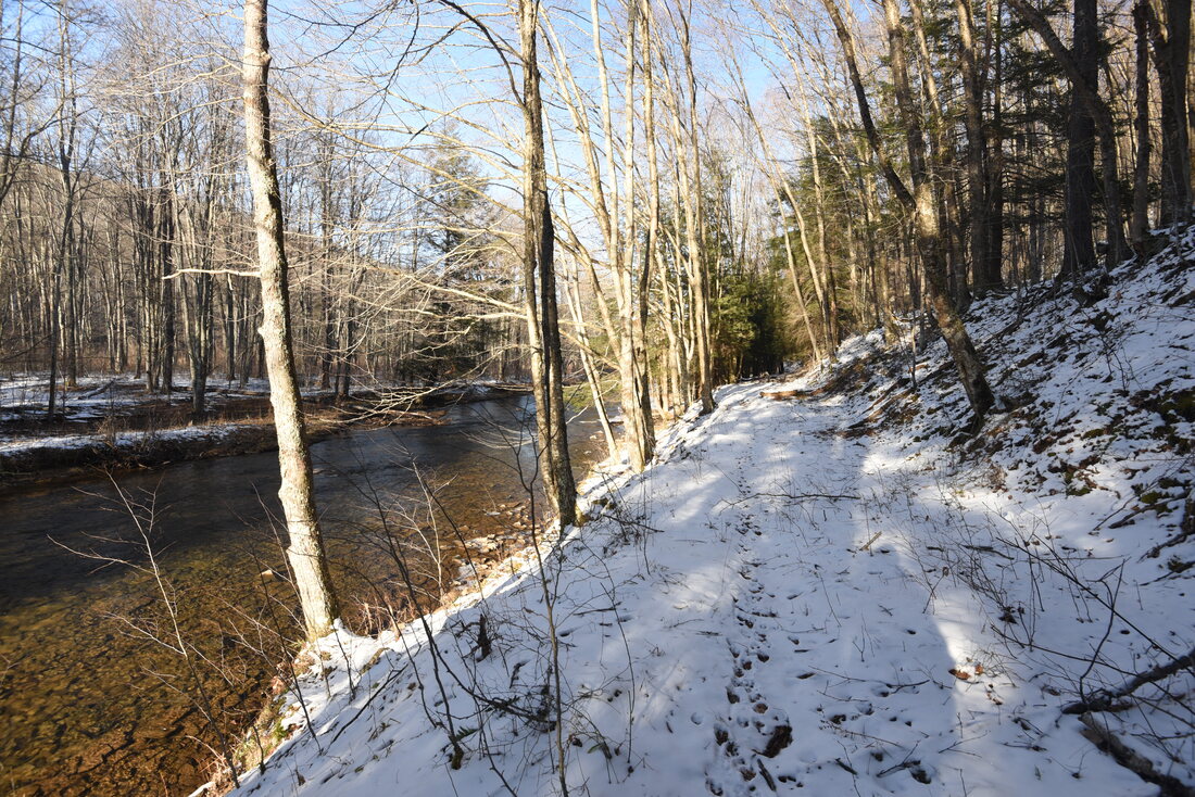
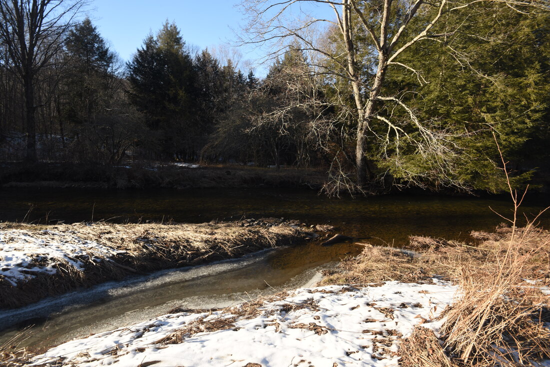
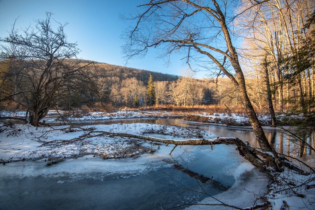
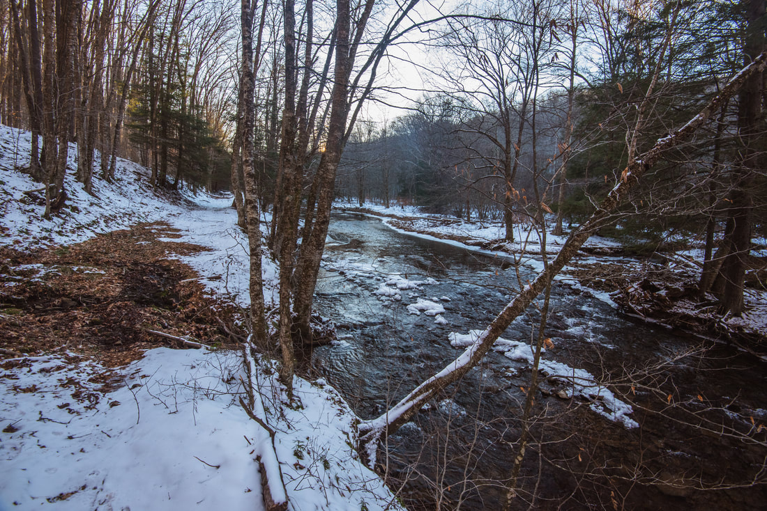
The next half-mile features continuous views of Laurel Fork as the trail closely follows the river bank. Laurel Fork is wide and mostly placid here, but miniature gurgling cascades occasionally break up the river's course. Note how the river tends to briefly split into large channels and form forested islands. At 2.5 miles, the trail reaches a vast meadow. This spot can seem confusing, because the old railroad grade turns right away from the meadow, and a rock cairn stands in between the meadow and the railroad grade. The Laurel River Trail bears left to enter the meadow, and then follows the right-hand side of the meadow past another cairn to a crossing of shady Adamson Run. Rock hop the stream, bear left, cross a muddy area, and look for the faint path as it traces the very edge of the meadow. The trail can probably get very overgrown here in summer. As you follow the meadow, watch for open views of the Middle Mountain ridge rising above the far side of the Laurel Fork valley. 

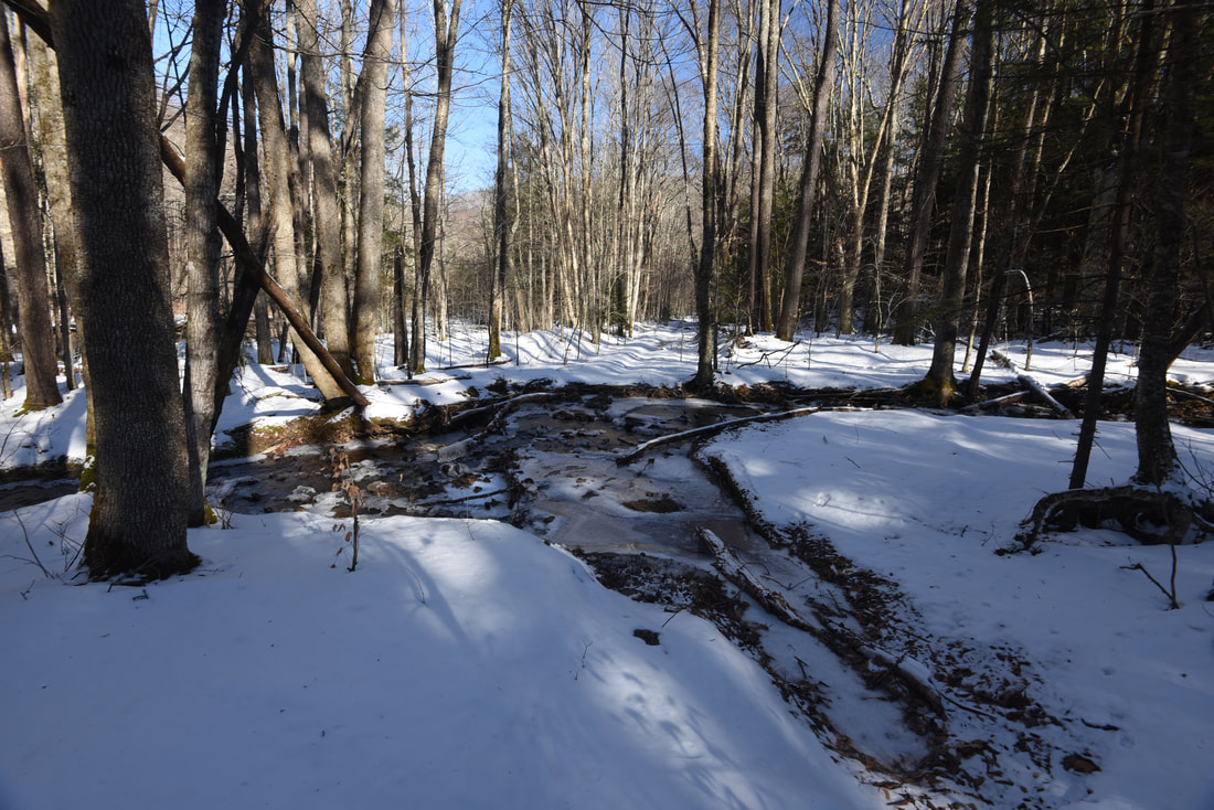
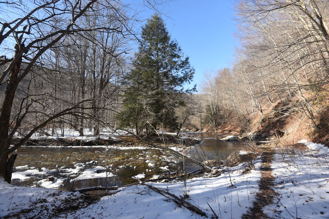
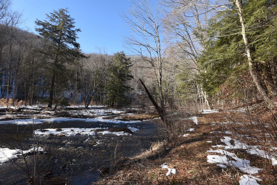
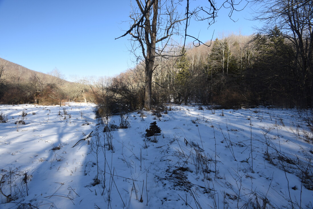
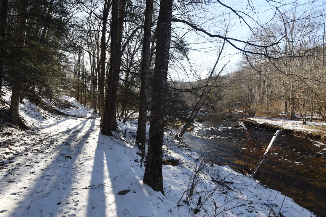
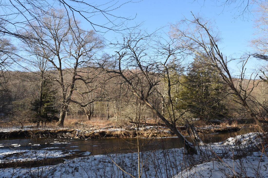
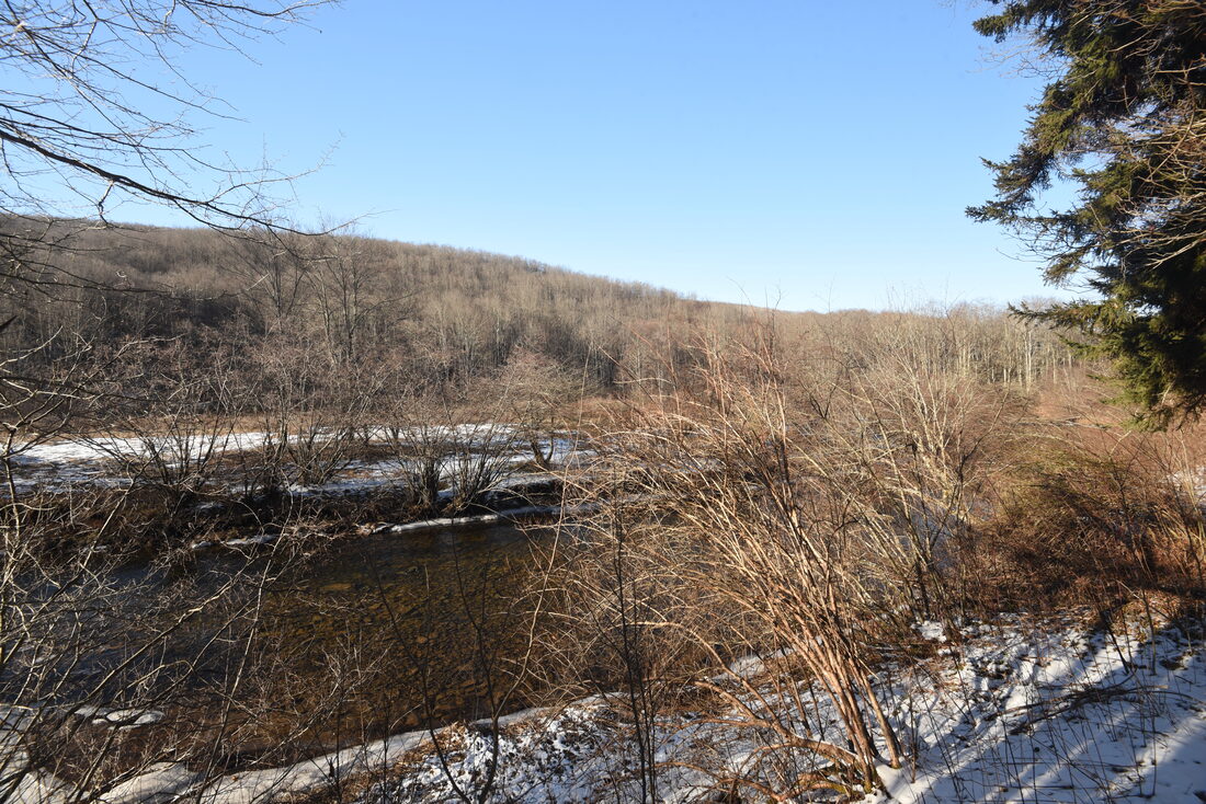
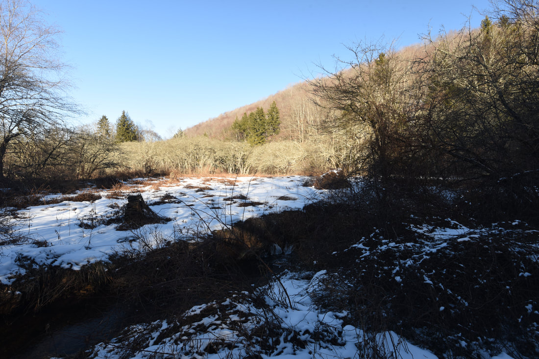
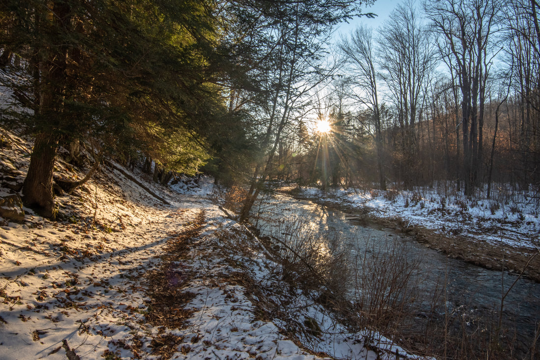
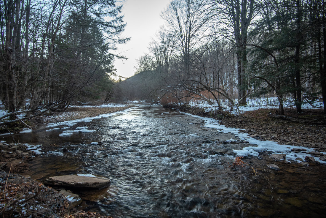
The meadows come to an end at 2.8 miles as the trail reaches the lively Laurel Fork again, and the old railroad grade suddenly reappears. This is one of my favorite views of Laurel Fork on the hike (pictured above), showing the river snaking its way through the meadow between its low banks. A line of lush green hemlocks guard the river's edge. Just ahead, the trail is squeezed between the river and a line of small rock outcrops. The trail soon edges away from the river but stays in bottomland before rock hopping the small Bill White Run at 3.25 miles. On the other side, the trail passes through a small island of raspberry bushes that is likely to be unpleasant in summer. A gentle downhill follows before the trail reaches Laurel Fork again at 3.6 miles, and continuous views of the river resume for the next 3/4 mile. As I walked along Laurel Fork, I marveled at how clear the river's stony bottom was visible beneath the evening sunrays. 

At 4.3 miles, the trail becomes increasingly faint as the old railroad grade appears to vanish and the valley widens greatly. The trail shortly reaches a crossing of Three Bear Run, a small stream with high banks. On the other side, the trail enters a large meadow and is marked by a series of rock cairns. Reach the inconspicuous junction with the Stone Camp Run Trail at 4.4 miles. It is marked by the third meadow cairn in the meadow and stands alongside a lone dead tree. If not the cairn, you would probably not even notice that this is an intersection. The Laurel River Trail continues for another seven miles and crosses the Laurel Fork itself once, before reaching its terminus on FR 14. However, this is a fine place to turn around if you're just day hiking and don't have a shuttle set up. However, before you head back, turn left on the Stone Camp Run Trail and follow it 100 feet to a very nice view of Laurel Fork. The banks of Laurel Fork are open and grassy here, and the clear, placid water looked inviting for a summertime wade. Take a moment to relax, close your eyes, and embrace the vast solitude that surrounds you. A lone cairn on the far side of Laurel Fork denotes the Stone Camp Run Trail's crossing of the river here; that trail comes to a trailhead along FR 14 in 1.5 miles, following a steep climb up Middle Mountain. 
Picture
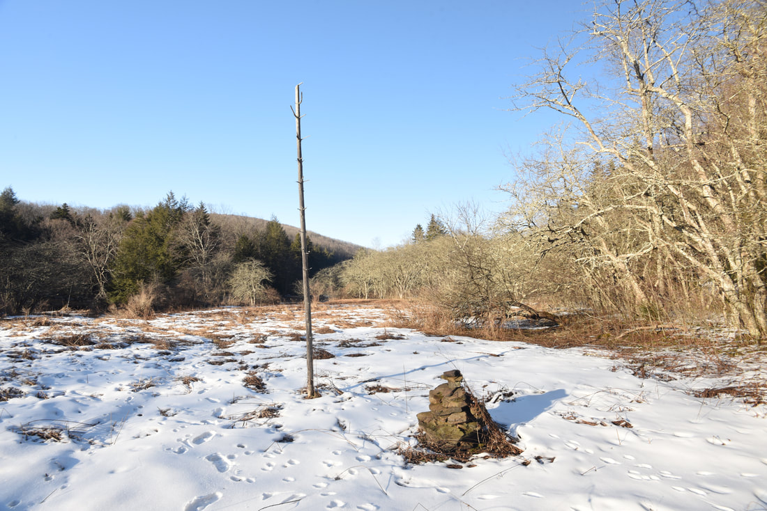
A lonely dead tree and rock cairn denote the inconspicuous junction with the Stone Camp Run Trail in a remote meadow within the Laurel Fork valley
You will return to Laurel Fork Campground the same way along the Laurel River Trail. The trail will be easier to follow on the way back now that you've figured out all of the faint trail sections, but the return trip will feature a little more uphill since you are now following the river upstream. On the flip side, you will get to enjoy many more nice views of the Laurel Fork, now flowing towards you. You will reach the Laurel Fork Campground at 8.8 miles, concluding the hike. 

Photo Gallery

0 Comments


Leave a Reply.

    About Me

    Mark Oleg Ozboyd
    I'm an avid outdoor explorer and a hobbyist landscape photographer. I'm 21 years old and have been hiking since 2011. Originally based out of Atlanta, Georgia, I started out by occasionally hiking short trails throughout well-known Georgia State Parks. During 2012 and 2013, I began to expand my trips into adjacent states, as well as into the wilder National Forest areas rather than just State Parks. Throughout the years that followed, as I slowly ran out of popular hiking trails in my area, I began to search for and hike in more seldom-visited areas. Today, you can find me out in the woods every weekend, whether it's on an official trail or bushwhacking through cross-country terrain without any paths. I now attend Washington & Lee University and am exploring Virginia and West Virginia. My other hobbies include chess, science, old music, and meteorology. I have 3 years of amateur weather forecasting experience, having studied a lot of meteorology basics over the years. I am also a student at European School of Music where I learned that music and nature have a lot in common. Listening to good music inspires me to capture nature's beauty on the camera in different aspects that also make me recall many beautiful music pieces that I've heard.​


    Dear readers: I have invested a tremendous amount of time and effort in this website and the Georgia Waterfalls Database the past five years. All of the work that has gone in keeping these websites updated with my latest trip reports has almost been like a full-time job. This has not allowed me to pick up a paid job to save up money for college, and therefore, I I've had to take out loans. If you find the information on this website interesting, helpful, or time-saving, you can say "thanks" and help me out by clicking the button above and making a contribution. I will be very grateful for any amount of support you give, as all of it will apply toward my college tuition. Thank you! 

    Enter your email address to subscribe for trail reports:

    Delivered by FeedBurner


    Picture
    Coming in 2022-2023?

    Other Hiking Websites

    DWHike's Adventures
    Florida's Natural Wonders
    Florida Trailblazer
    Meanderthals
    Mountain Images
    by Bernie Boyer

    North Carolina Waterfalls with
    ​Kevin Adams
    Take-a-Hike!
    Tennessee Landforms
    Waterfall Page
    Waterfall Adventurer
    Zach's Mild Adventures

    Miles Hiked

    Year 1: 540.0 Miles
    Year 2: 552.3 Miles
    ​Year 3: 518.4 Miles
    Year 4: 482.4 Miles
    Year 5: 259.9 Miles

    Archives

    March 2021
    February 2021
    January 2021
    November 2019
    October 2019
    September 2019
    August 2019
    July 2019
    June 2019
    February 2019
    January 2019
    December 2018
    November 2018
    October 2018
    August 2018
    July 2018
    June 2018
    May 2018
    April 2018
    March 2018
    February 2018
    January 2018
    December 2017
    November 2017
    October 2017
    September 2017
    August 2017
    July 2017
    June 2017
    May 2017
    April 2017
    March 2017
    February 2017
    January 2017
    December 2016
    November 2016
    October 2016
    September 2016
    August 2016
    June 2016
    May 2016
    April 2016
    March 2016
    January 2016
    December 2015
    November 2015
    October 2015
    September 2015
    August 2015
    July 2015
    June 2015
    May 2015
    April 2015
    March 2015
    February 2015
    January 2015
    December 2014
    November 2014
    October 2014
    September 2014
    August 2014
    July 2014
    June 2014
    May 2014
    April 2014
    March 2014
    February 2014

    Categories

    All
    Adel
    Adirondack Park
    Alabama
    Alfred A. Ring Park
    Allegheny Trail
    Amicalola Falls State Park
    Anniston Area
    Apalachicola Bluffs And Ravines Preserve
    Apalachicola National Forest
    Apalachicola/Port St. Joe Area
    Apopka
    Appalachian Trail
    Appling
    Art Loeb Trail
    Aska Trail System
    Bakersville
    Balm-Boyette Scrub Preserve
    Balsam Lake Recreation Area
    Bankhead National Forest
    Bartow County Parks
    Bartram Trail
    Basinger
    Beersheba Springs
    Benton
    Benton Mackaye Trail
    Berry College Trail System
    Best Hike
    Big South Fork National Recreation Area
    Black Bear Wilderness
    Black Rock Mountain State Park
    Blairsville
    Blakely
    Blood Mountain Wilderness
    Blowing Rock
    Blue Ridge
    Blue Ridge Parkway
    Boone
    Bradenton
    Bradenton Beach
    Brasstown Bald
    Brasstown Wilderness
    Brevard
    Bryson City
    Buchanan
    Bucks Pocket State Park
    Bulow Creek State Park
    Bulow Plantation Ruins State Park
    Caesars Head State Park
    Caladesi Island State Park
    Calhoun
    Camel's Hump State Park
    Cashiers
    Caspersen Beach Park
    Catfish Creek State Park
    Caves
    CC Putnam State Forest
    Cedar Point Environmental Park
    Chatsworth
    Chattahoochee National Forest
    Chattanooga
    Chattanooga Valley
    Chattooga National Wild And Scenic River
    Cheaha Wilderness
    Cherohala Skyway
    Cherokee
    Cherokee National Forest
    Chiefland Area
    Chillhowee Recreation Area
    Chipley
    Chunky Gal Trail
    Circle B Bar Reserve
    Citico Creek Wilderness
    Citrus Wildlife Management Area
    Clarkesville
    Clayton
    Cleevland
    Cleveland
    Cloudland Canyon State Park
    Cohutta Wilderness
    Collier-Seminole State Park
    Cordele
    Cornelia
    Covington
    Crestview Area
    Crew-land-and-water-trust
    Cullowhee
    Cumberland Trail
    Dahlonega
    Dalton
    Dawson Forest Wildlife Management Area
    Dawsonville
    Dayton
    De Soto National Memorial
    DeSoto State Park
    Dillard
    Double Springs
    Ducktown
    Duncan Ridge Trail
    Dunlap
    Eagle's Rest Park
    Eastpoint
    Econfina Creek Wildife Management Area
    Eglin Air Force Base
    Elizabethton
    Elkins
    Elk Knob Game Lands
    Elk Park
    Ellicott Rock Wilderness
    Ellijay
    Emerson Point Preserve
    Englewood Area
    Enota Retreat
    Erwin
    Falling Waters State Park
    Fayetteville
    Fires Creek Recreation Area
    Fire Tower
    Flint River
    Florence Area
    Florida
    Florida Caverns State Park
    Florida Trail
    Foothills Trail
    Fort Mountain State Park
    Fort Myers Area
    Fort Payne
    Fort Payne Area
    Fort Yargo State Park
    Franklin
    Franklin Delano Roosevelt State Park
    Franklin-Marion State Forest
    Frozen Head State Park
    Gainesville
    Gainesville Area
    Gatlinburg
    George Washington National Forest
    Georgia
    Georgia Veterans Memorial State Park
    Glasgow
    Gorges State Park
    Grandfather Mountain State Park
    Great Smoky Mountains National Park
    Greeneville
    Green River Game Lands
    Gruetli-Laager
    Grundy Forest State Natural Area
    GTM Reserve
    Guana River Wildlife Management Area
    Hayesville
    Helen
    Hiawassee
    High Falls State Park
    Highlands
    Highlands Scenic Highway
    Hillsborough River State Park
    Hinson Conservation & Recreation Area
    Historic Sites
    Honeymoon Island State Park
    Hot Springs
    Huntington
    Inverness Area
    Jackson
    Jasper
    Jefferson National Forest
    Joan M. Durante Park
    Jonathan Dickinson State Park
    Jones Gap State Park
    Joyce Kilmer Slickrock Wilderness
    Joyce Kilmer - Slickrock Wilderness
    Juniper Prairie Wilderness
    Kelly Park
    Keown Falls Recreation Area
    Kolomoki Mounds State Park
    LaFayette
    Lake City Area
    Lake George Wild Forest
    Lake June-in-Winter State Park
    Lakeland Area
    Lake Placid
    Lake Russell Wildlife Management Area
    Lake Wales Ridge State Forest
    Laurel Fork North Wilderness
    Leffis Key Preserve
    Leon Sinks Geological Area
    Lexington
    Lineville
    Linville
    Linville Gorge Wilderness
    Lithia Springs
    Little Frog Wilderness
    Little Manatee River State Park
    Little River Canyon National Preserve
    Longboat Key
    Long Trail
    Lookout Mountain
    Lookout Mountain Battlefield
    Lovingston
    Lula Lake Land Trust
    Lumpkin
    Maggie Valley
    Manatee Springs State Park
    Marianna Area
    Mark Trail Wilderness
    Marlinton
    Mccaysville
    McMinville
    Mentone
    Middlesex
    Mistletoe State Park
    Monongahela National Forest
    Montreat
    Mountain Bridge Wilderness Area
    Mountain City
    Mountains To Sea Trail
    Mountains-to-Sea Trail
    Mount Rogers National Recreation Area
    Myakka River State Park
    Myron B. Hodge City Park
    Nantahala National Forest
    Naples
    Naples Area
    Natural Bridge State Park
    Neal Preserve
    New Castle
    Newport
    New River Gorge National Park
    New York
    North Carolina
    Ocala Area
    Ocala National Forest
    Ocean-to-Lake Trail
    Oconee State Park
    Oconee Station Historic Site
    Okaloacoochee Slough State Forest
    Oldsmar
    Oneida
    Orlando Area
    Ormond Beach
    Oscar Scherer State Park
    Oxford
    Palatka
    Palmetto Trail
    Panama City Area
    Panthertown Valley
    Parrish
    Paynes Creek Historic State Park
    Peaks Of Otter Recreation Area
    Pigeon Crockford Mountain Wildlife Management Area
    Pigeon-Crockford Mountain Wildlife Management Area
    Pigeon-Crockford Wildlife Management Area
    Pine Mountain
    Pinhoti Trail
    Pinnacle Park
    Pisgah Civitan Park
    Pisgah National Forest
    Pittman Center
    Pond Mountain Wilderness
    Ponds/Lakes
    Prentice Cooper State Forest
    Providence Canyon State Park
    Pumpkintown
    Quick Point Nature Preserve
    Raven Cliffs Wilderness
    Reed Bingham State Park
    Reliance
    Rice Creek Conservation Area
    Riverview Pointe Preserve
    Robbinsville
    Robinson Preserve
    Rock Creek Gorge Scenic Area
    Rock Island State Park
    Rome
    Rosman
    Sale Creek
    Salem
    Salt Springs
    Saluda
    Santa Rosa Beach
    Sarasota
    Sarasota Area
    Savage Gulf State Natural Area
    Scenic Views
    Scottsboro Area
    Sebring Area
    Sewanee
    Sheltowee Trace Trail
    Shining Rock Wilderness
    Signal Mountain
    Sipsey Wilderness
    Sky Valley
    Smithgall Woods State Park
    Snowbird Backcountry Area
    Soddy Daisy
    Soddy-Daisy
    Sopchoppy
    South Carolina
    South Cumberland State Park
    Southeastern Cave Conservancy
    Southern Nantahala Wilderness
    Sparta
    Sprewell Bluff Park
    Spring City
    Spring Hill
    Springs
    Spruce Pine
    Standing Indian Backcountry Area
    St. Augustine
    St. George Island State Park
    St. Joseph Bay State Buffer Preserve
    St. Marks Area
    St. Marks National Wildlife Refuge
    Stone Mountain
    Stone Mountain Park
    Suches
    Sumatra
    Sumter National Forest
    Suwannee River
    Swallow Creek Wildlife Management Area
    Sweetwater Creek State Park
    Sylva
    Talladega National Forest
    Tallahassee Area
    Tallulah Falls
    Tallulah Gorge State Park
    Tampa Bay Area
    Tate City
    Tate's Hell State Forest
    Tea Creek Wildlife Management Area
    Tellico Plains
    Tennessee
    Thomaston
    Toccoa
    Topsail Hill State Park
    Torreya State Park
    Townsend
    Tracy City
    Tray Mountain Wilderness
    Trenton
    Triple Creek Preserve
    Troutdale
    Unaka Mountain Wilderness
    Upper Tampa Bay County Park
    Venice
    Vermont
    Virgin Falls State Natural Area
    Virginia
    Virginia Outdoors Foundation
    Vogel State Park
    Wakulla Springs State Park
    Waleska
    Walhalla
    Wartburg
    Water Features
    Waynesville
    Weedon Island Preserve
    Weeki Wachee Preserve
    Wekiwa Springs State Park
    West Palm Beach Area
    West Virginia
    Whitehall
    White Springs
    Winder
    Withlacoochee State Forest
    Young Harris

    RSS Feed

TRAIL REPORTS

Hikes in Alabama
​Hikes in Florida
Hikes in Georgia
Hikes in North Carolina
Hikes in South Carolina
Hikes in Tennessee
Hikes in Virginia

Hiking Resources

Alabama Resources
​
Florida Resources
Georgia Resources
North Carolina Resources
​South Carolina Resources
​
Tennessee Resources

Other

Contact
Map of Hikes
Alphabetical List of Hikes
Southeast Nature Society
© COPYRIGHT 2014-2018
​ALL RIGHTS RESERVED.
Important: I disclaim any responsibility for any damage or personal injury that may occur as a result of the activities and information found on this website. All outdoor activities, especially off-trail hiking, are done at your own risk. Never hike or head into that area that may be above your fitness or experience level.
  • Home
  • Trail Reports
    • Best Hikes
    • Hikes with Scenic Views
    • Hikes with Water Features
    • Alabama
    • Georgia
    • Florida
    • North Carolina
    • South Carolina
    • Tennessee
    • Vermont
    • Virginia
  • Map
  • Hike List
  • Testimonials
  • Resources
  • Contact Us
  • Southeast Nature Society
    • Our Team
  • Georgia Waterfalls Database