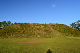
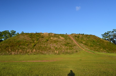
Kolomoki Mounds State Park is home to one of three large complexes of historical Indian mounds in Georgia. The park has the largest and oldest site in the Southeast that used to be occupied by the Woodland Indians. The park's tallest mound - known as the Temple Mound - rises 57 feet high. In addition to the mounds, the park has two lakes and several hiking trails that meander through hilly forest around the lakes. This hike occurred on Saturday, April 16, 2016. My plan was to hike the Temple Mound Trail to the Temple Mound and a couple of other small mounds next to it. Then, I would follow the White Oak Trail through mostly dry forest and across a pair of small streams back to the trailhead.
Summary
R/T Length of Trail: 1.5 Miles
Duration of Hike: 0:45 Type of Hike: Loop Difficulty Rating: 1 out of 10 Total Elevation Gain: 185 Feet Pros: Easy access to one of the most important historical sights in Georgia Cons: The White Oak Trail is a bit boring passing through mostly just plain hardwood forest Points of Interest: The Temple Mound and other historical Indian mounds Trail Blaze Color(s): White Oak Trail - Green Best Season(s) to Hike: Year-round Fees: There is a $5 parking fee at Kolomoki Mounds State Park. Beginning Point: Temple Mound/Mounds Tour Trailhead Directions: From Blakely, GA: Follow Main Street North from the square in downtown Blakely for 2.2 miles. Just before reaching US Route 27, turn left onto 1st Kolomoki Road. In another 4.5 miles, turn right onto Indian Mounds Road and enter Kolomoki Mounds State Park. Continue for 0.9 miles to a parking area on the left for the Temple Mound Trail. This is where the hike begins. If you have reached the Lake Kolomoki Dam, you have driven too far. MapDetails
I've been wanting to see the Kolomoki Mounds for over a year, but the location of this historical state park is one that made a day hike drive unreasonable, as it was over 200 miles from my house and the hiking options at the park are limited. Thus, I never quite had the perfect opportunity to visit this park, until one April weekend when I went for a week-long trip to the Florida Panhandle. Along the way, Kolomoki Mounds proved to be the perfect stop. The park has three hiking trails, but all I had time for was the White Oak Trail that led past the Temple Mound and several other smaller mounds.
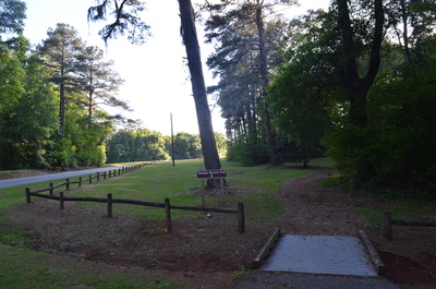
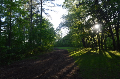
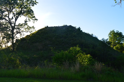
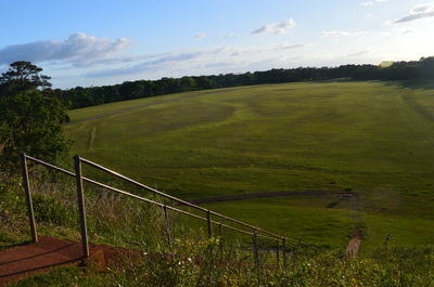
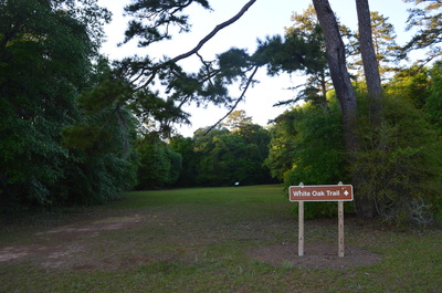
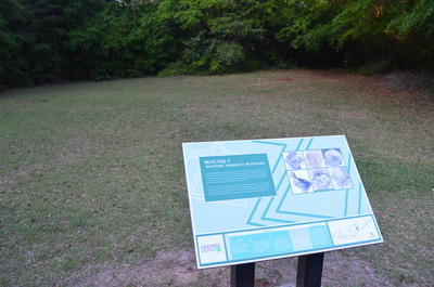
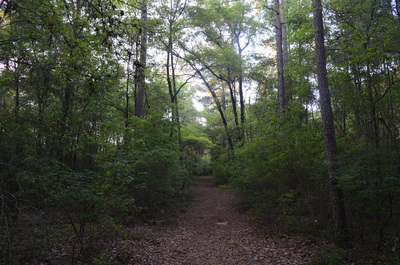
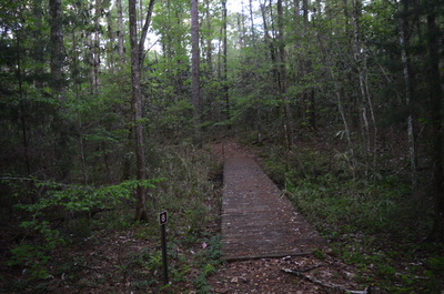
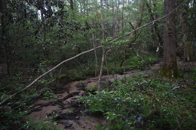
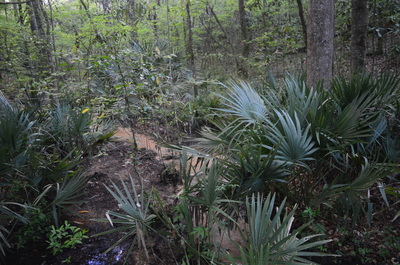
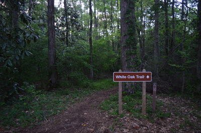
From the parking area that is described in the directions, two pathways head out into the fores. The Temple Mound Trail is the obvious double-track trail, while the White Oak Trail ends at the fence just below the far end of the parking area. Technically, the Temple Mound Trail is the White Oak Trail too, but for some reason, the short stretch of trail that leads to the Temple Mound was given its own name. Begin the hike by taking the Temple Mound Trail. It briefly enters some forest near Indian Mounds Road before approaching the field where most of the mounds are. This is where you gain a side view of the Temple Mound to your right. At first glance, the mound seems like a natural hill, but it quickly becomes obvious that the ancient "hill" is artificial. As you enter the field and bear right, Mound B is positioned diagonally to your left. Mound D is visible in the distance in the field. Mound B is a tiny rise in the field, while Mound D is a low but sharp, cone-like mound. There is an informational sign regarding Mound B. Archaeologists believe that Mound B was used for ceremonial activities. At 0.3 miles, at an informational sign regarding the Temple Mound Trail, a spur trail to the right leads to the top of the Temple Mound. Ascend to the top of this huge mound via a concrete staircase. The top of the mound is a small grassy field with some views of the surrounding terrain. The Temple Mound - the highlight of this hike - is roughly the size of a football field. Its height is 56.5 feet, and the base measures approximately 325 by 200 feet. The Temple Mound has been excavated by archaeologists several times. William H. Sears excavated a trench at the base of the mound, and he also did some excavations at the top of the mound, but he found very few artifacts related to the mound's past. Edward Palmer did some further work on excavating the mound, but he too found few artifacts. Thus, there are some differing opinions regarding what the mound was used for, From the Temple Mound, return to the main trail, and turn right. If you would like to see Mounds E, F, G, and H, then walk across the field and use the park's trail map to guide you to the mounds. At the edge of the field, a sign marks the double-track trail ahead as the White Oak Trail. As soon as you enter the woods, you reach Mound C to your right. Mound C is nearly identical to Mound B. This slight rise in the ground could easily be overlooked, if there was no sign here. It is unclear what Mound C was used for, but it is known that during excavations of the mound, many pottery shards were found. However, due to the different types of pottery from time periods, it is difficult for archaeologists to determine during what time period this mound was constructed. Just past Mound C, a double-track shortcut trail leaves to the right. It is possibly a service road. Regardless if it is or not, it can be used to decrease the hiking distance and to get back to the trailhead faster. To follow the outer loop, continue straight on the main trail. At 0.6 miles, bear right to continue on the trail. A seemingly well-worn path continues straight, but it gradually peters out. I followed the path straight and soon found myself returning to the junction only to notice a green-blazed tree on the true trail. At 0.95 miles, at the edge of a clearing, the trail turns right again begins descending into the Little Kolomoki Creek valley, although you will never see the waterway itself. At 1.1 miles, bear left at a fork in the trail to continue the outer loop. You will cross over a small marsh via a footbridge and then bear left at another fork in the trail at 1.35 miles before bridging a palmetto-lined tributary stream. Then, the trail ascends out of the tributary's small valley and reaches the trailhead and parking area at 1.5 miles. This concludes the hike, although you can hike the park's 1.25-mile Trillium Trail or 2.5-mile Spruce Pine Trail, if you're interested in spending some more of the day in the woods. Mileage
0.0 - Temple Mound Trailhead
0.3 - Temple Mound 1.35 - Cross a tributary of Little Kolomoki Creek 1.5 - Temple Mound Trailhead Variations
Walk out and back to the Temple Mound - 0.6 Miles
Bonus Stops
Kolomoki Mounds State Park has two other hiking trails to choose from: the 1.25-mile Trillium Trail and the 2.5-mile Spruce Pine Trail. The Spruce Pine Trail sounds like an interesting trail that traverses some ravines and follows the shorelines of Lake Kolomoki and Lake Yohola.
Pictures
0 Comments
Leave a Reply. |
About MeMark Oleg Ozboyd Dear readers: I have invested a tremendous amount of time and effort in this website and the Georgia Waterfalls Database the past five years. All of the work that has gone in keeping these websites updated with my latest trip reports has almost been like a full-time job. This has not allowed me to pick up a paid job to save up money for college, and therefore, I I've had to take out loans. If you find the information on this website interesting, helpful, or time-saving, you can say "thanks" and help me out by clicking the button above and making a contribution. I will be very grateful for any amount of support you give, as all of it will apply toward my college tuition. Thank you!
Coming in 2022-2023?
Other Hiking WebsitesMiles HikedYear 1: 540.0 Miles
Year 2: 552.3 Miles Year 3: 518.4 Miles Year 4: 482.4 Miles Year 5: 259.9 Miles Archives
March 2021
Categories
All
|



 RSS Feed