HIKING THE APPALACHIANS AND BEYOND
  • Home
  • Trail Reports
    • Best Hikes
    • Hikes with Scenic Views
    • Hikes with Water Features
    • Alabama
    • Georgia
    • Florida
    • North Carolina
    • South Carolina
    • Tennessee
    • Vermont
    • Virginia
  • Map
  • Hike List
  • Testimonials
  • Resources
  • Contact Us
  • Southeast Nature Society
    • Our Team
  • Georgia Waterfalls Database

Pinhoti Trail: Keown Falls Trail, Johns Mountain Trail, and Pilchers Pond, Calhoun, Georgia

11/17/2017

1 Comment

 
Picture
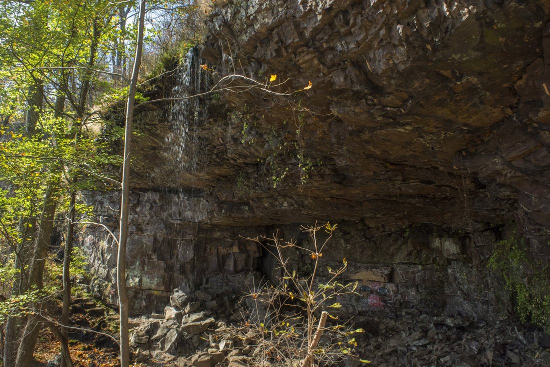
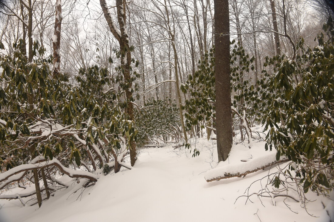
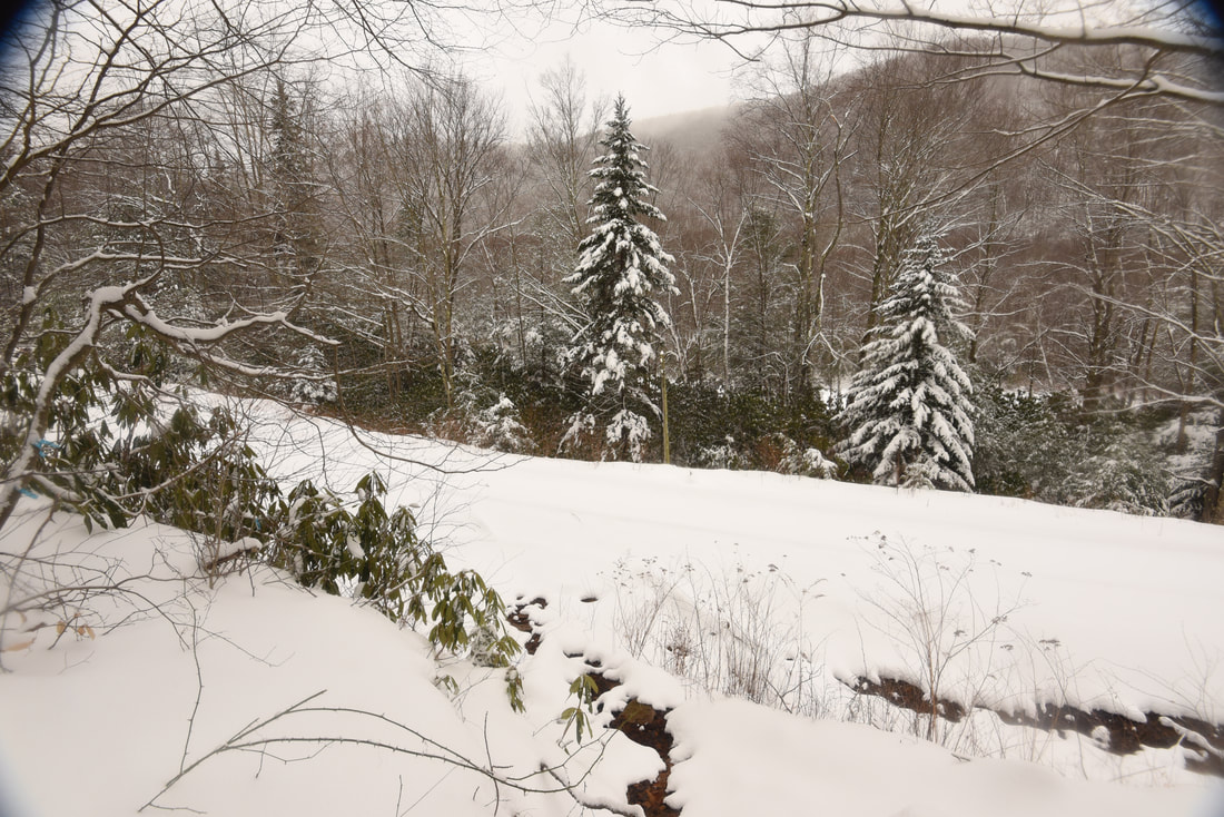
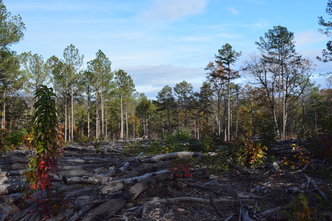
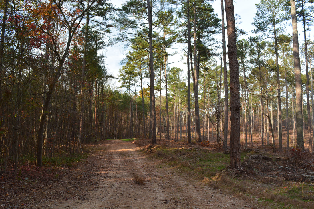
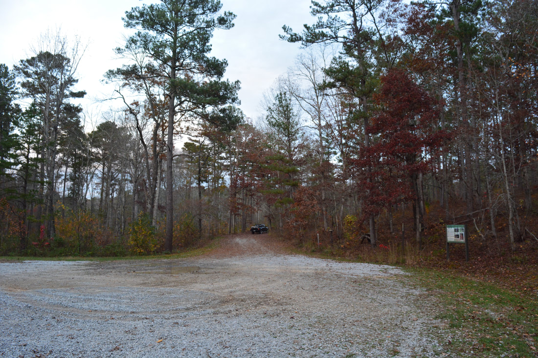
The Valley and Ridge area of Northwest Georgia is not known for waterfalls, unlike almost every other mountainous section of the state. Most of the available hikes in this area simply follow low ridges like Horn Mountain, Johns Mountain, and Taylor Ridge that separate similar valleys. The Keown Falls Scenic Area is unique to the region, as it is home to the area's two only publicly-accessible waterfalls: South Keown Falls and Keown Falls. Both waterfalls are accessed easily by the Keown Falls Trail, but it's worth extending the hike along the Johns Mountain Trail, which has great winter views from Johns Mountain. There are some other opportunities to extend the hike, such as following the Pinhoti Trail along Johns Mountain Road and past Pilchers Pond - although hikers may not find that part of the trail particularly exciting. This hike occurred on Saturday, November 11th, 2017. My plan was to hike a loop with the Keown Falls Trail, Johns Mountain Trail, FS 208, and the Pinhoti Trail past Pilchers Pond, starting at the end of FS 702. Unfortunately, the quality of this longer loop hike was degraded by a rather ugly logged area on the north side of Johns Mountain Road. 

Summary

R/T Length of Trail: 9.9 Miles 
Duration of Hike: 4:20 plus 1:30 of stopping 
Type of Hike: Loop 
Difficulty Rating: 5 out of 10 
Total Elevation Gain: 1693 Feet
Pros: Beautiful trail along Johns Mountain ridge and in the Keown Falls Scenic Area
Cons: Fairly long road-walk along FS 208 if you do the longer loop; ugly logged area along the Pinhoti Trail north of FS 208 near Pocket Road
Points of Interest: South Keown Falls - 4 stars during high flow; Keown Falls - 6 stars during high flow; Lower Johns Mountain Vista - 7 stars; Johns Mountain Summit Vista - 5 stars; Pilchers Pond 
Trail Blaze Colors: Keown Falls Trail - Lime Green; Johns Mountain Trail - Lime Green; Pinhoti Trail - White/Turkey Foot 
Best Seasons to Hike: Spring; Fall (during wet periods) 
Fees: None 
Beginning Point: End of FS 702 in Keown Falls Scenic Area 
Directions from Calhoun, GA: From the intersection of GA 136 Connector and Court Street in downtown Calhoun, follow GA 136 Connector North for 5.6 miles, and then, turn left onto Lake Marvin Road. Drive 7 miles on Lake Marvin Road to a T-shaped intersection with Everett Springs Road (Pocket Road), and take a right. Drive another 2.5 miles to Forest Service Road 702 and sign for Keown Falls, on your left. Drive the final 0.6 miles on the gravel Forest Service Road 702 to the trailhead and parking lot. The gravel road is well maintained.

Map

Picture
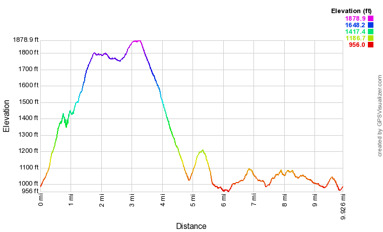
Click the link below to download a .GPX file with a track of this hike. 
pinhoti_trail__keown_falls_trail_johns_mountain_trail_and_pilchers_pond.gpx
File Size: 331 kb
File Type: gpx
Download File

Details

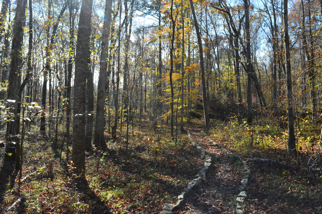
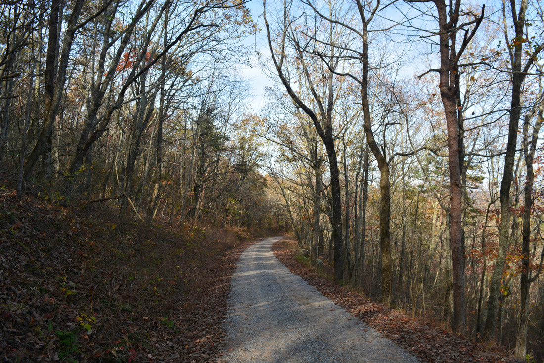
The small trail system at Keown Falls and Johns Mountain is one of the nicer hikes in Walker County. Unlike other parts of the Georgia mountains, there just isn't many hiking opportunities in the Valley & Ridge area due to the lack of points of interest. Keown Falls and South Keown Falls are exceptions in an otherwise waterfall-void area. The hike begins at the far end of the parking area at the end of FS 702. The trail splits into the Keown Falls Loop at 0.1 miles. If you do the smaller loop option, you'll hike both sides of the loop, but if you do the longer loop the way I did it past Pilchers Pond, I recommend going up the more scenic south side of the Keown Falls Loop to visit South Keown Falls too. Thus, stay left at the split and ascend the fairly steep slope of Johns Mountain via switchbacks. The trail eventually enters the Keown Falls Cove around 0.65 miles, with good views of the cliffs on the other side near Keown Falls. After making one last pair of switchbacks beside a small cliff, the trail reaches South Keown Falls at 0.75 miles. 

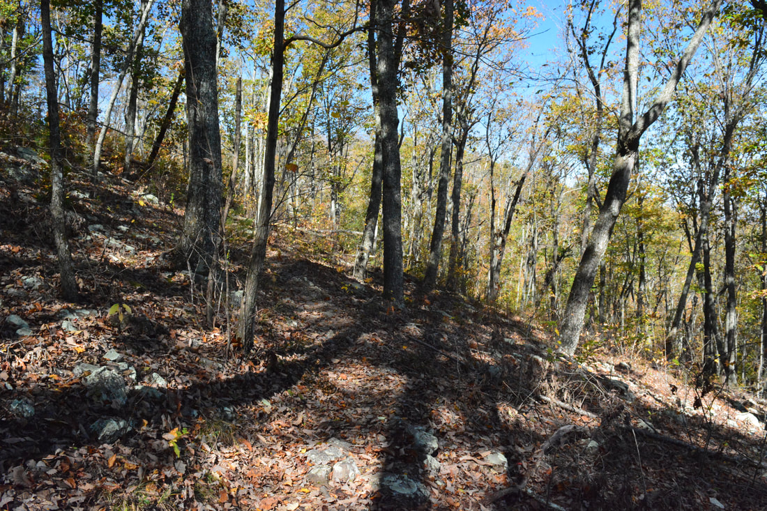
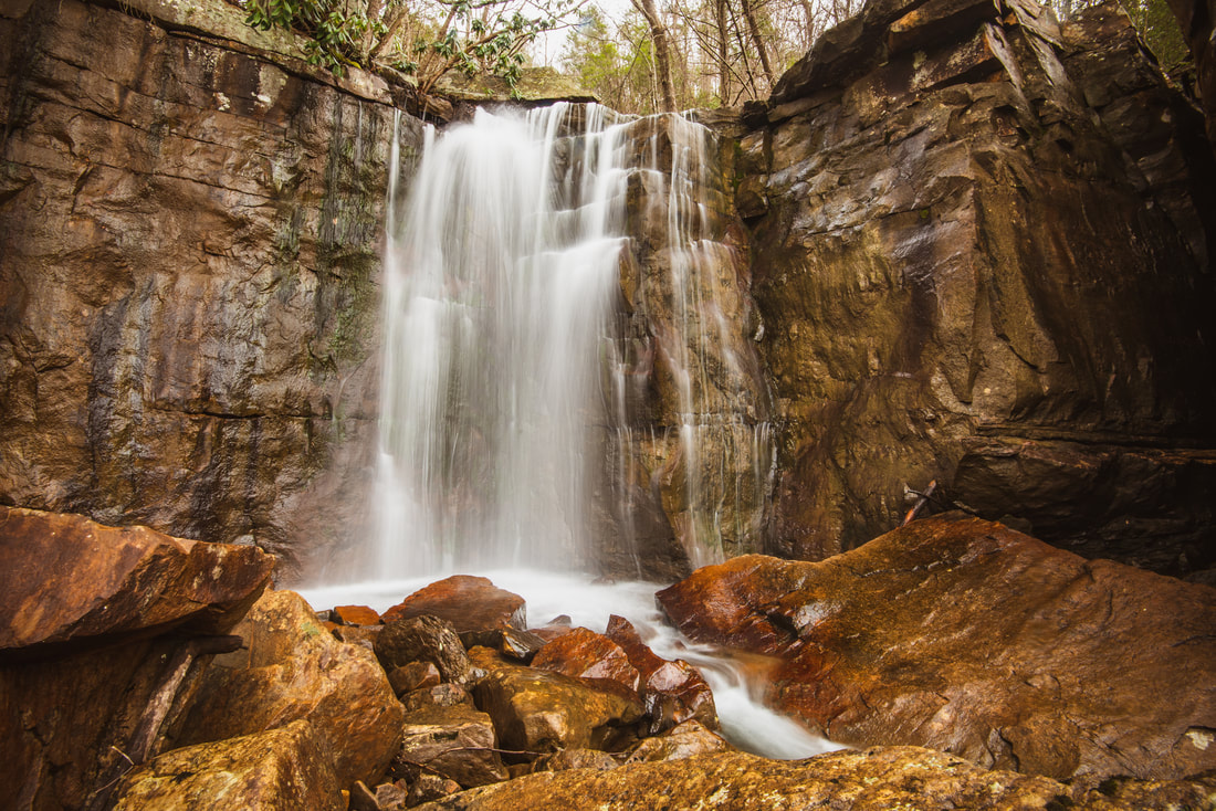
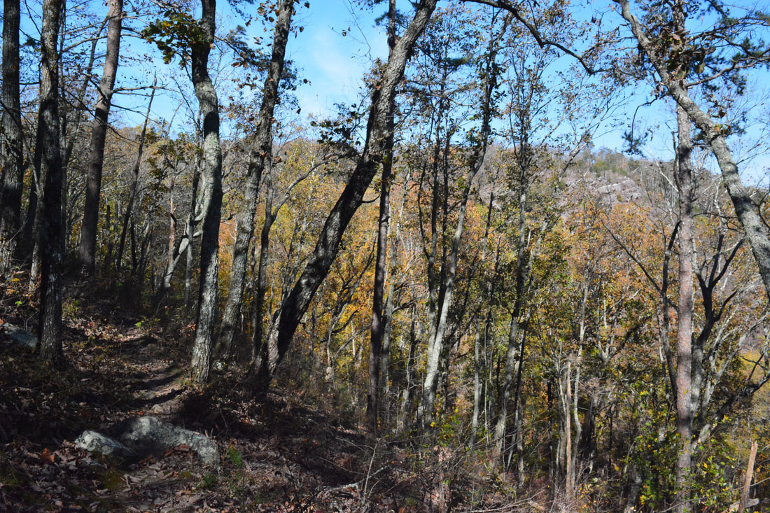
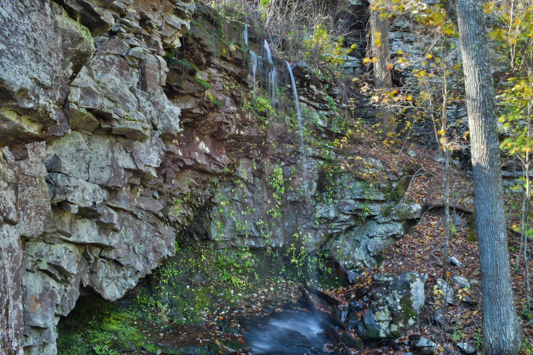
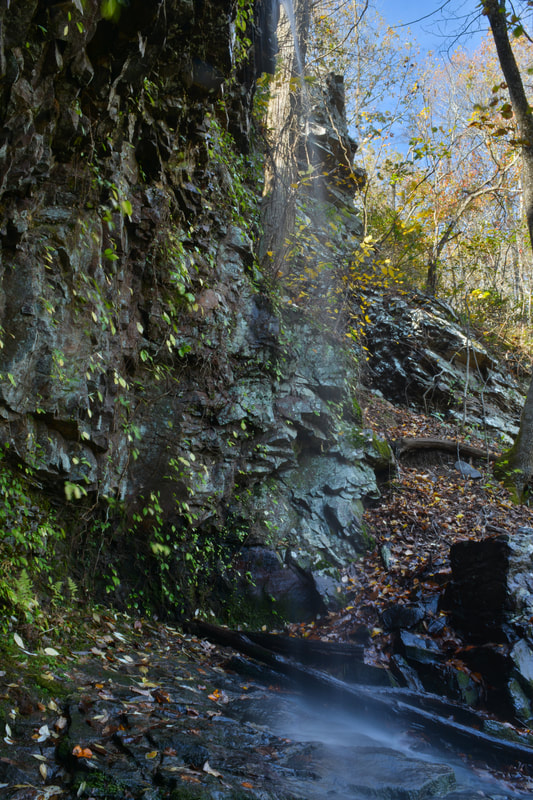
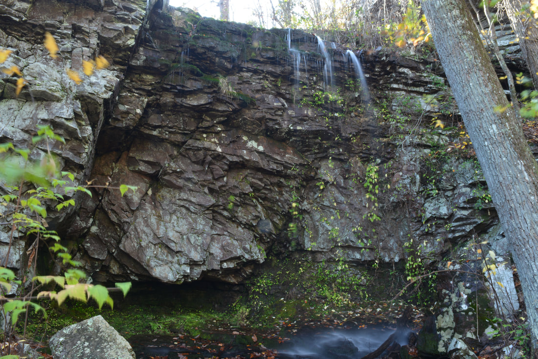
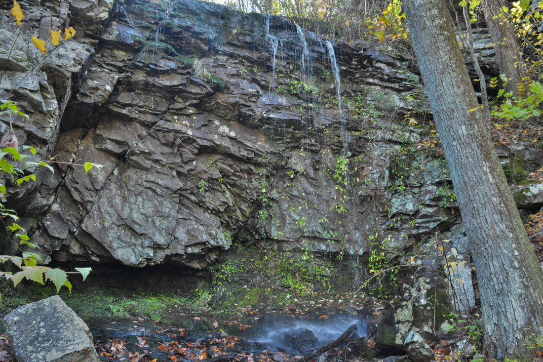
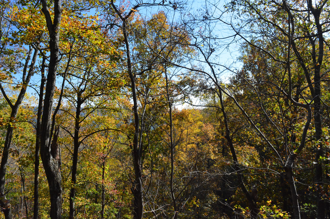
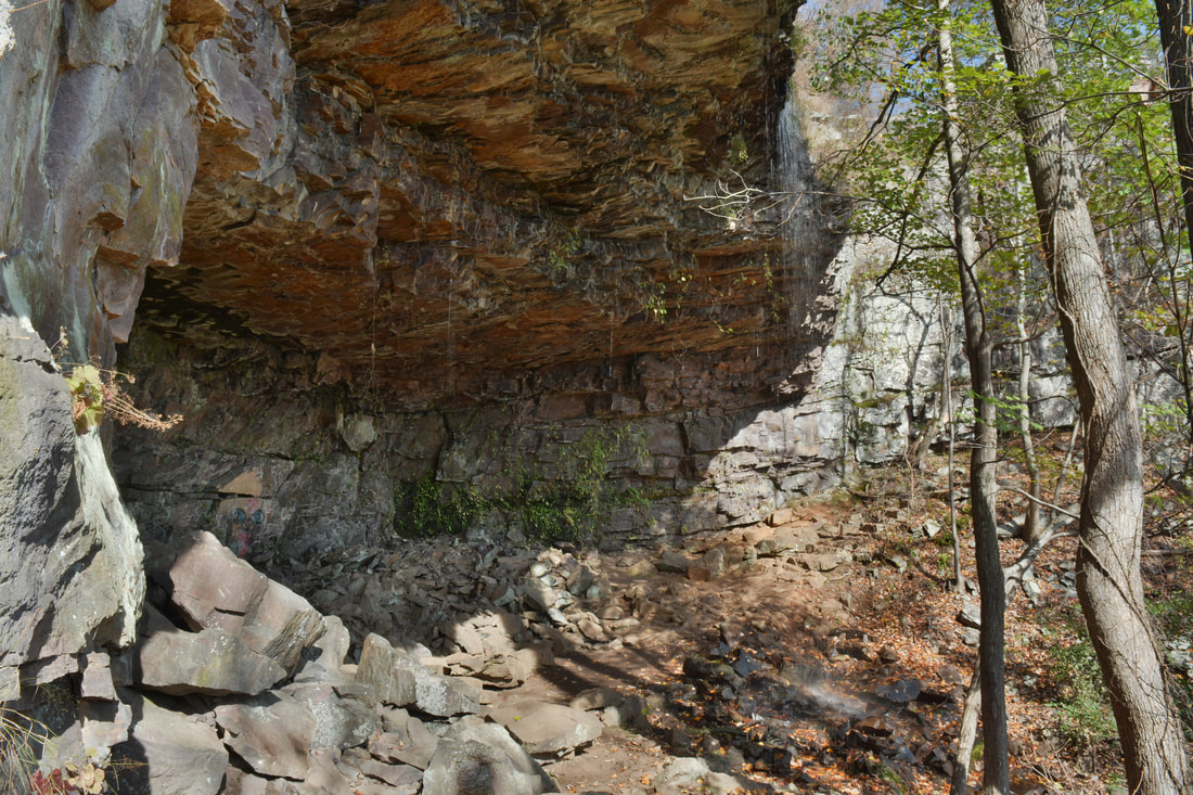
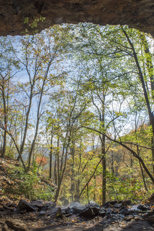
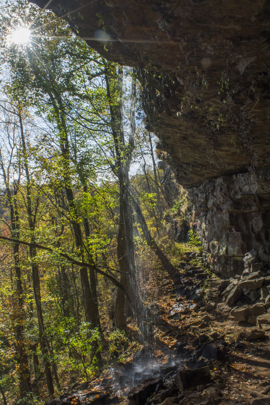
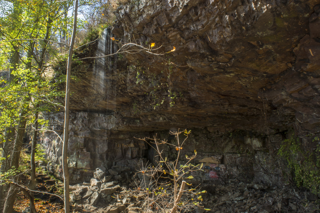
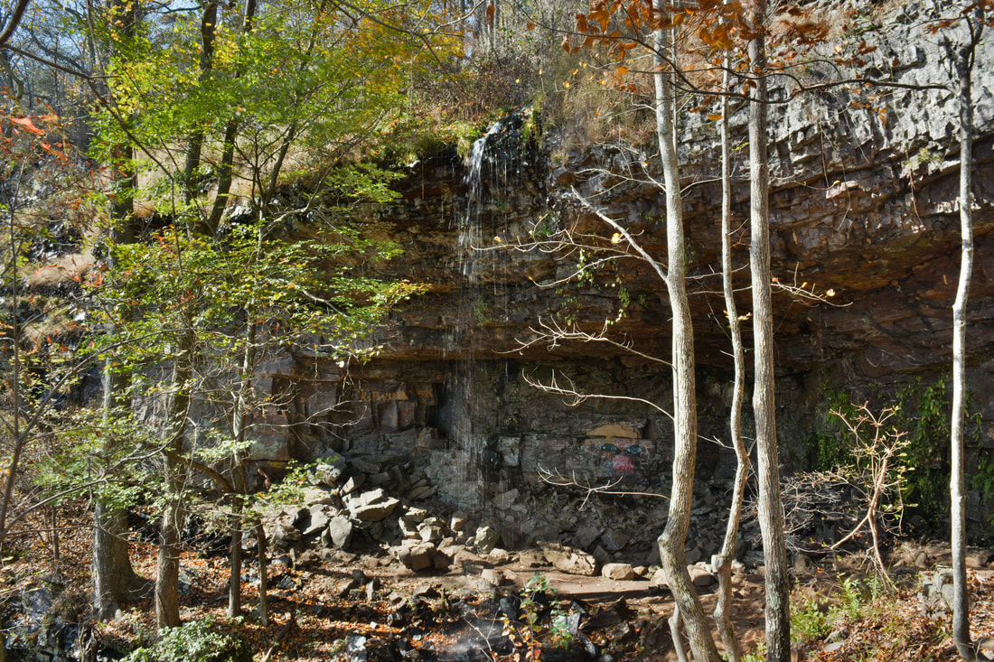
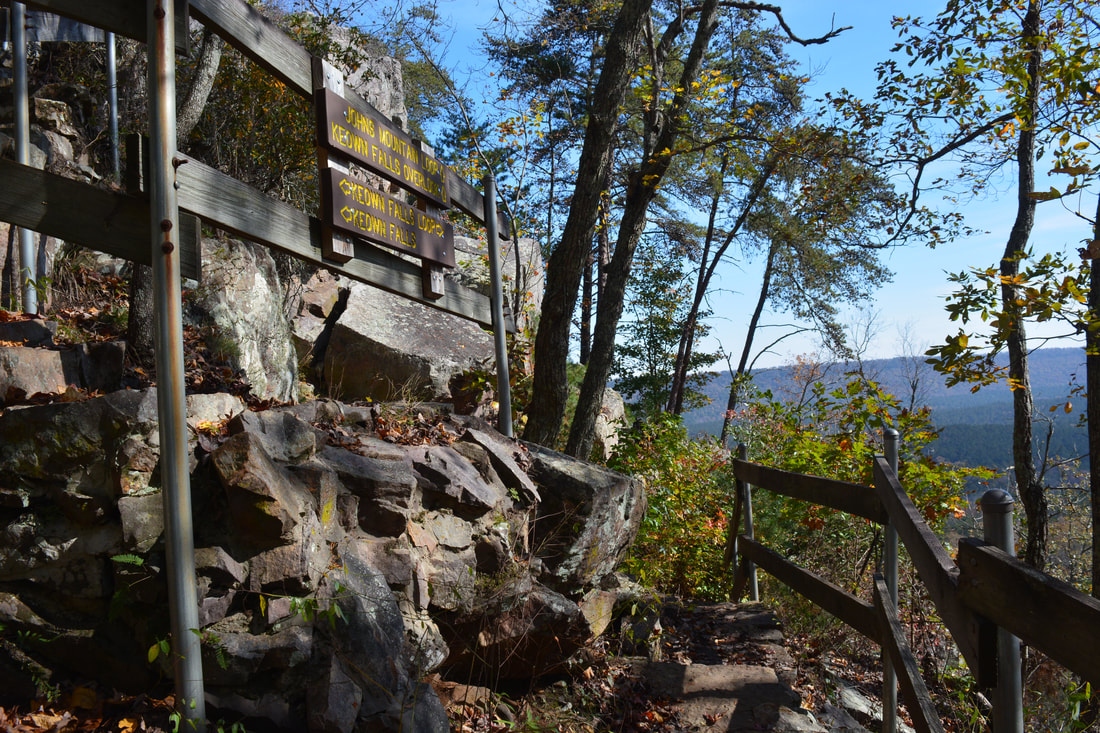
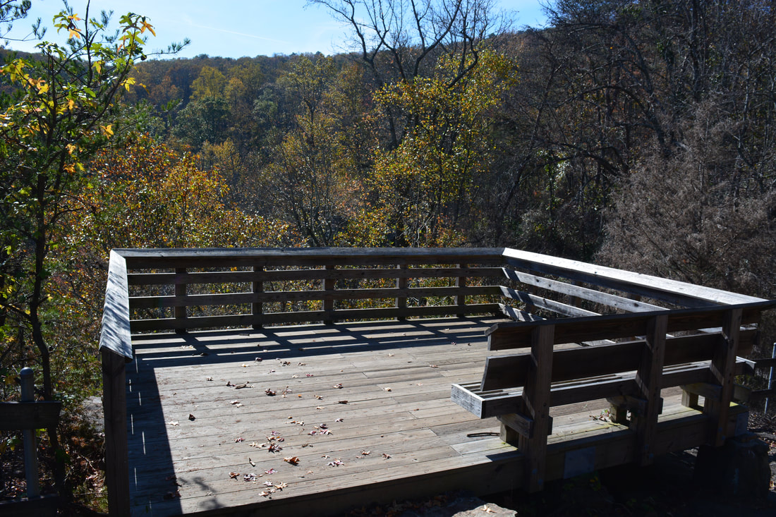
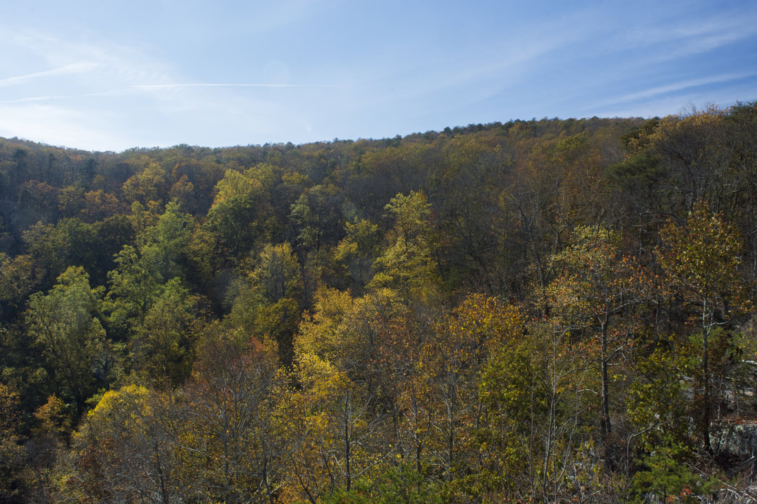
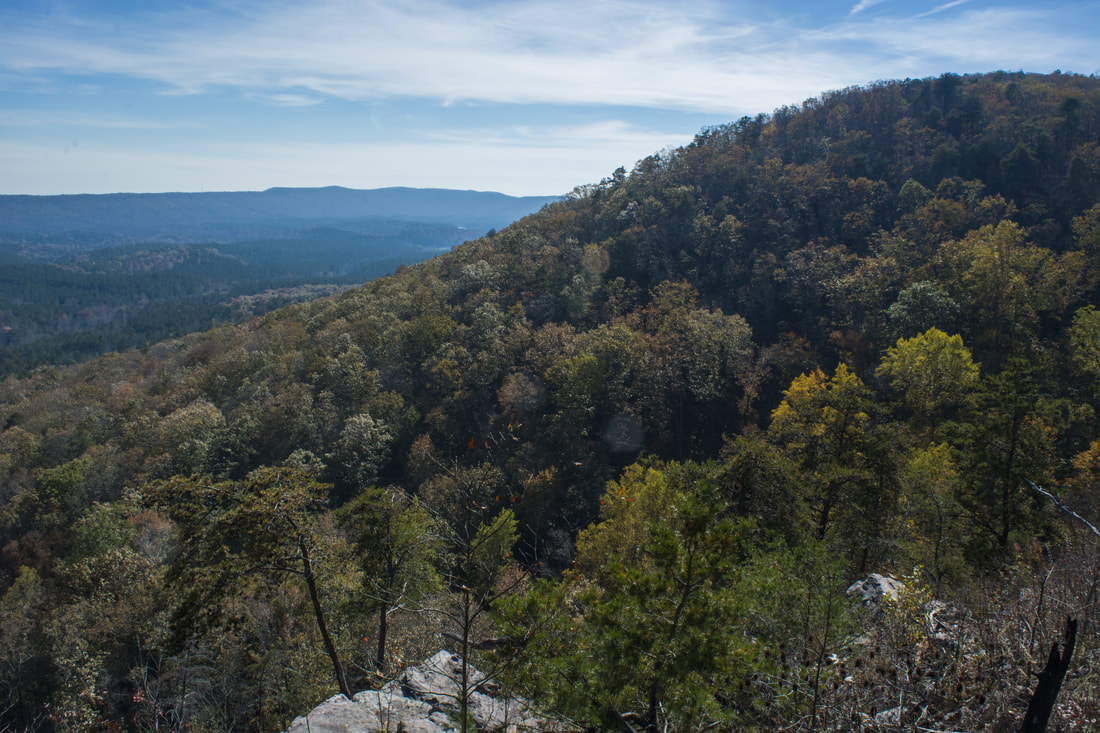
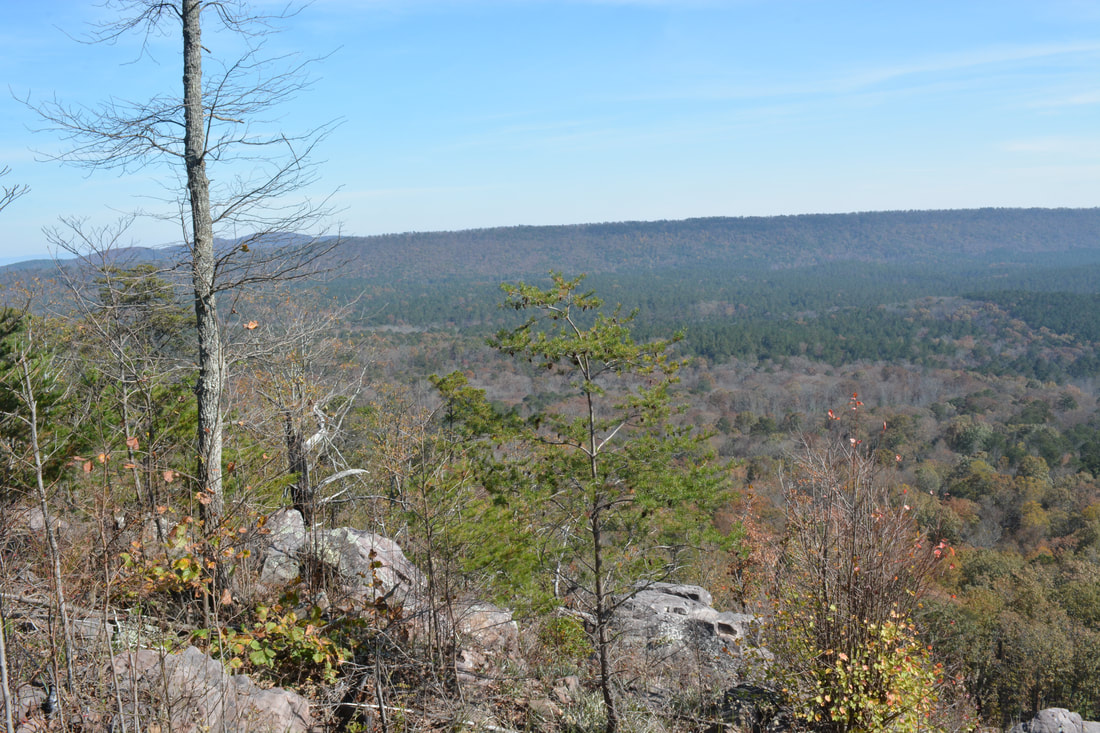
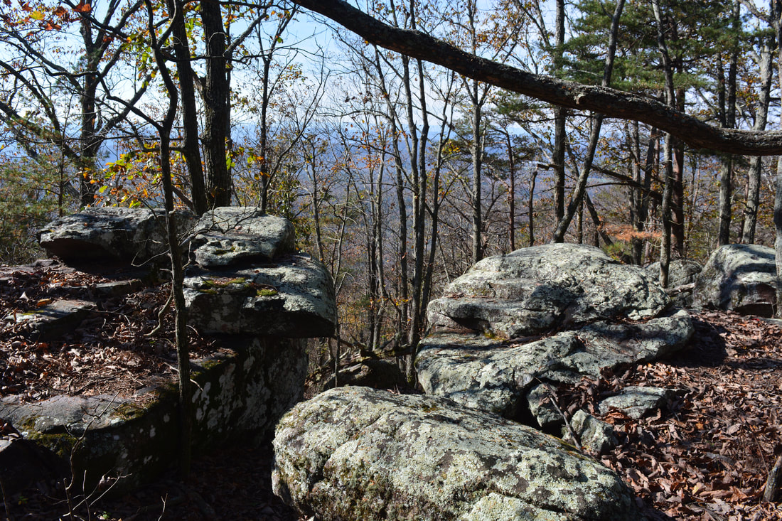
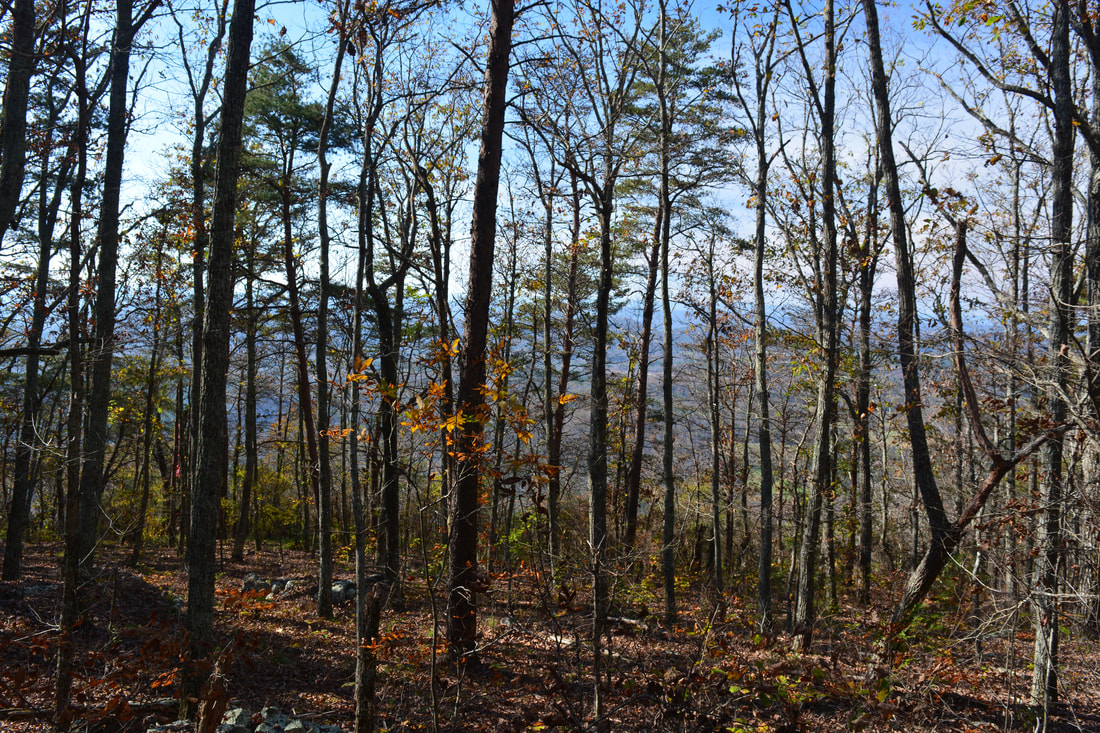
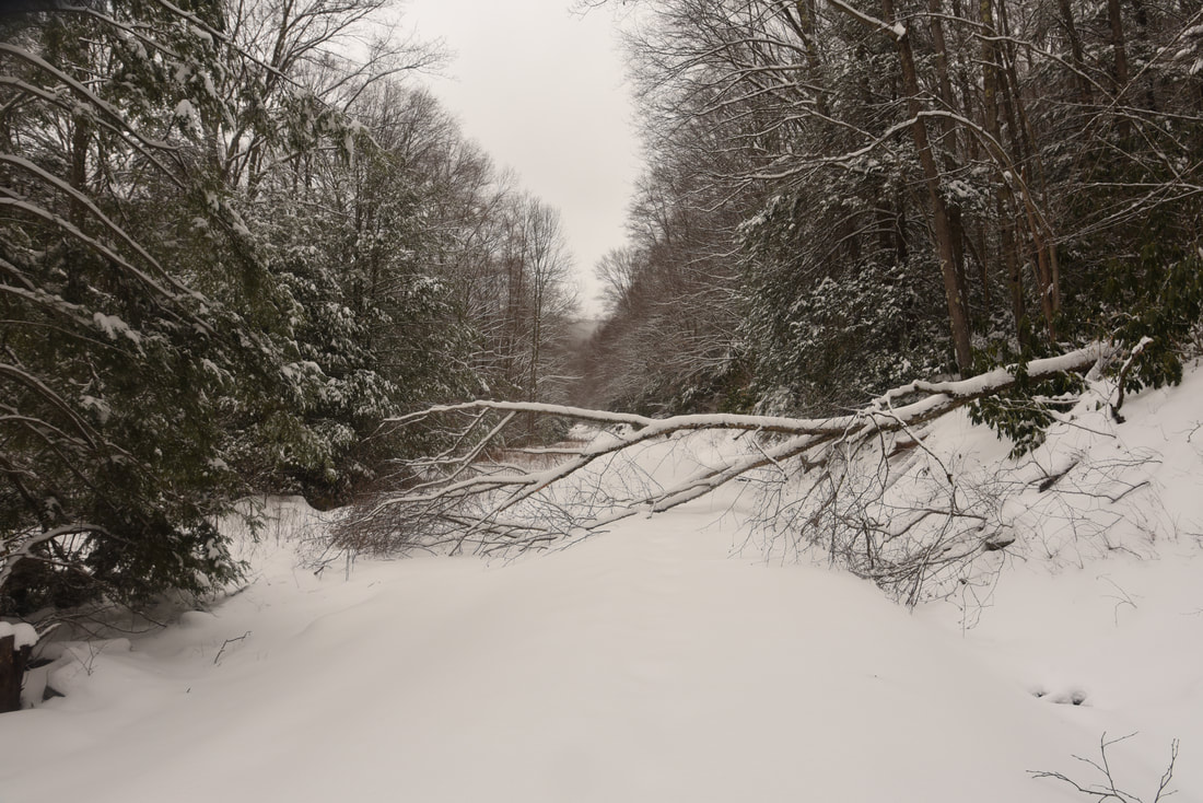
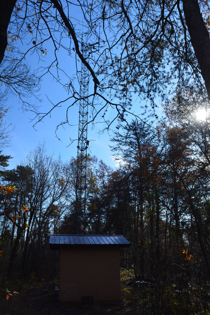
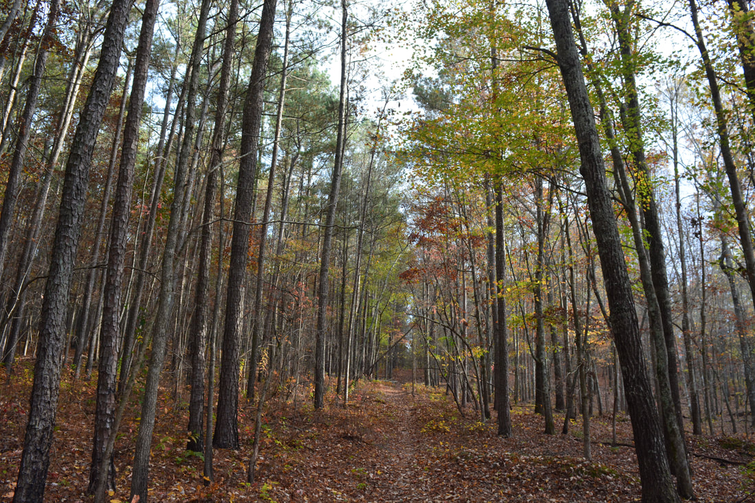
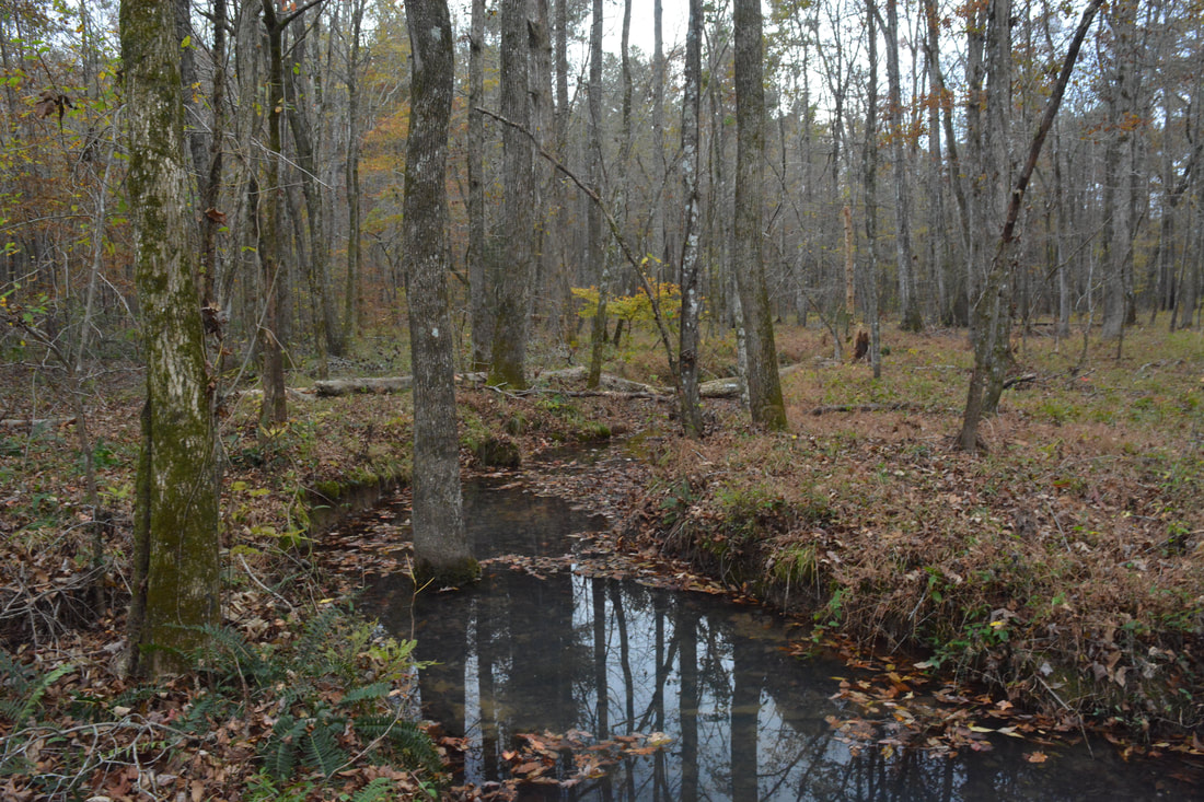
Located on a tributary of the creek that forms Keown Falls, South Keown Falls usually has even lower flow than Keown Falls. Still, it's an intriguing waterfall. I like how the creek trickles over the cliff, forming a small area of lush vegetation and spray community plants at the foot of the cliff. The falls is about 25 feet high, entirely a free-fall. Past South Keown Falls, the trail follows the base of a scenic bluff line. The fall colors were stunning in the cove at the time of my hike. At 0.9 miles, the trail reaches Keown Falls. Keown Falls free-falls about 35 feet over the lip of an overhanging bluff. The waterfall is usually close to a trickle except after heavy rain. The most interesting feature of Keown Falls is the huge undercut grotto behind it. The trail passes behind the falls and climbs up to a junction a hundred feet past the falls. Straight ahead, the Keown Falls Loop continues back to the parking area, while the hike turns left onto the Johns Mountain Trail up a series of rock steps. At 0.95 miles, the trail reaches an observation deck with a view of Keown Falls from the top of the cliff. To the right, a distinct side trail leads 100 feet to the spectacular lower vista on Johns Mountain, which includes most of Keown Falls Cove, the Johns Creek valley with Lake Marvin in the distance, and Horn Mountain on the other side of the valley. If you're lucky to catch this area during peak fall colors, the color display in the Keown Falls Cove will be spectacular! 

Continuing on the trail from the Keown Falls observation deck, you will reach a junction with the Johns Mountain Loop in a few feet. The south and west side of the loop is considerably more scenic, so stay left at the junction and cross a rickety footbridge just above Keown Falls. The trail then begins a slow ascent toward the Johns Mountain ridge, crossing the stream that forms South Keown Falls at 1.25 miles. Ignore any side trails that lead to the top of the cliffs as that is a dangerous area. After a slow ascent, the Johns Mountain Trail finally reaches the ridgecrest at 1.9 miles. From here on, as the trail follows the ridge, there are great winter views to the west. There are also several neat rock outcrops along the ridge. The trail is nearly level along the ridge, with occasional periods of gradual uphill. At 3.25 miles, the trail reaches the summit of Johns Mountain at the end of FS 208 after passing a small communications tower. 
Picture
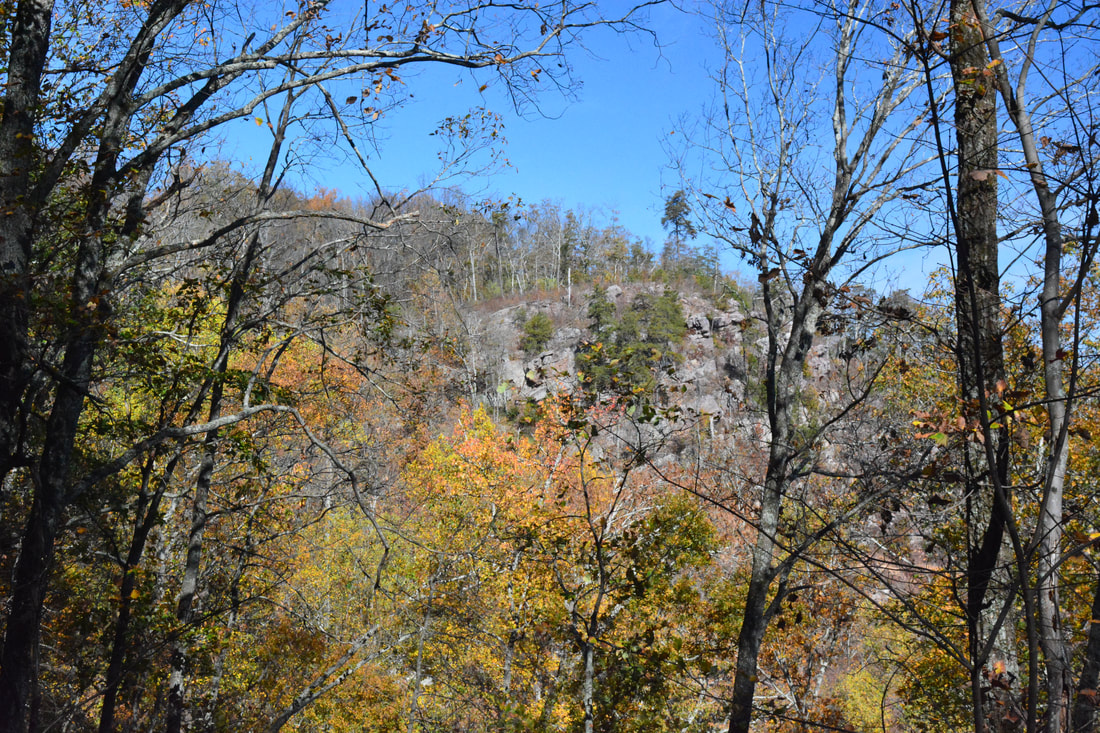
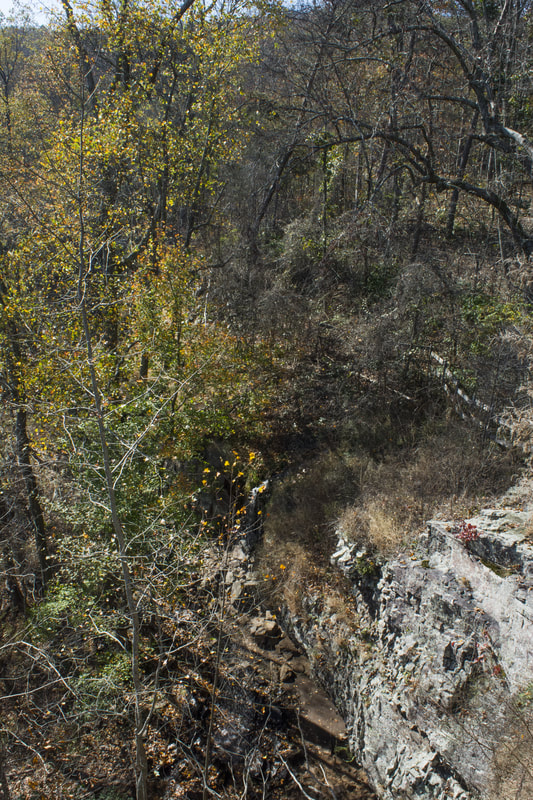
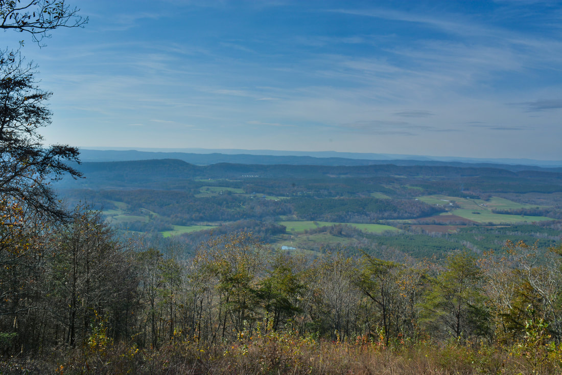
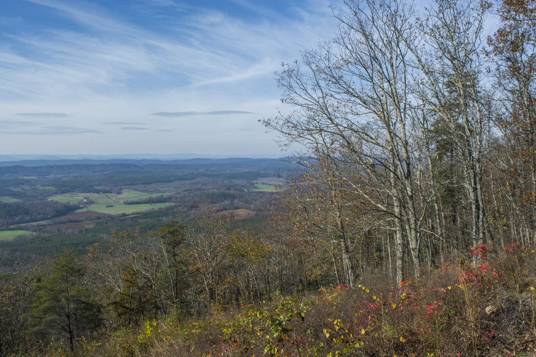
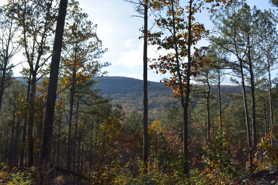
The cliffs on Johns Mountain near Keown Falls feature a spectacular view of the Johns Creek Valley and Horn Mountain.
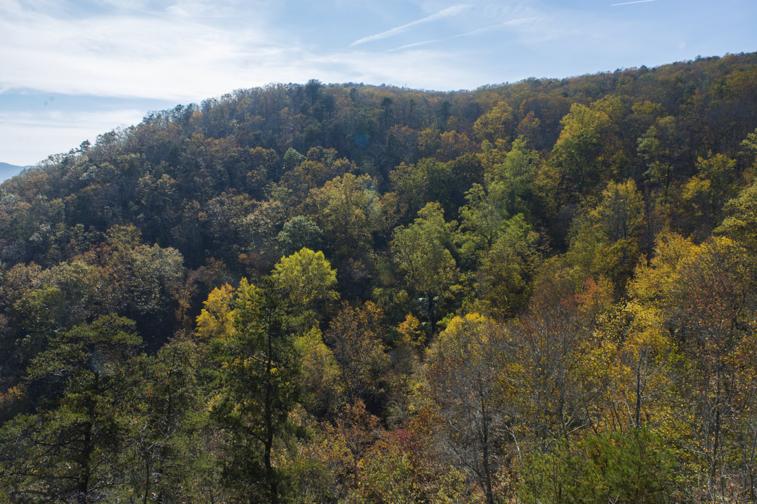
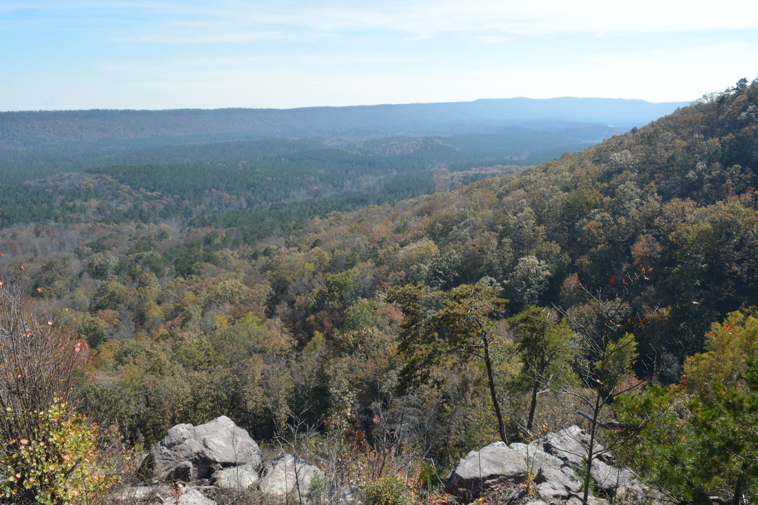
An observation deck in the clearing at the end of FS 208 provides a nice view of the Valley & Ridge area to the west, with Pigeon Mountain on the horizon. But even though this view is at a higher elevation than the first vista near Keown Falls, it actually feels lower due to the lack of a sheer drop-off. In general, I liked the first view better due to it also having a wider viewing range. Both views are worth seeing though. From the summit of Johns Mountain, you have the option of turning right and following the Johns Mountain Trail and Keown Falls Trail back to the parking area for a fairly short double loop of about four and a half miles. The hike described here is along a longer loop, although unfortunately, part of it is not very attractive due to logging operations north of FS 208. 

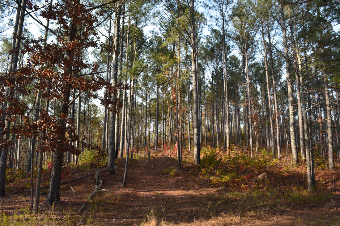
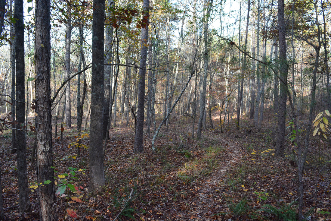
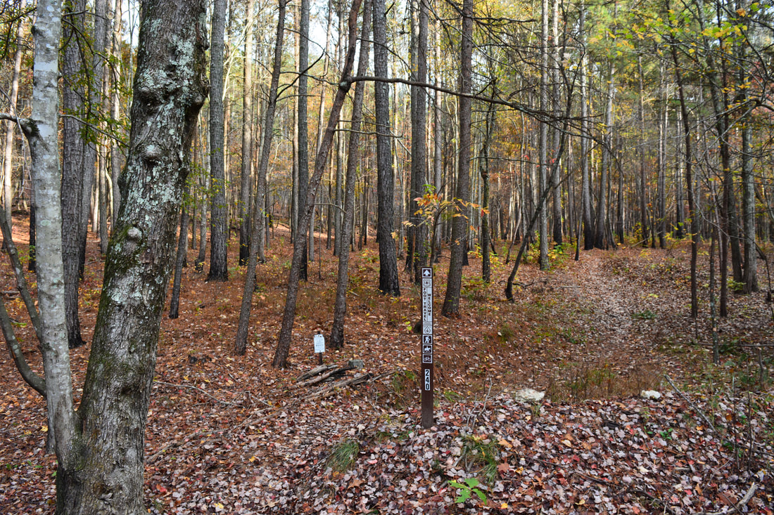
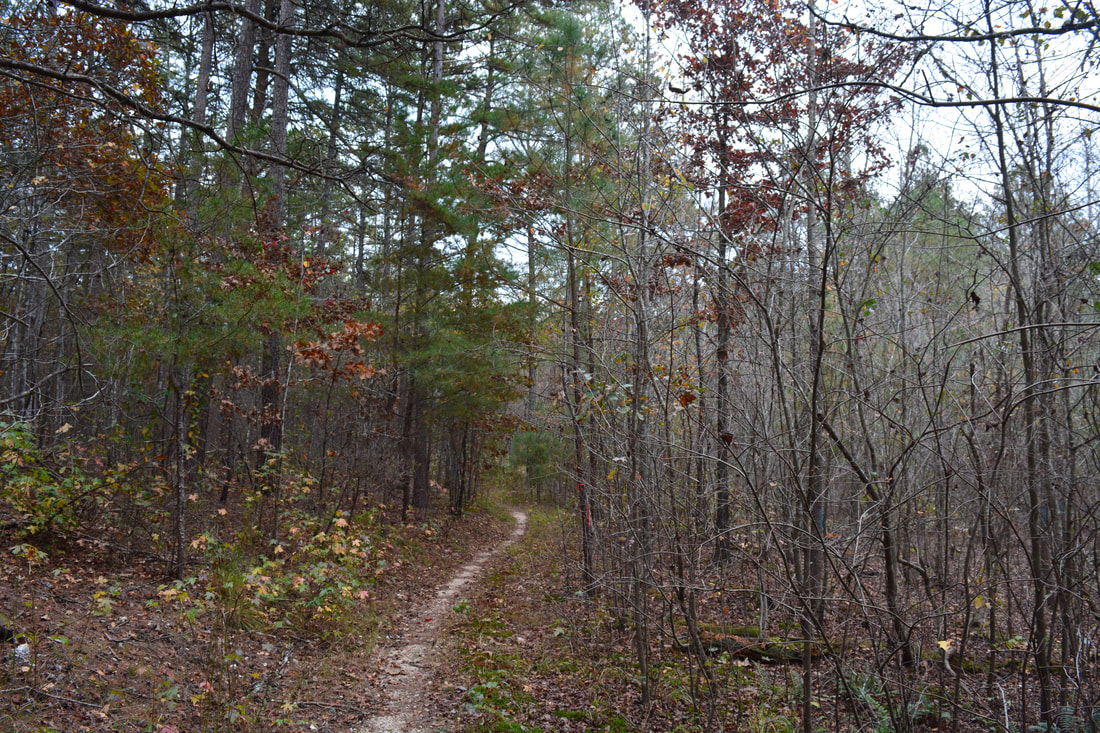
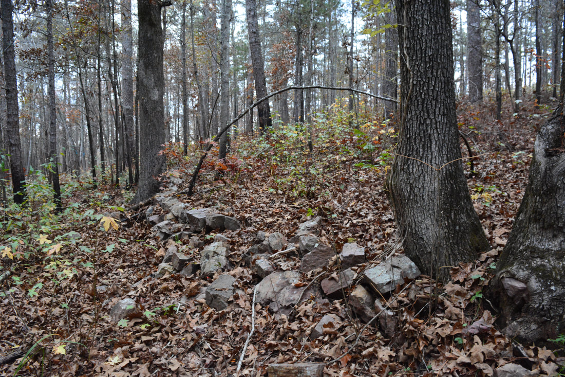
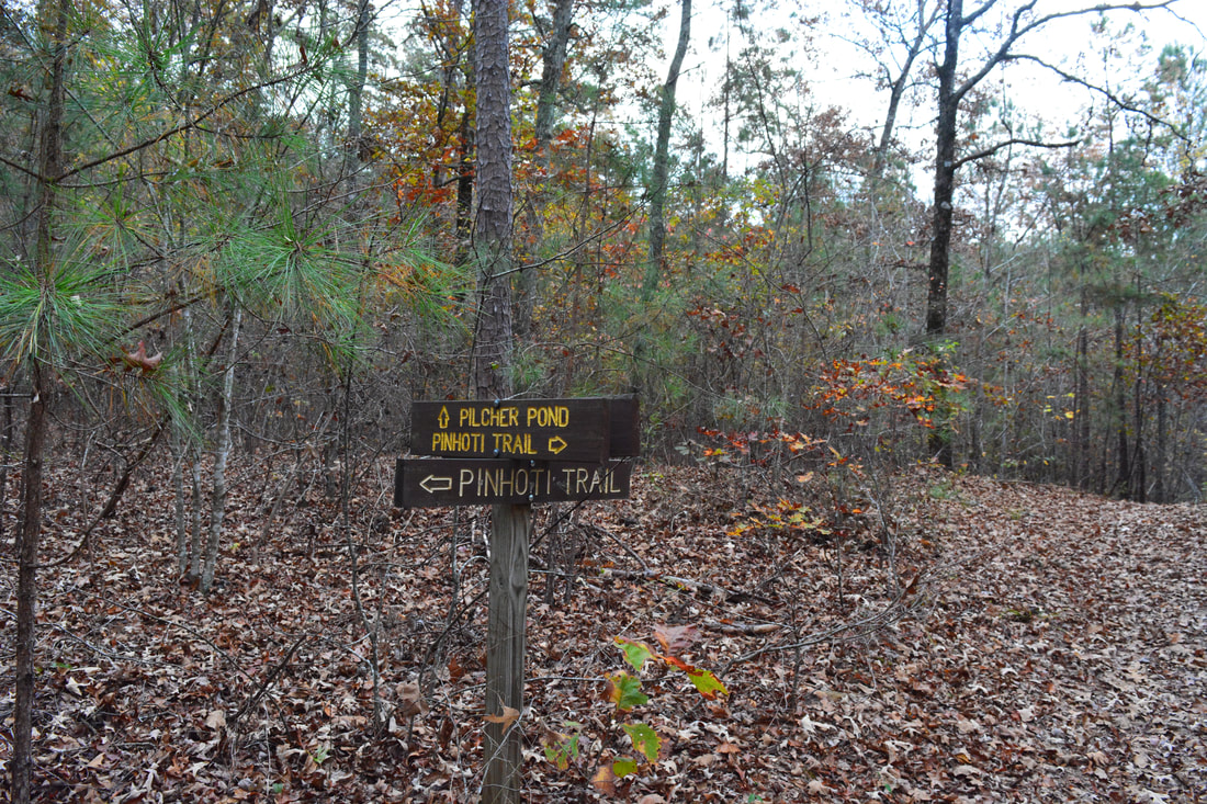
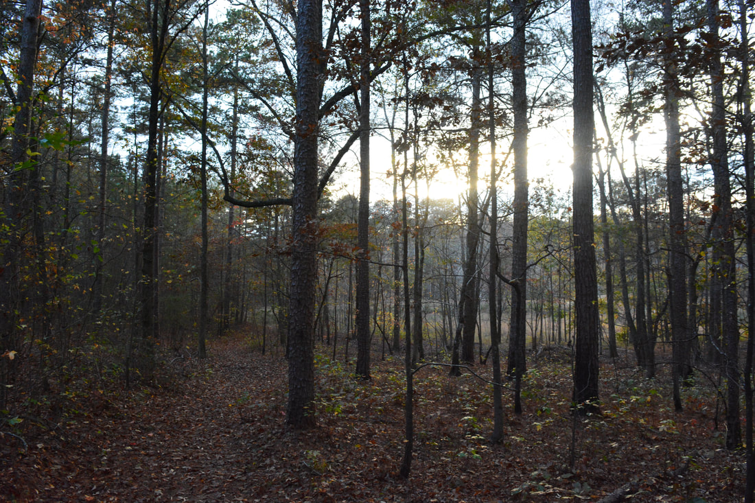
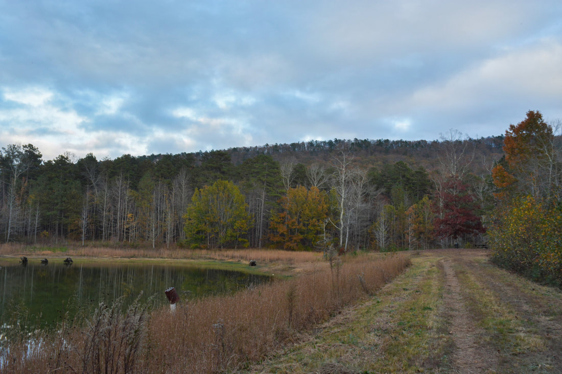
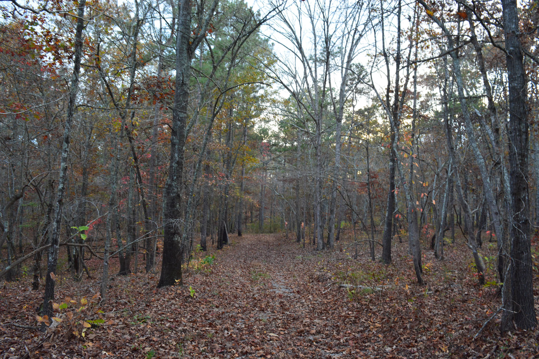
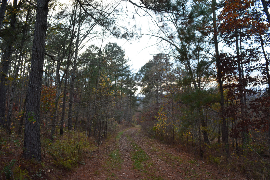
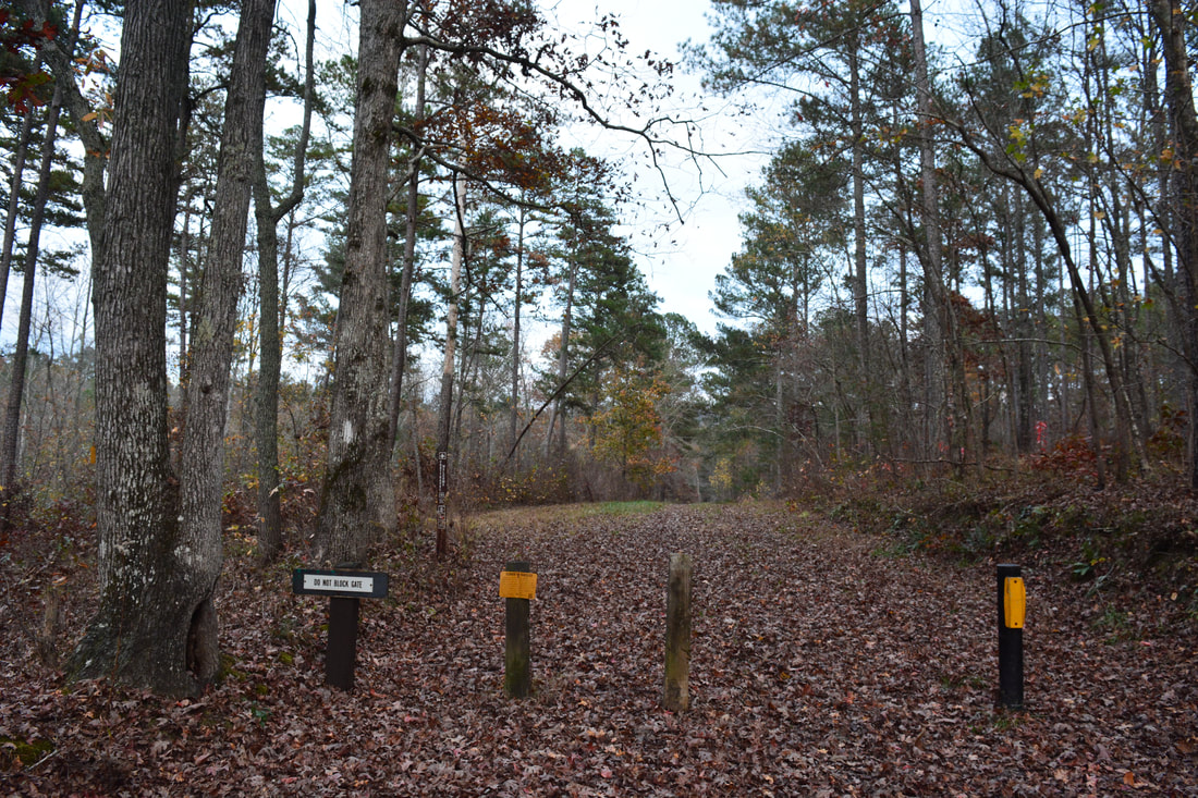
To hike the longer loop, begin walking down FS 208 as it drops off Johns Mountain. In the winter, this road is gated, but during other times of the year, you may encounter a few vehicles. The Pinhoti Trail joins the road from the left at 4.0 miles. The road reaches the bottom of the valley at 4.9 miles, where it crosses the head of Johns Creek. A short uphill brings the road to a low ridge at 5.05 miles. Here, the Pinhoti Trail turns left onto an old logging road, leaving FS 208. Follow the Pinhoti Trail along the old road through a pine forest that will likely be harvested at some point in the future. There are some nice views of the much taller Johns Mountain to the left throughout this section. At 5.6 miles, the Pinhoti Trail descends off the ridge and into a low-lying area that was recently logged extensively at the time of my hike and looked very ugly. Keep following the blazes along various old logging roads - trying to walk through the ugly logged area as fast as possible - to a logging road junction at 6.35 miles near Pocket Road. The main logging road bears left and shortly reaches Pocket Road, while the Pinhoti Trail bears right on a narrower path and finally leaves the logged area. At 6.65 miles, the trail crosses Pocket Road. On the other side, the trail parallels the road at first - making an odd double curve at 6.8 miles - before gradually curving away. The Pinhoti Trail briefly follows another forest road at 6.7 miles before curving eastward into the Furnace Creek area. All of this part of the trail is in the valley, and thus, it remains relatively flat with only small hills. At 7.45 miles, the Pinhoti Trail crosses marshy-looking Furnace Creek, which should be a hop at average water levels. There are campsites on both sides of the crossing. 

As the trail slowly climbs toward the foot of Horn Mountain, it passes an interesting rock wall. I suspect that the rock wall is from an old homestead, but I can't find any historical info about it. At 7.9 miles, the Pinhoti Trail reaches a signed junction. Here, the main route of the Pinhoti Trail turns left and ascends Horn Mountain before eventually reaching Highway 136 at  Snake Creek Gap. Meanwhile, the connector trail to Pilchers Pond and FS 702 turns right. Thus, turn right onto the connector trail, which is also known as the hikers route of the Pinhoti Trail (via Keown Falls). The trail reaches Pilchers Pond at 8.4 miles. It is named after a Civil War soldier called Samuel Pilcher who is buried nearby. The trail crosses the dam of the small pond and then follows a forest road back toward Pocket Road. Passing a couple of wildlife clearings, the Pinhoti Trail reaches Pocket Road at 9.25 miles. The rest of the hike is a fairly short roadwalk. First, turn left onto Pocket Road and follow it for about 300 feet to the beginning of FS 702 on the right. Then, walk along FS 702 (which you drove in on) for 0.6 miles, initially climbing a small ridge. You will reach the Keown Falls Parking Area at 9.9 miles, concluding the hike. 
Picture
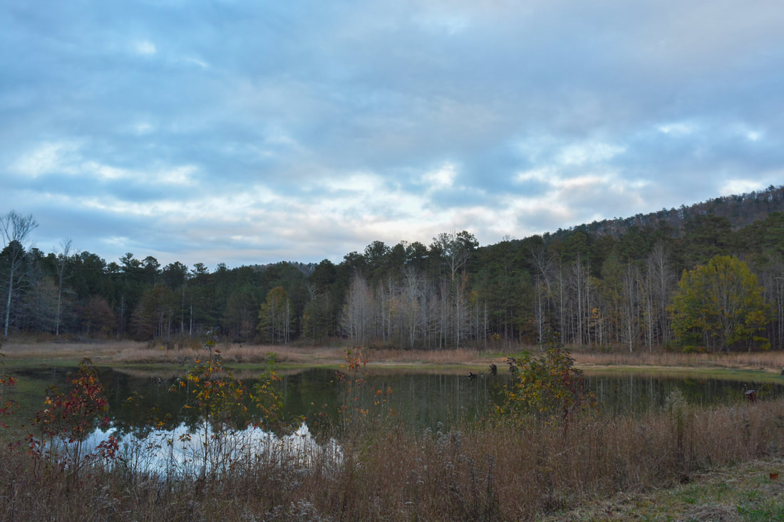
Pilchers Pond is a pretty spot at the foot of Horn Mountain along the Pinhoti Trail near Pocket Road.

Mileage

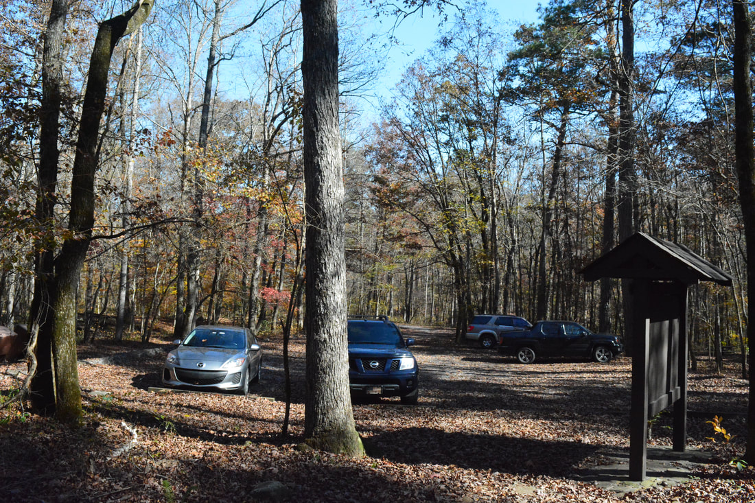
0.0 - Keown Falls Parking Area
0.75 - South Keown Falls 
0.9 - Keown Falls 
0.95 - Lower Johns Mountain Vista 
1.9 - Johns Mountain Ridge
3.25 - Johns Mountain Summit Vista 
6.65 - Pocket Road 
7.45 - Furnace Creek 
7.9 - Pilchers Pond Junction 
8.4 - Pilchers Pond 
9.25 - Pocket Road 
9.9 - Keown Falls Parking Area

Variations

Hike the Keown Falls/Johns Mountain Double Loop - 4.5 Miles 

Pictures

Videos

1 Comment
PJS
1/13/2018 04:02:25 pm

This is probably the best thing I have seen explaining this area

Reply


Leave a Reply.

    About Me

    Mark Oleg Ozboyd
    I'm an avid outdoor explorer and a hobbyist landscape photographer. I'm 21 years old and have been hiking since 2011. Originally based out of Atlanta, Georgia, I started out by occasionally hiking short trails throughout well-known Georgia State Parks. During 2012 and 2013, I began to expand my trips into adjacent states, as well as into the wilder National Forest areas rather than just State Parks. Throughout the years that followed, as I slowly ran out of popular hiking trails in my area, I began to search for and hike in more seldom-visited areas. Today, you can find me out in the woods every weekend, whether it's on an official trail or bushwhacking through cross-country terrain without any paths. I now attend Washington & Lee University and am exploring Virginia and West Virginia. My other hobbies include chess, science, old music, and meteorology. I have 3 years of amateur weather forecasting experience, having studied a lot of meteorology basics over the years. I am also a student at European School of Music where I learned that music and nature have a lot in common. Listening to good music inspires me to capture nature's beauty on the camera in different aspects that also make me recall many beautiful music pieces that I've heard.​


    Dear readers: I have invested a tremendous amount of time and effort in this website and the Georgia Waterfalls Database the past five years. All of the work that has gone in keeping these websites updated with my latest trip reports has almost been like a full-time job. This has not allowed me to pick up a paid job to save up money for college, and therefore, I I've had to take out loans. If you find the information on this website interesting, helpful, or time-saving, you can say "thanks" and help me out by clicking the button above and making a contribution. I will be very grateful for any amount of support you give, as all of it will apply toward my college tuition. Thank you! 

    Enter your email address to subscribe for trail reports:

    Delivered by FeedBurner


    Picture
    Coming in 2022-2023?

    Other Hiking Websites

    DWHike's Adventures
    Florida's Natural Wonders
    Florida Trailblazer
    Meanderthals
    Mountain Images
    by Bernie Boyer

    North Carolina Waterfalls with
    ​Kevin Adams
    Take-a-Hike!
    Tennessee Landforms
    Waterfall Page
    Waterfall Adventurer
    Zach's Mild Adventures

    Miles Hiked

    Year 1: 540.0 Miles
    Year 2: 552.3 Miles
    ​Year 3: 518.4 Miles
    Year 4: 482.4 Miles
    Year 5: 259.9 Miles

    Archives

    March 2021
    February 2021
    January 2021
    November 2019
    October 2019
    September 2019
    August 2019
    July 2019
    June 2019
    February 2019
    January 2019
    December 2018
    November 2018
    October 2018
    August 2018
    July 2018
    June 2018
    May 2018
    April 2018
    March 2018
    February 2018
    January 2018
    December 2017
    November 2017
    October 2017
    September 2017
    August 2017
    July 2017
    June 2017
    May 2017
    April 2017
    March 2017
    February 2017
    January 2017
    December 2016
    November 2016
    October 2016
    September 2016
    August 2016
    June 2016
    May 2016
    April 2016
    March 2016
    January 2016
    December 2015
    November 2015
    October 2015
    September 2015
    August 2015
    July 2015
    June 2015
    May 2015
    April 2015
    March 2015
    February 2015
    January 2015
    December 2014
    November 2014
    October 2014
    September 2014
    August 2014
    July 2014
    June 2014
    May 2014
    April 2014
    March 2014
    February 2014

    Categories

    All
    Adel
    Adirondack Park
    Alabama
    Alfred A. Ring Park
    Allegheny Trail
    Amicalola Falls State Park
    Anniston Area
    Apalachicola Bluffs And Ravines Preserve
    Apalachicola National Forest
    Apalachicola/Port St. Joe Area
    Apopka
    Appalachian Trail
    Appling
    Art Loeb Trail
    Aska Trail System
    Bakersville
    Balm-Boyette Scrub Preserve
    Balsam Lake Recreation Area
    Bankhead National Forest
    Bartow County Parks
    Bartram Trail
    Basinger
    Beersheba Springs
    Benton
    Benton Mackaye Trail
    Berry College Trail System
    Best Hike
    Big South Fork National Recreation Area
    Black Bear Wilderness
    Black Rock Mountain State Park
    Blairsville
    Blakely
    Blood Mountain Wilderness
    Blowing Rock
    Blue Ridge
    Blue Ridge Parkway
    Boone
    Bradenton
    Bradenton Beach
    Brasstown Bald
    Brasstown Wilderness
    Brevard
    Bryson City
    Buchanan
    Bucks Pocket State Park
    Bulow Creek State Park
    Bulow Plantation Ruins State Park
    Caesars Head State Park
    Caladesi Island State Park
    Calhoun
    Camel's Hump State Park
    Cashiers
    Caspersen Beach Park
    Catfish Creek State Park
    Caves
    CC Putnam State Forest
    Cedar Point Environmental Park
    Chatsworth
    Chattahoochee National Forest
    Chattanooga
    Chattanooga Valley
    Chattooga National Wild And Scenic River
    Cheaha Wilderness
    Cherohala Skyway
    Cherokee
    Cherokee National Forest
    Chiefland Area
    Chillhowee Recreation Area
    Chipley
    Chunky Gal Trail
    Circle B Bar Reserve
    Citico Creek Wilderness
    Citrus Wildlife Management Area
    Clarkesville
    Clayton
    Cleevland
    Cleveland
    Cloudland Canyon State Park
    Cohutta Wilderness
    Collier-Seminole State Park
    Cordele
    Cornelia
    Covington
    Crestview Area
    Crew-land-and-water-trust
    Cullowhee
    Cumberland Trail
    Dahlonega
    Dalton
    Dawson Forest Wildlife Management Area
    Dawsonville
    Dayton
    De Soto National Memorial
    DeSoto State Park
    Dillard
    Double Springs
    Ducktown
    Duncan Ridge Trail
    Dunlap
    Eagle's Rest Park
    Eastpoint
    Econfina Creek Wildife Management Area
    Eglin Air Force Base
    Elizabethton
    Elkins
    Elk Knob Game Lands
    Elk Park
    Ellicott Rock Wilderness
    Ellijay
    Emerson Point Preserve
    Englewood Area
    Enota Retreat
    Erwin
    Falling Waters State Park
    Fayetteville
    Fires Creek Recreation Area
    Fire Tower
    Flint River
    Florence Area
    Florida
    Florida Caverns State Park
    Florida Trail
    Foothills Trail
    Fort Mountain State Park
    Fort Myers Area
    Fort Payne
    Fort Payne Area
    Fort Yargo State Park
    Franklin
    Franklin Delano Roosevelt State Park
    Franklin-Marion State Forest
    Frozen Head State Park
    Gainesville
    Gainesville Area
    Gatlinburg
    George Washington National Forest
    Georgia
    Georgia Veterans Memorial State Park
    Glasgow
    Gorges State Park
    Grandfather Mountain State Park
    Great Smoky Mountains National Park
    Greeneville
    Green River Game Lands
    Gruetli-Laager
    Grundy Forest State Natural Area
    GTM Reserve
    Guana River Wildlife Management Area
    Hayesville
    Helen
    Hiawassee
    High Falls State Park
    Highlands
    Highlands Scenic Highway
    Hillsborough River State Park
    Hinson Conservation & Recreation Area
    Historic Sites
    Honeymoon Island State Park
    Hot Springs
    Huntington
    Inverness Area
    Jackson
    Jasper
    Jefferson National Forest
    Joan M. Durante Park
    Jonathan Dickinson State Park
    Jones Gap State Park
    Joyce Kilmer Slickrock Wilderness
    Joyce Kilmer - Slickrock Wilderness
    Juniper Prairie Wilderness
    Kelly Park
    Keown Falls Recreation Area
    Kolomoki Mounds State Park
    LaFayette
    Lake City Area
    Lake George Wild Forest
    Lake June-in-Winter State Park
    Lakeland Area
    Lake Placid
    Lake Russell Wildlife Management Area
    Lake Wales Ridge State Forest
    Laurel Fork North Wilderness
    Leffis Key Preserve
    Leon Sinks Geological Area
    Lexington
    Lineville
    Linville
    Linville Gorge Wilderness
    Lithia Springs
    Little Frog Wilderness
    Little Manatee River State Park
    Little River Canyon National Preserve
    Longboat Key
    Long Trail
    Lookout Mountain
    Lookout Mountain Battlefield
    Lovingston
    Lula Lake Land Trust
    Lumpkin
    Maggie Valley
    Manatee Springs State Park
    Marianna Area
    Mark Trail Wilderness
    Marlinton
    Mccaysville
    McMinville
    Mentone
    Middlesex
    Mistletoe State Park
    Monongahela National Forest
    Montreat
    Mountain Bridge Wilderness Area
    Mountain City
    Mountains To Sea Trail
    Mountains-to-Sea Trail
    Mount Rogers National Recreation Area
    Myakka River State Park
    Myron B. Hodge City Park
    Nantahala National Forest
    Naples
    Naples Area
    Natural Bridge State Park
    Neal Preserve
    New Castle
    Newport
    New River Gorge National Park
    New York
    North Carolina
    Ocala Area
    Ocala National Forest
    Ocean-to-Lake Trail
    Oconee State Park
    Oconee Station Historic Site
    Okaloacoochee Slough State Forest
    Oldsmar
    Oneida
    Orlando Area
    Ormond Beach
    Oscar Scherer State Park
    Oxford
    Palatka
    Palmetto Trail
    Panama City Area
    Panthertown Valley
    Parrish
    Paynes Creek Historic State Park
    Peaks Of Otter Recreation Area
    Pigeon Crockford Mountain Wildlife Management Area
    Pigeon-Crockford Mountain Wildlife Management Area
    Pigeon-Crockford Wildlife Management Area
    Pine Mountain
    Pinhoti Trail
    Pinnacle Park
    Pisgah Civitan Park
    Pisgah National Forest
    Pittman Center
    Pond Mountain Wilderness
    Ponds/Lakes
    Prentice Cooper State Forest
    Providence Canyon State Park
    Pumpkintown
    Quick Point Nature Preserve
    Raven Cliffs Wilderness
    Reed Bingham State Park
    Reliance
    Rice Creek Conservation Area
    Riverview Pointe Preserve
    Robbinsville
    Robinson Preserve
    Rock Creek Gorge Scenic Area
    Rock Island State Park
    Rome
    Rosman
    Sale Creek
    Salem
    Salt Springs
    Saluda
    Santa Rosa Beach
    Sarasota
    Sarasota Area
    Savage Gulf State Natural Area
    Scenic Views
    Scottsboro Area
    Sebring Area
    Sewanee
    Sheltowee Trace Trail
    Shining Rock Wilderness
    Signal Mountain
    Sipsey Wilderness
    Sky Valley
    Smithgall Woods State Park
    Snowbird Backcountry Area
    Soddy Daisy
    Soddy-Daisy
    Sopchoppy
    South Carolina
    South Cumberland State Park
    Southeastern Cave Conservancy
    Southern Nantahala Wilderness
    Sparta
    Sprewell Bluff Park
    Spring City
    Spring Hill
    Springs
    Spruce Pine
    Standing Indian Backcountry Area
    St. Augustine
    St. George Island State Park
    St. Joseph Bay State Buffer Preserve
    St. Marks Area
    St. Marks National Wildlife Refuge
    Stone Mountain
    Stone Mountain Park
    Suches
    Sumatra
    Sumter National Forest
    Suwannee River
    Swallow Creek Wildlife Management Area
    Sweetwater Creek State Park
    Sylva
    Talladega National Forest
    Tallahassee Area
    Tallulah Falls
    Tallulah Gorge State Park
    Tampa Bay Area
    Tate City
    Tate's Hell State Forest
    Tea Creek Wildlife Management Area
    Tellico Plains
    Tennessee
    Thomaston
    Toccoa
    Topsail Hill State Park
    Torreya State Park
    Townsend
    Tracy City
    Tray Mountain Wilderness
    Trenton
    Triple Creek Preserve
    Troutdale
    Unaka Mountain Wilderness
    Upper Tampa Bay County Park
    Venice
    Vermont
    Virgin Falls State Natural Area
    Virginia
    Virginia Outdoors Foundation
    Vogel State Park
    Wakulla Springs State Park
    Waleska
    Walhalla
    Wartburg
    Water Features
    Waynesville
    Weedon Island Preserve
    Weeki Wachee Preserve
    Wekiwa Springs State Park
    West Palm Beach Area
    West Virginia
    Whitehall
    White Springs
    Winder
    Withlacoochee State Forest
    Young Harris

    RSS Feed

TRAIL REPORTS

Hikes in Alabama
​Hikes in Florida
Hikes in Georgia
Hikes in North Carolina
Hikes in South Carolina
Hikes in Tennessee
Hikes in Virginia

Hiking Resources

Alabama Resources
​
Florida Resources
Georgia Resources
North Carolina Resources
​South Carolina Resources
​
Tennessee Resources

Other

Contact
Map of Hikes
Alphabetical List of Hikes
Southeast Nature Society
© COPYRIGHT 2014-2018
​ALL RIGHTS RESERVED.
Important: I disclaim any responsibility for any damage or personal injury that may occur as a result of the activities and information found on this website. All outdoor activities, especially off-trail hiking, are done at your own risk. Never hike or head into that area that may be above your fitness or experience level.
  • Home
  • Trail Reports
    • Best Hikes
    • Hikes with Scenic Views
    • Hikes with Water Features
    • Alabama
    • Georgia
    • Florida
    • North Carolina
    • South Carolina
    • Tennessee
    • Vermont
    • Virginia
  • Map
  • Hike List
  • Testimonials
  • Resources
  • Contact Us
  • Southeast Nature Society
    • Our Team
  • Georgia Waterfalls Database