HIKING THE APPALACHIANS AND BEYOND
  • Home
  • Trail Reports
    • Best Hikes
    • Hikes with Scenic Views
    • Hikes with Water Features
    • Alabama
    • Georgia
    • Florida
    • North Carolina
    • South Carolina
    • Tennessee
    • Vermont
    • Virginia
  • Map
  • Hike List
  • Testimonials
  • Resources
  • Contact Us
  • Southeast Nature Society
    • Our Team
  • Georgia Waterfalls Database

Jones Gap State Park: Pinnacle Pass Trail and Rim of the Gap Trail, Cleveland, South Carolina

5/2/2016

0 Comments

 
Picture
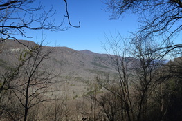
When someone mentions Jones Gap, you may think they're referring to a low point on some sort of ridge...  just like you would imagine with any other Gap. Jones Gap is actually the name of a deep depression, the Saluda River valley, that is located in the extreme northern tier of Greenville County, South Carolina. The Mountain Bridge Wilderness provides many hiking opportunities throughout the Jones Gap area. On this particular hike, you will ascend out of Jones Gap past seasonal views for a loop that circles along the south rim of the gap. This hike occurred on Saturday, February 13, 2016. My plan was to hike a short stretch of the Jones Gap Trail, and then to hike the Pinnacle Pass Loop by hiking the Pinnacle Pass Trail and the eastern half of the Rim of the Gap Trail. 

Summary

R/T Length of Trail: 8.5 Miles
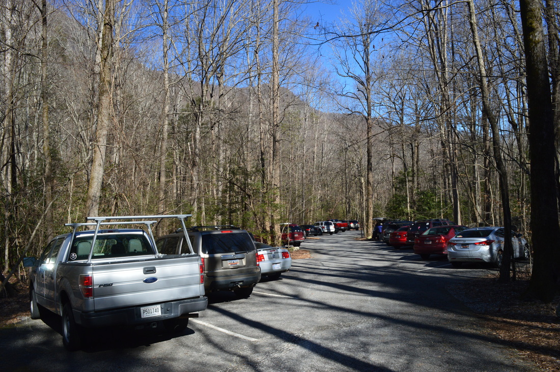
Duration of Hike: 5:20
Type of Hike: Lasso
Difficulty Rating: 6 out of 10 
Total Elevation Gain: 2329 Feet
Pros: Trail up the steep-sided gorge is graded well
Cons: None 
Points of Interest: Views of Jones Gap from Pinnacle Pass Trail - combined 4 stars
Trail Blaze Color(s): Jones Gap Trail - Blue; Rim of the Gap Trail - Yellow; Pinnacle Pass Trail - White; John Sloan Trail - Pink
Best Season(s) to Hike: Winter (Be aware of some ice on Pinnacle Pass Trail)
Fees: There is a $2 trail parking fee for adults. The fee is $1.25 for SC Seniors, and admission is free for children 15 years old or younger. Between October 1 and November 30, the admission fees are $5 per adult, $3.25 per SC Senior, $3 per children age 6 to 15, and free for children under 6. Pay at the fee station near the parking area at the trailhead. 
Beginning Point: Jones Gap State Park Visitor Center
Directions: From Cleveland, SC: Follow US Route 276 North for 0.9 miles. Then, turn right onto River Falls Road. Continue straight for 5.6 miles (the road name will change to Jones Gap Road) until you reach Jones Gap State Park. After you enter it, the parking area will be to your right. The parking area may be full, and if so, you will have to wait at the entrance gate until someone leaves. 

Map

Click here for more information and to download this trail map to view in Garmin Basecamp. ​

Details

The Mountain Bridge Wilderness Area, comprised of Caesars Head State Park and Jones Gap State Park, has always been known for some of the most beautiful and rugged trails in South Carolina. In the Caesars Head section, the best-known destination is 420-foot Raven Cliff Falls. In the Jones Gap section, locations such as the Middle Saluda River, Rainbow Falls, and Hospital Rock are some of the major points of interest. This hike was only my second hike in the area. Originally, I had planned to hike the famed western half of the Rim of the Gap Trail with its ice formations, but unfortunately, I had to significantly shorten my hike, because I happened to be sick on this day. Thus, I settled with a shorter loop hike that still had some views of Jones Gap. 

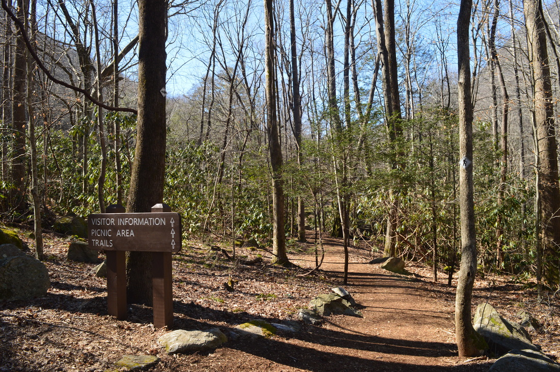
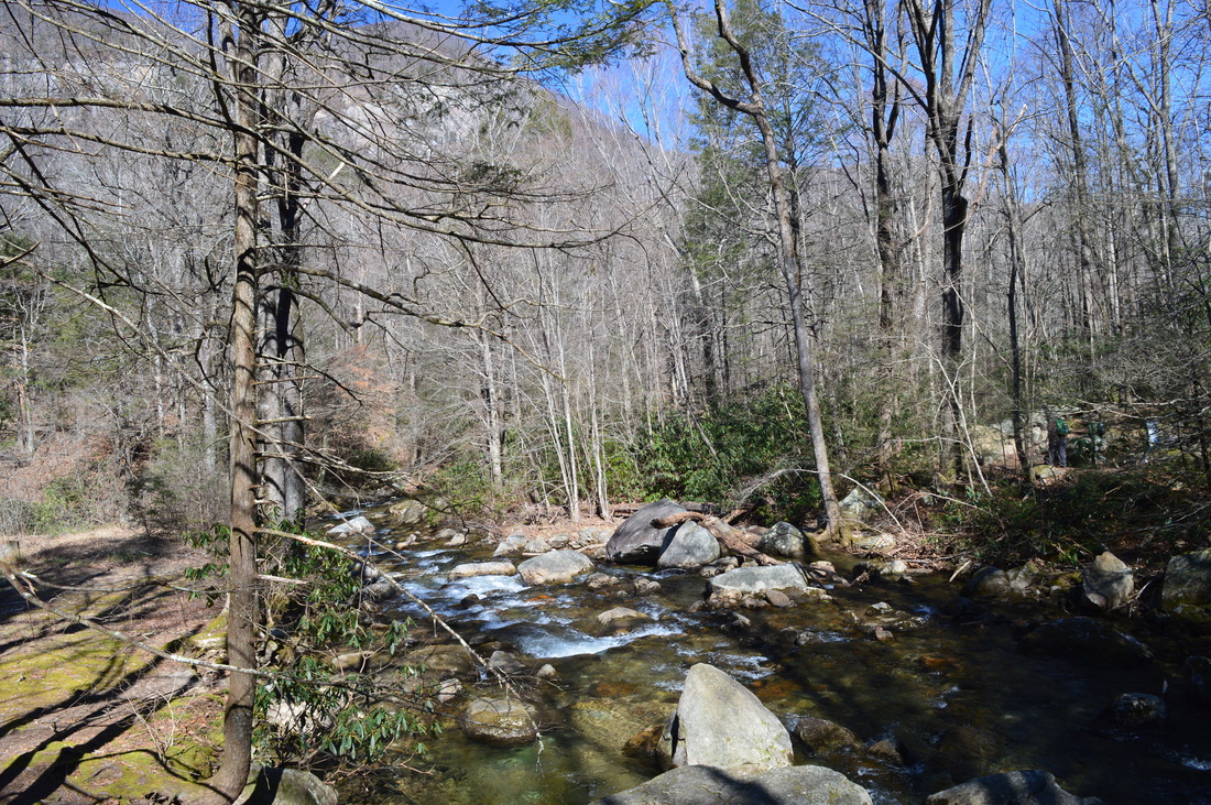
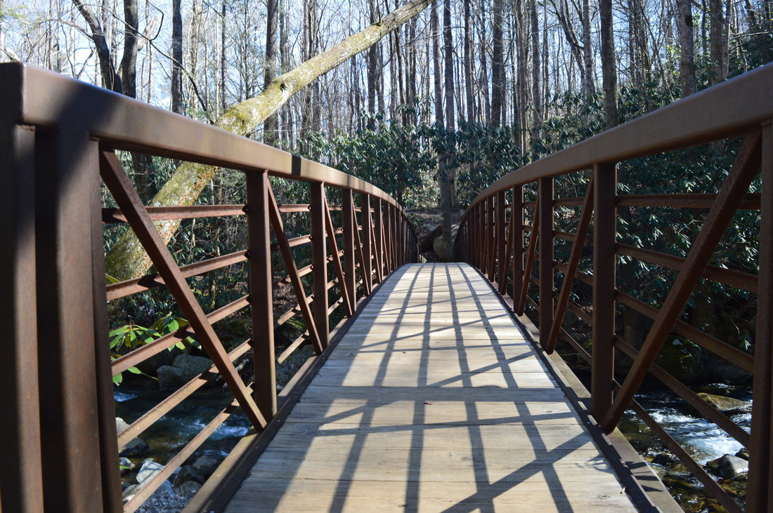
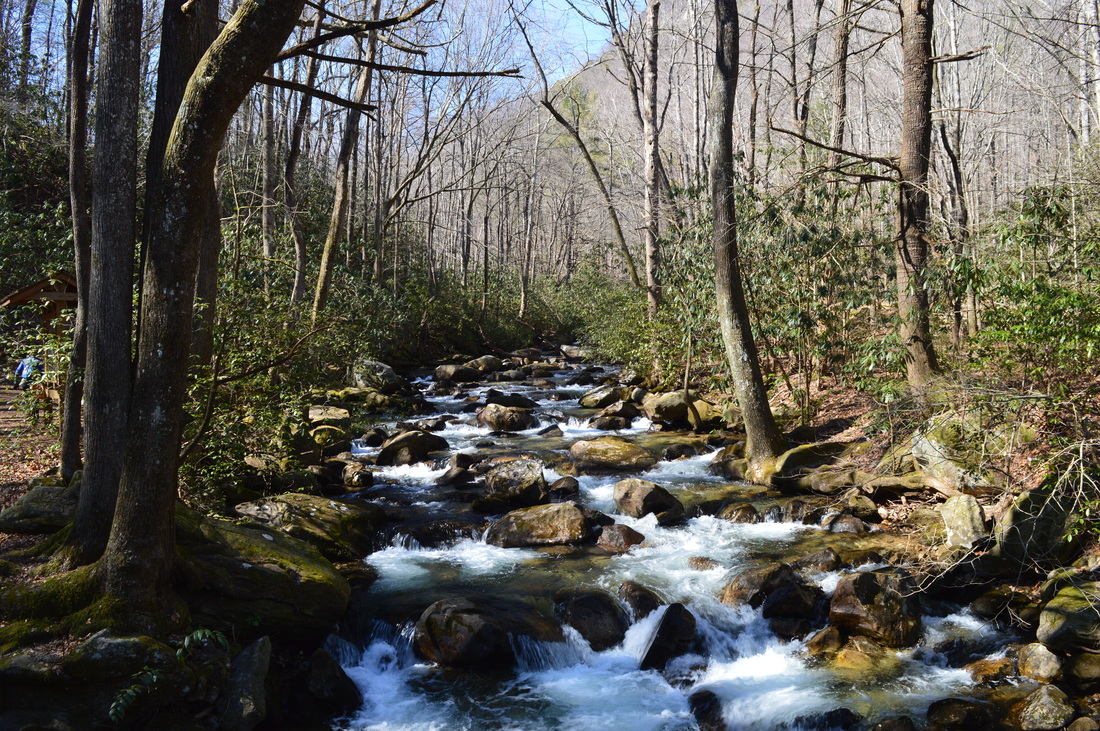
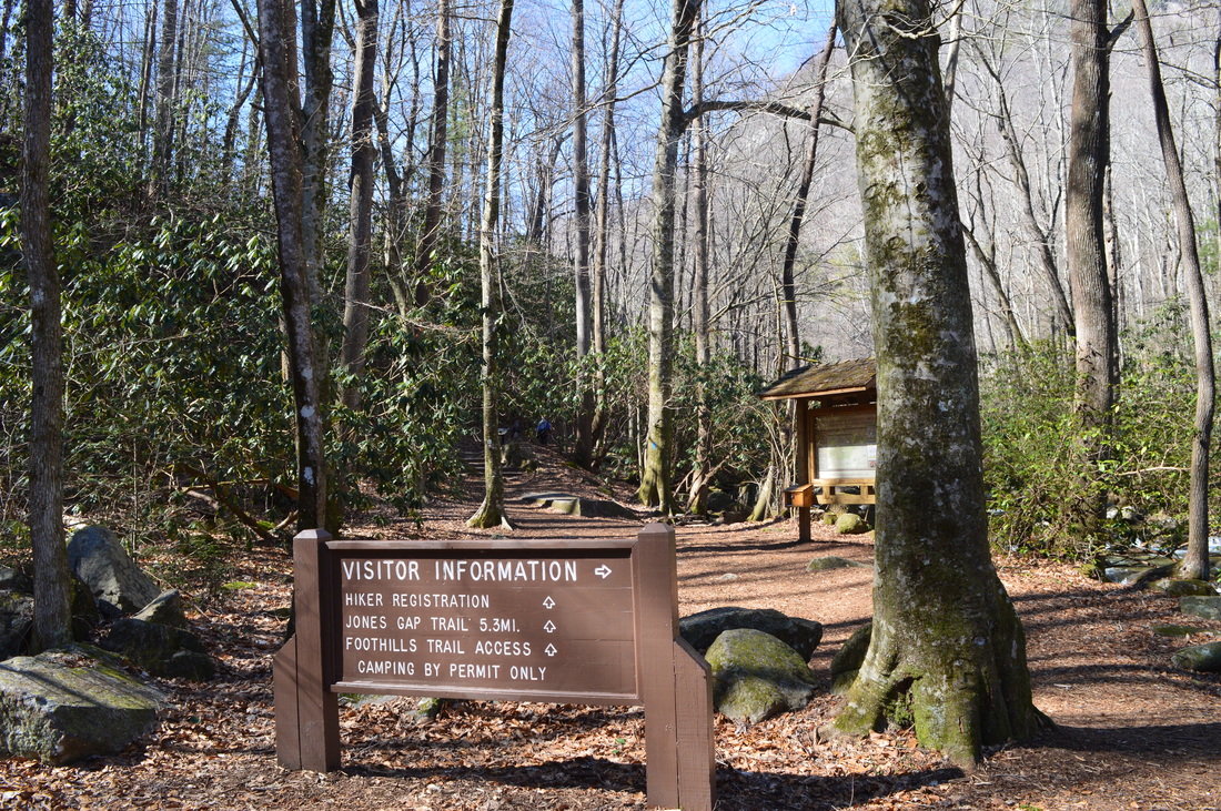
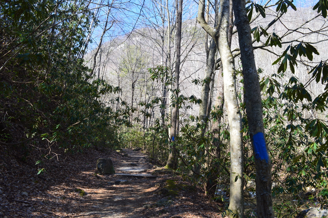
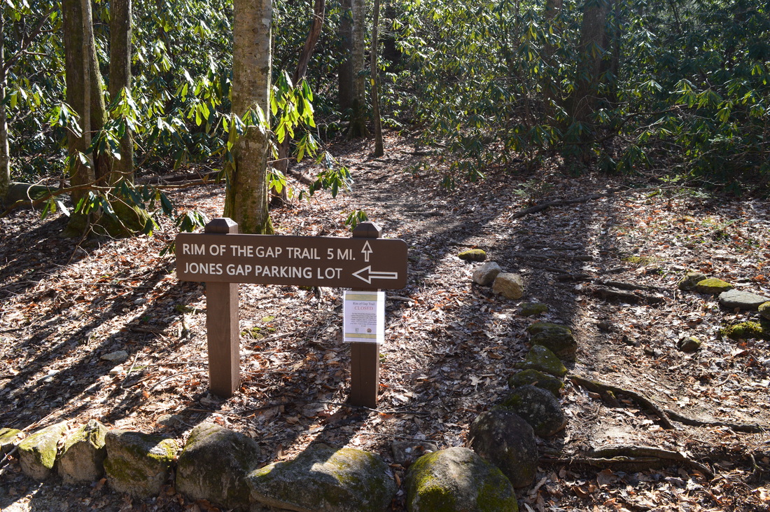
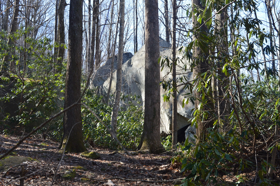
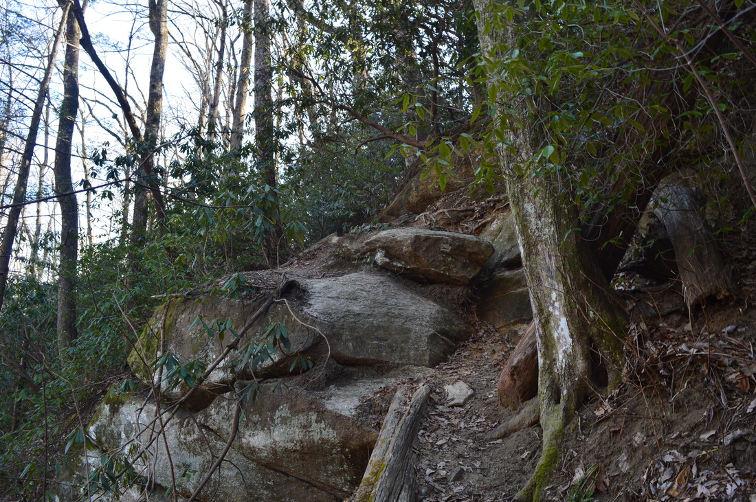
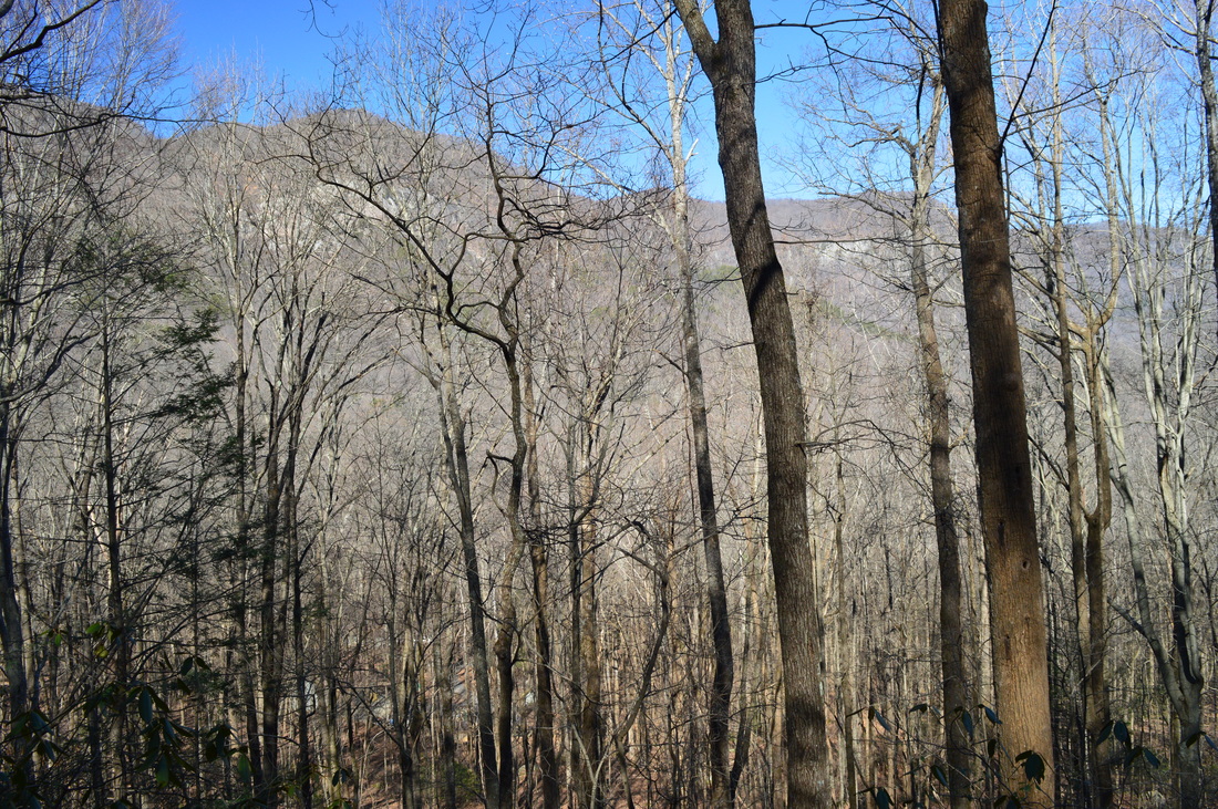
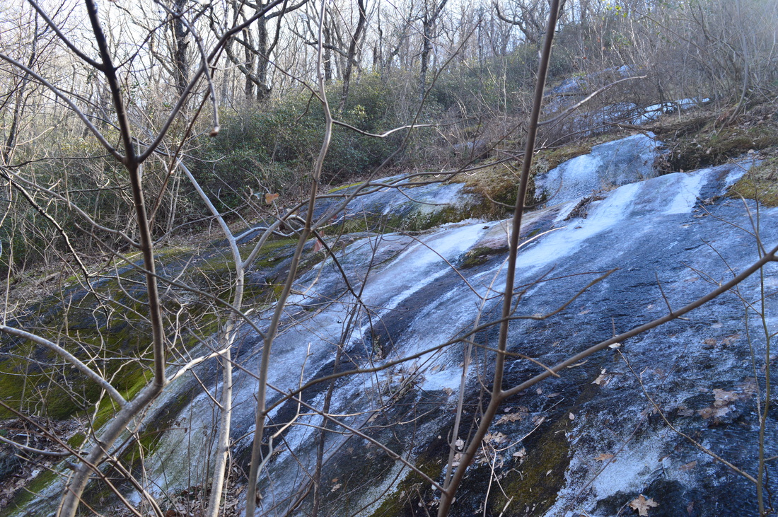
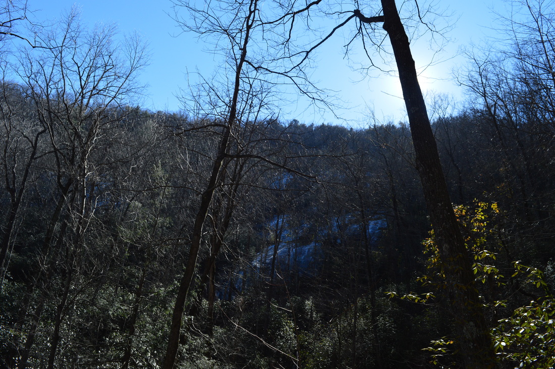
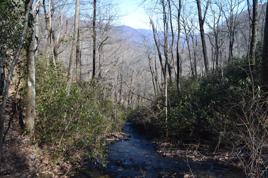
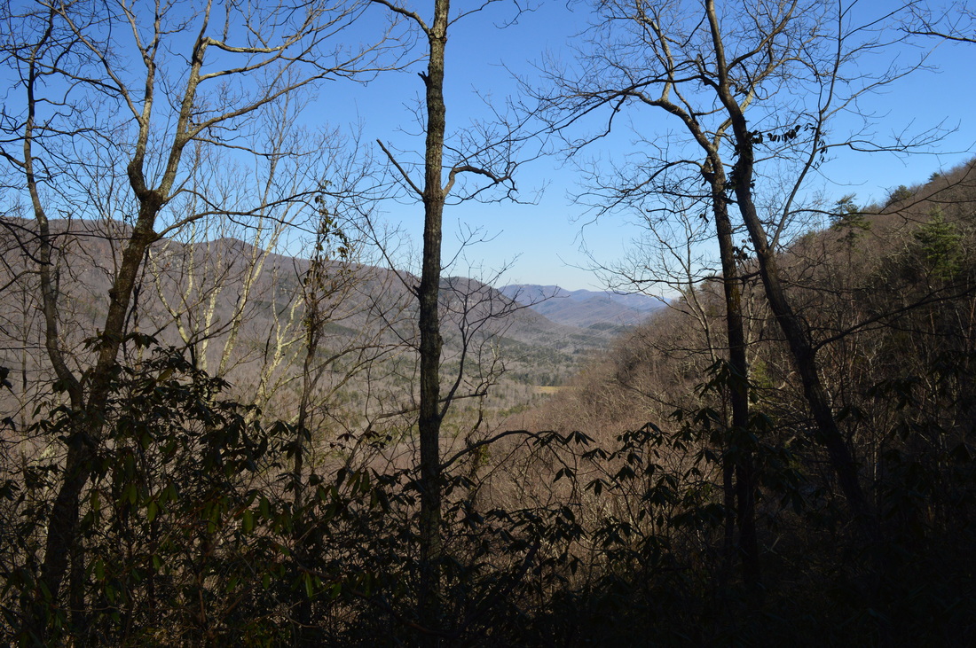
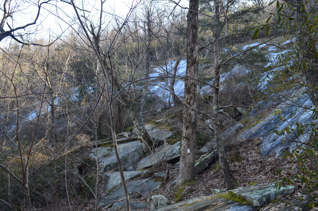
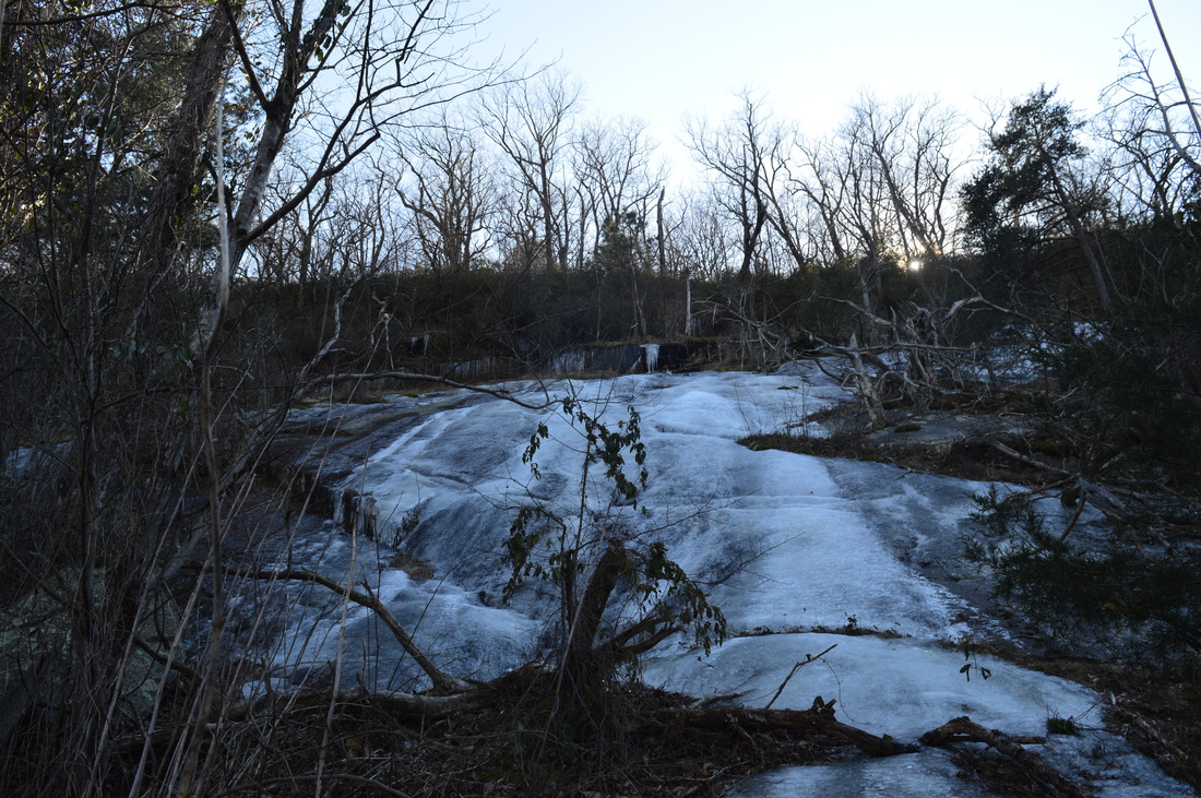
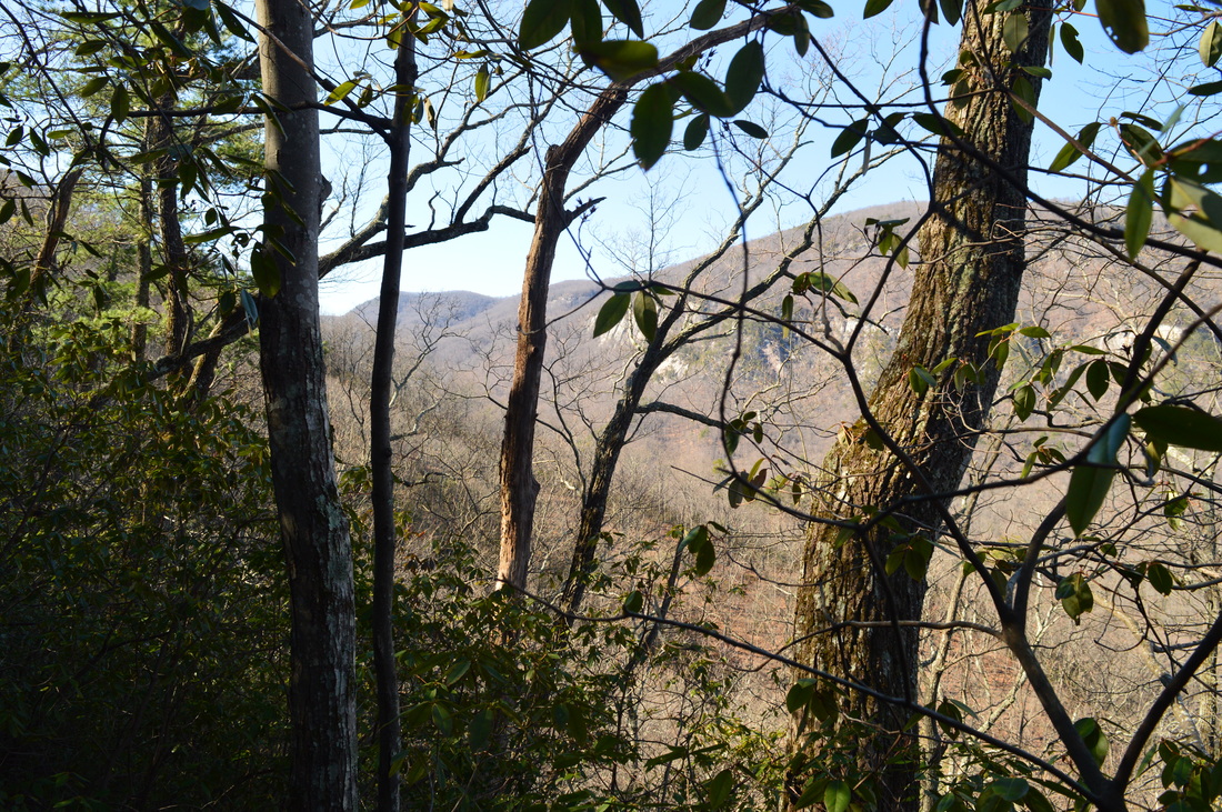
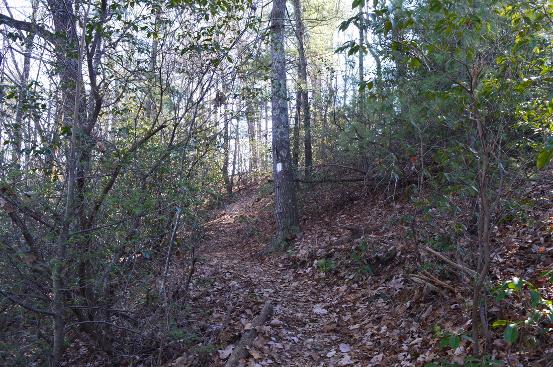
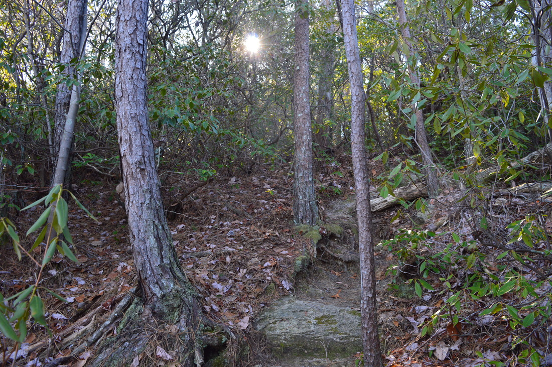
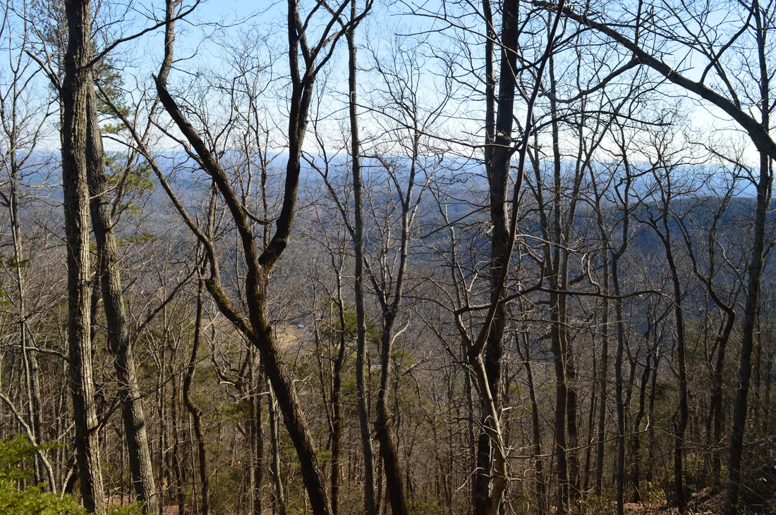
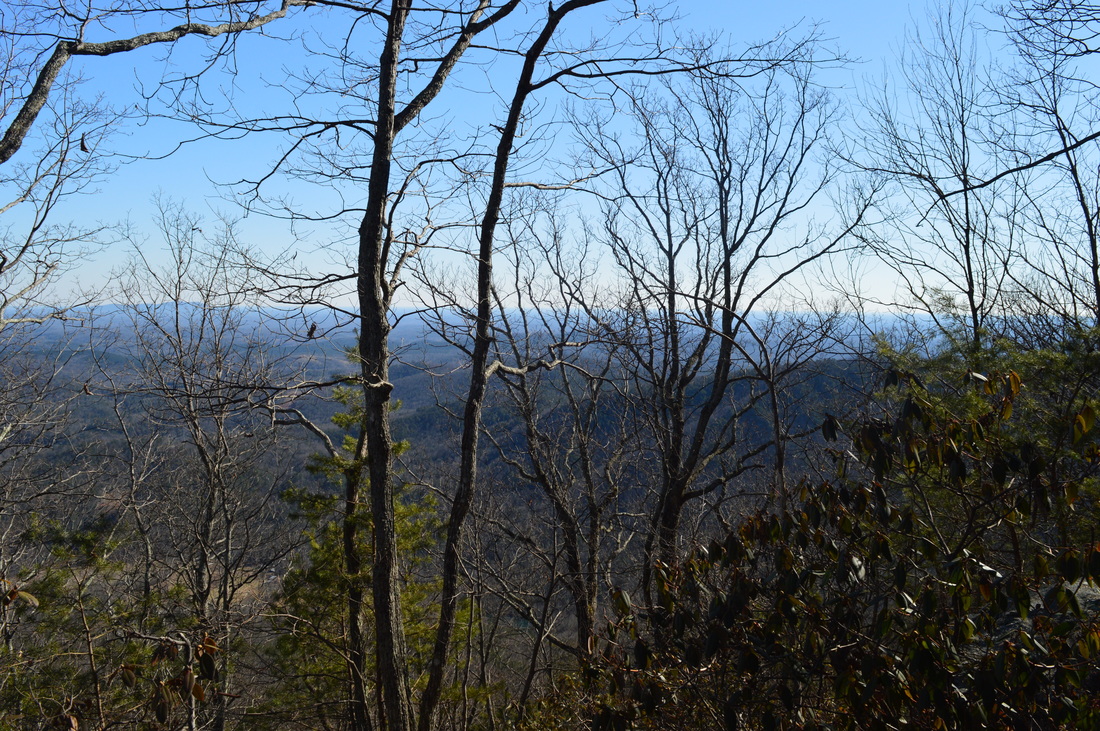
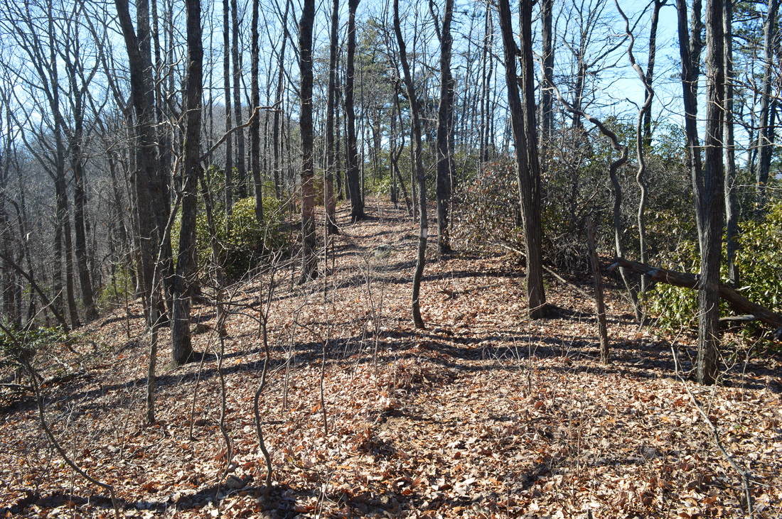
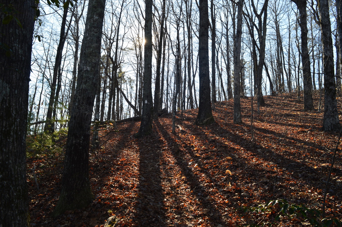
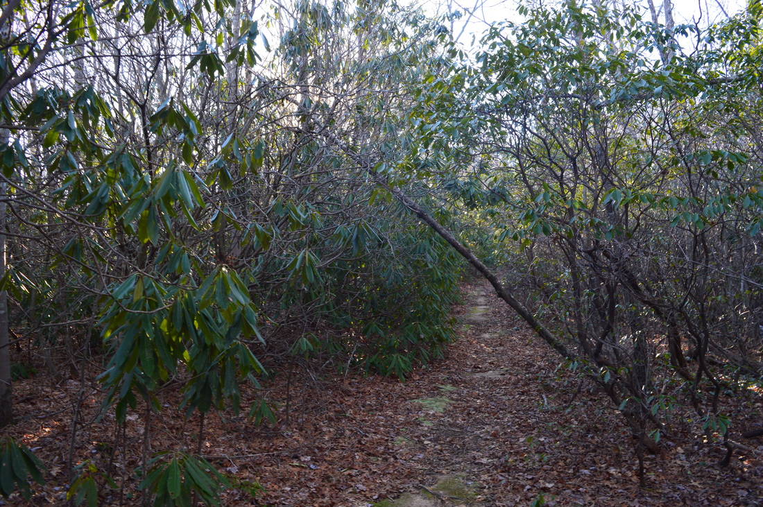
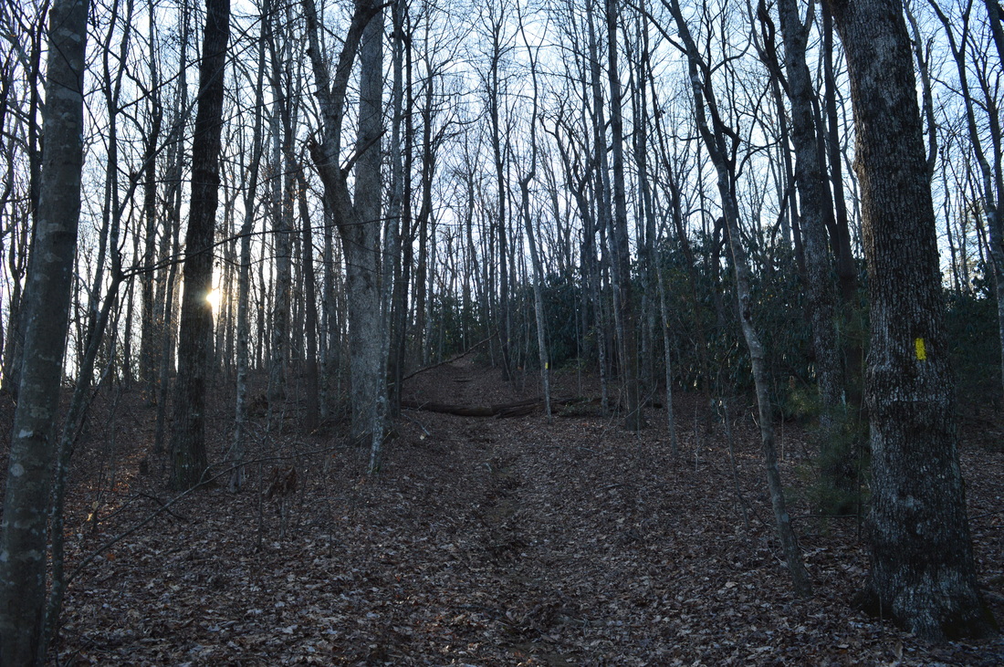
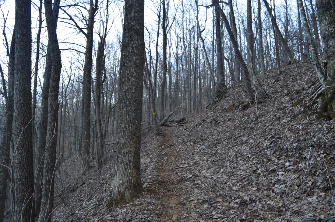
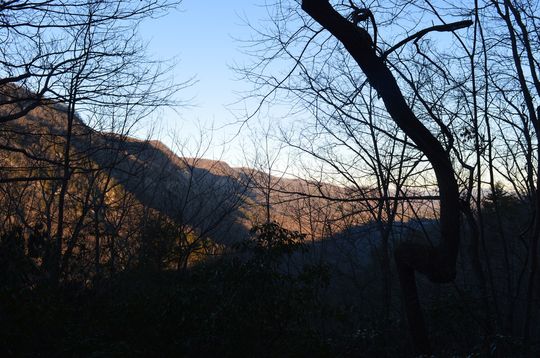
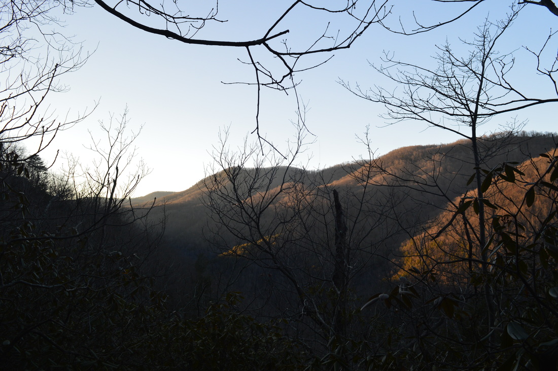
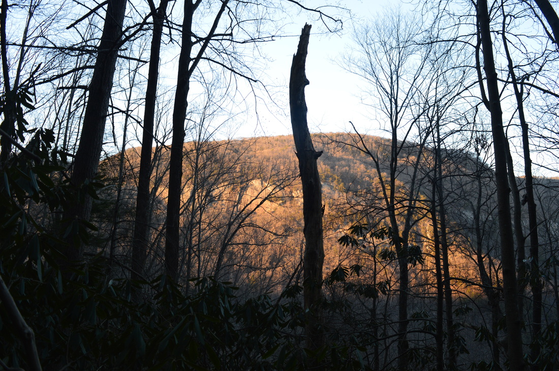
The hike starts on  the Jones Gap Trail, one of the park's center trails that follows the Middle Saluda River. From the parking area, take a wide path that starts at the kiosk. A sign at the start of the path states "Trails ^". You will shortly reach the Middle Saluda River. Walk alongside the river before crossing it on an impressive footbridge at 0.2 miles. Then, the path leads to the Visitor Center. Walk past the Visitor Center and cross the Middle Saluda River again on a service road bridge. Immediately afterwards, at 0.4 miles, the Jones Gap Trail begins to the right. Take the trail as it stays close to the river. This is a true mountain stream, full of boulders and cascades. At 0.45 miles, the Rim of the Gap Trail begins to the left. The Jones Gap Trail continues straight towards Rainbow Falls and Jones Gap Falls, but this hike turns left onto the Rim of the Gap Trail. This trail loses no time in beginning the ascent out of the gorge. However, the grades are not steep, and they remain that way for most of the hike. Not far from the beginning of the ascent, the trail will scramble onto a large boulder where you will have to use both your arms and legs.

At 0.85 miles, reach a junction with the Pinnacle Pass Trail. Here, the Rim of the Gap Trail turns right, while I continued straight onto the white-blazed Pinnacle Pass Trail and began the loop section of the hike. Initially, the Pinnacle Pass Trail stayed level and even descended some, with the Middle Saluda River Gorge bottoming out to your left. There are excellent winter views here of the Cleveland Cliffs across the gorge. At 1.25 miles, make a sharp right turn and begin a steep ascent along a small creek. Switchbacks aid you to ascend here. After significant rainfall, a picturesque slide waterfall may become visible on the small stream next to the trail. After this, you will rock hop across the stream and pass by several large rock faces with several openings in the trees that provide excellent winter views of Jones Gap and somewhat limited summer views. On this day, the rock faces were covered in sheets of ice, making them quite photogenic. While these vistas of the gorge have a lot of trees that limit the views, these are still some of the best vistas of the gorge from the south side. After these vistas, the trail will approach the rim of the gorge (still ascending). Make a sharp right turn at 1.9 miles - you are now on the rim of Jones Gap. 

Once you're on the rim, winter views will extend both north into and across Jones Gap and south to the Foothills. Keep in mind that even though you have reached the rim, your ascent for the day is not over. Over the next 1.6 miles, you will cross three separate summits. The last and highest one is Little Pinnacle Mountain. After descending from Little Pinnacle Mountain, you will reach a gap at 3.5 miles, where there is a junction with the 6 & 20 Connector Trail. This trail is a short connector between the Pinnacle Pass Trail and the Rim of the Gap Trail. You can use 6 & 20 Connector to shortcut your hike. I did not use this shortcut - I continued straight on the Pinnacle Pass Trail. The trail now follows a mostly level forest road that provides easy walking. You will stay on the forest road until the junction with the John Sloan Trail at 4.8 miles. Here, the Pinnacle Pass Trail veers left, aiming for Oil Camp Creek and eventually US 276. If you continue on the Pinnacle Pass Trail, it will be possible to do a much longer and more strenuous loop hike, but to continue on this day hike, turn right onto the John Sloan Trail. The John Sloan Trail serves as another connector that leads to the Rim of the Gap Trail. You will ascend gently on the John Sloan Trail as you pass near the top of another summit on the rim of the gorge. This is your last ascent for the day. At 5.4 miles, the pink-blazed trail ends at the Rim of the Gap Trail. Originally, I had planned to turn left here and hike the famed icy western half of the Rim of the Gap, but like I mentioned earlier, circumstances prevented me from doing so. Also, keep in mind that the trail to the left (west) of this junction is closed in winter due to major ice formations, so technically, I would not have been allowed to hike it. 

To continue the hike, turn right onto the Rim of the Gap Trail. This marks the beginning of a fairly steep descent back into the gorge. At 5.9 miles, pass the other end of the 6 & 20 Connector - continue straight. In the next section of the trail, there are some spectacular winter views of the deep gorge that is Jones Gap. The best views are at around 6.5 miles. After crossing several small streams and descending some more, you will reach the end of the loop at the junction with Pinnacle Pass Trail at 7.65 miles. Turn left here to retrace your steps back to the trailhead. You will end the hike at 8.5 miles at the trailhead near the visitor center. 

Mileage

0.0 - Jones Gap State Park
0.3 - Visitor Center
0.4 - Right onto Jones Gap Trail
0.45 - Left onto Rim of the Gap Trail
0.85 - Continue straight onto Pinnacle Pass Trail 
​1.9 - Reach the rim of the gorge
3.5 - Junction with 6 & 20 Connector to right, continue straight 
4.8 - Right onto John Sloan Trail 
5.4 - Right onto Rim of the Gap Trail 
7.65 - End of loop, turn left on Rim of the Gap Trail 
​8.05 - Right onto Jones Gap Trail 
8.1 - Left onto service road near Visitor Center
​8.2 - Visitor Center
8.5 - Jones Gap State Park

Variations

Hike the Pinnacle Pass Loop using the 6 & 20 Connector instead of the John Sloan Trail - 6.2 Miles 
Hike a larger loop (Pinnacle Pass Trail - Rim of the Gap Trail - Bill Kimball Trail - Jones Gap Trail) - Approximately 13 miles

Bonus Stops

After the hike, consider driving on US Roue 276 North to the Caesars Head State Park Visitor Center, where there is a spectacular vista just a few steps from the roadway. 

Pictures

0 Comments


Leave a Reply.

    About Me

    Mark Oleg Ozboyd
    I'm an avid outdoor explorer and a hobbyist landscape photographer. I'm 21 years old and have been hiking since 2011. Originally based out of Atlanta, Georgia, I started out by occasionally hiking short trails throughout well-known Georgia State Parks. During 2012 and 2013, I began to expand my trips into adjacent states, as well as into the wilder National Forest areas rather than just State Parks. Throughout the years that followed, as I slowly ran out of popular hiking trails in my area, I began to search for and hike in more seldom-visited areas. Today, you can find me out in the woods every weekend, whether it's on an official trail or bushwhacking through cross-country terrain without any paths. I now attend Washington & Lee University and am exploring Virginia and West Virginia. My other hobbies include chess, science, old music, and meteorology. I have 3 years of amateur weather forecasting experience, having studied a lot of meteorology basics over the years. I am also a student at European School of Music where I learned that music and nature have a lot in common. Listening to good music inspires me to capture nature's beauty on the camera in different aspects that also make me recall many beautiful music pieces that I've heard.​


    Dear readers: I have invested a tremendous amount of time and effort in this website and the Georgia Waterfalls Database the past five years. All of the work that has gone in keeping these websites updated with my latest trip reports has almost been like a full-time job. This has not allowed me to pick up a paid job to save up money for college, and therefore, I I've had to take out loans. If you find the information on this website interesting, helpful, or time-saving, you can say "thanks" and help me out by clicking the button above and making a contribution. I will be very grateful for any amount of support you give, as all of it will apply toward my college tuition. Thank you! 

    Enter your email address to subscribe for trail reports:

    Delivered by FeedBurner


    Picture
    Coming in 2022-2023?

    Other Hiking Websites

    DWHike's Adventures
    Florida's Natural Wonders
    Florida Trailblazer
    Meanderthals
    Mountain Images
    by Bernie Boyer

    North Carolina Waterfalls with
    ​Kevin Adams
    Take-a-Hike!
    Tennessee Landforms
    Waterfall Page
    Waterfall Adventurer
    Zach's Mild Adventures

    Miles Hiked

    Year 1: 540.0 Miles
    Year 2: 552.3 Miles
    ​Year 3: 518.4 Miles
    Year 4: 482.4 Miles
    Year 5: 259.9 Miles

    Archives

    March 2021
    February 2021
    January 2021
    November 2019
    October 2019
    September 2019
    August 2019
    July 2019
    June 2019
    February 2019
    January 2019
    December 2018
    November 2018
    October 2018
    August 2018
    July 2018
    June 2018
    May 2018
    April 2018
    March 2018
    February 2018
    January 2018
    December 2017
    November 2017
    October 2017
    September 2017
    August 2017
    July 2017
    June 2017
    May 2017
    April 2017
    March 2017
    February 2017
    January 2017
    December 2016
    November 2016
    October 2016
    September 2016
    August 2016
    June 2016
    May 2016
    April 2016
    March 2016
    January 2016
    December 2015
    November 2015
    October 2015
    September 2015
    August 2015
    July 2015
    June 2015
    May 2015
    April 2015
    March 2015
    February 2015
    January 2015
    December 2014
    November 2014
    October 2014
    September 2014
    August 2014
    July 2014
    June 2014
    May 2014
    April 2014
    March 2014
    February 2014

    Categories

    All
    Adel
    Adirondack Park
    Alabama
    Alfred A. Ring Park
    Allegheny Trail
    Amicalola Falls State Park
    Anniston Area
    Apalachicola Bluffs And Ravines Preserve
    Apalachicola National Forest
    Apalachicola/Port St. Joe Area
    Apopka
    Appalachian Trail
    Appling
    Art Loeb Trail
    Aska Trail System
    Bakersville
    Balm-Boyette Scrub Preserve
    Balsam Lake Recreation Area
    Bankhead National Forest
    Bartow County Parks
    Bartram Trail
    Basinger
    Beersheba Springs
    Benton
    Benton Mackaye Trail
    Berry College Trail System
    Best Hike
    Big South Fork National Recreation Area
    Black Bear Wilderness
    Black Rock Mountain State Park
    Blairsville
    Blakely
    Blood Mountain Wilderness
    Blowing Rock
    Blue Ridge
    Blue Ridge Parkway
    Boone
    Bradenton
    Bradenton Beach
    Brasstown Bald
    Brasstown Wilderness
    Brevard
    Bryson City
    Buchanan
    Bucks Pocket State Park
    Bulow Creek State Park
    Bulow Plantation Ruins State Park
    Caesars Head State Park
    Caladesi Island State Park
    Calhoun
    Camel's Hump State Park
    Cashiers
    Caspersen Beach Park
    Catfish Creek State Park
    Caves
    CC Putnam State Forest
    Cedar Point Environmental Park
    Chatsworth
    Chattahoochee National Forest
    Chattanooga
    Chattanooga Valley
    Chattooga National Wild And Scenic River
    Cheaha Wilderness
    Cherohala Skyway
    Cherokee
    Cherokee National Forest
    Chiefland Area
    Chillhowee Recreation Area
    Chipley
    Chunky Gal Trail
    Circle B Bar Reserve
    Citico Creek Wilderness
    Citrus Wildlife Management Area
    Clarkesville
    Clayton
    Cleevland
    Cleveland
    Cloudland Canyon State Park
    Cohutta Wilderness
    Collier-Seminole State Park
    Cordele
    Cornelia
    Covington
    Crestview Area
    Crew-land-and-water-trust
    Cullowhee
    Cumberland Trail
    Dahlonega
    Dalton
    Dawson Forest Wildlife Management Area
    Dawsonville
    Dayton
    De Soto National Memorial
    DeSoto State Park
    Dillard
    Double Springs
    Ducktown
    Duncan Ridge Trail
    Dunlap
    Eagle's Rest Park
    Eastpoint
    Econfina Creek Wildife Management Area
    Eglin Air Force Base
    Elizabethton
    Elkins
    Elk Knob Game Lands
    Elk Park
    Ellicott Rock Wilderness
    Ellijay
    Emerson Point Preserve
    Englewood Area
    Enota Retreat
    Erwin
    Falling Waters State Park
    Fayetteville
    Fires Creek Recreation Area
    Fire Tower
    Flint River
    Florence Area
    Florida
    Florida Caverns State Park
    Florida Trail
    Foothills Trail
    Fort Mountain State Park
    Fort Myers Area
    Fort Payne
    Fort Payne Area
    Fort Yargo State Park
    Franklin
    Franklin Delano Roosevelt State Park
    Franklin-Marion State Forest
    Frozen Head State Park
    Gainesville
    Gainesville Area
    Gatlinburg
    George Washington National Forest
    Georgia
    Georgia Veterans Memorial State Park
    Glasgow
    Gorges State Park
    Grandfather Mountain State Park
    Great Smoky Mountains National Park
    Greeneville
    Green River Game Lands
    Gruetli-Laager
    Grundy Forest State Natural Area
    GTM Reserve
    Guana River Wildlife Management Area
    Hayesville
    Helen
    Hiawassee
    High Falls State Park
    Highlands
    Highlands Scenic Highway
    Hillsborough River State Park
    Hinson Conservation & Recreation Area
    Historic Sites
    Honeymoon Island State Park
    Hot Springs
    Huntington
    Inverness Area
    Jackson
    Jasper
    Jefferson National Forest
    Joan M. Durante Park
    Jonathan Dickinson State Park
    Jones Gap State Park
    Joyce Kilmer Slickrock Wilderness
    Joyce Kilmer - Slickrock Wilderness
    Juniper Prairie Wilderness
    Kelly Park
    Keown Falls Recreation Area
    Kolomoki Mounds State Park
    LaFayette
    Lake City Area
    Lake George Wild Forest
    Lake June-in-Winter State Park
    Lakeland Area
    Lake Placid
    Lake Russell Wildlife Management Area
    Lake Wales Ridge State Forest
    Laurel Fork North Wilderness
    Leffis Key Preserve
    Leon Sinks Geological Area
    Lexington
    Lineville
    Linville
    Linville Gorge Wilderness
    Lithia Springs
    Little Frog Wilderness
    Little Manatee River State Park
    Little River Canyon National Preserve
    Longboat Key
    Long Trail
    Lookout Mountain
    Lookout Mountain Battlefield
    Lovingston
    Lula Lake Land Trust
    Lumpkin
    Maggie Valley
    Manatee Springs State Park
    Marianna Area
    Mark Trail Wilderness
    Marlinton
    Mccaysville
    McMinville
    Mentone
    Middlesex
    Mistletoe State Park
    Monongahela National Forest
    Montreat
    Mountain Bridge Wilderness Area
    Mountain City
    Mountains To Sea Trail
    Mountains-to-Sea Trail
    Mount Rogers National Recreation Area
    Myakka River State Park
    Myron B. Hodge City Park
    Nantahala National Forest
    Naples
    Naples Area
    Natural Bridge State Park
    Neal Preserve
    New Castle
    Newport
    New River Gorge National Park
    New York
    North Carolina
    Ocala Area
    Ocala National Forest
    Ocean-to-Lake Trail
    Oconee State Park
    Oconee Station Historic Site
    Okaloacoochee Slough State Forest
    Oldsmar
    Oneida
    Orlando Area
    Ormond Beach
    Oscar Scherer State Park
    Oxford
    Palatka
    Palmetto Trail
    Panama City Area
    Panthertown Valley
    Parrish
    Paynes Creek Historic State Park
    Peaks Of Otter Recreation Area
    Pigeon Crockford Mountain Wildlife Management Area
    Pigeon-Crockford Mountain Wildlife Management Area
    Pigeon-Crockford Wildlife Management Area
    Pine Mountain
    Pinhoti Trail
    Pinnacle Park
    Pisgah Civitan Park
    Pisgah National Forest
    Pittman Center
    Pond Mountain Wilderness
    Ponds/Lakes
    Prentice Cooper State Forest
    Providence Canyon State Park
    Pumpkintown
    Quick Point Nature Preserve
    Raven Cliffs Wilderness
    Reed Bingham State Park
    Reliance
    Rice Creek Conservation Area
    Riverview Pointe Preserve
    Robbinsville
    Robinson Preserve
    Rock Creek Gorge Scenic Area
    Rock Island State Park
    Rome
    Rosman
    Sale Creek
    Salem
    Salt Springs
    Saluda
    Santa Rosa Beach
    Sarasota
    Sarasota Area
    Savage Gulf State Natural Area
    Scenic Views
    Scottsboro Area
    Sebring Area
    Sewanee
    Sheltowee Trace Trail
    Shining Rock Wilderness
    Signal Mountain
    Sipsey Wilderness
    Sky Valley
    Smithgall Woods State Park
    Snowbird Backcountry Area
    Soddy Daisy
    Soddy-Daisy
    Sopchoppy
    South Carolina
    South Cumberland State Park
    Southeastern Cave Conservancy
    Southern Nantahala Wilderness
    Sparta
    Sprewell Bluff Park
    Spring City
    Spring Hill
    Springs
    Spruce Pine
    Standing Indian Backcountry Area
    St. Augustine
    St. George Island State Park
    St. Joseph Bay State Buffer Preserve
    St. Marks Area
    St. Marks National Wildlife Refuge
    Stone Mountain
    Stone Mountain Park
    Suches
    Sumatra
    Sumter National Forest
    Suwannee River
    Swallow Creek Wildlife Management Area
    Sweetwater Creek State Park
    Sylva
    Talladega National Forest
    Tallahassee Area
    Tallulah Falls
    Tallulah Gorge State Park
    Tampa Bay Area
    Tate City
    Tate's Hell State Forest
    Tea Creek Wildlife Management Area
    Tellico Plains
    Tennessee
    Thomaston
    Toccoa
    Topsail Hill State Park
    Torreya State Park
    Townsend
    Tracy City
    Tray Mountain Wilderness
    Trenton
    Triple Creek Preserve
    Troutdale
    Unaka Mountain Wilderness
    Upper Tampa Bay County Park
    Venice
    Vermont
    Virgin Falls State Natural Area
    Virginia
    Virginia Outdoors Foundation
    Vogel State Park
    Wakulla Springs State Park
    Waleska
    Walhalla
    Wartburg
    Water Features
    Waynesville
    Weedon Island Preserve
    Weeki Wachee Preserve
    Wekiwa Springs State Park
    West Palm Beach Area
    West Virginia
    Whitehall
    White Springs
    Winder
    Withlacoochee State Forest
    Young Harris

    RSS Feed

TRAIL REPORTS

Hikes in Alabama
​Hikes in Florida
Hikes in Georgia
Hikes in North Carolina
Hikes in South Carolina
Hikes in Tennessee
Hikes in Virginia

Hiking Resources

Alabama Resources
​
Florida Resources
Georgia Resources
North Carolina Resources
​South Carolina Resources
​
Tennessee Resources

Other

Contact
Map of Hikes
Alphabetical List of Hikes
Southeast Nature Society
© COPYRIGHT 2014-2018
​ALL RIGHTS RESERVED.
Important: I disclaim any responsibility for any damage or personal injury that may occur as a result of the activities and information found on this website. All outdoor activities, especially off-trail hiking, are done at your own risk. Never hike or head into that area that may be above your fitness or experience level.
  • Home
  • Trail Reports
    • Best Hikes
    • Hikes with Scenic Views
    • Hikes with Water Features
    • Alabama
    • Georgia
    • Florida
    • North Carolina
    • South Carolina
    • Tennessee
    • Vermont
    • Virginia
  • Map
  • Hike List
  • Testimonials
  • Resources
  • Contact Us
  • Southeast Nature Society
    • Our Team
  • Georgia Waterfalls Database