
Everyone knows about Rock City. But what about Rocktown? No, Rocktown is not a miniature version of Rock City; Rocktown is an area of natural bizarre rock formations on top of Pigeon Mountain, popular with rock climbers and hikers. A network of lesser-traveled trails lies in the vicinity, providing access to Allen Creek Falls - a small but picturesque waterfall on Allen Creek - as well as winter views from Pigeon Mountain's west brow. Another such trail, Hogjowl Trail, provides a rarely-used route from McLemore Cove to the top of Pigeon Mountain. This hike occurred on Saturday, February 18th, 2017. My plan was to hike the Hogjowl Trail from west to east as the first leg of a balloon loop. Then, I would take the Bluff Trail south to Rape Gap, from where I would follow a series of forest roads to potential viewpoints of the Allen Creek Gorge (later discovering that it was not worthwhile). After this, I would return to the Atwood Trail and follow it to Allen Creek Falls, after which I would take the Hood Trail and then a short connector trail to Rocktown. I would follow the Rocktown Trail from Rocktown out to the Rocktown Trailhead. Following a brief roadwalk to Sawmill Lake, I would pick up the Hogjowl Trail and hike it west back to McLemore Cove.
Summary
R/T Length of Trail: 16.6 Miles
Duration of Hike: 11:30 Type of Hike: Lasso Difficulty Rating: 10 out of 10 Total Elevation Gain: 3000 Feet Pros: None Cons: Hogjowl Trail is rough; extension to Allen Creek Gorge Rim is not worthwhile; most of the trails on the hike receive horse usage Points of Interest: Views of Allen Creek Gorge - 1 star cumulatively; Allen Creek Falls - 5 stars; Rocktown; Sawmill Lake Trail Blaze Colors: Hogjowl Trail - Red/Yellow (and sometimes Blue); Bluff Trail - White; Atwood Trail - Orange; Hood Trail - Blue; Rocktown Trail - Purple Best Seasons to Hike: Year-round Fees: To hike in Pigeon-Crockford Mountain Wildlife Management Area, a GORP pass is required for most people. This pass can only be obtained online or through the phone. The 3-day pass for one person costs $3.50, the annual pass for one person costs $19, the 3-day pass for up to eight people costs $10, and the annual pass for up to eight people costs $35. People who are under 16 years old or over 65 years old do not need this pass. Learn more about this pass and how to get it at www.georgiawildlife.com/Georgia-Outdoor-Recreational-Pass. Beginning Point: Hog Jowl Road Trailhead Directions from LaFayette, GA: From the intersection of US 27 Business (South Main Street) and GA 193 (West Main Street) in downtown LaFayette, follow GA 193 North for 8.0 miles, and then, turn left onto Hog Jowl Road. After another 4.7 miles, turn left to stay on Hog Jowl Road. Continue for another 1.8 miles to the unmarked and obscure trailhead. This is one of those spots that you can speed past in the blink of an eye. There is no designated parking area, so park at a wide spot on the inside curve of the road just before the road passes over a culvert through which Hogjowl Creek flows. The trail begins on the east side of the road but may initially be hard to find (see details below). Map
Click here for more information and to download this trail map to view in Garmin Basecamp.
Details
The difficulty rating of "10" for this hike stems from a combination of elevation gain and distance, as this hike is long enough to prevent many day hikers from completing it. Additionally, the Hogjowl Trail is a very slow and rough trail, both up and down, and it contributed to my decision to give this hike the highest difficulty rating. However, I suggest skipping the section of the hike that follows forest roads southwest of Rape Gap - it is not worthwhile. Cutting off that section will make this hike a manageable day hike for most people.
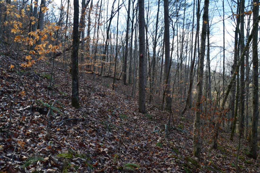
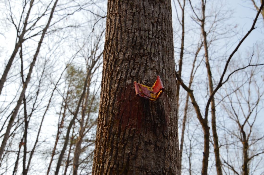
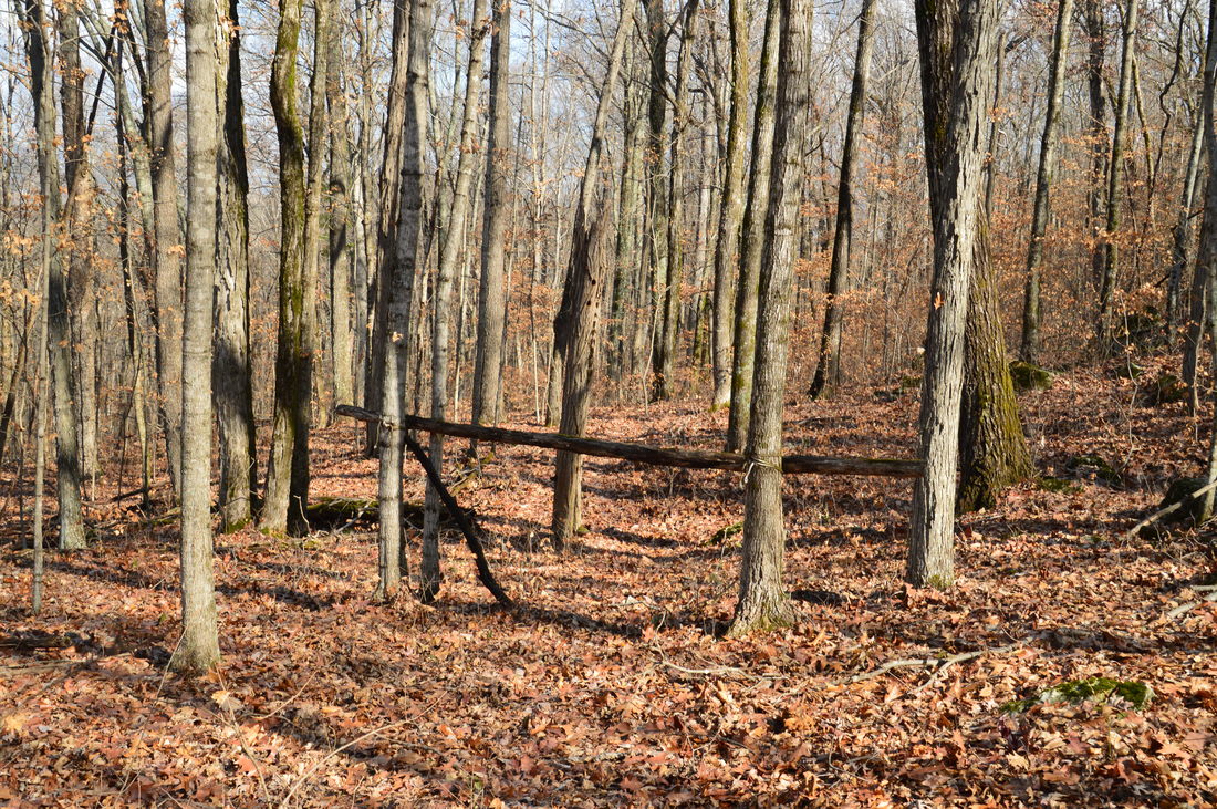
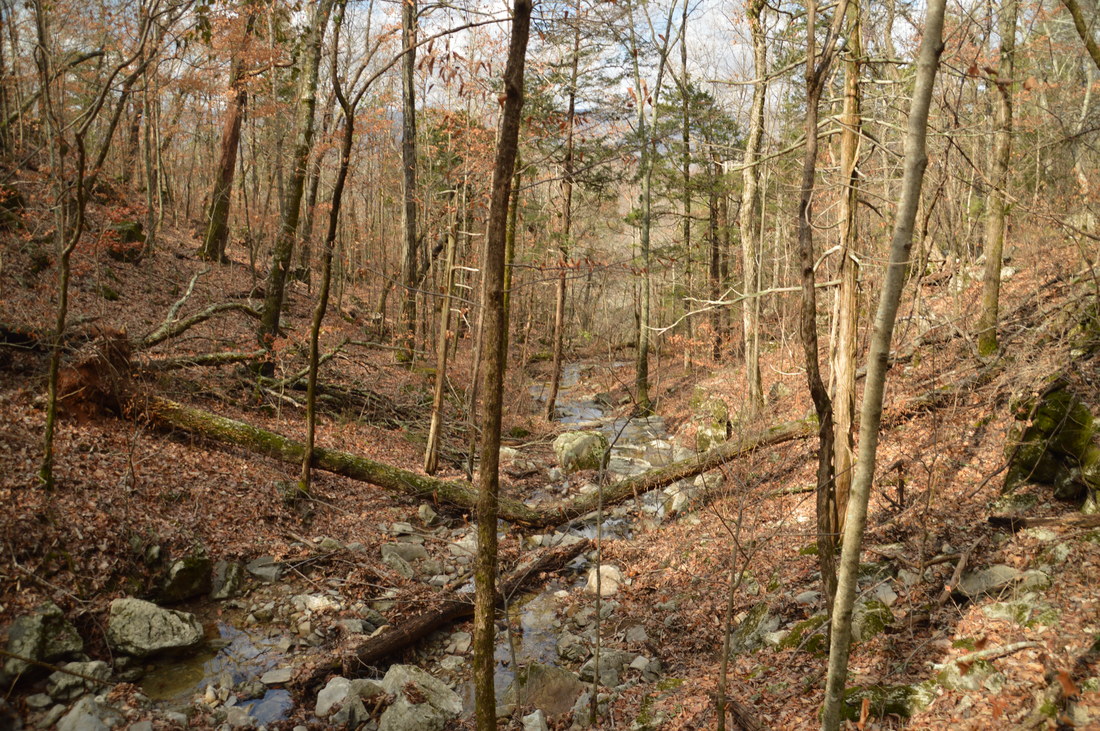
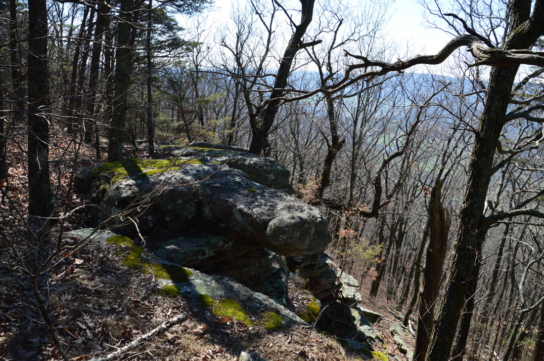
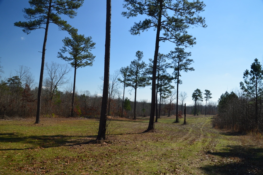
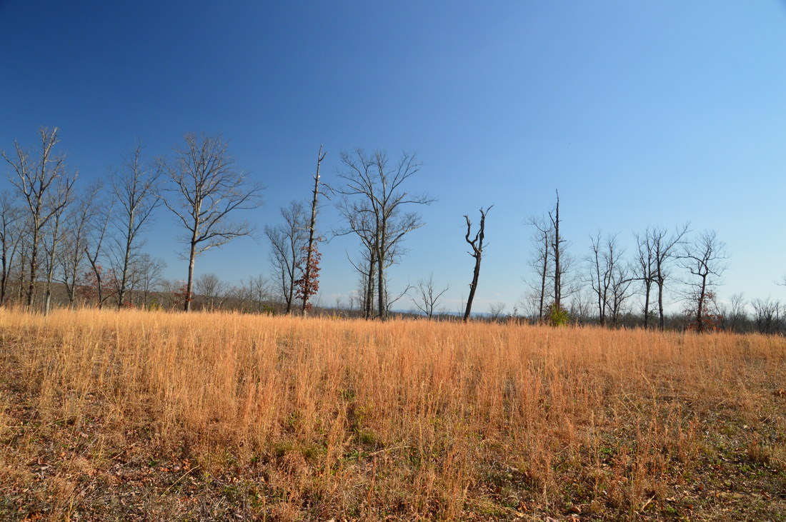
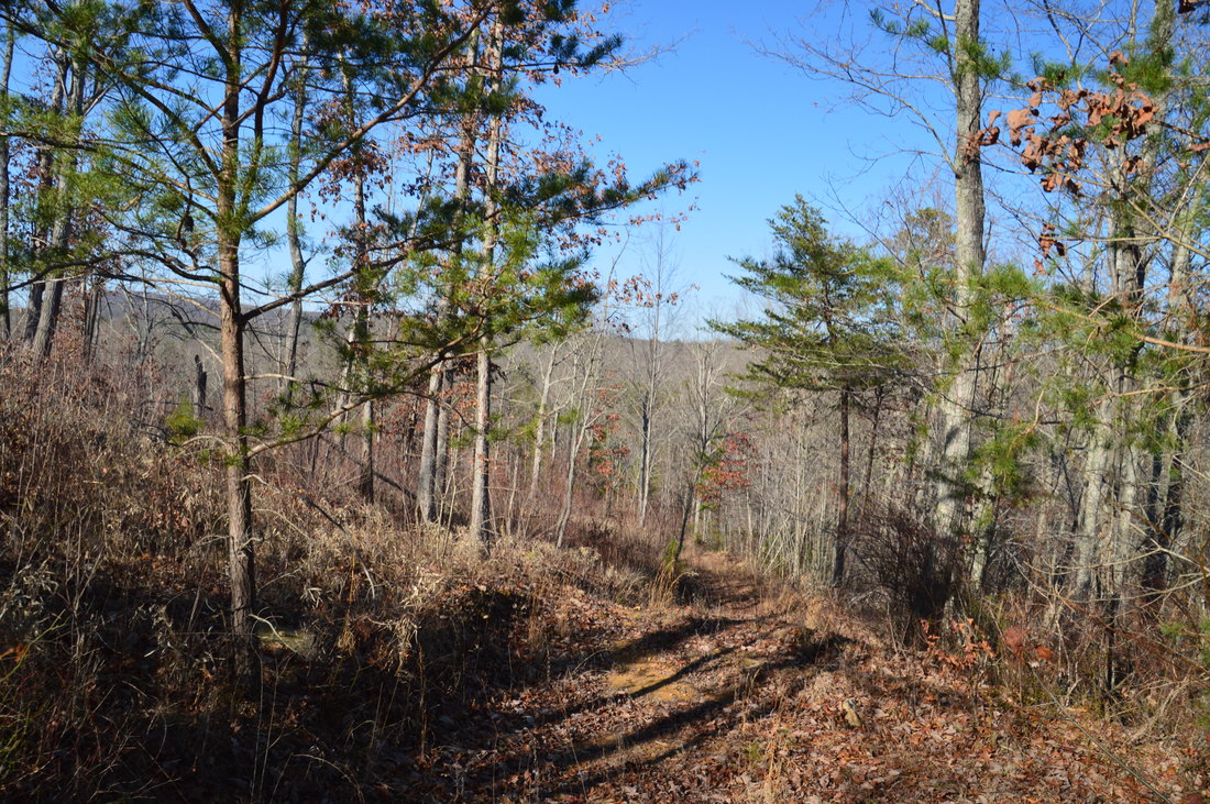
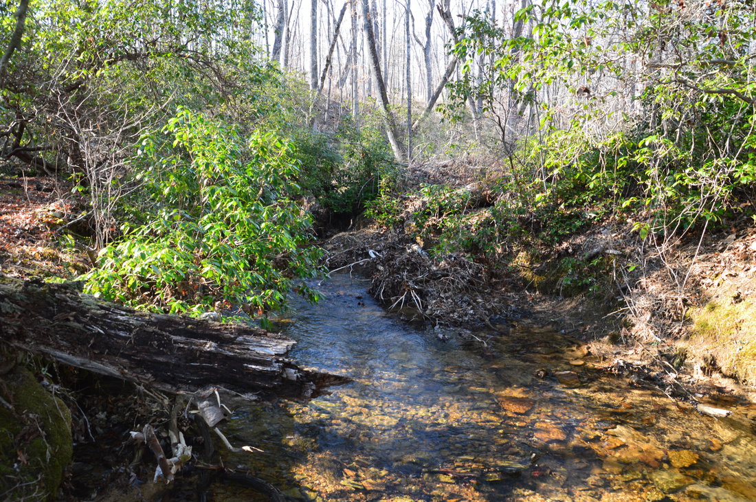
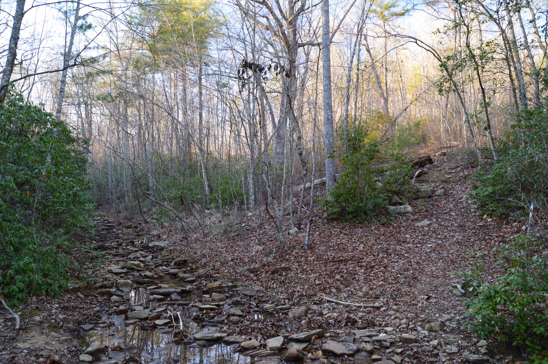
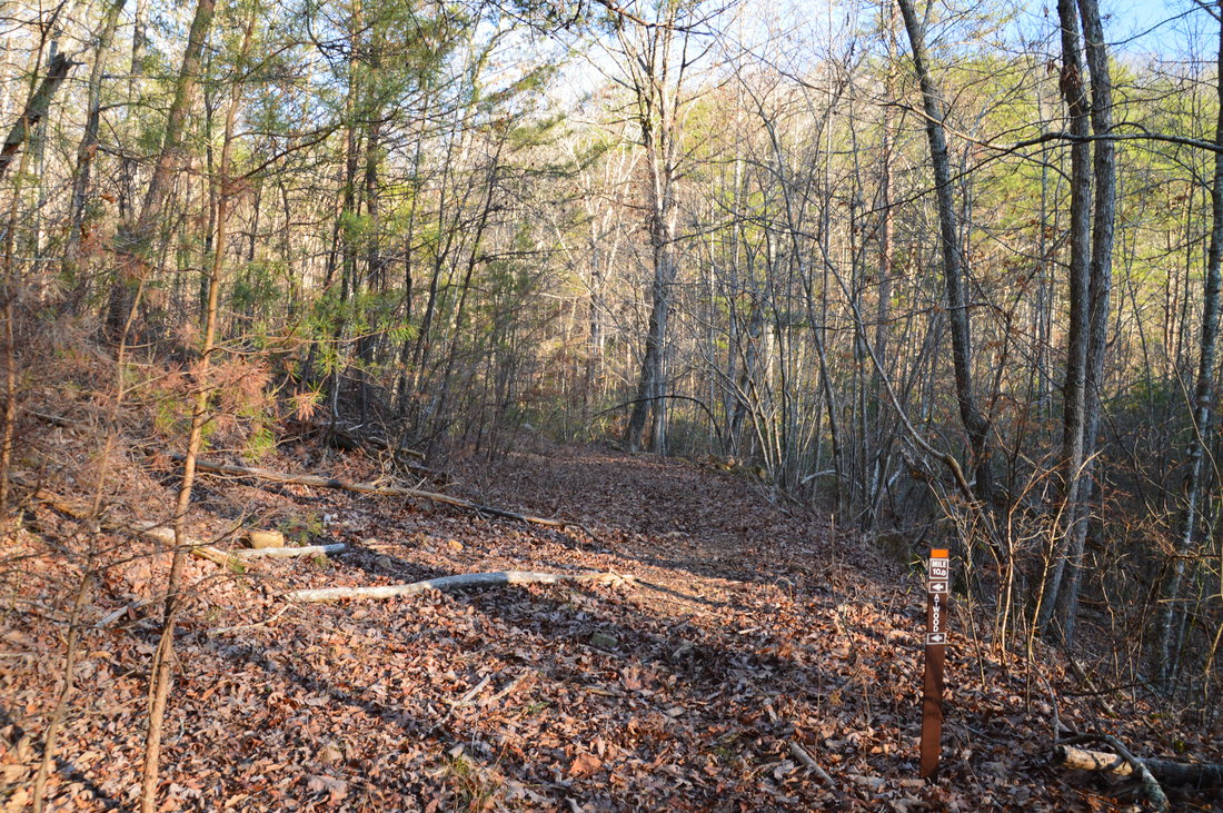
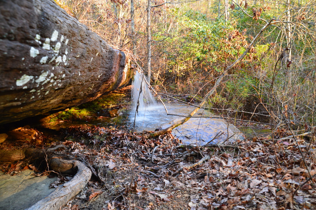
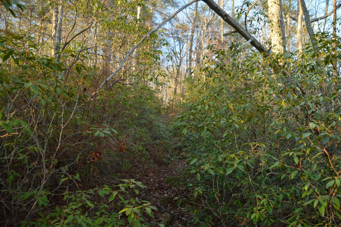
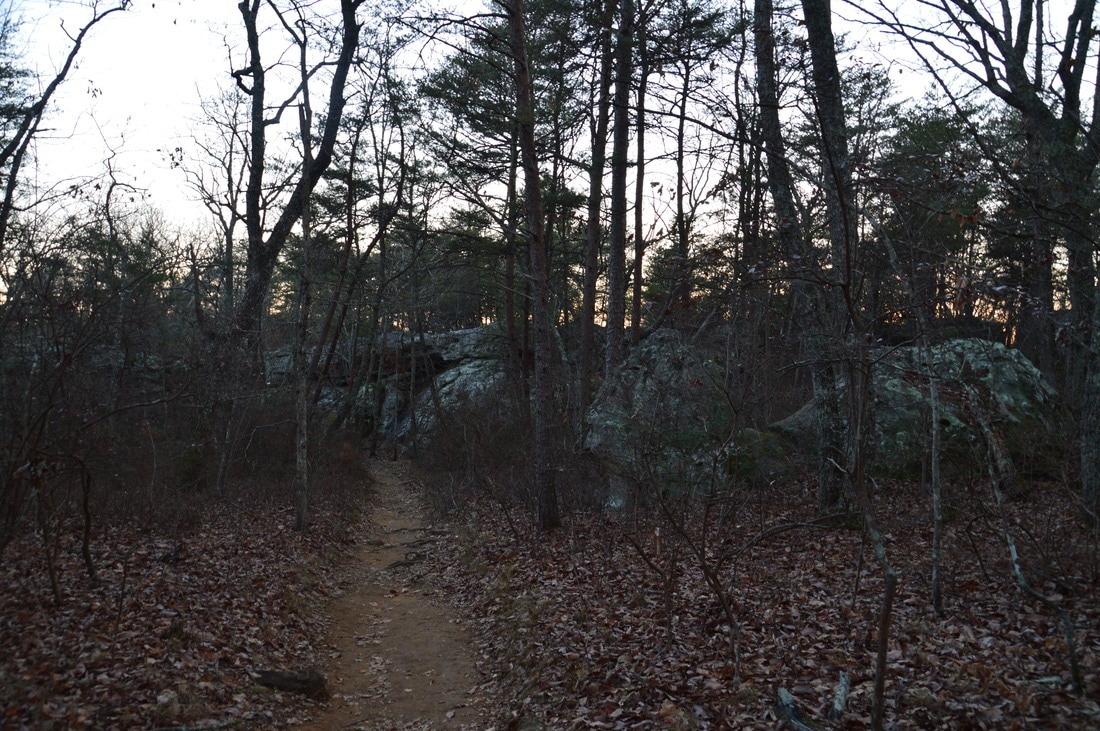
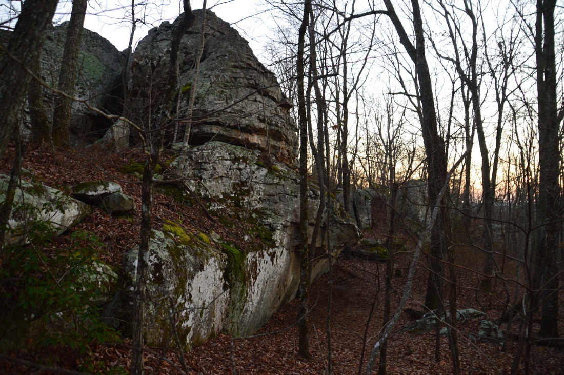
The hike begins along the Hogjowl Trail, which leaves Hog Jowl Road to the east (left-hand side of the road if coming from GA 193). it is difficult to locate the beginning of the unsigned trail. It begins as a faint path just north (just before) the culverted Hogjowl Creek, at a point where the slope isn't as steep. The trail also begins just to the right of a tree with yellow paint and a "Wildlife Management Area Boundary" sign. You will spot the first blaze not far past the beginning of the trail. Originally, the trail was blazed red, but much of the red paint on the metal pieces has faded away, exposing yellow paint below it. Thus, this trail has both yellow and red blazes. Some of the metal pieces were originally painted blue instead of yellow, so you might see a few blue blazes as well. There are no other trails until the top of Pigeon Mountain though, so regardless of which blaze you see, you will be on the trail. The Hogjowl Trail is generally in poor shape and is not maintained well, and in addition, it is quite steep for extended periods of time, but it is still a surprisingly pretty trail. However, you have to pay close attention to the phantom path and occasional blazes or you will be wandering around through the woods. At a switchback around a quarter-mile from the beginning, a "home-made" horse-hitching device is to the left of the trail. All of the trails on Pigeon Mountain, with the exception of the Rocktown Trail, are open to equestrian use. At the next switchback, the trail enters a picturesque boulder field and then continues a difficult ascent. After climbing about 400 feet in a half-mile, the Hogjowl Trail makes a right turn at 0.5 miles and levels out for the near future (thankfully). The trail actually descends slightly on a path that is much clearer than it was. At 0.8 miles, the Hogjowl Trail enters Nichols Hollow and crosses a small stream that flows through the hollow. Upstream, there are several ledges with interesting mineral deposits. While these ledges are nearly dry in normal weather, I suspect that there could be a powerful waterfall here during a flood or after repeated periods of heavy rain. Around 0.9 miles, the trail briefly gets nearly non-existent in a field of tall plants that look like could be formidable during summer (at least they're not briers, right?). Then, at 0.95 miles, the trail bears left and begins the second portion of the main ascent to Pigeon Mountain (about 700 feet of additional elevation gain in 0.9 miles). The rest of the Hogjowl Trail until the Bluff Trail junction is often steep with very uneven footing. I found the footing to be a big issue on my way back down, as my average downhill speed was barely higher than my average uphill speed! At 1.1 miles, the trail crosses a gully and then switchbacks to the right, joining an old roadbed. The rest of the trail follows this old roadbed. After a total of five switchbacks, the Hogjowl Trail finally reaches the west brow of Pigeon Mountain and the Bluff Trail junction - where the loop begins - at 1.85 miles. The single toughest climb on the hike is now over. To hike the loop counter-clockwise, turn right onto the Bluff Trail (you will return from the Hogjowl Trail that continued straight). The Bluff Trail generally receives more usage than the Hogjowl Trail so it is defined better. 
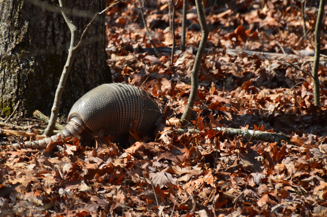
The Hogjowl Trail traverses several pretty boulder fields.
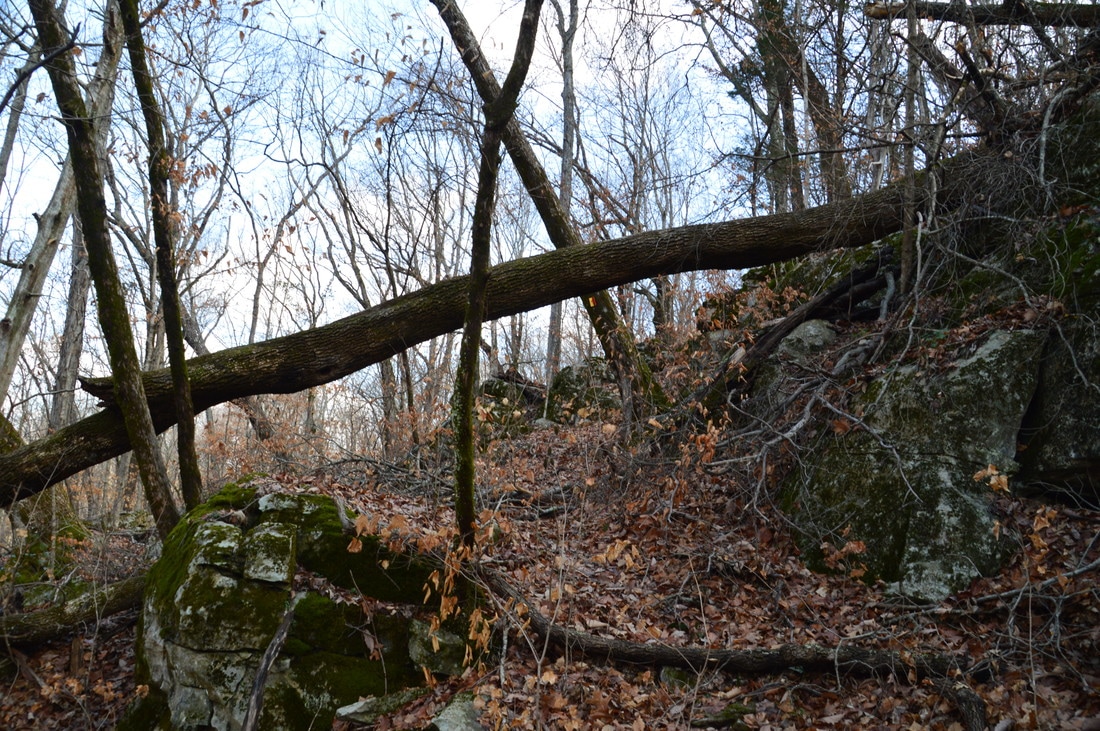
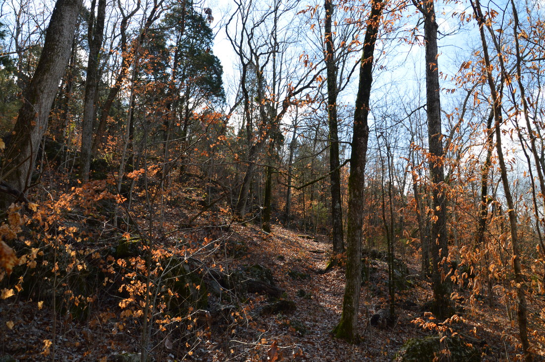
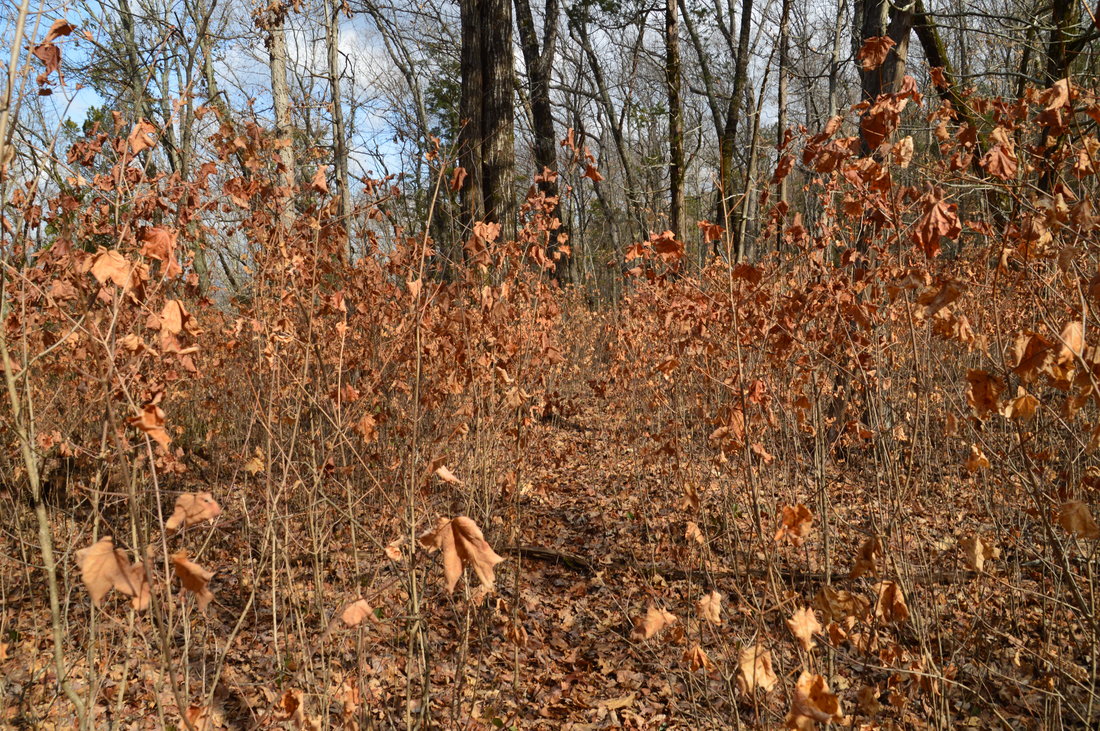
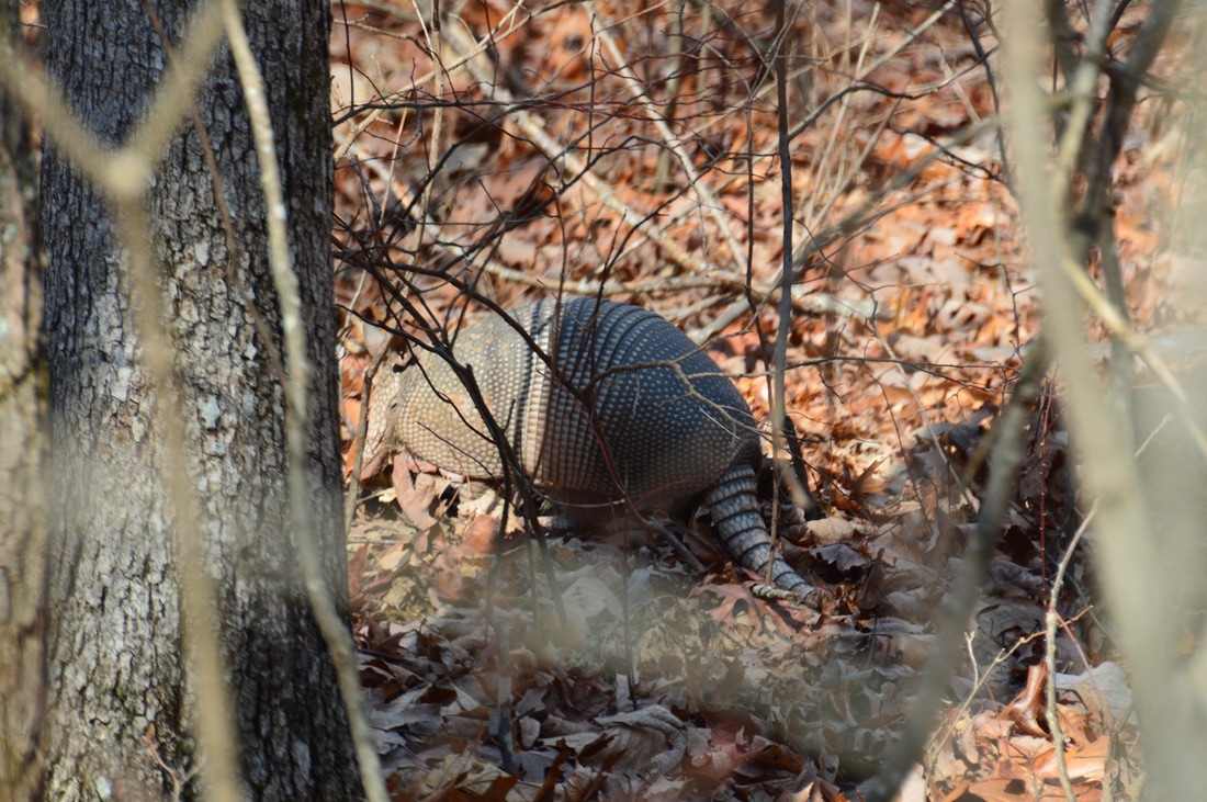
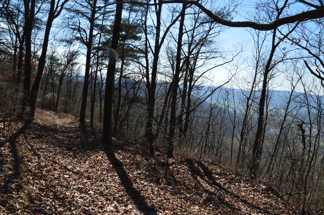
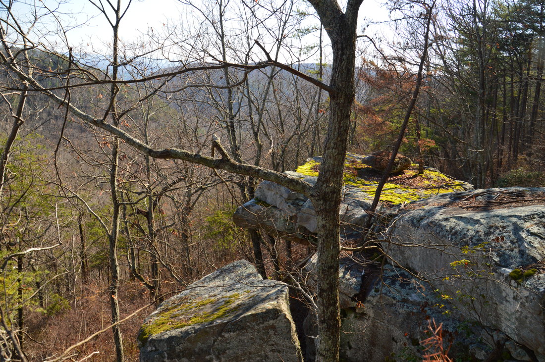
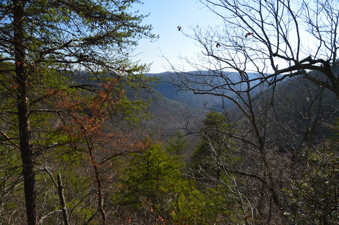
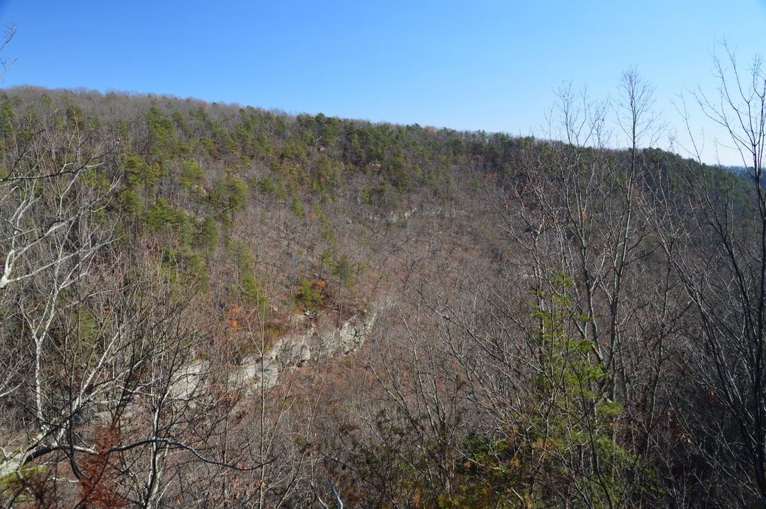
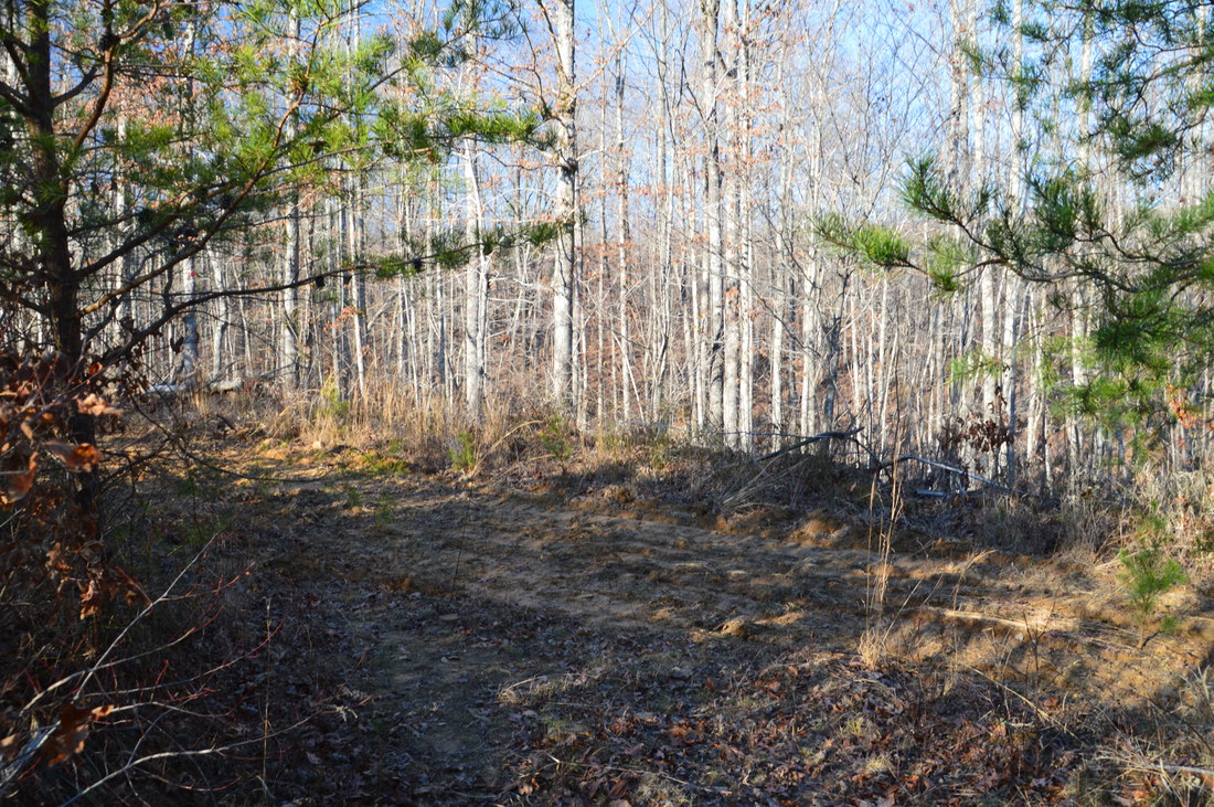
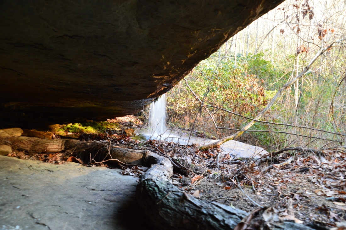
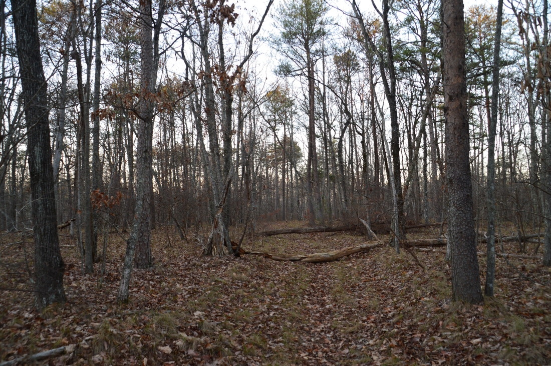
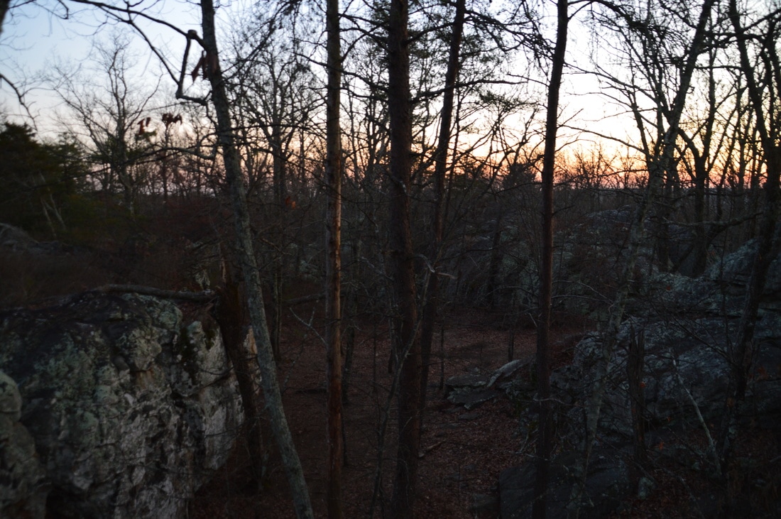
I must have gotten tricked by how groomed the white-blazed Bluff Trail looked, because at one point, I somehow got off the trail and had to bushwhack my way back. However, I was rewarded by sighting an armadillo foraging in the leaves. The trail crested a small hill at 2.35 miles and then descended to a gap, reaching Rocky Lane at 2.55 miles. The Bluff Trail bears right and away from Rocky Lane in the gap, without actually crossing the road. An easy ascent brings the trail to another hill atop the west brow at 3.4 miles. There are great winter views westward into McLemore Cove from here, and these seasonal views continue as the wide trail begins descending toward Rape Gap. This is one of the most enjoyable sections of the hike, due to the relaxing and well-defined trail with few obstacles. Just after joining a forest road, the Bluff Trail reaches Rape Gap at 4.8 miles. My suggestion is to turn left onto Rocky Lane here and pick up the Atwood Trail a short distance down to follow it to Allen Creek. I did an extended version of this route by following forest roads south and west of Rape Gap to an area that I wanted to investigate for views along the Allen Creek gorge Rim. I didn't find any worthwhile vistas, and I didn't like this part of the hike, as most of the forest roads were somewhat torn up and passed through many wildlife clearings, but if you wish to follow my route, then keep reading. Note: The route that I followed from Rape Gap to the Atwood Trail is the route of the old Wildlife Trail, which is no longer designated as a trail (and for good reason, as its route is not a trail in the true sense).
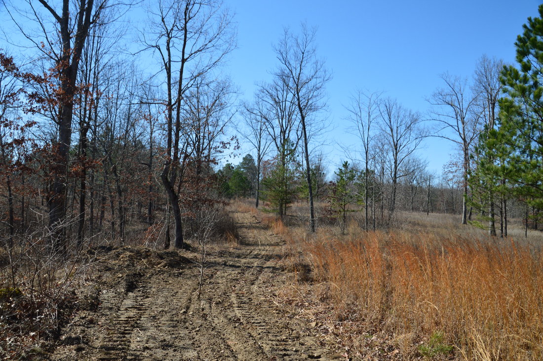
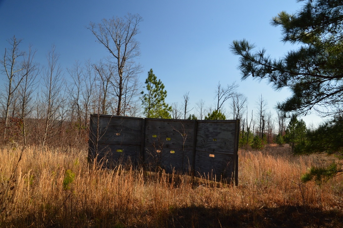
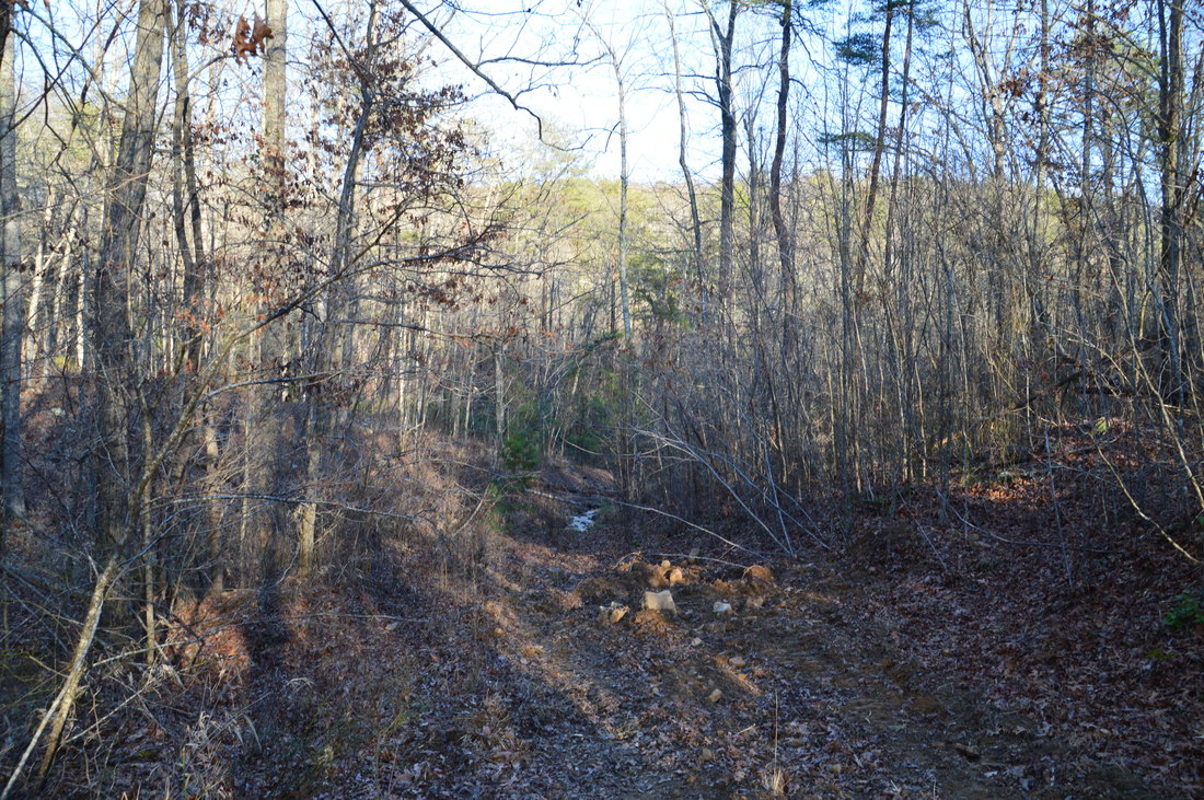
To hike to the rim of the Allen Creek gorge, enter the Rape Gap Trailhead parking area and then turn right and work your way into a large wildlife clearing. Walk to the far south end of the rectangular clearing, and at the end, turn right onto a forest road that leads back towards Rocky Lane. Just before the road, turn acutely left on another forest road, and at 5.25 miles, turn right onto another forest road heading westward (somewhat parallel to Rocky Lane). This forest road - as well as most of the forest roads in the vicinity - had recent tractor tracks on it that had really torn up the road. The road passes through a semi-open area that appears to be recovering from logging. There will be one wildlife clearing to the right, before the road reaches a T-intersection in a second clearing with a hunting structure to the left. At the intersection (at 5.7 miles), turn left onto another forest road (to the right, it leads to Rocky Lane). Skirt the edge of a wildlife clearing and then bear left at 5.95 miles, where there is a split in forest roads. At 6.3 miles, there is an intersection with another forest road; bear right here. At 6.45 miles, another road left to the left in the middle of a wildlife clearing. Continue straight on a much cleaner forest road that leaves the clearings and begins a gentle descent toward the edge of the Allen Creek gorge, reaching the rim at 7.2 miles. I was hoping to get several views of the Allen Creek gorge from the rim, but unfortunately, all of the views turned out to be meager. There is no year-round view at all at the point where the road reaches the rim (although the view in winter is decent), but if you bear right and follow the rim for a bit, you'll reach some impressive bluffs and boulders. To continue the hike, turn left onto a narrower forest road that stays near the gorge rim. The trail dips in and out of a ravine, passes by a small spring, and reaches the end of a forest road to the left at 7.5 miles. Here, bear right and bushwhack for a short distance in a south direction to some bluffs at the edge of the gorge, where there is a limited view of the gorge at 7.55 miles. The opening in the trees is quite small, although the trees do frame the scene nicely. 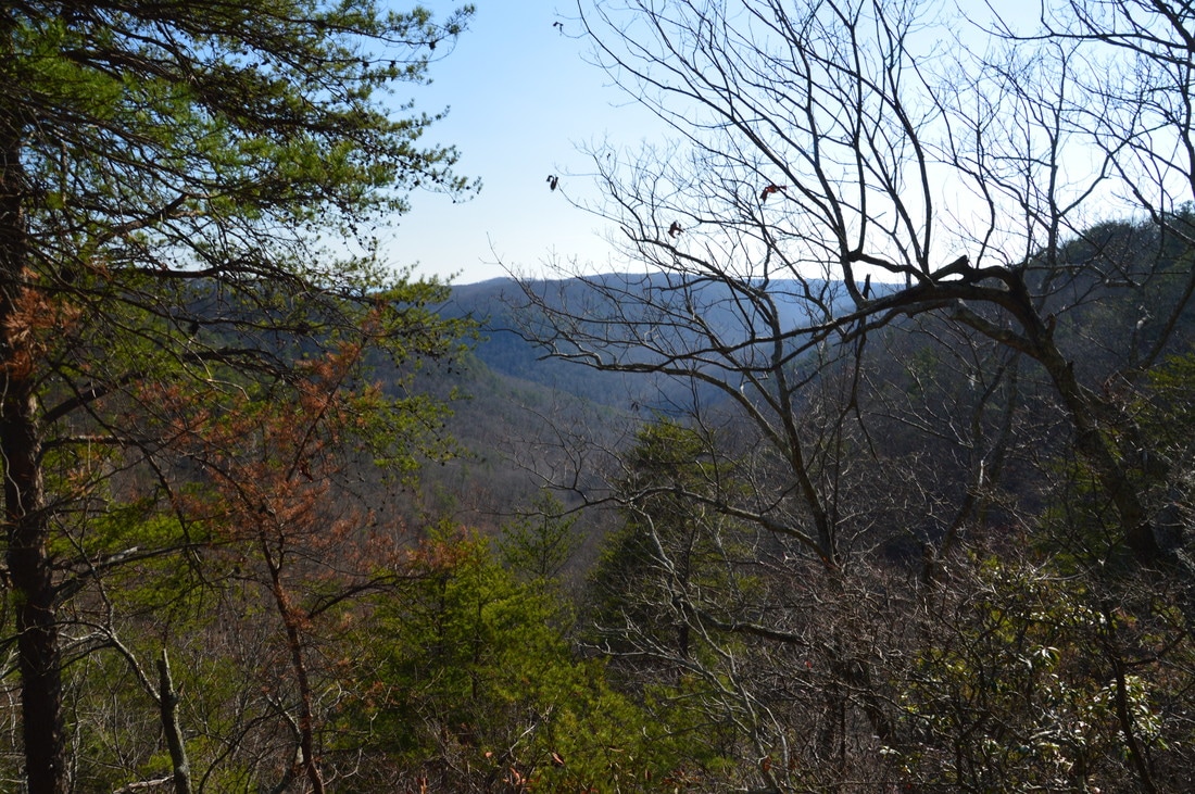
The west rim of the Allen Creek Gorge has several mediocre views of the gorge.
Return to the forest road that follows the rim and continue walking along it northward. The other good view of the Allen Creek gorge is at about 7.8 miles. To reach, turn right off the forest road about 0.2 miles after returning to it from the first view. Bushwhack a short distance through the rather thick woods to a cliff at the edge of the gorge.. From this semi-open vantage point, I could see some impressive bluffs across the gorge. How about that! It looks like there could be good views of the gorge from those bluffs, and I had been sure that the best views of the gorge would be from the west rim, not the east rim. I do not know any access details regarding the east rim bluffs. To continue the hike, return to the forest road and continue following it, reaching a point that separates the Allen Creek gorge and Rocktown Branch gorge at 8.05 miles. I could not find any view here, despite the promising look on satellite imagery. Turn left and follow the forest road away from the gorge rim. At 8.15 miles, the main forest road bears left, while a much older and slightly overgrown forest road (the former route of the Wildlife Trail) bears right into a recovering clearing. Bear right onto the lesser-used forest road, which provides a route to the Atwood Trail.
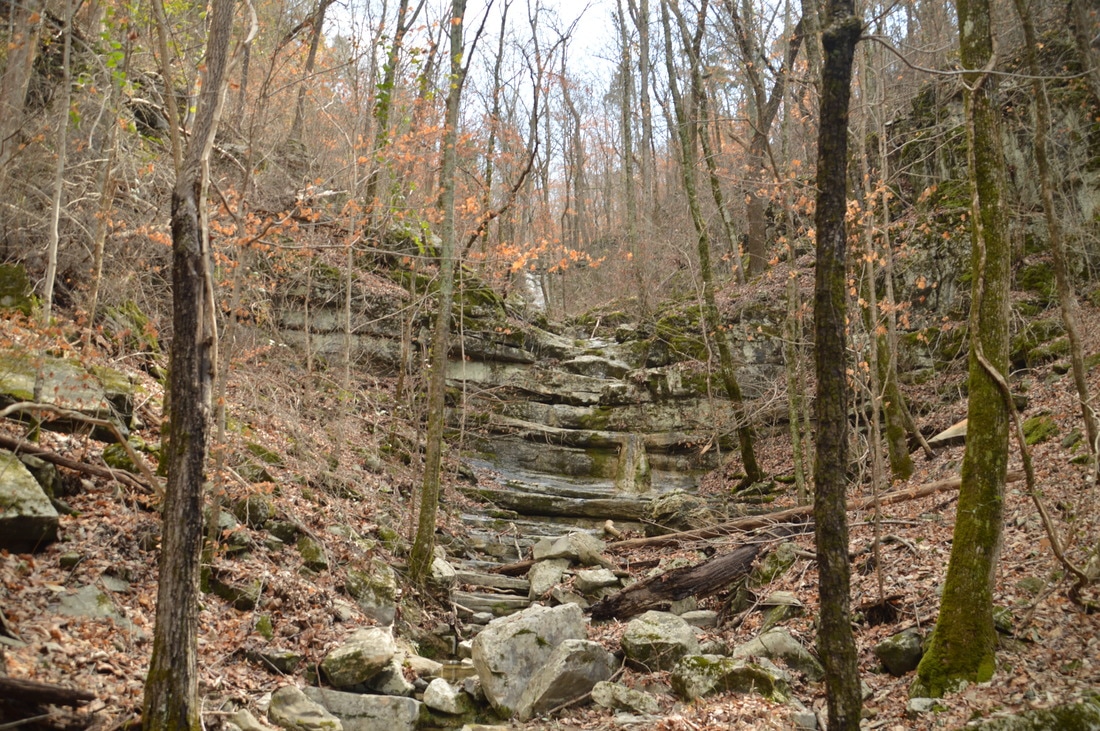
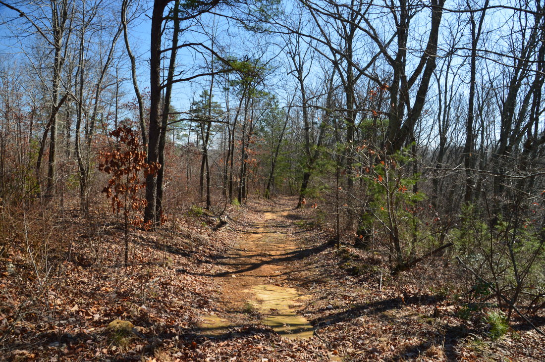
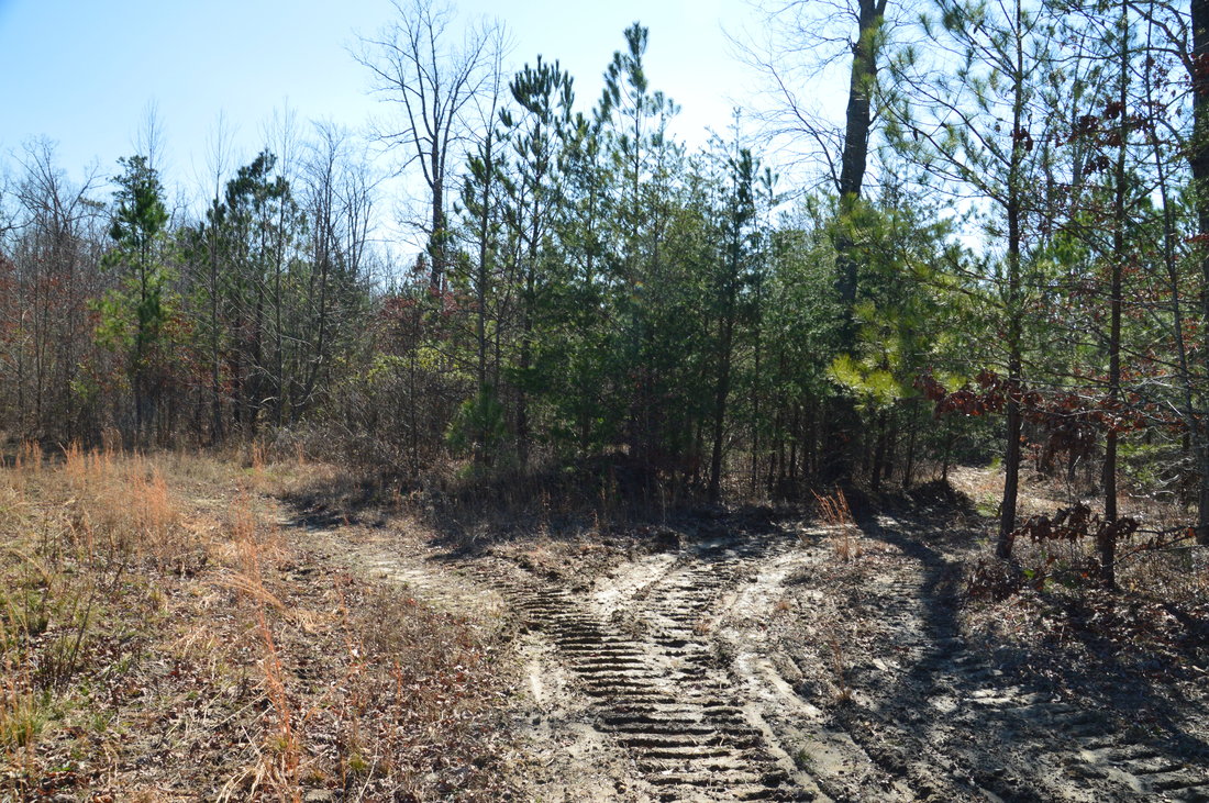
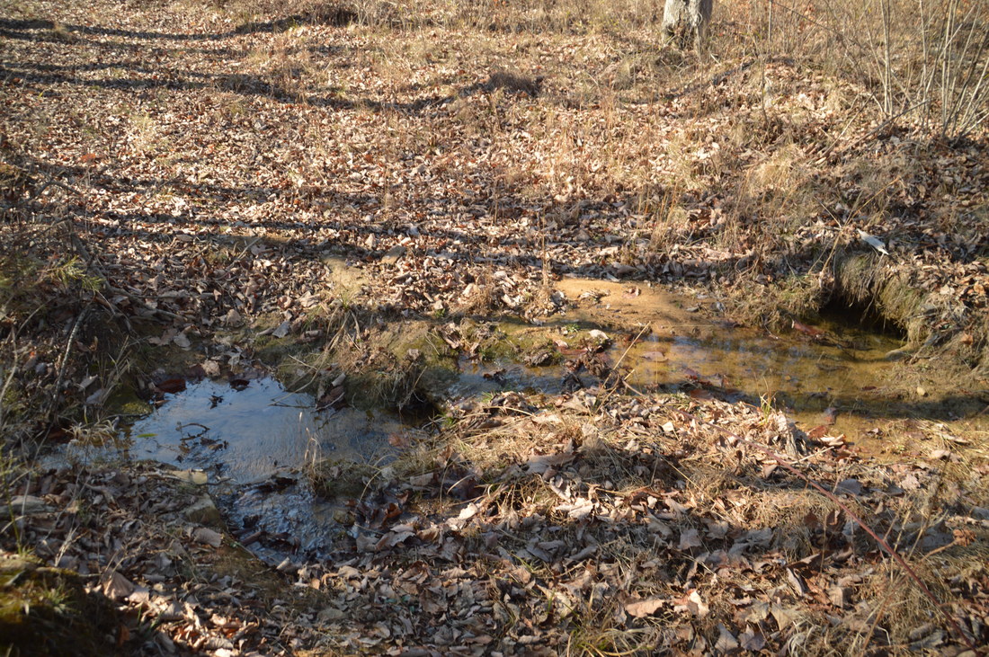
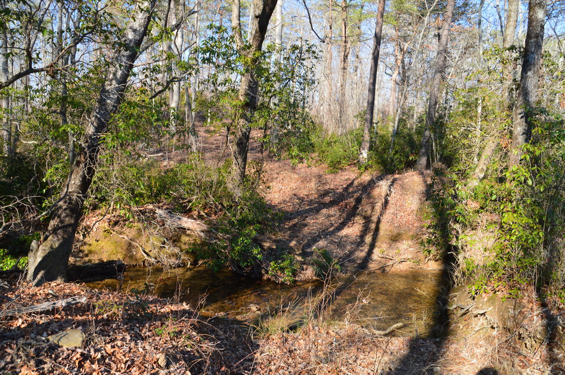
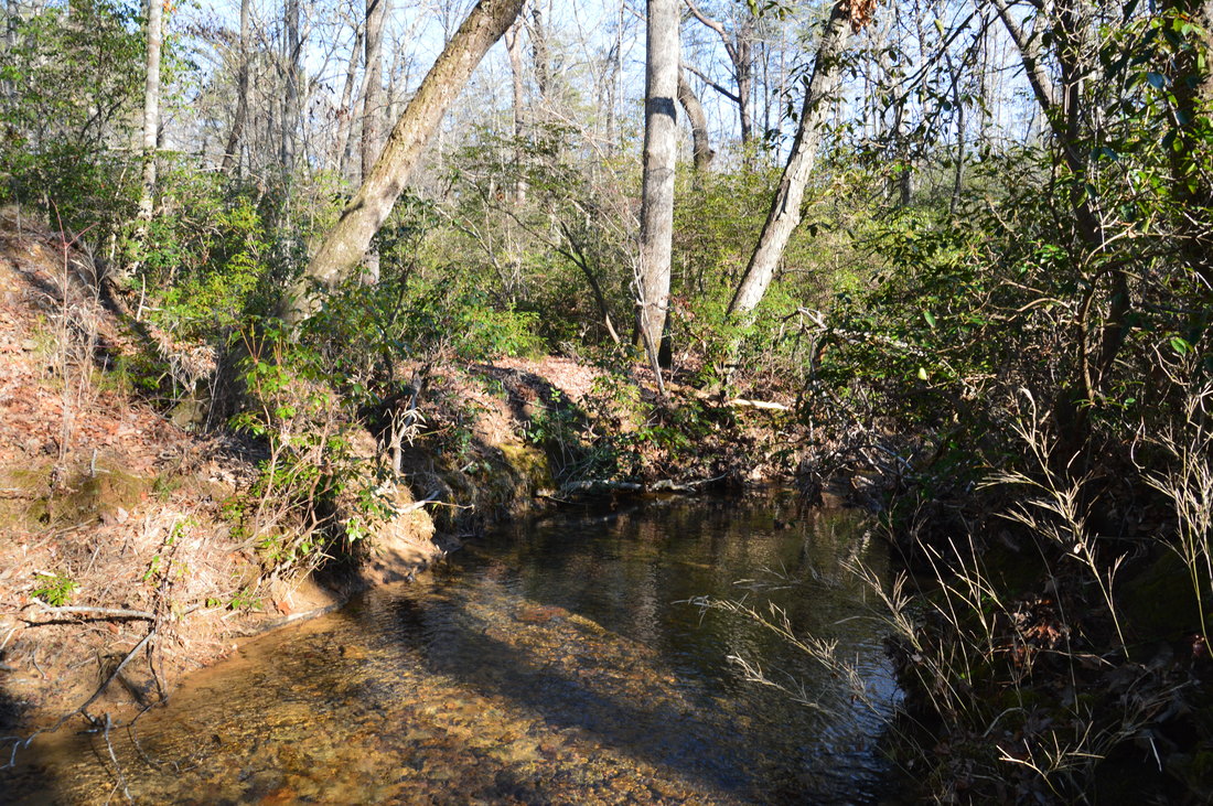
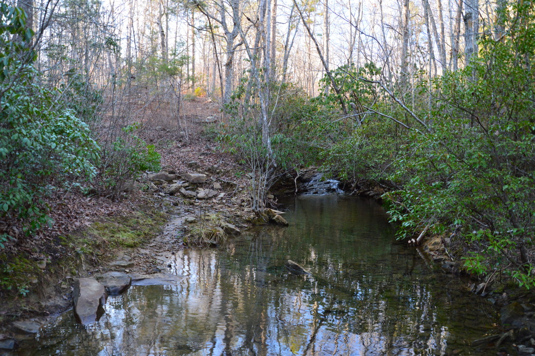
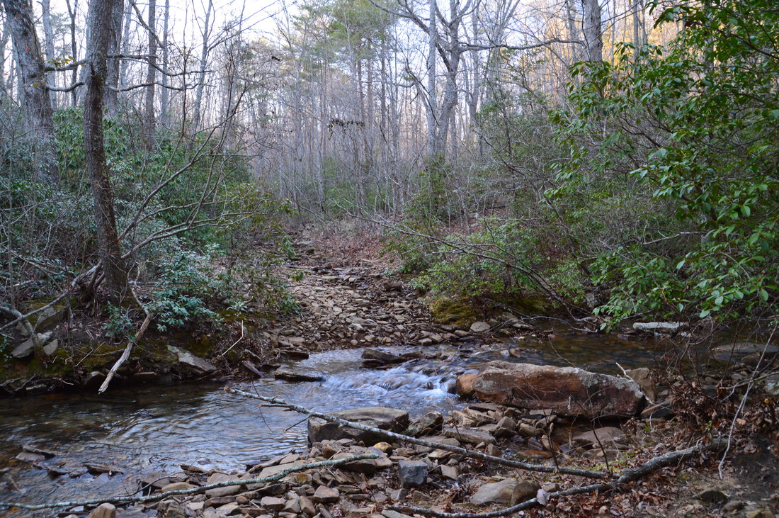
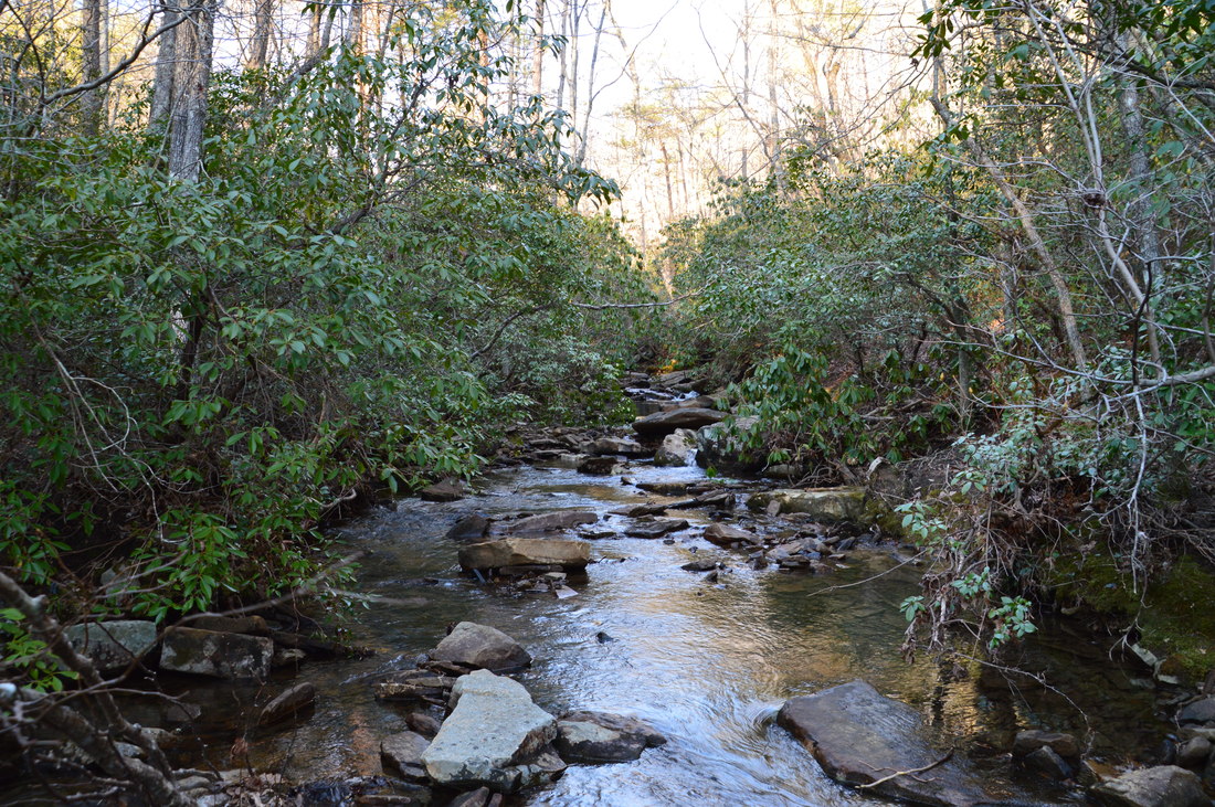
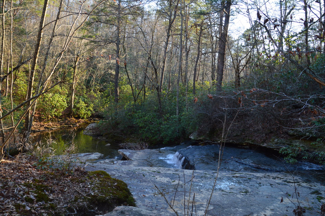
The forest road descends moderately into the Rocktown Branch gorge, reaching and fording the creek - which has a surprising amount of water - at 8.5 miles. During low water, you may be able to use some stones to hop across the stream. The forest road quickly rises out of the low gorge and then meanders along the edges of an area recovering from logging. At 8.8 miles, I saw what I thought looked like a path that headed straight into the recovering area eastward, and being eager to get back on real trail, I decided to utilize this "shortcut" (I marked the turn by the waypoint "Begin Bushwhack". Trust me, it is not worth it. The path quickly disappears and the briers are absolutely horrendous. The forest road leads to the same point that my "shortcut" did, and it is only around a quarter-mile longer (or even less). With my route, I reached the forest road again at 9.3 miles, although if you take the recommended route along the forest road, it'll be a bit longer. Well, to be honest, the recommended route includes skipping the section southwest of Rape Gap completely! Continue following the forest road (I turned left onto it after concluding the bushwhack "shortcut"), and reach the Atwood Trail junction at 9.45 miles. To the left, the Atwood Trail leads to Rape Gap, but this hike turns right onto the Atwood Trail, in the direction of Allen Creek Falls. The Atwood Trail begins descending along a forest road, but shortly, the forest road turns into a rocky drainage. At 9.6 miles, the rocky trail reaches an unnamed but surprisingly large tributary of Allen Creek. Depending on recent rainfall and water levels, this may be a wet ford, but on this day, I just barely managed to rock hop. On the other side of the tributary, there is a junction with the Hood Loop Trail. 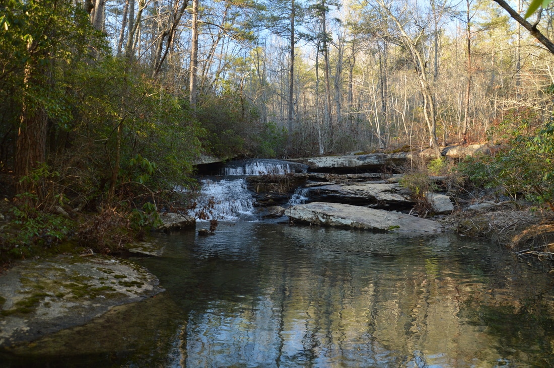
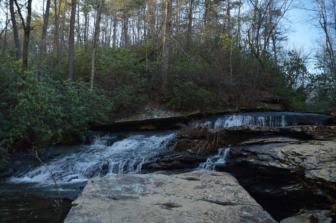
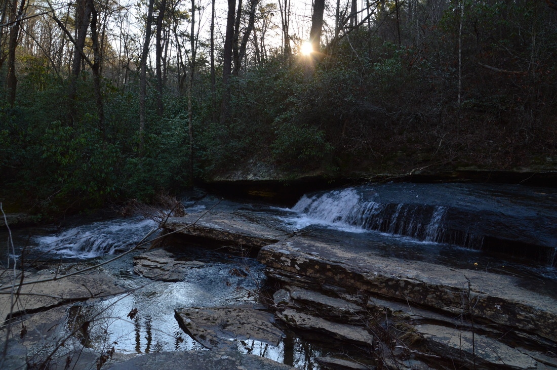
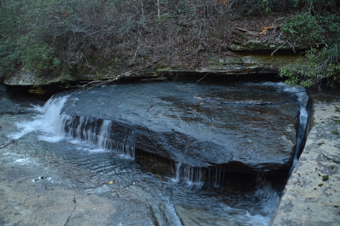
Allen Creek Falls, located at the head of the Allen Creek gorge, is a small but unique waterfall that spills over several rock ledges with grottoes and into a large pool.
The Hood Loop is a very nice 6.5-mile day hike that begins at Hood Overlook near Rocky Lane. The Hood Loop heads left and straight in conjunction with the Atwood Trail. To continue this hike, you'll want to turn left onto the Hood Loop at this junction, but first, I highly recommend continuing straight for the short side trip to beautiful Allen Creek Falls. Continuing on the Hood Loop/Atwood Trail straight, reach a ford of Allen Creek just past the junction. Depending on the water level, it may be possible to rock hop the creek. On the other side of the creek, bear right as the trail enters a very eroded and rocky drainage area. A narrow path bypasses the drainage to the right. At 9.8 miles, the Atwood Trail turns left and uphill (together with the Hood Loop) in the direction of Hood Overlook. Continue straight on a wide but unmarked path toward Allen Creek Falls. In around 100 feet, turn right onto an obvious path (while an old forest road continues straight). This path passes through a campsite and reaches the top of Allen Creek Falls at 9.85 miles. To reach the base, follow the edge of the small ledge to the left, cross a small feeder stream, and then hop down the ledge and to creek level, where there are several good viewpoints of Allen Creek Falls along the edge of the large pool in front of the waterfall. Allen Creek Falls is only about 15 feet high, but it is pretty. The creek cascades down several rock ledges, and low grottoes extend far back below the ledges. Furthermore, a small feeder stream contributes to the scene with its own fall. From what I have read, there may be additional picturesque small waterfalls/rapids further downstream on Allen Creek, as well as a possible 35-foot waterfall on Rocktown Branch.
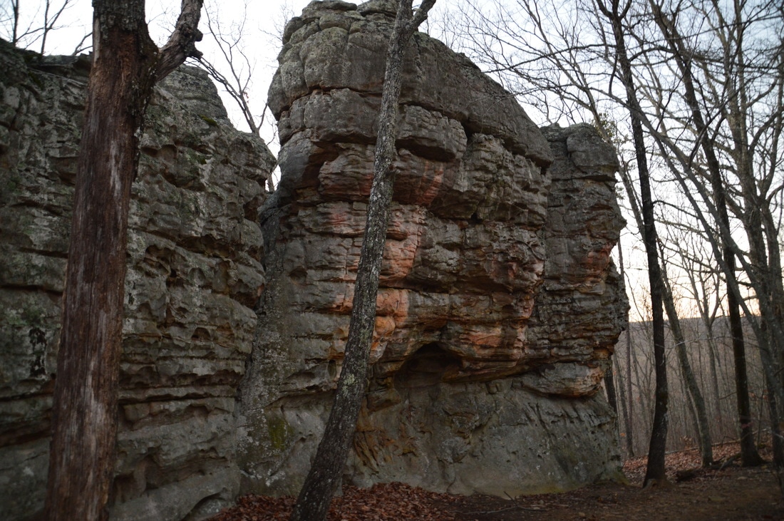
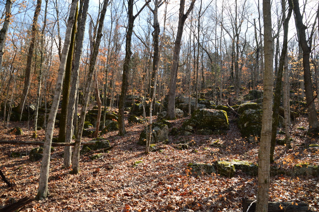
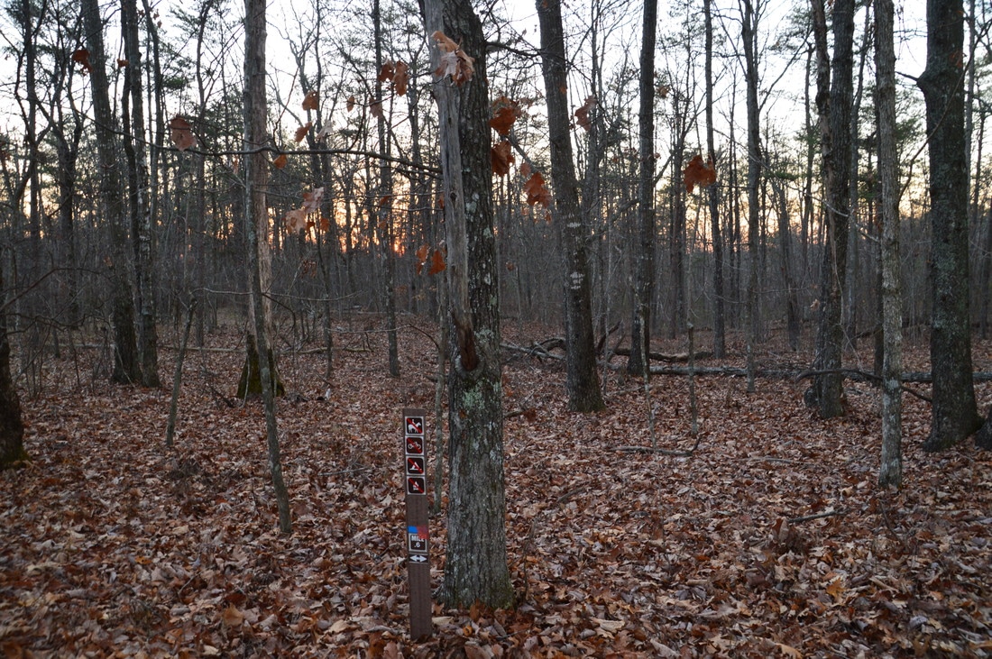
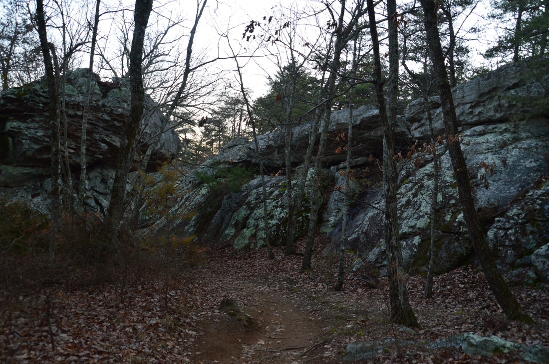
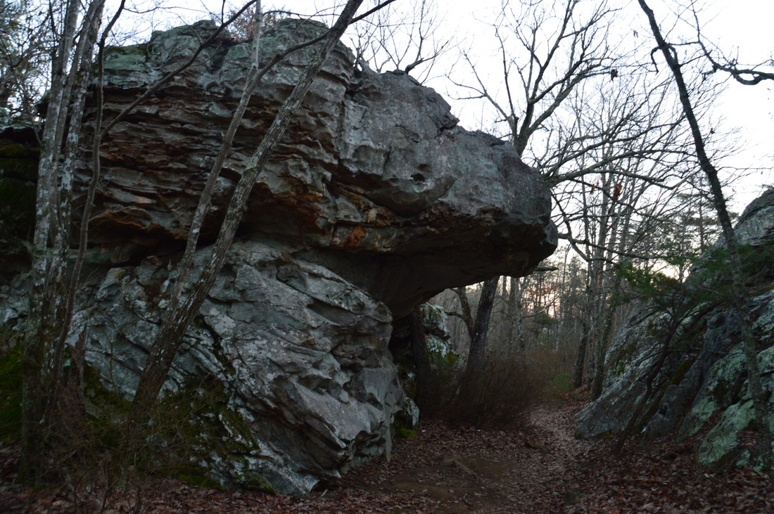
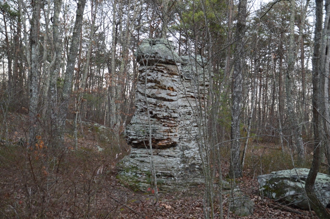
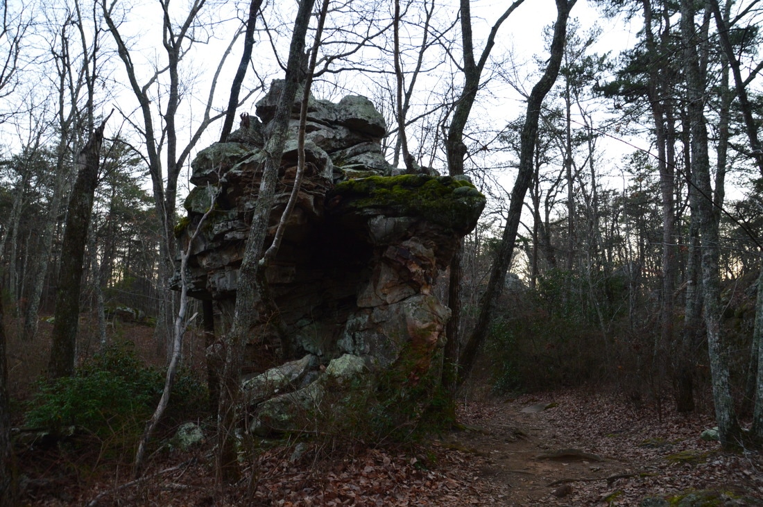
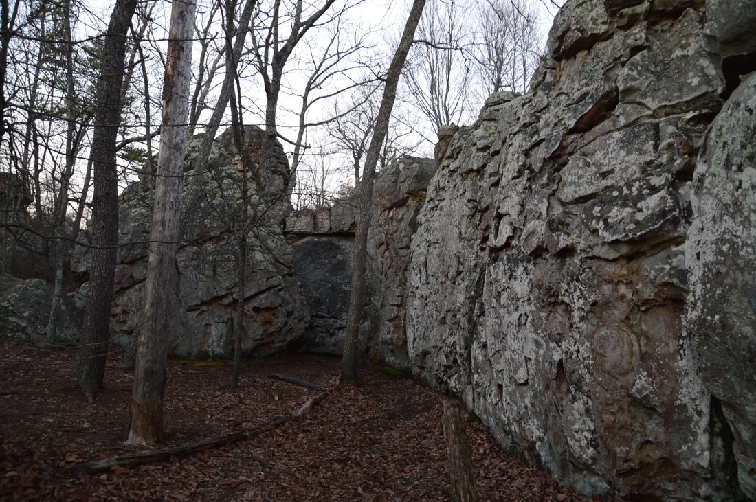
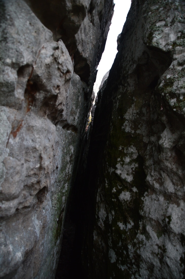
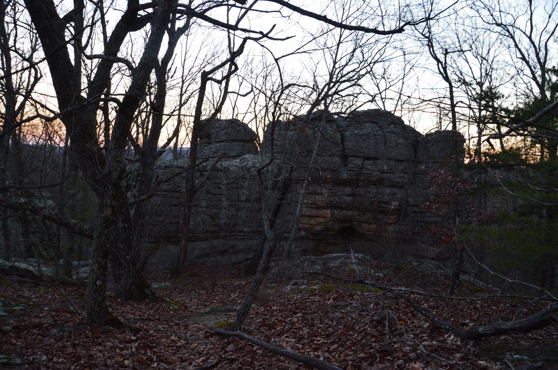
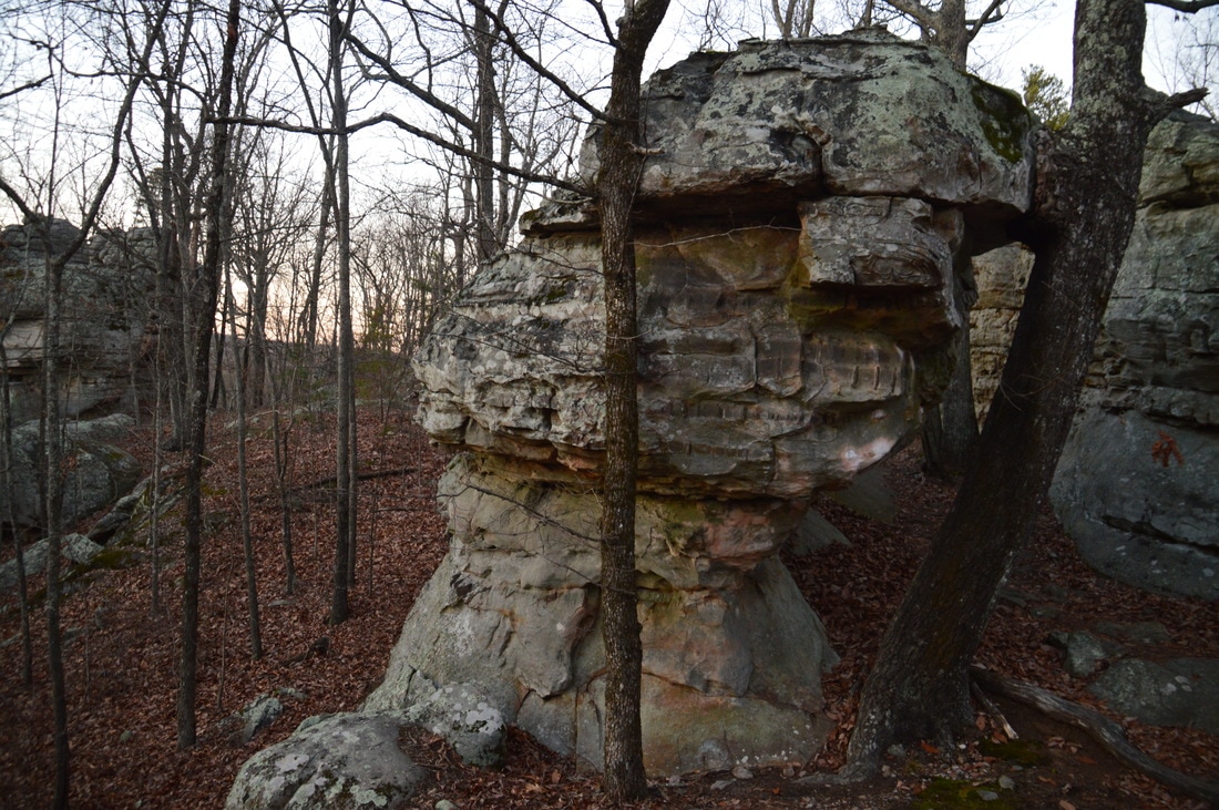
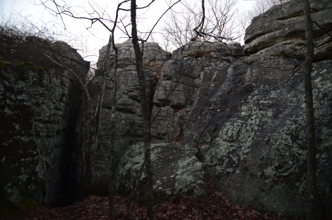
From Allen Creek Falls, return to the Hood Loop junction at the ford of Allen Creek, and turn right onto the Hood Loop Trail. This blue-blazed trail begins a moderate ascent out of the Allen Creek gorge. The trail is initially slightly overgrown in several places, but it is passable. The ascent becomes gentler around 10.6 miles as the trail crests a ridge that separates the Allen Creek gorge and Rocktown Branch gorge. At 11.2 miles, the wide trail reaches a carsonite trail marker to the left with the words "Mile .6 <-->". At this point, do not continue following the Hood Trail; instead, turn left onto a faint connector path that reaches the Rocktown Trail in 200 feet. Once at the Rocktown Trail, turn left onto the well-used path for the side trip to Rocktown (the hike will later continue to the right on the Rocktown Trail). The trail descends gently for a brief period of time before entering the "Rocktown area" at 11.4 miles and continuing through it to the trail's end at 11.55 miles. Rocktown is a very unique destination. The area of Pigeon Mountain known as Rocktown has many dozen (a few hundred?) bizarre rock formations of all shapes and sizes scattered throughout. For this reason, Rocktown is a popular rock climbing destination. It is possible to scramble up some of the rocks (without climbing skills) and gain a panorama of the surrounding rock formations. Rocktown is a place worth spending time at and wandering about for some time, and in fact, you can walk over a quarter-mile extra on the various paths that twist and turn among the rocks, even after the official trail ends.
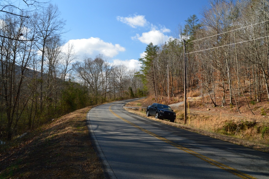
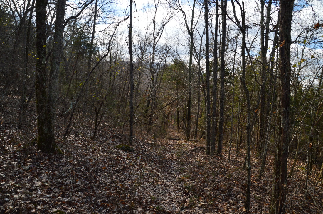
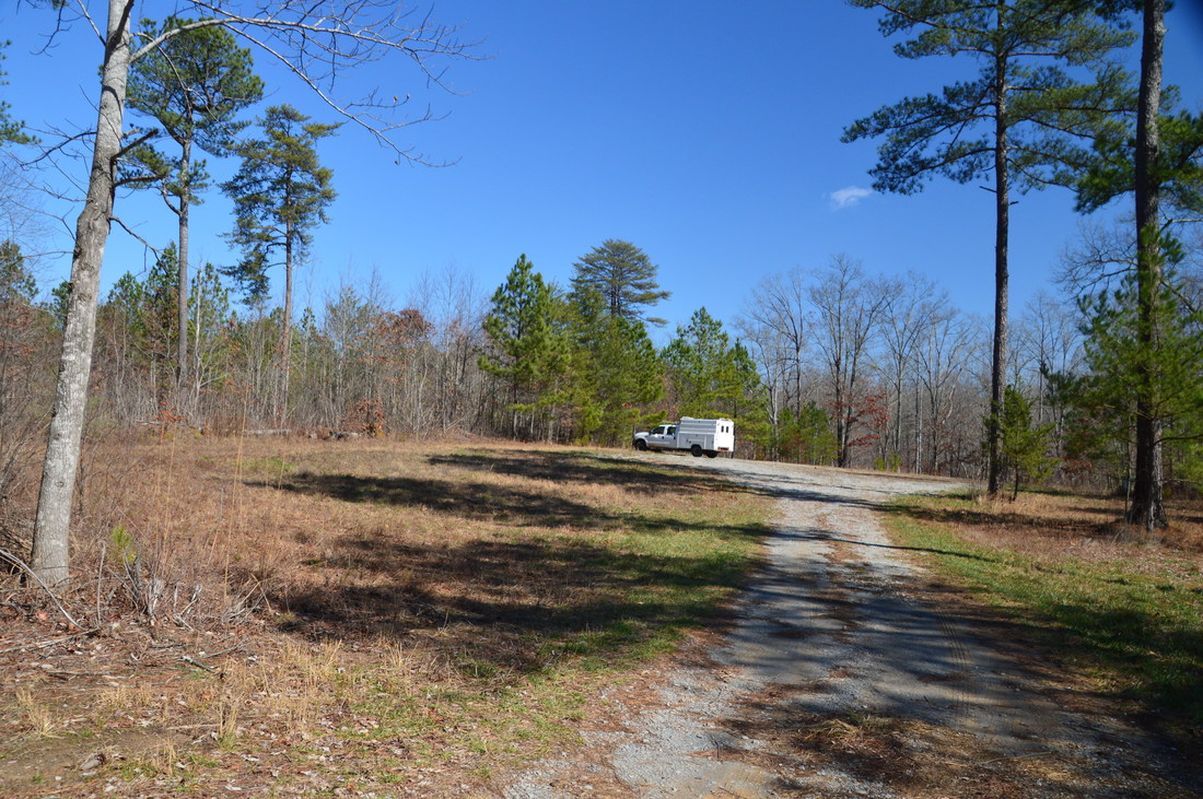
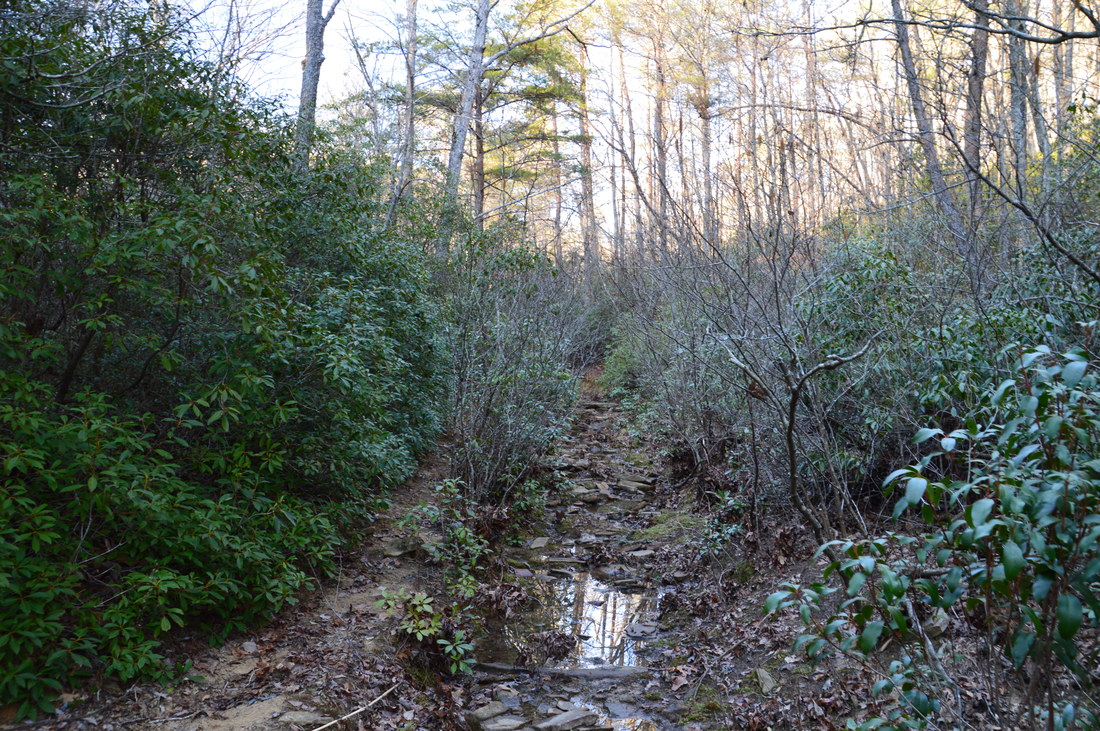
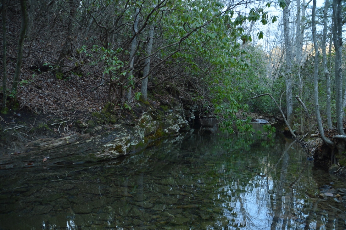
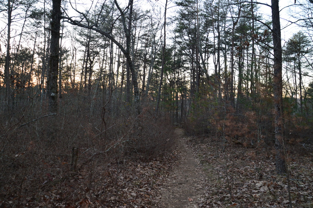
From Rocktown, return along the Rocktown Trail and continue following it northward (do not return to the Hood Trail). The Rocktown Trail is the only "popular" trail on Pigeon Mountain, and for this reason, it is well-groomed and easy to follow. The trail has a few ups and downs across small hills but none of them are particularly notable. Near its end, the trail crosses the now much smaller Allen Creek (near its head) via a footbridge and then reaches the Rocktown Trailhead at 12.7 miles. From here, to get back to the Hogjowl Trail, a period of roadwalk is required. However, the roads on Pigeon Mountain are unpaved and receive relatively little traffic. From the Rocktown Trailhead, follow Rocktown Lane on a gentle uphill to a T-intersection with Rocky Lane at 13.35 miles. Turn left onto Rocky Lane, and in another 0.2 miles, turn right onto signed McClutchin Springs Road (in the direction of Sawmill Lake). At 13.7 miles, the road reaches Sawmill Lake Campground. Bear right at the kiosk to continue on the main road (straight heads into the campground), descending to and reaching Sawmill Lake at 13.9 miles. About 250 feet past the point where you reach Sawmill Lake, the discreet Hogjowl Trail leaves to the left on an old roadbed. It is marked by a red sign (nailed to a tree) that reads "Foot Travel Welcome"; make sure not to miss this turn, as there is no adequate trail marker!
The Hogjowl Trail begins a moderate ascent along the old roadbed, passing several "Designated Camping Area" signs to the left. At a fork at 14.05 miles, bear right to continue on the trail. The trail comes over a hill and passes next to a turnaround at the end of a dirt road at 14.4 miles. A homemade arrow marks the trail as it continues across the road and begins descending toward the west brow. At 14.75 miles, reach the junction with the Bluff Trail (where you were much earlier in the day), closing the loop. From here, simply continue to follow the Hogjowl Trail west - retracing your steps from earlier in the day - returning to your car on Hog Jowl Road at 16.6 miles, thus concluding the hike. Remember that by taking the Atwood Trail fro Rape Gap, you can significantly shorten the hike and cut out the least interesting segment. Mileage
0.0 - Hog Jowl Road Trailhead
0.8 - Nichols Hollow 1.85 - West Brow of Pigeon Mountain 4.8 - Rape Gap 7.55 - Allen Creek Gorge View 7.8 - Allen Creek Gorge View Two 8.5 - Rocktown Branch 9.85 - Allen Creek Falls 11.4+ - Rocktown Area 12.7 - Rocktown Trailhead 13.7 - Sawmill Lake Campground 13.9 - Sawmill Lake 16.6 - Hog Jowl Road Trailhead Variations
Shortcut the hike using the Atwood Trail from Rape Gap - 11.95 Miles
Bonus Stops
The nearby Pocket Falls is a good bonus stop, when there is enough water flowing. The hike to it is very short.
PicturesVideos
3 Comments
Matt Nielson
3/21/2017 10:31:05 am
Mark, a great write up and consistent with my experiences, although limited, of Pigeon Mountain trails. The area is rugged, undeveloped, and hopefully will stay that way. It's in one of those areas that just seems to be wild and difficult. Thanks for sharing your observations. I don't think the trails there are on my to-hike list, but certainly the rock climbing and caving is worth a visit to Pigeon Mountain!!
Mark Oleg
3/21/2017 11:58:26 am
Matt-- Thanks! A lot of the trails on Pigeon Mountain are nothing to write home about, although there are several things on them that are great to see such as the views from High Point, the Estelle Mines, and Pocket Falls. I plan on seeing Nash Pit soon.
Judy Copeland
9/30/2023 04:32:48 pm
Enjoyed your hiking trail through Pigeon Mountain. Leave a Reply. |
About MeMark Oleg Ozboyd Dear readers: I have invested a tremendous amount of time and effort in this website and the Georgia Waterfalls Database the past five years. All of the work that has gone in keeping these websites updated with my latest trip reports has almost been like a full-time job. This has not allowed me to pick up a paid job to save up money for college, and therefore, I I've had to take out loans. If you find the information on this website interesting, helpful, or time-saving, you can say "thanks" and help me out by clicking the button above and making a contribution. I will be very grateful for any amount of support you give, as all of it will apply toward my college tuition. Thank you!

Coming in 2022-2023?
Other Hiking WebsitesMiles HikedYear 1: 540.0 Miles
Year 2: 552.3 Miles Year 3: 518.4 Miles Year 4: 482.4 Miles Year 5: 259.9 Miles Archives
March 2021
Categories
All
|


 RSS Feed