
Lookout Mountain is a long linear mountain ridge that stretches roughly from Chattanooga, Tennessee, to Gadsden, Alabama. Much of the ridge has a relatively constant elevation, and the highest point on Lookout Mountain is in Walker County, Georgia. Simply and appropriately named "High Point", this rise on Lookout Mountain is home to a row of sheer cliffs that provide breathtaking views east and south into Chattanooga Valley and towards Pigeon Mountain and Taylors Ridge. Thanks to the recent acquisition of various tracts of land atop Lookout Mountain by the Lula Lake Land Trust, access to High Point has now been secured, and the 14-mile Cloudland Connector Trail provides the perfect approach into the area. This hike occurred on Saturday, December 3rd, 2016. My plan was to hike the Cloudland Connector Trail from Nick-a-Jack Road to the High Point gated service road. From there, I would follow the closed road and then a short path to the summit of High Point and an excellent vista. I would return the same way.
Summary
R/ T Length of Trail: 8.7 Miles
Duration of Hike: 4:20 Type of Hike: Out and Back Difficulty Rating: 4 out of 10 Total Elevation Gain: 1568 Feet Pros: The hike to High Point stays on the top of Lookout Mountain the entire time, and as a result, it is quite easy with mostly easy grades and a brief stretch of moderate to steep grades Cons: The Cloudland Connector Trail is a multi-use trail, so biking and equestrian use can be expected Points of Interest: Views from High Point on Lookout Mountain - 8 stars Trail Blaze Colors: Cloudland Connector Trail - White-Rimmed Green Diamonds Best Seasons to Hike: Year-round Fees: There is a $5 Georgia State Parks fee for parking at the trailhead for this hike, as the property is partially managed by Cloudland Canyon State Park. Directions from Chattanooga Valley, GA: From the intersection of GA Route 193 and Nick-a-Jack Road in Chattanooga Valley, follow Nick-a-Jack Road West for 3.4 miles. Then, at a sign, turn left onto the entrance road to the Nick-a-Jack Road parking area for the Cloudland Connector Trail. Shortly reach the parking area and trailhead. Map
Click here for more information and to download this trail map to view in Garmin Basecamp.
Details
Compared to other areas of the north Georgia mountains, the northwest section of Georgia (generally west of I-75) has always been lacking hiking trails. Nondescript sections of the Pinhoti Trail, the short trail system around Keown Falls, Cloudland Canyon State Park, and James H. (Sloppy) Floyd State Park have always been considered to be the primary hiking destinations in the area, along with the extensive trail system in the Lookout Mountain Battlefield. I had always wondered if there are some lesser-known hikes in the area, and over the years, I did run into a few. I have noticed how over the past decade the Lula Lake Land Trust acquired various tracts of land on Lookout Mountain in northwest Georgia, starting with the core tract that encompasses the spectacular Lula Falls. The other acquisitions are more recent, and thanks to the new land owned by the Lula Lake Land Trust, in addition to some conservation easements and help from Cloudland Canyon State Park (which plays its role in managing the trail), the new Cloudland Connector Trail was officially completed in June 2014. The Cloudland Connector Trail and the trail system that evolved around it generally travels through rolling hills on the top of Lookout Mountain, and I used to believe that there was nothing of interest in this area. As a result, the multi-use trail never really grabbed my attention. That was before I learned that High Point - the highest point on Lookout Mountain - was part of the new land acquired by the Lula Lake Land Trust. The cliffs of High Point used to be off limits, but today, access is quite easy both for rock climbers and hikers, thanks to Lula Lake Land Trust and the Cloudland Connector Trail, and the view from High Point is certainly one of the best in the region.
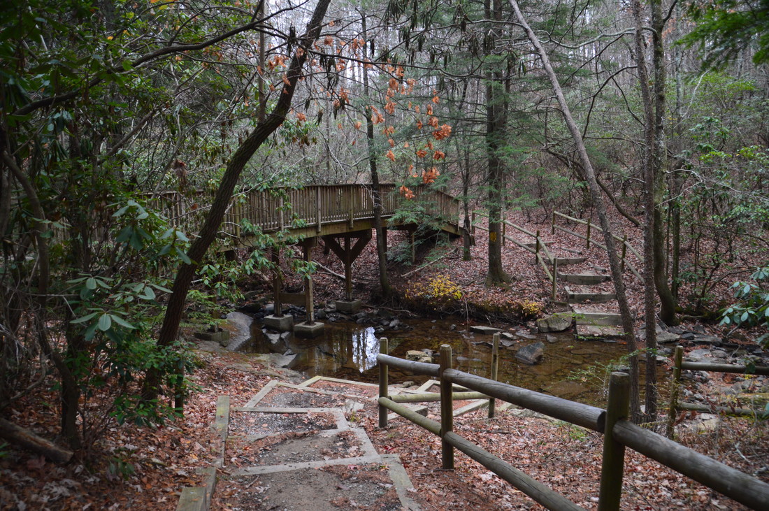
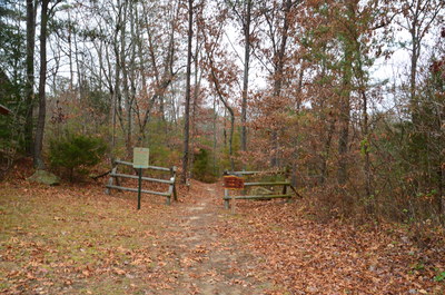
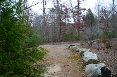
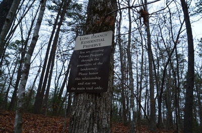
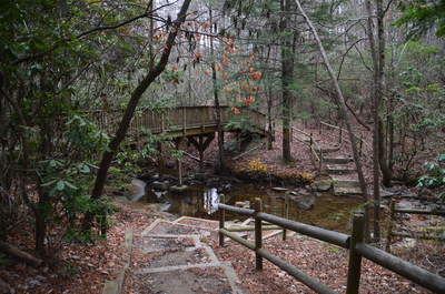
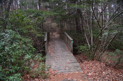
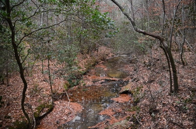
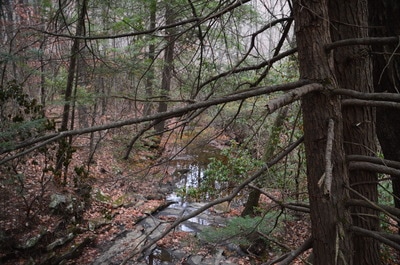
The hike begins at the beginning of the Cloudland Connector Trail at a sign that lists mileage to the other three major trailheads for the trail. The wide multi-use trail begins on land trust property, descending a small hill. At 0.15 miles, the trail crosses a private road and then enters the Long Branch Residential Preserve, which is private land under conservation easement. Please stay on the trail here. After a brief descent, the trail reaches Long Branch at 0.5 miles. I was impressed with the work that was done here. The trail crosses an impressive footbridge across Long Branch, and a bypass trail with a ford was built for horses. Anti-erosion structures were placed near the ford to prevent horses from messing up the trail.
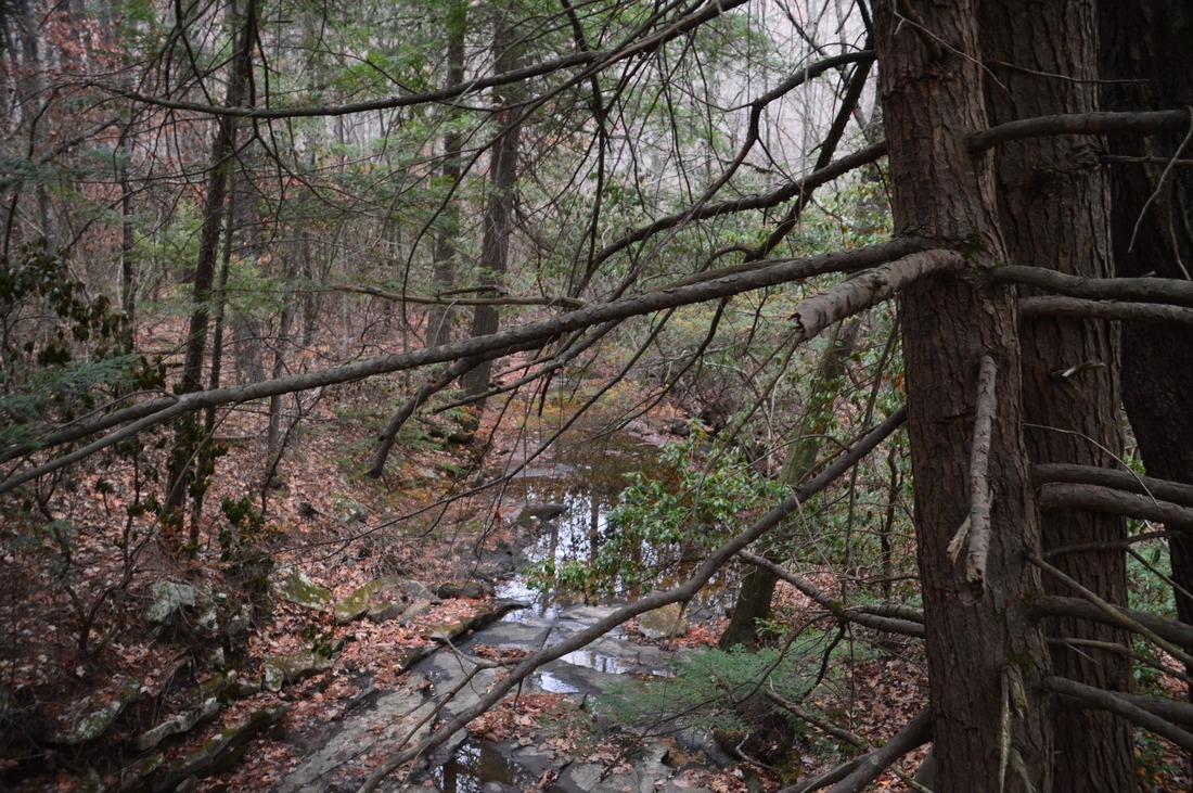
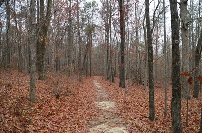
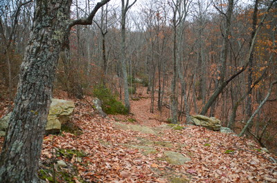
Much of the hike is very easy onward, as the trail meanders among low plateau-top hills west of Long Branch. There are few noticeable elevation changes in this section, and I was able to keep up a pace of around 3 miles per hour on the way in. After passing through pieces of land that are either private (but under conservation easement) or owned by the Lula Lake Land Trust, the trail officially leaves the Long Branch Residential Preserve at 1.8 miles and enters land trust property for good. At 2.15 miles, the trail begins descending back toward Long Branch. At 2.4 miles, there is a split in the trail; here, the horse bypass for the second Long Branch crossing bears left. Keep right on the foot trail. At 2.55 miles, descend to and cross Long Branch via another well-built footbridge in a grove of hemlocks that are still alive, as of this writing. While Long Branch is a small and fairly placid stream, hemlocks increase its beauty. As the horse bypass rejoins the main trail, bear right to continue on the Cloudland Connector Trail. The trail becomes rockier and parallels Long Branch until 2.9 miles, when the trail leaves the creek and begins an easy ascent up the lower reaches of High Point.
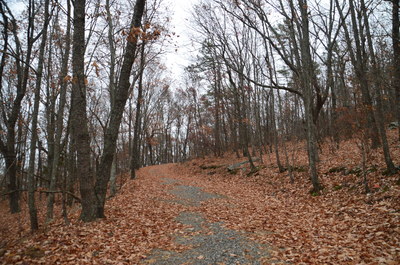
As soon as the trail levels out, it reaches the High Point service road at 3.75 miles. The Cloudland Connector Trail crosses the gravel road and continues to the Five Points Trailhead, which is in about two and three-quarter miles, but this hike turns left onto the gated service road that leads to microwave towers near the summit of High Point. This gravel road is kept in good shape for maintenance of the microwave towers at the top, but it is closed to regular vehicles. The steepest part of the hike is along this road, as you will ascend 500 feet from this point to the summit. At 4.1 miles, the road reaches a powerline clearing. There are some views both west and east here, and there is an abandoned house ahead as the road switchbacks to the left. The service road has a steep ending as it ascends towards the top of High Point, passing two microwave towers.
At 4.25 miles, the service road ends at a small turnaround. To the right, a staircase leads to another tower, but this staircase is closed to the public. To reach the summit of High Point, continue straight. From the turnaround, scramble over a fallen tree and pick up a goat path that soon bears right and aims for the summit. Near the top, there is a spot where you will have to scramble up a small ledge using your hands as well as your feet. The main path is unmarked, but it is easy to follow, as it is the only one that aims for the top and it is also evident that it receives a lot of use. At 4.35 miles, the path ends at the top of High Point, at a clearing at the edge of the tall bluffs on the east side of the ridge.
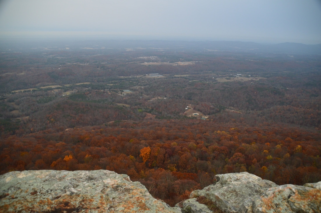
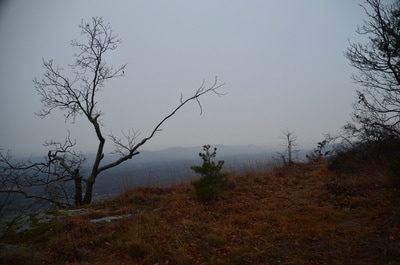
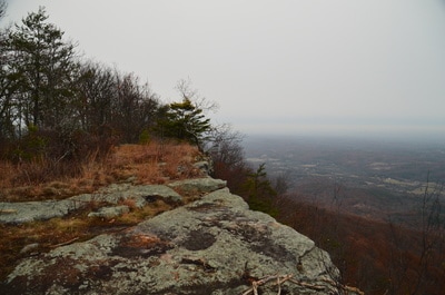
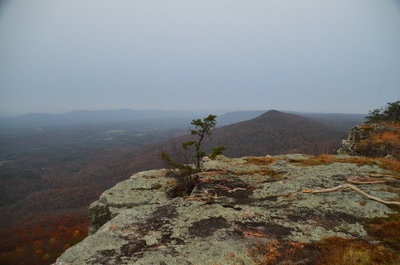
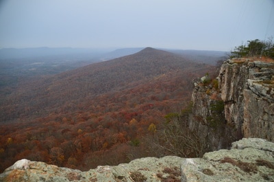
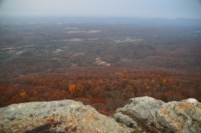
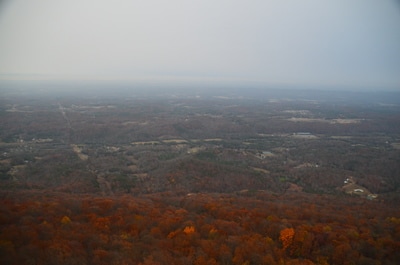
From the top of High Point, there are breathtaking 180-degree views. Chattanooga Valley is laid out in front. To the south is the continuation of Lookout Mountain, and further southeast is Pigeon Mountain. Far across the valley, you can make out Taylors Ridge on the horizon to the east. There are very few views like this in northwest Georgia, as most of the area is wooded and low elevation. Kudos to Lula Lake Land Trust for securing public access forever to this beautiful spot.
I attempted to hike north along the ridge of High Point, because I had a point marked on my topo map that I believed would provide views not only to the east and south but also to the west. However, the terrain is extremely rugged with large boulders everywhere, and there is no real path, as most of the climbing paths quickly end. While it is possible that there are better views further north, it is difficult to reach them, and I think that the main view at the end of the path is already very good. To return to the trailhead, simply retrace your steps, as this is an out and back hike with no loop options. You will return to the parking area, concluding the hike, at 8.7 miles. Mileage
0.0 - Nick-a-Jack Road Trailhead
0.5 - Long Branch 2.55 - Long Branch 3.75 - High Point service road 4.35 - High Point 8.7 - Nick-a-Jack Road Trailhead Variations
None
Bonus Stops
The core property of Lula Lake Land Trust, which is home to two waterfalls and more views, is very close to the Nick-a-Jack Road Trailhead. Consider adding the hike to Lula Falls on to a day at High Point.
PicturesVideos
0 Comments
Leave a Reply. |
About MeMark Oleg Ozboyd Dear readers: I have invested a tremendous amount of time and effort in this website and the Georgia Waterfalls Database the past five years. All of the work that has gone in keeping these websites updated with my latest trip reports has almost been like a full-time job. This has not allowed me to pick up a paid job to save up money for college, and therefore, I I've had to take out loans. If you find the information on this website interesting, helpful, or time-saving, you can say "thanks" and help me out by clicking the button above and making a contribution. I will be very grateful for any amount of support you give, as all of it will apply toward my college tuition. Thank you!
Coming in 2022-2023?
Other Hiking WebsitesMiles HikedYear 1: 540.0 Miles
Year 2: 552.3 Miles Year 3: 518.4 Miles Year 4: 482.4 Miles Year 5: 259.9 Miles Archives
March 2021
Categories
All
|

 RSS Feed