HIKING THE APPALACHIANS AND BEYOND
  • Home
  • Trail Reports
    • Best Hikes
    • Hikes with Scenic Views
    • Hikes with Water Features
    • Alabama
    • Georgia
    • Florida
    • North Carolina
    • South Carolina
    • Tennessee
    • Vermont
    • Virginia
  • Map
  • Hike List
  • Testimonials
  • Resources
  • Contact Us
  • Southeast Nature Society
    • Our Team
  • Georgia Waterfalls Database

Monongahela National Forest: High Falls Trail to High Falls on Shavers Fork Cheat River, Elkins, West Virginia

3/9/2021

1 Comment

 
Picture
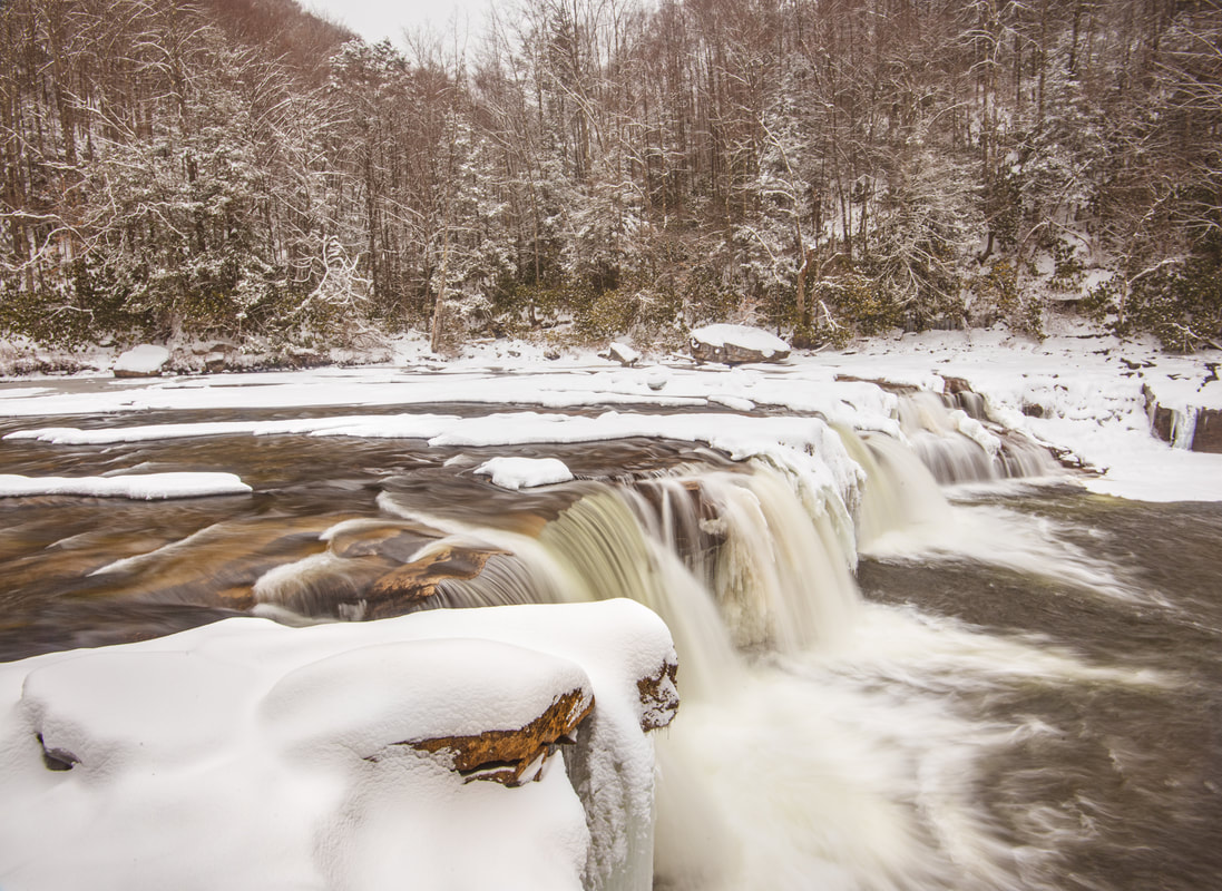
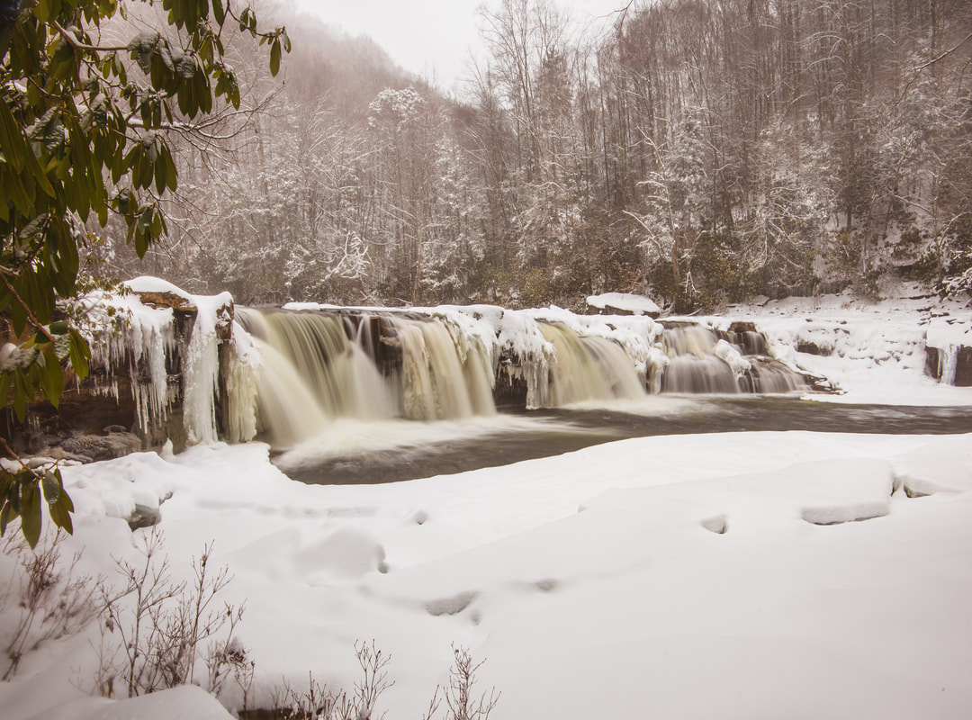
Despite its generic name, the High Falls of Cheat is known as one of Monongahela's more distinctive waterfalls. As less than 20 feet in height, the falls isn't very tall - but its signature feature is its width, stretching across a 100-foot wide cliff. The enormous pool and swimming hole denoting the base of High Falls is a welcome sight on a warm summer day. A scenic trail leads to the falls across Shavers Mountain from the West Fork Glady Fork valley. High Falls is unusual in that it is one of the longest waterfall hikes in Monongahela, yet it is also easily accessible by a scenic tourist train ride from Elkins. The Durbin and Greenbrier Valley Railroad Company runs a seasonal track through the Tygart Valley and up the remote gorge of the Shavers Fork Cheat River, otherwise accessible only by foot. The track runs directly past High Falls, so during the summer, don't be surprised to find company from people who reached the falls by train. On the other hand, you're likely to have the hike and falls all to yourself in the cold winter months, especially if you choose to visit after a foot of fresh snow has fallen, like I did. This hike occurred on Monday, February 1st, 2021. My plan was to simply hike the High Falls Trail out and back from the trailhead along FS 44.

Summary

R/T Length of Trail: 7.8 miles
Duration of Hike: 4:30 plus 1 hour and 30 minutes of stopping/photography
Type of Hike: Out and back
Total Elevation Gain: 1,542 feet
Difficulty Rating: 6 out of 10
Pros: Beautiful alpine forest along Shavers Mountain crest; numerous views of Shavers Fork Cheat River; well-constructed gradual ascents
Cons: Substantial walk alongside the Tygart Valley railroad at the end of the trail
Points of Interest: High Falls of Cheat - 7 stars; Meadows at the site of Beulah 
Trail Blaze Colors: High Falls Trail - blue; Allegheny Trail - yellow
Best Seasons to Hike: Year-round
Fees: None 
Beginning Point: High Falls Trailhead along FS 44
Directions from Elkins, WV: From the intersection of US 219/US 250 and US 33 near downtown Elkins, follow US 33 East for 12.0 miles. Then, turn right onto Glady Road (CR 27). In 9.4 miles, after entering the community of Glady, turn left onto Bemis Road (CR 22). Continue 0.2 mile; then, turn right onto Beulah Road. Follow Beulah Road for 3.0 miles to where it turns into FR 44. Continue along FR 44 for another 1.0 miles to the High Falls trailhead on the right. There are several wide spots along the road shoulder that can house roughly 6-8 vehicles. The best pullout is about 75 yards before the trailhead. FR 44 is in good shape and suitable for all passenger vehicles, but keep in mind it does not appear maintained in winter. 

Map

Picture
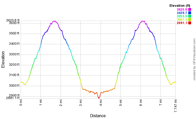
Click the link below to download a .GPX file with a track of this hike. 
high_falls_on_cheat_river.gpx
File Size: 282 kb
File Type: gpx
Download File

Details

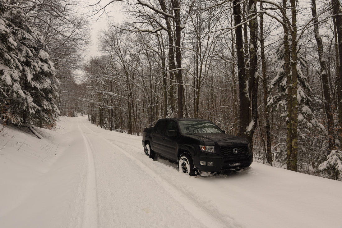
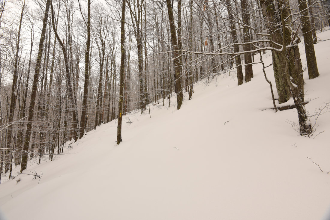
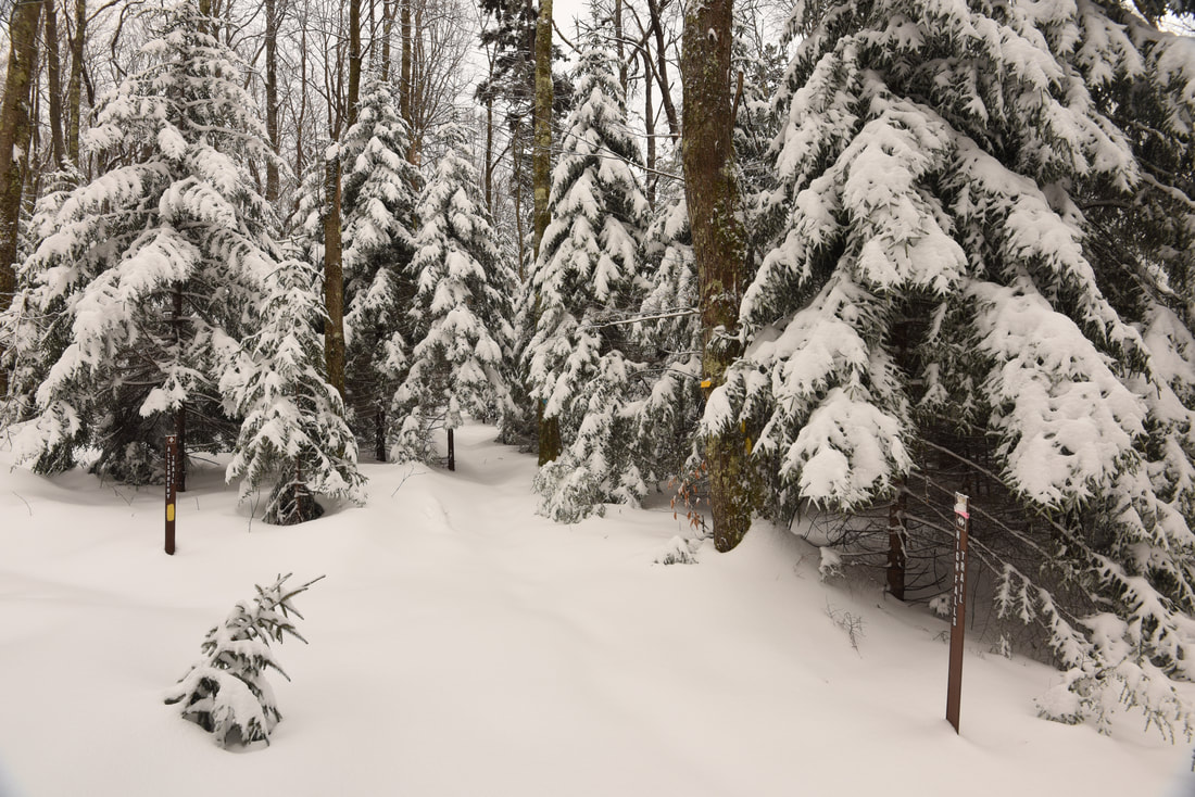
The start of February brought a blockbuster winter storm to West Virginia's Potomac Highlands. One to two feet of snow fell area-wide, with the highest totals observed Tucker County WV, Preston County WV, and Garrett County MD. My goal was to photograph a waterfall during the snowstorm, but lacking snowshoes at the time, I tried to stay away from the epicenter of the storm. Nevertheless, it turned out that at least a foot of snow had fallen further south in Randolph County (where High Falls is located) as well; needless to say, this made for one grueling hike given the length and elevation gain. I had never seen a snowy picture of High Falls before and was excited to see it in these conditions. The mile of driving along FS 44 was one of the more nerve-wracking winter drives I've done, as I was the first vehicle on the unmaintained road since the storm. Having chains and a shovel with me helped me feel more comfortable, but I still think heading out here solo in extreme winter conditions was probably not my brightest decision! 

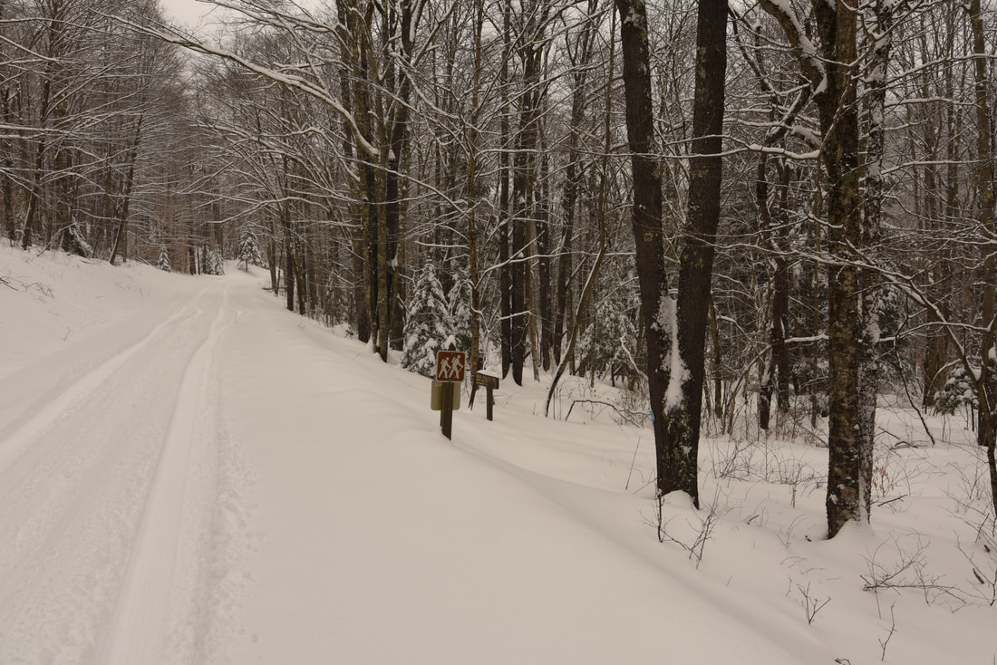
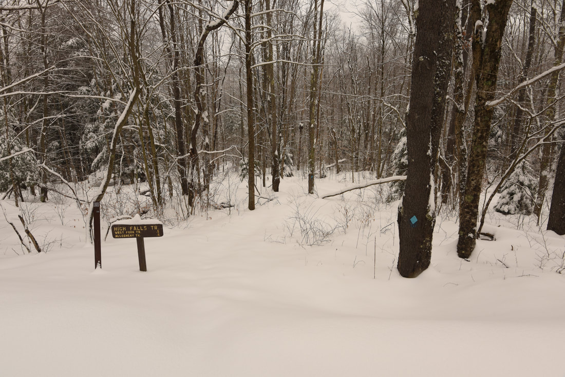
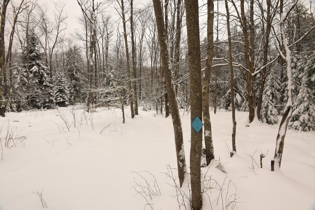
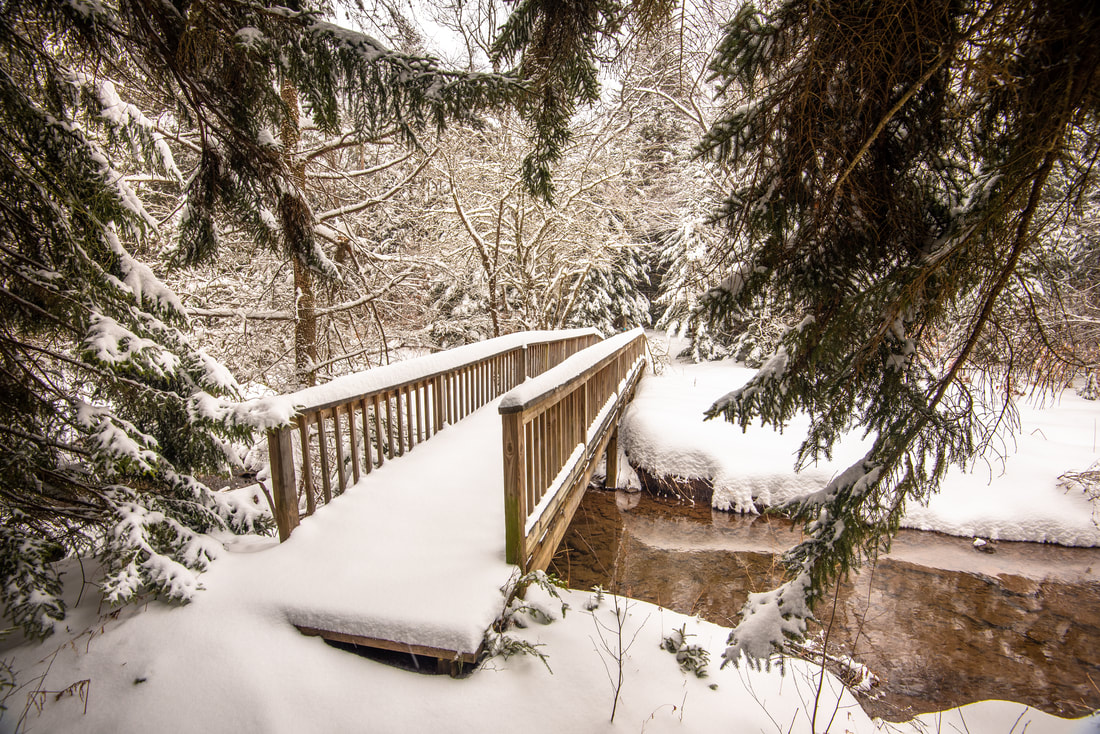
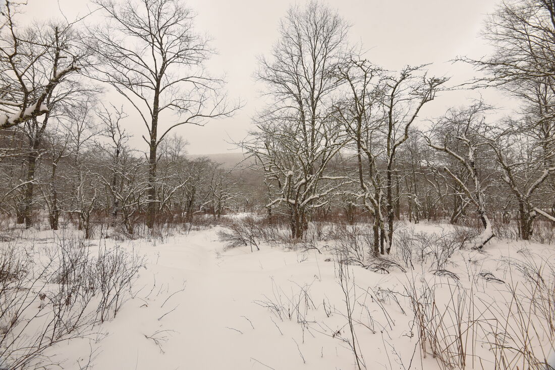
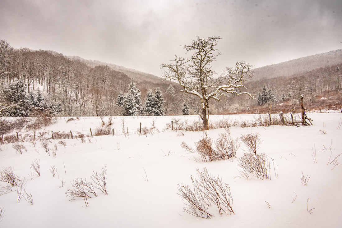
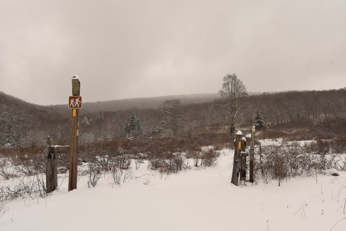
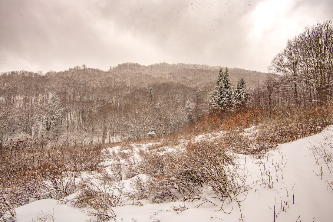
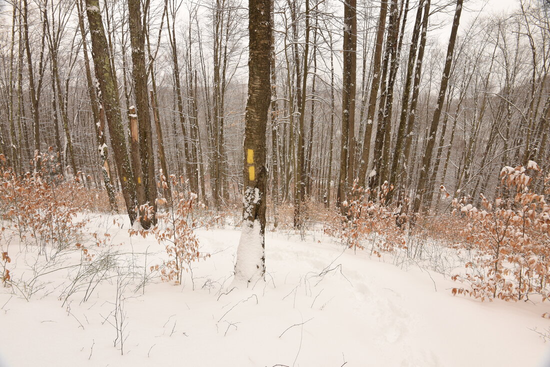
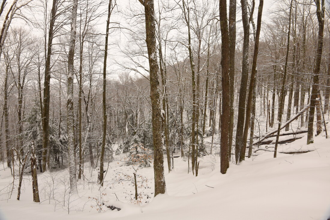
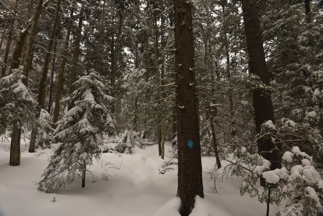
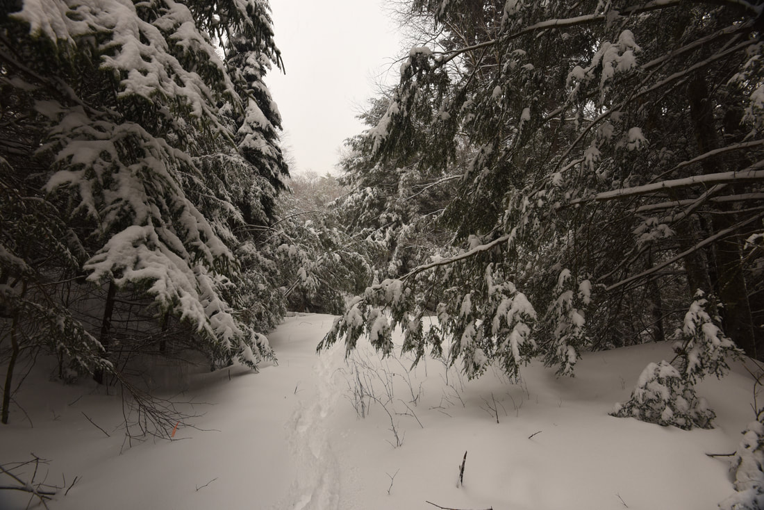
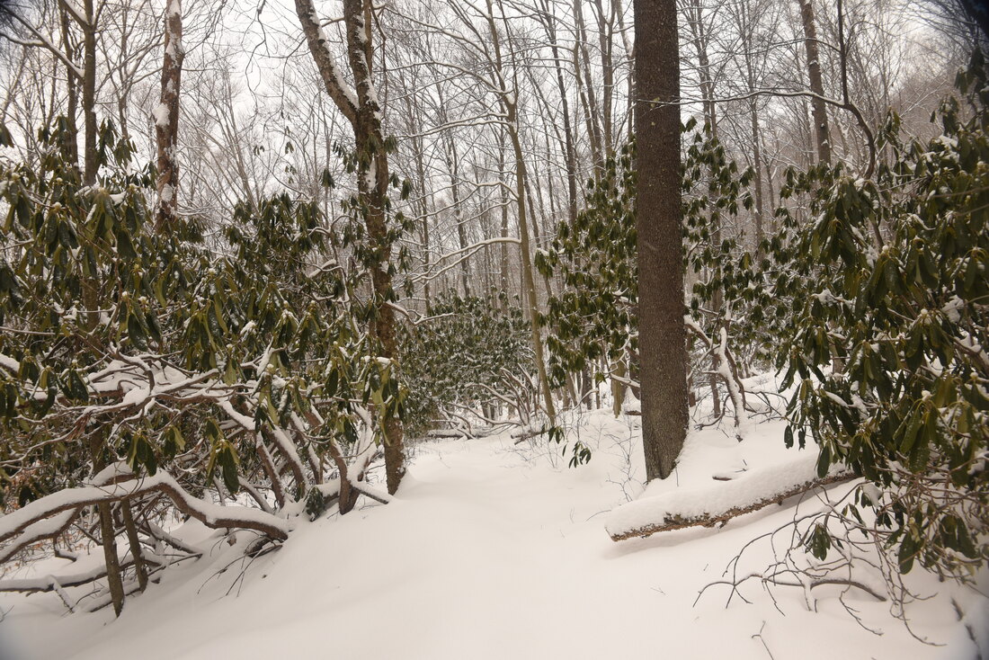
​The High Falls Trail (#38) begins at a large wooden sign and drops down the west side of FS 44. After 50 feet, turn left onto an old roadbed. The trail follows the roadbed for a little while before bearing right into a small opening and coming to a wooden footbridge across West Fork Glady Fork at 0.2 mile. West Fork is an exceptionally beautiful and clear stream, meandering across the flat bottomlands amongst snow-claden spruce trees. After the crossing, the High Falls Trail begins a gentle ascent. Entering a broad open meadow, the trail reaches a junction with the West Fork Rail Trail at 0.4 mile. This trail runs from north to south along a former railroad bed for 22 miles from Glady to Durbin, much of it along the West Fork Greenbrier River. In addition, the Allegheny Trail, West Virginia's master trail, follows the West Fork Trail northward from this junction to Glady. The High Falls Trail and Allegheny Trail run together for the next 1.2 miles as the path climbs Shavers Mountain. 

​Past the junction, the High Falls trail continues ascending through the beautiful meadow, which offers fine panoramic views of the West Fork Glady Fork valley and Shavers Mountain. Perhaps more importantly, these meadows denote the site of the former community of Beulah. Once upon a time, houses stood proudly and cattle grazed in these fields. Today, all that remains are a few wobbly wooden fences, and nature is slowly taking over with shrubs and hawthorne trees. Once the trail leaves the vast meadow, it begins a moderate ascent up Shavers Mountain. Thanks to numerous switchbacks, the grade is never steep. The trail starts to level out around 1.2 miles and contours along the slope before arriving at a saddle on the crest of Shavers Mountain at 1.6 miles. A nice mountaintop campsite lies to your right. Just ahead, the trail enters a shady spruce forest and arrives at the Allegheny Trail's split. 
Picture
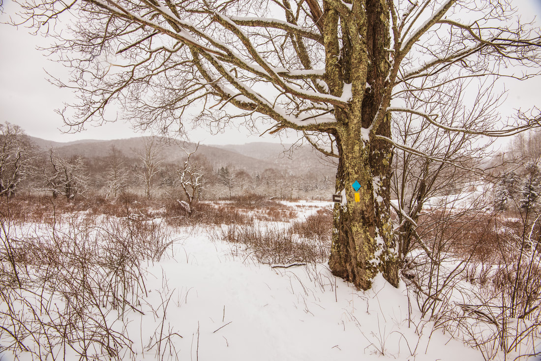
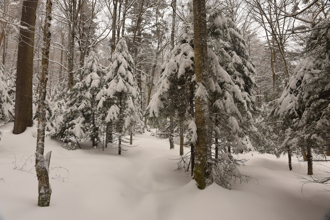
The High Falls trail winds through vast meadows at the foot of Shavers Mountain that were once home to the community of Beulah.
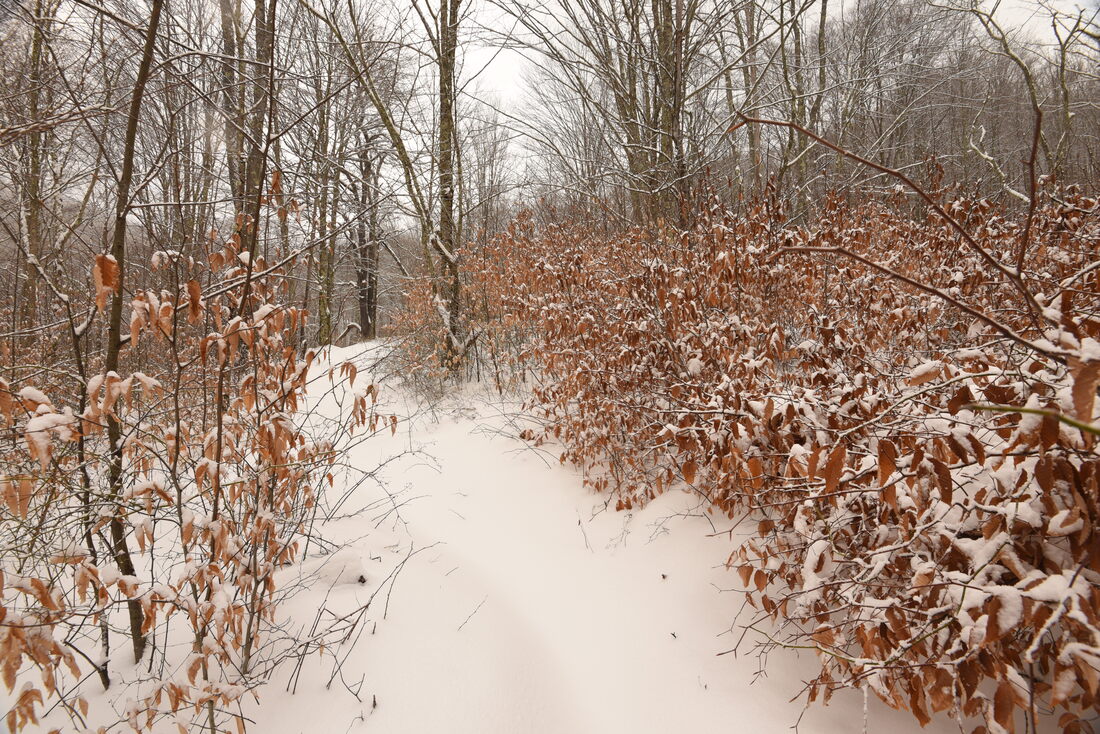
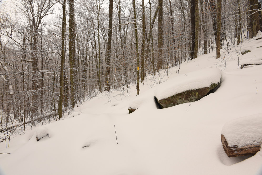
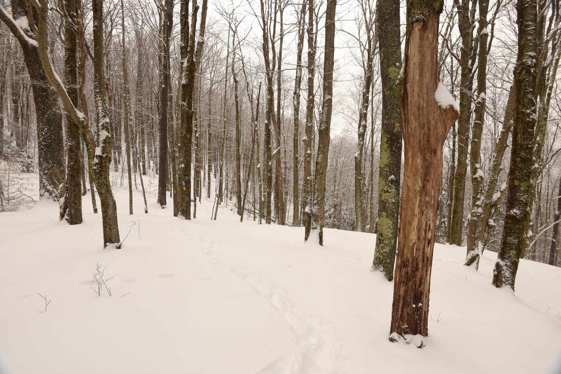
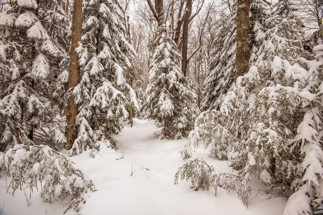
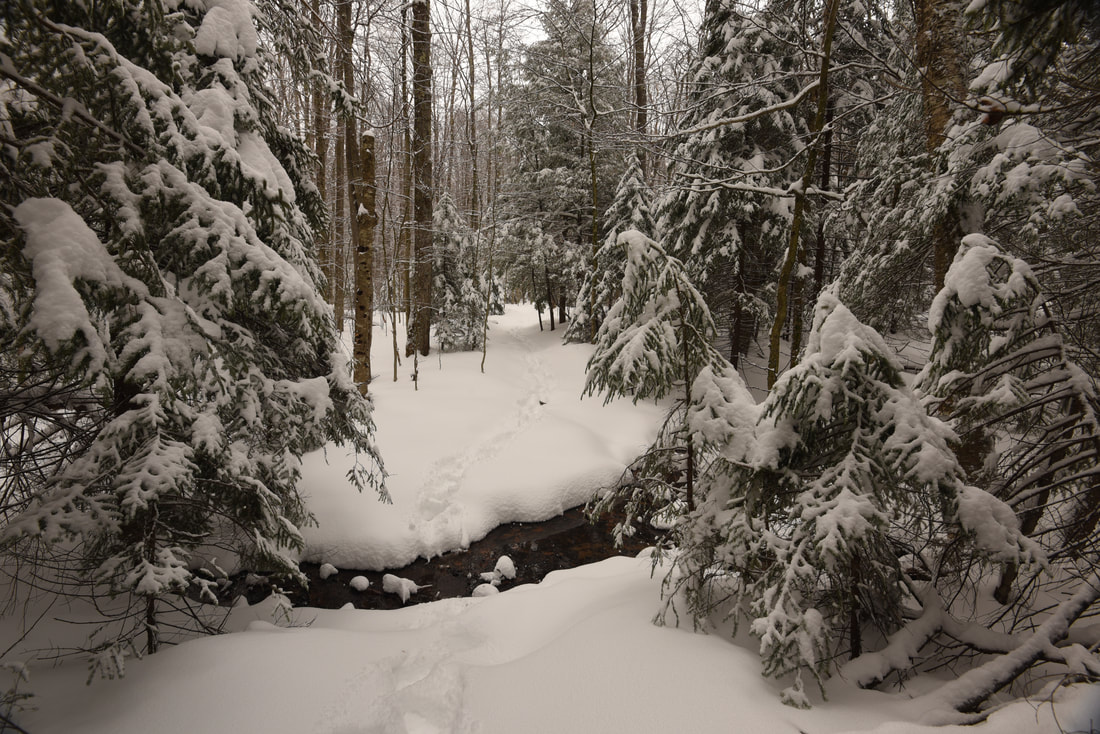
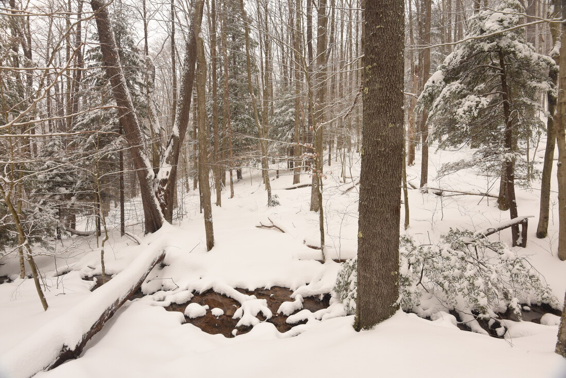
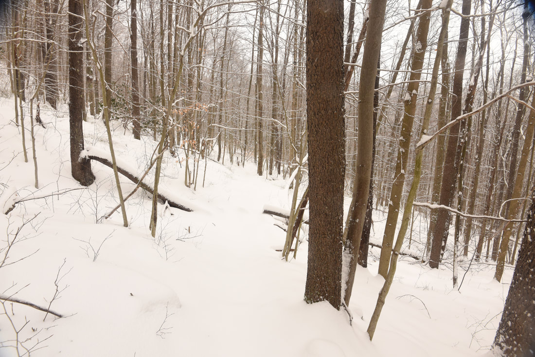
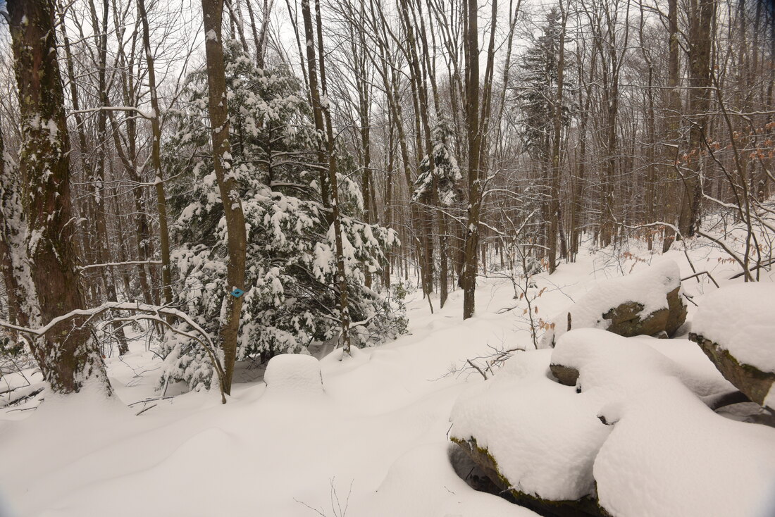
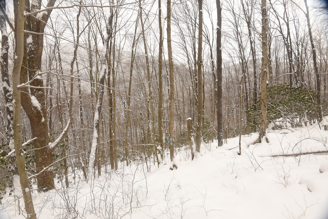
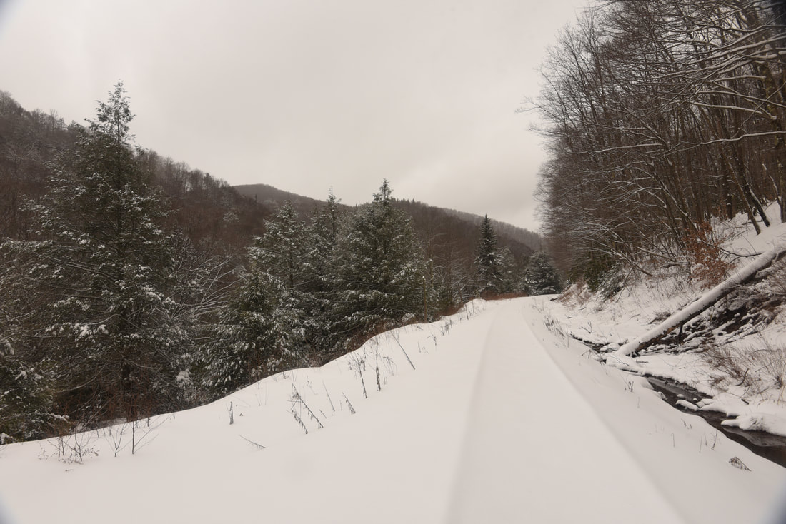
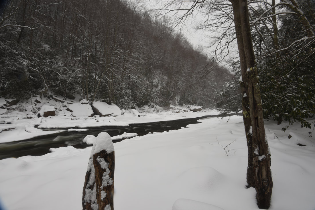
The Allegheny Trail turns left and continues a rather steep climb up Shavers Mountain on its 330-mile ​journey. This hike continues straight on the High Falls Trail. You've now reached the high point of the hike; I was surprised at how significantly the snow was deeper here, despite the modest elevation gain. The trail meanders through the spruce forest and crosses a couple rivulets that form the headwaters of Deer Lick Run. After a gradual descent begins, turn right onto an old roadbed at 1.9 miles. Follow the roadbed for 0.2 mile and then turn left to begin a steeper descent. This turn is rather easy to miss, because the broad roadbed continues ahead. The trail soon crosses a small stream and passes a conglomerate of boulders at 2.35 miles to the right. As the High Falls Trail approaches the Shavers Fork Cheat River, the forest changes back to mostly hardwood, and the understory becomes increasingly overgrown with rhododendron. The trail reaches the gorge floor and arrives at the Tygart Valley railroad tracks at 3.1 miles. I found the trail on the west side of Shavers Mountain to be generally steeper with fewer switchbacks than on the east side. 

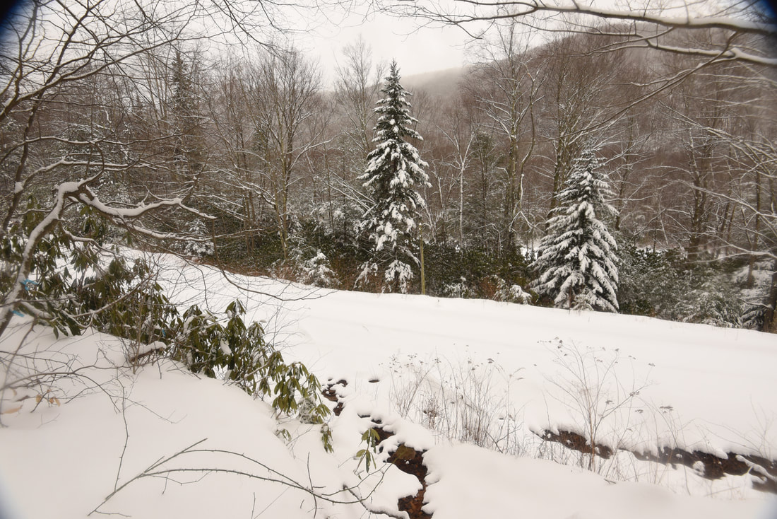
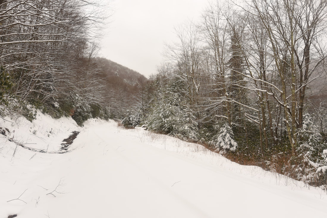
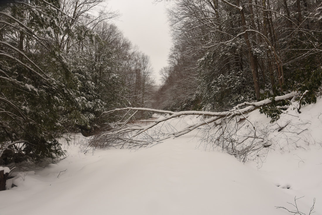
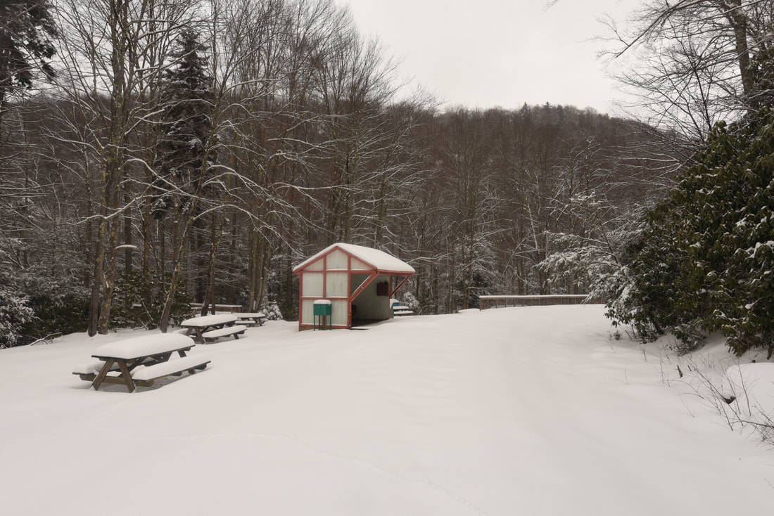
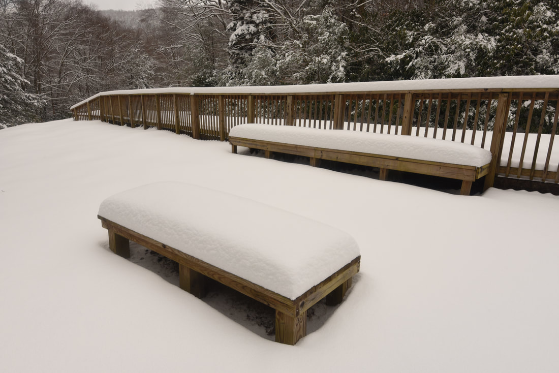
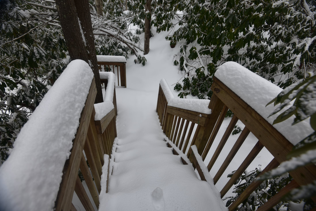
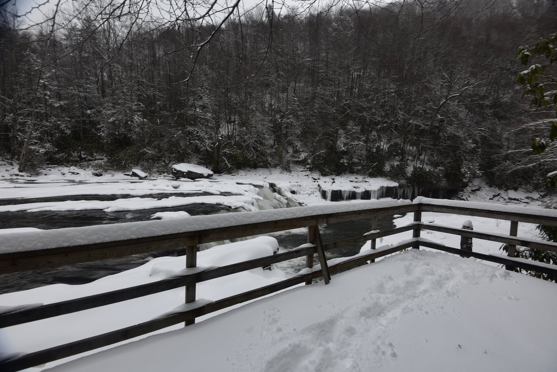
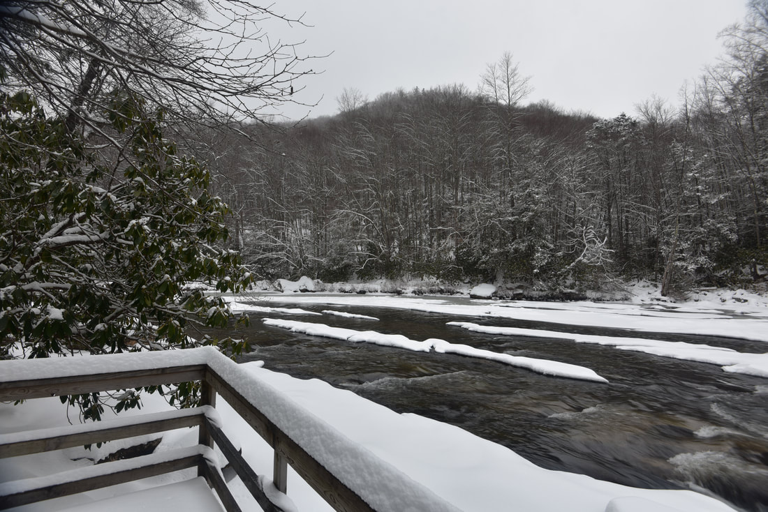
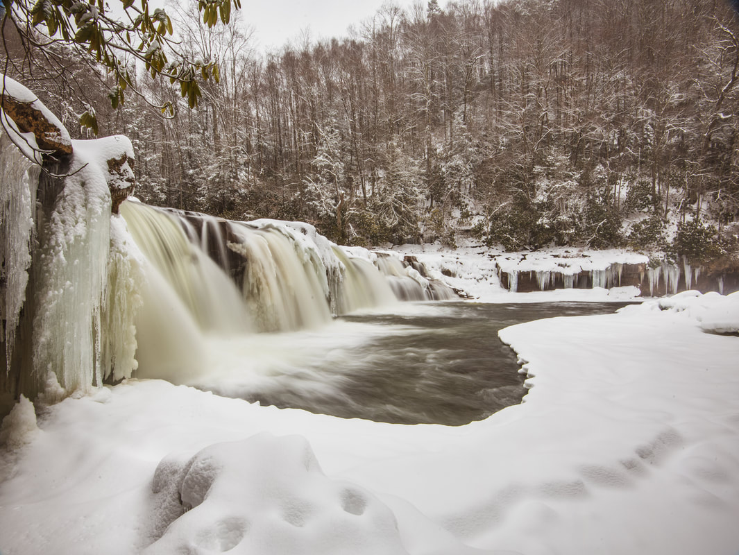
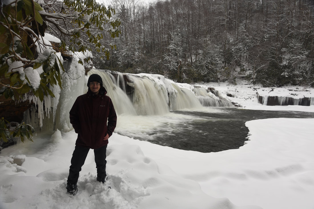
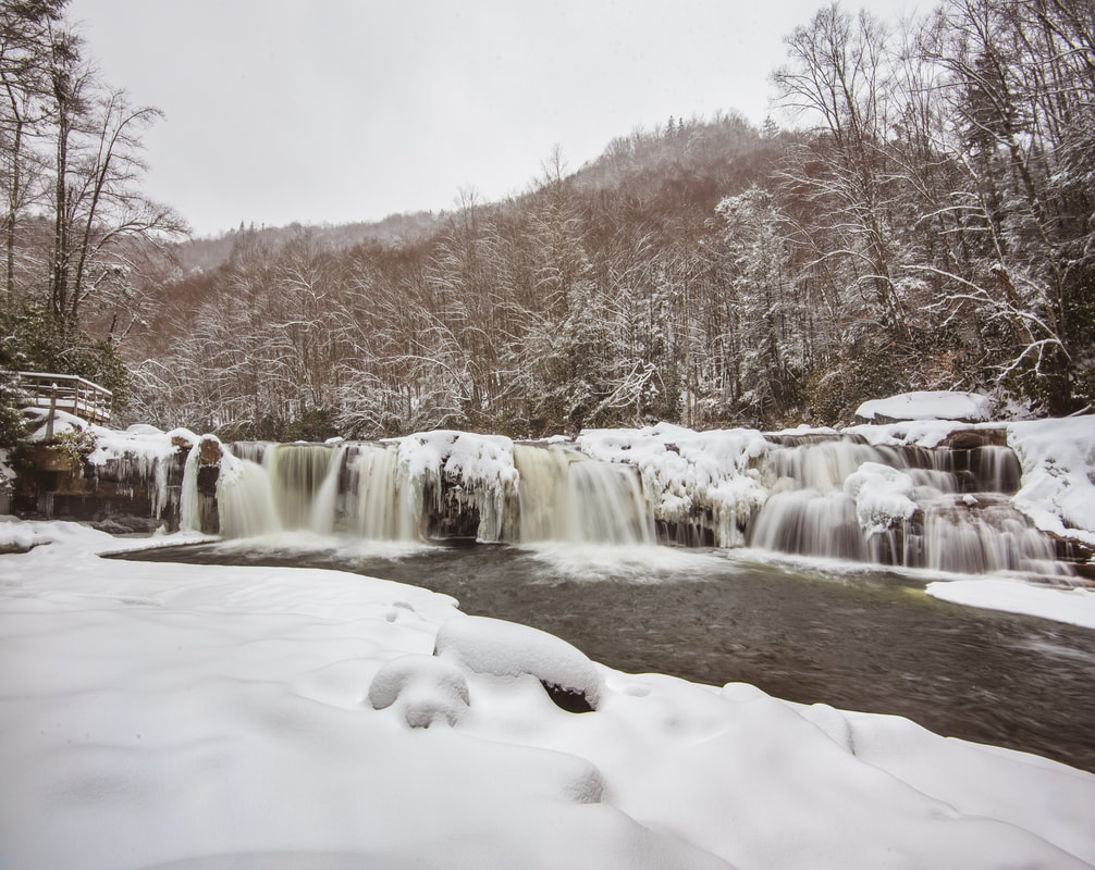
The rest of the trek to High Falls is along the railroad tracks. You are asked to walk alongside the tracks, not on them, and to pay close attention to incoming trains in the summer. The tracks are inactive in the winter though, which was evident on this day with numerous fallen trees and the tracks buried under a foot of snow. The tracks are flat, so this part of the hike is easy without snow. As you walk, you will see numerous views of the Shaver Fork's scenic cascades, especially as you approach High Falls. One of the best views is at 3.7 miles, showing a vast stretch of the river in the upstream direction. At 3.85 miles, you will arrive at the small track-side depot alongside High Falls (where the tracks make a sharp right curve). You will find a pair of dilapidated pit toilets and picnic tables here. Take the boardwalk to your left, which follows a wooden staircase down to High Falls. The path splits; the left fork leads to an observation deck at the top of High Falls, while the right fork leads to the base. 

I recommend checking out both views of High Falls for the complete picture. The horseshoe-shaped waterfall is 20 feet high and 100 feet wide. The waterfall is named High Falls not because it's a tall waterfall, but because it is located at the highest elevation of all major waterfalls in Monongahela, at 2,900 feet above sea level. An extensive gravel bar lines the giant pool at the base. The pool is popular with swimmers in the summer, and I have seen videos of people jumping off the top. On this day, dozens of icicles lined the overhanging bluffs on either side of the waterfall, and a heavy snow squall blew in while I photographed High Falls. Once you've seen all of High Falls, simply retrace your steps back across Shavers Mountain, concluding the hike at 7.8 miles. Be extra cautious returning along the railroad tracks when they are active in summer - trains generally approach from the north. The community of Bemis is located five miles to the north. 
Picture
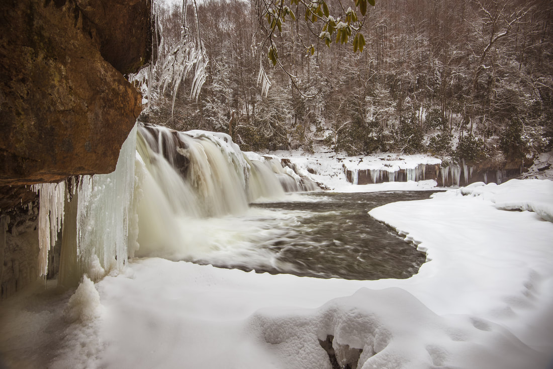
A close-up view of High Falls from the pool at the base.

Pictures

1 Comment
Brooke Graham
3/26/2021 02:03:21 pm

Mark,

I am inspired by your enthusiasm as such a young age! If I'd been lucky enough to have had access to such beautiful parts of the country as a teen, (along with a 35mm, and social media), I'm pretty sure I'd have been doing the exact same thing as you. I'm a native Texan, 51, and living my best life in Florida, but spent tons of time in the Carolinas - and fell in love with the mountains at a young age. Your site is wonderful! I've enjoyed your spectacular photos and knowledgeable insight! Keep up the good work. I'll continue to visit your site and appreciate the beauty through your lens. And, I'll be sure to donate to your college-cause as well. :)

Blessings,

Brooke G.
Lutz, FL

Reply


Leave a Reply.

    About Me

    Mark Oleg Ozboyd
    I'm an avid outdoor explorer and a hobbyist landscape photographer. I'm 21 years old and have been hiking since 2011. Originally based out of Atlanta, Georgia, I started out by occasionally hiking short trails throughout well-known Georgia State Parks. During 2012 and 2013, I began to expand my trips into adjacent states, as well as into the wilder National Forest areas rather than just State Parks. Throughout the years that followed, as I slowly ran out of popular hiking trails in my area, I began to search for and hike in more seldom-visited areas. Today, you can find me out in the woods every weekend, whether it's on an official trail or bushwhacking through cross-country terrain without any paths. I now attend Washington & Lee University and am exploring Virginia and West Virginia. My other hobbies include chess, science, old music, and meteorology. I have 3 years of amateur weather forecasting experience, having studied a lot of meteorology basics over the years. I am also a student at European School of Music where I learned that music and nature have a lot in common. Listening to good music inspires me to capture nature's beauty on the camera in different aspects that also make me recall many beautiful music pieces that I've heard.​


    Dear readers: I have invested a tremendous amount of time and effort in this website and the Georgia Waterfalls Database the past five years. All of the work that has gone in keeping these websites updated with my latest trip reports has almost been like a full-time job. This has not allowed me to pick up a paid job to save up money for college, and therefore, I I've had to take out loans. If you find the information on this website interesting, helpful, or time-saving, you can say "thanks" and help me out by clicking the button above and making a contribution. I will be very grateful for any amount of support you give, as all of it will apply toward my college tuition. Thank you! 

    Enter your email address to subscribe for trail reports:

    Delivered by FeedBurner


    Picture
    Coming in 2022-2023?

    Other Hiking Websites

    DWHike's Adventures
    Florida's Natural Wonders
    Florida Trailblazer
    Meanderthals
    Mountain Images
    by Bernie Boyer

    North Carolina Waterfalls with
    ​Kevin Adams
    Take-a-Hike!
    Tennessee Landforms
    Waterfall Page
    Waterfall Adventurer
    Zach's Mild Adventures

    Miles Hiked

    Year 1: 540.0 Miles
    Year 2: 552.3 Miles
    ​Year 3: 518.4 Miles
    Year 4: 482.4 Miles
    Year 5: 259.9 Miles

    Archives

    March 2021
    February 2021
    January 2021
    November 2019
    October 2019
    September 2019
    August 2019
    July 2019
    June 2019
    February 2019
    January 2019
    December 2018
    November 2018
    October 2018
    August 2018
    July 2018
    June 2018
    May 2018
    April 2018
    March 2018
    February 2018
    January 2018
    December 2017
    November 2017
    October 2017
    September 2017
    August 2017
    July 2017
    June 2017
    May 2017
    April 2017
    March 2017
    February 2017
    January 2017
    December 2016
    November 2016
    October 2016
    September 2016
    August 2016
    June 2016
    May 2016
    April 2016
    March 2016
    January 2016
    December 2015
    November 2015
    October 2015
    September 2015
    August 2015
    July 2015
    June 2015
    May 2015
    April 2015
    March 2015
    February 2015
    January 2015
    December 2014
    November 2014
    October 2014
    September 2014
    August 2014
    July 2014
    June 2014
    May 2014
    April 2014
    March 2014
    February 2014

    Categories

    All
    Adel
    Adirondack Park
    Alabama
    Alfred A. Ring Park
    Allegheny Trail
    Amicalola Falls State Park
    Anniston Area
    Apalachicola Bluffs And Ravines Preserve
    Apalachicola National Forest
    Apalachicola/Port St. Joe Area
    Apopka
    Appalachian Trail
    Appling
    Art Loeb Trail
    Aska Trail System
    Bakersville
    Balm-Boyette Scrub Preserve
    Balsam Lake Recreation Area
    Bankhead National Forest
    Bartow County Parks
    Bartram Trail
    Basinger
    Beersheba Springs
    Benton
    Benton Mackaye Trail
    Berry College Trail System
    Best Hike
    Big South Fork National Recreation Area
    Black Bear Wilderness
    Black Rock Mountain State Park
    Blairsville
    Blakely
    Blood Mountain Wilderness
    Blowing Rock
    Blue Ridge
    Blue Ridge Parkway
    Boone
    Bradenton
    Bradenton Beach
    Brasstown Bald
    Brasstown Wilderness
    Brevard
    Bryson City
    Buchanan
    Bucks Pocket State Park
    Bulow Creek State Park
    Bulow Plantation Ruins State Park
    Caesars Head State Park
    Caladesi Island State Park
    Calhoun
    Camel's Hump State Park
    Cashiers
    Caspersen Beach Park
    Catfish Creek State Park
    Caves
    CC Putnam State Forest
    Cedar Point Environmental Park
    Chatsworth
    Chattahoochee National Forest
    Chattanooga
    Chattanooga Valley
    Chattooga National Wild And Scenic River
    Cheaha Wilderness
    Cherohala Skyway
    Cherokee
    Cherokee National Forest
    Chiefland Area
    Chillhowee Recreation Area
    Chipley
    Chunky Gal Trail
    Circle B Bar Reserve
    Citico Creek Wilderness
    Citrus Wildlife Management Area
    Clarkesville
    Clayton
    Cleevland
    Cleveland
    Cloudland Canyon State Park
    Cohutta Wilderness
    Collier-Seminole State Park
    Cordele
    Cornelia
    Covington
    Crestview Area
    Crew-land-and-water-trust
    Cullowhee
    Cumberland Trail
    Dahlonega
    Dalton
    Dawson Forest Wildlife Management Area
    Dawsonville
    Dayton
    De Soto National Memorial
    DeSoto State Park
    Dillard
    Double Springs
    Ducktown
    Duncan Ridge Trail
    Dunlap
    Eagle's Rest Park
    Eastpoint
    Econfina Creek Wildife Management Area
    Eglin Air Force Base
    Elizabethton
    Elkins
    Elk Knob Game Lands
    Elk Park
    Ellicott Rock Wilderness
    Ellijay
    Emerson Point Preserve
    Englewood Area
    Enota Retreat
    Erwin
    Falling Waters State Park
    Fayetteville
    Fires Creek Recreation Area
    Fire Tower
    Flint River
    Florence Area
    Florida
    Florida Caverns State Park
    Florida Trail
    Foothills Trail
    Fort Mountain State Park
    Fort Myers Area
    Fort Payne
    Fort Payne Area
    Fort Yargo State Park
    Franklin
    Franklin Delano Roosevelt State Park
    Franklin-Marion State Forest
    Frozen Head State Park
    Gainesville
    Gainesville Area
    Gatlinburg
    George Washington National Forest
    Georgia
    Georgia Veterans Memorial State Park
    Glasgow
    Gorges State Park
    Grandfather Mountain State Park
    Great Smoky Mountains National Park
    Greeneville
    Green River Game Lands
    Gruetli-Laager
    Grundy Forest State Natural Area
    GTM Reserve
    Guana River Wildlife Management Area
    Hayesville
    Helen
    Hiawassee
    High Falls State Park
    Highlands
    Highlands Scenic Highway
    Hillsborough River State Park
    Hinson Conservation & Recreation Area
    Historic Sites
    Honeymoon Island State Park
    Hot Springs
    Huntington
    Inverness Area
    Jackson
    Jasper
    Jefferson National Forest
    Joan M. Durante Park
    Jonathan Dickinson State Park
    Jones Gap State Park
    Joyce Kilmer Slickrock Wilderness
    Joyce Kilmer - Slickrock Wilderness
    Juniper Prairie Wilderness
    Kelly Park
    Keown Falls Recreation Area
    Kolomoki Mounds State Park
    LaFayette
    Lake City Area
    Lake George Wild Forest
    Lake June-in-Winter State Park
    Lakeland Area
    Lake Placid
    Lake Russell Wildlife Management Area
    Lake Wales Ridge State Forest
    Laurel Fork North Wilderness
    Leffis Key Preserve
    Leon Sinks Geological Area
    Lexington
    Lineville
    Linville
    Linville Gorge Wilderness
    Lithia Springs
    Little Frog Wilderness
    Little Manatee River State Park
    Little River Canyon National Preserve
    Longboat Key
    Long Trail
    Lookout Mountain
    Lookout Mountain Battlefield
    Lovingston
    Lula Lake Land Trust
    Lumpkin
    Maggie Valley
    Manatee Springs State Park
    Marianna Area
    Mark Trail Wilderness
    Marlinton
    Mccaysville
    McMinville
    Mentone
    Middlesex
    Mistletoe State Park
    Monongahela National Forest
    Montreat
    Mountain Bridge Wilderness Area
    Mountain City
    Mountains To Sea Trail
    Mountains-to-Sea Trail
    Mount Rogers National Recreation Area
    Myakka River State Park
    Myron B. Hodge City Park
    Nantahala National Forest
    Naples
    Naples Area
    Natural Bridge State Park
    Neal Preserve
    New Castle
    Newport
    New River Gorge National Park
    New York
    North Carolina
    Ocala Area
    Ocala National Forest
    Ocean-to-Lake Trail
    Oconee State Park
    Oconee Station Historic Site
    Okaloacoochee Slough State Forest
    Oldsmar
    Oneida
    Orlando Area
    Ormond Beach
    Oscar Scherer State Park
    Oxford
    Palatka
    Palmetto Trail
    Panama City Area
    Panthertown Valley
    Parrish
    Paynes Creek Historic State Park
    Peaks Of Otter Recreation Area
    Pigeon Crockford Mountain Wildlife Management Area
    Pigeon-Crockford Mountain Wildlife Management Area
    Pigeon-Crockford Wildlife Management Area
    Pine Mountain
    Pinhoti Trail
    Pinnacle Park
    Pisgah Civitan Park
    Pisgah National Forest
    Pittman Center
    Pond Mountain Wilderness
    Ponds/Lakes
    Prentice Cooper State Forest
    Providence Canyon State Park
    Pumpkintown
    Quick Point Nature Preserve
    Raven Cliffs Wilderness
    Reed Bingham State Park
    Reliance
    Rice Creek Conservation Area
    Riverview Pointe Preserve
    Robbinsville
    Robinson Preserve
    Rock Creek Gorge Scenic Area
    Rock Island State Park
    Rome
    Rosman
    Sale Creek
    Salem
    Salt Springs
    Saluda
    Santa Rosa Beach
    Sarasota
    Sarasota Area
    Savage Gulf State Natural Area
    Scenic Views
    Scottsboro Area
    Sebring Area
    Sewanee
    Sheltowee Trace Trail
    Shining Rock Wilderness
    Signal Mountain
    Sipsey Wilderness
    Sky Valley
    Smithgall Woods State Park
    Snowbird Backcountry Area
    Soddy Daisy
    Soddy-Daisy
    Sopchoppy
    South Carolina
    South Cumberland State Park
    Southeastern Cave Conservancy
    Southern Nantahala Wilderness
    Sparta
    Sprewell Bluff Park
    Spring City
    Spring Hill
    Springs
    Spruce Pine
    Standing Indian Backcountry Area
    St. Augustine
    St. George Island State Park
    St. Joseph Bay State Buffer Preserve
    St. Marks Area
    St. Marks National Wildlife Refuge
    Stone Mountain
    Stone Mountain Park
    Suches
    Sumatra
    Sumter National Forest
    Suwannee River
    Swallow Creek Wildlife Management Area
    Sweetwater Creek State Park
    Sylva
    Talladega National Forest
    Tallahassee Area
    Tallulah Falls
    Tallulah Gorge State Park
    Tampa Bay Area
    Tate City
    Tate's Hell State Forest
    Tea Creek Wildlife Management Area
    Tellico Plains
    Tennessee
    Thomaston
    Toccoa
    Topsail Hill State Park
    Torreya State Park
    Townsend
    Tracy City
    Tray Mountain Wilderness
    Trenton
    Triple Creek Preserve
    Troutdale
    Unaka Mountain Wilderness
    Upper Tampa Bay County Park
    Venice
    Vermont
    Virgin Falls State Natural Area
    Virginia
    Virginia Outdoors Foundation
    Vogel State Park
    Wakulla Springs State Park
    Waleska
    Walhalla
    Wartburg
    Water Features
    Waynesville
    Weedon Island Preserve
    Weeki Wachee Preserve
    Wekiwa Springs State Park
    West Palm Beach Area
    West Virginia
    Whitehall
    White Springs
    Winder
    Withlacoochee State Forest
    Young Harris

    RSS Feed

TRAIL REPORTS

Hikes in Alabama
​Hikes in Florida
Hikes in Georgia
Hikes in North Carolina
Hikes in South Carolina
Hikes in Tennessee
Hikes in Virginia

Hiking Resources

Alabama Resources
​
Florida Resources
Georgia Resources
North Carolina Resources
​South Carolina Resources
​
Tennessee Resources

Other

Contact
Map of Hikes
Alphabetical List of Hikes
Southeast Nature Society
© COPYRIGHT 2014-2018
​ALL RIGHTS RESERVED.
Important: I disclaim any responsibility for any damage or personal injury that may occur as a result of the activities and information found on this website. All outdoor activities, especially off-trail hiking, are done at your own risk. Never hike or head into that area that may be above your fitness or experience level.
  • Home
  • Trail Reports
    • Best Hikes
    • Hikes with Scenic Views
    • Hikes with Water Features
    • Alabama
    • Georgia
    • Florida
    • North Carolina
    • South Carolina
    • Tennessee
    • Vermont
    • Virginia
  • Map
  • Hike List
  • Testimonials
  • Resources
  • Contact Us
  • Southeast Nature Society
    • Our Team
  • Georgia Waterfalls Database