Panther Creek Falls is one of two well-known waterfalls in the Cohutta Wilderness. During high flow, the falls is quite beautiful as Panther Creek slides 80 feet down a massive cliff. But the many different wilderness approaches to Panther Creek Falls are at least as great as the falls itself. The Hickory Creek Loop approach to Panther Creek Falls is likely the most difficult and least-used, but the spectacular wilderness experience on remote trails is well worth it. On this strenuous loop hike, you'll follow the Conasauga River and cross it twice, scramble through a steep and unique boulder field, visit Panther Creek Falls and the great vista atop it, and gain over 3500 feet in elevation. If you don't feel like completing the Hickory Creek Loop in a long day hike, numerous superb campsites will allow you to split the loop into as many days as you feel comfortable. This hike occurred on Saturday, September 16th, 2017. My plan was to hike the Hickory Creek Loop counter-clockwise from the end of East Cowpen Road by following the Hickory Creek Trail, Conasauga River Trail, Panther Creek Trail, and East Cowpen Trail.
Summary
R/T Length of Trail: 14.2 Miles
Duration of Hike: 9:30 Type of Hike: Loop Difficulty Rating: 9 out of 10 Total Elevation Gain: 3558 Feet Pros: Remote wilderness trails Cons: Above average amount of blowdowns on trails as well as a few poorly-marked spots Points of Interest: Panther Creek Falls - 7 stars (considerably less scenic at low flow such as typical of late summer/early fall); Top of Panther Creek Falls Vista - 4 stars; Panther Creek boulder field Trail Blaze Colors: None Best Seasons to Hike: Spring Fees: None Beginning Point: End of East Cowpen Road Directions from Chatsworth, GA: Follow US Route 411 North from the intersection with US 76/GA 52 West for about 11.8 miles. In Cisco, turn right onto Old Highway 2. The road will turn gravel shortly. Follow it for 7.6 miles, and then, turn right onto Forest Service Road 51, which is the road leading to the East Cowpen Trailhead. Follow this road for 4.9 miles to the dead-end and parking area. East Cowpen Road (FS 51) used to be quite muddy, but it has been graveled and graded. This road is generally in good condition, but due to two car fords of Jigger Creek, you may need a high-clearance vehicle to reach the trailhead. Map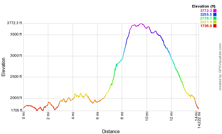
Click the link below download a .GPX file with a track of this hike.
Details
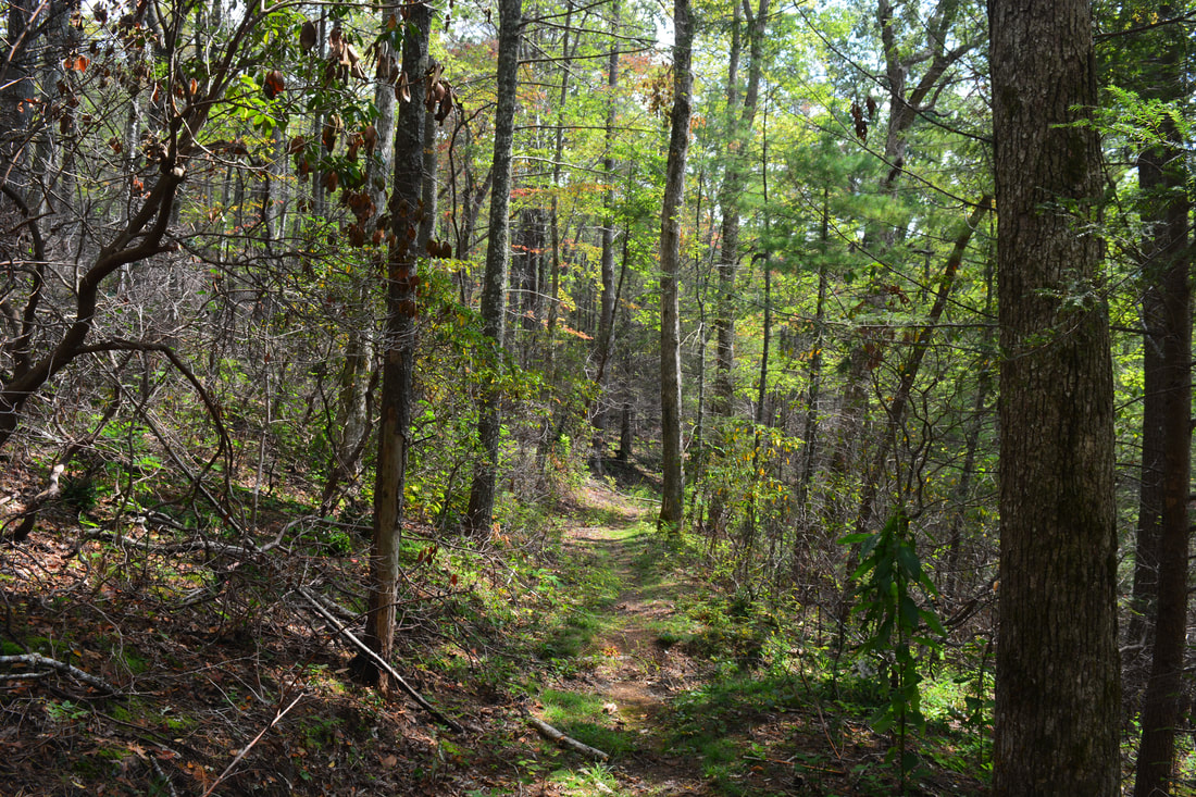
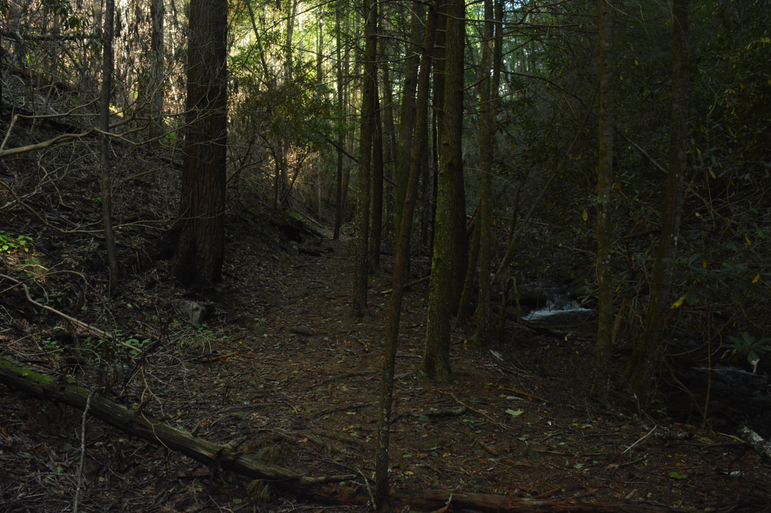
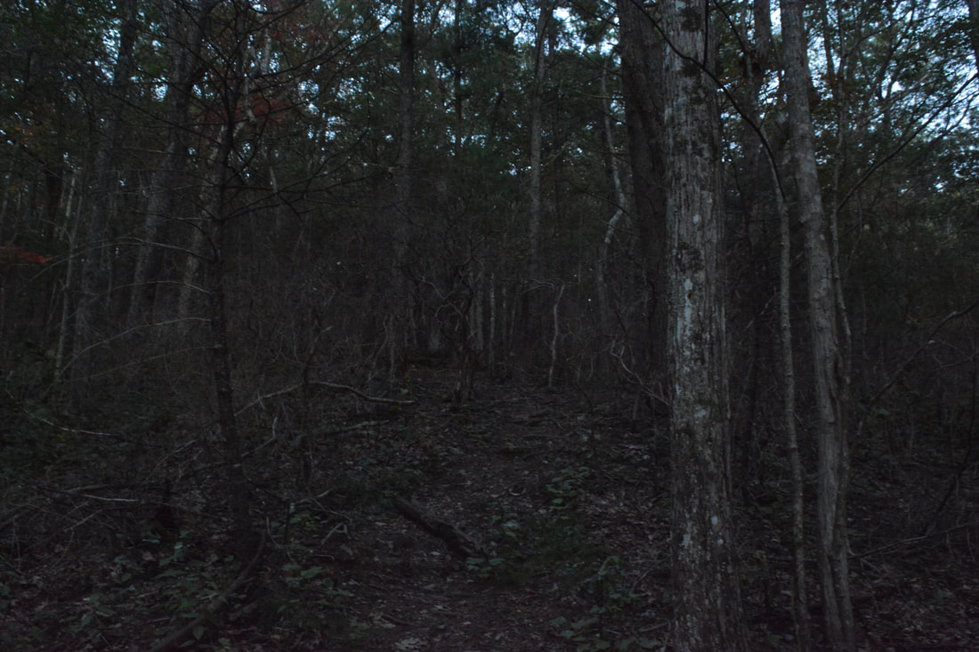
The Hickory Creek Loop is a truly classic Cohutta Wilderness loop hike. It's just the right length, just wild enough, and has just enough beautiful scenery. For some reason, the Hickory Creek Loop often gets ignored amidst more popular loop hikes like the Rice Camp Loop and Penitentiary Loop, but in my opinion, Hickory Creek Loop is right up there with the others. My main word of advice is to hike the loop counter-clockwise no matter how formidable the 1850-foot climb up Panther Creek Trail looks, because finishing the loop with East Cowpen Trail is much more enjoyable than Hickory Creek Trail. While at first glance Hickory Creek Trail looks like an easy trail, it bisects numerous low ridges and stream valleys, resulting in an array of short climbs some of which are pretty steep at times. On the other hand, the East Cowpen Trail is a nearly continuous moderate descent that makes for an easy hike ending. The hills of the Hickory Creek Trail also make for a good warm-up before the main ascent.
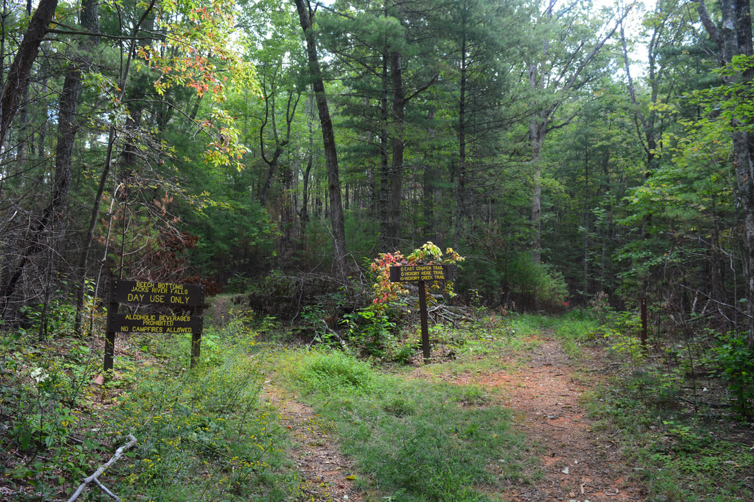
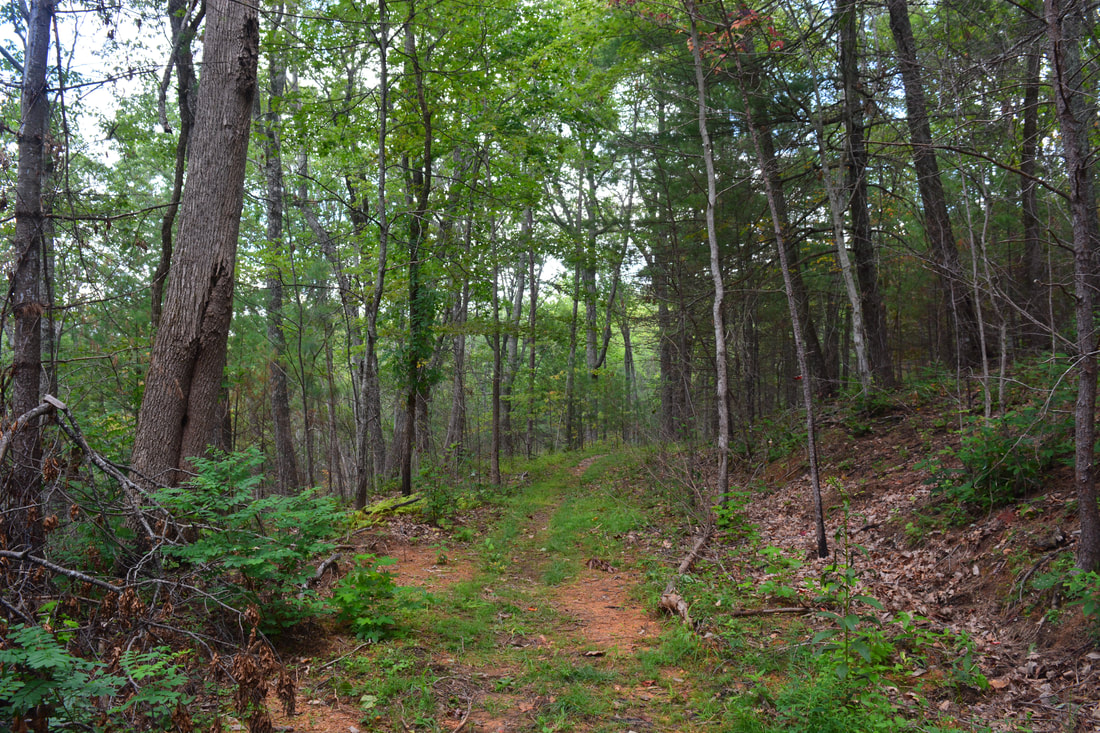
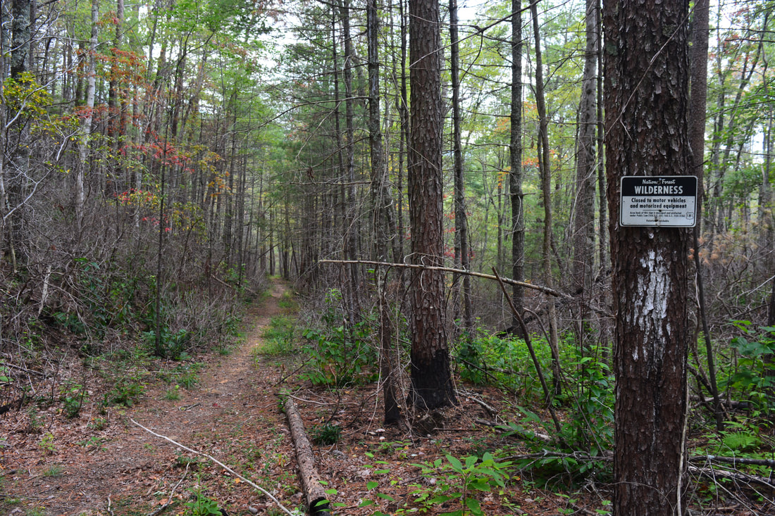
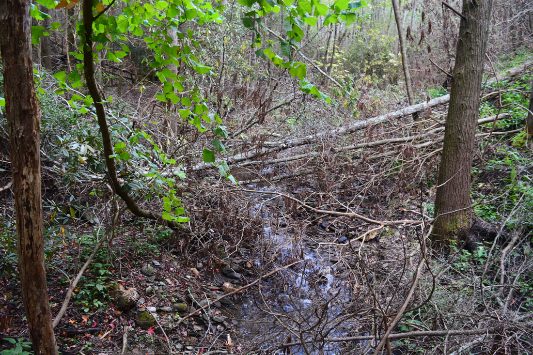
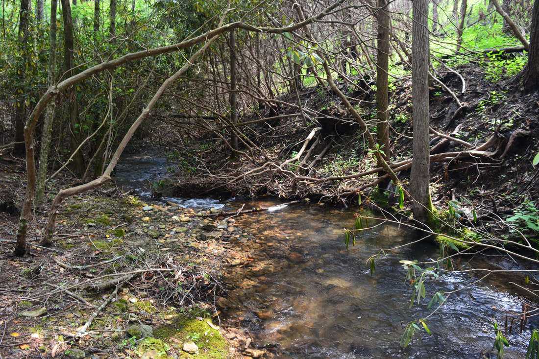
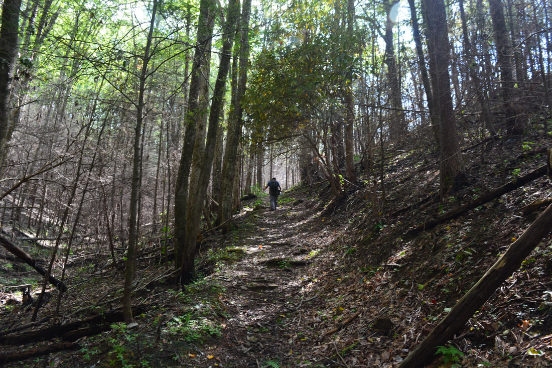
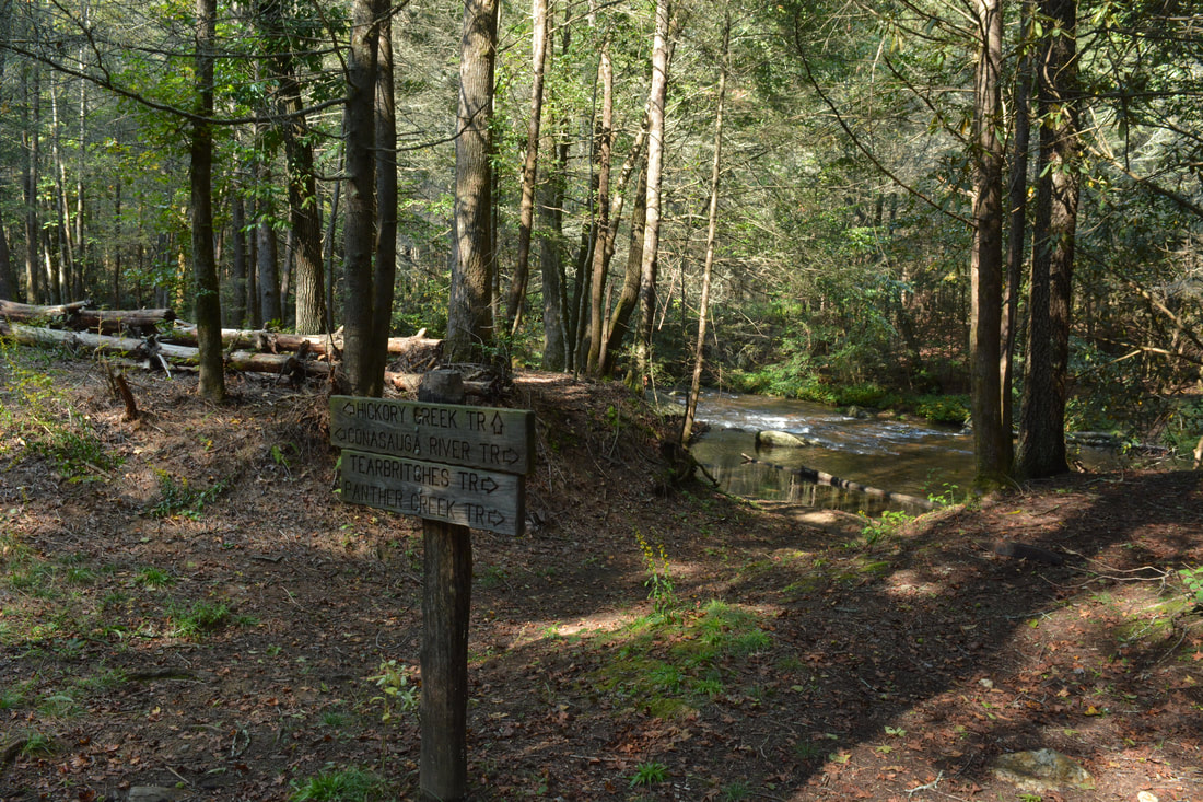
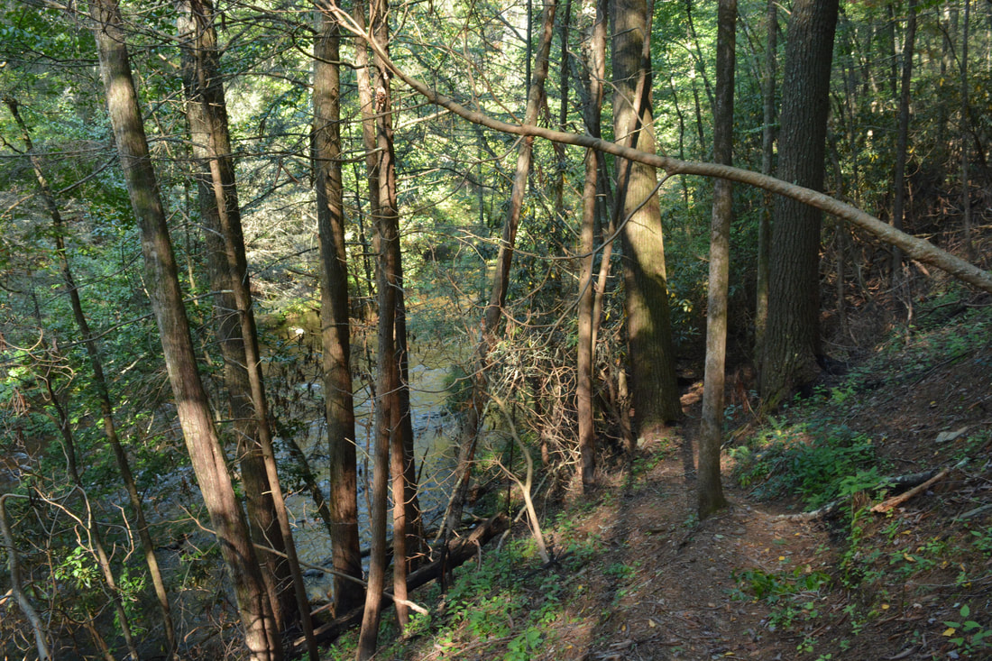
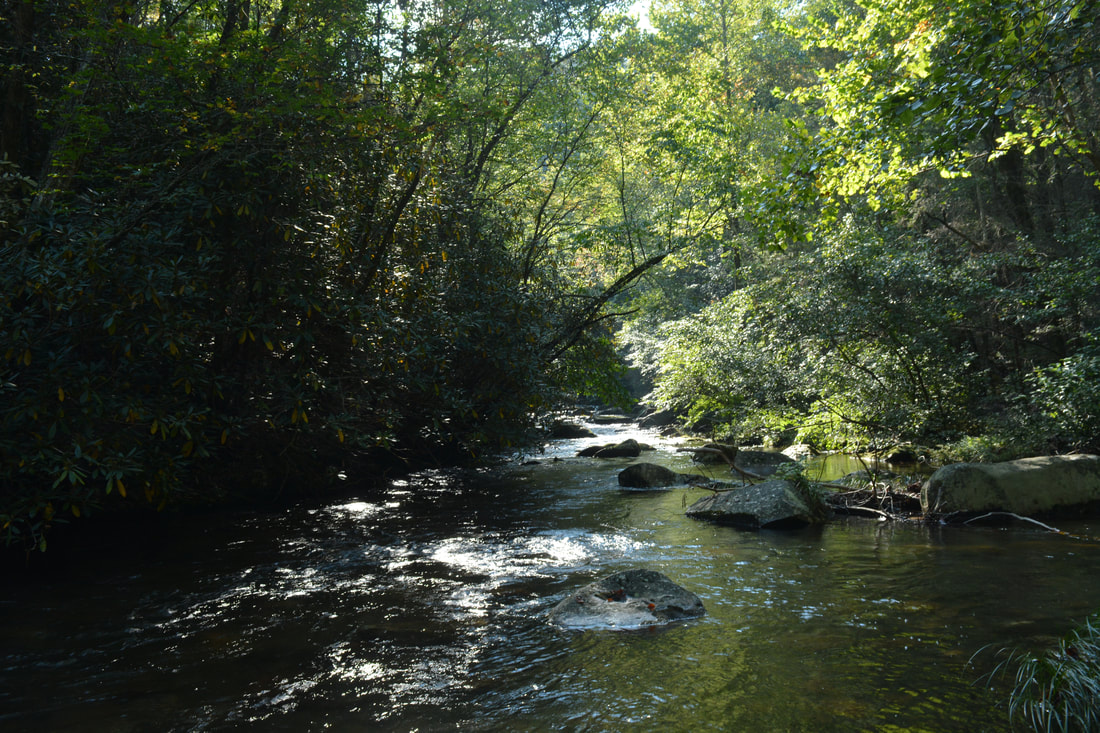
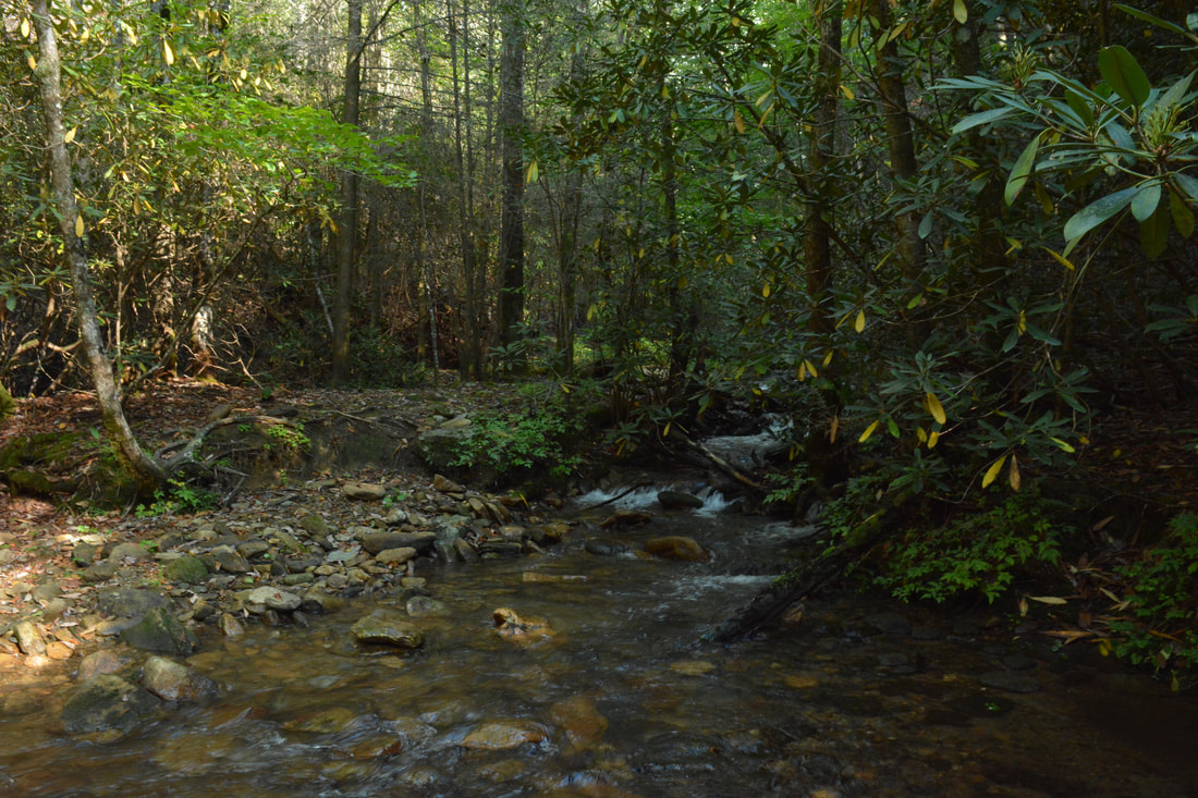
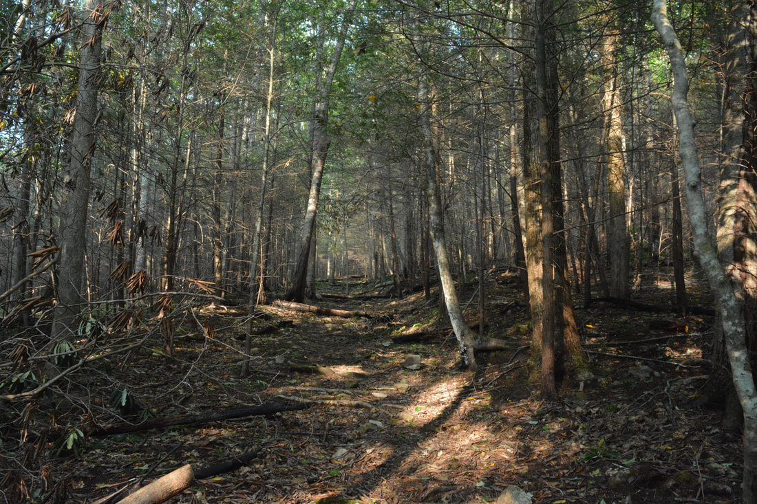
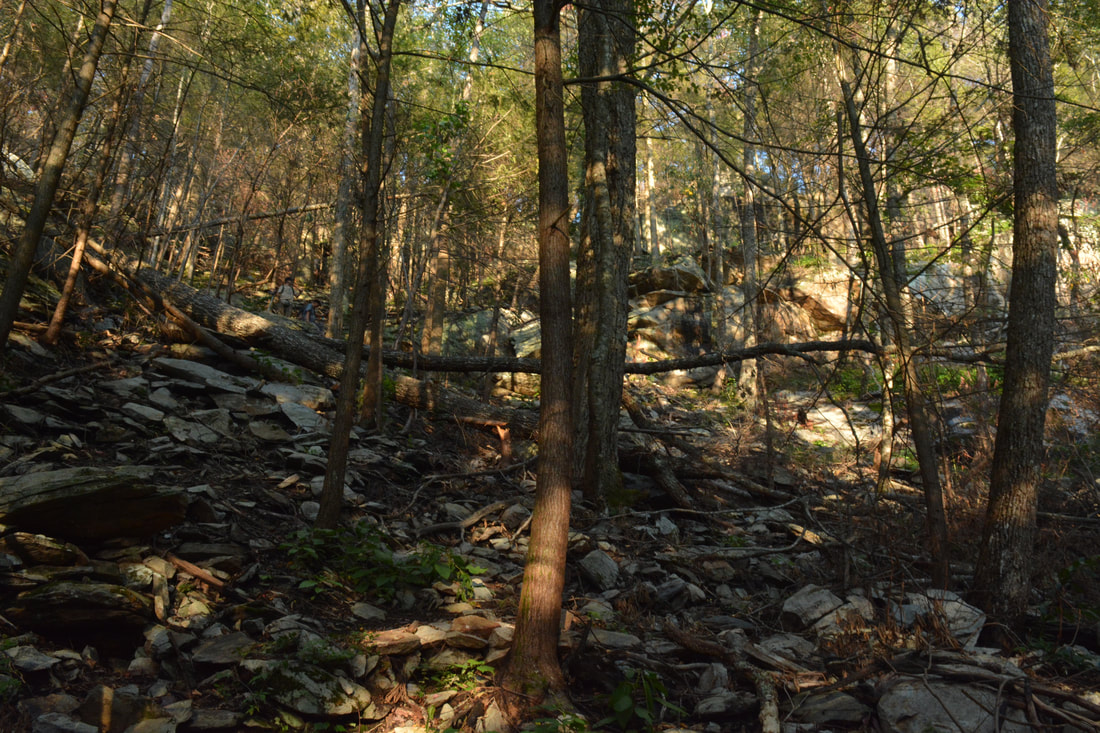
From the circular parking area, begin the hike by walking around the gate straight ahead onto the East Cowpen Trail, which follows an old road - the continuation of East Cowpen Road that is now closed to vehicles. Many dozens of years ago, East Cowpen Road was drivable from Alaculsy Valley all the way to Three Forks on FS 64 near Cowpen Mountain. Eventually, after the Cohutta Wilderness was created, the road was closed to vehicles, and since then, it has steadily become more and more overgrown to the point that the trail that follows it is often a narrow single-track footpath. In 100 feet, reach a signed split where the loop begins. Here, the East Cowpen Trail (your return route) continues straight while you must stay right on the Hickory Creek Trail, which follows another old roadbed. The first part of the Hickory Creek Trail is very easy along the ever-so-slightly-descending forest road. At 0.9 miles, the trail reaches the Cohutta Wilderness boundary, marked by a small sign nailed to a tree. Stay left here as another path splits off to the right. The trail then curves in and out of two hollows with small tributaries of Hickory Creek before passing over culverted Hickory Creek itself at 1.6 miles. There are a couple nice views of the creek before the trail rises out of the valley. It's a bit odd how the trail is named Hickory Creek Trail but spends very little time along Hickory Creek. The trail continues its pattern of climbing in and out of hollows with unnamed streams, but now that it has left the well-defined forest road, the trail no longer contours along the slopes and instead plunges into each hollow and over each lead, which can get slightly annoying. Most of the uphills are easy, but there are a few very brief moderate to steep stretches scattered throughout the trail. One thing I noticed is that the trail generally became more difficult the farther south it got. For the most part, it is well-defined though. At 3.85 miles, the Hickory Creek Trail crosses North Fork Thomas Creek - a very scenic cascading stream. This is likely to be a shallow wade during winter and spring. A great campsite is situated next to the creek just past the crossing. After this, the trail climbs to the top of the ridge separate North Fork Thomas Creek from (South Fork) Thomas Creek, briefly following a rocky drainage along the way. Reach a crossing of Thomas Creek at 4.5 miles. You will probably be able to rock hop and stay dry here due to how the creek spreads out into several channels. The Hickory Creek Trail then continues its rollercoaster pattern, eventually descending into the Conasauga River valley. At 5.65 miles, the trail comes to a ford of the Conasauga River. The ford is pretty easy but it was fairly deep on this day - reaching above the knees at the deepest spot. Note that the water levels on this day were high following Hurricane Irma's passage through North Georgia and were more typical of winter and early spring. There is a really nice view of the mellow Conasauga River upstream from the ford. On the other side of the crossing, there is a junction with the Conasauga River Trail in a small clearing known as Bray Field. 
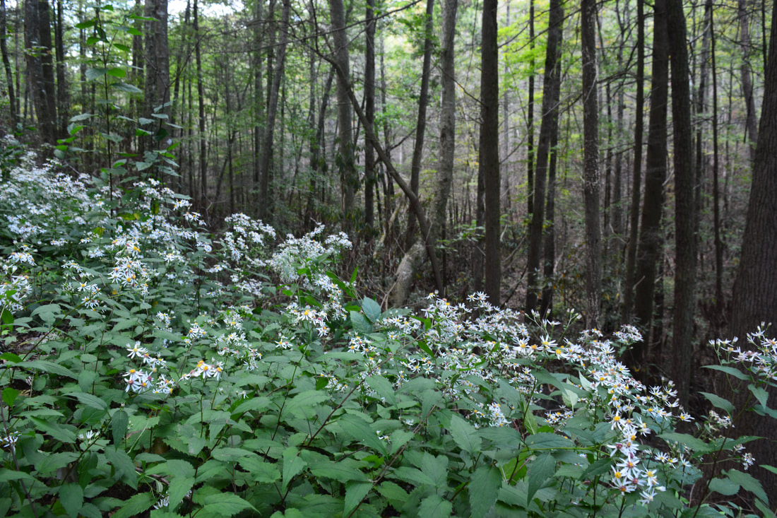
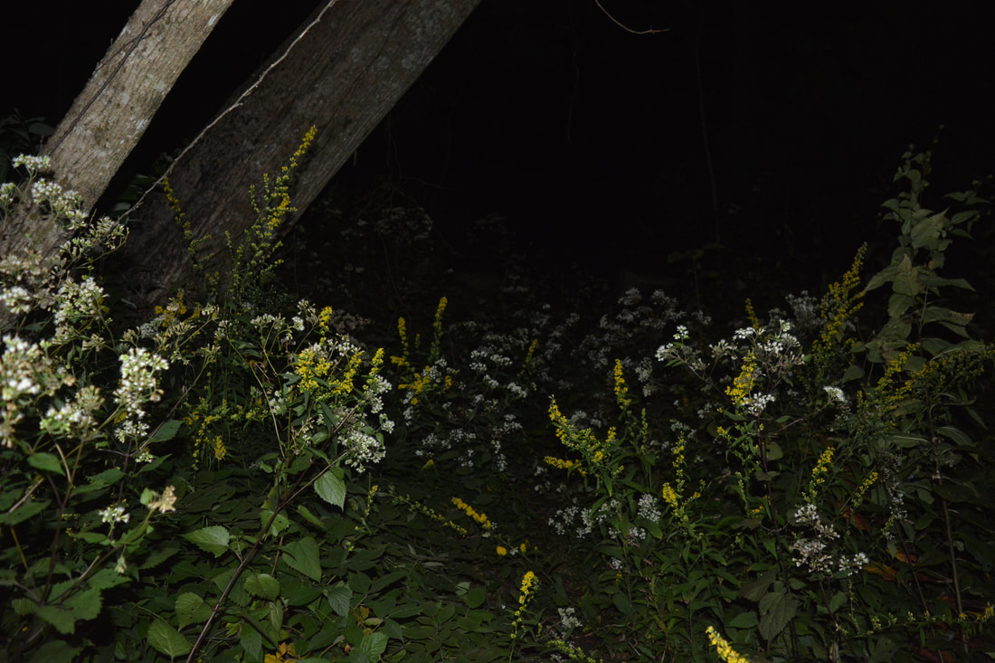
Gentian along the Hickory Creek Trail
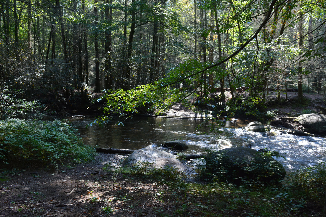
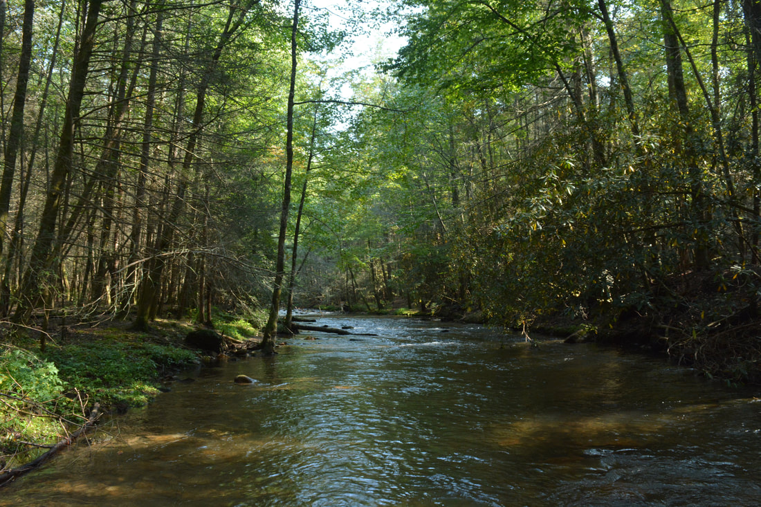
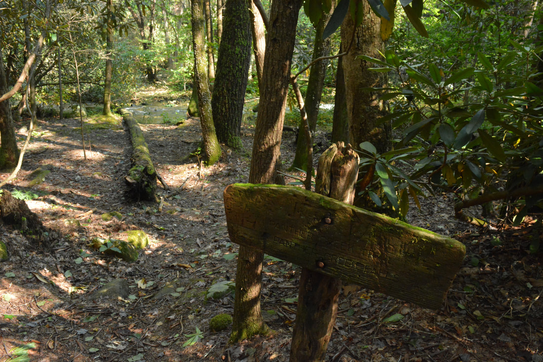
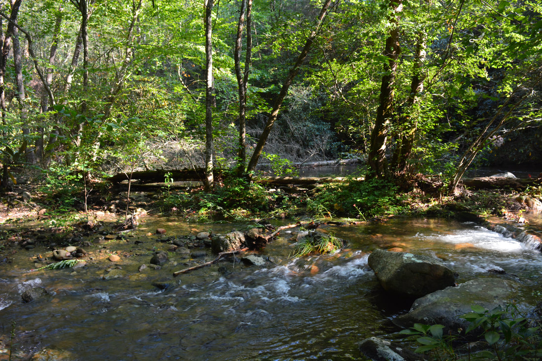
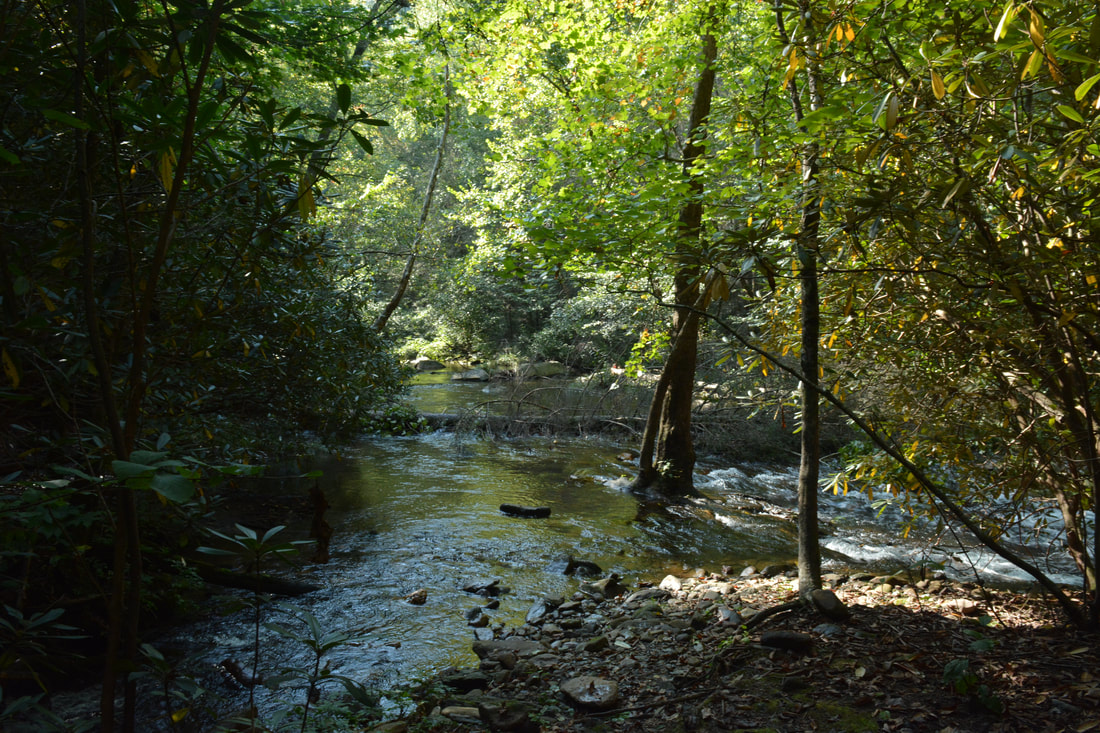
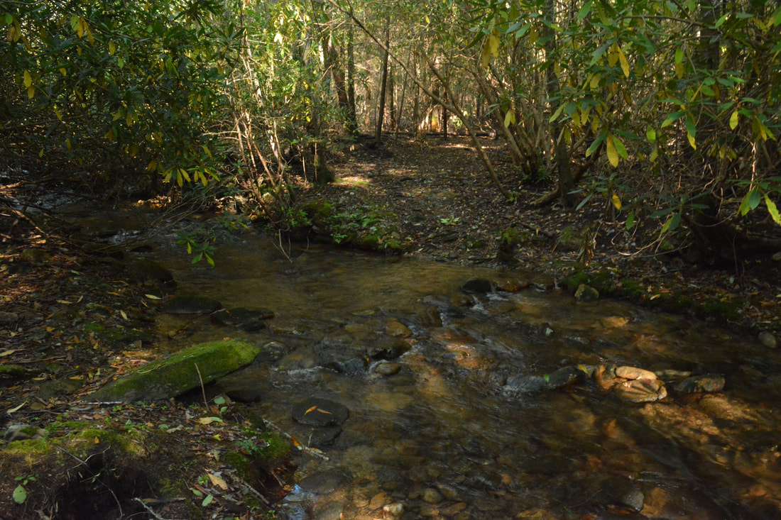
At the junction, the Hickory Creek Trail bears right joining the northbound Conasauga River Trail (not hard right - that is an unofficial camping path). That direction of the Hickory Creek Trail leads to the trailhead off West Cowpen Road as well as provides access to the spectacular lower section of the Conasauga River Trail. However, this loop hike turns left onto the southbound Conasauga River Trail. The trail shortly passes a "No Horses Beyond This Point" sign and enters a large camping flat alongside the river. Reach a usually-signed junction with the Tearbritches Trail at 5.7 miles. While the Tearbritches Trail turns right and ascends steeply for several miles to Little Bald Mountain and FS 64, you must stay straight on the Conasauga River Trail, which crosses Tearbritches Creek in a few feet and then makes a short ascent, briefly rising above the river. The trail rejoins the very scenic Conasauga River at 5.95 miles where there is a perfect riverside campsite. After closely following the river, the Conasauga River Trail arrives at a usually-signed junction with the Panther Creek Trail on the left at 6.1 miles. This loop turns left onto the Panther Creek Trail, coming to a broad ford of the Conasauga River in a few feet. The ford is generally shallow, but one deep area was around knee-level on this day (it will be lower in normal summer and fall conditions). At the time of this hike, crossing a fallen tree was necessary in the middle of the ford. At the far end, Panther Creek ties into the Conasauga River. The Panther Creek Trail begins just to the left of the confluence.
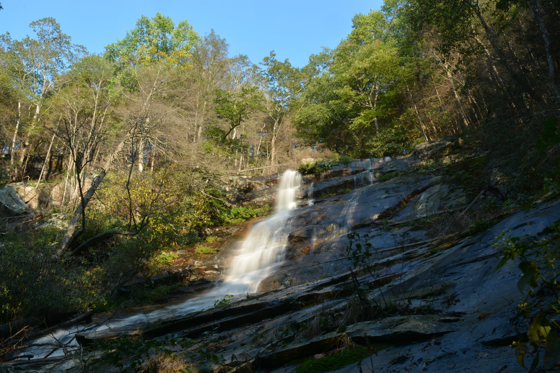
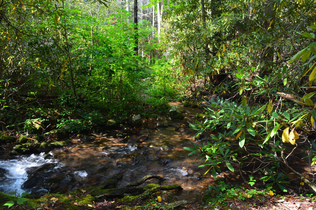
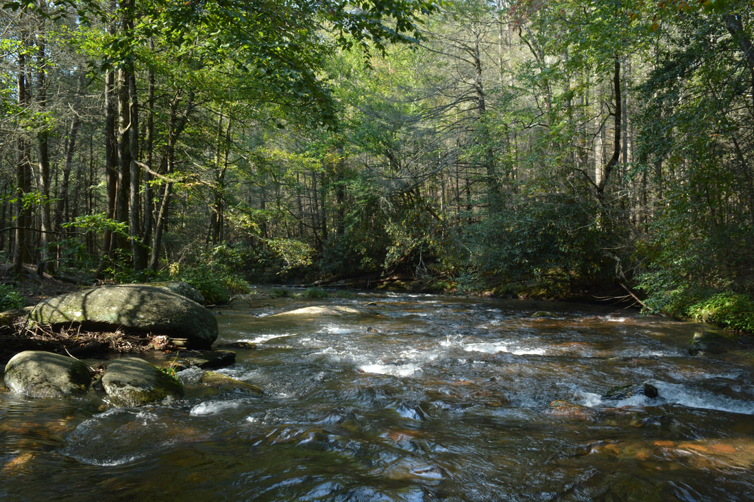
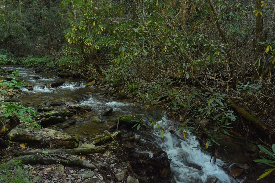
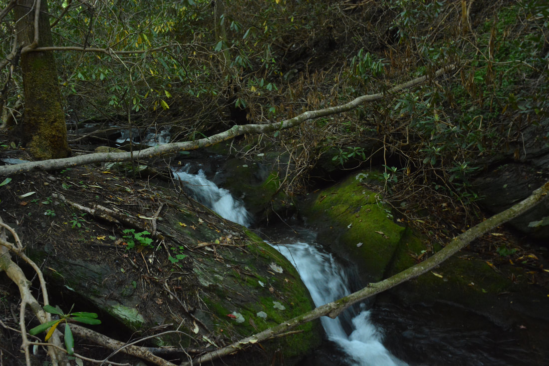
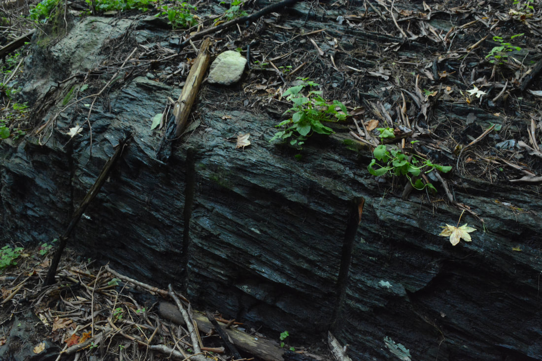
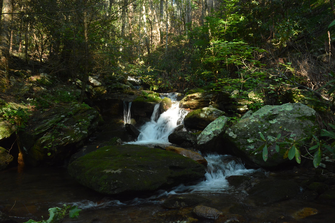
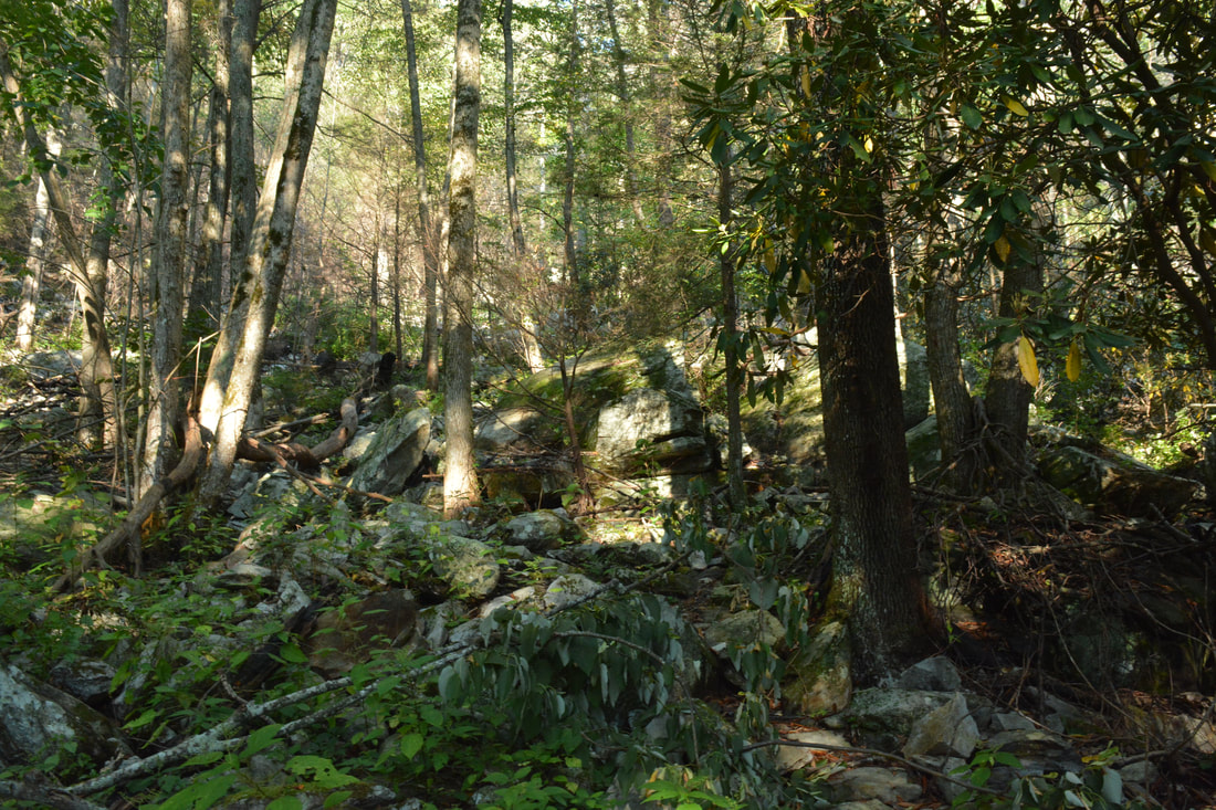
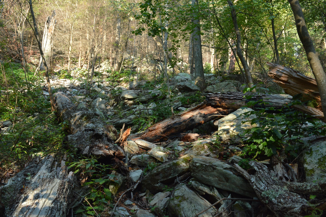
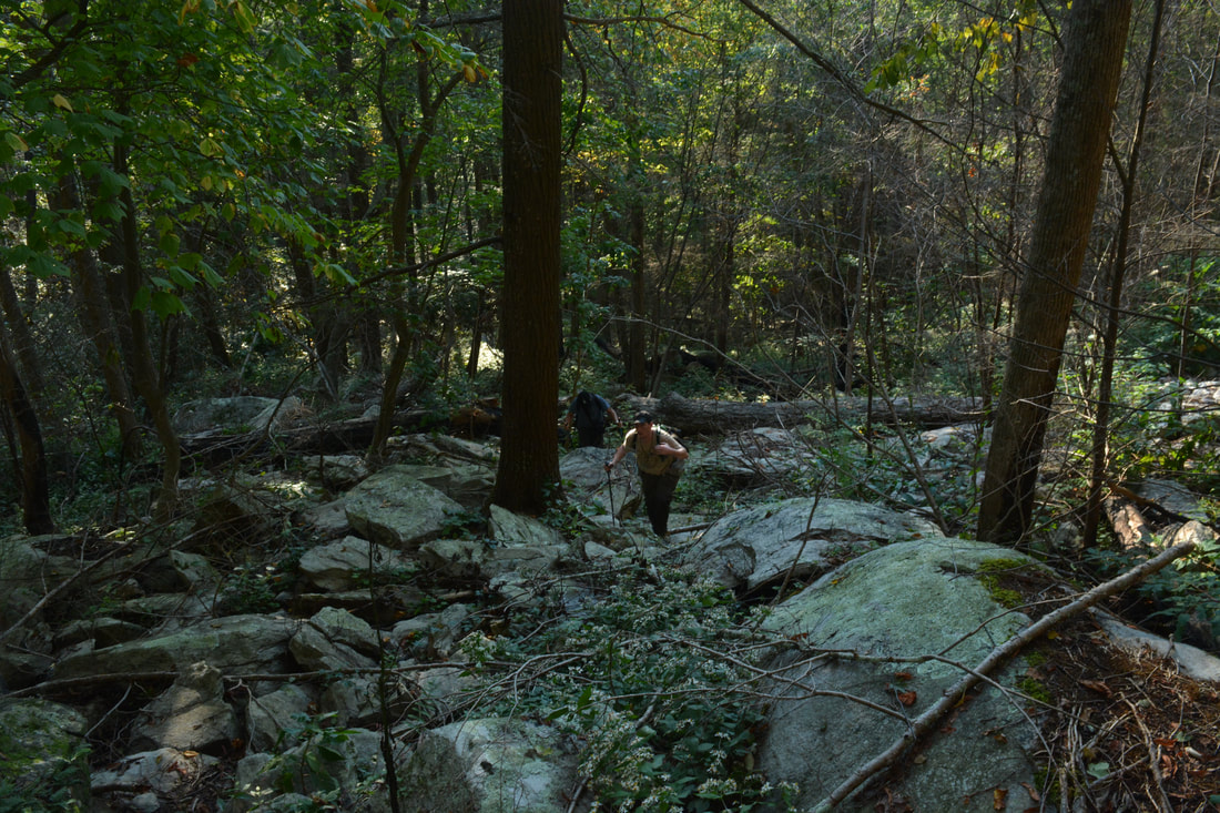
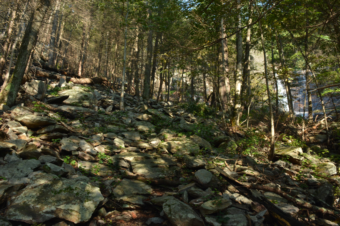
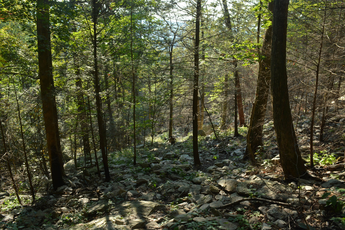
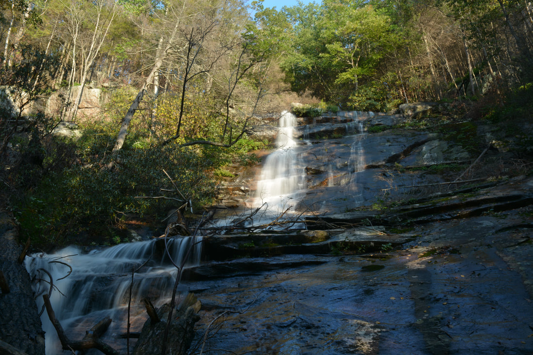
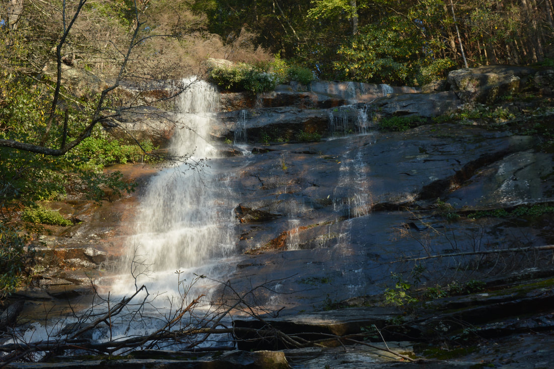
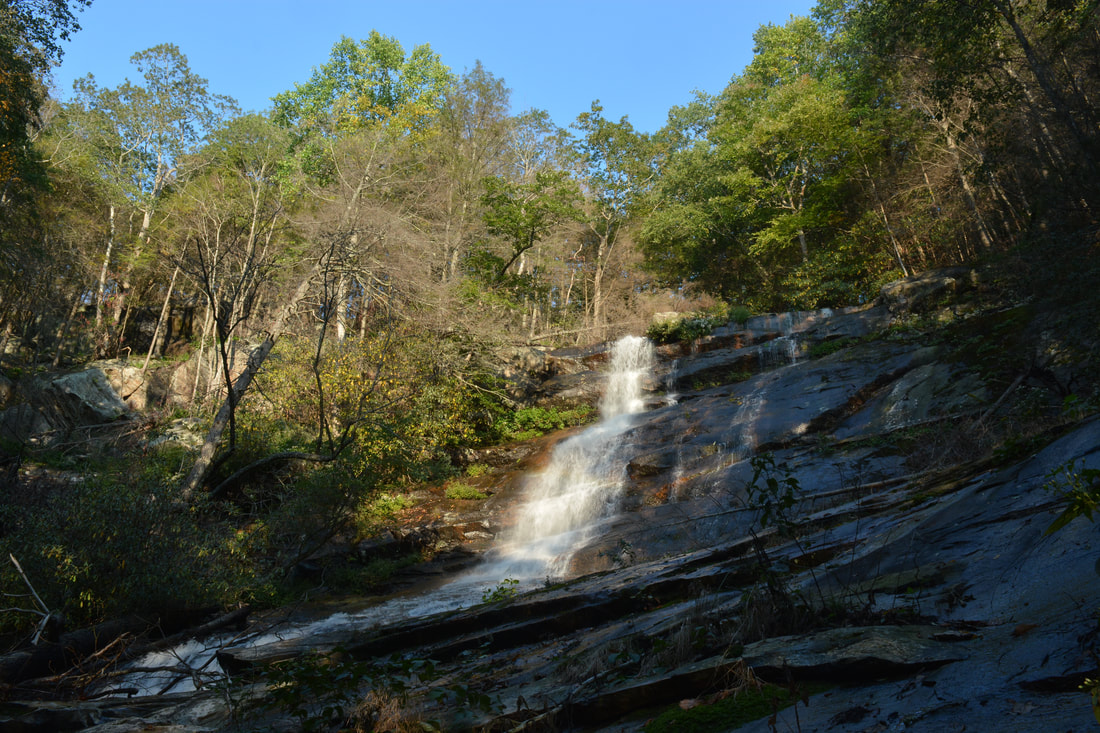
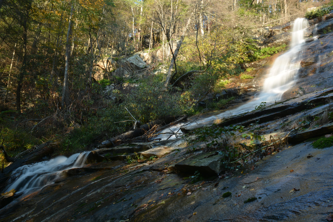
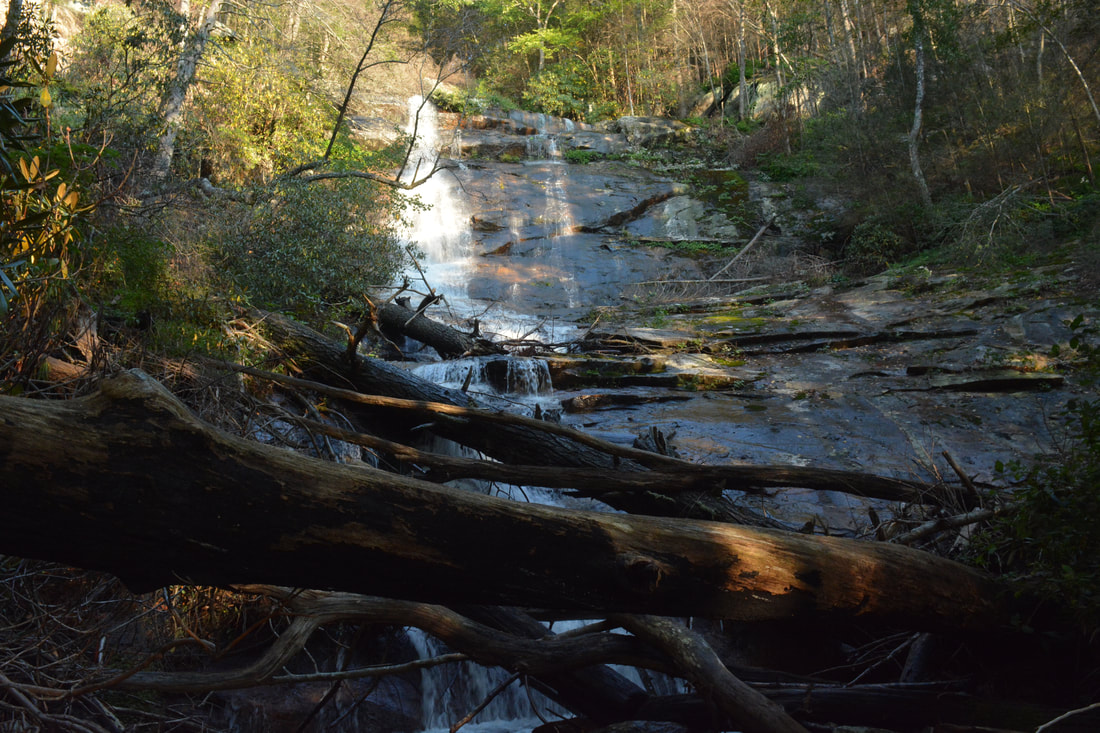
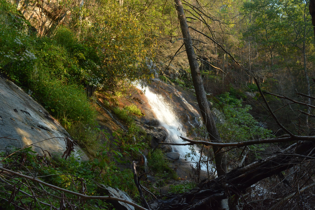
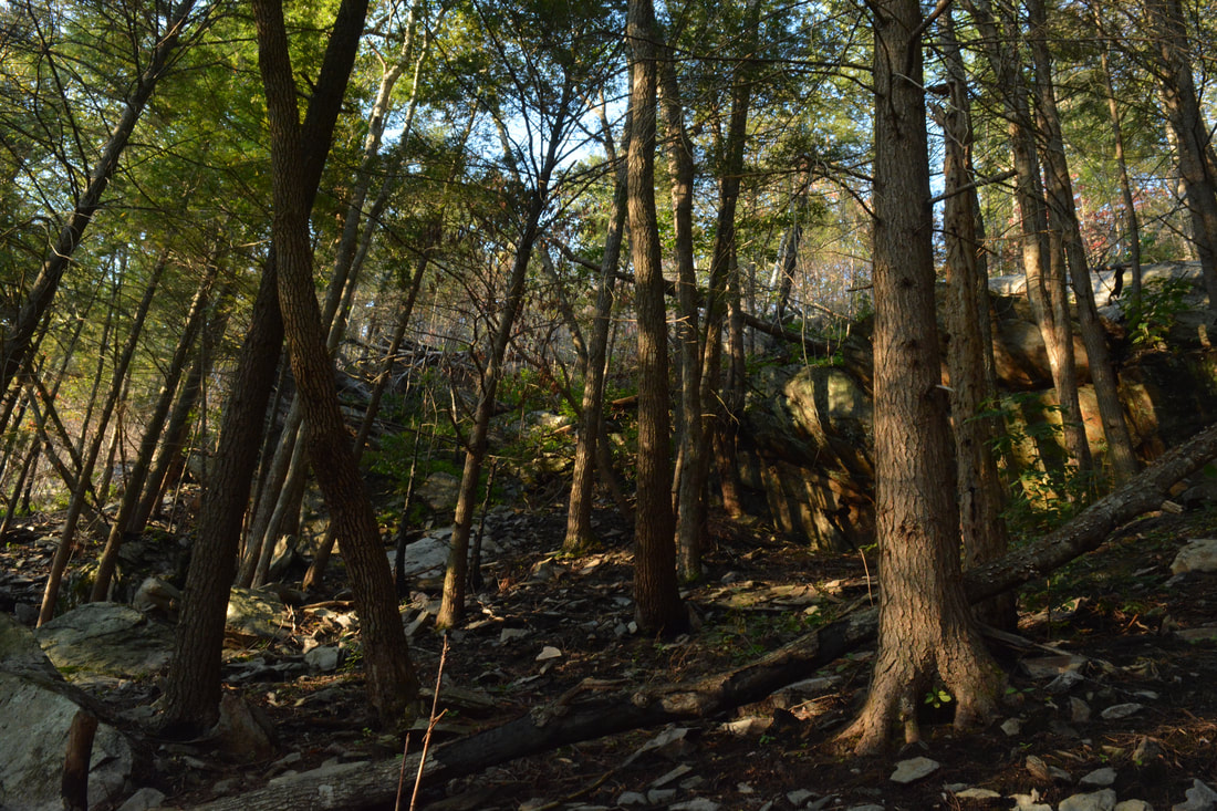
In total, the Panther Creek Trail has eight crossings of Panther Creek: six below Panther Creek Falls and two above. All of the crossings were shallow wades on this day, but they can be rock hopped during normal water levels. The size of the creek crossings along the Panther Creek Trail is a good indicator for the flow at Panther Creek Falls; if there is enough water in the creek that the crossings have to be waded, then the falls will be flowing well. The first five crossings come in quick succession in the trail's first half-mile (between 6.1 and 6.6 miles). In this section, the trail is nearly flat and there are several scenic cascades on Panther Creek. Like many other trails in the Cohutta Wilderness, the lower part of Panther Creek Trail follows an old railroad bed used for hauling out timber in the logging days, and there is evidence of this in the form of blast lines in a rock outcrop on the left side of the trail just before the first creek crossing. After the fifth crossing, the Panther Creek Trail begins an easy ascent along the southeast side of the creek with occasional blowdowns. As the valley steepens, the ascent becomes moderate for some time before the Panther Creek Trail comes to its sixth crossing of Panther Creek just below a set of scenic cascades at 7.2 miles - the last crossing before Panther Creek Falls. After a steep bank scramble on the other side, the trail enters the unique and spectacular boulder field below Panther Creek Falls. To me, the very steep boulder scramble along Panther Creek is one of this hike's biggest highlights. I have not encountered any such piece of trail anywhere else in Georgia. The truth is - there really is no trail through the boulder scramble. Just pick out the most obvious route but make sure to not stray too far from the creek. You won't want to be right along the creek either. The optimal place to be doing the boulder scramble is approximately 100 feet (give or take a few) from Panther Creek, with many of its cascades clearly audible and perhaps visible through the trees. The boulder scramble starts out at a moderate grade, but as you approach Panther Creek Falls, the grade steadily turns very steep - in fact, my GPS shows that there was a prolonged grade of about 40% along the steepest part! Between the sixth crossing of Panther Creek and the base of the falls, the trail ascends 350 feet in less than 0.3 miles - that comes to show just how steep the boulder scramble is! But don't get me wrong - the scramble is quite fun, and the size of the boulder field is incredible. Also, the boulder field is home to a pocket of old-growth forest, as it was pretty difficult to log this area. Eventually Panther Creek Falls comes into view through the trees. When you approach the base of the falls, you'll have to make a short side trip to the right, reaching the base of Panther Creek Falls at 7.5 miles. There is usually a jumble of fallen trees at the base, making it a bit tricky to get a good view of the falls. The best view is actually on the opposite side of the creek (see this report's cover photo), but getting there requires a slightly risky scramble across one of the logs. 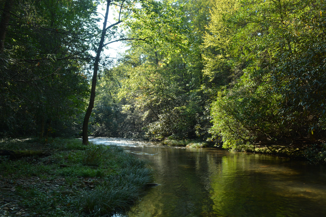
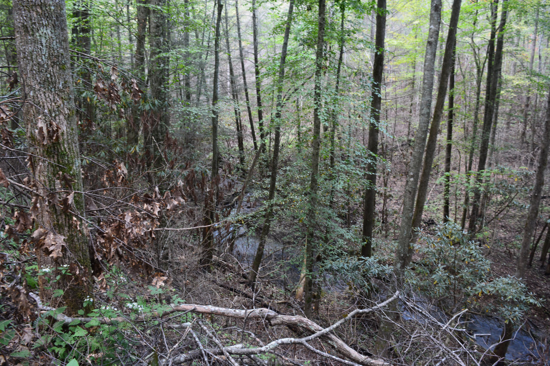
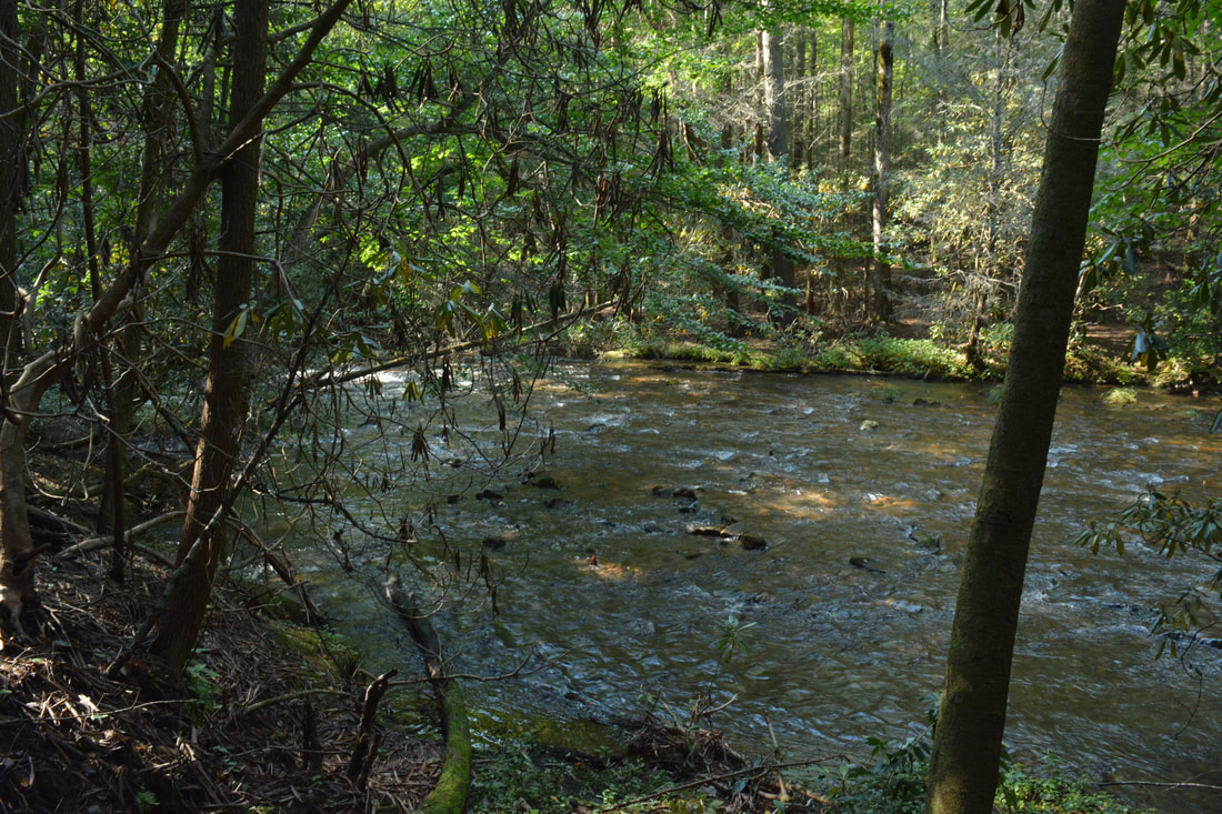
The Conasauga River is a stunningly beautiful wilderness waterway.
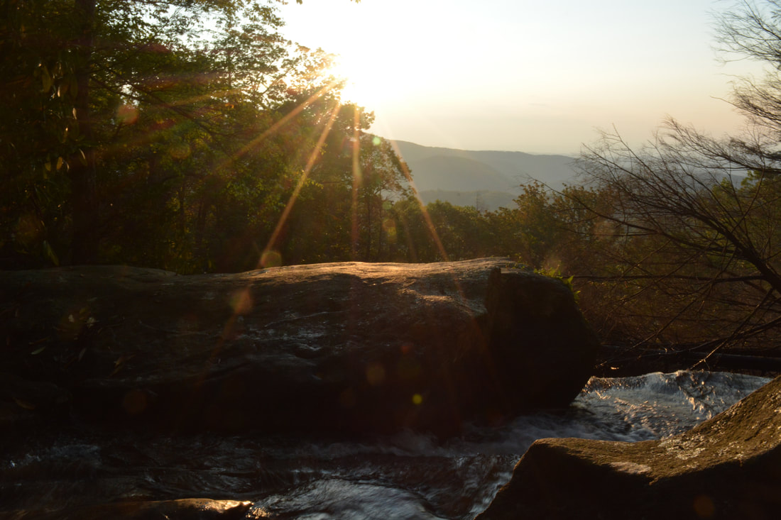
The total height of Panther Creek Falls, including the lowermost cascades at the logs, is about 70 to 80 feet. The waterfall begins with a short free-fall, followed by a long slide - steep at first, more gradual later. All of the falls is on a massive cliff, which extends well away from the center of the falls. During high flow, additional trickles of flow form to the right of the main channel, making the falls more scenic. That's the best way to see it. However, since Panther Creek Falls is located high up on a stream that already is pretty small, it can prove to be tough to catch the falls at optimal flow. Panther Creek Falls is still worth it even in lower flows, as the main channel of flow is always beautiful, as is the setting. The rocky setting is unusual for Georgia waterfalls, and the whole area - including the boulder field and the falls - is reminiscent of the Cumberland Plateau. The rock outcrops at the top of Panther Creek Falls have a great vista, and that's where you're headed next.
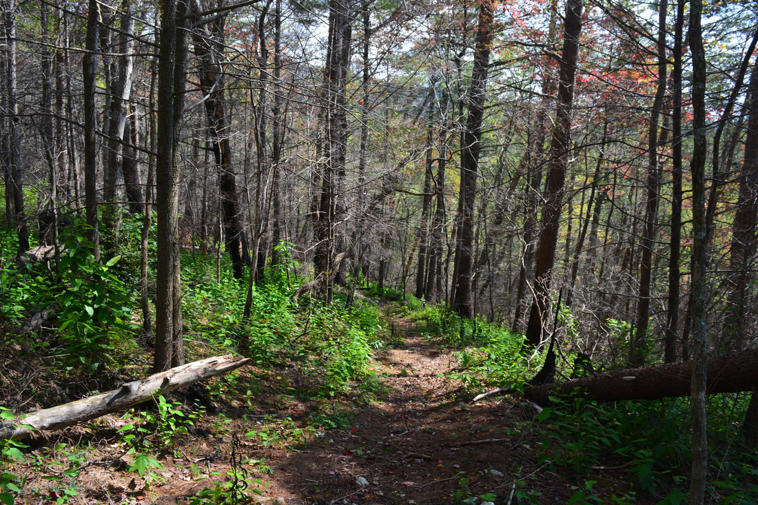
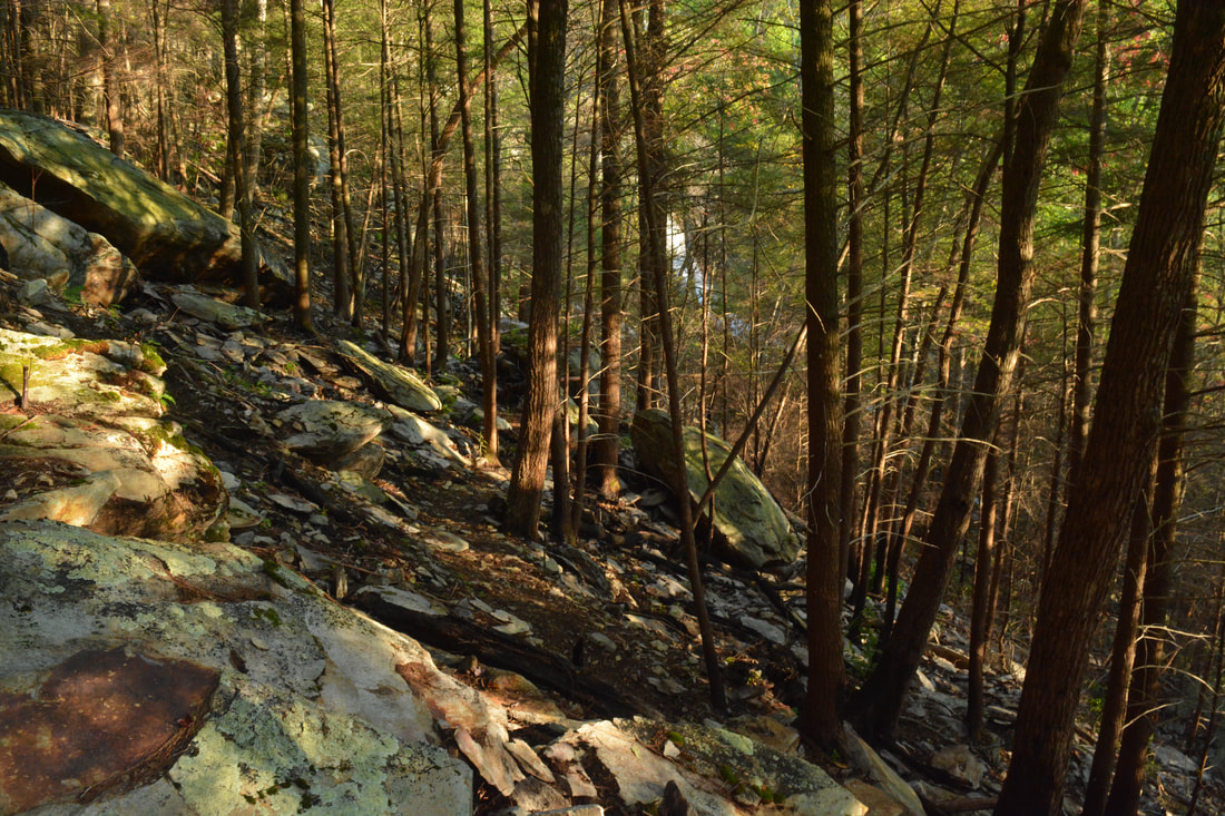
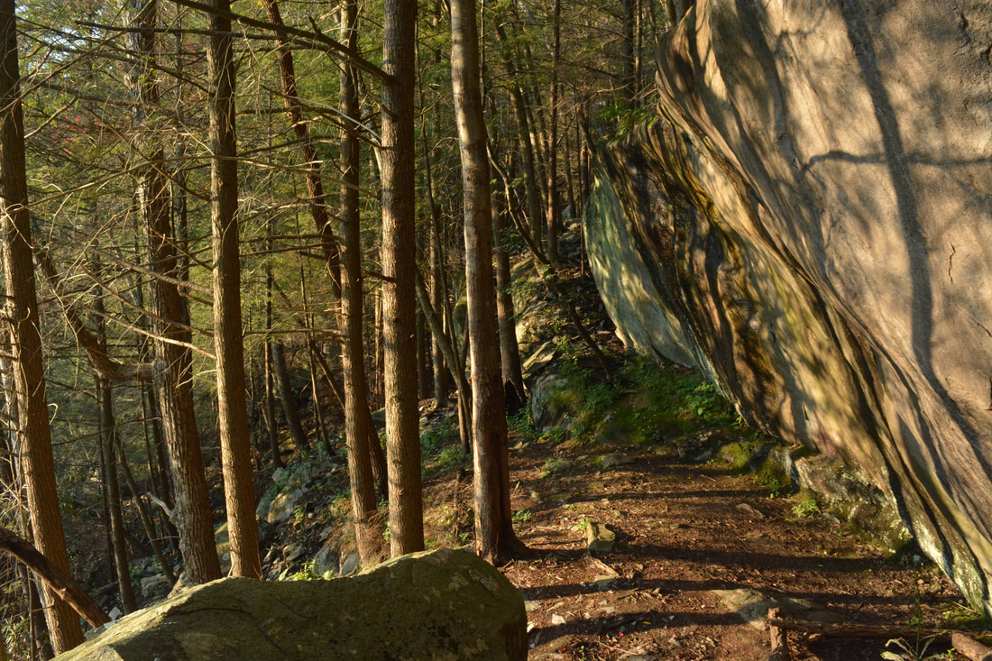
Return to the main route and continue scrambling through the boulder field, with the top now in view. The path through the boulders actually becomes more distinct now, making a switchback to the left at a point where there is a great side view of Panther Creek Falls. The trail then ascends above the level of the falls, making another switchback back toward the creek. Boulders and rock outcrops of all kinds are scattered about. As it approaches Panther Creek again, the trail comes alongside a long scenic bluff and follows its base. Finally, the Panther Creek Trail reaches the top of Panther Creek Falls at 7.6 miles. A rock outcrop to the right in the middle of the creek provides the optimal view, but care must be taken in getting to it, as you'll have to cross several slippery rocks along the way. From the top of Panther Creek Falls, there is a scenic view west into the Conasauga River Valley with countless lower ridgelines all the way to the horizon. Surrounding trees make the viewing window smaller but also frame it beautifully. The view from the top of Panther Creek Falls is one of only two trailside views in the Cohutta Wilderness (the Horseshoe Bend Vista being the other). The Panther Creek Falls Vista is also a superb sunset-viewing spot, with several great campsites a short distance downstream. The trail gets a bit confusing after the top of the falls. On my hike, I followed an unofficial path along the same side of Panther Creek, eventually rejoining the main trail without any crossings, but I know this is incorrect. I believe the Panther Creek Trail crosses the creek not far above the falls and quickly recrosses for the eight and final time back to the north side of the creek. Along the way, you will pass a number of popular campsites. At 7.9 miles, the Panther Creek Trail suddenly leaves Panther Creek and begins a steep ascent out of the valley and to Cowpen Ridge. The trail ascends about 850 feet over the next 0.9 miles - only slightly less steep than the boulder scramble below the falls. A particularly steep stretch comes between 8.1 and 8.2 miles, where the trail ascends 150 feet! The trail then reaches a gap on the ridge crest at 8.2 miles and turns abruptly right (a path to the left quickly dead ends). The ascent along the ridge remains strenuous with brief moderate stretches in between. Finally, at 8.8 miles, the Panther Creek Trail levels out just below a knob northwest of Cowpen Mountain. The rest of the Panther Creek Trail is level or nearly so as it contours below Cowpen Ridge with good winter views, eventually arriving at a usually-signed T-intersection with the East Cowpen Trail at 9.5 miles. The elevation at this junction is about 3770 feet, the highest on the hike. That's quite a difference when compared to the elevation of about 1920 feet at the lower end of the Panther Creek Trail! 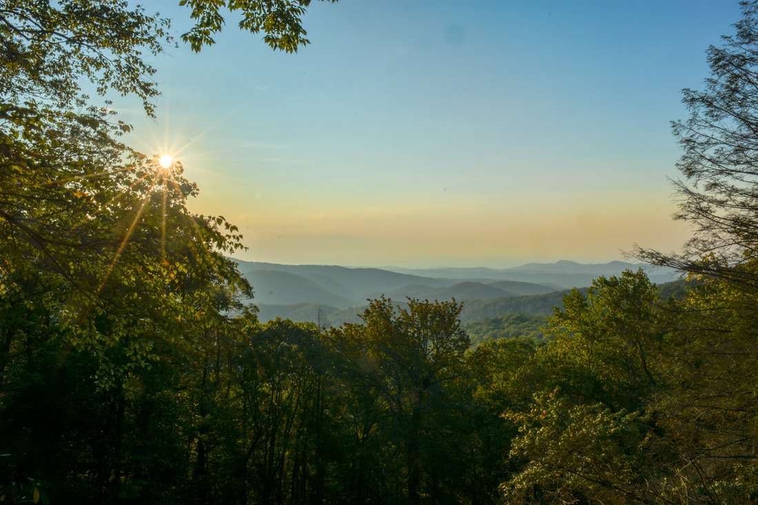
The scenic westward view from the top of Panther Creek Falls is a superb sunset-viewing spot.
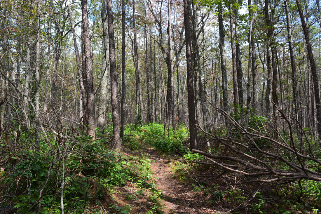
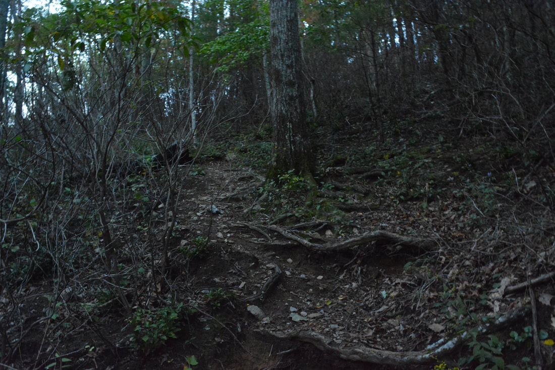
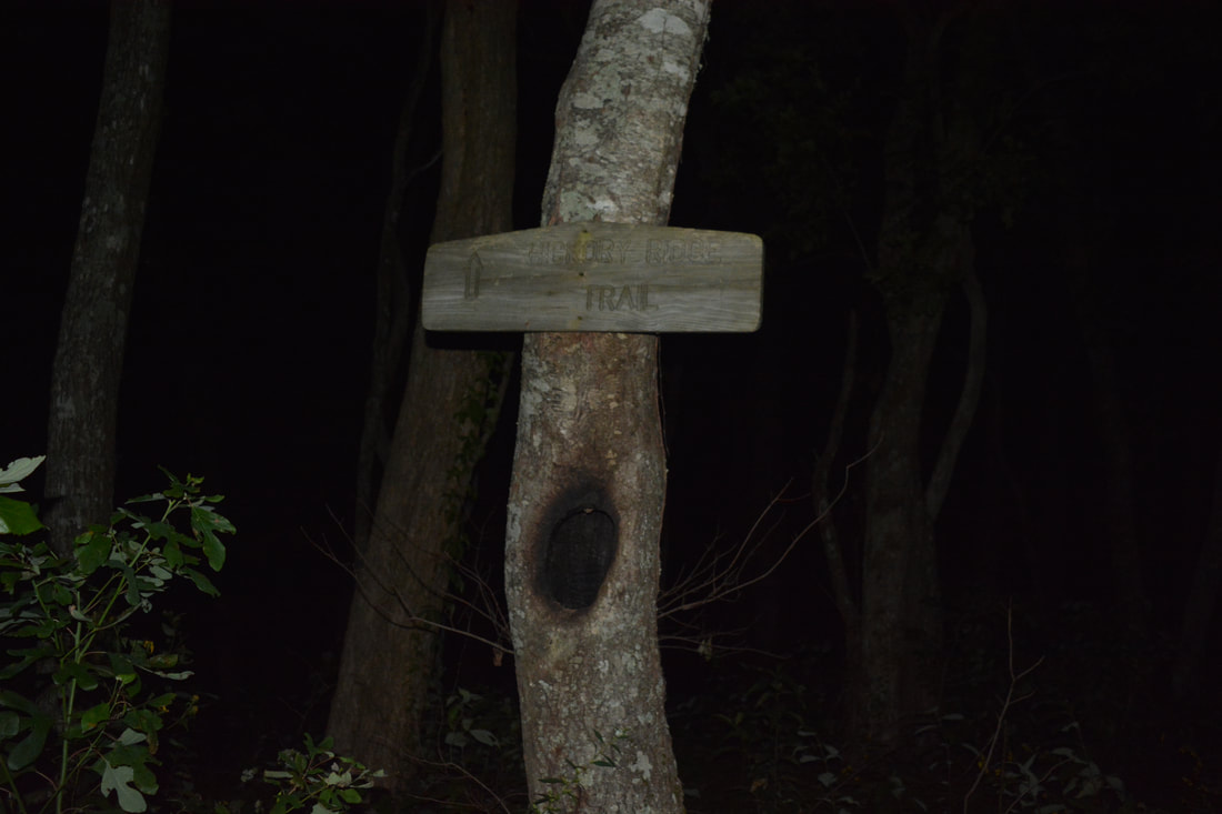
Turn left onto the East Cowpen Trail to begin the final leg of the loop (the East Cowpen Trail also heads right and reaches the Three Forks Trailhead off FS 64 in 2.2 miles). Essentially all of the East Cowpen Trail between the Panther Creek junction and FS 51 is downhill, although there are a few very minor bumps along the way. Also, the East Cowpen Trail between the Panther Creek and Hickory Ridge junctions is very overgrown. Even though it follows an old road the entire way, it is hardly recognizable and the trail is a narrow single-track path. For the first 1.6 miles from the junction, the trail mostly follows the ridge with good winter views. This section is generally a gradual descent. There was a group of heavy blowdowns around 10.35 miles at the time of my hike. At 11.1 miles, the East Cowpen Trail veers off the ridge, curving around Buckeye Mountain as the descent becomes moderate to steep. The East Cowpen Trail reaches the Hickory Ridge Trail junction at 11.6 miles. It is very easy to go the wrong way and keep going straight here onto the Hickory Ridge Trail here, as the overgrown East Cowpen Trail turn to the left is barely noticeable in the fairly large clearing. Normally, a somewhat obvious "Hickory Ridge Trail" sign is nailed to a tree on the left side of the trail, but if the sign is missing, you're going to have pay very close attention, as the Hickory Ridge Trail turns far away from FS 51 and descends to the Jacks River above Jacks River Falls. Since the old road that the East Cowpen Trail follows is so overgrown - especially in the summer - the Hickory Ridge Trail can actually appear to be the main trail, but it's not!
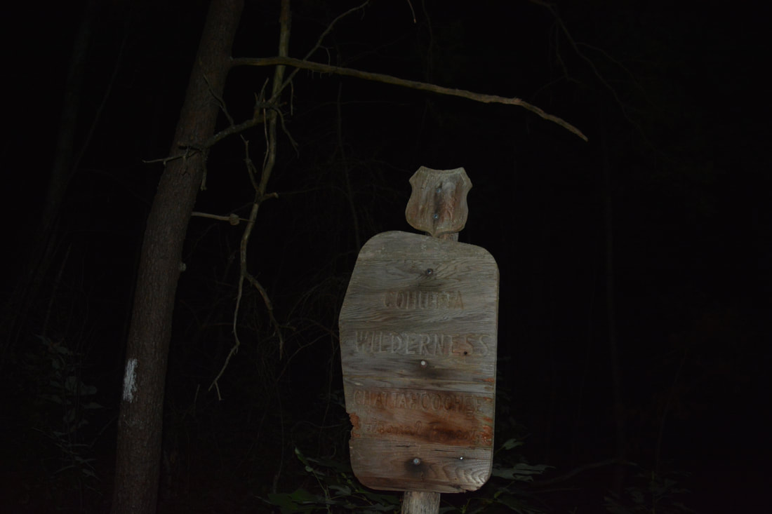
After the left turn, the East Cowpen Trail continues descending in earnest down the lower slopes of Buckeye Mountain. After a while, the trail actually becomes a little less overgrown. The descent isn't overly interesting, although like most other trails along this loop, it is remote, and there are some limited views to the west in a semi-open area at 13.5 miles. The East Cowpen Trail exits the Cohutta Wilderness at a large wooden sign at 13.9 miles. Finally, the East Cowpen Trail reaches the end of the loop at the Hickory Creek Trail split at 14.2 miles. Continue straight, reaching the FS 51 parking area 100 feet farther and concluding this spectacular wilderness loop hike. Mileage
0.0 - FS 51 East Cowpen Trailhead
0.9 - Enter Cohutta Wilderness 1.6 - Hickory Creek 3.85 - North Fork Thomas Creek 4.5 - Thomas Creek 5.65 - Conasauga River Ford 1 & Conasauga River Trail Junction 6.1 - Conasauga River Ford 2 & Panther Creek Trail Junction 7.5 - Panther Creek Falls 7.6 - Top of Panther Creek Falls 9.5 - East Cowpen Trail Junction 11.6 - Hickory Ridge Trail Junction 13.9 - Exit Cohutta Wilderness 14.2 - FS 51 East Cowpen Trailhead Variations
Hike out and back to Conasauga River and Bray Field via Hickory Creek Trail from FS 51 - 11.3 Miles
Bonus Stops
Along the way to the East Cowpen Trailhead is a nice roadside waterfall on Jigger Creek next to FS 51. There is also a lower waterfall on Jigger Creek accessed by a fairly easy trail and scramble less than a mile one way.
Pictures & Videos
0 Comments
Leave a Reply. |
About MeMark Oleg Ozboyd Dear readers: I have invested a tremendous amount of time and effort in this website and the Georgia Waterfalls Database the past five years. All of the work that has gone in keeping these websites updated with my latest trip reports has almost been like a full-time job. This has not allowed me to pick up a paid job to save up money for college, and therefore, I I've had to take out loans. If you find the information on this website interesting, helpful, or time-saving, you can say "thanks" and help me out by clicking the button above and making a contribution. I will be very grateful for any amount of support you give, as all of it will apply toward my college tuition. Thank you!

Coming in 2022-2023?
Other Hiking WebsitesMiles HikedYear 1: 540.0 Miles
Year 2: 552.3 Miles Year 3: 518.4 Miles Year 4: 482.4 Miles Year 5: 259.9 Miles Archives
March 2021
Categories
All
|
||


 RSS Feed