HIKING THE APPALACHIANS AND BEYOND
  • Home
  • Trail Reports
    • Best Hikes
    • Hikes with Scenic Views
    • Hikes with Water Features
    • Alabama
    • Georgia
    • Florida
    • North Carolina
    • South Carolina
    • Tennessee
    • Vermont
    • Virginia
  • Map
  • Hike List
  • Testimonials
  • Resources
  • Contact Us
  • Southeast Nature Society
    • Our Team
  • Georgia Waterfalls Database

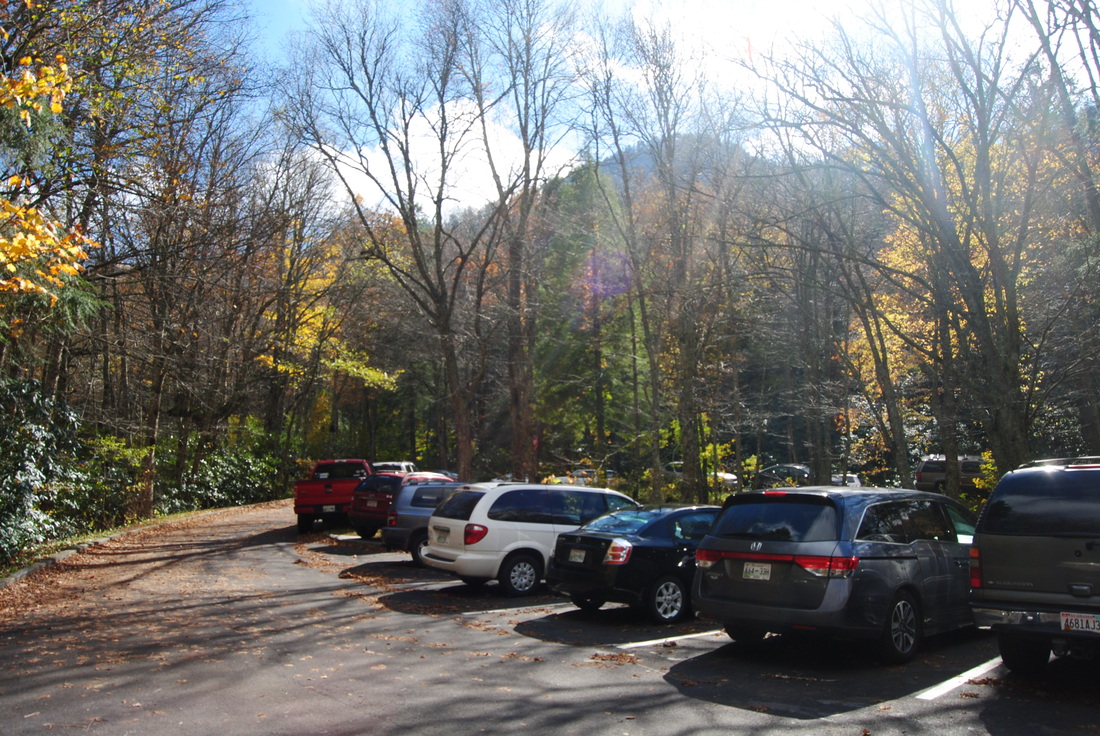
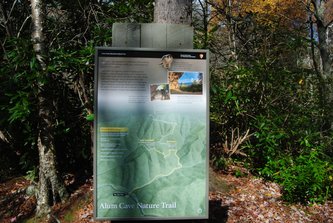
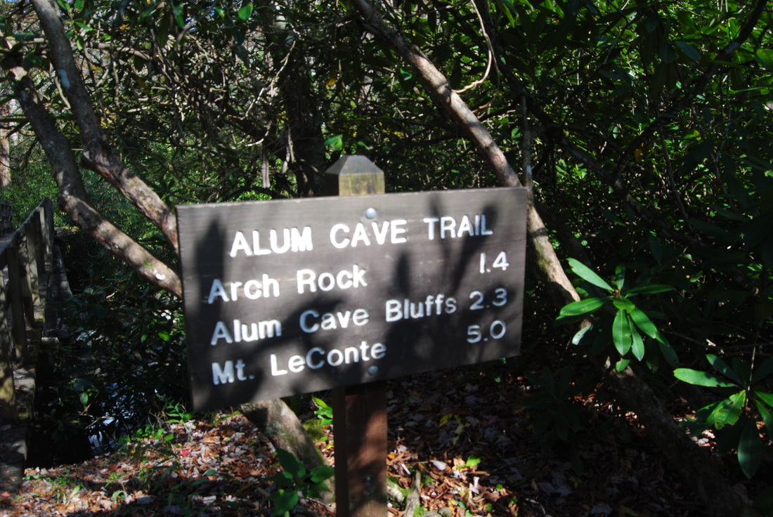
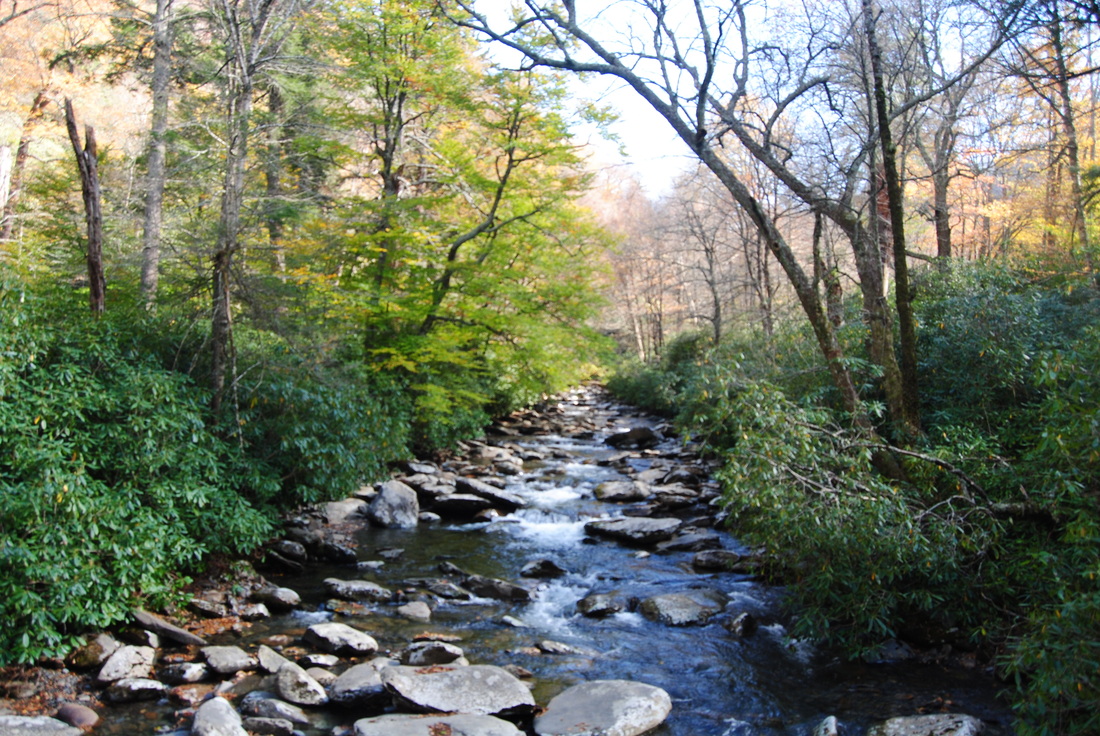
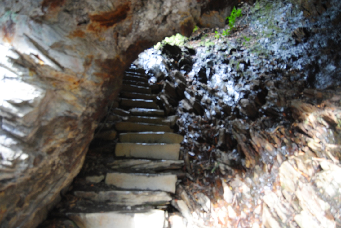
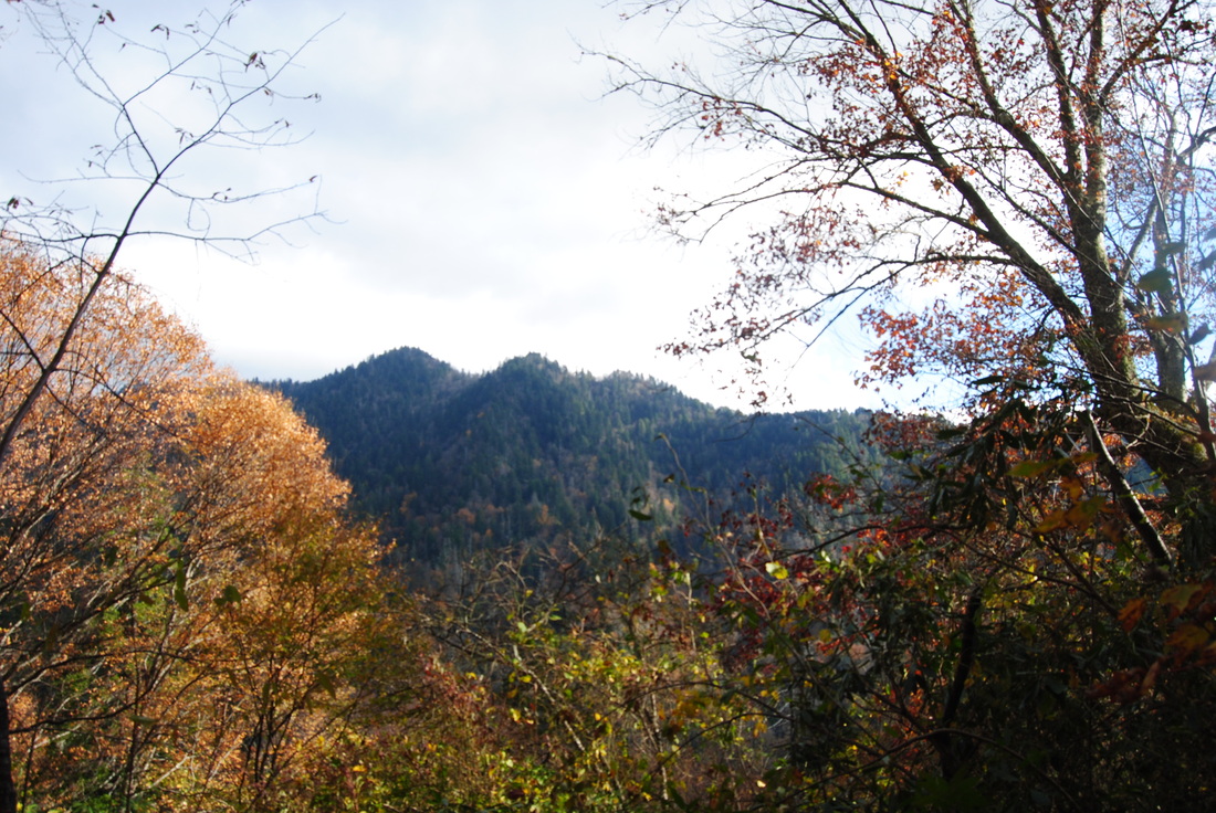
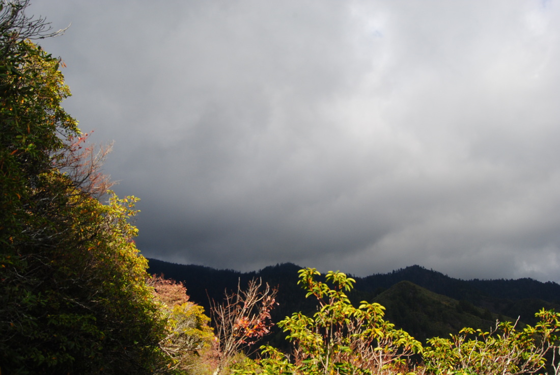
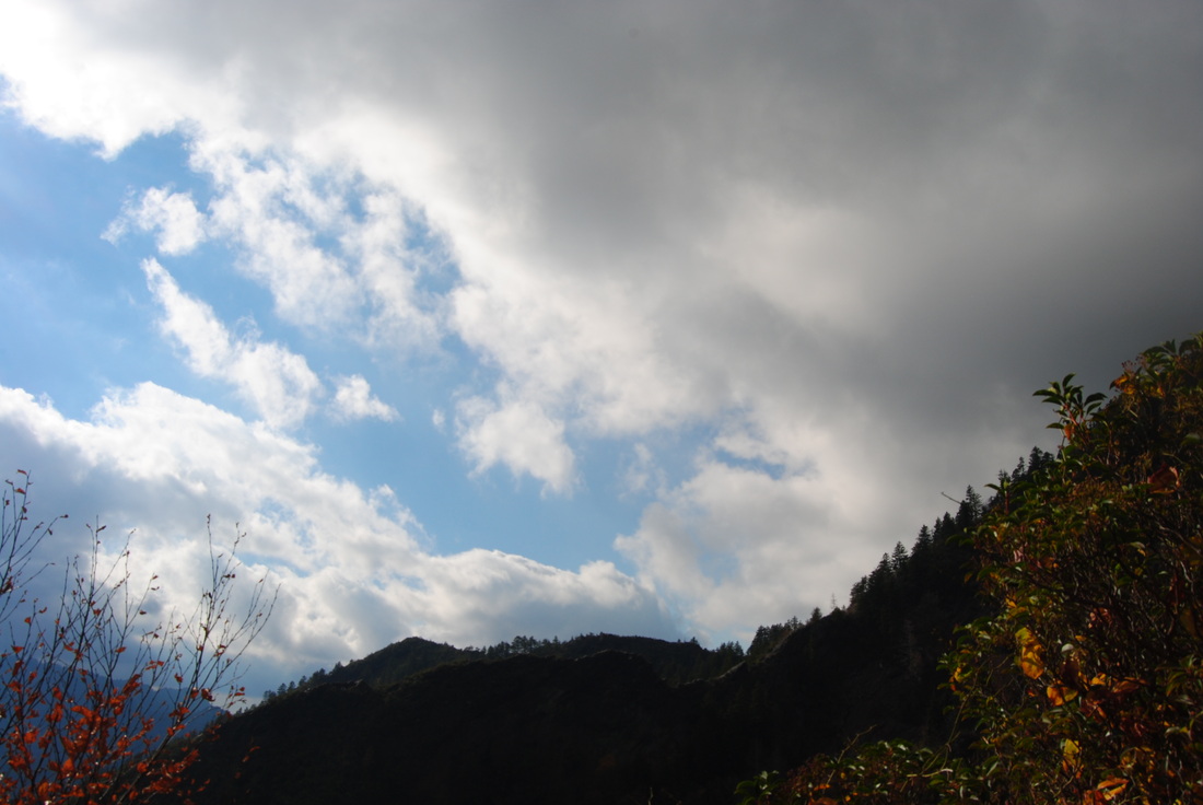
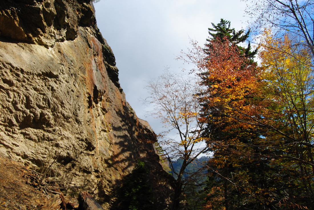
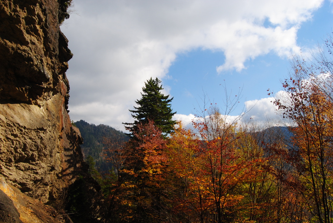
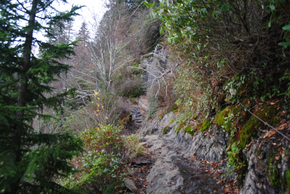
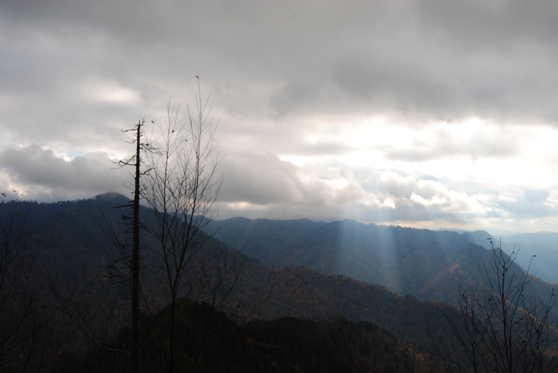
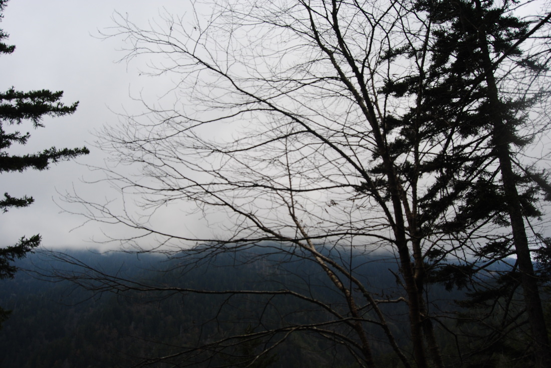
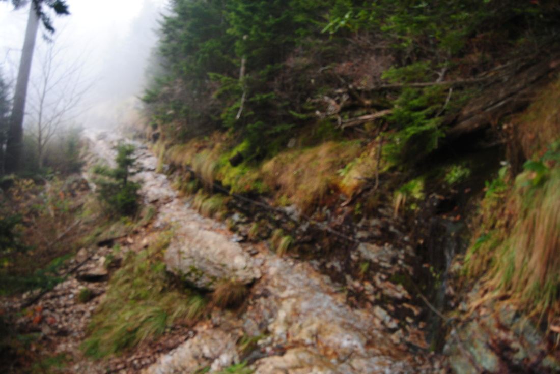
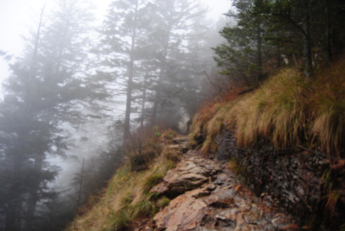
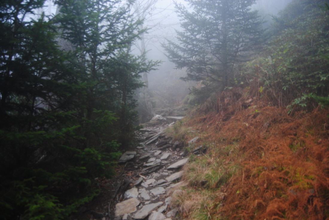
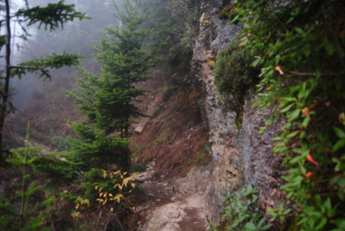
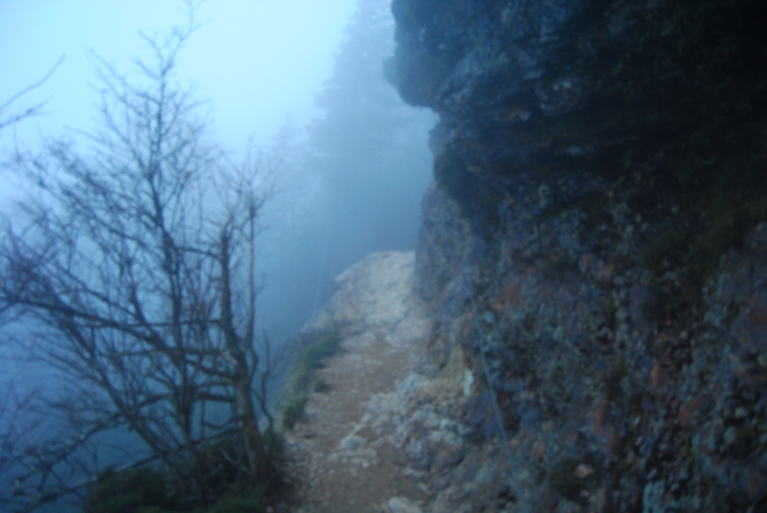
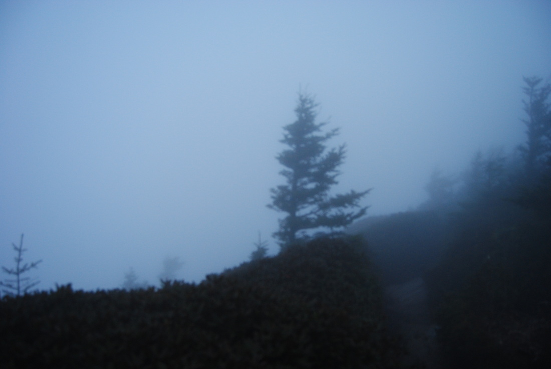
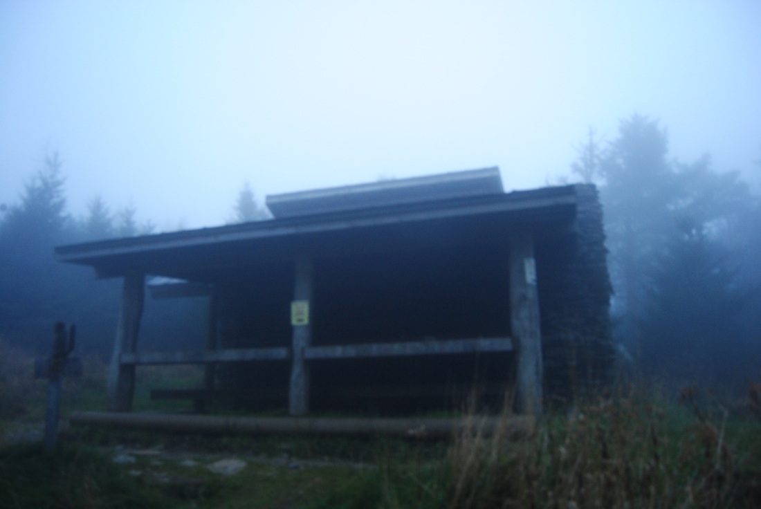
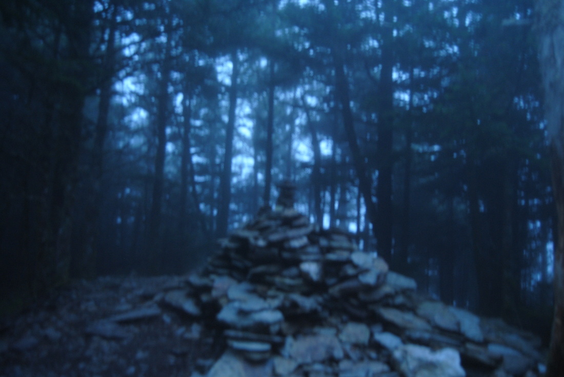
Great Smoky Mountains National Park: Mount LeConte via Alum Cave Trail, Gatlinburg, Tennessee

11/3/2014

0 Comments

 
Picture
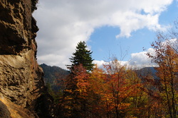
Mount LeConte is one of the most famous mountains in the Southeast. 3rd highest in the Great Smoky Mountains, it has as many as five access trails to the summit. I have done only one, but it is beautiful. Along the way up to LeConte, pass Arch Rock - an arch formed by water over the course of millions of years, and Alum Cave Bluffs - a huge rock overhang of Anakeesta Rock. Also, see the red squirrels, unique to the Southeast, that are found in this area. Near the summit, visit Mount LeConte Lodge and spend the night in the romantic-based lodge or cabins, or if you're like me, squeeze it all in a day hike. It's not that hard. This hike occurred on Saturday, October 18th, 2014. My plan was starting at the Alum Cave Bluffs Trailhead to follow the Alum Cave Trail all the way to the summit of Mt. LeConte. Then, I would visit Cliff Tops, Myrtle Point, and High Point. However, my plans did not include an excellent day changing to wind, fog, and drizzle. 

R/T Length of Trail: 12 Miles
Duration of Hike: 6:50 
Type of Hike: Out-and-back, plus side trails at summit
Difficulty Rating: 7 out of 10
Pros: Views entire trail; many interesting geological features; possibility of staying overnight at LeConte Lodge 
Cons: Huge crowds (and that's a BIG con!); many areas slippery when wet and icy in winter
Scenic Views: Inspiration Point - 8 stars; Cliff Tops and Mount LeConte area - N/A (details further)
Water Features: None
Best Season(s) to Hike: Year-round, winter may be a little tricky because of ice
Trail Blaze Color(s): None and None Needed
Beginning Point: Alum Cave Trail Parking Area on US-441 (Newfound Gap Road)
Directions: From Gatlinburg, TN: Follow US Route 441 South for roughly 11 miles. The Alum Cave Trailhead's two parking areas will be on the left. 
Are you a fan of hiking in lines of crowds, 5 people per minute? That's the definition of October in the Smokies. The only reason I did the most popular trail in the park on the busiest weekend of the year was to see fall foliage, but as it turns out, I didn't see a lot of fall foliage but still saw the usual amount of people. Minus the people, this is an amazing hike, so I still recommend it, but try to hike it on a weekday or off-season. 


There are two parking lots for this hike - both work. Follow the path from the parking lot to the official start of the trail, complete with a map and a mileage sign. The trail starts with a bridge over Walker Camp Prong. After the bridge, shortly cross another bridge over Alum Cave Creek, with great views of cascades upstream. Over the course of the next mile, the trail is mainly flat with a slight uphill trend as it follows the banks of Alum Cave Creek. Usually, trails like this are rocky, but the path is so clear because of popularity that it was actually pretty easy fir walking. There are several small waterfalls and cascades along the way, with perhaps the most noticeable one at the first of 4 footlogs over the creek. At the third footlog, you have hiked 1.4 miles and reached Arch Rock - the turning point, aka the start of the climb. Arch Rock is a very interesting geological feature. It is really a natural arch, formed and carved over millions of years by water. The trail goes up through the arch over the course of over a dozen steps, before topping out above. Then, the trail follows some bluffs and crosses Alum Cave Creek for the last time, before beginning to follow Styx Branch. As the trail starts climbing, there will be a small crossing of Styx Branch. The trail climbs gradually for the next half mile to reach Inspiration Point at 2 miles. This was my min view of the hike, as the clouds soon took over. It is still an excellent overlook, with a great panorama of the surrounding mountains, and the Sugarlands and Gatlinburg in the valley far below. This area all the way to Mt. LeConte is famous for its red squirrels. I saw one of them here, but I wasn't able to get a good shot, so I won't include it. 


In my opinion, the steepest section of the hie comes right after Inspiration Point. The next 0.3 miles are steep uphill, first along open rock, then along the bluffs approaching Alum Cave. At 2.3 miles, ascend several staircases to reach Alum Cave. This is not an actual cave, but more like a large rock overhang over the trail. It can be a good shelter during rain. Most of the tourists stop here, while the hikers continue forward (although I still saw a lot of these "hikers" after Alum Cave!). Also, I saw a couple more red squirrels here. 


The next part of the trail is called The Saddle, as it traverses many rocky edges with open views. They can be slippery after rain, and icy in winter. There will be a brief descent at around 3 miles, and then the trail starts ascending the main mass of Mount LeConte. At one point, there will be a long staircase, and shortly afterwards, a clearing with some views of the uppermost reaches of Styx Branch. There are lots of seeps in this area, and the trail will cross several of these. Then, around 4 miles the trail makes a sharp turn to the west, climbing up another staircase. This could have been the most beautiful section of the trail if not all the fog. There are many cliffs, drop-offs, overlooks, etc on the left, with the trail traversing the rocky edges. Finally, after a lot of climbing, the trail levels out at around 4.7 miles, descending through a spruce/fir forest to reach a junction with the Bullhead and Boulevard Trails at 4.9 miles. The Bullhead Trail turns left to eventually reach Cherokee Orchard, while Boulevard Trail went right. Here, it is a very rocky roadbed. There will be a couple bridges before you reach Mount LeConte Lodge at 5.5 miles. This is the highest elevation lodge in the Eastern US, and it can be reached only by hiking. Personally, I would never stay at the lodge. They barely have any electricity - they use gas lamps (or something like that), and the "cabins' are rickety, old structures.. full of mites and other stuff like that? Although, many people do head up there and stay the night. And most importantly, it's so expensive for something like this - nearly $100 per person per night for an 8-person room. 


Anyway, at the lodge, there's a little trail heading up right with a sign for Cliff Tops. This is a short 0.2 mile steep,spur trail. It leads to an overlook called Cliff Tops, with great views. It is good for sunrises. However, everything was fogged in. You can turn left at the overlook and access the Boulevard Trail near High Top, but I didn't know that, so I backtracked to the lodge, and took the Boulevard Trail up. Soon, the Rainbow Falls Trail exits left to Cherokee Orchard. That is a hike for another day. Keep following  the Boulevard Trail for about 0.3 miles to High Top (the summit of Mt. LeConte). the summit doesn't have views. However, there is a huge pile of "summit stones". The story is that each person, who makes it to the summit should leave a stone there. The pile is certainly big. I originally planned to continue to Myrtle Point, but I decided not to, because the fog would limit any views whatsoever. From High Top, return the way you came back to the trailhead. 


Mount LeConte, especially via Alum Cave Bluffs Trail, is an amazing hike. Just the problem is that much of the time, Mt. LeConte is fogged in, even when at the bottom it is sunny. You have to be a local and really be careful about picking the day to do the hike. One day, I will return. I haven't decided yet how. I was thinking of maybe doing a Bullhead/Rainbow Falls Trail Loop, and starting in the middle of the night, so I make it up by sunrise, limiting the chances of being inside a cloud. I don't know when though. But even if it is fogged in, I still recommend this hike a lot. It is one of the best hikes in the Southeast - I rate it a "Best Hike". If you're in fairly good shape, you can do this hike. It's a must-do. Just have lots of stops and rest some, if you feel it's tough. 
Best Hike!
0 Comments


Leave a Reply.

    About Me

    Mark Oleg Ozboyd
    I'm an avid outdoor explorer and a hobbyist landscape photographer. I'm 21 years old and have been hiking since 2011. Originally based out of Atlanta, Georgia, I started out by occasionally hiking short trails throughout well-known Georgia State Parks. During 2012 and 2013, I began to expand my trips into adjacent states, as well as into the wilder National Forest areas rather than just State Parks. Throughout the years that followed, as I slowly ran out of popular hiking trails in my area, I began to search for and hike in more seldom-visited areas. Today, you can find me out in the woods every weekend, whether it's on an official trail or bushwhacking through cross-country terrain without any paths. I now attend Washington & Lee University and am exploring Virginia and West Virginia. My other hobbies include chess, science, old music, and meteorology. I have 3 years of amateur weather forecasting experience, having studied a lot of meteorology basics over the years. I am also a student at European School of Music where I learned that music and nature have a lot in common. Listening to good music inspires me to capture nature's beauty on the camera in different aspects that also make me recall many beautiful music pieces that I've heard.​


    Dear readers: I have invested a tremendous amount of time and effort in this website and the Georgia Waterfalls Database the past five years. All of the work that has gone in keeping these websites updated with my latest trip reports has almost been like a full-time job. This has not allowed me to pick up a paid job to save up money for college, and therefore, I I've had to take out loans. If you find the information on this website interesting, helpful, or time-saving, you can say "thanks" and help me out by clicking the button above and making a contribution. I will be very grateful for any amount of support you give, as all of it will apply toward my college tuition. Thank you! 

    Enter your email address to subscribe for trail reports:

    Delivered by FeedBurner


    Picture
    Coming in 2022-2023?

    Other Hiking Websites

    DWHike's Adventures
    Florida's Natural Wonders
    Florida Trailblazer
    Meanderthals
    Mountain Images
    by Bernie Boyer

    North Carolina Waterfalls with
    ​Kevin Adams
    Take-a-Hike!
    Tennessee Landforms
    Waterfall Page
    Waterfall Adventurer
    Zach's Mild Adventures

    Miles Hiked

    Year 1: 540.0 Miles
    Year 2: 552.3 Miles
    ​Year 3: 518.4 Miles
    Year 4: 482.4 Miles
    Year 5: 259.9 Miles

    Archives

    March 2021
    February 2021
    January 2021
    November 2019
    October 2019
    September 2019
    August 2019
    July 2019
    June 2019
    February 2019
    January 2019
    December 2018
    November 2018
    October 2018
    August 2018
    July 2018
    June 2018
    May 2018
    April 2018
    March 2018
    February 2018
    January 2018
    December 2017
    November 2017
    October 2017
    September 2017
    August 2017
    July 2017
    June 2017
    May 2017
    April 2017
    March 2017
    February 2017
    January 2017
    December 2016
    November 2016
    October 2016
    September 2016
    August 2016
    June 2016
    May 2016
    April 2016
    March 2016
    January 2016
    December 2015
    November 2015
    October 2015
    September 2015
    August 2015
    July 2015
    June 2015
    May 2015
    April 2015
    March 2015
    February 2015
    January 2015
    December 2014
    November 2014
    October 2014
    September 2014
    August 2014
    July 2014
    June 2014
    May 2014
    April 2014
    March 2014
    February 2014

    Categories

    All
    Adel
    Adirondack Park
    Alabama
    Alfred A. Ring Park
    Allegheny Trail
    Amicalola Falls State Park
    Anniston Area
    Apalachicola Bluffs And Ravines Preserve
    Apalachicola National Forest
    Apalachicola/Port St. Joe Area
    Apopka
    Appalachian Trail
    Appling
    Art Loeb Trail
    Aska Trail System
    Bakersville
    Balm-Boyette Scrub Preserve
    Balsam Lake Recreation Area
    Bankhead National Forest
    Bartow County Parks
    Bartram Trail
    Basinger
    Beersheba Springs
    Benton
    Benton Mackaye Trail
    Berry College Trail System
    Best Hike
    Big South Fork National Recreation Area
    Black Bear Wilderness
    Black Rock Mountain State Park
    Blairsville
    Blakely
    Blood Mountain Wilderness
    Blowing Rock
    Blue Ridge
    Blue Ridge Parkway
    Boone
    Bradenton
    Bradenton Beach
    Brasstown Bald
    Brasstown Wilderness
    Brevard
    Bryson City
    Buchanan
    Bucks Pocket State Park
    Bulow Creek State Park
    Bulow Plantation Ruins State Park
    Caesars Head State Park
    Caladesi Island State Park
    Calhoun
    Camel's Hump State Park
    Cashiers
    Caspersen Beach Park
    Catfish Creek State Park
    Caves
    CC Putnam State Forest
    Cedar Point Environmental Park
    Chatsworth
    Chattahoochee National Forest
    Chattanooga
    Chattanooga Valley
    Chattooga National Wild And Scenic River
    Cheaha Wilderness
    Cherohala Skyway
    Cherokee
    Cherokee National Forest
    Chiefland Area
    Chillhowee Recreation Area
    Chipley
    Chunky Gal Trail
    Circle B Bar Reserve
    Citico Creek Wilderness
    Citrus Wildlife Management Area
    Clarkesville
    Clayton
    Cleevland
    Cleveland
    Cloudland Canyon State Park
    Cohutta Wilderness
    Collier-Seminole State Park
    Cordele
    Cornelia
    Covington
    Crestview Area
    Crew-land-and-water-trust
    Cullowhee
    Cumberland Trail
    Dahlonega
    Dalton
    Dawson Forest Wildlife Management Area
    Dawsonville
    Dayton
    De Soto National Memorial
    DeSoto State Park
    Dillard
    Double Springs
    Ducktown
    Duncan Ridge Trail
    Dunlap
    Eagle's Rest Park
    Eastpoint
    Econfina Creek Wildife Management Area
    Eglin Air Force Base
    Elizabethton
    Elkins
    Elk Knob Game Lands
    Elk Park
    Ellicott Rock Wilderness
    Ellijay
    Emerson Point Preserve
    Englewood Area
    Enota Retreat
    Erwin
    Falling Waters State Park
    Fayetteville
    Fires Creek Recreation Area
    Fire Tower
    Flint River
    Florence Area
    Florida
    Florida Caverns State Park
    Florida Trail
    Foothills Trail
    Fort Mountain State Park
    Fort Myers Area
    Fort Payne
    Fort Payne Area
    Fort Yargo State Park
    Franklin
    Franklin Delano Roosevelt State Park
    Franklin-Marion State Forest
    Frozen Head State Park
    Gainesville
    Gainesville Area
    Gatlinburg
    George Washington National Forest
    Georgia
    Georgia Veterans Memorial State Park
    Glasgow
    Gorges State Park
    Grandfather Mountain State Park
    Great Smoky Mountains National Park
    Greeneville
    Green River Game Lands
    Gruetli-Laager
    Grundy Forest State Natural Area
    GTM Reserve
    Guana River Wildlife Management Area
    Hayesville
    Helen
    Hiawassee
    High Falls State Park
    Highlands
    Highlands Scenic Highway
    Hillsborough River State Park
    Hinson Conservation & Recreation Area
    Historic Sites
    Honeymoon Island State Park
    Hot Springs
    Huntington
    Inverness Area
    Jackson
    Jasper
    Jefferson National Forest
    Joan M. Durante Park
    Jonathan Dickinson State Park
    Jones Gap State Park
    Joyce Kilmer Slickrock Wilderness
    Joyce Kilmer - Slickrock Wilderness
    Juniper Prairie Wilderness
    Kelly Park
    Keown Falls Recreation Area
    Kolomoki Mounds State Park
    LaFayette
    Lake City Area
    Lake George Wild Forest
    Lake June-in-Winter State Park
    Lakeland Area
    Lake Placid
    Lake Russell Wildlife Management Area
    Lake Wales Ridge State Forest
    Laurel Fork North Wilderness
    Leffis Key Preserve
    Leon Sinks Geological Area
    Lexington
    Lineville
    Linville
    Linville Gorge Wilderness
    Lithia Springs
    Little Frog Wilderness
    Little Manatee River State Park
    Little River Canyon National Preserve
    Longboat Key
    Long Trail
    Lookout Mountain
    Lookout Mountain Battlefield
    Lovingston
    Lula Lake Land Trust
    Lumpkin
    Maggie Valley
    Manatee Springs State Park
    Marianna Area
    Mark Trail Wilderness
    Marlinton
    Mccaysville
    McMinville
    Mentone
    Middlesex
    Mistletoe State Park
    Monongahela National Forest
    Montreat
    Mountain Bridge Wilderness Area
    Mountain City
    Mountains To Sea Trail
    Mountains-to-Sea Trail
    Mount Rogers National Recreation Area
    Myakka River State Park
    Myron B. Hodge City Park
    Nantahala National Forest
    Naples
    Naples Area
    Natural Bridge State Park
    Neal Preserve
    New Castle
    Newport
    New River Gorge National Park
    New York
    North Carolina
    Ocala Area
    Ocala National Forest
    Ocean-to-Lake Trail
    Oconee State Park
    Oconee Station Historic Site
    Okaloacoochee Slough State Forest
    Oldsmar
    Oneida
    Orlando Area
    Ormond Beach
    Oscar Scherer State Park
    Oxford
    Palatka
    Palmetto Trail
    Panama City Area
    Panthertown Valley
    Parrish
    Paynes Creek Historic State Park
    Peaks Of Otter Recreation Area
    Pigeon Crockford Mountain Wildlife Management Area
    Pigeon-Crockford Mountain Wildlife Management Area
    Pigeon-Crockford Wildlife Management Area
    Pine Mountain
    Pinhoti Trail
    Pinnacle Park
    Pisgah Civitan Park
    Pisgah National Forest
    Pittman Center
    Pond Mountain Wilderness
    Ponds/Lakes
    Prentice Cooper State Forest
    Providence Canyon State Park
    Pumpkintown
    Quick Point Nature Preserve
    Raven Cliffs Wilderness
    Reed Bingham State Park
    Reliance
    Rice Creek Conservation Area
    Riverview Pointe Preserve
    Robbinsville
    Robinson Preserve
    Rock Creek Gorge Scenic Area
    Rock Island State Park
    Rome
    Rosman
    Sale Creek
    Salem
    Salt Springs
    Saluda
    Santa Rosa Beach
    Sarasota
    Sarasota Area
    Savage Gulf State Natural Area
    Scenic Views
    Scottsboro Area
    Sebring Area
    Sewanee
    Sheltowee Trace Trail
    Shining Rock Wilderness
    Signal Mountain
    Sipsey Wilderness
    Sky Valley
    Smithgall Woods State Park
    Snowbird Backcountry Area
    Soddy Daisy
    Soddy-Daisy
    Sopchoppy
    South Carolina
    South Cumberland State Park
    Southeastern Cave Conservancy
    Southern Nantahala Wilderness
    Sparta
    Sprewell Bluff Park
    Spring City
    Spring Hill
    Springs
    Spruce Pine
    Standing Indian Backcountry Area
    St. Augustine
    St. George Island State Park
    St. Joseph Bay State Buffer Preserve
    St. Marks Area
    St. Marks National Wildlife Refuge
    Stone Mountain
    Stone Mountain Park
    Suches
    Sumatra
    Sumter National Forest
    Suwannee River
    Swallow Creek Wildlife Management Area
    Sweetwater Creek State Park
    Sylva
    Talladega National Forest
    Tallahassee Area
    Tallulah Falls
    Tallulah Gorge State Park
    Tampa Bay Area
    Tate City
    Tate's Hell State Forest
    Tea Creek Wildlife Management Area
    Tellico Plains
    Tennessee
    Thomaston
    Toccoa
    Topsail Hill State Park
    Torreya State Park
    Townsend
    Tracy City
    Tray Mountain Wilderness
    Trenton
    Triple Creek Preserve
    Troutdale
    Unaka Mountain Wilderness
    Upper Tampa Bay County Park
    Venice
    Vermont
    Virgin Falls State Natural Area
    Virginia
    Virginia Outdoors Foundation
    Vogel State Park
    Wakulla Springs State Park
    Waleska
    Walhalla
    Wartburg
    Water Features
    Waynesville
    Weedon Island Preserve
    Weeki Wachee Preserve
    Wekiwa Springs State Park
    West Palm Beach Area
    West Virginia
    Whitehall
    White Springs
    Winder
    Withlacoochee State Forest
    Young Harris

    RSS Feed

TRAIL REPORTS

Hikes in Alabama
​Hikes in Florida
Hikes in Georgia
Hikes in North Carolina
Hikes in South Carolina
Hikes in Tennessee
Hikes in Virginia

Hiking Resources

Alabama Resources
​
Florida Resources
Georgia Resources
North Carolina Resources
​South Carolina Resources
​
Tennessee Resources

Other

Contact
Map of Hikes
Alphabetical List of Hikes
Southeast Nature Society
© COPYRIGHT 2014-2018
​ALL RIGHTS RESERVED.
Important: I disclaim any responsibility for any damage or personal injury that may occur as a result of the activities and information found on this website. All outdoor activities, especially off-trail hiking, are done at your own risk. Never hike or head into that area that may be above your fitness or experience level.
  • Home
  • Trail Reports
    • Best Hikes
    • Hikes with Scenic Views
    • Hikes with Water Features
    • Alabama
    • Georgia
    • Florida
    • North Carolina
    • South Carolina
    • Tennessee
    • Vermont
    • Virginia
  • Map
  • Hike List
  • Testimonials
  • Resources
  • Contact Us
  • Southeast Nature Society
    • Our Team
  • Georgia Waterfalls Database