Great Smoky Mountains National Park: Charlie's Bunion via Kephart Prong, Cherokee, North Carolina6/5/2015 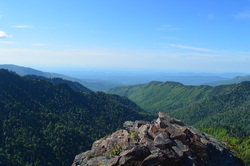
Kephart Prong, named after Horace Kephart, is one of the major tributaries of the Oconaluftee River. The headwaters of Kephart Prong are on the south side of Mount Kephart near the Appalachian Trail. This gorgeous balloon hike takes you from the confluence of Oconaluftee River and Kephart Prong deep into the Kephart Prong drainage, and then up a climb that will get your heart pumping all the way to Charlie's Bunion, a breathtaking vista of the Tennessee side of the Smokies and into the Tennessee River Valley. Your return route takes you past more views and even a couple waterfalls. This hike occurred on Saturday, May 23rd, 2015. My plan was to hike the Kephart Prong Trail to its terminus, and then continue on the Grassy Branch Trail. From there, I would take Dry Sluice Gap Trail to the Appalachian Trail, and take the Appalachian Trail over Mount Kephart and past Charlie's Bunion. I would continue by descending down Sweat Heifer Creek Trail and finishing the hike by going back down Kephart Prong Trail.
R/T Length of Trail: 14.5 Miles
Duration of Hike: 9:30 Type of Hike: Lasso Difficulty Rating: 8 out of 10 Pros: Very good pathways throughout the entire hike; very well-graded ascents and descents; spectacular views Cons: Horse usage Scenic Views: Charlie's Bunion - 10 stars; Old Charlie's Bunion Vista - 8 stars Water Features: Sweat Heifer Creek Falls - 3 stars; Unnamed waterfall on tributary of Sweat Heifer Creek - 1 star Trail Blaze Color(s): Appalachian Trail - White; Other Trails - None Best Season(s) to Hike: Winter; Spring Beginning Point: Kephart Prong Trailhead Directions: From Cherokee, NC: Follow US Route 441 North for approximately 10 miles. The parking pullout will be on the right at a footbridge across Oconaluftee River. There is a Kephart Prong Trail sign at the footbridge too.
This hike is surely one of the finest in the Great Smoky Mountains National Park. While most folks consider the Alum Cave Trail to be the best in the park, my opinion is different. While the Alum Cave Trail is good, the peaceful (for the most part) and spectacular hike described here deserves considerably more attention than it currently does. The classical approach to Charlie's Bunion can get a bit too crowded, right? No problem. The routeThe described here visits the same vista in an nontraditional way, and encounters the busy, crowded section for only a couple miles, with the rest being on great, little-used trails.
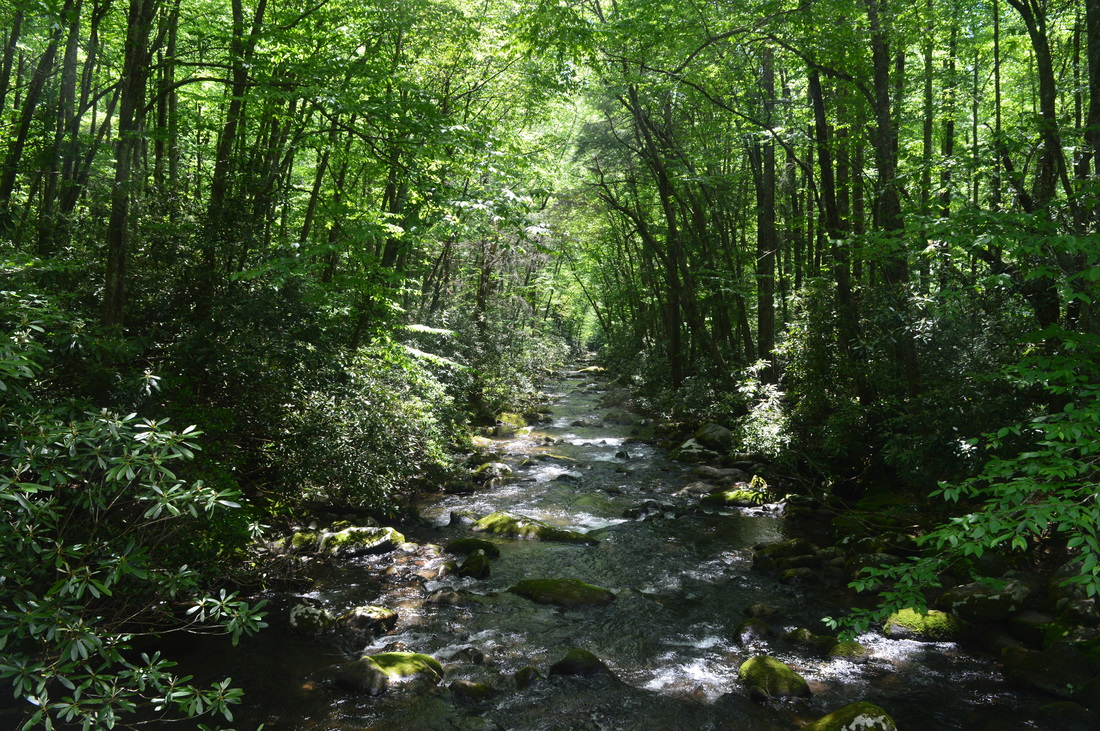
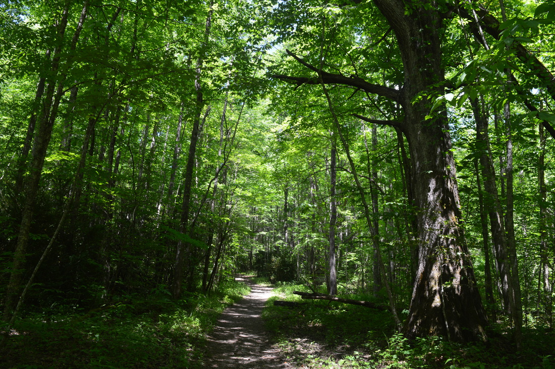
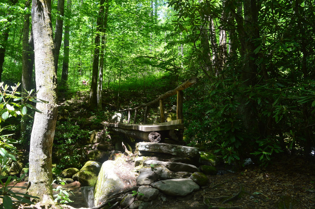
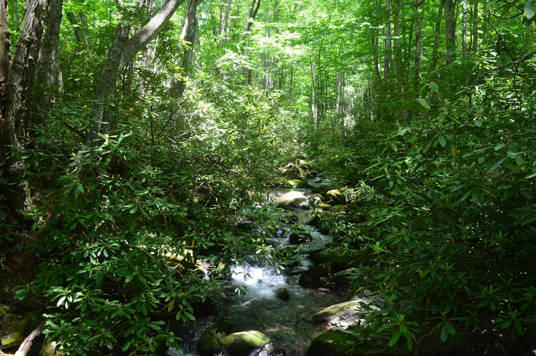
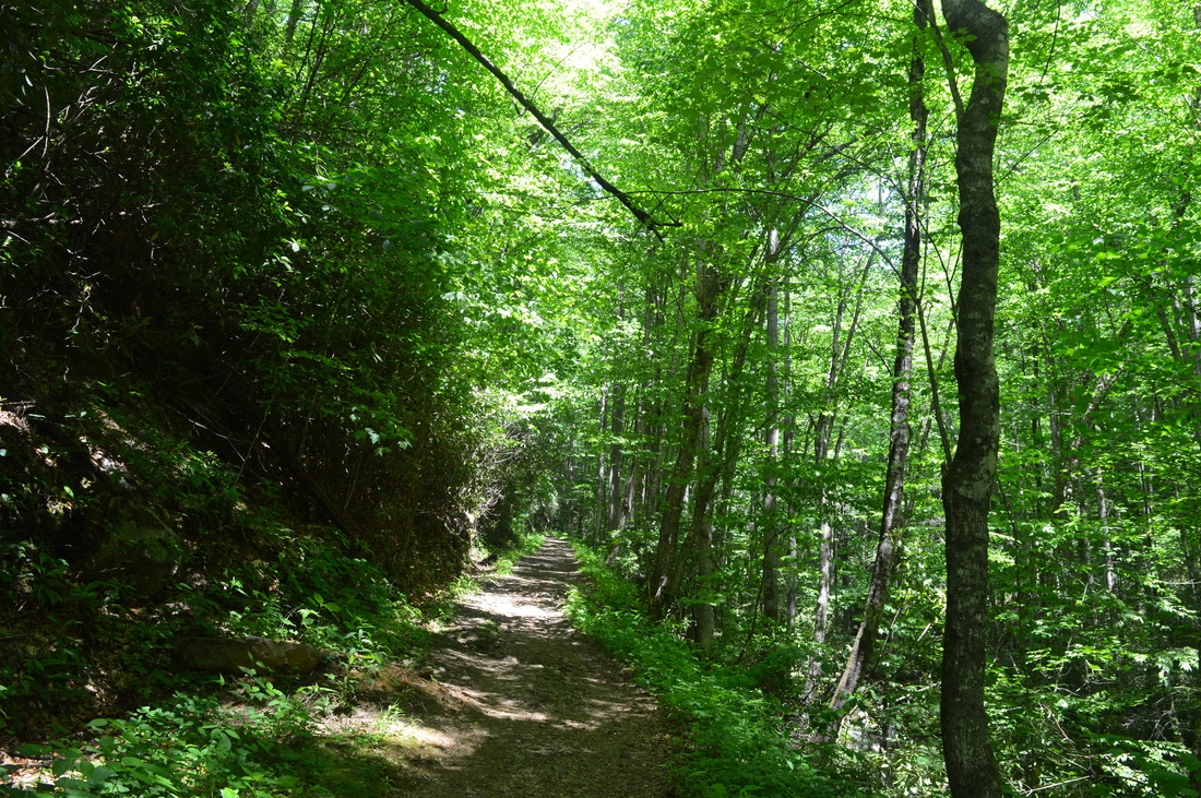
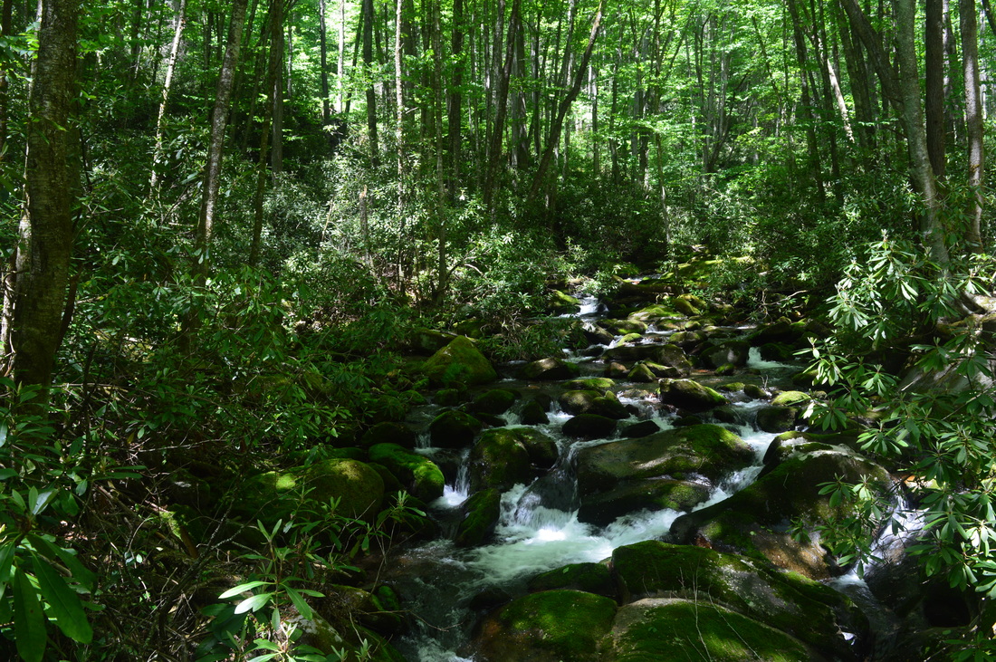
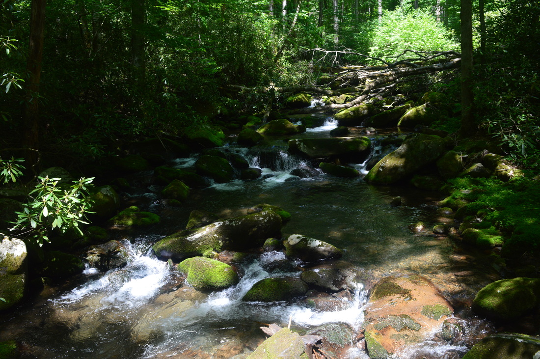
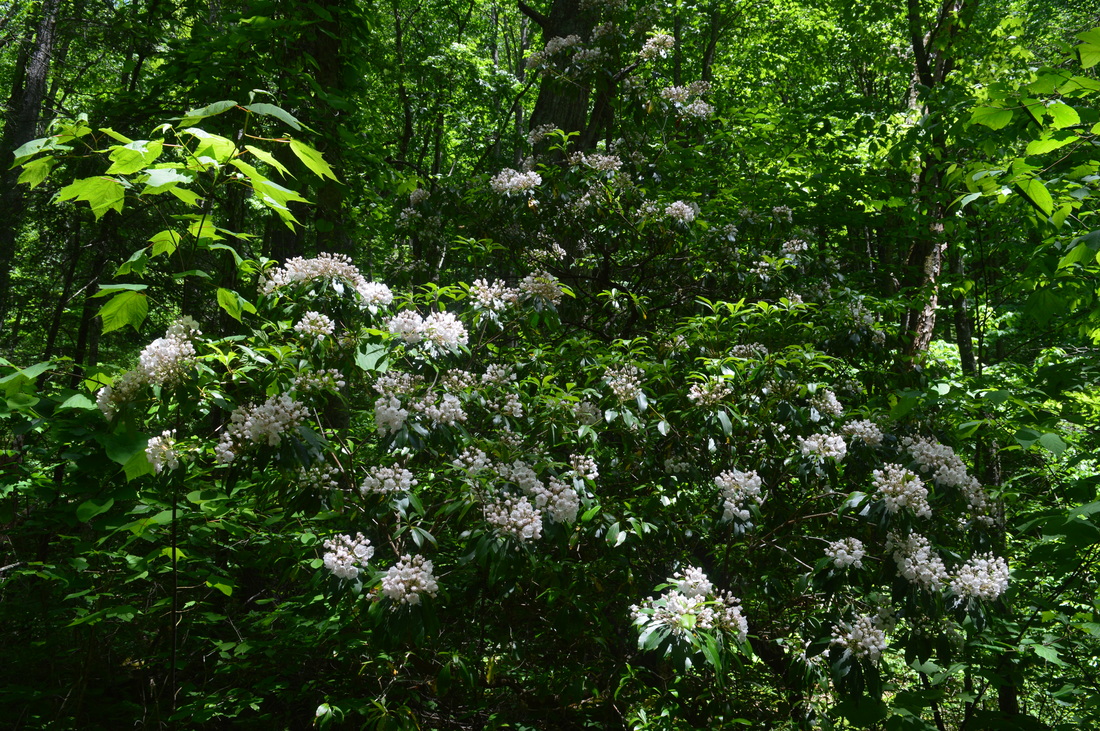
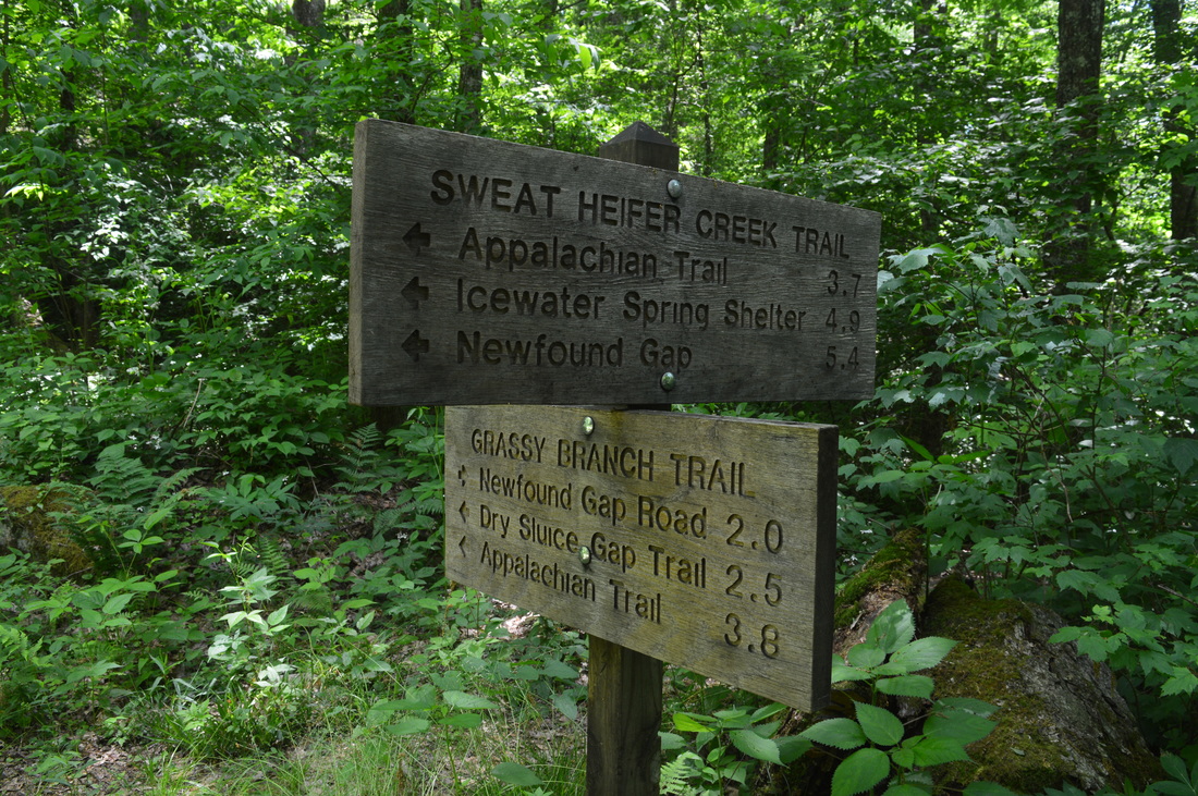
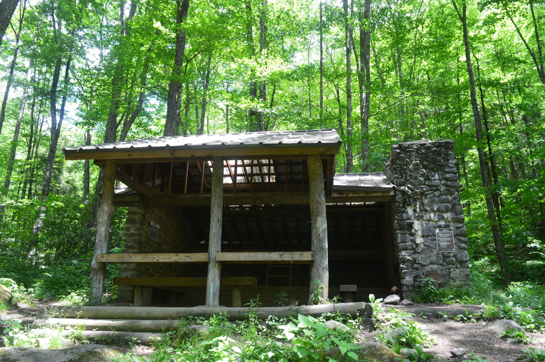
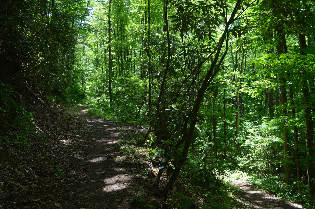
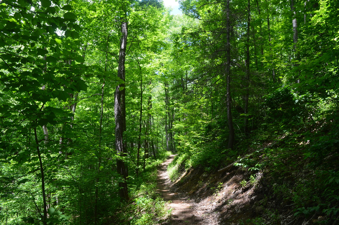
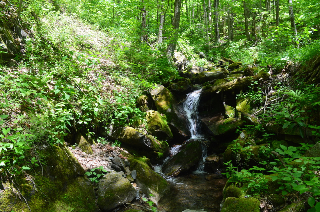
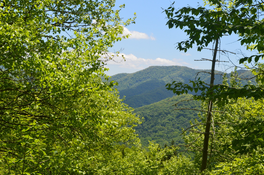
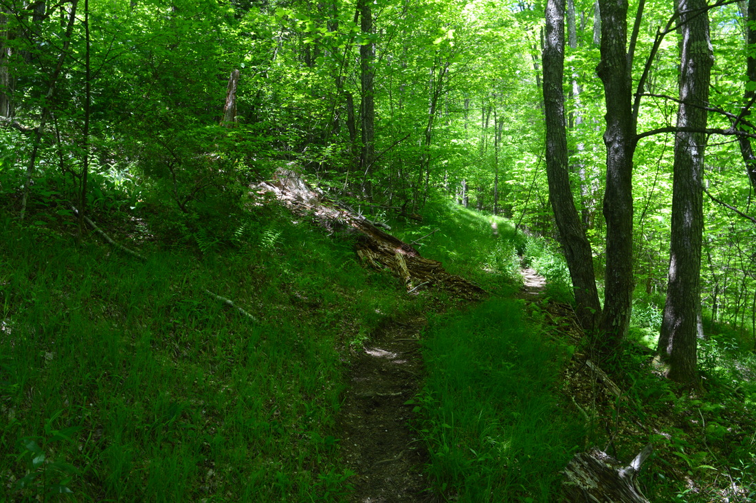
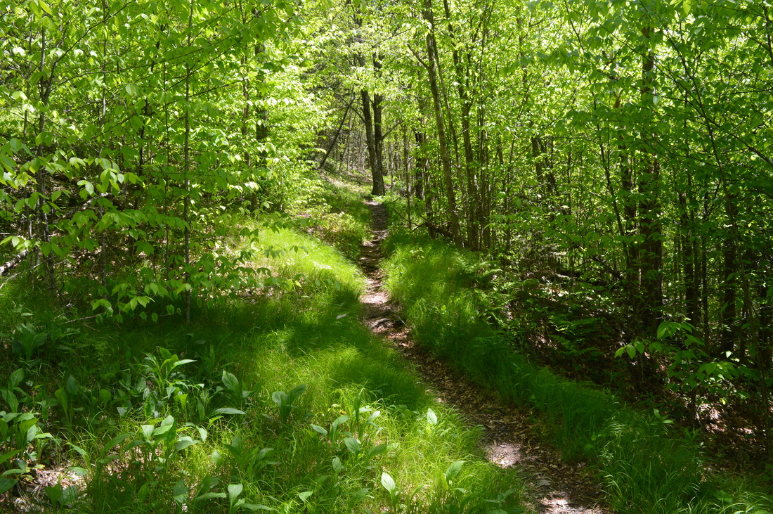
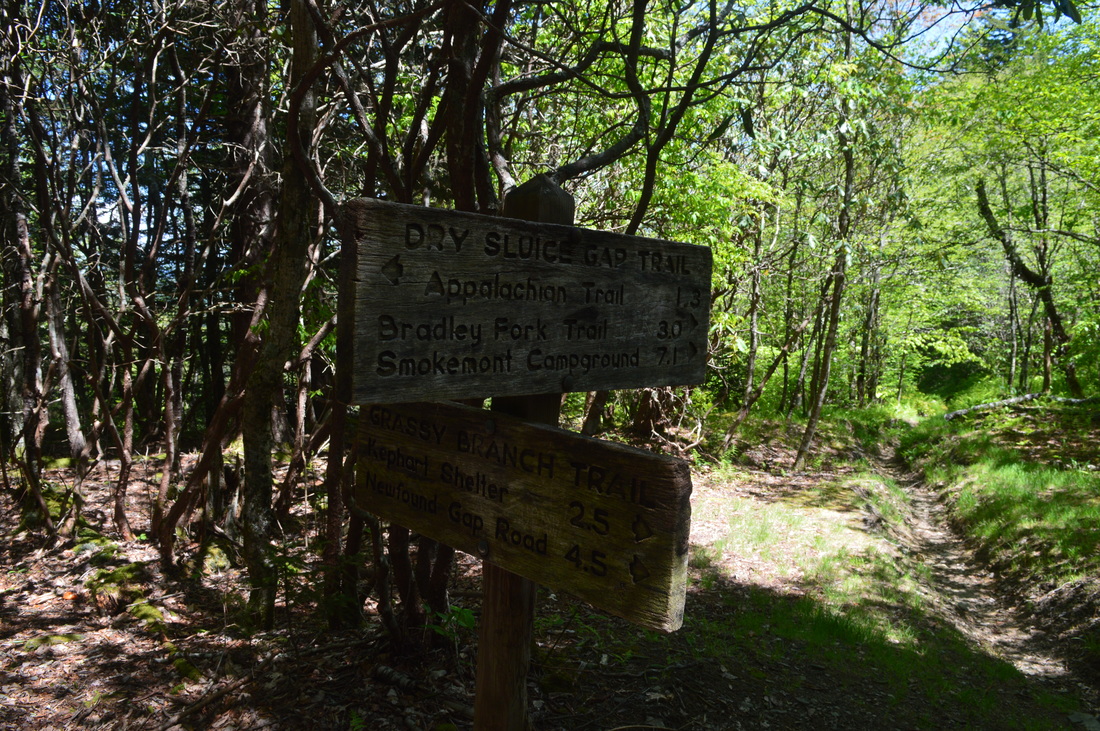
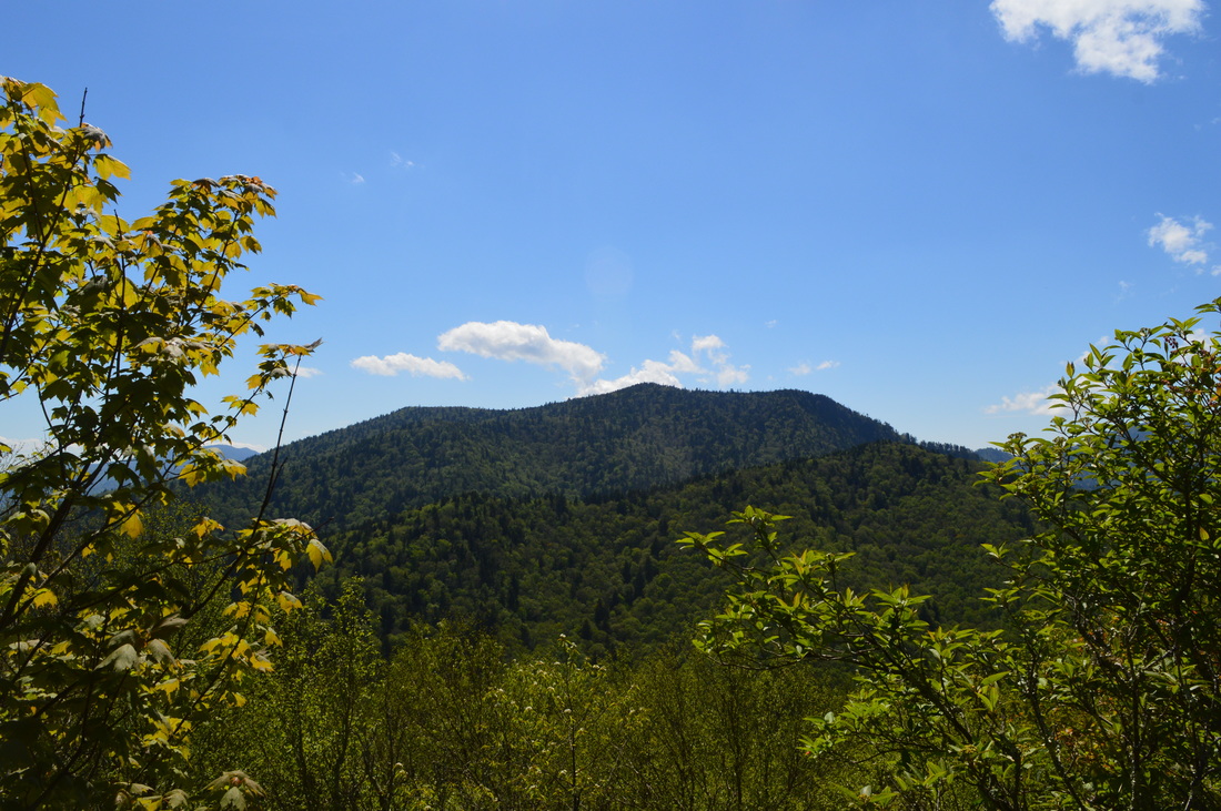
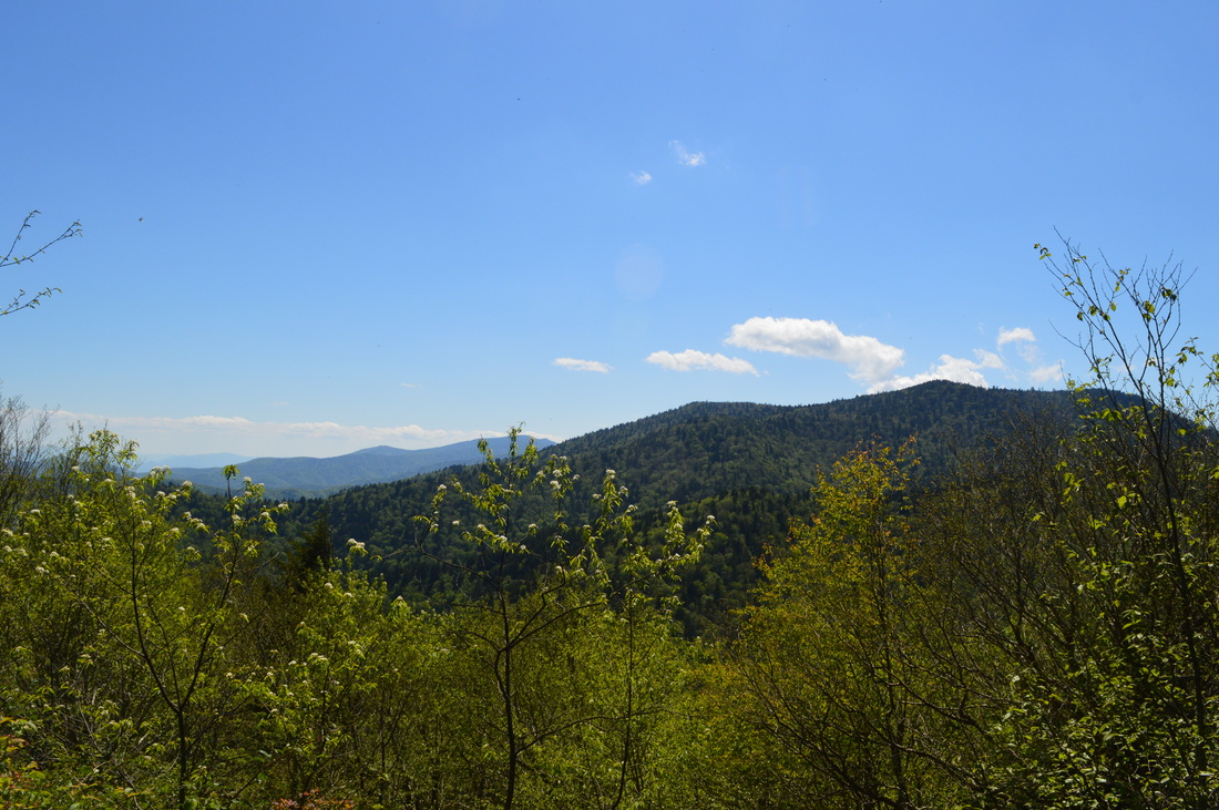
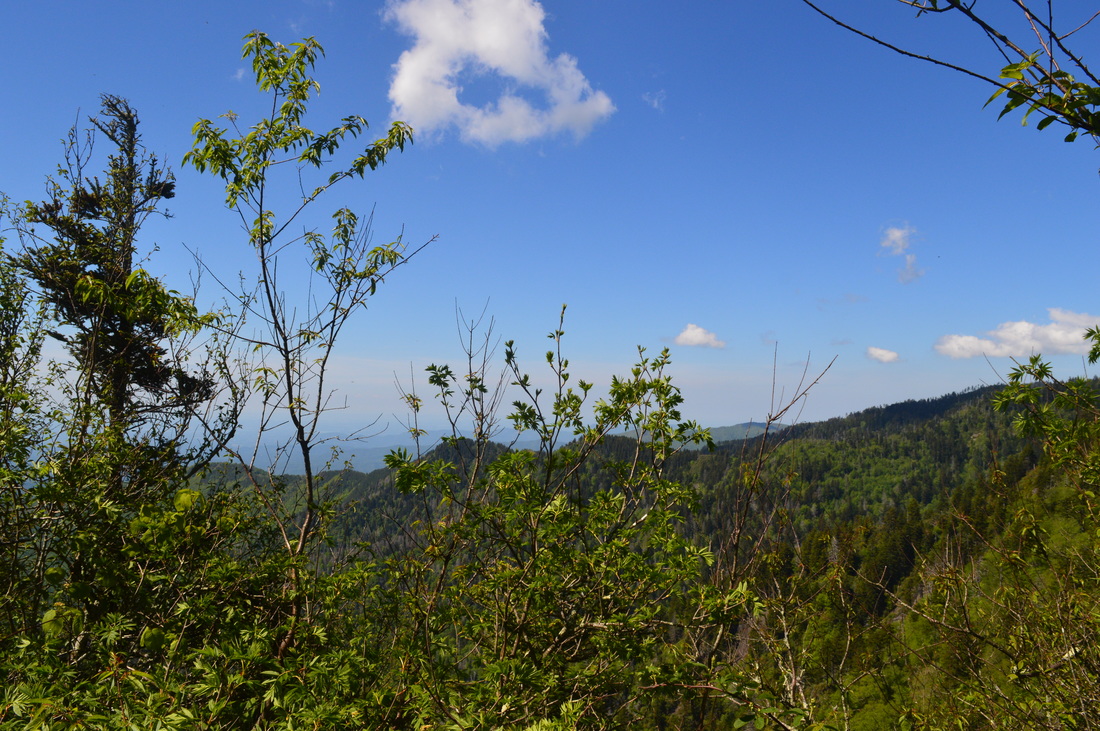
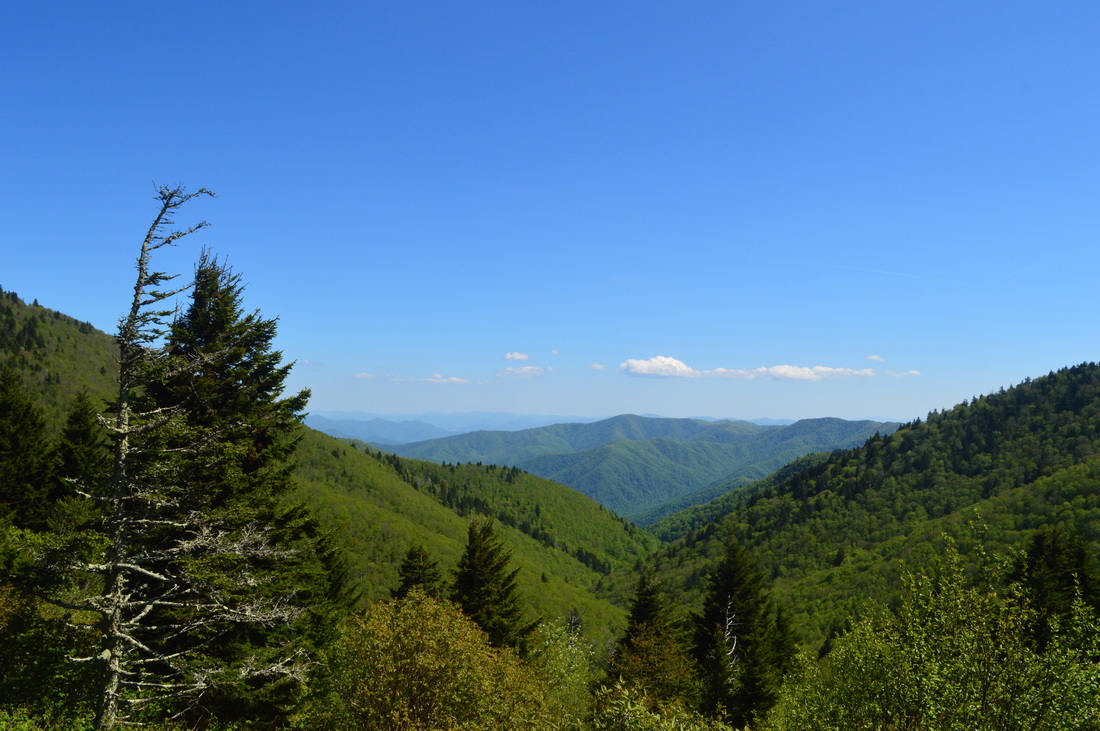
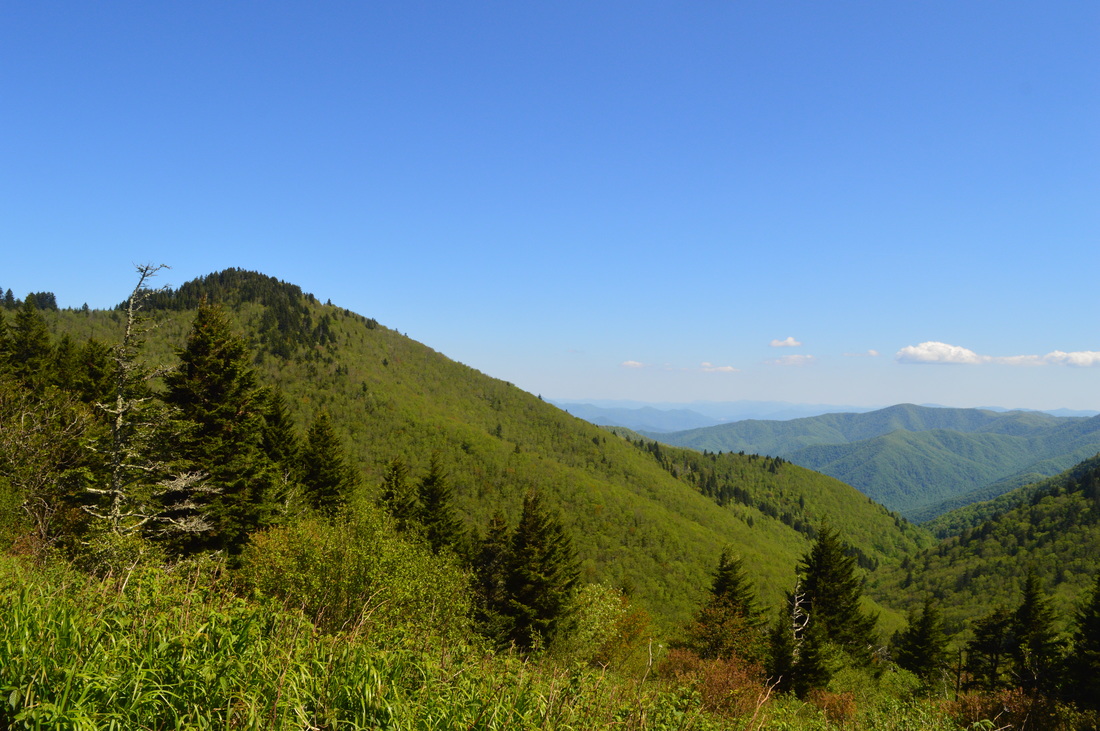
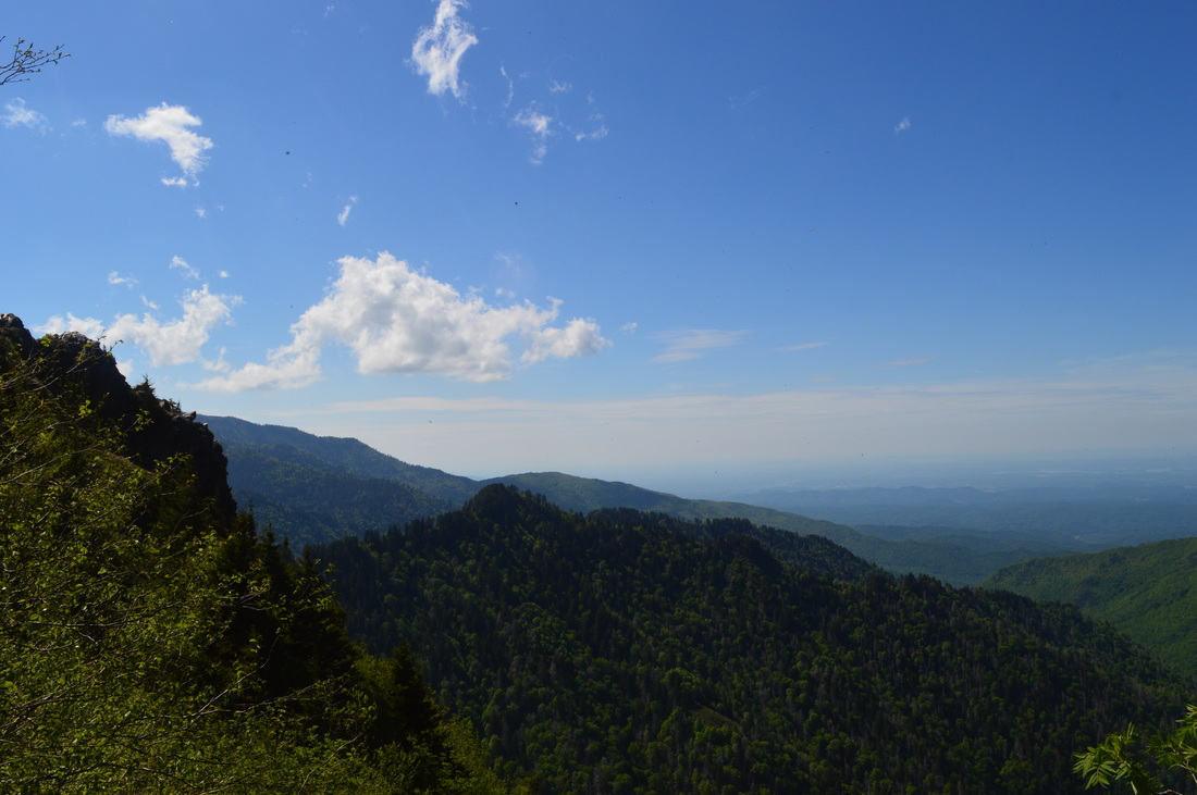
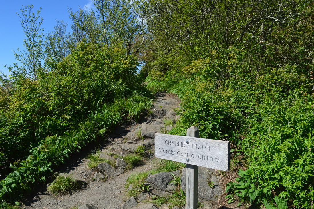
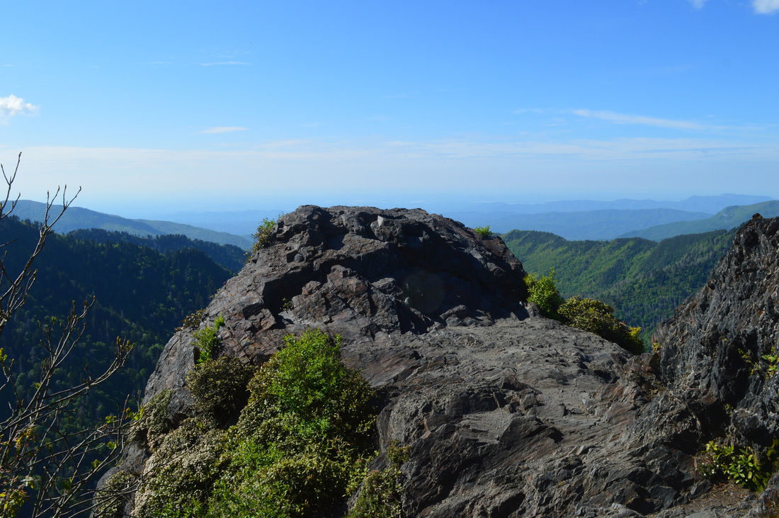
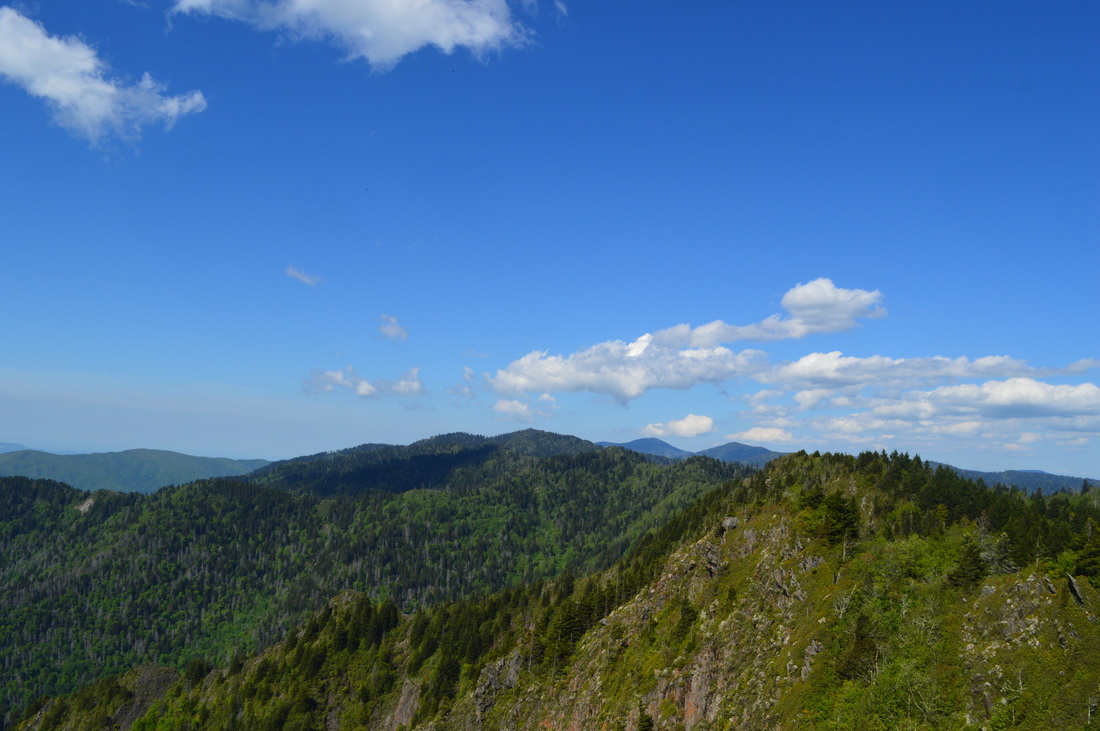
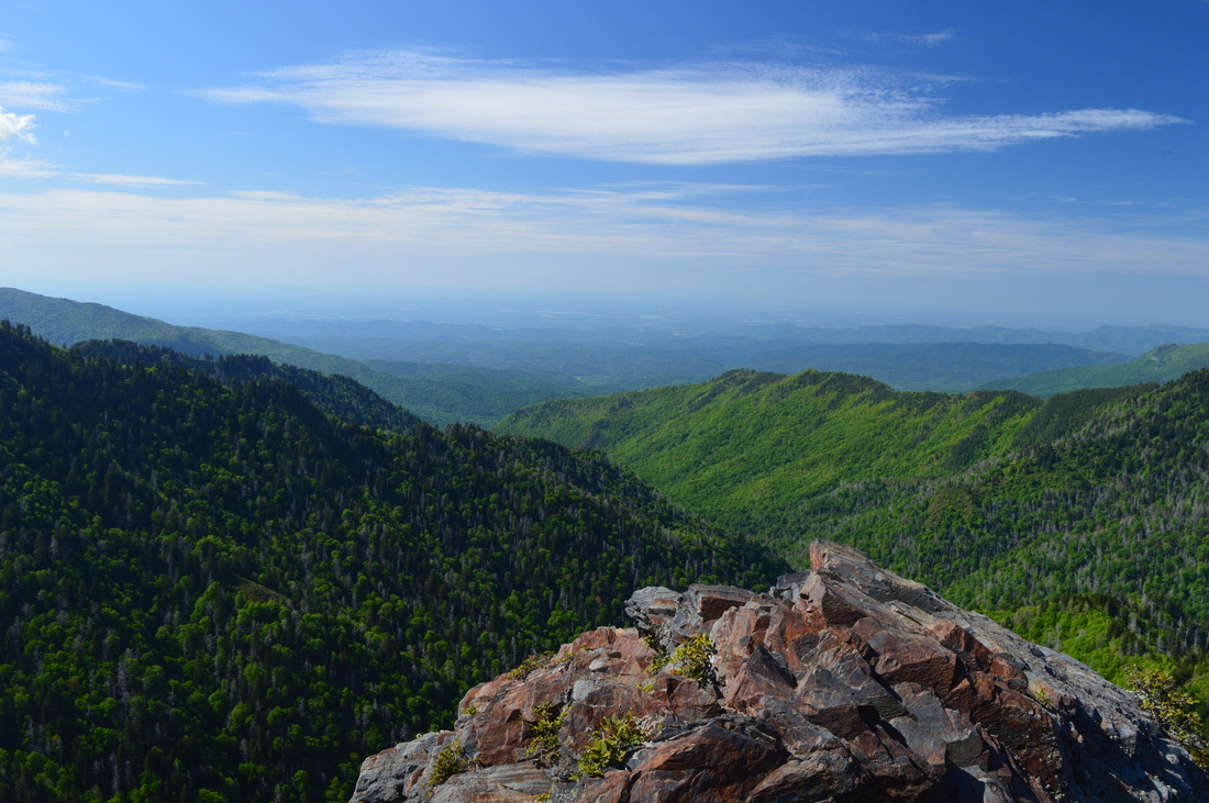
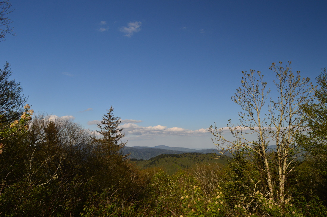
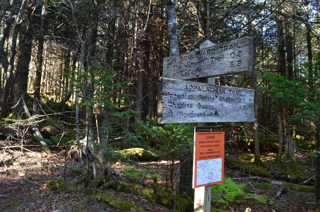
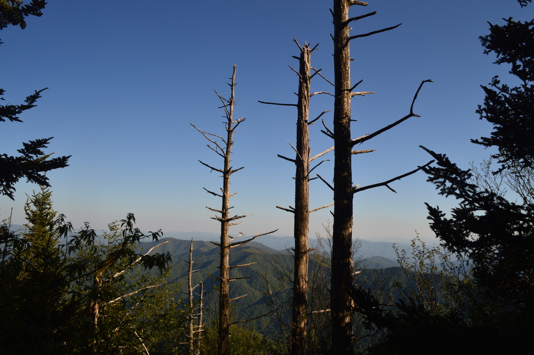
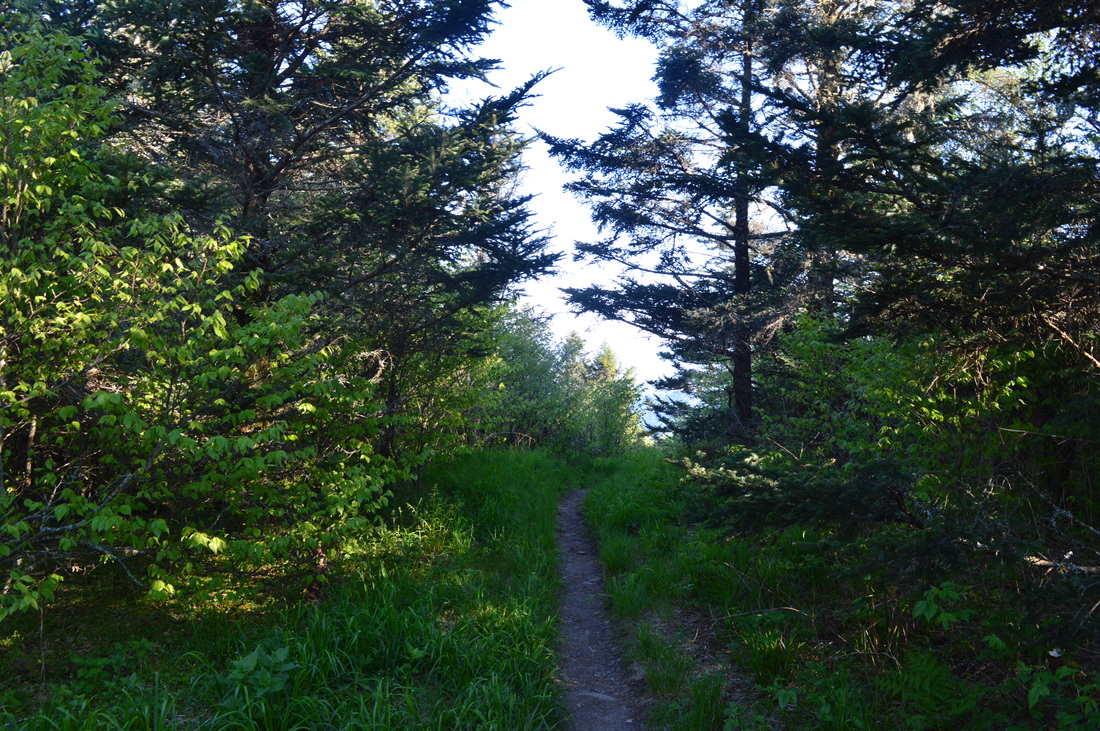
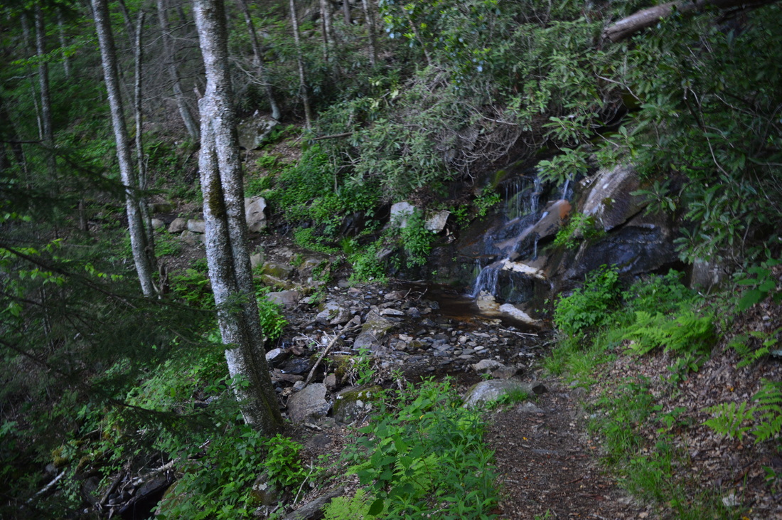
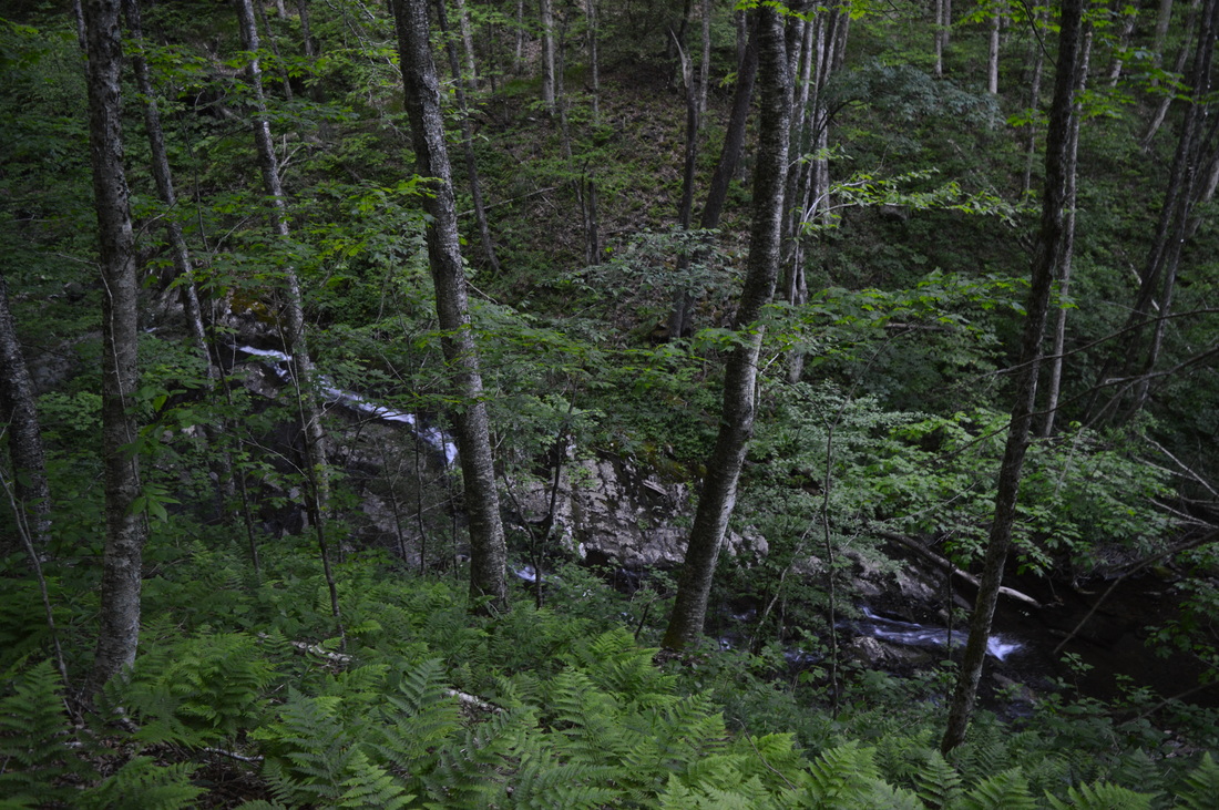
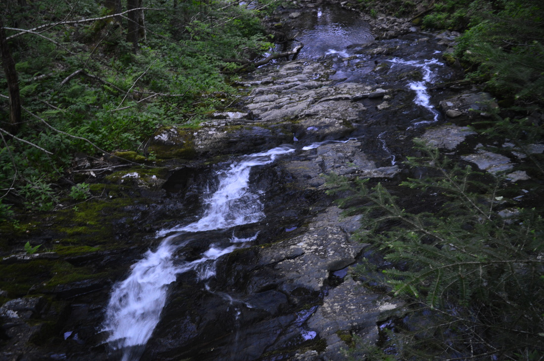
The hike starts with a footbridge crossing of the boulder-filled Oconaluftee River. The boulders have a green tint due to algae and moss - it is a common appearance in most streams and rivers throughout the Smokies. Following the footbridge, the trail is in the form of a wide, gravel old road. There is one spot shortly after the start where there are some traces of pavement. At first, the trail follows the Oconaluftee River, which lies on the left. There are a couple side paths to the river with views of cascades. But then, the trail leaves the river, and at 0.1 miles, cross the first of four footlogs over Kephart Prong. This isn't quite a footlog, as it has been modified to look like a footbridge with wooden boards. From here on, you will be closely following Kephart Prong until the terminus of Kephart Prong Trail at Kephart Shelter. Also, each footlog has a bypass with a ford for horses. For the first one, the bypass is just before the footlog, to the left of the trail. The trail then climbs at an easy grade along the scenic stream. In winter, many cascades can be clearly seen, and some can be seen in summer too. At 0.4 miles, reach the second footlog. The horse bypass is obvious here, as it is right alongside the footlog. This footlog, along with the last two, is classical for the Smokies, unlike the first one. At 0.6 miles, reach another footlog area. The trail seemingly goes ahead to ford the stream, but that is the horse bypass, or in this case the horse trail. The hiking trail/bypass turns right and ascends up some roots and past boulders to cross a footlog upstream from the horse ford. This footlog is close, but it is not visible from the ford. Shortly afterwards, rejoin the main trail and continue climbing easily alongside the stream. After crossing a couple small side streams, cross the fourth and final footlog at 1.4 miles over Kephart Prong just below Sweat Heifer Creek ties into the main stream. Again, the horse bypass is right by the footlog and is obvious. After some more easy climbing, reach the Kephart Shelter and the start of the loop at 1.7 miles. Here, Kephart Prong Trail terminates. The Sweat Heifer Creek Trail continues straight and will be your return route. The Grassy Branch Trail departs to the right. The shelter lies straight past the junction on the Sweat Heifer Creek Trail, and it is easily visible from the junction. To hike the loop the way I did it, turn right onto Grassy Branch Trail. However, please note that doing it the opposite way will feature a slightly shorter distance of ascent. While the namesake of Grassy Branch Trail is probably Grassy Branch of Kephart Prong. While the trail never comes close to Grassy Branch, there are a few views of it occasionally, mainly in the lower part of the trail. The trail starts a moderate scent with switchbacks. There are a couple unofficial shortcuts of the switchbacks - please do not use them. The climb is well-graded and moderate. There will be many winter views along the trail, and occasional summer views. There are several limited summer views to the north of Mount Kephart and the ridge that the Appalachian Trail follows. Along the way up, you will cross several small streams, including Lower Grassy Branch. At the Lower Grassy Branch crossing, look for a small cascade on the right. After a long climb, reach the terminus of the Grassy Branch Trail at Dry Sluice Gap Trail at 4.4 miles. The junction is in a gap on the Richland Mountain ridge. The Richland Mountain ridge is a long ridgeline that runs from the TN/NC state line to near the confluence of Bradley Fork and Oconaluftee River. While the bulk of the climb is over, there's still over a thousand feet left to climb. The Dry Sluice Gap Trail goes to the left and also bears diagonally right, downhill. If continuing to the right, you will reach Bradley Fork Trail and its namesake waterway in 2.9 miles. This hike turns left to continue the ascent up Richland Mountain, although the grade becomes gentle and easy. At first, you'll be ascending directly along the ridge, but soon, the trail veers left to follow the contours of the hill. Both this trail and the Grassy Branch Trail is perfect for viewing spring greenery - thus, this hike is good or both winter (winter views) and spring (spring greenery). As the elevation increases, some glimpses of mountain views appear to the south and west. Skirt an unnamed knob on the ridge, and then reach a temporary end of the climbing in an open area with great westward views at 5.4 miles. Mount Kephart, Masa Knob, and Charlie's Bunion are all visible from here. Charlie's Bunion is a prominent rock outcrop visible almost straight ahead. It looks significantly lower than Mount Kephart, which can be seen farther to the left. Following this vista, the trail begins to descend steeply on a rocky and rooty path. Drop into a gap dominated and join the ridge with some easterly views. There is a spruce/fir forest here - something you'll see several more times on this hike. After bypassing a small knob, reach the terminus of Dry Sluice Gap Trail at the Appalachian Trail at 5.9 miles. This is near Dry Sluice Gap. A right turn on the Appalachian Trail would lead towards the Tricorner Knob area, Mount Guyot, and eventually Mount Camerrer. This hike turns left here towards Charlie's Bunion, Mount Kephart, and eventually Newfound Gap. After passing over a short knife-edge ridge section with great northerly views, begin an ascent to Charlie's Bunion. At 6.1 miles, enter an open, bald-like area with a very nice southerly vista. This was originally known as Charlie's Bunion, before the spur trail to the present-day vista was built 0.3 miles farther on. From this vista, Richland Mountain is visible on the far left, and Thomas Divide, with the highest peak being Newton Bald, visible straight ahead. If you are coming to Charlie's Bunion from Newfound Gap, I highly recommend continuing to this vista. It's the best southerly vista on the hike. There are no southerly views from Charlie's Bunion. After this vista, continue a gentle ascent. Soon, pass a warning sign. There is a small vista on a side trail on the right. At 6.4 miles, reach the spur trail for Charlie's Bunion. Turn right onto this spur trail. The short trail follows a cliff edge with spectacular views. Reach the end of the spur trail at a large rock outcrop with breathtaking, panoramic views of the Tennessee side of the Smokies. To the left is Mount Kephart and Mount LeConte; straight ahead is the Tennessee River Valley; and on the right, countless ridges lead up to what I believe is Mount Guyot. Also, the "old" Charlie's Bunion, where you just were, is visible to the right, although there is no trail to its top from the Appalachian Trail. From Charlie's Bunion, retrace your steps back to the Appalachian Trail and continue following it towards Mount Kephart. Make a brief climb skirting Masa Knob, and then reach a gap with some more views. From here, begin a steady climb to Mount Kephart through a dark forest on a somewhat rocky trail. At 7.4 miles, pass Icewater Spring, named for its year-round ice cold waters. It is located right on the trail. At 7.5 miles, reach a spur trail to Icewater Springs Shelter. This shelter was full on my visit, due to the popularity of this section of the Appalachian Trail. From the shelter, there is a nice eastward view of many mountain ridges. From Icewater Springs Shelter, continue ascending along the flanks of Mount Kephart. The trail bypasses the summit, but it still breaks the 6000-foot mark enroute to the slightly lower Mount Ambler. At 7.8 miles, amidst a spruce/fir forest, reach a junction with the Boulevard Trail. The Boulevard Trail heads right to Mount LeConte. An extra mile roundtrip will take you to The Jumpoff, an excellent vista, if you turn right. The main trail bears left. Reach the summit of Mount Ambler and the end of the climb (finally) at 8.1 miles. From here on, it is all downhill to the end of the hike. The Appalachian Trail starts descending moderately from the summit. There are a couple southerly vistas on the left, but none are as good as the one near Charlie's Bunion. At 8.7 miles, reach the junction with Sweat Heifer Creek Trail in a gap. Turn left here, as the Appalachian Trail continues straight to Newfound Gap. The Sweat Heifer Creek Trail starts off gently descending through a grassy area - the trail is a little overgrown with grass here but still easily visible. There are a few southerly views. Then, make a switchback and leave the grassy area, entering the woods. The Sweat Heifer Creek Trail is a very well-constructed trail, with rock and wooden staircases and erosion control structures. On the way down, there are several small seeps encountered, but generally, there's nothing worthy of mention here. In winter, there are great southern views, and even some limited views are seen in summer. At 10.7 miles, cross a tributary of Sweat Heifer Creek. There is a waterfall on the left. This waterfall is best seen after periods of rain. At 10.8 miles, reach and cross Sweat Heifer Creek on stepping stones. This crossing may be a problem after heavy rain, as the stones may be submerged. This crossing is at the middle of Sweat Heifer Creek Falls. The most scenic portion of it, in the form of a cascade, lies just upstream. The taller part of the falls, a long waterslide (best seen after periods of rain_, lies below the crossing and is harder to reach. Take a slim path along the creek just before the crossing for a top-down view. It may be possible to scramble further down, but I didn't have time for it. In winter, there may be a better view of the falls from the trail. Following the waterfall, the trail parallels Sweat Heifer Creek, but stays above the creek. There are more cascades below the falls that are visible best in winter. After rounding a lead, the trail descends somewhat steeply to Grassy Branch. Cross Grassy Branch on a footlog just above its confluence with Kephart Prong. Reach Kephart Shelter and the terminus of Sweat Heifer Creek Trail at 12.8 miles. Continue straight onto the Kephart Prong Trail the way you came from earlier, and reach the trailhead at 14.5 miles. To summarize, this is an excellent hike that displays the true colors of the Great Smoky Mountains. The major elevation change and length of the hike may deter some folks, but for those who think this hike is in their physical capabilities, I highly recommend doing it, especially instead of the more common approach to Charlie's Bunion. I rate this hike a "Best Hike". Below are my pictures and a video. I had a hard time picking out the best pictures, so you will find more than I regularly post here!
1 Comment
8/4/2022 06:17:42 am
Edirne baymak servisi en uygun fiyat ve en hızlı servis garantisi ile sizlerle. https://www.edirneklimaservisi.com/edirne-baymak-servisi/ Leave a Reply. |
About MeMark Oleg Ozboyd Dear readers: I have invested a tremendous amount of time and effort in this website and the Georgia Waterfalls Database the past five years. All of the work that has gone in keeping these websites updated with my latest trip reports has almost been like a full-time job. This has not allowed me to pick up a paid job to save up money for college, and therefore, I I've had to take out loans. If you find the information on this website interesting, helpful, or time-saving, you can say "thanks" and help me out by clicking the button above and making a contribution. I will be very grateful for any amount of support you give, as all of it will apply toward my college tuition. Thank you!

Coming in 2022-2023?
Other Hiking WebsitesMiles HikedYear 1: 540.0 Miles
Year 2: 552.3 Miles Year 3: 518.4 Miles Year 4: 482.4 Miles Year 5: 259.9 Miles Archives
March 2021
Categories
All
|


 RSS Feed