Anyone who lives in the Southeastern United States must have a hike along the crest of Grandfather Mountain on their bucket list. No words or pictures can accurately describe or convey the rugged splendor of the Grandfather Crest. Part of Grandfather Mountain is still operated as a private attraction that does allow public access under a hefty fee and a number of restrictions, but most of the mountain is land owned by the state of North Carolina in the form of Grandfather Mountain State Park. One of the secondary trailheads for Grandfather Mountain is actually off the Blue Ridge Parkway, from which several trails lead to Calloway Peak - the highest point on Grandfather Mountain. From there, the Grandfather Trail makes a very rugged traverse over two other peaks - Attic Window Peak and MacRae Peak - with many technical rock scrambles, cable sections, ladders, and of course, outstanding views. The 360-degree vistas on Attic Window Peak and MacRae Peak are of the type that you would find in Montana or Colorado rather than North Carolina. Eventually, the Grandfather Trail descends into the mountain's private section, reaching Linville Peak (where additional views await) and one of North Carolina's best-known tourist attractions: the Mile-High Swinging Bridge. This hike occurred on Monday, July 10th, 2017. My plan was to hike the Tanawha Trail, Nuwati Trail, Cragway Trail, and Daniel Boone Scout Trail to the summit of Calloway Peak, passing Top Crag View, Flat Rock View, Lynn Cove Viaduct View, and an old plane crash. Then, I would follow the Grandfather Trail over Attic Window Peak and MacRae Peak to Linville Peak and the Swinging Bridge, making side trips to Watauga View and Indian House Cave along the way. My return route would be similar, but I would use the Underwood Trail to bypass MacRae Peak, and I would use only the Daniel Boone Scout Trail instead of the Cragway Trail and Nuwati Trail for a slightly easier descent back to the trailhead from Calloway Peak. This hike was the ninth of ten hikes that I did during a seven-day trip to the mountains of northwest North Carolina.
Summary
R/T Length of Trail: 11.9 Miles
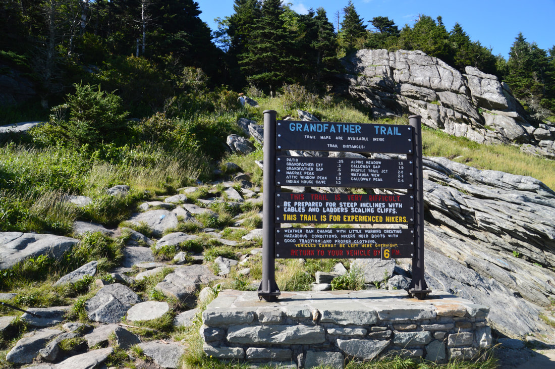
Duration of Hike: 12:30 (Yes, the hike is really this slow - although depending on how much you stop, it may take you a few hours less) Type of Hike: Out and Back (with small loop sections) Difficulty Rating: 10 out of 10 Total Elevation Gain: 3985 Feet Pros: Outstanding views (arguably the best vista hike in North Carolina) Cons: Challenging sections of trail with rock scrambles, cables, and ladders; crowds around the Swinging Bridge, Linville Peak, and MacRae Peak Points of Interest: Top Crag View - 6 stars; Flat Rock View - 6 stars; Lynn Cove Viaduct View - 5 stars; Calloway Peak Views - 9 stars; Watauga View - 10 stars; Attic Window Peak Views - 10+ stars; MacRae Peak Views - 10+ stars; Linville Peak Views - 10 stars; Other Views along Grandfather Trail - 10 stars collectively; Indian House Cave; 1978 Plane Crash Trail Blaze Colors: Tanawha Trail - White Feather; Nuwati Trail - Blue; Cragway Trail - Orange; Daniel Boone Scout Trail - White; Grandfather Trail - Blue; Underwood Trail - Yellow; Side Trails to Vistas - None Best Seasons to Hike: Fall Fees: None Beginning Point: Boone Fork Parking Area Directions from Blowing Rock, NC: From the intersection of Valley Boulevard (US 321/US 221 North) and Blowing Rock Highway (US 221 South) in Blowing Rock, follow US 321/221 North for 0.8 miles to an exit ramp to the Blue Ridge Parkway on the right. Once at the Blue Ridge Parkway, turn right onto it and follow it for 8.3 miles to the signed Boone Fork Parking Area on the right. This medium-sized lot is at the trailhead for the hike. Map
Click the link below to download a .GPX file with a track of this hike.
Details
Grandfather Mountain. I've heard and seen the name for longer than I can remember - even back when I had just started hiking. The truth is, Grandfather Mountain is one of the most incredible unique mountains in the Southeast. There simply isn't any mountain ridge in the Southeast that is quite like the Grandfather Crest (although a few in the same area come close). Grandfather Mountain was the single biggest reason that I wanted to visit Northwest North Carolina. I was a bit leery about leaving the difficult hike on Grandfather Mountain for the last full day of my trip, but it worked out fairly well, and the hike was no less stunning and rewarding than I had expected! While I hiked the entire Grandfather Crest from the Boone Fork Trailhead, this is a very difficult hike, and folks who are looking for an easier way to see the full Grandfather Crest must start at the Swinging Bridge/Grandfather Mountain Visitor Center and hike out and back to Calloway Peak.
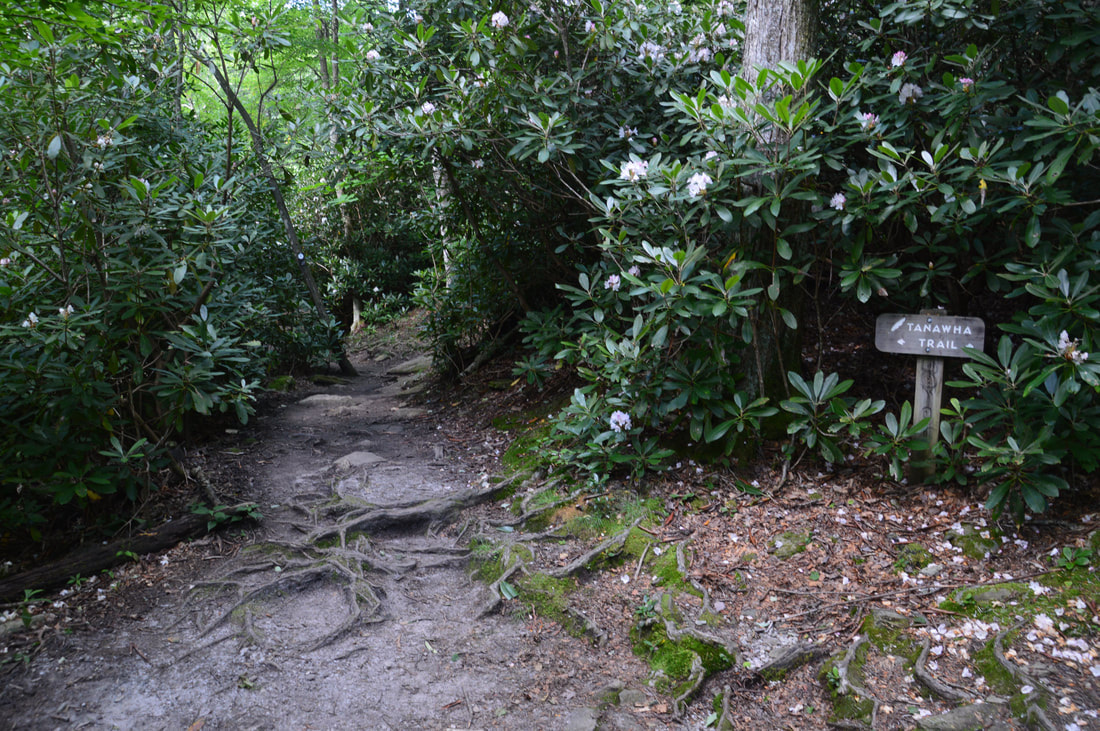
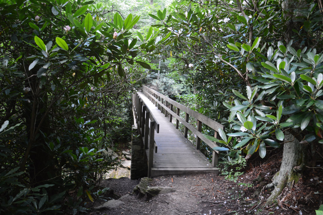
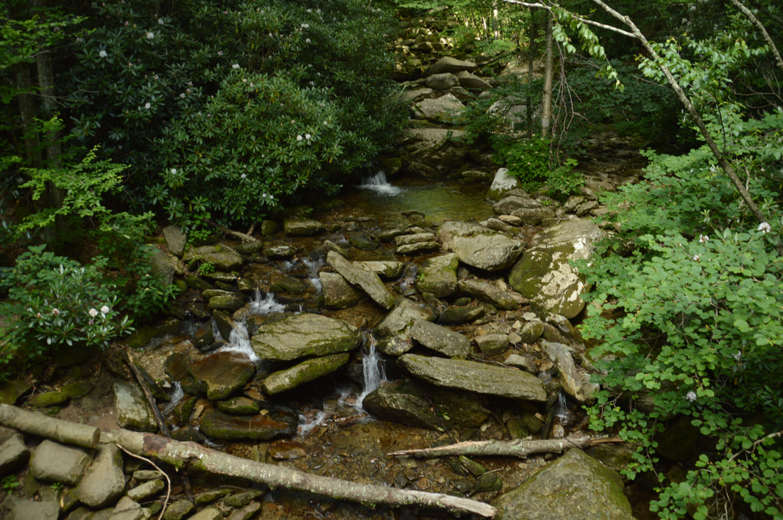
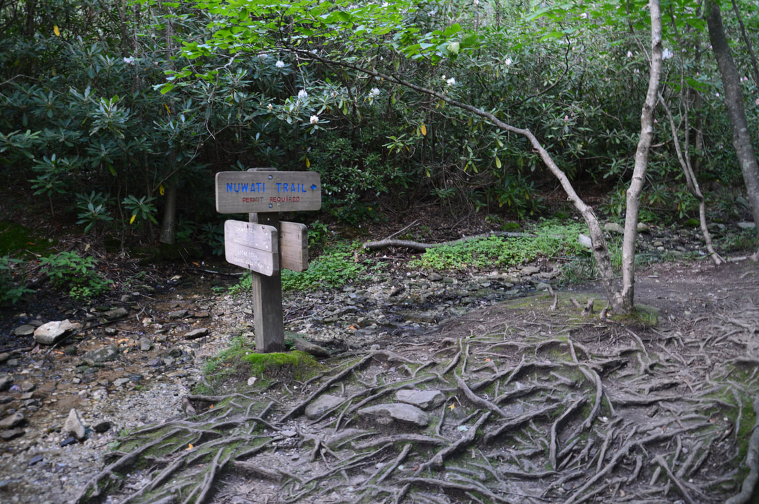
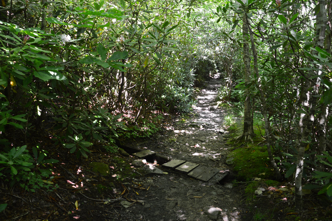
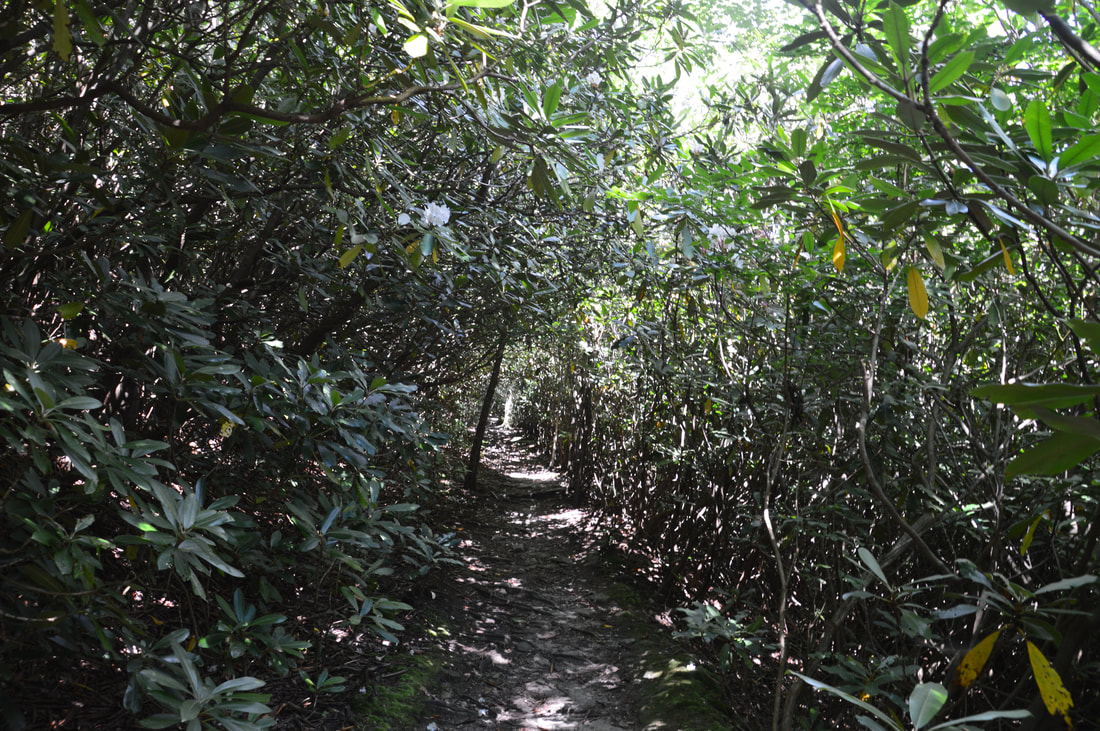
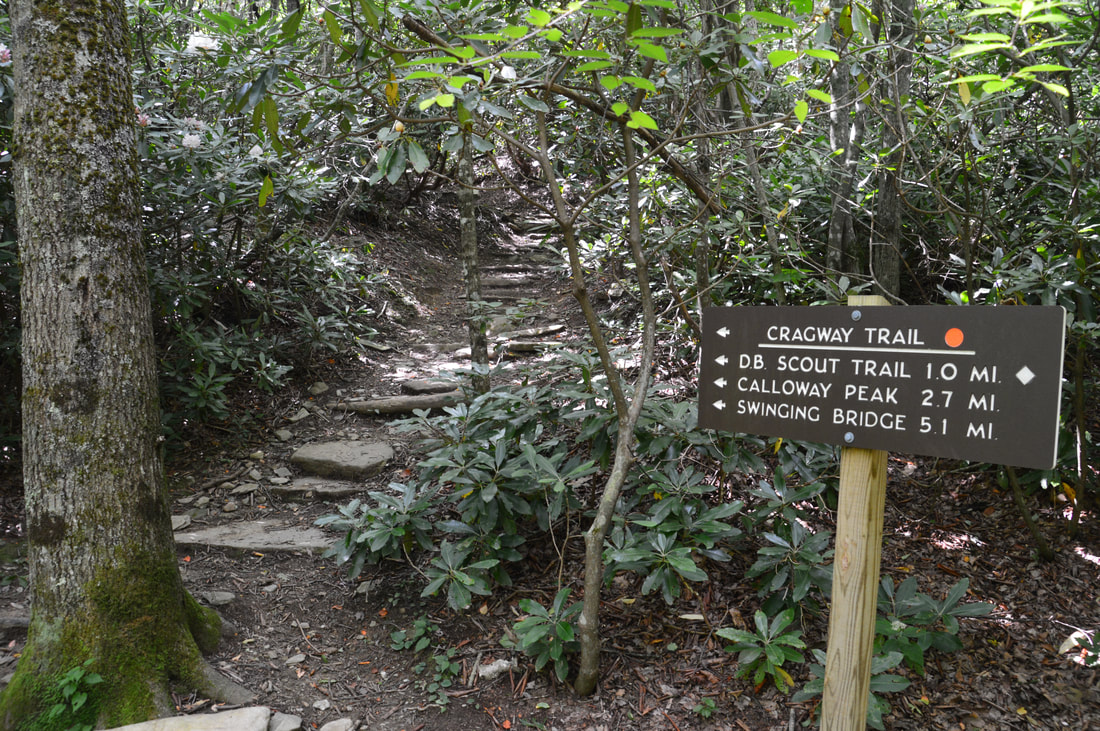
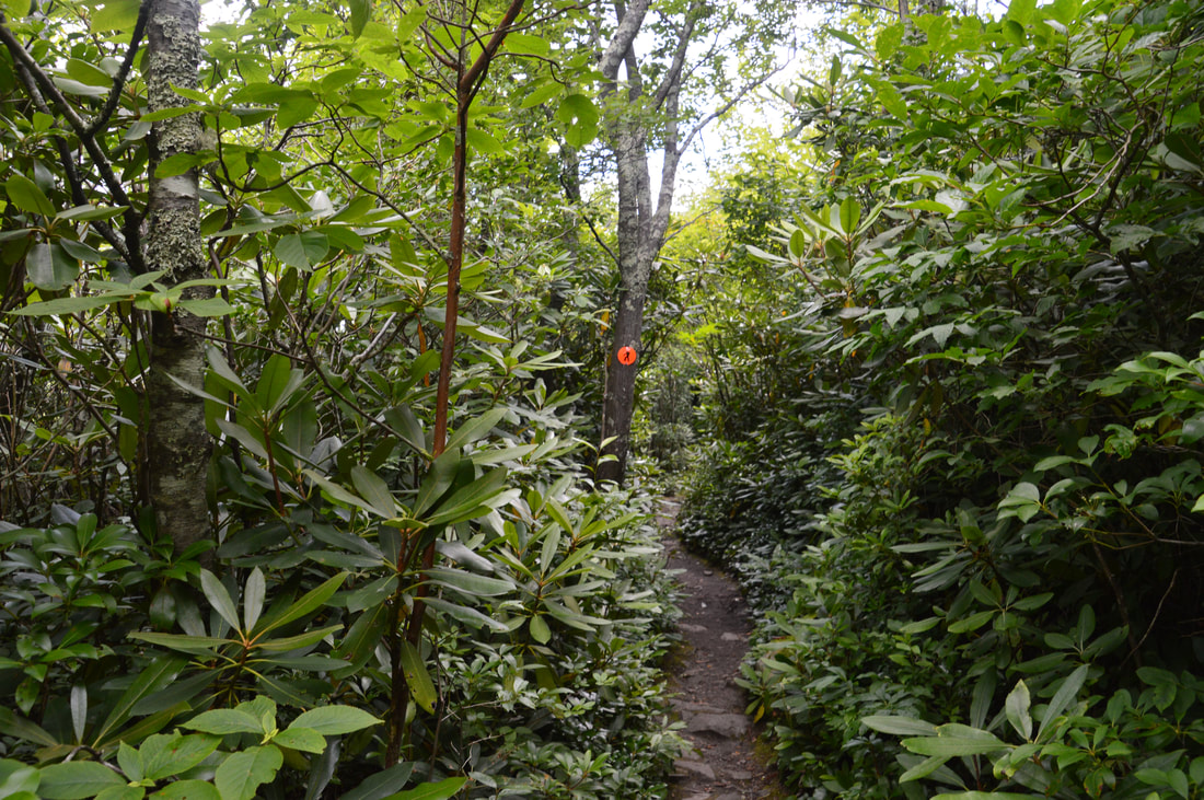
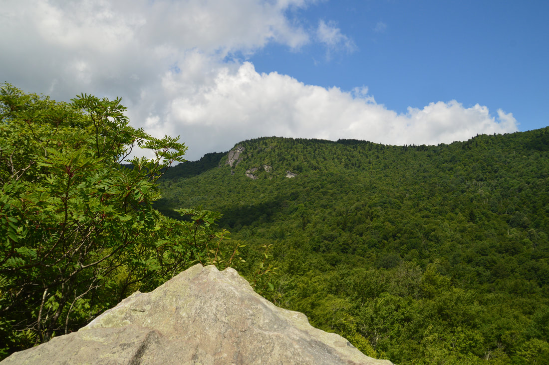
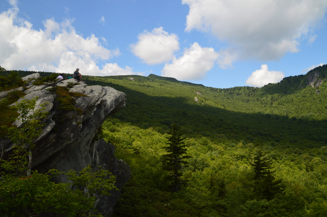
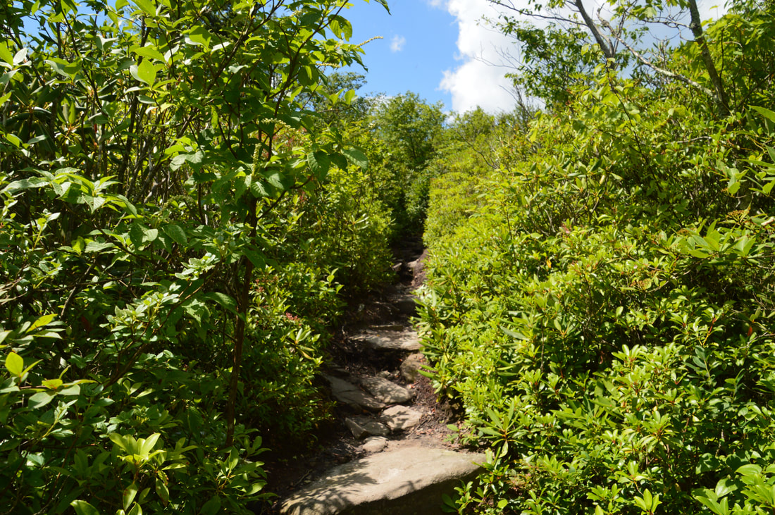
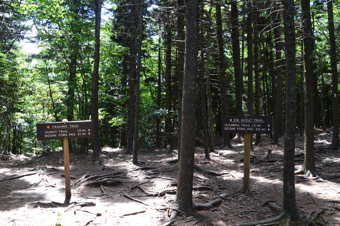
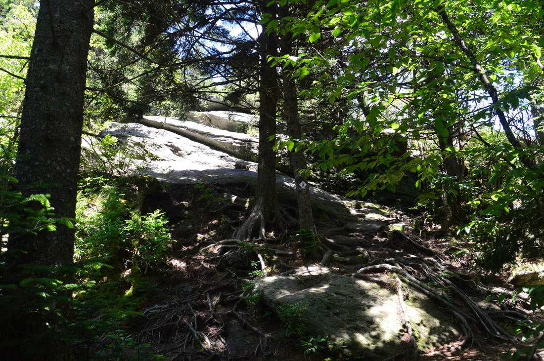
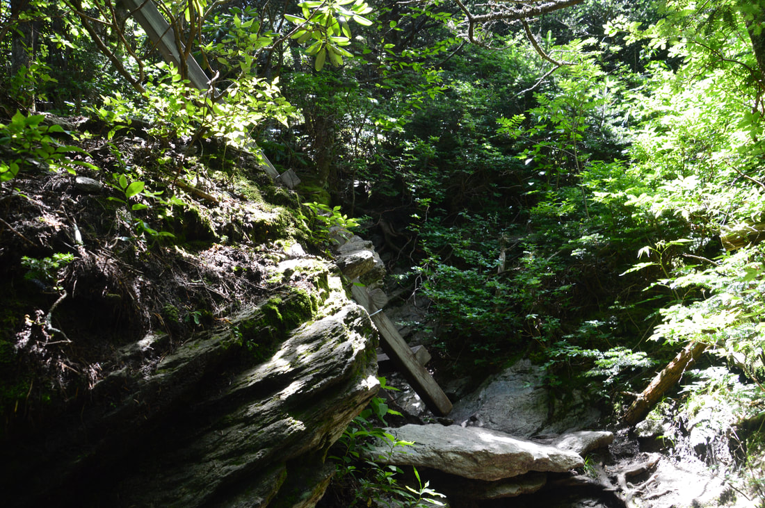
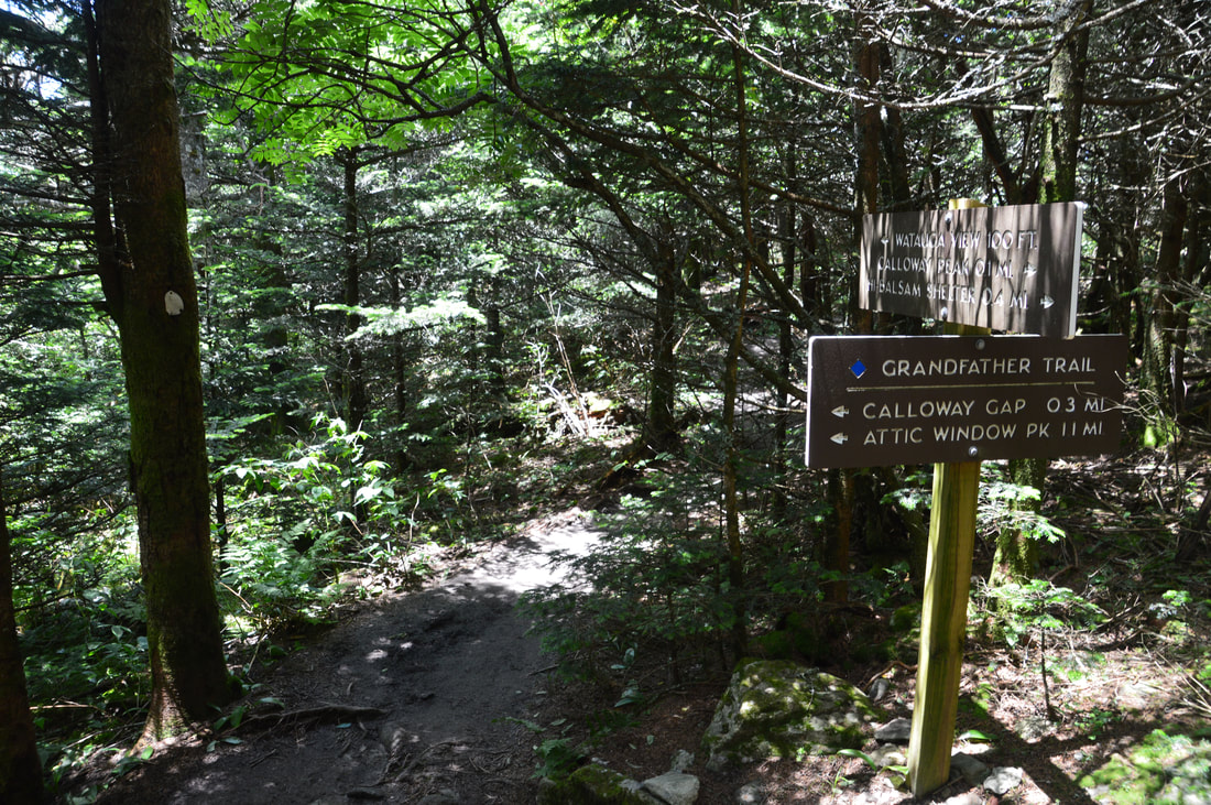
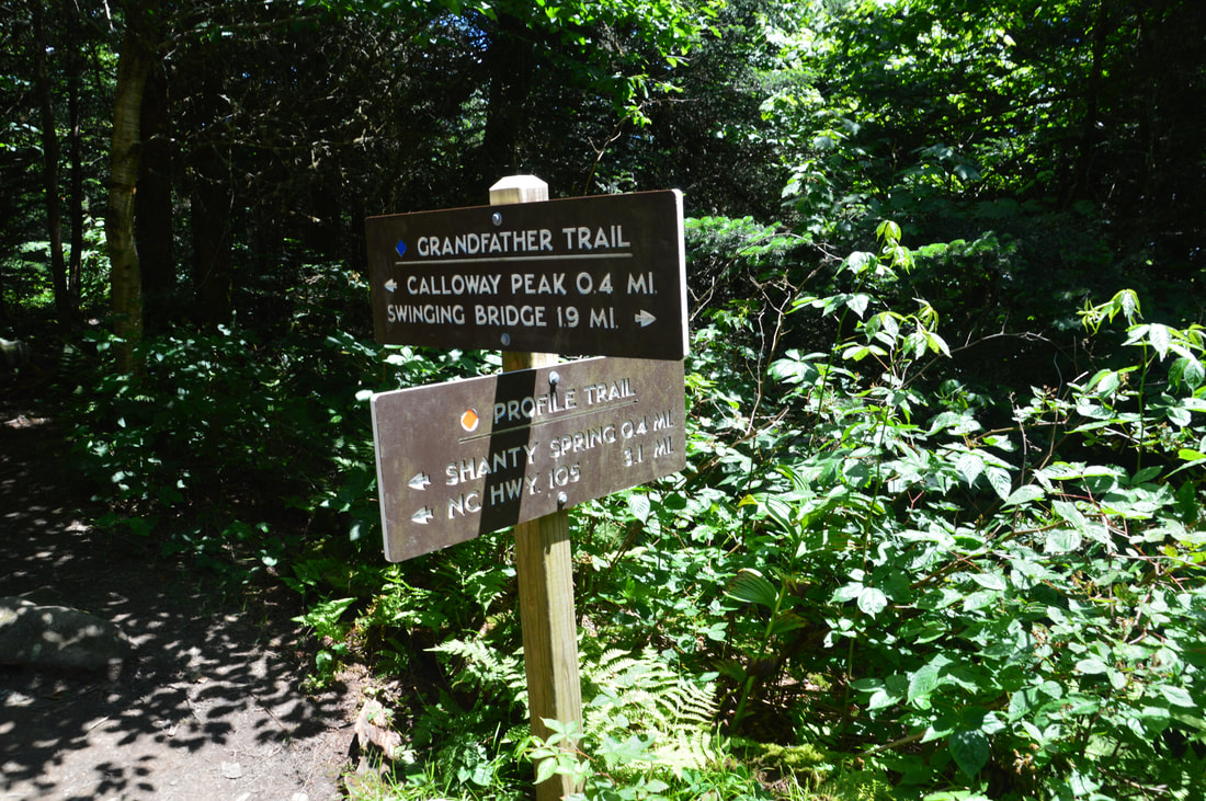
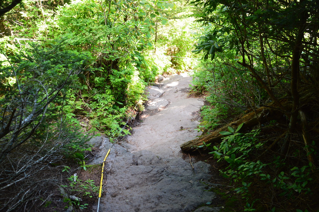
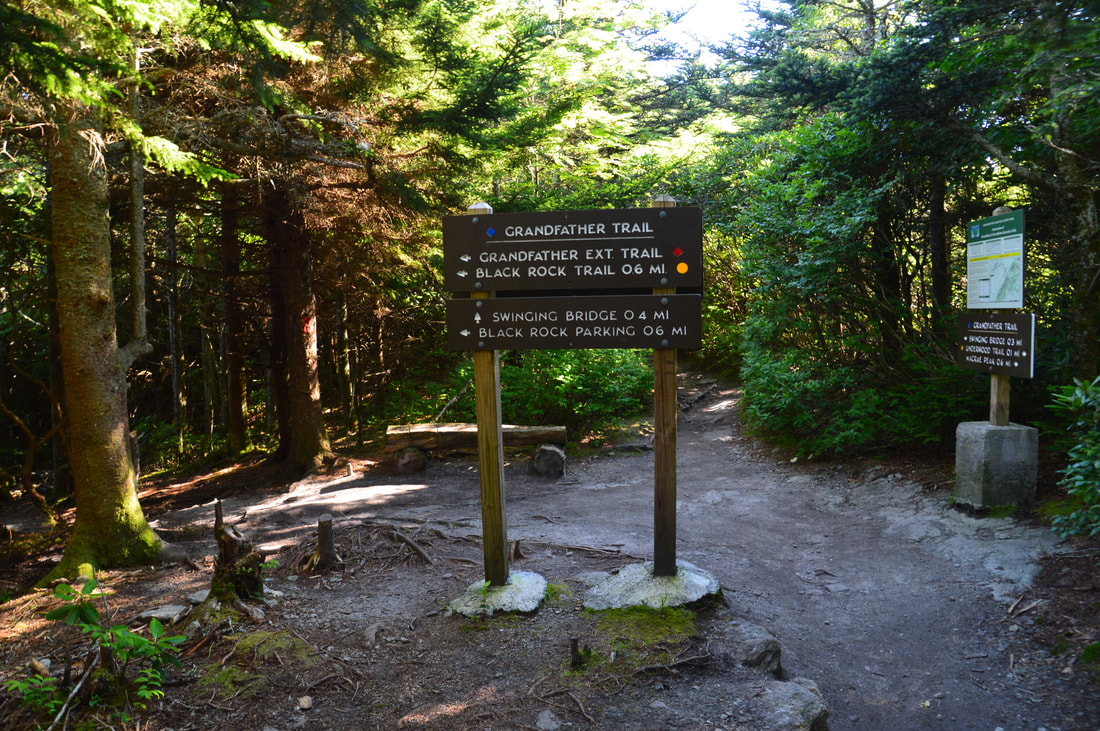
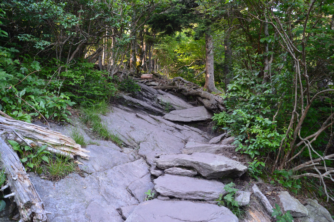
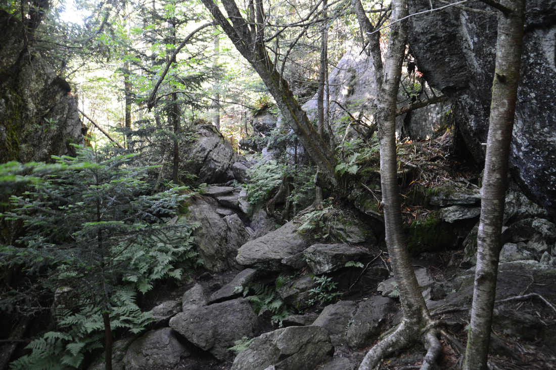
From the Boone Fork Parking Area, pick up the obvious access trail. The Upper Boone Fork Trail leaves left shortly; stay on the main trail, reaching the Tanawha Trail in about 200 feet. Turn left onto this trail and shortly reach a broad wooden footbridge across the crystal clear cascading waterfalls of Boone Fork at 0.15 miles. Take a good look at the footbridge: It is the last flat spot that you will see on this hike. Just past the bridge, the Asutsi Trail leaves left and reaches a parking area off US 221 in 0.4 miles, which is used when the Blue Ridge Parkway is closed during winter. Then, as the Tanawha Trail leaves the Blue Ridge parkway corridor and enters Grandfather Mountain State Park, there is a kiosk on the right where you have to fill out a free permit to let the rangers know your hiking plans for the day. The trail then ascends gradually to a junction with the Nuwati Trail at 0.4 miles. While many people continue straight and take the Daniel Boone Scout Trail to Calloway Peak, I suggest turning right onto the blue-blazed Nuwati Trail and taking the much more scenic Cragway Trail, like I did. The Nuwati Trail ascends gently through rhododendron tunnels well above Boone Fork to a signed junction with the orange-blazed Cragway Trail at 1.05 miles. The Nuwati Trail continues straight past several campsites to Storyteller's Rock - where there is a view of the Boone Bowl - but this hike turns left onto the steeply-ascending Cragway Trail. The Cragway Trail instantly becomes narrower and more rugged, and before long, rock outcrops with great views of the Boone Bowl begin showing up along the trail. The Boone Bowl is a geologically unique area that encompasses the headwaters of the Boone Fork, as it is the only glacial cirque in North Carolina. While Top Crag View is the main vista along the Cragway Trail, there are many others as well. You'll know that you have reached Top Crag when you reach a particularly broad rock outcrop on the right after a short section of open trail at 1.4 miles. A sign post marks Top Crag, but at the time of my hike, the sign itself was blank. From Top Crag, Calloway Peak and Storyteller's Rock are in the view. Looking down the Boone Fork valley, there is a scenic long range view to the east. After Top Crag, the trail enters the forest and continues a fairly steep ascent. At 1.85 miles, there is a split at the base of a particularly large rock outcrop. While a short bypass path goes left, the main trail bears right, scrambling diagonally to the top of the rock outcrop, which is home to the Flat Rock View. This eastward view is somewhat limited compared to the other views on this hike, but nevertheless, it is very pretty. Past the view, the path scrambles down to the left from the rocks, goes through a small passage, and ends at a junction with the Daniel Boone Scout Trail. 
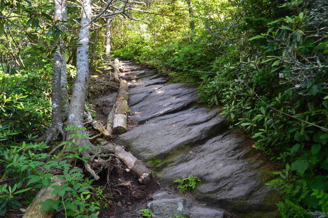
Near the beginning of the hike, the Tanwaha Trail crosses the crystal clear waters of Boone Fork on a beautiful wooden footbridge.
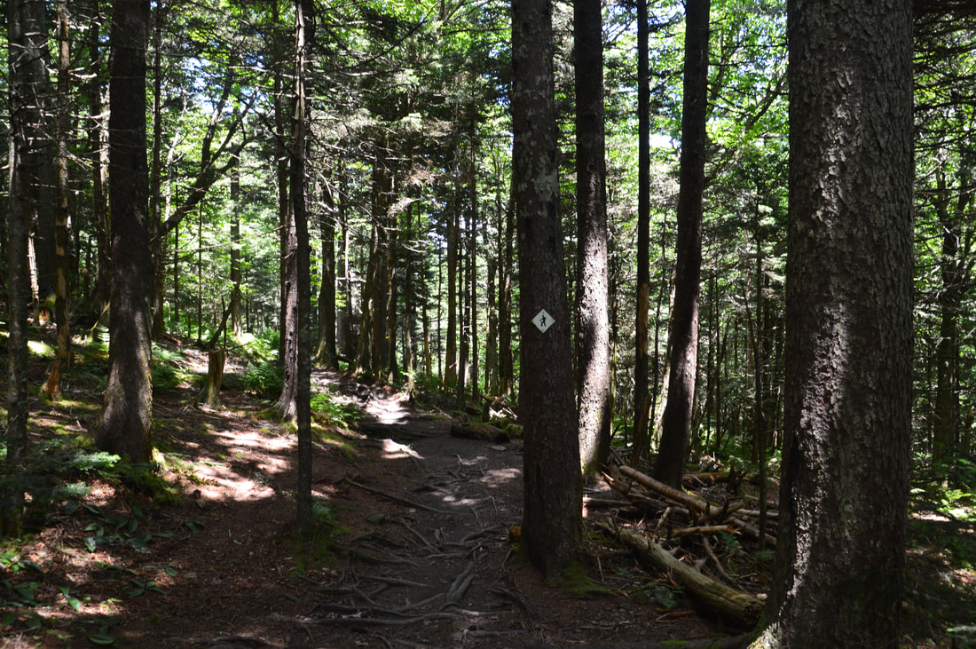
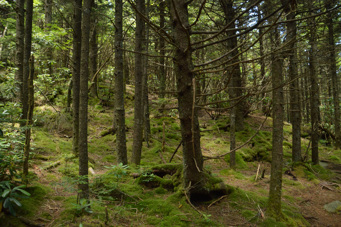
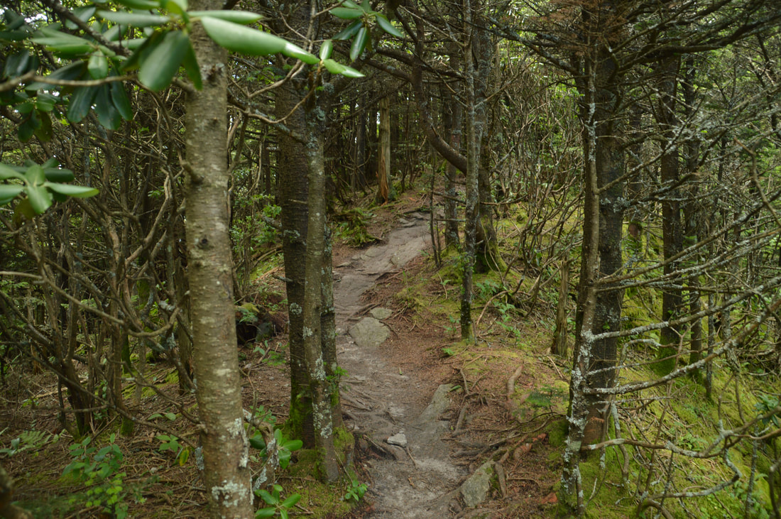
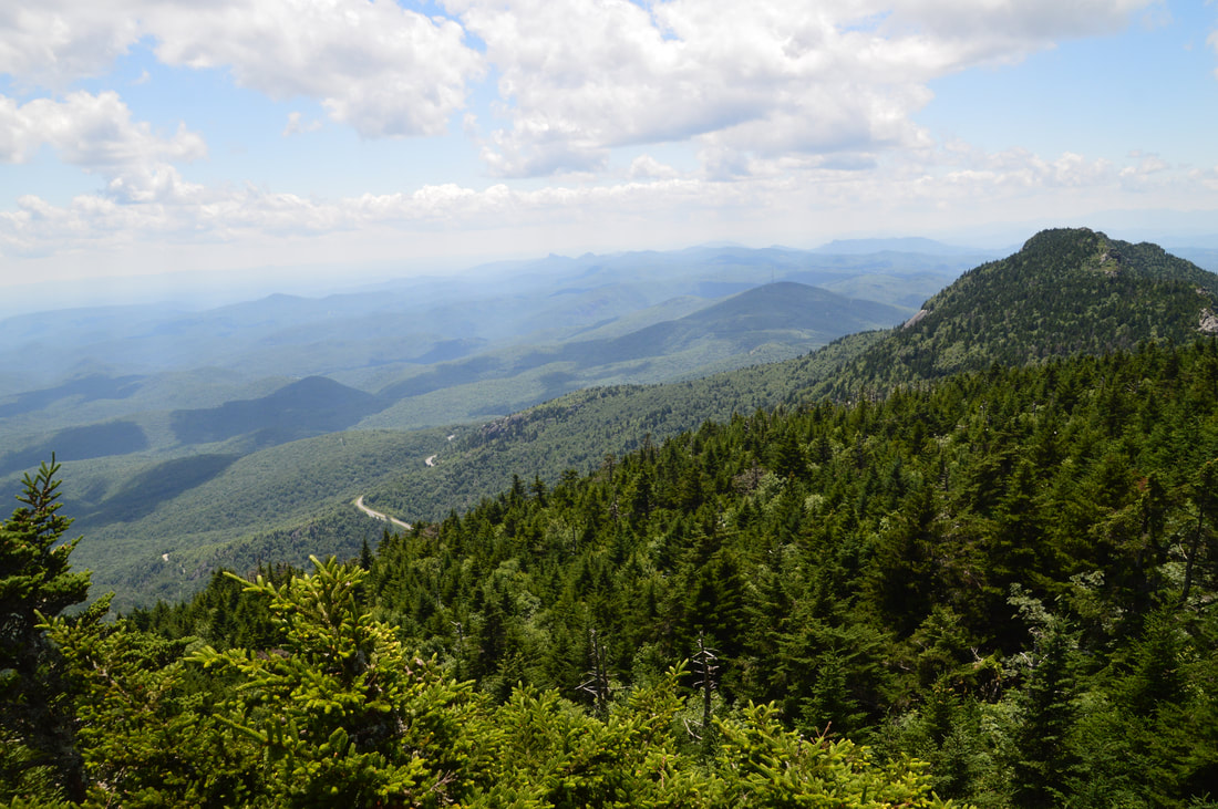
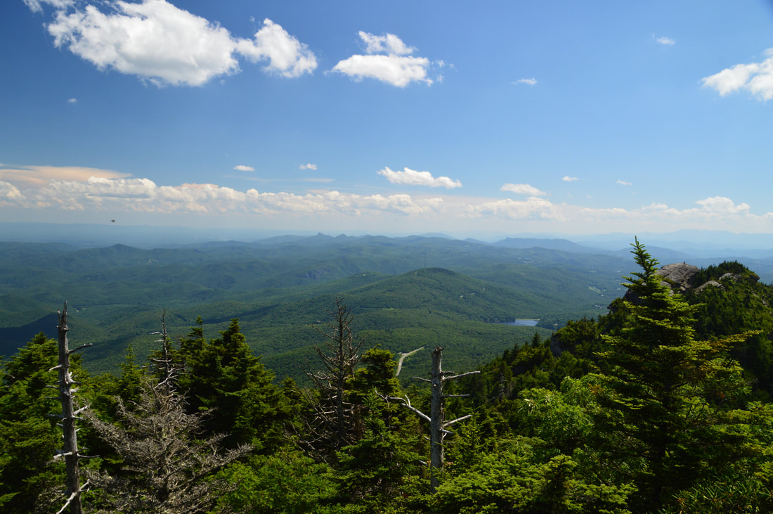
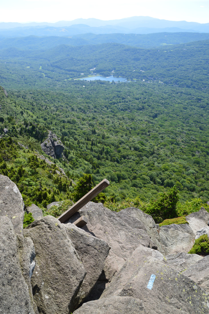
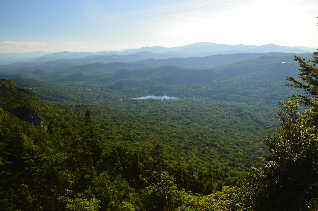
Your return route will follow the Daniel Boone Scout Trail to the left. In the meantime, turn right onto this white-blazed trail and continue the ascent to Calloway Peak. The Daniel Boone Trail is generally well-graded with ample switchbacks, making it a fairly enjoyable ascent through mixed forest with spruce/fir becoming increasingly common as you gain altitude. The only issue with the trail is that it is very rooty, and on the descent, this will become annoying. As the trail ascends, you'll pass side trails to several campsites. Around 2.95 miles, the trail scrambles up a large rock face and enters a surreal spruce-fir forest near the summit of Calloway Peak. At 3.0 miles, there is a 75-foot signed side trail on the left to Lynn Cove Viaduct View. If you're not short on time, it is worth making this quick side trip. The side trail ends at a rock outcrop with a southward view of the Lynn Cove Viaduct on the Blue Ridge Parkway and beyond to the easily-recognizable peaks of Linville Gorge (Table Rock and Hawksbill Mountain). The view is scenically framed by spruce trees.
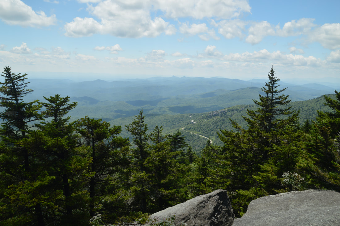
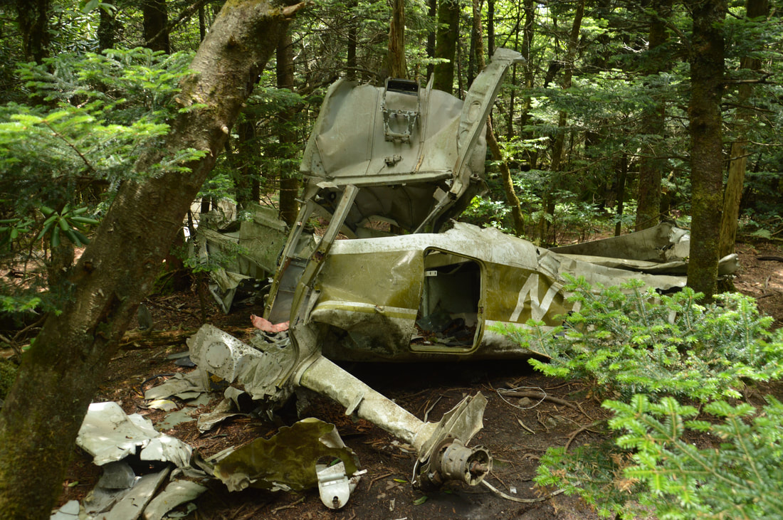
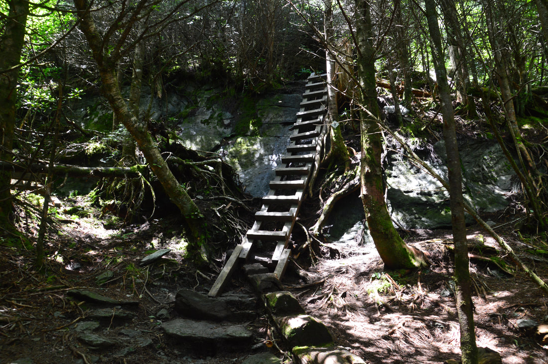
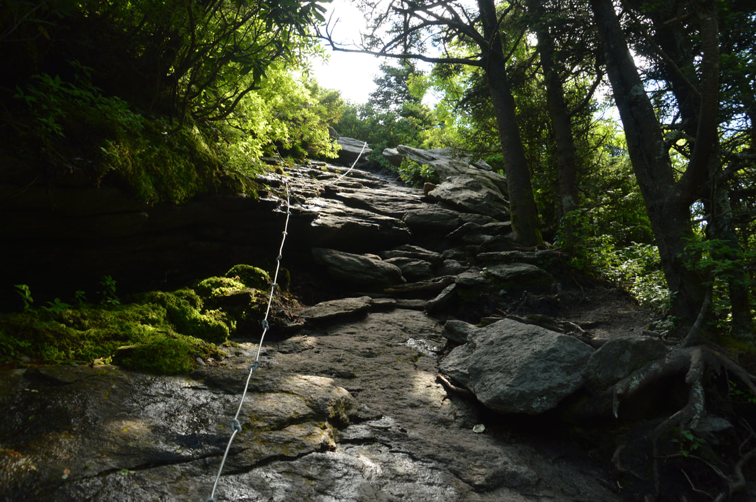
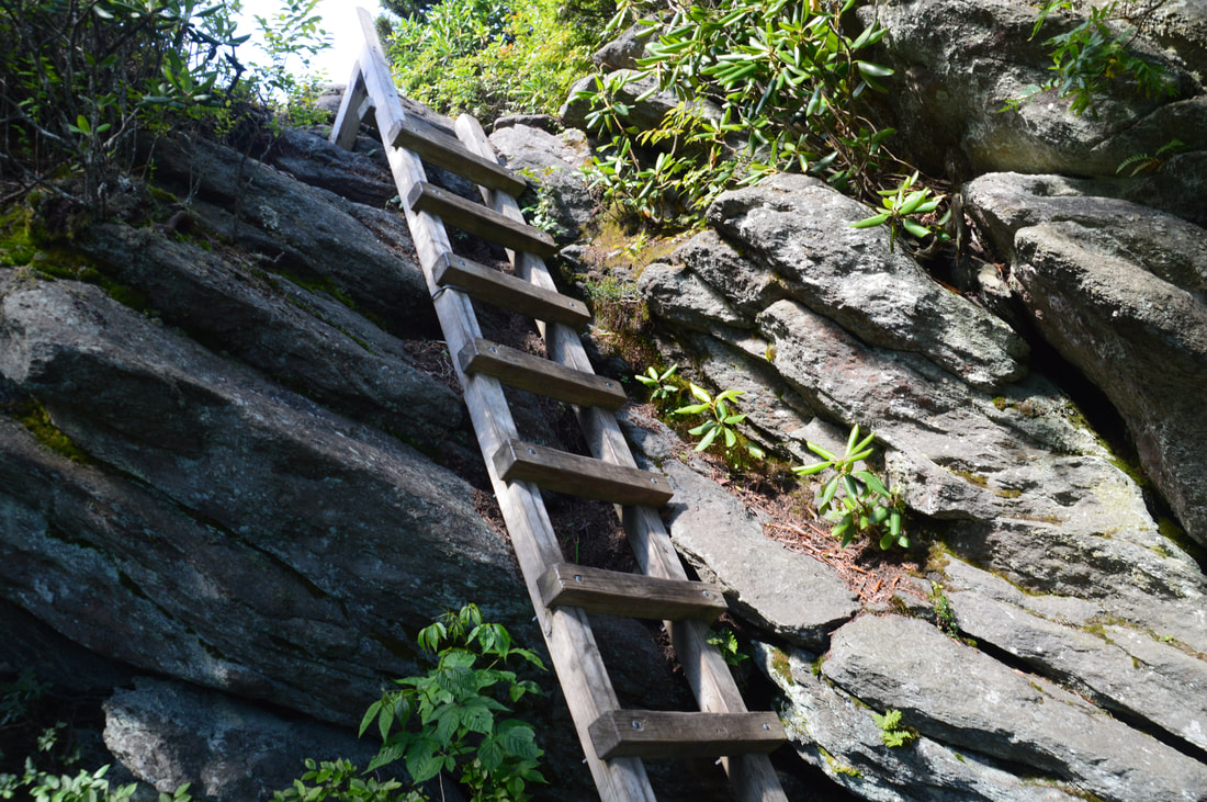
Back on the main trail, you will pass through a narrow stretch that looks like it has received some tornado damage. Around 3.25 miles, there are several side trails to campsites as well as the signed Hi-Balsam Shelter. A few feet farther, an unmarked side trail on the right leads to the remains of a 1978 plane crash that is worth a look. The main trail becomes a bit more rugged and shortly reaches the first ladder on the trail. All of the ladders on this trail are easily navigable if you know what you're doing, but people who are afraid of heights may have trouble with some of them, and of course, pets will as well. In this final section of the Daniel Boone Scout Trail, there are three ladders in a short span just below the summit of Calloway Peak. The first two ladders are rather long and then the third one is a short one. The Daniel Boone Scout Trail reaches its terminus at the summit of Calloway Peak at 3.45 miles only a few dozen feet after the last ladder. The views from the summit of Calloway Peak are spectacular (and yet still not as good as the next two peaks!). The rock outcrop at the summit provides open views to the southwest, south, and southeast, as well as limited views to the north (but those will be mostly covered by Watauga View). Perhaps the most impressive part of the view is to the southwest the Grandfather Crest and its rugged cliffs and boulders. Far in the distance, Attic Window Peak rises ominously. In the foreground, a scenic spruce-fir forest covers the slopes of Calloway Peak and even surrounds the summit. At about 5900 feet, Calloway Peak is the tallest peak of the Grandfather Mountain Ridge. You've ascended over 2000 feet to get to this point, but a lot more uphill is coming up! 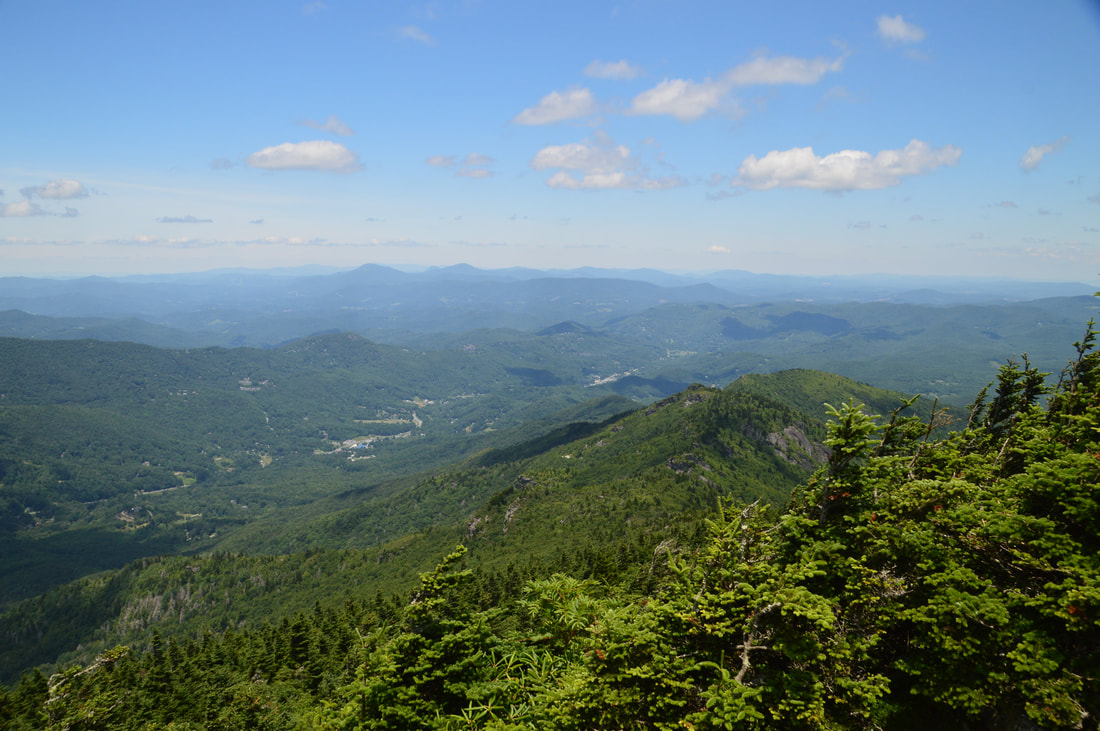
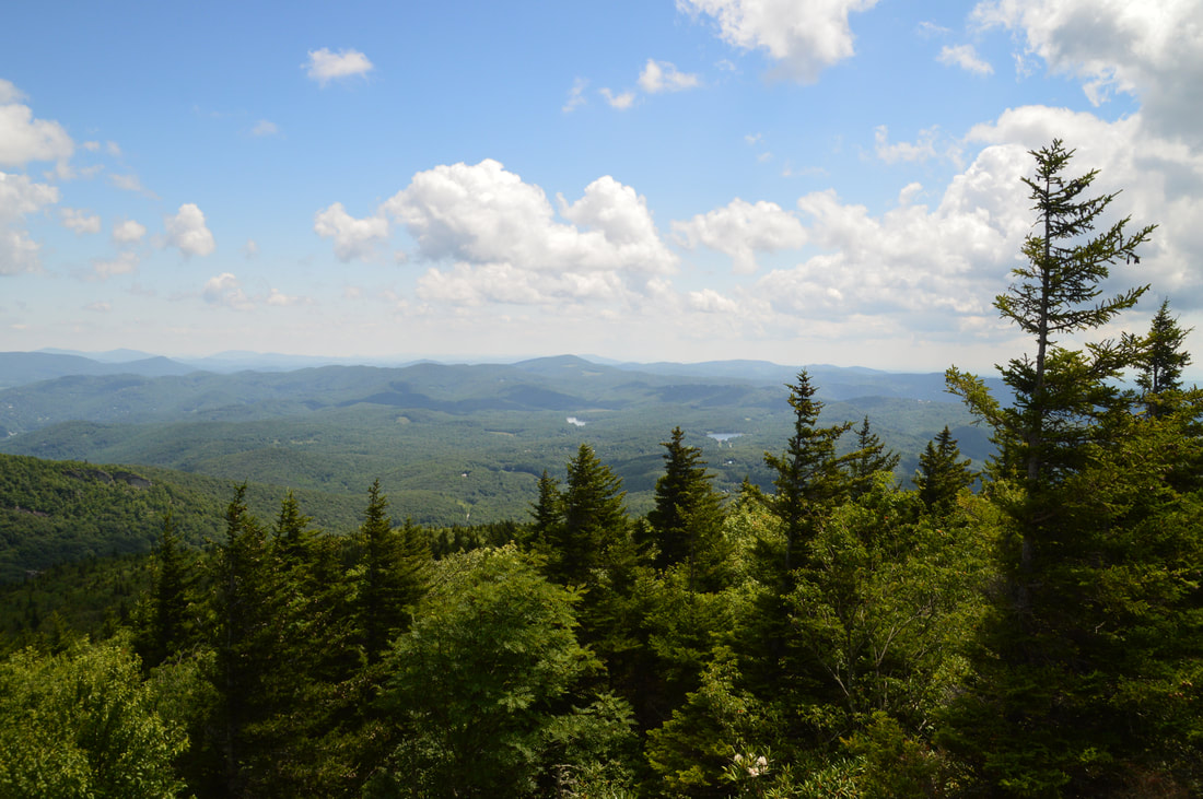
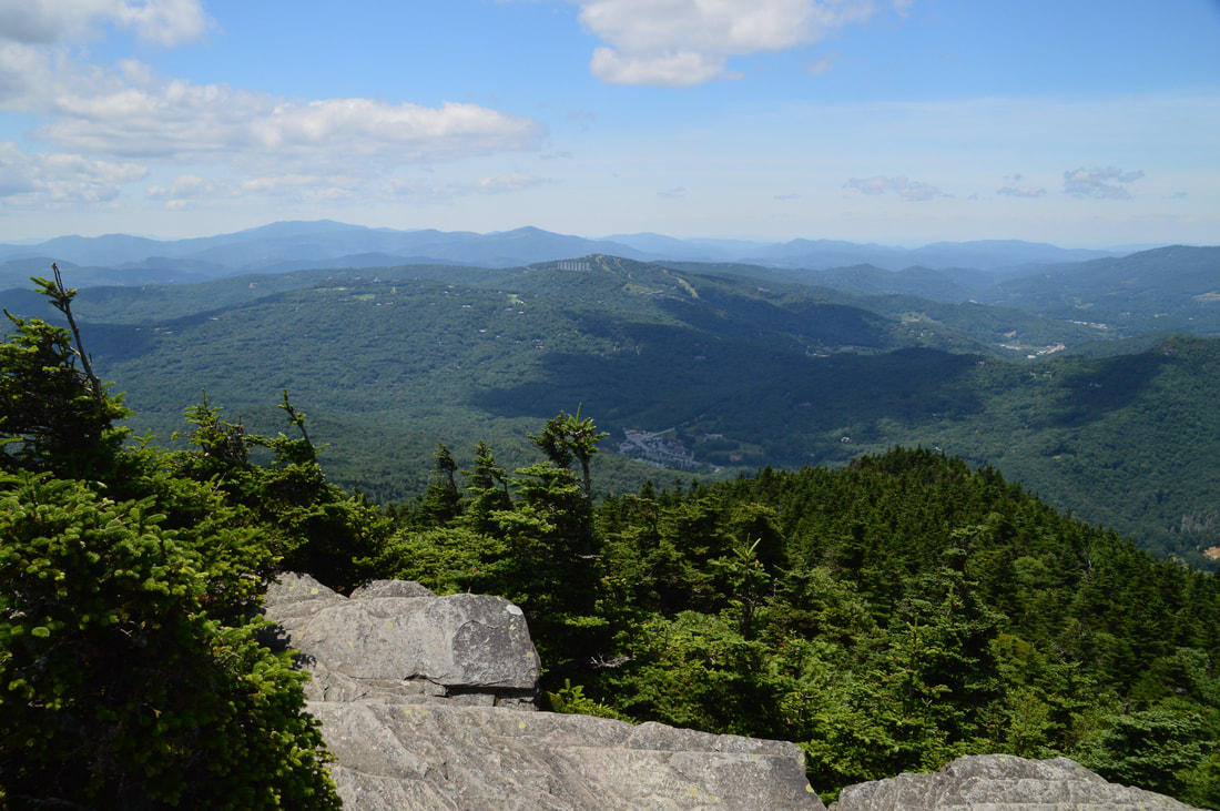
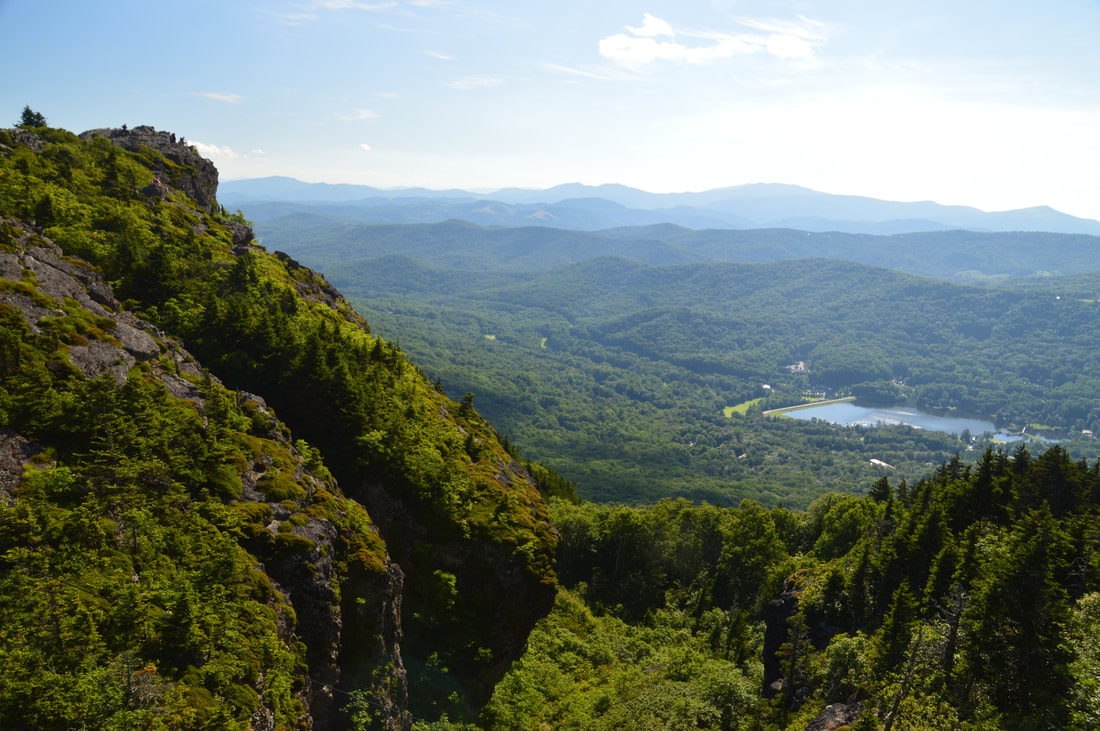
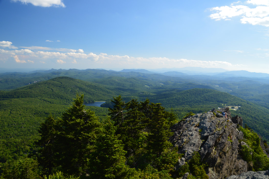
Watauga View is just one of countless top-notch vistas along the Grandfather Crest.
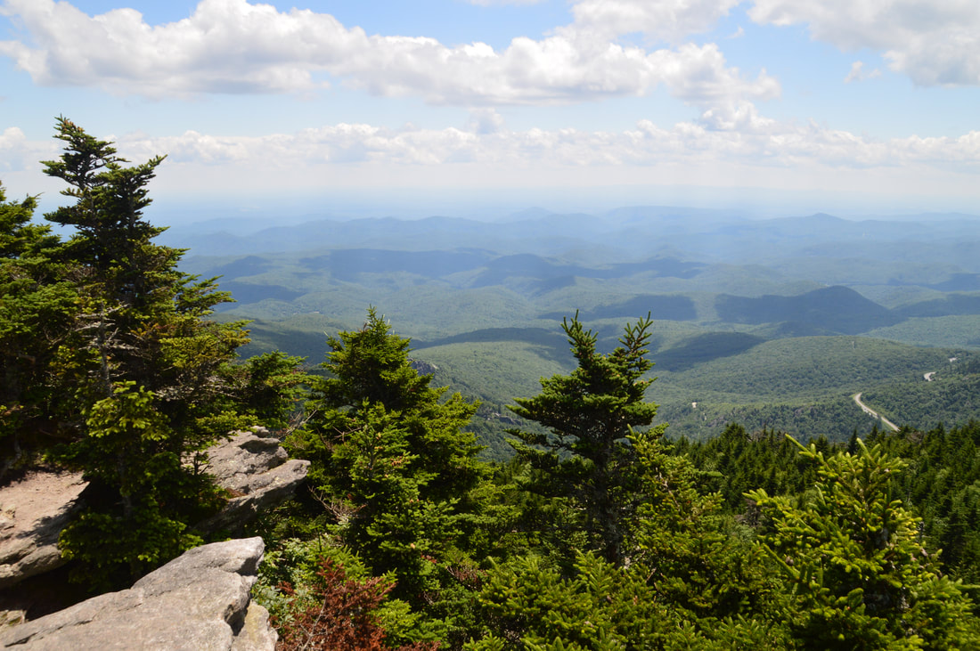
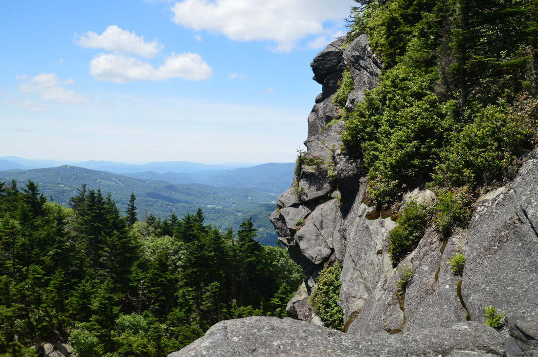
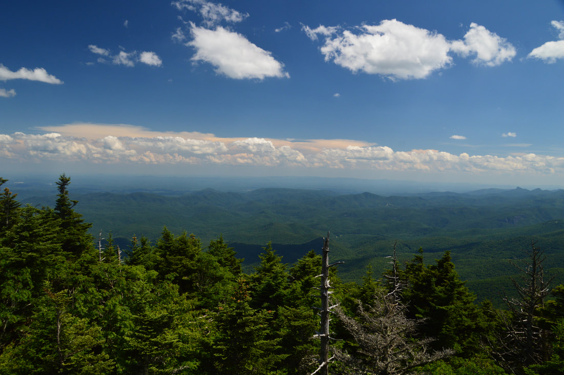
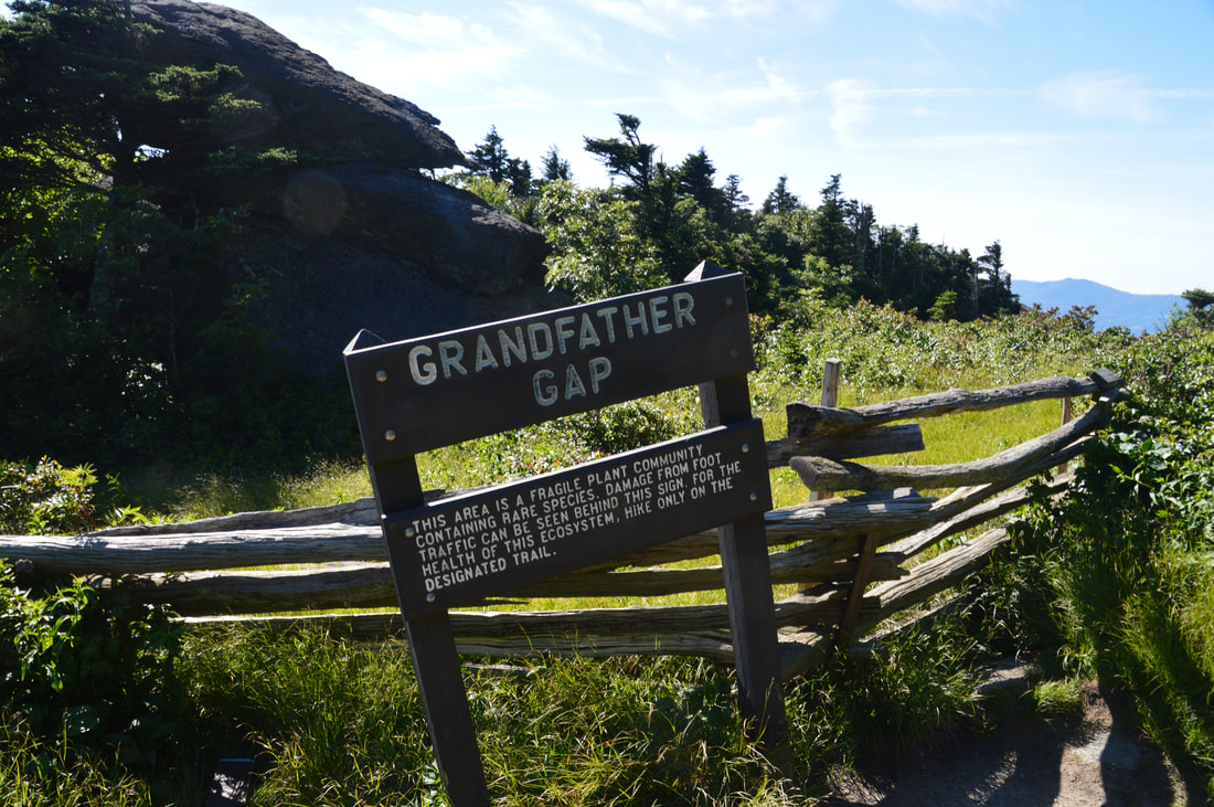
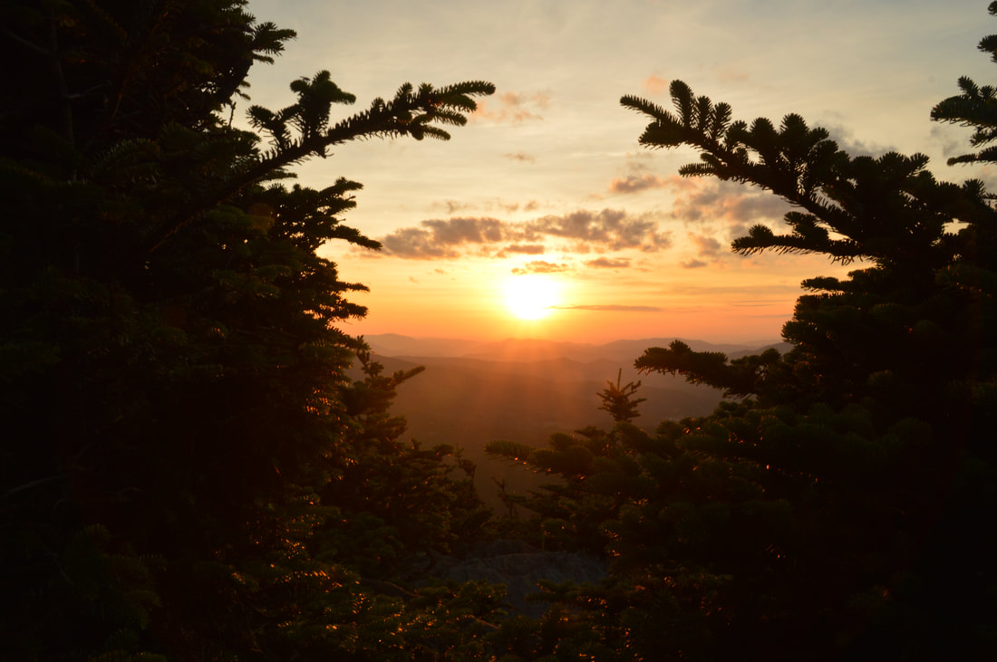
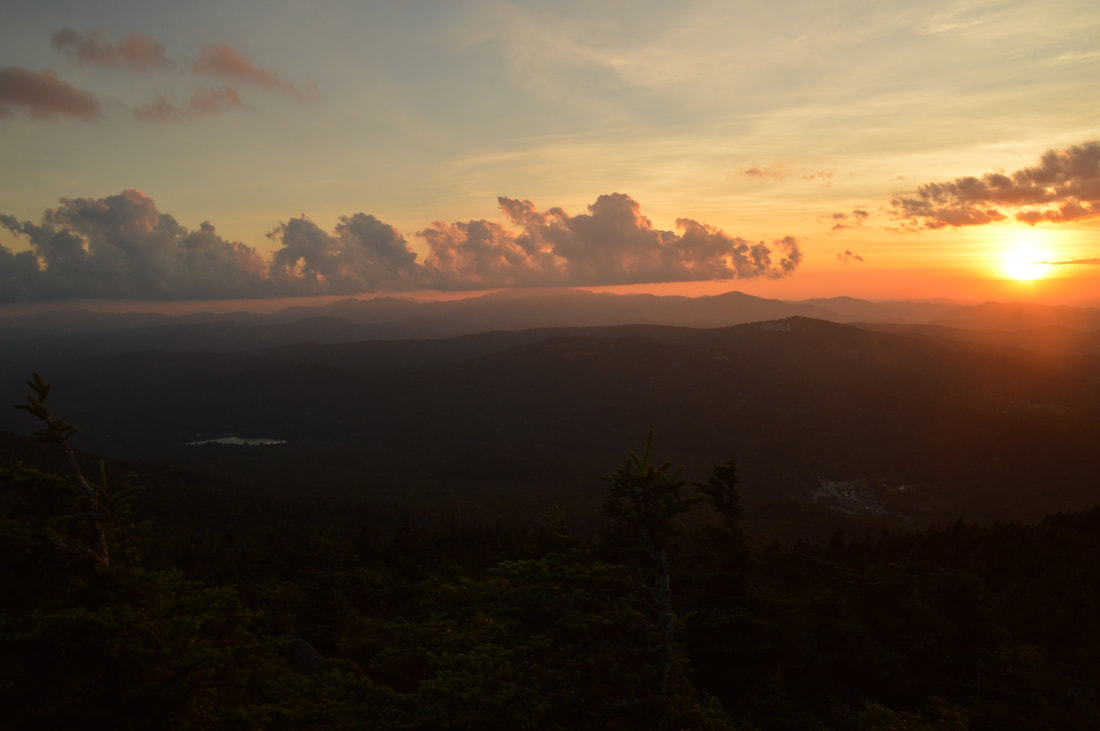
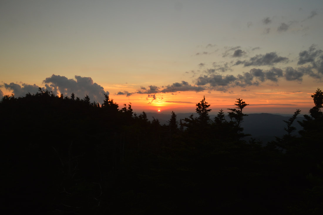
Most people who hike to Calloway Peak from Boone Fork Trailhead retrace their steps from this point, but the best (by far) part of the hike is ahead. To the right of the Calloway Peak Vista, the blue-blazed Grandfather Trail (Grandfather Crest Trail). Begin following it downhill and then along a narrow ridge with several more rock outcrop vistas and three small ladders. At 3.55 miles, the Grandfather Trail reaches a signed junction with the side trail to must-see Watauga View, which goes straight as the main trail turns left. Watauga View is a spectacular vista, so take the side trail and follow it for about 100 feet to a broad rock outcrop with a breathtaking 180-degree view to the west, north, and east. The Watauga River Valley is prominent in the foreground, and you have gotten your first view of the condominium on Sugar Top. Far in the distance to the west, the Roan Mountains line the horizon. Storyteller's Rock, now much lower, is visible at the far right end of the view. This is a top-notch sunset viewing destination (provided that you're comfortable with a long hike out in the dark). Return to the main trail and begin a rather steep descent through spruce-fir forest into Calloway Gap. In Calloway Gap at 4.0 miles, there is a signed junction with the orange-blazed Profile Trail. The Profile Trail turns right and makes a 3.6-mile descent into the Watauga River Valley to a trailhead off NC Route 105. Stay straight on the Grandfather Trail, which follows the ridge and begins a series of small ups and downs across rugged hills with spectacular views.
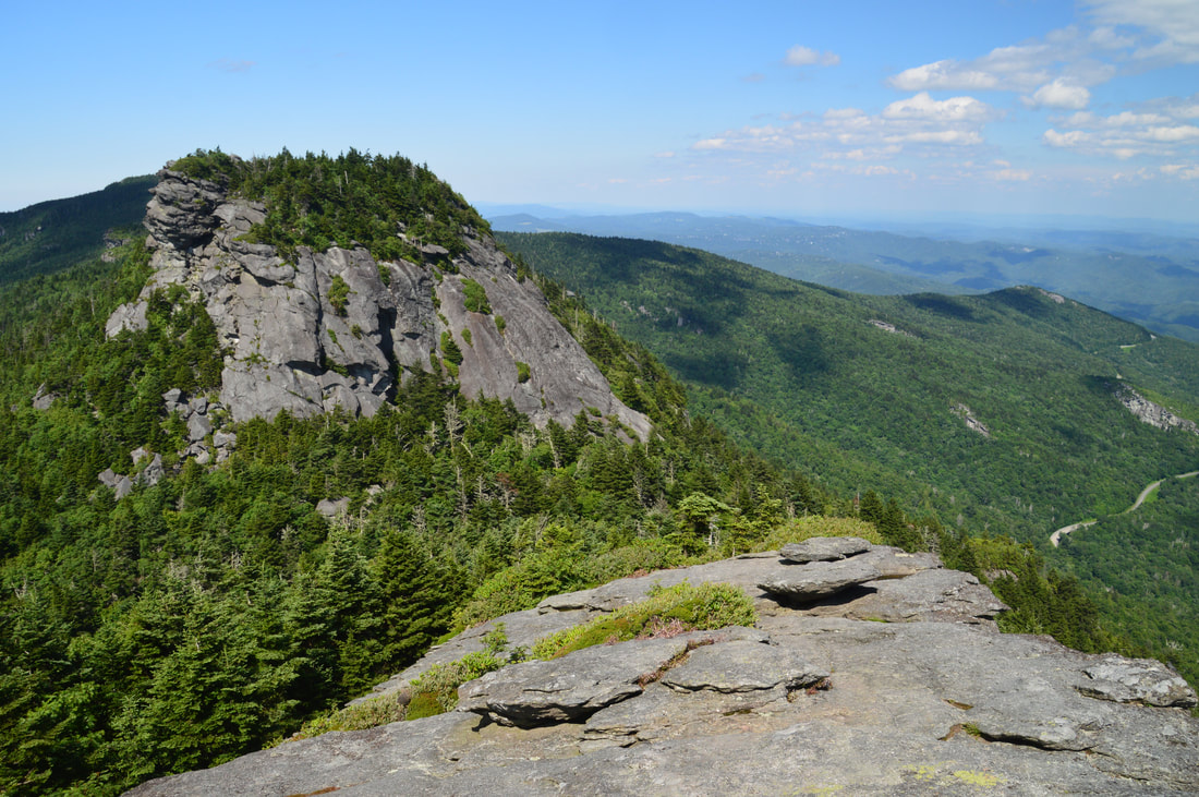
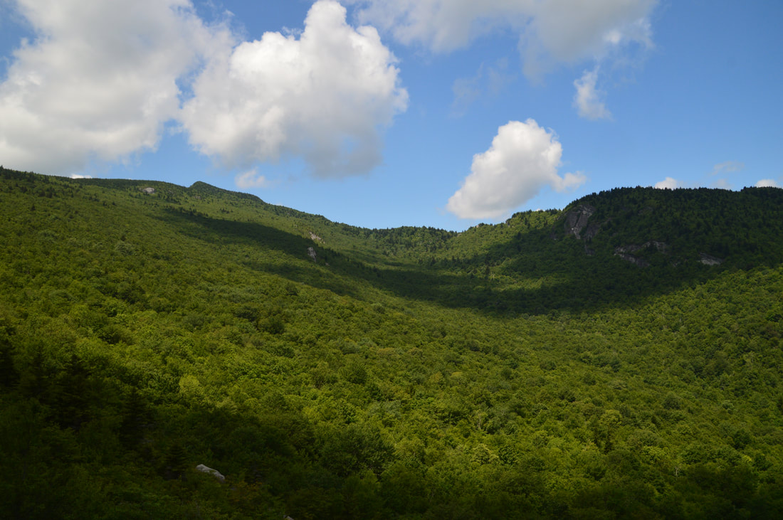
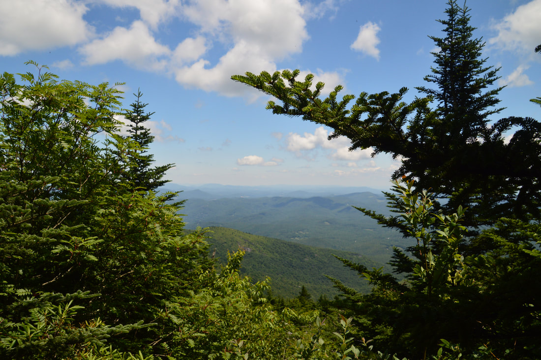
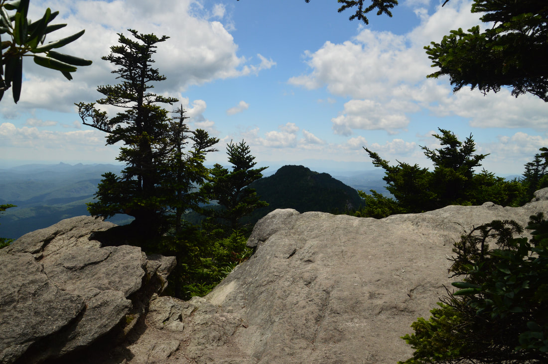
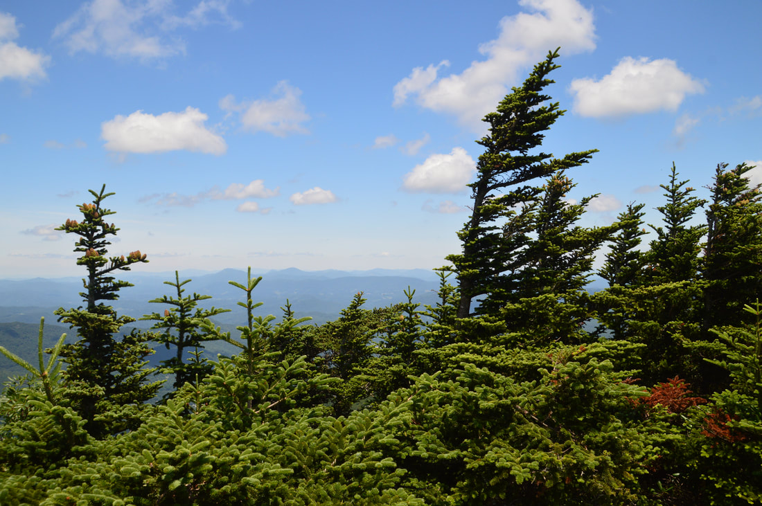
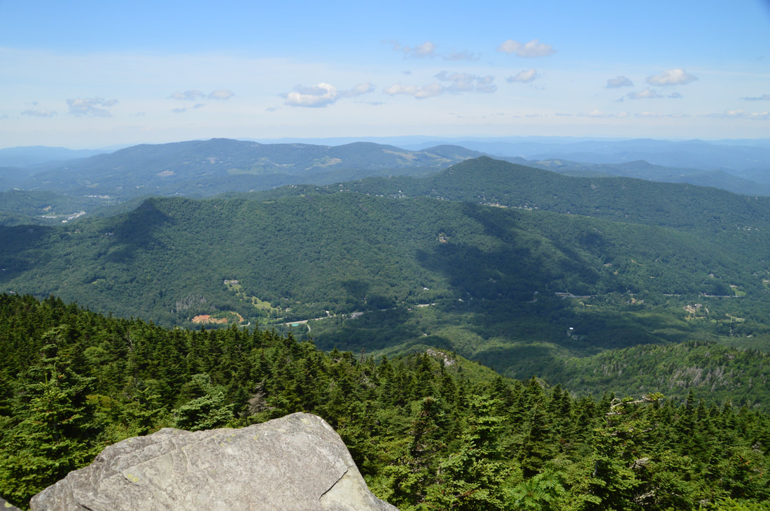
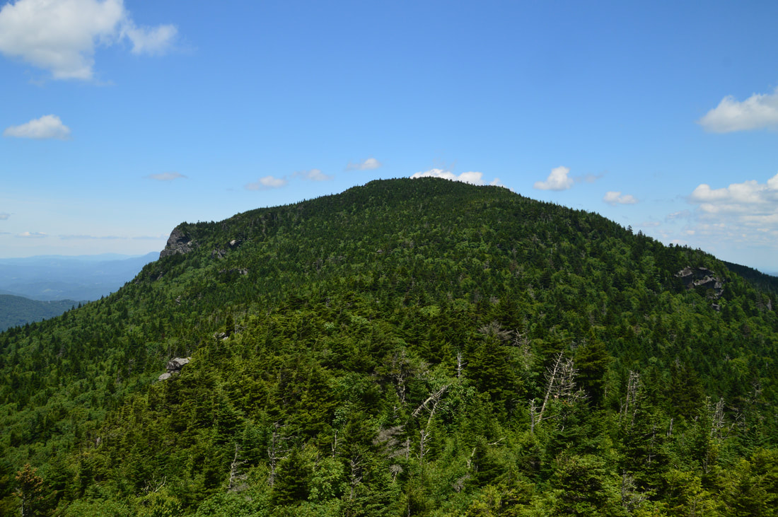
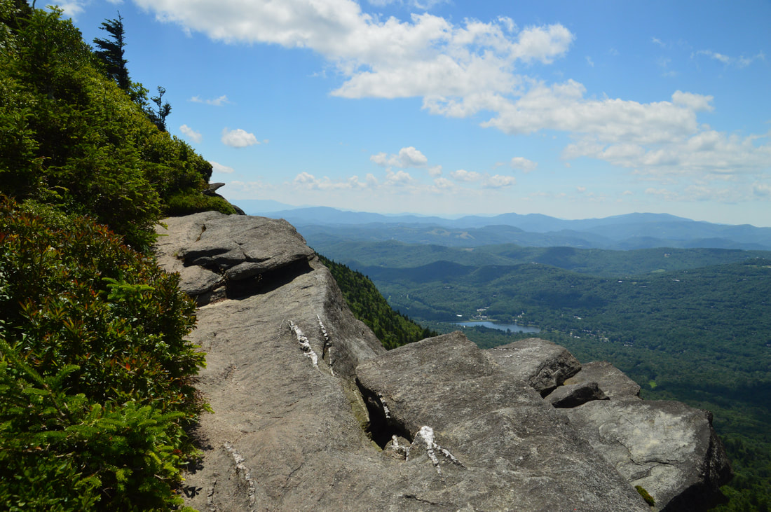
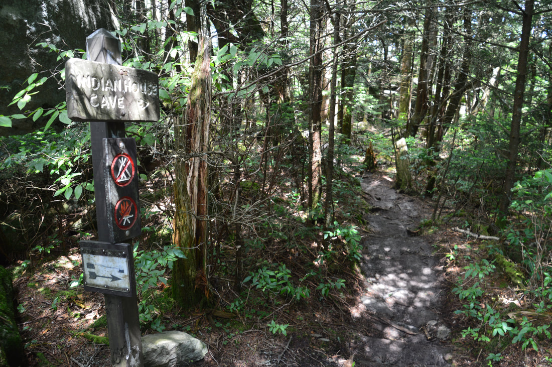
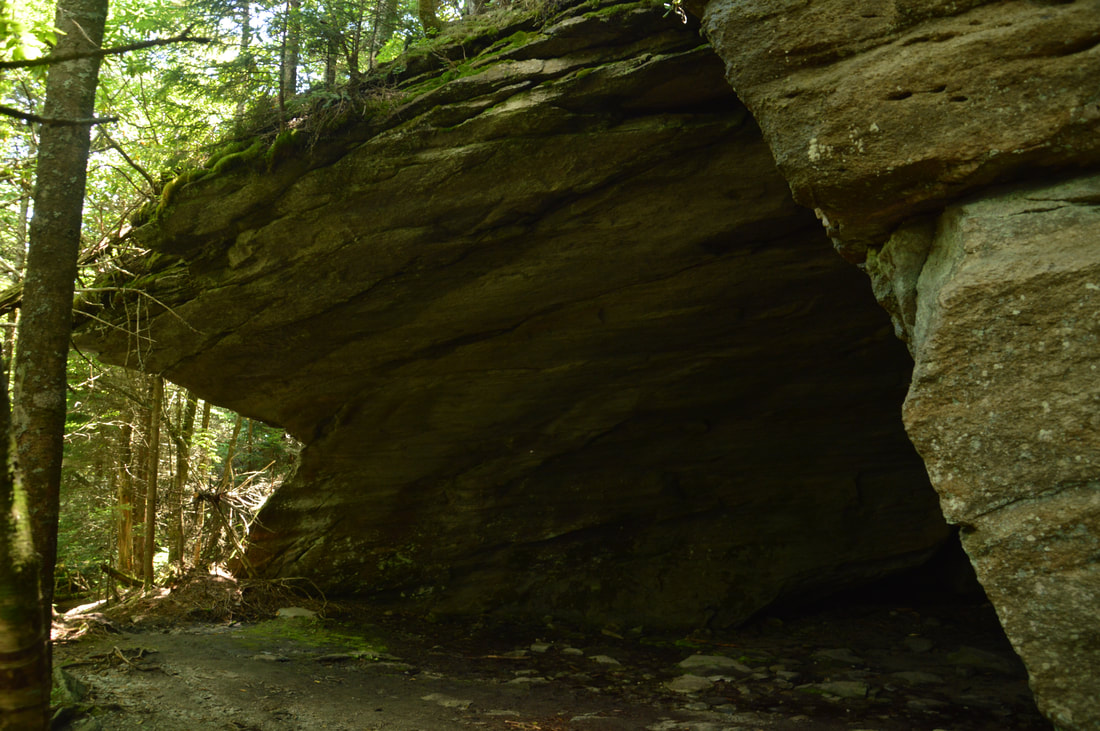
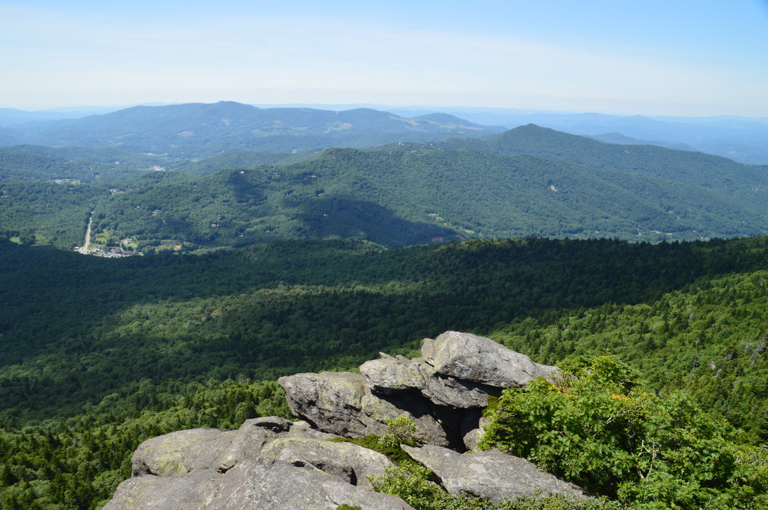
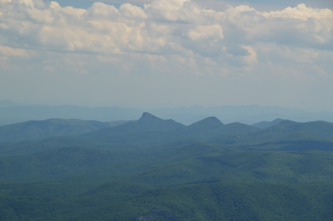
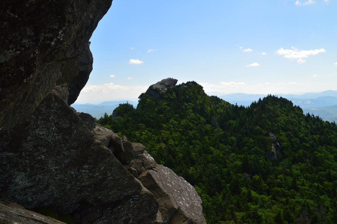
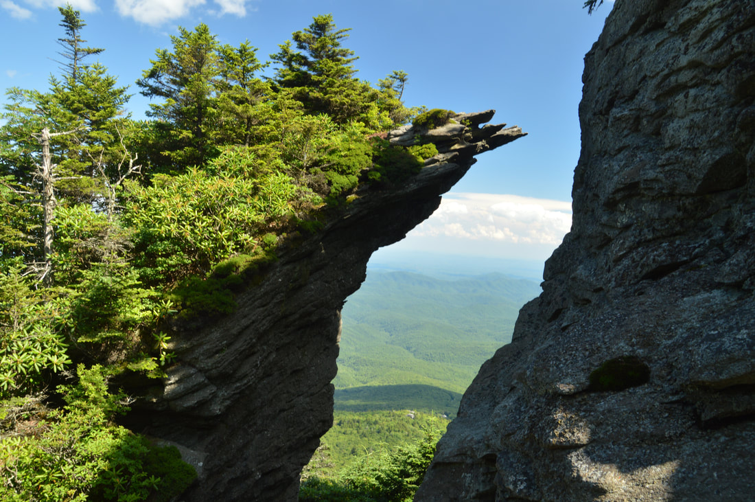
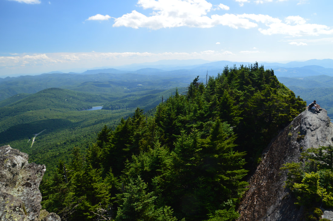
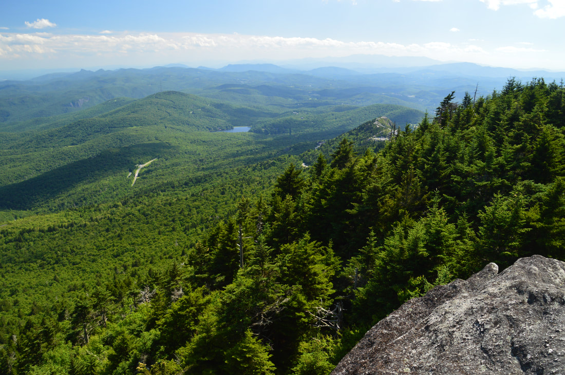
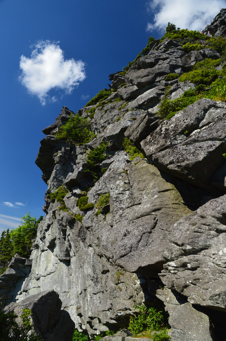
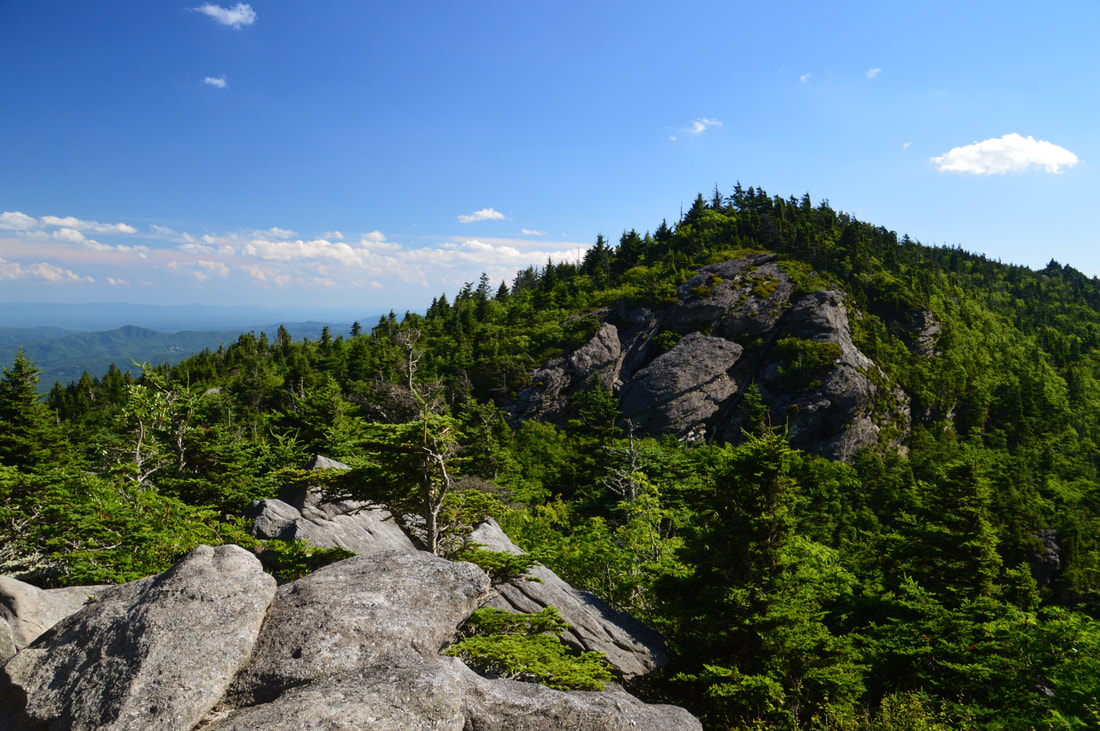
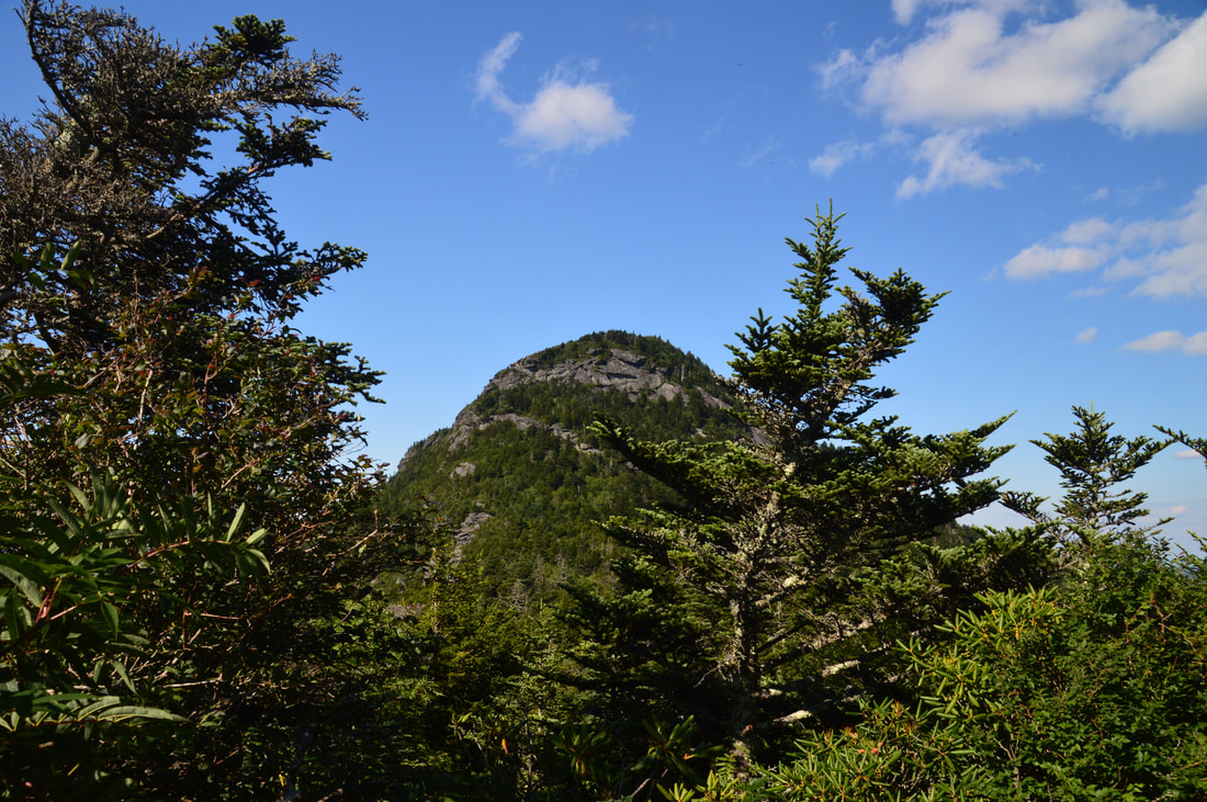
Around 4.15 miles, the trail scrambles up a long steep rock face with great views back toward Calloway Peak. The trail briefly follows the edge of a tall cliff before descending into a gap with a small clearing and campsite known as Alpine Meadow. After this, the trail crosses another small peak on the ridge with open rock slabs, cliffs, and great views to the west and north and back toward Calloway Peak. Then, at 4.5 miles, the trail descends down a slippery rock along the edge of another tall cliff, descends down a ladder, and reaches a junction with a side trail to Indian House Cave in another gap. At the same time, there is a view back toward the tall cliff that you just followed. The side trail to Indian House Cave is worth the trip - turn left onto it and follow it steeply down for about 250 feet to its terminus at the cave. Indian House Cave is actually a very large grotto/rock overhang rather than a true cave, but nonetheless, it is impressive. From Indian House Cave, return to the main trail and follow it along the final ascent to Attic Window Peak. The Grandfather Trail reaches the summit of Attic Window Peak at 4.7 miles. Here, the trail turns left and descends off the summit, but for the amazing 360-degree view, continue straight and scramble up the huge boulders at the summit. What a view!!! Perhaps the most spectacular part of the view is back towards Calloway Peak, which highlights the ruggedness of the narrow ridge that you have been following. Calloway Peak and the Watauga View cliffs look to be so far away, and yet, you've hiked only a little over a mile from Calloway Peak. Looking in the other direction along the ridge, the rocky dome of MacRae Peak is rising up ahead, and a pair of lakes lie in the valley below on either side of MacRae Peak. In each direction, countless mountains and ridges adorn the view. 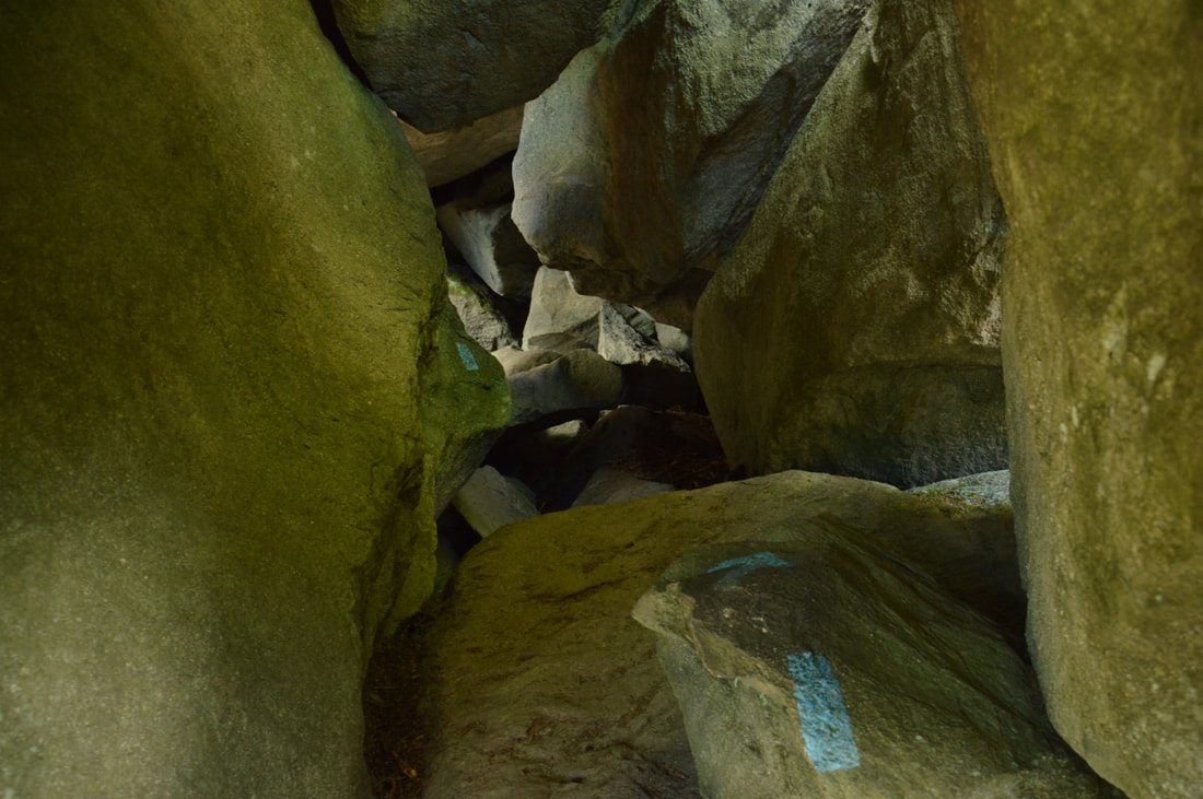
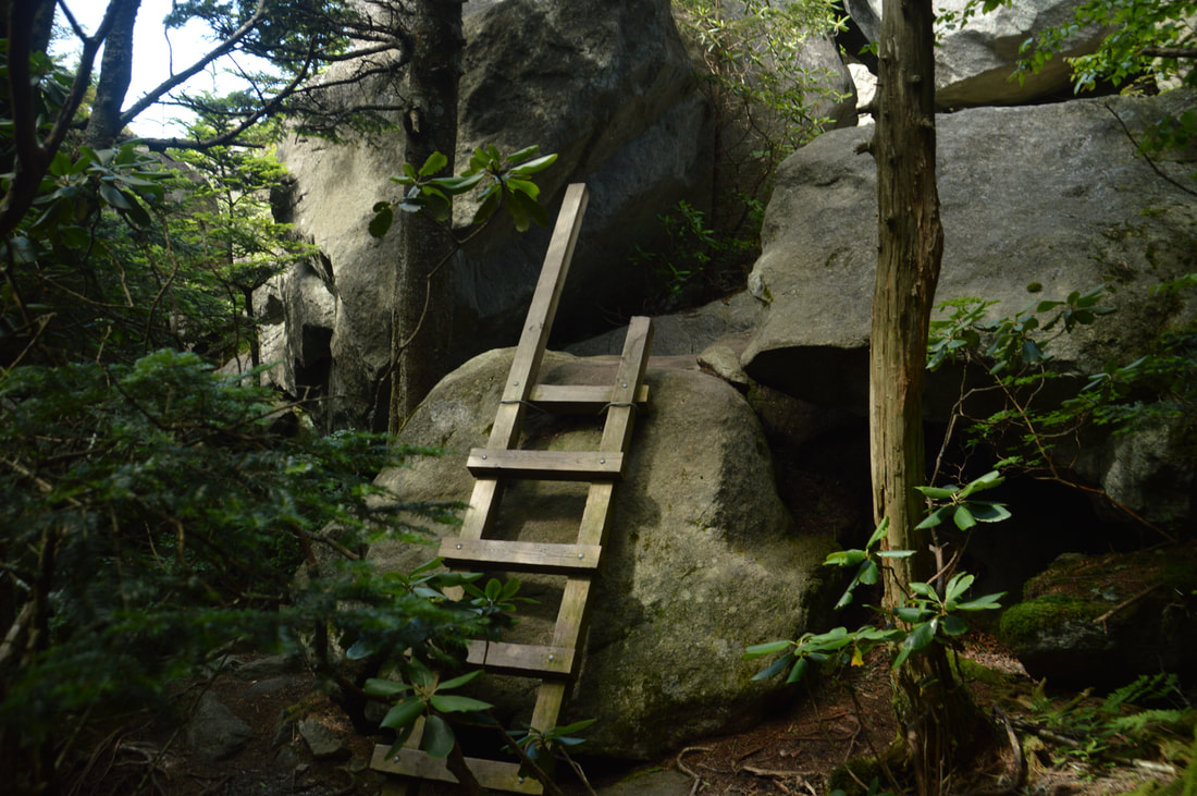
Between Attic Window Peak and MacRae Gap, the Grandfather Trail passes through a unique boulder cave.
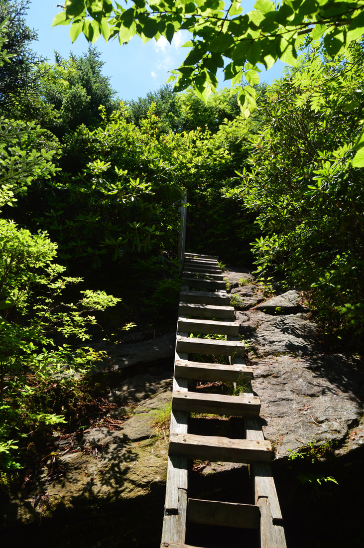
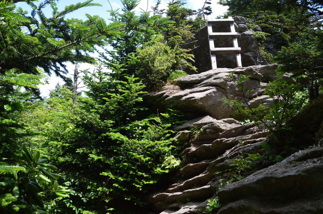
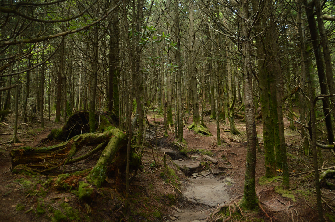
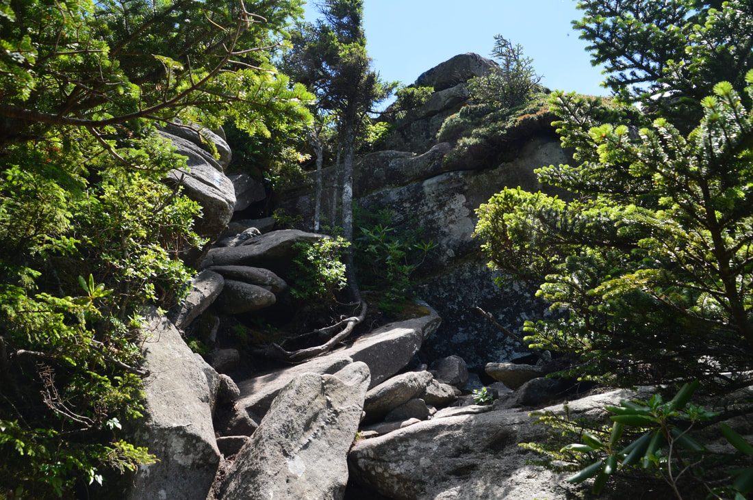
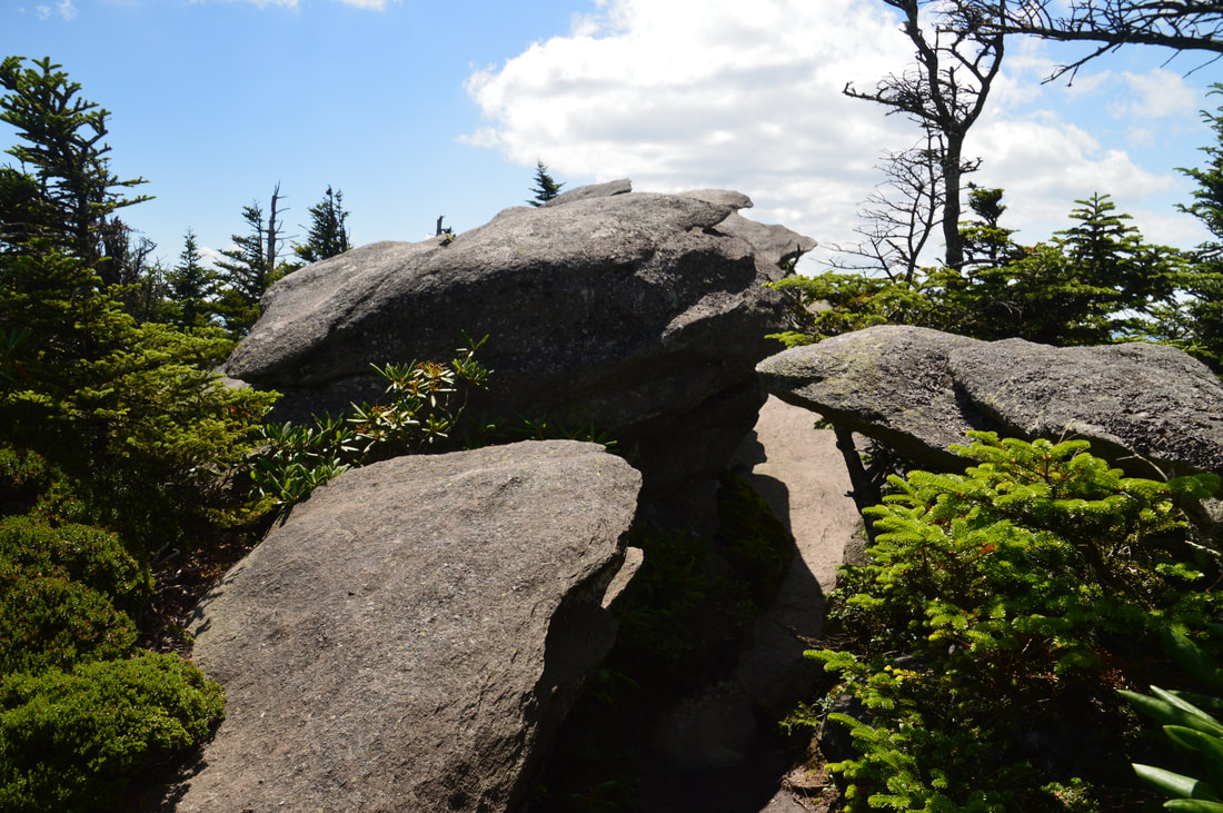
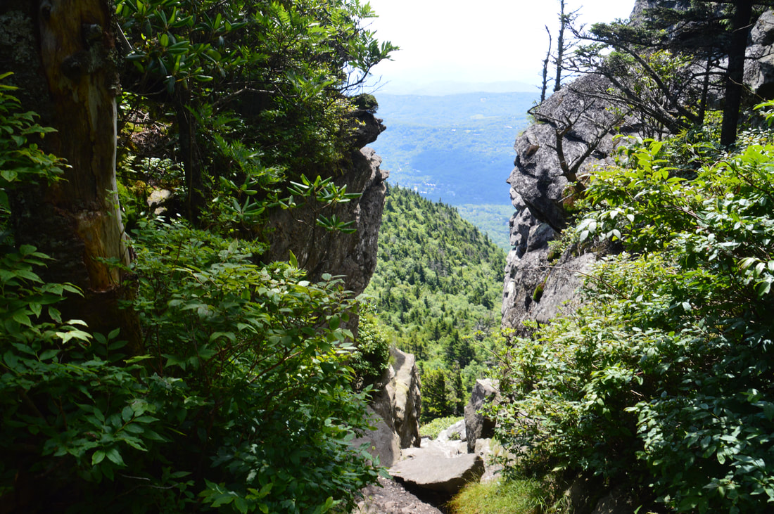
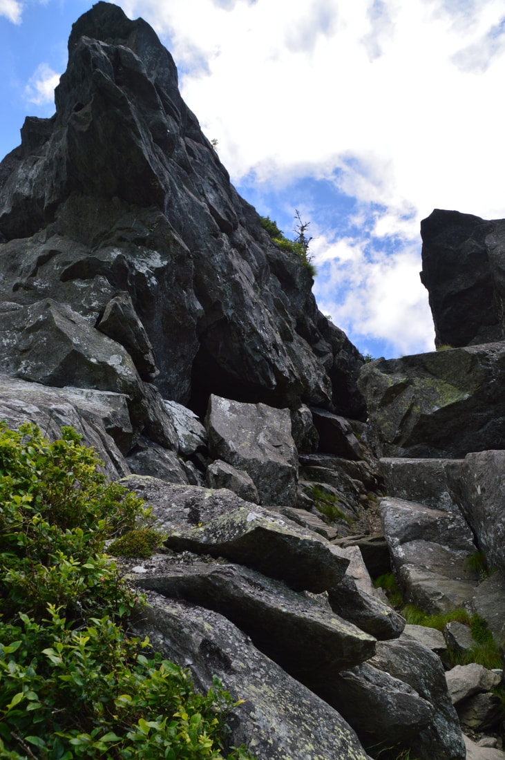
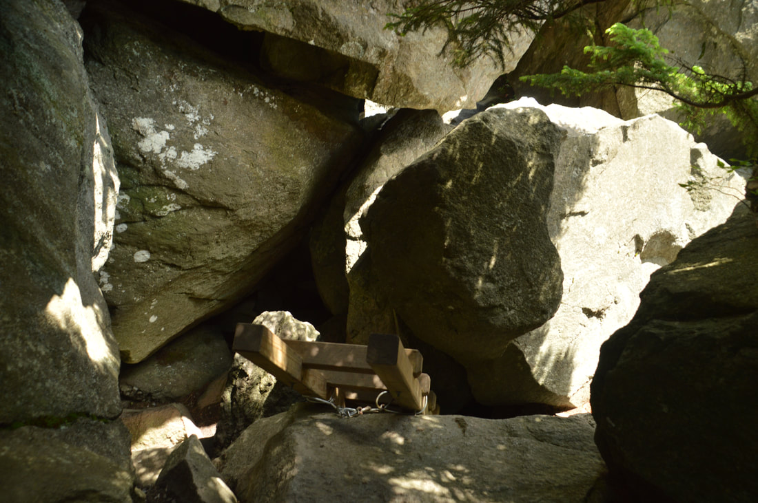
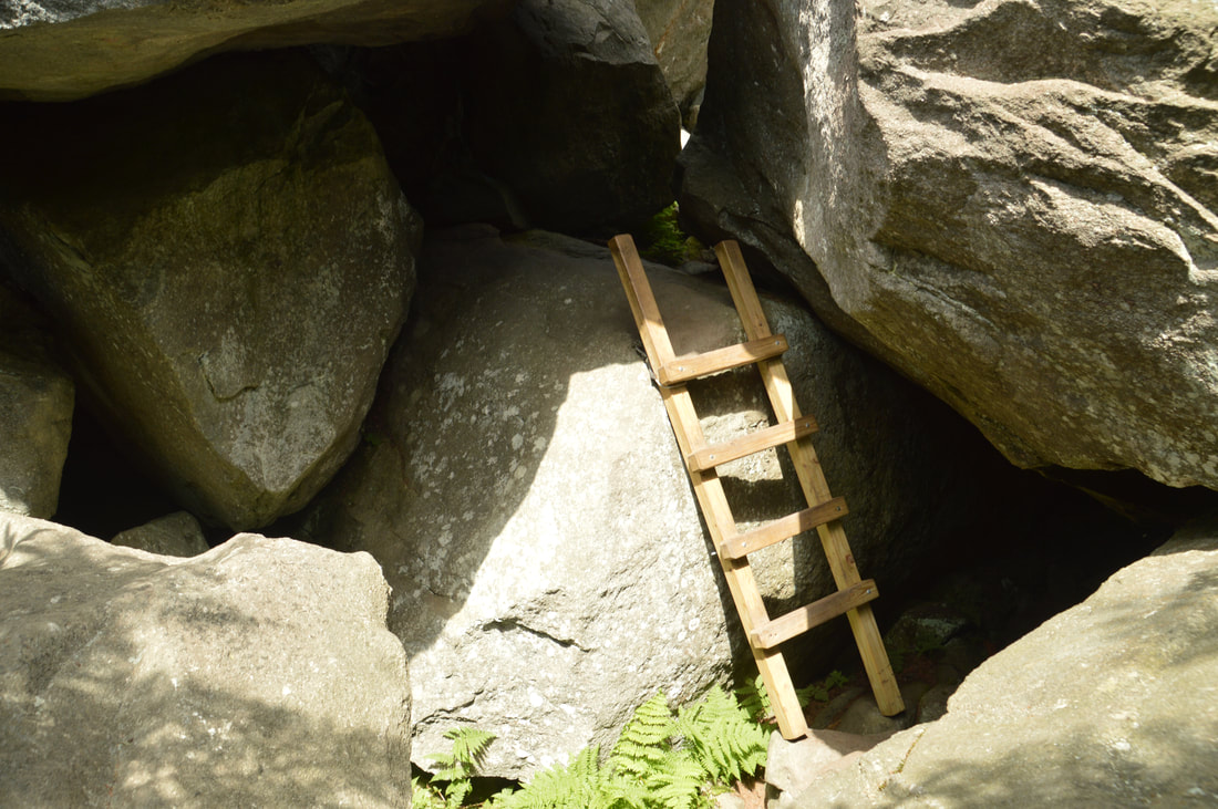
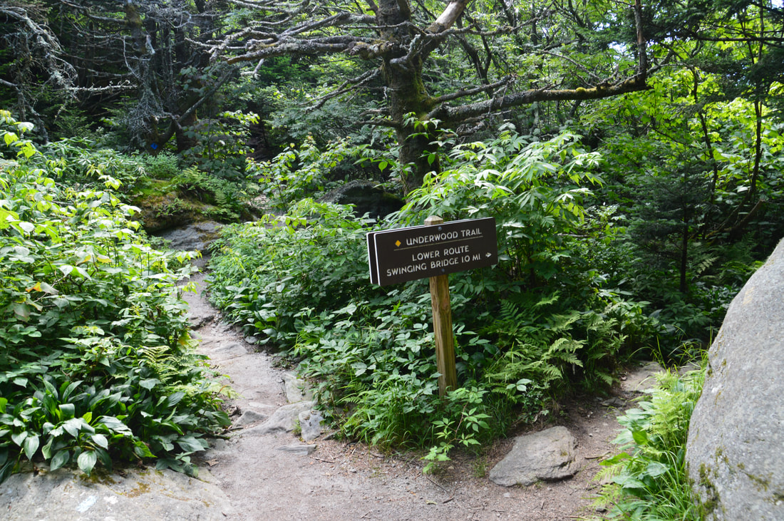
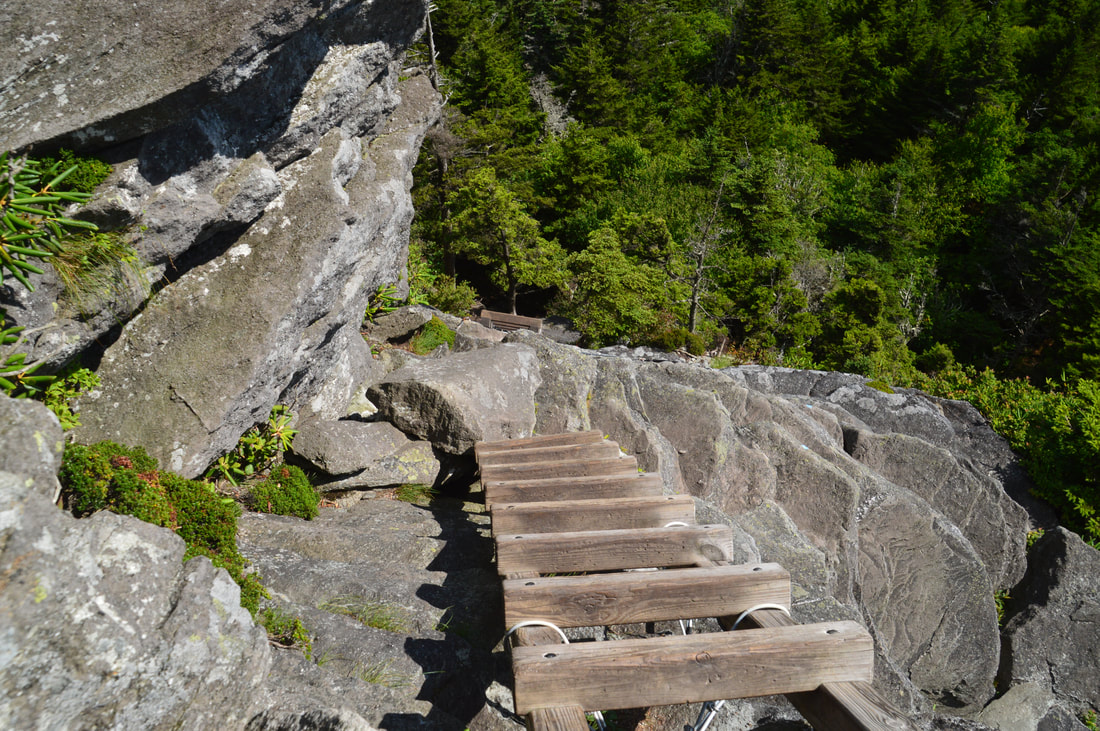
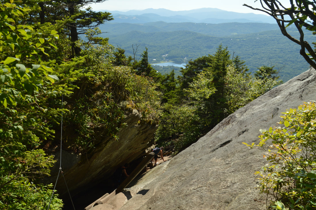
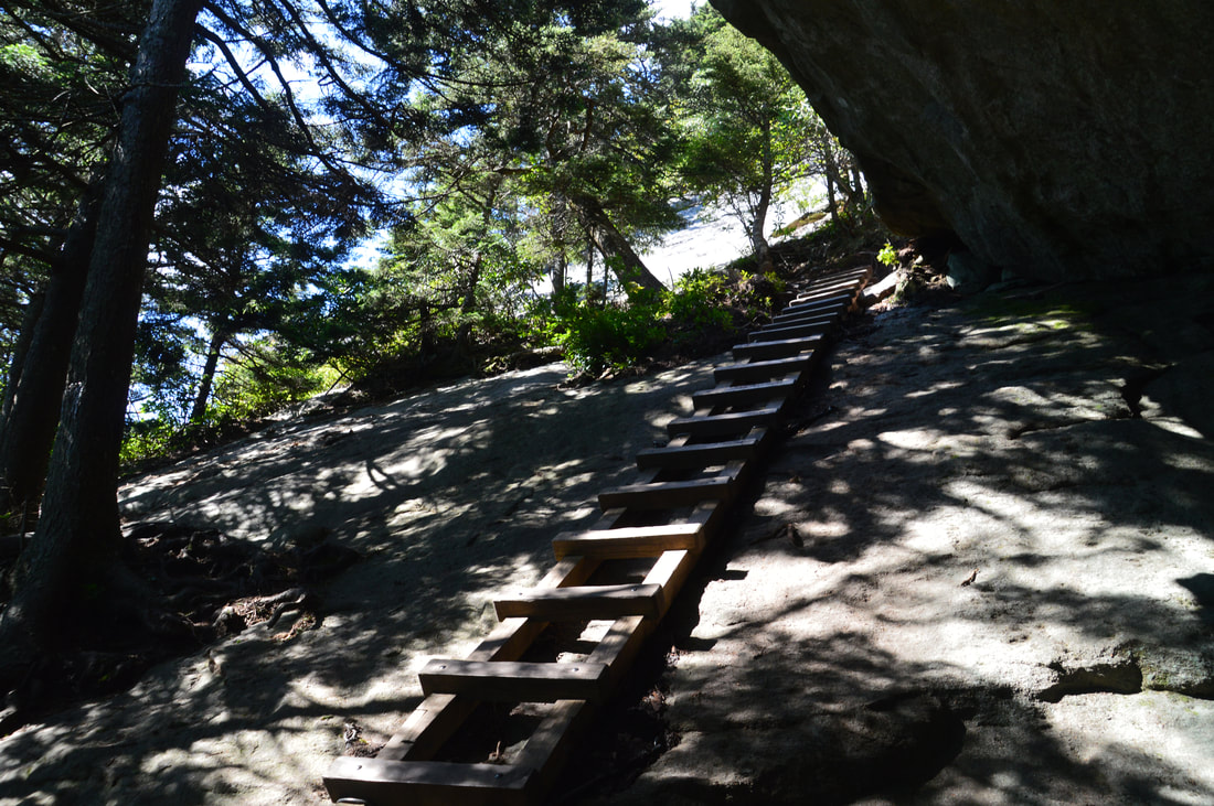
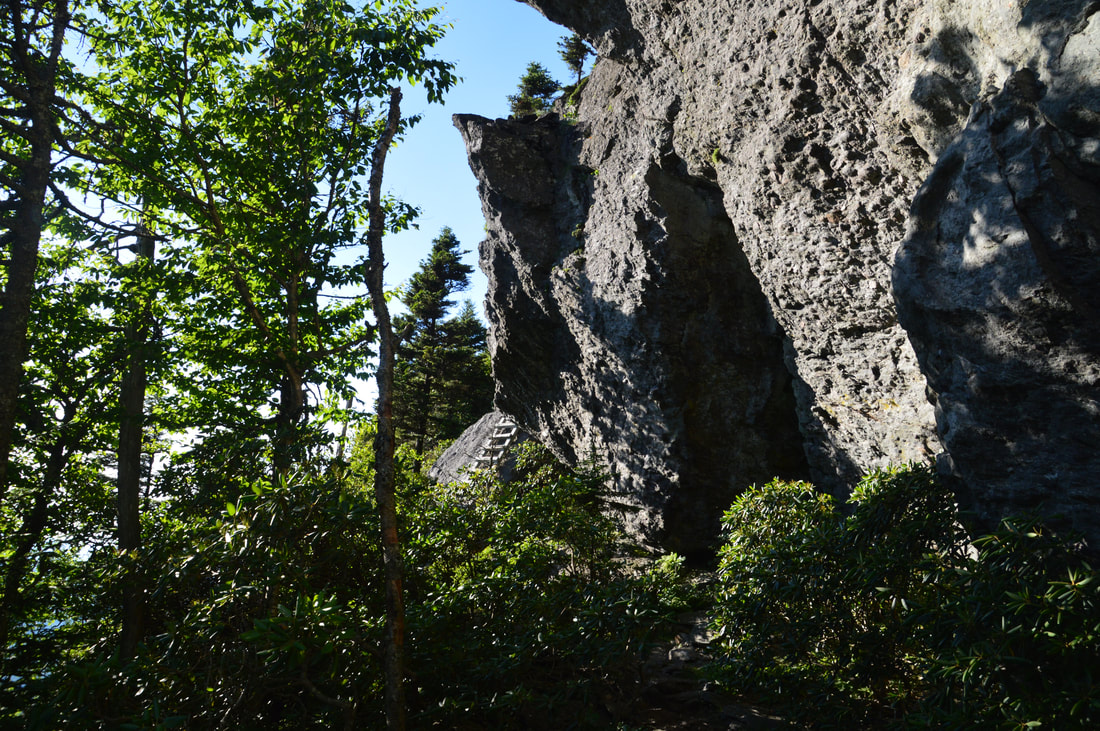
Continue following the main trail from Attic Window Peak as it drops off the rugged peak. In a few slippery feet, there is a junction where a side path to a campsite turns left while the main trail turns right and seemingly disappears. Actually, the trail is about to descend 200 vertical feet in 0.1 miles. Sounds tough? But how does the trail manage the descent? It makes a technical rock scramble through an insanely steep cleft in the massive cliffs on the south side of Attic Window Peak. In my opinion, the following section of trail is the most difficult scramble on the Grandfather Trail, but if you are sure of your ability to use both your hands and feet, it won't be too hard. Follow the blazes as the trail drops precipitously down the rocks. At the bottom of the boulder scramble, a new challenge appears ahead. The trail descends a ladder into a huge boulder jumble: but where does the trail go? The trail bears left and actually passes through a boulder cave of sorts. Huge boulders have piled on top of each other to create a tunnel-like passage under them. At the end of the passage, two more ladders take the trail down additional rock outcrops that are too steep and slippery to navigate hand-and-foot. Just past the final ladder, the Grandfather Trail reaches MacRae Gap and a signed junction with the Underwood Trail at 4.85 miles. The yellow-blazed Underwood Trail turns right, serving as a bypass around the rugged rock scrambles, ladders, and cables of MacRae Peak. But if you're comfortable with all of the above, you absolutely must take the Grandfather Trail to MacRae Peak: the view from MacRae Peak is arguably the best view on the hike and perhaps even more jaw-dropping than any views you have seen so far. On the way back, you can take the Underwood Trail bypass, unless you want to summit MacRae Peak twice - which can be very enjoyable if you're not short on time.
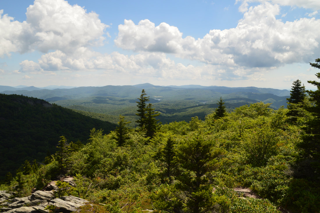
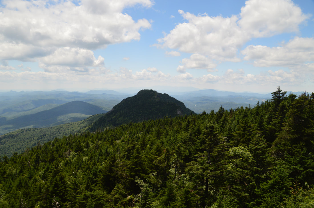
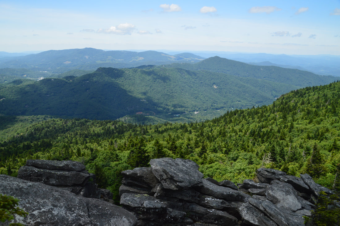
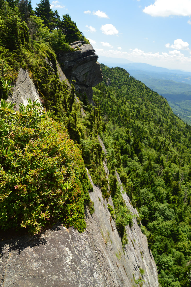
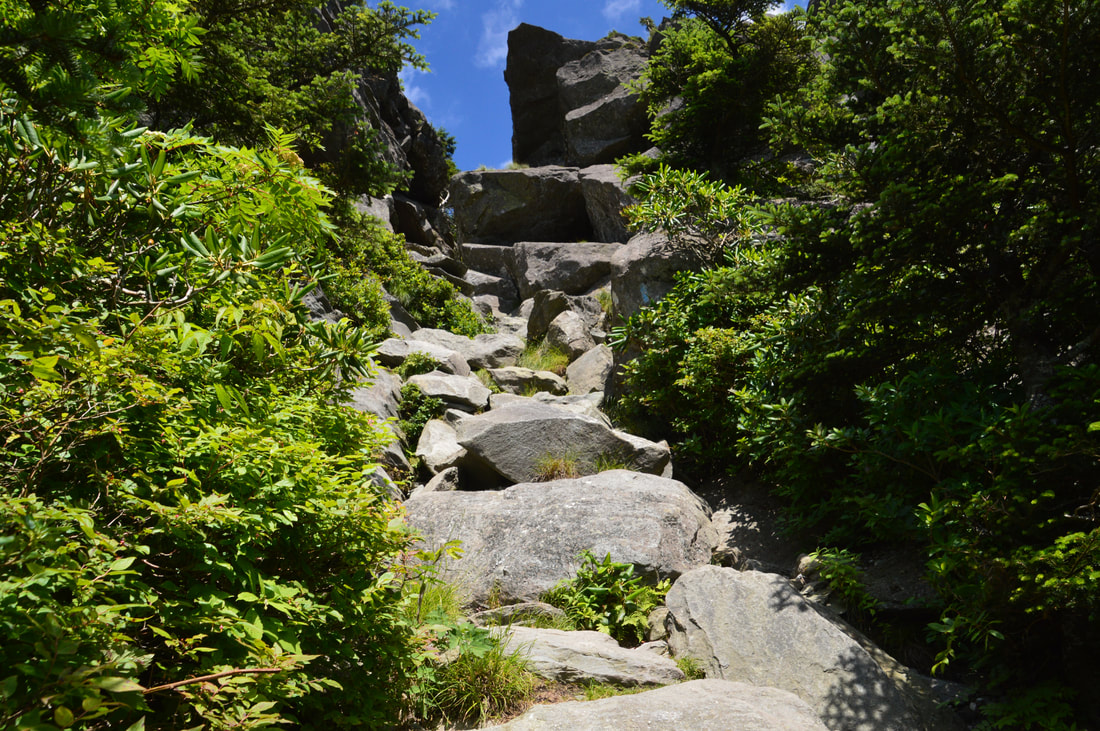
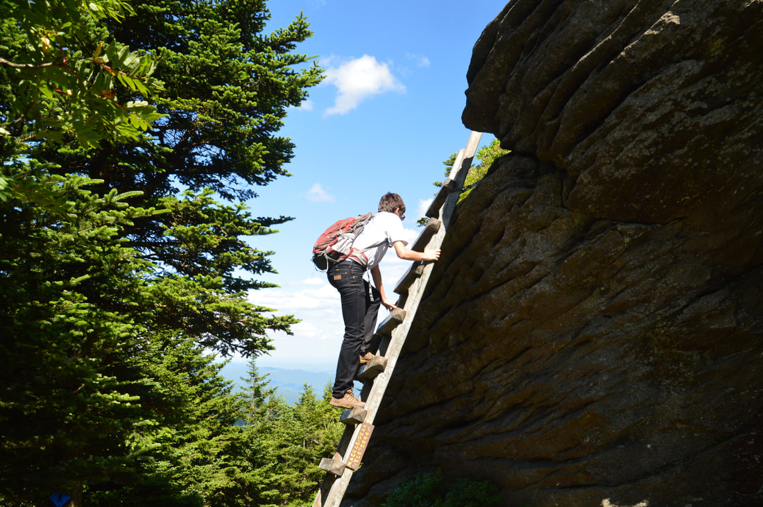
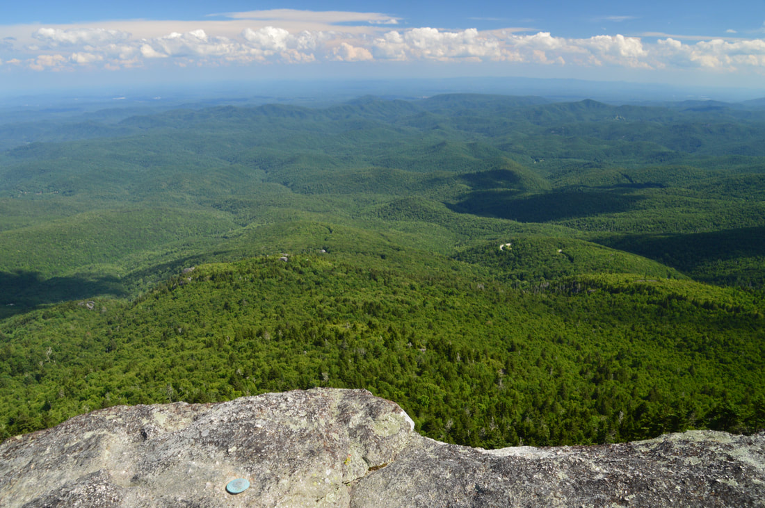
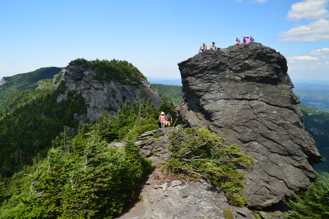
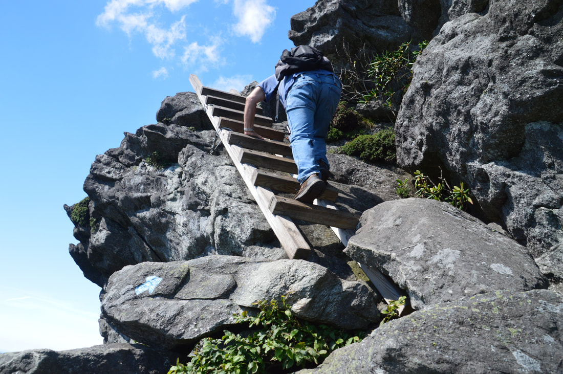
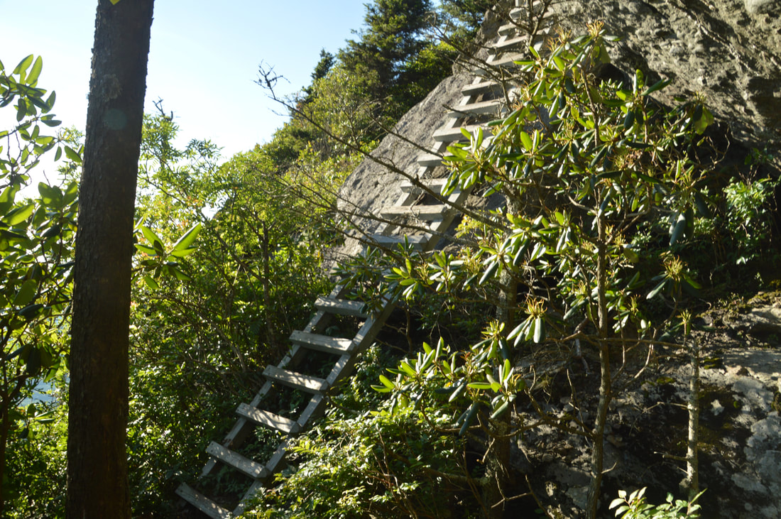
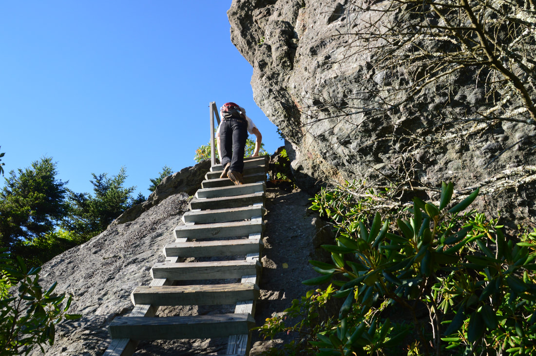
Continuing on the blue-blazed Grandfather Trail, you will shortly reach another particularly tricky stretch. The trail climbs up a lengthy ladder and then continues up a very steep and sometimes slippery rock face with the aid of a cable. I suspect descending this stretch would be tough; the ascent was somewhat easier, and I actually stayed on the right side of the rock face away from the cable for most of the way except the final little piece. At the top of the cable section, there is a grand view back toward the sheer cliffs on the south and west sides of Attic Window Peak. A few feet farther, there is a somewhat tricky scramble up a diagonal rock face. A scenic overhanging cliff is to the left. In a few more feet, at about 4.95 miles, a ladder on the left acts as the spur to the summit of MacRae Peak while the main trail continues straight. Absolutely don't miss out on the 100-foot side trail to MacRae Peak. A sign "MacRae Peak 5844 Ft." attached to the ladder confirms that this is the side trail. At the top of the steep ladder, there is a rather tricky cable section that will be unnerving to folks afraid of heights. Past the cable, turn right and walk up the sloping rock face to the very summit of MacRae Peak. The 360-degree vista atop MacRae Peak is among the best I've ever seen. The summit itself is a small rocky dome with zero trees that could impede the view. Completely open panoramas from rocky peaks like this are exceedingly rare in the Southern Appalachians. Some parts of the view are similar to Attic Window Peak, but others are vastly different. For example, the cliffs on Attic Window Peak are new. Also, the view to the south and southeast is much better from MacRae Peak than Attic Window Peak. This part of the view, with its rolling foothills stretching away to the Piedmont, is particularly scenic. The Blue Ridge Parkway snakes through the lower elevations of Grandfather Mountain nearly two thousand feet lower. Also, the lakes to the west are more clearly visible from this peak. A small drawback of MacRae Peak is that it will be more crowded than Attic Window Peak due to easier access from the swinging bridge; in fact, I had Attic Window Peak to myself for some time, while I shared MacRae Peak with over a half-dozen people. 
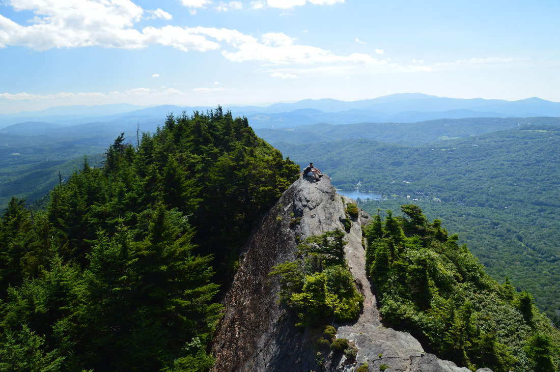
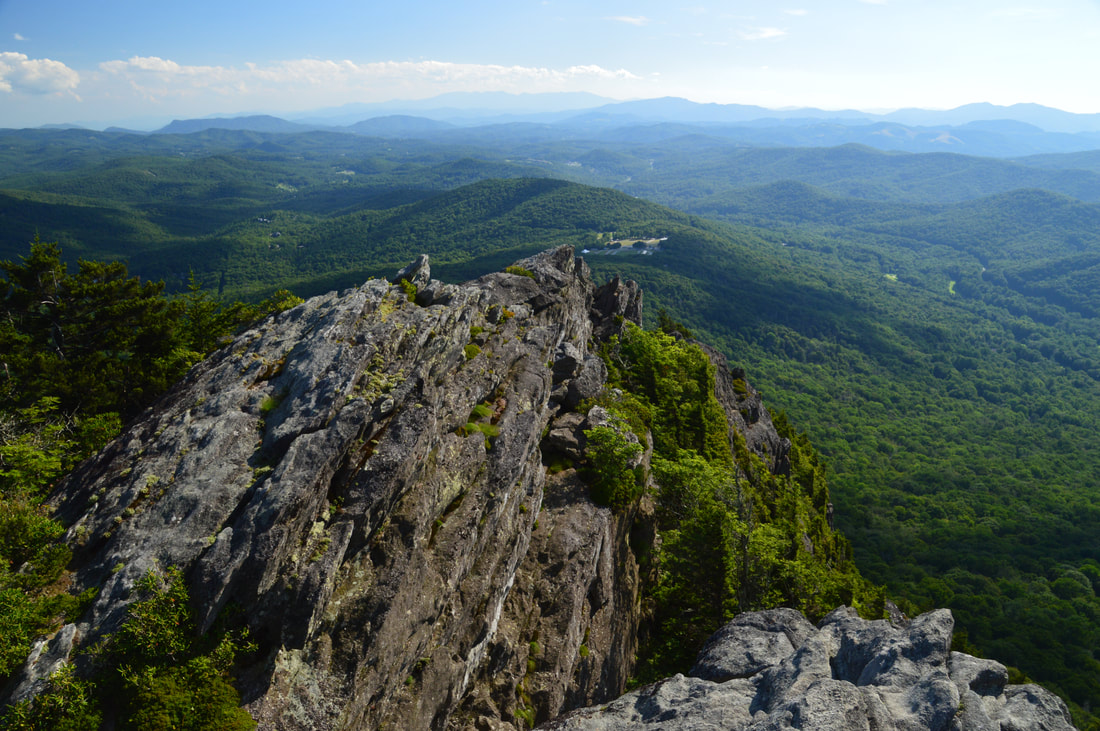
MacRae Peak, the prominent rock tower on the right, is a fully open rocky dome directly across from the tall cliffs of Attic Window Peak (center).
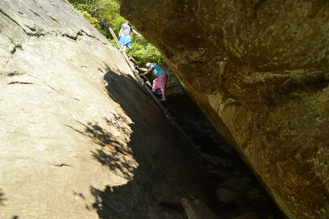
After taking plenty of time to enjoy the views from MacRae Peak, return down the cable and ladder to the Grandfather Trail and continue following as it follows a knife-edge rocky ridge, slowly descending. At 5.15 miles, the trail abruptly reaches a drop-off with steep cliffs all around, shortly after a ladder. There are super views west of Linville Peak, the Swinging Bridge and Grandfather Mountain Visitor Center, as well as the two lakes and Roan Mountain at the horizon. Great views to Here, you must follow the blazes very cautiously down the rocks toward the edge of a cliff that appears to be over a hundred feet high. Near the edge, the trail turns left and descends a series of four ladders down a nearly vertical cliff. This is followed by a steep cable and another ladder with great views. This ladder is unique, as it descends into a cave-like area, where the trail is squeezed between the wall of a large rock overhang and a steeply-sloping rock face. The trail exits the cave-like area with another very long ladder, bringing the total amount of ladders on the southwest side of MacRae Peak to seven. At the end of the seventh ladder, there is one more steep cable section down a series of rock slabs, after which the trail regains its sanity and continues a more moderate descent on a rocky footpath.
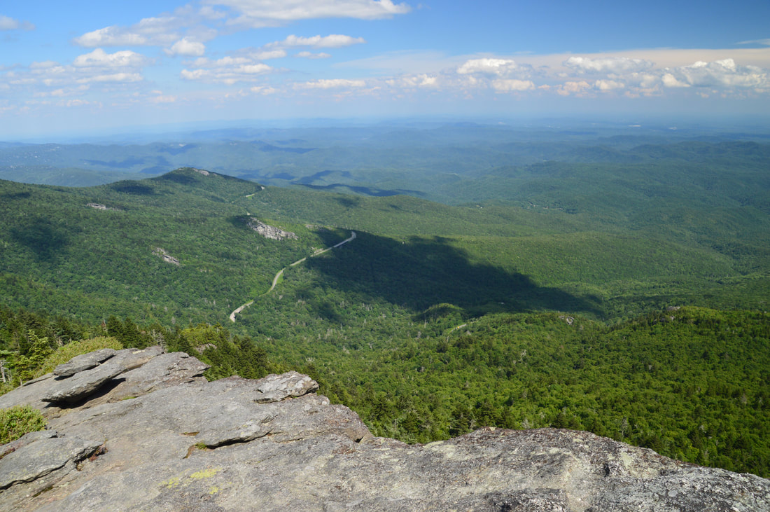
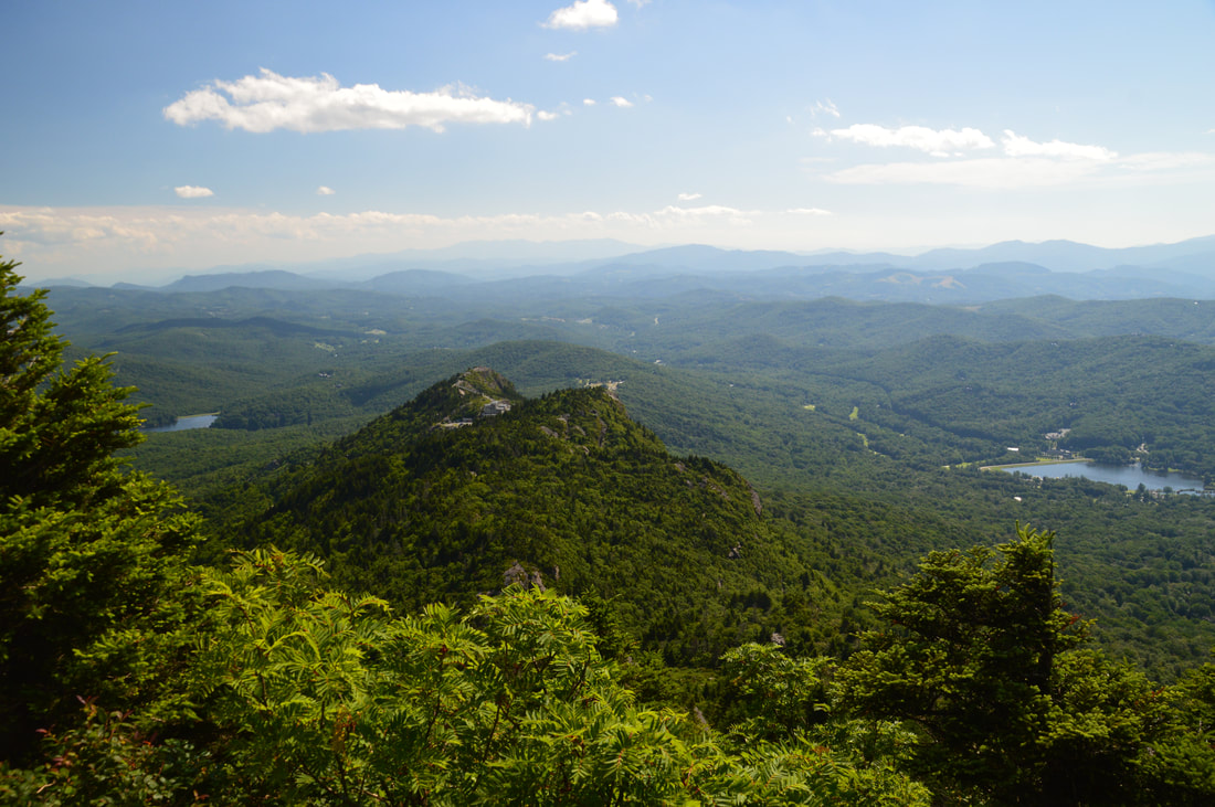
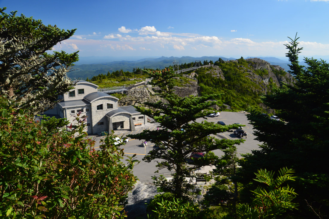
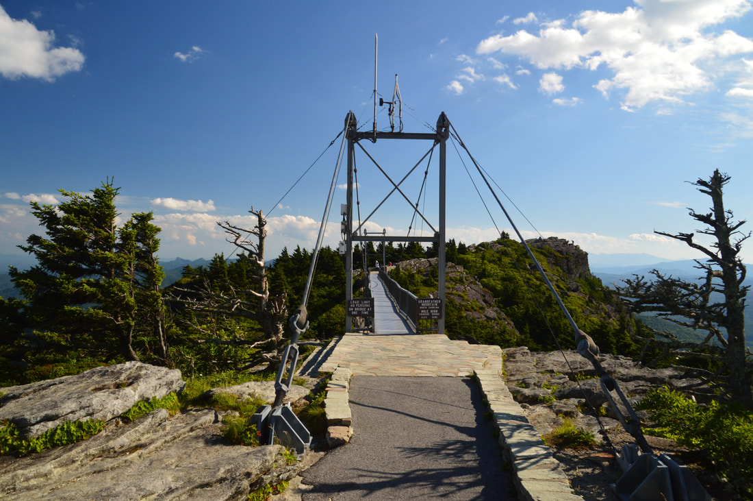
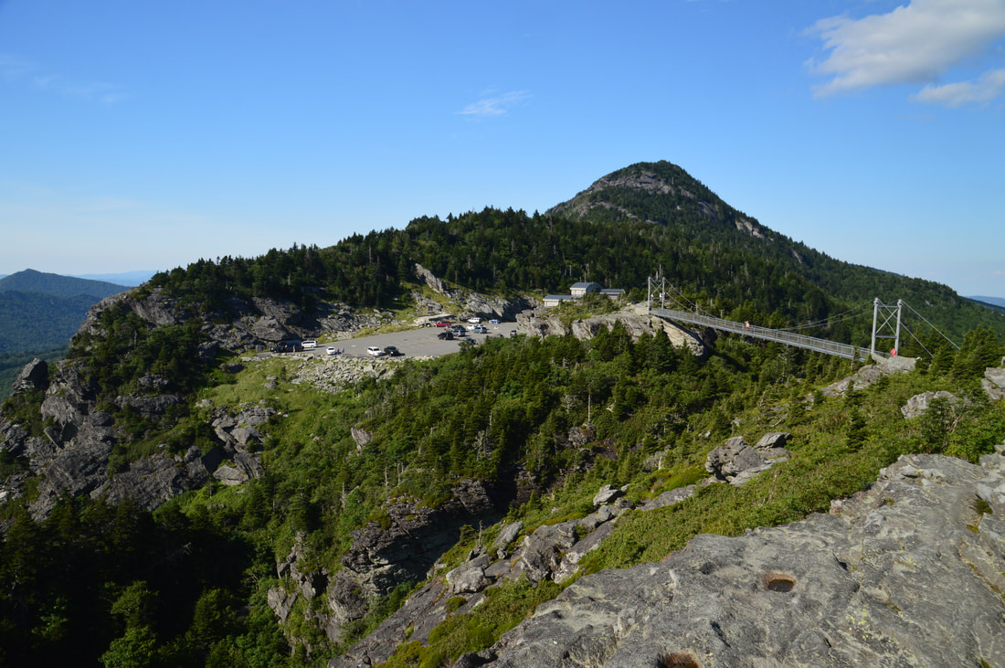
At 5.4 miles, reach a junction with the Underwood Trail's lower end. On the way back, if you don't wish to summit MacRae Peak again, you'll turn onto the Underwood Trail here, but for now, continue straight along the Grandfather Trail toward the Swinging Bridge. The trail passes through Grandfather Gap at 5.5 miles and then ascends up a small knob. At 5.65 miles, the Grandfather Extension Trail leaves left while the main trail continues straight, passing an easy cable section and then climbing to a rock outcrop with a view known as The Patio View. This view looks back at the grand cliffs of MacRae Peak. This is a very impressive view, as MacRae Peak rises up as some sort of Western butte! It is hard to imagine that you have just climbed down from that mountain. The Grandfather Trail gradually broadens as it approaches the Swinging Bridge, passing numerous signs that imply that the visitor center trailhead closes at 6 PM. Fortunately, hikers from Boone Fork Trailhead or Profile Trailhead don't need to concern themselves about this restriction. After a close-up view of the visitor center and the bridge, the Grandfather Trail makes the final steep descent to the visitor center trailhead and parking area at 5.95 miles. To see the swinging bridge and access Linville Peak, walk across the bustling parking area, up the stone steps, and along the paved walkway to the bridge. Dubbed the 'Mile-High Swinging Bridge', the swinging bridge is among Western North Carolina's top tourist attractions. In reality, the bridge is at an elevation that is roughly equal to a mile (5278 feet above sea level, a mile equals 5280 feet), but the bridge itself is suspended less than 100 feet above the ground. Nevertheless, it is an impressive construction. Walk across the bridge to the stone steps on the far side, and then, simply stay right to follow the obvious route across the rocks to the open summit of Linville Peak, which you'll reach at 6.15 miles. 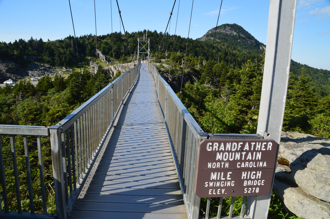
The Mile-High Swinging Bridge on Grandfather Mountain is one of Western North Carolina's top tourist attractions.
Like the previous two peaks, Linville Peak also has spectacular 360-degree views. The beauty rating is marginally lower due to the lower elevation of Linville Peak, as MacRae Peak blocks some of the views to the north. MacRae Peak itself is gorgeous though, so the difference is very small, and of course, Linville Peak is well worth a visit. In the other three directions, the views are completely unimpeded and are actually somewhat similar to the views from MacRae Peak. Linville Peak is the turnaround point - congratulations! You have successfully hiked the entire Grandfather Crest. Now you get to do it all again on the way back. Retrace your steps to the lower junction with the Underwood Trail at 6.9 miles, and turn left onto the Underwood Trail.
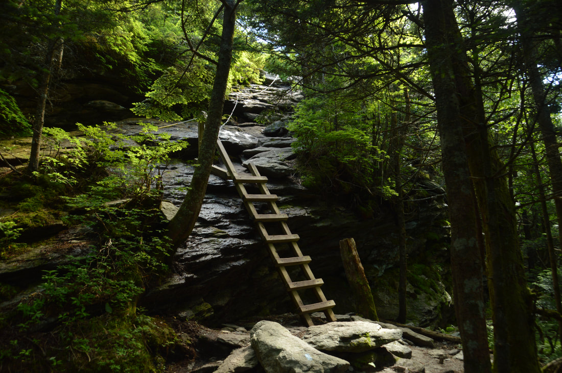
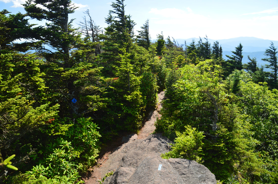
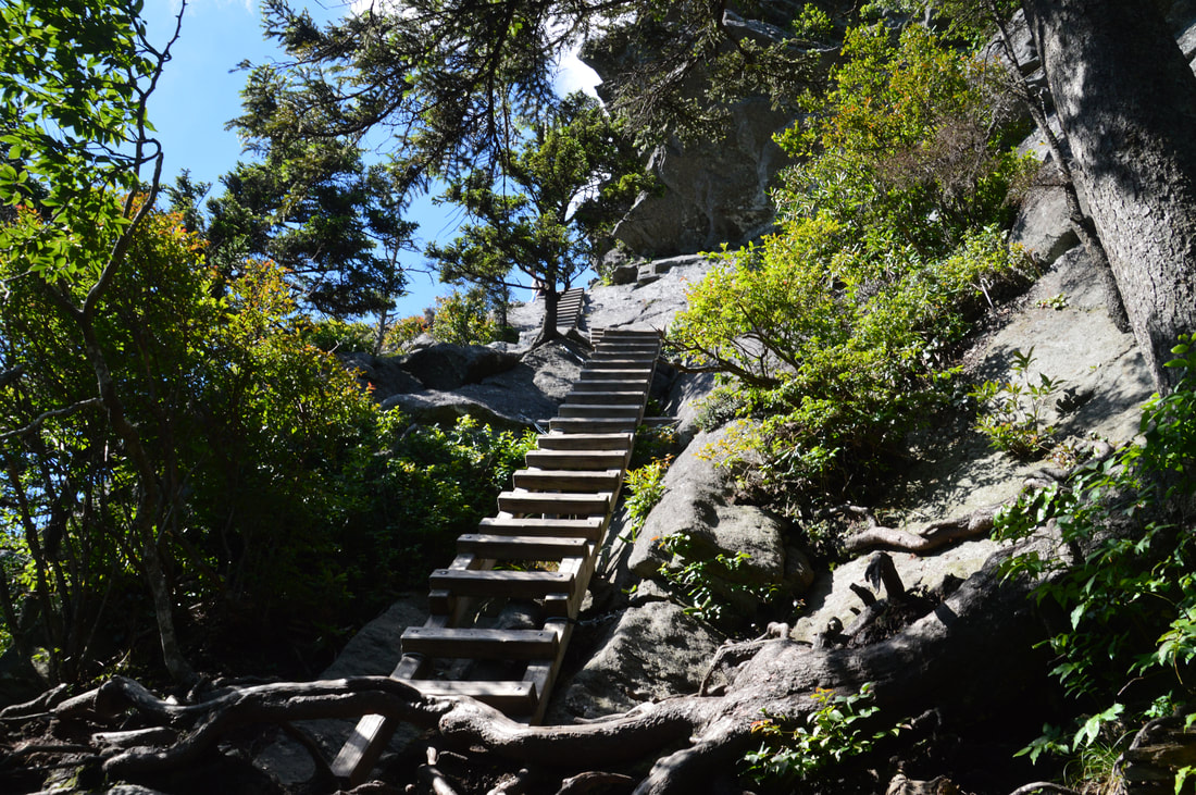
The Underwood Trail is mainly known for its extreme rockiness. It is a fairly slow trail, but probably still faster than the Grandfather Trail across MacRae Peak. Most of the Underwood Trail is just a moderate to steep ascent through woods, but there is one scenic point where the trail ascends a long ladder at 7.25 miles. Just before the ladder, the trail passes along the base of a tall cliff. At the top of the ladder, a rock outcrop provides a narrow but stunning view of the valley and lake to the west. After this, the trail becomes pretty easy before ending in MacRae Gap at 7.4 miles. Here, turn left on the Grandfather Trail and simply retrace your steps across Attic Window Peak, Calloway Peak, and all the way to the Cragway Trail junction. Along the way, I recommend taking the side trips to Watauga View and Attic Window Peak Vista again as I did - it will be worth it. You will return to the Cragway Trail junction at 10.1 miles. Here, continue straight on the Daniel Boone Scout Trail. The rest of the descent is pretty nondescript, as the very rooty trail descends moderately to a junction with the Tanawha Trail at 11.3 miles. Turn left on the Tanawha Trail and follow it to the Nuwati Trail junction, which you'll reach at 11.5 miles. At the beginning of the day, you were at this junction. Now, to finish the hike, turn right to stay on the Tanawha Trail, crossing Boone Fork once again and reaching the Boone Fork parking area at 11.9 miles, concluding this spectacular hike. 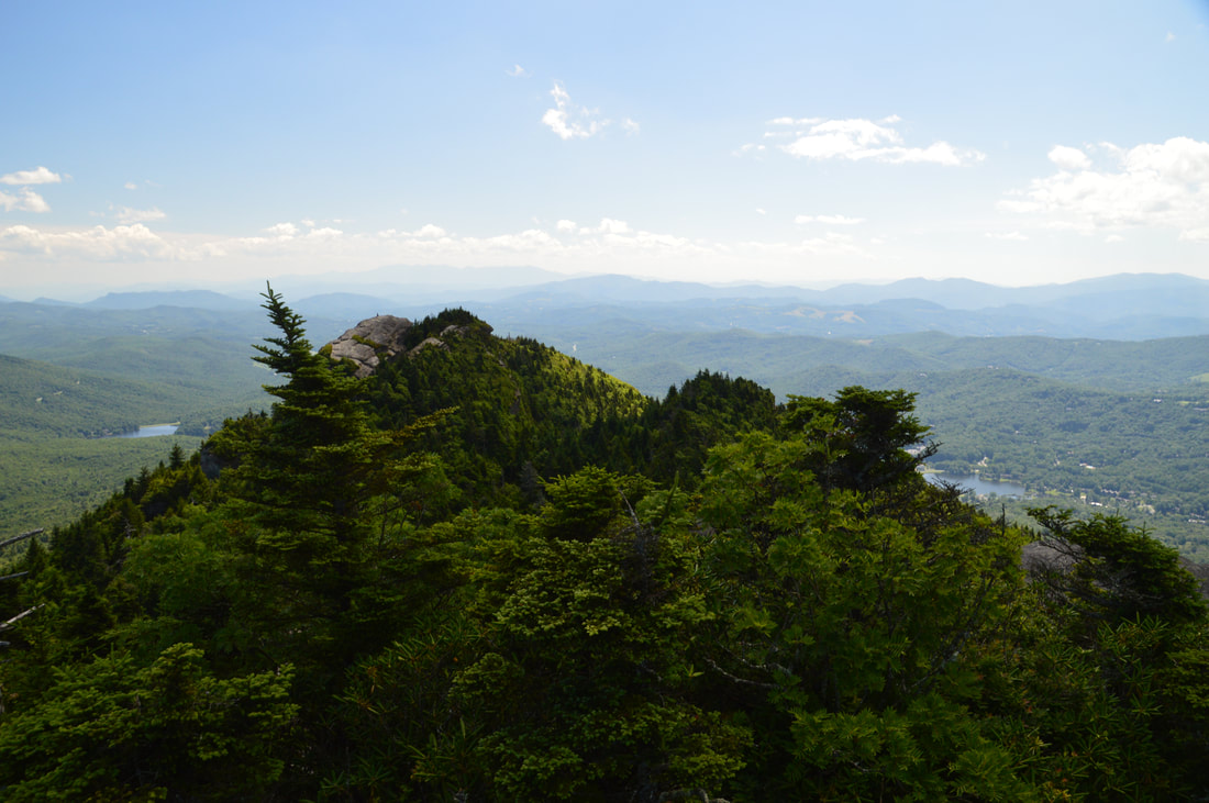
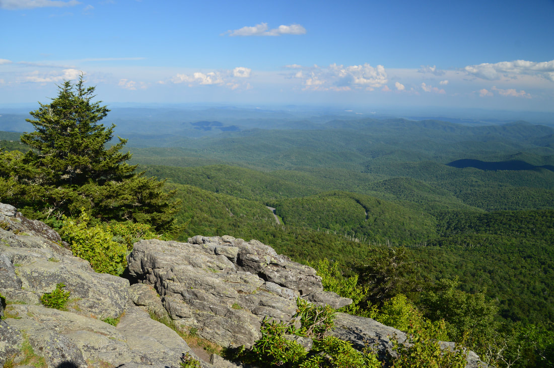
One part of Attic Window Peak's 360-degree view encompasses MacRae Peak to the southwest, with a lake on either side in the valley below. Far in the distance, the Roan Mountains line the horizon.
The Grandfather Mountain hike is incredible. There is really no hike like it anywhere in the Southeast US. Due to its spectacular rock features and stunning views, this hike automatically warrants the "Best Hike" classification. If you live in the Southeast, you must hike the Grandfather Crest at least once. Trust me!
Mileage
0.0 - Boone Fork Parking Area
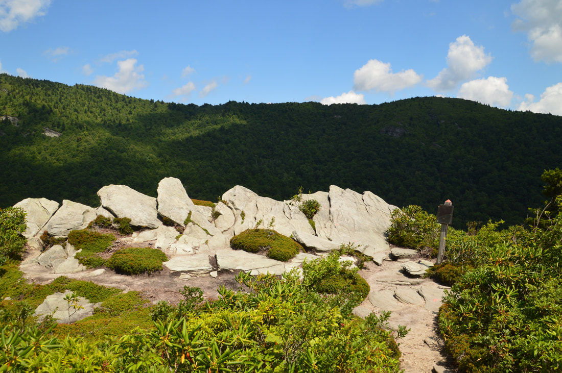
1.4 - Top Crag View 1.85 - Flat Rock View 3.0 - Lynn Cove Viaduct View 3.25 - Hi-Balsam Shelter/1978 Plane Crash 3.45 - Calloway Peak 3.55 - Watauga View 4.0 - Calloway Gap 4.55 - Indian House Cave 4.7 - Attic Window Peak 4.85 - MacRae Gap 4.95 - MacRae Peak 5.75 - The Patio View 5.95-6.05 - Visitor Center Parking Area and Mile-High Swinging Bridge 6.15 - Linville Peak 7.25 - Underwood Trail View 11.9 - Boone Fork Parking Area Variations
Hike to Calloway Peak from Boone Fork Parking Area via Cragway/Daniel Boone Loop - 6.7 Miles
Hike to Attic Window Peak from Boone Parking Area via Cragway/Daniel Boone Loop - 9.1 Miles Hike to MacRae Peak from Boone Parking Area via Cragway/Daniel Boone Loop - 9.6 Miles Hike to Calloway Peak from Swinging Bridge via Underwood Loop - 4.8 Miles Hike to Attic Window Peak from Swinging Bridge via Underwood Loop - 2.5 Miles Hike to MacRae Peak from Swinging Bridge via Underwood Loop - 2.0 Miles Hike to Calloway Peak via Profile Trail - 8.3 Miles Hike to Attic Window Peak and MacRae Peak via Profile Trail - 9.0 Miles Hike to MacRae Peak, Attic Window Peak, and Calloway Peak via Profile Trail - 10.1 Miles PicturesVideos
0 Comments
Leave a Reply. |
About MeMark Oleg Ozboyd Dear readers: I have invested a tremendous amount of time and effort in this website and the Georgia Waterfalls Database the past five years. All of the work that has gone in keeping these websites updated with my latest trip reports has almost been like a full-time job. This has not allowed me to pick up a paid job to save up money for college, and therefore, I I've had to take out loans. If you find the information on this website interesting, helpful, or time-saving, you can say "thanks" and help me out by clicking the button above and making a contribution. I will be very grateful for any amount of support you give, as all of it will apply toward my college tuition. Thank you!

Coming in 2022-2023?
Other Hiking WebsitesMiles HikedYear 1: 540.0 Miles
Year 2: 552.3 Miles Year 3: 518.4 Miles Year 4: 482.4 Miles Year 5: 259.9 Miles Archives
March 2021
Categories
All
|
||


 RSS Feed