In the Valley and Ridge Province of northwest Georgia, Rocky Face Mountain is the home of a battle from the Civil War: the Battle of Dalton in 1864. Near the north end of Rocky Face Mountain is the grave of George W. Disney, a Confederate soldier who was killed during the battle, and whose grave was discovered by a group of boy scouts in 1912. Today, the George W. Disney Trail, in memory of the fallen soldier, is a short but steep trail (that is actually referred to as the steepest short trail in the state) that leads past the grave and to a pair of rock outcrops with beautiful views into the heart of the "Valley and Ridge". This hike occurred on Saturday, December 3rd, 2016. My plan was to hike the George W. Disney Trail out and back to the vistas at the north end of Rocky Face Mountain. I would also explore the Rocky Face Mountain Ridge southward for any continuations of the trail.
Summary
R/T Length of Trail: 1.5 Miles
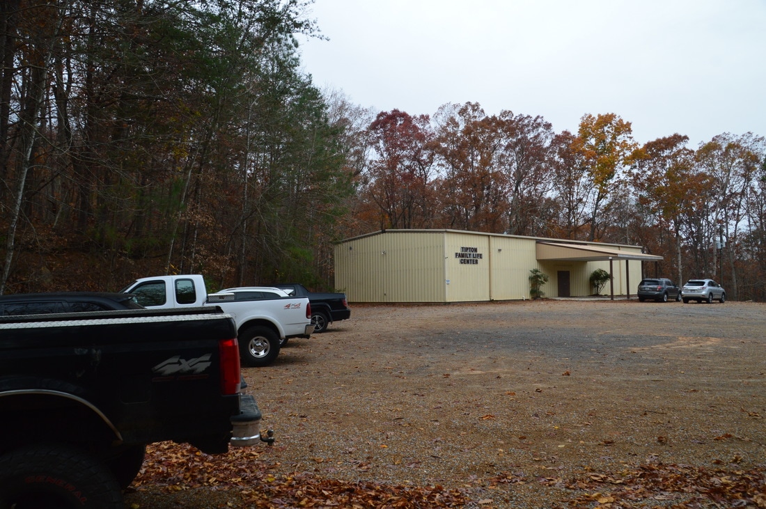
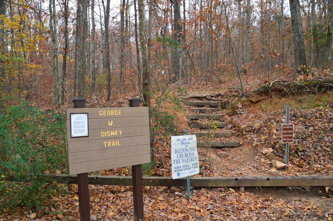
Duration of Hike: 1:00 Type of Hike: Out and Back Difficulty Rating: 3 out of 10 Total Elevation Gain: 754 Feet Pros: None Cons: There is some highway noise in the first part of the hike; portions of the trail have become eroded; some of the rock outcrops at the top of Rocky Face Mountain have been spray painted Points of Interest: Buzzards Roost on Rocky Face Mountain - 4 stars; Main Vista on Rocky Face Mountain - 6 stars; George W. Disney Grave Trail Blaze Colors: George W. Disney Trail - White Best Seasons to Hike: Year-round Fees: None Beginning Point: George W. Disney Trailhead near the First Church of the Nazarene Directions from Dalton, GA: From Exit 336 on I-75, follow US 41 North for 0.7 miles, until when you see a sign for the "First Church of the Nazarene" to the left. Turn into the steep driveway, follow it to and past the church. Past the church, bear left onto another minor road that shortly ends at the Tipton Family Life Center. The large dirt parking area for the hike is to the left of the family life center. Map
Click here for more information and to download this trail map to view in Garmin Basecamp.
Note: The track of my exploration southward along the ridgeline is not included above, although if anyone's interested, I can publish it. Details
There are many historic Civil War-era sights in northwest Georgia. Throughout the war, several key battles occurred throughout the Chattanooga area, including on Lookout Mountain and Rocky Face Mountain. George W. Disney, who was a soldier in the war, was killed in the Rocky Face Mountain battle, and today, his grave can still be found in the area where he was killed. Due to the namesake grave that the George W. Disney Trail passes, it has historical significance, but it also leads to one of northwest Georgia's more beautiful views - and there aren't many in this region of the state. Furthermore, the hike to the overlook is quite short, so it can easily be done in a short daytime period.
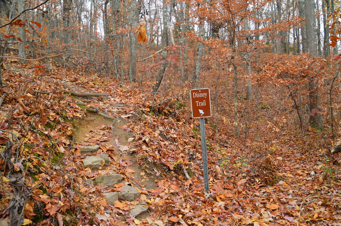
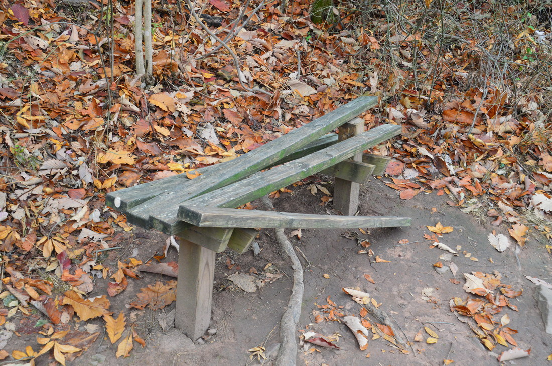
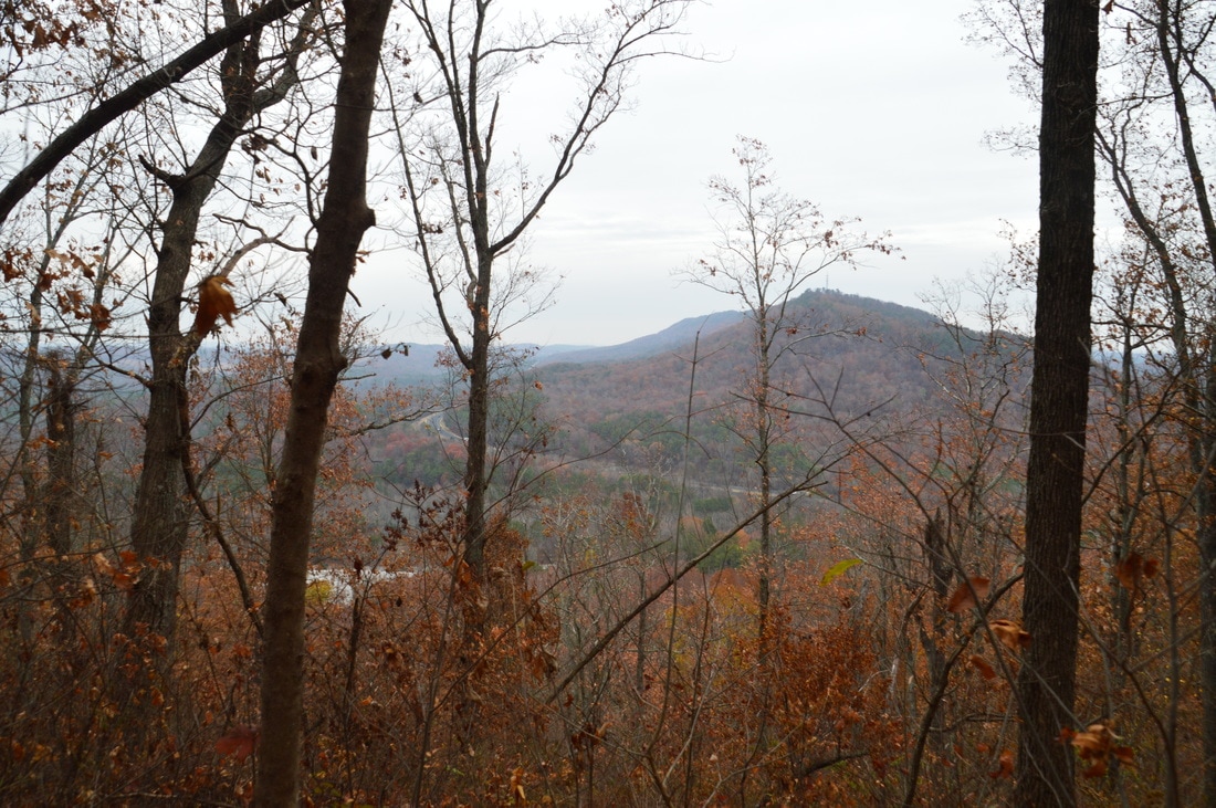
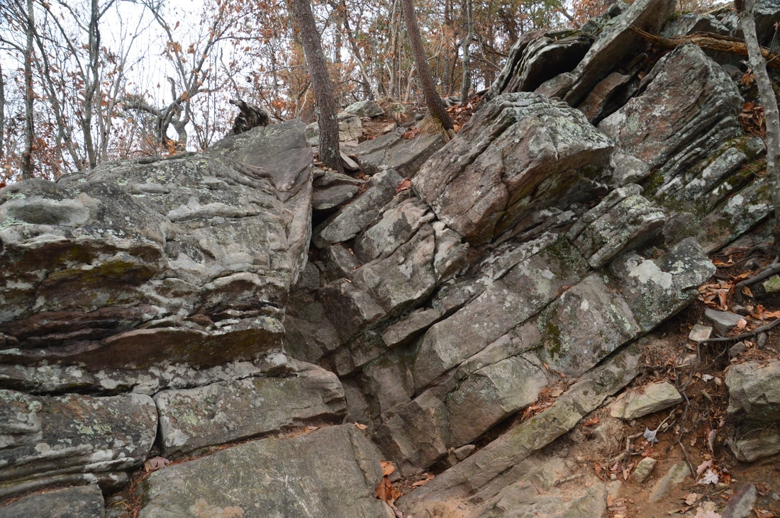
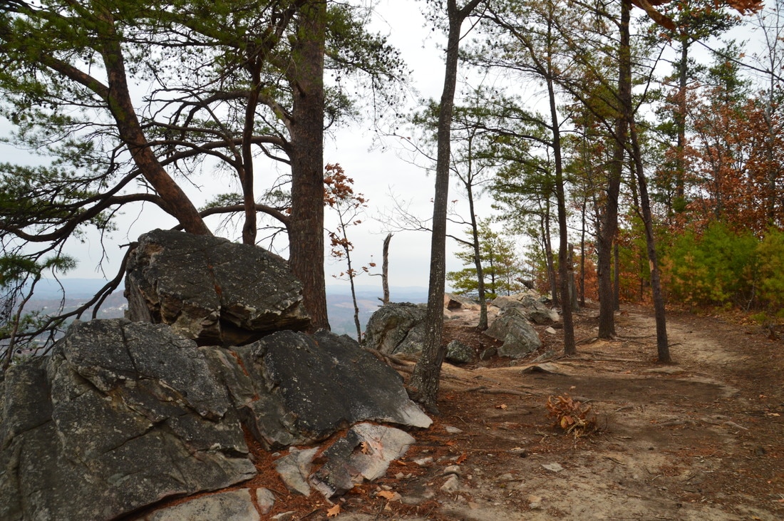
The trail begins at the far end of the parking area. A pair of signs mark the beginning of the trail. Initially, the trail is fairly level as it joins an old roadbed that contours along the mountain. However, the easiness doesn't last. At 0.15 miles, a sign points out the trail as it bears left, leaving the old roadbed and beginning the steep ascent, which has a general rate of about 1000 feet per mile. As the trail ascends Rocky Face Mountain, winter views open up to the north across Mill Creek Gap and towards the next mountain, which appears to be a continuation of Rocky Face Mountain/Rocky Face Ridge. There is a slight point of confusion here, as both mountains are known as Rocky Face Mountain. I am going to refer to the mountain on the Disney Trail as Rocky Face Mountain and the mountain to the north of Mill Creek Gap as Rocky Face Ridge. Portions of the ascent are fairly rocky and are also eroded. When I first hiked the George W. Disney Trail in 2012, the trail was virtually unknown to the public and there were no traces such as spray paint anywhere. All of that has changed since then, as the trail has gradually started to receive more and more use, in part leading to the erosion of the steep footpath. I hope that some work will be done on the trail soon. At 0.4 miles, there is a dilapidated bench to the right of the trail at one of the switchbacks. Remember, please do not cut across the switchbacks. At 0.55 miles, the trail reaches a tricky spot. Here, you are required to scramble up a small ledge, adding some fun to the hike. I think that there is a bypass around this spot (I did not confirm this), but it is not difficult at all. After the rock scramble, the trail passes the first open views to the west and follows the edge of the mountain to Buzzards Roost, reaching Buzzards Roost at 0.6 miles. While this is the named overlook on Rocky Face Mountain, it is actually not as good as the second overlook, which is located farther ahead. 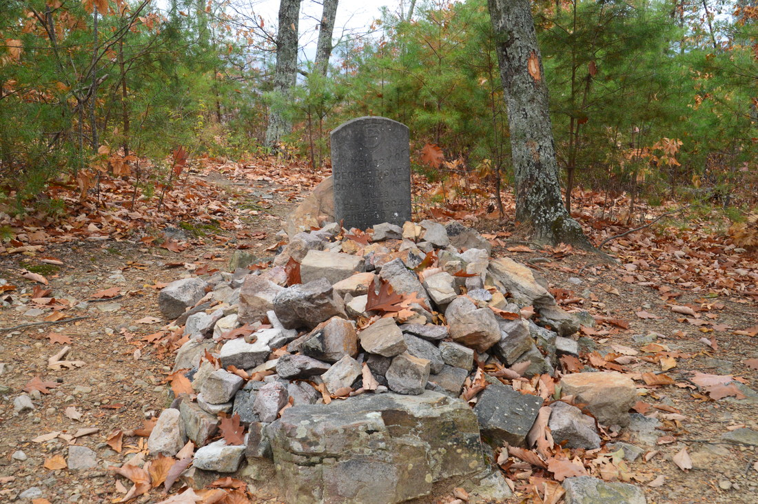
The grave of George W. Disney - a Confederate soldier who was killed during the Civil War - is one of the highlights of the trail.
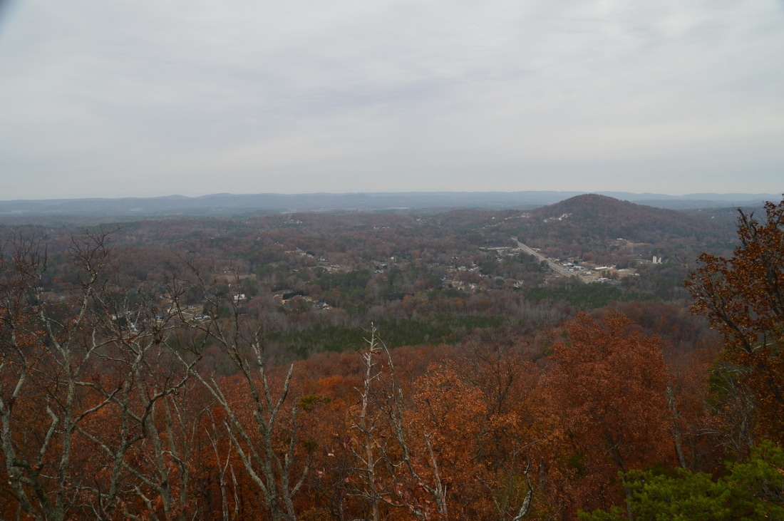
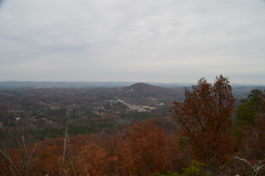
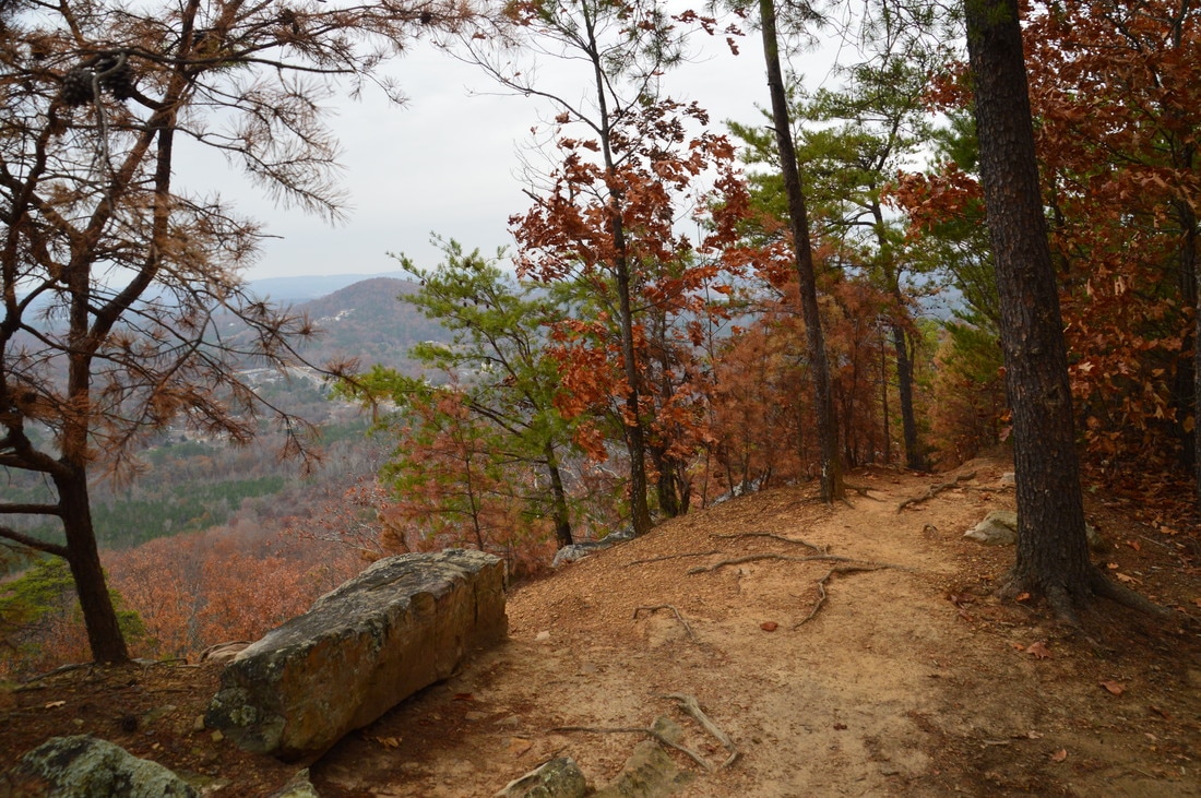
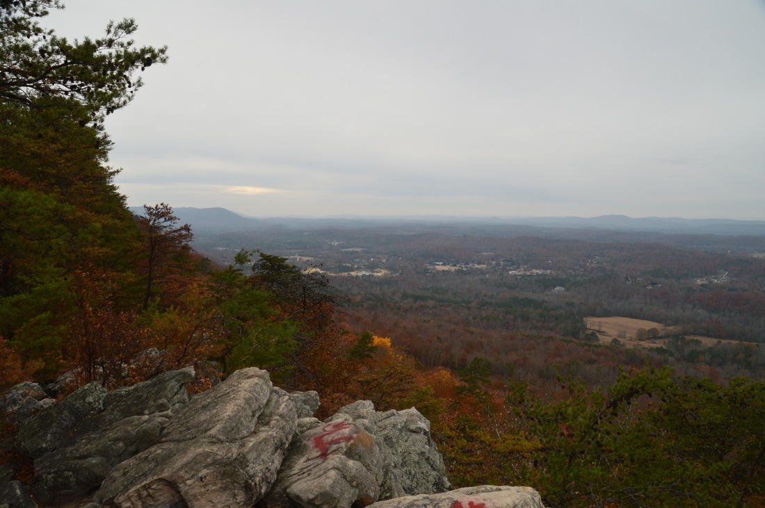
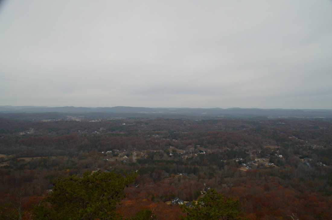
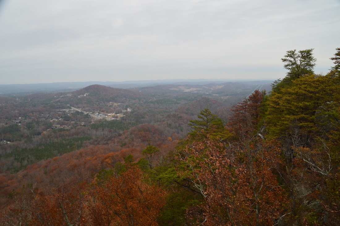
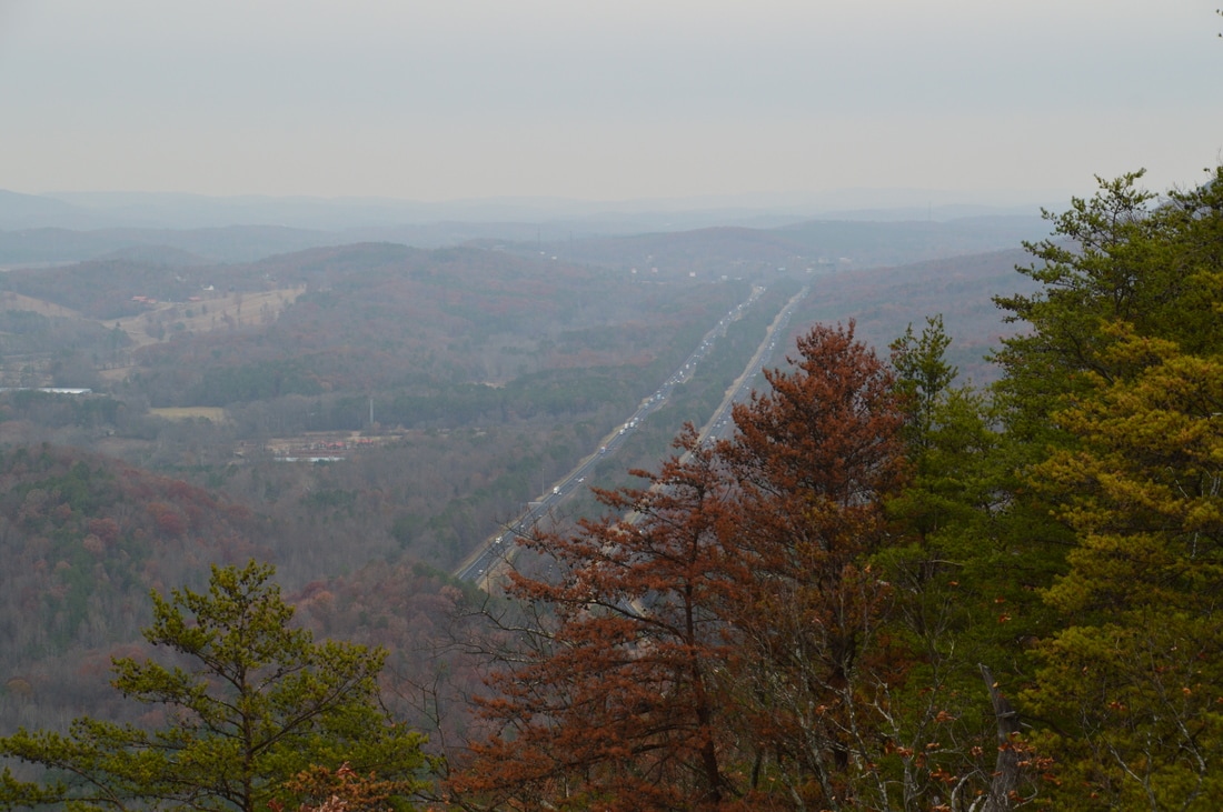
There is an assortment of user-created paths leading away from Buzzards Roost. On my way in, I accidentally followed the unofficial path along the edge of the mountain, before realizing that I was not on the trail. The main trail actually bears left and away from the edge of the mountain, reaching the grave of George W. Disney in about 150 feet, A tall gravestone and a pile of rocks mark the grave. After the grave, the trail makes the final ascent to the main vista. At 0.75 miles, the official trail ends at a clearing, where there is an amphitheater to the left and a rock outcrop to the right with excellent 180-degree views westward. Most of the view is taken up by the broad valley rolling away to Rocky Ridge and farther Taylors Ridge on the horizon. Several creeks flow through this valley, including Mill Creek, Mount Vernon Creek, and East Chickamauga Creek. The valley between Rocky Ridge and Taylors Ridge is known as Houston Valley. At the far left (south) end of the view, Hurricane Mountain can be seen. To the northwest, the low hill in the foreground is Blue Mountain. At the far right (north) end of the view, I-75 (the source of the muffled distant highway din through the lower part of the trail) can be seen.
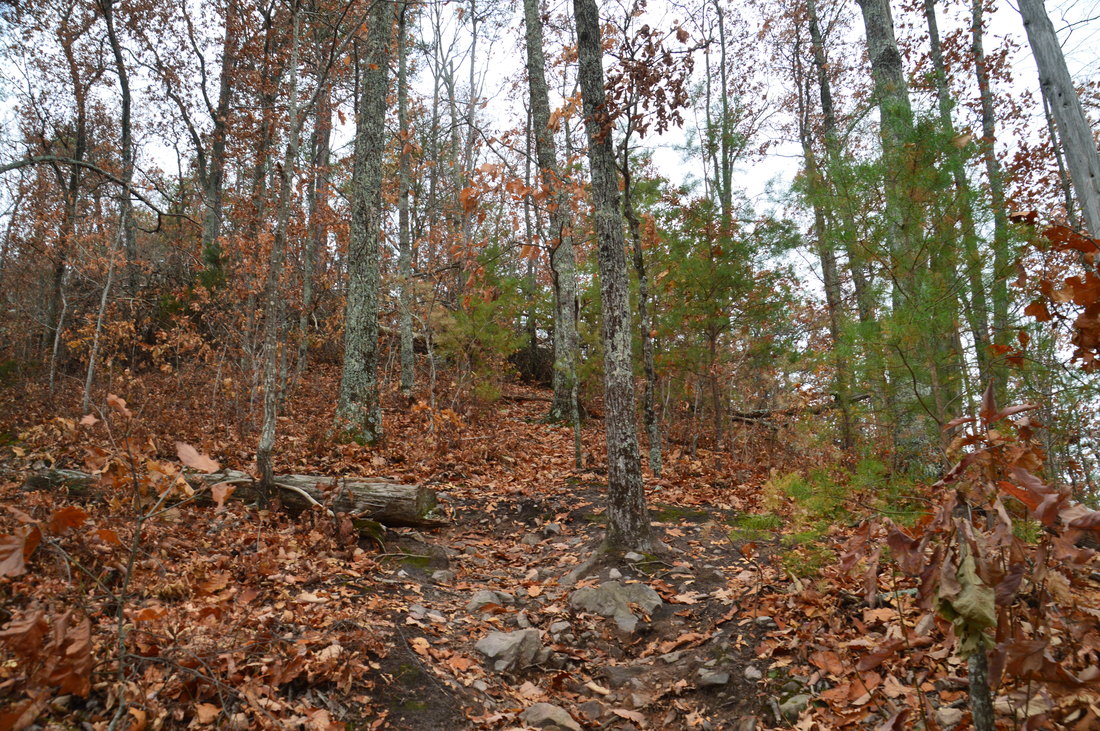
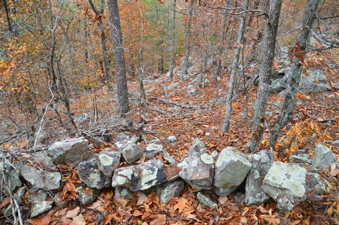
Now, remember I mentioned that the "official" trail ends at the overlook? Well, an unofficial path continues south along the crest of Rocky Face Mountain from the overlook. On my previous visit, I had seen this path but I did not explore it far. On this day, I followed the path along the ridge south for about 1.3 miles in one direction. The path is often faint or even non-existent in places and does not have any worthwhile views. The only attraction to the path is that it has some very neat civil war ramparts that are still intact. If you choose to hike the path to see the ramparts, please do not disturb them. However, personally, I do not find seeing the ramparts worth the slow trek along the ridge without a real trail. There is a rumor that the ridge of Rocky Face Mountain is the future route of the Pinhoti Trail, but I have not found any confirmation. One other note that I would like to add is about the forest road that leaves the clearing with the amphitheater and follows the east side of the mountain. While I did not hike along this road very far, I have confirmation from a friend that the road approaches Dalton State College, and thus, one could possibly reach the Rocky Face Mountain vistas from the Dalton State College Trail System, with a short connecting bushwhack involved. 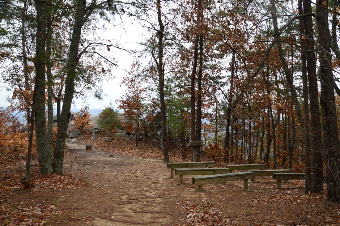
This is the rock outcrop that provides the best view into the heart of Ridge and Valley country from Rocky Face Mountain.
To return to the trailhead, simply retrace your steps along the George W. Disney Trail, concluding the hike at the trailhead at 1.5 miles.
Mileage
0.0 - Disney Trailhead
0.4 - Bench 0.6 - Buzzards Roost and George W. Disney Grave 0.75 - Main Vista on Rocky Face Mountain 1.5 - Disney Trailhead Variations
The only sensible variation to this hike is to extend it along the ridge south of Rocky Face Mountain.
Bonus Stops
The double Johns Mountain/Keown Falls loop is a nearby hike in the Ridge and Valley area that leads to a low-flow waterfall and more great views.
PicturesVideos
1 Comment
Randy Whittaker
7/19/2017 12:35:35 pm
Is there a map of the trail and if so how can I get one ? Leave a Reply. |
About MeMark Oleg Ozboyd Dear readers: I have invested a tremendous amount of time and effort in this website and the Georgia Waterfalls Database the past five years. All of the work that has gone in keeping these websites updated with my latest trip reports has almost been like a full-time job. This has not allowed me to pick up a paid job to save up money for college, and therefore, I I've had to take out loans. If you find the information on this website interesting, helpful, or time-saving, you can say "thanks" and help me out by clicking the button above and making a contribution. I will be very grateful for any amount of support you give, as all of it will apply toward my college tuition. Thank you!

Coming in 2022-2023?
Other Hiking WebsitesMiles HikedYear 1: 540.0 Miles
Year 2: 552.3 Miles Year 3: 518.4 Miles Year 4: 482.4 Miles Year 5: 259.9 Miles Archives
March 2021
Categories
All
|


 RSS Feed