HIKING THE APPALACHIANS AND BEYOND
  • Home
  • Trail Reports
    • Best Hikes
    • Hikes with Scenic Views
    • Hikes with Water Features
    • Alabama
    • Georgia
    • Florida
    • North Carolina
    • South Carolina
    • Tennessee
    • Vermont
    • Virginia
  • Map
  • Hike List
  • Testimonials
  • Resources
  • Contact Us
  • Southeast Nature Society
    • Our Team
  • Georgia Waterfalls Database

Fort Yargo State Park: Fort Yargo Lake Multi-Use Loop, Winder, Georgia

5/29/2015

3 Comments

 
Picture
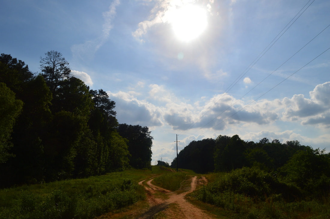
When you're looking for outdoor recreational opportunities near the busy city of Atlanta, chances are you won't find much - but your best shot would be to take a look at nearby state parks, such as Sweetwater Creek State Park, Panola Mountain State Park, and the one this article is about: Fort Yargo State Park. While this state park has neither the solitude nor the remoteness of a wilderness area, you will still find a nice, easy day hike that is doable as an after-work hike or a short weekend outing. This hike occurred on Saturday, May 16th, 2015. My plan was to hike the loop trail around Fort Yargo Lake counter-clockwise, and also to hike the Winder Connector Trail roundtrip (I never found the trailhead for it though). Most of the loop trail was going to be open to both bikers and hikers, although a small section was going to be hiking only.

R/T Length of Trail: 8.8 Miles
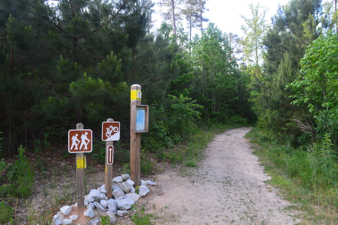
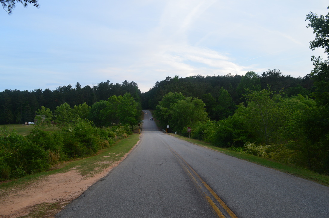
Duration of Hike: 4 Hours
Type of Hike: Loop
Difficulty Rating: 2 out of 10
Pros: Lake views; easily-visible trail
Cons: Some presence of mountain bikers; crowded sections
Scenic Views: None
Water Features: None
Trail Blaze Color(s): Multi-Use Trail - Orange, Yellow, and Blue
Best Season(s) to Hike: Year-round
Beginning Point: Historical Fort Yargo
Directions: From Winder, GA: Follow GA State Route 81 South for 0.7 miles, and then, turn left onto Fort Yargo Road to enter Fort Yargo State Park. Follow Fort Yargo Road for 0.6 miles, and then turn left (just after a bridge) onto the parking at the historical Fort Yargo cabin. The trail is located just below the cabin, near the lakeshore.
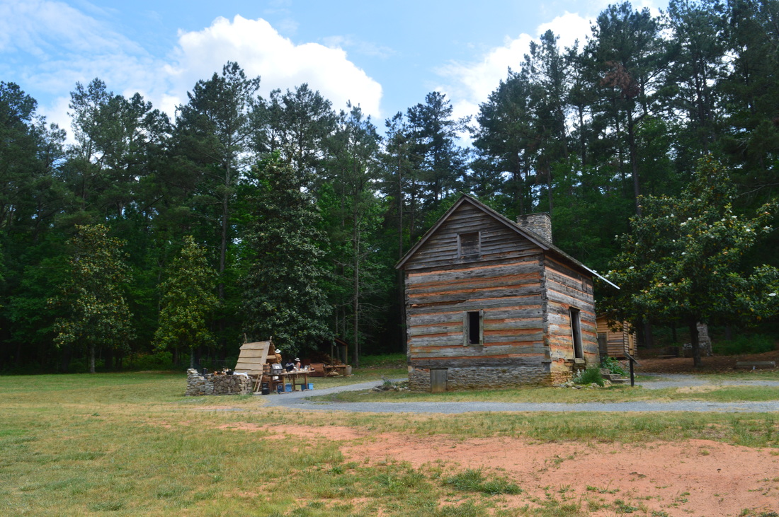
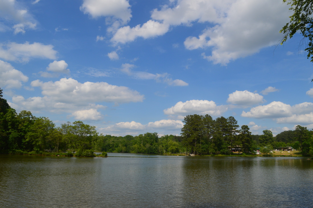
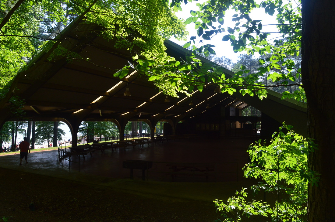
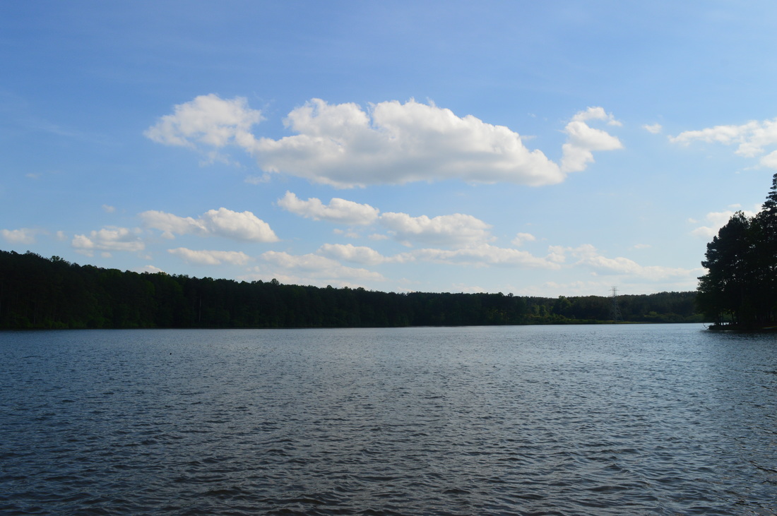
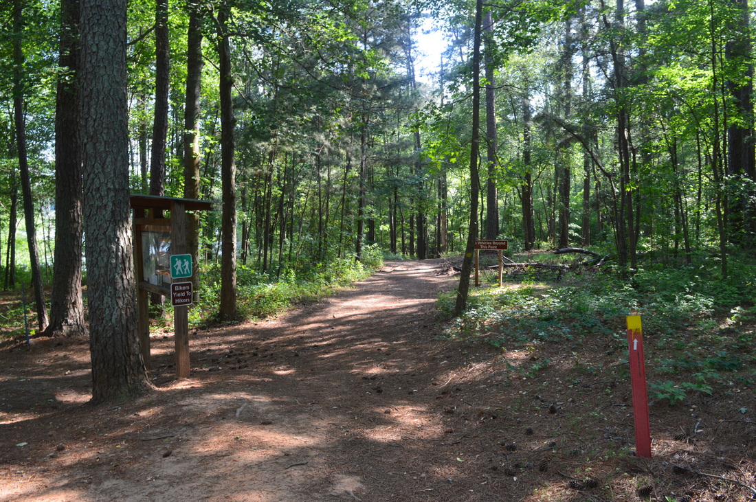
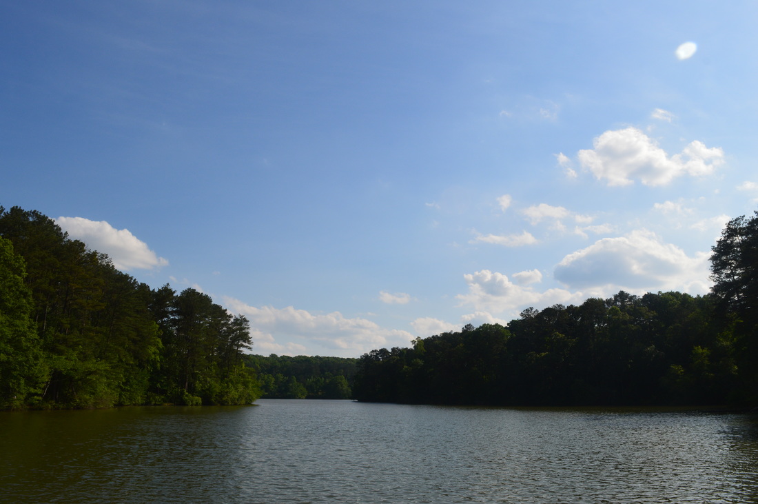
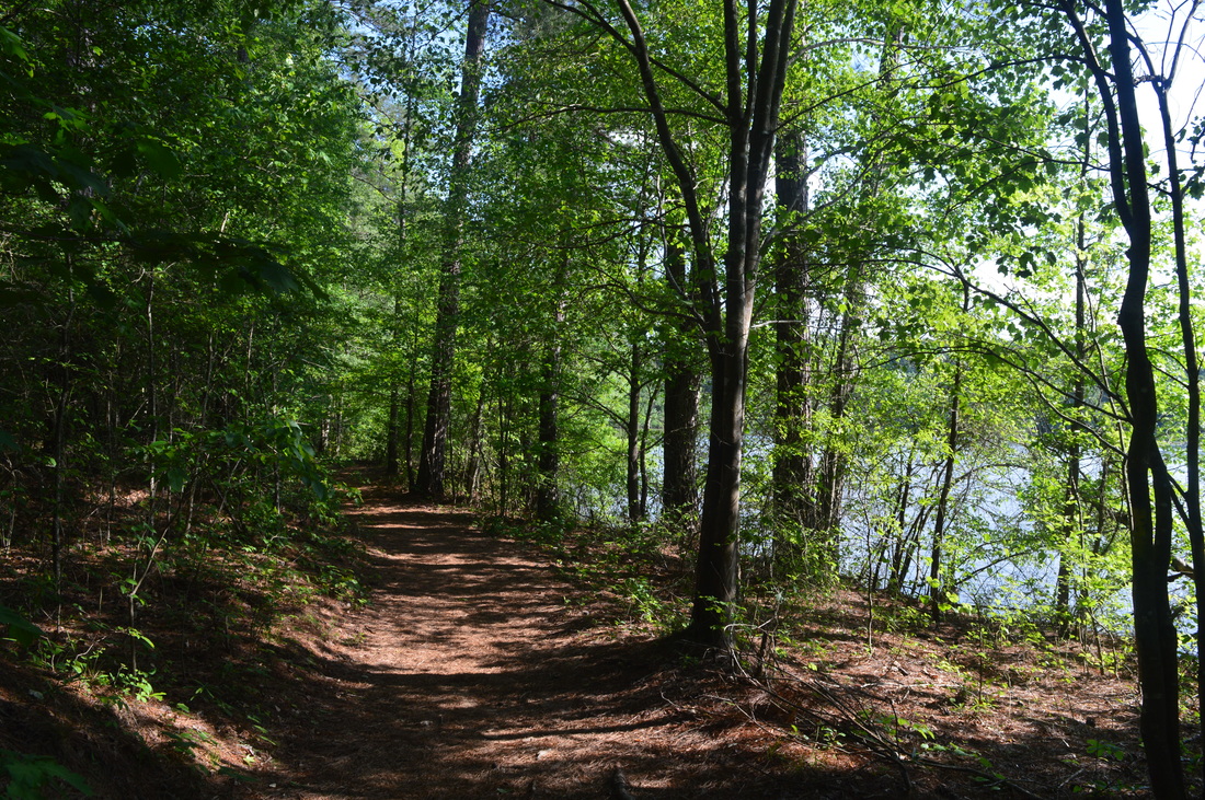
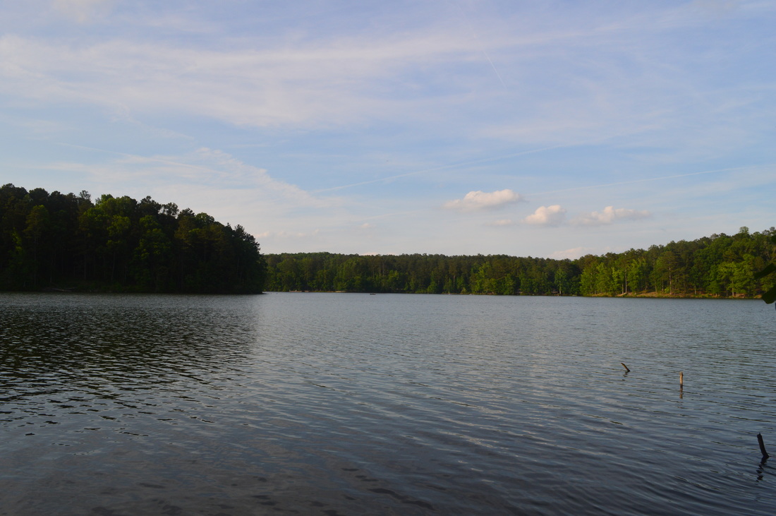
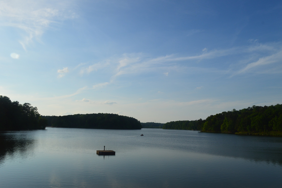
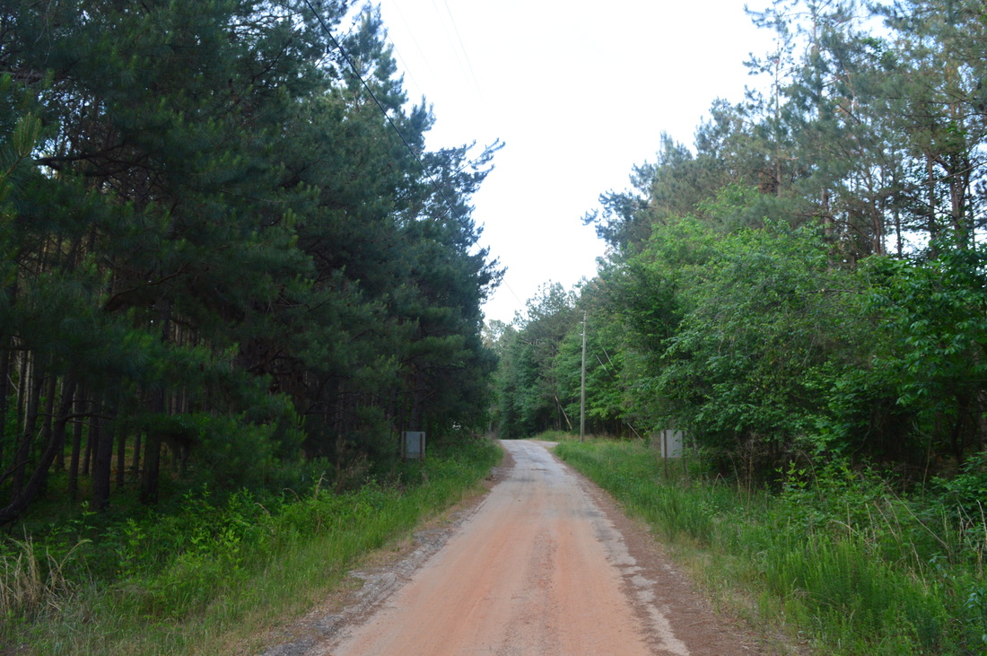
This hike starts with a visit to the historical Fort Yargo cabin, right by the parking.area. Make sure to check out both floors - it's interesting to see the types of houses that people used to live in many years ago. Once you've explored the cabin, proceed to the lakeshore, and pick up the trail, heading away from the road. It is marked by a sign. The trail starts off as a flat, dirt path that meanders along the lake. For some reason, some of the lakeside paths were closed off when I was here, although I would suggest following the closest path to the lake - you are less likely to encounter bikers there and it is more interesting.  At 0.5 miles, following a slight uphill stretch, cross one of the park roads. You will return to the lake shortly. Next, you will pass the state park's disc golf course on the right - try to follow the path that stays just to the left of the course. Then, you will reach a small peninsula. Here, the Fort Yargo Dam seems close, but a whole new area of the lake opens up on the right - the Marberry Creek section. Pass a parking area and a group shelter (just up the hill), and approach a confusing area amidst the park's most popular area. Pass a large shelter-type building on the left, and reach a large parking area and another road at 1.5 miles. Turn left onto the road, and then go down towards the beach area. Take a path that leads right, just above the lakeshore. Shortly afterwards, a spur trail leads left to a good lake view, and then, the bike trail comes in from the right. At 1.7 miles, reach yet another road (Picnic Area Road). Turn left here, and follow the road up a small hill and then down a one-way loop at the end of the road. At the lower part of the loop, where it turns left, continue straight onto a wide, dirt road at 2 miles. 


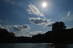
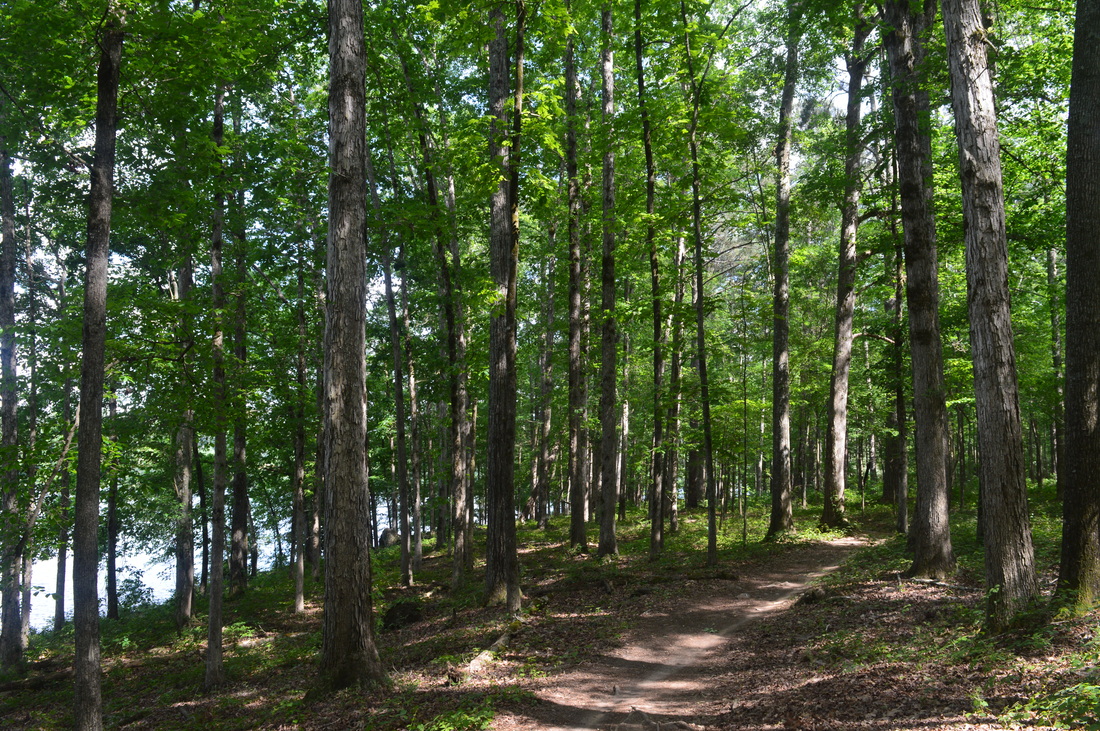
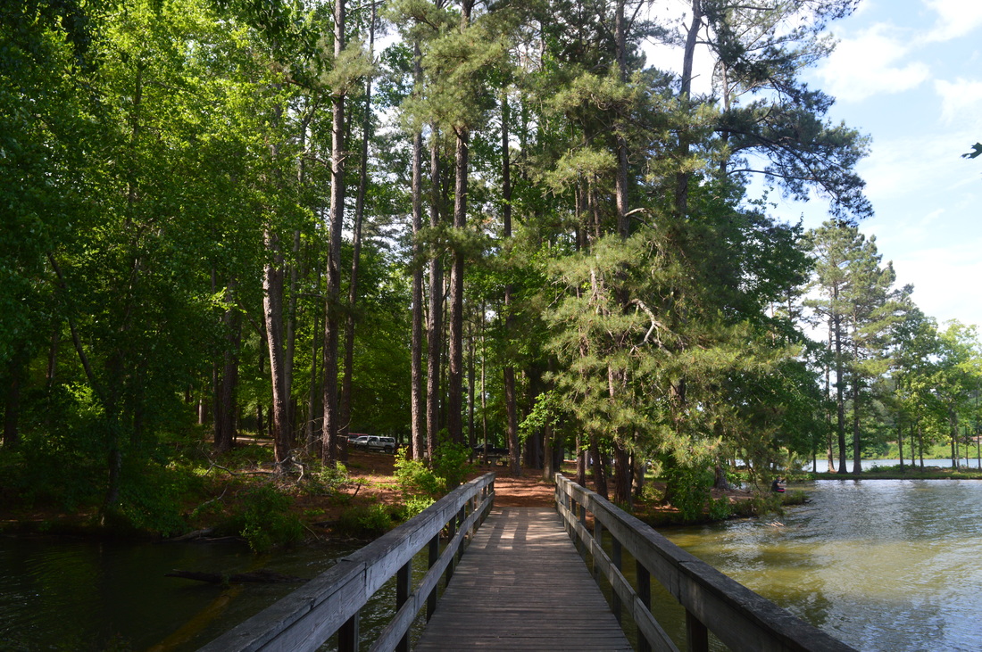
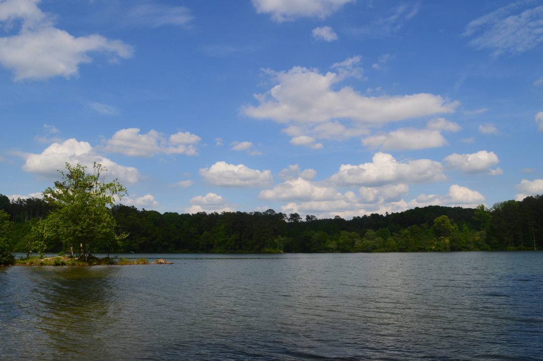
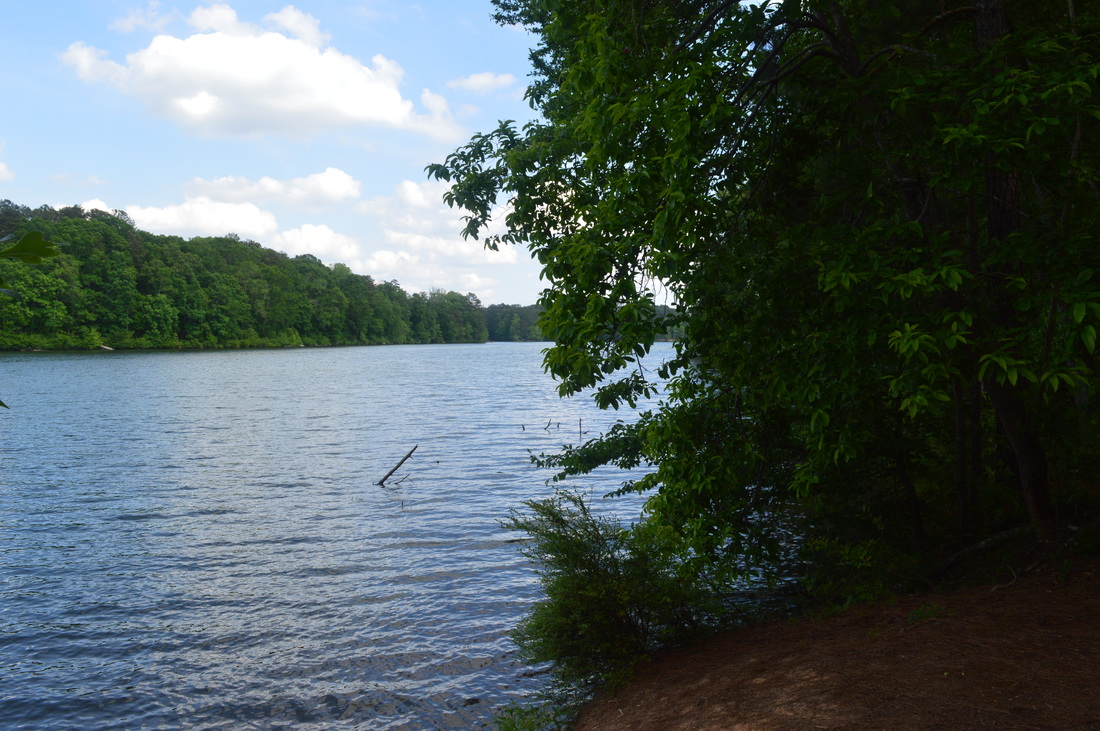
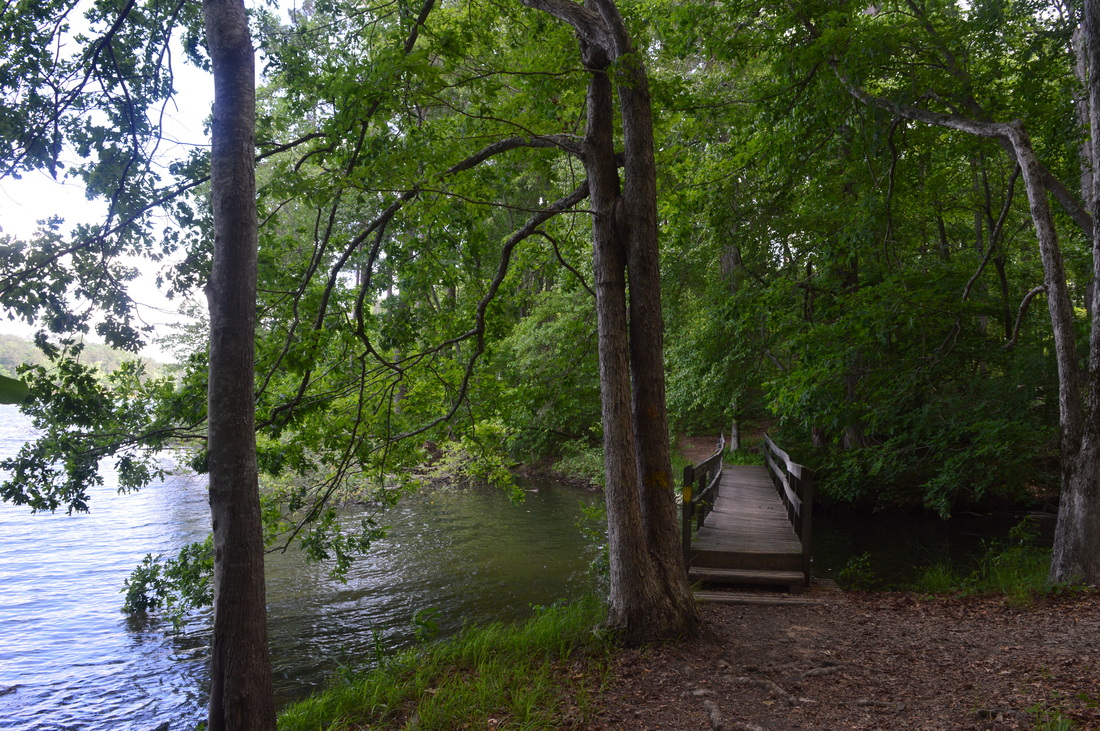
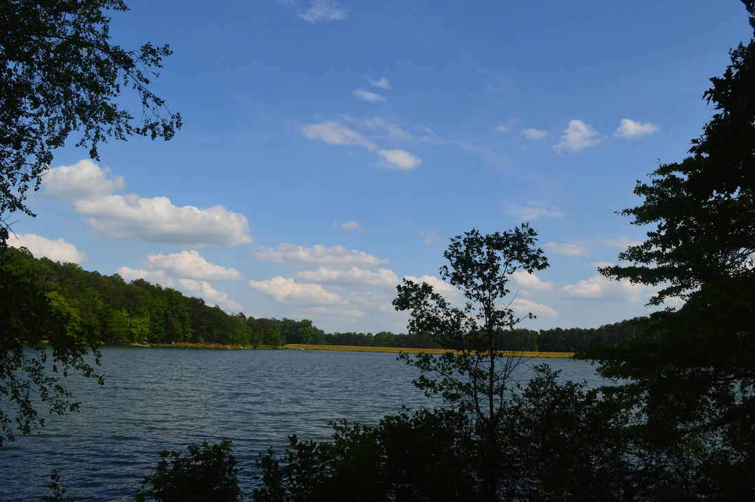
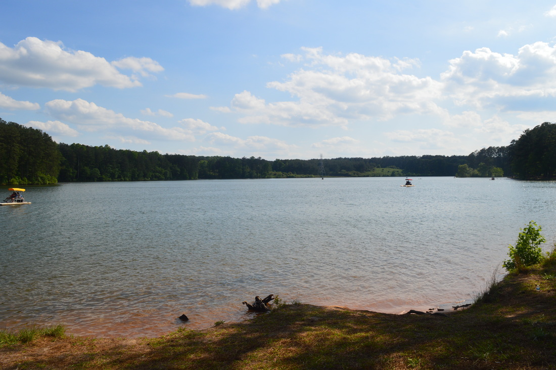
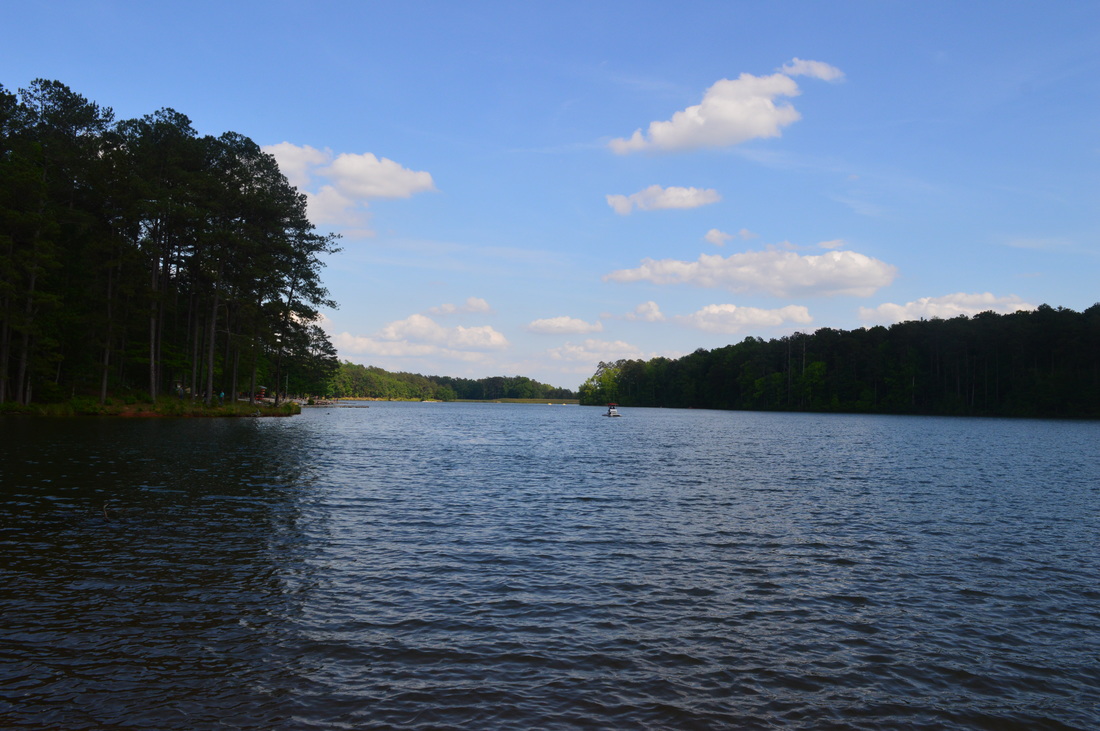
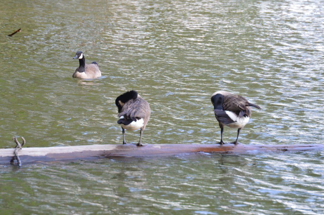
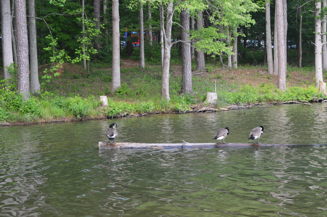
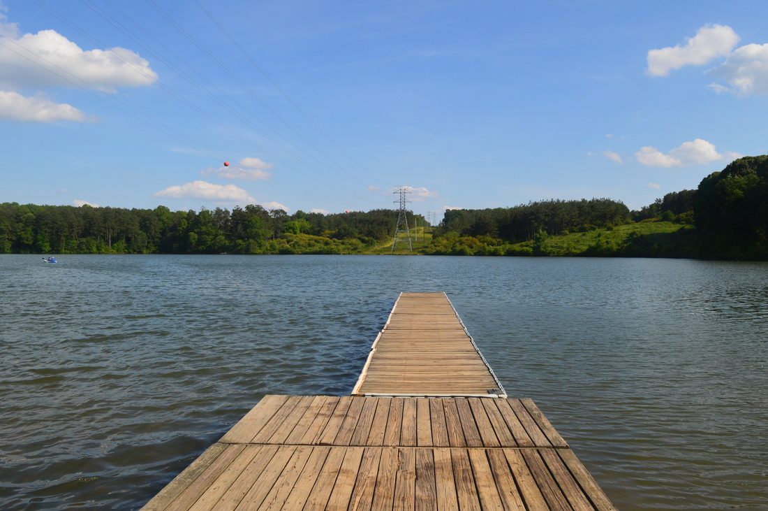
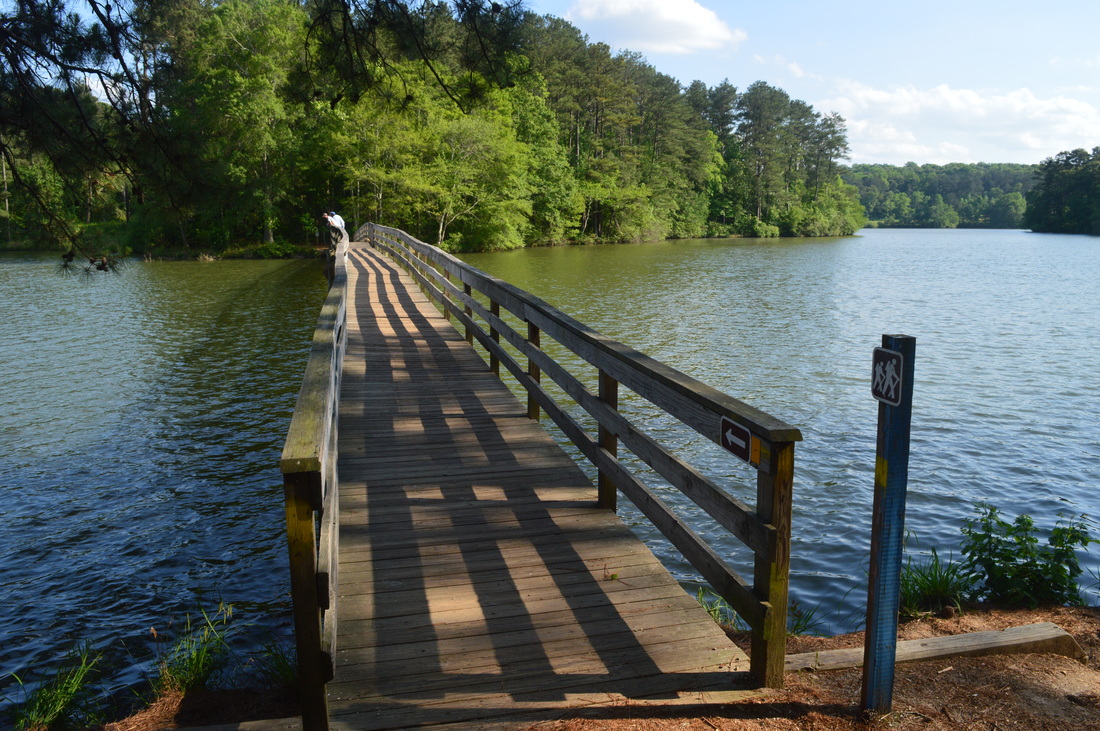
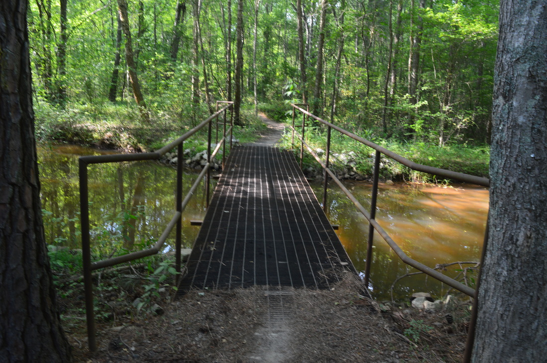
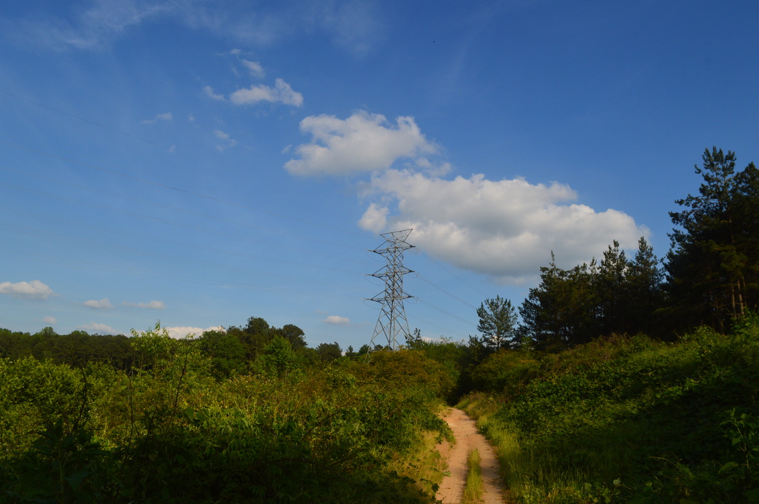
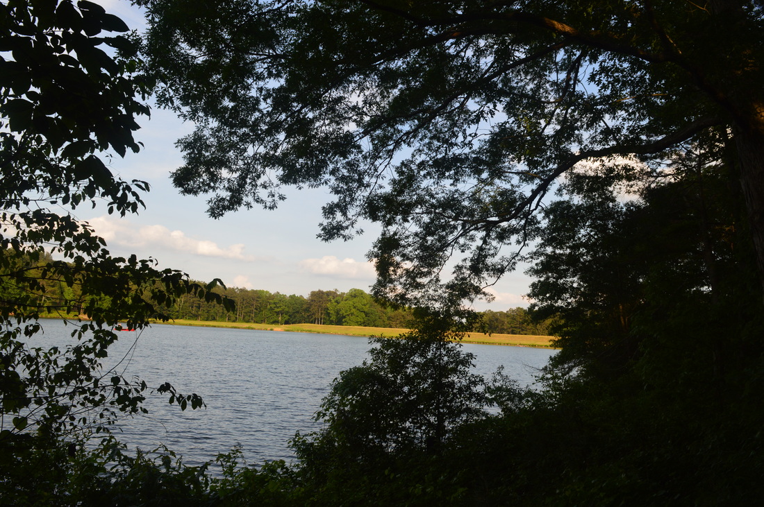
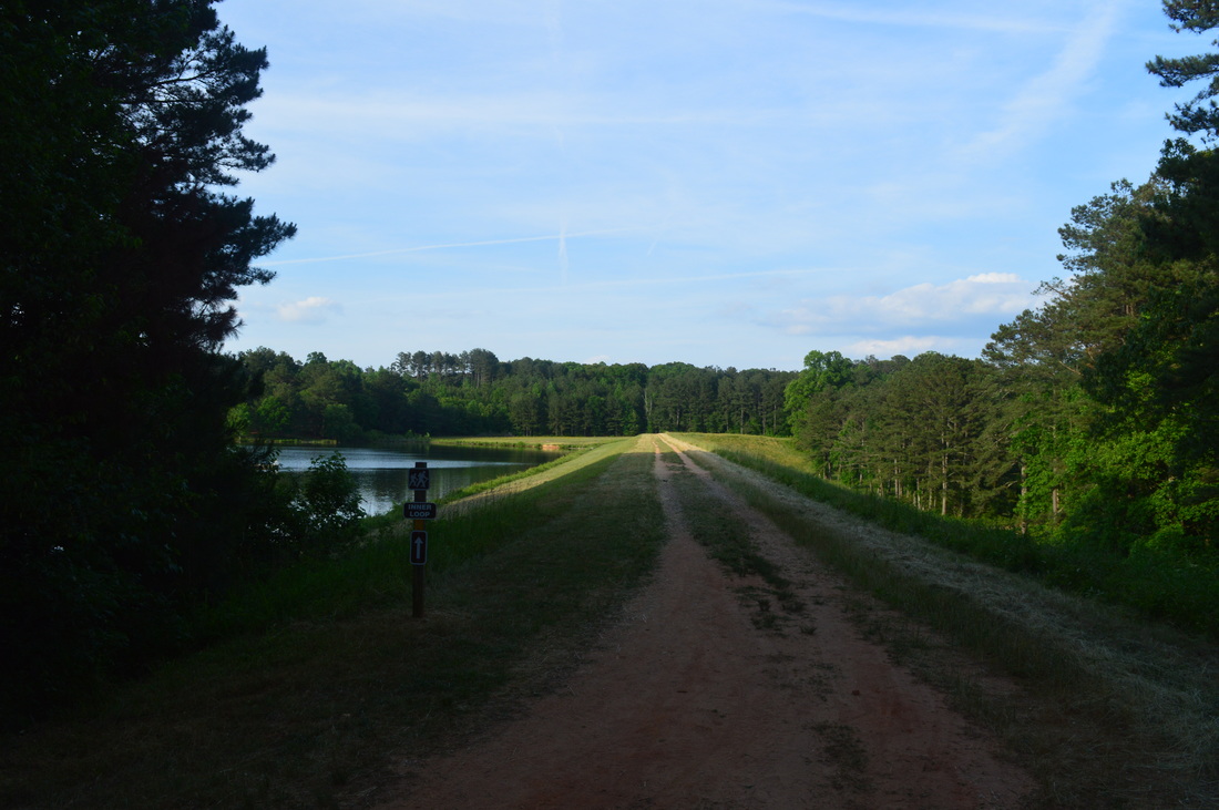
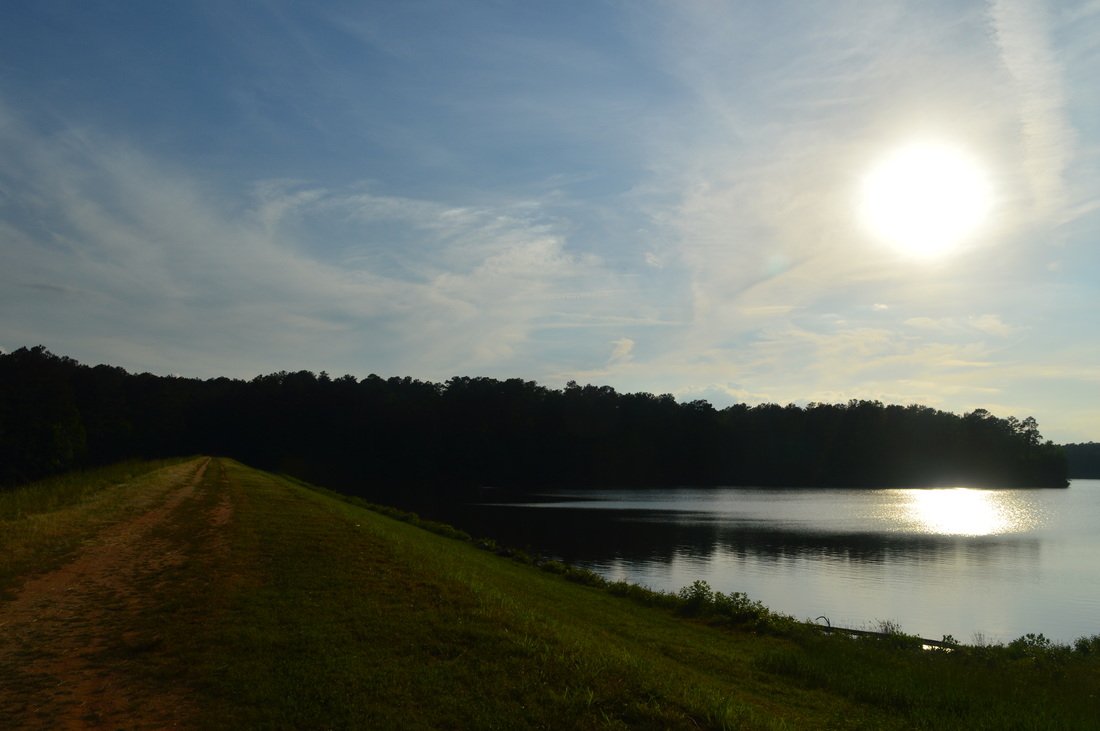
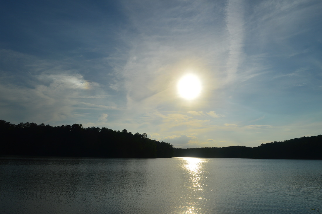
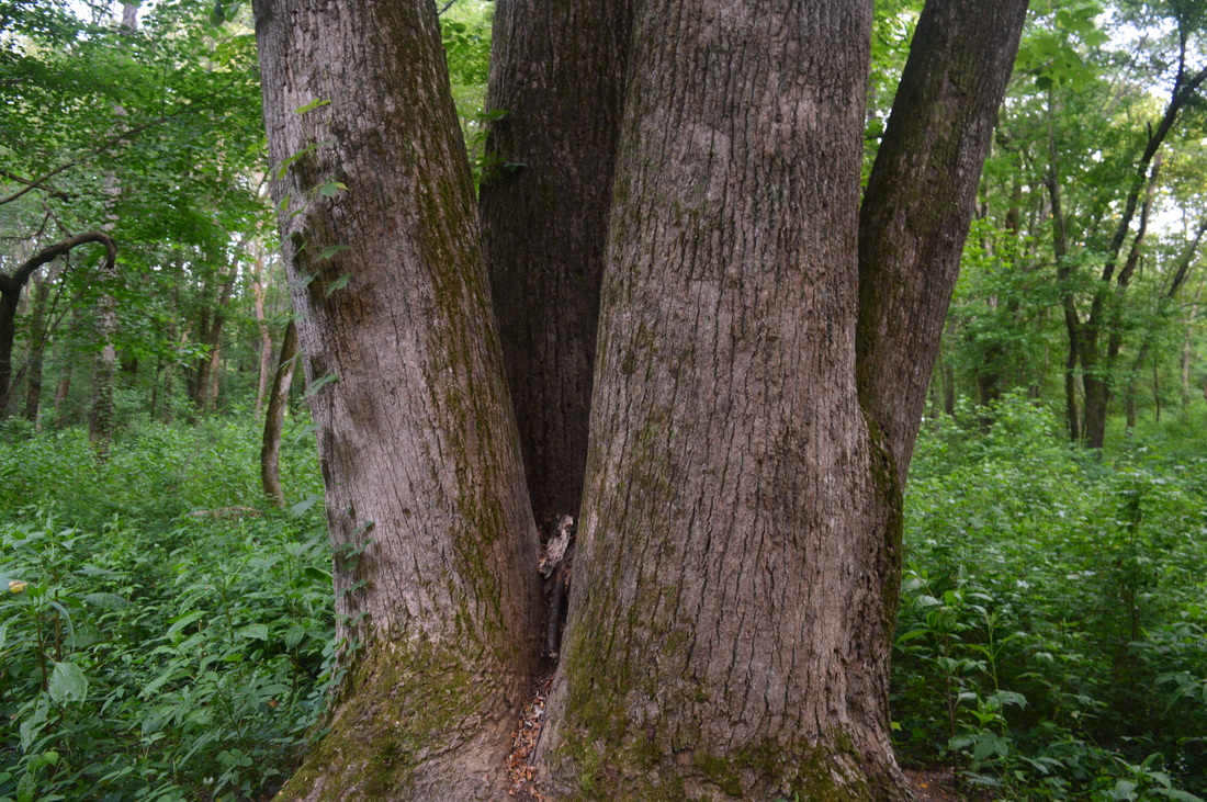
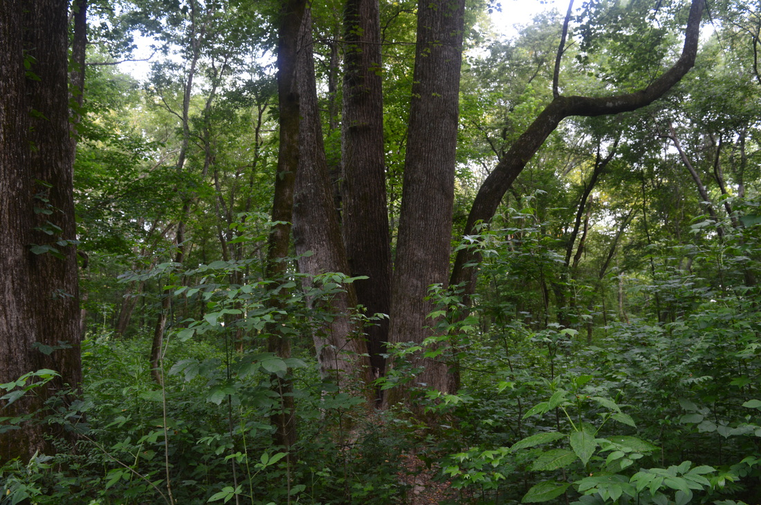
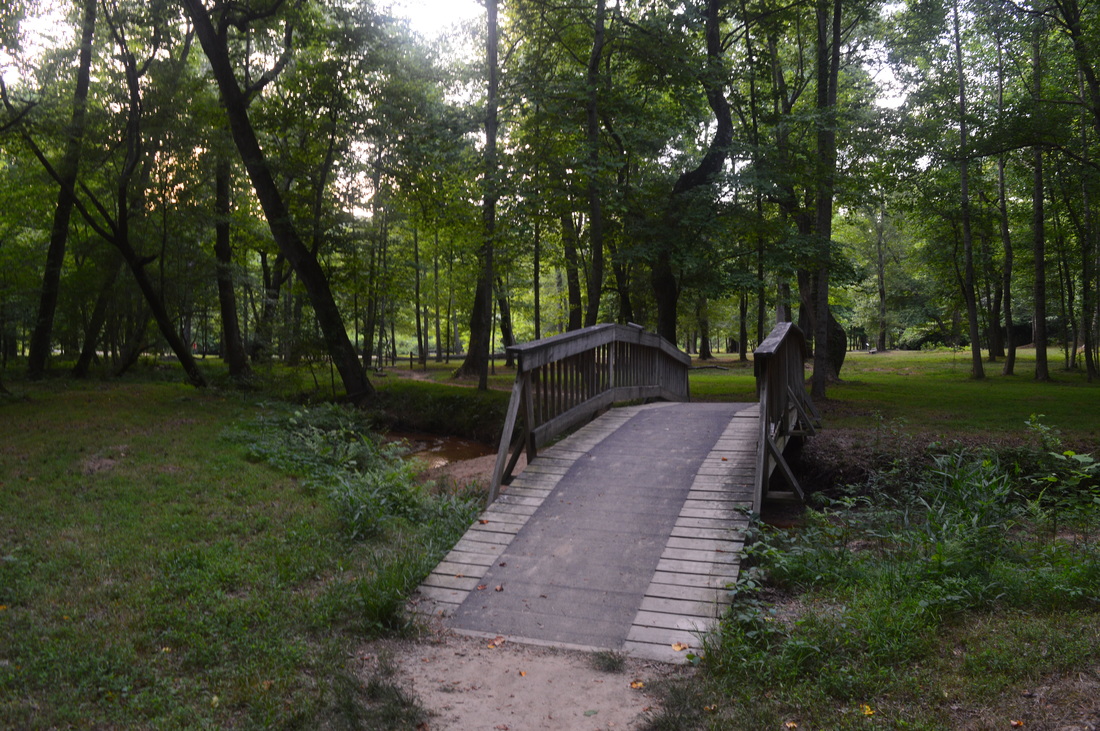
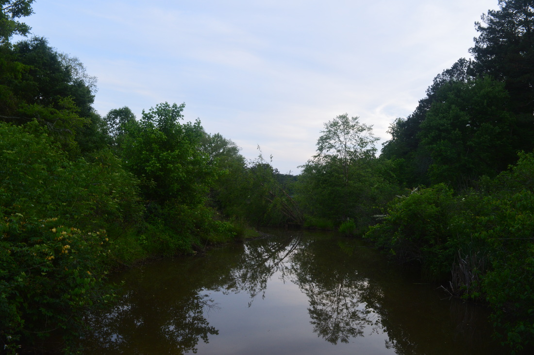
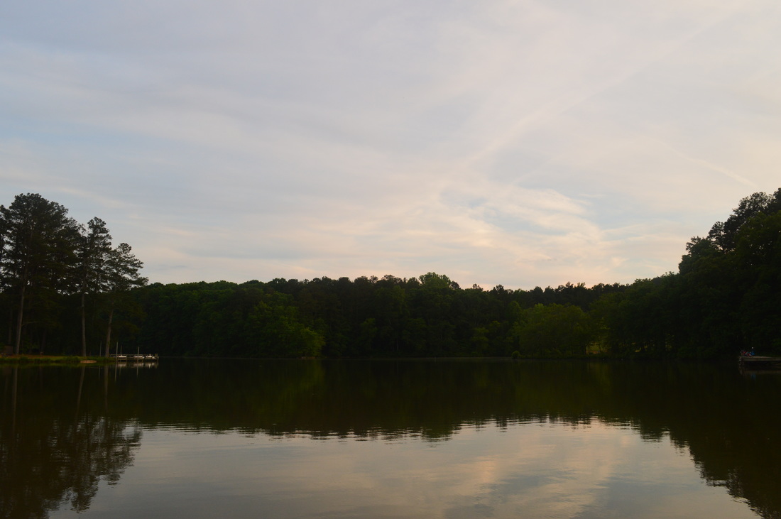
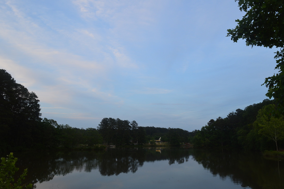
The old road soon becomes a path as the trail follows the lakeshore, sometimes closely. At 2.3 miles, reach high-tension powerlines. A fishing pier is on the left right afterwards. It has a good view of the lake. After the pier, reach another parking area and the end of Yargo Area B Road. On the other side of the parking area, a footbridge heads left across the lake. This is a good shortcut, if you want to lessen the hike distance. You can also head out onto the footbridge for a view of the lake both up and down. Otherwise, continue straight on a path along the lake. The path soon curves to the right along a small finger of the lake. At the far end of the finger, keep left to continue following the path across a footbridge over a small creek. Take another left here. The trail will meander along the lakeshore. Make two left turns at junctions with bike trail alternatives. Then, pass some storage buildings off GA 81 on the right, and cross Marberry Creek on a steel footbridge at 2.9 miles. The creek is not large and is quite still. Following the steel footbridge, you will be generally paralleling GA 81 and cross a petroleum pipeline cut. Then, make a small ascent onto a hill with some maze-like twists, typical of mountain biking trails. After reaching the "high point" of this ascent, descend in a similar manner in the same area following the border of a powerline cut. Recross the petroleum pipeline cut and reach the powerline cut. Follow a wide, dirt path down the powerline cut to an unmarked intersection, where the a portion of the lake can be seen on the left. This intersection is at 3.3 miles. Keep left onto a dirt path heading into lakeside woods to continue following the route of this hike. The wider path continuing straight along the powerline cut is part of the bike only trail. Follow the path left into the woods along the shore of the lake to reach the other end of the wooden footbridge seen earlier. This footbridge is reached at 3.5 miles. This is where you would end up, if taking the shortcut over the footbridge earlier. Keep right along the lakeshore to continue following the loop.


The trail soon reaches a high-tension powerline cut. Cross the cut and begin a series of small ups and downs along the south shore of the lake, the biggest of which is roughly 40 feet, although it is steep both up and down (relatively). On the top of this small hill, there will be a junction with an old road heading right. Bear left to continue the loop. After more undulations near the lakeshore, the trail will reach the Fort Yargo Dam and a major trail junction at 5.8 miles. This is where you meet the bike only trail, and according to he bike map, it is the same trail that was at the powerline cut earlier.To the right is the Monster Mile Bypass. Straight ahead is a shot connector to the primary biking trail. To the left is where the route described here goes, continuing to follow the multi-use lake loop. Cross the long, wide, grassy dam. This is the best view of the lake on the entire hike, with an excellent view of the main body of the lake, and a partial view of the Marberry Creek section of the lake. To the right, the small creek that was dammed flows into a marshy area. The bike trail can be seen at the base of the dam. Once across the dam, bear left - a faint path heads to the right, likely connecting to the main bike trail. The wide lakeside path shortly reaches a bench on the left at what I consider the second best lake view on the hike. You can see much of the Marberry Creek section of the lake and much of the main body of the lake from here, as well as the dam itself. Following this view, continue following the lake with more views, before reaching a small boat ramp and a paved road at 6.3 miles. This is the most confusing area of the hike - keep your eyes peeled for blazes. Follow the paved road to a small parking area, and at the fork, keep left through the lower end of Campground #2. At the playground, turn left onto a wide old road and cross a small creek.


After following the old road a short distance, reach another paved road. The old road continues straight, but there is no point in continuing following it, as it ends at the paved road shortly. Continue following the paved road through Campground #1, and then keep left onto a gravel road to a gravel parking lot. The trail exits the parking area at the upper right corner at 6.8 miles. The longest ascent of the hike starts at this point, and in fact, it leads to the highest point on the hike. Also, the lake views you've seen up to this point are generally the last you'll see on the hike, besides a few viewpoints near the end. Follow the dirt path through dry woods up an easy incline to reach the highest point of the hike (946 feet high) at 7.1 miles amidst a pine forest. This pine forest has possibly been planted here, but it's hard to say for sure. At 7.2 miles, cross Boys' Home Road. On the left, this road ends at Philip H. Grace Group Home, a private area. The start of Winder Connecting Trail is shortly after the road, according to the map, but I never even saw any signs of any trail there. Later, I drove to a point where Yargo Camp Road crosses Boys' Home Road, and I saw the trailhead at the intersection. Maybe you have to walk up this road to that intersection? I'm not sure. 


In any case, cross the road and continue on an easy trail through drier terrain.At 7.5 miles, cross a narrow, dirt service road, and then descend past some structures on the left that probably have to do with Will-A-Way Recreation Area. At 7.6 miles, cross the access road to Will-A-Way Recreation Area (for special needs groups only). Continue descending on an easy trail back towards lake level. Along the way, an overgrown spur trail goes to the left to an unusual feature - four trees growing out of one base. Don't miss this quadruple tree! The spur trail is right after a small "pullout" on the trail on the right, a spur trail on the right to a small creek, and a spot where the trailside looks like it's mowed (and it is mowed). After this, descend to a creek and cross it on a footbridge. This area is a garden, created for the Bird Berry Nature Trail. Reach a paved path. To the right is the end of the Bird Berry Nature Trail, where there is a gazebo and a small loop with interpretive signs. The main hike turns left down the paved path, where there are more interpretive signs. Cross a creek on a footbridge, and pass a spur paved path to the left that leads to a viewpoint of Will-A-Way Inlet. Meanwhile, the main trail continues straight to the end of the paved path at a large parking area. There is an observation deck on the left with a view of Will-A-Way Inlet. At 8.6 miles, continue straight through the parking area to another parking lot, for bikers and hikers, on the left, just before the main park road. Turn left, and pick up the trail from the parking lot. The trail descends along the road, and then joins the road, crossing a bridge over a small finger of the lake. Following the bridge, reach the trailhead and parking area where your car is at 8.8 miles. 


To summarize, this is a great, easy hike, good for novice hikers or for a half-day hike. It is also good for joggers and possibly aquatic wildlife viewers - you have a shot at seeing some aquatic birds here. Below are my pictures. 
3 Comments
Ash @ Dirt In My Shoes link
5/29/2015 03:39:56 pm

Your pictures are beautiful! I am from the West so I am not familiar with Georgia trails at all, so thanks for the information. A family member of mine is moving to Atlanta this summer, so I will be sure to spread the word :)

Reply
Mark Oleg
5/29/2015 03:45:39 pm

Thank you. I hope my website will help.

Reply
Edirne ECA servisi link
8/3/2022 05:32:04 pm

Edirne ECA servisi en uygun fiyat ve en hızlı servis garantisi ile sizlerle. https://www.edirneklimaservisi.com/edirne-eca-servisi/

Reply


Leave a Reply.

    About Me

    Mark Oleg Ozboyd
    I'm an avid outdoor explorer and a hobbyist landscape photographer. I'm 21 years old and have been hiking since 2011. Originally based out of Atlanta, Georgia, I started out by occasionally hiking short trails throughout well-known Georgia State Parks. During 2012 and 2013, I began to expand my trips into adjacent states, as well as into the wilder National Forest areas rather than just State Parks. Throughout the years that followed, as I slowly ran out of popular hiking trails in my area, I began to search for and hike in more seldom-visited areas. Today, you can find me out in the woods every weekend, whether it's on an official trail or bushwhacking through cross-country terrain without any paths. I now attend Washington & Lee University and am exploring Virginia and West Virginia. My other hobbies include chess, science, old music, and meteorology. I have 3 years of amateur weather forecasting experience, having studied a lot of meteorology basics over the years. I am also a student at European School of Music where I learned that music and nature have a lot in common. Listening to good music inspires me to capture nature's beauty on the camera in different aspects that also make me recall many beautiful music pieces that I've heard.​


    Dear readers: I have invested a tremendous amount of time and effort in this website and the Georgia Waterfalls Database the past five years. All of the work that has gone in keeping these websites updated with my latest trip reports has almost been like a full-time job. This has not allowed me to pick up a paid job to save up money for college, and therefore, I I've had to take out loans. If you find the information on this website interesting, helpful, or time-saving, you can say "thanks" and help me out by clicking the button above and making a contribution. I will be very grateful for any amount of support you give, as all of it will apply toward my college tuition. Thank you! 

    Enter your email address to subscribe for trail reports:

    Delivered by FeedBurner


    Picture
    Coming in 2022-2023?

    Other Hiking Websites

    DWHike's Adventures
    Florida's Natural Wonders
    Florida Trailblazer
    Meanderthals
    Mountain Images
    by Bernie Boyer

    North Carolina Waterfalls with
    ​Kevin Adams
    Take-a-Hike!
    Tennessee Landforms
    Waterfall Page
    Waterfall Adventurer
    Zach's Mild Adventures

    Miles Hiked

    Year 1: 540.0 Miles
    Year 2: 552.3 Miles
    ​Year 3: 518.4 Miles
    Year 4: 482.4 Miles
    Year 5: 259.9 Miles

    Archives

    March 2021
    February 2021
    January 2021
    November 2019
    October 2019
    September 2019
    August 2019
    July 2019
    June 2019
    February 2019
    January 2019
    December 2018
    November 2018
    October 2018
    August 2018
    July 2018
    June 2018
    May 2018
    April 2018
    March 2018
    February 2018
    January 2018
    December 2017
    November 2017
    October 2017
    September 2017
    August 2017
    July 2017
    June 2017
    May 2017
    April 2017
    March 2017
    February 2017
    January 2017
    December 2016
    November 2016
    October 2016
    September 2016
    August 2016
    June 2016
    May 2016
    April 2016
    March 2016
    January 2016
    December 2015
    November 2015
    October 2015
    September 2015
    August 2015
    July 2015
    June 2015
    May 2015
    April 2015
    March 2015
    February 2015
    January 2015
    December 2014
    November 2014
    October 2014
    September 2014
    August 2014
    July 2014
    June 2014
    May 2014
    April 2014
    March 2014
    February 2014

    Categories

    All
    Adel
    Adirondack Park
    Alabama
    Alfred A. Ring Park
    Allegheny Trail
    Amicalola Falls State Park
    Anniston Area
    Apalachicola Bluffs And Ravines Preserve
    Apalachicola National Forest
    Apalachicola/Port St. Joe Area
    Apopka
    Appalachian Trail
    Appling
    Art Loeb Trail
    Aska Trail System
    Bakersville
    Balm-Boyette Scrub Preserve
    Balsam Lake Recreation Area
    Bankhead National Forest
    Bartow County Parks
    Bartram Trail
    Basinger
    Beersheba Springs
    Benton
    Benton Mackaye Trail
    Berry College Trail System
    Best Hike
    Big South Fork National Recreation Area
    Black Bear Wilderness
    Black Rock Mountain State Park
    Blairsville
    Blakely
    Blood Mountain Wilderness
    Blowing Rock
    Blue Ridge
    Blue Ridge Parkway
    Boone
    Bradenton
    Bradenton Beach
    Brasstown Bald
    Brasstown Wilderness
    Brevard
    Bryson City
    Buchanan
    Bucks Pocket State Park
    Bulow Creek State Park
    Bulow Plantation Ruins State Park
    Caesars Head State Park
    Caladesi Island State Park
    Calhoun
    Camel's Hump State Park
    Cashiers
    Caspersen Beach Park
    Catfish Creek State Park
    Caves
    CC Putnam State Forest
    Cedar Point Environmental Park
    Chatsworth
    Chattahoochee National Forest
    Chattanooga
    Chattanooga Valley
    Chattooga National Wild And Scenic River
    Cheaha Wilderness
    Cherohala Skyway
    Cherokee
    Cherokee National Forest
    Chiefland Area
    Chillhowee Recreation Area
    Chipley
    Chunky Gal Trail
    Circle B Bar Reserve
    Citico Creek Wilderness
    Citrus Wildlife Management Area
    Clarkesville
    Clayton
    Cleevland
    Cleveland
    Cloudland Canyon State Park
    Cohutta Wilderness
    Collier-Seminole State Park
    Cordele
    Cornelia
    Covington
    Crestview Area
    Crew-land-and-water-trust
    Cullowhee
    Cumberland Trail
    Dahlonega
    Dalton
    Dawson Forest Wildlife Management Area
    Dawsonville
    Dayton
    De Soto National Memorial
    DeSoto State Park
    Dillard
    Double Springs
    Ducktown
    Duncan Ridge Trail
    Dunlap
    Eagle's Rest Park
    Eastpoint
    Econfina Creek Wildife Management Area
    Eglin Air Force Base
    Elizabethton
    Elkins
    Elk Knob Game Lands
    Elk Park
    Ellicott Rock Wilderness
    Ellijay
    Emerson Point Preserve
    Englewood Area
    Enota Retreat
    Erwin
    Falling Waters State Park
    Fayetteville
    Fires Creek Recreation Area
    Fire Tower
    Flint River
    Florence Area
    Florida
    Florida Caverns State Park
    Florida Trail
    Foothills Trail
    Fort Mountain State Park
    Fort Myers Area
    Fort Payne
    Fort Payne Area
    Fort Yargo State Park
    Franklin
    Franklin Delano Roosevelt State Park
    Franklin-Marion State Forest
    Frozen Head State Park
    Gainesville
    Gainesville Area
    Gatlinburg
    George Washington National Forest
    Georgia
    Georgia Veterans Memorial State Park
    Glasgow
    Gorges State Park
    Grandfather Mountain State Park
    Great Smoky Mountains National Park
    Greeneville
    Green River Game Lands
    Gruetli-Laager
    Grundy Forest State Natural Area
    GTM Reserve
    Guana River Wildlife Management Area
    Hayesville
    Helen
    Hiawassee
    High Falls State Park
    Highlands
    Highlands Scenic Highway
    Hillsborough River State Park
    Hinson Conservation & Recreation Area
    Historic Sites
    Honeymoon Island State Park
    Hot Springs
    Huntington
    Inverness Area
    Jackson
    Jasper
    Jefferson National Forest
    Joan M. Durante Park
    Jonathan Dickinson State Park
    Jones Gap State Park
    Joyce Kilmer Slickrock Wilderness
    Joyce Kilmer - Slickrock Wilderness
    Juniper Prairie Wilderness
    Kelly Park
    Keown Falls Recreation Area
    Kolomoki Mounds State Park
    LaFayette
    Lake City Area
    Lake George Wild Forest
    Lake June-in-Winter State Park
    Lakeland Area
    Lake Placid
    Lake Russell Wildlife Management Area
    Lake Wales Ridge State Forest
    Laurel Fork North Wilderness
    Leffis Key Preserve
    Leon Sinks Geological Area
    Lexington
    Lineville
    Linville
    Linville Gorge Wilderness
    Lithia Springs
    Little Frog Wilderness
    Little Manatee River State Park
    Little River Canyon National Preserve
    Longboat Key
    Long Trail
    Lookout Mountain
    Lookout Mountain Battlefield
    Lovingston
    Lula Lake Land Trust
    Lumpkin
    Maggie Valley
    Manatee Springs State Park
    Marianna Area
    Mark Trail Wilderness
    Marlinton
    Mccaysville
    McMinville
    Mentone
    Middlesex
    Mistletoe State Park
    Monongahela National Forest
    Montreat
    Mountain Bridge Wilderness Area
    Mountain City
    Mountains To Sea Trail
    Mountains-to-Sea Trail
    Mount Rogers National Recreation Area
    Myakka River State Park
    Myron B. Hodge City Park
    Nantahala National Forest
    Naples
    Naples Area
    Natural Bridge State Park
    Neal Preserve
    New Castle
    Newport
    New River Gorge National Park
    New York
    North Carolina
    Ocala Area
    Ocala National Forest
    Ocean-to-Lake Trail
    Oconee State Park
    Oconee Station Historic Site
    Okaloacoochee Slough State Forest
    Oldsmar
    Oneida
    Orlando Area
    Ormond Beach
    Oscar Scherer State Park
    Oxford
    Palatka
    Palmetto Trail
    Panama City Area
    Panthertown Valley
    Parrish
    Paynes Creek Historic State Park
    Peaks Of Otter Recreation Area
    Pigeon Crockford Mountain Wildlife Management Area
    Pigeon-Crockford Mountain Wildlife Management Area
    Pigeon-Crockford Wildlife Management Area
    Pine Mountain
    Pinhoti Trail
    Pinnacle Park
    Pisgah Civitan Park
    Pisgah National Forest
    Pittman Center
    Pond Mountain Wilderness
    Ponds/Lakes
    Prentice Cooper State Forest
    Providence Canyon State Park
    Pumpkintown
    Quick Point Nature Preserve
    Raven Cliffs Wilderness
    Reed Bingham State Park
    Reliance
    Rice Creek Conservation Area
    Riverview Pointe Preserve
    Robbinsville
    Robinson Preserve
    Rock Creek Gorge Scenic Area
    Rock Island State Park
    Rome
    Rosman
    Sale Creek
    Salem
    Salt Springs
    Saluda
    Santa Rosa Beach
    Sarasota
    Sarasota Area
    Savage Gulf State Natural Area
    Scenic Views
    Scottsboro Area
    Sebring Area
    Sewanee
    Sheltowee Trace Trail
    Shining Rock Wilderness
    Signal Mountain
    Sipsey Wilderness
    Sky Valley
    Smithgall Woods State Park
    Snowbird Backcountry Area
    Soddy Daisy
    Soddy-Daisy
    Sopchoppy
    South Carolina
    South Cumberland State Park
    Southeastern Cave Conservancy
    Southern Nantahala Wilderness
    Sparta
    Sprewell Bluff Park
    Spring City
    Spring Hill
    Springs
    Spruce Pine
    Standing Indian Backcountry Area
    St. Augustine
    St. George Island State Park
    St. Joseph Bay State Buffer Preserve
    St. Marks Area
    St. Marks National Wildlife Refuge
    Stone Mountain
    Stone Mountain Park
    Suches
    Sumatra
    Sumter National Forest
    Suwannee River
    Swallow Creek Wildlife Management Area
    Sweetwater Creek State Park
    Sylva
    Talladega National Forest
    Tallahassee Area
    Tallulah Falls
    Tallulah Gorge State Park
    Tampa Bay Area
    Tate City
    Tate's Hell State Forest
    Tea Creek Wildlife Management Area
    Tellico Plains
    Tennessee
    Thomaston
    Toccoa
    Topsail Hill State Park
    Torreya State Park
    Townsend
    Tracy City
    Tray Mountain Wilderness
    Trenton
    Triple Creek Preserve
    Troutdale
    Unaka Mountain Wilderness
    Upper Tampa Bay County Park
    Venice
    Vermont
    Virgin Falls State Natural Area
    Virginia
    Virginia Outdoors Foundation
    Vogel State Park
    Wakulla Springs State Park
    Waleska
    Walhalla
    Wartburg
    Water Features
    Waynesville
    Weedon Island Preserve
    Weeki Wachee Preserve
    Wekiwa Springs State Park
    West Palm Beach Area
    West Virginia
    Whitehall
    White Springs
    Winder
    Withlacoochee State Forest
    Young Harris

    RSS Feed

TRAIL REPORTS

Hikes in Alabama
​Hikes in Florida
Hikes in Georgia
Hikes in North Carolina
Hikes in South Carolina
Hikes in Tennessee
Hikes in Virginia

Hiking Resources

Alabama Resources
​
Florida Resources
Georgia Resources
North Carolina Resources
​South Carolina Resources
​
Tennessee Resources

Other

Contact
Map of Hikes
Alphabetical List of Hikes
Southeast Nature Society
© COPYRIGHT 2014-2024
​ALL RIGHTS RESERVED.
Important: I disclaim any responsibility for any damage or personal injury that may occur as a result of the activities and information found on this website. All outdoor activities, especially off-trail hiking, are done at your own risk. Never hike or head into that area that may be above your fitness or experience level.
  • Home
  • Trail Reports
    • Best Hikes
    • Hikes with Scenic Views
    • Hikes with Water Features
    • Alabama
    • Georgia
    • Florida
    • North Carolina
    • South Carolina
    • Tennessee
    • Vermont
    • Virginia
  • Map
  • Hike List
  • Testimonials
  • Resources
  • Contact Us
  • Southeast Nature Society
    • Our Team
  • Georgia Waterfalls Database