Foothills Trail: Musterground Road to Hilliard Falls to Horsepasture River, Salem, South Carolina6/18/2016 
The 77-mile Foothills Trail straddles the North Carolina and South Carolina border for much of its trek through the Southern Blue Ridge Escarpment. One particular section between SC 130 and US 178 is nearly 30 miles long and is known for very limited road access. A very rough ATV road - used mainly by hunters - called Musterground Road, is open during hunting seasons. This road provides access to the Foothills Trail several miles east of the traditional Lower Whitewater Falls Trailhead. The section of the Foothills Trail east of Musterground Road visits Hilliard Falls, a tall waterfall on Bearcamp Creek, before using forest roads to wind through hills before reaching the Horsepasture River. This hike occurred on Saturday, April 30, 2016. My plan was to use an abandoned forest road to get to the Foothills Trail from Musterground Road. From there, i would follow the Foothills Trail to the Horsepasture River, with a side trip to Hilliard Falls. I would return the same way.
Summary
Please Note: Line Rock Gap, the beginning point for this hike, is on Musterground Road. Per my knowledge, Musterground Road - a very rough dirt road designed for ATV use - is open only during April (spring hunting season) and September 15 through the end of December (fall hunting season). I am not sure of the exact dates, as I have found varying information online. I would appreciate it, if you could let me know if you have the most accurate exact opening and closing dates for the road.
R/T Length of Trail: 11.5 Miles
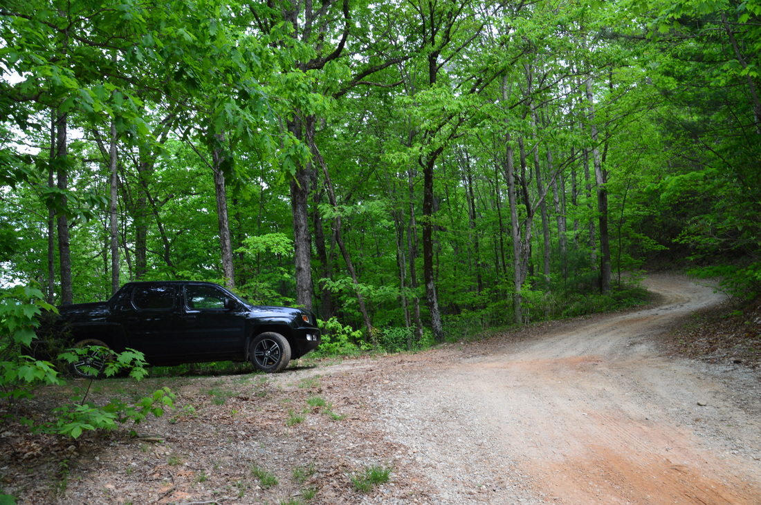
Duration of Hike: 6:30 Type of Hike: Out and Back Difficulty Rating: 5 out of 10 Total Elevation Gain: 2288 Feet Pros: None Cons: Very rough road for trail access - the road is not suitable for passenger vehicles Points of Interest: Hilliard Falls - 5 stars; Horsepasture River Bridge Trail Blaze Color(s): Foothills Trail - White; Hilliard Falls Spur Trail - Blue Best Season(s) to Hike: Winter; Spring Fees: None Beginning Point: Line Rock Gap Directions: From Salem, SC: Follow SC State Route 130 for about 11 miles, until you see the Duke Energy Plant Entrance on the right. Enter here, and follow Bad Creek Road for 2.1 miles. Then turn left onto an unnamed road that ends at the Bad Creek Parking Area in 0.2 miles. Just before you reach the Bad Creek Parking Area, you will see a dirt road taking off to the right. This is Musterground Road. There is a gate at the beginning of the road. Like I mentioned earlier, this gate is open only during spring hunting season and fall hunting season. Pass through the gate. From the gate to Line Rock Gap, the driving distance is about 6 miles. The road seems to be in good condition at first, being graveled well. The first steep grade occurs just before the road crosses the Whitewater River on a bridge, 0.6 miles in. About 1.2 miles in, an ATV unloading area is seen to the left. This is where the Lower Whitewater Falls Trail crosses the road. After this, the road condition deteriorates. As the road descends into the Thompson River Gorge, the grade becomes rather steep and you will actually drive under a fallen tree at one point. The fallen tree provided just a barely high enough clearance for my pickup truck to pass under! Once you bottom out near the Thompson River end of Lake Jocassee, there are several steep "hills" on the road that will require high clearance and four wheel drive. At about 5 miles from the Bad Creek Parking, Musterground Road reaches a unique bridge across the Thompson River. The bridge is like a culvert - the river flows through three huge pipes under the road. This is your last chance to turn around before hitting the section of road that is hardest to navigate. On the other side of the bridge, the road climbs a very steep hill that is not suitable for any regular passenger vehicles - for sure. Not every high clearance vehicle can make it up either. The road has a maximum grade of 19% (I included a picture in the gallery at the bottom of this post). I had to use wheel locker, low gear, and 4WD to ascend up the hill! At the top of the visible portion of the hill, there is a hairpin turn and another steep area with some rocks. If you manage to make it up this challenging climb, you're all good to the trailhead. At around 6 miles from the start, Musterground Road bears right at Line Rock Gap. Park here in a small pullout to the left. A gated logging road leading to the Foothills Trail begins to the left. It took me a total of an hour and five minutes to drive this six-mile road. Map
Below is a map of my hike.
Click here for more information and to download this trail map to view in Garmin Basecamp.
Below is a map of Musterground Road.
Details
The segment of the Foothills Trail between the Bad Creek Trailhead and Rocky Bottom has intrigued me for a long time. It is very difficult to day hike any parts of this segment, because there are practically no useful access points due to the remote nature of the terrain. Some hikers use a boat shuttle across Lake Jocassee to split the segment, but that was not really an option in my case, because I would likely finish the hike after the shuttling service closes for the night. I was also aware of some trails from the Frozen Creek Trailhead in Gorges State Park that connect to the Foothills Trail, but by the time I would get to the trail using that access, I wouldn't have much time left to hike to any location. The last option that I was left with was to try to use an ATV road mainly used by hunters - Musterground Road - to get to a point on the Foothills Trail several miles east of Bad Creek. This would make a day hike to the Horsepasture River possible.
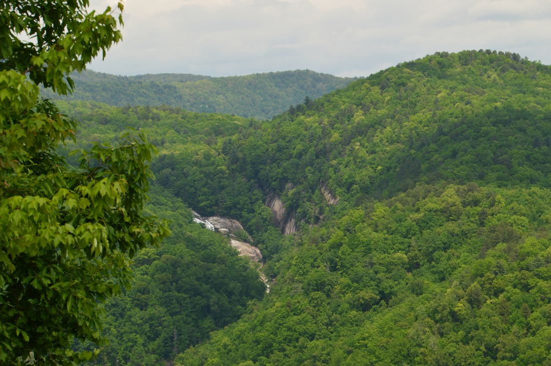
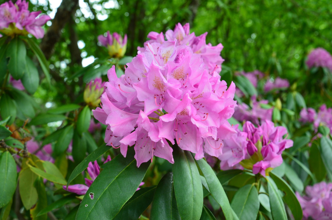
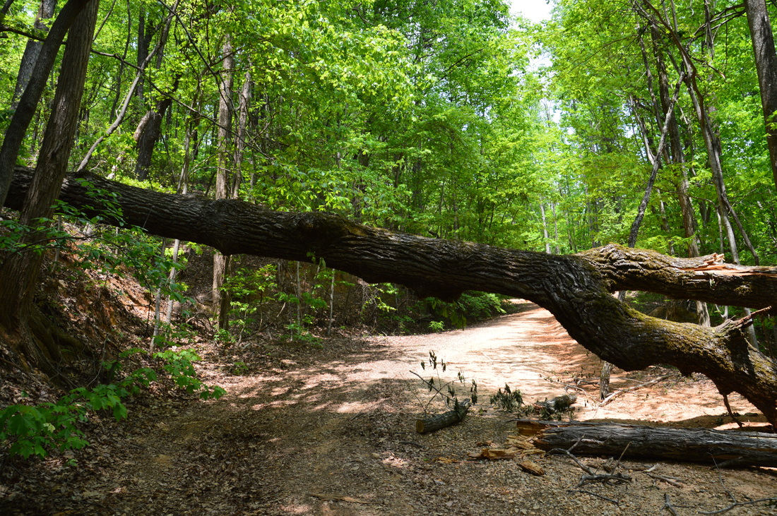
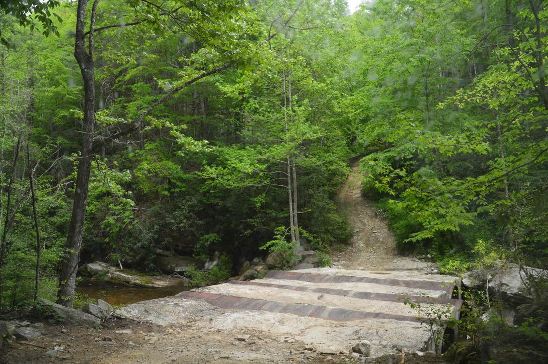
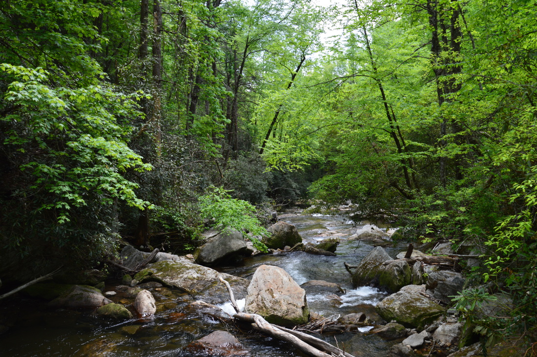
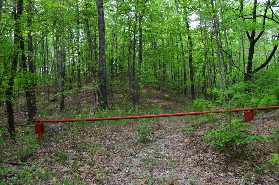
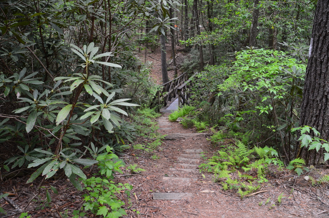
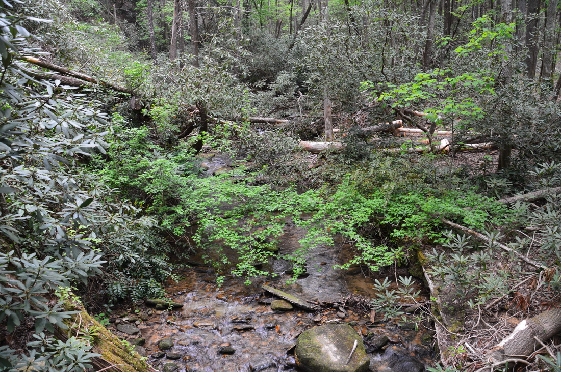
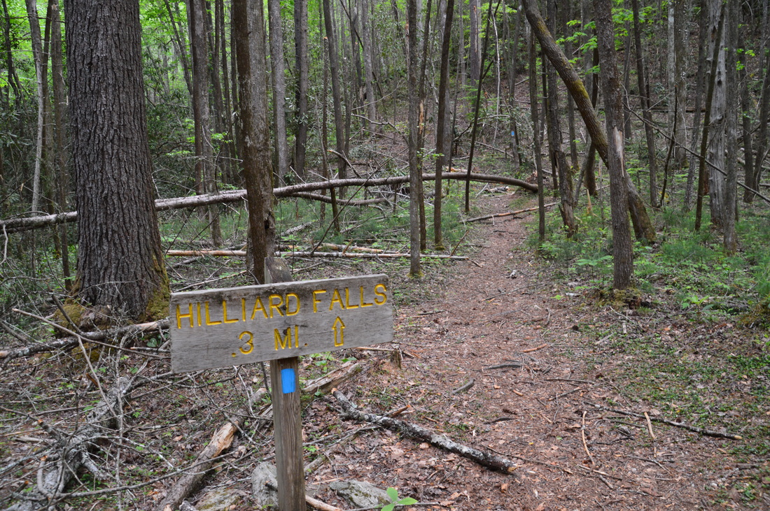
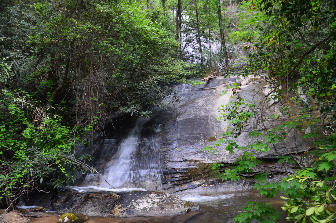
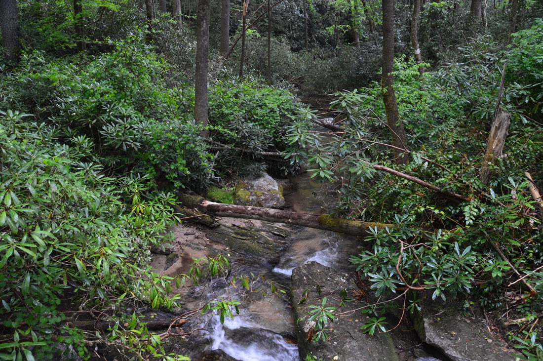
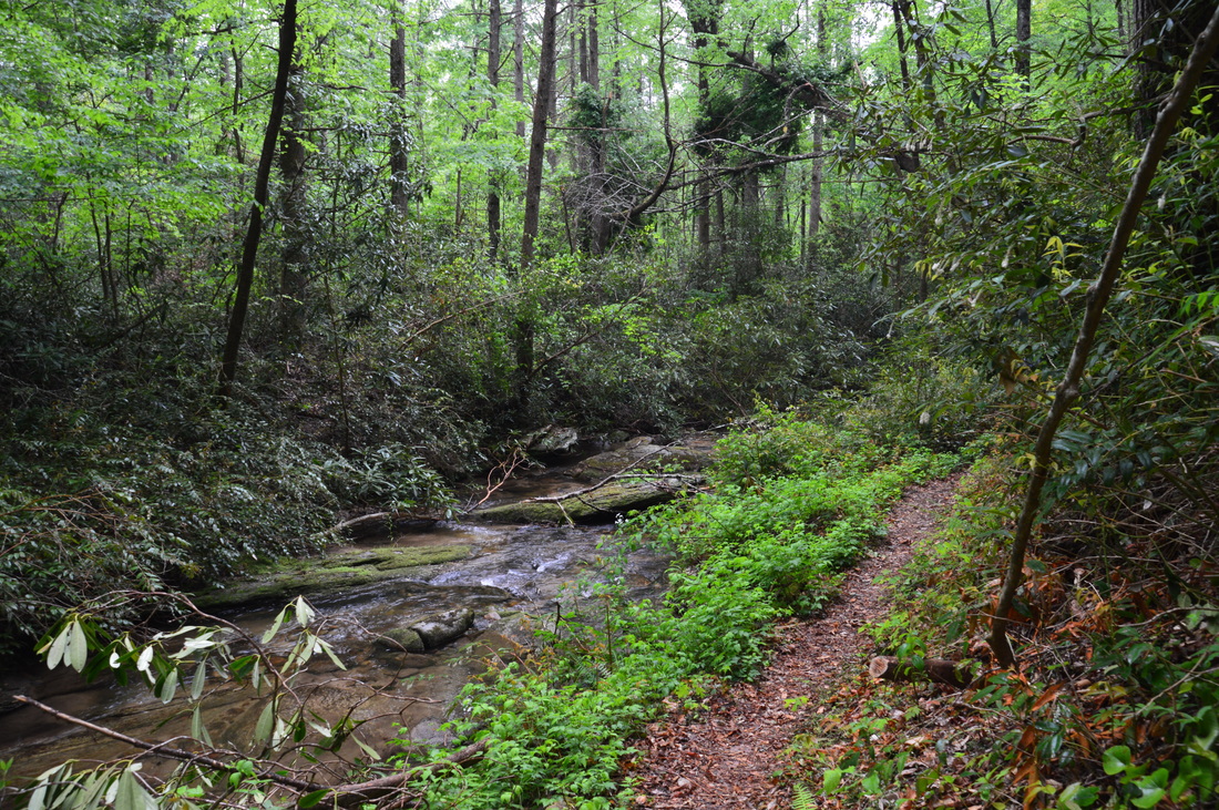
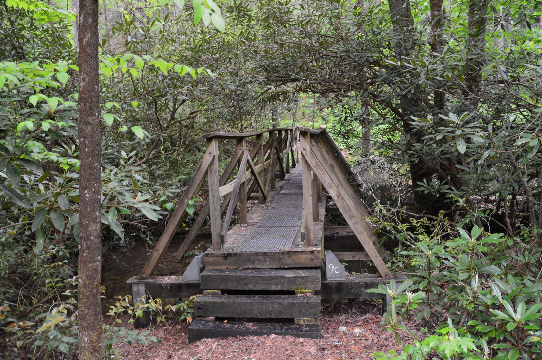
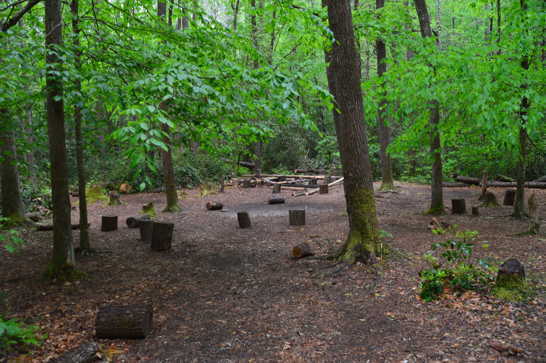
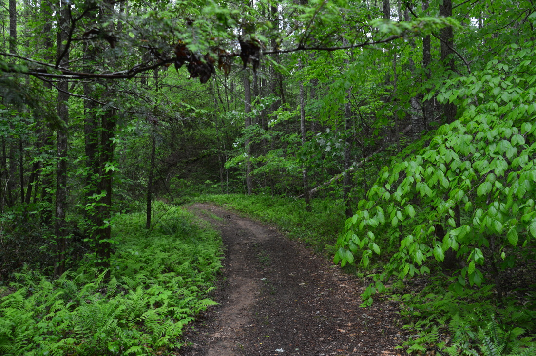
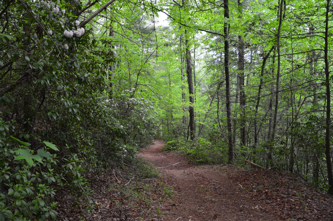
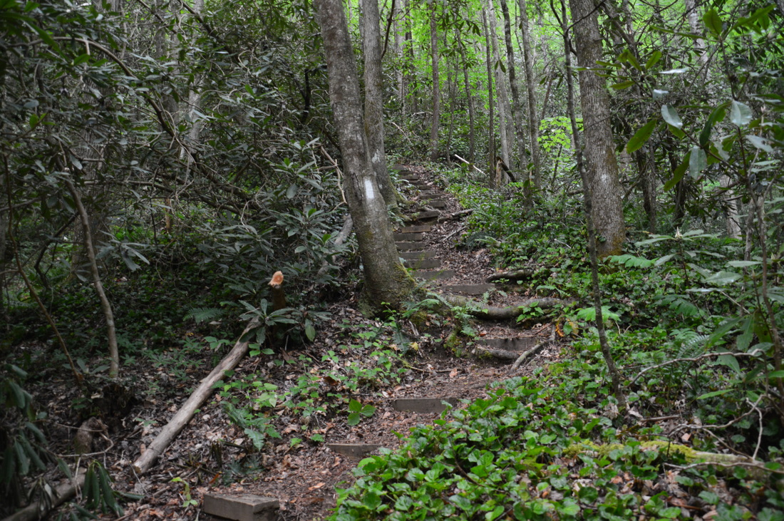
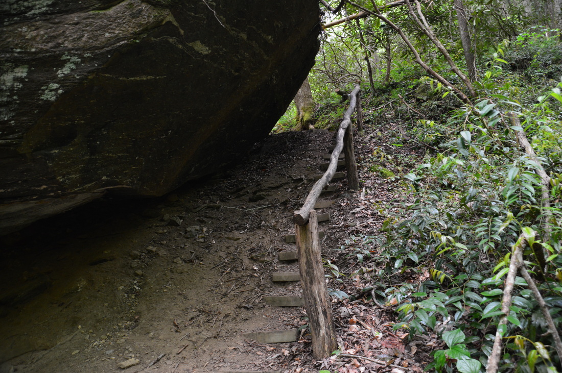
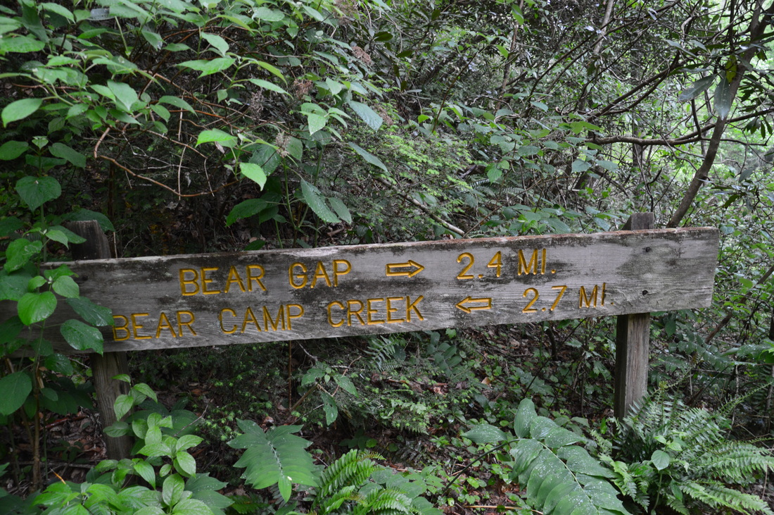
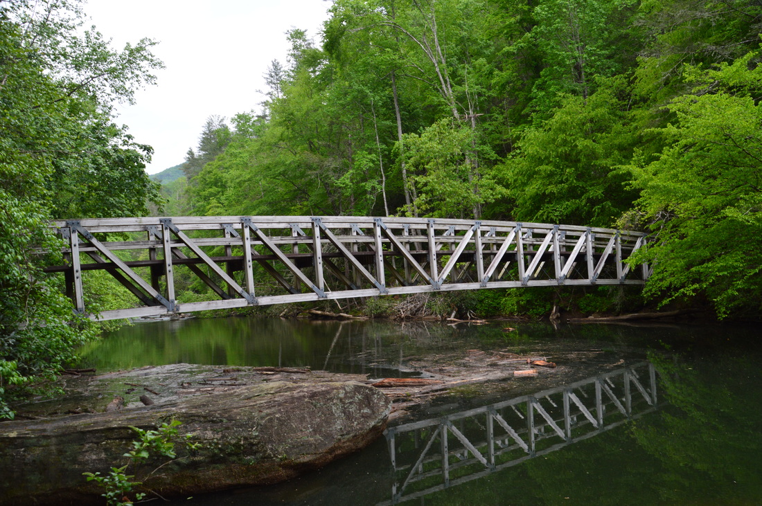
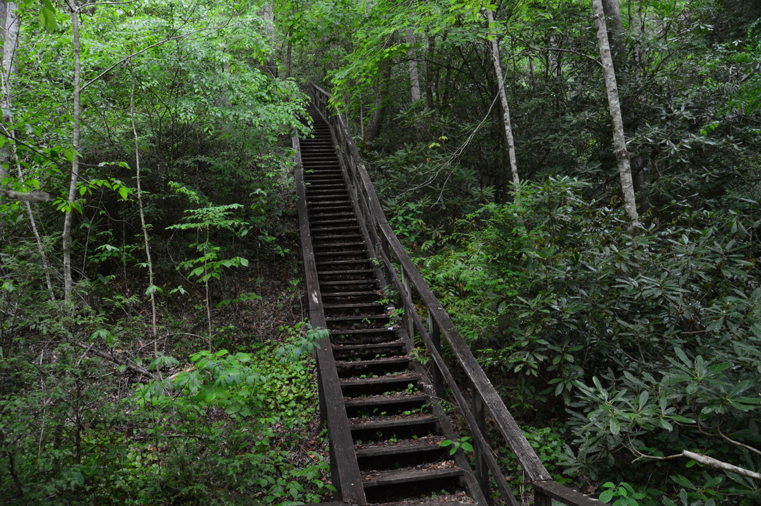
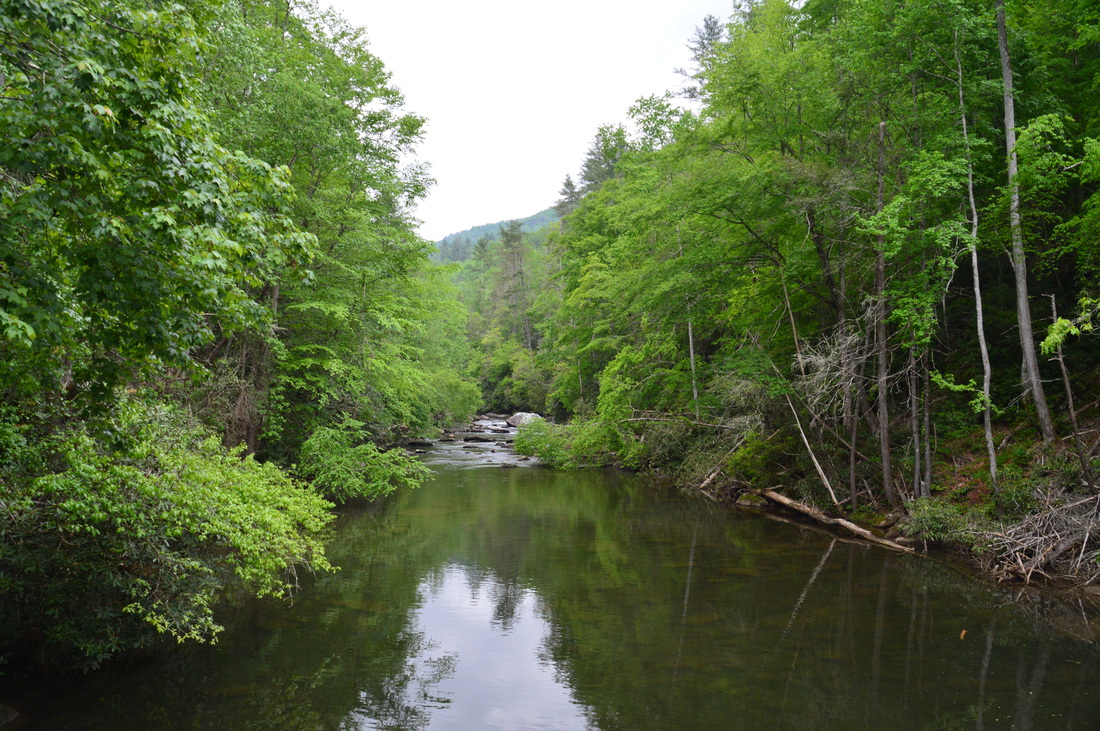
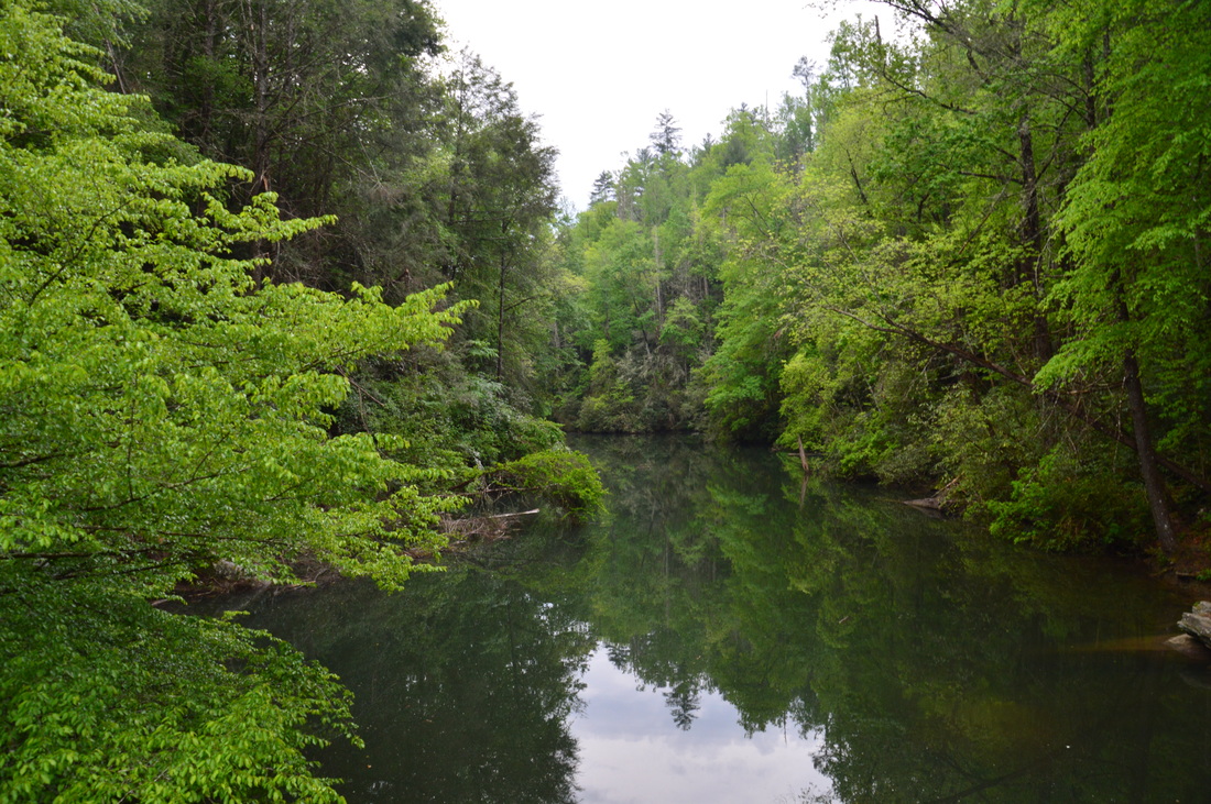
After spending over an hour on Musterground Road, I finally started the hike (behind schedule). From the small pullout at Line Rock Gap, you can see an unsigned logging road heading up the hill. While there is no indication that the road connects to the Foothill Trail, I could tell from my map that it does. Pass around the gate and begin following this old roadbed. After the initial brief uphill, the road remains mostly straight and level. You will cross from South Carolina into North Carolina on this road, and you will remain in North Carolina for the rest of the hike. The logging road ends at 0.4 miles at a u-shaped turn in the Foothills Trail. If you bear left onto the Foothills Trail, you will be headed toward the Thompson River gorge and Whitewater River gorge. If you bear right onto the Foothills Trail, you will be headed toward Bearcamp Creek and the Horsepasture River gorge, the destinations of this hike. Thus, bear right onto the Foothills Trail. A dry campsite lies to the left of the trail. The Foothills Trail is wide and easy here. At 0.7 miles, the trail bears left as it begins descending, while an old road exits to the right. At 0.9 miles, the trail bridges a small stream that joins Coley Creek downstream. At 1.15 miles, the trail turns to the left off the wide old roadbed that it has been following. Begin descending along a single-track path. This descent is mostly moderate with a few brief steep stretches, but by the time you're concluding the hike, I am sure that you will feel the uphill. At one point along the downhill, the trail descends along a long wooden staircase. I should note that the trail maintenance on this hike is superb - the trail is blazed well, there are few blowdowns, and bridges and steps are in abundance. At 1.7 miles, the trail crosses an old road. Originally, I was led to believe that Musterground Road is drivable all the way to this point. However, even though this is still Musterground Road, I have been told that the road is gated year-round to the south, and that means that a vehicle currently cannot reach this point. Beyond the road crossing, the trail continues to descend before reaching Bearcamp Creek at 1.9 miles. The trail crosses the creek on a slanted wooden footbridge. On the other side of the creek, there are some camping flats, in the middle of which is a trail junction. A blue-blazed spur trail leads left to Hilliard Falls. Take this spur trail - Hilliard Falls must not be missed. At 2.05 miles, the spur trail comes out onto a flat rock at Bearcamp Creek. The lower cascade of Hilliard Falls is directly in front of you, and the main falls is visible farther up. To reach the main falls, bear right across the rock, and take a trail back into the woods. A set of steps brings the trail to Hilliard Falls at 2.1 miles. This is a fairly tall waterfall that slides down a long nearly vertical rock face. However, this waterfall is a bit on the low flow side - seeing it after some rainfall would be the best. From Hilliard Falls, retrace your steps back to the main trail. Turn left onto the Foothills Trail at 2.3 miles, and begin working your way downstream along Bearcamp Creek. The trail remains close to the creek, which has a few attractive cascades. At 2.4 miles, cross a tributary of Bearcamp Creek, and at 2.5 miles, cross Bearcamp Creek itself on a well-constructed footbridge. Then, a gradual downhill continues, with the trail crossing a couple of small streams on tiny plank bridges. The trail moves farther away from the main creek, but you can still catch sight of it several times. The trail crosses Bearcamp Creek on another footbridge at 3.25 miles. This is where you will leave the creek for good. There is another camping area next to the creek here. Beyond the camping area, follow the white blazes as the trail bears right onto an old logging road. Much of the rest of the trail to the Horsepasture River follows this old logging road. After passing through a ferny area, the trail ascends to a ridge above the creek valley. On this ridge, I came across mountain laurel blooming in great amounts. Around 4 miles, there are some winter views of Lake Jocassee to the south. Over the next 1.4 miles, the forest road that the trail follows winds in and out of a number of coves, and the trail is rather monotonous. After what feels more like five miles than under two miles, the Horsepasture River gorge comes into view through the trees at 1.4 miles. The trail swings off the forest road (that gets pretty overgrown ahead) and turns left up a wooden staircase and onto a single-track path. The trail crosses the nose of a ridge and then begins a fairly steep descent into the Horsepasture River gorge. At the beginning of the descent, there is a long set of wooden steps that takes you into the gorge. The descent is long, but it is picturesque, with the river visible through the trees. At one point, another staircase takes the trail under a large rock overhang. At 5.85 miles, at a campsite to the right, the Foothills Trail reaches the Horsepasture River. There is a suspension bridge that takes the trail across the river. This iis considered as the halfway point of the Foothills Trail. Walk onto the bridge for good views of the river. Since this bridge is located near the point where the river becomes part of Lake Jocassee, the water is still and murky. However, you can see and hear some cascades just upstream. On the other side of the bridge, a tall staircase is the continuation of the trail, but for an average day hike, this bridge is the best turnaround point. From the Horsepasture River, retrace your steps back to the trailhead. Much of the route back is uphill, but take it slow, and you'll eventually make it. The hike is concluded at 11.5 miles. Mileage
0.0 - Line Rock Gap on Musterground Road
0.4 - Bear right onto Foothills Trail 1.9 - Bearcamp Creek 2.1 - Hilliard Falls 5.85 - Horsepasture River; turnaround point 11.5 - Line Rock Gap on Musterground Road Variations
Hike out and back to Hilliard Falls from Bad Creek Trailhead - 10.6 Miles
Hike out and back to Horsepasture River from Bad Creek Trailhead - 17.9 Miles Bonus Stops
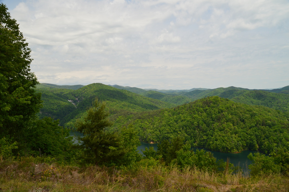
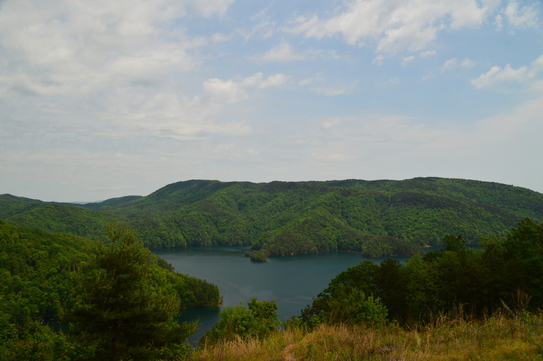
Before or after the hike, drive south on Bad Creek Road to the Visitor's Overlook, which will be to your left. This fantastic roadside vista provides good views of Lake Jocassee and even a distant view of Lower Whitewater Falls.
PicturesVideos
0 Comments
Leave a Reply. |
About MeMark Oleg Ozboyd Dear readers: I have invested a tremendous amount of time and effort in this website and the Georgia Waterfalls Database the past five years. All of the work that has gone in keeping these websites updated with my latest trip reports has almost been like a full-time job. This has not allowed me to pick up a paid job to save up money for college, and therefore, I I've had to take out loans. If you find the information on this website interesting, helpful, or time-saving, you can say "thanks" and help me out by clicking the button above and making a contribution. I will be very grateful for any amount of support you give, as all of it will apply toward my college tuition. Thank you!

Coming in 2022-2023?
Other Hiking WebsitesMiles HikedYear 1: 540.0 Miles
Year 2: 552.3 Miles Year 3: 518.4 Miles Year 4: 482.4 Miles Year 5: 259.9 Miles Archives
March 2021
Categories
All
|


 RSS Feed