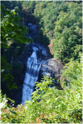
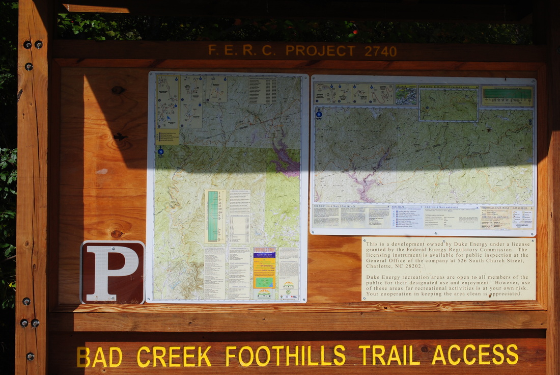
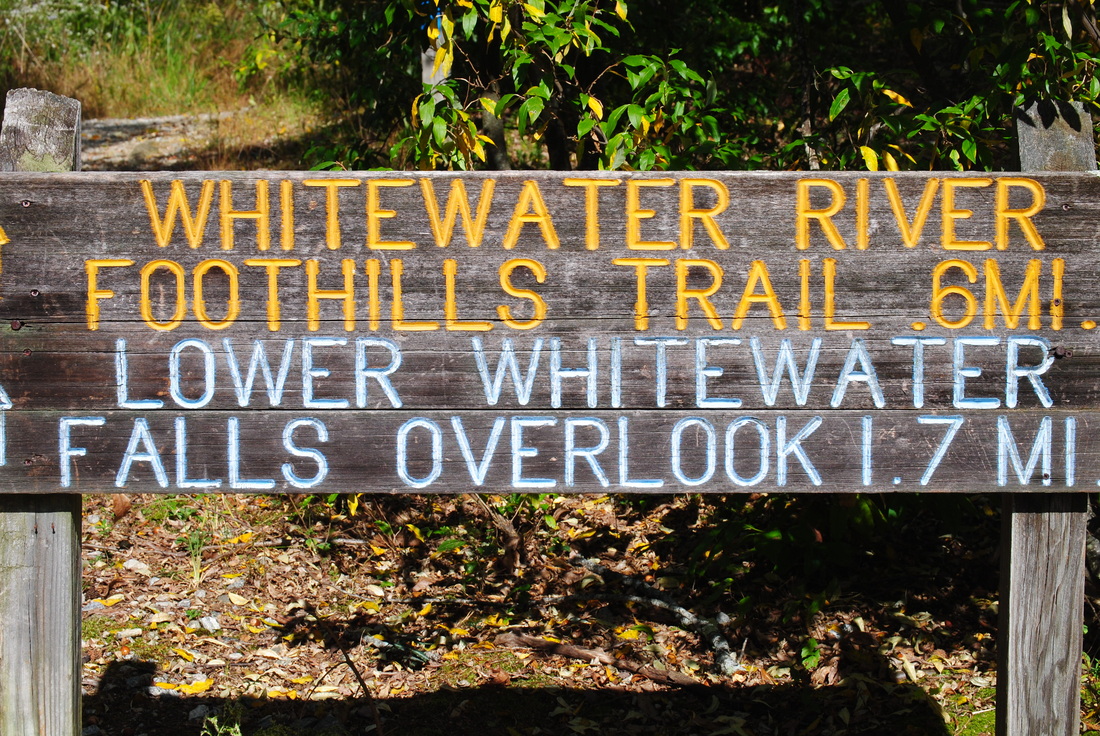
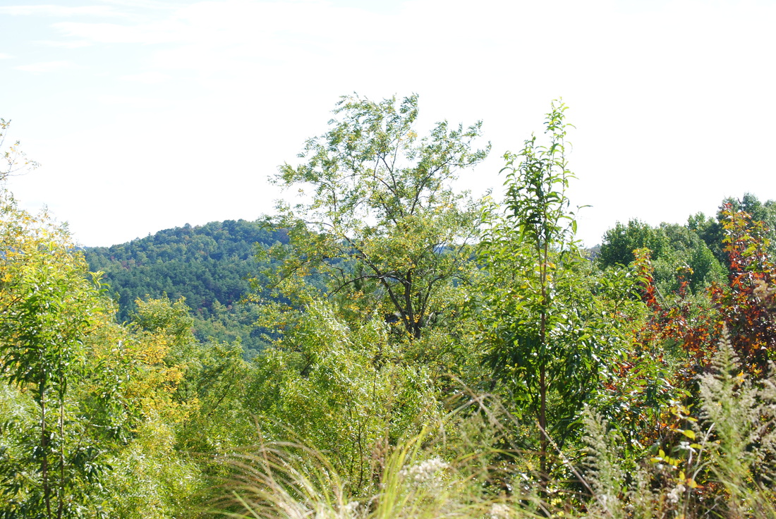
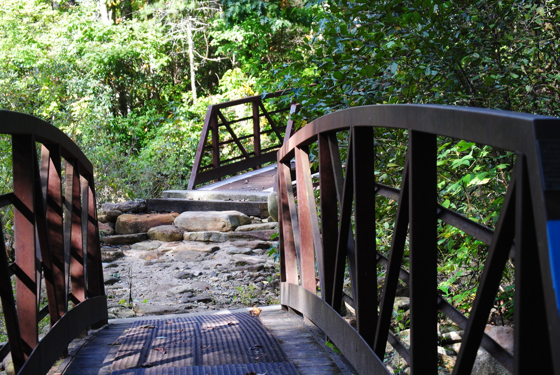
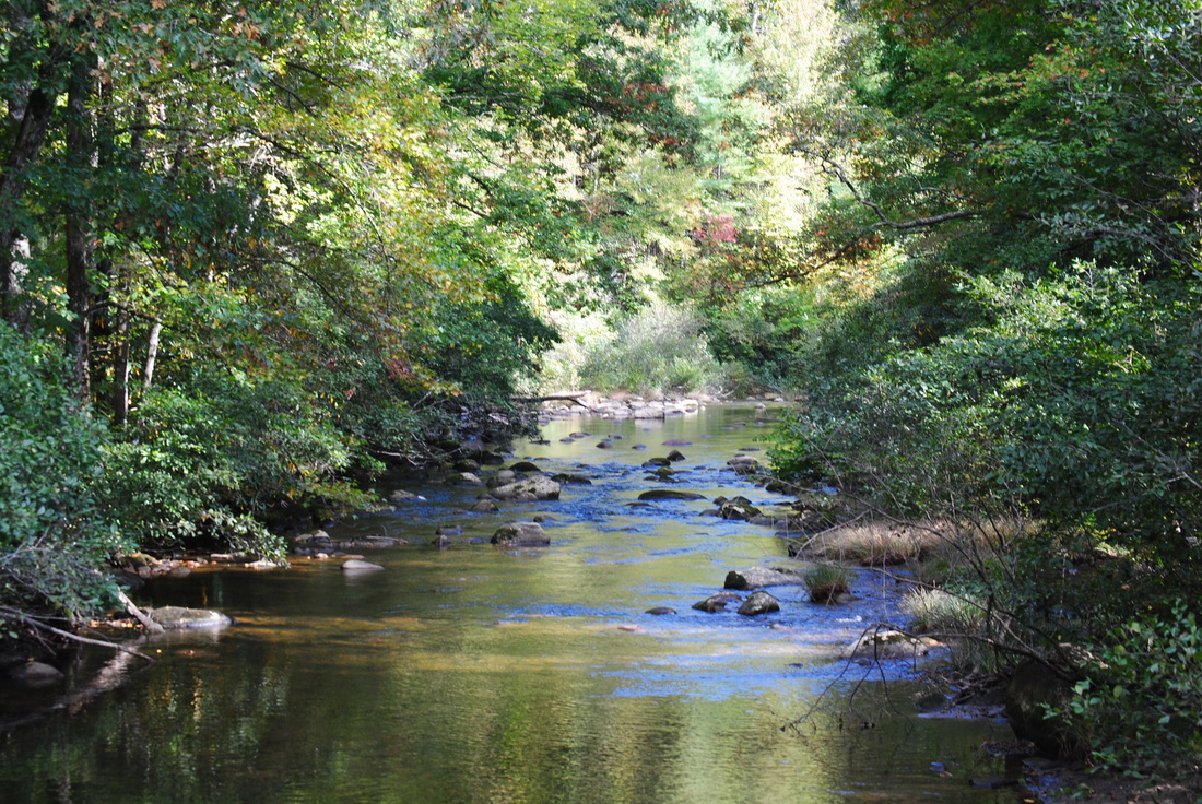
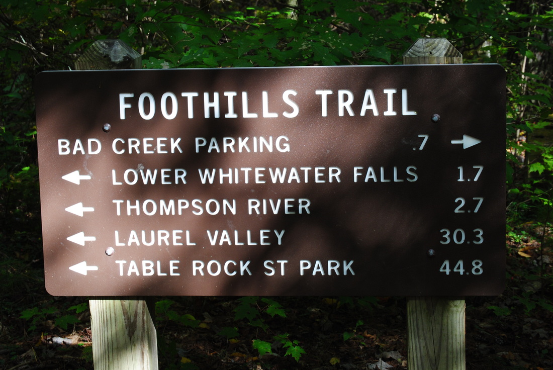
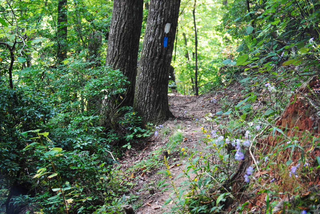
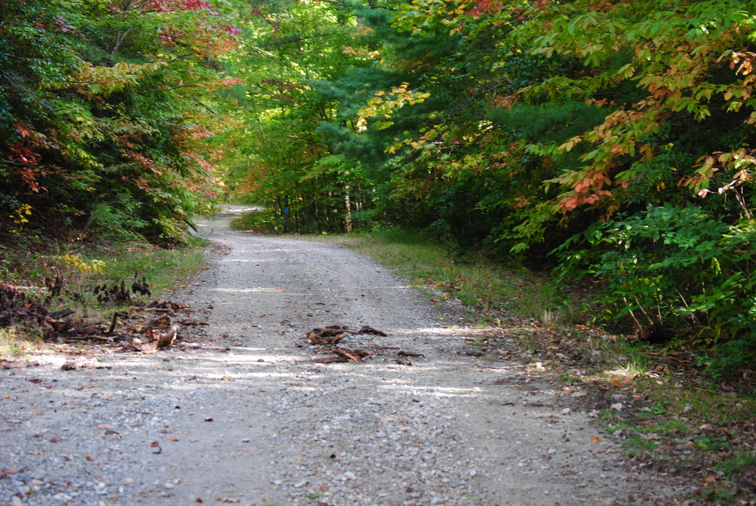
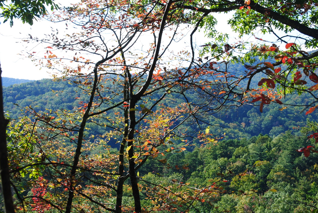
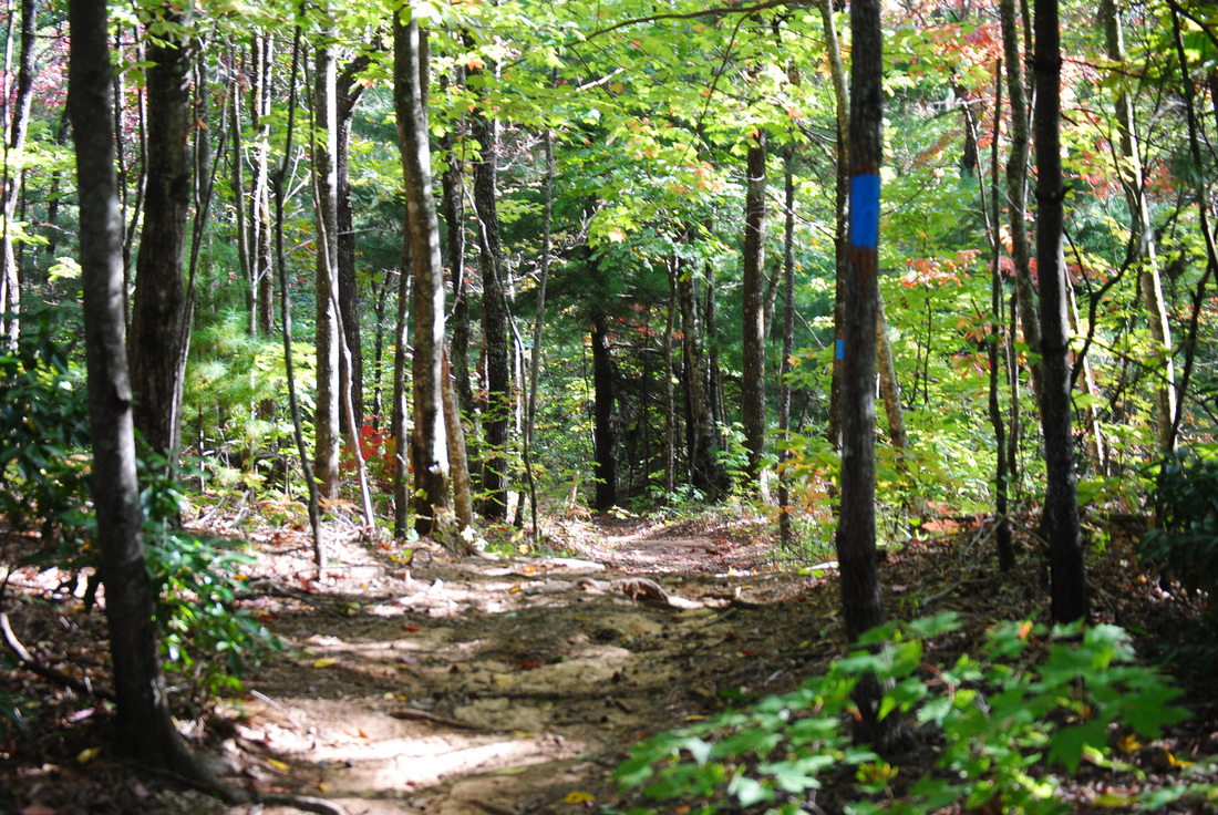
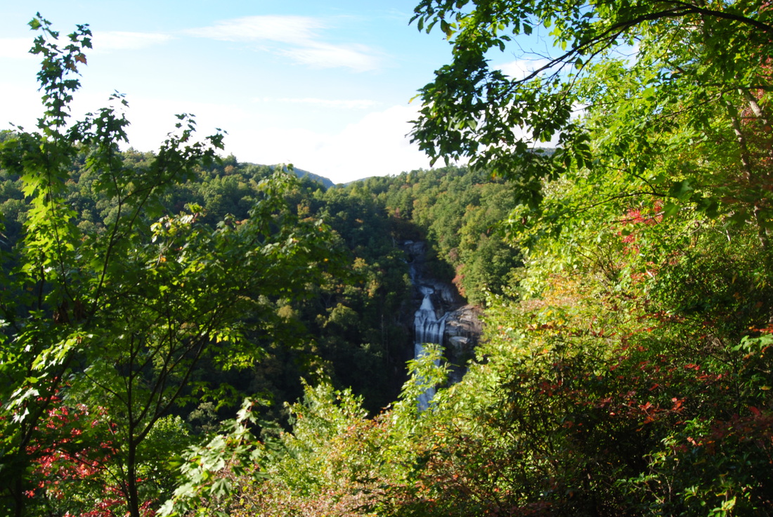
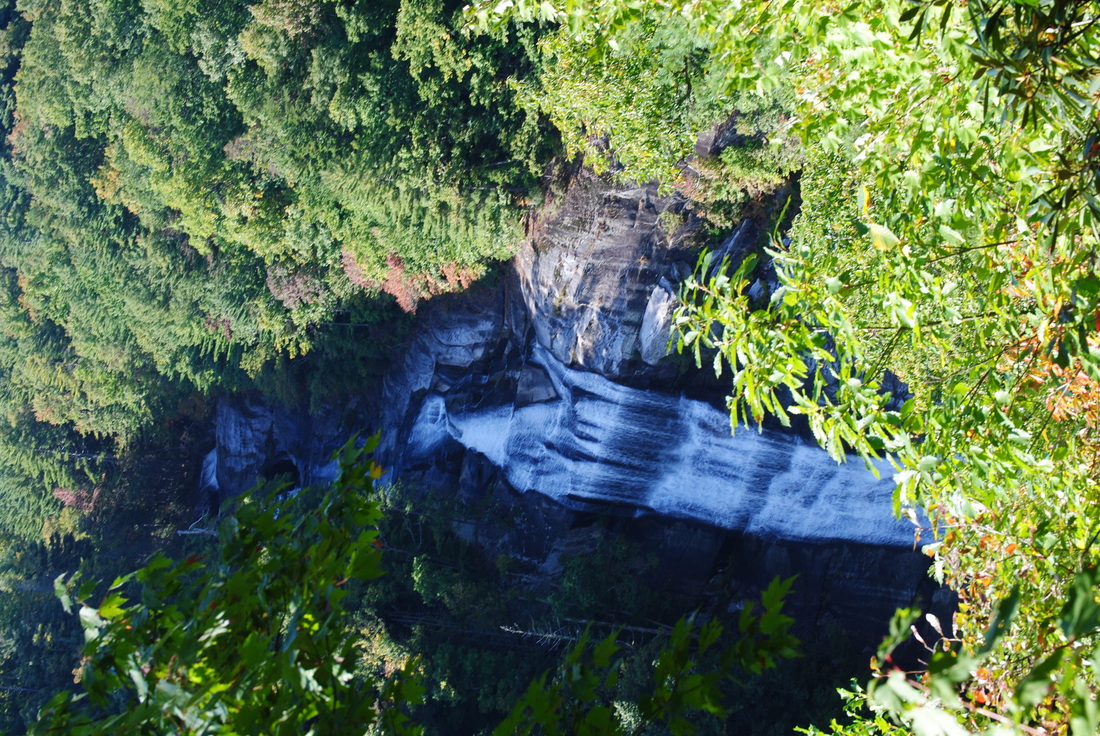
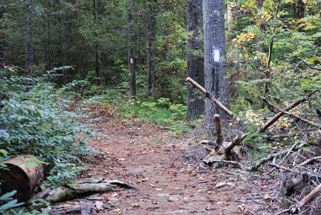
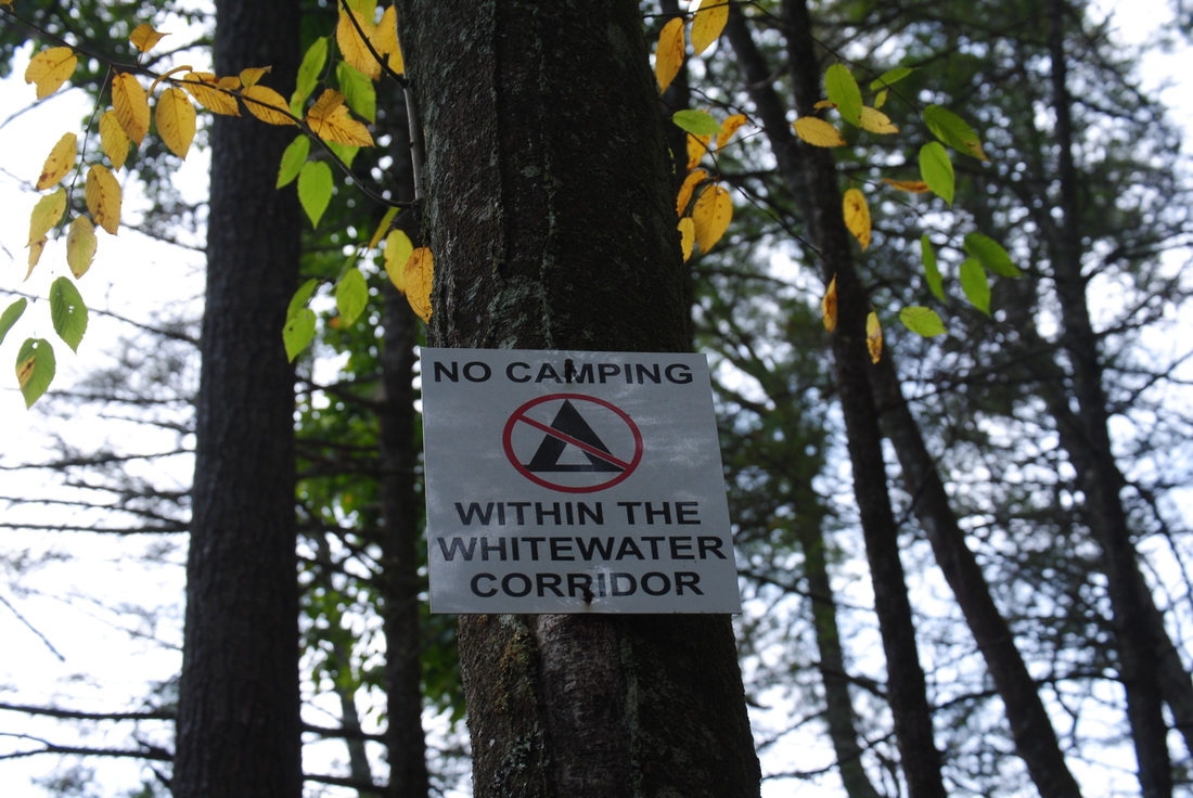
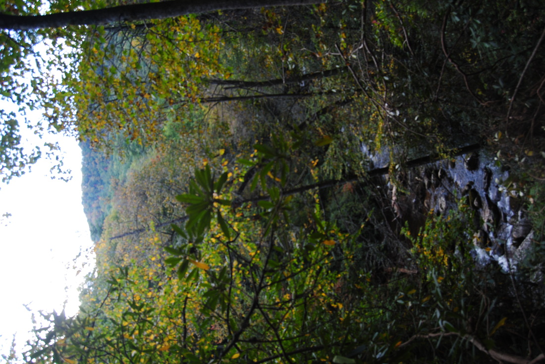
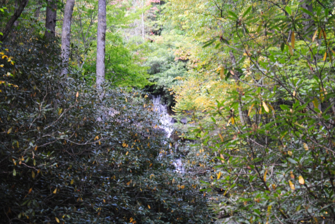
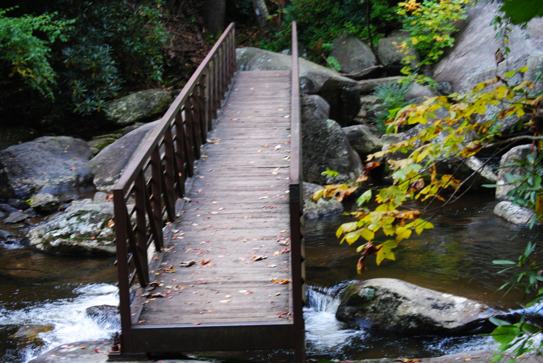
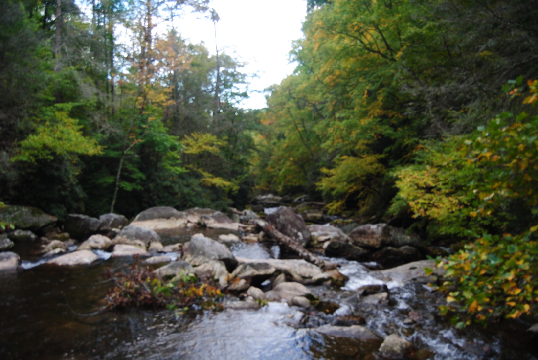
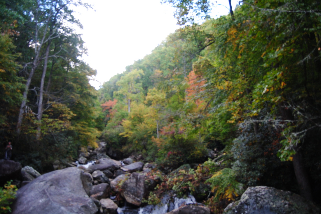
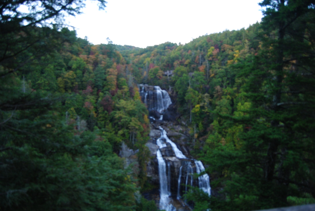
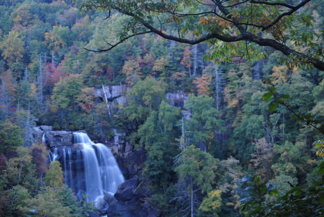
 I have hiked a bit on the Foothills Trail, but in general I have underestimated it. This primer on the Foothills Trail in extreme upstate South Carolina is about as good as it can get while hiking - in fact, this is one of my favorite hikes not only this year, but in the past few years. The Whitewater River starts in the mountains near Cashiers, and grows on its way to Lake Jocassee. There are six waterfalls on the Whitewater River, but two waterfalls are the biggest ones, and more importantly, will take your breath. First, Upper Whitewater Falls is a gigantic double-tiered waterfall, claimed to be the highest waterfall east of the Mississippi River. Following this, the Whitewater River plunges with whitewater through the Whitewater River Gorge, exiting the gorge with another dramatic drop at Lower Whitewater Falls, into Lake Jocassee. This hike occurred on Saturday, October 11th, 2014. My plan was to take the Bad Creek Access Trail to the Foothills Trail, and first take the Foothills Trail east to the Lower Whitewater Falls Trail, and follow it to the Lower Whitewater Falls Overlook. Following this, I would backtrack to the Bad Creek Access Trail, and take the Foothills Trail northwest to Upper Whitewater Falls. After this, I would return the same way to the trailhead. R/T Length of Hike: 9.4 Miles Duration of Hike: 5 Hours, 10 Minutes Type of Hike: Y-Shape Designation Difficulty Rating: 6 out of 10 Pros: Breathtaking waterfalls, great views of Whitewater River, top-notch quality of trail to Lower Whitewater Falls Cons: Very rugged and some tough climbing to Upper Whitewater Falls, lack of camping options along Whitewater River Corridor Water Features: Lower Whitewater Falls - 10+ stars; Upper Whitewater Falls - 10+ stars; Corbin Creek Falls - 4 stars Scenic Views: None Best Season(s) to Hike: Winter; Spring Trail Blaze Color(s): Bad Creek Access Trail -Blue; Lower Whitewater Falls Trail - Blue; Upper Whitewater Falls Trail - Blue; Foothills Trail - White Beginning Point: Bad Creek Access Parking Lot Directions: From Salem, SC: Follow SC State Route 130 for about 11 miles, until you see the Duke Energy Plant Entrance on the right. Enter here, and follow Bad Creek Road for 2.1 miles. Then turn left onto an unnamed road that ends at the Bad Creek Parking Area in 0.2 miles. Duke Energy owns a large tract of land in extreme upstate South Carolina, bordering Sumter National Forest and Nantahala National Forest. They manage a section of the Foothills Trail that comes through their land, helping to improve the access to Upper and Lower Whitewater Falls. Be aware that all entry access to the Bad Creek Trailhead is only from 9 AM until 4 PM - although you can exit any time, as the gate opens automatically for someone exiting. The trail starts on the back end of the Bad Creek parking area at the kiosk. It has a pretty good map of the area. The trail gently ascends to a junction at 0.1 mile. Here, a trail, labeled "Lake Jocassee^", turns right. I am not exactly sure where this trail goes, but it seems like it comes out on the northern tip of Lake Jocassee below Lower Whitewater Falls, and from there, reaching the base of Lower Whitewater Falls shouldn't be too much of a problem. It is probably not more than half of a mile off-trail along the Whitewater River. Anyway, for this description, turn left to keep following the Bad Creek Access Trail. It passes through a large meadow with mainly grass and young trees. There are some nice views off to the south and west, particularly in winter. After this, the trail ascends to cross a small ridgeline, and then steadily descends for 0.4 miles to the Whitewater River. At 0.7 miles, reach a junction with the Coon Branch Trail. This trail bears left, and follows the Whitewater River for about a mile past some old-growth trees/ Meanwhile, keep forward across the Whitewater River on a pair of sturdy, metal bridges. View the Whitewater River's water rushing in the form of rapids through multiple channels. On the other side of the river, the Bad Creek Access Trail ends at the Foothills Trail. Turning left on the Foothills Trail is the route to Upper Whitewater Falls - continuing forward is the route to Lower Whitewater Falls. I went to Lower Whitewater Falls first, because I wanted to see it in more daylight, but generally, it is better to go to Upper Whitewater Falls first, because it's harder to reach it. But I'll do the description in the order I hiked the trails, so keep forward to reach Lower Whitewater Falls. It's 1.7 miles till the falls. At first, the trail stays flat, but it soon starts to ascend along a small stream, and the Whitewater River is quickly muted behind the rolling hills. The ascent is sometimes steep, but never too steep. At 1.5 miles from the start, reach a junction with the Lower Whitewater Falls Trail, appropriately signed. Turn right onto it. First, rise over a small knob and then keep going downhill to reach to reach a gravel road and an ATV unloading area at 1.7 miles. The trail merges with the road for 0.1 mile, going south, before turning right off the road at 1.8 miles. The next 0.6 miles are some of the best pieces of trail from the entire hike. Great winter views abound of the surrounding mountains and the Whitewater River Gorge narrowing in between. Even in summer, it gives a decent view. Meanwhile, the trail itself gets consistently steeper as it plunges downhill towards Lower Whitewater Falls. The last 0.2 miles are the steepest, before it suddenly levels out, turns right, and reaches the observation platform for Lower Whitewater Falls at 2.4 miles. Lower Whitewater Falls is an incredibly beautiful waterfall. The sheer drop seems more than 200 feet to me, as the whole force of Whitewater River plunges into an abyss, revealed only when the leaves are down. The river first has several large cascades visible, then one bigger slide, followed by the main drop. This was the most beautiful waterfall I have seen up to date, and probably even a little bit more beautiful than Upper Whitewater Falls. I would love to visit the base to witness the full force of the waterfall, but I do not do any tough off-trail excursions, as the name might be appropriate for the process of reaching the base of the falls. Once you have gotten your fill of the view, and that may probably take some time, head back up the trail, all the way to the Bad Creek Access Trail junction, reaching it at 4.1 miles. Now, turn right to keep following the Foothills Trail. You'll soon come to a sign that reveals the fact that no camping is allowed along the Whitewater River, although I saw not one, but two groups violating the rule. At first, the trail stays flat, but that quickly gives way to a series of steps helping the trail to ascend to some rock bluffs above the Whitewater River, as the terrain is too rugged and steep for a trail. Around 4.6 miles, there were also some good views of the Whitewater River Gorge up ahead. After this, the Foothills Trail descends temporarily back to the river bank, where I saw some campers. Shortly after this, there was a sign that notified me of the end of the Duke Energy Maintenance Area, which also marks the North Carolina/South Carolina border. The trail stayed flat for a little bit, but it wasn't long before the ups and downs started again, because as the gorge was narrowing, the terrain was getting more and more rugged. At least steps were put everywhere, so it wasn't as rugged as some other hikes I have done along similar creeks and rivers. The most rugged part was around 5.1 miles, before the trail descended to near the river again, and became easier. At 5.5 miles, reach a footbridge across Corbin Creek. Directly up the stream is Corbin Creek Falls. It is extremely hard to focus in and get a good shot of Corbin Creek Falls - much of it is hidden behind growth, and even the part that is seen is always dark, so my best picture was zoomed out, not zoomed in. Cross the footbridge, and follow the river to descend to a "weird" crossing of the Whitewater River at 5.6 miles on another metal bridge. While the metal bridge removes any fording needs, it is a little hard to get to the bridge on both ends, especially at the other end. They have even installed a cable to help with going down from the bridge! But once you're on the bridge, stop for a minute and contemplate the surroundings. The river, a huge froth of water rushing around large boulders, makes for a great sight. You can certainly get some good pictures here up and downstream. After this bridge, the trail stays tricky. Pay attention to the blazes here. The trail passes under a couple of downed trees, followed by a scramble across some large boulders. After the boulders, turn left and begin a steep climb out of the gorge. The next 0.7 miles, are rugged, steep, and slow. Don't cut the switchbacks - this is very steep terrain! There are some steep sections of the trail too, definitely harder than at Lower Whitewater Falls. At 6.3 miles, reach a junction with the Upper Whitewater Falls Trail. The Foothills Trail continues forward to NC HWY-281, but you need to turn right onto the Upper Whitewater Falls Trail. It is only 0.1 mile to the main observation area, but you need to h up a lot of small wooden steps - I would say close to a hundred. Once you top out, you reach the observation platform, and what a view! This is another amazing waterfall. It is different from the Lower Falls. There are two main drops, with huge amounts of water going down for 200 feet, and then another 250 feet into the gorge. All of the trees around the waterfall, and near the observation area, blend into the scene, creating it even more beautiful. While Lower Whitewater Falls was a bit too far away from the observation platform, this waterfall wasn't - it was exactly the correct distance! There are relatively easy ways to reach the top and base of the falls, but they all require going off-trail, so I didn't try it this time. I didn't have any time left for it anyway, as it was already around sunset. There is also a long wooden staircase going up from the platform, about 150 - 160 steps, that leads to another view of the waterfall, although the lower overlook was better. If you are feeling up to it, I would recommend to check out both views though, because they give slightly different perspectives. Also, if you walk down the asphalt road (that ends at the overlook) a bit, you will come to a great view of the gorge and Lake Jocassee in the distance. Unfortunately, I didn't know about this until after I had gotten home. Once you have gotten your view of the falls, retrace your steps slowly to the Bad Creek Access Trail, and follow the Bad Creek Access Trail back to the parking area, like you had come. To summarize, this is an amazing hike, and one of the best hikes I have done this year. These waterfalls are easily the most beautiful in the Southeast, and also Upper Whitewater Falls is the tallest waterfall in the East, unofficially. Amicalola Falls in Georgia is officially higher, but it is multi-drop with many cascades, so personally, I don't think it's higher than Upper Whitewater Falls. I classify this hike as a "Best Hike". Below are my pictures and videos.
11 Comments
Karina Henry
9/22/2016 08:13:01 pm
Hi. Quick question:
Mark Oleg
9/22/2016 09:39:59 pm
Hello Karina,
Samantha
1/16/2017 05:31:00 pm
I followed your hiking path and even though the Upper Whitewater Falls trail was closed (due to the resent fires) I found your directions and descriptions right on the money and extremely helpful. Thank you for taking the time to document all of these details! Look forward to your next hike!!
Mark Oleg
1/16/2017 07:48:39 pm
Hi Samantha,
Kevin Wadley
9/22/2017 03:47:58 pm
Great review! I know the signs say no camping but did you see any camp ground where overnight camping in a tent is permitted? Or do you know if there's a camp area near Lower Whitewater Falls on the Foothills trail? Many Thanks, Kevin 4/1/2022 12:59:51 pm
There are some nice views off to the south and west, particularly in winter. After this, the trail ascends to cross a small ridgeline, I truly appreciate your great post! 3/15/2023 02:18:02 pm
Duke Energy owns a large tract of land in extreme upstate South Carolina, bordering Sumter National Forest and Nantahala National Forest. They manage a section of the Foothills Trail that comes through their land, I truly appreciate your great post! 8/11/2023 05:06:57 pm
Trail in outrageous upstate South Carolina is similarly great as it can get while climbing - truth be told, this is one of my #1 climbs this year, yet in the beyond couple of years. The Whitewater Stream begins in the mountains close to Clerks, 8/23/2023 04:24:33 pm
The trail merges with the road for going south, before turning right off the road at miles are some of the best pieces of trail from the entire hike. Great winter views abound of the surrounding mountains and the Whitewater River Gorge narrowing in between. I’m so thankful for your helpful post! 8/23/2023 04:47:09 pm
We Energy possesses a huge lot of land in outrageous upstate South Carolina, lining Sumter Public Backwoods and Nantahala Public Timberland. They deal with a part of the Lower regions Trail that gets through their property, 10/25/2023 03:12:36 pm
Duke Energy claims a huge parcel of land in outrageous upstate South Carolina, lining Sumter Public Woods and Nantahala Public Woodland. They deal with a segment of the Lower regions Trail that gets through their property, Leave a Reply. |
About MeMark Oleg Ozboyd Dear readers: I have invested a tremendous amount of time and effort in this website and the Georgia Waterfalls Database the past five years. All of the work that has gone in keeping these websites updated with my latest trip reports has almost been like a full-time job. This has not allowed me to pick up a paid job to save up money for college, and therefore, I I've had to take out loans. If you find the information on this website interesting, helpful, or time-saving, you can say "thanks" and help me out by clicking the button above and making a contribution. I will be very grateful for any amount of support you give, as all of it will apply toward my college tuition. Thank you!

Coming in 2022-2023?
Other Hiking WebsitesMiles HikedYear 1: 540.0 Miles
Year 2: 552.3 Miles Year 3: 518.4 Miles Year 4: 482.4 Miles Year 5: 259.9 Miles Archives
March 2021
Categories
All
|


 RSS Feed