The Endless Wall Trail is one of the most famous trails in New River Gorge National Park and all of West Virginia. Following the brink of the gorge for nearly two miles, the trail provides many outstanding views looking down from the towering cliffs of the Endless Wall. None is as legendary as Diamond Point, a rock promontory that features unobstructed views in both directions of the New River Gorge. However, what is less common knowledge is that the Endless Wall Trail serves as an access point to a set of spectacular off-trail waterfalls on Fern Creek. The trail crosses a placid Fern Creek above the gorge rim, but few people realize that a plethora of awe-striking beauty lies downstream. A side trail off the Endless Wall Trail known as the Climbers' Trail descends into the gorge through a series of ladders and caves, providing relatively easy access to Matteus Falls and Upper Fern Creek Falls. But reaching the middle and lower waterfalls of Fern Creek is a true adventure that is devoid of any paths, full of expansive rock gardens, and punctuated by house-size boulders. This trip report is split into two sections: the first describes the Fern Creek waterfall excursion, and the second describes the rest of the easy Endless Wall Trail. I initially hiked the Endless Wall Trail on Saturday, August 1st, 2020. I then returned to the area and explored the entirety of Fern Creek from top to bottom on Sunday, January 17th, 2021. This trip report combines details and photos from both hikes.
Summary
Fern Creek Waterfalls
R/T Length of Hike: 3.0 miles
Duration of Hike: 3:20 plus 2 hours and 20 minutes of stopping and photography Type of Hike: Out and back Total Elevation Gain: 1,185 feet Points of Interest: Matteus Falls - 8 stars; Upper Fern Creek Falls - 2 stars low water, 7 stars high water; Middle Fern Creek Falls - 8 stars; Lower Fern Creek Falls - 7 stars; Vista at start of climbers' trail - 6 stars; Ladders and caves along the Endless Wall Best Season(s) to Hike: Winter
Endless Wall Trail and Diamond Point
R/T Length of Hike: 2.9 miles
Duration of Hike: 1:30 plus 40 minutes of stopping and photography Type of Hike: Loop Total Elevation Gain: 438 feet Points of Interest: Diamond Point - 10 stars; Other views along Endless Wall Best Season(s) to Hike: Fall
Fees: None
Beginning Point: Fern Creek Trailhead along Lansing-Edmond Road Directions from Fayetteville, WV: From the intersection of US 19 and WV 16/Court Street near downtown Fayetteville, follow US 19 North for 2.3 miles (across the New River Gorge bridge). Then, turn right onto Lansing-Edmond Road (CR 82). Continue another 1.3 miles to the signed parking area for the Endless Wall Trail at Fern Creek Trailhead on the right. If you keep driving another 0.5 mile, you will reach the signed Nuttall Trailhead. Map
Click the link below to download a .GPX file with a track of this hike.
Details
This is a rather unusual trip report! Part of this trip report serves to discuss the Endless Wall Trail, a rather easy and very scenic trail that visits numerous panoramic views of the gorge. As a matter of fact, the Endless Wall Trail was one of my first hikes in West Virginia - a trail I hiked last summer but never got the chance to write about on this website. Then, in January, I returned to the Endless Wall Trail with a different goal: I was determined to access the renowned off-trail waterfalls located along Fern Creek deep in the New River Gorge. I wanted to make sure I saw these waterfalls during winter, as the boulder fields around Fern Creek are known to be a copperhead haven in the summer. The reason I decided to split up this report into different sections is simple. The Endless Wall Trail is a great choice for everyone, whether you are a regular hiker or whether you are just looking for a casual family outing. However, the rough off-trail trek to the Fern Creek waterfalls is only for seasoned adventurers who are confident in their capabilities to navigate steep, boulder-strewn terrain. I decided that it still made sense to describe both hikes in one page because they begin at the same trailhead. I will start with the description of the Fern Creek waterfall trek, because there is very little info available online about it in contrast to the Endless Wall Trail.
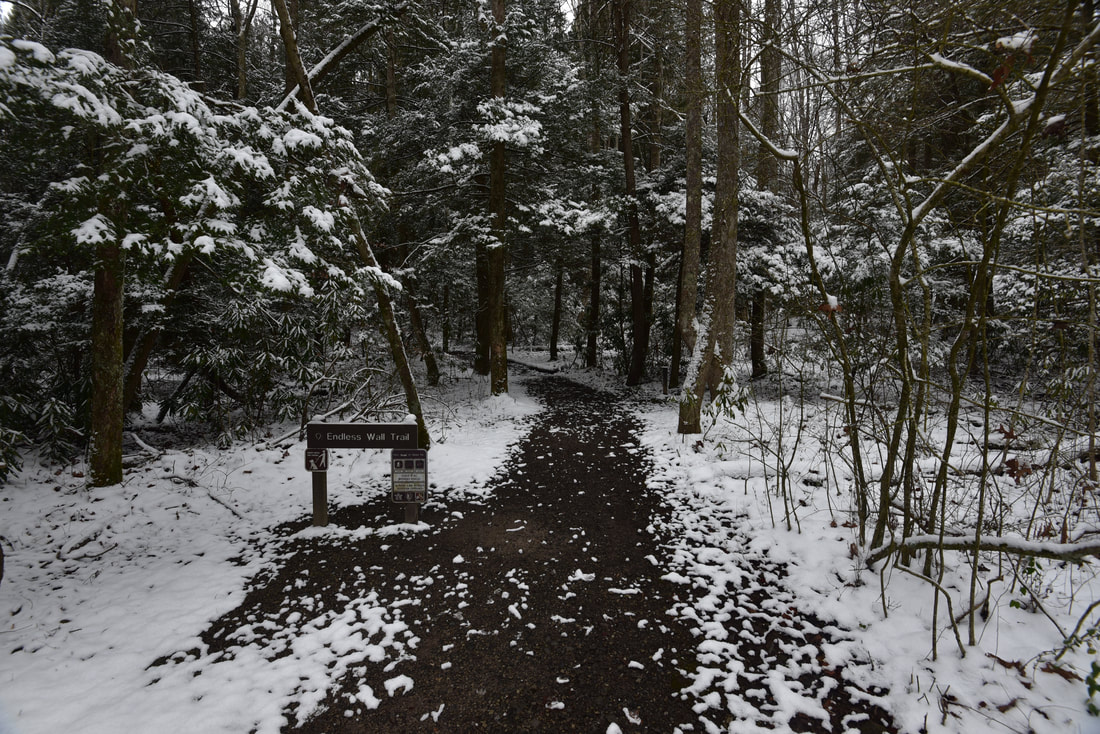
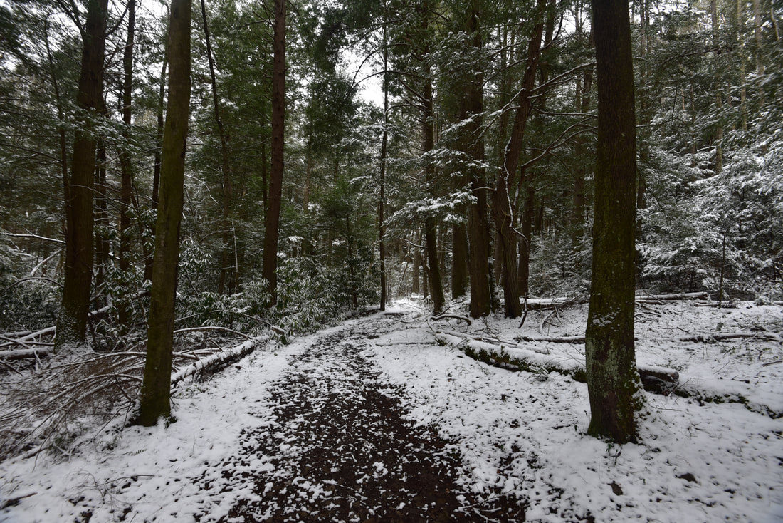
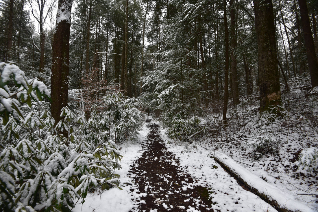
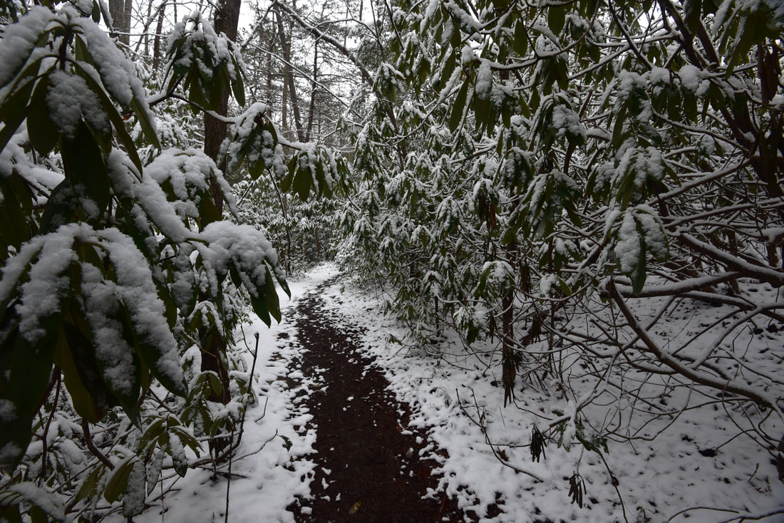
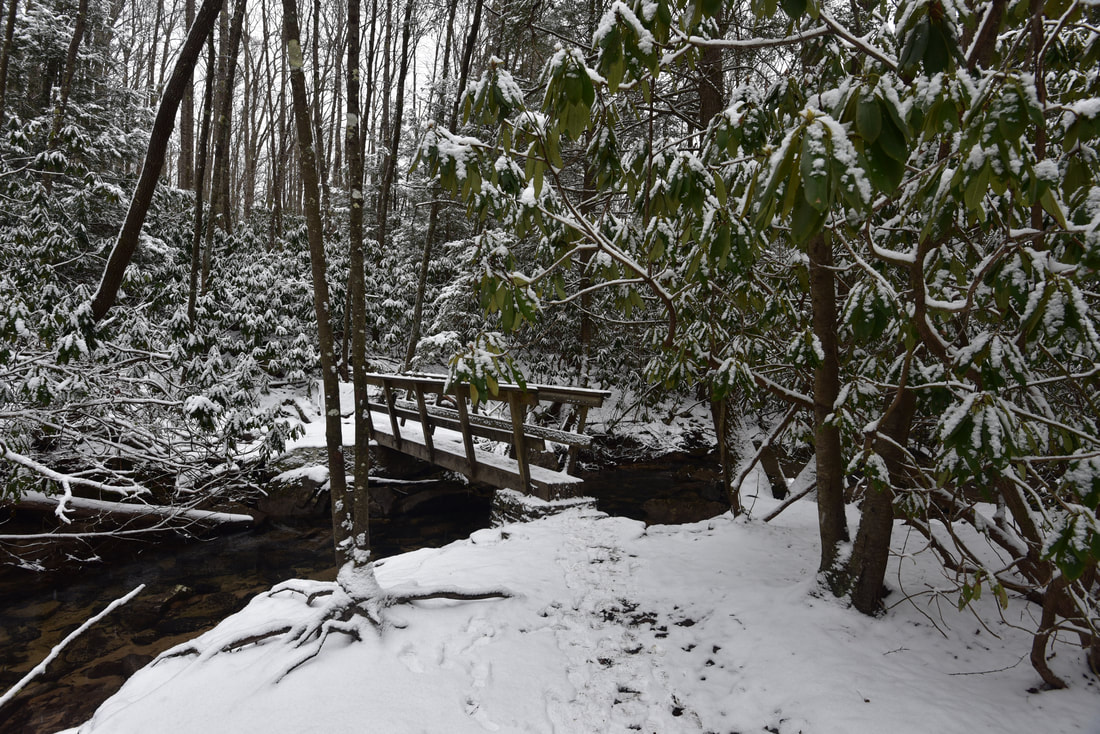
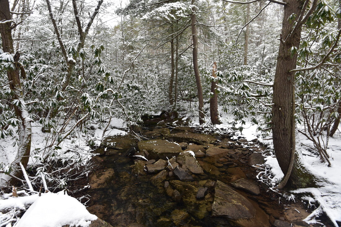
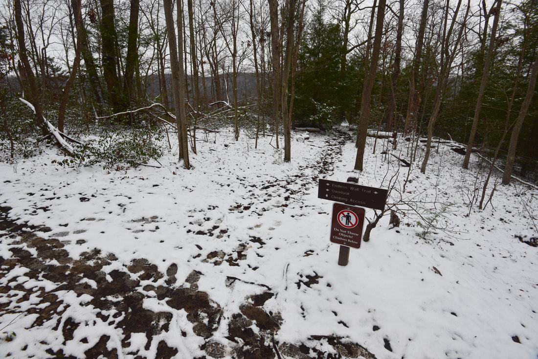
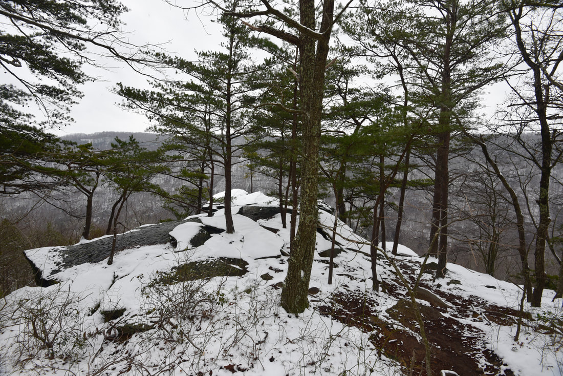
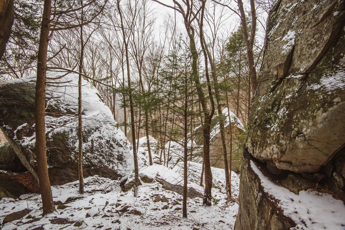
Both hikes begin at the Fern Creek trailhead along Lansing-Edmond Road. The Endless Wall Trail exits the far end of the parking area and quickly enters a gorgeous, shady hemlock grove. On this day, a light dusting of snow peppering the dense rhododendron shrubs lining the trail made for a perfect scene. The trail soon starts a gradual descent and reaches a picturesque wooden footbridge across Fern Creek at 0.5 miles. You are above the rim of the gorge, and therefore, above all the waterfalls on Fern Creek. A side path before the bridge leads downstream to a mediocre view of the top of Upper Fern Creek Falls. You won't really be able to see the waterfall there, and I encourage you to stay away from the cliff edge. After the footbridge, the trail gently rises along the plateau and soon approaches the rim of the gorge. At 0.7 mile, you will arrive at a junction with the Climbing Access Trail on the right. The Endless Wall Trail continues straight ahead to Diamond Point and other vistas - to read more about the rest of the trail, scroll down to the second half of this report. To access the waterfalls on Fern Creek, as well as some really spectacular rock formations beneath the gorge rim, turn right on the climbing access. Fern Creek Waterfalls
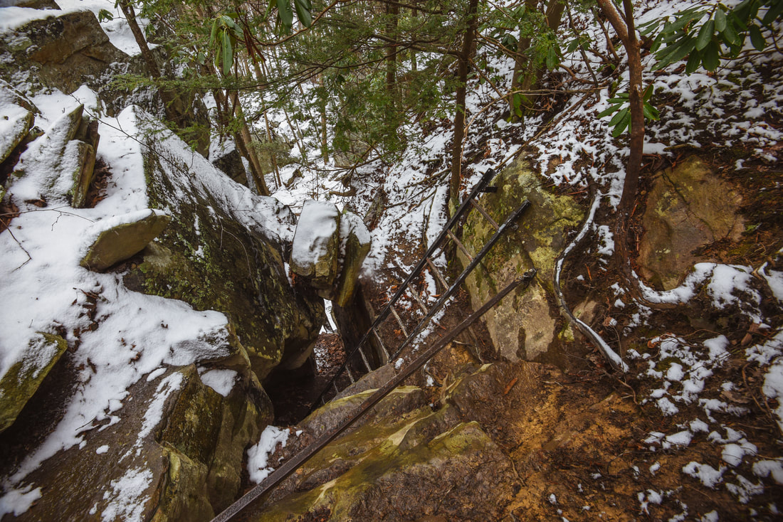
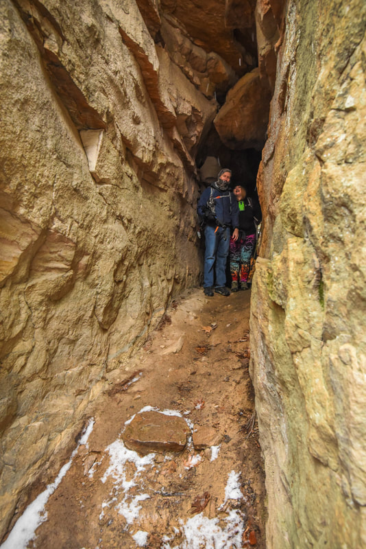
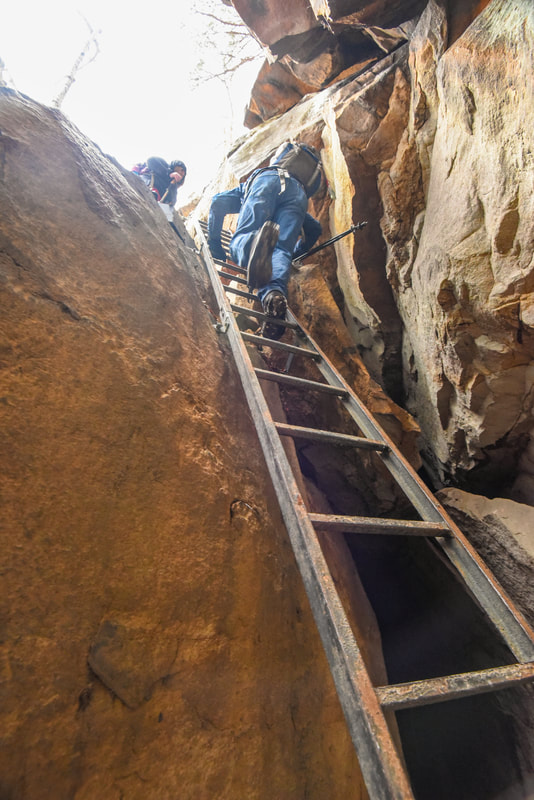
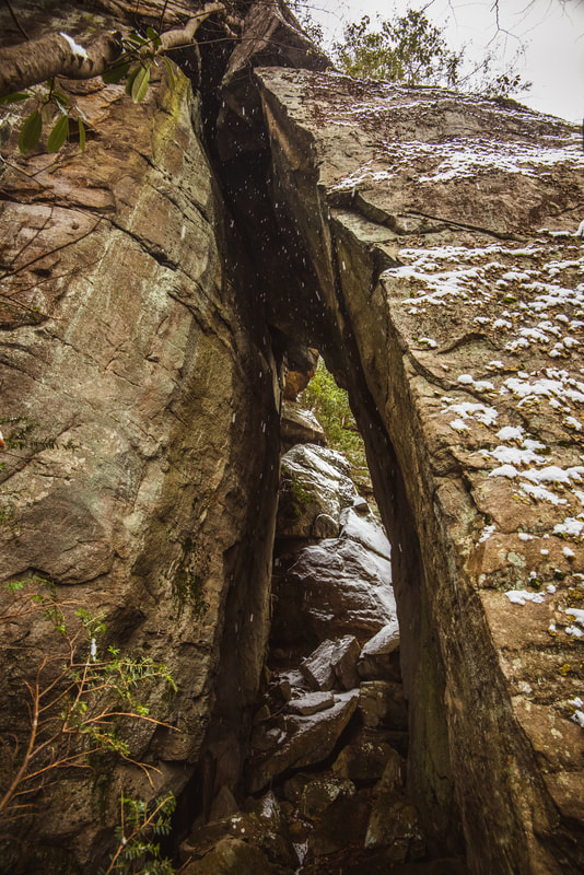
The Climbing Access Trail reaches the rim of the gorge in just 250 feet. The main trail bears right, but I highly encourage that you take the short side path on the left to a really nice view of the New River Gorge. Although it's not Diamond Point, it's still an unobstructed view of the gorge, showing the murky waters of the New River flowing nearly a thousand feet below you. The tan-colored sandstone cliffs formed a beautiful contrast to the snow-covered slopes of the gorge. The main trail soon reaches another rock outcrop, which provides a nice view through the trees of the New River Gorge Bridge. The trail than bears right and reaches the first of three ladders into the gorge. The first ladder is about 12 feet high and leads to a unique cave that the trail then passes through. On the other side of the cave, the trail descends a 25-foot ladder and an 8-foot ladder before reaching the foot of the bluffs.
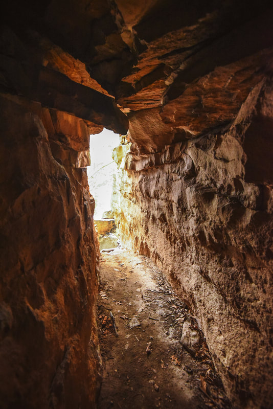
The Climbers Access Trail passes through this cave as it descends the New River Gorge bluffs
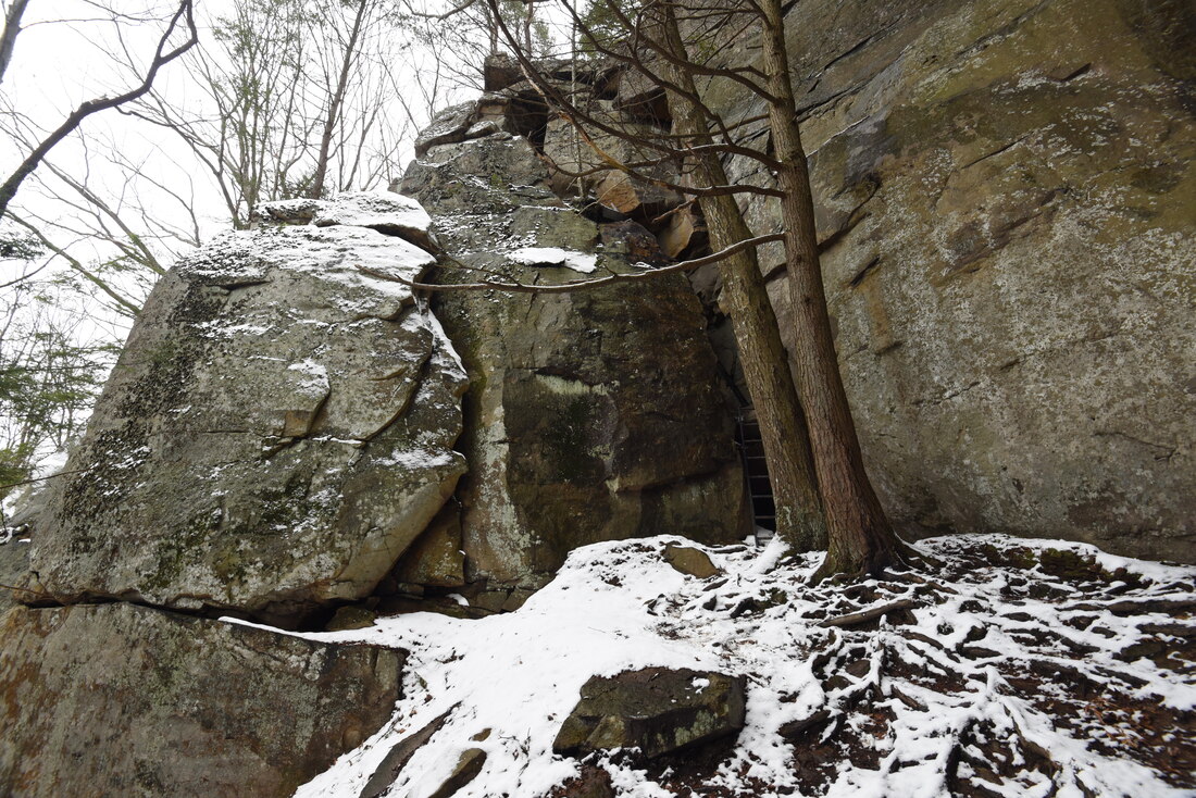
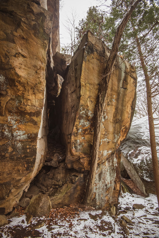
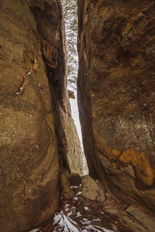
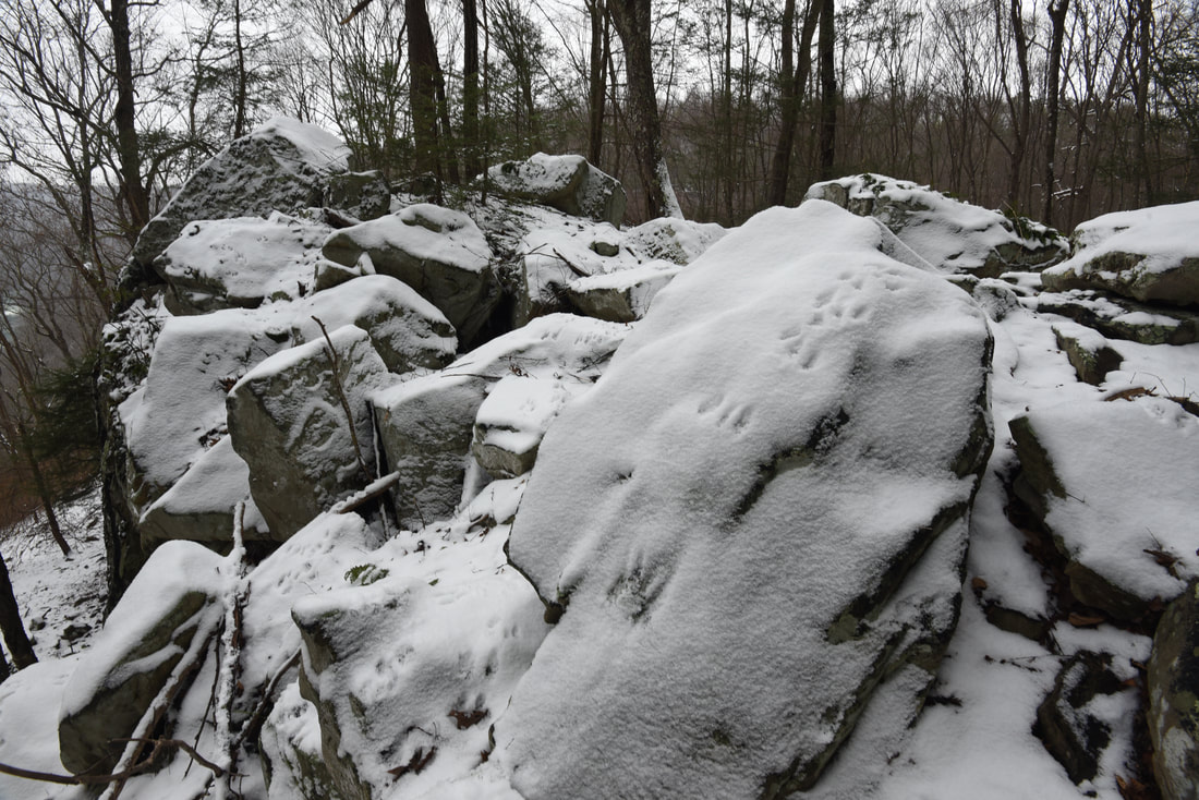
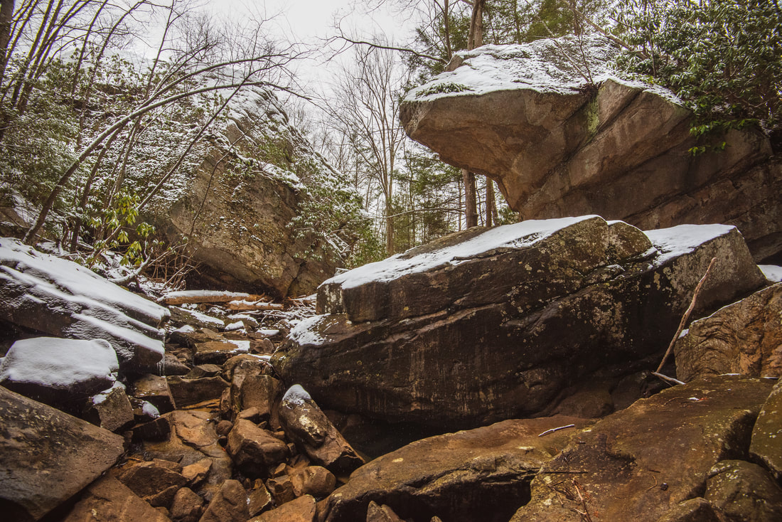
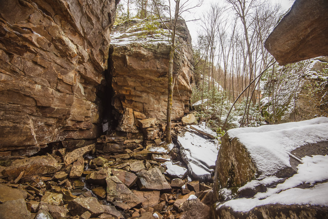
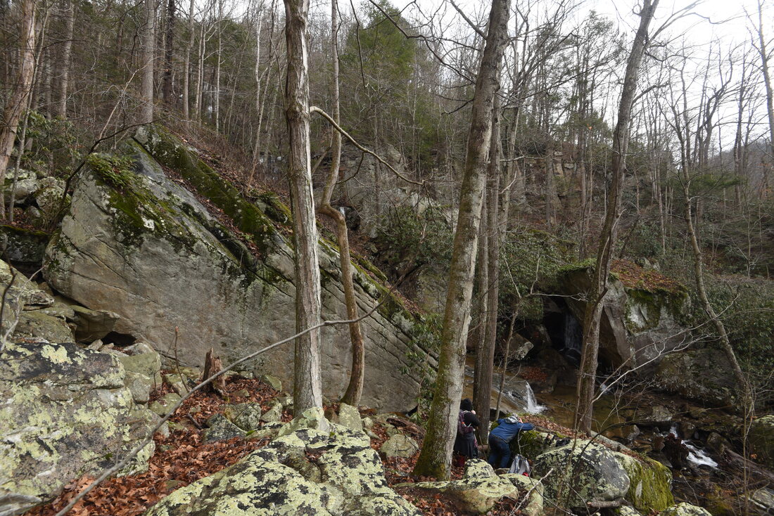
At the foot of the bluffs, look around and you will see that you are surrounded by an assortment of spectacular rock formations. The official Climbing Access Trail turns left and squeezes through a long, tight crack between two bluffs. That trail goes on to circumnavigate the cliffs of Diamond Point and returns to the Endless Wall Trail via another series of ladders in about a half-mile. However, to access the waterfalls of Fern Creek, you will want to instead turn right on the unofficial extension of the Climbing Access Trail, which leads westward eventually all the way to Fayette Station Road. The path loosely parallels the bluff line, although it meanders about 100 feet below it. As the trail approached Fern Creek, it became a little faint amongst scores of large boulders having fallen from the bluffs. The fresh coating of snow also made it harder to find. If you don't see the path, just follow the route of least resistance near the bluffs and you will soon return to it.
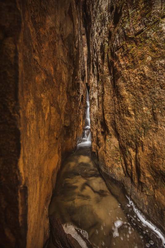
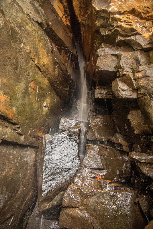
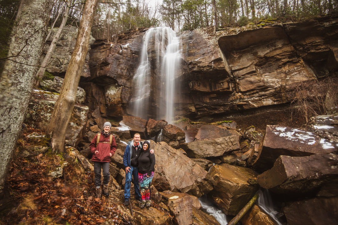
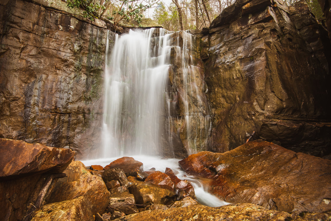
About 0.2 mile after the ladders, arrive at a small stream crossing. This is the south branch of Fern Creek, which is home to Matteus Falls (GPS: N38.05800° W81.06205°). Note that this branch of Fern Creek is not shown on topo maps. Scramble upstream along the creek to see the waterfall, which is only 50 feet away. You will shortly arrive at towering 60-foot bluffs. Straight ahead is a spectacular natural arch-like formation. To the left, Matteus Falls is barely visible in a slim fissure within the bluffs. You should be able to rock hop into the slot canyon for a better view. I was not able to get a close-up view on this day, as it would've required wading beyond the last rock into knee-deep water. Although I couldn't view it fully, I would say Matteus Falls is at least 40 feet high. This is one of the most unique waterfalls I've ever seen - the slot canyon is hardly a foot wide. Returning to the main pathway, you will reach the larger north branch of Fern Creek in just another 100 feet. Despite being shown on topo maps, this creek did not appear very large when I was here, so perhaps the south branch is actually the main one. You are directly at the base of Upper Fern Creek Falls (GPS: N38.05830° W81.06205°). This falls really is worth seeing only during high water and after heavy rain. At those times, a torrent of water free-falls over the bluffs and crashes into the rock garden below. But at most other times, all the water trickles through a slim crack in the bluffs and hardly resembles a waterfall. With that said, house-sized boulders and jagged bluffs all around this spot are very impressive. 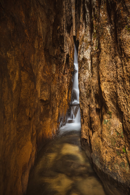
Matteus Falls is an exceptionally unique waterfall in a foot-wide slot canyon amidst the bluffs at the rim of the New River Gorge
eIn order to access the off-trail middle and lower waterfalls of Fern Creek, my recommendation is to continue following the climbing access path westward along the bluffs for another 0.2 mile. This is because the terrain along Fern Creek between the upper and middle falls is extremely rugged, plus overgrown with rhododendron. I've heard from at least one individual who attempted to follow the creek downstream to the middle falls but reached a dead-end at a cliff. Thus, the better choice is to stick with the climbers' path, which scrambles up a rocky gully between a gigantic boulder and the main bluff line. After this, the path closely follows the very foot of the bluffs on a rather rollercoaster route. I think a good point to leave the trail is once the woods to your left open up and the rhododendron thins out.
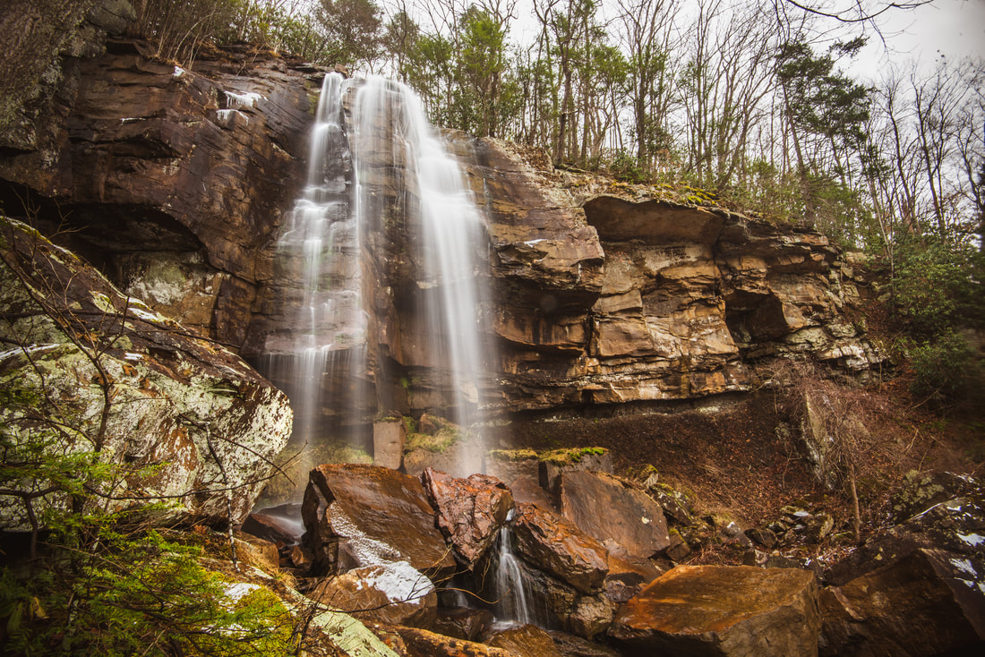
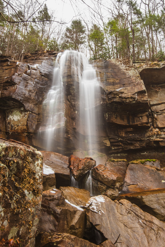
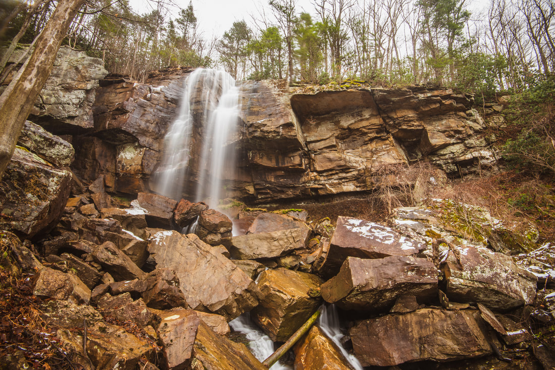
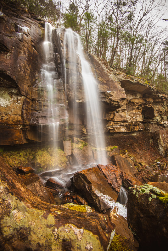
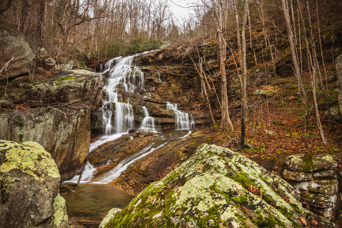
It is hard to describe a precise route for the bushwhack down to Middle Creek Falls. My suggestion is to bushwhack directly down the steep slope in a southwesterly direction. Do not approach Fern Creek until you are around the same level as the falls. A GPS would help in navigating directly to the waterfall, though I don't think it's necessary. As you get closer to the falls, you will start encountering large rock outcrops that become increasingly challenging to maneuver around. Observing the vast rock gardens scattered across the slopes of the gorge helped me realize why bushwhacking here in the summer would be like trudging through a minefield of snakes! You should approach Middle Fern Creek Falls (GPS: N38.05757° W81.06591°) after about 0.2 mile of bushwhacking. This is an awesome waterfall! It's 60 to 70 feet high, plunges in a free-fall over a huge bluff line, and lands in a conglomerate of boulders. During periods of very high flow, Middle Fern Creek Falls can be seen while driving across the New River Gorge Bridge on Highway 19. Lower Fern Creek Falls is located another 0.15 mile downstream, but the trek there is hardly any easier. I recommend staying closer to the creek for this part of the bushwhack. Immediately below the Middle Falls is a broken line of cliffs that is rather difficult to climb down. The easiest route seemed right by the creek. You will reach the base of a scenic yet unnamed 20-foot waterfall here that is well worth a few pictures. After this, a faint path of least resistance becomes a little more evident as it twists between the gigantic boulders lining the creek. As the creek steepens, you will want to move perhaps 50 feet away from it. After passing an island and some noisy cascades, you will finally reach the top of the Lower Falls as the railroad tracks come into view. The final scramble to the base is relatively easy. 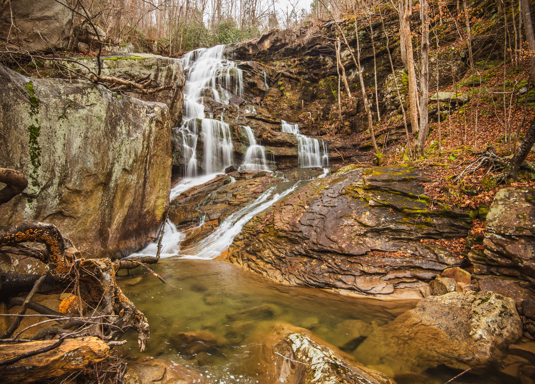
Lower Fern Creek Falls, a tall stairstep cascade, is the most picturesque of the waterfalls on Fern Creek.
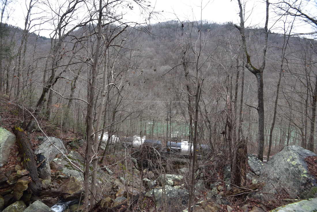
The lower falls on Fern Creek (GPS: N38.05766° W81.06794°) is about as large as the middle falls, even if less of a sheer drop. I would say the waterfall is at least 80 feet high, although a section of it is not visible from the base. This waterfall will likely be the photographers' favorite due to the intricate stairstep cascading pattern and layered rocks. I think it will look even better when surrounded by green foliage, but of course, I think doing this bushwhack in the warm season is a bad idea! Amazingly, in the last 0.4 mile or so, you've lost 700 feet in elevation since you left the climbing access path. Lower Fern Creek Falls is almost at the gorge floor; the New River is in plain sight straight ahead. So you might wonder, "can I just follow the railroad tracks instead of making the hellacious climb back up?". The answer is no. The railroad tracks immediately below Lower Fern Creek Falls are considered private property, and it is illegal to walk alongside them. Note that the railroad tracks cross Fayette Station Road less than a mile to the northwest. It would be an easy hike from there to Lower Fern Creek Falls, but again, this would be illegal. Therefore, your only option is to retrace your steps. I decided to make my return climb a bit further to the north and stay away from the creek entirely. The terrain was equally steep, but I did manage to avoid some of the tougher rock scrambling around Middle Fern Creek Falls. Once you return to the climbing access path, the rest of the hike will be a piece of cake in comparison, and you can now brag about having accessed several of the most spectacular yet hardest-to-reach waterfalls in the New River Gorge.
Endless Wall Trail to Diamond Point
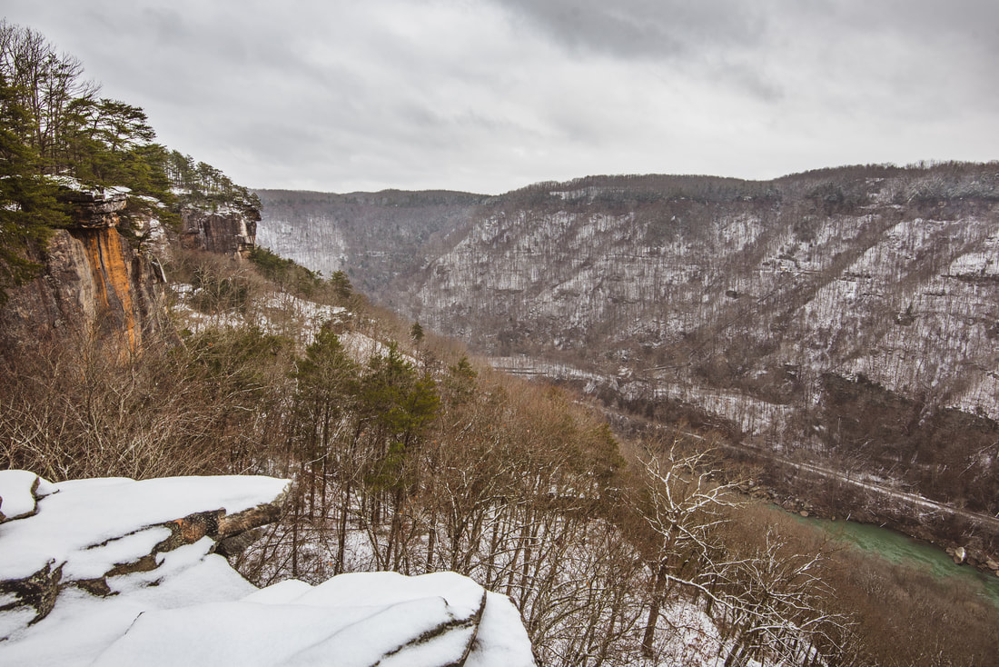
The Endless Wall Trail passed the junction with the climbing access trail at 0.7 mile from the Fern Creek trailhead. If you are just the casual hiker looking to experience all the beautiful vistas of the Endless Wall, continue straight on the main trail. At 0.9 mile, the trail reaches the rim of the gorge, where a couple of side paths lead to nice views on your right. At 1.0 miles, arrive at the signed intersection with the 100-foot Diamond Point spur trail. The spur trail gently descends to the rocky promontory of Diamond Point, which affords incredible views both up and down the New River Gorge. Scraggly pines are scattered throughout the point and tenaciously cling to the cliffs. To your left is the edge of a sheer cliff, dropping down over a hundred feet, providing a birds-eye view of the gorge in the upstream direction. The sheer bluffs of the Endless Wall stretch out as far as the eye can see. Two railroad tracks running alongside the New River are clearly visible - if you're lucky, you might even spot a train with wagons full of coal! On the west side of Diamond Point is a different view, showing the New River Gorge Bridge in the downstream direction. Look straight down and you will see kayakers navigating the New River's noisy rapids on a warm summer day.
Many people choose to just hike out and back to Diamond Point, but I encourage you to walk the rest of the trail and see the additional vistas it has to offer. At 1.2 miles, a sign denotes the other end of the Climbing Access Trail on the right. If you would like a little more challenge and interesting bluff scenery (without the off-trail trek down Fern Creek), one option is to use the Climbing Access Trail to loop back to the trailhead. I didn't hike most of that trail, but I do know it is significantly slower than the Endless Wall Trail, with more ladders and mild rock scrambles along the bluffs. Meanwhile, the Endless Wall Trail turns into a narrower path flanked by mountain laurel and passes occasional side paths to small vistas. A really nice view is on the right at 1.5 miles, where the powerful rapids of the New River are once again squarely in sight. The trail meanders along the rim for another half-mile before abruptly turning left onto the plateau at 2.0 miles. After crossing a small stream that feeds into Fern Creek, the Endless Wall Trail ends at the Nuttall Trailhead at 2.3 miles. Finishing the hike involves an easy 0.6-mile walk back west along Lansing-Edmond Road. Hikers frequently close off the loop this way, and as the road gets low traffic, vehicles should not be a huge concern. But the best part? The roadwalk is all downhill! 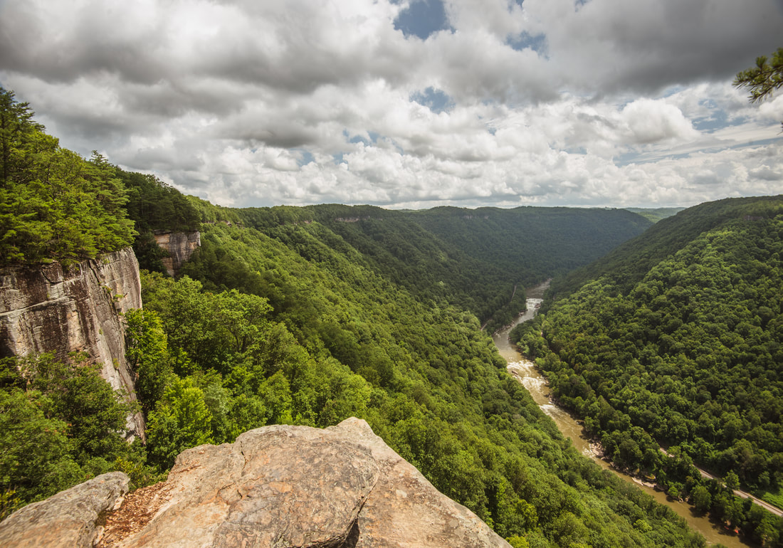
Diamond Point provides first-rate panoramic views of the New River Gorge
Pictures
2 Comments
Theresa
12/27/2021 11:19:00 am
Thanks for the detailed description! This is fantastic. Will check it out this spring before snakes 😬 7/1/2022 09:11:25 am
An uneven, whitewater river flowing northward via deep channels, the New River is amid the oldest rivers on the continent. The park contains over 70,000 acres of land further the New River, is rich in esthetic and natural history, and provides an exuberance of scenic and recreational opportunities. Several of the trails in the Fayetteville area were planned and set up by volunteers. Some of the trails lived before the park got the property, but required preservation or trail re-routing. The park was supported in some of the introductory trail design and construction by a Trail Care Crew from the International Mountain Bike Association. Leave a Reply. |
About MeMark Oleg Ozboyd Dear readers: I have invested a tremendous amount of time and effort in this website and the Georgia Waterfalls Database the past five years. All of the work that has gone in keeping these websites updated with my latest trip reports has almost been like a full-time job. This has not allowed me to pick up a paid job to save up money for college, and therefore, I I've had to take out loans. If you find the information on this website interesting, helpful, or time-saving, you can say "thanks" and help me out by clicking the button above and making a contribution. I will be very grateful for any amount of support you give, as all of it will apply toward my college tuition. Thank you!

Coming in 2022-2023?
Other Hiking WebsitesMiles HikedYear 1: 540.0 Miles
Year 2: 552.3 Miles Year 3: 518.4 Miles Year 4: 482.4 Miles Year 5: 259.9 Miles Archives
March 2021
Categories
All
|
||


 RSS Feed