HIKING THE APPALACHIANS AND BEYOND
  • Home
  • Trail Reports
    • Best Hikes
    • Hikes with Scenic Views
    • Hikes with Water Features
    • Alabama
    • Georgia
    • Florida
    • North Carolina
    • South Carolina
    • Tennessee
    • Vermont
    • Virginia
  • Map
  • Hike List
  • Testimonials
  • Resources
  • Contact Us
  • Southeast Nature Society
    • Our Team
  • Georgia Waterfalls Database

Point Washington State Forest: Eastern Lake Trail (Orange Loop) to Eastern Lake, Santa Rosa Beach, Florida

5/19/2017

0 Comments

 
Picture
The Gulf of Mexico coastline vicinity in Florida's Walton County is known for its dune lakes. One of the rarest ecosystems in Florida and worldwide, dune lakes are shallow freshwater lakes that are separated from saltwater ocean by thin strips of dunes and beaches. Walton County is home to a whole 17 dune lakes, which are otherwise only found in New Zealand, Madagascar, and Australia. Many of the dune lakes in Walton County are protected by state parks and other conservation areas. One such dune lake, Eastern Lake, is partially private, but its northern shore is part of Point Washington State Forest and is open to public access. The Eastern Lake Trail System consists of several color-coded loops ranging from 3.5 miles to 11 miles that travel through mostly longleaf pine scrub, and additionally, a side trail leads to the edge of Eastern Lake's sparkling blue waters. This hike occurred on Saturday, May 13th, 2017. My plan was to hike the outer loop (Orange Loop) of the Eastern Lake Trail counter-clockwise. Along the way, I would hike the spur trail to Eastern Lake out and back. 

Summary

R/T Length of Trail: 12.1 Miles 
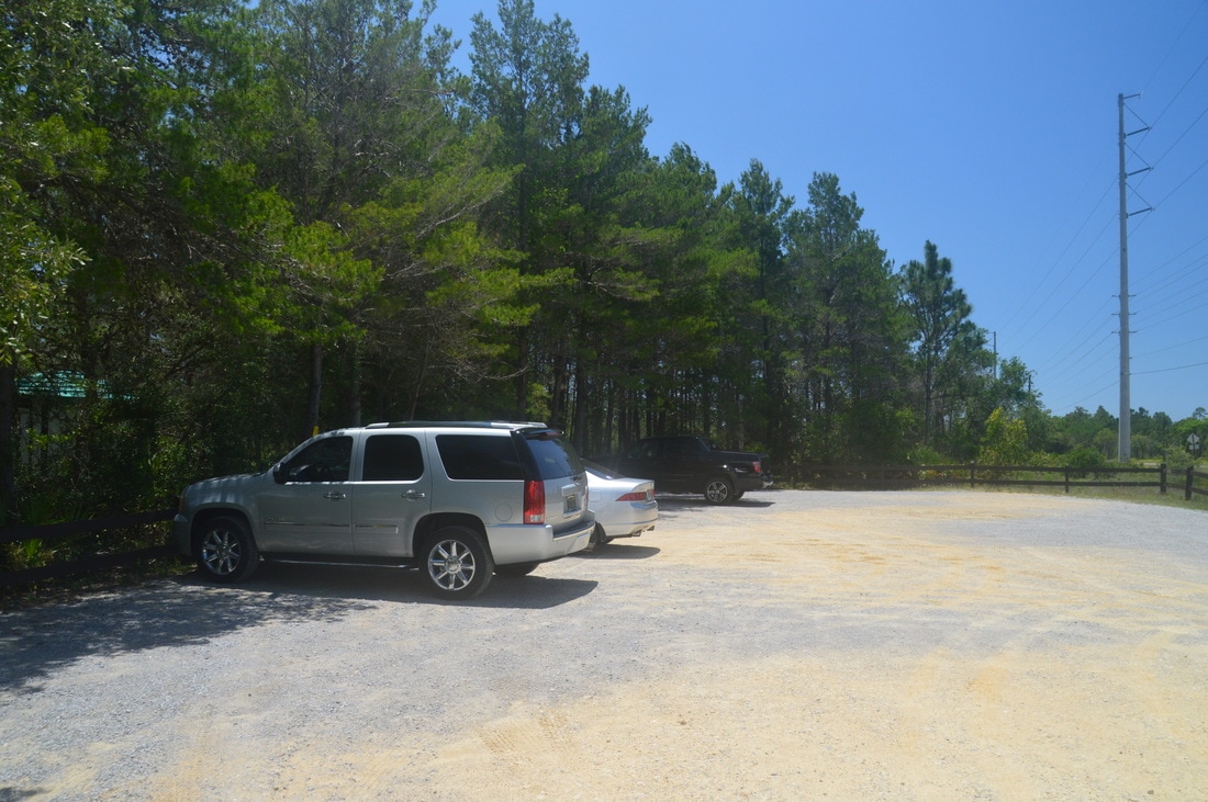
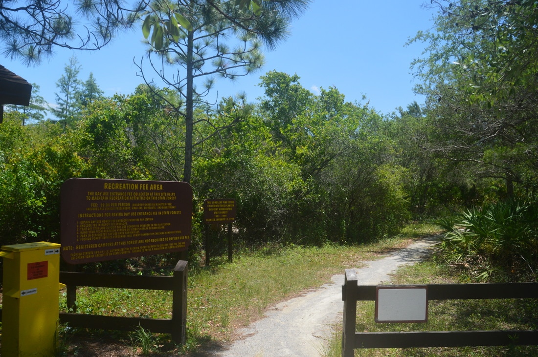
Duration of Hike: 5:35 
Type of Hike: Loop 
Difficulty Rating: 4 out of 10 
Total Elevation Gain: Minimal 
Pros: Relatively little of the hike follows forest roads 
Cons: A lot of the hike showcases similar scenery 
Points of Interest: Eastern Lake; West Fork Peach Tree Creek 
Trail Blaze Colors: Inner Yellow Loop of Eastern Lake Trail - Yellow; Middle Red Loop of Eastern Lake Trail - Red; Outer Orange Loop of Eastern Lake Trail - Orange; Eastern Lake Side Trail - Pink
Best Seasons to Hike: Winter 
Fees: There is a day use fee of $2 per person at the Eastern Lake Trailhead
Beginning Point: Eastern Lake Trailhead
Directions from Santa Rosa Beach, FL: From the intersection of US Highway 98 and County Highway 30A in Santa Rosa Beach, follow US Highway 98 for 8.9 miles, and then, turn right onto County Highway 395. Continue for 1.2 miles and then reach the Eastern Lake Trailhead parking area on the left side of the road. 

Map

Click here to download a track of this hike.

Details

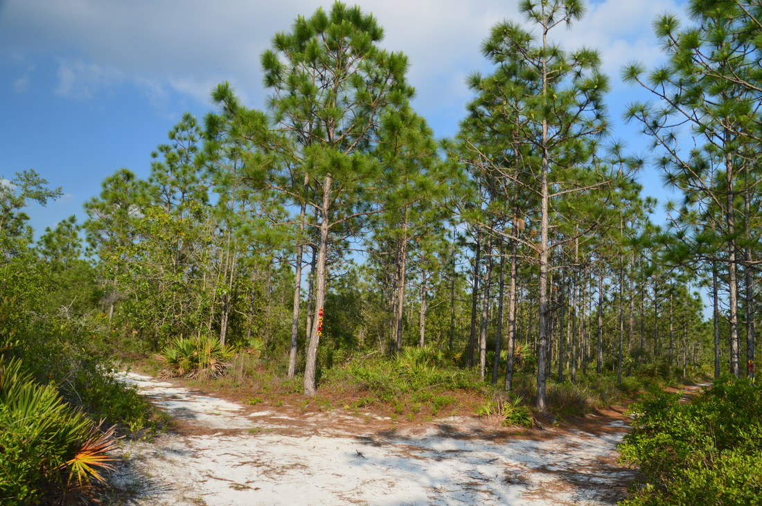
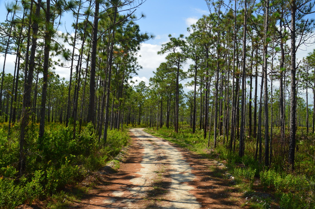
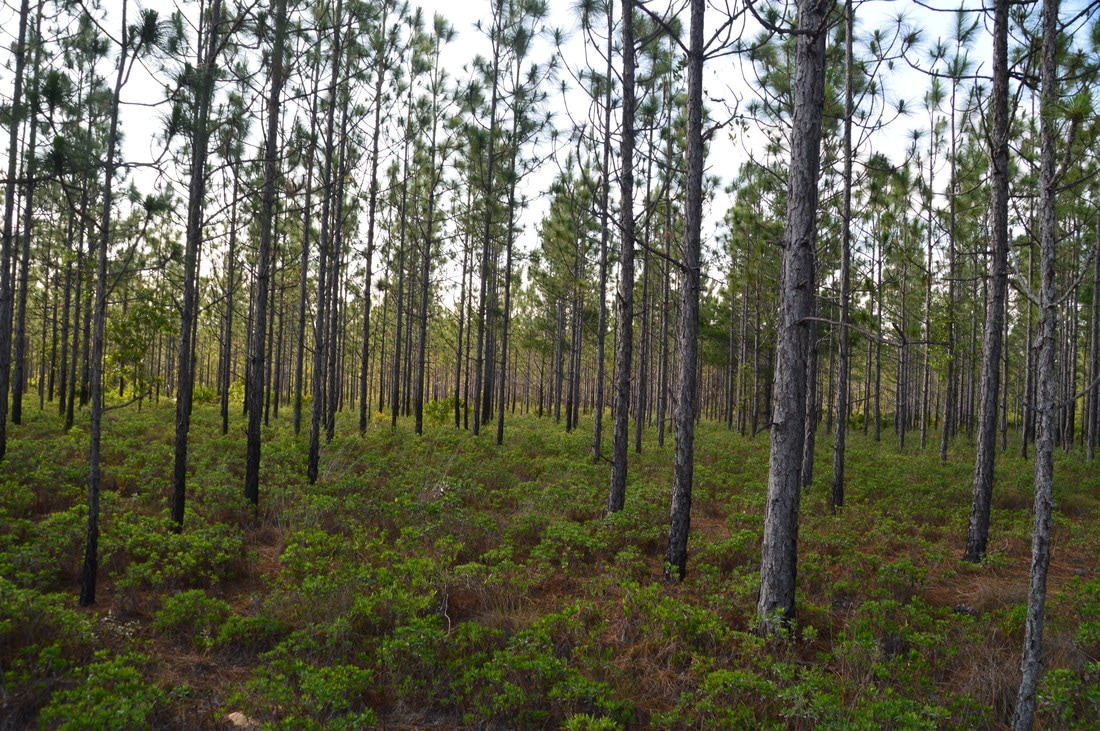
Point Washington State Forest is not a popular destination for hikers. It is often overlooked by folks who are more interested in well-known natural areas such as Topsail Hill State Park and Grayton Beach State Park. In fact, the Eastern Lake Trail System is used more by hikers. Nonetheless, while the trail system may not be as outstanding as some of the others in the area, it provides an excellent walk through stands of endangered longleaf pine, along with views of one of Florida's less-known but equally beautiful dune lakes: Eastern Lake. 

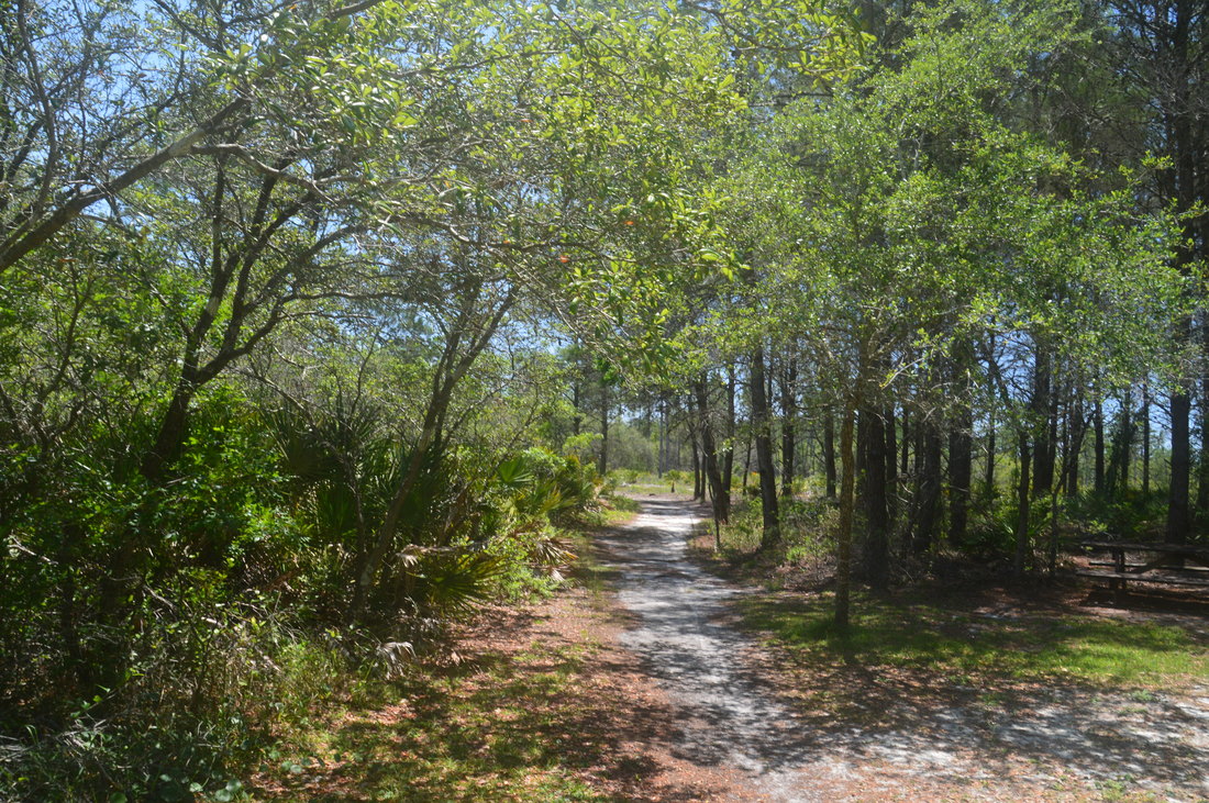
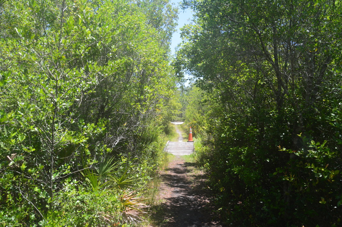
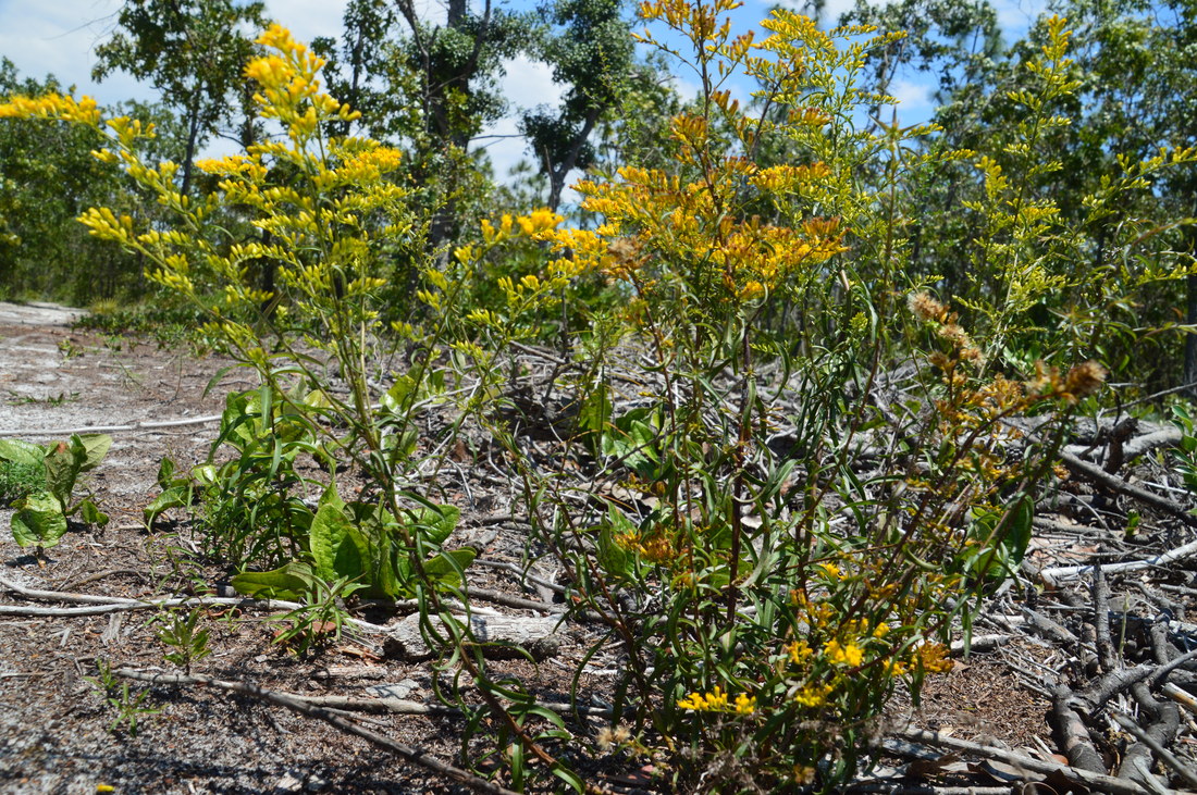
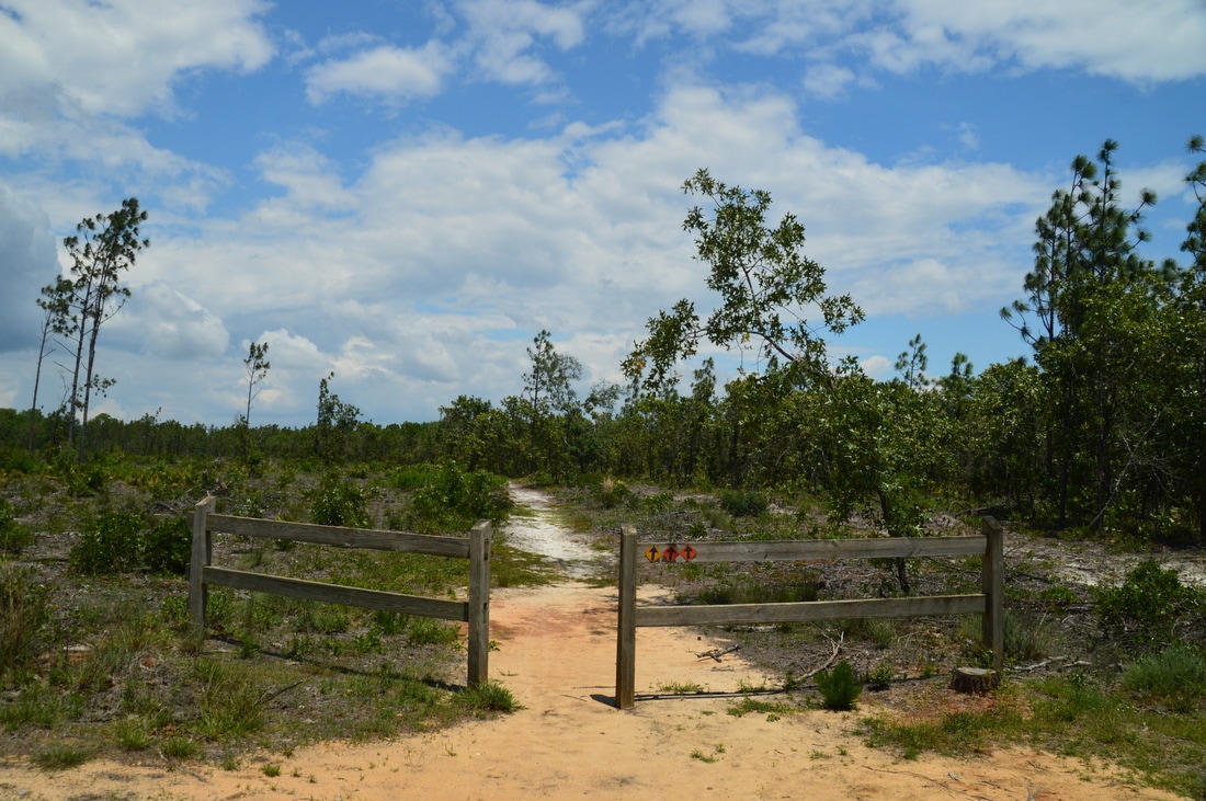
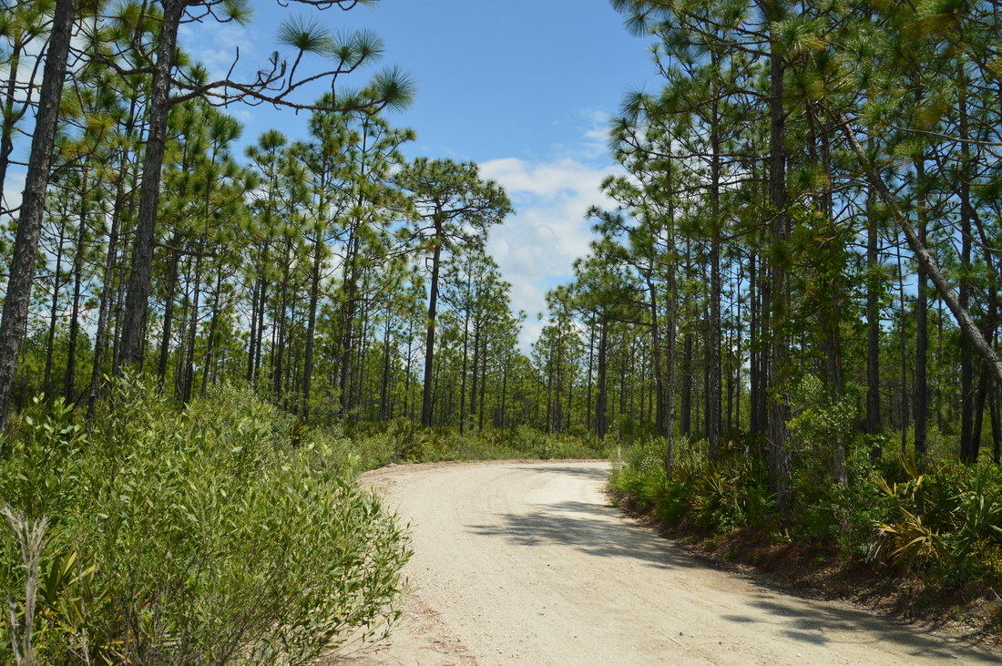
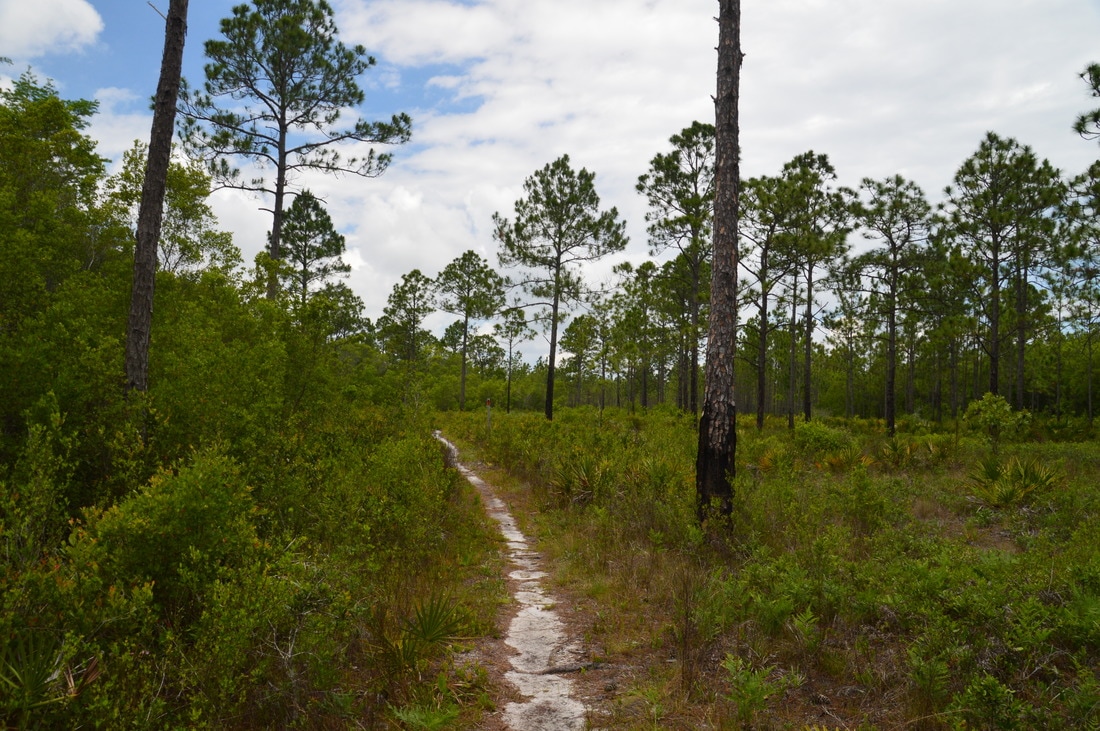
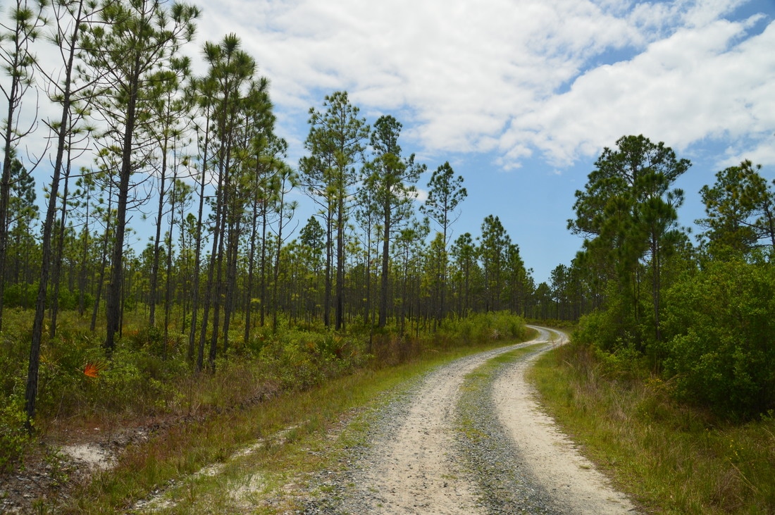
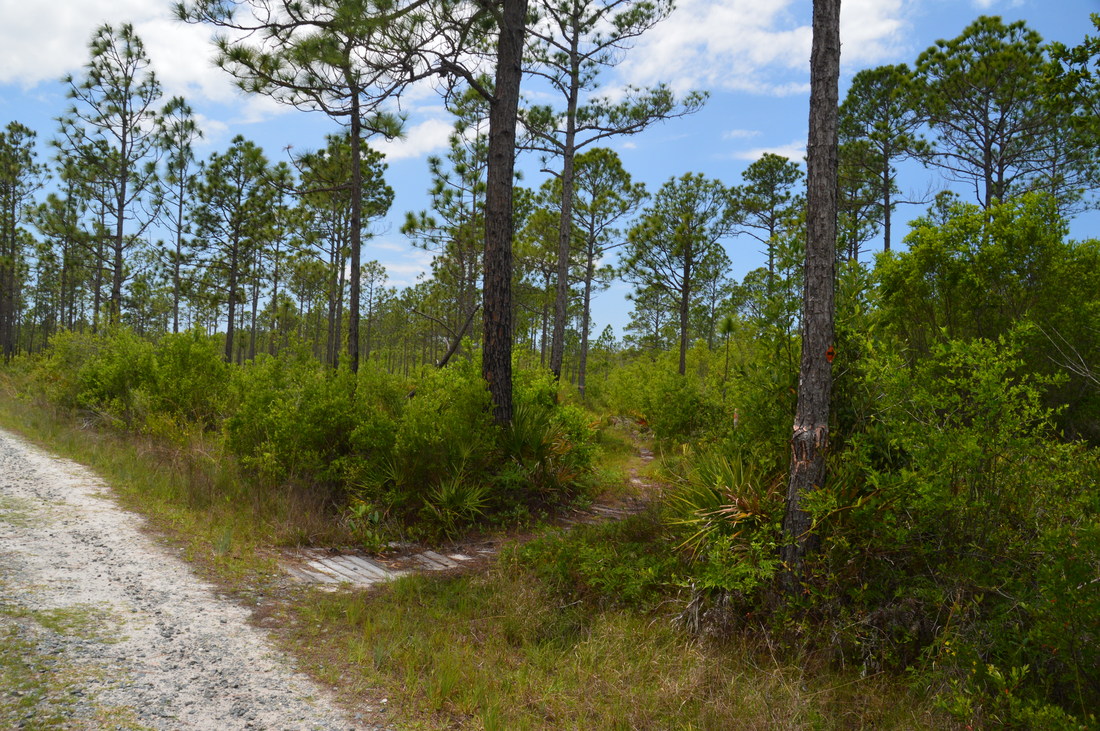
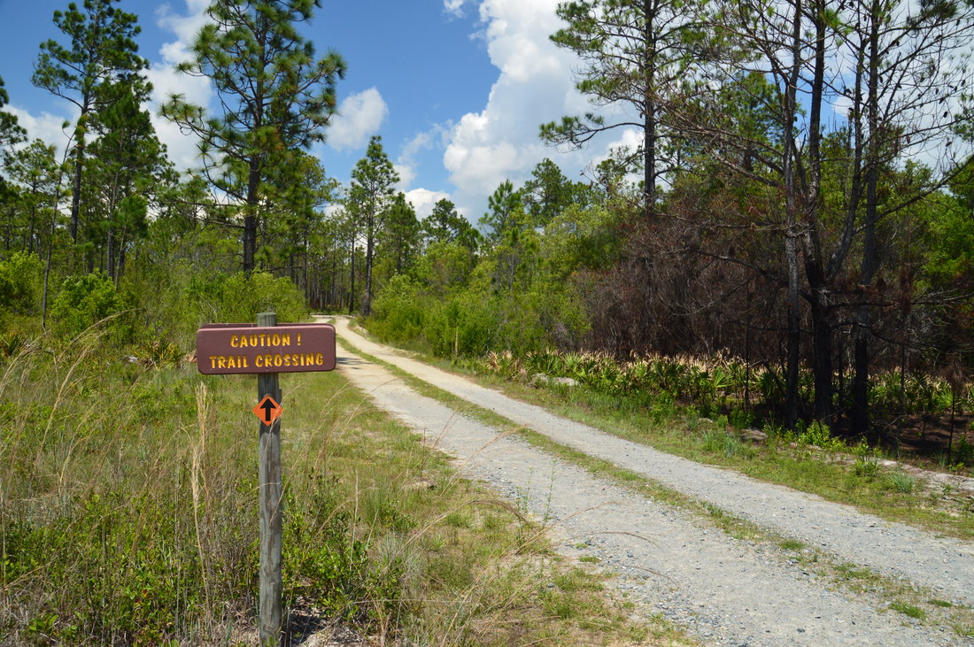
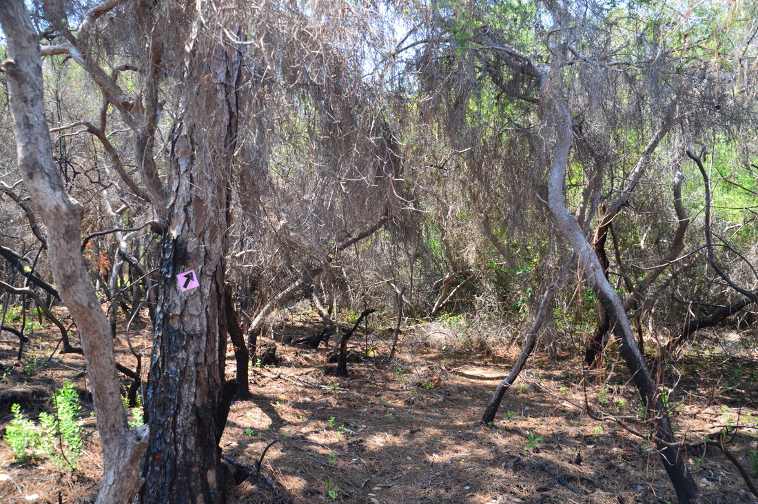
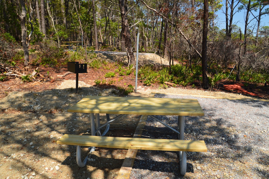
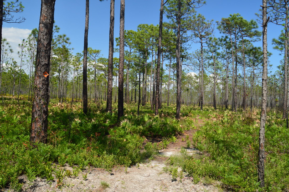
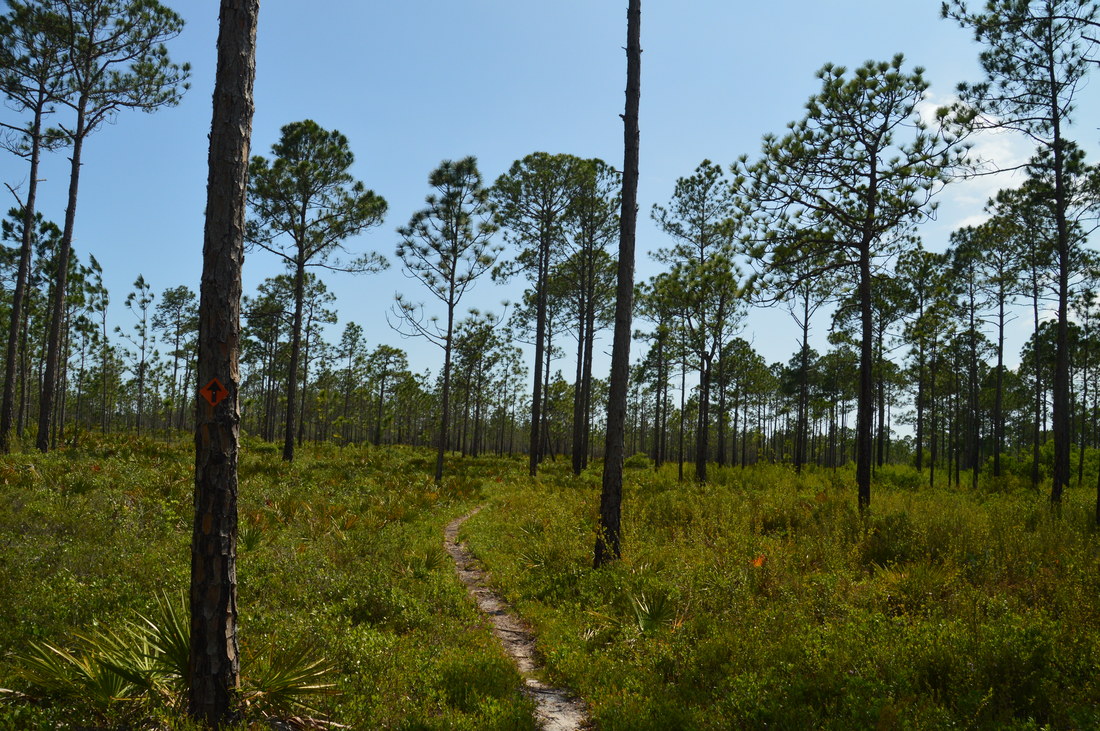
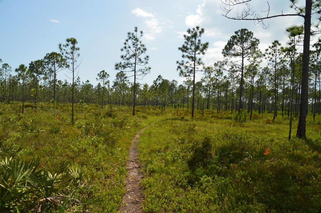
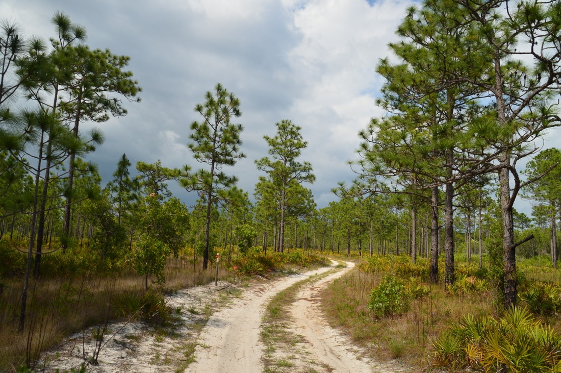
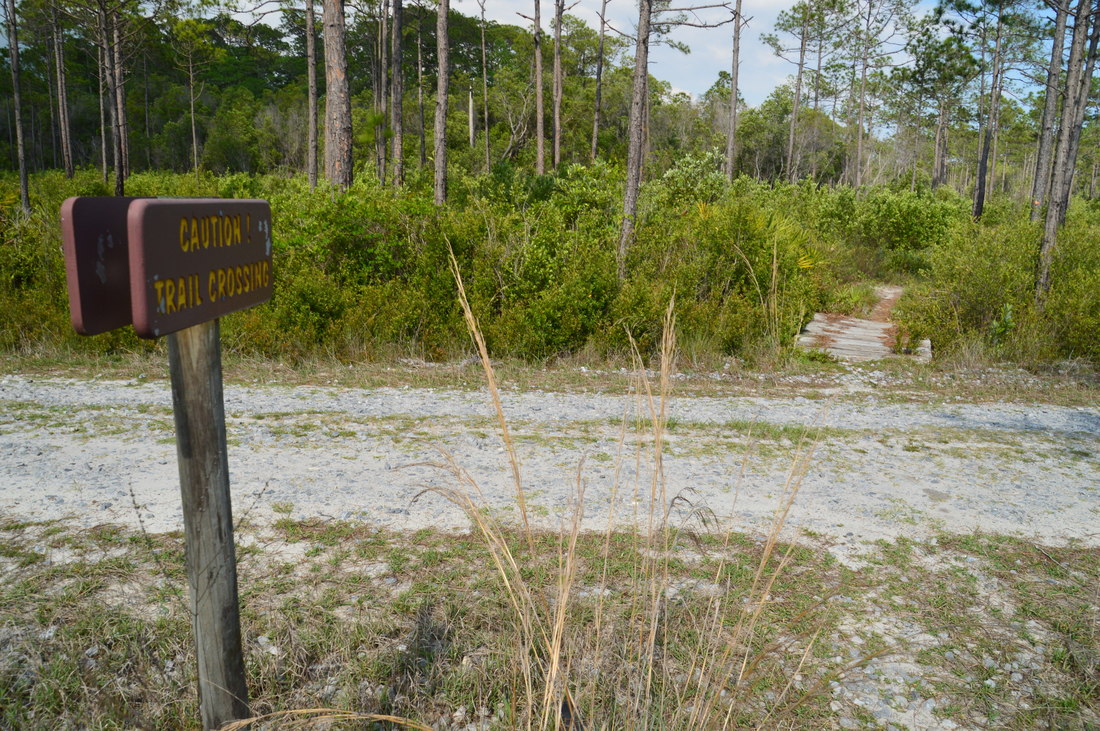
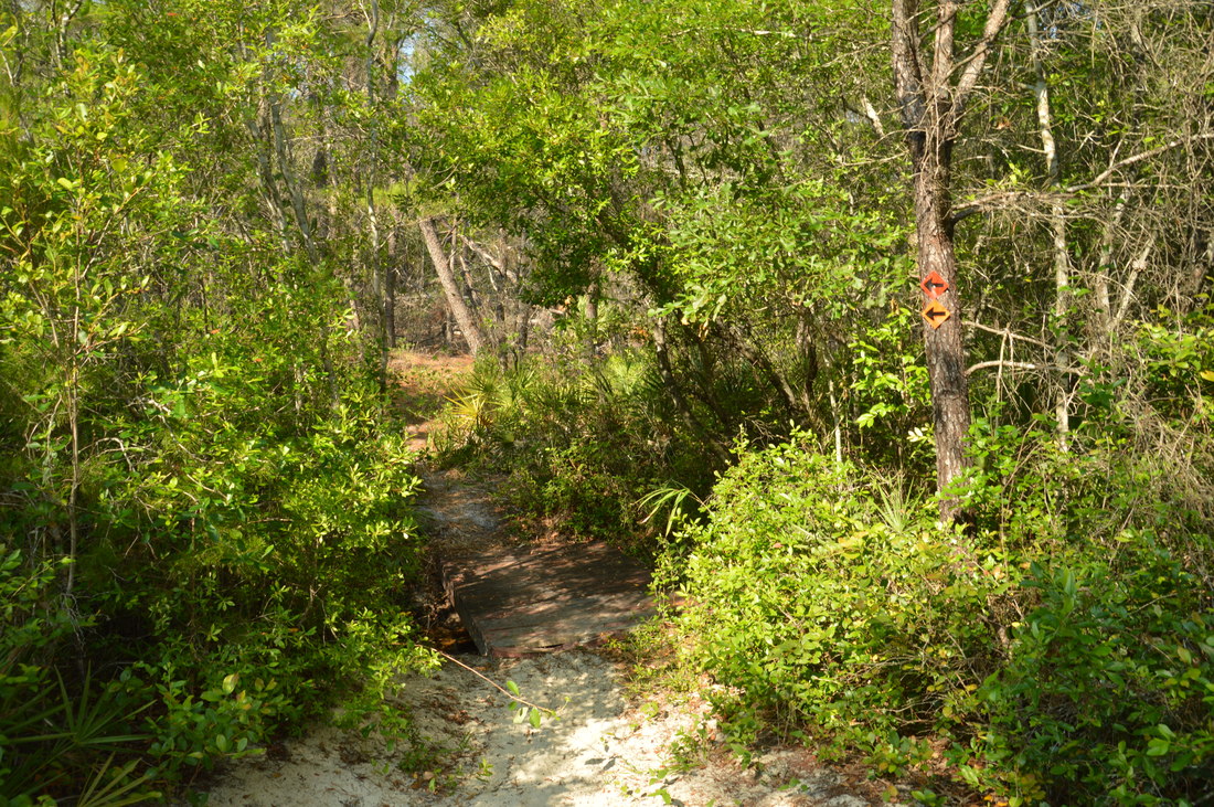
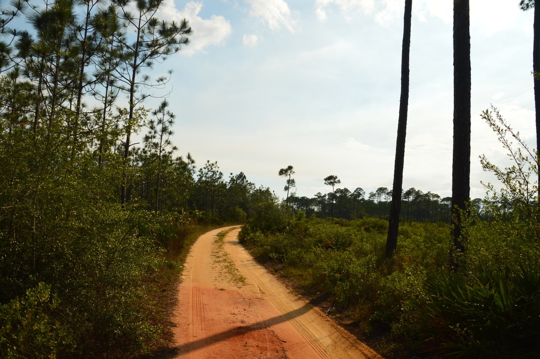
While there are multiple access points for the Eastern Lake Trails, the most convenient one is located off County Highway 395. The hike begins at the distinct trail near the trailhead kiosk. Passing a picnic table to the right, the trail quickly curves into a titi swamp where the headwaters of West Fork Peach Tree Creek are located. A short footbridge takes the trail across a small stream, and at 0.15 miles, the loop begins. Yellow, red, and orange arrows mark the trail both to the left and to the right. To hike the loop counter-clockwise, bear right, although there is no major difference in terms of the direction to hike the loop in. Keep in mind that if you want to hike the full outer loop to Eastern Lake like I did, you will be following the orange blazes (which mark the longest loop). At 0.25 miles, the trail passes through another brief stretch of titi swamp, crossing via footbridge another small stream in the headwaters. After passing a longleaf pine restoration area to the right, the Eastern Lake Trail crosses State Forest Road 2 at 0.55 miles. Over the next few miles, the trail stays about the same, passing through mainly longleaf pine flatwoods, although occasionally, dense vegetation near the trail indicates the presence of wetter areas. At 1.15 miles, the trail recrosses SFR 2, and at 1.85 miles, you will reach a junction at Forest Road 13 with the first cross-trail: the Yellow Trail. The Yellow Trail turns left onto SFR 13 for a 3-mile loop, while the Orange/Red Trail crosses the road and continues to the right of a bench and kiosk. 

After another stretch of mostly pines and another crossing of SFR 2, the trail reaches the Red Cross-Trail at 2.35 miles, where there is a kiosk. The cross-trail leaves to the left for a 6-mile loop and follows SFR 8 for most of its length, but for this hike, bear right on the Orange Trail. The trail reaches SFR 2 again at 2.55 feet; turn right onto the road and follow it for about 250 feet before turning right back onto a footpath. At 3.35 miles, the trail once again reaches and turns right onto SFR 2, but after only a couple hundred feet, the road bears left while the trail continues straight through a gap in a fence and onto a double-track path. Before long, the trail enters an extended section of titi swamp, crossing two footbridges - one of which is across a stream. At 4.1 miles, a sign marks the trail as it turns acutely left just as a broad forest road continues straight, eventually connecting to the Cassine Trail. The Cassine Trail is a side trail that leads to a separate private trailhead near County Highway 30A. Meanwhile, the Orange Trail reaches Forest Road 7 at 4.4 miles. Here, the Orange Trail turns left onto SFR 7 while the pink-blazed Eastern Lake Spur Trail continues across the road. 
Picture
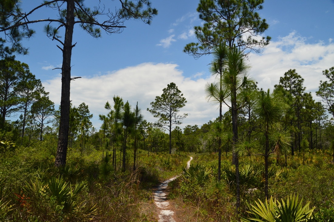
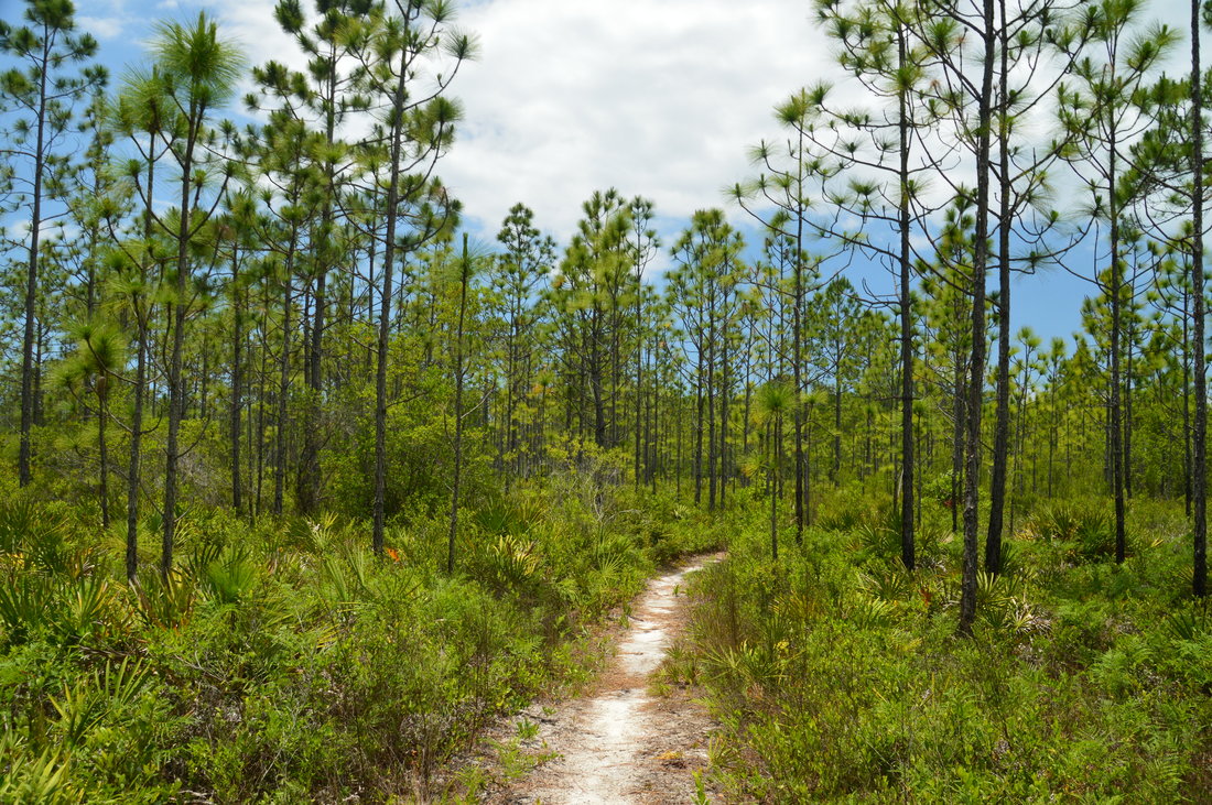
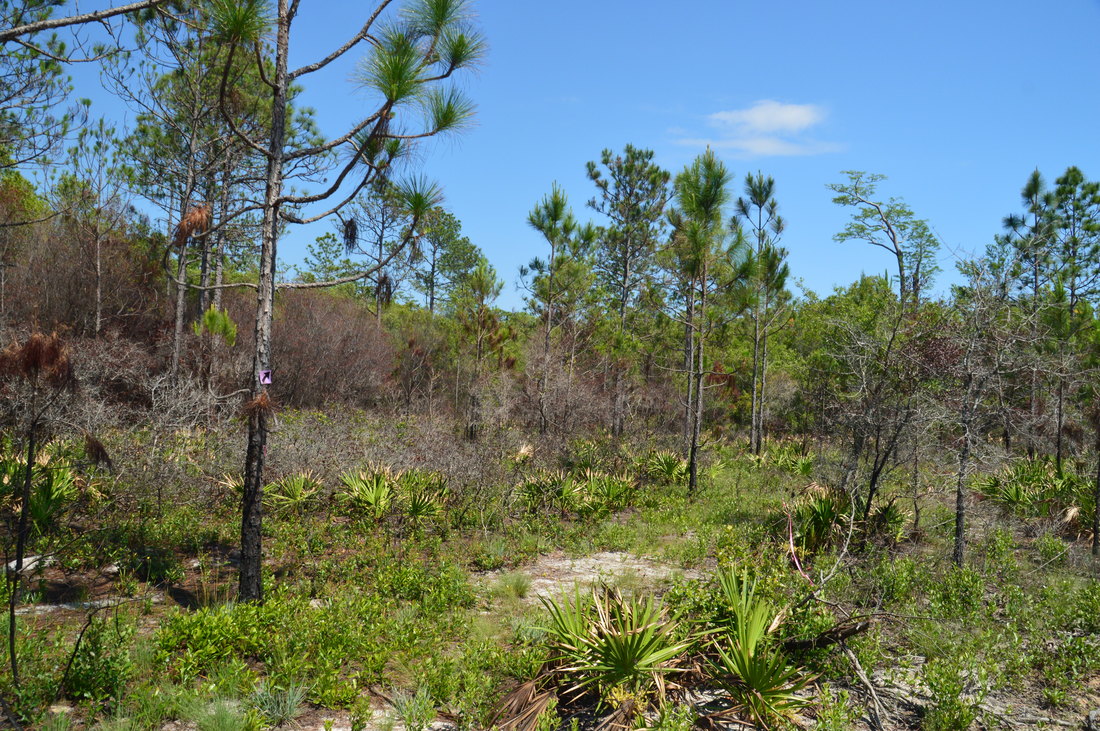
Much of the Eastern Lake Trail's Orange Loop passes through pine flatwoods with far-reaching views.
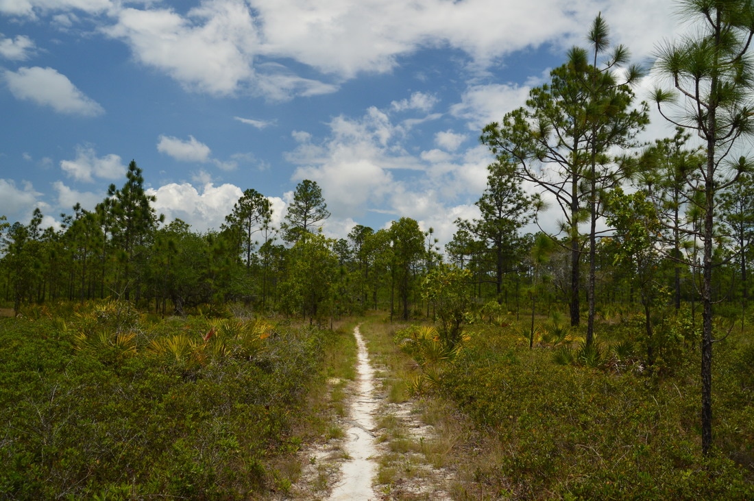
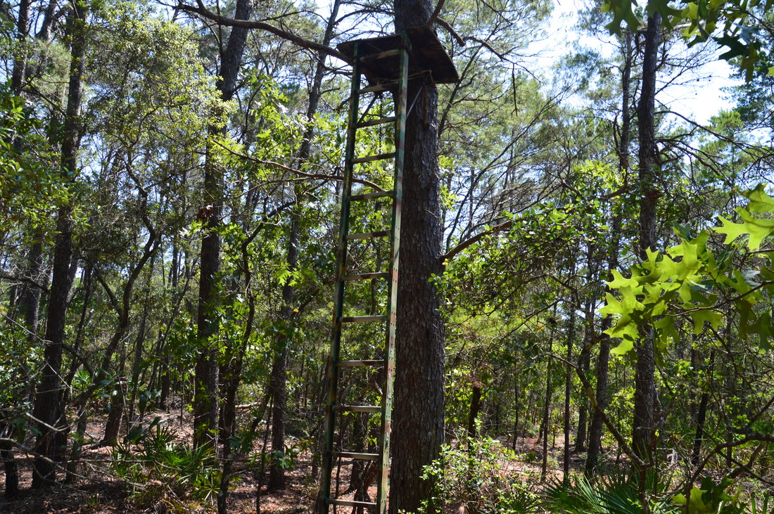
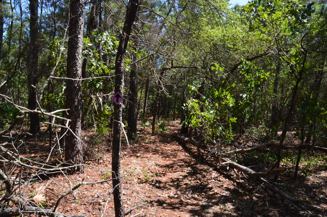
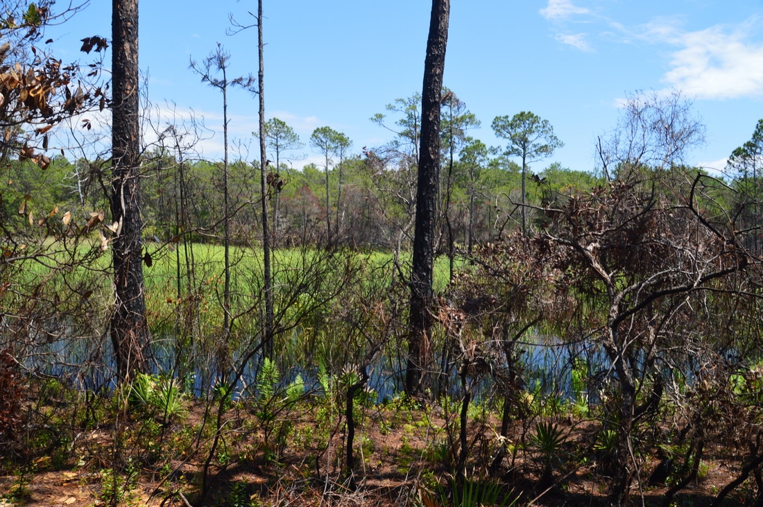
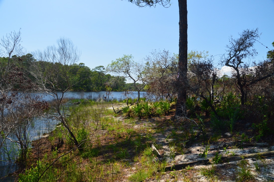
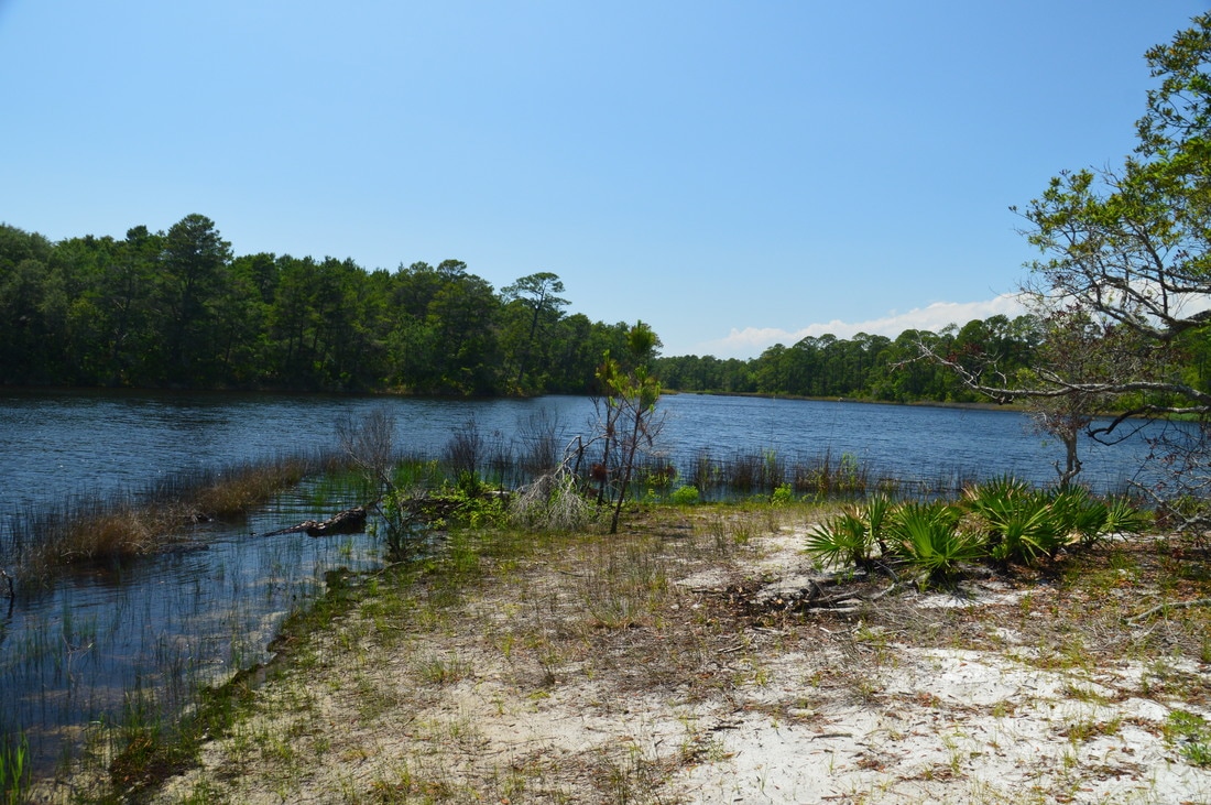
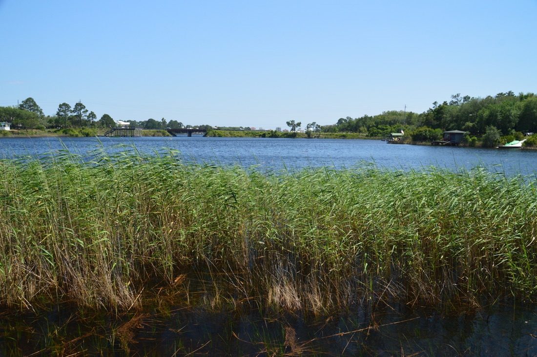
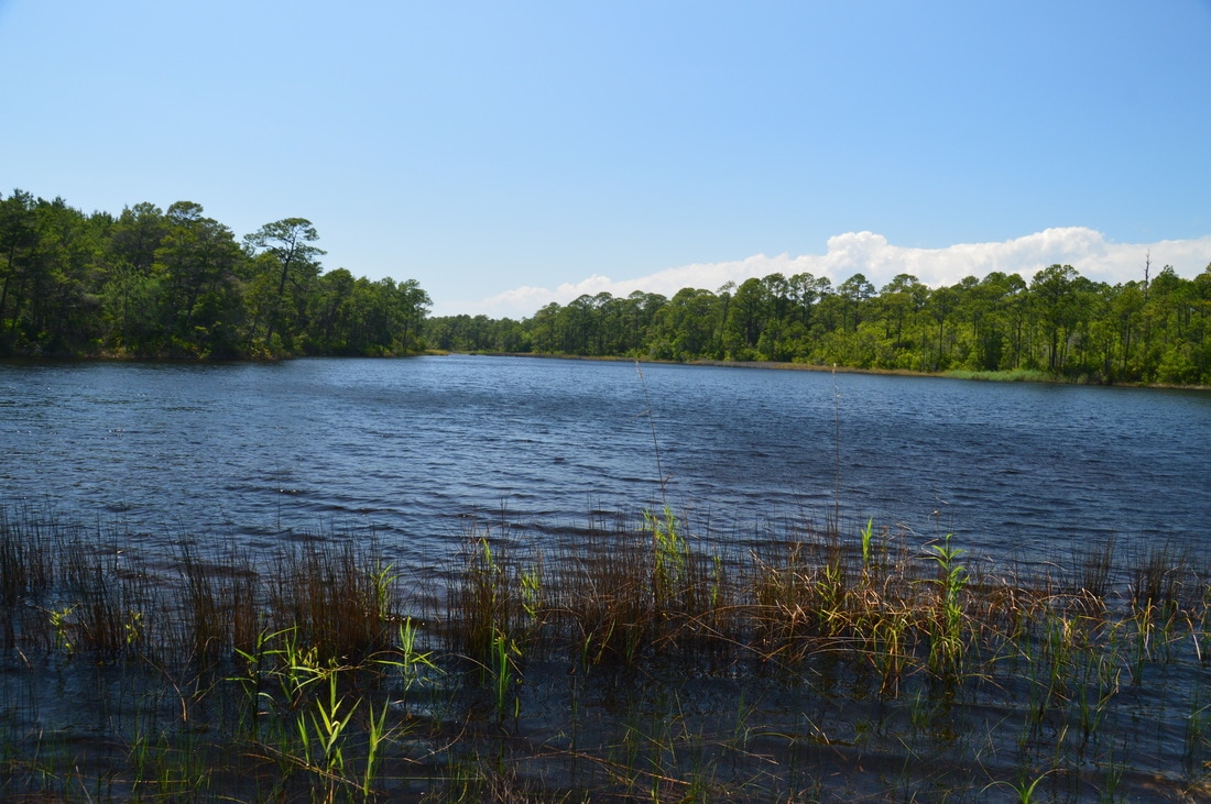
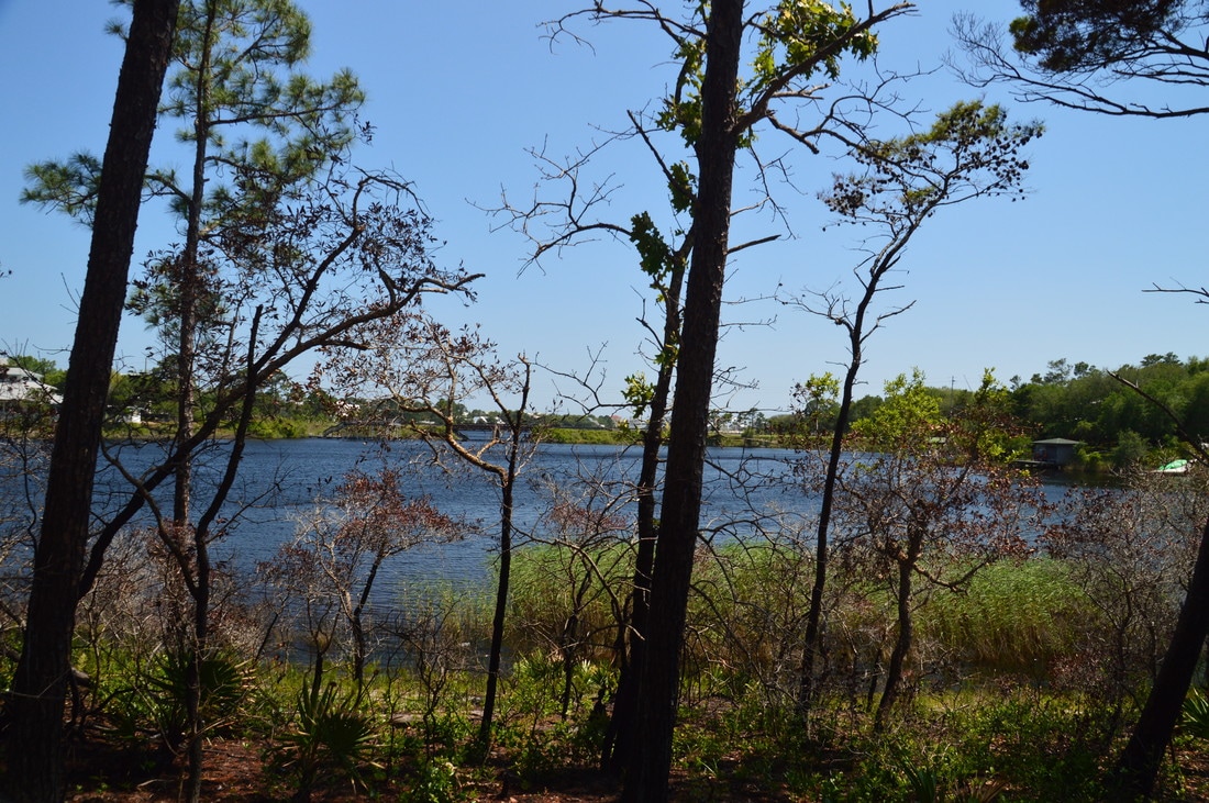
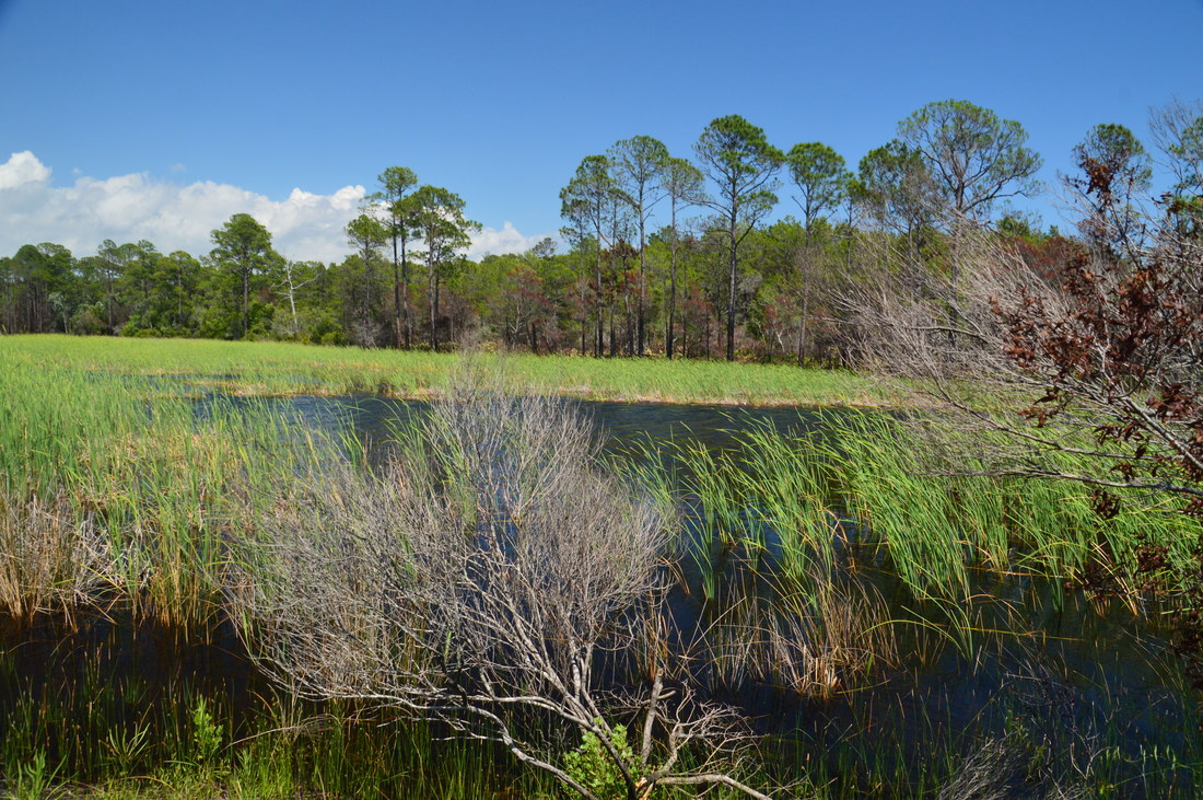
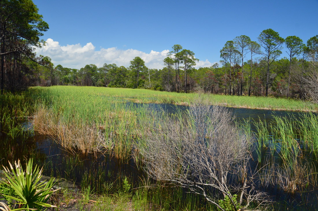
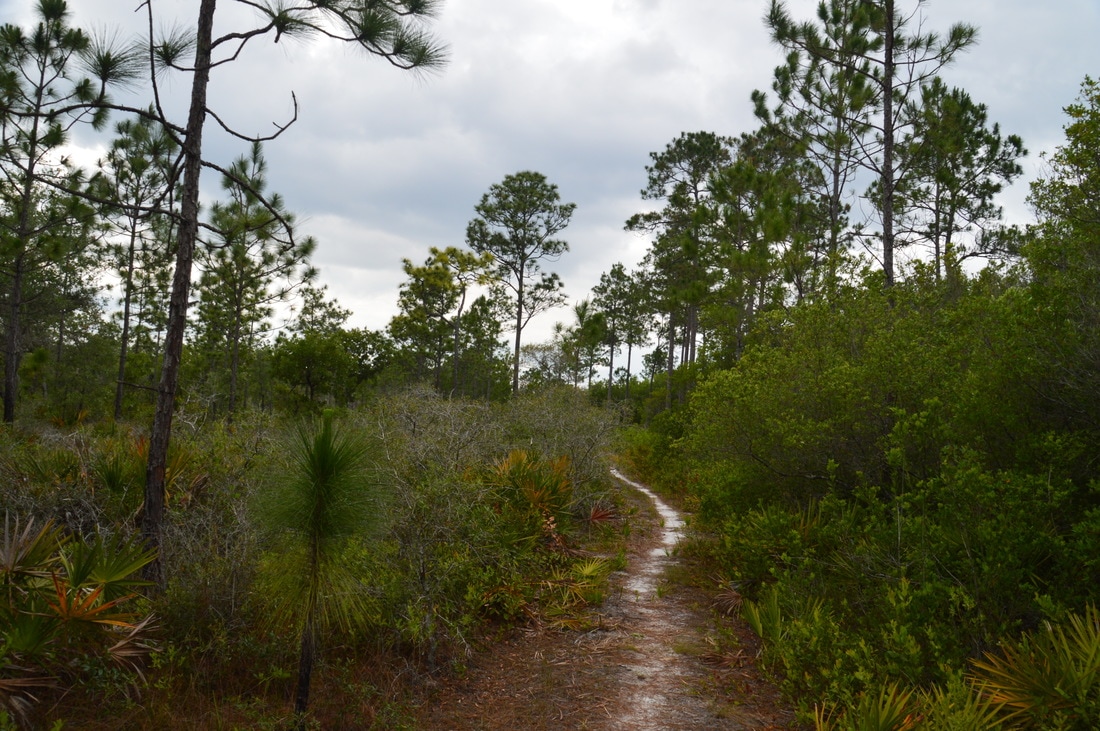
Take the Eastern Lake Spur Trail, which is a lot less distinct than the other trails in the forest, because it is a very new trail. The trail turns south and initially parallels SFR 7, although after a few hundred feet, the trail bears left away from the road. Pay close attention to the blazes, as the trail remains indistinct, entering a hammock near Eastern Lake. At 4.8 miles, the trail passes a deer stand to the left, and at 5.0 miles, the trail approaches a finger of Eastern Lake and turns right, following it toward the main part of the lake. At 5.1 miles, the trail comes alongside the shore of Eastern Lake just below a primitive camping area that is accessible by car. The trail ends only a couple dozen feet farther at the edge of a small peninsula jutting into the lake. From here, there are great views of Eastern Lake in all directions. To the left (south), the blue waters of Eastern Lake stretch down to the Highway 30A bridge. Private houses line the shores of the lake. Straight ahead, the west side of the lake - which is surrounded entirely by state land - looks a lot more remote and pristine. This is a spot worth lingering at.

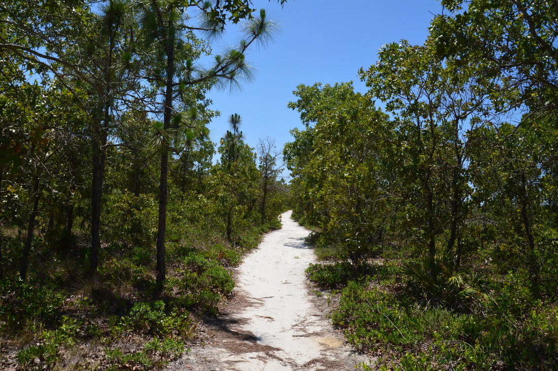
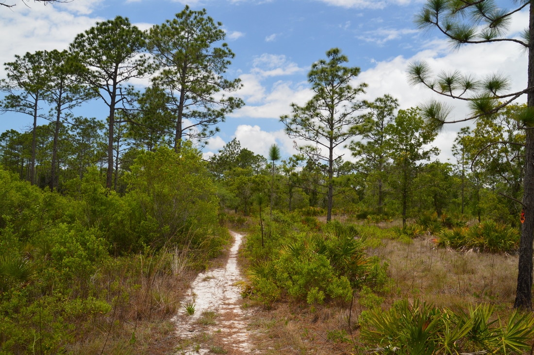
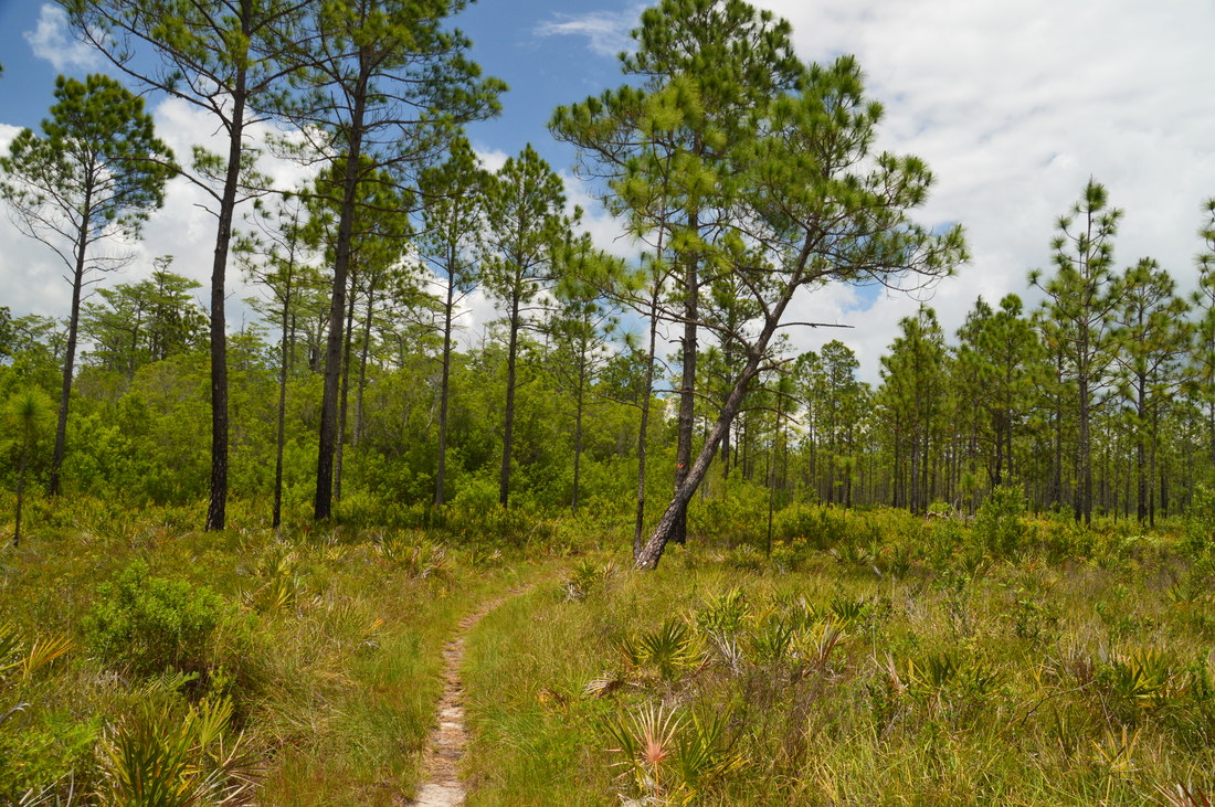
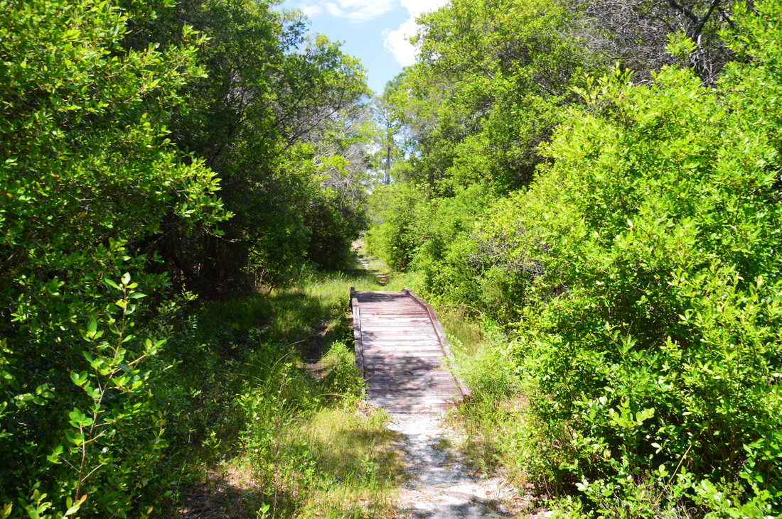
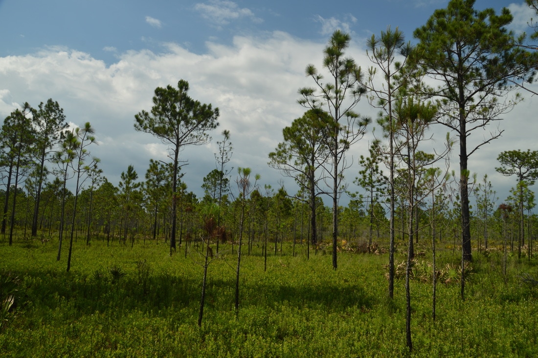
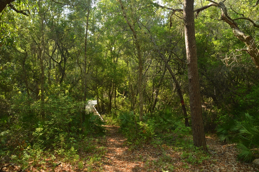
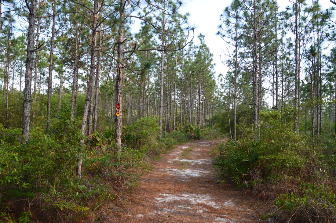
Once you've had your fill of beautiful Eastern Lake, retrace your steps back to the Orange Loop and continue following it counter-clockwise. The trail follows SFR 7 for a tenth of a mile, and then, it turns right at an arrow onto a single-track footpath at 5.9 miles. In my opinion, the following stretch of trail passes through one of the forests's more scenic stretches of flatwoods, because it is more prairie-like with the pines spaced far apart from each other. Passing through an intersection with SFR 2 and SFR 11 at 6.4 miles, the trail briefly joins a forest road before turning right, heading northward in the direction of Peach Tree Creek. For some time - staring around 7.1 miles - the trail closely follows the ecotone between pine flatwoods and floodplain swamp along Peach Tree Creek, but it never reaches the creek itself. At 8.3 miles, the trail briefly joins a forest road before turning left off of it and then crossing SFR 11 at 8.6 miles. After following another ecotone, the trail turns left onto a forest road and arrives at the north end of the Red Cross-Trail, along with a kiosk and bench, at 9.4 miles. Bear right here, following the orange blazes along a sandy forest road in the direction of West Fork Peach Tree Creek. At 9.9 miles, just after the end of the forest road, the trail crosses West Fork Peach Tree Creek via a long footbridge in the middle of a shady hammock. West Fork Peach Tree Creek is a small clear stream with a sandy bed that is typical of streams in the central and western portions of the Florida Panhandle. The stream is hard to see downstream from the bridge, but there is a photogenic bend in the stream just upstream from the bridge. 
Picture
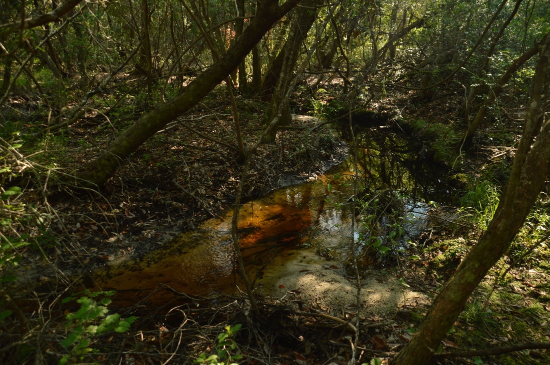
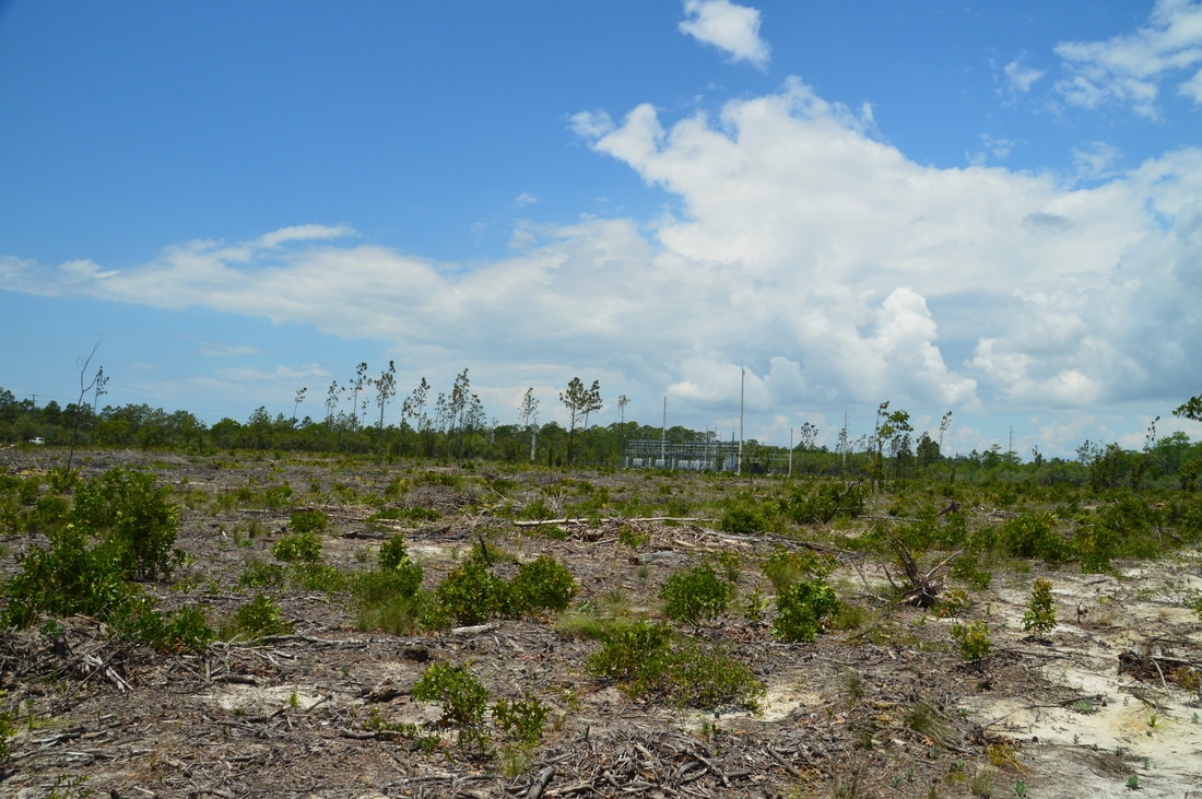
After the footbridge across the creek, the trail turns left, crosses a small tributary, and joins another sandy forest road briefly, before turning left off of it. The common scenery of pine flatwoods returns as the trail reaches the north end of the Yellow Cross-Trail at 10.9 miles. Here, the main trail turns right onto SFR 13, and in about a hundred feet, it turns left at a large road intersection. For much of the remaining portion of the hike, the trail follows this forest road westward, passing a pair of clearings along the way. At 11.6 miles, arrows point the trail abruptly to the left on a narrower forest road, and at 11.95 miles, you will reach the end of the loop. Bear right and follow the final leg of the trail back to the trailhead, concluding the hike at 12.1 miles. 

Mileage

0.0 - Eastern Lake Trailhead
0.15 - Begin Loop 
1.85 - Begin Yellow Cross-Trail 
2.35 - Begin Red Cross-Trail
4.4 - Begin Eastern Lake Spur Trail 
5.1 - Eastern Lake 
9.4 - End Red Cross-Trail 
9.9 - West Fork Peach Tree Creek 
10.9 - Yellow Cross-Trail 
11.95 - End Loop 
​12.1 - Eastern Lake Trailhead 

Variations

Hike just the Yellow Loop - 3.0 Miles
Hike just the Red Loop - 6.0 Miles
Hike the Orange Loop without Eastern Lake side trip (not recommended as Eastern Lake is a highlight) - 10.7 MIles 

Bonus Stops

After the main hike, consider hiking the short and gorgeous nature trail in Grayton Beach State Park. 

Pictures

Videos

0 Comments


Leave a Reply.

    About Me

    Mark Oleg Ozboyd
    I'm an avid outdoor explorer and a hobbyist landscape photographer. I'm 21 years old and have been hiking since 2011. Originally based out of Atlanta, Georgia, I started out by occasionally hiking short trails throughout well-known Georgia State Parks. During 2012 and 2013, I began to expand my trips into adjacent states, as well as into the wilder National Forest areas rather than just State Parks. Throughout the years that followed, as I slowly ran out of popular hiking trails in my area, I began to search for and hike in more seldom-visited areas. Today, you can find me out in the woods every weekend, whether it's on an official trail or bushwhacking through cross-country terrain without any paths. I now attend Washington & Lee University and am exploring Virginia and West Virginia. My other hobbies include chess, science, old music, and meteorology. I have 3 years of amateur weather forecasting experience, having studied a lot of meteorology basics over the years. I am also a student at European School of Music where I learned that music and nature have a lot in common. Listening to good music inspires me to capture nature's beauty on the camera in different aspects that also make me recall many beautiful music pieces that I've heard.​


    Dear readers: I have invested a tremendous amount of time and effort in this website and the Georgia Waterfalls Database the past five years. All of the work that has gone in keeping these websites updated with my latest trip reports has almost been like a full-time job. This has not allowed me to pick up a paid job to save up money for college, and therefore, I I've had to take out loans. If you find the information on this website interesting, helpful, or time-saving, you can say "thanks" and help me out by clicking the button above and making a contribution. I will be very grateful for any amount of support you give, as all of it will apply toward my college tuition. Thank you! 

    Enter your email address to subscribe for trail reports:

    Delivered by FeedBurner


    Picture
    Coming in 2022-2023?

    Other Hiking Websites

    DWHike's Adventures
    Florida's Natural Wonders
    Florida Trailblazer
    Meanderthals
    Mountain Images
    by Bernie Boyer

    North Carolina Waterfalls with
    ​Kevin Adams
    Take-a-Hike!
    Tennessee Landforms
    Waterfall Page
    Waterfall Adventurer
    Zach's Mild Adventures

    Miles Hiked

    Year 1: 540.0 Miles
    Year 2: 552.3 Miles
    ​Year 3: 518.4 Miles
    Year 4: 482.4 Miles
    Year 5: 259.9 Miles

    Archives

    March 2021
    February 2021
    January 2021
    November 2019
    October 2019
    September 2019
    August 2019
    July 2019
    June 2019
    February 2019
    January 2019
    December 2018
    November 2018
    October 2018
    August 2018
    July 2018
    June 2018
    May 2018
    April 2018
    March 2018
    February 2018
    January 2018
    December 2017
    November 2017
    October 2017
    September 2017
    August 2017
    July 2017
    June 2017
    May 2017
    April 2017
    March 2017
    February 2017
    January 2017
    December 2016
    November 2016
    October 2016
    September 2016
    August 2016
    June 2016
    May 2016
    April 2016
    March 2016
    January 2016
    December 2015
    November 2015
    October 2015
    September 2015
    August 2015
    July 2015
    June 2015
    May 2015
    April 2015
    March 2015
    February 2015
    January 2015
    December 2014
    November 2014
    October 2014
    September 2014
    August 2014
    July 2014
    June 2014
    May 2014
    April 2014
    March 2014
    February 2014

    Categories

    All
    Adel
    Adirondack Park
    Alabama
    Alfred A. Ring Park
    Allegheny Trail
    Amicalola Falls State Park
    Anniston Area
    Apalachicola Bluffs And Ravines Preserve
    Apalachicola National Forest
    Apalachicola/Port St. Joe Area
    Apopka
    Appalachian Trail
    Appling
    Art Loeb Trail
    Aska Trail System
    Bakersville
    Balm-Boyette Scrub Preserve
    Balsam Lake Recreation Area
    Bankhead National Forest
    Bartow County Parks
    Bartram Trail
    Basinger
    Beersheba Springs
    Benton
    Benton Mackaye Trail
    Berry College Trail System
    Best Hike
    Big South Fork National Recreation Area
    Black Bear Wilderness
    Black Rock Mountain State Park
    Blairsville
    Blakely
    Blood Mountain Wilderness
    Blowing Rock
    Blue Ridge
    Blue Ridge Parkway
    Boone
    Bradenton
    Bradenton Beach
    Brasstown Bald
    Brasstown Wilderness
    Brevard
    Bryson City
    Buchanan
    Bucks Pocket State Park
    Bulow Creek State Park
    Bulow Plantation Ruins State Park
    Caesars Head State Park
    Caladesi Island State Park
    Calhoun
    Camel's Hump State Park
    Cashiers
    Caspersen Beach Park
    Catfish Creek State Park
    Caves
    CC Putnam State Forest
    Cedar Point Environmental Park
    Chatsworth
    Chattahoochee National Forest
    Chattanooga
    Chattanooga Valley
    Chattooga National Wild And Scenic River
    Cheaha Wilderness
    Cherohala Skyway
    Cherokee
    Cherokee National Forest
    Chiefland Area
    Chillhowee Recreation Area
    Chipley
    Chunky Gal Trail
    Circle B Bar Reserve
    Citico Creek Wilderness
    Citrus Wildlife Management Area
    Clarkesville
    Clayton
    Cleevland
    Cleveland
    Cloudland Canyon State Park
    Cohutta Wilderness
    Collier-Seminole State Park
    Cordele
    Cornelia
    Covington
    Crestview Area
    Crew-land-and-water-trust
    Cullowhee
    Cumberland Trail
    Dahlonega
    Dalton
    Dawson Forest Wildlife Management Area
    Dawsonville
    Dayton
    De Soto National Memorial
    DeSoto State Park
    Dillard
    Double Springs
    Ducktown
    Duncan Ridge Trail
    Dunlap
    Eagle's Rest Park
    Eastpoint
    Econfina Creek Wildife Management Area
    Eglin Air Force Base
    Elizabethton
    Elkins
    Elk Knob Game Lands
    Elk Park
    Ellicott Rock Wilderness
    Ellijay
    Emerson Point Preserve
    Englewood Area
    Enota Retreat
    Erwin
    Falling Waters State Park
    Fayetteville
    Fires Creek Recreation Area
    Fire Tower
    Flint River
    Florence Area
    Florida
    Florida Caverns State Park
    Florida Trail
    Foothills Trail
    Fort Mountain State Park
    Fort Myers Area
    Fort Payne
    Fort Payne Area
    Fort Yargo State Park
    Franklin
    Franklin Delano Roosevelt State Park
    Franklin-Marion State Forest
    Frozen Head State Park
    Gainesville
    Gainesville Area
    Gatlinburg
    George Washington National Forest
    Georgia
    Georgia Veterans Memorial State Park
    Glasgow
    Gorges State Park
    Grandfather Mountain State Park
    Great Smoky Mountains National Park
    Greeneville
    Green River Game Lands
    Gruetli-Laager
    Grundy Forest State Natural Area
    GTM Reserve
    Guana River Wildlife Management Area
    Hayesville
    Helen
    Hiawassee
    High Falls State Park
    Highlands
    Highlands Scenic Highway
    Hillsborough River State Park
    Hinson Conservation & Recreation Area
    Historic Sites
    Honeymoon Island State Park
    Hot Springs
    Huntington
    Inverness Area
    Jackson
    Jasper
    Jefferson National Forest
    Joan M. Durante Park
    Jonathan Dickinson State Park
    Jones Gap State Park
    Joyce Kilmer Slickrock Wilderness
    Joyce Kilmer - Slickrock Wilderness
    Juniper Prairie Wilderness
    Kelly Park
    Keown Falls Recreation Area
    Kolomoki Mounds State Park
    LaFayette
    Lake City Area
    Lake George Wild Forest
    Lake June-in-Winter State Park
    Lakeland Area
    Lake Placid
    Lake Russell Wildlife Management Area
    Lake Wales Ridge State Forest
    Laurel Fork North Wilderness
    Leffis Key Preserve
    Leon Sinks Geological Area
    Lexington
    Lineville
    Linville
    Linville Gorge Wilderness
    Lithia Springs
    Little Frog Wilderness
    Little Manatee River State Park
    Little River Canyon National Preserve
    Longboat Key
    Long Trail
    Lookout Mountain
    Lookout Mountain Battlefield
    Lovingston
    Lula Lake Land Trust
    Lumpkin
    Maggie Valley
    Manatee Springs State Park
    Marianna Area
    Mark Trail Wilderness
    Marlinton
    Mccaysville
    McMinville
    Mentone
    Middlesex
    Mistletoe State Park
    Monongahela National Forest
    Montreat
    Mountain Bridge Wilderness Area
    Mountain City
    Mountains To Sea Trail
    Mountains-to-Sea Trail
    Mount Rogers National Recreation Area
    Myakka River State Park
    Myron B. Hodge City Park
    Nantahala National Forest
    Naples
    Naples Area
    Natural Bridge State Park
    Neal Preserve
    New Castle
    Newport
    New River Gorge National Park
    New York
    North Carolina
    Ocala Area
    Ocala National Forest
    Ocean-to-Lake Trail
    Oconee State Park
    Oconee Station Historic Site
    Okaloacoochee Slough State Forest
    Oldsmar
    Oneida
    Orlando Area
    Ormond Beach
    Oscar Scherer State Park
    Oxford
    Palatka
    Palmetto Trail
    Panama City Area
    Panthertown Valley
    Parrish
    Paynes Creek Historic State Park
    Peaks Of Otter Recreation Area
    Pigeon Crockford Mountain Wildlife Management Area
    Pigeon-Crockford Mountain Wildlife Management Area
    Pigeon-Crockford Wildlife Management Area
    Pine Mountain
    Pinhoti Trail
    Pinnacle Park
    Pisgah Civitan Park
    Pisgah National Forest
    Pittman Center
    Pond Mountain Wilderness
    Ponds/Lakes
    Prentice Cooper State Forest
    Providence Canyon State Park
    Pumpkintown
    Quick Point Nature Preserve
    Raven Cliffs Wilderness
    Reed Bingham State Park
    Reliance
    Rice Creek Conservation Area
    Riverview Pointe Preserve
    Robbinsville
    Robinson Preserve
    Rock Creek Gorge Scenic Area
    Rock Island State Park
    Rome
    Rosman
    Sale Creek
    Salem
    Salt Springs
    Saluda
    Santa Rosa Beach
    Sarasota
    Sarasota Area
    Savage Gulf State Natural Area
    Scenic Views
    Scottsboro Area
    Sebring Area
    Sewanee
    Sheltowee Trace Trail
    Shining Rock Wilderness
    Signal Mountain
    Sipsey Wilderness
    Sky Valley
    Smithgall Woods State Park
    Snowbird Backcountry Area
    Soddy Daisy
    Soddy-Daisy
    Sopchoppy
    South Carolina
    South Cumberland State Park
    Southeastern Cave Conservancy
    Southern Nantahala Wilderness
    Sparta
    Sprewell Bluff Park
    Spring City
    Spring Hill
    Springs
    Spruce Pine
    Standing Indian Backcountry Area
    St. Augustine
    St. George Island State Park
    St. Joseph Bay State Buffer Preserve
    St. Marks Area
    St. Marks National Wildlife Refuge
    Stone Mountain
    Stone Mountain Park
    Suches
    Sumatra
    Sumter National Forest
    Suwannee River
    Swallow Creek Wildlife Management Area
    Sweetwater Creek State Park
    Sylva
    Talladega National Forest
    Tallahassee Area
    Tallulah Falls
    Tallulah Gorge State Park
    Tampa Bay Area
    Tate City
    Tate's Hell State Forest
    Tea Creek Wildlife Management Area
    Tellico Plains
    Tennessee
    Thomaston
    Toccoa
    Topsail Hill State Park
    Torreya State Park
    Townsend
    Tracy City
    Tray Mountain Wilderness
    Trenton
    Triple Creek Preserve
    Troutdale
    Unaka Mountain Wilderness
    Upper Tampa Bay County Park
    Venice
    Vermont
    Virgin Falls State Natural Area
    Virginia
    Virginia Outdoors Foundation
    Vogel State Park
    Wakulla Springs State Park
    Waleska
    Walhalla
    Wartburg
    Water Features
    Waynesville
    Weedon Island Preserve
    Weeki Wachee Preserve
    Wekiwa Springs State Park
    West Palm Beach Area
    West Virginia
    Whitehall
    White Springs
    Winder
    Withlacoochee State Forest
    Young Harris

    RSS Feed

TRAIL REPORTS

Hikes in Alabama
​Hikes in Florida
Hikes in Georgia
Hikes in North Carolina
Hikes in South Carolina
Hikes in Tennessee
Hikes in Virginia

Hiking Resources

Alabama Resources
​
Florida Resources
Georgia Resources
North Carolina Resources
​South Carolina Resources
​
Tennessee Resources

Other

Contact
Map of Hikes
Alphabetical List of Hikes
Southeast Nature Society
© COPYRIGHT 2014-2024
​ALL RIGHTS RESERVED.
Important: I disclaim any responsibility for any damage or personal injury that may occur as a result of the activities and information found on this website. All outdoor activities, especially off-trail hiking, are done at your own risk. Never hike or head into that area that may be above your fitness or experience level.
  • Home
  • Trail Reports
    • Best Hikes
    • Hikes with Scenic Views
    • Hikes with Water Features
    • Alabama
    • Georgia
    • Florida
    • North Carolina
    • South Carolina
    • Tennessee
    • Vermont
    • Virginia
  • Map
  • Hike List
  • Testimonials
  • Resources
  • Contact Us
  • Southeast Nature Society
    • Our Team
  • Georgia Waterfalls Database