HIKING THE APPALACHIANS AND BEYOND
  • Home
  • Trail Reports
    • Best Hikes
    • Hikes with Scenic Views
    • Hikes with Water Features
    • Alabama
    • Georgia
    • Florida
    • North Carolina
    • South Carolina
    • Tennessee
    • Vermont
    • Virginia
  • Map
  • Hike List
  • Testimonials
  • Resources
  • Contact Us
  • Southeast Nature Society
    • Our Team
  • Georgia Waterfalls Database

Chattahoochee National Forest: Duncan Ridge Trail from Mulky Gap to Rhodes Mountain View, Blairsville, Georgia

12/14/2017

3 Comments

 
Picture
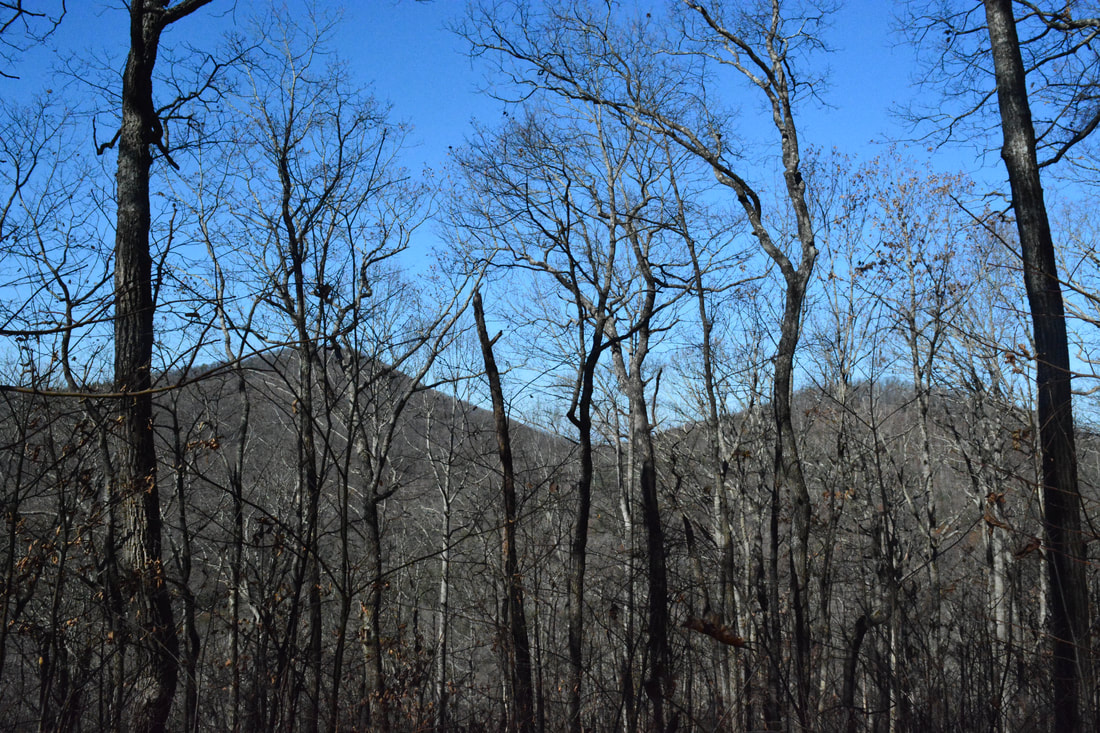
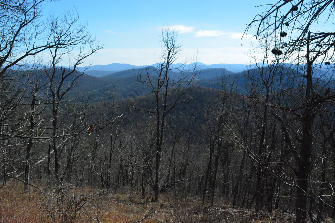
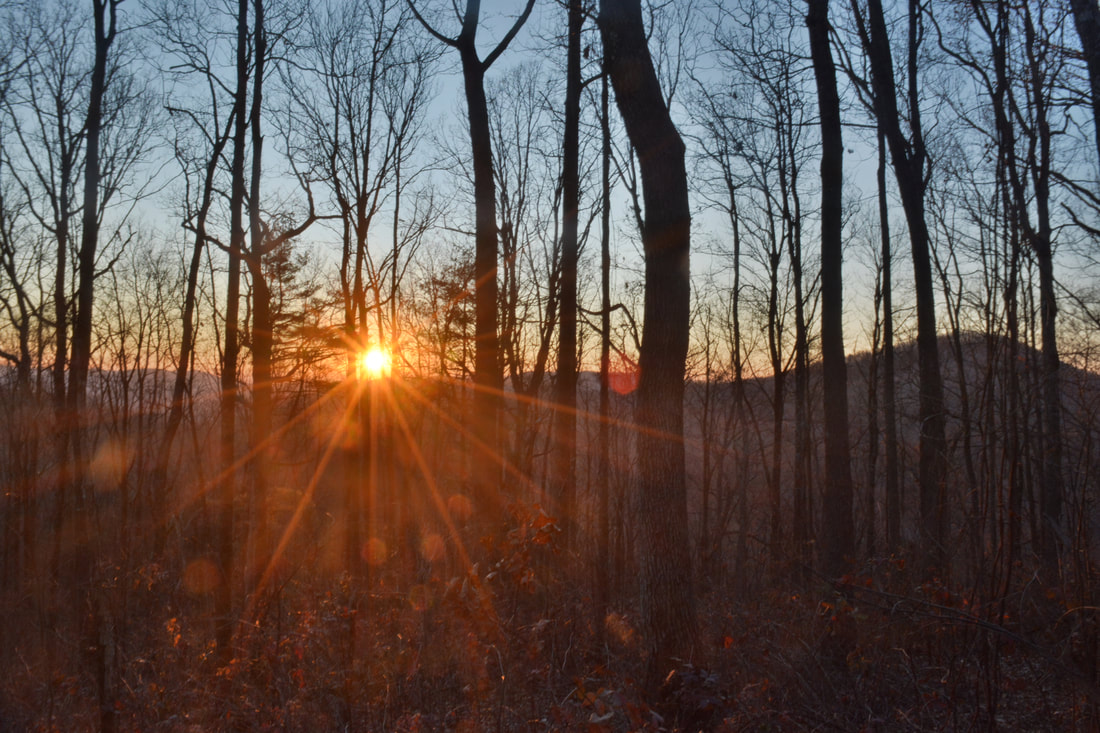
There's something about the Duncan Ridge Trail that sets it apart from most other trails in Georgia: its sheer difficulty. This unique trail constantly follows Duncan Ridge with its sharp knobs and deep gaps that present constant obstacles along the trail. The rollercoaster fashion of the Duncan Ridge Trail will give you a tough workout, and that's exactly why most people hike it - for there are no spectacular waterfalls anywhere on the trail. The trail is best hiked in the winter when bare trees allow continuous views in both directions from the ridge. Even though there is only one year-round view - on Rhodes Mountain - of any significance along the west part of the trail, seasoned hikers will still find it an enjoyable peaceful hike. This hike occurred on Thursday, November 23rd, 2017. My plan was to hike out and back along the Duncan Ridge Trail from Mulky Gap to the Benton Mackaye Trail Junction just past the view from Rhodes Mountain.

Summary​

R/T Length of Trail: 13.5 Miles 
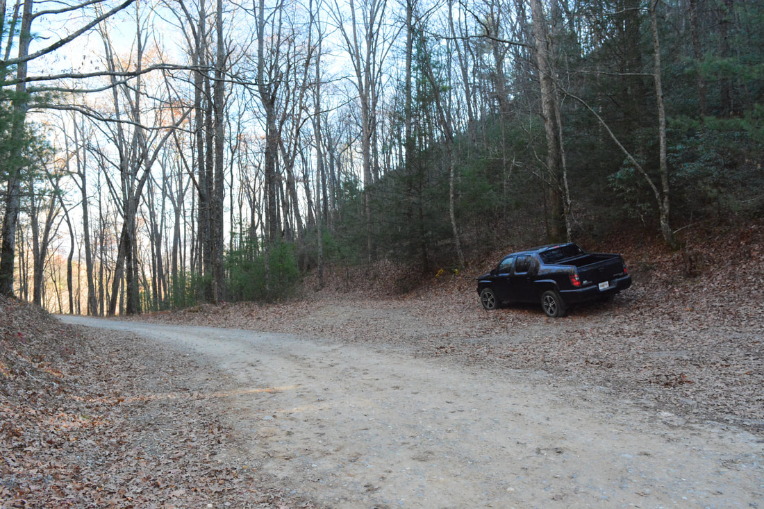
Duration of Hike: 8:20 plus 30 minutes of break 
Type of Hike: Out and Back 
Difficulty Rating: 10 out of 10 
Total Elevation Gain: 4685 Feet 
Pros: Solitude and great winter views 
Cons: Very difficult trail with constant uphill and downhill scattered all throughout the hike
Points of Interest: View from Akin Mountain - 2 stars; View from Rhodes Mountain - 2 stars
Trail Blaze Colors: Duncan Ridge Trail - Blue 
Best Seasons to Hike: Winter 
Fees: None  
Beginning Point: Mulky Gap 
Directions from Blairsville, GA: From the intersection of Highway 76/2 and Blue Ridge Highway near downtown Blairsville, follow Blue Ridge Highway west for 2.9 miles. Then, turn left onto Mulky Gap Road. Follow it as it turns into FS 4 for 5.6 miles to Mulky Gap, where there is a very wide area suitable for parking. The Duncan Ridge Trail crosses the unpaved road at this spot. If you drive all the way to a sign for the Cooper Creek Wildlife Management Area, then you have just missed the Mulky Gap Trailhead. 

Map

Picture
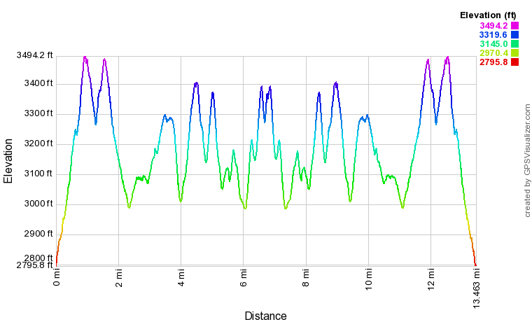
Click the link below to download a .GPX file with a track of this hike. 
duncan_ridge_trail_from_mulky_gap_to_rhodes_mountain.gpx
File Size: 700 kb
File Type: gpx
Download File

Details

The best way to describe a hike on the Duncan Ridge Trail from Mulky Gap to Rhodes Mountain is a strenuous aerobic exercise. It's no wonder that the Duncan Ridge Trail is known as one of the the most difficult trails in the state, as there simply isn't any comparable trail that follows such a long narrow ridge and visits nearly every bump and dip along it. From the two sections of the Duncan Ridge Trail, I decided to pick the section to Rhodes Mountain rather than Coosa Bald because it is more secluded with less road access. 

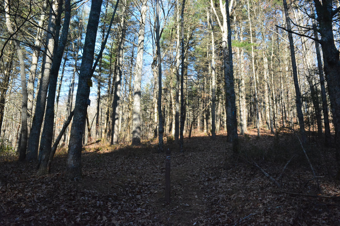
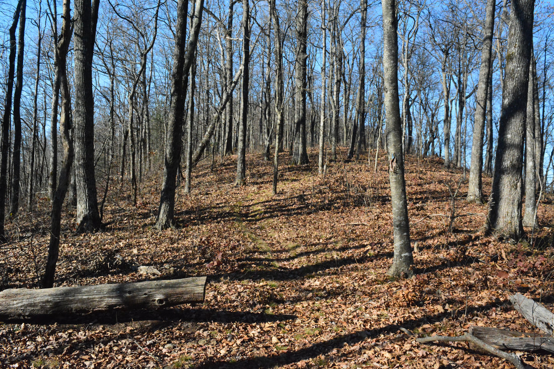
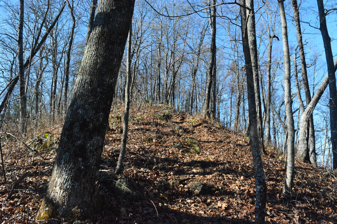
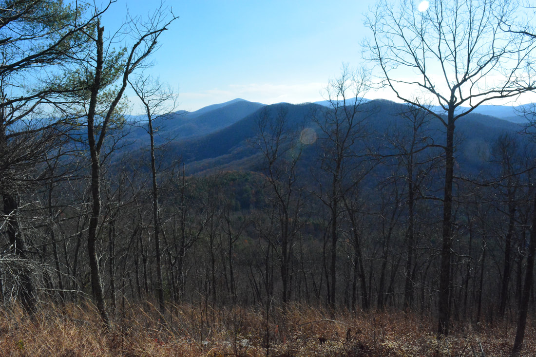
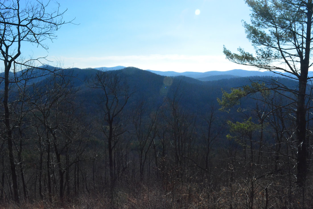
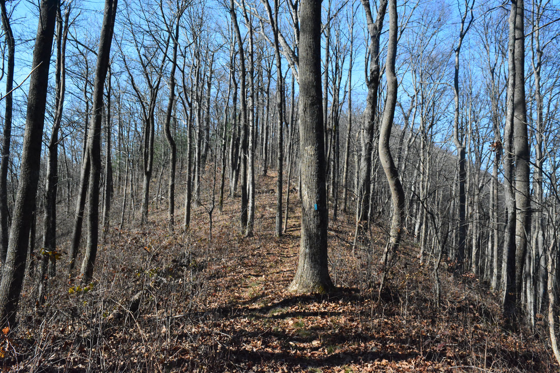
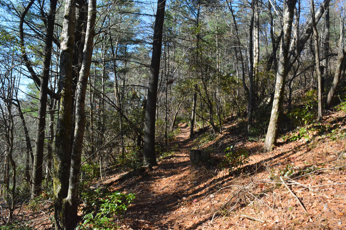
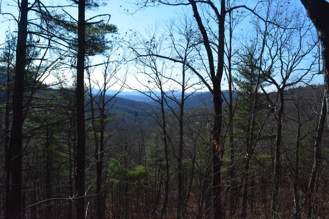
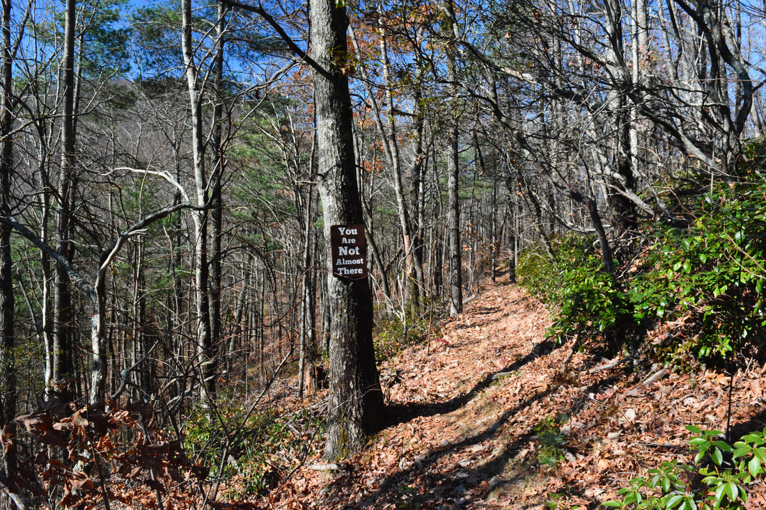
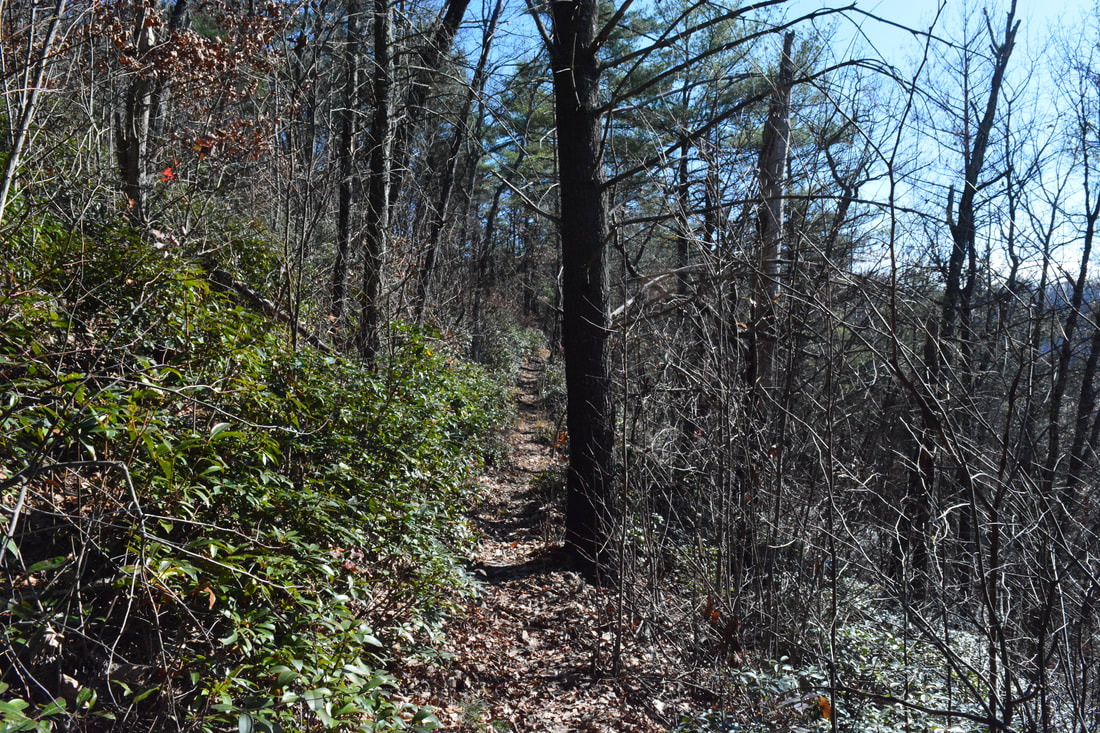
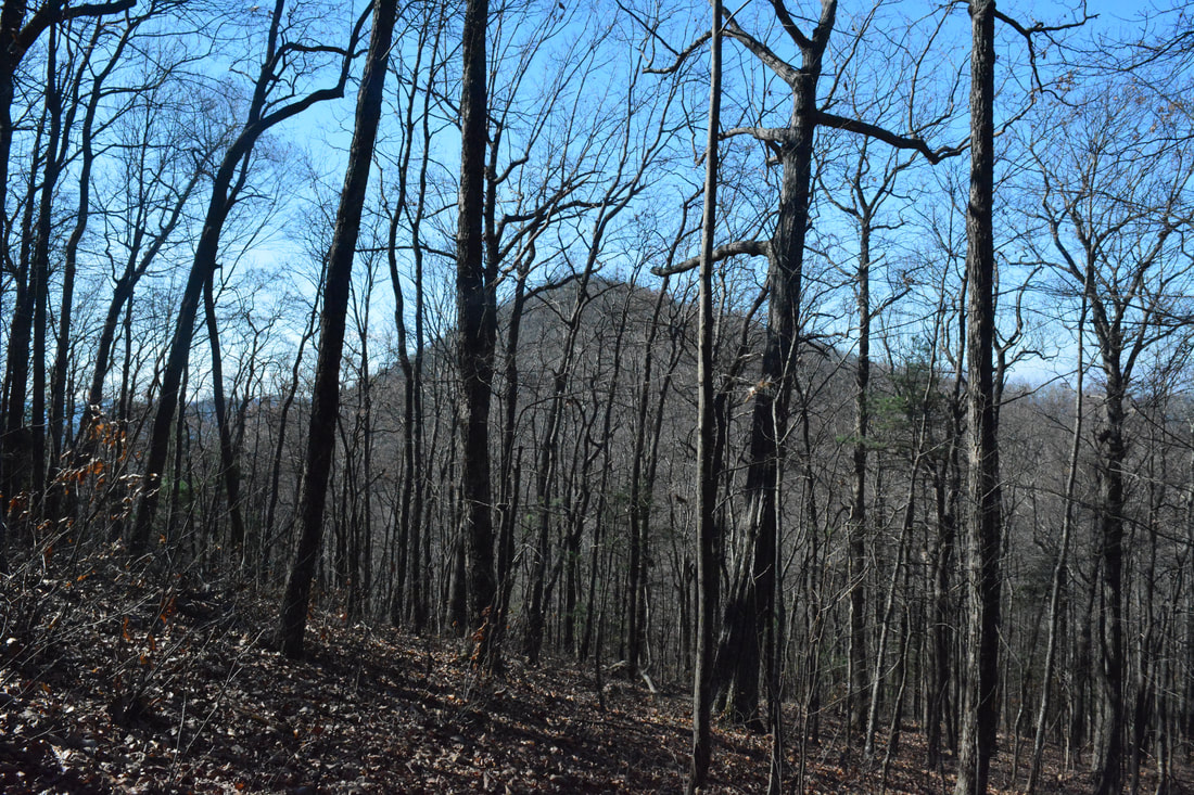
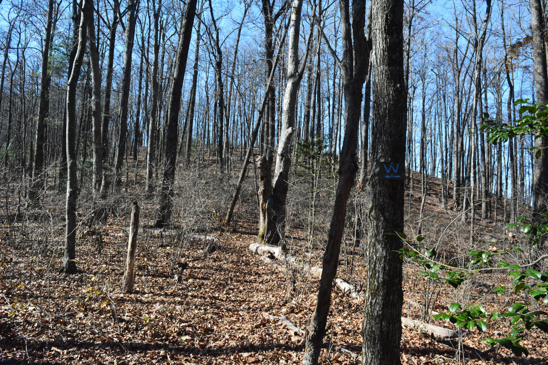
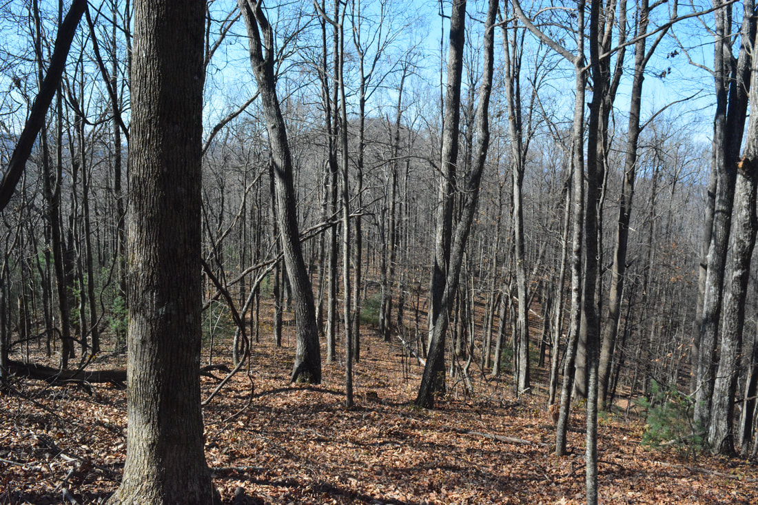
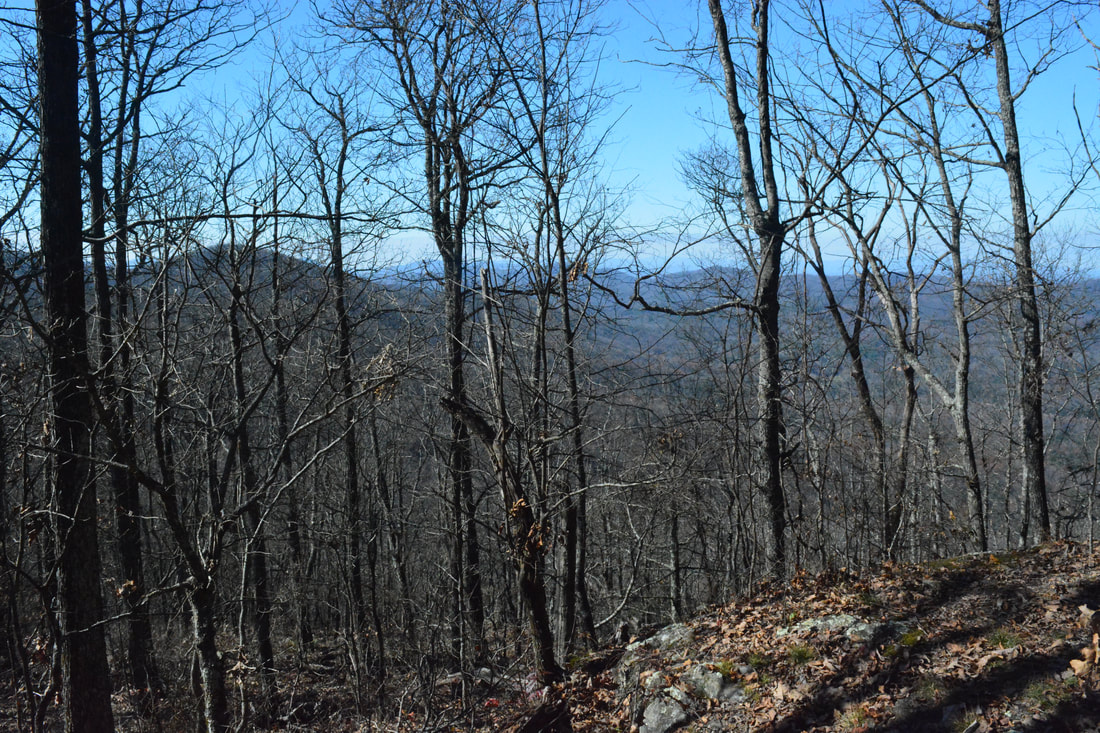
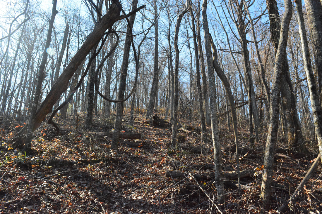
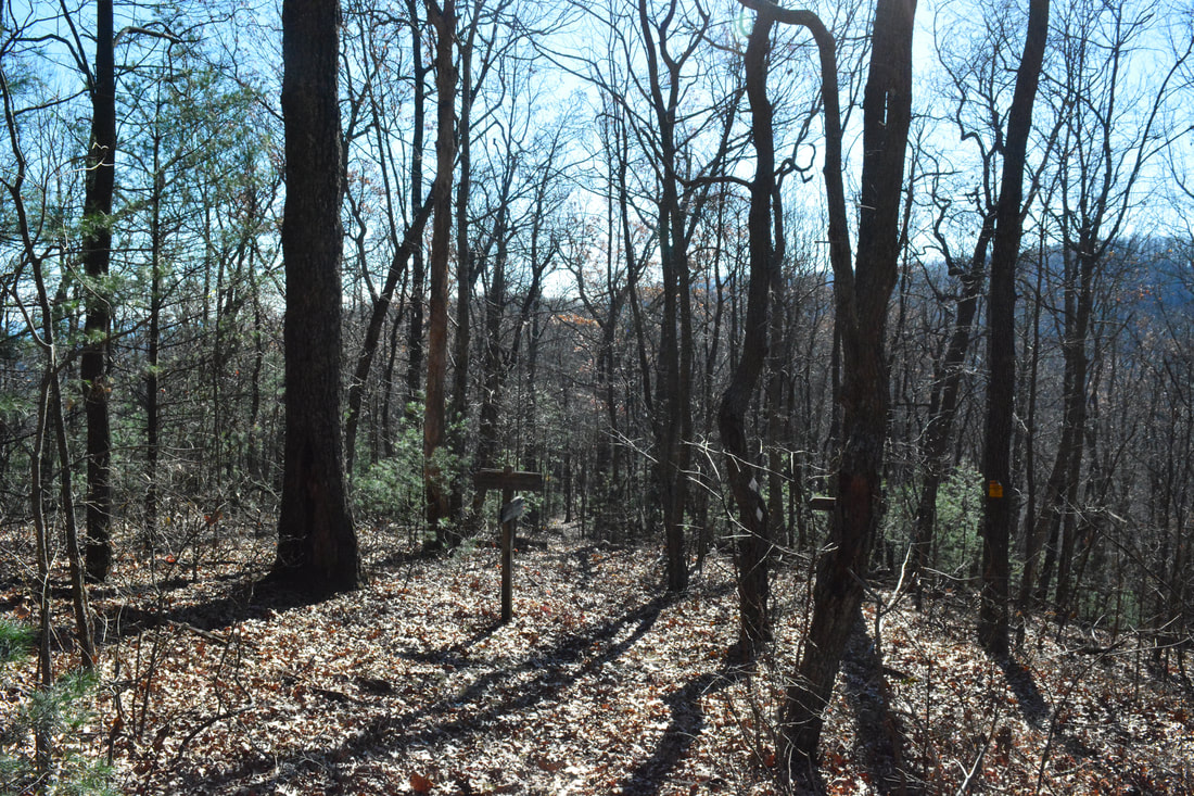
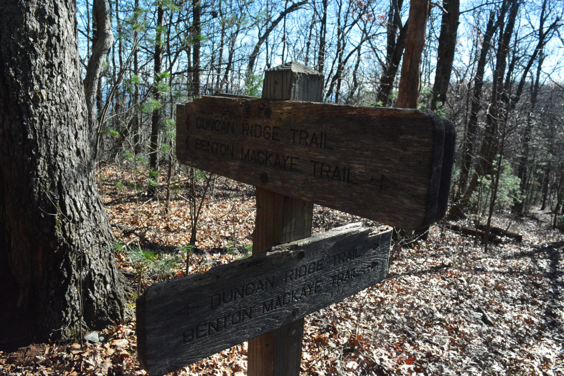
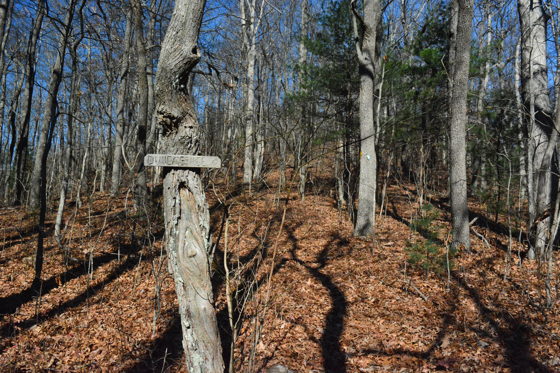
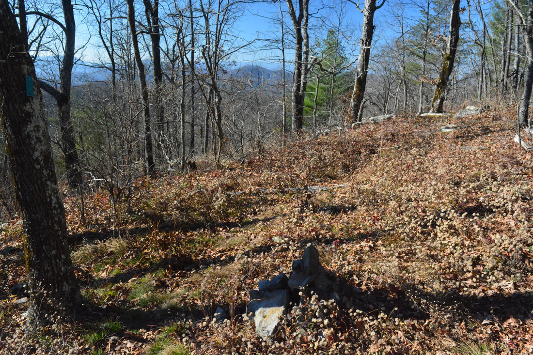
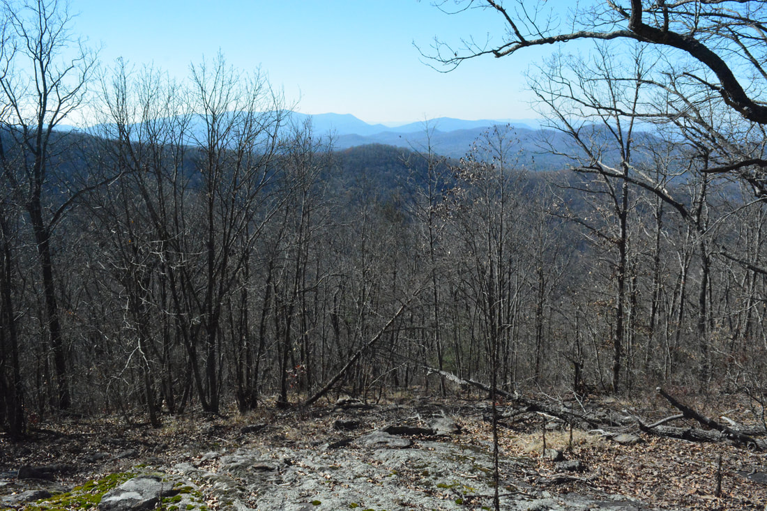
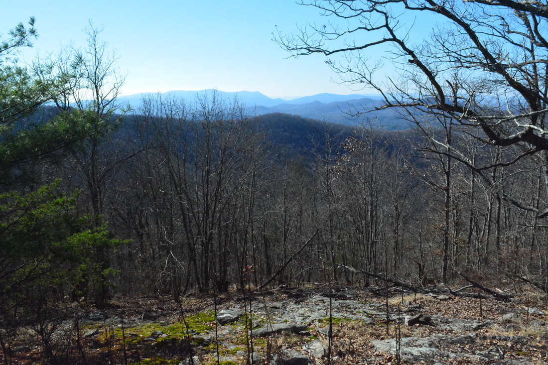
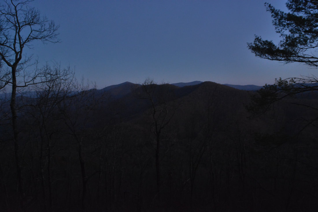
From Mulky Gap, pick up the blue-blazed trail as it heads steeply uphill to the west from a carsonite stake at the road. This is the right-hand side of the road if coming from Blairsville. The Duncan Ridge Trail follows the north boundary of the Cooper Creek Wildlife Management Area for nearly all of its length between Mulky Gap and Rhodes Mountain, as the WMA boundary roughly straddles the ridgeline. A moderate 700-foot ascent to Akin Mountain begins. Although this is the highest single ascent on the hike, it is relatively easy compared to some of the other steeper knobs. The trail reaches the ridge at 0.6 miles and nears the summit of Akin Mountain at 0.95 miles, although it does not cross the very top. A series of small rock outcrops near the summit provides a beautiful winter view and partial summer view to the east and south. The Duncan Ridge Trail passes through a gap at 1.3 miles and then reaches Clements Mountain, the second of eight mountains along the hike (in each direction), at 1.6 miles. A long descent begins here, and this part will be particularly annoying on your way back. 

After descending 500 feet, the Duncan Ridge Trail reaches Akin Gap at 2.3 miles. What follows is one of the easiest sections of the trail as it actually leaves the ridge for once and contours along a nearly level path through mountain laurel thickets on the south side of Fish Knob before emerging to Fish Gap at 2.95 miles. Just before Fish Gap is an ironic sign that states "You Are Not Almost There". It's the truth, because the hike so far has been a relative piece of cake, and coming up past Fish Gap is a particularly hardcore stretch of trail along one of the most rugged parts of the ridge. A dirt road identified as Ridge Runner Trail accesses Fish Gap from Mulky Gap Road, although it may be in fairly rough condition. Cross the turnaround area in Fish Gap and continue following the trail as it begins a slow ascent along an old forest road on the north side of Parke Knob. Even though the trail stays well below the summit, I still consider this to be the third mountain on the hike - especially if the much more difficult climb on the way back is factored in. The first of a series of very steep grades brings the trail to Sarvis Gap at 4.0 miles, where there is a side trail to a water source in the headwaters of Long Cove Creek. 

The next two mountains are the most difficult ascents on the hike in my opinion. In the next half-mile, the trail ascends 400 feet to Payne Knob, reaching it at 4.5 miles. Then, it drops 250 feet in 0.3 miles to an unnamed gap and climbs 250 feet in 0.25 miles to Gregory Knob at 5.05 miles. There are excellent winter views from the pointed summits of both Payne Knob and Gregory Knob, and in fact, the section of the trail between Parke Knob and Rhodes Mountain Gap is one of the trail's most beautiful segments - especially in winter. A 350-foot descent brings the Duncan Ridge Trail to Gregory Gap at 5.35 miles, after which the trail temporarily becomes somewhat easier. The trail next crosses a small knob and then ascends to the north end of Chinquapin Ridge - a side ridge - which is the sixth mountain at 5.7 miles. The next gap, Rhodes Mountain Gap, is at 6.1 miles, after which the trail ascends 200 feet in 0.2 miles to a knob (the seventh mountain) that stands in the shadow of Rhodes Mountain. The final ascent to Rhodes Mountain is perhaps the steepest on the entire hike as it is 250 feet in only 0.2 miles. Reach the summit of Rhodes Mountain at 6.6 miles. A little-used campsite is located just to the right of the trail. The side trail to the view from Rhodes Mountain begins on the right about 200 feet past the summit. It was marked by a cairn at the time of my hike. However, first follow the Duncan Ridge Trail to the Benton Mackaye Trail junction and stop by the view on the way back. After a short, rocky descent,  the Duncan Ridge Trail reaches the signed junction at 6.7 miles. 

​The junction with the Benton Mackaye Trail is the turnaround point for the hike. The stand-alone section of the DRT ends at the junction, after which it bears left and joins the BMT on its way to Highway 60, the Toccoa River Swinging Bridge, and eventually Long Creek Falls. The Benton Mackaye Trail also turns right toward Skeenah Gap. From the junction, begin retracing your steps along the endless rollercoaster route. Make sure to take the 250-foot side trail to the view from Rhodes Mountain. The limited northwest view is from a small rock outcrop and is not special, but it's still a nice bonus to this strenous hike. As much of the view is impeded by trees, it looks considerably better in winter. After taking in the small view, continue the hike back to Mulky Gap, which will become slower and tougher with every new  ascent. It will be a huge relief when you finally return to Mulky Gap at 13.5 miles, concluding the hike! 

Mileage

0.0 - Mulky Gap 
0.95 - Akin Mountain 
1.6 - Clements Mountain 
2.3 - Akin Gap 
2.95 - Fish Gap 
4.0 - Sarvis Gap 
4.5 - Payne Knob 
5.05 - Gregory Knob
5.35 - Gregory Gap 
6.1 - Rhodes Mountain Gap
6.6 - Rhodes Mountain
6.7 - Benton Mackaye Trail Junction 
13.5 - Mulky Gap 

Variations

Hike out and back to Rhodes Mountain and the BMT from Fish Gap - 7.6 Miles

Bonus Stops

A scenic waterfall known as Sea Creek Falls is located south of the Duncan Ridge. It is accessed by a good trail from Sea Creek Road (FS 264) off Cooper Creek Road (FS 4). 

Pictures

3 Comments
Giselle Romero
6/20/2020 11:14:35 pm

Thank you! I’ve been looking for this. Attempting in a few weeks.

Reply
John Koenig
10/3/2020 09:48:08 am

Thank you so much for this write-up! Very helpful info.

Reply
Keith Moses
2/11/2022 03:46:50 pm

Great description, spot on. There have since been several reroutes done on this section which now traverse the side of three of these mountains instead of climbing and descending them. This is still an incredibly tough section but around 2000 feet of gain and loss has been removed. One can still use the old sections if you pay attention. Trail runners still use the old sections of trail keeping it in decent shape.

Reply


Leave a Reply.

    About Me

    Mark Oleg Ozboyd
    I'm an avid outdoor explorer and a hobbyist landscape photographer. I'm 21 years old and have been hiking since 2011. Originally based out of Atlanta, Georgia, I started out by occasionally hiking short trails throughout well-known Georgia State Parks. During 2012 and 2013, I began to expand my trips into adjacent states, as well as into the wilder National Forest areas rather than just State Parks. Throughout the years that followed, as I slowly ran out of popular hiking trails in my area, I began to search for and hike in more seldom-visited areas. Today, you can find me out in the woods every weekend, whether it's on an official trail or bushwhacking through cross-country terrain without any paths. I now attend Washington & Lee University and am exploring Virginia and West Virginia. My other hobbies include chess, science, old music, and meteorology. I have 3 years of amateur weather forecasting experience, having studied a lot of meteorology basics over the years. I am also a student at European School of Music where I learned that music and nature have a lot in common. Listening to good music inspires me to capture nature's beauty on the camera in different aspects that also make me recall many beautiful music pieces that I've heard.​


    Dear readers: I have invested a tremendous amount of time and effort in this website and the Georgia Waterfalls Database the past five years. All of the work that has gone in keeping these websites updated with my latest trip reports has almost been like a full-time job. This has not allowed me to pick up a paid job to save up money for college, and therefore, I I've had to take out loans. If you find the information on this website interesting, helpful, or time-saving, you can say "thanks" and help me out by clicking the button above and making a contribution. I will be very grateful for any amount of support you give, as all of it will apply toward my college tuition. Thank you! 

    Enter your email address to subscribe for trail reports:

    Delivered by FeedBurner


    Picture
    Coming in 2022-2023?

    Other Hiking Websites

    DWHike's Adventures
    Florida's Natural Wonders
    Florida Trailblazer
    Meanderthals
    Mountain Images
    by Bernie Boyer

    North Carolina Waterfalls with
    ​Kevin Adams
    Take-a-Hike!
    Tennessee Landforms
    Waterfall Page
    Waterfall Adventurer
    Zach's Mild Adventures

    Miles Hiked

    Year 1: 540.0 Miles
    Year 2: 552.3 Miles
    ​Year 3: 518.4 Miles
    Year 4: 482.4 Miles
    Year 5: 259.9 Miles

    Archives

    March 2021
    February 2021
    January 2021
    November 2019
    October 2019
    September 2019
    August 2019
    July 2019
    June 2019
    February 2019
    January 2019
    December 2018
    November 2018
    October 2018
    August 2018
    July 2018
    June 2018
    May 2018
    April 2018
    March 2018
    February 2018
    January 2018
    December 2017
    November 2017
    October 2017
    September 2017
    August 2017
    July 2017
    June 2017
    May 2017
    April 2017
    March 2017
    February 2017
    January 2017
    December 2016
    November 2016
    October 2016
    September 2016
    August 2016
    June 2016
    May 2016
    April 2016
    March 2016
    January 2016
    December 2015
    November 2015
    October 2015
    September 2015
    August 2015
    July 2015
    June 2015
    May 2015
    April 2015
    March 2015
    February 2015
    January 2015
    December 2014
    November 2014
    October 2014
    September 2014
    August 2014
    July 2014
    June 2014
    May 2014
    April 2014
    March 2014
    February 2014

    Categories

    All
    Adel
    Adirondack Park
    Alabama
    Alfred A. Ring Park
    Allegheny Trail
    Amicalola Falls State Park
    Anniston Area
    Apalachicola Bluffs And Ravines Preserve
    Apalachicola National Forest
    Apalachicola/Port St. Joe Area
    Apopka
    Appalachian Trail
    Appling
    Art Loeb Trail
    Aska Trail System
    Bakersville
    Balm-Boyette Scrub Preserve
    Balsam Lake Recreation Area
    Bankhead National Forest
    Bartow County Parks
    Bartram Trail
    Basinger
    Beersheba Springs
    Benton
    Benton Mackaye Trail
    Berry College Trail System
    Best Hike
    Big South Fork National Recreation Area
    Black Bear Wilderness
    Black Rock Mountain State Park
    Blairsville
    Blakely
    Blood Mountain Wilderness
    Blowing Rock
    Blue Ridge
    Blue Ridge Parkway
    Boone
    Bradenton
    Bradenton Beach
    Brasstown Bald
    Brasstown Wilderness
    Brevard
    Bryson City
    Buchanan
    Bucks Pocket State Park
    Bulow Creek State Park
    Bulow Plantation Ruins State Park
    Caesars Head State Park
    Caladesi Island State Park
    Calhoun
    Camel's Hump State Park
    Cashiers
    Caspersen Beach Park
    Catfish Creek State Park
    Caves
    CC Putnam State Forest
    Cedar Point Environmental Park
    Chatsworth
    Chattahoochee National Forest
    Chattanooga
    Chattanooga Valley
    Chattooga National Wild And Scenic River
    Cheaha Wilderness
    Cherohala Skyway
    Cherokee
    Cherokee National Forest
    Chiefland Area
    Chillhowee Recreation Area
    Chipley
    Chunky Gal Trail
    Circle B Bar Reserve
    Citico Creek Wilderness
    Citrus Wildlife Management Area
    Clarkesville
    Clayton
    Cleevland
    Cleveland
    Cloudland Canyon State Park
    Cohutta Wilderness
    Collier-Seminole State Park
    Cordele
    Cornelia
    Covington
    Crestview Area
    Crew-land-and-water-trust
    Cullowhee
    Cumberland Trail
    Dahlonega
    Dalton
    Dawson Forest Wildlife Management Area
    Dawsonville
    Dayton
    De Soto National Memorial
    DeSoto State Park
    Dillard
    Double Springs
    Ducktown
    Duncan Ridge Trail
    Dunlap
    Eagle's Rest Park
    Eastpoint
    Econfina Creek Wildife Management Area
    Eglin Air Force Base
    Elizabethton
    Elkins
    Elk Knob Game Lands
    Elk Park
    Ellicott Rock Wilderness
    Ellijay
    Emerson Point Preserve
    Englewood Area
    Enota Retreat
    Erwin
    Falling Waters State Park
    Fayetteville
    Fires Creek Recreation Area
    Fire Tower
    Flint River
    Florence Area
    Florida
    Florida Caverns State Park
    Florida Trail
    Foothills Trail
    Fort Mountain State Park
    Fort Myers Area
    Fort Payne
    Fort Payne Area
    Fort Yargo State Park
    Franklin
    Franklin Delano Roosevelt State Park
    Franklin-Marion State Forest
    Frozen Head State Park
    Gainesville
    Gainesville Area
    Gatlinburg
    George Washington National Forest
    Georgia
    Georgia Veterans Memorial State Park
    Glasgow
    Gorges State Park
    Grandfather Mountain State Park
    Great Smoky Mountains National Park
    Greeneville
    Green River Game Lands
    Gruetli-Laager
    Grundy Forest State Natural Area
    GTM Reserve
    Guana River Wildlife Management Area
    Hayesville
    Helen
    Hiawassee
    High Falls State Park
    Highlands
    Highlands Scenic Highway
    Hillsborough River State Park
    Hinson Conservation & Recreation Area
    Historic Sites
    Honeymoon Island State Park
    Hot Springs
    Huntington
    Inverness Area
    Jackson
    Jasper
    Jefferson National Forest
    Joan M. Durante Park
    Jonathan Dickinson State Park
    Jones Gap State Park
    Joyce Kilmer Slickrock Wilderness
    Joyce Kilmer - Slickrock Wilderness
    Juniper Prairie Wilderness
    Kelly Park
    Keown Falls Recreation Area
    Kolomoki Mounds State Park
    LaFayette
    Lake City Area
    Lake George Wild Forest
    Lake June-in-Winter State Park
    Lakeland Area
    Lake Placid
    Lake Russell Wildlife Management Area
    Lake Wales Ridge State Forest
    Laurel Fork North Wilderness
    Leffis Key Preserve
    Leon Sinks Geological Area
    Lexington
    Lineville
    Linville
    Linville Gorge Wilderness
    Lithia Springs
    Little Frog Wilderness
    Little Manatee River State Park
    Little River Canyon National Preserve
    Longboat Key
    Long Trail
    Lookout Mountain
    Lookout Mountain Battlefield
    Lovingston
    Lula Lake Land Trust
    Lumpkin
    Maggie Valley
    Manatee Springs State Park
    Marianna Area
    Mark Trail Wilderness
    Marlinton
    Mccaysville
    McMinville
    Mentone
    Middlesex
    Mistletoe State Park
    Monongahela National Forest
    Montreat
    Mountain Bridge Wilderness Area
    Mountain City
    Mountains To Sea Trail
    Mountains-to-Sea Trail
    Mount Rogers National Recreation Area
    Myakka River State Park
    Myron B. Hodge City Park
    Nantahala National Forest
    Naples
    Naples Area
    Natural Bridge State Park
    Neal Preserve
    New Castle
    Newport
    New River Gorge National Park
    New York
    North Carolina
    Ocala Area
    Ocala National Forest
    Ocean-to-Lake Trail
    Oconee State Park
    Oconee Station Historic Site
    Okaloacoochee Slough State Forest
    Oldsmar
    Oneida
    Orlando Area
    Ormond Beach
    Oscar Scherer State Park
    Oxford
    Palatka
    Palmetto Trail
    Panama City Area
    Panthertown Valley
    Parrish
    Paynes Creek Historic State Park
    Peaks Of Otter Recreation Area
    Pigeon Crockford Mountain Wildlife Management Area
    Pigeon-Crockford Mountain Wildlife Management Area
    Pigeon-Crockford Wildlife Management Area
    Pine Mountain
    Pinhoti Trail
    Pinnacle Park
    Pisgah Civitan Park
    Pisgah National Forest
    Pittman Center
    Pond Mountain Wilderness
    Ponds/Lakes
    Prentice Cooper State Forest
    Providence Canyon State Park
    Pumpkintown
    Quick Point Nature Preserve
    Raven Cliffs Wilderness
    Reed Bingham State Park
    Reliance
    Rice Creek Conservation Area
    Riverview Pointe Preserve
    Robbinsville
    Robinson Preserve
    Rock Creek Gorge Scenic Area
    Rock Island State Park
    Rome
    Rosman
    Sale Creek
    Salem
    Salt Springs
    Saluda
    Santa Rosa Beach
    Sarasota
    Sarasota Area
    Savage Gulf State Natural Area
    Scenic Views
    Scottsboro Area
    Sebring Area
    Sewanee
    Sheltowee Trace Trail
    Shining Rock Wilderness
    Signal Mountain
    Sipsey Wilderness
    Sky Valley
    Smithgall Woods State Park
    Snowbird Backcountry Area
    Soddy Daisy
    Soddy-Daisy
    Sopchoppy
    South Carolina
    South Cumberland State Park
    Southeastern Cave Conservancy
    Southern Nantahala Wilderness
    Sparta
    Sprewell Bluff Park
    Spring City
    Spring Hill
    Springs
    Spruce Pine
    Standing Indian Backcountry Area
    St. Augustine
    St. George Island State Park
    St. Joseph Bay State Buffer Preserve
    St. Marks Area
    St. Marks National Wildlife Refuge
    Stone Mountain
    Stone Mountain Park
    Suches
    Sumatra
    Sumter National Forest
    Suwannee River
    Swallow Creek Wildlife Management Area
    Sweetwater Creek State Park
    Sylva
    Talladega National Forest
    Tallahassee Area
    Tallulah Falls
    Tallulah Gorge State Park
    Tampa Bay Area
    Tate City
    Tate's Hell State Forest
    Tea Creek Wildlife Management Area
    Tellico Plains
    Tennessee
    Thomaston
    Toccoa
    Topsail Hill State Park
    Torreya State Park
    Townsend
    Tracy City
    Tray Mountain Wilderness
    Trenton
    Triple Creek Preserve
    Troutdale
    Unaka Mountain Wilderness
    Upper Tampa Bay County Park
    Venice
    Vermont
    Virgin Falls State Natural Area
    Virginia
    Virginia Outdoors Foundation
    Vogel State Park
    Wakulla Springs State Park
    Waleska
    Walhalla
    Wartburg
    Water Features
    Waynesville
    Weedon Island Preserve
    Weeki Wachee Preserve
    Wekiwa Springs State Park
    West Palm Beach Area
    West Virginia
    Whitehall
    White Springs
    Winder
    Withlacoochee State Forest
    Young Harris

    RSS Feed

TRAIL REPORTS

Hikes in Alabama
​Hikes in Florida
Hikes in Georgia
Hikes in North Carolina
Hikes in South Carolina
Hikes in Tennessee
Hikes in Virginia

Hiking Resources

Alabama Resources
​
Florida Resources
Georgia Resources
North Carolina Resources
​South Carolina Resources
​
Tennessee Resources

Other

Contact
Map of Hikes
Alphabetical List of Hikes
Southeast Nature Society
© COPYRIGHT 2014-2024
​ALL RIGHTS RESERVED.
Important: I disclaim any responsibility for any damage or personal injury that may occur as a result of the activities and information found on this website. All outdoor activities, especially off-trail hiking, are done at your own risk. Never hike or head into that area that may be above your fitness or experience level.
  • Home
  • Trail Reports
    • Best Hikes
    • Hikes with Scenic Views
    • Hikes with Water Features
    • Alabama
    • Georgia
    • Florida
    • North Carolina
    • South Carolina
    • Tennessee
    • Vermont
    • Virginia
  • Map
  • Hike List
  • Testimonials
  • Resources
  • Contact Us
  • Southeast Nature Society
    • Our Team
  • Georgia Waterfalls Database