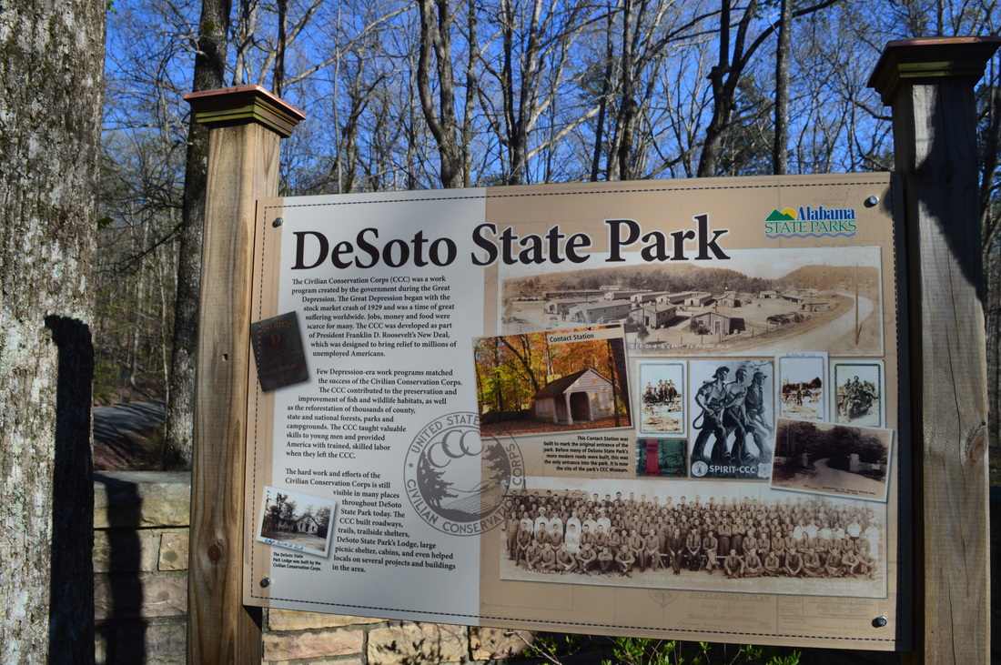
As one of Alabama's first state parks, DeSoto State Park was developed by the Civilian Conservation Corps during the 1930s, and much of their work can still be seen throughout the park today. Located on Lookout Mountain, the park is positioned on the west side of the West Fork of the Little River, conveniently close to the town of Fort Payne. A network of hiking trails visits as many as five waterfalls on tributaries of West Fork Little River. You will also see some views of the Little River gorge and some of the CCC's work on this moderate mountaintop hike. This hike occurred on Saturday, April 2nd, 2016. After completing a short hike to nearby De Soto Falls, I drove down to DeSoto State Park with a plan to make a loop out of several of the park's trail. First, I would take the Talmadge Butler Boardwalk to Azalea Cascade. Then, I would take the Azalea Cascade Trail to the Laurel Falls Trail. I would follow the Laurel Falls Trail to the Lost Falls Trailhead, making sure to make the side trips to Laurel Falls and Lost Falls. After the Lost Falls Trailhead, I would continue on a mountain bike trail that would take me past the CCC Museum and to the CCC Quarry. From the CCC Quarry, I would follow the CCC Quarry Trail to its terminus near the DeSoto State Park Visitor Center. After this, I would cross the park's Picnic and Play Area and follow an access trail to the DeSoto Scout Trail. I would follow the DST north for a little bit to the CCC Trail Shelter and views of the Little River, before turning south and finishing the hike at the park's lodge, passing Indian Falls and Lodge Falls in the meantime. A bit of roadwalk would be necessary to return back to the parking area.
Summary
R/T Length of Trail: 7.3 Miles
Duration of Hike: 4:15 Type of Hike: Loop Difficulty Rating: 3 out of 10 Total Elevation Gain: 1002 Feet Pros: None Cons: The waterfalls on Laurel Creek can dry up during summer and fall; The section of the hike along the Mountain Bike Trail is a bit boring due to the "biking style" of the trail Points of Interest: Azalea Cascade - 2 stars; Laurel Falls - 2 stars; Lost Falls - 5 stars; CCC Museum; CCC Quarry; CCC Trail Shelter and views of Little River; Indian Falls - 6 stars; Lodge Falls - 3 stars Trail Blaze Color(s): Lost Falls Trail - Blue; Azalea Cascade Trail - Red; Laurel Falls Trail - Orange; Mountain Bike Trail - None; CCC Quarry Trail - White; DeSoto Scout Trail - Yellow; Cabin Trail - Green Best Season(s) to Hike: Spring Fees: None Beginning Point: Talmadge Butler Boardwalk Parking Directions: From Fort Payne, AL: Follow AL State Route 35 South for 2.4 miles. Then, turn left onto Desoto Parkway. In 5.2 miles after the left turn, enter DeSoto State Park. From the park entrance, continue straight for another 0.4 miles. The parking area for Talmadge Butler Boardwalk will be on the left side of the road. If you have reached the DeSoto State Park Nature Center, Visitor Center, and Country Store to the left, you have gone too far. Map
Click here for more information and to download this trail map to view in Garmin Basecamp.
Details
My first trip to De Soto State Park was several years ago (I believe that it was in the autumn of 2012), and it was one of my first out-of-state trips. At the time, I was a novice hiker. My plan on that day was to see how much of the DeSoto Scout Trail I could hike, and I was not very impressed with it, as the DST became very rough, rocky, and somewhat boring south of the Lodge. At the time, I was not aware that the park's trails were not only focused along the Little River, and for a while, I did not even consider returning to the park. Then, a couple of years later, I noticed a hike in one of my guidebooks that was on trails in the western portions of DeSoto State Park, and I was surprised to find out about the numerous waterfalls on Laurel Creek and the CCC Quarry. More recently, I learned about the Gillium Loop, another interesting trail that is located at the southern end of the park - separate from any of the other trails. With new knowledge about the park's other trails, I made a plan to hike them eventually, and this mild early spring weekend proved to have the perfect opportunity. After completing a nearby short hike to De Soto Falls, I decided to hike several trails in DeSoto State Park, although unfortunately, I didn't have enough time to hike the Gillium Loop as well. One thing that I would like to note is that if you're going to follow my hiking route through DeSoto State Park, you should obtain a trail map, as there are a lot of trail intersections and it is easy to take the wrong trail. You can download a map by clicking here.
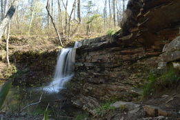
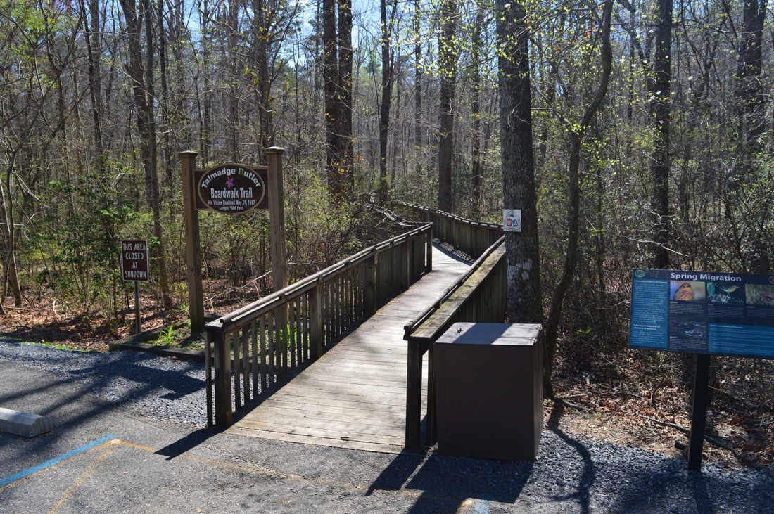
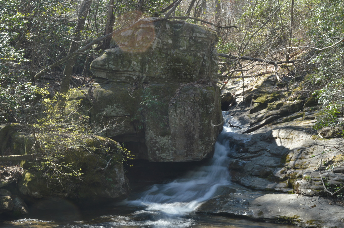
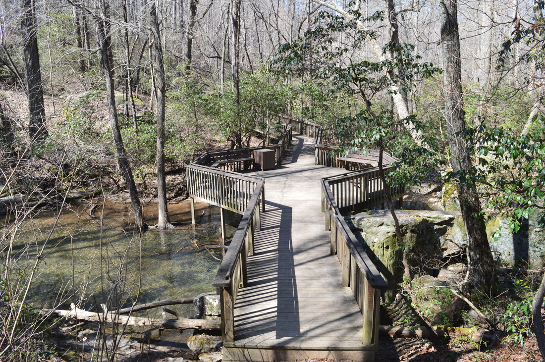
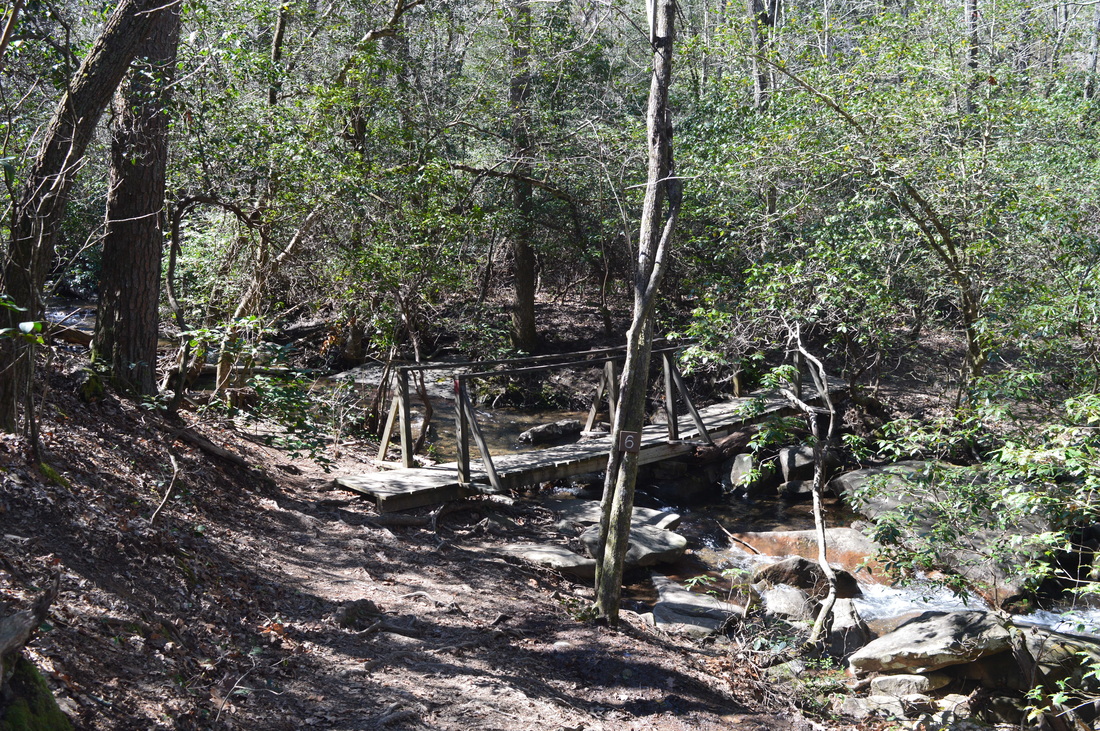
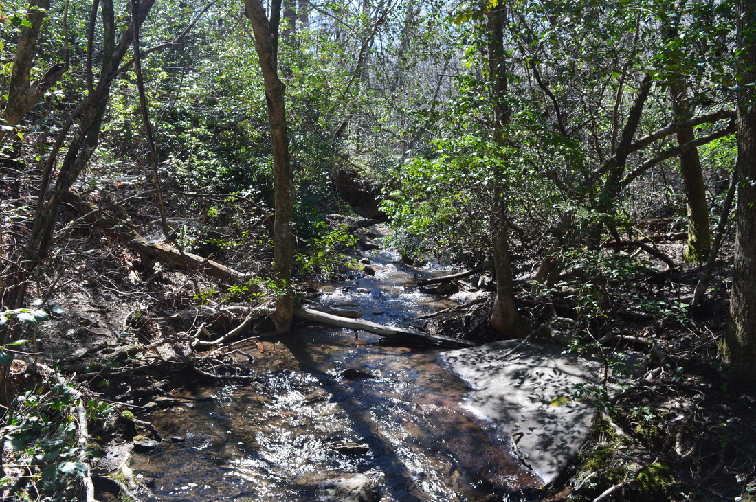
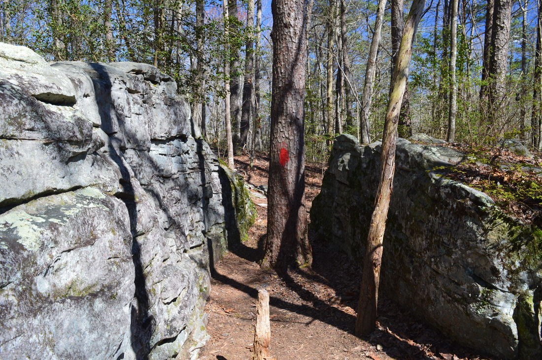
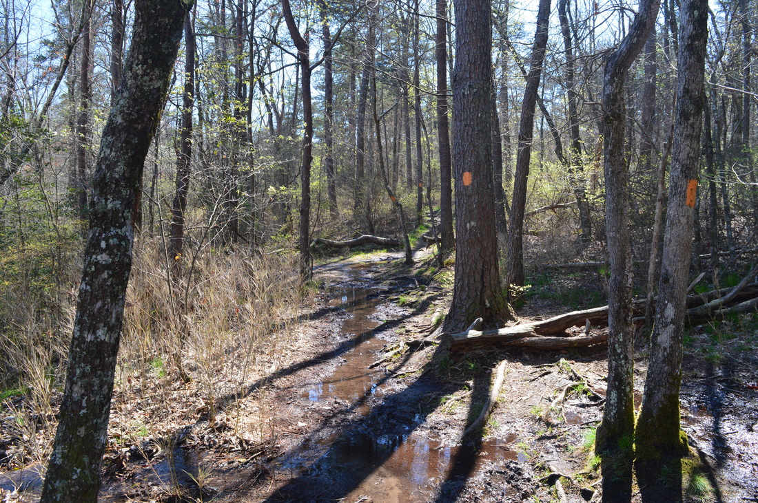
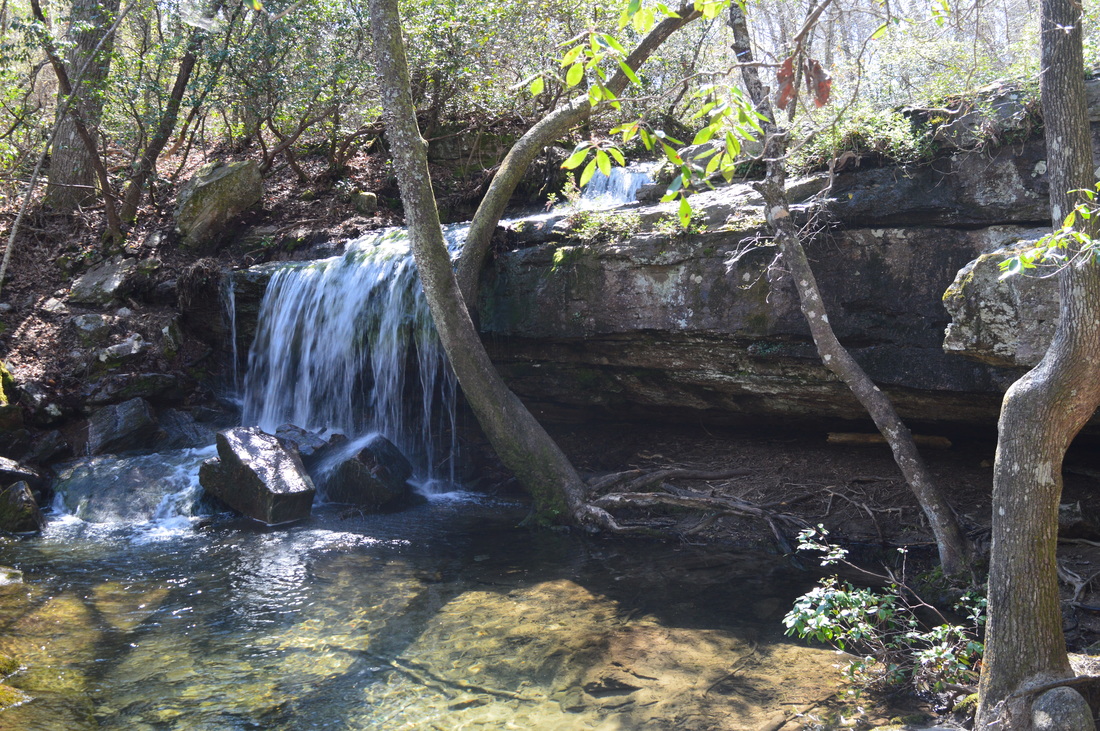
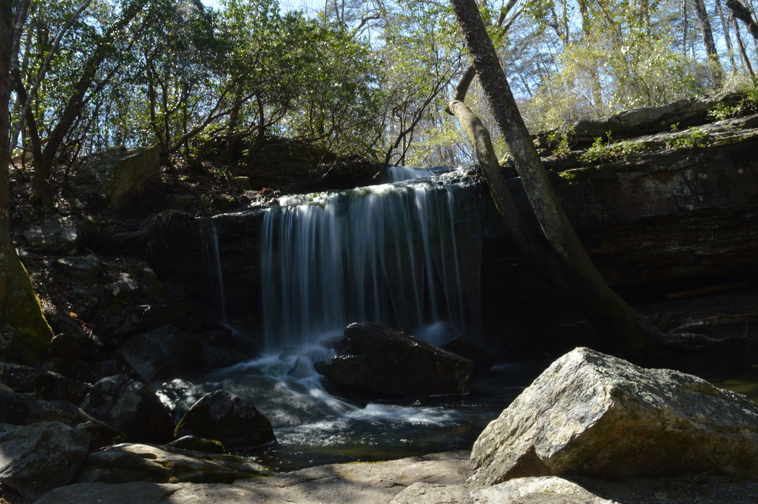
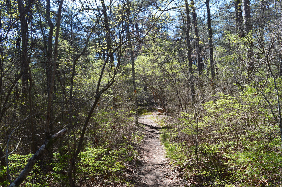
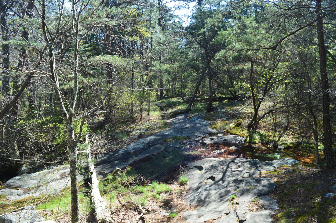
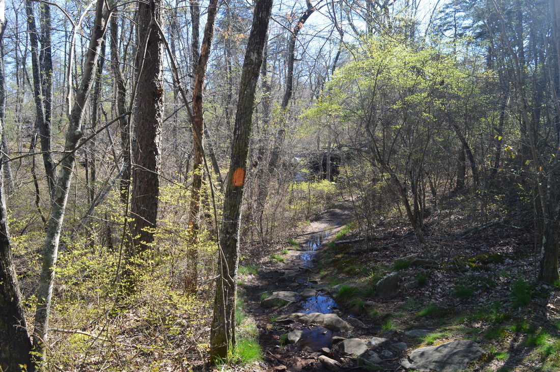
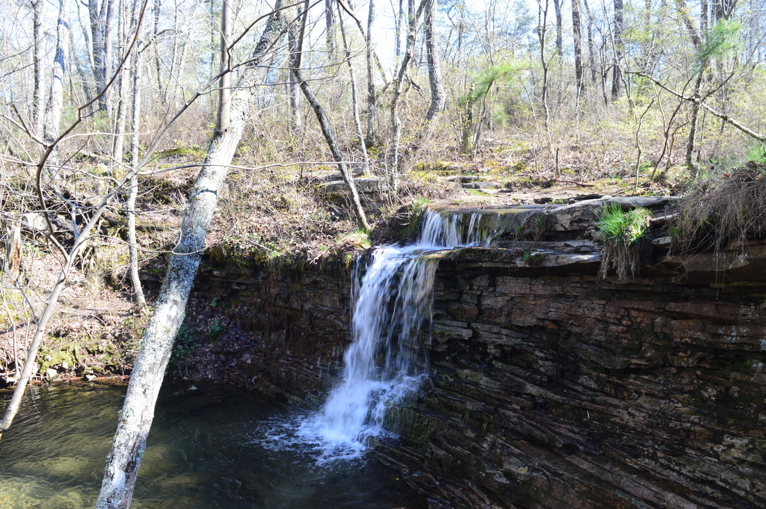
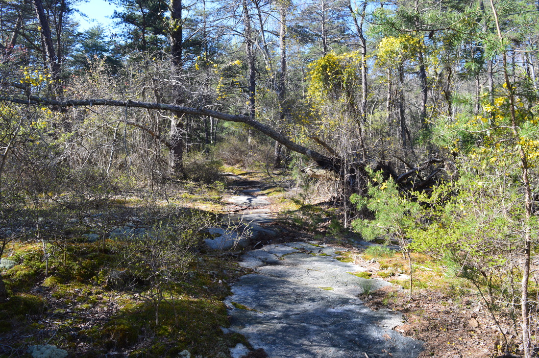
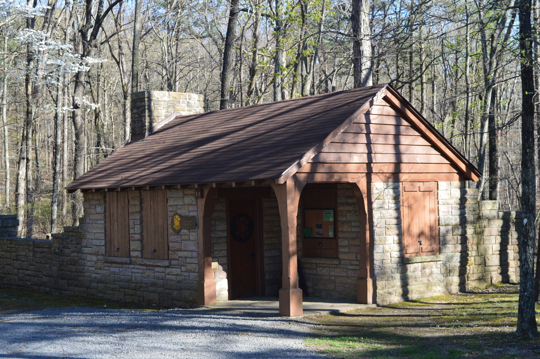
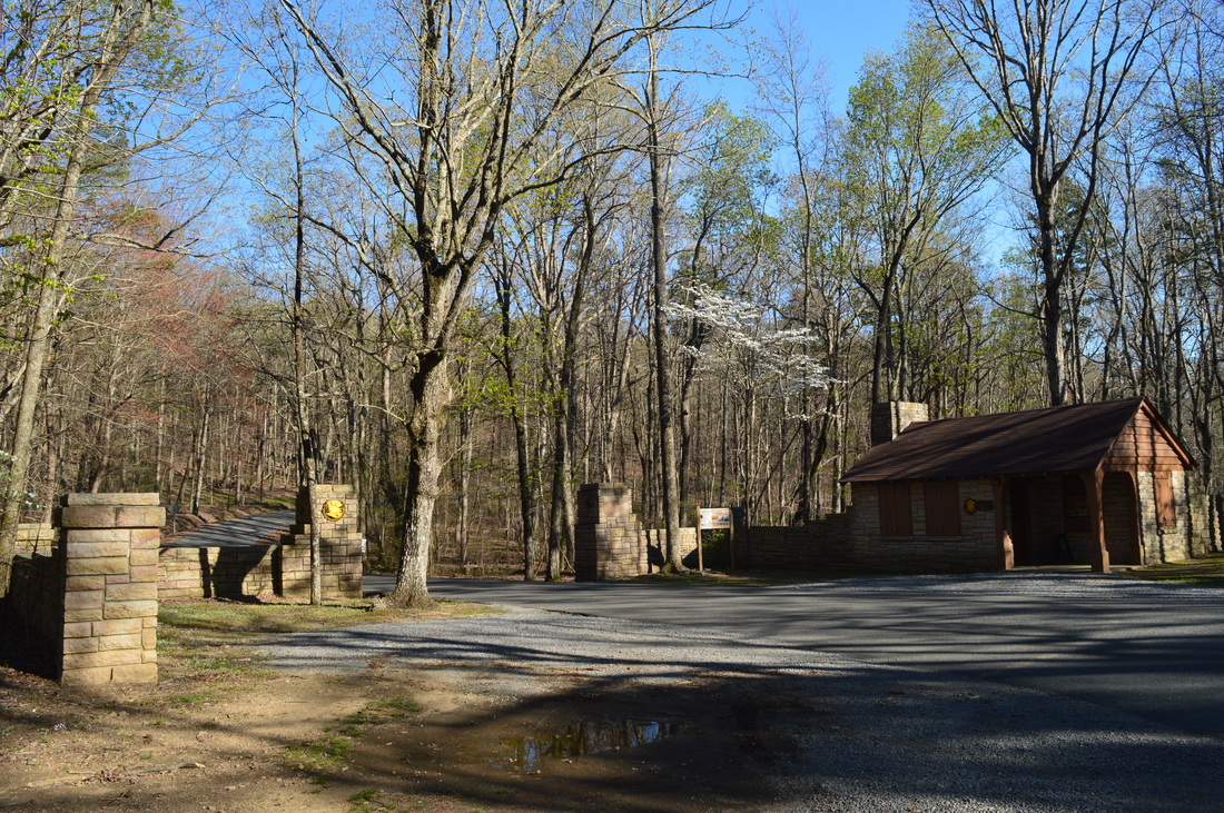
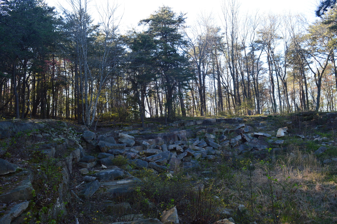
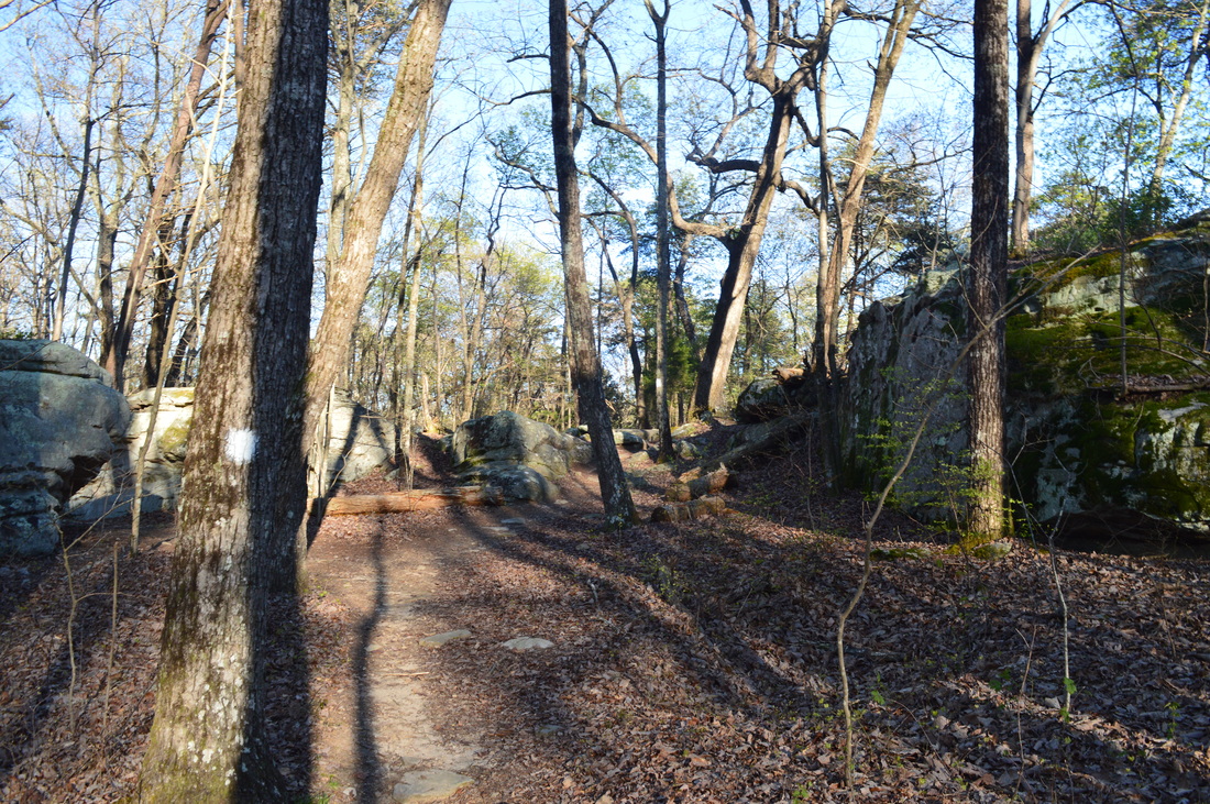
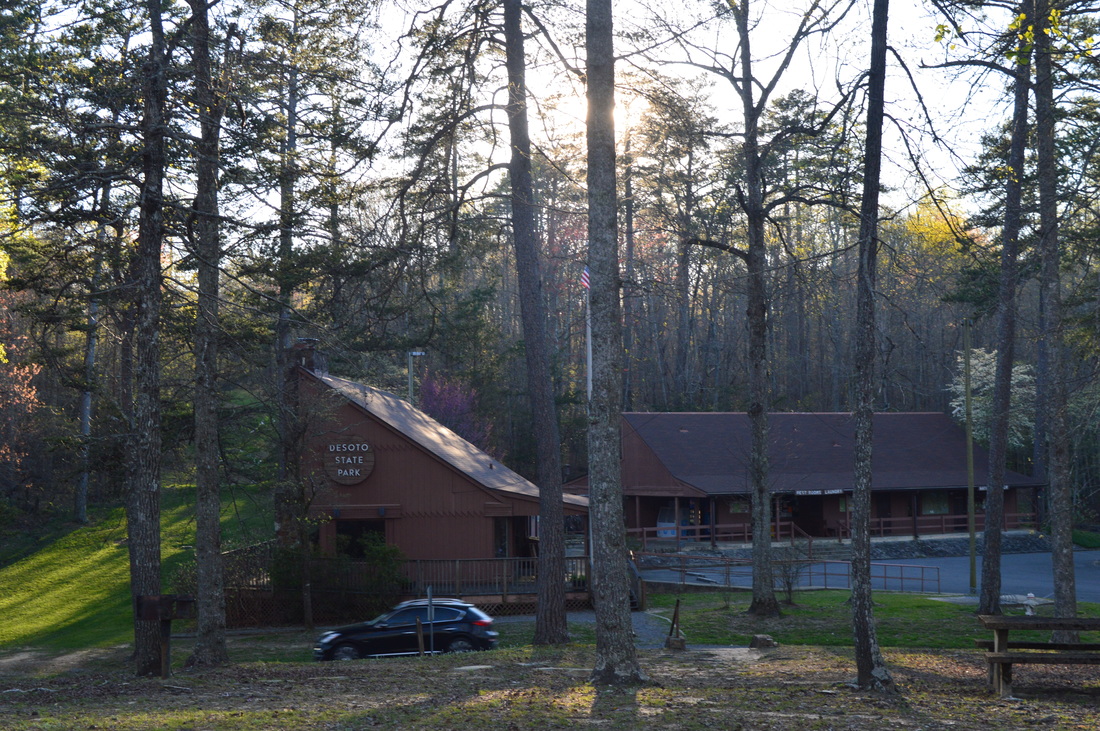
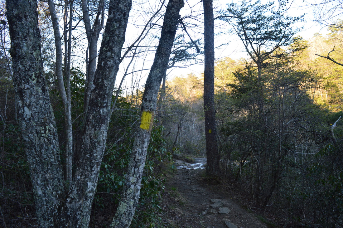
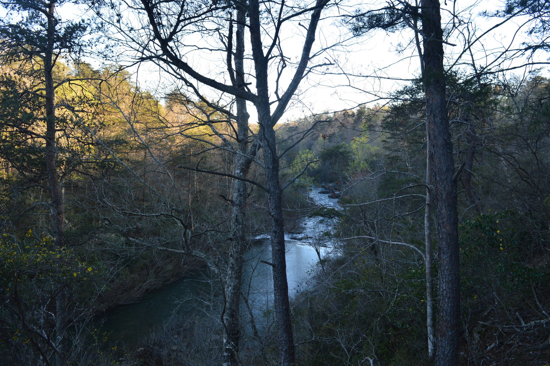
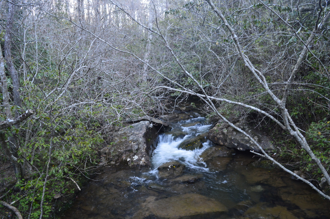
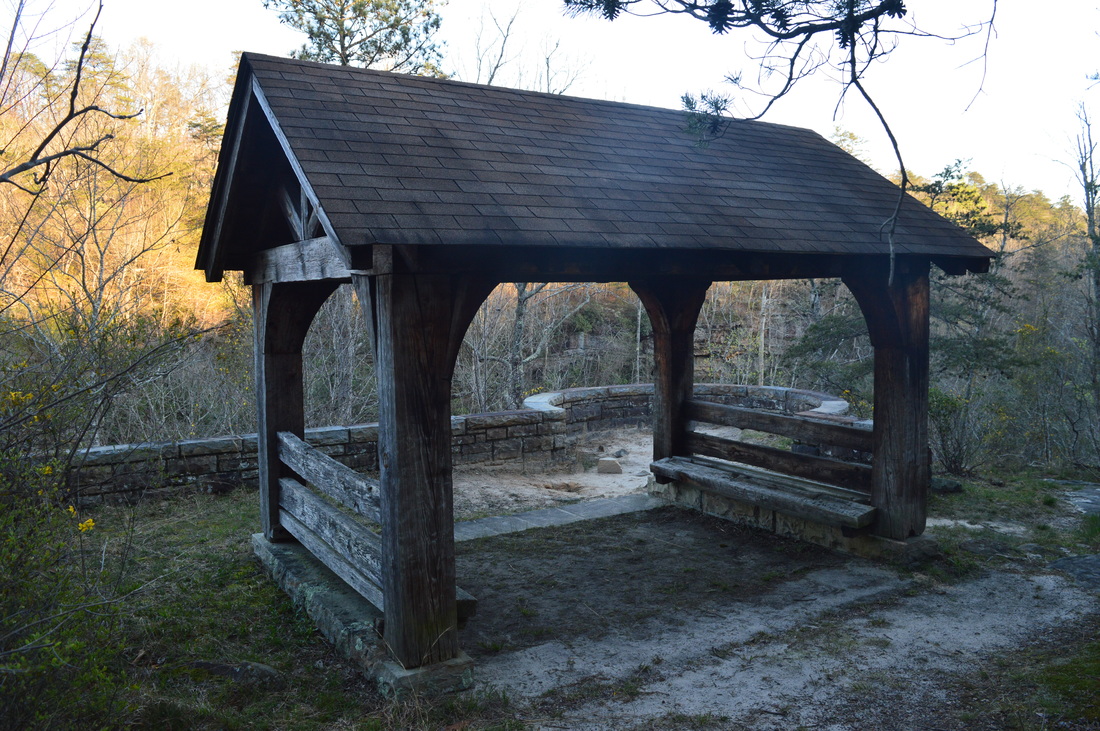
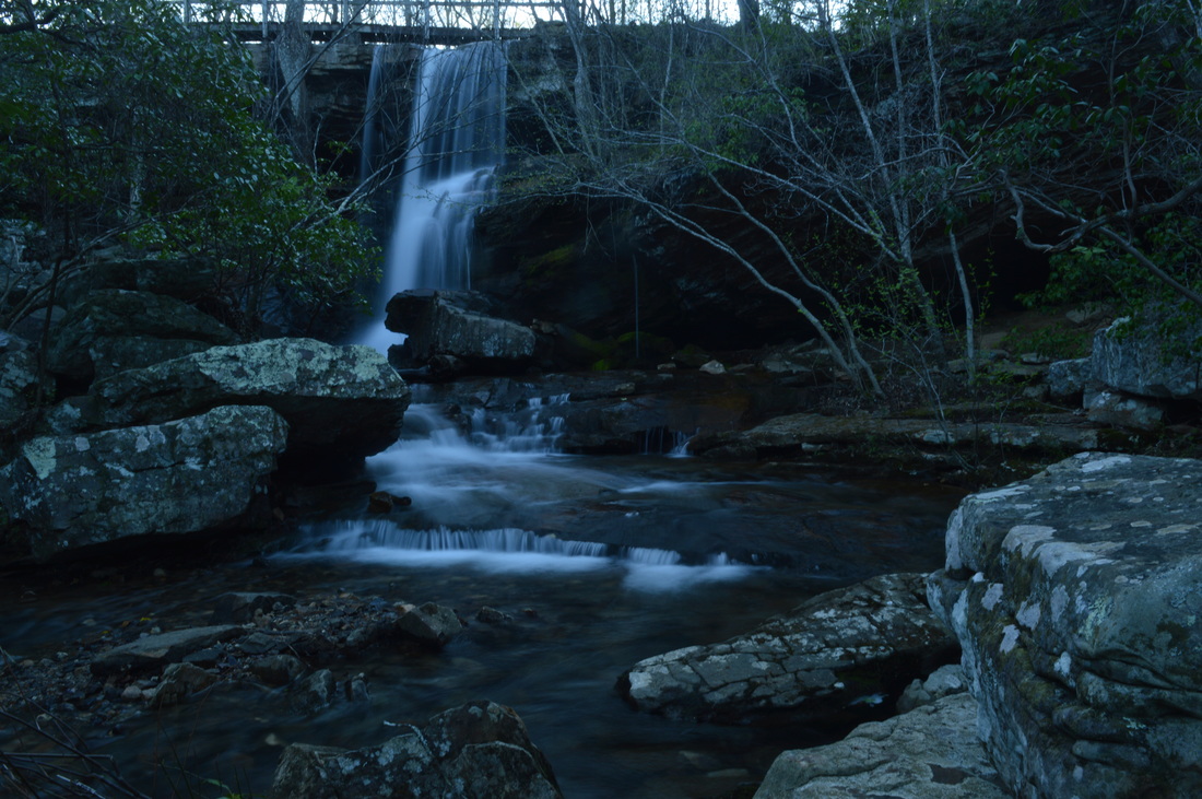
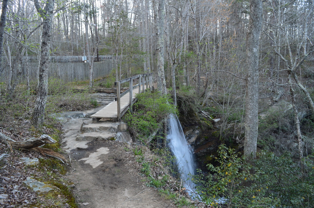
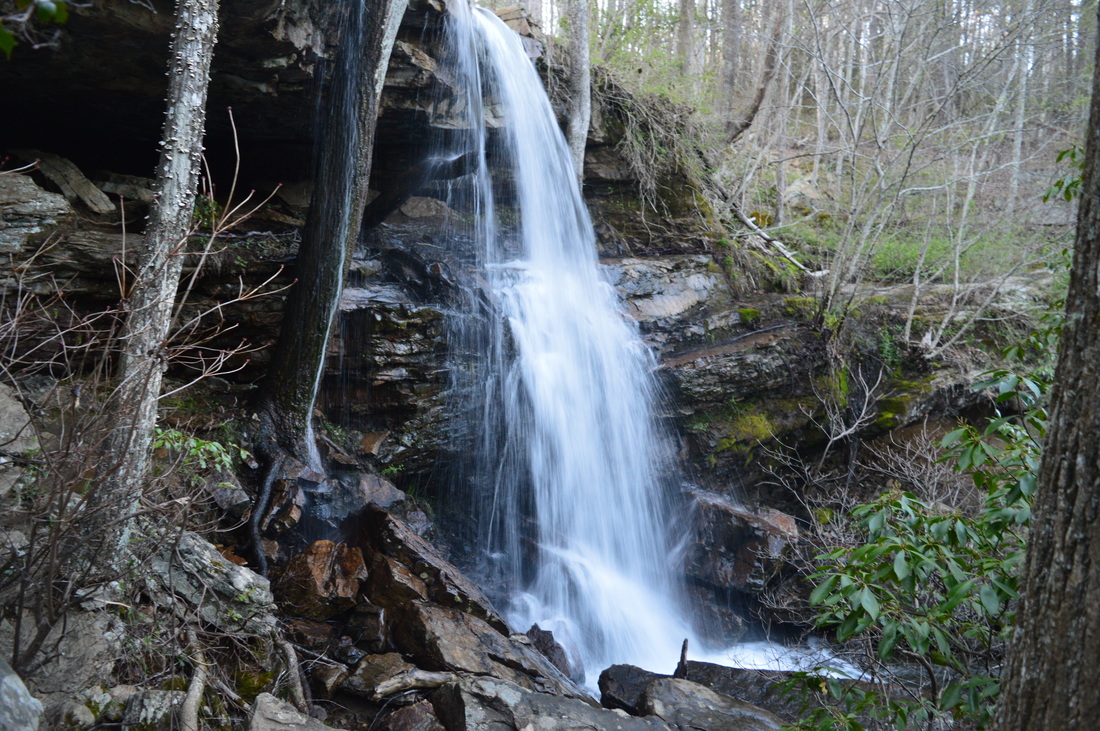
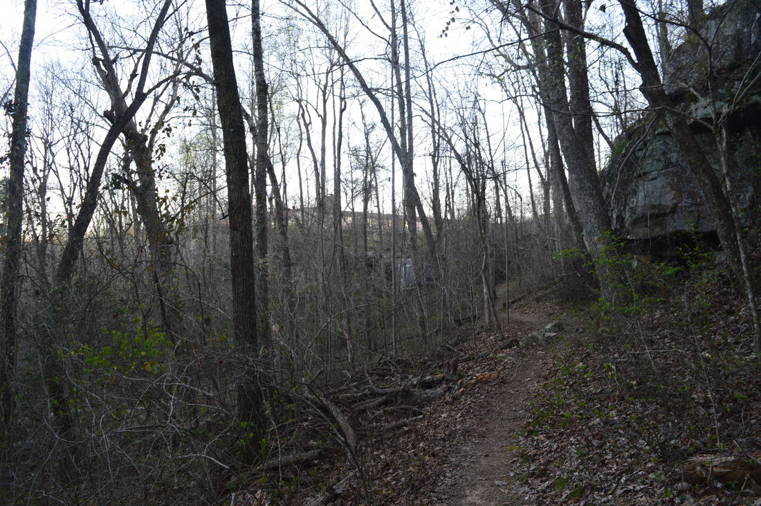
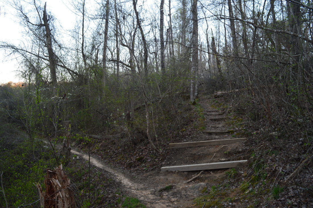
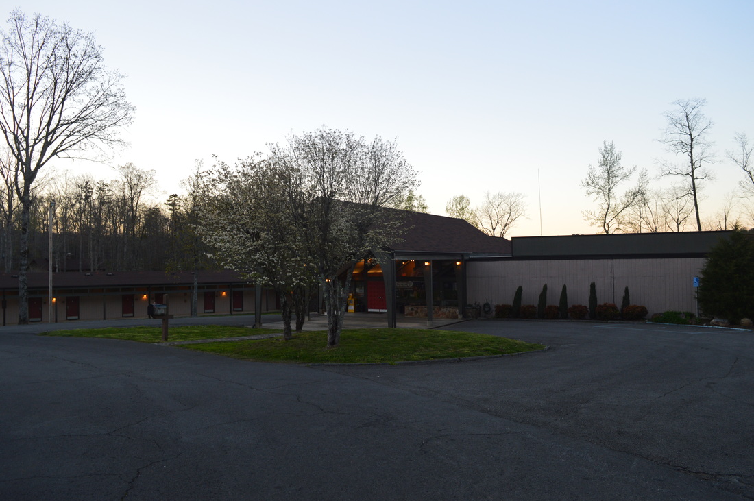
I began the hike at the Talmadge Butler Boardwalk. This boardwalk was established on May 31, 1997. It is 1000 feet long, and it was designed to provide an accessible route to Azalea Cascade. Head out in a southwesterly direction on the boardwalk. Shortly after the beginning of the boardwalk, a set of steps to the left leads to a path that serve as an access route to the Lost Falls Trail. In several more yards, the Azalea Cascade Trail leaves to the right in the direction of Needle-Eye Rock and Laurel Falls Trail. Continue straight on the boardwalk. At about 0.2 miles, reach the end of the boardwalk, where one path turns right to parallel Laurel Creek, while another path continues straight, crosses the creek, and ascends a steep slope. Here, there is an observation area at Laurel Creek, directly in front of Azalea Cascade. This is not a true waterfall - it is rather a small slide, but it is still notable. The creek bends around a huge boulder at the slide. After viewing the cascade, cross Laurel Creek on the last leg of the boardwalk, and ascend some steps to reach the blue-blazed Lost Falls Trail. Turn right here. Follow the trail along the creek to another junction at 0.3 miles. Here, the Lost Falls Trail bears left to continue following Laurel Creek, while the Azalea Cascade Trail bears right and crosses Laurel Creek on a footbridge and then connects with the Laurel Falls Trail. Both routes lead to about the same location eventually, but there is an important difference: the Lost Falls Trail provides access only to Lost Falls, while the Laurel Falls Trail provides access to both Laurel Falls and Lost Falls. Thus, the Laurel Falls Trail seems like a better option for someone who has never seen Laurel Falls before. Cross Laurel Creek and pass a trail to the right that leads back to Azalea Cascade. At 0.4 miles, reach the Laurel Falls Trail after a slight uphill. Turn left onto the orange-blazed trail. Shortly afterwards, bear left again as a spur trail leaves to the right towards the park's Improved Campground. At 0.5 miles, step across a tributary of Laurel Creek. After this, the trail became full of standing water and mud after the rains that had occurred over the past few days, although I was able to walk around most of the water. At 0.7 miles, reach a spur trail to the left that leads to Laurel Falls. Turn onto the spur trail and descend to Laurel Creek to reach the top of Laurel Falls. Bear left onto a path that leads to the base of this small waterfall. Laurel Falls attracts more of a crowd than Lost Falls, but personally, I did not find anything particularly special about this 6-foot waterfall. Laurel Falls is best recognized by its double drop: a small cascade at the top and then a slightly larger fall over a small rock wall. You can cross the creek on stones for a slightly different view of the waterfall. Return back to and turn left onto the main trail. The trail resumes a very gradual ascent, but it is barely noticeable. In fact, as I hiked the Laurel Falls Trail, I had no doubt that this was one of the easiest trails I had hiked in a long time - in fact, the whole hike was relatively easy. The Laurel Falls Trail passes through open forest and over some areas of granite after Laurel Falls. Some greens were showing up on the trees and there were several wildflowers that I spotted. At 1 mile, the Campground Trail leaves to the right - it leads to the Improved Campground. At 1.4 miles, a spur trail bears left to Lost Falls (the falls is visible ahead). Lost Falls - only five feet tall - is even shorter than Laurel Falls, but it is actually prettier, provided that there is water (one of my friends hiked to this waterfall during late summer and found it completely dried up). If you get here during the dry season, you may find out how Lost Falls got its name. Otherwise, it is a nice single drop waterfall that cascades over a very neat rock wall. After you have gotten a good view of the falls, continue on the spur trail - it rejoins the main trail shortly. Keep straight onto the main trail. At 1.65 miles, reach a junction in the middle of a large area of granite. Here. the Lost Falls Trail turns left, while the Laurel Falls Trail bears right. You can turn left, if you're looking to hike only a short loop and to return to the parking area fast. Otherwise, bear right onto the Laurel Falls Trail. You will cruise through nearly flat terrain - crossing a small stream along the way - before reaching a junction with the Never-Never Land Bike Trail at 2 miles. Bear right and reach the Lost Falls Trailhead. This is the end of the Laurel Falls Trail. There are several different trails that leave the trailhead, and you can utilize any of them to continue your hike. To the right, a bike trail leads to the Improved Campground. Straight ahead, across the road, another bike trail is the most direct route to the CCC Quarry. A third bike trail leaves the trailhead to the left. The bike trail heads in the direction of the CCC Museum - this is the trail that you need to take. The trail initially veers away from the road before reaching a junction with the other end of the Never-Never Land Bike Loop. Keep right here to continue on the trail to the CCC Museum. This trail section of the trail stays very close to Desoto Parkway, and the road is within sight several times. The trail is forced to stay very close to the road due to private property to the left. At 2.3 miles, cross a private driveway, with Desoto Parkway still very close to your right. On the other side of the driveway, the terrain suddenly opens up in front of you as you begin descending off the mountain. This trail is popular with bikers, so this section of the trail was designed for biking use more than for hiking use - in other words, the trail makes a number of painfully long switchbacks down a slope that is not steep at all. Also, the trail makes some extra curves that are not very useful. The main reason that I added this section of the trail was for extra mileage. You could simply take the trail that continued straight from the Lost Falls Trailhead, if you're interested in a more direct route. At 3.2 miles, you will finally reach the CCC Museum and contact station. This is a pretty important location in historical terms. The entrance to DeSoto State Park to the right is the original entrance to the park, built by the CCC during the 1930s. In November 1933, a CCC camp was built in nearby Fort Payne. In the first part of 1934, the CCC began work on Lookout Mountain. The CCC built roads, tails, culverts, various structures such as picnic pavilions, cabins, and even a lodge, as well as a 9-hole golf course. Much of what the CCC built then became part of DeSoto State Park. The CCC Museum, located here at the original entrance to the park, is open between 12 PM and 4 PM local time on Saturdays March through November. During the week, and during the winter, the museum is open only by appointment. If you would like to schedule an appointment, call (256) 845-0051. From the CCC Museum, cross Desoto Parkway and continue to follow the bike trail - which will be a lot more direct from this point on. Bear right and then continue straight on the primary uphill trail as a number of paths leave to the left and right for a route that would provide more fun for bikers. This ascent is a little bit steeper than the other uphills that you have encountered so far on this hike, but the uphill segment is very short. At 3.4 miles, reach a small rock wall. Bear right here, enter the Primitive Camping Area, and cross the dirt access road for the camping area at 3.5 miles. Shortly afterwards, reach a junction, where the trail to the CCC Quarry turns left, while the shortcut back to the Lost Falls Trailhead turns right. This is where you would have come out if you continued straight at the Lost Falls Trailhead. If you turn right, you will reach the Lost Falls Trailhead in 0.3 miles. To continue the outer loop, turn left. Pass the Family Bike Loop to the right. The trail enters a forest with a lot of young pines before crossing an old road at 3.8 miles. Then, the trail begins to descend off the mountain into the Sharp Branch valley, although it never quite reaches the creek. At 4.2 miles, reach an old road and a junction. Here, the quarry bypass continues straight, while the trail to the CCC Quarry goes left down the old road. Turn left, and slightly further downhill, reach a clearing where the quarry is. I have read that a shelter is located farther down the road,but I cannot confirm it myself. Bear right onto a singletrack trail at the edge of the quarry and reach the best view of the old rock quarry at 4.25 miles. Here, there is an informational sign regarding the CCC, as well as some rocks to take a break. After the quarry, the trail continues to descend amidst some boulders, before rejoining the main trail at 4.4 miles. You're now on the white-blazed CCC Quarry Hiking Trail. At 4.6 miles, approach Desoto Parkway, with thentrance to the Improved Campground located off to your right. After this, the dirt path continues to descend, and there will be some views of fenced-off reservoir on Sharp Branch below to your left. At 5.3 miles, the CCC Quarry Trail ends at Desoto Parkway across from the park's Visitor Center. Here, a simple roadwalk will bring you back to your car within a few minutes, but my plan was to continue to the trail system in the east side of the park to visit some additional destinations. Turn left onto Desoto Parkway, cross Lookout Mountain Parkway at the visitor center, and continue straight on a paved road into the Picnic and Play Area. Continue through the parking area here, pass the CCC Pavilion, and pick up a path at the far end of the picnic area clearing. This path begins to descend into the Little River gorge. It is an access trail (on of three access trails at the picnic area) for the DeSoto Scout Trail. At 5.55 miles, reach the end of the access trail at the DST, with the West Fork Little River visible through the trees at the bottom of the gorge ahead. If you turn left onto the DST, you will be headed toward the CCC Trail Shelter and the trail's northern terminus at County Road 165. If you turn right, you will be headed toward Indian Falls, Lodge Falls, the park lodge, and the remote section of the DeSoto Scout Trail south of the park. Turn left first, as there are several good views of the Little River gorge that way. The first rock outcrop with what I consider as the best view is only several dozen yards after the junction. Some trees block the view, as well as the other views on this trail, so they are best seen during winter. The gorge is not very deep, but it is impressive due to the size of the river in it. After this rock outcrop, descend down some stone steps and reach Sharp Branch. There are a couple of small but turbulent cascades on this tributary stream. At 5.7 miles, the aqua-blazed Pool Loop continues straight, while the DST bears right and crosses Sharp Branch on a footbridge. On the other side of the footbridge, you will ascend out of the creek's own miniature gorge. At the top of the short ascent, the other end of the Pool Loop leaves acutely to the left, The Pool Loop serves as an access trail for the DST, beginning at the park's pool. At 5.8 miles, reach the CCC Trail Shelter - another of the numerous structures in the park that were built by the CCC. From a special observation area at the shelter, there are some more views of the Little River gorge and rapids on the river itself. From the CCC Trail Shelter, the DST continues northward for another 0.2 miles to County Road 165, but on this day, I did not continue any farther, as I still had two more waterfalls to see before the day was over. Turn around and follow the trail back south across Sharp Branch and past the picnic area access trails. At 6.2 miles, reach the spur trail to the base of Indian Left, located on trail's left. Take the spur trail and reach a rock overhang at the base of Indian Falls. Indian Falls, at 20 feet high, is easily the most impressive waterfall in the park. It is a single-drop waterfall, and it is the lowermost waterfall on Laurel Creek. It also has the most water. The waterfall does have disadvantage - and it's a biggie: there is a waste water treatment plant located just upstream from the falls, and this causes an odor in the atmosphere around the falls that is... uh... not the most desirable. This reason prompted me not to stay too long at the waterfall. Return to the main trail, and cross a footbridge over Laurel Creek at the top of Indian Falls. To the right, a spur trail leads to the Talmadge Butler Boardwalk parking. You still have one more waterfall to see on this hike, though, so don't take the spur trail. Right after the footbridge, another spur trail to the left also leads to the base of Indian Falls. There is a different view here, because this spur trail leads to a view of the falls on the south side of the creek. Personally, I preferred the north side view, but both spur trails are worth taking. After the spur trail, there is a junction. The green-blazed Cabin Trail veers right, while the DST continues straight and downhill into the Little River gorge. Unless you're planning to start a lengthier adventure along the DeSoto Scout Trail, continue onto the Cabin Trail. The Cabin Trail passes by Cabins 1 and 2 to the right, before reaching another intersection at 6.4 miles. The violet-blazed Wildflower Trail bears left while the Cabin Trail bears right. Keep right, if you want to see Lodge Falls. The trail turns uphill briefly before pass an access trail to the lodge and descending to Lodge Falls at 6.6 miles, with the lodge perched on the rim of the gorge just above the falls. Lodge Falls is located a little bit upstream from the trail on an unnamed tributary stream, so to get the best view of the falls, you must descend to one of the boulders in the creek below the falls. Lodge Falls is 25 feet high, but the stream that it is on is merely a wet-weather tributary that can easily dry up during the dry season. I was lucky to see Lodge Falls with a decent amount of water; on my first trip to DeSoto State Park during autumn, both Lodge Falls and Indian Falls were dried up. At Lodge Falls, you have the option to return to Indian Falls and take the spur trail to Tthe parking area to avoid any roadwalk. I chose to continue onward, although it doesn't make much of a difference. After Lodge Falls, the trail crosses the stream on stepping stones, before reaching a junction with the second lodge access trail. This is where the Wildflower Trail rejoins the Cabin Trail, coming in from the left at an acute angle. The Cabin Trail bears left softly, heading in the direction of the other cabins and the Gillium Loop. The Gillium Loop is a separate trail that features a CCC bridge and access to Poision Ivy Falls, a wet-weather waterfall that is located on a tributary of the Little River. The falls itself is viewed from the DST, but it is best accessed by one of the access trails from the Gillium Loop. If you would like to hike the Gillium Loop, continue on the Cabin Trail. Otherwise, to conclude the hike, bear right on the access trail and ascend some steps. Reach the end of the trail at the lodge parking area at 6.75 miles. The lodge is positioned to your right. From here, a short roadwalk is necessary to return to the Talmadge Butler Boardwalk parking. Follow Blalock Lane to Desoto Parkway, and then continue straight on Desoto Parkway. At a pair of sharp curves on Desoto Parkway, a footpath was created to not walk on the road there. At 7.3 miles, after a roadwalk slightly longer than a half-mile, reach the Talmadge Butler Boardwalk parking area to your left, concluding the hike. Mileage
0.0 - Talmadge Butler Boardwalk Parking
0.2 - Azalea Cascade 0.4 - Left onto Laurel Falls Trail 0.7 - Laurel Falls 1.4 - Lost Falls 2.0 - Lost Falls Trailhead 3.2 - CCC Museum 3.5 - Primitive Camping Area 4.25 - CCC Quarry 5.3 - DeSoto State Park Visitor Center 5.55 - Left onto DeSoto Scout Trail 5.8 - CCC Trail Shelter 6.2 - Indian Falls 6.6 - Lodge Falls 6.75 - Lodge 7.3 - Talmadge Butler Boardwalk Parking Variations
Hike just the Laurel Falls Trail and Lost Falls Trail Loop - 3.0 Miles
Skip the DeSoto Scout Trail section and hike just the Laurel Creek and CCC Quarry Loop - 5.5 Miles Use the shortcut at Lost Falls Trailhead - 6.1 Miles Complete the full hike in addition to the Gillium Loop - 12.2 Miles Bonus Stops
De Soto Falls is a beautiful waterfall on the West Fork of the Little River. It is accessible by two short trails that are only a handful of miles north of DeSoto State Park.
PicturesVideos
0 Comments
Leave a Reply. |
About MeMark Oleg Ozboyd Dear readers: I have invested a tremendous amount of time and effort in this website and the Georgia Waterfalls Database the past five years. All of the work that has gone in keeping these websites updated with my latest trip reports has almost been like a full-time job. This has not allowed me to pick up a paid job to save up money for college, and therefore, I I've had to take out loans. If you find the information on this website interesting, helpful, or time-saving, you can say "thanks" and help me out by clicking the button above and making a contribution. I will be very grateful for any amount of support you give, as all of it will apply toward my college tuition. Thank you!

Coming in 2022-2023?
Other Hiking WebsitesMiles HikedYear 1: 540.0 Miles
Year 2: 552.3 Miles Year 3: 518.4 Miles Year 4: 482.4 Miles Year 5: 259.9 Miles Archives
March 2021
Categories
All
|


 RSS Feed