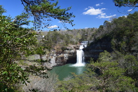
Alabama's Little River is one of the few rivers in the United States that flows along a mountaintop. The headwaters of both the West Fork and East Fork of the Little River are in northwest Georgia on Lookout Mountain. Both forks of the river continue flowing along Lookout Mountain into Alabama, gradually carving out their own gorges on the mountain, before merging together and entering the Little River Canyon. Upon the end of Little River Canyon, the Little River flows into the Coosa River. One of the major landmarks on the West Fork of the Little River is De Soto Falls - an impressive waterfall that drops more than 100 feet into a rock amphitheater. The official view of the falls is from a rock outcrop on the side of the falls at the end of Desoto Falls Road. However, many people are not aware of an unofficial trail system that leads to the base of the falls. This hike occurred on Saturday, April 2nd, 2016. My plan was to take the unofficial trail from Desoto Falls Road past Icebox Cave to the base of De Soto Falls. Then, I would return to the road and take another unofficial trail to a view that would take in all of De Soto Falls and its basin.
Summary
R/T Length of Trail: 2.3 Miles
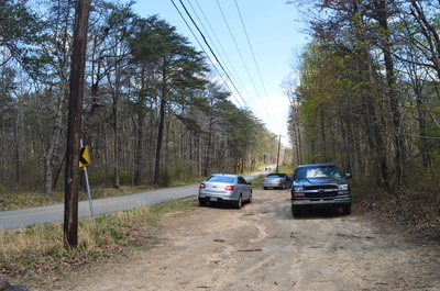
Duration of Hike: 1:40 Type of Hike: Two Out and Back Trails Difficulty Rating: 2 out of 10 Total Elevation Gain: 384 Feet Pros: The unofficial trail to the base of Desoto Falls receives good use, making it much easier to follow than one could imagine Cons: None Points of Interest: Desoto Falls (Base View) - 7 stars; Desoto Falls (Front Basin View) - 8 stars; Icebox Cave Trail Blaze Color(s): None Best Season(s) to Hike: Year-round Fees: None Beginning Point: Dirt pullout on Desoto Falls Road Directions: From Mentone, AL: Follow County Road 89 (Scenic Highway) South for 2.2 miles to Tutwiler Gap. Then, turn left onto County Road 613 (Desoto Falls Road). Continue for 0.6 miles. Then, at a place where the road curves to the left, with a powerline clearing to the right, turn right into a dirt pullout next to the powerline clearing. There are no signs here, but this is the trailhead for the trails to the views of De Soto Falls. Map
Click here for more information and to download this trail map to view in Garmin Basecamp
Details
I heard about De Soto Falls - one of Alabama's tallest waterfalls - a while ago, but the information online regarding how to get to the base of the falls was very sparse. For this reason, I had refrained to hiking to the base of the falls for quite some time. However, on the first weekend of April, I decided it would be the perfect time to see the waterfalls in Desoto State Park, following periods of rain. Since Desoto State Park is just a handful of miles south of De Soto Falls, I figured that I could throw in the short hike to De Soto Falls as well. Although I wasn't sure what to expect in terms of trail maintenance for the De Soto Falls hike, I was relieved when I found that the trail was well-traveled and easy to follow.
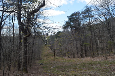
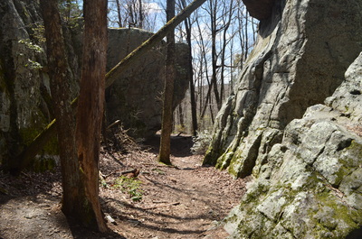
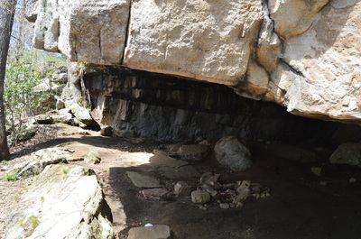
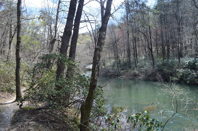
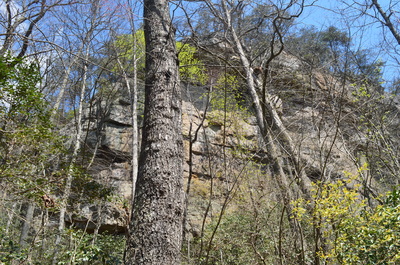
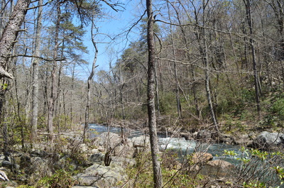
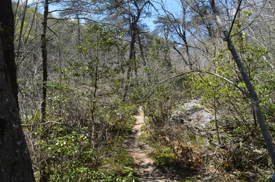
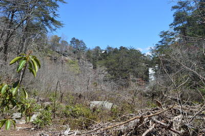
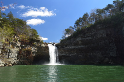
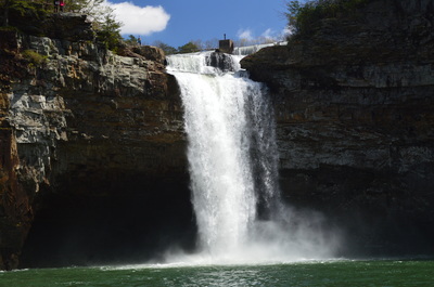
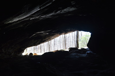
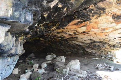
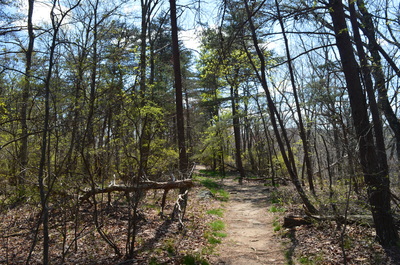
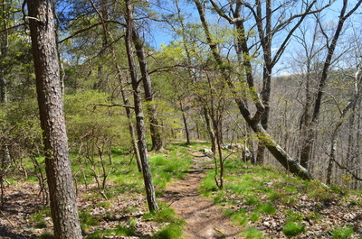
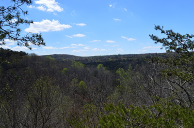
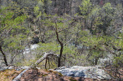
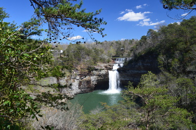
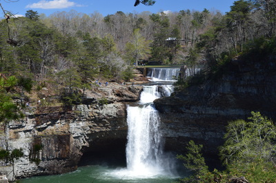
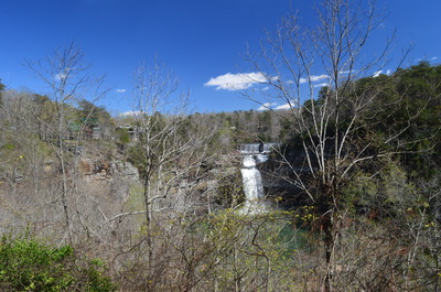
From the dirt pullout on Desoto Falls Road, there are two trails that lead to vastly different views of De Soto Falls. The obvious trail heads away on flat terrain from the parking area and to the south. This is the trail to the panorama of the falls and its basin - leave it for later. The beginning of the second trail, that leads to the base of the falls, is not as obvious. Start the hike by walking down the parking pullout to the powerline clearing next to the road. Walk down the clearing for several feet, and then, bear left onto an obvious pathway. This is the trail to the base of Desoto Falls. The trail descends a bit and then follows the base of a bluff line to the left. At 0.2 miles, reach the first point of interest on this hike: Icebox Cave - on the trail's left. This is not a true cave. It is actually a rock overhang with a lot of space underneath. Icebox Cave is larger than a typical rockhouse - you can walk quite a bit to the back of the rockhouse in the bluffs. This is a good spot to take shelter, if you get hit by a sudden thunderstorm. Shortly after Icebox Cave, reach an intersection. Here, a trail continues straight along the bluffs while a second trail turns right and descends into the gorge. I do not know where the trail straight leads, although I have heard it is the trail to Welch Caves. For my hike to the base of Desoto Falls, I turned right onto a well-defined path that began to descend moderately. Reach the bottom of the gorge at the West Fork of the Little River at 0.3 miles. Here, a trail goes both to the left and right, paralleling the river. I do not know where the trail to the right leads, but in order to get to Desoto Falls, turn left and follow the river upstream. The river is quite calm here, but as you continue upstream, some cascades begin to appear. You will pass another trail coming in from the left. This may be the same trail that continued straight at the bluffs. After this, enter a sandy area with a campsite and enter increasingly rocky terrain as the river makes a bend. Some tall bluffs at the rim of the gorge are visible to the left through the trees, The flat trail remains obvious until it reaches the huge pool below De Soto Falls at 0.7 miles. Continue just a little bit further to a large rock with a great view of De Soto Falls. This is one of Alabama's tallest waterfalls, and with adequate water, it is quite beautiful. Near the top of the falls, on a large rock to the left of the waterfall, I could see a large amount of people milling around. Upon seeing me, those people were probably wondering how I got to the base of the falls! After all, the route was a lot easier than I was led to believe. Also, please note that the trail always stays on the west side of the river, without crossing it, contrary to what my GPS recorded. From the base De Soto Falls, retrace your steps back to the parking area. Reach the parking area at 1.4 miles. However, the hike isn't over yet. Take the second trail - the trail that heads directly away from the pullout, following the rim of the gorge. The trail originally stays very close to the lower trail, except the lower trail follows the base of the rather tall bluff line, while the upper trail (that you're on) follows the rim of the bluff line. At 1.6 miles, reach a rock outcrop that provides a limited view of the gorge to the right of the trail. At 1.75 miles, reach another rock outcrop that provides through-the-trees views of the the river below. Here, the trail curves left. Make sure to continue to follow the rim of the bluff line and gorge, as there are a lot of different paths here and it can get confusing. The entire upper trail stays very close to the rim of the gorge. At 1.8 miles, reach a rock outcrop to the right of the trail. This rock outcrop provides the best panorama of De Soto Falls and its pool. This is a very impressive view, as you can truly see the size of the falls' basin. You can also see a small lake above the falls, and a number of houses lining the sides of the gorge. Beyond this vista, you will see a house to the left on private property as you continue down the trail to a couple more panoramas of the area around the falls. However, these vistas are not as good due to some trees and brush blocking the views. I decided to turn around at 1.85 miles, having been convinced that I saw the best view of the falls. Follow the same route back to the parking area, concluding this double hike at 2.3 miles. Mileage
0.0 - Trailhead at Desoto Falls Road
0.2 - Icebox Cave 0.3 - West Fork Little River; turn left onto a trail along the river 0.7 - Base of De Soto Falls and pool 1.4 - Return to trailhead; turn right onto upper trail 1.6 - Limited view to right 1.8+ - Panoramic views of De Soto Falls and the surrounding area 2.3 - Return to the trailhead on Desoto Falls Road Variations
Hike just the lower trail to the base of De Soto Falls - 1.4 Miles
Hike just the upper trail to the panoramic views of the De Soto Falls area - 0.9 Miles Bonus Stops
PicturesVideos
13 Comments
Brandon Cao
10/24/2017 12:37:30 pm
Hi Mark, you are Awesome!
Reply
Bethany Redmond
3/27/2018 06:44:47 pm
Thank you for your detailed descriptions. We would not have known how to get to the base if I hadn't found your site. We truly enjoyed this hike!
Reply
Dawn
4/14/2018 09:37:37 pm
Thanks for the detailed directions. My husband and I were able to hike to the base of the falls with no problem. The view was amazing!
Reply
8/7/2018 05:17:47 pm
thanks for the detailed information. I have asked several park employees and got no information about this trail. I'm looking forward to getting to the base with the help of your information.
Reply
Ann Whitaker
1/19/2019 07:23:44 am
Thank you so much, I have been curious and I will hike both trails. If it ever stops raining every day that don'thave to work, I will go soon.
Reply
Johnny
2/21/2019 09:00:06 pm
I also will hike this trail and soon. Have been looking for info on this trail and thanks for all this detail.
Reply
Johnny
7/26/2019 11:41:27 am
Just checking back. Ann, did you get a chance to to hike this trail, and how was the fun? I was in Mentone recently, and went to the dam area, but not enough time to hike down. Will go next time.
Reply
Ann Whitaker
7/28/2019 09:05:04 pm
I did get a chance to go. I really enjoyed the hike and am grateful for this post giving directions. It was very easy to follow.
carson wade keith
7/26/2019 12:19:55 am
I will definitely have to try this. I have been down there once as a teenager,but I went across the Damm. This way seems much safer thanks for the info.
Reply
Ann
12/6/2019 12:47:43 pm
Thanks again for posting this and your clear directions on how to get to thr falls. I have share this link often. Maybe one day one of my friends will hike this trail also.
Reply
Ann Whitaker
4/16/2020 11:20:40 pm
I was up a couple of weeks ago. There has been a lot of work put into clearing thd path, placing signs snd markers.
Reply
5/16/2020 06:38:07 pm
I went today and it was beautiful. I saw some people way up top too On that rock loon off with no guard rail and I was afraid they would fall off!! How did they get up there?
Reply
5/16/2020 09:55:28 pm
I found the answer, horseback riding tours at Shady Grove Dude Ranch. :)
Reply
Leave a Reply. |
About MeMark Oleg Ozboyd Dear readers: I have invested a tremendous amount of time and effort in this website and the Georgia Waterfalls Database the past five years. All of the work that has gone in keeping these websites updated with my latest trip reports has almost been like a full-time job. This has not allowed me to pick up a paid job to save up money for college, and therefore, I I've had to take out loans. If you find the information on this website interesting, helpful, or time-saving, you can say "thanks" and help me out by clicking the button above and making a contribution. I will be very grateful for any amount of support you give, as all of it will apply toward my college tuition. Thank you!
Coming in 2022-2023?
Other Hiking WebsitesMiles HikedYear 1: 540.0 Miles
Year 2: 552.3 Miles Year 3: 518.4 Miles Year 4: 482.4 Miles Year 5: 259.9 Miles Archives
March 2021
Categories
All
|

 RSS Feed