Chattahoochee National Forest: Darnell Creek Loop Trail to Ramey Creek Falls, Dillard, Georgia5/1/2017 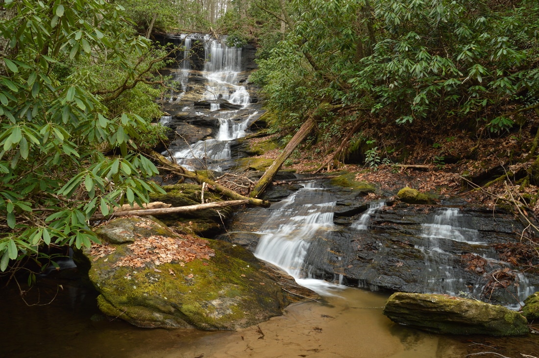
The Darnell Creek area is known for its abundance of notable waterfalls. All of the waterfalls on Darnell Creek and Thomas Creek - one of its two headwater tributaries - are close to Darnell Creek Road and are reached via short and easy hikes. But what about Darnell Creek's other headwater tributary, Ramey Creek? This creek, which is in no way less scenic than Thomas Creek, flows considerably further south and is reached by the Darnell Creek Trail: a well-established trail that first follows Darnell Creek and then Ramey Creek. The Darnell Creek Trail's biggest highlight is a 45-foot waterfall on Ramey Creek. Situated at the head of a narrow gorge, Ramey Creek Falls is a photogenic waterfall featuring a cliff over which the waterfall initially plunges, followed by a series of cascades down a number of rock outcrops. Taking the waterfall aside though, the Darnell Creek Trail is still a very pretty trail that passes numerous cascades and small waterfalls on Darnell Creek and Ramey Creek, in addition to a panoramic wintertime view of the grand 100-foot Big Falls on Thomas Creek in the distance across the valley. This hike occurred on Saturday, March 25th, 2017. My plan was to hike the Darnell Creek Trail to Ramey Creek Falls. From Ramey Creek Falls, I would add variety to my hike by hiking the TR 61A Loop (Darnell Creek Loop), rejoining the Darnell Creek Trail at Pine Gap Branch and retracing my steps the rest of the way to the trailhead.
Summary
R/T Length of Trail: 4.1 Miles
Duration of Hike: 3:25 Type of Hike: Lasso Difficulty Rating: 4 out of 10 Total Elevation Gain: 900 Feet Pros: Very well-graded trail along Darnell Creek and Ramey Creek Cons: It is difficult to see Big Falls on Thomas Creek across the valley in summer, when there are leaves on the trees Points of Interest: Distant View of Big Falls on Thomas Creek; Ramey Creek Falls - 8 stars; Pine Gap Branch Falls - 1 star Trail Blaze Colors: Darnell Creek Trail - Green Diamonds; Darnell Creek Loop - Green Diamonds; Ramey Creek Falls Side Trail - None/Unmarked Best Seasons to Hike: Winter (or Early Spring due to wet ford) Fees: None Beginning Point: Darnell Creek Horse Trailhead (Darnell Creek Road) Directions from Dillard, GA: From the intersection of Bettys Creek Road and US 23/441 in DIllard, follow US 23/441 South for 0.9 miles. Then, turn left onto Kelly's Creek Road and continue for 1.0 miles. Next, turn right onto Darnell Creek Road. In 0.5 miles, there is a confusing fork, where the road splits into three. The middle and right forks of the road are private roads. Take the leftmost fork - the only downhill road - which is the continuation of Darnell Creek Road. In another 350 feet, after a bridge across Darnell Creek, the road turns into Forest Road 150. Forest Road 150 is in good condition all the way to each of the waterfalls described in this trail report, and it can be driven by most passenger vehicles. Furthermore, fresh gravel has recently been added to the lower section of the road, and by the time I have written this, perhaps more of the road has been graveled. Keep in mind that the road condition significantly deteriorates higher up, past the trailhead for Middle Thomas Creek Falls. From the beginning of FS 150, drive for 0.7 miles to the Darnell Creek Trailhead. The marked trail begins on the right side of the road, and there is space for one car in front of the trail without completely blocking it. Also, a short distance ahead, in a left-hand curve in the road, there is a pullout on the right with space for one to two cars. Map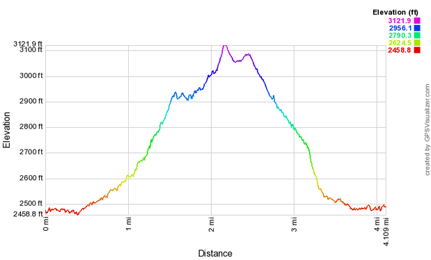
Click here to download a track of this hike.
Details
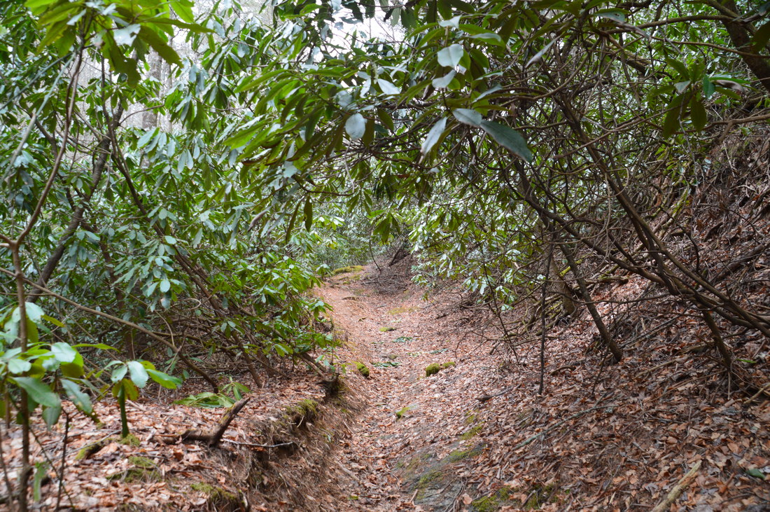
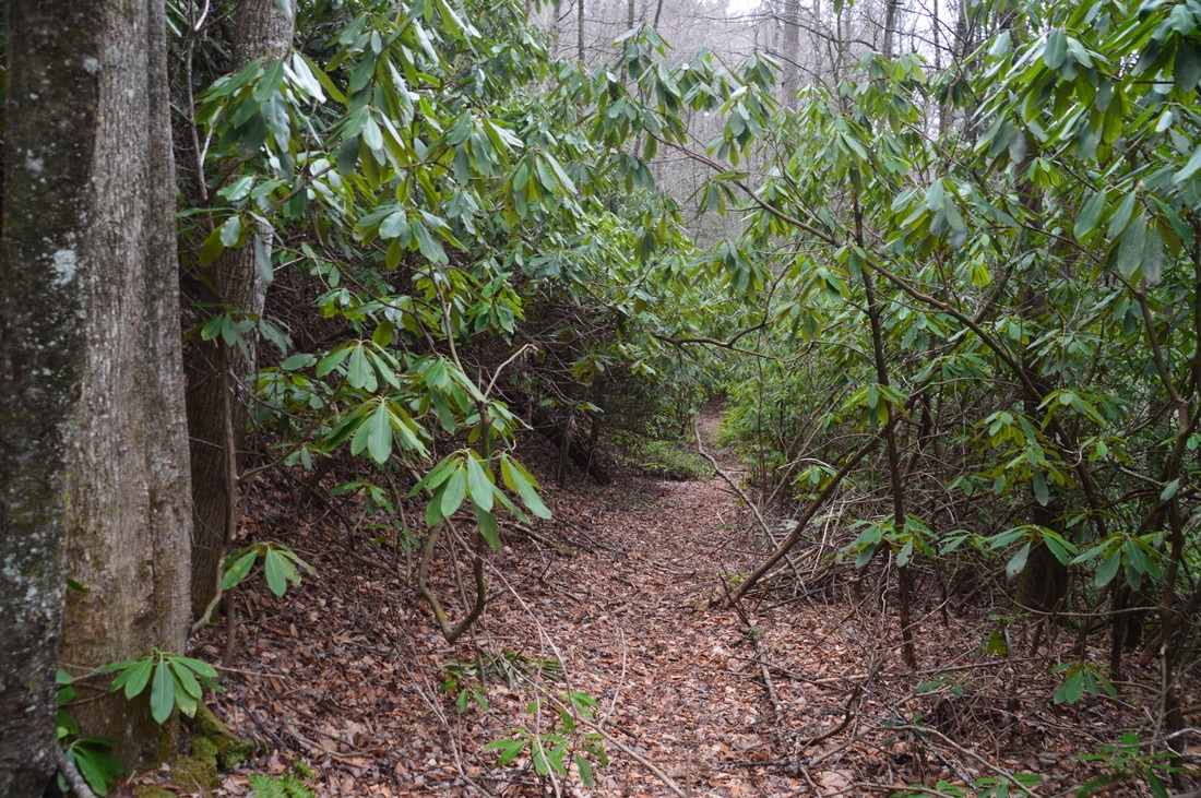
The hike along the Darnell Creek Trail is one of the most gorgeous streamside hikes in Georgia, as throughout much of the trail's length, you are treated to continuous views of the countless cascades and small waterfalls on Darnell Creek and Ramey Creek, in addition to at least two major waterfalls. After doing this hike, I can conclude that it easily meets the criteria for a "Best Hike". Notably, the Darnell Creek Trail is classified as a horse trail and is open to equestrian traffic in addition to foot traffic, but there were no noticeable signs of significant horse usage.
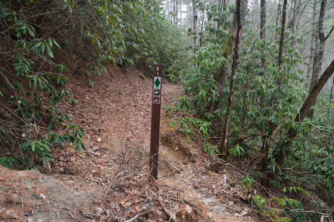
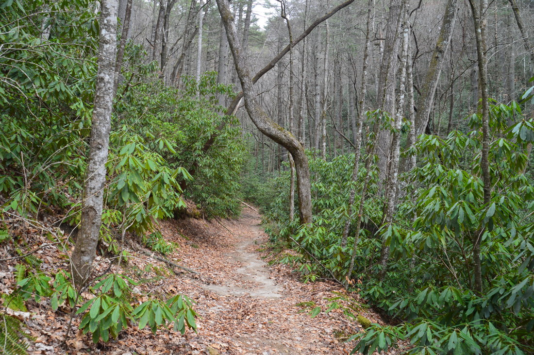
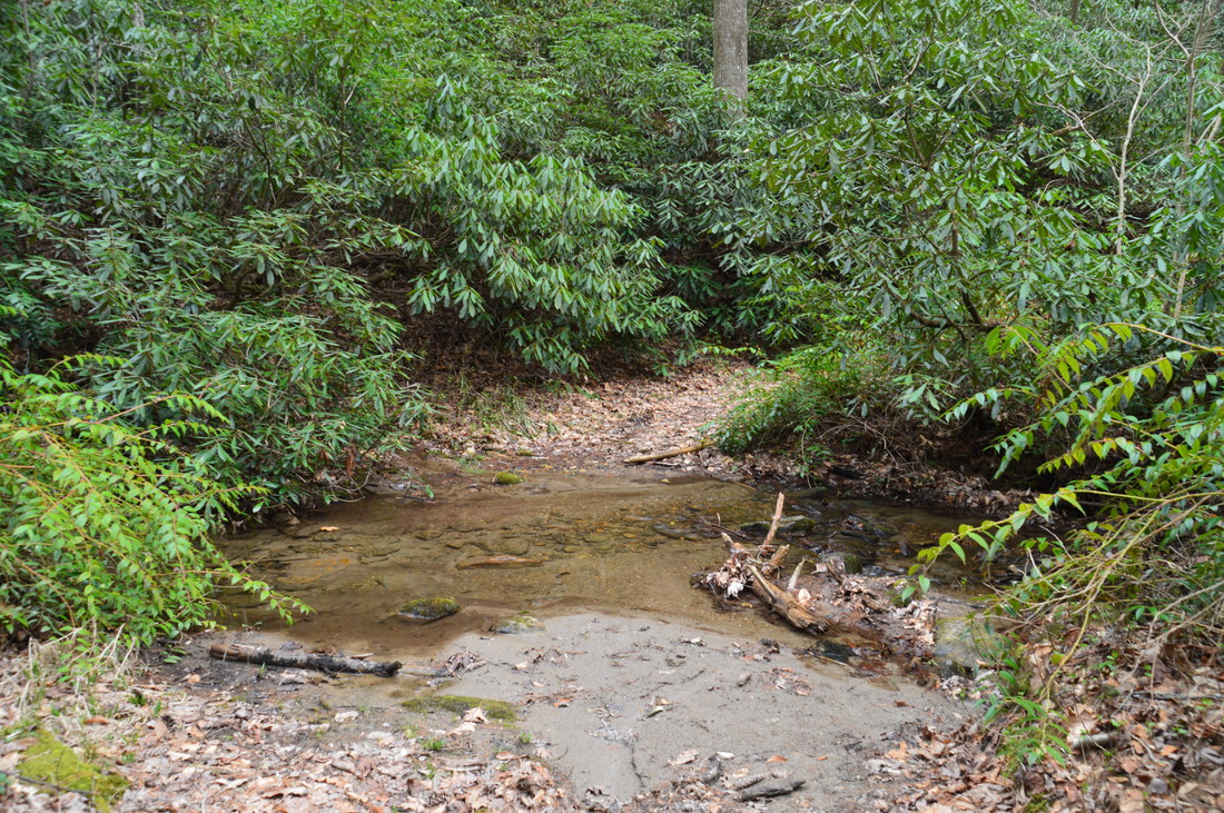
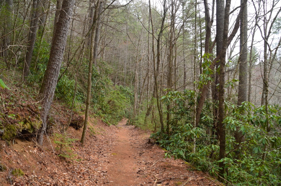
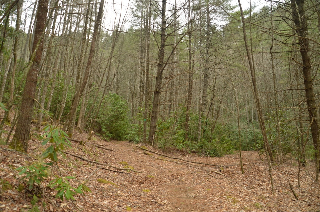
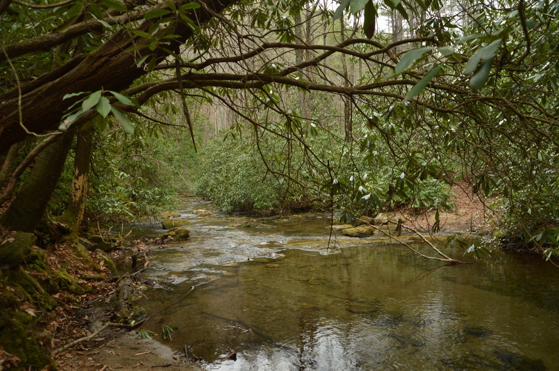
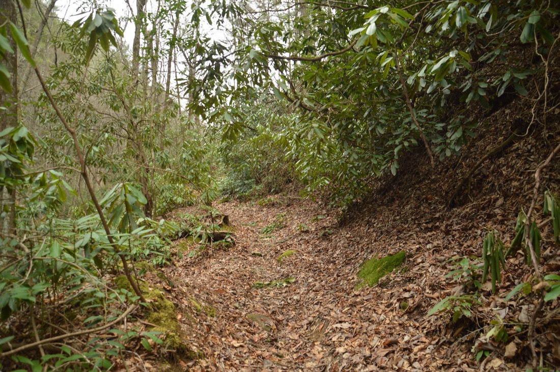
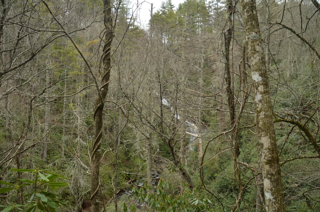
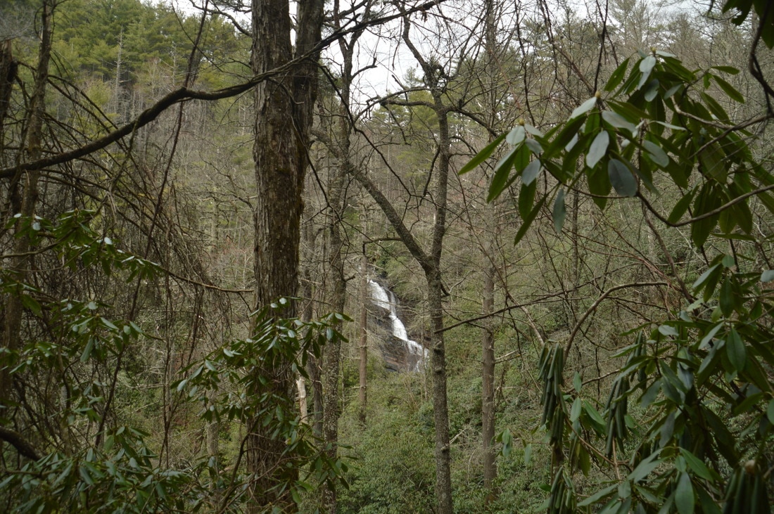
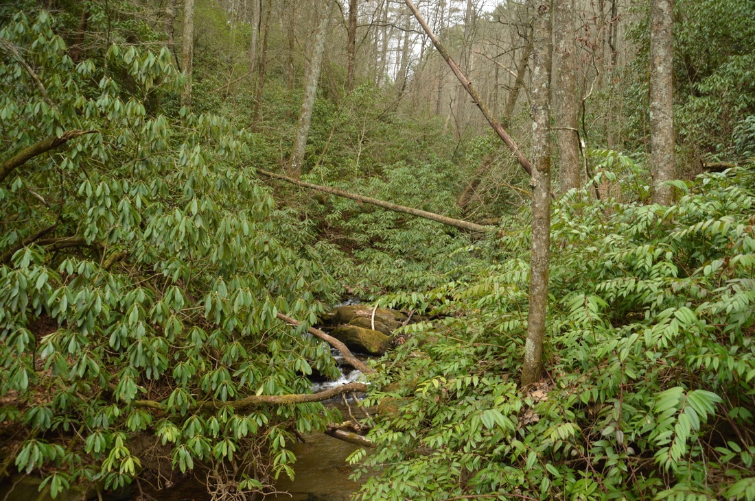
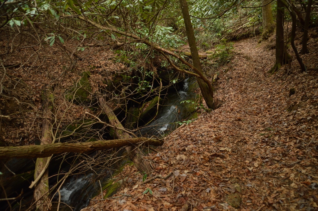
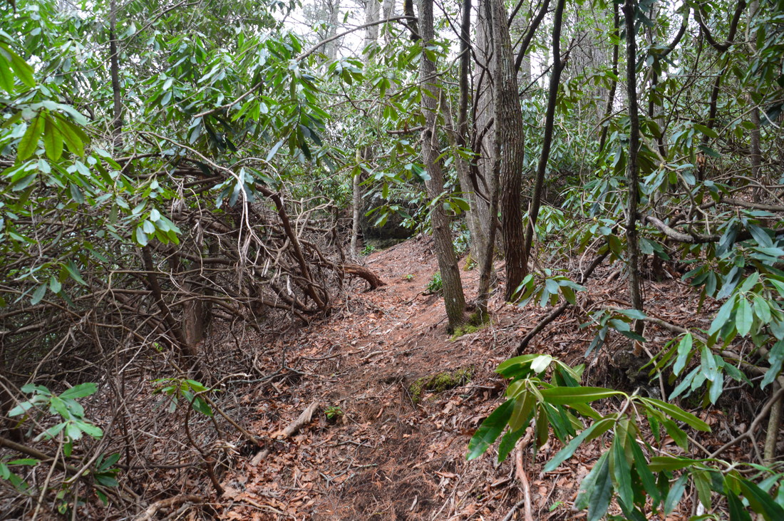
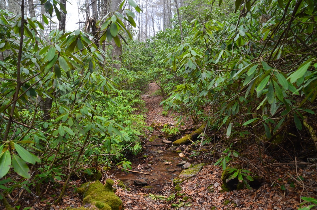
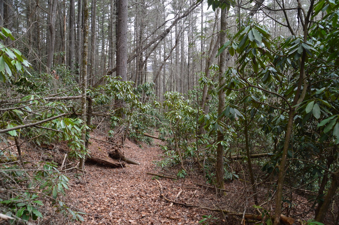
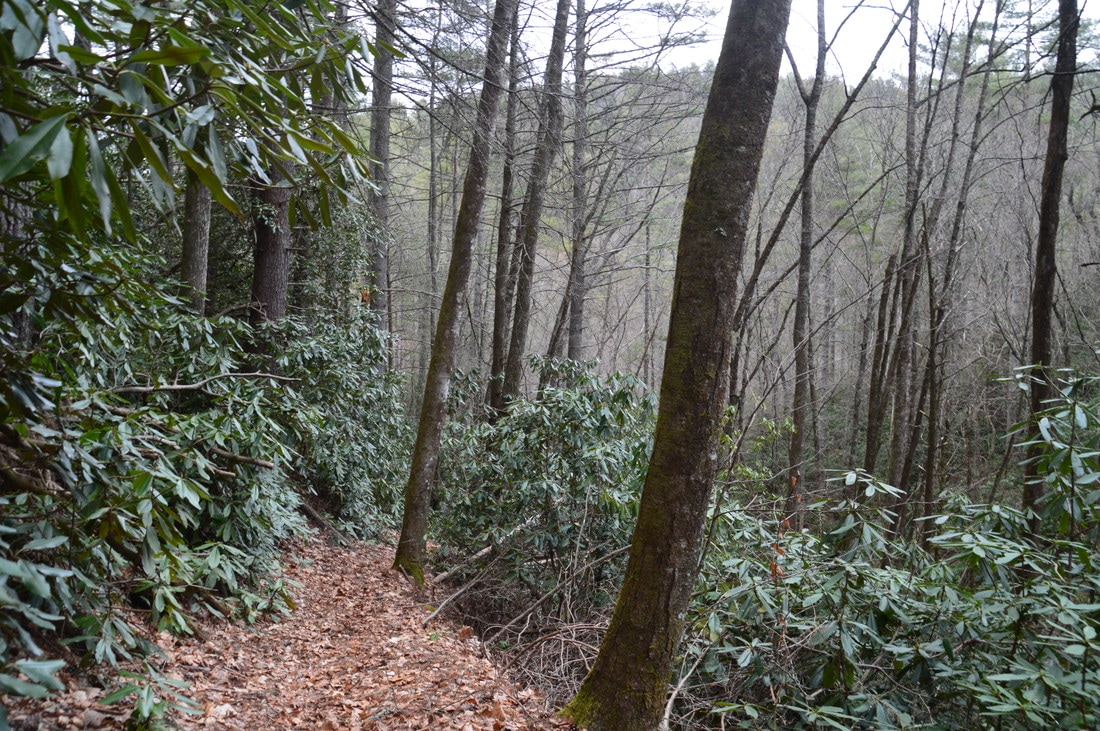
The hike begins at the lower Darnell Creek Trailhead off Darnell Creek Road. There are two other trailheads for the Darnell Creek Trail on Wilson Gap Road, but the easier hike to Ramey Creek Falls is from Darnell Creek Road. From the Darnell Creek Road trailhead, pick up the trail over a pair of jeep mounds and past a carsonite trail marker with #61 and a green diamond on it. The broad trail follows an old logging grade, and it will continue to do so for much of its length. The trail curves east at 0.05 miles into the Hoojah Branch valley, and at 0.1 miles, it crosses Hoojah Branch. I was able to rock hop the stream today, but it will be a wade during higher water levels. Upstream on Hoojah Branch are a number of large cascades and small waterfalls, but they do not appear to be worth the effort needed to reach them. After Hoojah Branch, the trail descends gently toward Darnell Creek and then begins closely following it upstream, staying nearly level about 20 feet above the creek. In this stretch, there are many noisy cascades down below. At 0.7 miles, the Darnell Creek Trail passes through a flat next to the creek - where camping is a possibility - and then reaches a shallow ford of Darnell Creek at a wide spot. Even though you're nearly guaranteed to get wet feet here, the ford was only ankle-deep today and is likely below knee-level most of the time. The trail continues on the south side of the creek, but it becomes slightly more difficult as the gorge narrows and the trail begins an easy to moderate ascent. At 0.8 miles, there is an unmarked but conspicuous intersection, where the loop section of the hike begins. Here, the Darnell Creek Trail continues straight, while the Darnell Creek Loop Trail (#61A) leaves to the right along Pine Gap Branch. You will return from the right, but for now, continue straight along Darnell Creek. A few yards after the intersection is a rock-hop crossing of Pine Gap Branch, followed by another tributary. After this, the trail continues following Darnell Creek closely, providing views of numerous small rhododendron-lined waterfalls, but with time, the trail begins ascending more steeply above Darnell Creek to bypass the rugged area around the confluence of Thomas Creek and Ramey Creek. At 1.3 miles, the trail - now about 100 to 150 feet above the creek - passes the confluence of Thomas Creek and Ramey Creek. This is where Big Falls on Thomas Creek is visible in the winter directly across the valley. When the leaves are off the trees, this is quite a sight that cannot be captured well by photos, as Big Falls falls 100 feet in multiple drops, with the main drop having a height of 70 feet. The view of this waterfall from the trail is unique, but there is no easy way to get to it from the Darnell Creek Trail. For a closer view of Big Falls on Thomas Creek, it is best to hike a short but steep trail from Darnell Creek Road. 
In winter, the view of 100-foot Big Falls on Thomas Creek across the valley from the Darnell Creek Trail is impressive.
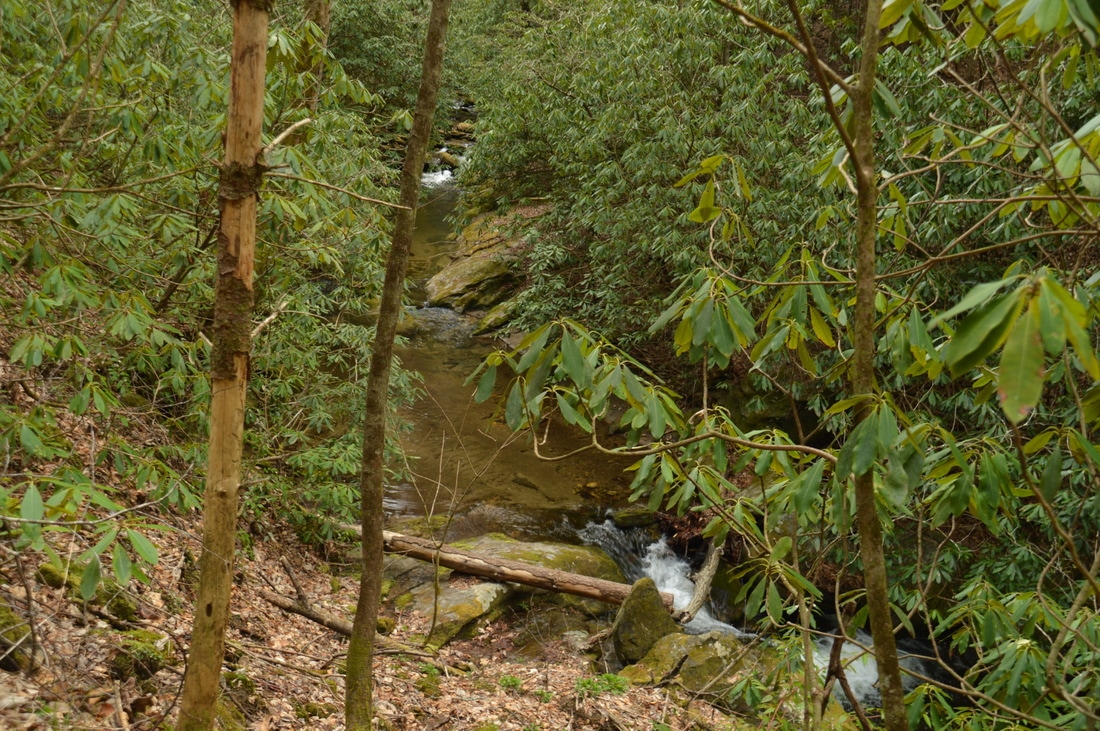
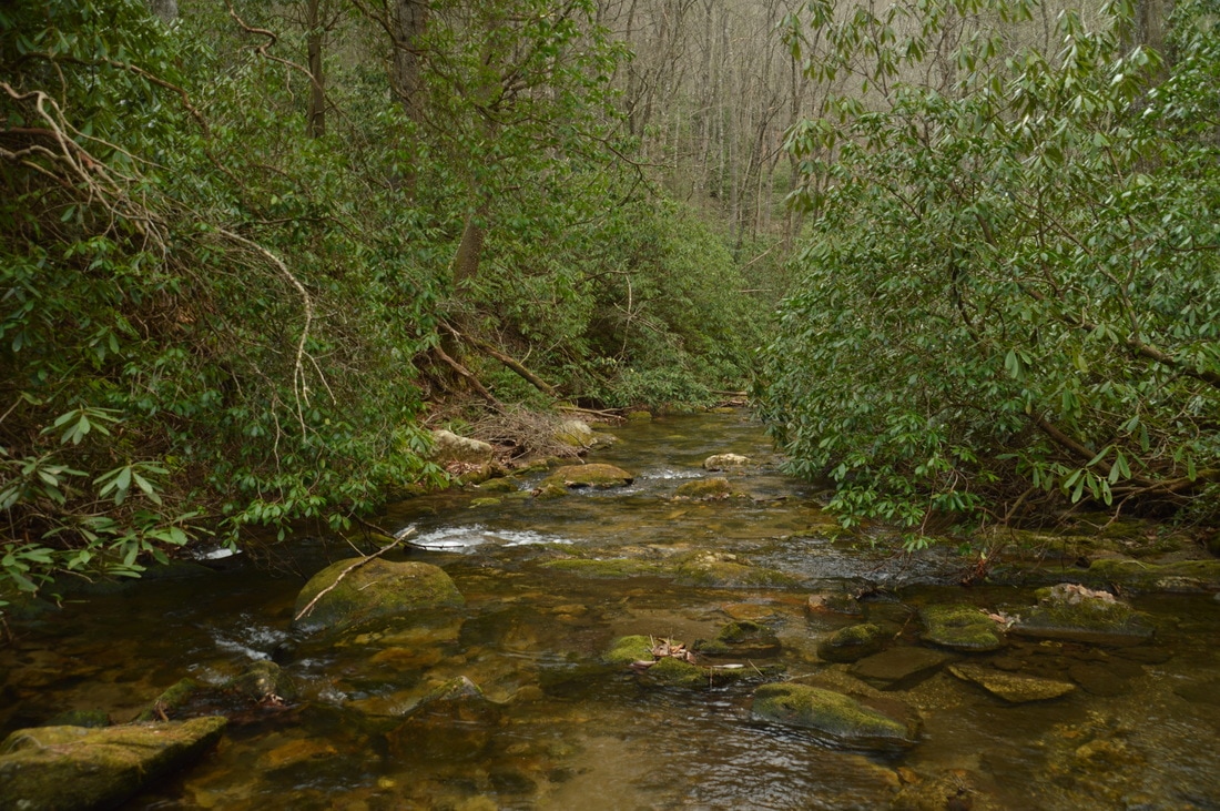
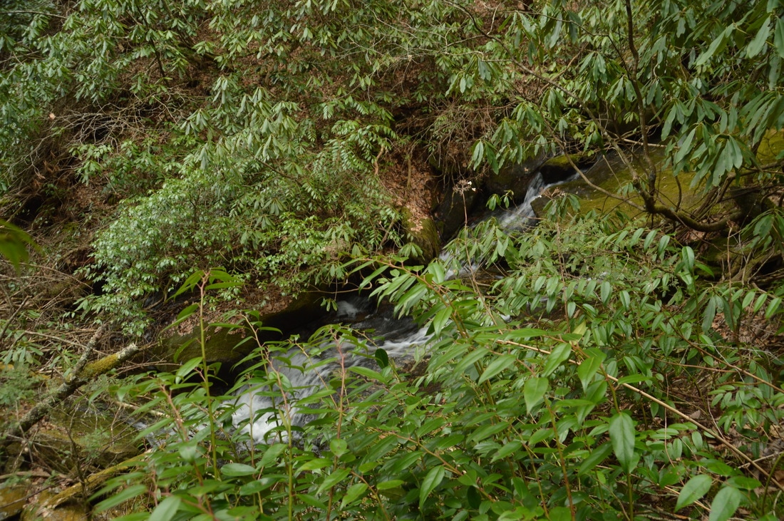
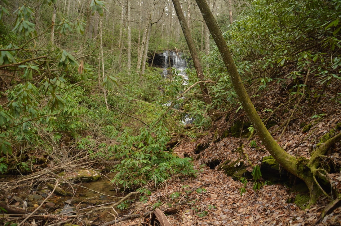
As the trail leaves the view of Big Falls, the trail is now following Ramey Creek, which forms Darnell Creek at the Thomas Creek confluence. Some maps seem to indicate that this is still Darnell Creek, but I do not think that those maps are correct. Ramey Creek can be heard far below in a very tight gorge. At 1.35 miles, the trail reaches the level of Ramey Creek at a sizable cascade, and there is a glimpse of the creek tumbling into the narrow gorge below. Directly above this spot, Ramey Creek is lined by dozens of tall rhododendron bushes that make it look very pretty. As the trail continues ascending moderately along the old logging road, it gradually meanders away from Ramey Creek, reaching a picturesque slide on a tributary at 1.5 miles. Some maps indicate that this is the actual Darnell Creek, while Ramey Creek turns east, but once again, I think that they are wrong, as the tributary is considerably smaller than Ramey Creek. Just past the slide, the trail makes a rock-hop crossing of the tributary, turning left and ascending a set of broad stone steps.
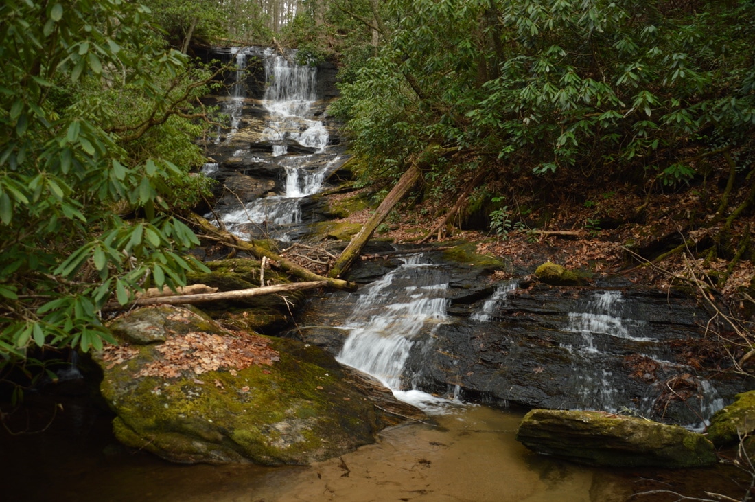
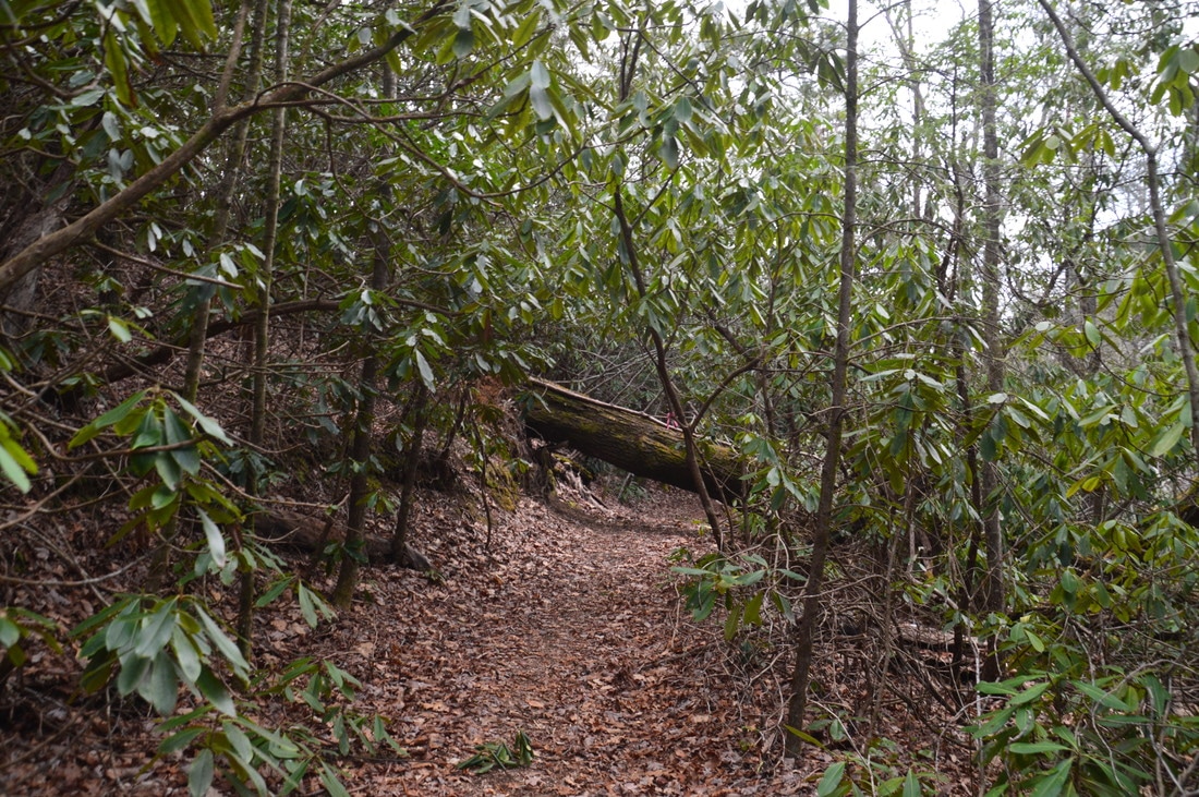
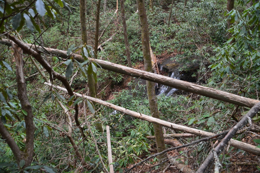
At the top of the stone steps, at 1.55 miles, is an unsigned intersection with the side trail to Ramey Creek Falls, which leaves to the left while the Darnell Creek Trail continues straight. Turn onto the side trail, which is unmarked but easy to follow. The trail passes over a small ridge, curves east, descends to Ramey Creek, and ends at Ramey Creek Falls at 1.65 miles. Ramey Creek Falls is a very photogenic waterfall. Ramey Creek drops over a cliff and then cascades down a long series of rock outcrops and slabs, culminating in a very shallow pool. There is some minor tree litter near the bottom but it does not detract from the scene. The full waterfall, including all of the cascades, is around 45 feet high and resembles a miniature version of Dismal Falls near Cashiers, North Carolina. Note: I think that there may be a 20-foot (or taller) upper waterfall on Ramey Creek at the 3120-foot elevation, not far off the Darnell Creek Trail. However, I have heard that access to the potential location is very difficult, due to severe tornado damage in the vicinity. From Ramey Creek Falls, return to the main trail at 1.75 miles and turn left onto it. The trail ascends gently to another unsigned intersection at 1.85 miles (although when I did this hike, there was a rock cairn at the junction). This is where the Darnell Creek Trail turns left and continues on the old road toward two trailheads on Wilson Gap Road, while the other end of the Darnell Creek Loop is to the right. To continue on this hike, turn right onto the Darnell Creek Loop Trail, which descends to and crosses a pair of small streams. At the second stream crossing was an abundance of flagging tape. Based on maps, the full Darnell Creek Loop should follow the tributary's east side south to the summit of Oakey Mountain. However, I was not paying attention and followed the obvious route, which apparently is a shortcut that avoids the bulk of the ascent to Oakey Mountain. It might be that the south side of the Darnell Creek Loop is not maintained anymore. Regardless, follow the obvious trail as it climbs west out of the Ramey Creek valley. At 2.15 miles, after a very steep final pitch, the trail passes through a gap on a north-south lead from Oakey Mountain. 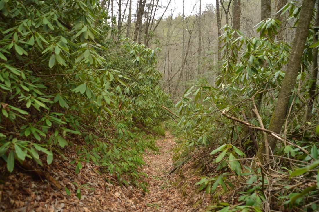
The Darnell Creek Trail is a well-built and maintained trail that provides easy access to some of the scenic sights on Darnell Creek and its tributaries.
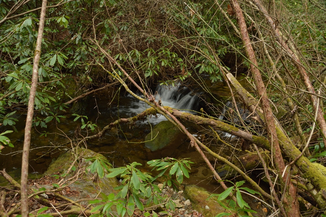
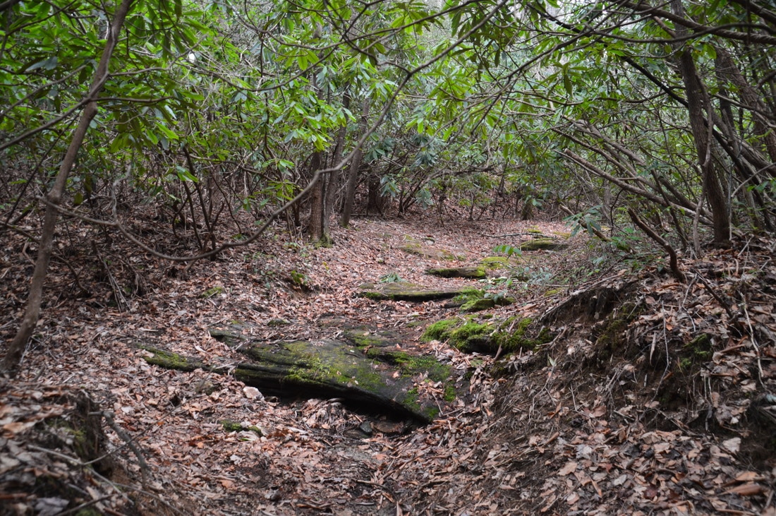
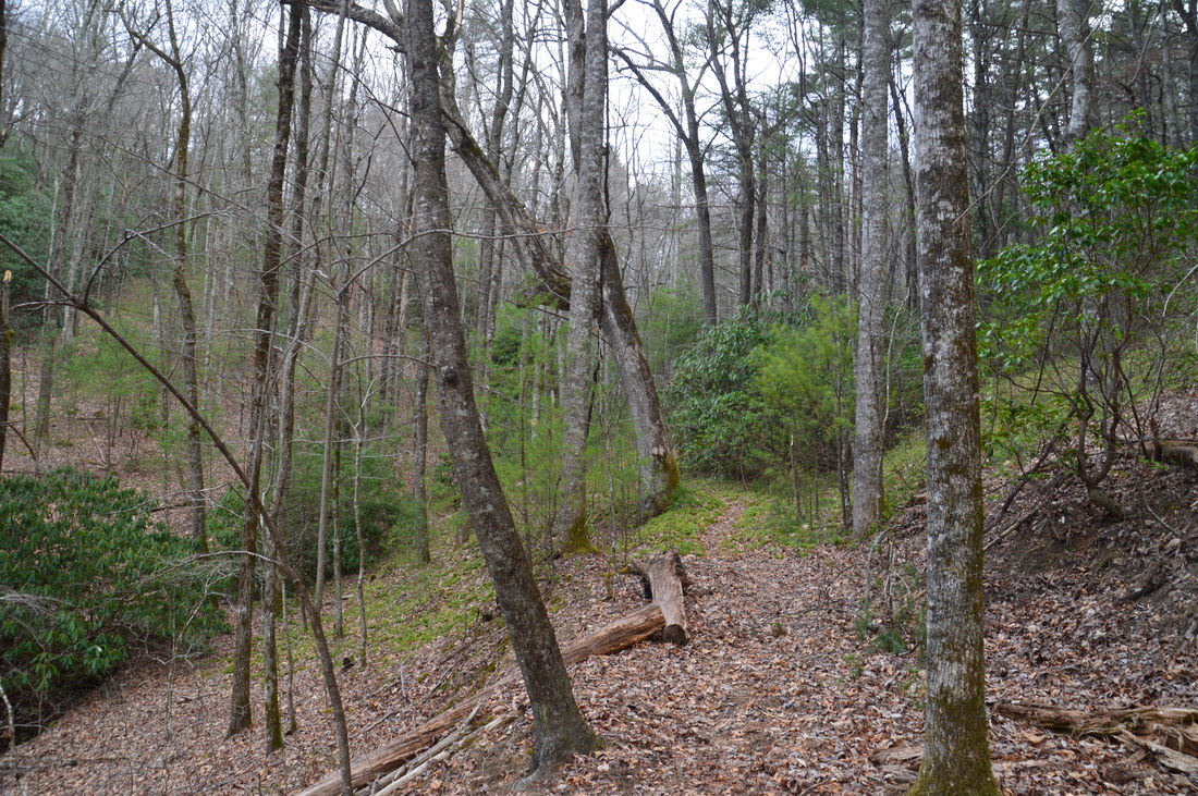
After the gap, from where Oakey Mountain is seen in winter to the south, the trail descends gently into a large flat with two small streams, before ascending to another ridge. At the top of the ridge, at 2.45 miles, is the west end of the "shortcut", where a wide old roadbed comes in from the left and continues straight as the trail joins it. I suppose that this roadbed is the route of the south side of the Darnell Creek Loop, but it is unclear if that part of the trail is still maintained. Regardless, begin hiking downhill back into the Darnell Creek valley. The trail winds in and out of several coves before dropping to Pine Gap Branch. The trail now follows Pine Gap Branch on its west side, and the descent gets steadily steeper as the trail dives into the valley, with the steepest part beginning at 3.15 miles. At 3.2 miles, the top of Pine Gap Branch Falls is visible to the right. This 20-foot single-drop waterfall has some water in it, but there is a lot of dead tree litter at the base of the falls, so it is probably not worth bushwhacking from the trail to the base of the waterfall unless you're doing this hike after heavy rain.
At 3.3 miles, the loop portion of the trail ends at the junction with the Darnell Creek Trail. Turn left onto the main trail, ford Darnell Creek, and retrace your steps from earlier in the day back to the trailhead, concluding this excellent moderate hike at 4.1 miles. Mileage
0.0 - Darnell Creek Trailhead
0.7 - Ford of Darnell Creek 0.8 - Begin loop 1.3 - View of Big Falls on Thomas Creek 1.65 - Ramey Creek Falls 2.15 - Highest point on the hike 3.2 - Ramey Creek Falls 3.3 - End loop 4.1 - Darnell Creek Trailhead Variations
Hike out and back to Ramey Creek Falls - 3.3 Miles
Bonus Stops
Besides Ramey Creek Falls, there are several other major waterfalls in the Darnell Creek watershed. Four of them - Darnell Creek Falls, Upper Darnell Creek Falls, Big Falls on Thomas Creek, and Middle Thomas Creek Falls - can be reached by short hikes from Darnell Creek Road.
PicturesVideos
0 Comments
Leave a Reply. |
About MeMark Oleg Ozboyd Dear readers: I have invested a tremendous amount of time and effort in this website and the Georgia Waterfalls Database the past five years. All of the work that has gone in keeping these websites updated with my latest trip reports has almost been like a full-time job. This has not allowed me to pick up a paid job to save up money for college, and therefore, I I've had to take out loans. If you find the information on this website interesting, helpful, or time-saving, you can say "thanks" and help me out by clicking the button above and making a contribution. I will be very grateful for any amount of support you give, as all of it will apply toward my college tuition. Thank you!

Coming in 2022-2023?
Other Hiking WebsitesMiles HikedYear 1: 540.0 Miles
Year 2: 552.3 Miles Year 3: 518.4 Miles Year 4: 482.4 Miles Year 5: 259.9 Miles Archives
March 2021
Categories
All
|


 RSS Feed