The Darnell Creek watershed, geologically located north of the Warwoman Shear, is loaded with waterfalls among the rugged terrain on the southwest side of Rabun Bald. The two known waterfalls on Darnell Creek and three known waterfalls on Thomas Creek, a major tributary of Darnell Creek, are all located within short hiking distance from FS Road 150 (Darnell Creek Road). Perhaps the most impressive waterfall of all is the monster Big Falls on Thomas Creek: a steep, sliding waterfall that consists of several sections, the most distinct of which has a height of 70 feet! Furthermore, there is now a recently-developed and fairly established trail to the Big Falls on Thomas Creek. Don't focus on Big Falls on Thomas Creek solely though, as the other waterfalls - while smaller - are at least as photogenic, and some might be even more beautiful, depending on your point of view. This hike occurred on Saturday, March 25th, 2017. My plan was to hike to each of the waterfalls on Darnell Creek and Thomas Creek in order from lowest elevation to highest elevation. The exception was that I skipped Upper Thomas Creek Falls, which requires a significant amount of water to look good.
This trail report is a bit different from most other trail reports on this website. Instead of describing one hike, this trail report describes a collection of four very short hikes on unofficial paths to waterfalls on Darnell Creek and Thomas Creek, near Darnell Creek Road. The total hiking distance for all four waterfalls is only 1.1 miles. For this reason, I am going to provide more information about each hike in its respective summaries below, while here, I am only going to provide the directions to each of the waterfall trailheads. Additionally, below is a map of all four short hikes.
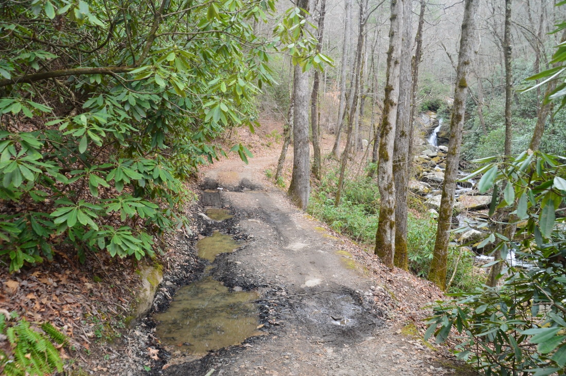
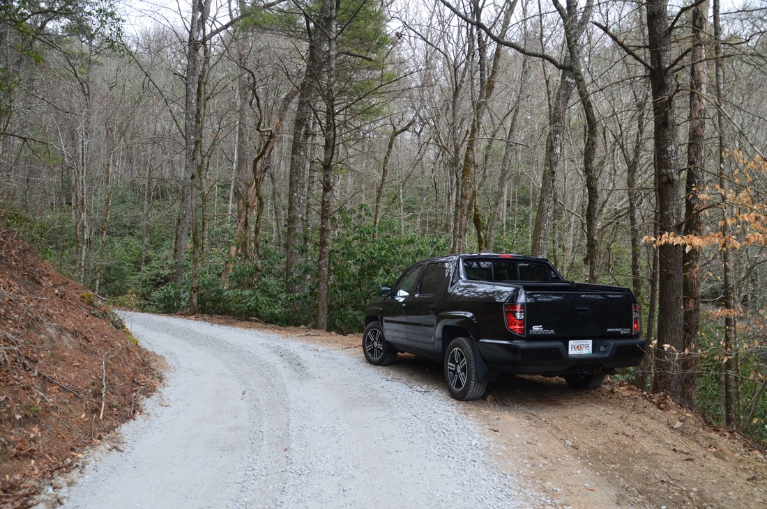
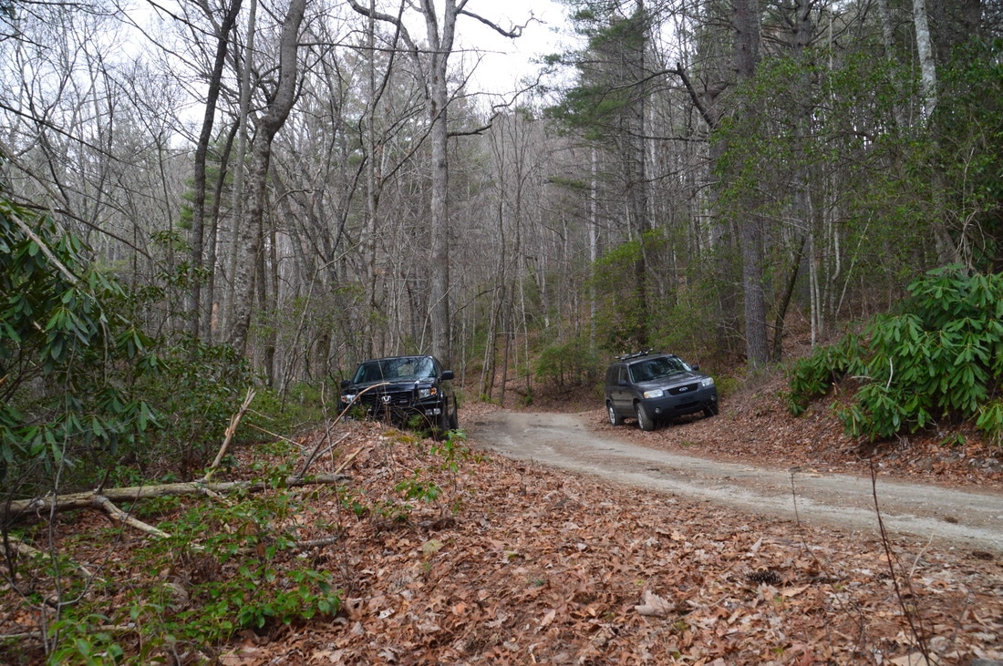
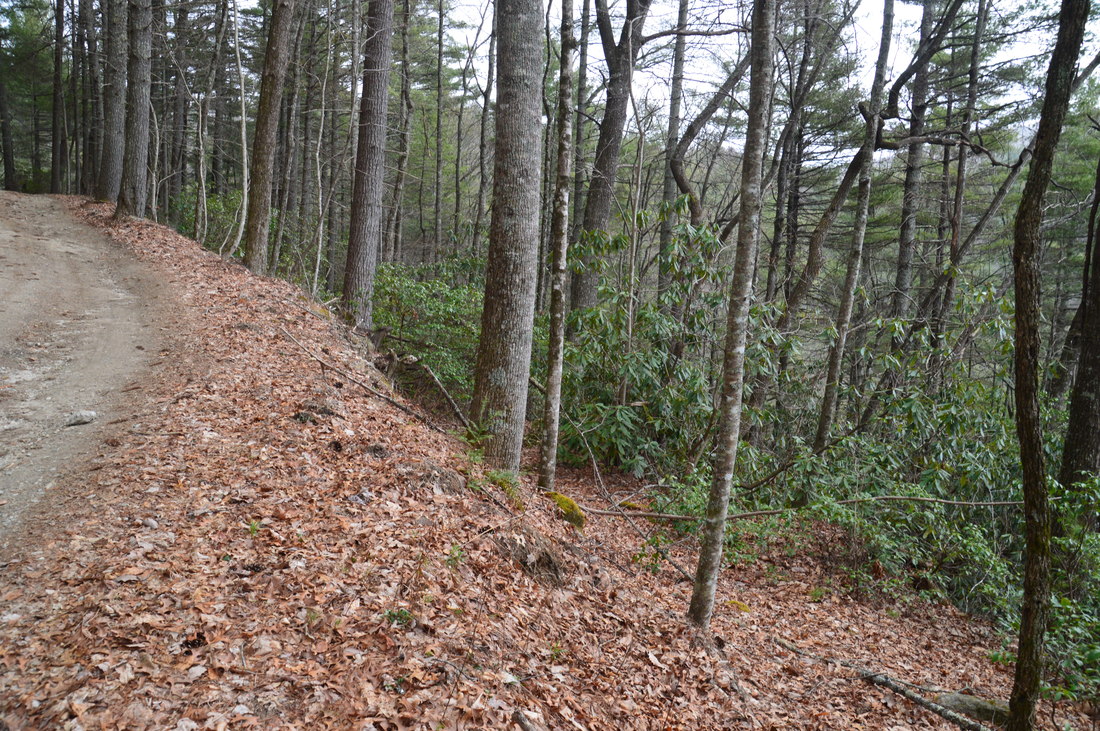
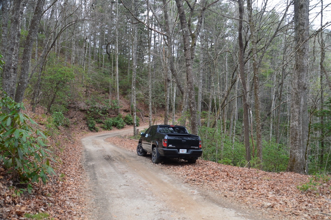
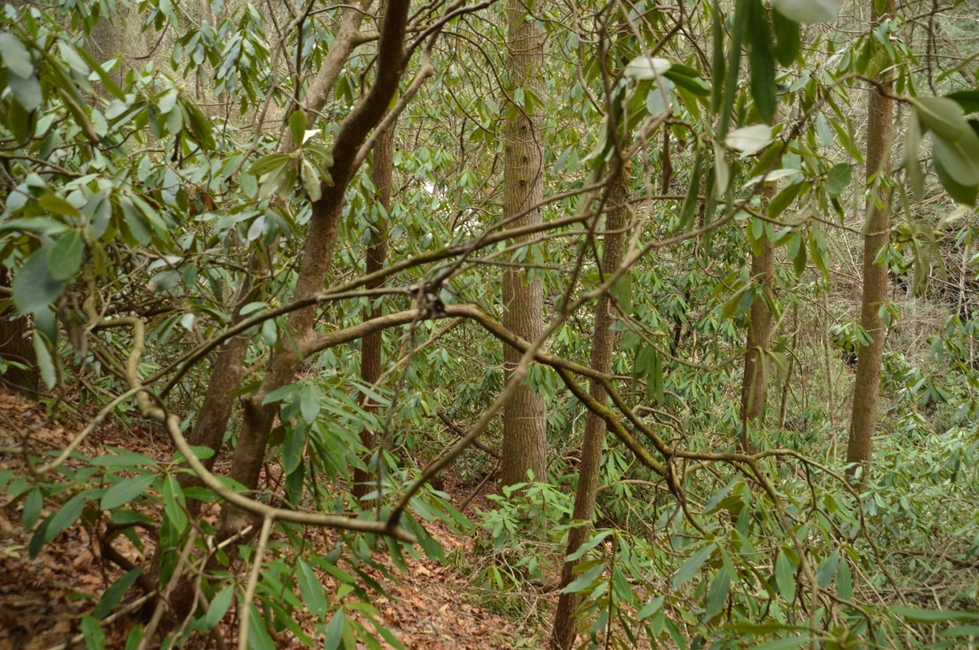
Directions from Dillard, GA: From the intersection of Bettys Creek Road and US 23/441 in DIllard, follow US 23/441 South for 0.9 miles. Then, turn left onto Kelly's Creek Road and continue for 1.0 miles. Next, turn right onto Darnell Creek Road. In 0.5 miles, there is a confusing fork, where the road splits into three. The middle and right forks of the road are private roads. Take the leftmost fork - the only downhill road - which is the continuation of Darnell Creek Road. In another 350 feet, after a bridge across Darnell Creek, the road turns into Forest Road 150. Forest Road 150 is in good condition all the way to each of the waterfalls described in this trail report, and it can be driven by most passenger vehicles. Furthermore, fresh gravel has recently been added to the lower section of the road, and by the time I have written this, perhaps more of the road has been graveled. Keep in mind that the road condition significantly deteriorates after the uppermost trailhead (Middle Thomas Creek Falls).
Map
Click here to download a track of this hike.
Darnell Creek Falls
R/T Length of Trail: 0.3 Miles
Duration of Hike: 0:25 Difficulty Rating: 1 out of 10 Total Elevation Gain: 20 Feet Waterfall Beauty Rating: 5 stars
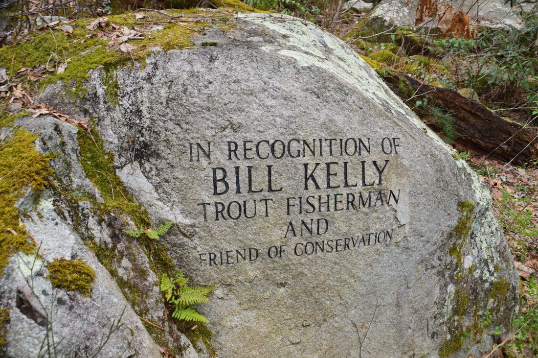
All four waterfall hikes described in this trail report are fairly easy - even though they are on unofficial trails - but Darnell Creek Falls is the easiest one for sure, and for that reason, it is also the most popular of the waterfalls on Darnell Creek and Thomas Creek. Of course, that is a relative term, as you're still not likely to run into people here. To reach Darnell Creek Falls, begin hiking along the right-hand split in the road where you parked. Keep in mind that the road leading to the falls (the road that you should start following) begins with a gentle downhill in the direction of Darnell Creek, at the same time as FS 150 climbs slightly away from the creek. After the initial downhill, the jeep road levels out near Darnell Creek, and Darnell Creek Falls soon comes into view. At 0.15 miles, the jeep road ends at a turnaround at Darnell Creek Falls. Unfortunately, the area was trashed up at the time of my visit. At the falls, there is a commemorating plaque about Bill Kelly, a trout fisherman who I believe helped to conserve for public use the tract of land that includes this waterfall and Upper Darnell Creek Falls.
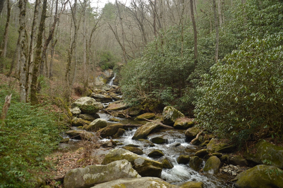
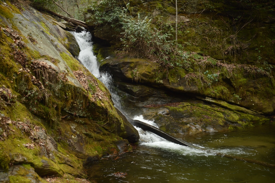
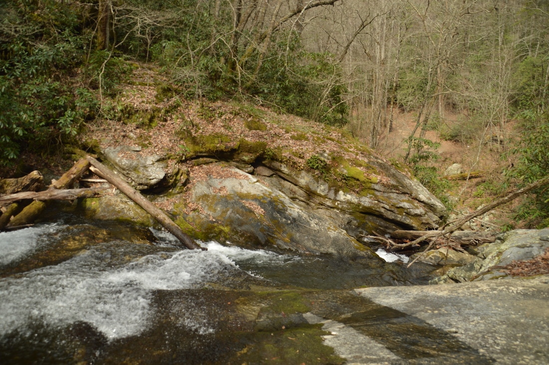
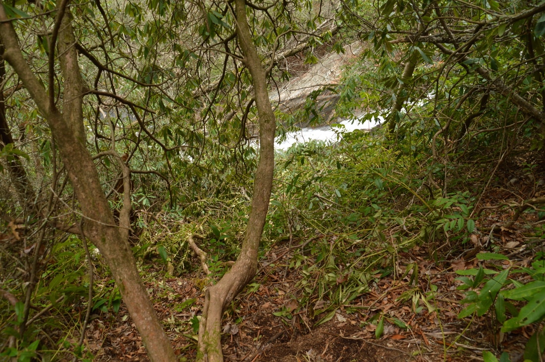
Darnell Creek Falls is a beautiful 30-foot waterfall, where Darnell Creek gushes through a narrow chute between two large rock outcrops. There is a nice pool at the base of the waterfall, and there are a few cascades a short distance downstream. Also, there is a 15-foot sliding cascade just above the main portion of Darnell Creek Falls, but it is out of sight from the base. However, you will visit that cascade along with the top of Darnell Creek Falls on your next stop: the hike to Upper Darnell Creek Falls. Simply retrace your steps back to the car from Darnell Creek Falls, concluding the first of the four hikes at 0.3 miles, and drive on to the next waterfall stop: Upper Darnell Creek Falls. 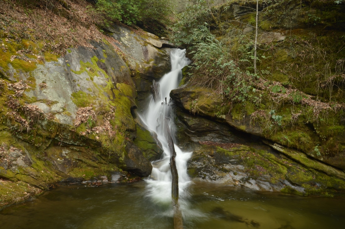
Darnell Creek Falls is a photogenic 30-foot chute waterfall.
Upper Darnell Creek Falls
R/T Length of Trail: 0.1 Miles
Duration of Hike: 0:40 Difficulty Rating: 1 out of 10 Total Elevation Gain: 60 Feet Waterfall Beauty Rating: 7 stars
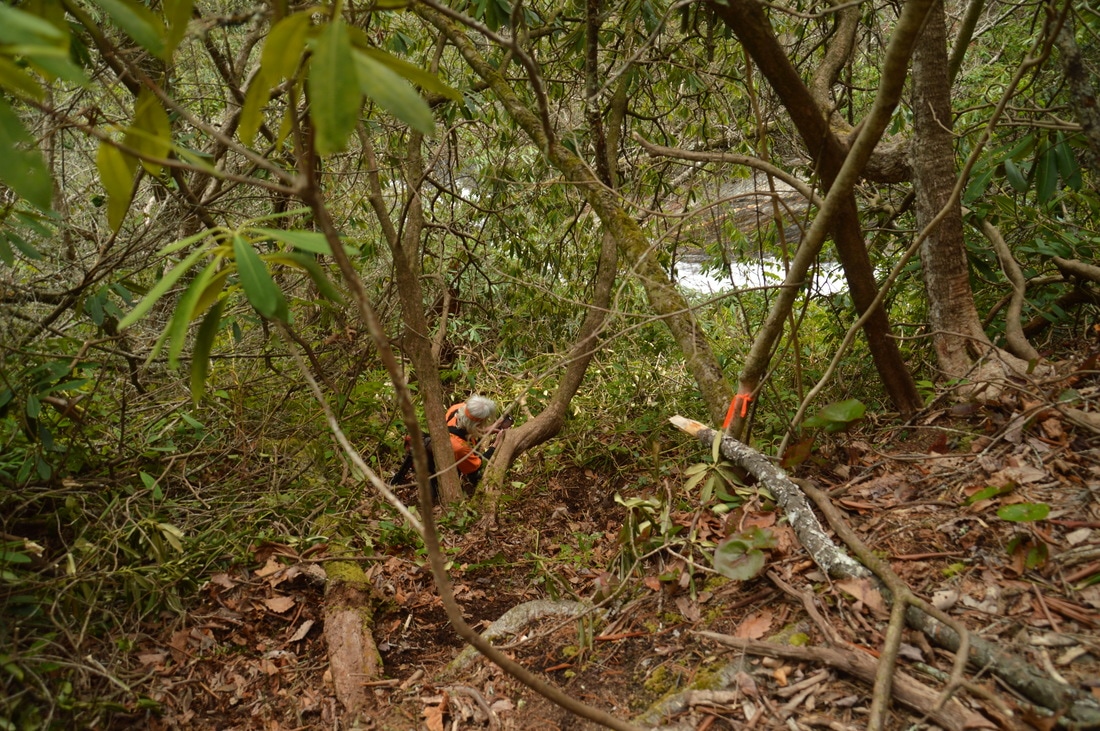
Begin the hike to Upper Darnell Creek Falls at the pullout near the left-hand curve on FS 150. Look for the stone that is a useful landmark for identifying the trailhead, and begin hiking down the slope behind the stone through open woods in the direction of Darnell Creek. The more obvious path heads straight toward the creek, and this path leads to the top of Darnell Creek Falls, while the path to Upper Darnell Creek Falls splits off to the left about 100 feet from the trailhead. However, it is worth visiting the top of Darnell Creek Falls, so keep straight for now - you should reach Darnell Creek just above Darnell Creek Falls less than 200 feet from the trailhead. Note that even if you do not see a clear path anywhere, simply hike in the direction of the creek - it's easy. The area at the top of Darnell Creek Falls is interesting, because there is both a view down the falls to the point where you were at a short while ago, and also, the 15-foot sliding cascade immediately above the falls is viewable here.
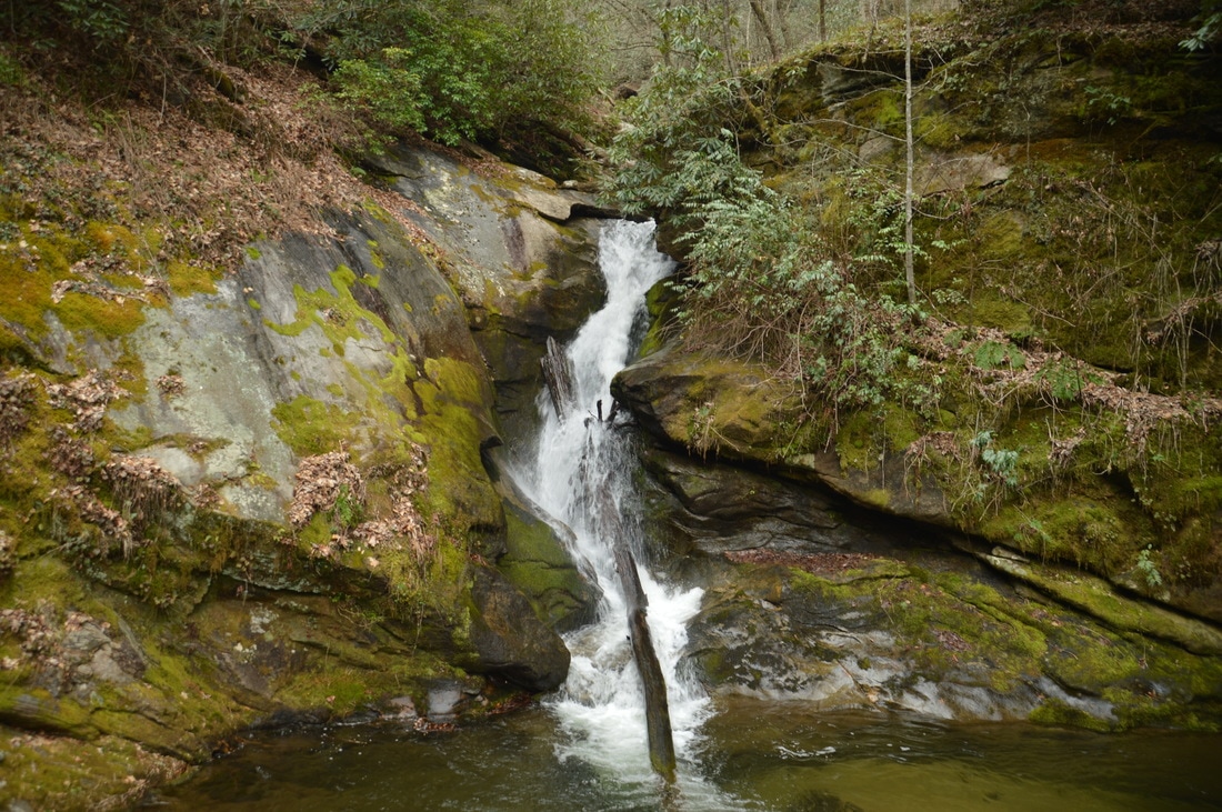
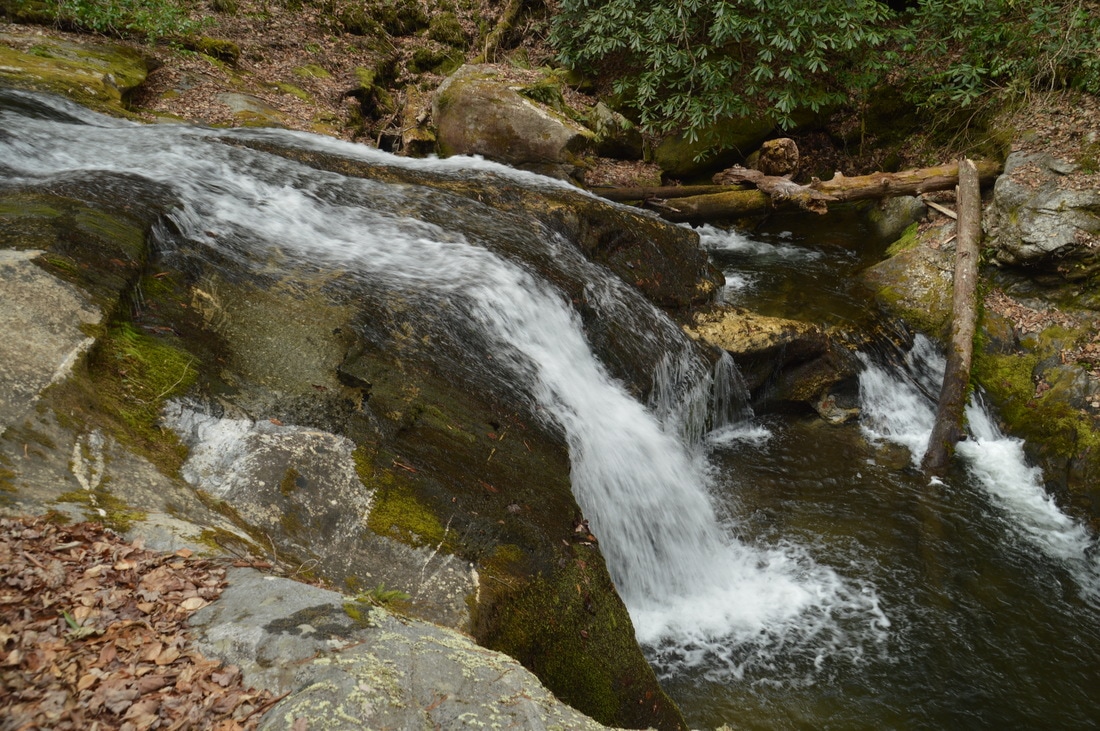
To get to Upper Darnell Creek Falls, return to the split and follow a faint path that heads diagonally in the upstream direction of Darnell Creek, soon reaching the creek again. Once again, even if you do not see the path, just follow the route of least resistance upstream along the creek, as the falls is very close. Keep in mind that the immediate bank of the creek is heavily overgrown just above Darnell Creek Falls, which is why you have to head back up to the split and then rejoin the creek a short distance upstream. Once you're at the creek, there are signs of a path along the bank, and about 400 feet after beginning the hike - and 150 feet after the path split - reach Upper Darnell Creek Falls. This is a very picturesque and gorgeous sliding waterfall. Here, Darnell Creek flows in twin ribbons of water down a broad rock face. Just like Darnell Creek Falls, there is a noteable pool at the bottom of Upper Darnell Creek Falls. The visible portion of the waterfall is about 35 feet high, but there is actually 30 to 35 feet more of falling water above! In fact, just out of sight from the base of Upper Darnell Creek Falls is a chute-like drop, and then above it, there is another sliding waterfall. However, getting to the upper parts of the waterfall from the base requires a messy and difficult bushwhack, so the easiest thing to do would be to hike to the top area of Upper Darnell Creek Falls from a different point of Darnell Creek Road. In my opinion, though, the view from the base of Upper Darnell Creek Falls is good enough already. From Upper Darnell Creek Falls, retrace your steps back to the road, concluding the hike at approximately 0.12 miles, and drive on to the next waterfall stop: Big Falls on Thomas Creek. 
A broad sliding waterfall, only half of which is visible from its base, Upper Darnell Creek Falls is an instant classic.
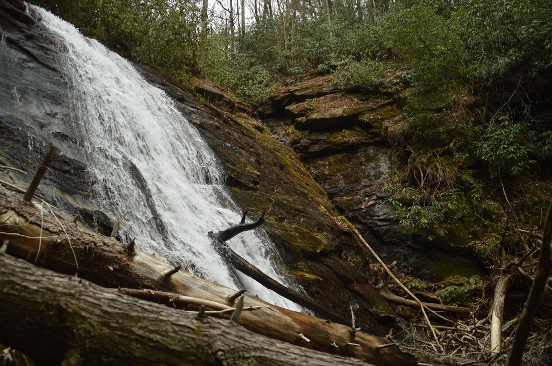
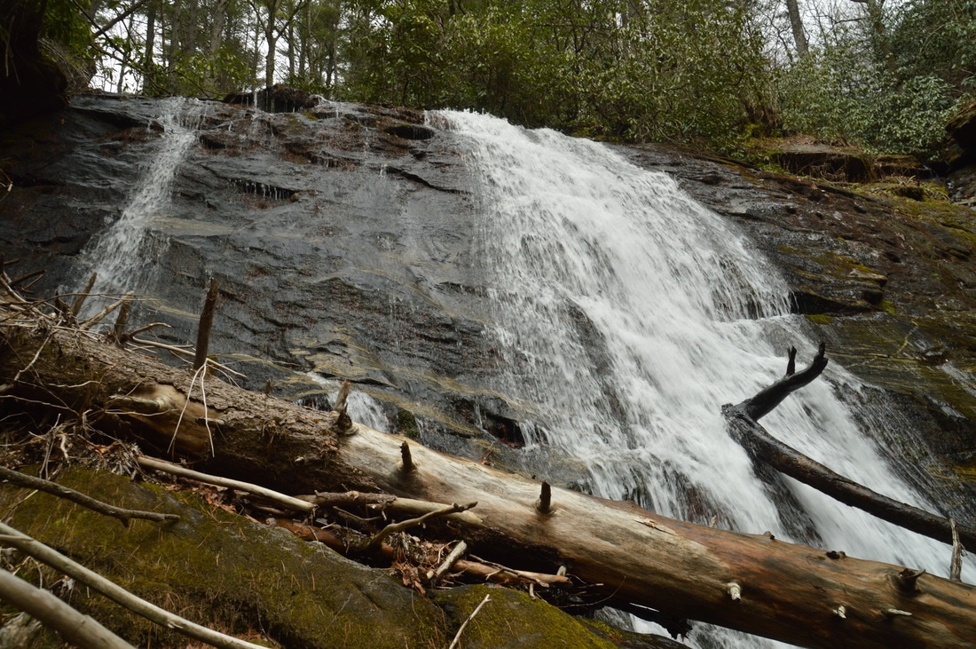
Big Falls on Thomas Creek
R/T Length of Trail: 0.5 Miles
Duration of Hike: 1:35 Difficulty Rating: 3 out of 10 Total Elevation Gain: 150 Feet Waterfall Beauty Rating: 7 stars
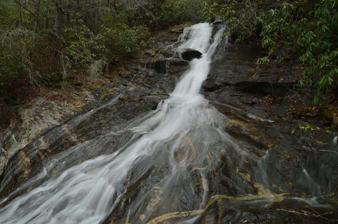
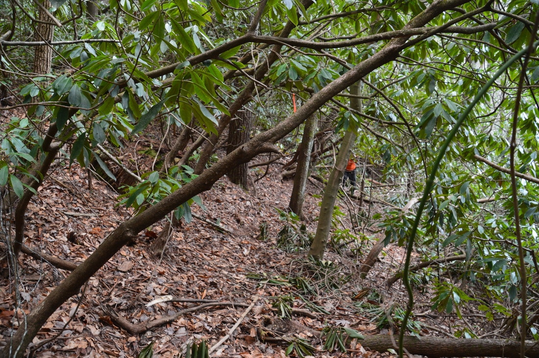
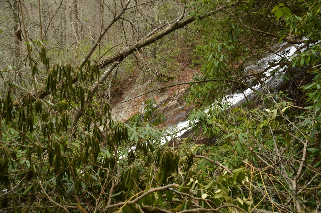
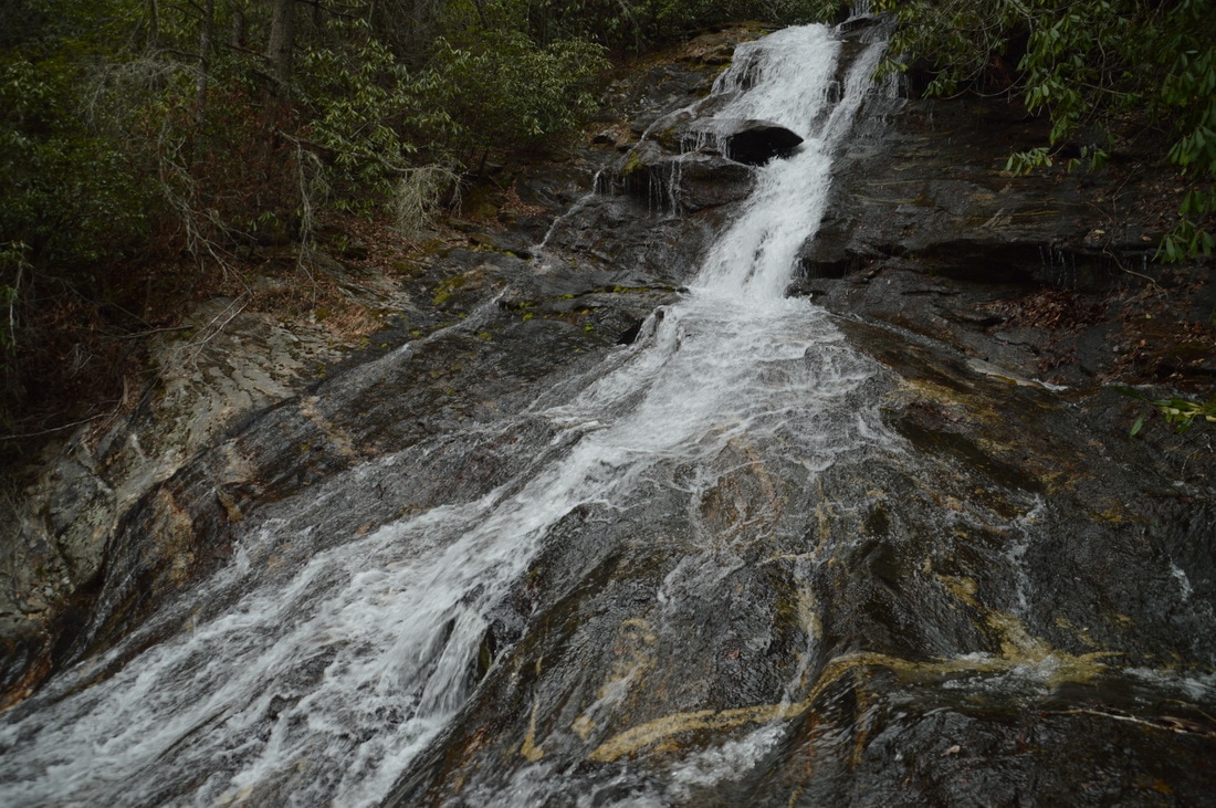
Of the four waterfalls described in this trail report, Big Falls on Thomas Creek is by far the tallest, although perhaps not the most photogenic. The hike to it is also the longest of the four, but it is still only 0.5 miles roundtrip. This waterfall, along with Upper Darnell Creek Falls and Middle Thomas Creek Falls, was uncovered and documented by waterfall guru Bernie Boyer. In addition to finding Big Falls on Thomas Creek (which was christened as such by him), Bernie developed an established trail to the waterfall, by clearing rhododendron from the path and flagging it extensively with ribbons/surveyor's tape. Bernie did an incredible job here, and us waterfallers cannot thank him enough for providing relatively easy access to this impressive waterfall, reaching which would have otherwise required a time-consuming bushwhack through rhododendron jungles around Thomas Creek.
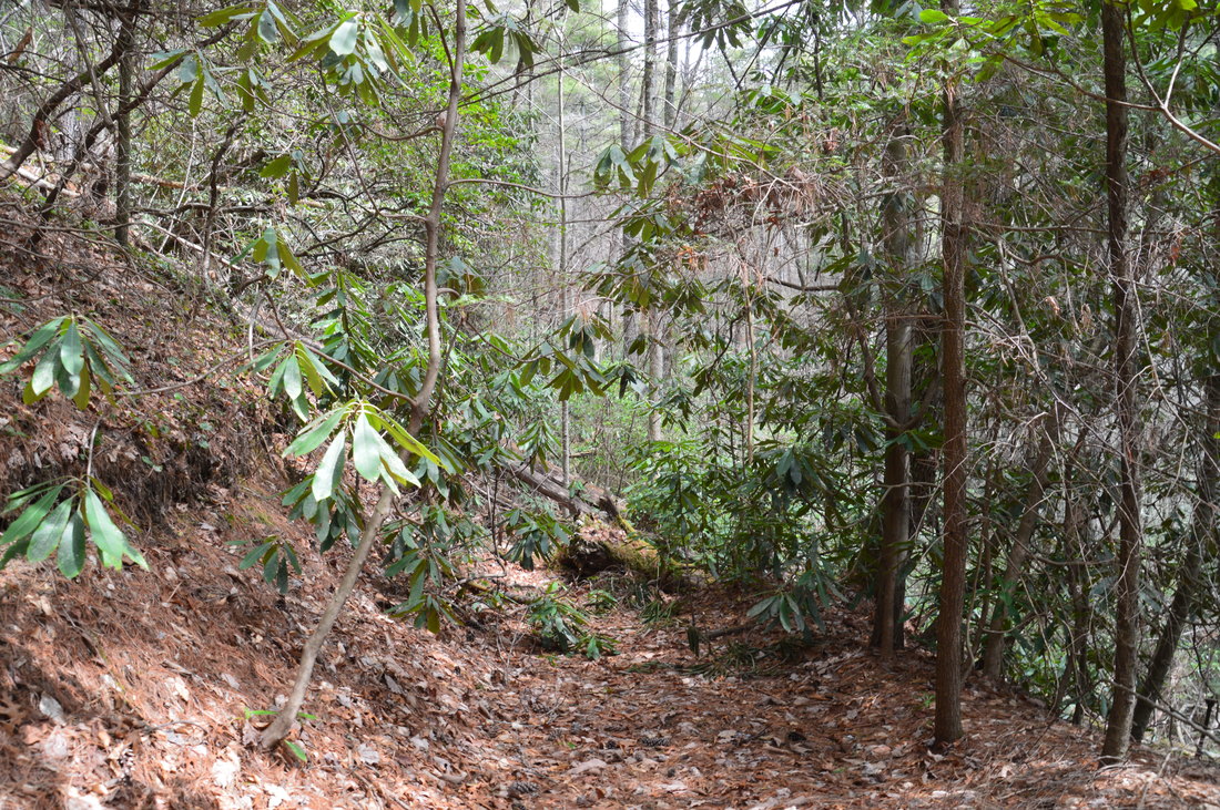
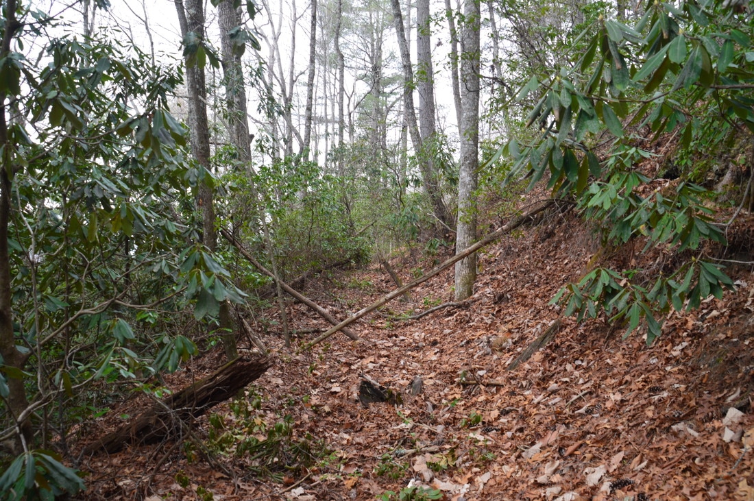
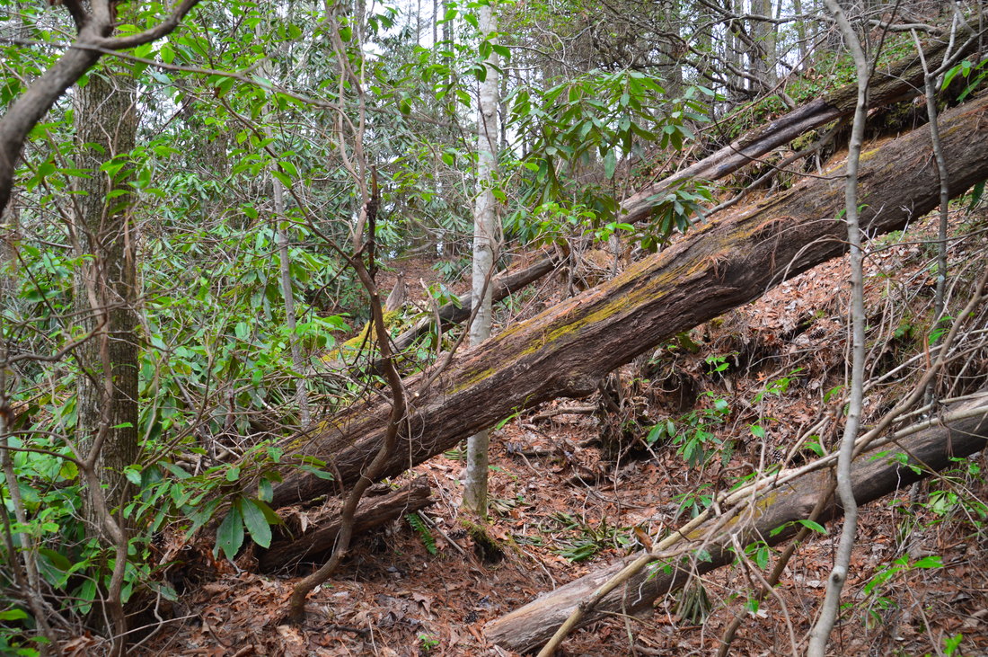
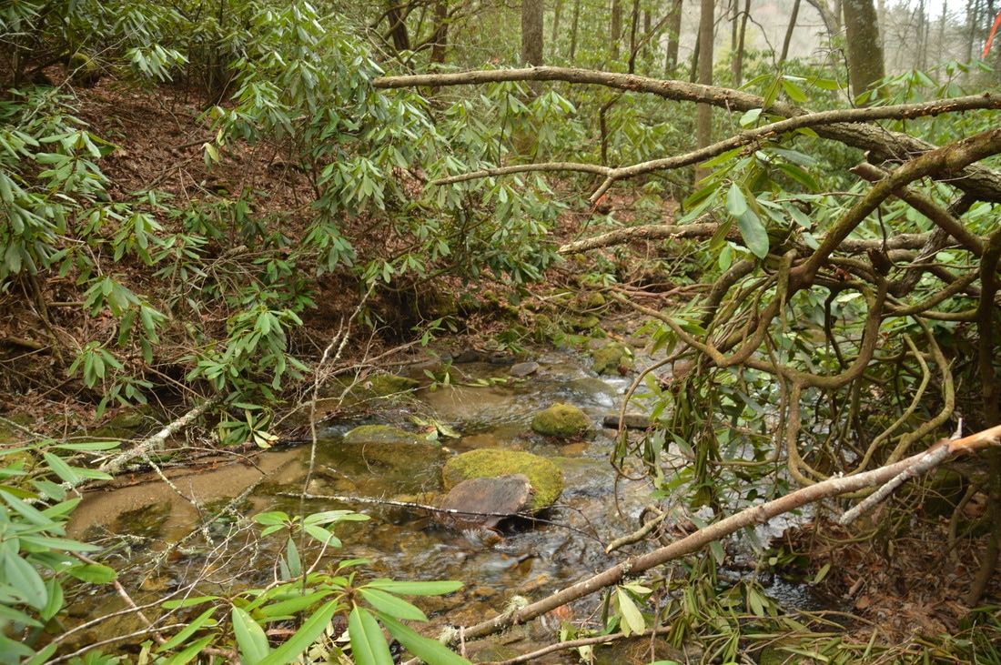
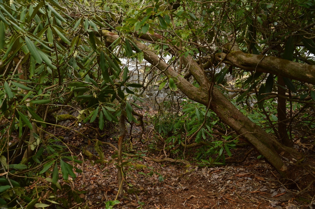
The hike to Big Falls on Thomas Creek begins on an old logging road grade that leaves Darnell Creek Road to the right, initially staying nearly parallel to the road. The start of the path along the old road was marked by a piece of flagging tape when I did this hike, although don't count on it still being there. However, due to the left-hand curve that the road makes just after the trailhead, the trailhead is relatively easy to find. Follow the path along the old road grade and around a few fallen trees gradually downhill into the Thomas Creek valley. The path was marked very well the entire time with flagging tape when I did this hike. 0.1 miles from the trailhead, the logging grade becomes very overgrown up ahead, so the path bears right off the old road. After passing through a gully with a small stream, the distinct path rejoins the logging grade and reaches Thomas Creek at 0.15 miles. This is a slightly confusing place. While the most obvious thing to do appears to be to cross the creek, you must actually continue downstream along Thomas Creek for about 100 feet and then cross over to the south side of the creek. There was some flagging tape at the crossing when I did this hike, but the continuation of the path on the other side of the creek is obvious. I managed to rock hop across the creek today, but it will definitely be a wet ford during higher water levels. After the creek crossing, the trail approaches the top of Big Falls on Thomas Creek and comes to a split. The steep path that continues straight leads to a vantage point at the top of the waterfall, but there is no clear view from there and the area is dangerous, so do not go there; instead, turn left onto the path to the base of the falls. Initially, the path is level, but it quickly begins descending very steeply right along the waterfall. There are plenty of handholds here, but it is easy for the path to become eroded, so follow it carefully. Near the bottom of the path, bear right as straight ahead is a dead-end. The final steep pitch brings you out to a great side view of Big Falls on Thomas Creek at 0.25 miles. 
The steep path to the base area of Big Falls on Thomas Creek descends right along the waterfall itself.
Big Falls on Thomas Creek lives up to its name, as the full waterfall is at least 100 feet high. However, the waterfall consists of multiple drops. The biggest drop is about 70 to 75 feet high, and this is the drop that the trail leads to. There are a few smaller drops farther below, but they are very difficult to reach. The vantage point that the trail ends is unique, because it is right on the side of the falls. About 50 to 55 feet of the waterfall are visible very well from here, and there are about 15 feet more immediately below, with the creek dropping into a small pool and then out of sight. To get the best view of Big Falls on Thomas Creek, it is necessary to step out a few feet into the creek. However, this is a very dangerous spot, so I cannot stress enough how careful you need to be around the slick rocks here. Please do not go anywhere else from the end of the trail if you do not know what you're doing, and regardless of the conditions, you must keep dogs and children restrained. During high water, do not even think of stepping out into the creek; instead, content yourself with the view from the side of the waterfall. The entire drop is a very steep and long slide with several ribbons of water flowing down a picturesque rock face. Overall, this waterfall could be more beautiful and more photogenic if there was a better way to view it, but it is still well worth visiting - take my word for it.
From Big Falls on Thomas Creek, simply retrace your steps back to the trailhead, concluding the hike at 0.5 miles, and drive on to the final and arguably most picturesque waterfall stop on Darnell Creek Road: Middle Falls on Thomas Creek. Middle Falls on Thomas Creek
R/T Length of Trail: 0.2 Miles
Duration of Hike: 0:45 Difficulty Rating: 1 out of 10 Total Elevation Gain: 100 Feet Waterfall Beauty Rating: 8 stars
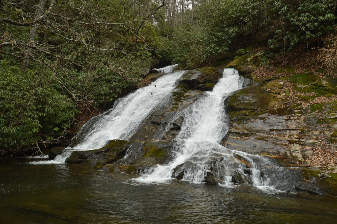
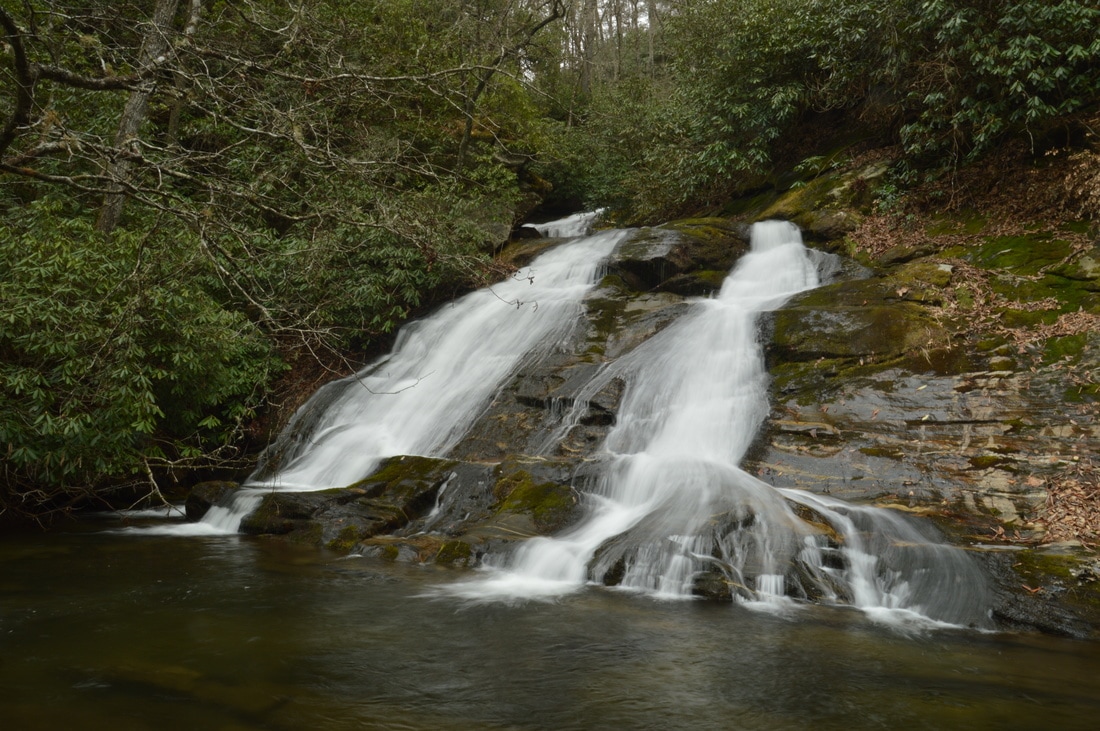
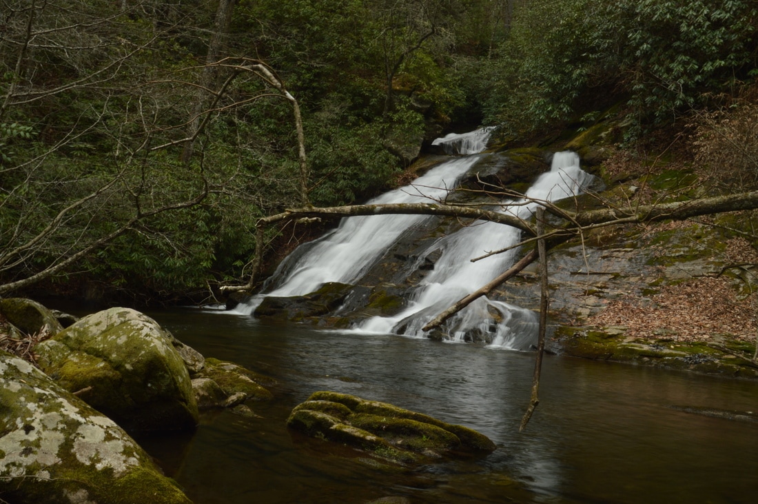
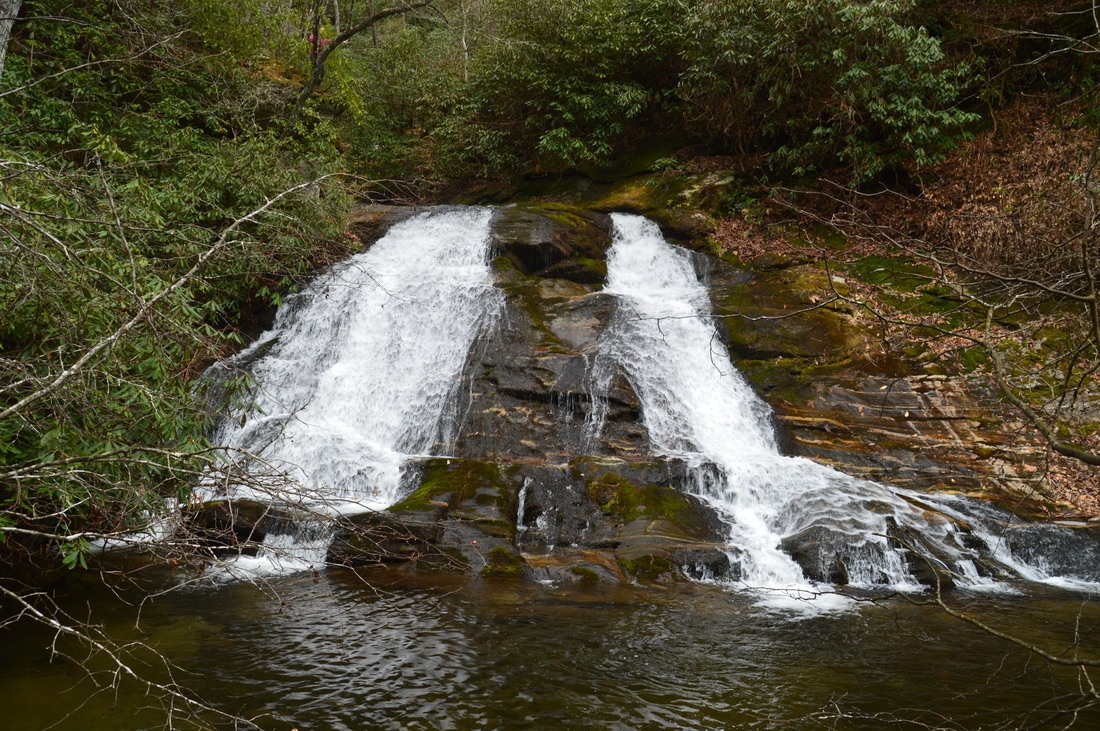
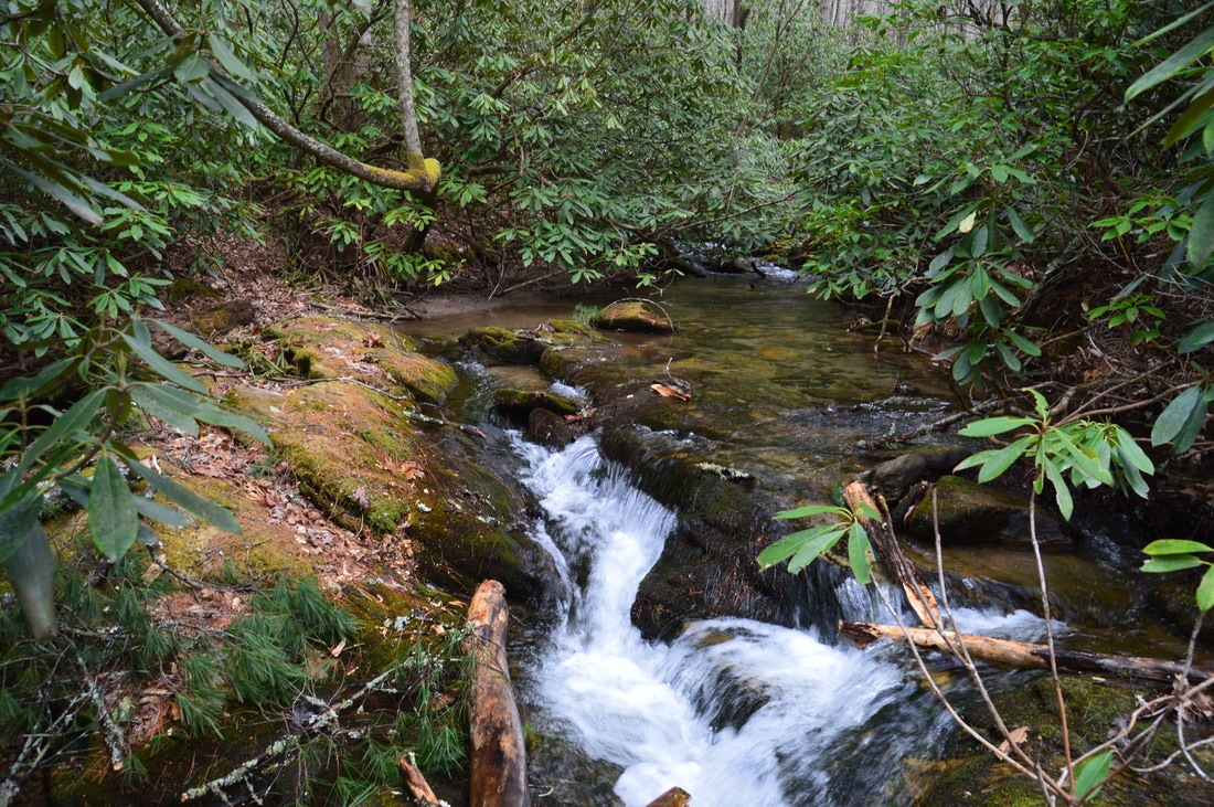
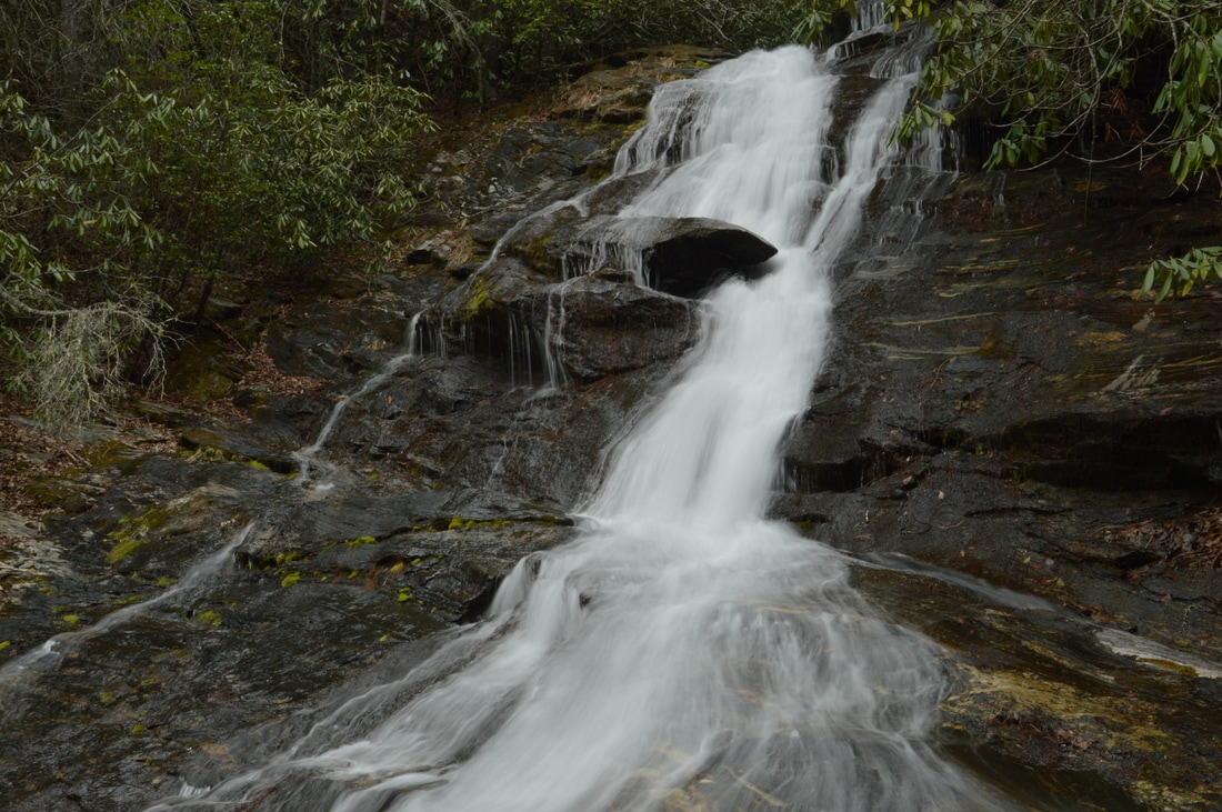
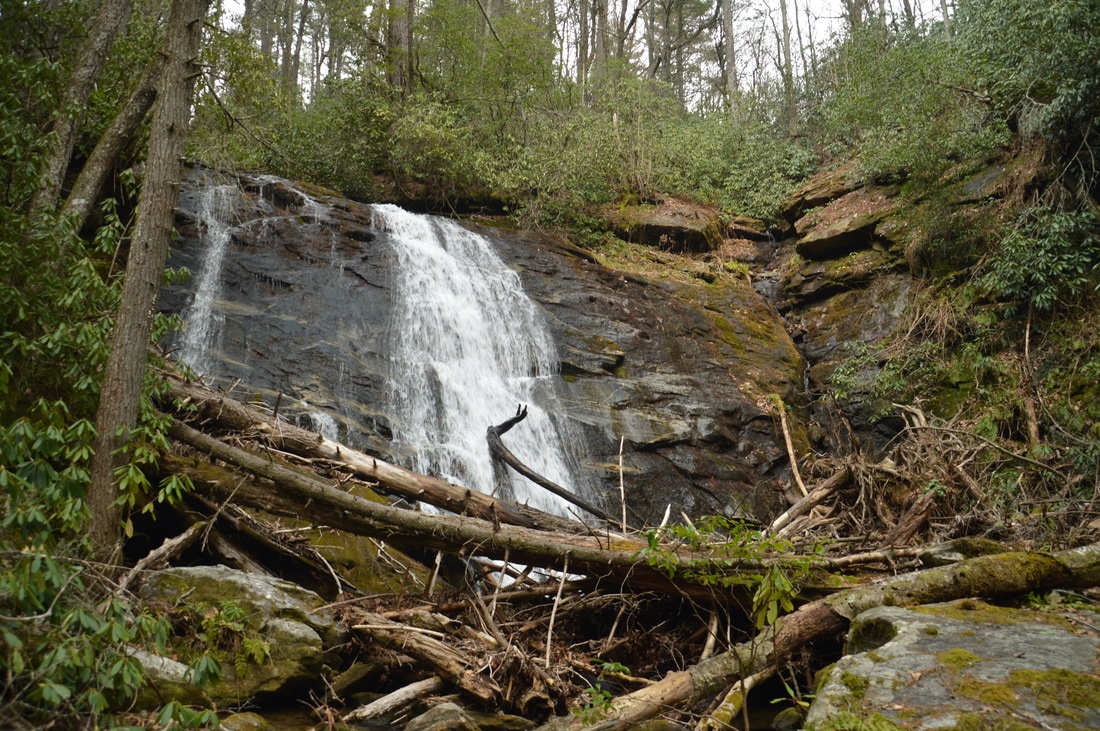
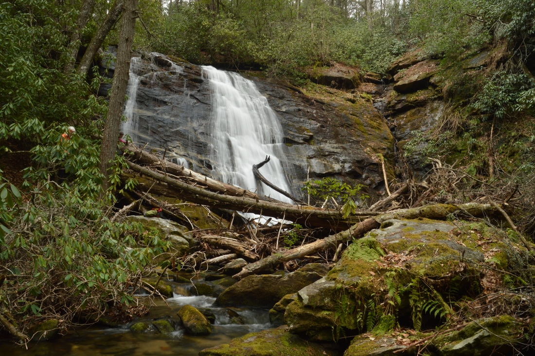
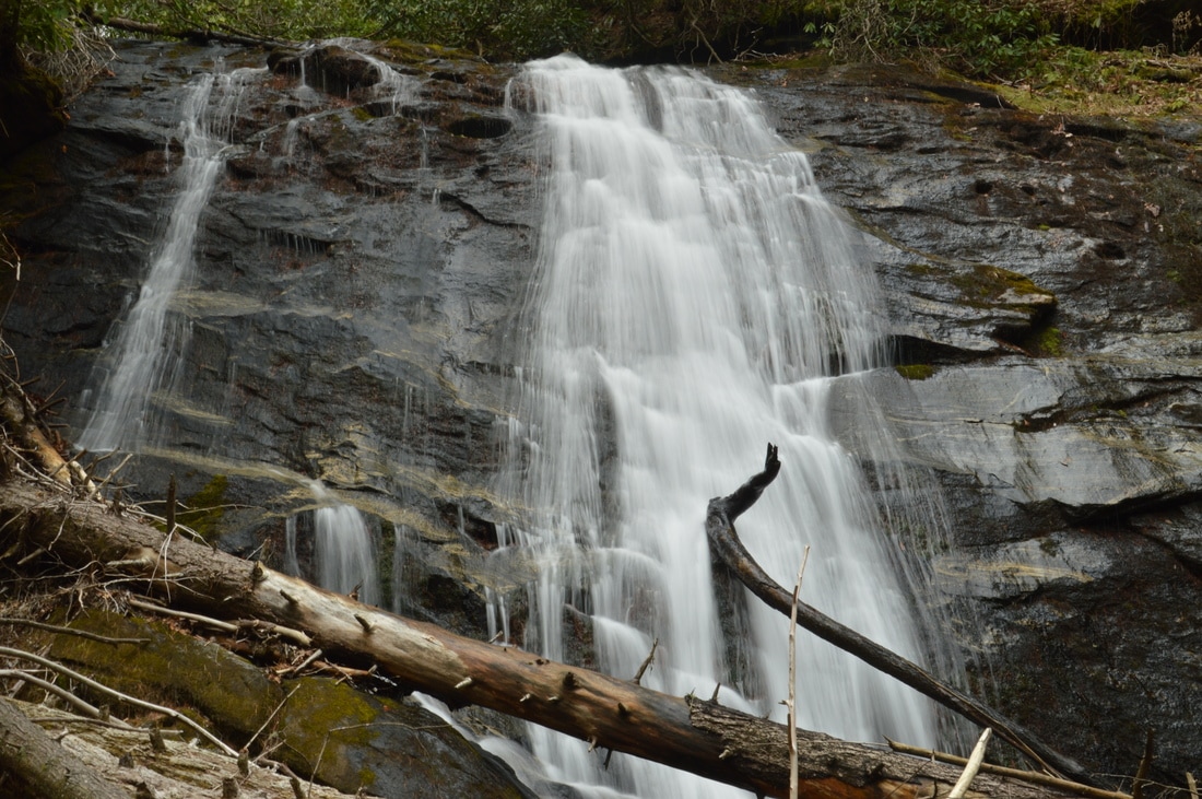
Even though Middle Falls on Thomas Creek is not the tallest waterfall of the Darnell Creek Road waterfall quartet, it is the most picturesque in my opinion, due to a combination of remoteness and scenic setting. The hike to Middle Falls begins from a point on Darnell Creek Road just northwest of the waterfall. From the trailhead area, where there is space for a few cars, hike down the moderately steep slope with open woods in a south-southeast direction. About 250 feet from the trailhead, the open woods end at an area of rhododendron, but you should spot a fairly distinct path veering off to the left (southeast). Even if you do not see the path, just head in the direction of the sound of the waterfall, which is fairly close. The path dips through a small gully and ends just below Middle Falls on Thomas Creek 0.1 miles from the trailhead. Scrambling along either side of the creek is possible for an "up-close and personal" view of the waterfall.
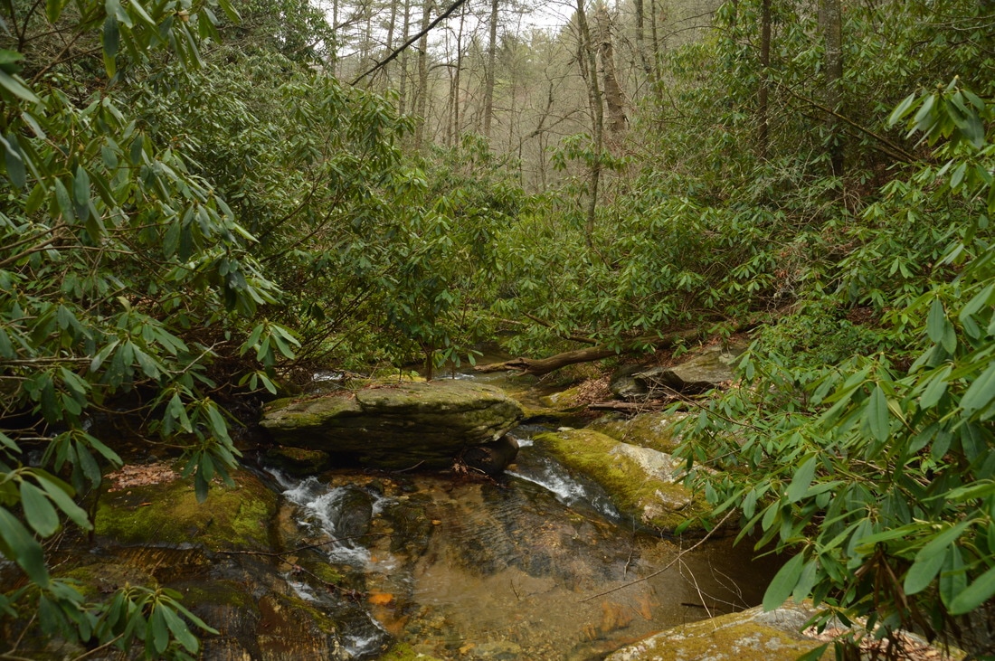
The combination of favorable beauty factors at Middle Falls of Thomas Creek makes it a 40-foot striking waterfall. The waterfall is set in an area of sheer cliffs, down one of which Thomas Creek slides in multiple ribbons of flow. To the right of the main waterfall, a tiny tributary - that might be especially showy after a period of wet weather - makes its own waterfall on the other end of the cliff. At the base of the falls, there is a distorted mass of large fallen trees amidst large boulders. Together, the sheer cliffs and fallen trees help to add a wild and remote feeling to this waterfall. Just below the falls, Thomas Creek enters a tight gorge on its way to Big Falls. I believe that there may be another waterfall in between Big Falls and Middle Falls, and even though as of this writing there is no proof that it exists, one of us hard-core waterfallers might perhaps explore this possibility in the future. From Middle Falls, simply retrace your steps back to the trailhead, concluding the hike at 0.2 miles. If you're interested in a longer hike after all of these short hikes, consider hiking to Ramey Creek Falls via the Darnell Creek Trail, also accessible off Darnell Creek Road. 
Middle Falls on Thomas Creek is a striking 40-foot waterfall that is set in a wild and remote setting among sheer cliffs.
PicturesVideos
0 Comments
Leave a Reply. |
About MeMark Oleg Ozboyd Dear readers: I have invested a tremendous amount of time and effort in this website and the Georgia Waterfalls Database the past five years. All of the work that has gone in keeping these websites updated with my latest trip reports has almost been like a full-time job. This has not allowed me to pick up a paid job to save up money for college, and therefore, I I've had to take out loans. If you find the information on this website interesting, helpful, or time-saving, you can say "thanks" and help me out by clicking the button above and making a contribution. I will be very grateful for any amount of support you give, as all of it will apply toward my college tuition. Thank you!

Coming in 2022-2023?
Other Hiking WebsitesMiles HikedYear 1: 540.0 Miles
Year 2: 552.3 Miles Year 3: 518.4 Miles Year 4: 482.4 Miles Year 5: 259.9 Miles Archives
March 2021
Categories
All
|


 RSS Feed