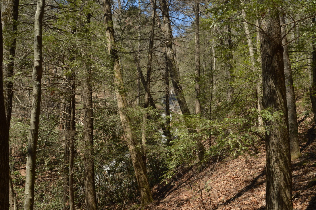
The hike to Blood Mountain's expansive vistas is one of North Georgia's most popular hikes. The valleys on the south side of Blood Mountain are a whole different story, however. Deep in the wilderness, two streams - Crow Mountain Creek and Blood Mountain Creek - form several waterfalls as they make their rapid descent to the Chestatee River. Especially of note is Frogface Falls: a remote 35-foot waterfall that is nestled in the heart of the Blood Mountain Wilderness among tall cliffs. Along the hike to Frogface Falls, you'll follow increasingly fainter paths past two other waterfalls, Third Falls on Blood Mountain Creek and Crow Mountain Creek Falls, each of which is worthy of a visit in their own rights. And if this was not exciting enough, you will also have the opportunity to see several more waterfalls closer to Dicks Creek Road. This hike occurred on Saturday, April 1st, 2017. My plan was to hike the Crow Mountain Creek Trail past Crow Mountain Creek Falls to the Blood Mountain Creek Trail, where I would follow the latter trail past Third Falls and to Frogface Falls (with the last portion being off-trail). I would return the same way along the Blood Mountain Creek Trail, but instead of taking the Crow Mountain Creek Trail back, I would walk along Dicks Creek Road back to my car, visiting up to three other waterfalls if I had time.
Summary
R/T Length of Trail: 9.4 Miles
Duration of Hike: 7:50 Type of Hike: Loop with Spur Difficulty Rating: 5 out of 10 Total Elevation Gain: 1776 Feet Pros: All of the unofficial trails on this hike are well-maintained Cons: The final leg of the hike to Frogface Falls is off-trail Points of Interest: Crow Mountain Creek Falls - 3 stars; Third Falls on Blood Mountain Creek - 5 stars; Frogface Falls - 7 stars; (Upper) Dicks Creek Falls - 2 stars; First Falls on Blood Mountain Creek - N/A; Second Falls on Blood Mountain Creek - N/A Trail Blaze Colors: None, as these are not official trails Best Seasons to Hike: Winter, Spring Fees: None Beginning Point: Crow Mountain Creek Trailhead Directions from Dahlonega, GA: From the intersection of East Main Street with US Route 19/9 in Dahlonega, follow US Route 19/9 North for 7.3 miles. At the intersection with GA Route 60, bear right to continue on US Route 19/9 for another 4.8 miles. Then, turn left onto Dicks Creek Road and follow it for 3.6 miles, passing the roadside Waters Creek Falls at Mile 2.8, after which the road turns unpaved but still well-maintained. The trailhead parking area is on the left just before an unbridged but shallow crossing of Crow Mountain Creek. Map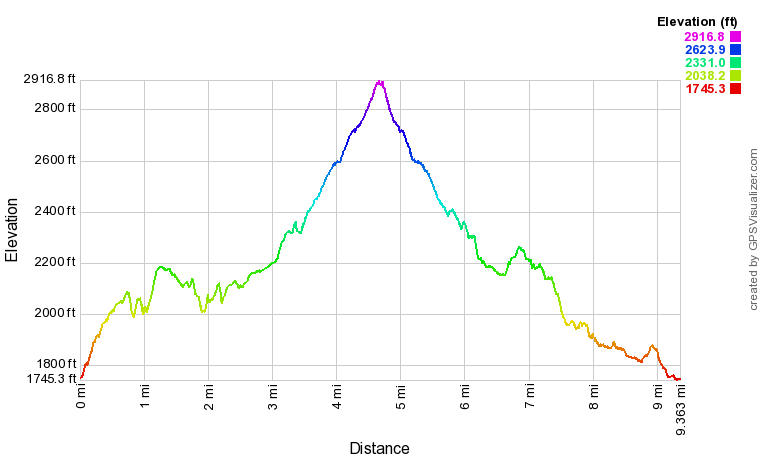
Click here to download a track of this hike.
Details
Over the years, some confusion has been evident in the names of waterfalls on Blood Mountain Creek and Dicks Creek. For example, the Third Falls on Blood Mountain Creek (the third waterfall from bottom to top) has long been known as the "Upper Falls" on the creek, even though there are two waterfalls further upstream. Additionally, the small waterfall on Dicks Creek next to Dicks Creek Falls has been known as Upper Dicks Creek Falls, even though there are more waterfalls upstream. It has also been known as simply Dicks Creek Falls, but there is a large roadside waterfall on Dicks Creek further downstream, which is known both as Dicks Creek Falls and Waters Creek Falls. Are you confused yet? In this trail report, I will use the names for these waterfalls that appear to be the most correct. Taking the confusing names aside though, all of the waterfalls in the area are quite beautiful and access is relatively easy.
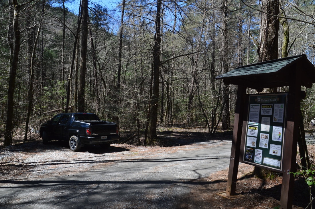
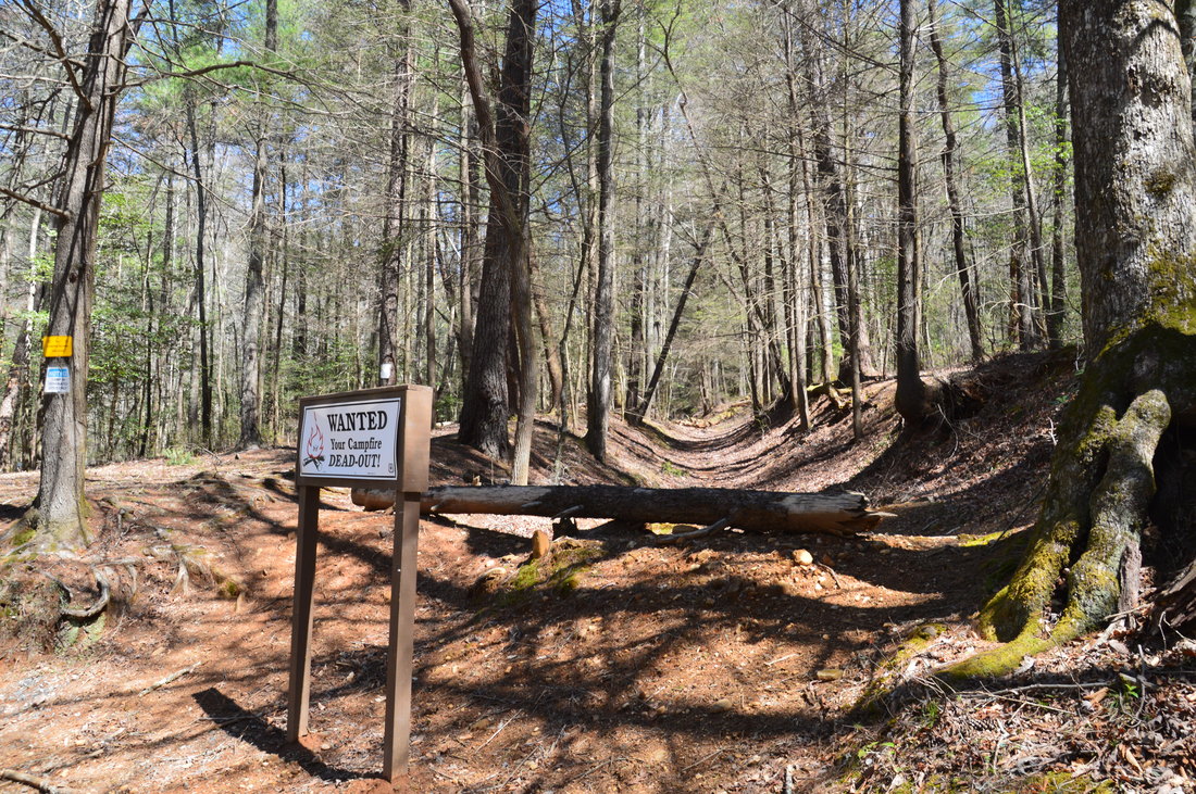
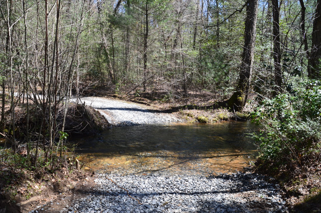
The hike begins at the trailhead for Crow Mountain Creek Falls, which is actually a bit tricky to locate. The best thing to do is to park in one of the several pullouts and parking spaces near the road ford of Crow Mountain Creek. You will notice that on the east side of Crow Mountain Creek Road, a well-established forest road heads upstream, marked by a kiosk and by the sign "Campsites A & B". This is not the trail. The Crow Mountain Creek Trail actually begins about 150 to 200 feet east of this spot. The beginning of the trail is behind a large fallen log and on a distinct old logging road. At the time of this hike, there was a sign here that stated "Wanted - Your Campfire DEAD-OUT!". Walk around the log and begin following the old road upstream (this is the Crow Mountain Creek Trail). There is a path alongside the forest road initially, as the road has become deeply eroded. Eventually, all paths converge. An easy to moderate ascent quickly begins after a tributary crossing. At a sharp turn at 0.2 miles, turn right to continue following the old logging road/trail. The trail becomes more level at 0.35 miles, but it stays well above Crow Mountain Creek. At 0.7 miles, the trail crosses a large tributary cascading down from Miller Top. In about 450 feet (less than 0.1 mile after the tributary crossing), the trail will be passing above Crow Mountain Creek Falls. At this point, turn left off the trail and walk through the open woods directly west in the direction of the creek and waterfall. The walking is very easy, and about 250 feet from the trail, you should reach the creek at a point in the middle of the waterfall. Here, bear left and scramble a short distance downstream to the base of the falls at 0.85 miles, at a small bend in the creek where there are several very large boulders near the creek. 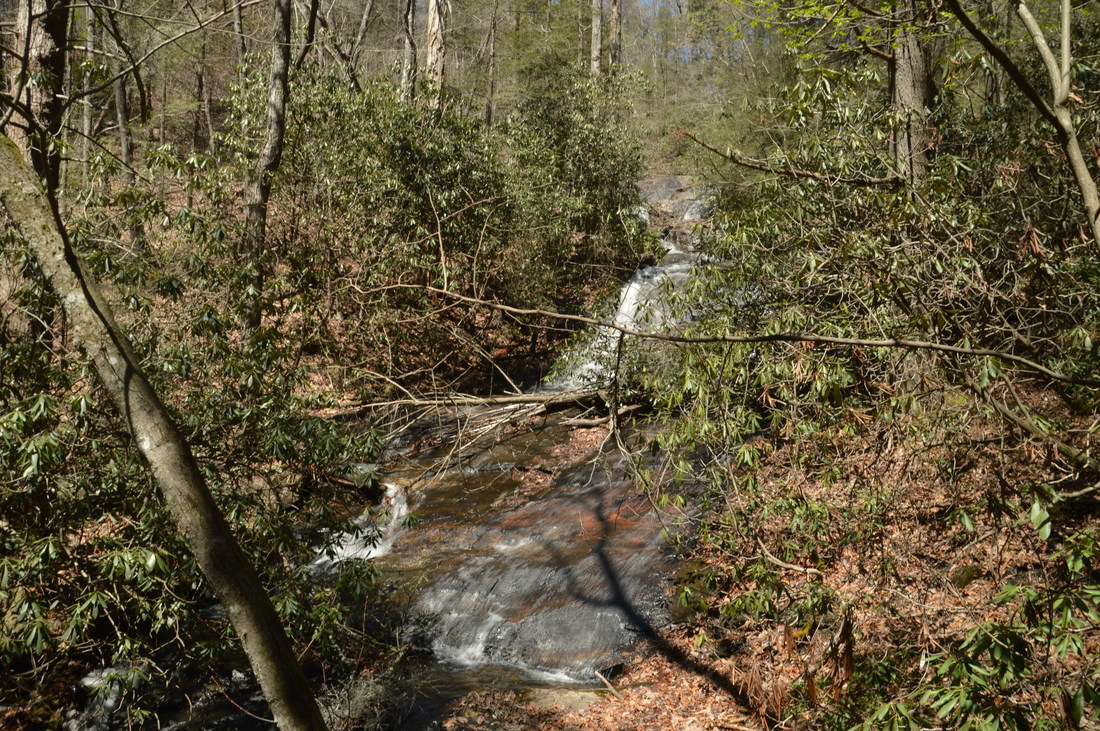
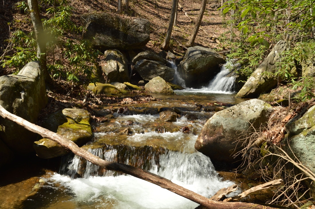
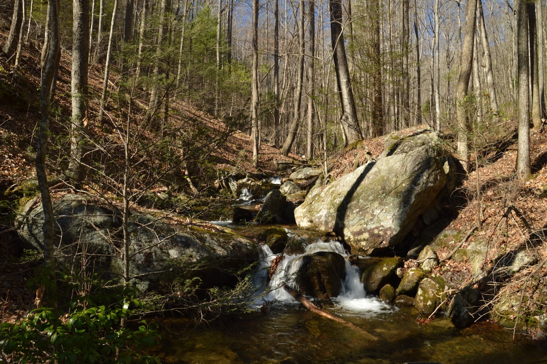
Crow Mountain Creek Falls is a long series of cascades and slides, and in fact, the total height of the waterfall is at least 130 feet, although it is difficult to see all of it at once.
Crow Mountain Creek Falls is an interesting waterfall. It is very big, as I estimate its height to be at least 130 feet, but it is also very long, as the waterfall consists of a long series of slides and cascades. About 50 feet of the waterfall's lower sliding segment is visible from the base. Due to how spread out the waterfall is, it is difficult to see all of the waterfall at once, although in winter, you may see about 2/3 of it at once through the trees. For this reason, despite the magnitude of the waterfall, my beauty rating for it is relatively low. Don't get me wrong though - Crow Mountain Creek Falls is definitely worth the side trip. Additionally, there are some mediocre viewpoints of the waterfall higher above. From the base, return to the main trail and continue following it as it approaches the top of Crow Mountain Creek Falls. In 250 feet, take a distinct side trail on the left that leads to a vantage point near the top of the waterfall, providing a view of one of its biggest sliding sections. Once again, return to the trail, and at 1.05 miles, pass the top of the falls, where there is another vantage point. Immediately after this, the trail appears to dead-end at the creek, while to the right is a campsite. To continue the hike, turn right, walk to the campsite, and at the fire ring, bear left on the wide trail.
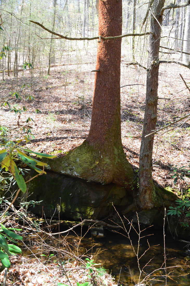
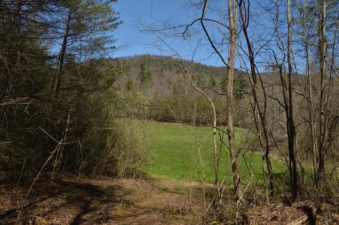
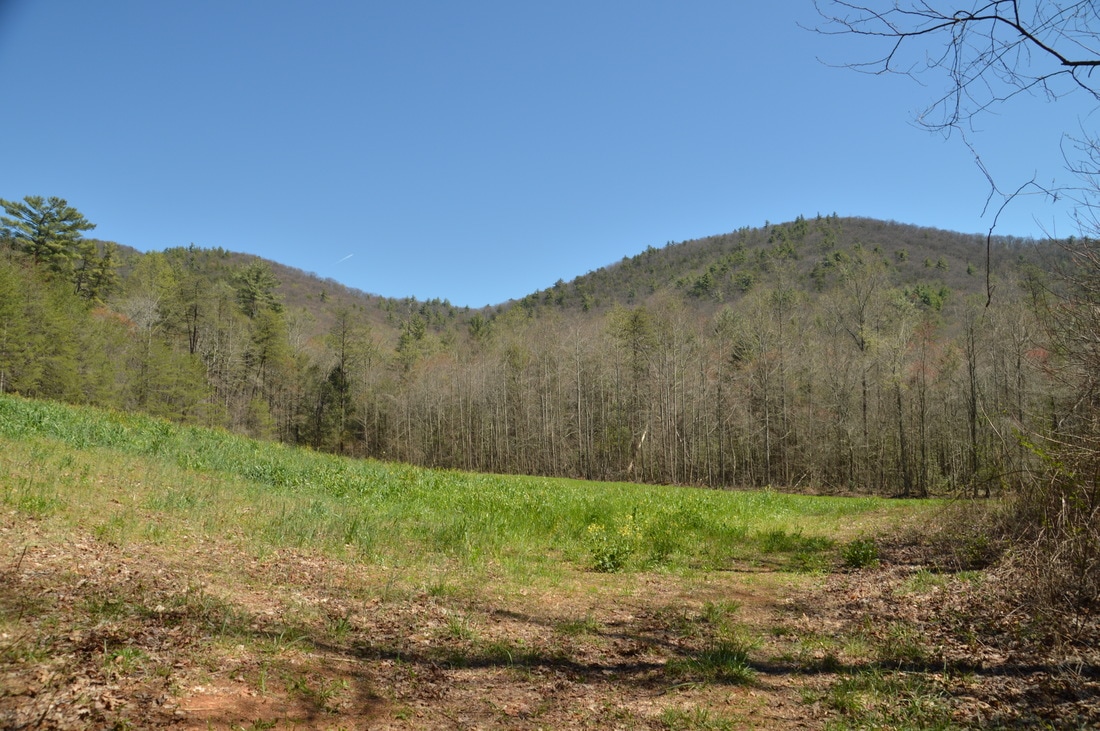
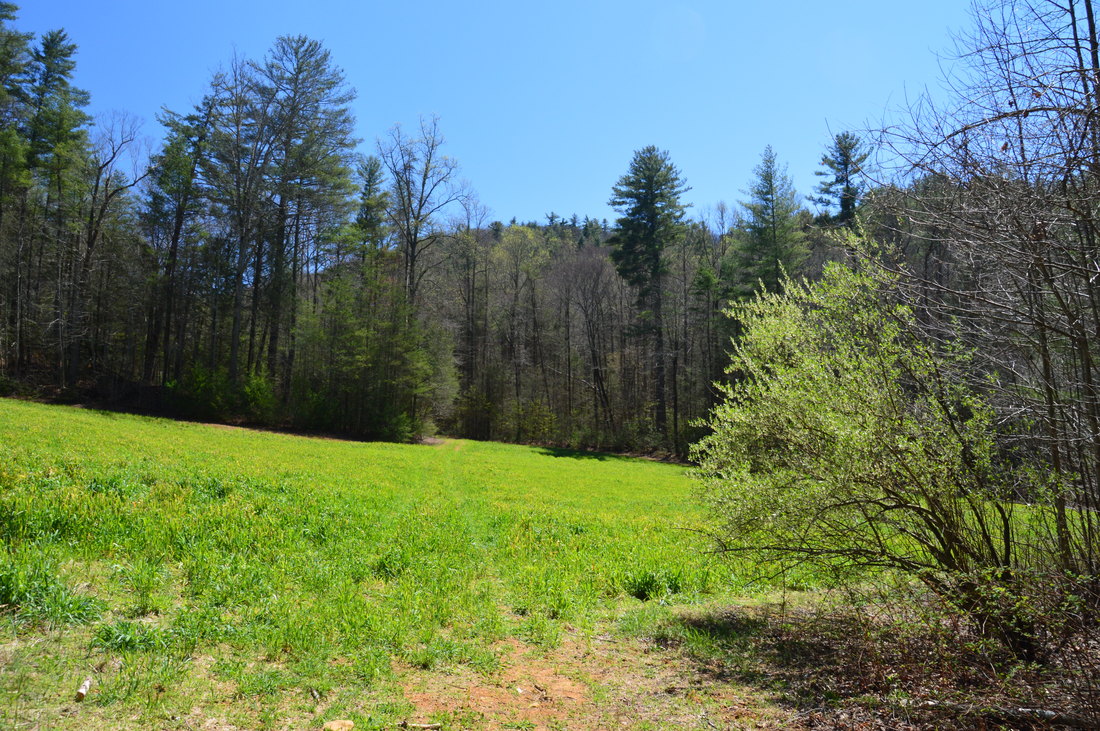
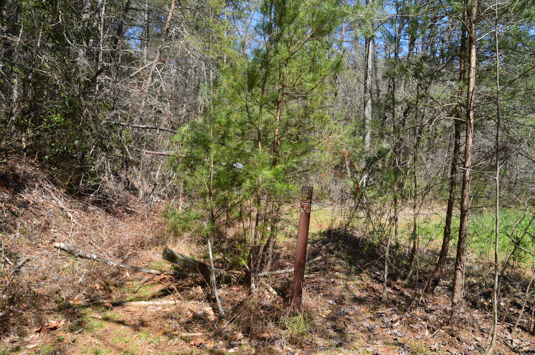
At 1.1 miles, there is a crossing of Crow Mountain Creek. On this day, I got wet feet at this shallow ford, although the water level appeared to be above average on this day, so it is possible that this crossing is dry some of the time. To the left of the crossing is a neat tree that is growing on top of a boulder. Beyond the crossing, the trail stays flat and easy. At 1.25 miles, the trail reaches the first of three grassy wildlife clearings. Turn left and follow the edge of the clearing, following the obvious trail along the left side of a second clearing at 1.5 miles and through the middle of a third clearing at 1.6 miles. After this, the trail gradually descended to its terminus at a turnaround at the end of Dicks Creek Road at 1.8 miles. Simply continue walking on the gravel road for the time-being. The nearly level road follows the east side of Blood Mountain Creek, making a wet ford of Chestnut Flats Creek at 2.2 miles and the first wet ford of Blood Mountain Creek itself at 2.5 miles. After this, the road ascends gently to yet another wildlife clearing at 2.65 miles. Just where the road curves left and away from the clearing is the beginning of the Blood Mountain Creek Trail on the right. A carsonite stake with a "No Bicycles" symbol marks the beginning of this unofficial but easy-to-follow trail. The narrow trail quickly enters the woods above the clearing and reaches a Y-split at 2.8 miles. The more obvious trail - the Blood Mountain Creek Trail - bears right, while the Frogface Falls Trail bears left on an old logging grade. The Frogface Falls Trail generally stays parallel to the Blood Mountain Creek Trail, but it stays about 100 feet higher, and while the Frogface Falls Trail leads to Frogface Falls, the Blood Mountain Creek Trail leads to Third Falls on Blood Mountain Creek. From Third Falls on Blood Mountain Creek, it is not necessary to retrace your steps all the way to this junction though; it is very easy to scramble up from the Blood Mountain Creek Trail to the Frogface Falls Trail. Thus, bear right on the Blood Mountain Creek Trail and soon come alongside Blood Mountain Creek and its numerous cascades. The trail stays quite easy as it follows the creek. At 3.3 miles, the trail reaches the second ford of Blood Mountain Creek as the gorge narrows just below Third Falls. Note that a dead-end path continues along the same side of the stream, leading to a decent view of the waterfall together with its lower drops. To reach Third Falls itself though, ford the creek and continue along its other side. There are a couple of picturesque cascades below the main waterfall. Getting to the main waterfall requires a careful scramble over a small rock outcrop with a 15-foot drop-off to the left. At 3.35 miles, the trail ends at the base of the primary drop of Third Falls on Blood Mountain Creek. 
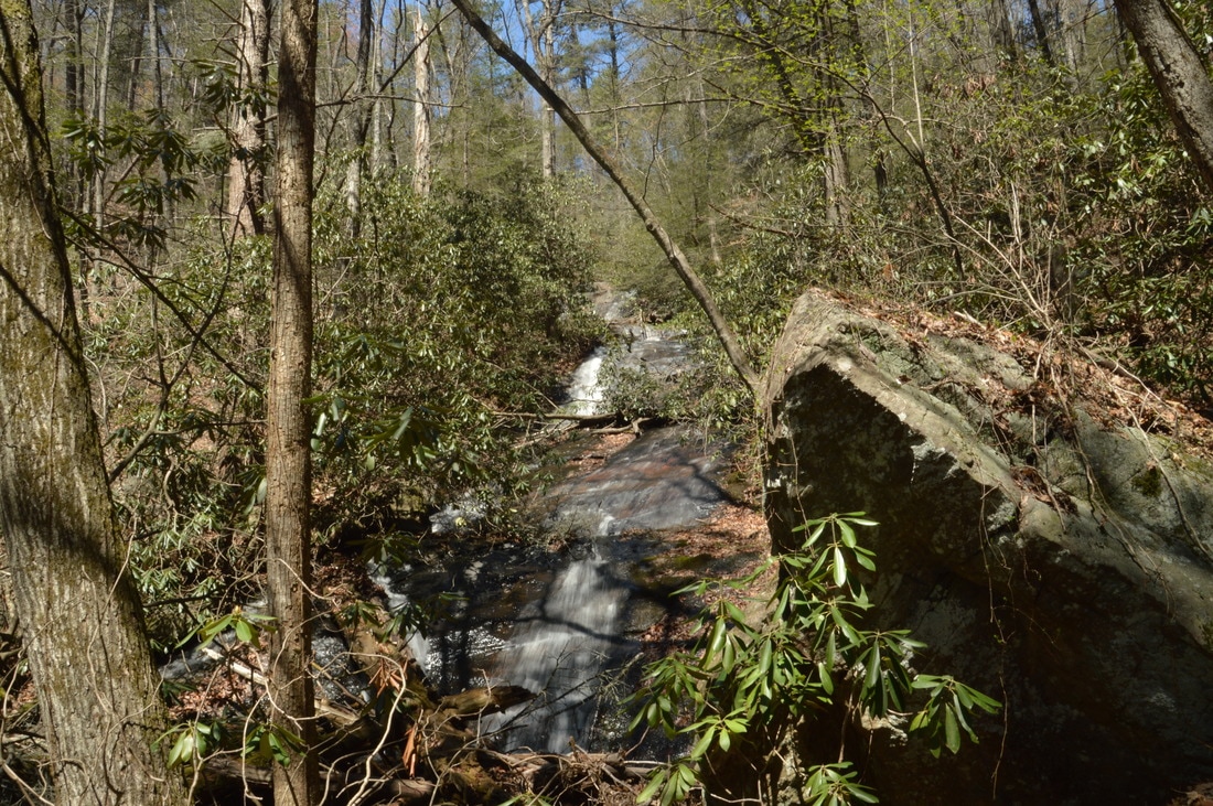
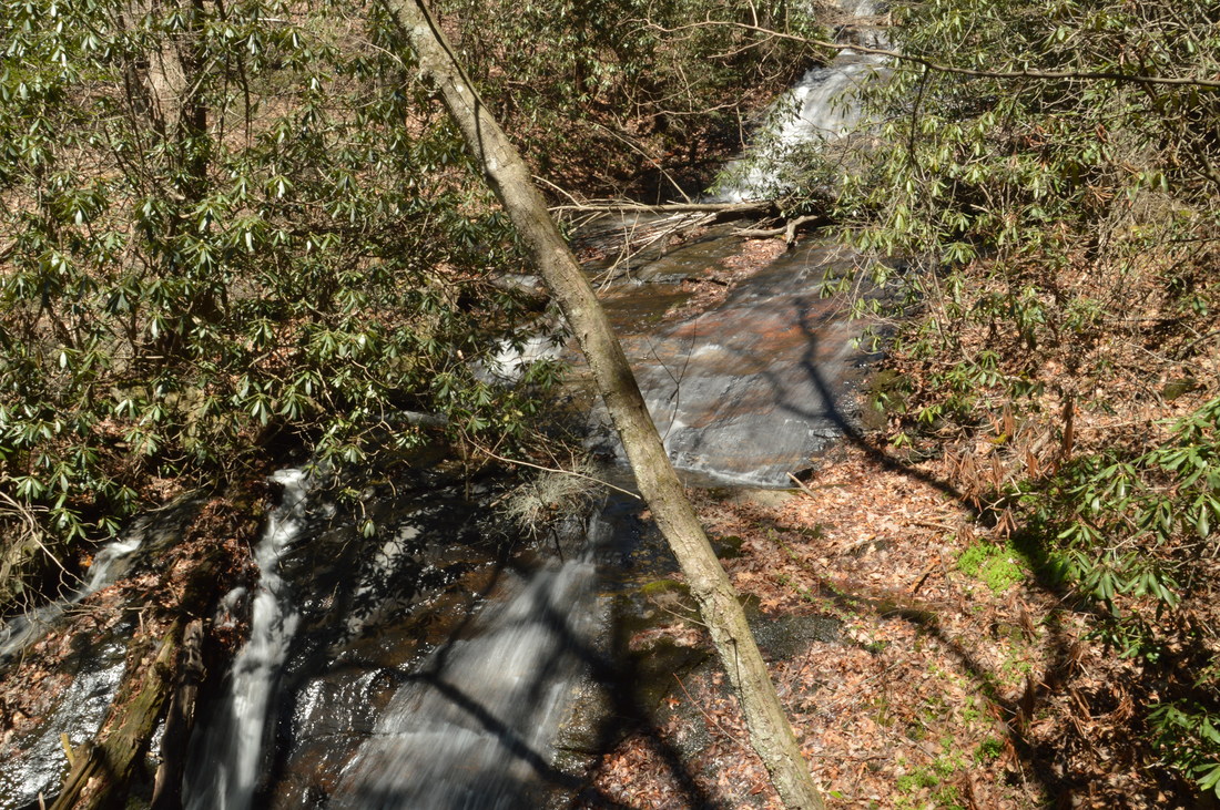
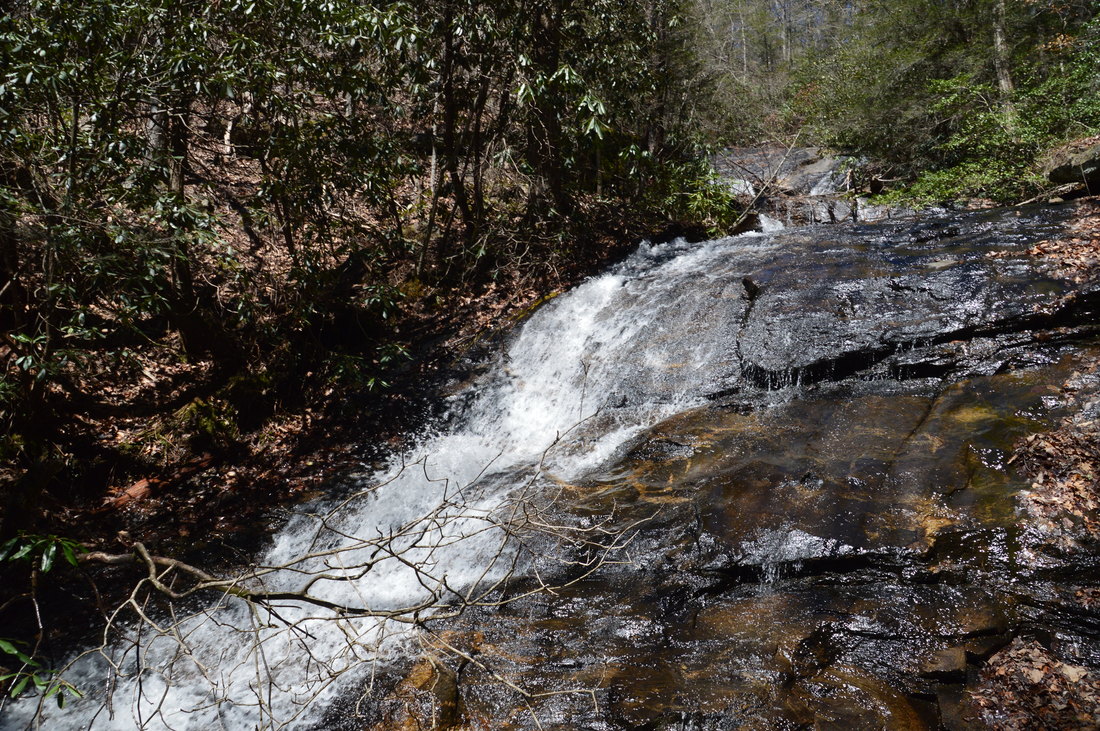
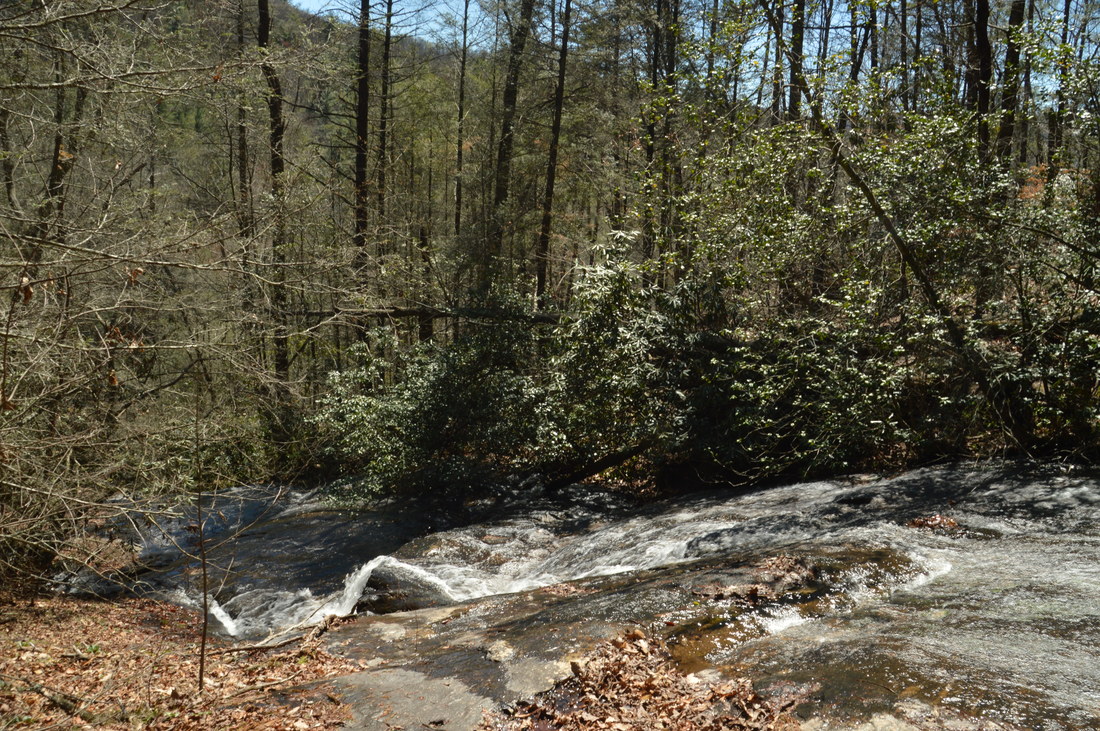
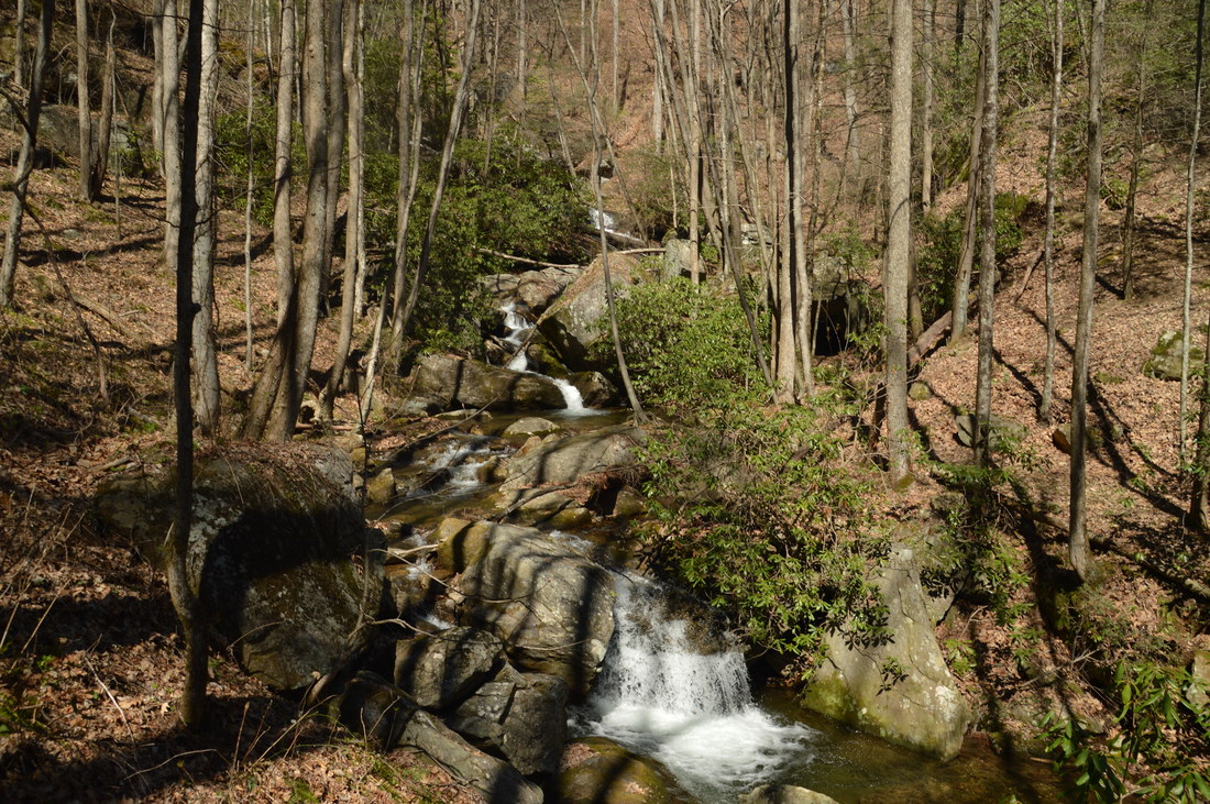
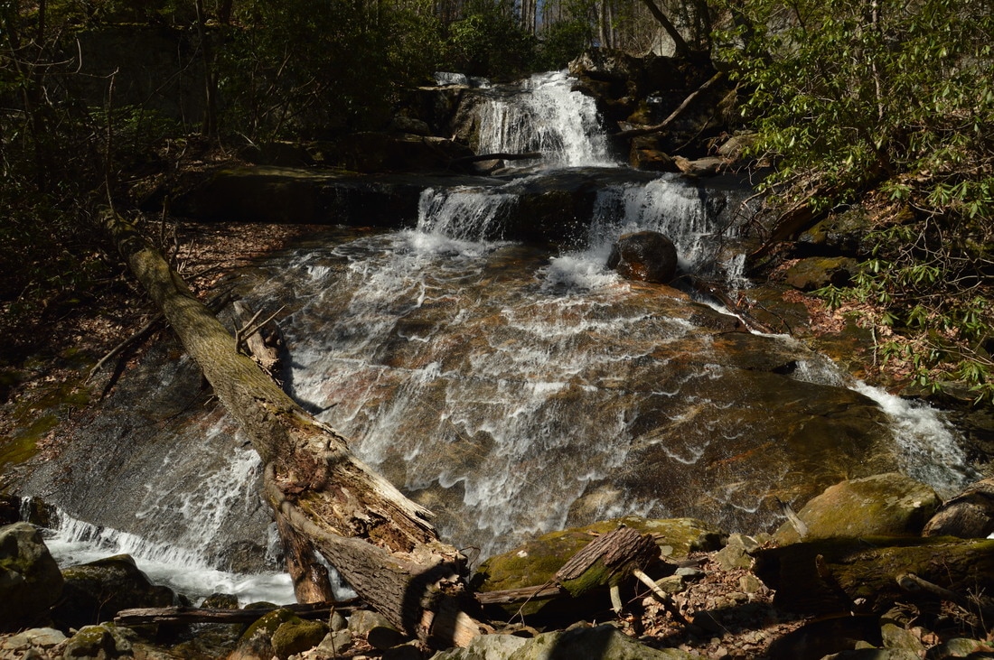
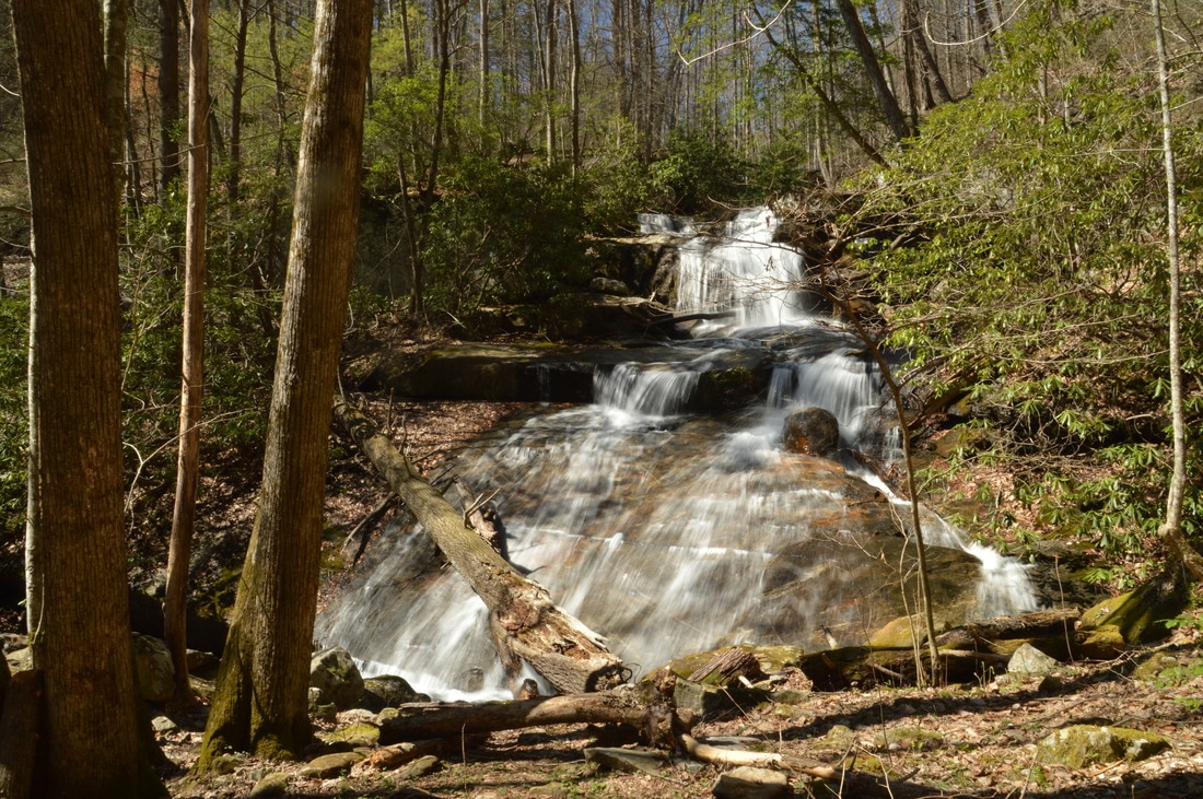
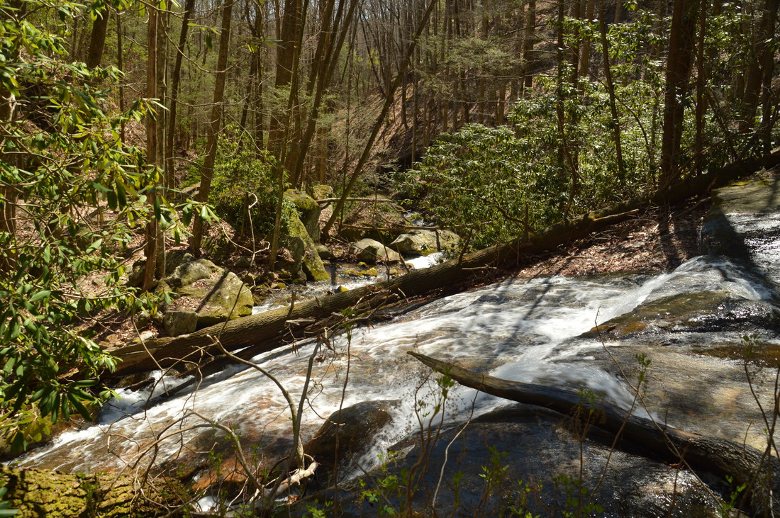
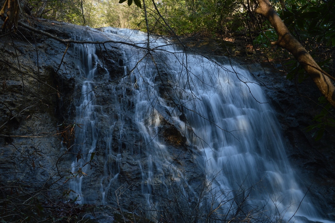
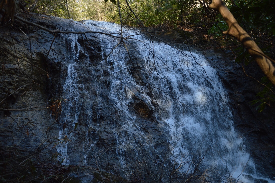
The Third Falls on Blood Mountain Creek is quite big, dropping in multiple cascades as the creek loses 80 feet in elevation. The main slide drop shown here is about 40 feet high.
Third Falls on Blood Mountain Creek (sometimes referred to as the upper falls by people who have never hiked further upstream) is a fairly large waterfall. It is located at the head of a narrow gorge, and the creek rapidly loses about 80 feet in elevation via multiple cascades and waterfalls. Most of the cascades and waterfalls are small, but the primary drop at which the trail ends is a scenic 40-foot waterfall. The waterfall consists of two tiers: a small upper free-fall portion and a wide lower sliding portion that spreads out across a broad rock slab. In front of the waterfall is a campsite and an impressive cliff. A short path scrambles up the right side of the waterfall to the upper free-fall portion, which actually has a miniature grotto.
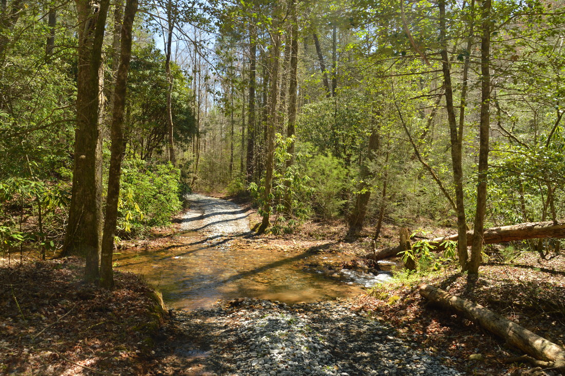
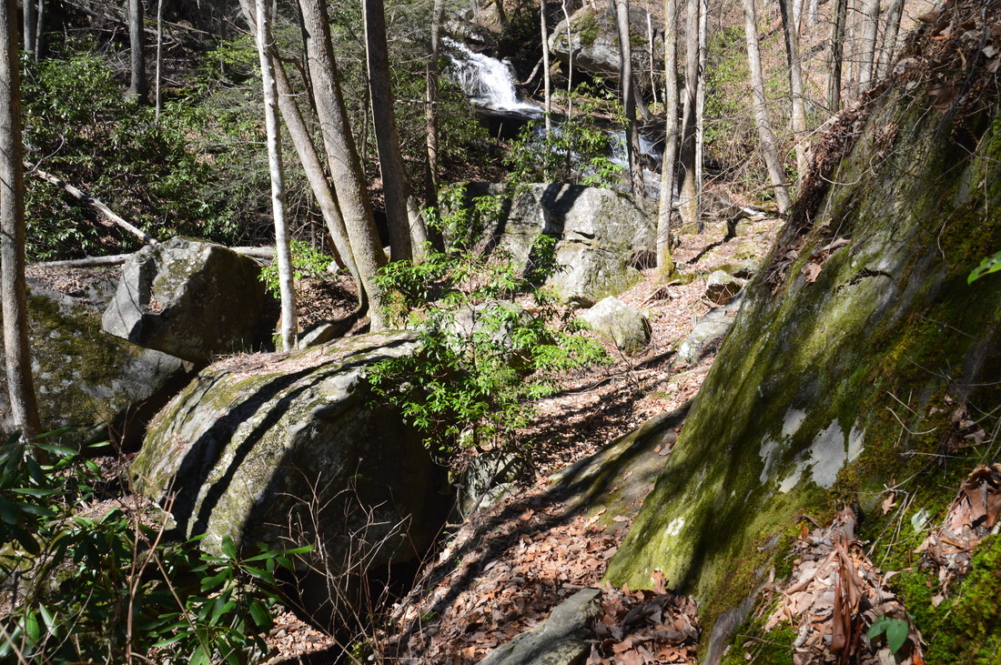
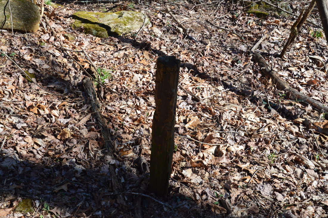
From Third Falls, return along the trail and repeat the crossing of the creek. Then, continue retracing your steps along the trail for about 250 feet. As the slope to the right (west) becomes less steep, you must leave the trail and hike/scramble through the open woods on this slope, in order to reach the Frogface Falls Trail. The brief off-trail section of the hike ends at 3.5 miles as you reach an old forest road. Turn right onto the forest road, which continues ascending away from the waterfall and its gorge, tying into the Frogface Falls Trail in about 100 feet. In the winter, there is a good view here of Third Falls down below. Continue following the Frogface Falls Trail along the wide old forest road upstream and north as it begins a gentle uphill. At 3.7 miles, there is a washed out place on the forest road, but paths to the right and left provide bypasses. The trail soon comes right alongside the creek, which is smaller but still pretty with many small cascades. At 4.05 miles, there is another shallow wet ford of Blood Mountain Creek, and the trail gradually becomes more poorly-defined but still not difficult to follow on the other side of the creek. At 4.3 miles, the vague trail reaches an old post that seems to mark a split in paths. The path that bears right quickly dissipates, but it can be used to access the cliffs of Rocky Mountain less than a mile to the east. To reach Frogface Falls, take the path that bears left in the direction of the creek. 250 feet later, at about 4.35 miles, the trail reaches the creek and appears to cross it again. The path that crosses the creek eventually reaches the Appalachian Trail at Jarrard Gap. To reach Frogface Falls Trail, leave the trail and begin hiking through the open woods on the right (east) side of Blood Mountain Creek. It is important to stay on the east (right) side of the creek, without crossing the creek, on the final leg of the hike to Frogface Falls, because the west (left) side is significantly more rugged and overgrown. On my way to the waterfall, I had crossed the creek and followed the west side, but on my way out, I found that the east side was much, much easier to traverse. Initially, the hiking is very easy, and at around 4.45 miles, you will join an old roadbed/path above the creek. The roadbed/path eventually ends about 250 feet from the falls. At that point, you may be able to hear it. To reach Frogface Falls, simply continue scrambling upstream but make sure to descend close to the creek. If you follow the closest-to-the-creek path of least resistance upstream from the end of the roadbed, you will reach Frogface Falls at 4.65 miles. For the best view of the waterfall, you will have to cross Blood Mountain Creek just below the falls. There is a small flat area suitable for viewing and photographing the waterfall right at its base on the west side of the creek. 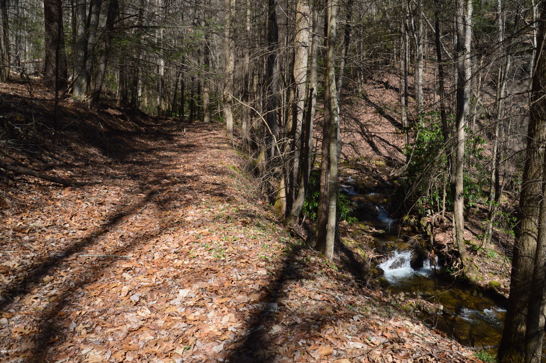
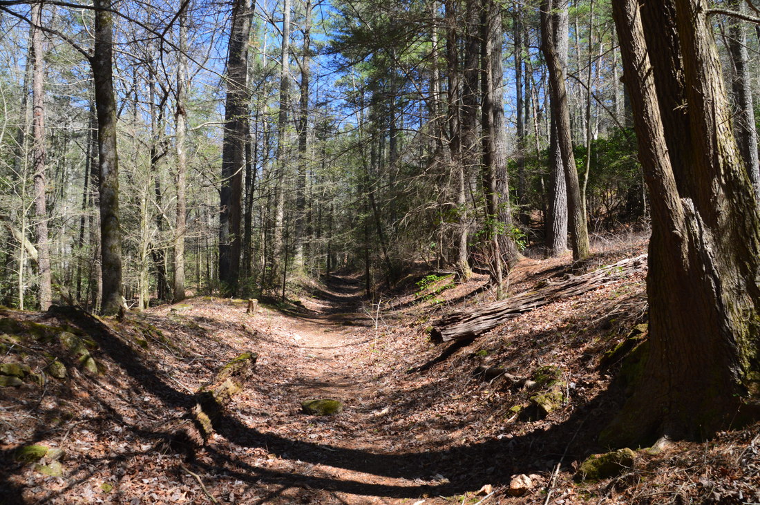
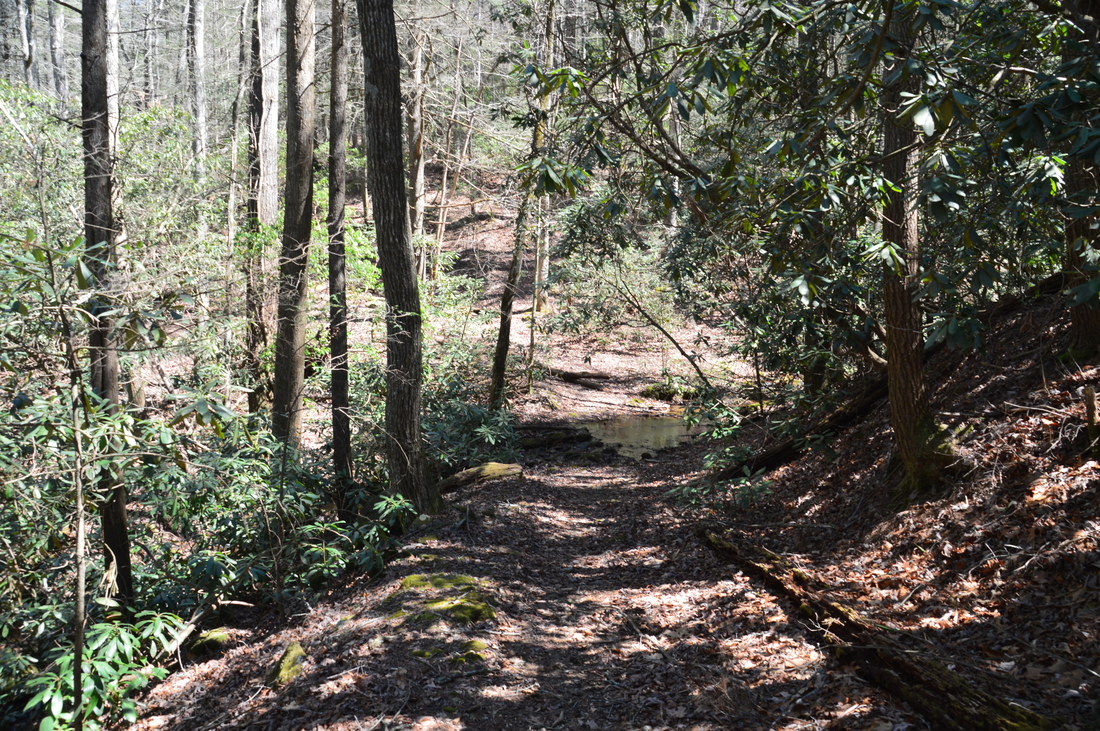
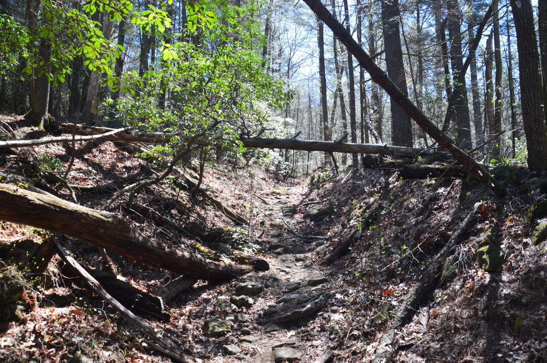
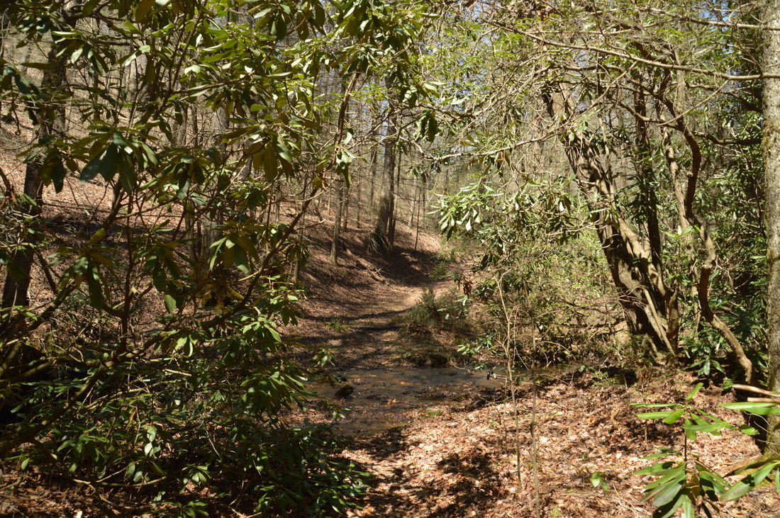
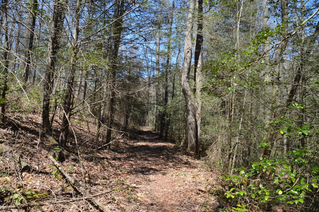
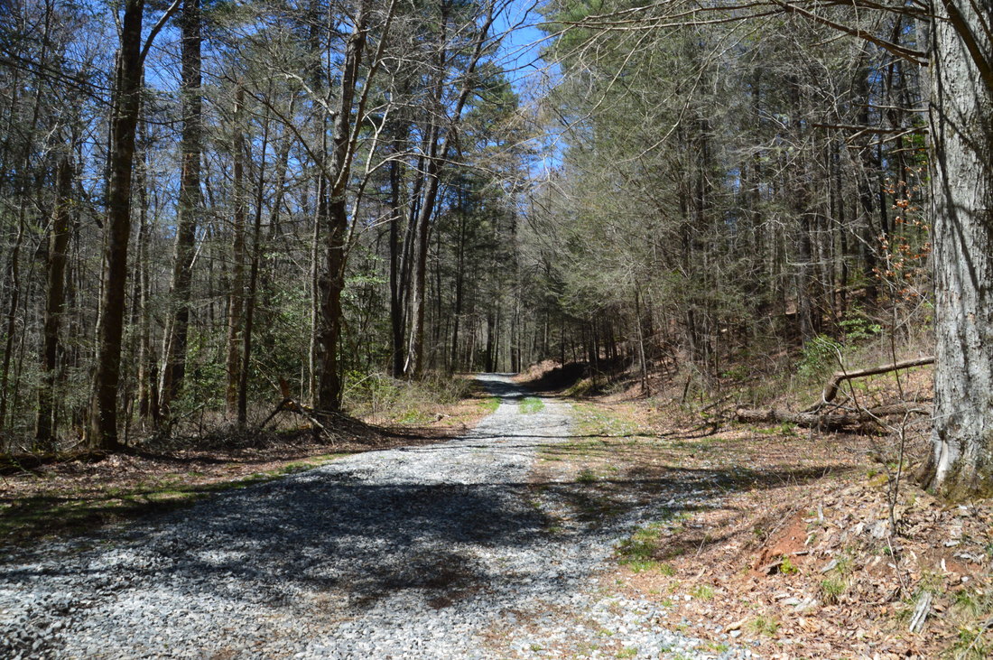
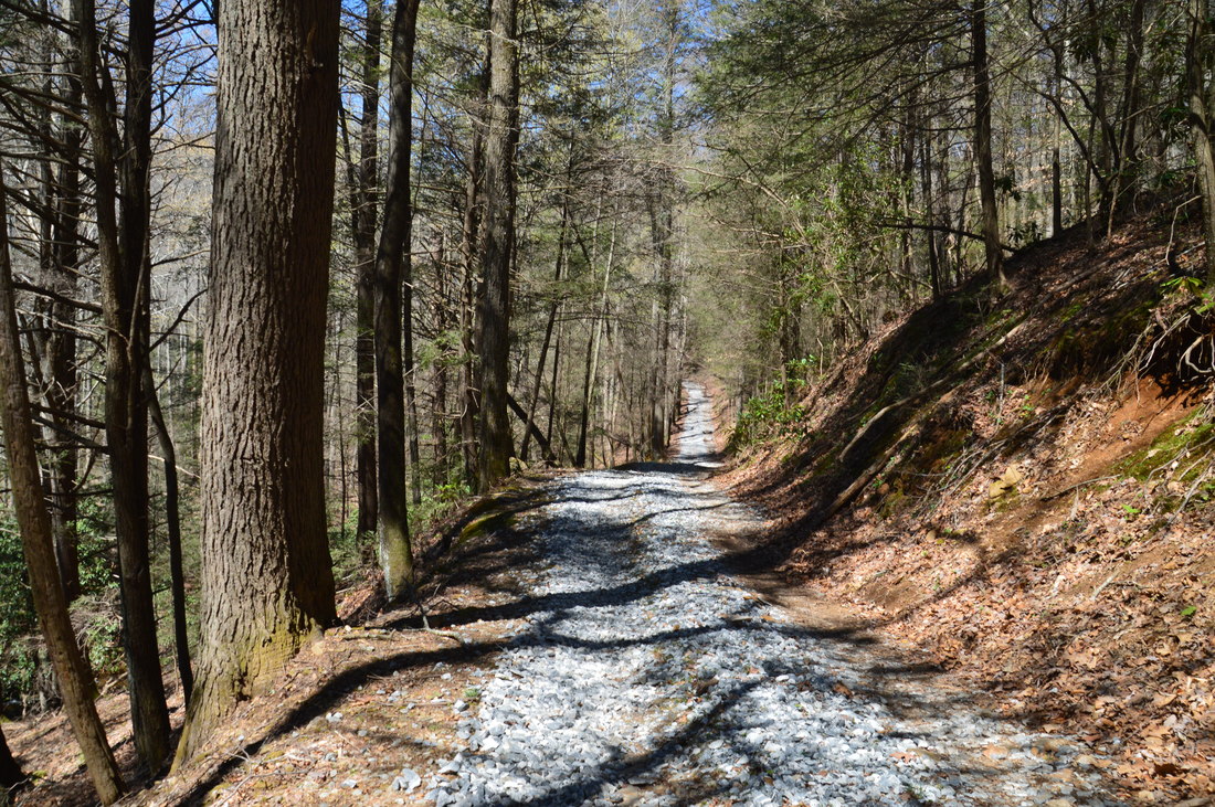
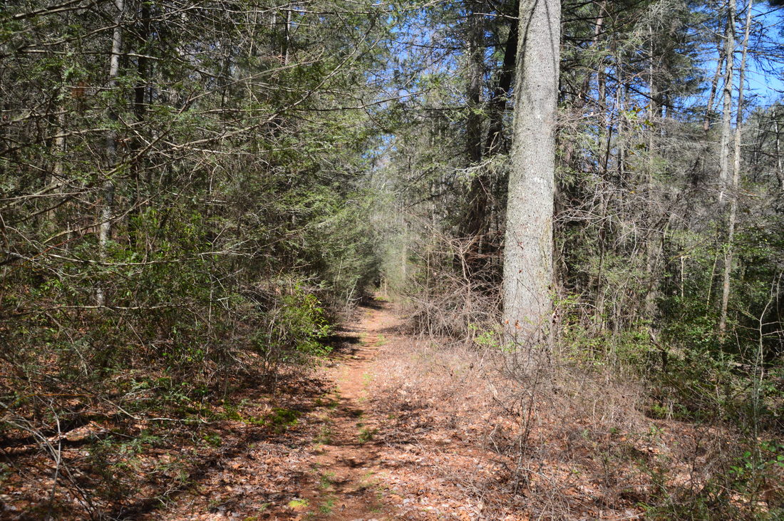
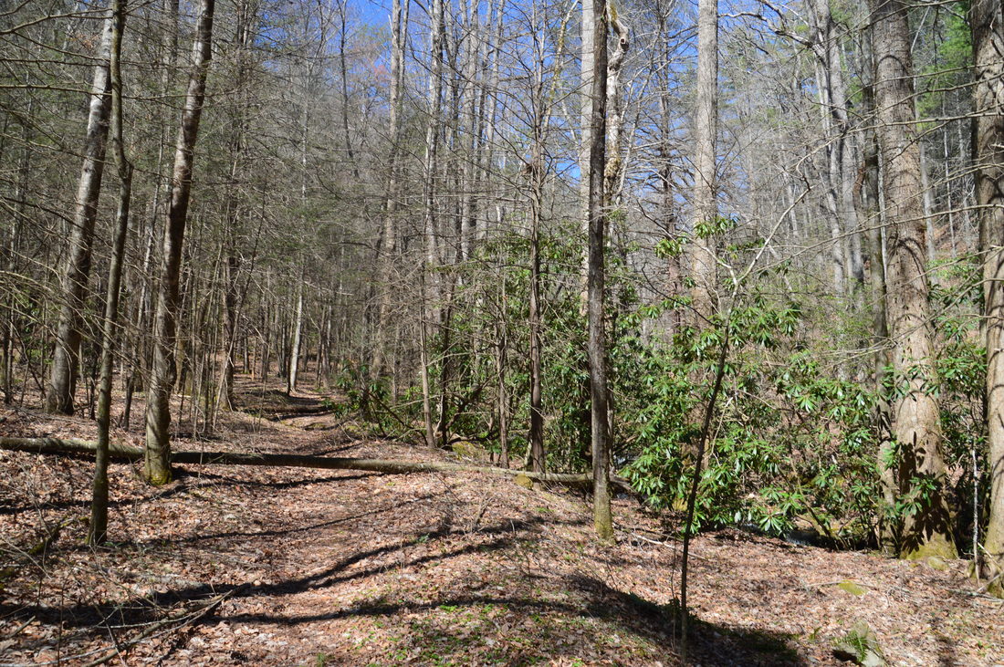
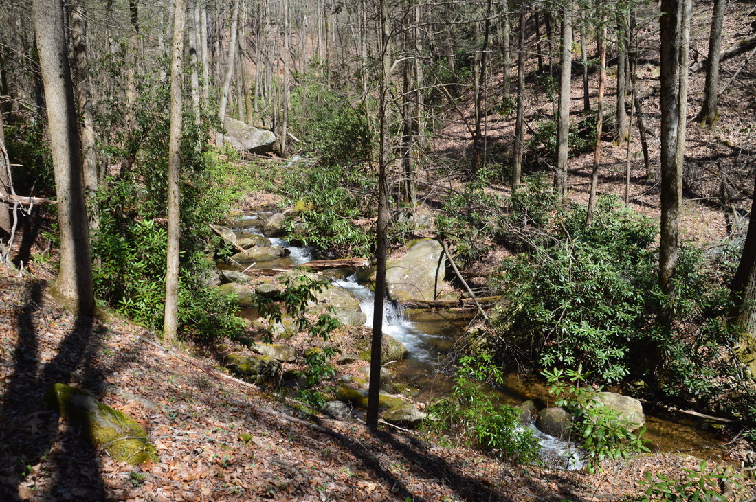
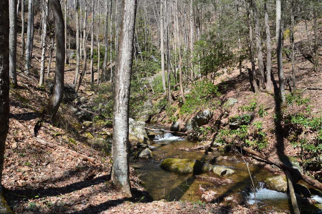
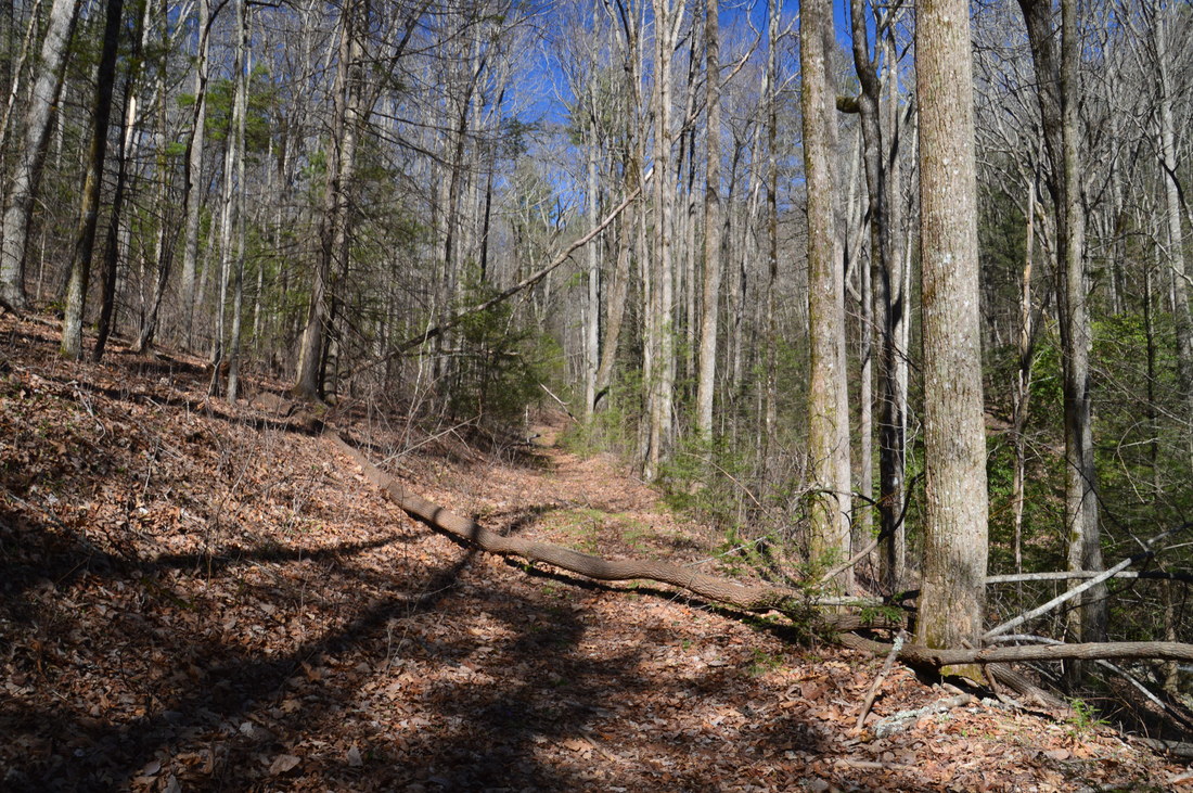
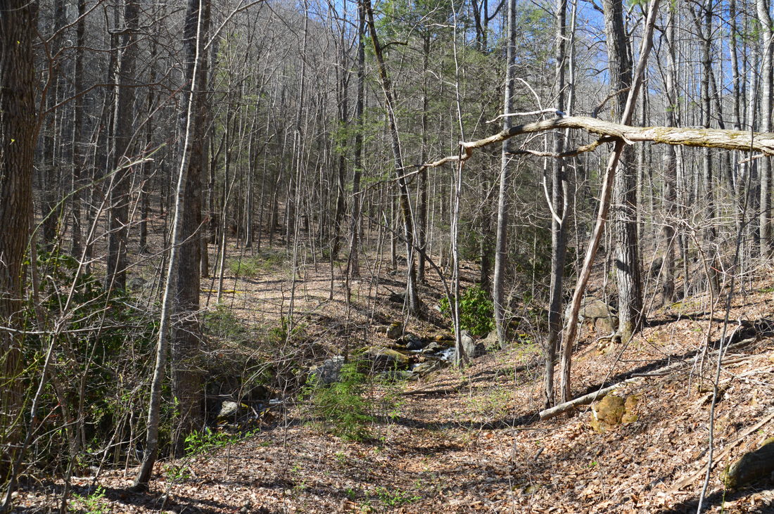
The hike to Third Falls and Frogface Falls on Blood Mountain Creek follows mostly distinct old logging roads that often provide views of the creek's numerous cascades.
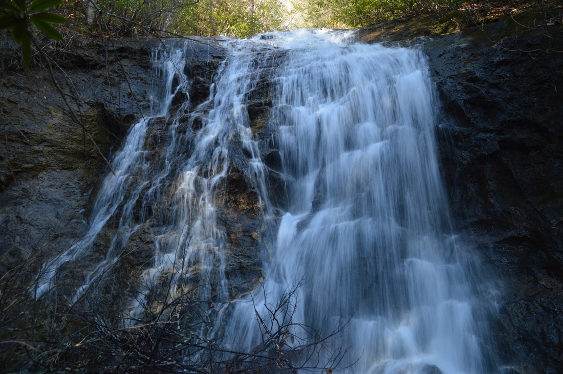
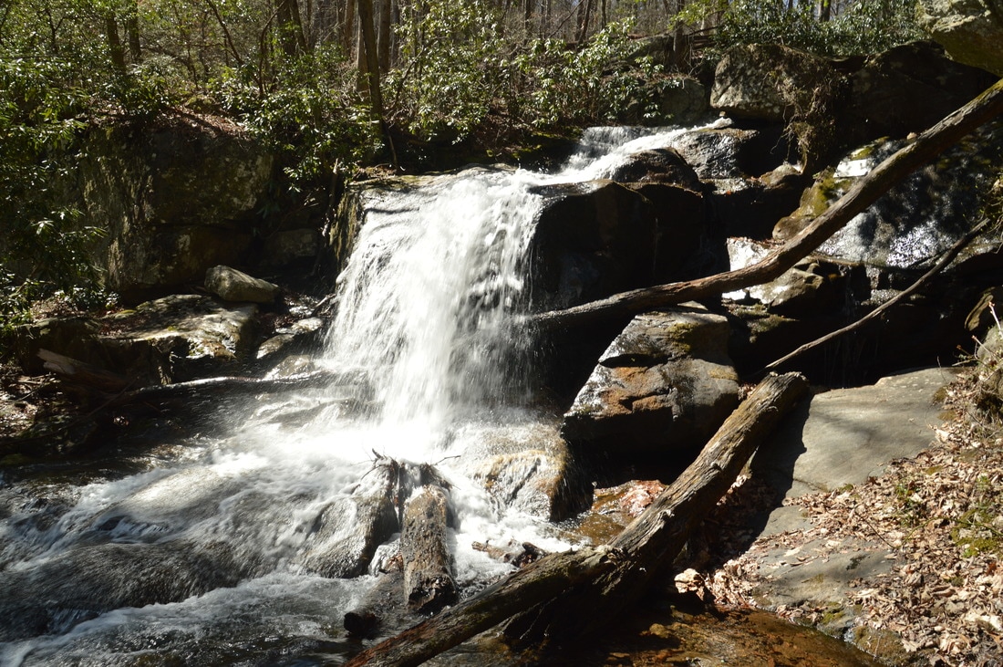
Frogface Falls consists mainly of one vertical drop about 35 feet down a large cliff. Actually, from the base, you cannot see some cascades that drop an additional 15 feet just above the main waterfall. The waterfall is very remote, set in a wild setting among rhododendron tangles, steep slopes, and cliffs, and you are likely to have it all to yourself. On this day, the water flow here was above average even for winter flow, due to a lot of recent rainfall, so it is possible that the waterfall will have a lot less flow during typical summer conditions. Even though Frogface Falls is best to see in winter or spring, it is good any time of year. The name of the waterfall originates from a rock outcrop on the cliff (that was hidden by water today) which resembles the face of a frog. Frogface Falls is also known as Fourth Falls on Blood Mountain Creek. There is a "Fifth Falls" or "Upper Falls" about 0.3 miles upstream - and in fact it is nearly 100 feet high - but it requires a harder trek, and by the time I had reached Frogface Falls, I felt quite satisfied with how far I had gone up along Blood Mountain Creek, so I decided to retrace my steps from here. Also, the Fifth Falls typically has very little water (although it probably was flowing well on this day). If you decide to continue to the Fifth Falls, keep in mind that it is best to scramble up the steep slope to the left of Frogface Falls and continue upstream from there, as the area to the right of the waterfall is essentially impassable.
Otherwise, from Frogface Falls Trail, begin retracing your steps back to the south. When you return to the area above Third Falls at 5.75 miles, simply continue following the Frogface Falls Trail along the old roadbed that stays about 100 feet higher than Blood Mountain Creek. This trail remains easy to follow as it curves in and out of a pair of coves, although at the time of this hike, there was one major blowdown that included multiple fallen trees. At 6.4 miles, rejoin the Blood Mountain Creek Trail at the Y-split, and at 6.55 miles, reach Dicks Creek Road. If you wish, you can continue retracing your steps to and along the Crow Mountain Creek Trail, but I personally decided to walk Dicks Creek Road to the car instead in order to see three more waterfalls near the road. Unfortunately, it got dark fast, so I didn't get to see the roadside waterfalls, but the walk was fairly pleasant and the sound of rushing water was present much of the time. Assuming that you choose the walk along the road, turn right and follow the road to a gap and large cul-de-sac type area at 6.9 miles, from where the rest of the way is downhill. As you follow the road, you will pass a number of designated roadside campsites. At 7.65 miles, you will pass Dicks Creek Falls to the right, which is a small but scenic waterfall. Even though some folks know this as Upper Dicks Creek Falls, there are at least two major waterfalls upstream, so it is not the upper falls! At 8.3 miles, just before a bridge across Blood Mountain Creek, a short path leaves to the left to the First Falls and Second Falls on Blood Mountain Creek, both of which are well worth seeing. The mileage here does not include the short side trip, because I did not take it due to the darkness. Continuing ahead on the road, you will reach the car and conclude the hike at 9.4 miles just after the wet crossing of Crow Mountain Creek. Assuming that you saw the roadside waterfalls as well, you will have seen six waterfalls on this hike! Mileage
0.0 - Crow Mountain Creek Trailhead
0.85 - Crow Mountain Creek Falls 1.25 - Wildlife Clearing 1 1.5 - Wildlife Clearing 2 1.6 - Wildlife Clearing 3 2.65 - Blood Mountain Creek Trailhead 3.35 - Third Falls on Blood Mountain Creek 4.65 - Frogface Falls 6.55 - Blood Mountain Creek Trailhead 7.65 - Dicks Creek Falls 8.3 - Side Trail to First and Second Falls on Blood Mountain Creek 9.4 - Crow Mountain Creek Trailhead Variations
Hike out and back to Crow Mountain Creek Falls - 1.7 Miles
Hike out and back to Third Falls and Frogface Falls from Blood Mountain Creek Trailhead - 3.9 Miles Do the full hike out and back instead of Dicks Creek roadwalk - 9.2 Miles Bonus Stops
After the hike, it is well worth stopping at the roadside Waters Creek Falls (also known as Dicks Creek Falls) further south on Dicks Creek Road near its intersection with Waters Creek Road.
PicturesVideos
11 Comments
Mike Hiler
5/9/2017 11:21:59 pm
Nice article. Water was really flowing @ Frogface. Too bad you didn't get shots of the upper portion.
Will Mitchell
5/8/2018 04:00:48 pm
The trail to the third falls and Frogface was impassable due to deadfall. I may have just been on the wrong trail from the Y split (I hope so) but had to turn around shortly after the last wildlife clearing and finish the loop
Mark Oleg
5/8/2018 04:22:50 pm
Will,
Chad
3/29/2020 12:08:53 pm
I tried to make it up to Third Falls and Frogface falls on 3/21/20. I bushwhacked from 2nd Falls on Blood Mountain Creek up to the gravel road and then the last clearing. After the clearing the trail looks like a microburst hit it. You can actually see it in the satellite views fairly clearly. I'm up for some tough bushwhacking, but this was beyond brutal. I think a longer off trail workaround will be needed to get there in any kind of enjoyable way.
Chad
3/29/2020 10:57:27 pm
Made it to Third Falls today by bushwhacking in the east side of the creek to avoid the downfalls. Slow going- no easy steps the whole way. The old roadbed that splits left to go above the falls towards Frogface still had a lot of downfall on it...was hoping I was past it and ended up turning around and saving that part for another day.
Zhili Zhan
5/2/2020 09:56:51 pm
I wish I had seen this post before we went today. about 500 feet after entering the blood mountain creek trail past the last clearing, we encountered very large amount of deadfall. We tried both uphill and downhill side to circumvent the deadfalls, but to no avail. The briar jungles all around the deadfalls made the bushwhack especially painful, literally! We managed to get past the Y Split about 250 feet on the downhill side and I am certain I am already on the right way to the third fall. Even then, the old logging road bed was also destroyed and completely covered by briar mess with no end of deadfall in sights ahead. Have to call it a day there and turn around.
Patrick M
6/22/2019 03:16:26 pm
Nice article. I am investigating waterfall hikes and this outlines how to see multiple waterfalls in a day. Well done. I especially like the milestones and the pictures. It sets expectations nicely. Keep it up!
Michelle
6/30/2021 11:34:21 am
I too tried to access Frogface and the 2 additional upper falls in late May or June 2020. We started from the gate at the end of Dicks Creek Rd, walked the old gravel road to the clearing and veered off. Trail was easy to identify in the woodline, but came to a complete halt with deadfall. Could not go over and did not see good places to try to go around. Have not been back since.
Michelle
1/8/2023 06:43:47 pm
1/8/23
Molly
5/17/2023 03:07:30 pm
Did you find a way around this? Any other trails I can take? I've been waiting to see any updates this is the first one I've seen from 2023. This is a hike I have wanted to revisit for years.
Mark Oleg
6/22/2023 04:51:03 pm
Hey everyone, Leave a Reply. |
About MeMark Oleg Ozboyd Dear readers: I have invested a tremendous amount of time and effort in this website and the Georgia Waterfalls Database the past five years. All of the work that has gone in keeping these websites updated with my latest trip reports has almost been like a full-time job. This has not allowed me to pick up a paid job to save up money for college, and therefore, I I've had to take out loans. If you find the information on this website interesting, helpful, or time-saving, you can say "thanks" and help me out by clicking the button above and making a contribution. I will be very grateful for any amount of support you give, as all of it will apply toward my college tuition. Thank you!

Coming in 2022-2023?
Other Hiking WebsitesMiles HikedYear 1: 540.0 Miles
Year 2: 552.3 Miles Year 3: 518.4 Miles Year 4: 482.4 Miles Year 5: 259.9 Miles Archives
March 2021
Categories
All
|


 RSS Feed