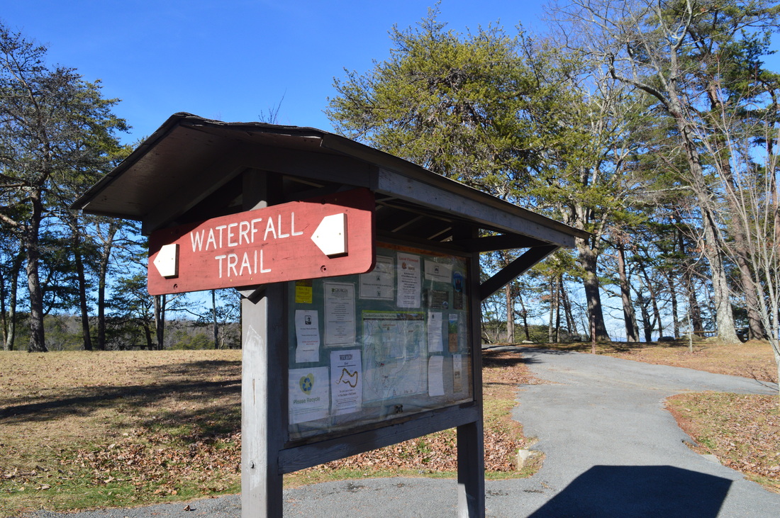
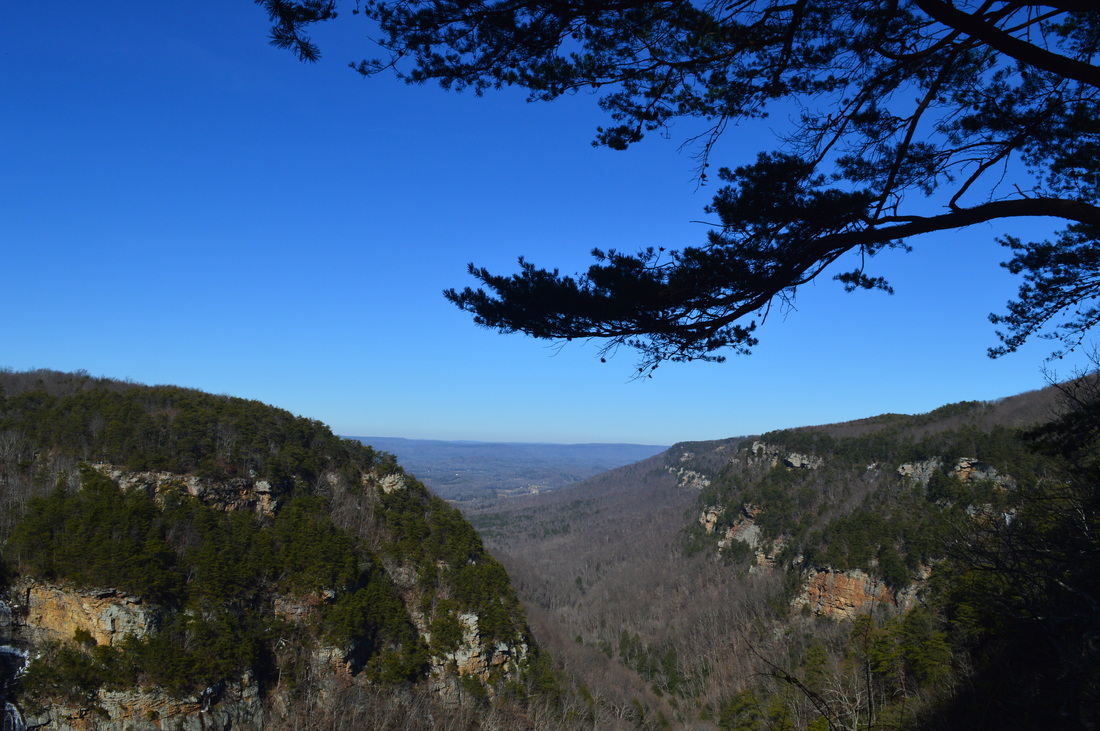
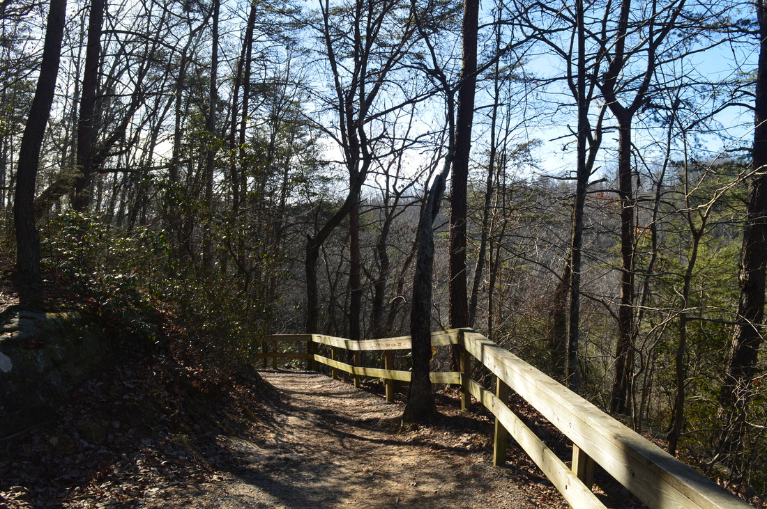
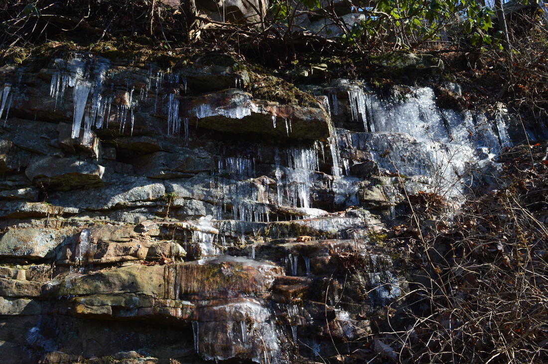
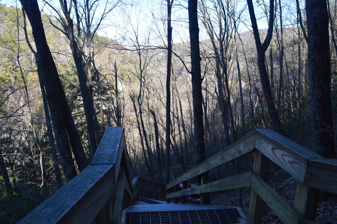
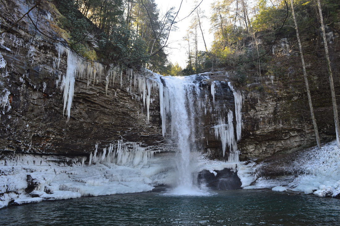
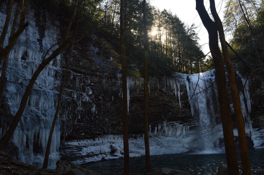
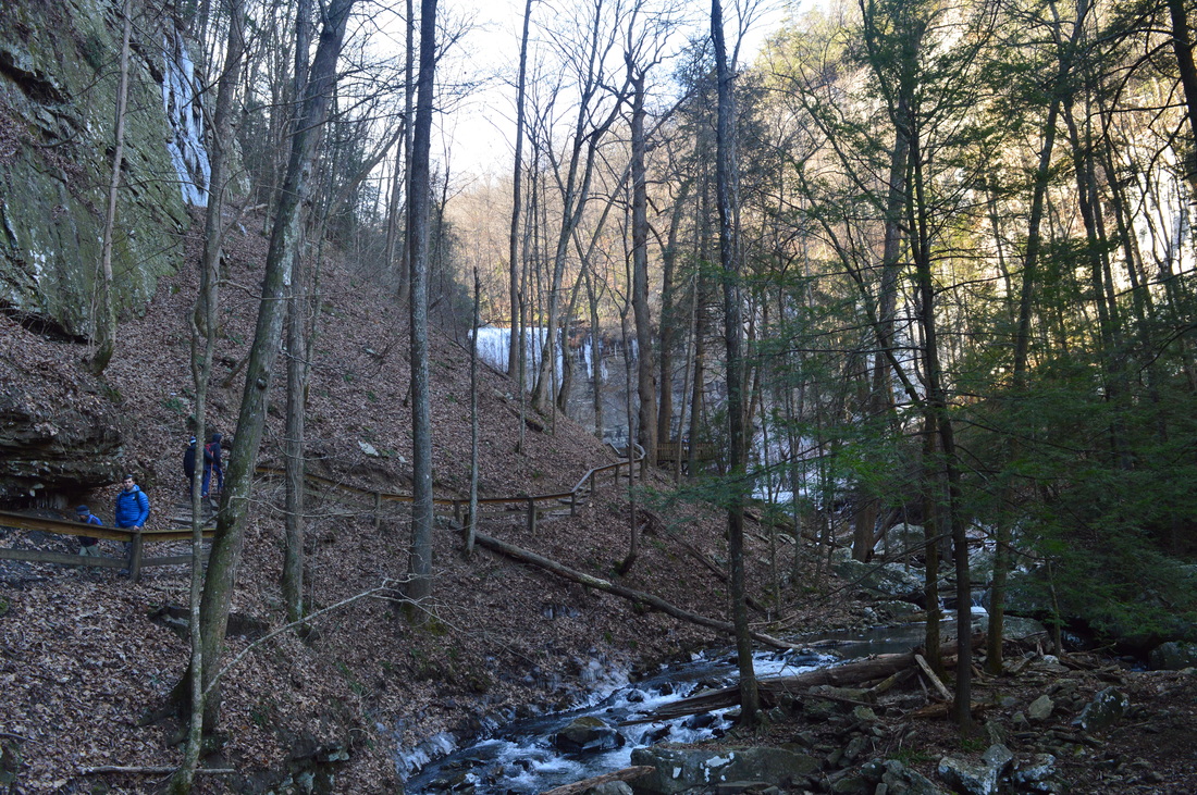
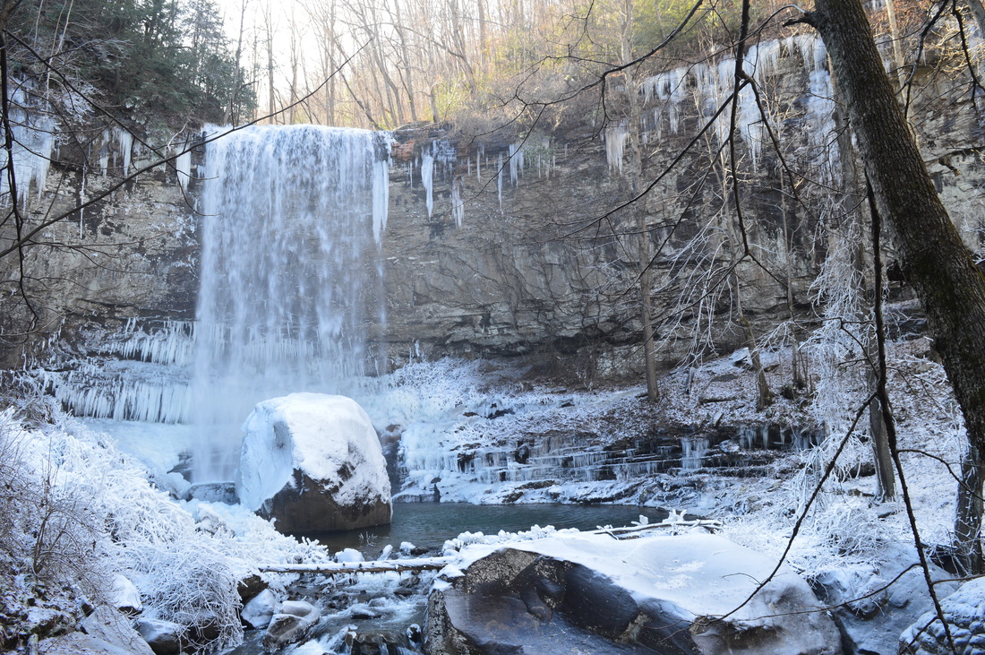
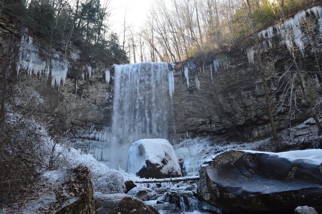
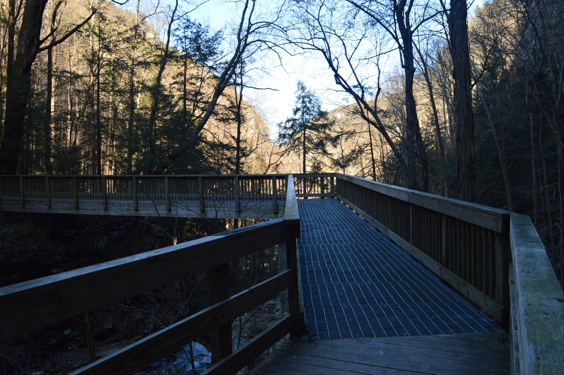
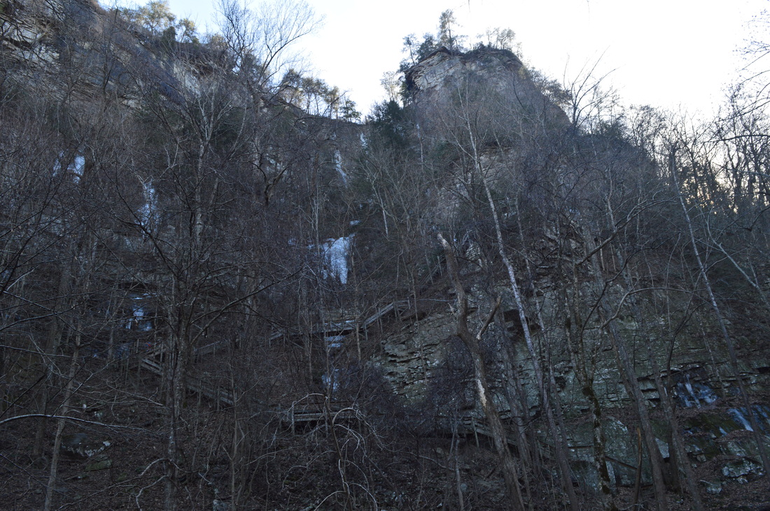
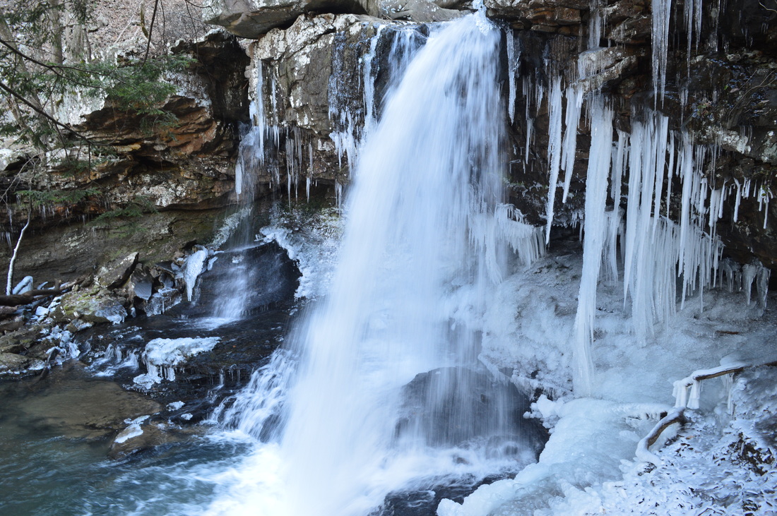
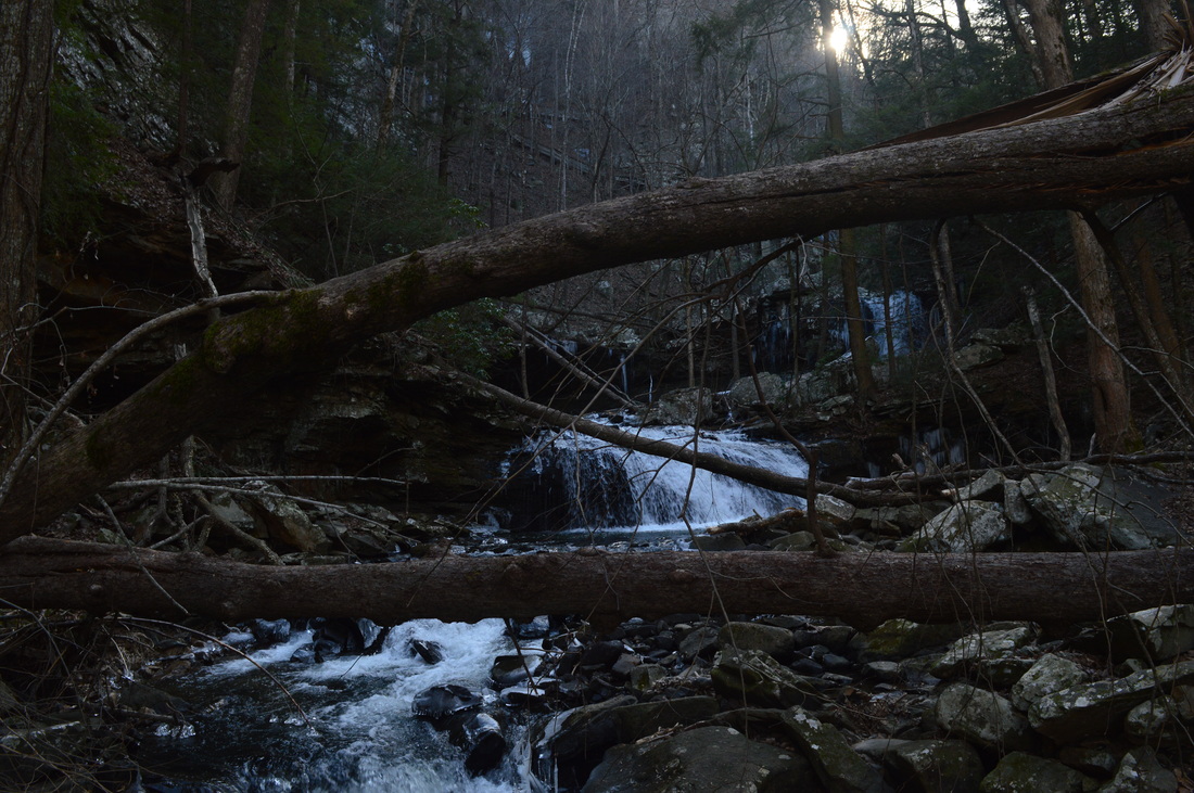
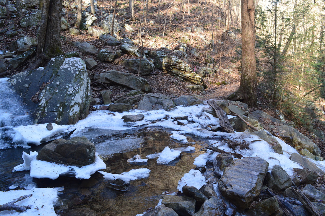
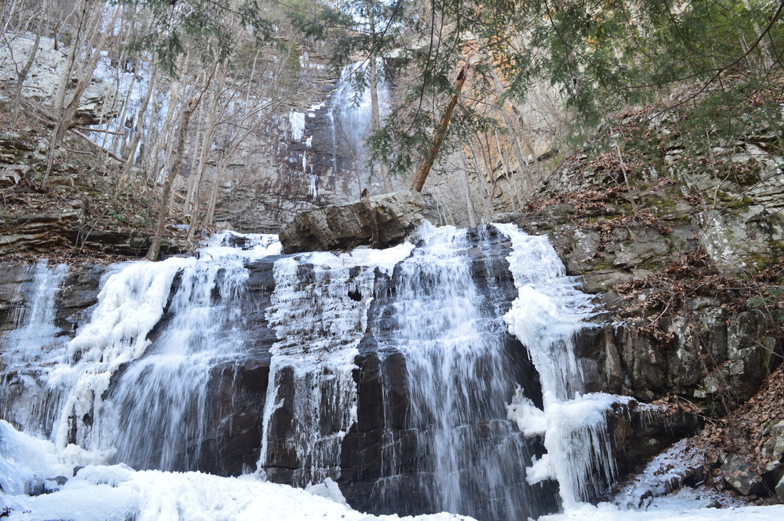
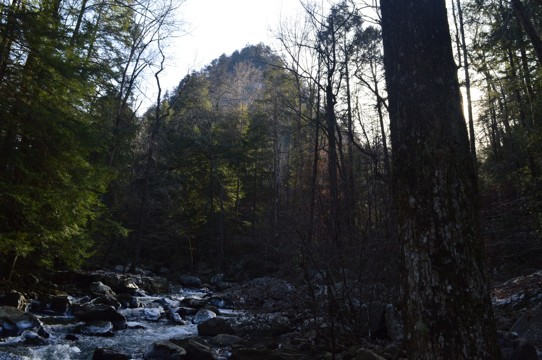
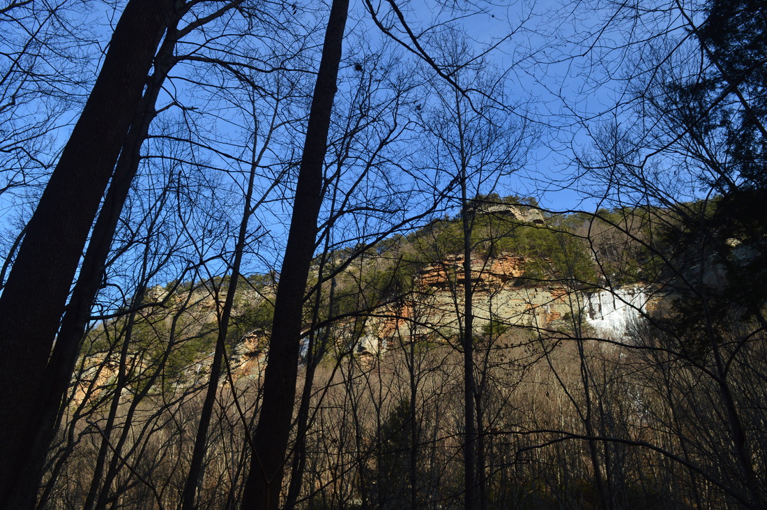
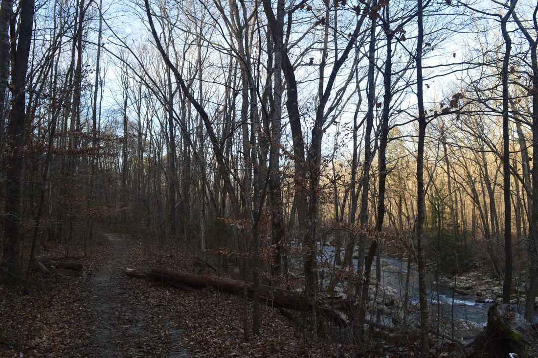
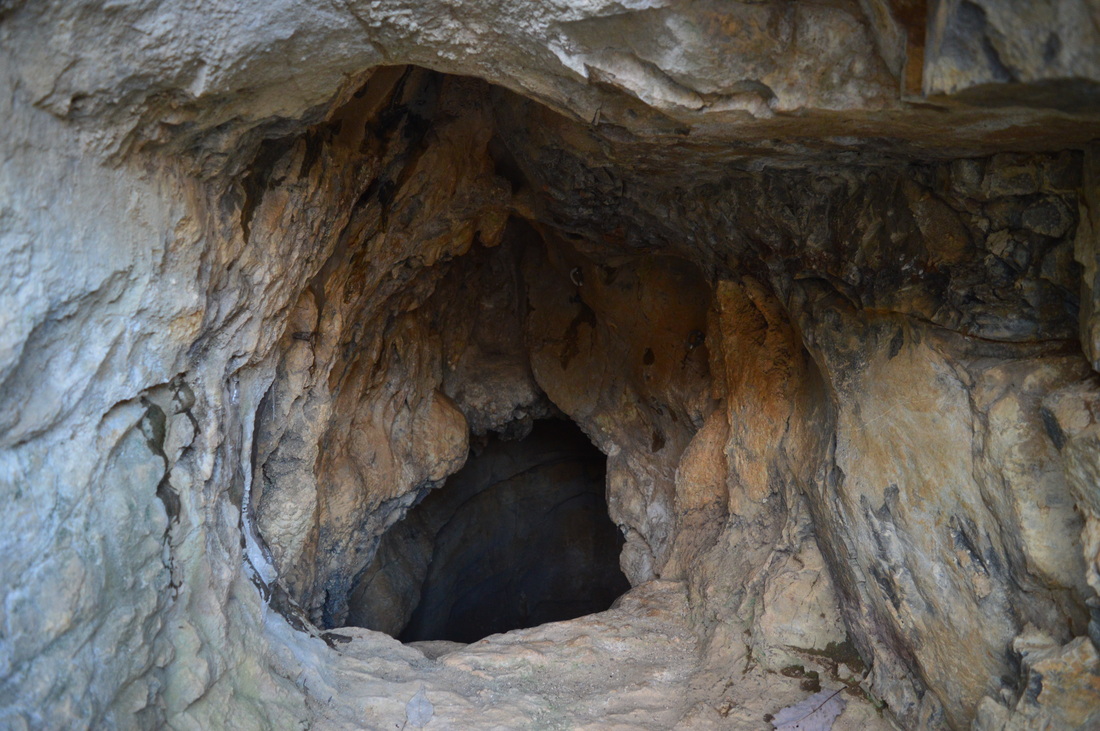
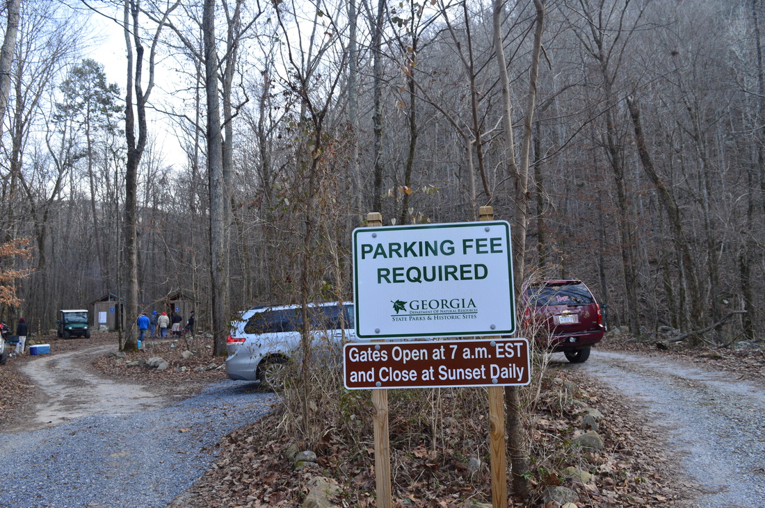
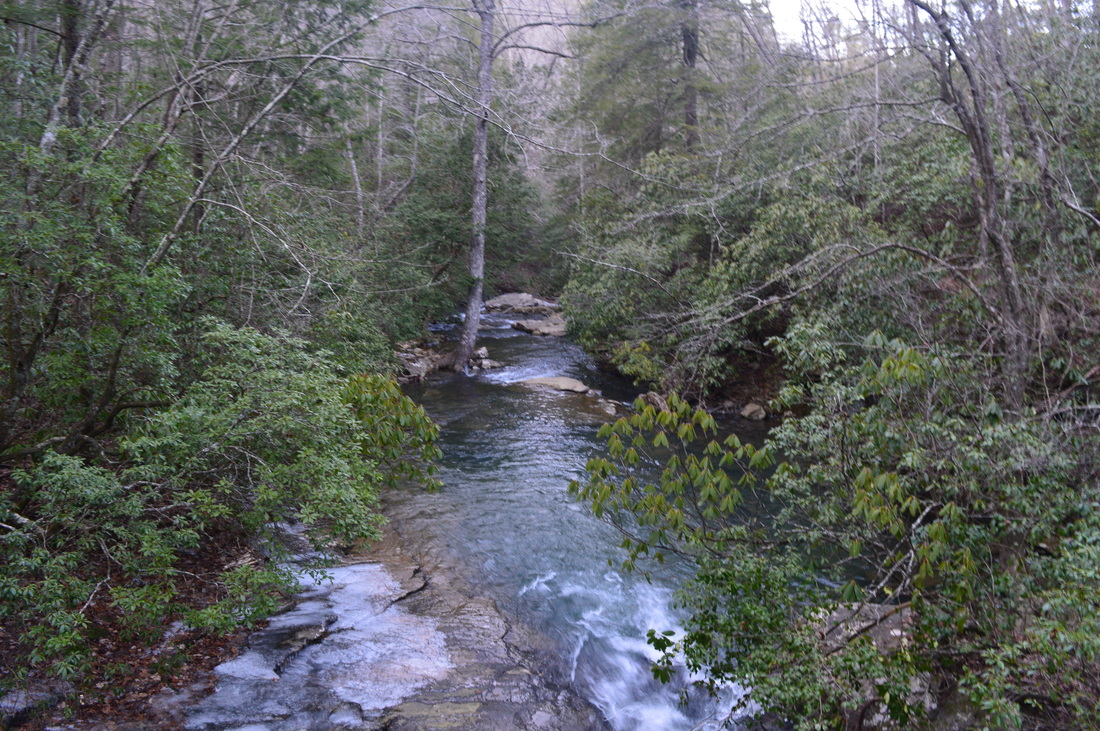
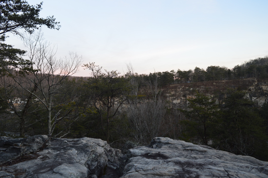
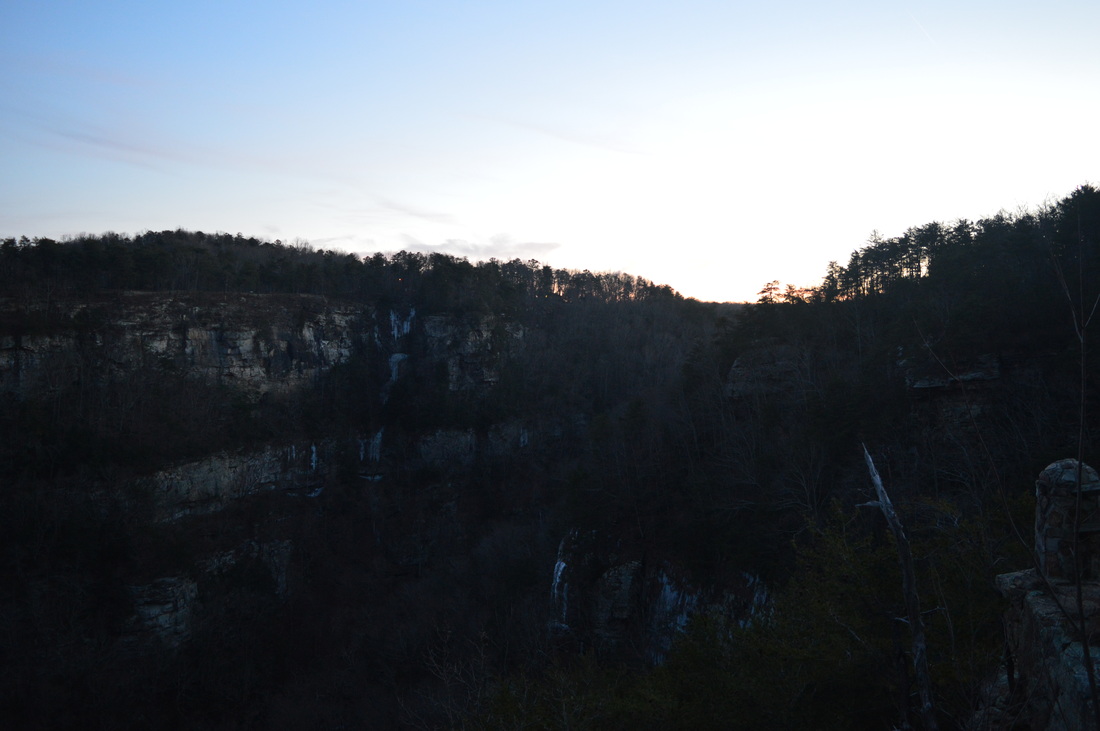
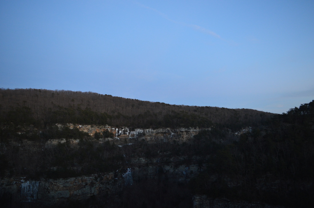
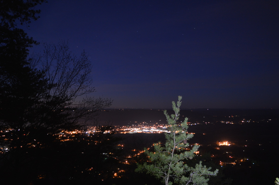
 When hearing the name Cumberland Plateau, the plateau and valley pattern in middle Tennessee comes to mind. But did you know the plateau doesn't end there? On its way into Alabama, it passes through the extreme northwestern sliver of Georgia, where one of the most spectacular sights on the entire plateau await: Sitton Gulch. Inside the Gulch, you will find a fine mountain stream and four waterfalls, the highest topping out at 100 feet. And if you want a bonus, do the hike in winter after a cold snap - you won't regret it. This hike occurred on January 10th, 2015, following an Arctic cold blast. My plan was to first hike the Sitton Gulch Trail out and back from the main Cloudland Canyon State Park trailhead. Following this, I would hike the West Rim Loop counter-clockwise. R/T Length of Trail: 10.5 Miles Duration of Hike: 6:20 Type of Hike: Out-and-back plus loop Difficulty Rating: 6 out of 10 Pros: Many waterfalls; great canyon views; groomed trails Cons: Lots of steps on ascent out of Sitton Gulch Scenic Views: Views from West Rim Trail - 5-6 stars Water Features: Cherokee Falls - 8 stars; West Rim Falls - 8 stars; Hemlock Falls - 7 stars; Third Falls - 7 stars; Fourth Falls - 2 stars Trail Blaze Color(s): Sitton Gulch Trail - Blue: West Rim Loop - Yellow Best Season(s) to Hike: Winter Beginning Point: Interpretive Center trailhead Directions: From Trenton, GA: Follow GA State Route 136 East for 6 miles until the Cloudland Canyon State Park entrance, on the left. Turn left onto the main park road and follow it for 1.4 miles until the Interpretive Center and trailhead parking. Not every winter areas below 2000 feet in the South dip into the single digits, but when it does happen, ice grows like mushrooms after a good summer rain. Iced-up waterfalls present amazing sights, so I decided that seeing the widely-known set of waterfalls in Sitton Gulch after a cold blast would make for some nice photography opportunities. After I did the hike, I learned there's an overlook down the Overlook Trail, just down from the Interpretive Center. I was not aware of this, so I didn't go that way at all. Check it out and send me a picture! To follow the hike I did, from the parking area, go up the paved path and pass a trail wand that indicates you're on Waterfall Trail and West Rim Trail. This also appears to be the route of the new Great Eastern Trail, that is still being laid out. For the first quarter mile or so, the Waterfall Trail and West Rim Trail share paths. Pass a few cabins on the left, and then descend a little bit to the place where the trails divide. The West Rim Trail continues along the rim to the left, while the Waterfalls Trail continues straight into the canyon. This is a steep descent via staircases. Reach the spur trail for Cherokee Falls at 0.5 miles (I accidentally put it as Hemlock Falls on the map). The short spur trail goes left while the main trail continues right. This is the most beautiful year-round waterfall in the canyon, although all are best in winter. Hemlock Falls is a single drop falls with a large plunge pool. Swimming may be tempting in summer, but it is not allowed. When I came here, the whole rock wall to the left of the falls was iced up, there was a large mass of ice on the ground to the right of the falls, and there were massive icicles all around the falls itself. This was my first attempt at a slow shutter waterfall photo. It didn't work out, due to the shutter speed being too slow, so I will not post the resulting picture. I will still post the fast shutter picture, of course. It is the header for this post. After Hemlock Falls, retrace your steps to the main trail and continue the steep descent on a well-built staircase. It reminds me of the steps in Tallulah Gorge State Park near Clayton, Georgia, except there's even more there and most are metal, not wooden. It is also similar to the metal staircase at Amicalola Falls State Park near Dawsonville, Georgia. At around 1 mile, reach the spur trail for Cherokee Falls. This spur trail is located just before a metal bridge over Daniel Creek. It is also a very short spur trail leading to an observation platform of the falls. I don't like where the platform is behind two tulip trees. It is easy to scramble down behind the platform and get a better view of the falls. It is lower and wider than Hemlock Falls, but it's still beautiful. There were many icicles in the vicinity of the falls and the rocks and surrounding ground was covered with a thick sheet of ice. From Cherokee Falls, retrace your steps to the main trail and cross Daniel Creek on the aforementioned metal footbridge. You can see Cherokee Falls through the trees upstream, and the smaller Third Falls and Fourth Falls just downstream, as the stream makes its most dramatic drop of feet per mile here. After the footbridge, a short set of steps leads you to a good viewpoint of Third Falls. There is a short but rough side path leading to the base of Third Falls. I didn't go quite all the way down because of the icy slopes, but I still got a good view of the falls. It is smaller than the others so far, and consists of a powerful single drop. It is most picturesque during high water levels. The Fourth Falls just downstream from Third Falls, is a small set of cascades that is like a continuation of Third Falls. However, one of the prettiest waterfalls (in my opinion) still lays ahead, although it is a wet-weather one. After about a half-mile of following scenic Daniel Creek, the trail reaches at 1.5 miles the crossing of West Rim Creek (marked as an unnamed stream flowing from Whiteoak Spring on some maps). In summer and during low water levels, this is nothing but a dry rock jumble, and if the crossing is dry, there is no point to make the short scramble up to West Rim Falls. However, if there is water in the crossing, then turn left up the slope and scramble up to the falls. The falls consists of a double drop - a .large first drop off the sheer canyon walls and then another set of cascades. It might be the prettiest waterfall in the park, closely rivaling Hemlock Falls. Too bad it's only seen during wet weather. The crossing of West Rim Creek itself can be done dry-shod even when there is water, but on this day, it was completely iced up, making for an extremely slippery crossing. Great care must be taken if it's iced up! After West Rim Falls the Sitton Gulch Trail continues a steady descent along Daniel Creek. Shortly, Daniel Creek and Bear Creek merge, creating Sitton Gulch Creek,which is wider and quieter. During the last mile and a half of Sitton Gulch Trail, you can see in winter the sheer canyon walls on the opposite side. There is a spur trail to a cave at 2.5 miles. It is unmarked, but it is a wide roadbed, so it's easy to see. The old roadbed leads to a shot path that climbs up a hill to the gated cave entrance. It was gated recently - just a few years ago, it was open to the public, and there are still cable mounts that can be seen through the gate. After the spur trail to the cave, the Sitton Gulch Trail widens and reaches its northern terminus at northern parking area at 3 miles. This parking area can be easily accessed from Trenton and is just outside of the Trenton city limits. After a short break, retrace your steps back to the top of the rim. That ascent up the 1200 steps on the Waterfall Trail will take a while! Once you've made it back up to the junction with the West Rim Loop on the top of the rim, you've hiked about 6 miles, but the hardest part of the hike is over. The West Rim Loop is almost entirely on the plateau, so any ascents or descents will be minor. If climbing out of the canyon, the West Rim Loop starts off on the right. It is marked by yellow blazes, is at the end of the steps, and is also marked by a Great Eastern Trail logo. The trail descends a little bit to Daniel Creek and crosses it at 6.2 miles on a picturesque wooden footbridge. There is barely a canyon this far up on Daniel Creek - it is just a small valley. However, the canyon starts just a couple hundred yards downstream with Hemlock Falls. Following the Daniel Creek footbridge, a short but steep climb, aided by switchbacks, brings the trail back onto the rim. This part of the trail has ample yellow blazes. Once the trail reaches the rim, pass the Yurt Village on the left at 6.5 miles. There are 10 yurts, although not all are visible from the trail. At 6.7 miles, a spur trail leads left to one of the park's campgrounds. There are also good winter views of the canyon on the right. At 7 miles, the trail crosses a rock outcrop with some nice views of the opposite side of the Daniel Creek section of the canyon (where the trailhead parking is located). At 7.2 miles, reach a junction with the loop section of West Rim Trail. Most books and websites have the description as hiking the loop clockwise, but I hiked it counter-clockwise, so I'll put the description that way too. To hike it counter-clockwise, cross the small footbridge over a small, often dry creek. This is West Rim Creek, which produces the spectacular wet-weather West Rim Falls. On this day, the creek was flowing pretty good. If you end up hiking this trail before going down into the canyon, if you see water here, you'll know West Rim Falls is flowing good down below. At 7.6 miles, reach the best overlook of the canyon on the trail. While still not perfect, this viewing area provides a clear view of the Daniel Creek section of the canyon, as well as some of the Bear Creek section. From here, you can clearly tell where you were down in the canyon, and also where the trailhead parking is located. I wish you could see more down the way of Sitton Gulch Creek though. The next mile or so will have more overlooks of the canyon, but I think this one is the best one. Shortly after the overlook, pass Cabins 10-16 on the left. They can be seen from the trail, but I didn't see any clear spur trail to them. Perhaps people from the cabins just go through the woods to the trail. At around 8 miles, reach a spur trail left leading to Cabins 6-9. Maybe this spur trail is used for Cabins 10-16 too. The trail continues following the rim and ascends slightly over the next half-mile, before reaching the edge of the plateau at 8.7 miles. This is the end of the plateau - the trail turns left here and follows the north rim, as there's nowhere to go forward. However, there is a very short spur trail that goes forward to a nice overlook. This one doesn't provide a view of the canyon, but it provides a good view of the surrounding areas. Right upfront in the valley is the city of Trenton (slightly to the left). In the middle are the mountains of the Cumberland Plateau, on the right you can see the edge of the east rim of Cloudland Canyon, and far in the distance Chattanooga can be seen. However, there are a few small trees in the way of the overlook. It is still a very nice view, but it would have been slightly better if the trees weren't there. After this overlook, the trail now follows the north edge of the plateau, constantly overlooking Trenton. There are a few more overlooks with views of Trenton. The night views of the town are great here. At 8.8 miles, the trail leaves the rim for good. A spur trail continues forward to another trailhead, but the main trail turns left. A park road is crossed at 9 miles - after this, a steady downhill continues. At 9.3 miles, a spur trail leads right to a campground, and then the trail approaches West Rim Creek and Whiteoak Spring. Whiteoak Spring is somewhere around here, but it's not right on the trail. At 9.5 miles, the trail crosses West Rim Creek without the benefit of a footbridge. However, this place is usually dry - on this day, even though there was water, it was STILL easily rock hopped, so there's no worries about wetting your feet ever here. Shortly after the crossing, the trail reaches the end of the loop. Turn right here and retrace your steps back to the trailhead, finishing the hike at 10.5 miles. Let's summarize this hike. I'd say this is one of the best hikes in Georgia, and definitely out of the best ones in northwest Georgia. There's all kinds of waterfalls and many views too. Best time to go is in winter or after a good rain, but it's still a good hike in other times of the year. Just it's best with the waterfalls flowing good. I rate this hike a Best Hike. See my pictures and videos below.
1 Comment
8/3/2022 05:55:07 pm
Edirne ECA servisi en uygun fiyat ve en hızlı servis garantisi ile sizlerle. https://www.edirneklimaservisi.com/edirne-eca-servisi/ Leave a Reply. |
About MeMark Oleg Ozboyd Dear readers: I have invested a tremendous amount of time and effort in this website and the Georgia Waterfalls Database the past five years. All of the work that has gone in keeping these websites updated with my latest trip reports has almost been like a full-time job. This has not allowed me to pick up a paid job to save up money for college, and therefore, I I've had to take out loans. If you find the information on this website interesting, helpful, or time-saving, you can say "thanks" and help me out by clicking the button above and making a contribution. I will be very grateful for any amount of support you give, as all of it will apply toward my college tuition. Thank you!

Coming in 2022-2023?
Other Hiking WebsitesMiles HikedYear 1: 540.0 Miles
Year 2: 552.3 Miles Year 3: 518.4 Miles Year 4: 482.4 Miles Year 5: 259.9 Miles Archives
March 2021
Categories
All
|


 RSS Feed