You have probably heard about Cloudland Canyon. Cloudland Canyon State Park's Sitton Gulch and Daniel Creek's waterfalls are known very well throughout the hiking community. The park's West Rim Trail is also known quite well. However, many hikers are not aware of another hiking trail in the park - and one that is much more secluded: the Bear Creek Backcountry Trail. The Bear Creek Trail passes through the Bear Creek gorge and then cruises over hills in the eastern section of the park, before reaching a fantastic vista of Cloudland Canyon. Unfortunately, as of March 21, 2016, the Bear Creek Backcountry Trail is closed east of Bear Creek indefinitely. This hike occurred on Saturday, March 19th, 2016. My plan was to check out the "tourist overlook" of Cloudland Canyon near the trailhead. From there, I would hike the Overlook Trail to the Bear Creek Backcountry Trail. Then, I would hike the entire Bear Creek Backcountry Trail - my plan was to hike the loop section counter-clockwise and then return the same way. On my way back, I planned to hike the park's Backcountry Loop clockwise.
Summary
R/T Length of Trail: 10.8 Miles
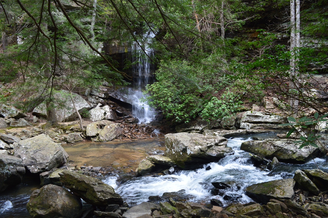
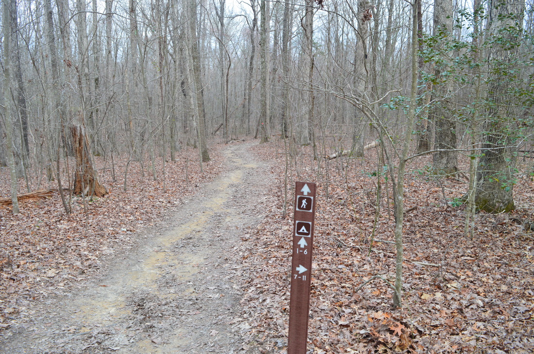
Duration of Hike: 7:20 Type of Hike: Y-Shape with Two Loops Difficulty Rating: 5 out of 10 Total Elevation Gain: 2231 Feet Pros: Beautiful, easy-to-access, and yet somewhat secluded scenery on this hike Cons: None Points of Interest: Cloudland Canyon Overlook - 8 stars; Bear Creek Overlook - 5 stars; Waterfall on tributary of Bear Creek - 6 stars with enough water flow; Scenic area at Bear Creek near the ford; Vista of Cloudland Canyon on Bear Creek Trail - 10+ stars Trail Blaze Color(s): Overlook Trail - Blue; Bear Creek Trail - Orange; Backcountry Loop - Red Best Season(s) to Hike: Year-round; possibly summer due to wet ford at Bear Creek Fees: There is a $5 entrance fee for Cloudland Canyon State Park.. Also, you must fill out a permit to hike the Bear Creek Backcountry Trail. Beginning Point: Trailhead at Cloudland Canyon State Park Interpretive Center Directions: From Trenton, GA: Follow GA State Route 136 East for 6 miles until the Cloudland Canyon State Park entrance, on the left. Turn left onto the main park road and follow it for 1.4 miles until the Interpretive Center and trailhead parking. Map
Click here for more information and to download this trail map to view in Garmin Basecamp.
Details
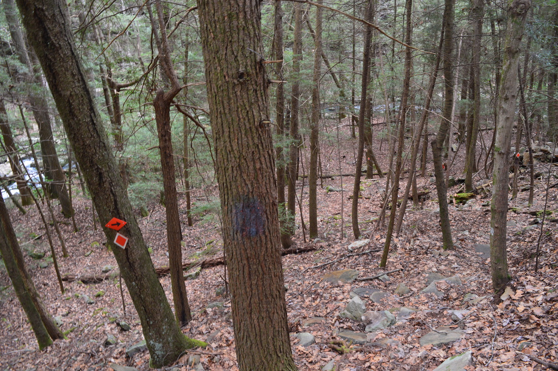
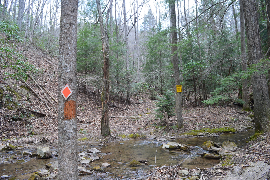
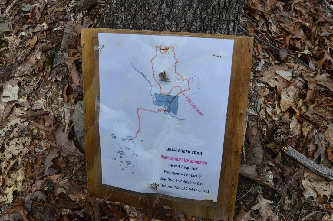
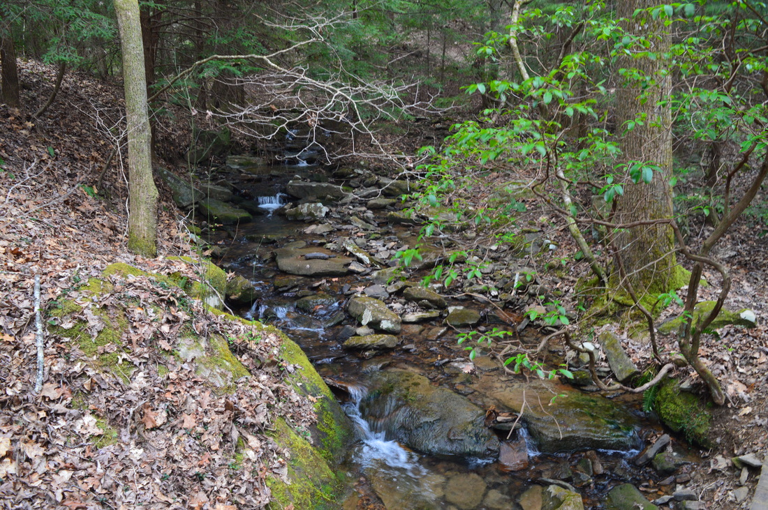
On my previous trip to Cloudland Canyon State Park, I hiked the Sitton Gulch Trail and West Rim Trail, and I enjoyed very much seeing the impressive waterfalls on Daniel Creek, as well as vistas of Cloudland Canyon. Nevertheless, one thing that I was discontent with was the large amount of people on the Sitton Gulch Trail. When I learned that one of the park's main trails - the Bear Creek Backcountry Trail - was supposed to close in less than a week, I made plans to hike the trail as soon as possible, and I was not disappointed. It is sad that now, you cannot hike the trail farther than the ford at Bear Creek, due to a private property issue. The section of closed trail is relatively short, but it is enough to currently prevent any access to the loop section of the Bear Creek Trail. This means that, at the moment, it is impossible to reach the breathtaking view of Cloudland Canyon that is near the Bear Creek Trail. Even though it is rather pointless to describe the closed section of trail, I will provide details for it anyway, with hopes that one day it will reopen, or maybe one day a new access point will be created. It is important to note that you need to fill out a special permit to hike the Bear Creek Trail. You will put one section of the permit somewhere around the windshield of your car, and you will take the other section with you on your hike. You can obtain the permit at the park's Visitor Center.
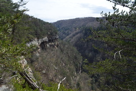
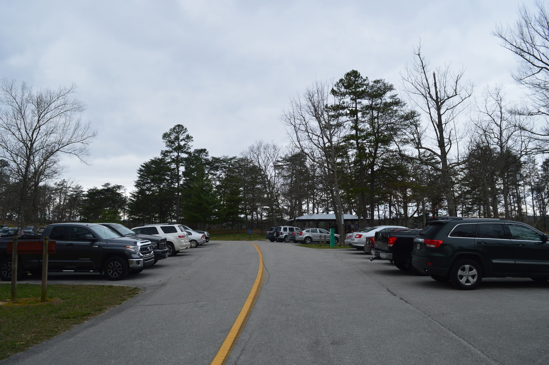
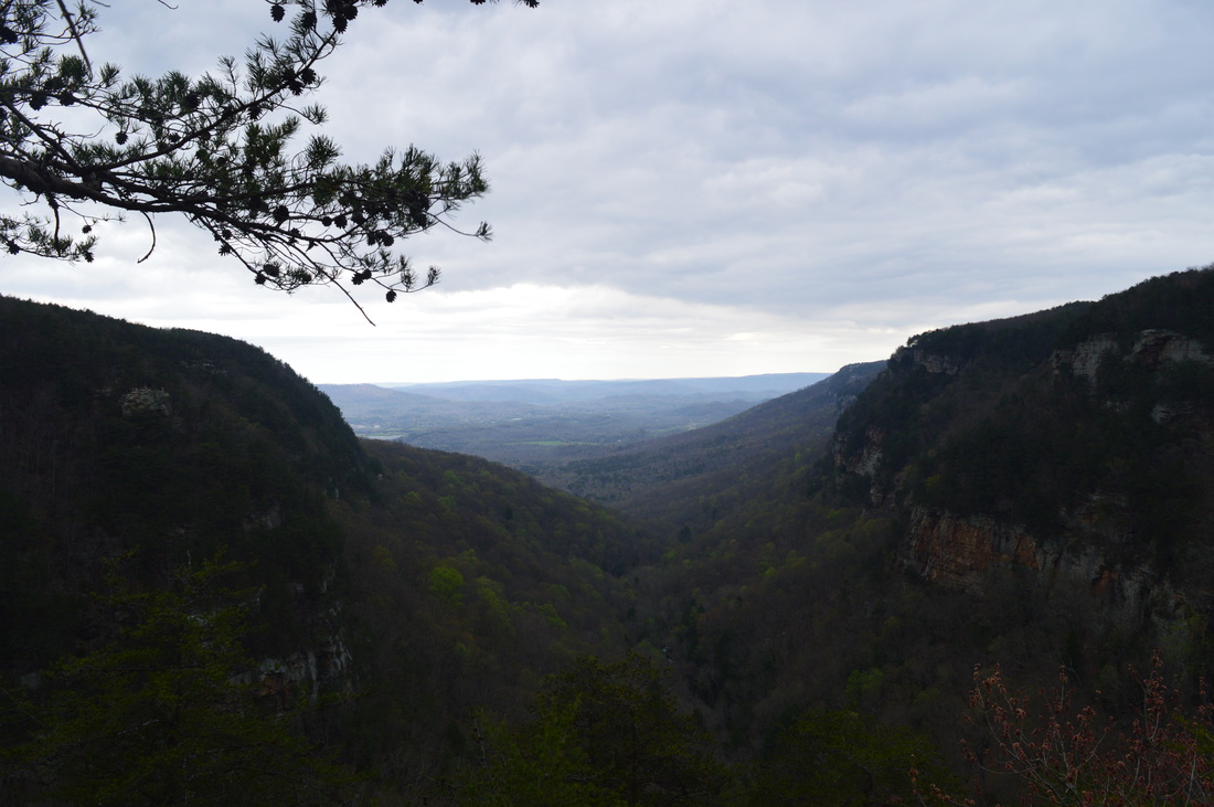
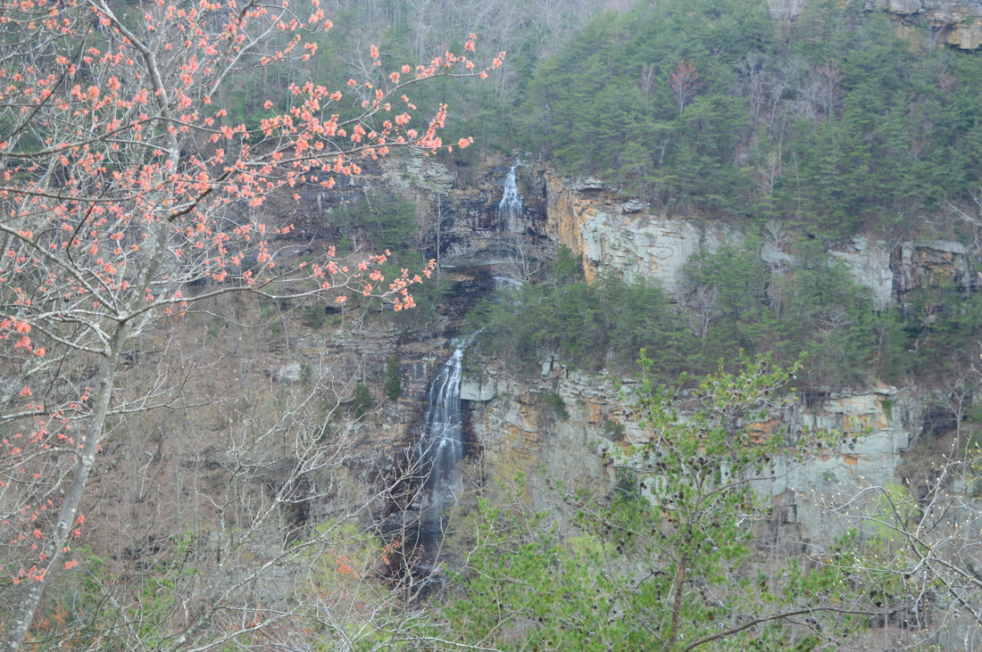
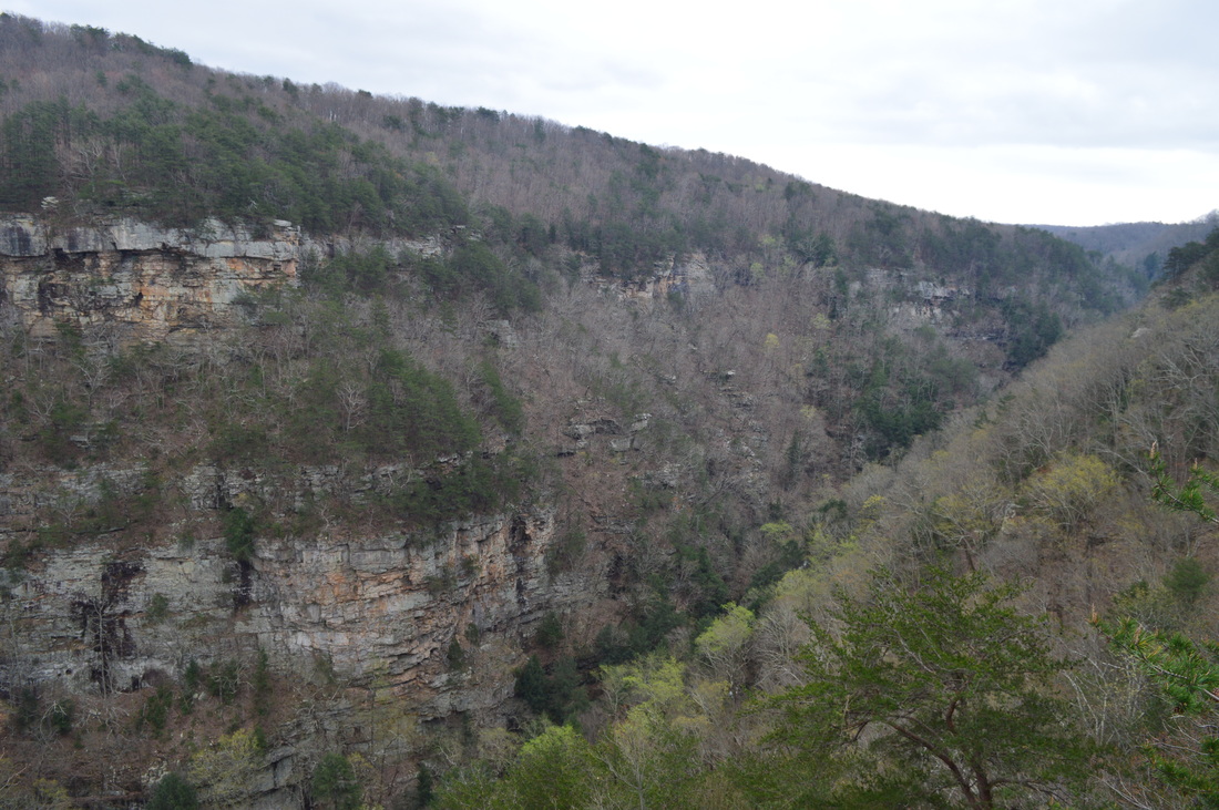
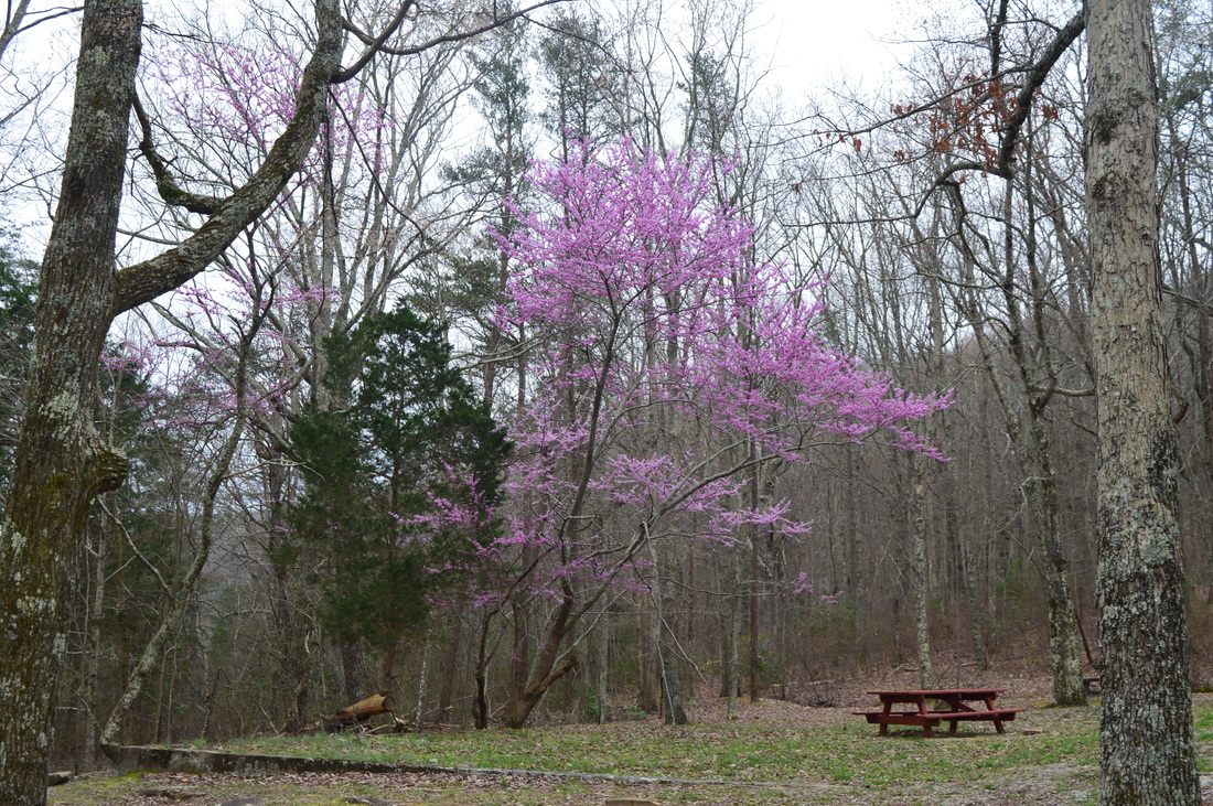
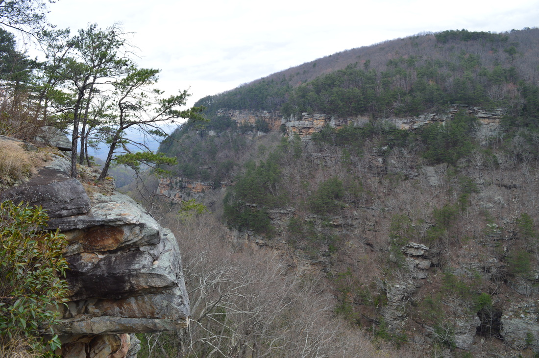
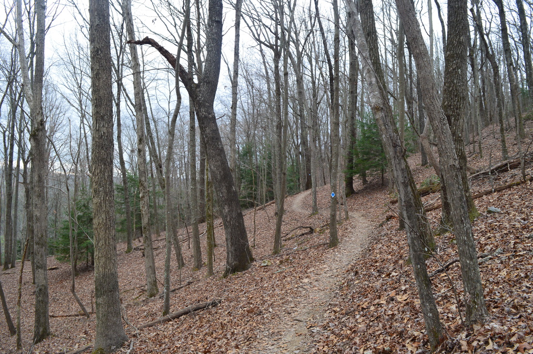
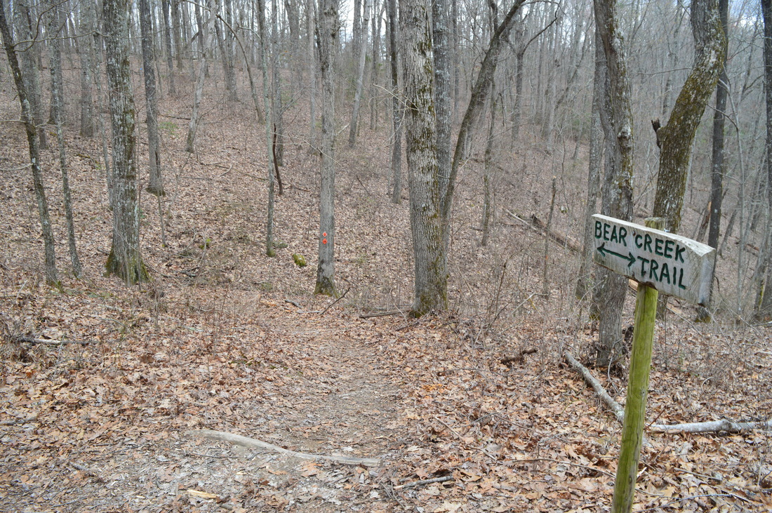
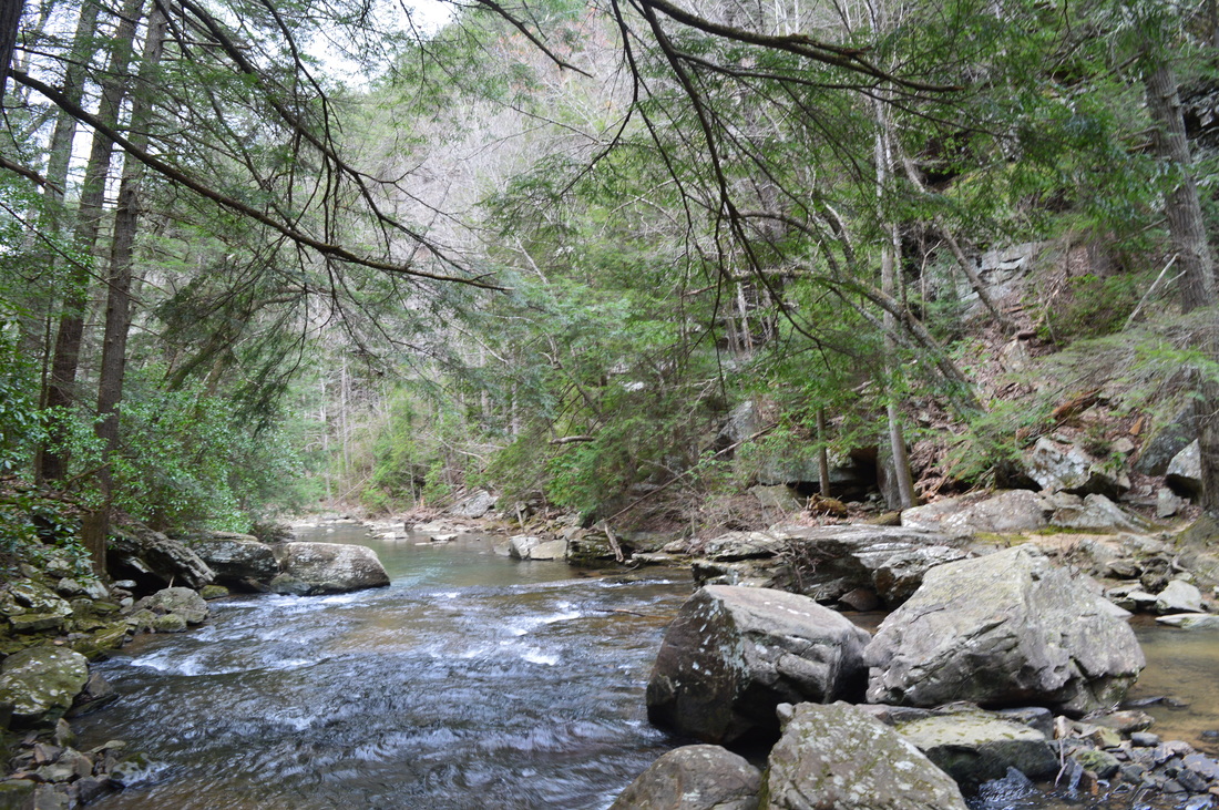
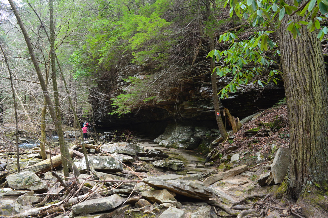
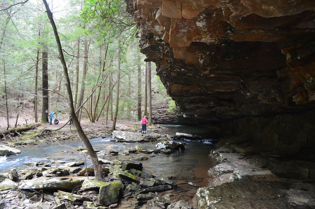
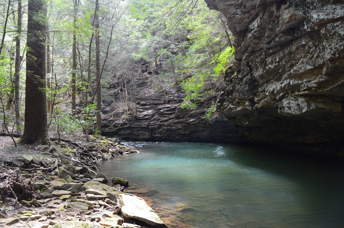
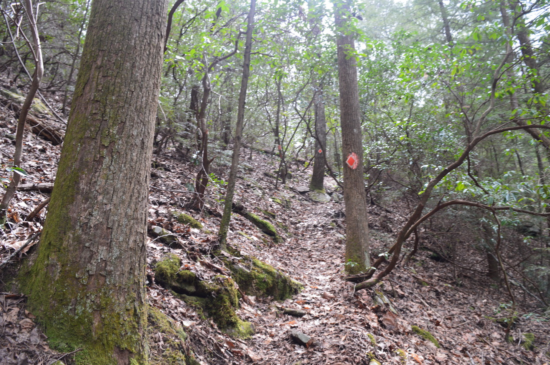
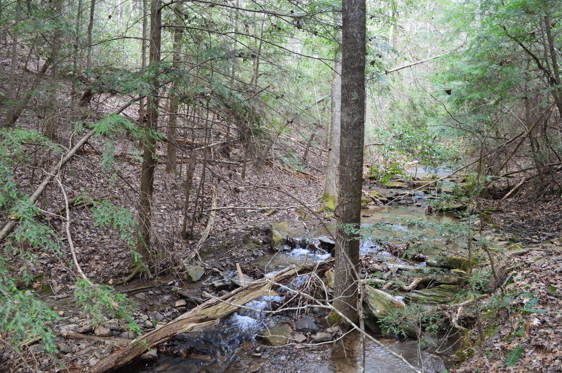
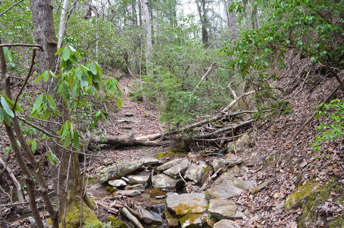
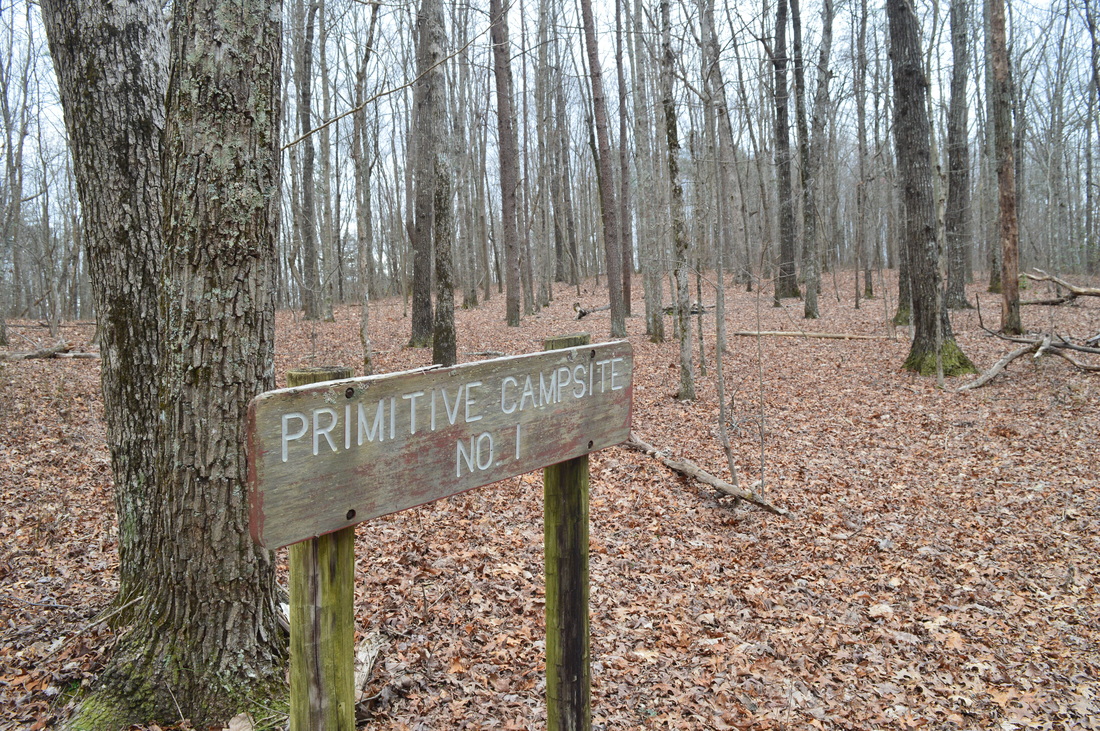
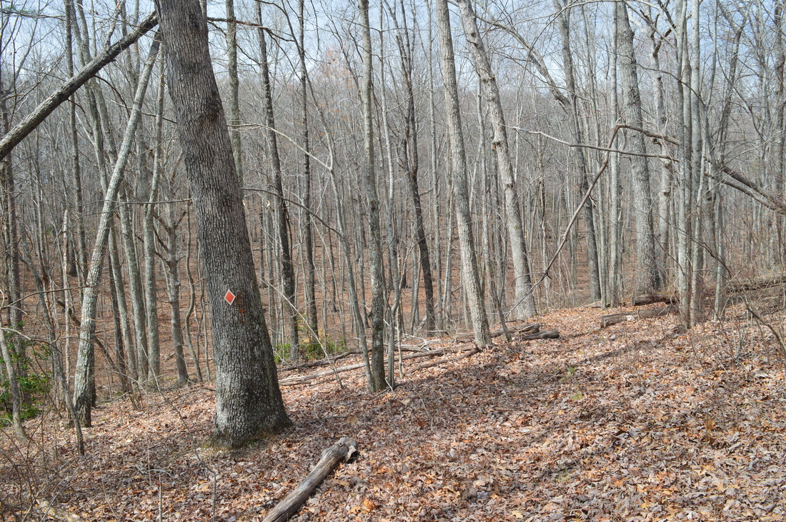
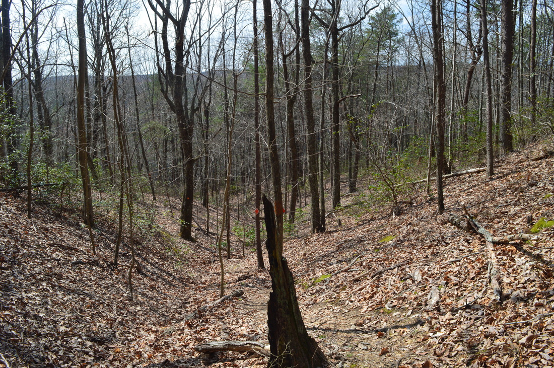
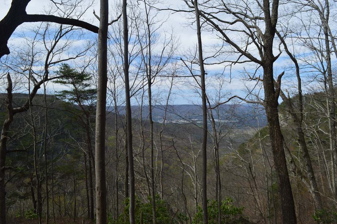
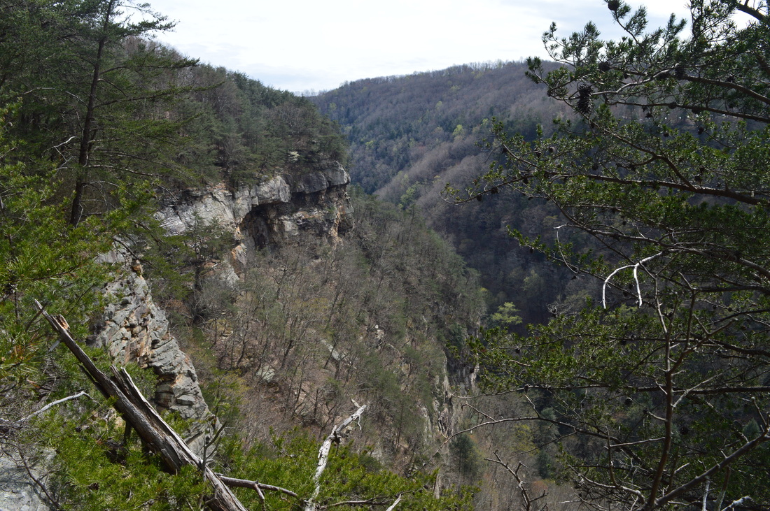
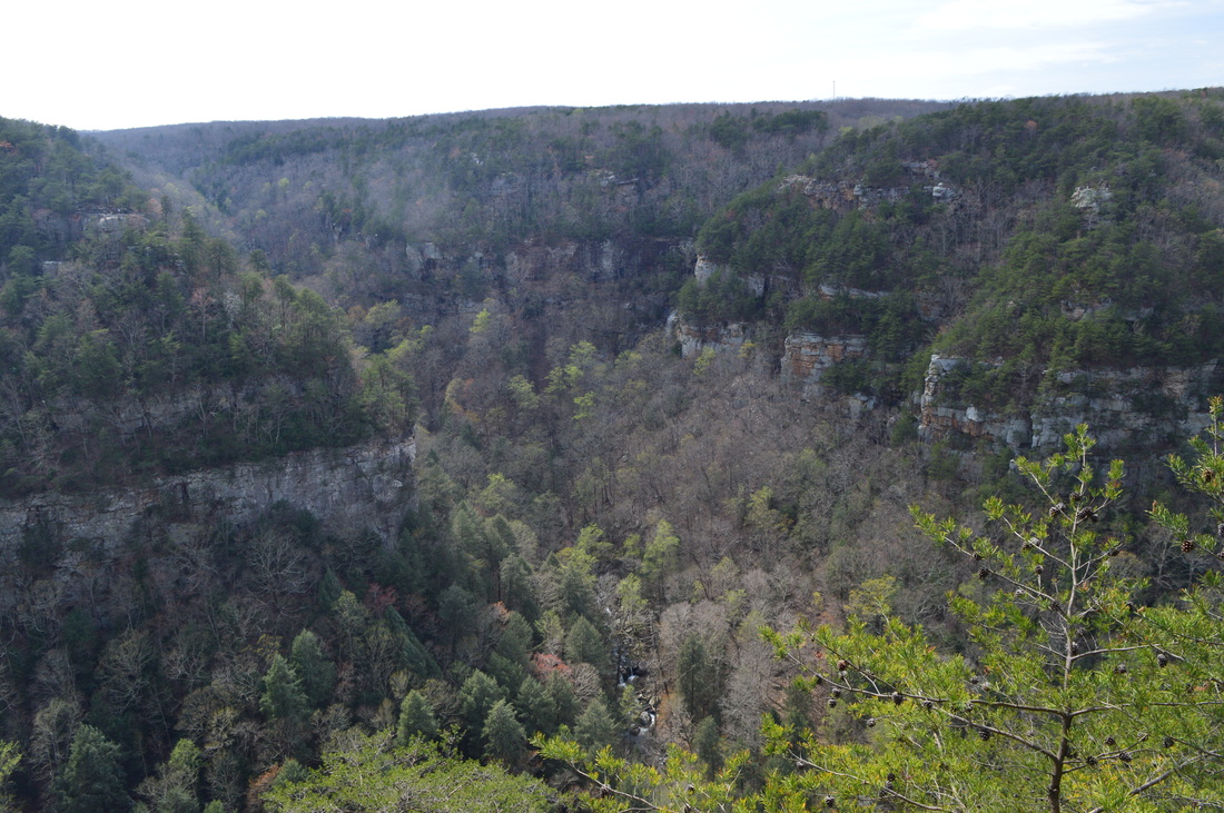
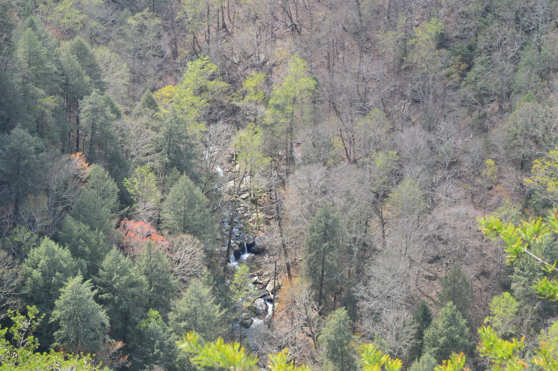
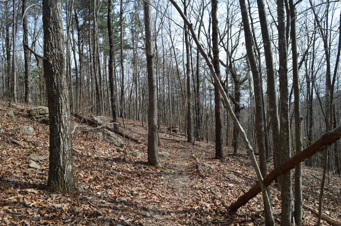
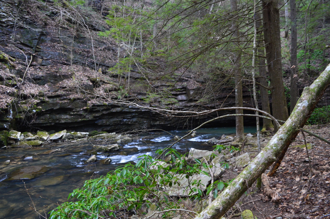
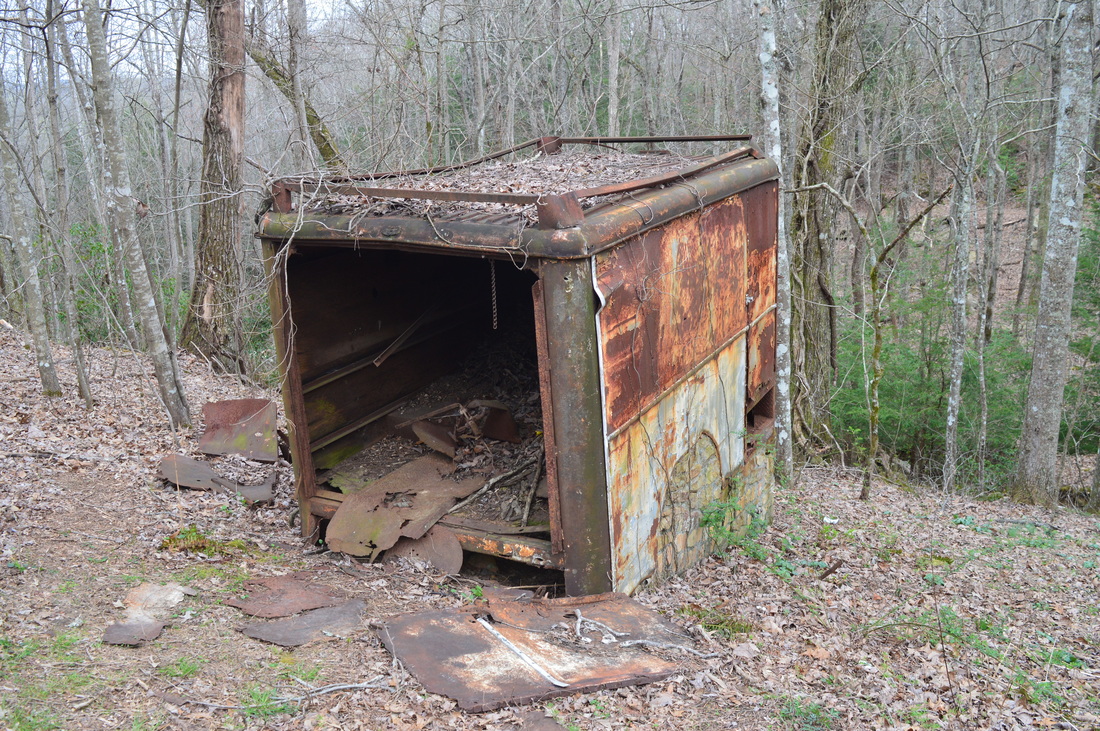
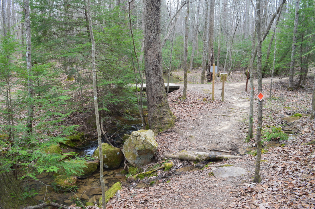
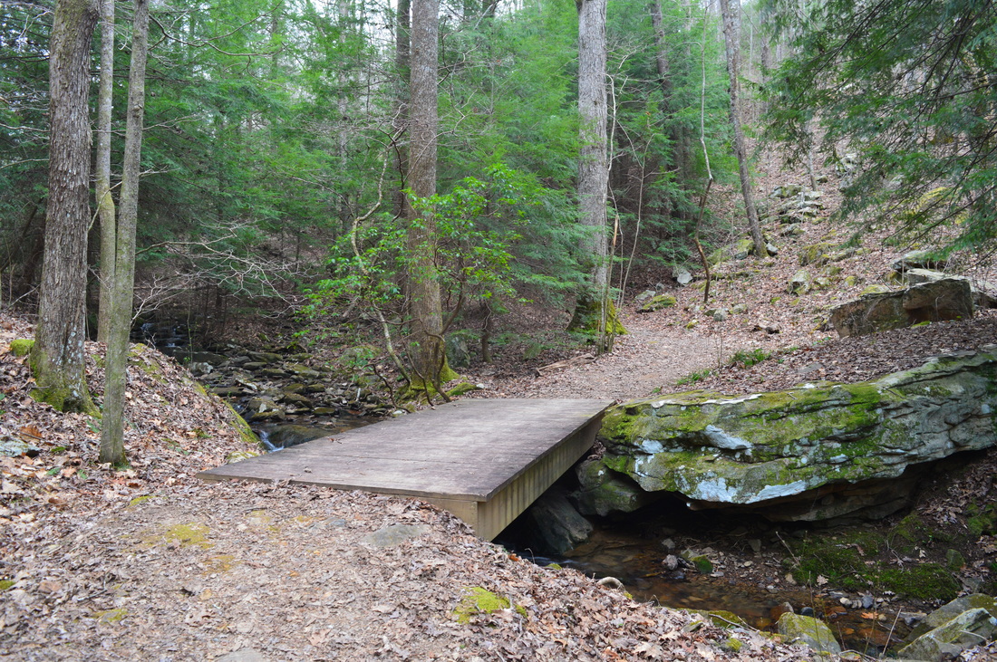
The hike begins at the park's Interpretive Center. This is pretty much the same trailhead as for the Sitton Gulch/West Rim hike, except that I parked a little bit farther down the road. From the parking area, walk across the picnic area to a paved path running from left to right. The main hike is to the right, but first follow the paved path to the left. At 0.1 miles, a dirt path leaves to the right. Turn right onto this path - it leads to the main overlook of Cloudland Canyon. At 0.2 miles, reach the overlook. This is the view of Cloudland Canyon most tourists and casual visitors see, since it is very close to the road/parking - a lot closer than all of the other vistas in the park. It is a great view, as you can see Sitton Gulch to the where it merges into Lookout Valley. From the vista, there is also a good view of the Bear Creek gorge, and a limited view of the Daniel Creek gorge. On this day, I could see that West Rim Falls - a wet-weather waterfall on the west rim of the Daniel Creek gorge - was flowing quite well. From this vista, retrace your steps to the paved Overlook Trail to begin the main hike. Turn left again, pass the picnic area, and continue on a paved path along the edge of the gorge. Don't worry - the paved path will not last long. The paved path ends at around 0.4 miles. Shortly afterwards, as you continue onto a dirt trail, a spur trail to the left leads to the Bear Creek Overlook. Descend some steps and reach the vista at 0.5 miles. This is a pretty good view of the Bear Creek Gorge upstream. Bear Creek and Daniel Creek have their separate gorges, before they join together and form Sitton Gulch/Cloudland Canyon. While the Bear Creek gorge and Daniel Creek gorge are similar, the Bear Creek gorge is certainly the less popular and harder-to-reach of the two. From the Bear Creek Overlook, you can hear and possibly see through the trees a fairly large waterfall far below, but there is no trail to it. However, while this view is good, the best was yet to come (not anymore since you can no longer access the view on the opposite side of the gorge). From the overlook, return to the main trail and turn left. The trail gradually ascends up a hill on the rim of the gorge. There really is nothing much to see until you reach a signed junction with the Bear Creek Trail at 1.05 miles just after you begin descending. This is the end of the Overlook Trail. The main section of Bear Creek Trail goes to the left, while straight ahead, it leads to the Backcountry Loop. Turn left and leave the Backcountry Loop for later, since it is not important. From this point on, you need to have a permit to continue. The trail begins to descend moderately into the Bear Creek gorge. At 1.4 miles, a series of switchbacks begins as the gorge walls steepen. You will enter a wetter forest that is characteristic to the bottoms of gorges in the Cumberland Plateau area. At 1.55 miles, reach the bottom of the gorge after a steeper section of trail. Here, an unmarked side trail leads left to an unnamed waterfall. The side trail is worth it. At 1.6 miles, reach the waterfall. It is located on a tributary of Bear Creek, spilling perpendicularly right into Bear Creek. I suspect that this waterfall can dry up during summer and fall, but if there is enough water, it is a great water feature in a beautiful setting. For me, it was a pleasant surprise, considering that it was not listed in any descriptions. Also, the best part is that this waterfall and this part of the Bear Creek Trail is still accessible to the public. From the waterfall, retrace your steps back to and continue on the main trail. cruise along Bear Creek before reaching a very scenic area at the ford of Bear Creek at 1.7 miles. The trail is now closed due to private property beyond the ford, but the area at the ford is worth seeing - let me explain. Just upstream from where the trail crosses the creek, a long, tall cliff lines the creek's right side. The fast creek full of rapids suddenly turns into a blue-green pool that flows under the cliff. As soon as the cliff ends, the creek transitions back to rapids. It is hard to explain this scene in words - it is a very beautiful spot to see in person. The ford of the creek here is about knee deep in the deepest part, although it will likely be lower some parts of the year. As of March 21st, 2016, the Bear Creek Trail is closed to all traffic beyond the ford. However, I will describe it anyway. On the way back I planned to explore a faint path upstream along Bear Creek, but for now, I continued straight and began ascending out of the gorge. Soon, as I ascended above the creek, I could hear a waterfall to my right, so I figured that the faint path along the creek probably led to this waterfall. After an initially steep ascent, the trail nearly levels out and passes by a large bluff. After this, continue ascending gradually along a small stream. You will cross an old road and then cross the stream several times. All crossings can be completed dry-footed. At one of the crossings, you will leave the private property area and re-enter the state park's property. At 2.3 miles, with the bulk of the ascent over, reach a junction where the loop section of the Bear Creek Trail starts. I chose to hike it counter-clockwise, so I continued straight. The following section of the hike has not much more than just wooded rolling hills, and thus, there really is nothing to describe, other than you will ascend and descend gently several times on these hills. At 2.6 miles, you will pass Primitive Campsite #1 to the right. At about 4 miles, the trail makes a sudden turn, approaching the gorge side of the hill. This is where you get some views of Sitton Gulch through the trees. At 40.5 miles, pass Primitive Campsite #2 to the left, and then, begin descending suddenly and steeply. The descent will take you off the rim to the top of the bluff line. The trail levels out at 4.4 miles. At 4.6 miles, reach a short side trail to the right that leads to a vista of spectacular vista of Cloudland Canyon Once you reach the bluff that provides this excellent view, you will be astounded. To the left, the deep Bear Creek gorge is lined by two levels of bluffs on its east rim. Straight ahead, the Bear Creek gorge merges with the Daniel Creek gorge, and you can see Fourth Falls on Daniel Creek far below, as well as possibly people beside it. You can see the parking area where your car is, located near the tip of the nose of land stretching out above the confluence of the gorges. Also, you can see the "tourist overlook" that you were at near the beginning of the hike. To the right, the huge Sitton Gulch stretches on to the north before emptying into Lookout Valley. Take a moment and enjoy the sights and sounds at the overlook. From the overlook, return to the main trail and turn right. You will follow an old roadbed for some time before ascending back to the rim of the gorge. The ascent is brief but steep nonetheless. At 5.5 miles, cross a streambed that was dry on this day. Then, pass over a hill before ending the loop at 5.9 miles. This is where you should turn right to retrace your steps back to the west rim of the Bear Creek gorge. You will return to the bottom of the gorge at 6.5 miles. Before fording the creek, I decided to take the faint path upstream along the creek. Shorty, it ended at a campsite and reached the creek. This is where the creek transitions from rapids to a pool under and next to the cliff. You can scramble along the rocks next to the creek to see the top of a waterfall on a tributary of Bear Creek, but in order to fully see the small waterfall, you would have to ford the creek again here, and I did not think that it would be worth the time. Thus, I returned to the ford, and proceeded to climb up to the west rim of the gorge. Return to the Overlook Trail junction at 7.2 miles. This is where you have the choice to add the Backcountry Loop to your hike. Since I wasn't tired yet, and since I had some extra time remaining, I decided to go for it. If you move on to the Backcountry Loop, turn left to continue on the Bear Creek Trail. Continue on a mostly flat trail along the rim of the gorge. At 7.5 miles, pass a wildlife clearing to the right, and a bizarre structure to the left a little bit farther. At 7.7 miles, reach the official end of the Bear Creek Trail. The Backcountry Loop continues to the left and to the right. I decided to hike the loop clockwise to get most of the uphill out of the way first, so I turned left. Cross a small creek on a footbridge and begin descending along an old road into the valley of a tributary of Bear Creek. You will pass many campsites along this loop - most of them are located on signed spur trails. At 7.9 miles, the trail levels out - begin an uphill section along a small but lively stream. The trail crosses the stream on footbridges four times. The trail finishes ascending at 8.1 miles and travels over mostly flat terrain on the plateau. This section of the trail is pretty boring, and it was designed mainly for those who are wishing to camp out without having to hike in too far. At 9.1 miles, reach the official Bear Creek/Backcountry Trailhead, with a parking area to the left. This is where most people who hike just the Bear Creek Trail begin. To continue the Backcountry Loop, turn right and begin descending. You will complete the Backcountry Loop at 9.6 miles after passing some more campsites. Turn left onto the Bear Creek Trail, and follow trail that you hiked earlier. Bear left onto the Overlook Trail at 10.1 miles, and reach the Interpretive Center parking at 10.8 miles, completing the hike. After some reflection, I decided to rate this hike a "Best Hike". Even though large portions of it are pretty boring, the sights in the Bear Creek gorge, and the fantastic vista on the east rim make this an excellent hike. Even though you currently cannot access the east rim vista, it is still a great hike to just see the Bear Creek gorge. If you're hiking the Sitton Gulch and West Rim Trail, you could combine those trails with the remaining short stub of the Bear Creek Trail. I will update this page if the rest of the Bear Creek Trail ever reopens. Mileage
0.0 - Interpretive Center
0.2 - Cloudland Canyon Overlook 0.5 - Bear Creek Overlook 1.05 - Left onto Bear Creek Trail 1.6 - Unnamed waterfall on Bear Creek tributary 1.7 - Bear Creek ford and scenic area 2.3 - Start loop section of Bear Creek Trail, continue straight 2.6 - Primitive Campsite #! to right 4.05 - Primitive Campsite #2 to left 4.6 - Fantastic vista of Bear Creek gorge, Daniel Creek gorge, and Sitton Gulch 5.9 - Close the loop and turn right 7.2 - Return to Overlook Trail, bear left on Bear Creek Trail 7.7 - Turn left onto the Backcountry Loop 9.6 - Complete the Backcountry Loop, turn left onto Bear Creek Trail 10.1 - Bear left onto the Overlook Trail 10.8 - Interpretive Center Variations
Do this hike only to the ford of Bear Creek and back (the currently open section) - 5.9 Miles
Do the full hike (currently not possible) without the Backcountry Loop extension - 7.9 Miles Bonus Stops
Consider combining this hike in some way with one of the park's other trails: West Rim Trail or Sitton Gulch Trail
PicturesVideos
1 Comment
Patti
11/2/2018 08:42:56 am
Please note, Bear Creek Trail at Cloudland Canyon opened 1 month ago! Hiked it 3 days ago, it was wonderful! Leave a Reply. |
About MeMark Oleg Ozboyd Dear readers: I have invested a tremendous amount of time and effort in this website and the Georgia Waterfalls Database the past five years. All of the work that has gone in keeping these websites updated with my latest trip reports has almost been like a full-time job. This has not allowed me to pick up a paid job to save up money for college, and therefore, I I've had to take out loans. If you find the information on this website interesting, helpful, or time-saving, you can say "thanks" and help me out by clicking the button above and making a contribution. I will be very grateful for any amount of support you give, as all of it will apply toward my college tuition. Thank you!

Coming in 2022-2023?
Other Hiking WebsitesMiles HikedYear 1: 540.0 Miles
Year 2: 552.3 Miles Year 3: 518.4 Miles Year 4: 482.4 Miles Year 5: 259.9 Miles Archives
March 2021
Categories
All
|


 RSS Feed