HIKING THE APPALACHIANS AND BEYOND
  • Home
  • Trail Reports
    • Best Hikes
    • Hikes with Scenic Views
    • Hikes with Water Features
    • Alabama
    • Georgia
    • Florida
    • North Carolina
    • South Carolina
    • Tennessee
    • Vermont
    • Virginia
  • Map
  • Hike List
  • Testimonials
  • Resources
  • Contact Us
  • Southeast Nature Society
    • Our Team
  • Georgia Waterfalls Database

Chattahoochee National Forest: Cliff Creek Falls, Tallulah Falls, Georgia

4/9/2017

6 Comments

 
Picture
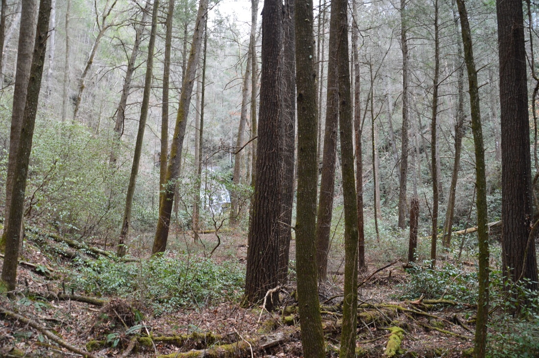
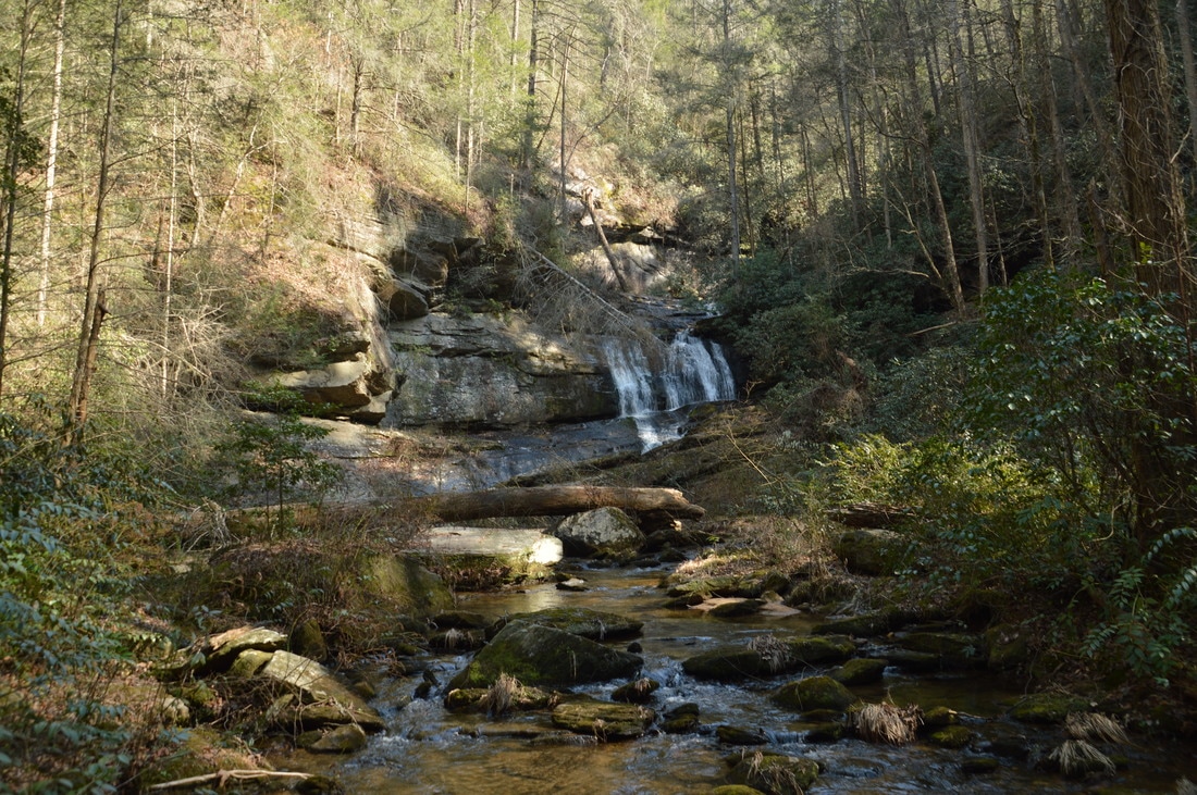
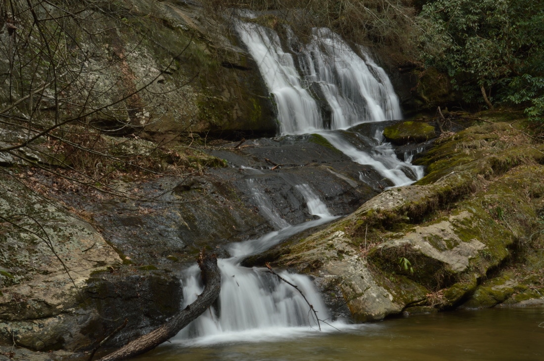
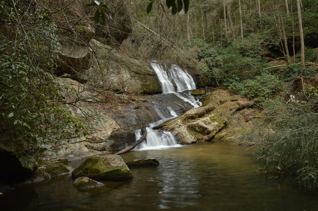
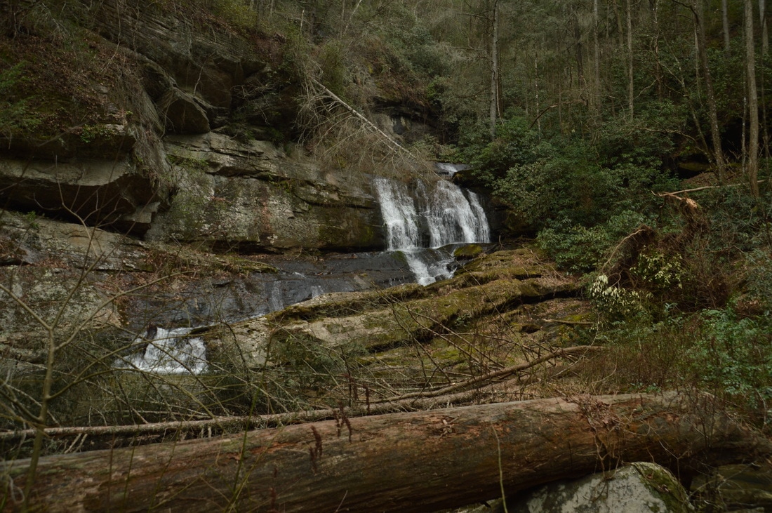
The southeast corner of Rabun County, Georgia, is not known for hiking and pristine nature as much as other parts of Rabun County, especially north of Clayton. Of course, Tallulah Gorge - which occupies the southeastern end of the county - is one of Georgia's best-known and most amazing natural sights. However, there is a lot more to this largely little-visited end of the county. At least some of the creeks in this area have photogenic waterfalls that are not documented well, both small and large, and the area is home to a section of the Wild and Scenic Chattooga River with many rapids. One of the area's more interesting remote waterfalls is a 40-footer located on Cliff Creek, nestled in a beautiful gorge among tall cliffs. This hike occurred on Saturday, March 18th, 2017. My plan was to make an exploratory bushwhack from Watergauge Road into the Cliff Creek gorge in search of a potential undocumented waterfall on Cliff Creek at a very promising location. The bushwhack turned out fairly easy and the waterfall was there, as gorgeous as any. 

Summary

R/T Length of Trail: 1.0 Miles
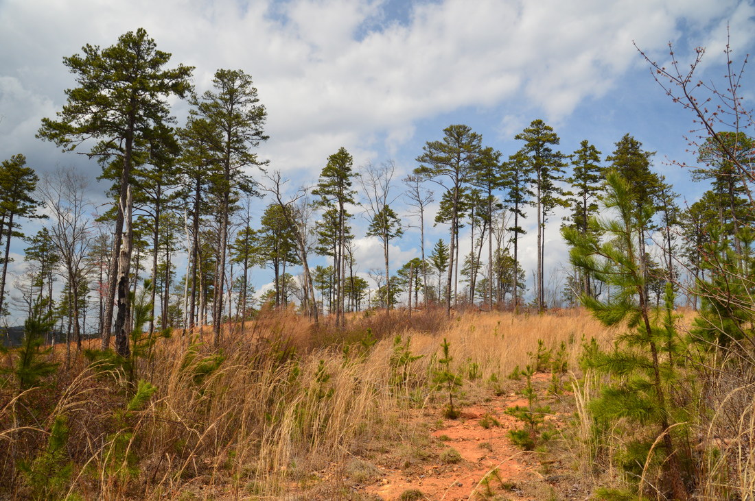
Duration of Hike: 1:50
Type of Hike: Out and Back (Bushwhack) 
Difficulty Rating: 3 out of 10 
Total Elevation Gain: 432 Feet
Pros: Solitude 
Cons: No established trail
Points of Interest: Cliff Creek Falls - 5 stars 
Trail Blaze Colors: None (no trail) 
Best Seasons to Hike: Winter 
Fees: None 
Beginning Point: Watergauge Road
Directions from Tallulah Falls, GA: From the Tallulah Gorge/Tallulah Falls Lake Dam Bridge on US 23/441 in Tallulah Falls, follow US 23/441 North for 2.9 miles. Then, turn right onto Camp Creek Road. In 1.4 miles, turn left onto Watergauge Road - sometimes referred to as Camp Creek Road as well - which shortly turns into unpaved Forest Road 511. From the turn-off, continue for 1.8 miles to a wide spot on the road with space for several cars on the right side. To the left, a ravine drops off, and just ahead to the left is a recovering logged area. This is the best place to begin the hike to Cliff Creek Falls. 

Map

Picture
Click here to download a track of this hike. 

Details

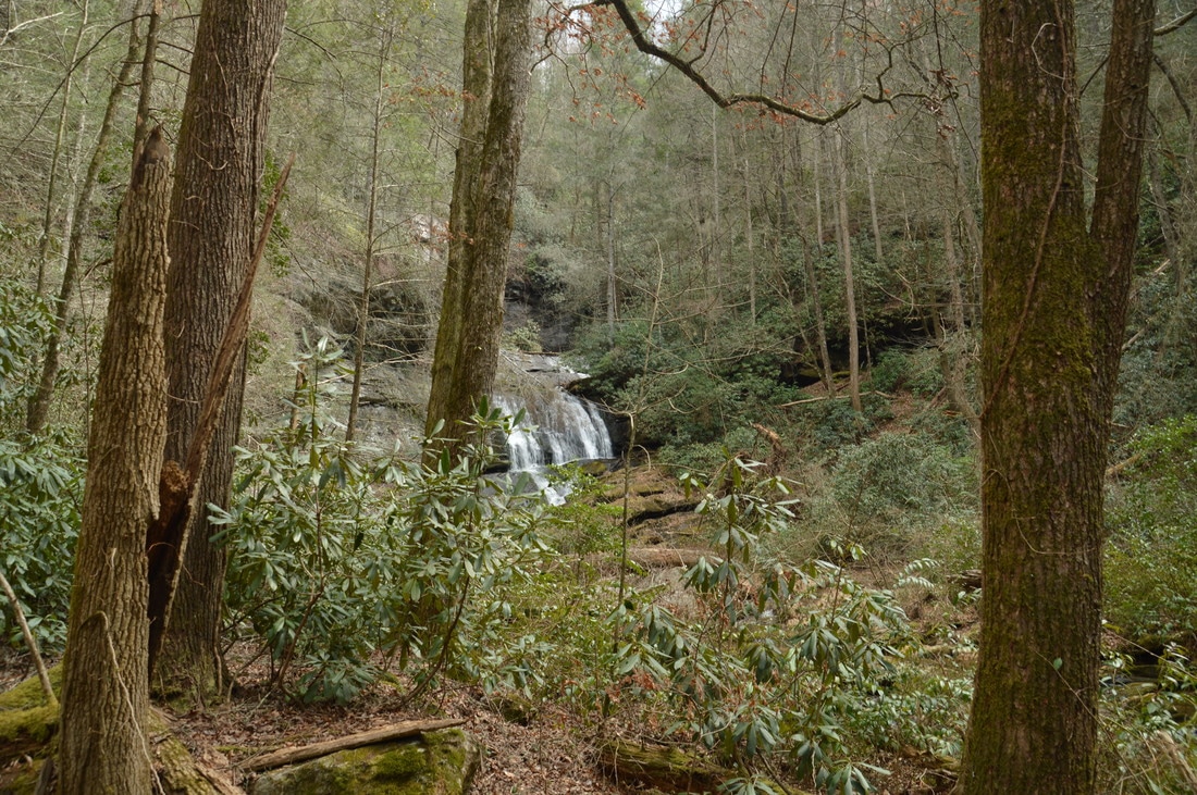
While studying the topographic map for the southeastern portion of Rabun County for several trails that I wanted to do in the area, I noticed a location of rapid elevation change on Cliff Creek, where the creek appeared to enter a deep gorge. Upon further analysis using Google Earth and Google Terrain, I came to the conclusion that an undocumented waterfall was present at this location. On this hike, my goal was to bushwhack to this waterfall, and upon arriving at the location that held my interest, I was greeted by a 40-foot waterfall in a picturesque setting with large cliffs. Also, I believe that there was more falling water out of sight. Furthermore, the bushwhack to Cliff Creek Falls turned out to be fairly easy. 

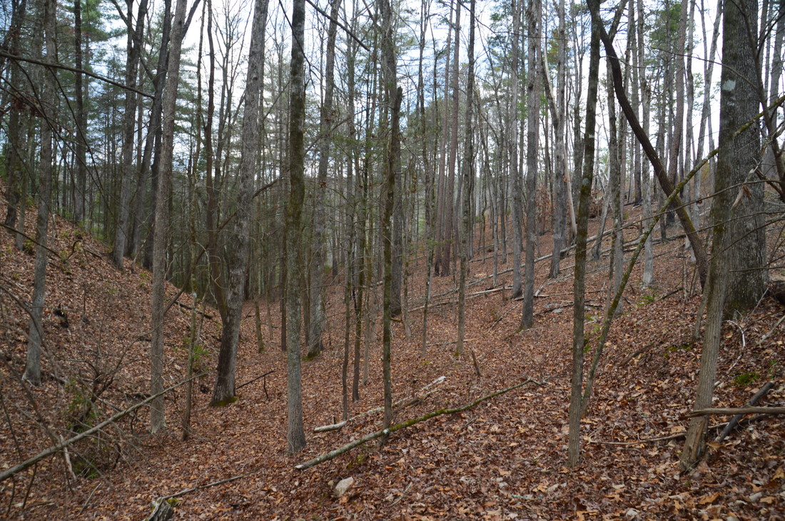
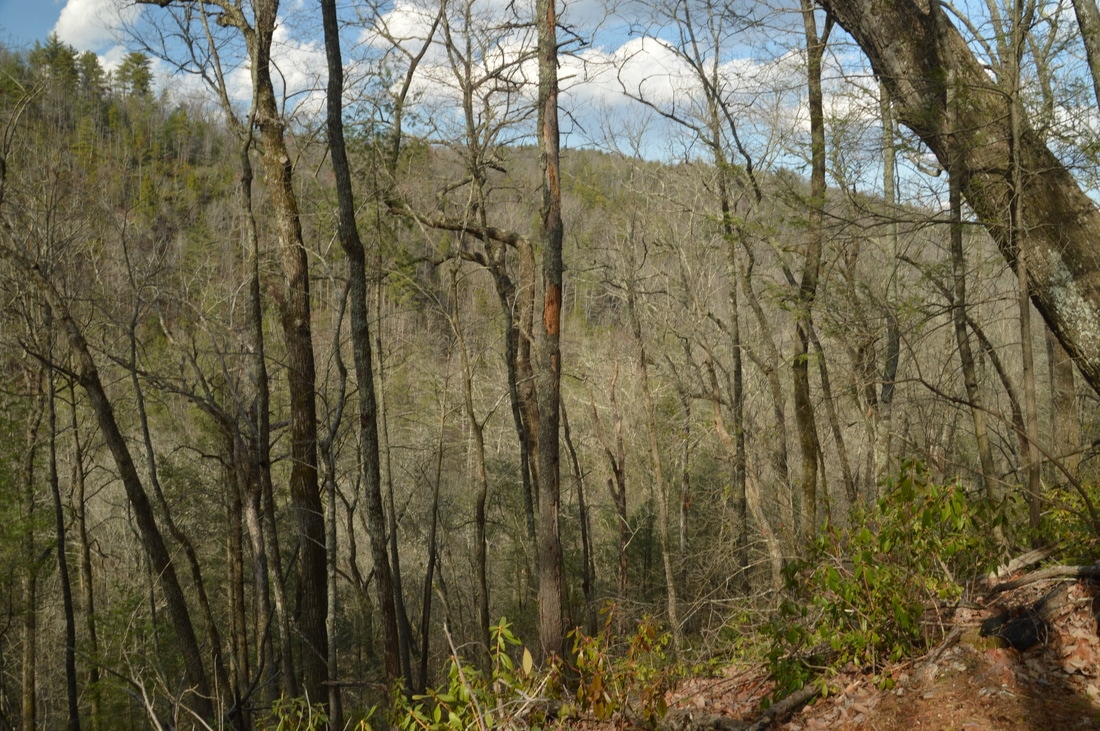
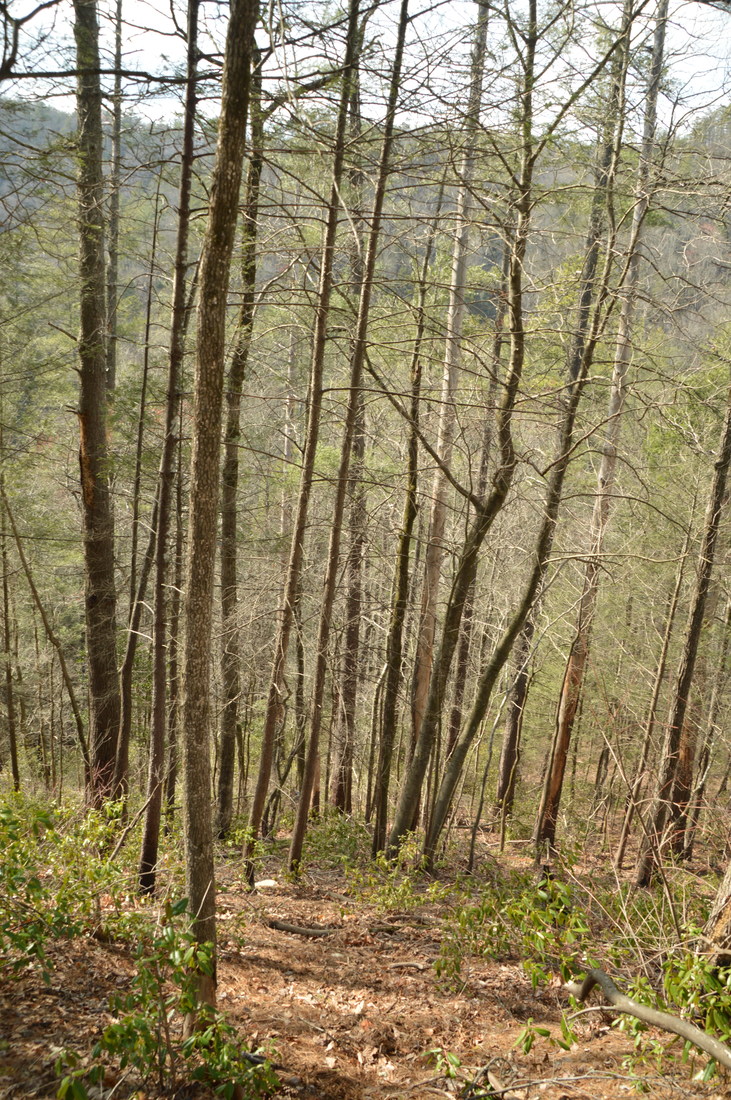
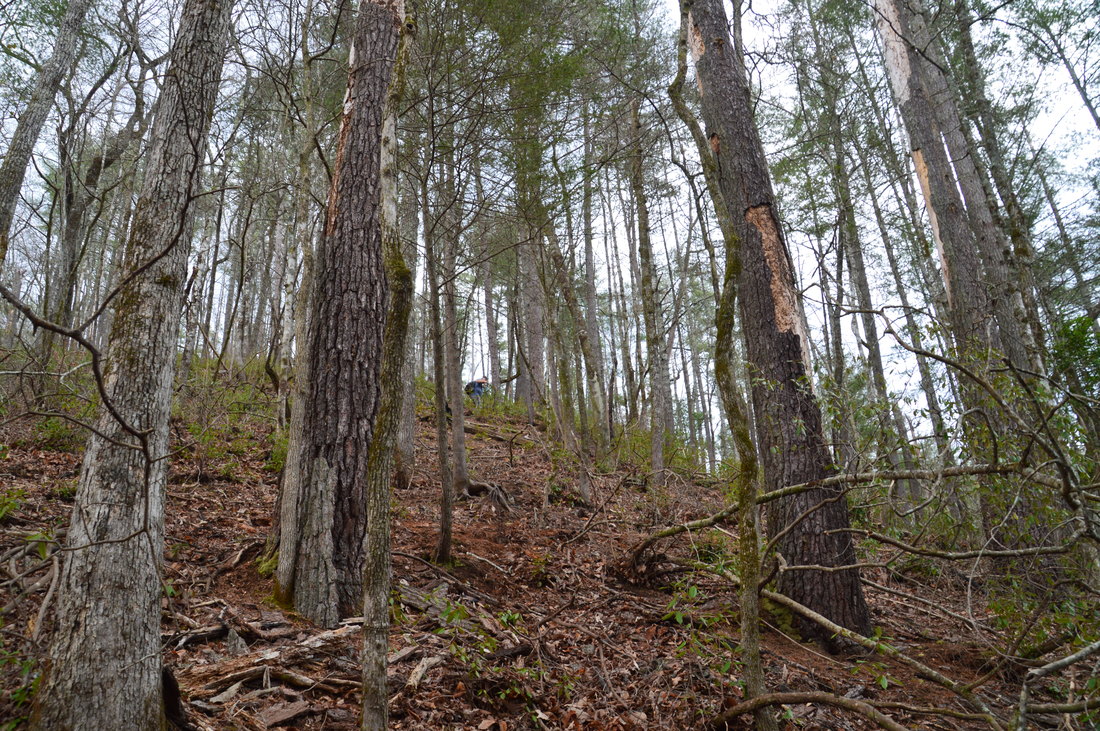
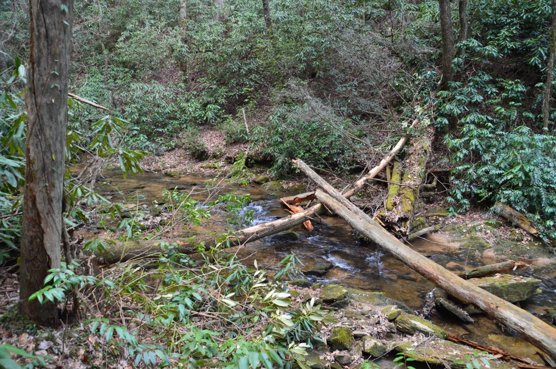
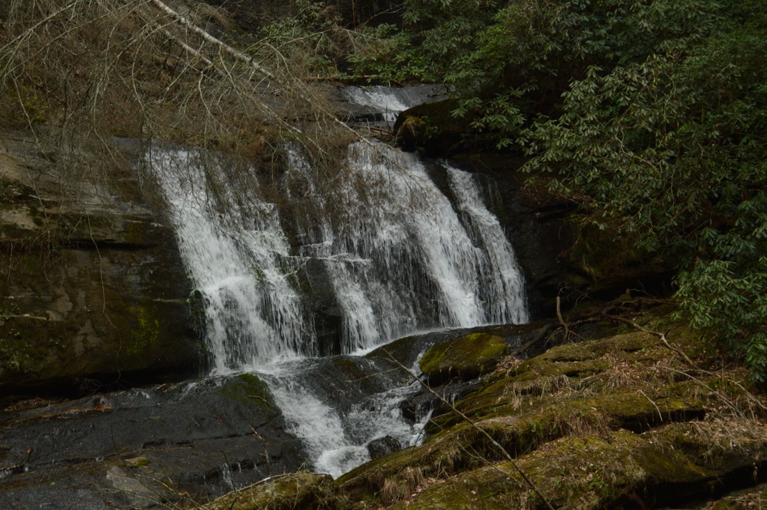
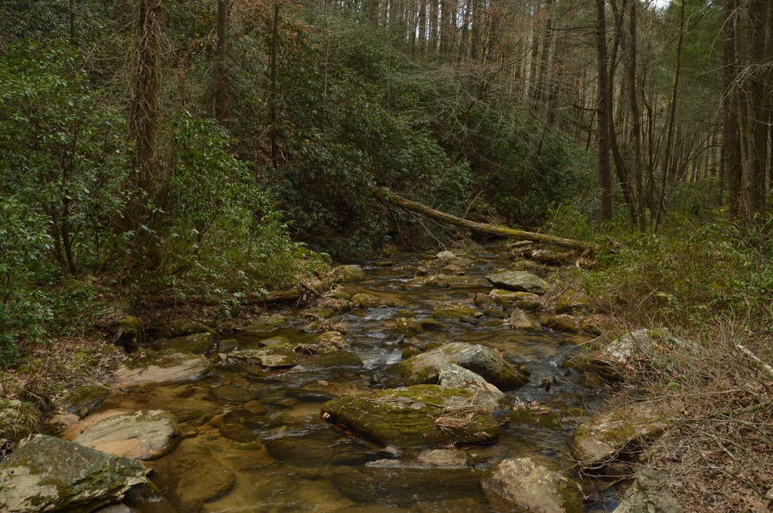
The best place to begin the hike to Cliff Creek Falls is off Camp Creek Road at a ravine south of the falls. The ravine is located just west of a huge clearing that is recovering from logging and is overgrown with tall grass and green briars. See the map above for the best starting point (that I used and suggest using). When you do this hike, make sure to stay out of the clearing/formerly logged area on top of the knob just east of my track, as it is essentially impassable. In other words, begin the hike by heading northwest down into the dry ravine from the starting point. It is fairly steep initially, but the woods are open. At 0.1 miles, join a forest road that comes in from the left (west). Follow the forest road downhill through the ravine until the forest road ends/dissipates at 0.2 miles near the edge of the gorge. Here, you will notice that on my GPS track, my way out differed from my way in. Initially, I continued following the ravine to the edge of the gorge, but that was a bad decision, because the slopes are extremely steep in that area. So, instead, you must follow the route that I took on my way out (on the map above, it is the slightly further east track). In other words, from the end of the forest road, bear right and hike through open woods near or along the edge of the recovering clearing, staying just above the edge of the gorge. 

At 0.35 miles, reach a steep ridge that extends down from the knob with the overgrown clearing to the right to the bottom of the gorge. This ridge is a little less steep than the surrounding areas, so it is best to bear left and descend to Cliff Creek using this ridge. You will know you have reached the ridge when the gorge opens up in front of you as well as to your left. The ridge is still steep, but there are plenty of handholds, and the woods are open enough for easy hiking. As you descend, make sure to keep following the ridge all the way to the creek. At 0.45 miles, you will bottom out in flats near Cliff Creek. In the past 0.1 miles, you descended about 200 feet! At Cliff Creek, you can hear and might be able to see Cliff Creek Falls just upstream. Hike through the open flats southward and upstream along Cliff Creek in the direction of the falls. At 0.5 miles, reach Cliff Creek Falls.

Cliff Creek Falls is a really nice waterfall. The visible portion of it is about 40 feet high. Much of the waterfall consists of a series of steep slides, but at the end ,the creek makes a sharp turn and passes through a chute before emptying into a small pool via a final cascade. In times of high water, the chute may "overflow". However, the setting is what plays the biggest role in turning this waterfall into a scenic one. A long cliff stretches across the entire creek here, with the water occupying only a small part of it. On the left (east) side of the creek, towering bluffs help to add a remote, gorge-like feeling to the waterfall. Unfortunately, there is a fallen tree that obscures part of the waterfall near its top; the waterfall would be more photogenic without this tree. To the best of my knowledge, Cliff Creek Falls was undocumented prior to my visit. I could not find any online or printed references about it, so I believe that this post has officially the first description of the falls and the best route to it. Also, I suspect that there is 40-50 more feet of falling water - perhaps in two tiers - hidden just out of sight above the main waterfall. The creek makes a 90-degree bend just above the main falls, so you cannot see what is above, but topo maps and satellite imagery are supportive of an "upper waterfall". Getting to the location of that potential upper drop would be quite difficult regardless, so I will leave this task for the most hardcore waterfallers. 

From Cliff Creek Falls, simply retrace your steps back to the trailhead, and make sure to take your time on the steep ascent out of the gorge! You will conclude this hike at 1.0 miles. 

Mileage

0.0 - Watergauge Road 
0.1 - Join forest road
0.2 - End forest road
0.35 - Steep descent 
0.45 - Cliff Creek 
0.5 - Cliff Creek Falls 
1.0 - Watergauge Road

Variations

None

Bonus Stops

Two trails can be accessed off FS 511 and FS 511B: Raven Rock Trail and Watergauge Trail (Camp Creek Trail). The Raven Rock Trail leads to the Raven Rock Cliffs on the Chattooga River, and the Watergauge Trail leads to a set of great campsites along the Chattooga River and to the Canyon of Five Falls - one of the most beautiful gorges in Georgia. 

Pictures

Videos

6 Comments
James m Wentworth
9/4/2017 10:40:23 am

I love write-ups like this, off the road and they just feel special. Thank you for sharing and look forward to one day scoping this out.

Reply
Bill Solomon link
12/18/2017 11:56:25 pm

Mark,
Another excellent write up. Last I went there was 10-12 years ago with a group to see the old growth hemlocks before the hemlock wooly adelgid (HWA) did their damage. That is why few hikers ever ventured upstream to the falls - they were there to see giant trees whose time was short,. This stand of hemlocks was one of the few never logged (Joyce Kilmer being another). The trees range up to near 135-140 ft. tall and are between 250-300 years old. When the forest loses trees that big, it really opens up a big hole. When a whole stand of trees of that size die, it changes the fundamental nature of the forest. It has truly broken my heart to see all the old hemlock stands die across this region, leaving behind gray skeletons that are hazards to hikers, block trails, clog streams and wreck havoc. However, the seedling hemlocks cannot be attacked by HWA, so over decades the hemlock will gradually come back. In the mean time, their lose changes the environmental balance of the forest, allowing more sunlight to the trout streams and warming the waters.

Hey, all of us that are bushwhack explorers stared for similar reasons. Over time as I learned more about where I was exploring, I wanted to know the history and how man effected the forest, what plants grow there, the paths Native Americans traveled and ones the white explorers followed which became roads. Did you know that with pioneer expansion, the white tail deer was hunted out and become all but extent. Prior to deer, buffalo were hunted out. It took the efforts of FS Ranger Arthur Woody and others to redevelop the deer herds that fill the forest today.

Reply
Rick Sawyer
2/25/2019 10:17:18 am

I have lived in Rabun County approximately 7 years and until a week ago, had never heard of this waterfall. This weekend, two friends and I headed out to do this hike. I parked roughly in the vicinity described, near some cleared/logging areas. We walked down the road a short distance and descended the hill. We followed the old logging road towards the edge of the gorge, but made the mistake of attempting to descend the steep cliffs above the falls. We eventually followed a game trail which led us east/downstream below a large boulder outcropping. Once past that, we saw pink ribbon on a tree which we assumed were markers. the descent from the markers was much easier to the bottom. The falls were full due to the heavy rains and secondary falls were coming down the cliffs. The log blocking view in these photos was also gone and the view was unobstructed. We assumed the upper falls could be viewed from the northern ridgeline and we crossed the creek on a large log and ascended the ridge. It was very steep and difficult to climb. We followed more game trails and another logging road up above the falls, but at no point was the upper falls easily visible. The vegetation on the northern ridge was more dense than the southern ridge and blocked the view. We retraced our tracks to the large log downstream and crossed and followed the pink ribbon markings until the ended at the top of the ridge. After following another game trail along the ridgeline, we returned to the logging road but followed it up the ridge into a logged area which was difficult (and probably great rattlesnake and copperhead territory) to navigate.

Knowing how to get to the pink ribbon is the biggest part of this hike as it avoids the most difficult parts of the hike. I agree winter is the best time to do this hike and with the frequent rain the falls are very full and worth the effort.

Reply
Jennifer link
3/24/2020 09:38:18 am

So glad to have found this hike so close to my house yet so far from the crowds. I have been there to paint 3 times in the past couple of weeks. Thanks for your great instructions on how to get there.

Reply
Carson Reed link
2/27/2021 09:42:23 am

Very nice blog youu have here

Reply
Stephen Benz
3/11/2022 07:57:24 pm

You have an invaluable resource in these pages. I have used them along with Bernie's info to plot routes to falls. One thing would make your pages even more valuable. None of the gpx links to the Garmin pages work and there are many such links. On other pages you provide gpx links that don't go to Garmin and work. Can you fix rework the Garmin links? BTW: You sent me your gpx track for Angelica Falls which worked well. Like you, we didn't make it to Plumorchard Falls. Maybe next time. Keep up the good work.

Reply


Leave a Reply.

    About Me

    Mark Oleg Ozboyd
    I'm an avid outdoor explorer and a hobbyist landscape photographer. I'm 21 years old and have been hiking since 2011. Originally based out of Atlanta, Georgia, I started out by occasionally hiking short trails throughout well-known Georgia State Parks. During 2012 and 2013, I began to expand my trips into adjacent states, as well as into the wilder National Forest areas rather than just State Parks. Throughout the years that followed, as I slowly ran out of popular hiking trails in my area, I began to search for and hike in more seldom-visited areas. Today, you can find me out in the woods every weekend, whether it's on an official trail or bushwhacking through cross-country terrain without any paths. I now attend Washington & Lee University and am exploring Virginia and West Virginia. My other hobbies include chess, science, old music, and meteorology. I have 3 years of amateur weather forecasting experience, having studied a lot of meteorology basics over the years. I am also a student at European School of Music where I learned that music and nature have a lot in common. Listening to good music inspires me to capture nature's beauty on the camera in different aspects that also make me recall many beautiful music pieces that I've heard.​


    Dear readers: I have invested a tremendous amount of time and effort in this website and the Georgia Waterfalls Database the past five years. All of the work that has gone in keeping these websites updated with my latest trip reports has almost been like a full-time job. This has not allowed me to pick up a paid job to save up money for college, and therefore, I I've had to take out loans. If you find the information on this website interesting, helpful, or time-saving, you can say "thanks" and help me out by clicking the button above and making a contribution. I will be very grateful for any amount of support you give, as all of it will apply toward my college tuition. Thank you! 

    Enter your email address to subscribe for trail reports:

    Delivered by FeedBurner


    Picture
    Coming in 2022-2023?

    Other Hiking Websites

    DWHike's Adventures
    Florida's Natural Wonders
    Florida Trailblazer
    Meanderthals
    Mountain Images
    by Bernie Boyer

    North Carolina Waterfalls with
    ​Kevin Adams
    Take-a-Hike!
    Tennessee Landforms
    Waterfall Page
    Waterfall Adventurer
    Zach's Mild Adventures

    Miles Hiked

    Year 1: 540.0 Miles
    Year 2: 552.3 Miles
    ​Year 3: 518.4 Miles
    Year 4: 482.4 Miles
    Year 5: 259.9 Miles

    Archives

    March 2021
    February 2021
    January 2021
    November 2019
    October 2019
    September 2019
    August 2019
    July 2019
    June 2019
    February 2019
    January 2019
    December 2018
    November 2018
    October 2018
    August 2018
    July 2018
    June 2018
    May 2018
    April 2018
    March 2018
    February 2018
    January 2018
    December 2017
    November 2017
    October 2017
    September 2017
    August 2017
    July 2017
    June 2017
    May 2017
    April 2017
    March 2017
    February 2017
    January 2017
    December 2016
    November 2016
    October 2016
    September 2016
    August 2016
    June 2016
    May 2016
    April 2016
    March 2016
    January 2016
    December 2015
    November 2015
    October 2015
    September 2015
    August 2015
    July 2015
    June 2015
    May 2015
    April 2015
    March 2015
    February 2015
    January 2015
    December 2014
    November 2014
    October 2014
    September 2014
    August 2014
    July 2014
    June 2014
    May 2014
    April 2014
    March 2014
    February 2014

    Categories

    All
    Adel
    Adirondack Park
    Alabama
    Alfred A. Ring Park
    Allegheny Trail
    Amicalola Falls State Park
    Anniston Area
    Apalachicola Bluffs And Ravines Preserve
    Apalachicola National Forest
    Apalachicola/Port St. Joe Area
    Apopka
    Appalachian Trail
    Appling
    Art Loeb Trail
    Aska Trail System
    Bakersville
    Balm-Boyette Scrub Preserve
    Balsam Lake Recreation Area
    Bankhead National Forest
    Bartow County Parks
    Bartram Trail
    Basinger
    Beersheba Springs
    Benton
    Benton Mackaye Trail
    Berry College Trail System
    Best Hike
    Big South Fork National Recreation Area
    Black Bear Wilderness
    Black Rock Mountain State Park
    Blairsville
    Blakely
    Blood Mountain Wilderness
    Blowing Rock
    Blue Ridge
    Blue Ridge Parkway
    Boone
    Bradenton
    Bradenton Beach
    Brasstown Bald
    Brasstown Wilderness
    Brevard
    Bryson City
    Buchanan
    Bucks Pocket State Park
    Bulow Creek State Park
    Bulow Plantation Ruins State Park
    Caesars Head State Park
    Caladesi Island State Park
    Calhoun
    Camel's Hump State Park
    Cashiers
    Caspersen Beach Park
    Catfish Creek State Park
    Caves
    CC Putnam State Forest
    Cedar Point Environmental Park
    Chatsworth
    Chattahoochee National Forest
    Chattanooga
    Chattanooga Valley
    Chattooga National Wild And Scenic River
    Cheaha Wilderness
    Cherohala Skyway
    Cherokee
    Cherokee National Forest
    Chiefland Area
    Chillhowee Recreation Area
    Chipley
    Chunky Gal Trail
    Circle B Bar Reserve
    Citico Creek Wilderness
    Citrus Wildlife Management Area
    Clarkesville
    Clayton
    Cleevland
    Cleveland
    Cloudland Canyon State Park
    Cohutta Wilderness
    Collier-Seminole State Park
    Cordele
    Cornelia
    Covington
    Crestview Area
    Crew-land-and-water-trust
    Cullowhee
    Cumberland Trail
    Dahlonega
    Dalton
    Dawson Forest Wildlife Management Area
    Dawsonville
    Dayton
    De Soto National Memorial
    DeSoto State Park
    Dillard
    Double Springs
    Ducktown
    Duncan Ridge Trail
    Dunlap
    Eagle's Rest Park
    Eastpoint
    Econfina Creek Wildife Management Area
    Eglin Air Force Base
    Elizabethton
    Elkins
    Elk Knob Game Lands
    Elk Park
    Ellicott Rock Wilderness
    Ellijay
    Emerson Point Preserve
    Englewood Area
    Enota Retreat
    Erwin
    Falling Waters State Park
    Fayetteville
    Fires Creek Recreation Area
    Fire Tower
    Flint River
    Florence Area
    Florida
    Florida Caverns State Park
    Florida Trail
    Foothills Trail
    Fort Mountain State Park
    Fort Myers Area
    Fort Payne
    Fort Payne Area
    Fort Yargo State Park
    Franklin
    Franklin Delano Roosevelt State Park
    Franklin-Marion State Forest
    Frozen Head State Park
    Gainesville
    Gainesville Area
    Gatlinburg
    George Washington National Forest
    Georgia
    Georgia Veterans Memorial State Park
    Glasgow
    Gorges State Park
    Grandfather Mountain State Park
    Great Smoky Mountains National Park
    Greeneville
    Green River Game Lands
    Gruetli-Laager
    Grundy Forest State Natural Area
    GTM Reserve
    Guana River Wildlife Management Area
    Hayesville
    Helen
    Hiawassee
    High Falls State Park
    Highlands
    Highlands Scenic Highway
    Hillsborough River State Park
    Hinson Conservation & Recreation Area
    Historic Sites
    Honeymoon Island State Park
    Hot Springs
    Huntington
    Inverness Area
    Jackson
    Jasper
    Jefferson National Forest
    Joan M. Durante Park
    Jonathan Dickinson State Park
    Jones Gap State Park
    Joyce Kilmer Slickrock Wilderness
    Joyce Kilmer - Slickrock Wilderness
    Juniper Prairie Wilderness
    Kelly Park
    Keown Falls Recreation Area
    Kolomoki Mounds State Park
    LaFayette
    Lake City Area
    Lake George Wild Forest
    Lake June-in-Winter State Park
    Lakeland Area
    Lake Placid
    Lake Russell Wildlife Management Area
    Lake Wales Ridge State Forest
    Laurel Fork North Wilderness
    Leffis Key Preserve
    Leon Sinks Geological Area
    Lexington
    Lineville
    Linville
    Linville Gorge Wilderness
    Lithia Springs
    Little Frog Wilderness
    Little Manatee River State Park
    Little River Canyon National Preserve
    Longboat Key
    Long Trail
    Lookout Mountain
    Lookout Mountain Battlefield
    Lovingston
    Lula Lake Land Trust
    Lumpkin
    Maggie Valley
    Manatee Springs State Park
    Marianna Area
    Mark Trail Wilderness
    Marlinton
    Mccaysville
    McMinville
    Mentone
    Middlesex
    Mistletoe State Park
    Monongahela National Forest
    Montreat
    Mountain Bridge Wilderness Area
    Mountain City
    Mountains To Sea Trail
    Mountains-to-Sea Trail
    Mount Rogers National Recreation Area
    Myakka River State Park
    Myron B. Hodge City Park
    Nantahala National Forest
    Naples
    Naples Area
    Natural Bridge State Park
    Neal Preserve
    New Castle
    Newport
    New River Gorge National Park
    New York
    North Carolina
    Ocala Area
    Ocala National Forest
    Ocean-to-Lake Trail
    Oconee State Park
    Oconee Station Historic Site
    Okaloacoochee Slough State Forest
    Oldsmar
    Oneida
    Orlando Area
    Ormond Beach
    Oscar Scherer State Park
    Oxford
    Palatka
    Palmetto Trail
    Panama City Area
    Panthertown Valley
    Parrish
    Paynes Creek Historic State Park
    Peaks Of Otter Recreation Area
    Pigeon Crockford Mountain Wildlife Management Area
    Pigeon-Crockford Mountain Wildlife Management Area
    Pigeon-Crockford Wildlife Management Area
    Pine Mountain
    Pinhoti Trail
    Pinnacle Park
    Pisgah Civitan Park
    Pisgah National Forest
    Pittman Center
    Pond Mountain Wilderness
    Ponds/Lakes
    Prentice Cooper State Forest
    Providence Canyon State Park
    Pumpkintown
    Quick Point Nature Preserve
    Raven Cliffs Wilderness
    Reed Bingham State Park
    Reliance
    Rice Creek Conservation Area
    Riverview Pointe Preserve
    Robbinsville
    Robinson Preserve
    Rock Creek Gorge Scenic Area
    Rock Island State Park
    Rome
    Rosman
    Sale Creek
    Salem
    Salt Springs
    Saluda
    Santa Rosa Beach
    Sarasota
    Sarasota Area
    Savage Gulf State Natural Area
    Scenic Views
    Scottsboro Area
    Sebring Area
    Sewanee
    Sheltowee Trace Trail
    Shining Rock Wilderness
    Signal Mountain
    Sipsey Wilderness
    Sky Valley
    Smithgall Woods State Park
    Snowbird Backcountry Area
    Soddy Daisy
    Soddy-Daisy
    Sopchoppy
    South Carolina
    South Cumberland State Park
    Southeastern Cave Conservancy
    Southern Nantahala Wilderness
    Sparta
    Sprewell Bluff Park
    Spring City
    Spring Hill
    Springs
    Spruce Pine
    Standing Indian Backcountry Area
    St. Augustine
    St. George Island State Park
    St. Joseph Bay State Buffer Preserve
    St. Marks Area
    St. Marks National Wildlife Refuge
    Stone Mountain
    Stone Mountain Park
    Suches
    Sumatra
    Sumter National Forest
    Suwannee River
    Swallow Creek Wildlife Management Area
    Sweetwater Creek State Park
    Sylva
    Talladega National Forest
    Tallahassee Area
    Tallulah Falls
    Tallulah Gorge State Park
    Tampa Bay Area
    Tate City
    Tate's Hell State Forest
    Tea Creek Wildlife Management Area
    Tellico Plains
    Tennessee
    Thomaston
    Toccoa
    Topsail Hill State Park
    Torreya State Park
    Townsend
    Tracy City
    Tray Mountain Wilderness
    Trenton
    Triple Creek Preserve
    Troutdale
    Unaka Mountain Wilderness
    Upper Tampa Bay County Park
    Venice
    Vermont
    Virgin Falls State Natural Area
    Virginia
    Virginia Outdoors Foundation
    Vogel State Park
    Wakulla Springs State Park
    Waleska
    Walhalla
    Wartburg
    Water Features
    Waynesville
    Weedon Island Preserve
    Weeki Wachee Preserve
    Wekiwa Springs State Park
    West Palm Beach Area
    West Virginia
    Whitehall
    White Springs
    Winder
    Withlacoochee State Forest
    Young Harris

    RSS Feed

TRAIL REPORTS

Hikes in Alabama
​Hikes in Florida
Hikes in Georgia
Hikes in North Carolina
Hikes in South Carolina
Hikes in Tennessee
Hikes in Virginia

Hiking Resources

Alabama Resources
​
Florida Resources
Georgia Resources
North Carolina Resources
​South Carolina Resources
​
Tennessee Resources

Other

Contact
Map of Hikes
Alphabetical List of Hikes
Southeast Nature Society
© COPYRIGHT 2014-2018
​ALL RIGHTS RESERVED.
Important: I disclaim any responsibility for any damage or personal injury that may occur as a result of the activities and information found on this website. All outdoor activities, especially off-trail hiking, are done at your own risk. Never hike or head into that area that may be above your fitness or experience level.
  • Home
  • Trail Reports
    • Best Hikes
    • Hikes with Scenic Views
    • Hikes with Water Features
    • Alabama
    • Georgia
    • Florida
    • North Carolina
    • South Carolina
    • Tennessee
    • Vermont
    • Virginia
  • Map
  • Hike List
  • Testimonials
  • Resources
  • Contact Us
  • Southeast Nature Society
    • Our Team
  • Georgia Waterfalls Database