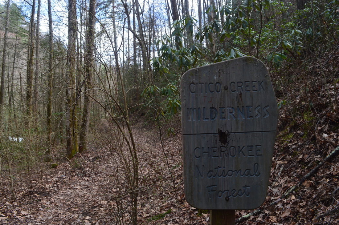
Located to the north of the Cherohala Skyway in southeastern Tennessee, the Citico Creek watershed offers rugged, wilderness hiking opportunities for true hiking enthusiasts. On this hike, you'll have a chance to see three waterfalls in the beautiful setting of the headwaters of North Fork Citico Creek. In addition, you have an option of continuing past the waterfalls and attempting to return down Brushy Mountain Trail - maybe your luck will be better than mine. This hike occurred on Saturday, March 21st, 2015. My plan was to hike the South Fork Trail to the place where North Fork Trail starts, and then to follow the North Fork Trail to Cold Springs Gap Trail or perhaps to Cherry Log Gap. I would either take the Benton Mackaye Trail or Cold Springs Gap Trail to Brushy Mountain Trail. Then, I would start down the Brushy Mountain Trail and hopefully make it down back to South Fork Trail without any major problems. My plan didn't materialize, and I ended up backtracking from about 1 mile down the Brushy Mountain Trail.
*Please note: the reason I am putting the duration of the hike below is one way, is because by the time I was going back down, I was quite tired and I am sure you could do it faster than I did. Also, the trail information paragraph below is ONLY for the section of my hike from the trailhead to the junction with Cold Springs Gap Trail. It is still probably safe to continue to Cherry Log Gap or to take the COld Springs Gap Trail to its terminus on the Benton Mackaye Trail, but proceed further onto the Brushy Mountain Trail at your own risk.*
R/T Length of Trail: 12.4 Miles
One Way Duration of Hike: 4:45 Type of Hike: Out and Back with Additional Options Difficulty Rating: 7 out of 10, harder and potentially dangerous if continuing onto Brushy Mountain Trail Pros: First half of hike is mainly flat; headwaters of North Fork is a very beautiful area Cons: Nearly three dozen river fords if doing out and back; narrow and often overgrown or unclear trail; last mile or so is very slow and often steep with some sections right in the creek; Brushy Mountain Trail has not been maintained for a long time and is pretty much no longer discernible Scenic Views: None Water Features: Old Goat Falls and upper cascades and waterfalls of North Fork Citico Creek - combined 10 stars Best Season(s) to Hike: A small period of time during early Spring when the temperatures are warm enough for numerous river fords and the forest hasn't turned green yet Trail Blaze Color(s): Generally none - some occasional old white blazes can be found on all trails; look out for axe cuts on trees that act as blazes Beginning Point: Citico Creek Trailhead Directions: From Tellico Plains, TN: Follow TN State Route 165 East for 14.3 miles. Then, turn left onto Indian Boundary Road at a brown road sign for Indian Boundary. Follow the road for 1.2 miles, and then, turn right to keep following Indian Boundary Road. If you reach Indian Boundary Campground, you've gone too far. The turn is marked by a sign for Citico Creek. From the turn, follow the road for 2.3 miles until you see a pullout on the right at a gated old road. This is the trailhead. You can see the Citico Creek bridge just down the road - if you have crossed the bridge, you have driven too far. The last 2.3 miles are on a gravel road that has several very muddy areas not preferable for 2WD vehicles.
*The map above does not have the full distance and other information, because my phone died about halfway back.*
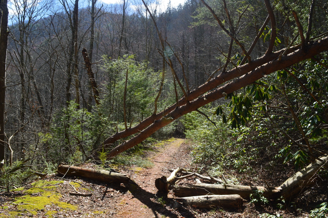
If you've ever looked for a trail which will feel more like bushwhacking through a forest, then here is your chance. The Brushy Mountain Trail gets the award of the hardest-to-discern trail I've ever been on - if you can call it one. Well, for the first quarter-mile to half-mile maybe you can, but not after that. It is likely that you will have to hike off-trail for at least half of the Brushy Mountain Trail from near the beginning to Ike Camp Branch. It seems that from this point, the trail is easier to follow, but I cannot confirm it, so if you plan on doing this particular trail, please be prepared for up to 4 miles of off-trail hiking. I strongly advise you to not take that trail though. There are many other options for doing this hike, including a simple out-and-back on the North Fork Trail or returning via Big Fodderstack Mountain and Pine Ridge Trail which sounds like a fairly well-discernible trail. In general, though, all trails in Citico Creek Wilderness are wild, and the North Fork Trail is probably one of the best, as it's one of the most popular trails in the area. Remember, all of the trails within the boundaries of the Citico Creek Wilderness are not the relatively groomed trails of the Cohutta Wilderness, Cheaha Wilderness, Shining Rock Wilderness... and probably even Southern Nantahala Wilderness. I'd say that a hiker with some experience should make it through North Fork Trail generally without problems (and probably a novice hiker can as long as you are fine with the river crossings, mileage, etc) - but don't venture out anywhere else unless you know the area well or have significant experience.
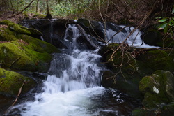
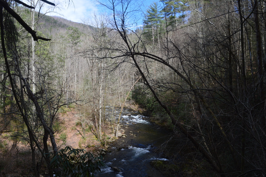
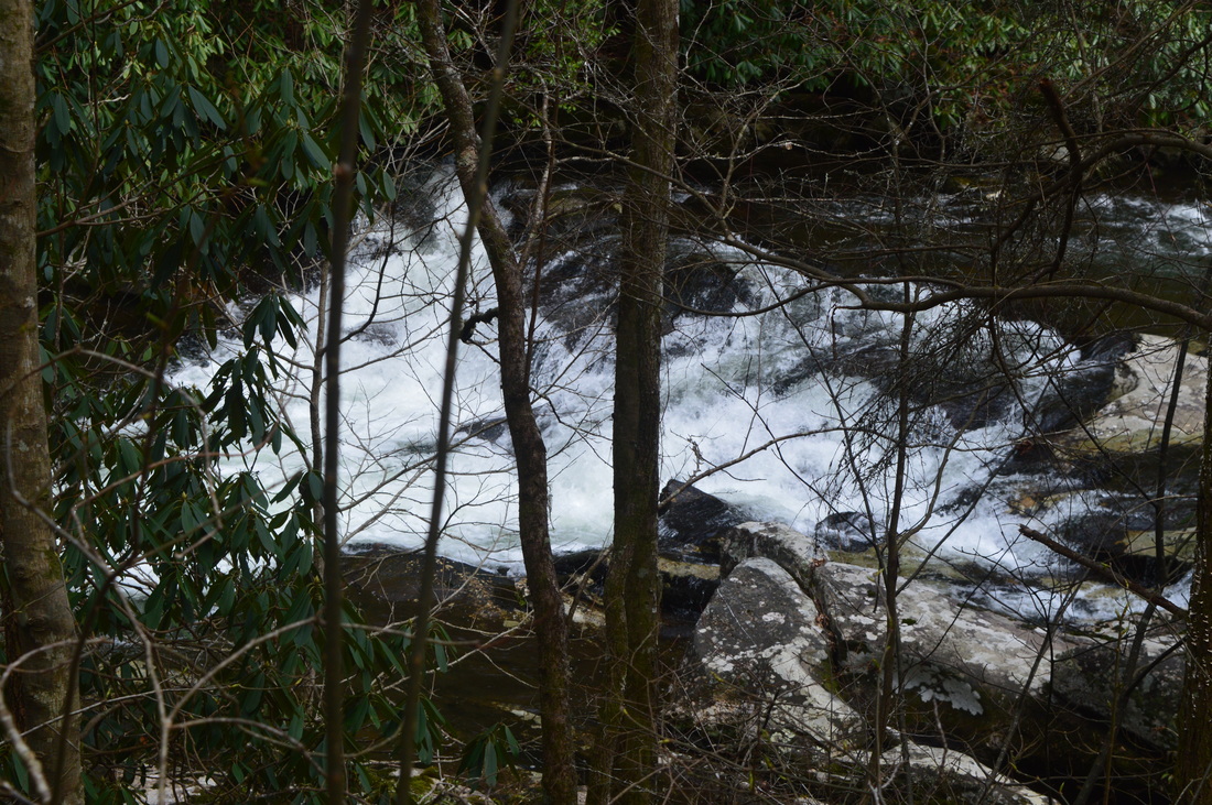
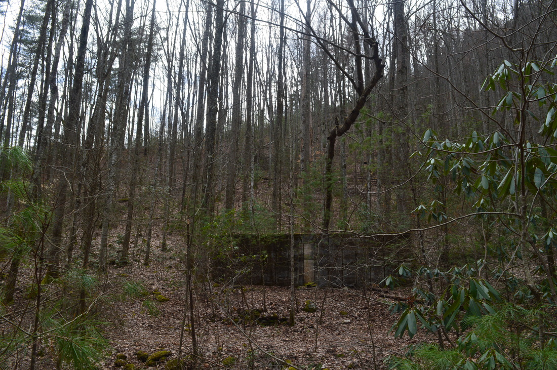
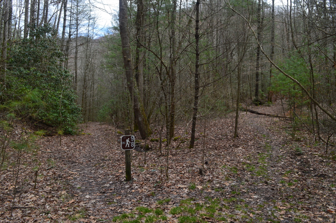
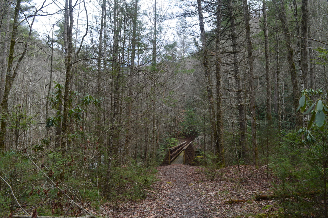
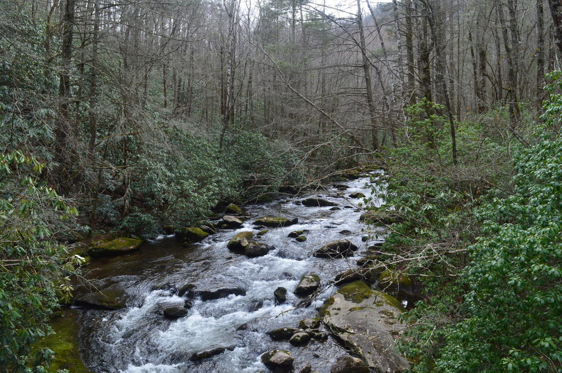
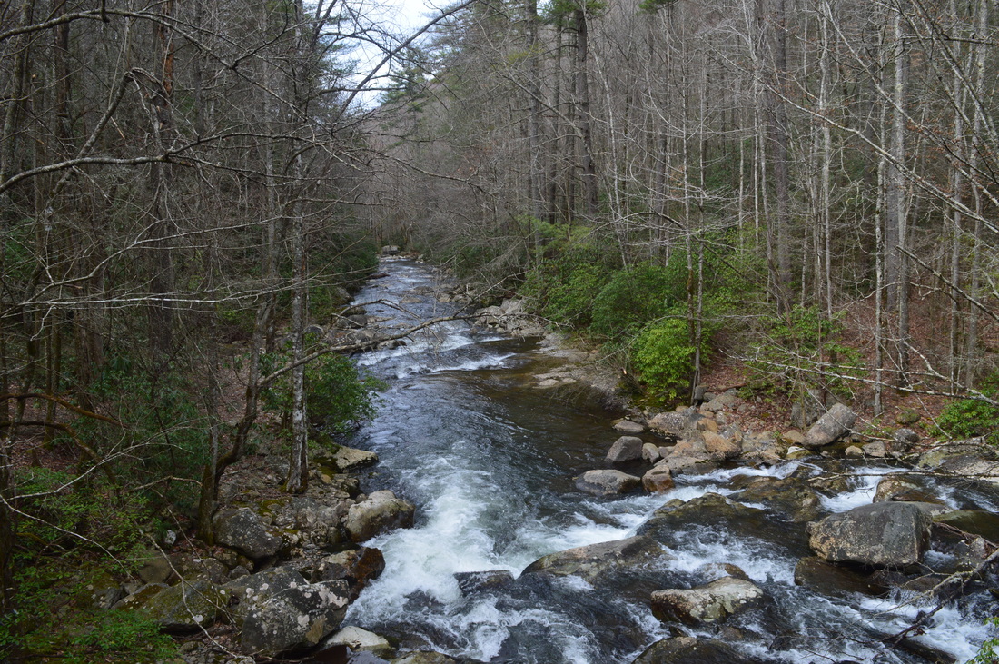
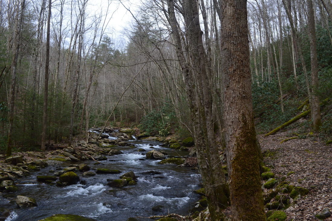
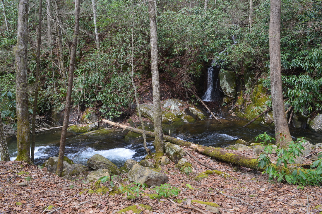
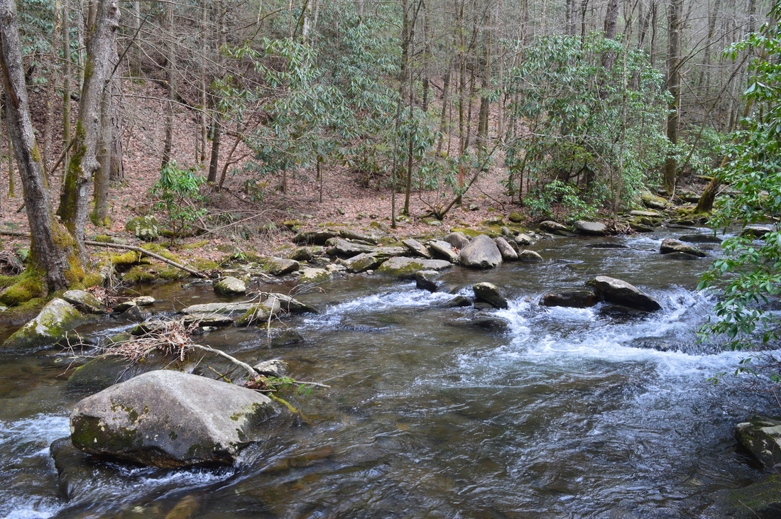
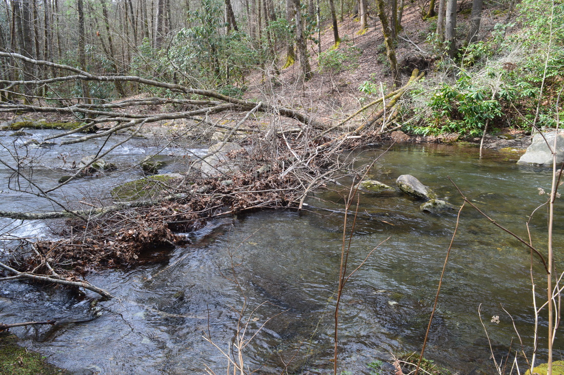
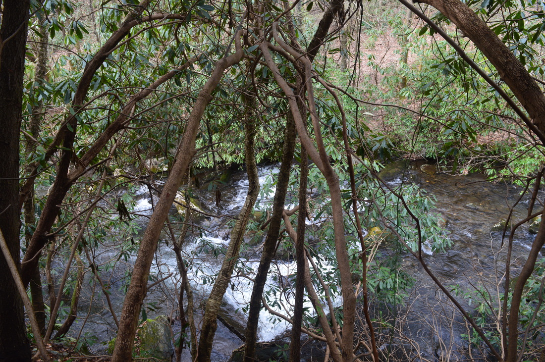
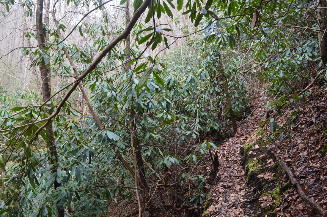
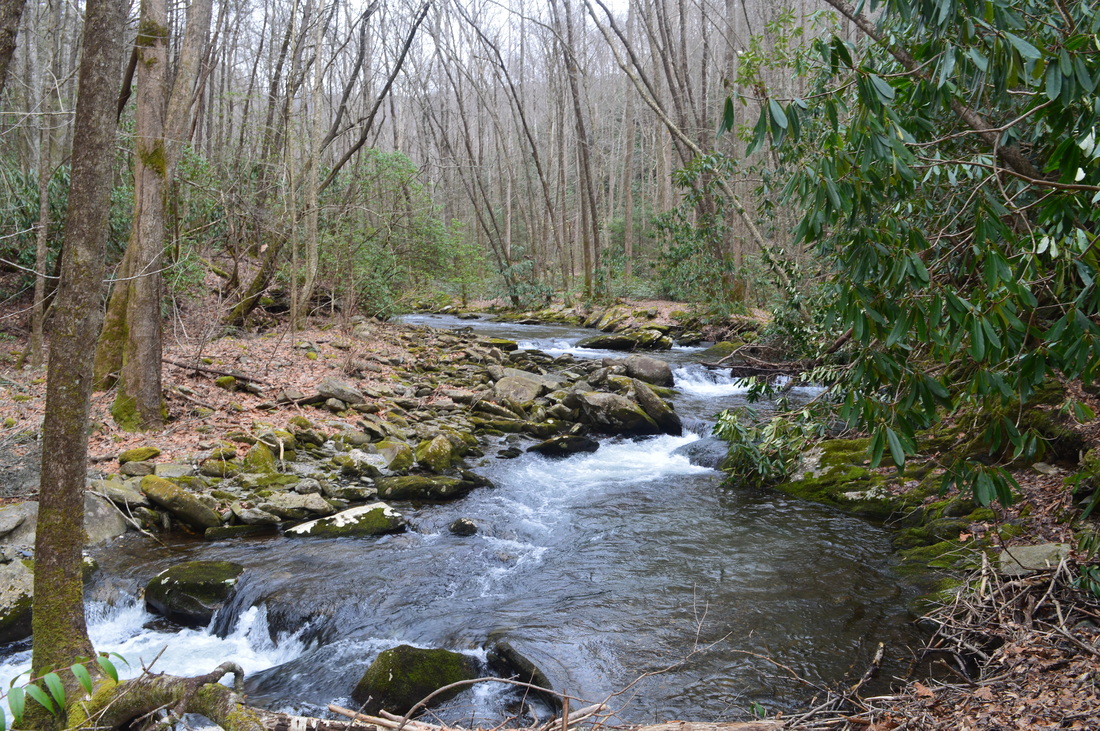
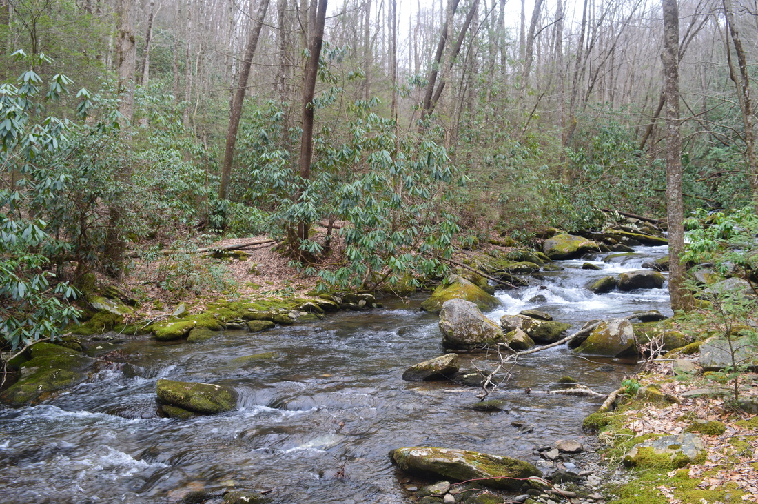
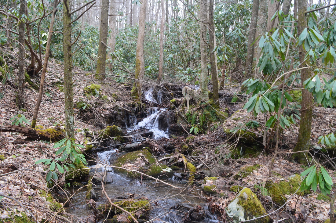
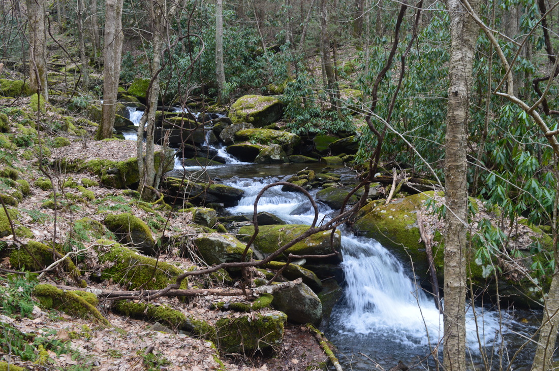
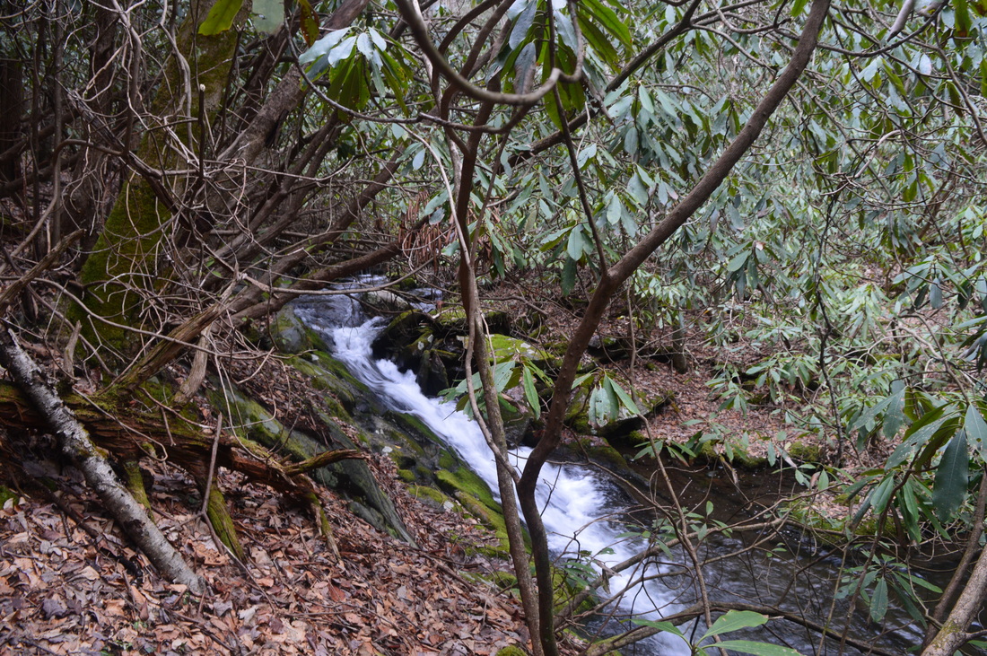
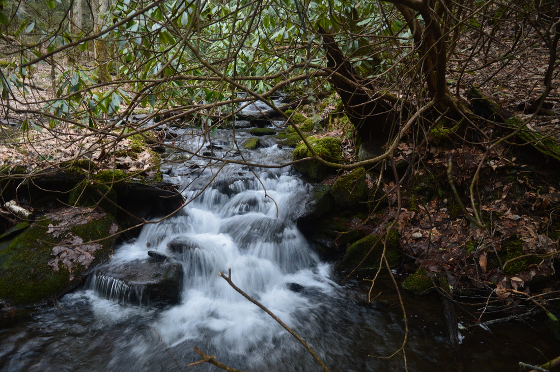
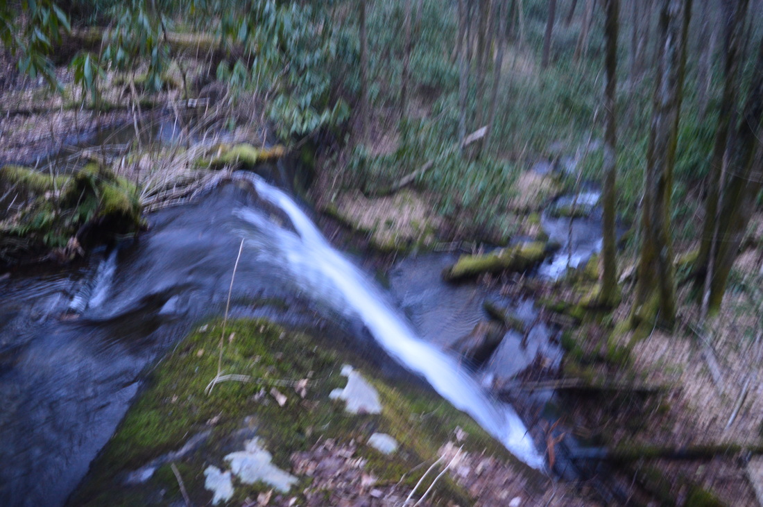
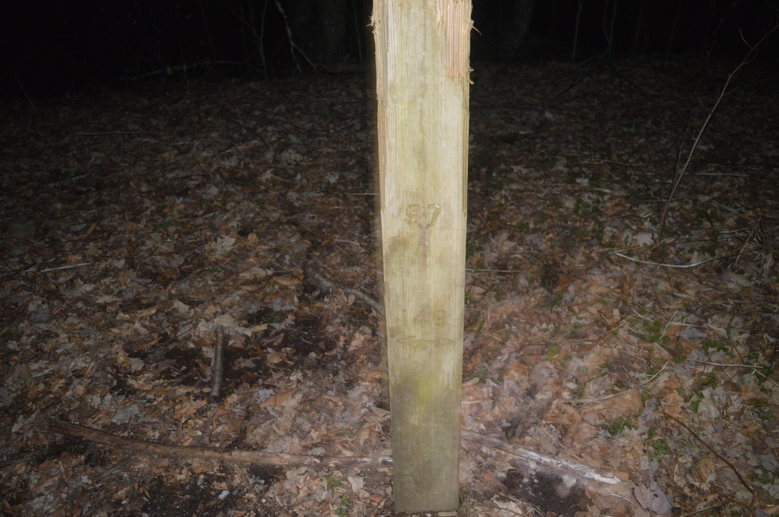
The trail that you'll be originally following is the South Fork Trail. At the trailhead, this trail is simply marked as #105. Walk around the gate and complete a short uphill. The trail shortly curves right, and views of the Citico Creek Gorge open. A camping area can be seen below, on the opposite bank of the large waterway. Starting from 0.1 miles, the trail will make a gradual downhill to Citico Creek. There will be one small stream crossing before the trail reaches water level at 0.3 miles, at another small stream. Following this, the trail passes through a flat area - shortly afterwards, pass some ruins of a building's foundation on the right. This has to do with an old warden camp that used to be here. You'll see another ruin connected to this soon. At 0.5 miles, enter the Citico Creek Wilderness. As you continue upstream along Citico Creek, during high water, the creek is one long froth of rapids/whitewater here.At 0.8 miles, pass more ruins on the right of the warden camp building and then reach an important trail junction. North Fork Trail, marked on a large brown sign as #98, bears left towards a wooden/iron footbridge, while South Fork Trail continues straight. For this hike, take North Fork Trail. The South Fork Trail leads to a completely different area of the wilderness. I'll do it one day. After you turn onto North Fork Trail, cross the footbridge, which is the first and only one you'll see on this hike. The footbridge crosses South Fork Citico Creek at its confluence with North Fork Citico Creek. On the day I went, during high water, both forks seemed equally large and equally raging, with many rapids on both streams. Following the footbridge, pass what looks like remnants of a small dam on the left. According to topographical maps, this used to be a gaging station. For the first half-mile, the North Fork Trail closely follows North Fork, full of rapids and cascades. It is a beautiful waterway. At 1.3 miles, make your first ford of North Fork. This is an easy ford, about knee deep (please note that all water depths I will be listing are during the somewhat high water conditions I visited in). Even though I have read that you can bypass this ford along with the next one, the bypass wasn't obvious and I chose to simply do the fords. After this first ford, the trail passes through camping area and quickly makes the second ford at 1.4 miles. This ford is slightly more difficult mainly due to a large blowdown in the middle of the creek right at the ford. It seems like the best option is to cross the creek parallel to the blowdown through knee-deep water, and then scramble along the other bank to the trail. While working your way through the blowdown is an option, you will run into at least waist-deep water there (due to being backed up by the blowdown), so I wouldn't do that. After this ford, you'll have a break from the fords for about 1.5 miles. The next 1.5 miles are mainly flat as the trail closely follows North Fork. Some sections are slightly overgrown and may be worse in summer, but generally, everything is manageable. At 2.5 miles, the trail crosses a small tributary, and shortly afterwards, maps suggest you ford the creek somewhere here, but I followed a rather obvious path that went above the creek,without even knowing that I was on a bypass of two fords. This bypass steeply climbs at first and then stays level slightly above the creek along a steep slope. Some deep pools can be seen in the creek below. At 3 miles, reach the third ford (technically it's the fifth one but I suggest following the bypass I just mentioned, in which case, it would be the third one). This and the next ford can also be bypassed, but it is a tricky scramble right along the cliff, so I chose to not do it. This third ford is probably the trickiest ford on the hike, but still not hard. It is mid-thigh deep, but the depth doesn't really matter - there is a rather noticeable current which will require some balance for you to make through, although I'll still call it a piece of cake. After the third ford, immediately ford back to the other side of the creek the fourth time. This is a knee to mid-thigh deep ford, but an easy one. The two fords are so close to each other that maybe the best option is to just walk up the creek here. These pair or fords is followed by another flat stretch, as the trail stays in a flat close to North Fork. At 3.4 miles, there is a large campsite on the right. At 3.5 miles, make the fifth and final major ford of North Fork.This ford is no more than knee deep and is easy. This is also the only major ford that cannot be bypassed, as the trail will stay on the north bank of North Fork for quite a bit from here. After the fifth ford, the grades begin to gradually trend uphill, although it is still barely noticed here. At 4 miles, it seems like the trail would ford the creek here again, but the trail actually turns left here, and it's a rather easy-to-miss spot. There are two rock cairns which make this considerably easier to notice. The trail steeply climbs up and then turns left again at another rock cairn. The grades begin to get noticeably steeper from here on. At 4.1 miles, make another switchback back to the right. On the way back, if you don't see the cairns here, it is easy to continue straight, which is a spur to a campsite. It is confusing, because there is another cairn at the campsite for some reason. The next stretch consists of a lower end moderate uphill stretch. North Fork is far below, but you can still spot its many cascades. There will be several tributaries seen flowing into the creek. At 4.7 miles, the trail looses itself amidst a boulder field near a large tributary of North Fork. The place where the tributary flows into North Fork is a very beautiful spot and marks the start of the headwaters section of North Fork, which is one of the most beautiful, pristine watersheds I've encountered. At the tributary, the trail comes back down to the level of the main creek, and you can see an island in the middle, with North Fork briefly splitting into two channels. On the left, the large tributary flows between two large boulders. You will probably have to ford the tributary, which is about ankle-deep. A fallen tree on the left aids with balance. Watch for a couple rock cairns here that will help to guide you onto the trail. The uphill grades change to upper end moderate from here, as the main stream shrinks in size and gains steepness. At 5 miles, break the 3000-foot mark and start on a steep section of trail that leads to Old Goat Falls. Pass between two huge boulders before reaching Old Goat Falls at 5.3 miles. This falls can be seen through rhododendron on North Fork, but I didn't a spot a clear way to get to the base. You might have to scramble through rhododendron for that. Old Goat Falls marks the start of a nearly mile-long section of North Fork where it flows through a narrow gorge in its uppermost reaches. Beyond Old Goat Falls, the trail gets progressively harder with fords of the creek coming in quick succession, one after another. For the novice hiker, this would probably be a good place to turn around, but if you feel like doing nearly another dozen fords and some more strenuous hiking, then I strongly recommend you continue to the junction with Cold Springs Gap Trail. The section between Old Goat Falls and Cold Springs Gap Trail is extremely beautiful, and features many cascades/waterfalls. It is hard to picture the scene, but this whole section combined is up there in the list of the best water features I've seen (although it will be really hard to beat the falls on Whitewater River). After Old Goat Falls, the trail does a 0.1-mile long steep climb up the slope which Old Goat Falls off of. Then, at the top of the climb, it gets a bit confusing, but keep to the right and descend to the creek, fording it at 5.4 miles. This is the first of eleven consecutive fords in less than a mile. All are shallow and easy, but they are a nuisance. Over the next 0.8 miles, the trail constantly crosses and recrosses the creek. There is nothing much to describe here other than that there will be several blowdowns and a couple more steep ascents. There will be one particularly noticeable, pretty cascade above one of the fords, and also, a small single-drop waterfall. The trail will ford the creek right above this waterfall. At 6.2 miles, arrive at the junction with Cold Springs Gap Trail. This trail is marked with a sign for Trail #149. You have several options here. First of all, you can simply turn around and retrace your steps back to the parking area. You could also continue another half-mile to Cherry Log Gap, where you can find some wild cherry trees. You could turn around from there, and you will also have an option of continuing northward along the Fodderstack Trail and then looping back via Pine Ridge Trail. I have not done those trails, so I do not know about their condition. In addition, you can also take the Cold Springs Gap Trail and then Brushy Mountain Trail, using it to loop back. This is the plan I had in mind, which I do not recommend for you to try. Like I already noted earlier, Brushy Mountain Trail is an overgrown, not maintained trail, and it's completely gone in some places. Cold Springs Gap Trail is fine though, so you could do it, if you want to add mileage. From the start of Cold Springs Gap Trail on North Fork Trail to its junction with Brushy Mountain Trail (marked as Trail #97 at the junction), it is 1.7 miles one way. For informational purposes, I will mention that the first half-mile of the trail is more or less fine. It does have many blowdowns, but the trail is visible most of the time. Once you run into flagging tape markers, that's where the trail condition deteriorates significantly. I followed the flagging tape for a bit eventually reached a spot with no visible trail at all - and the flagging tape disappeared too. One day, I'll attempt to redo this - probably whenever I'll do the South Fork Trail. To summarize, this hike is a true wilderness experience, and also has many rewards with the water features in its latter part. I had to think over this one for a while. It's very close to Best Hike criteria, but I decided to not make it one, because I really do not want touristy hikers to do this hike, as it's everything from a well-groomed trail. Even though the North Fork Trail is in decent condition, all the river fords, blowdowns, etc, should keep out the touristy. But if you're ready for this true wilderness hike, you're going to get quite a reward in the end. Below are my pictures.
1 Comment
Bridgette
2/19/2020 07:42:30 pm
I really want to do this hike to Old Goat Falls and then back out same way. I guess it will require water shoes and warmer temps. I really appreciate the info so I know what to expect. On my list for warm, early spring day for sure. Leave a Reply. |
About MeMark Oleg Ozboyd Dear readers: I have invested a tremendous amount of time and effort in this website and the Georgia Waterfalls Database the past five years. All of the work that has gone in keeping these websites updated with my latest trip reports has almost been like a full-time job. This has not allowed me to pick up a paid job to save up money for college, and therefore, I I've had to take out loans. If you find the information on this website interesting, helpful, or time-saving, you can say "thanks" and help me out by clicking the button above and making a contribution. I will be very grateful for any amount of support you give, as all of it will apply toward my college tuition. Thank you!

Coming in 2022-2023?
Other Hiking WebsitesMiles HikedYear 1: 540.0 Miles
Year 2: 552.3 Miles Year 3: 518.4 Miles Year 4: 482.4 Miles Year 5: 259.9 Miles Archives
March 2021
Categories
All
|


 RSS Feed