HIKING THE APPALACHIANS AND BEYOND
  • Home
  • Trail Reports
    • Best Hikes
    • Hikes with Scenic Views
    • Hikes with Water Features
    • Alabama
    • Georgia
    • Florida
    • North Carolina
    • South Carolina
    • Tennessee
    • Vermont
    • Virginia
  • Map
  • Hike List
  • Testimonials
  • Resources
  • Contact Us
  • Southeast Nature Society
    • Our Team
  • Georgia Waterfalls Database

Tray Mountain Wilderness: Chimney Mountain Trail, Helen, Georgia

2/9/2017

1 Comment

 
Picture
The Tray Mountain Wilderness is perhaps the least-explored wilderness area in Georgia. The focal point of the wilderness is Tray Mountain, which is one of the highest mountains in Georgia, and the section of the Appalachian Trail that passes over Tray Mountain. South and east of Tray Mountain, however, lies a remote area that has largely been unexplored: the Left Fork Soquee River watershed, which is home to numerous waterfalls. On the south side of the watershed stands Chimney Mountain, a lower peak that has several cliffs with great views but is overshadowed by the taller Tray Mountain only a few miles away. The hike to Chimney Mountain follows an unofficial trail that leads to a panoramic vista that faces Mount Yonah and the Georgia Piedmont. This hike occurred on Saturday, December 10th, 2016. My plan was to hike the unofficial path to Chimney Mountain out and back. 

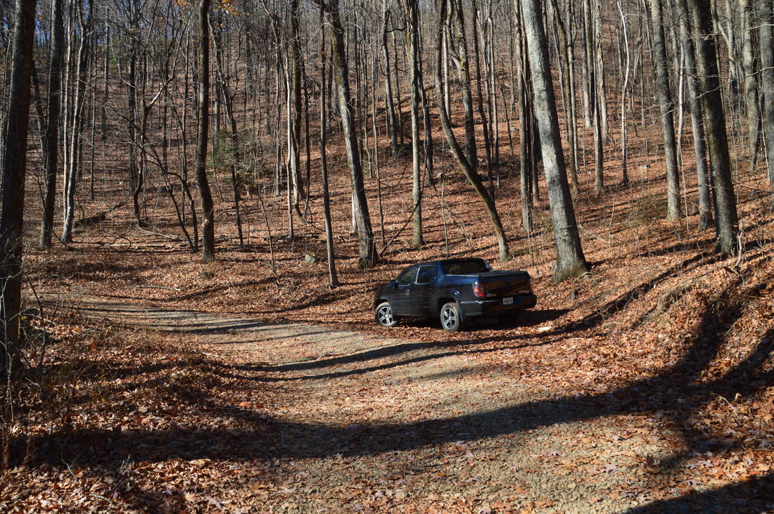
Note: FS 79 is the worst forest road that I have ever seen to date, in Georgia or anywhere else. The road is in decent shape up to the Chimney Mountain Trailhead, although you will have to do some tricky maneuvering across mud holes and around deep rutted areas (as well as across a few rocky areas), and not all low-clearance passenger vehicles will make it to the trailhead. However, beyond the trailhead, the road turns absolutely awful! I drive a 4WD truck with 8 inches of clearance, and I had trouble getting across some of the extremely rocky portions of the road past the trailhead. Eventually, I turned around, as there is one spot that may not be passable even by my truck, and plus, I was running low on gas. In other words, most (but probably not all) passenger vehicles can make it to the trailhead, if care is used, but only high clearance vehicles with four wheel drive can pass across the part of the road that is after the trailhead. 

Summary

​​R/T Length of Trail: 3.4 Miles 
Duration of Hike: 4:00 (This includes a lot of time spent scrambling and bushwhacking to reach the lower vista on Chimney Mountain, as well as a side trip not shown on the track to explore potential routes across South Fork Goshen Creek)
Type of Hike: Out and Back 
Difficulty Rating: 4 out of 10 
Total Elevation Gain: 1377 Feet 
Pros: Solitude 
Cons: Unestablished trail that requires some minor navigational skills
Points of Interest: Vistas on Chimney Mountain - 6 stars 
Trail Blaze Colors: None; the trail to Chimney Mountain is not official and not maintained 
Best Seasons to Hike: Winter 
Fees: None 
Beginning Point: Chimney Mountain Road Trailhead
Directions from Helen, GA: From the intersection of GA 75 and GA 356 just north of downtown Helen, take GA 356 East and follow it for 5.2 miles. Then, turn left onto Chimney Mountain Road. After 0.1 miles, turn right to continue on Chimney Mountain Road. In another 1.8 miles, continue straight onto FS Road 79. This is known both as Chimney Mountain Road and Tray Mountain Road. A "Rough Road" sign is placed at the beginning of the road. Continue on this road for 2.2 miles to the trailhead. The trailhead will be about 400 feet after the road crosses McClure Creek. There is a small pullout here with space for about one car (and there is another pullout a bit earlier). A small wilderness sign is attached to a tree at the trailhead. 

Map

Click ​here for more information and to download this trail map to view in Garmin Basecamp.

Details

I had been eyeballing the area of the Tray Mountain Wilderness south and east of the Appalachian Trail for some time prior to this hike, and when I learned that there is a path to Chimney Mountain - where I could see notable cliffs on satellite - I quickly pushed this hike up my list. In addition, I have also learned that there is an abundance of waterfalls in the Left Fork Soquee River watershed, and you might be hearing more about these waterfalls on this website from me in the near future. But on today's hike, my plan was to hike just to Chimney Mountain and make some reconnaissance regarding a possible approach to the Left Fork Soquee River from the trail to Chimney Mountain. The path that I had in mind, which headed NNE from the waypoint "Right Turn in Gap" on the map above, actually petered out about a quarter-mile farther in the vicinity of South Fork Goshen Creek. Since then, I have narrowed down other more realistic approaches to the Soquee River waterfalls, but that is beyond the scope of this post, as this hike was to Chimney Mountain. 

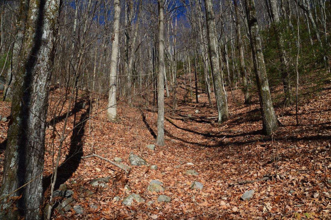
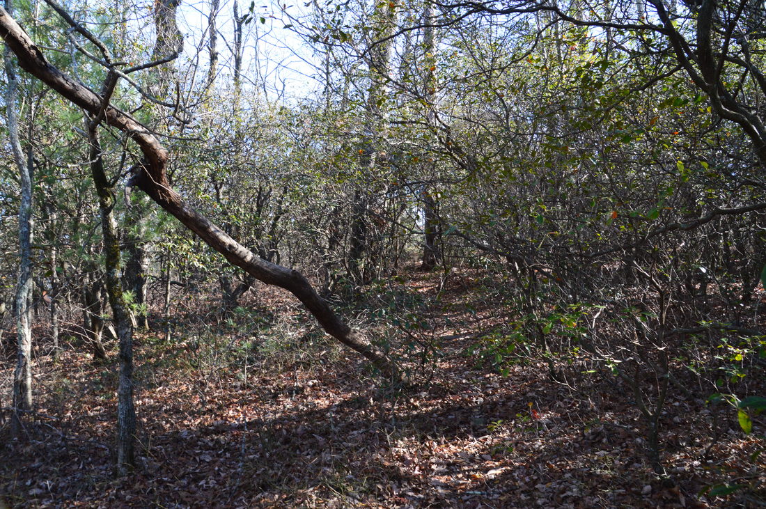
Since the trail to Chimney Mountain is not official, it can be a bit tricky to locate the trailhead for it. I estimated that the trailhead is approximately 400 feet after Chimney Mountain Road crosses McClure Creek, if coming from the bottom. The best way to describe the trailhead parking area is that it is in a wide spot on the road, where the road bends to the left, and what looks like the beginning of an ATV road (although it really isn't) leaves to the right. There is a small rectangular "National Forest Wilderness" sign attached to a tree at this spot, to the right of the road. 

The beginning of the trail to the Chimney Mountain is on the "ATV road" that I mentioned above. or rather, this isn't an ATV road - it is just a drive-in to a campsite, located just beyond the road, that appears to receive some ATV usage. Walk through the campsite and locate a faint path on the far end. This path is unmarked but it appears to get foot traffic. At times, the path isn't very obvious as it ascends, but in general, you must be aiming for the ridge (that leads to Chimney Mountain) to the north-northeast. I have found a reference that this trail may be called the Rich Cove Trail, although I will simply refer to it as the Chimney Mountain Trail. The first part of the hike is the most difficult, as in the first 0.35 miles, the trail ascends just under 400 feet to the ridge (without any switchbacks, of course). 
Picture
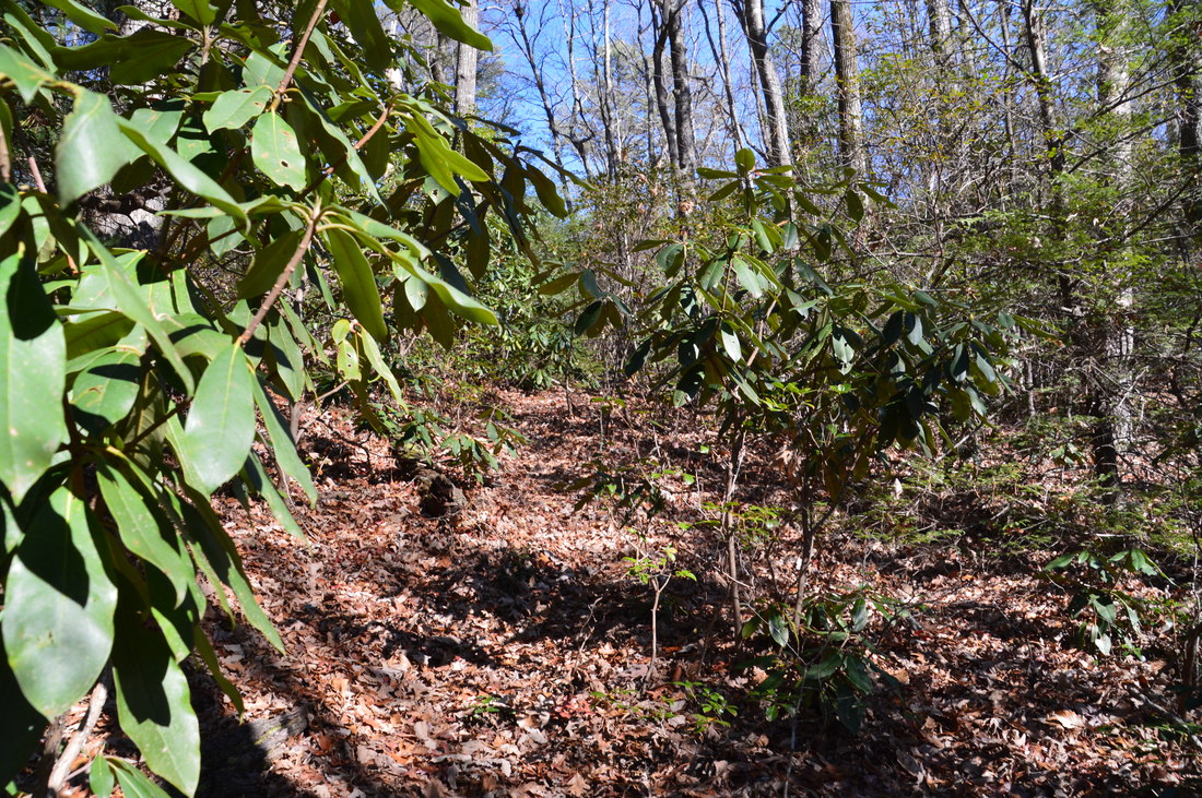
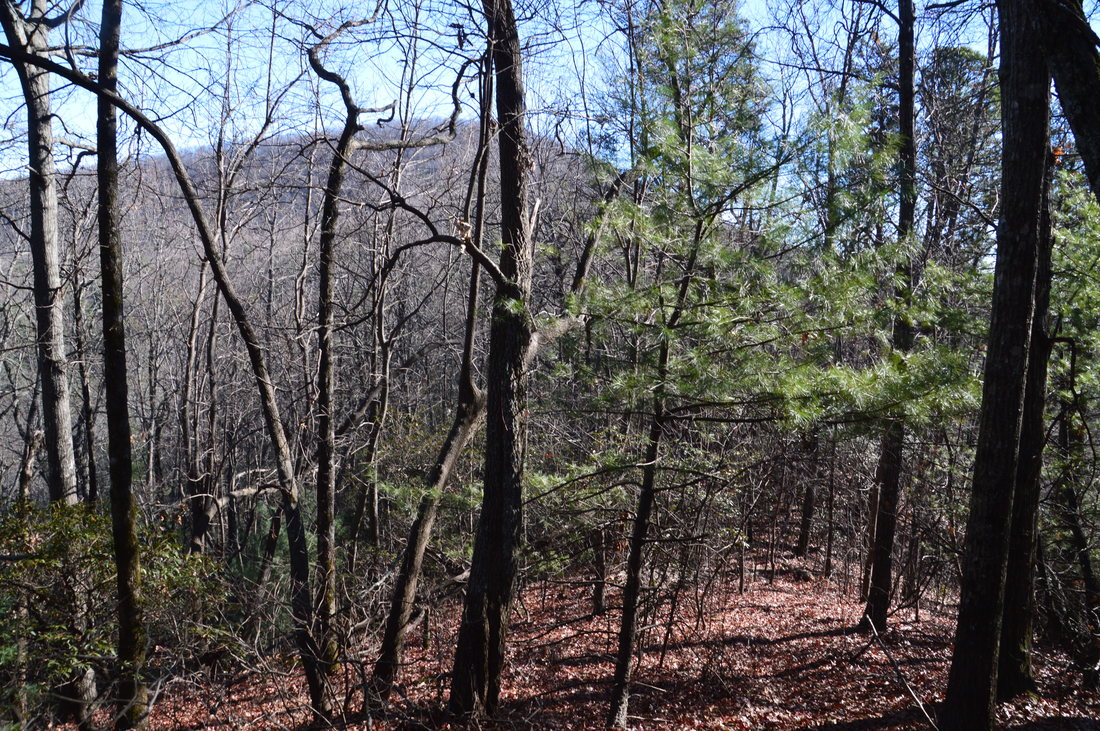
Several parts of the trail to Chimney Mountain pass through thickets of mountain laurel.
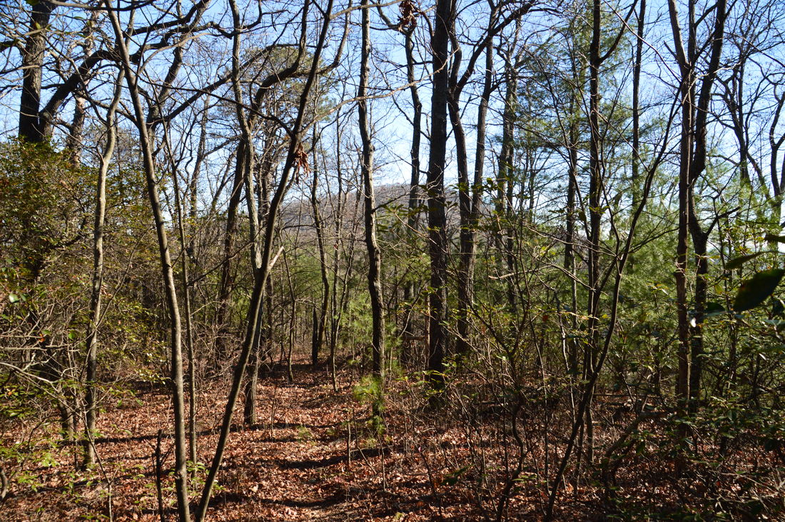
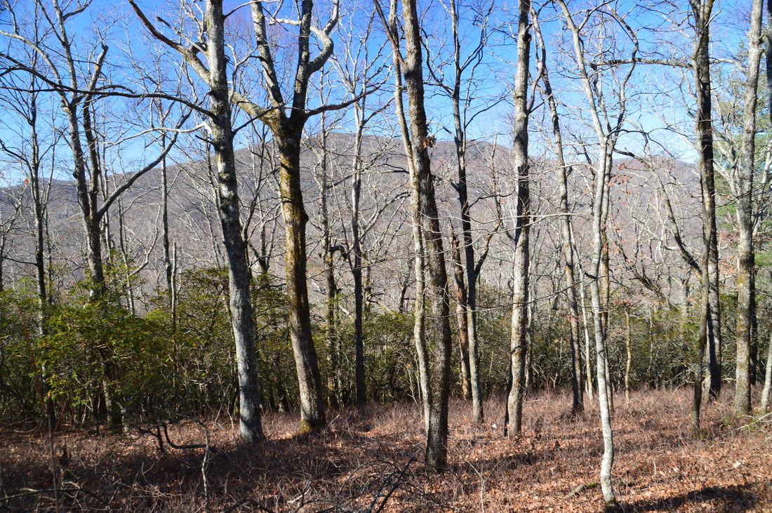
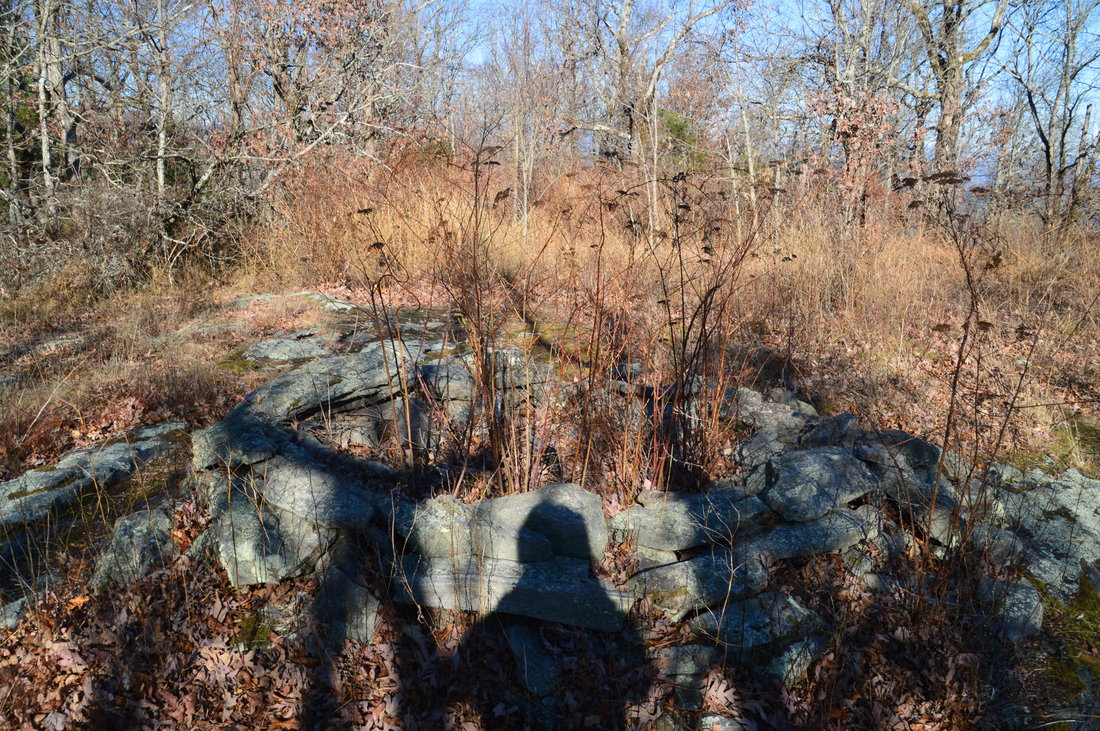
At 0.35 miles, reach the ridge that connects Tray Mountain to Chimney Mountain. I have marked this point as "Right Turn in Gap" on my map. There is an intersection here; turn right onto the ridge to keep following the trail to Chimney Mountain. The faint path that bears left and downhill out of the gap leads to a campsite at South Fork Goshen Creek and then dissipates. There used to be a trail from here to the Soquee River waterfalls, but from what I could tell, this trail does not exist anymore. The main trail to Chimney Mountain follows the ridgeline - more or less - for the rest of the way. Interestingly, the path is more obvious along the ridge then along the ascent. The ridgewalk begins with the path ascending a small knob, reaching the top at 0.55 miles. After this, the path descends to a gap, crosses a low knob, and descends to another gap just below Chimney Mountain at 1.0 miles. All along the ridge, there are great winter views both south and north. At the gap is where the final ascent to Chimney Mountain begins. At first it is easy to moderate, but it becomes increasingly steeper, turning very steep towards the end. In some places along this ascent, it may be hard to discern the path, but simply follow the spine of the ridge (in the direction of the summit) headed in a southeast route to reach the top of Chimney Mountain. While I was able to stay on the path throughout most of the ascent, the path disappeared about 100 feet from the summit, but as I could see the summit, I just worked through some briars straight toward it. At 1.55 miles, reach the summit of Chimney Mountain, which has a small flat rock slab and a huge fire ring in the middle. 

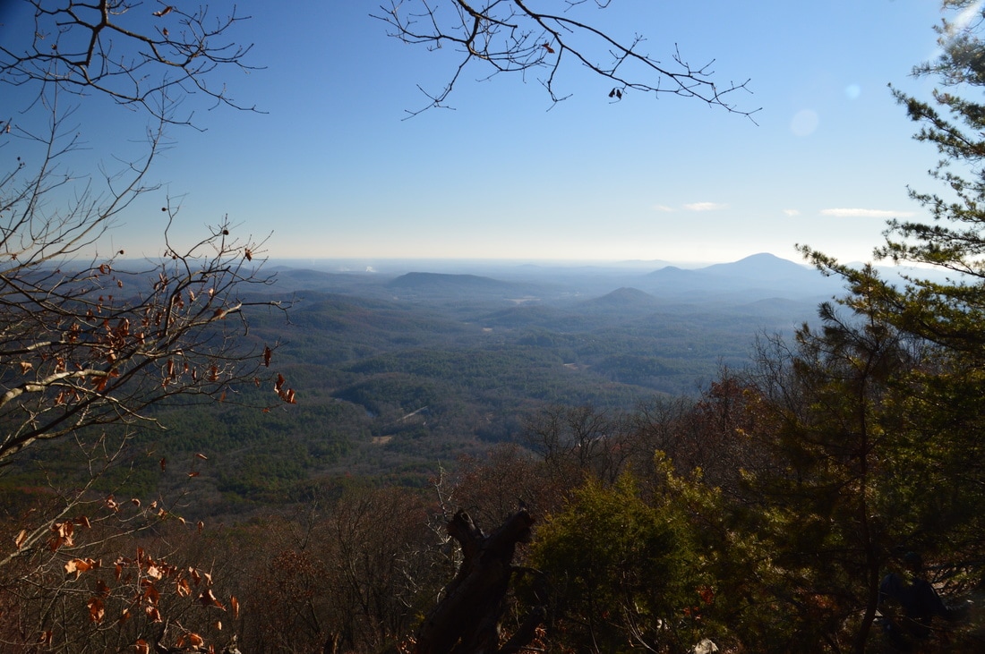
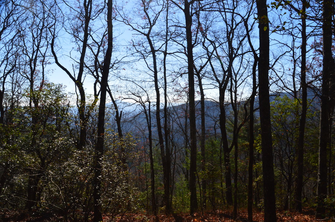
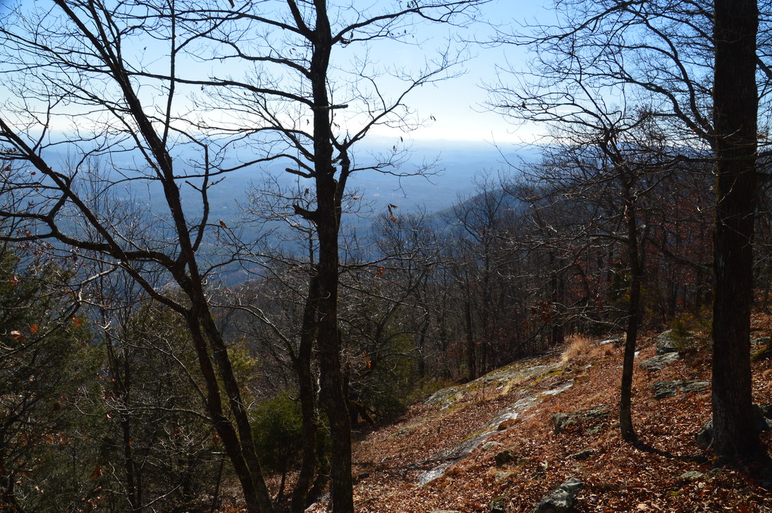
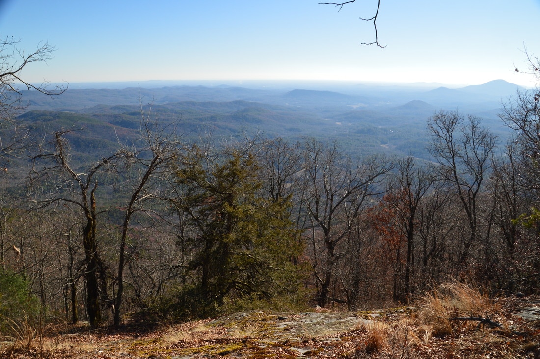
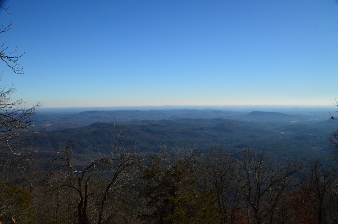
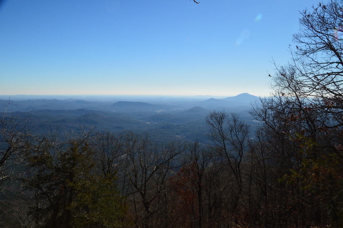
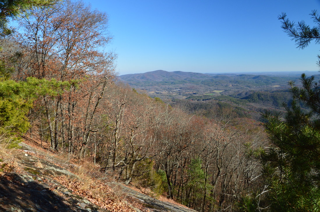
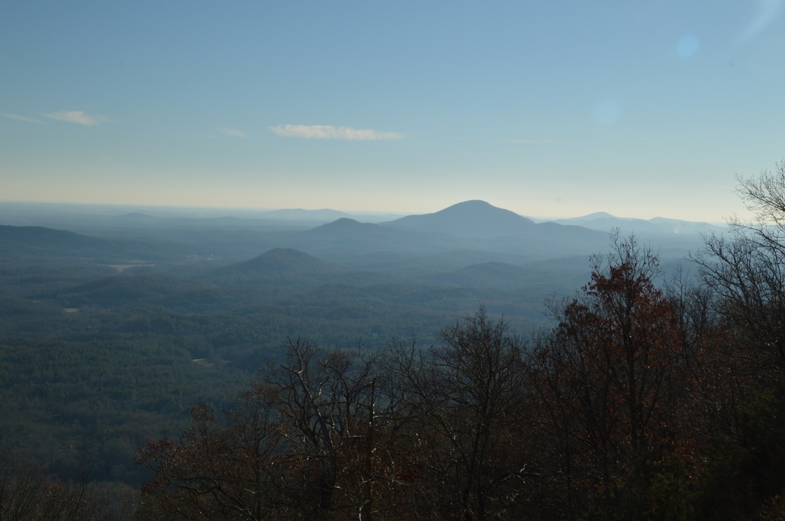
There are two main vistas on Chimney Mountain, and both of them are beyond the end of the trail. It is fairly easy to reach the first (upper) vista. Some steep scrambling is required to reach the lower vista. In my opinion, the lower vista has a slightly less obstructed view to the southwest, but the upper vista has a slightly broader panorama. I suggest getting to just the first vista and calling it a day, because in my opinion, the difference between the views is very marginal and it is not worth the long scramble to get to to the lower vista. However, I will provide directions to both vistas. To reach the upper vista from the summit of Chimney Mountain, head southwest down a steep wooded slope with sparse undergrowth. Walk about 250 feet generally southwest. You should spot the rock slab with views before you reach it. Reach the long but narrow rock slab with the upper vista at 1.6 miles. From here, there is a great panoramic view to the south, with the rolling hills of the Piedmont taking up most of the view. Mount Yonah occupies the right end (southwest corner) of the view. The main problem with this view is that the rock slab is not very large or steep, so tall trees at the bottom of it encroach on the view a bit, but it is still a very good vista. 
Picture
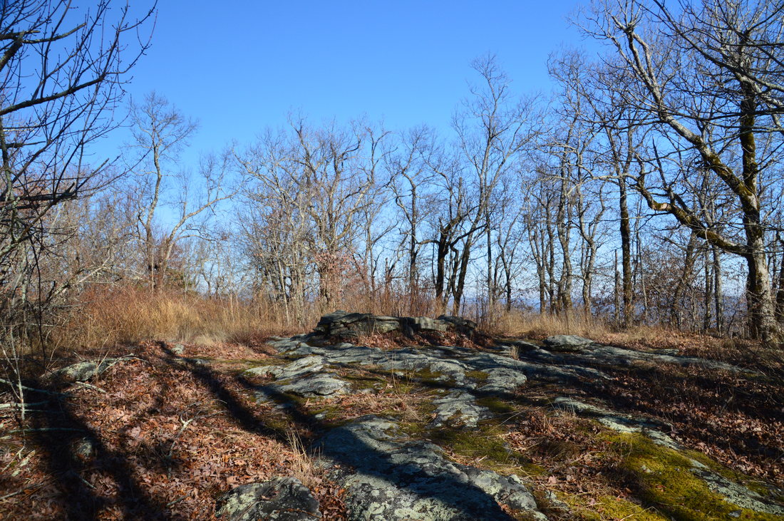
The rocky summit of Chimney Mountain has a huge campfire ring that does not appear to receive much use anymore.
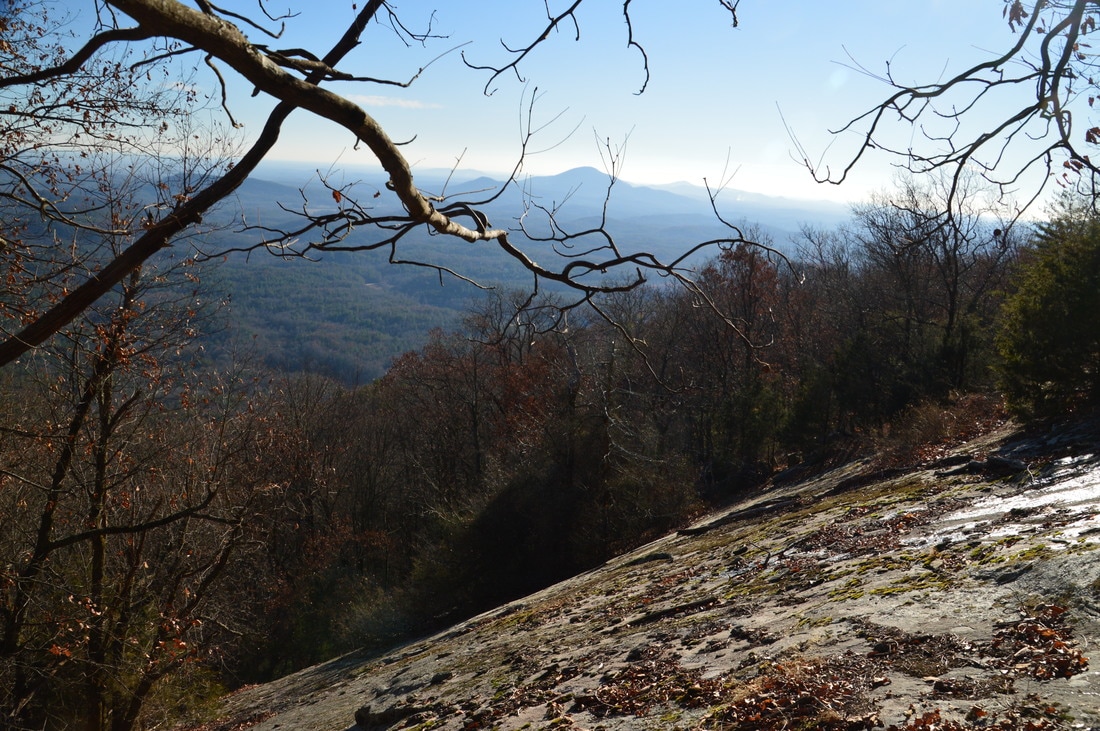
Reaching the lower vista is much more complicated. I would describe reaching it as follows: bushwhack steeply downhill along the ridge that heads southwest from Chimney Mountain and from the upper vista. About 250 feet past the upper vista, you should be able to spot a steep dropoff to the south (below the left-hand side of the ridge). Initially, I didn't realize that this is a rock face, and I continued down the ridge to a point where I reached a line of blue flagging tape that comes up from the bottom (apparently someone's used a different approach to this rock face?). I realized that the flagging tape ends at the rock face, so obviously, someone came up from lower down on Chimney Mountain Road and flagged the way. I do not know what route they used, but it is definitely worse than the one I used, because there is no trail whatsoever on the south side of Chimney Mountain. Regardless, you should reach the lower vista about 0.1 miles after the upper vista, although these 0.1 miles are very steep and trail-less.
The following GPS coordinates are for the upper vista on Chimney Mountain: N34° 46' 41.1" W83° 39' 18.1"
The following GPS coordinates are for the lower vista on Chimney Mountain: N34° 46' 38.3" W83° 39' 19.2"
The biggest problem with the lower vista is that due to the steepness of the rock face, it is extremely hard to get onto it to obtain a good view. I was able to get to a vantage point near the top of the cliff, on its east end, from where I had a clear view southwestward toward the Piedmont and Mount Yonah. The view is slightly clearer, due to less impediment by trees, but the difference is very subtle, and I would not continue beyond the upper vista. Plus, the upper vista actually has a better panorama. In the gallery below, I have included photos from both vistas, so that you can judge yourself which view is better. 

Regardless which vista you chose to turn around at, retrace your steps back to the trailhead along the same trail, concluding the hike at 3.4 miles (or 3.2 miles if you hike just to the upper vista). 

Variations

None

Bonus Stops

There are some waterfalls on Chinquapin Branch, that can be accessed from a camping area near the lower end of FS Road 79. I have not been to these waterfalls, so I cannot provide details, but I do know that a goat path leads almost all the way to the main falls on the creek. 

Pictures

Videos

1 Comment
Phillip Barrett
6/19/2020 07:05:58 pm

What is the fire ring on the summit, is it man made, or what can you tell me about it?

Reply


Leave a Reply.

    About Me

    Mark Oleg Ozboyd
    I'm an avid outdoor explorer and a hobbyist landscape photographer. I'm 21 years old and have been hiking since 2011. Originally based out of Atlanta, Georgia, I started out by occasionally hiking short trails throughout well-known Georgia State Parks. During 2012 and 2013, I began to expand my trips into adjacent states, as well as into the wilder National Forest areas rather than just State Parks. Throughout the years that followed, as I slowly ran out of popular hiking trails in my area, I began to search for and hike in more seldom-visited areas. Today, you can find me out in the woods every weekend, whether it's on an official trail or bushwhacking through cross-country terrain without any paths. I now attend Washington & Lee University and am exploring Virginia and West Virginia. My other hobbies include chess, science, old music, and meteorology. I have 3 years of amateur weather forecasting experience, having studied a lot of meteorology basics over the years. I am also a student at European School of Music where I learned that music and nature have a lot in common. Listening to good music inspires me to capture nature's beauty on the camera in different aspects that also make me recall many beautiful music pieces that I've heard.​


    Dear readers: I have invested a tremendous amount of time and effort in this website and the Georgia Waterfalls Database the past five years. All of the work that has gone in keeping these websites updated with my latest trip reports has almost been like a full-time job. This has not allowed me to pick up a paid job to save up money for college, and therefore, I I've had to take out loans. If you find the information on this website interesting, helpful, or time-saving, you can say "thanks" and help me out by clicking the button above and making a contribution. I will be very grateful for any amount of support you give, as all of it will apply toward my college tuition. Thank you! 

    Enter your email address to subscribe for trail reports:

    Delivered by FeedBurner


    Picture
    Coming in 2022-2023?

    Other Hiking Websites

    DWHike's Adventures
    Florida's Natural Wonders
    Florida Trailblazer
    Meanderthals
    Mountain Images
    by Bernie Boyer

    North Carolina Waterfalls with
    ​Kevin Adams
    Take-a-Hike!
    Tennessee Landforms
    Waterfall Page
    Waterfall Adventurer
    Zach's Mild Adventures

    Miles Hiked

    Year 1: 540.0 Miles
    Year 2: 552.3 Miles
    ​Year 3: 518.4 Miles
    Year 4: 482.4 Miles
    Year 5: 259.9 Miles

    Archives

    March 2021
    February 2021
    January 2021
    November 2019
    October 2019
    September 2019
    August 2019
    July 2019
    June 2019
    February 2019
    January 2019
    December 2018
    November 2018
    October 2018
    August 2018
    July 2018
    June 2018
    May 2018
    April 2018
    March 2018
    February 2018
    January 2018
    December 2017
    November 2017
    October 2017
    September 2017
    August 2017
    July 2017
    June 2017
    May 2017
    April 2017
    March 2017
    February 2017
    January 2017
    December 2016
    November 2016
    October 2016
    September 2016
    August 2016
    June 2016
    May 2016
    April 2016
    March 2016
    January 2016
    December 2015
    November 2015
    October 2015
    September 2015
    August 2015
    July 2015
    June 2015
    May 2015
    April 2015
    March 2015
    February 2015
    January 2015
    December 2014
    November 2014
    October 2014
    September 2014
    August 2014
    July 2014
    June 2014
    May 2014
    April 2014
    March 2014
    February 2014

    Categories

    All
    Adel
    Adirondack Park
    Alabama
    Alfred A. Ring Park
    Allegheny Trail
    Amicalola Falls State Park
    Anniston Area
    Apalachicola Bluffs And Ravines Preserve
    Apalachicola National Forest
    Apalachicola/Port St. Joe Area
    Apopka
    Appalachian Trail
    Appling
    Art Loeb Trail
    Aska Trail System
    Bakersville
    Balm-Boyette Scrub Preserve
    Balsam Lake Recreation Area
    Bankhead National Forest
    Bartow County Parks
    Bartram Trail
    Basinger
    Beersheba Springs
    Benton
    Benton Mackaye Trail
    Berry College Trail System
    Best Hike
    Big South Fork National Recreation Area
    Black Bear Wilderness
    Black Rock Mountain State Park
    Blairsville
    Blakely
    Blood Mountain Wilderness
    Blowing Rock
    Blue Ridge
    Blue Ridge Parkway
    Boone
    Bradenton
    Bradenton Beach
    Brasstown Bald
    Brasstown Wilderness
    Brevard
    Bryson City
    Buchanan
    Bucks Pocket State Park
    Bulow Creek State Park
    Bulow Plantation Ruins State Park
    Caesars Head State Park
    Caladesi Island State Park
    Calhoun
    Camel's Hump State Park
    Cashiers
    Caspersen Beach Park
    Catfish Creek State Park
    Caves
    CC Putnam State Forest
    Cedar Point Environmental Park
    Chatsworth
    Chattahoochee National Forest
    Chattanooga
    Chattanooga Valley
    Chattooga National Wild And Scenic River
    Cheaha Wilderness
    Cherohala Skyway
    Cherokee
    Cherokee National Forest
    Chiefland Area
    Chillhowee Recreation Area
    Chipley
    Chunky Gal Trail
    Circle B Bar Reserve
    Citico Creek Wilderness
    Citrus Wildlife Management Area
    Clarkesville
    Clayton
    Cleevland
    Cleveland
    Cloudland Canyon State Park
    Cohutta Wilderness
    Collier-Seminole State Park
    Cordele
    Cornelia
    Covington
    Crestview Area
    Crew-land-and-water-trust
    Cullowhee
    Cumberland Trail
    Dahlonega
    Dalton
    Dawson Forest Wildlife Management Area
    Dawsonville
    Dayton
    De Soto National Memorial
    DeSoto State Park
    Dillard
    Double Springs
    Ducktown
    Duncan Ridge Trail
    Dunlap
    Eagle's Rest Park
    Eastpoint
    Econfina Creek Wildife Management Area
    Eglin Air Force Base
    Elizabethton
    Elkins
    Elk Knob Game Lands
    Elk Park
    Ellicott Rock Wilderness
    Ellijay
    Emerson Point Preserve
    Englewood Area
    Enota Retreat
    Erwin
    Falling Waters State Park
    Fayetteville
    Fires Creek Recreation Area
    Fire Tower
    Flint River
    Florence Area
    Florida
    Florida Caverns State Park
    Florida Trail
    Foothills Trail
    Fort Mountain State Park
    Fort Myers Area
    Fort Payne
    Fort Payne Area
    Fort Yargo State Park
    Franklin
    Franklin Delano Roosevelt State Park
    Franklin-Marion State Forest
    Frozen Head State Park
    Gainesville
    Gainesville Area
    Gatlinburg
    George Washington National Forest
    Georgia
    Georgia Veterans Memorial State Park
    Glasgow
    Gorges State Park
    Grandfather Mountain State Park
    Great Smoky Mountains National Park
    Greeneville
    Green River Game Lands
    Gruetli-Laager
    Grundy Forest State Natural Area
    GTM Reserve
    Guana River Wildlife Management Area
    Hayesville
    Helen
    Hiawassee
    High Falls State Park
    Highlands
    Highlands Scenic Highway
    Hillsborough River State Park
    Hinson Conservation & Recreation Area
    Historic Sites
    Honeymoon Island State Park
    Hot Springs
    Huntington
    Inverness Area
    Jackson
    Jasper
    Jefferson National Forest
    Joan M. Durante Park
    Jonathan Dickinson State Park
    Jones Gap State Park
    Joyce Kilmer Slickrock Wilderness
    Joyce Kilmer - Slickrock Wilderness
    Juniper Prairie Wilderness
    Kelly Park
    Keown Falls Recreation Area
    Kolomoki Mounds State Park
    LaFayette
    Lake City Area
    Lake George Wild Forest
    Lake June-in-Winter State Park
    Lakeland Area
    Lake Placid
    Lake Russell Wildlife Management Area
    Lake Wales Ridge State Forest
    Laurel Fork North Wilderness
    Leffis Key Preserve
    Leon Sinks Geological Area
    Lexington
    Lineville
    Linville
    Linville Gorge Wilderness
    Lithia Springs
    Little Frog Wilderness
    Little Manatee River State Park
    Little River Canyon National Preserve
    Longboat Key
    Long Trail
    Lookout Mountain
    Lookout Mountain Battlefield
    Lovingston
    Lula Lake Land Trust
    Lumpkin
    Maggie Valley
    Manatee Springs State Park
    Marianna Area
    Mark Trail Wilderness
    Marlinton
    Mccaysville
    McMinville
    Mentone
    Middlesex
    Mistletoe State Park
    Monongahela National Forest
    Montreat
    Mountain Bridge Wilderness Area
    Mountain City
    Mountains To Sea Trail
    Mountains-to-Sea Trail
    Mount Rogers National Recreation Area
    Myakka River State Park
    Myron B. Hodge City Park
    Nantahala National Forest
    Naples
    Naples Area
    Natural Bridge State Park
    Neal Preserve
    New Castle
    Newport
    New River Gorge National Park
    New York
    North Carolina
    Ocala Area
    Ocala National Forest
    Ocean-to-Lake Trail
    Oconee State Park
    Oconee Station Historic Site
    Okaloacoochee Slough State Forest
    Oldsmar
    Oneida
    Orlando Area
    Ormond Beach
    Oscar Scherer State Park
    Oxford
    Palatka
    Palmetto Trail
    Panama City Area
    Panthertown Valley
    Parrish
    Paynes Creek Historic State Park
    Peaks Of Otter Recreation Area
    Pigeon Crockford Mountain Wildlife Management Area
    Pigeon-Crockford Mountain Wildlife Management Area
    Pigeon-Crockford Wildlife Management Area
    Pine Mountain
    Pinhoti Trail
    Pinnacle Park
    Pisgah Civitan Park
    Pisgah National Forest
    Pittman Center
    Pond Mountain Wilderness
    Ponds/Lakes
    Prentice Cooper State Forest
    Providence Canyon State Park
    Pumpkintown
    Quick Point Nature Preserve
    Raven Cliffs Wilderness
    Reed Bingham State Park
    Reliance
    Rice Creek Conservation Area
    Riverview Pointe Preserve
    Robbinsville
    Robinson Preserve
    Rock Creek Gorge Scenic Area
    Rock Island State Park
    Rome
    Rosman
    Sale Creek
    Salem
    Salt Springs
    Saluda
    Santa Rosa Beach
    Sarasota
    Sarasota Area
    Savage Gulf State Natural Area
    Scenic Views
    Scottsboro Area
    Sebring Area
    Sewanee
    Sheltowee Trace Trail
    Shining Rock Wilderness
    Signal Mountain
    Sipsey Wilderness
    Sky Valley
    Smithgall Woods State Park
    Snowbird Backcountry Area
    Soddy Daisy
    Soddy-Daisy
    Sopchoppy
    South Carolina
    South Cumberland State Park
    Southeastern Cave Conservancy
    Southern Nantahala Wilderness
    Sparta
    Sprewell Bluff Park
    Spring City
    Spring Hill
    Springs
    Spruce Pine
    Standing Indian Backcountry Area
    St. Augustine
    St. George Island State Park
    St. Joseph Bay State Buffer Preserve
    St. Marks Area
    St. Marks National Wildlife Refuge
    Stone Mountain
    Stone Mountain Park
    Suches
    Sumatra
    Sumter National Forest
    Suwannee River
    Swallow Creek Wildlife Management Area
    Sweetwater Creek State Park
    Sylva
    Talladega National Forest
    Tallahassee Area
    Tallulah Falls
    Tallulah Gorge State Park
    Tampa Bay Area
    Tate City
    Tate's Hell State Forest
    Tea Creek Wildlife Management Area
    Tellico Plains
    Tennessee
    Thomaston
    Toccoa
    Topsail Hill State Park
    Torreya State Park
    Townsend
    Tracy City
    Tray Mountain Wilderness
    Trenton
    Triple Creek Preserve
    Troutdale
    Unaka Mountain Wilderness
    Upper Tampa Bay County Park
    Venice
    Vermont
    Virgin Falls State Natural Area
    Virginia
    Virginia Outdoors Foundation
    Vogel State Park
    Wakulla Springs State Park
    Waleska
    Walhalla
    Wartburg
    Water Features
    Waynesville
    Weedon Island Preserve
    Weeki Wachee Preserve
    Wekiwa Springs State Park
    West Palm Beach Area
    West Virginia
    Whitehall
    White Springs
    Winder
    Withlacoochee State Forest
    Young Harris

    RSS Feed

TRAIL REPORTS

Hikes in Alabama
​Hikes in Florida
Hikes in Georgia
Hikes in North Carolina
Hikes in South Carolina
Hikes in Tennessee
Hikes in Virginia

Hiking Resources

Alabama Resources
​
Florida Resources
Georgia Resources
North Carolina Resources
​South Carolina Resources
​
Tennessee Resources

Other

Contact
Map of Hikes
Alphabetical List of Hikes
Southeast Nature Society
© COPYRIGHT 2014-2018
​ALL RIGHTS RESERVED.
Important: I disclaim any responsibility for any damage or personal injury that may occur as a result of the activities and information found on this website. All outdoor activities, especially off-trail hiking, are done at your own risk. Never hike or head into that area that may be above your fitness or experience level.
  • Home
  • Trail Reports
    • Best Hikes
    • Hikes with Scenic Views
    • Hikes with Water Features
    • Alabama
    • Georgia
    • Florida
    • North Carolina
    • South Carolina
    • Tennessee
    • Vermont
    • Virginia
  • Map
  • Hike List
  • Testimonials
  • Resources
  • Contact Us
  • Southeast Nature Society
    • Our Team
  • Georgia Waterfalls Database