
Folks who live in the Atlanta metro area are very familiar with the Chattahoochee River: one of Georgia's largest rivers and a source of drinking water for many. But where does the river begin? In the North Georgia Mountains near Helen and Hiawassee, where a tiny spring gives birth to a rivulet that is the same Chattahoochee River as the one that feeds Lake Lanier and Walter F. George Lake. The Jacks Knob Trail in Chattahoochee National Forest's Mark Trail Wilderness is the shortest route to the source of the Chattahoochee River. The Chattahoochee Spring isn't the only point of interest in the area, however; two nearby creeks drop off the north side of the Tennessee Valley Divide and form large waterfalls on their way into the Hiwassee River valley. This hike occurred on Saturday, January 7th, 2017. My plan was to hike the Jacks Knob Trail from Jacks Gap to Chattahoochee Gap. After seeing the Chattahoochee Spring, I would hike the Appalachian Trail from Chattahoochee Gap to Red Clay Gap. This is where I would pick up an unofficial side trail north into the Joel Creek valley, visiting Joel Creek Falls and Gurley Creek Falls. I would return to Jacks Gap by walking along Route 180.
Summary
R/T Length of Trail: 9.0 Miles
Duration of Hike: 6:50 Type of Hike: Loop Difficulty Rating: 5 out of 10 Total Elevation Gain: 2237 Feet Pros: Solitude (except at Enota Retreat) Cons: No year-round vistas; unsigned and easy-to-miss trail in Red Clay Gap Points of Interest: Chattahoochee Spring; Joel Creek Falls - 4 stars (water-dependent); Gurley Creek Falls - 5 stars Trail Blaze Colors: Jacks Knob Trail - Blue; Appalachian Trail - White; Chattahoochee Spring Spur Trail - Blue; Joel Creek Trails - None; Gurley Creek Trail - None Best Seasons to Hike: Winter Fees: There are no fees for parking at Jacks Gap. However, there is a $10 fee for entry to Enota Retreat. Part of this hike is on the property of Enota Retreat (and both Joel Creek Falls and Gurley Creek Falls are on retreat property), so you will still have to pay this fee at the lodge in Enota Retreat. Beginning Point: Jacks Gap Trailhead Directions from Hiawassee, GA: From the intersection of Main Street (US 76/GA 75) and Bell Street in downtown Hiawassee, follow US 76 East/GA 75 South for 2.7 miles. Then, turn right onto GA 17/75 South and continue for 6.3 miles, after which turn right onto GA 180 West. Follow GA 180 West for 5.3 miles to Jacks Gap, where there is an intersection with GA 180 Spur. The parking area for the Jacks Knob Trail is located right at the intersection of GA 180 and GA 180 Spur. Map
Click here for more information and to download this trail map to view in Garmin Basecamp.
Details
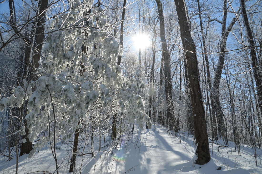
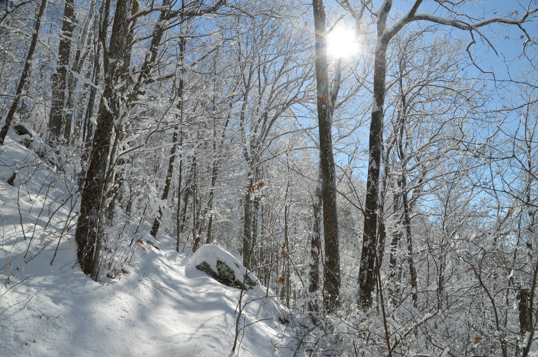
I always have treated the Jacks Knob Trail as two separate trails: one that heads north from Jacks Gap to Brasstown Bald and one that heads south to Chattahoochee Spring and the Appalachian Trail. I hiked the northbound segment back in 2014. Now, over two and a half years later, I decided to hike several trails - including the south part of the Jacks Knob Trail - right after a winter storm blanketed the north Georgia mountains in 4 to 6 inches of snow.
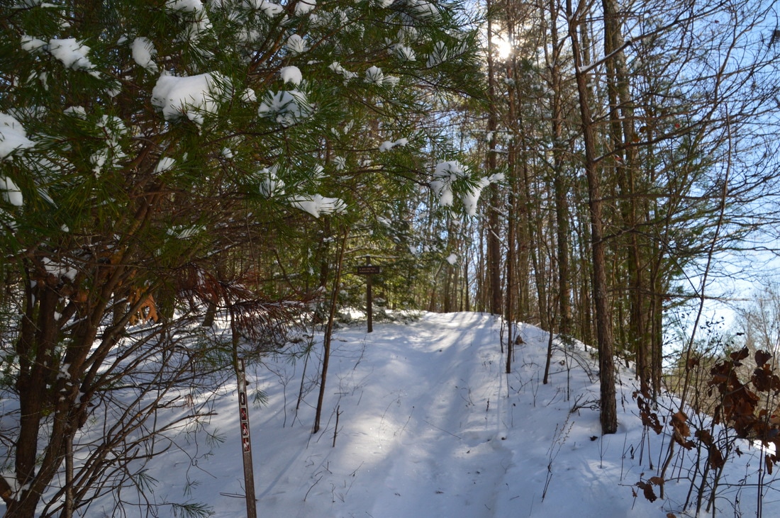
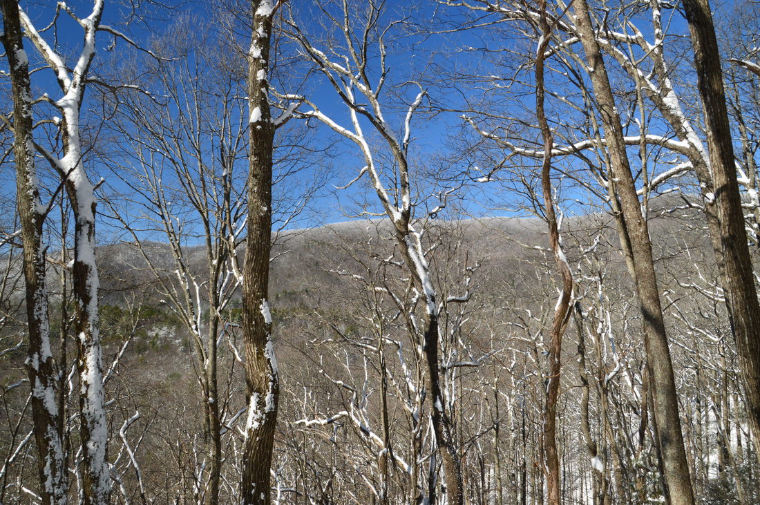
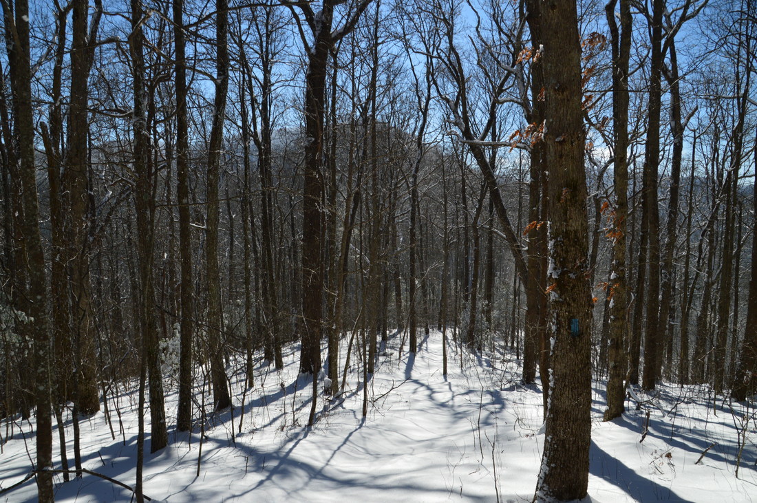
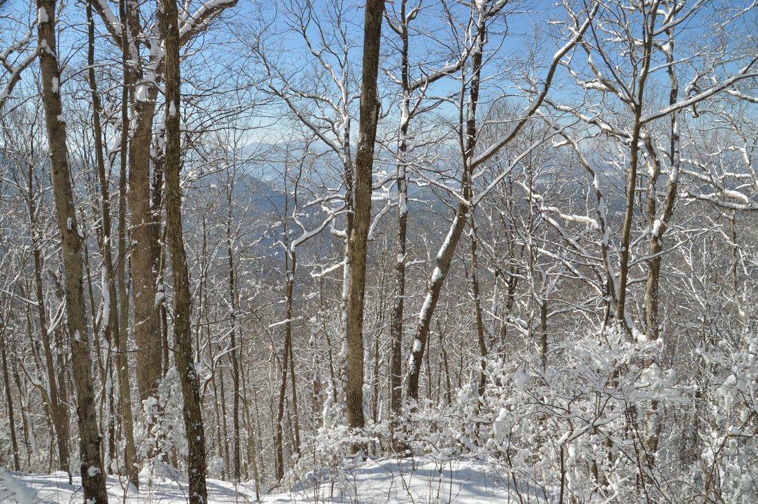
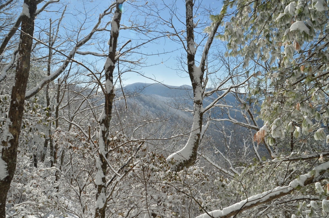
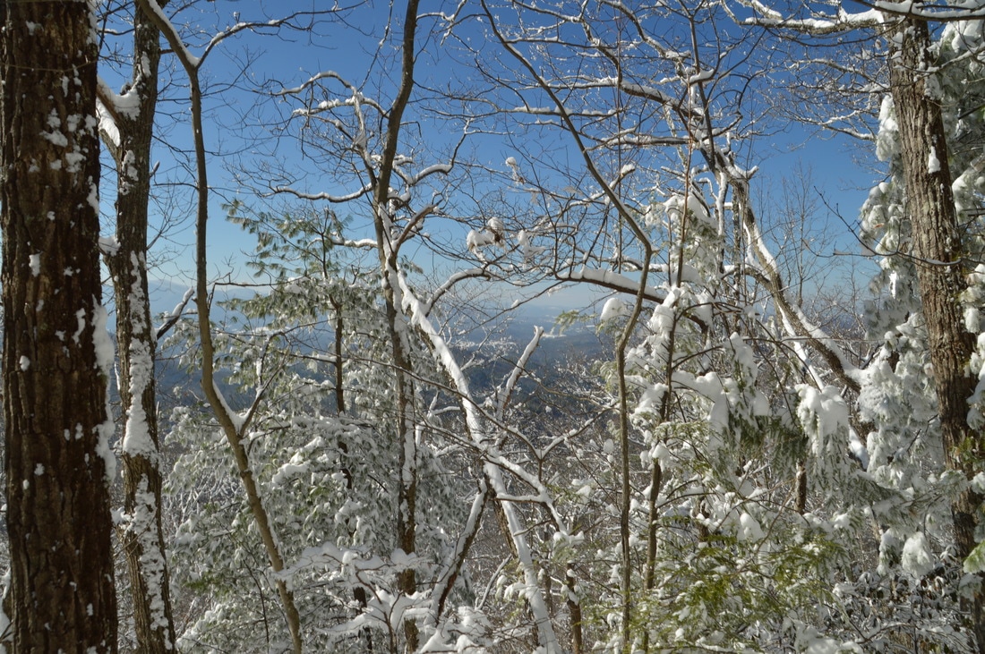
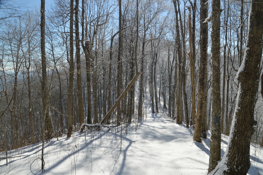
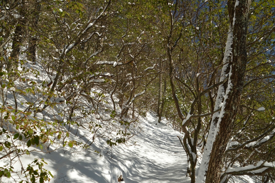
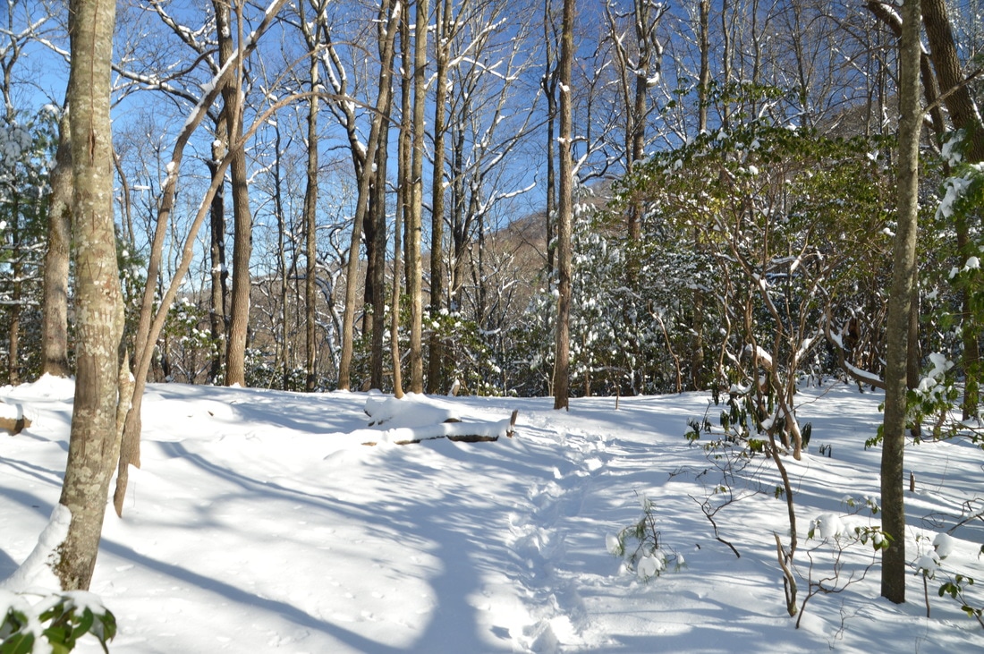
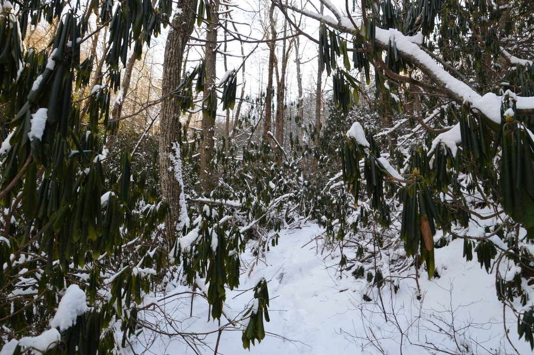
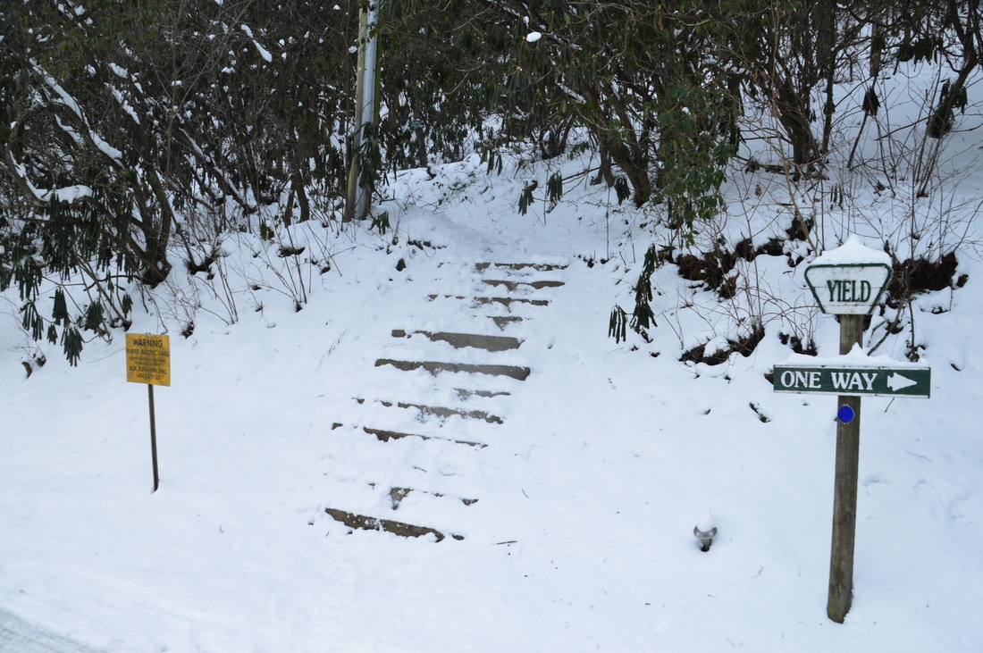
The hike begins at the parking area off GA 180 at Jacks Gap. The northbound Jacks Knob Trail is quite obvious, but the southbound trail is slightly tricky to find. To reach the southbound continuation of the Jacks Knob Trail, walk for about 250 feet down GA 180 East (the direction you drove from, if you were coming from Hiawassee). Just as the road begins to descend, notice the Jacks Knob Trail leaving sharply to the right. A mileage sign and carsonite stake mark the trail. The blue-blazed trail begins with an easy to moderate ascent up Henry Knob, although before long, the trail levels out, passing to the west and south of the knob. At 0.5 miles, the trail enters the Mark Trail Wilderness. A campsite lies in a gap to the left at 0.7 miles. This is where the trail resumes an easy to moderate ascent to Brookshire Top. Along the way, there are some winter views of Brasstown Bald to the northwest. The trail passes near the wooded summit of Brookshire Top at 1.05 miles. After this, the trail picks up the Hiwassee Ridge; there are continuous winter views both west and east for nearly the next mile. The trail descends to a gap at 1.35 miles and then ascends to Eagle Knob at 1.7 miles. At 1.9 miles, the trail leaves the ridge and wings around the west side of Jacks Knob. Here, there are several small openings in the trees that provide limited summer views and good winter views to the west. A brief descent brings the Jacks Knob Trail to its south terminus at Chattahoochee Gap and a junction with the Appalachian Trail at 2.4 miles. 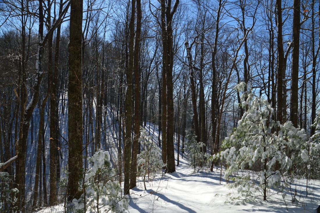
A 0.85-mile segment of the Jacks Knob Trail follows the Hiwassee Ridge with great winter views in both directions.
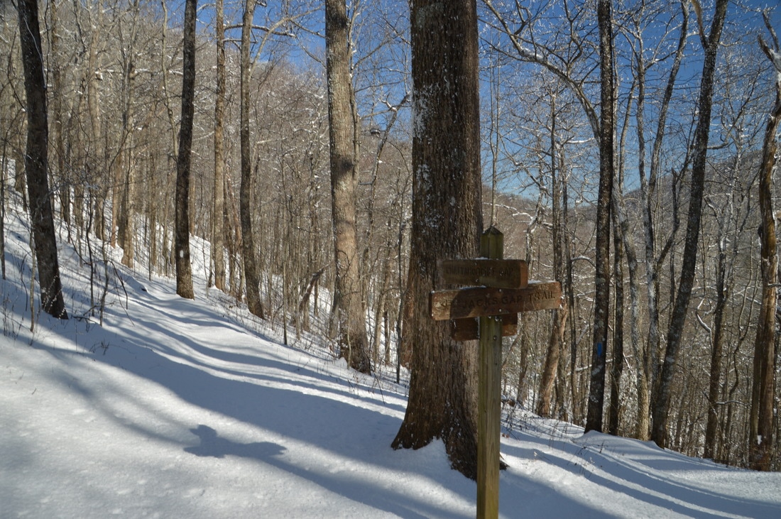
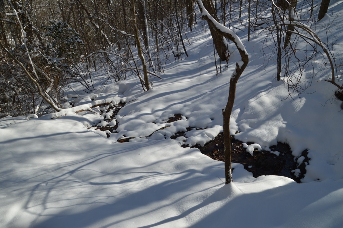
The Appalachian Trail passes directly through Chattahoochee Gap, which is named after the spring that is the source of the Chattahoochee River. This spring is located just southeast of the gap. Before continuing the hike, take the short spur trail to the Chattahoochee Spring. The signed blue-blazed side trail begins just ahead of the end of the Jacks Knob Trail. Follow the narrow path steeply downhill to shortly reach the Chattahoochee Spring at 2.5 miles. This tiny spring - which is a frequently-used water source for hikers on the Appalachian Trail - is the very beginning of the same Chattahoochee River that flows through Atlanta. It is hard to believe! On this day, there was even less water visible than normal at the spring, due to drought conditions and snow. From the spring, return to the AT, reaching it at 2.6 miles. To continue this hike, turn right onto the Appalachian Trail. Technically, you're hiking the trail northbound, although the current direction is east. At first, the AT stays nearly level along the south slope of Jacks Knob, crossing one of the uppermost branches of the Chattahoochee River at 3.0 miles. With time, the trail begins a gentle downhill toward Red Clay Gap. At 3.25 miles, the AT reaches Red Clay Gap, where there is a campsite to the left of the trail.
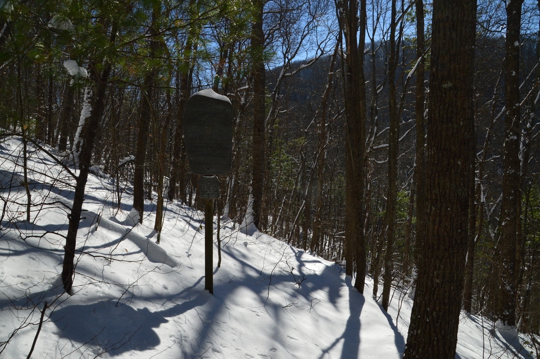
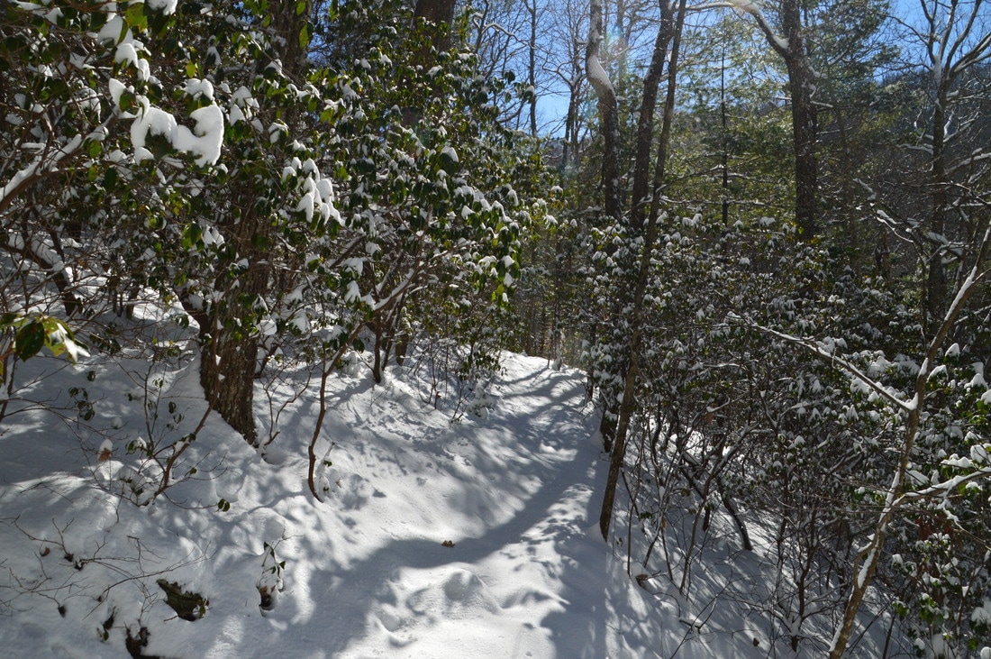
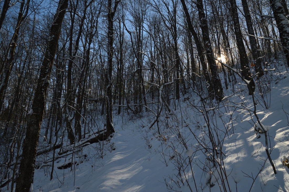
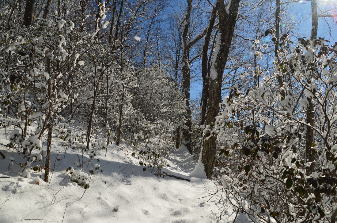
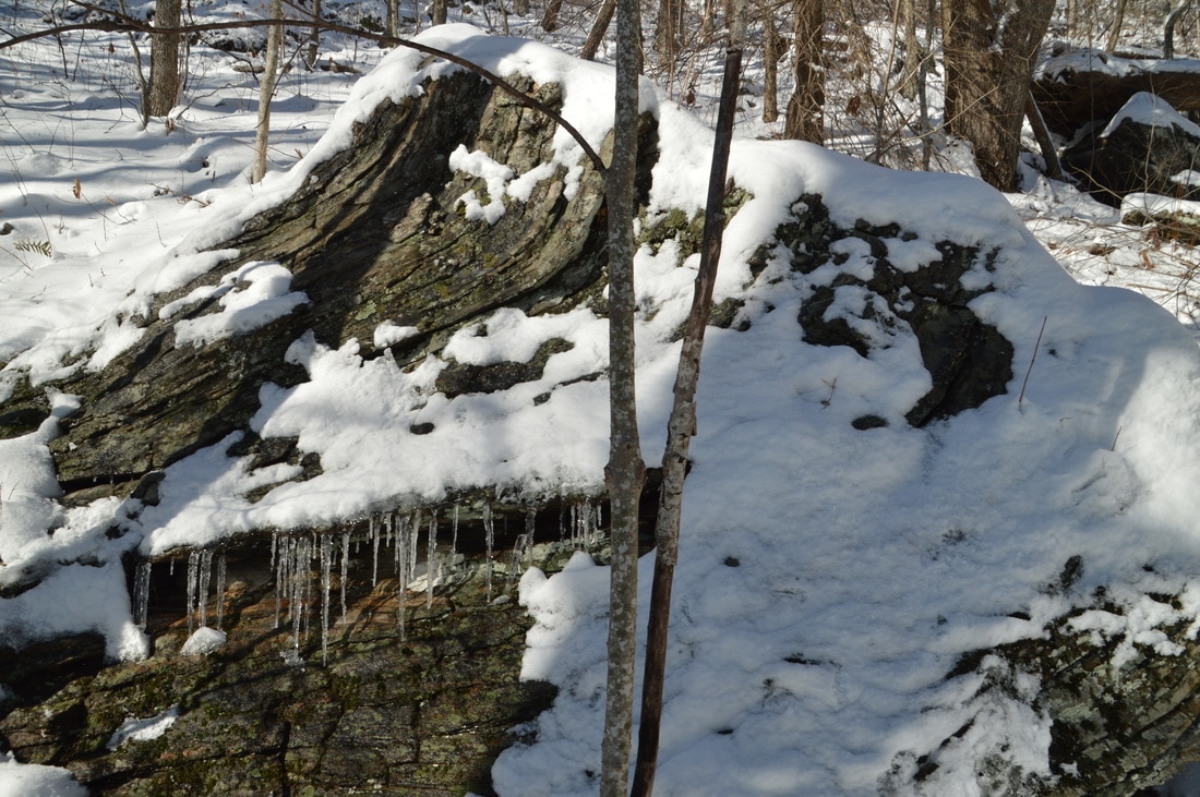
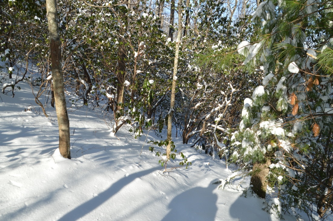
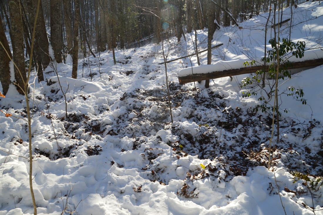
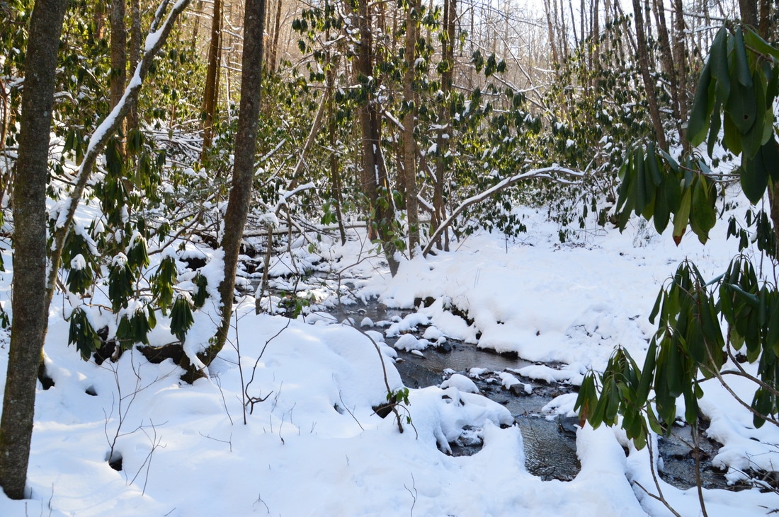
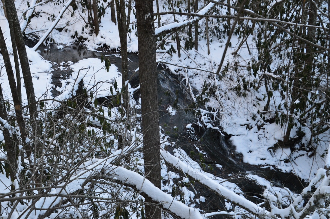
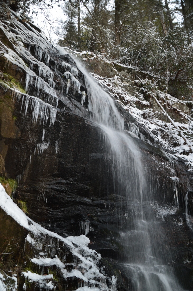
Red Clay Gap has an important intersection that must not be missed, as the AT continues much farther to Unicoi Gap. The unofficial Joel Creek Trail leaves to the north from Red Clay Gap. It is very easy to walk right past the intersection and never know it. The Joel Creek Trail leaves the gap at the lower left-hand corner (if hiking the AT from Chattahoochee Gap). In other words, the Joel Creek Trail leaves the northwest side of Red Clay Gap. Assuming that you've located the trail, begin following it downhill through a rhododendron tunnel. Before long, the narrow path becomes extremely steep. The steepness required some creativity to navigate due to the slick snow-covered nature of the ground. Thankfully, the steepness didn't last long, as the downhill becomes saner around the headwaters of Joel Creek at 3.45 miles. The trail continues downhill moderately along the west side of Joel Creek, which is a rather small creek but features a few pretty cascades. At 4.3 miles, the trail crosses Joel Creek. This should be a rock hop most of the time except during above normal water levels. You might notice a few faded blue blazes as the trail gradually swings away from Joel Creek to avoid the steep terrain around Joel Creek Falls. Even though the trail passes near the top of Joel Creek Falls at 4.5 miles, there are no views of the falls from this particular trail. A side trail leads to the left leads to the area around the top of the falls. 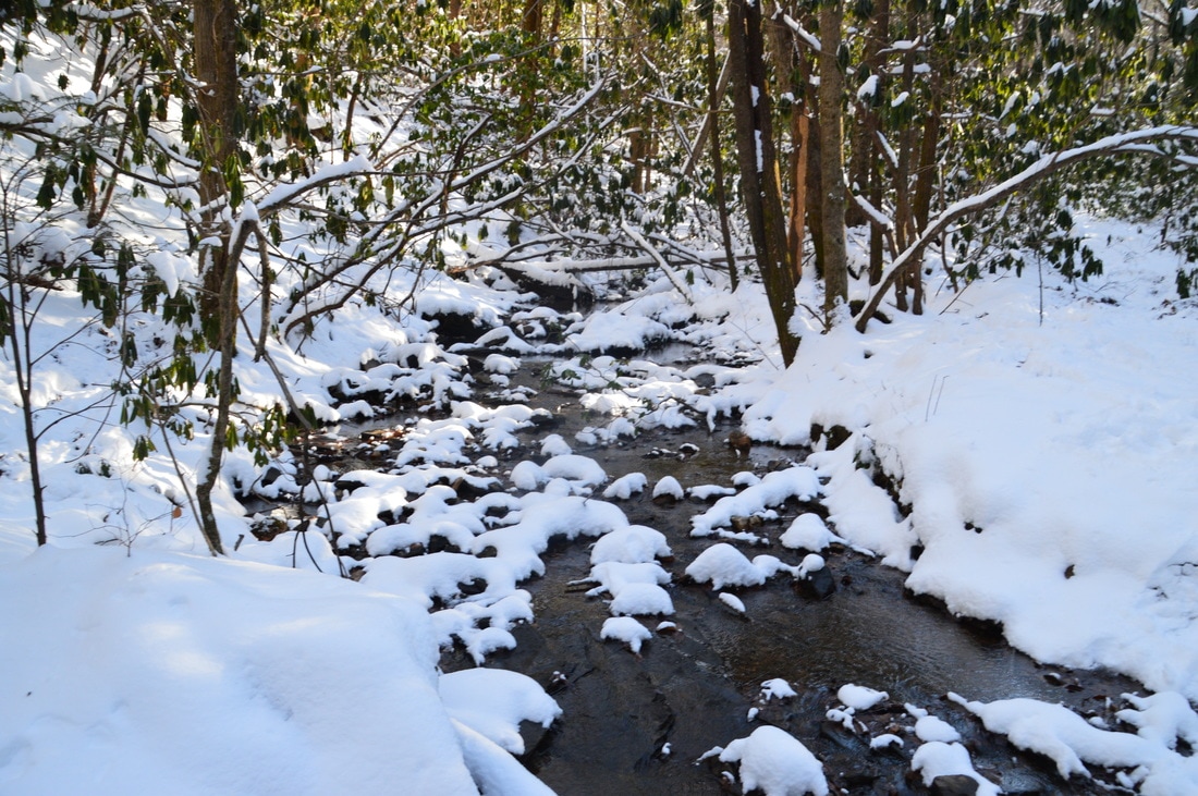
The upper portions of the Joel Creek Trail follow Joel Creek with several views of this small cascading stream.
After the top of Joel Creek Falls, the trail makes a moderate descent to Enota Retreat, entering the retreat's property at 4.75 miles. At 4.85 miles, the trail makes a sharp left turn and descends a set of steps, ending at the Enota entrance road. To see Joel Creek Falls and Gurley Creek Falls, turn left onto the entrance road and walk to the lodge. After paying the $10 fee at the lodge, walk to the left (south) of the lodge and shortly reach a small pond on Joel Creek. At the far end of the pond, the primitive and unsigned Joel Creek Falls Trail begins to follow the west side of the creek. Somewhere near the beginning of the trail, there is supposed to be a side trail that crosses the creek and leads to the base of the falls, but I didn't see it. Regardless, it doesn't seem difficult to get to the base of the falls in regular (non-snowy) conditions. The main trail becomes rather steep and rugged as it approaches the falls. Reach the main viewing area for Joel Creek Falls at 5.15 miles.
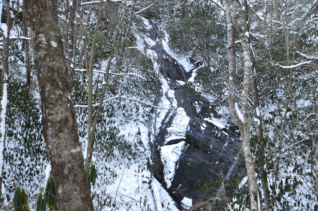
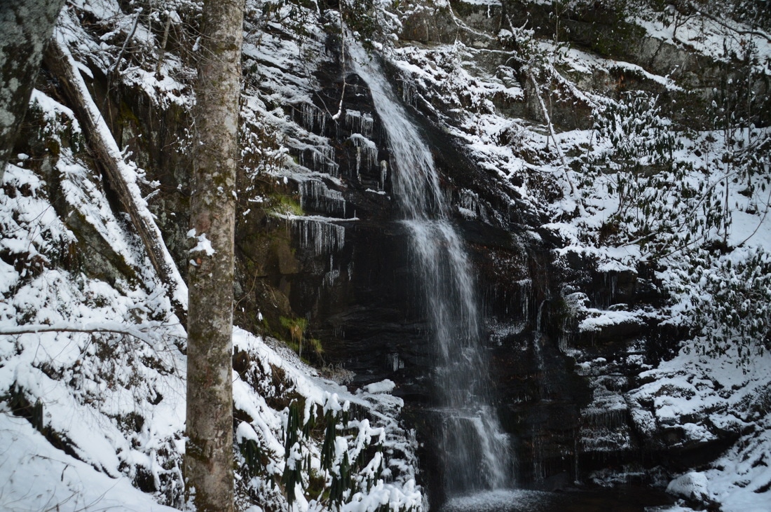
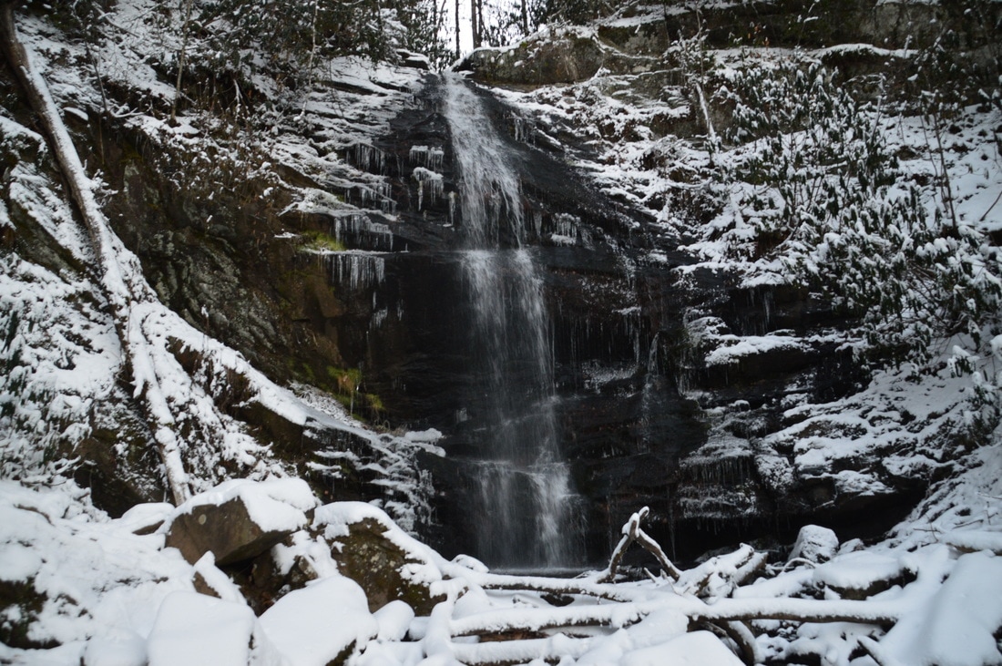
From this vantage point, the entire 120-foot waterfall is visible. It is important to note that neither Gurley Creek Falls nor Joel Creek Falls are as high as the Enota website claims they are. Joel Creek Falls is a fairly scenic waterfall that consists of several sliding sections. The primary drawback is that the water flow on Joel Creek Falls can be quite low. On this day, there were drought conditions present, and Joel Creek Falls was just a trickle. I have seen better pictures of it but I suspect that the flow is highly variable, as Joel Creek has a very small watershed. Also, while this hike is generally best to do this winter, it seems like Joel Creek Falls would be most photogenic during spring and summer, when the surrounding greenery (including rhododendron) will frame the waterfall in a very picturesque way. If the normal water flow was higher, then I would have given this waterfall a much higher rating, as it has great potential. 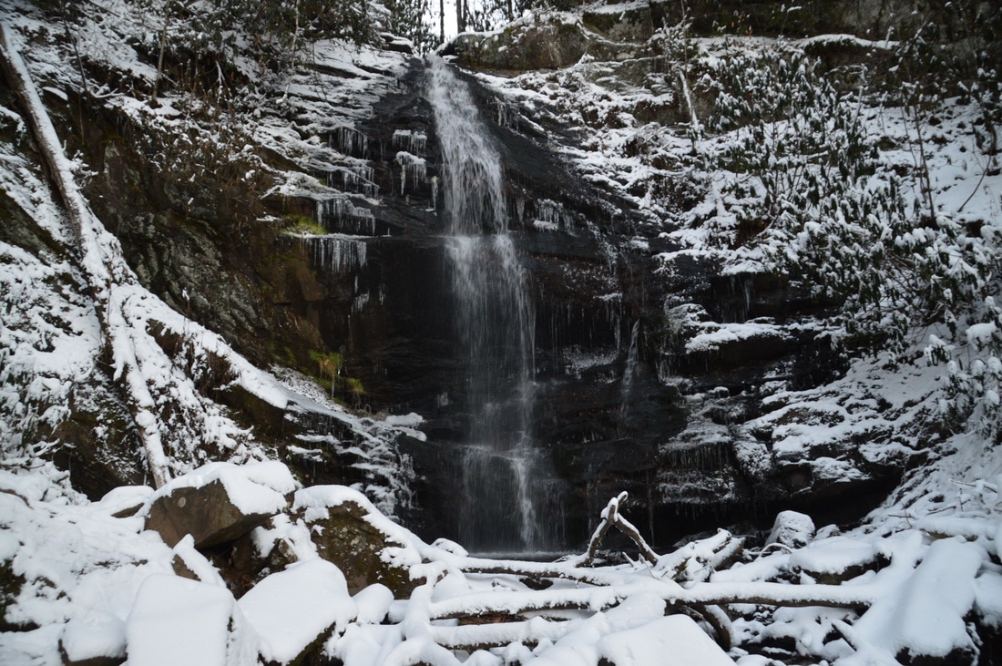
Gurley Creek Falls is one of the two waterfalls at Enota Retreat. It is the more beautiful of the two, in my opinion.
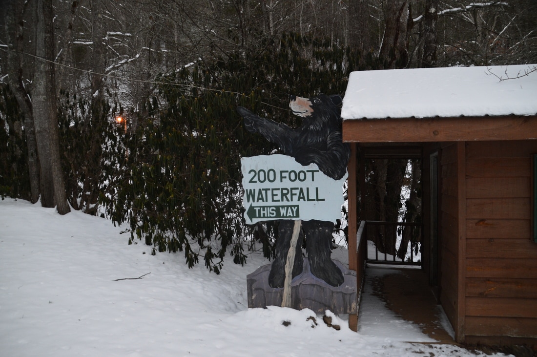
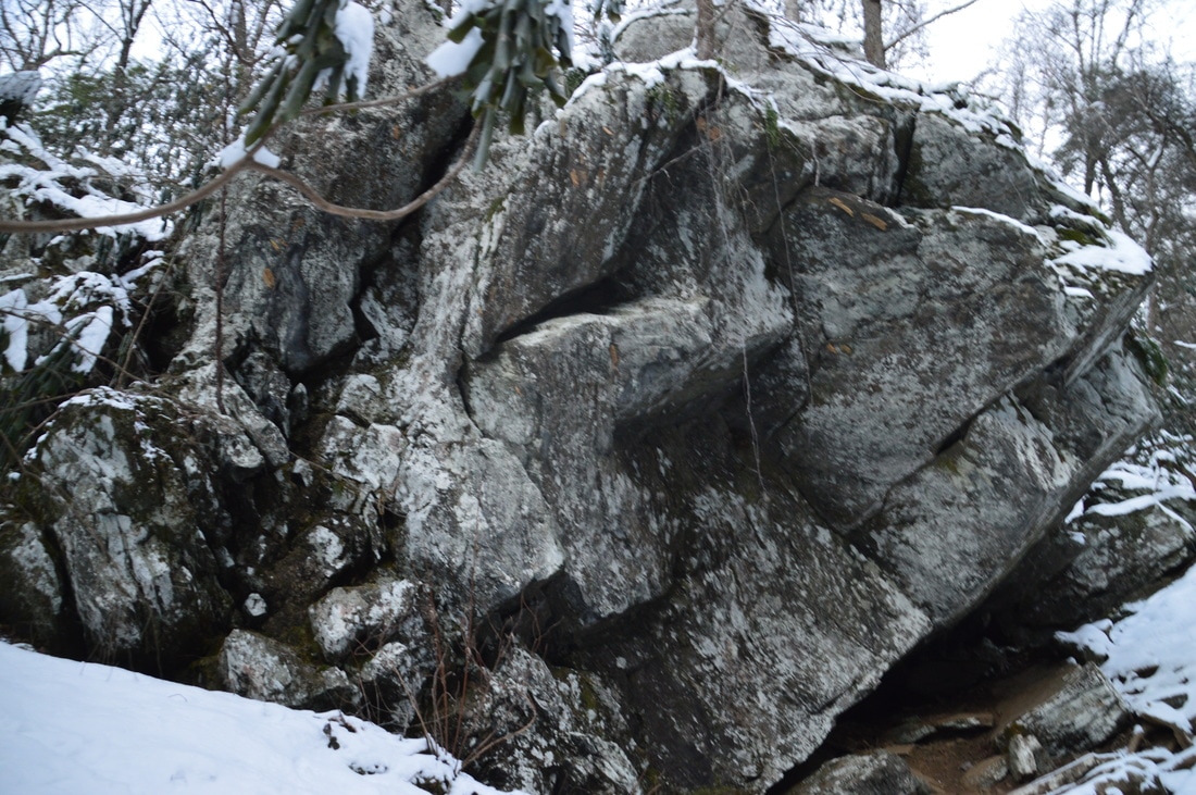
From Joel Creek Falls, return to the Enota Lodge and continue following the entrance road past the lodge. It can be a bit tricky to locate the Gurley Creek Falls Trail. Just before the road bridge across Gurley Creek, turn left and walk into an area that has several cabins. There is a sign here that reads "200-Foot Waterfall This Way". Walking in the direction that the sign points (westward and upstream along the south side of Gurley Creek), pass between two cabins and pick up the obvious path on the south side of the creek. This trail is extremely steep as it climbs up the Gurley Creek gorge. There will be some winter views of the lower sections of the falls along the way, but getting to their base is very tough. The trail will pass a large rock outcrop to the left near the falls. Just before the falls, the trail passes the ruins of an old pump house that used to serve Camp Pioneer (the settlement that used to be where Enota Retreat stands today). At 5.65 miles, the trail reaches Gurley Creek Falls, which is actually the top and most accessible portion of the nearly 200-foot waterfall. Two scramble paths continue from this point. One of these paths leads to the top of the falls, and I believe that this path connects to FS Road 137. I would appreciate it if anyone can confirm this. Meanwhile, the other scramble path leads down to the right to the base of the main drop of Gurley Creek Falls. This scramble path affords a much better view of the falls than from the end of the trail. Here, Gurley Creek cascades down a steep rock face and into a small pool. The watershed and normal water flow for Gurley Creek are slightly larger than for Joel Creek, and as a result, I think that this waterfall is more scenic.
From Gurley Creek Falls, retrace your steps back to Enota Retreat. You can retrace your steps back along the Joel Creek Trail, AT, and Jacks Knob Trail, but I chose to walk to the entrance of Enota Retreat and then follow GA 180 West to Jacks Gap. Normally, this roadwalk is not a good idea, but due to snowy and icy conditions on the road, there was little traffic on it. Using the roadwalk, you should return to Jacks Gap Trailhead at 9.0 miles, concluding the hike. In the variations below, I have listed the mileage for the out and back option as well. Mileage
0.0 - Jacks Gap Trailhead
2.4 - Chattahoochee Gap 2.5 - Chattahoochee Spring 3.25 - Red Clay Gap 4.85 - Enota Retreat 5.15 - Joel Creek Falls 5.65 - Gurley Creek Falls 9.0 - Jacks Gap Trailhead Variations
Hike the Jacks Knob Trail out and back to Chattahoochee Spring from Jacks Gap - 5.0 Miles
Hike the Jacks Knob Trail, Appalachian Trail, and Joel Creek Trail to the waterfalls out and back - 10.9 Miles It may also be possible to continue on an unofficial path from Gurley Creek Falls to FS 137 and then walk FS 137 to Jacks Gap. This would eliminate the GA 180 roadwalk and would also add a variation to the more difficult out and back trail route. I would like this possibility to be verified by someone who knows for sure. Bonus Stops
The summit of Brasstown Bald, which is the highest mountain in Georgia, is very close to Jacks Gap. It is possible to drive up to within a half-mile of the summit, and from there, an easy paved path can be followed to an observation area with 360-degree views from the summit. This is a great bonus addition to the main hike.
PicturesVideos
4 Comments
Loretta
2/24/2017 01:27:33 pm
Your only 15...great job your parents did with you. My 16 yr old loves the outdoors and music but you got her beat. I will show her your post for motivation.
Mark Oleg
2/24/2017 01:43:41 pm
Thanks Loretta! I am grateful for the continuous opportunity to hike in the mountains nearly every weekend. My favorite hobbies are photography and spending time in nature.
Alicia
12/23/2018 09:44:00 pm
Hey Mark,
David J Childs
1/9/2019 11:35:27 pm
.Yes, Alicia, just turn around and back track from the spring to the Hwy 180 parking lot.How long are you going to be here hiking the AT? Leave a Reply. |
About MeMark Oleg Ozboyd Dear readers: I have invested a tremendous amount of time and effort in this website and the Georgia Waterfalls Database the past five years. All of the work that has gone in keeping these websites updated with my latest trip reports has almost been like a full-time job. This has not allowed me to pick up a paid job to save up money for college, and therefore, I I've had to take out loans. If you find the information on this website interesting, helpful, or time-saving, you can say "thanks" and help me out by clicking the button above and making a contribution. I will be very grateful for any amount of support you give, as all of it will apply toward my college tuition. Thank you!

Coming in 2022-2023?
Other Hiking WebsitesMiles HikedYear 1: 540.0 Miles
Year 2: 552.3 Miles Year 3: 518.4 Miles Year 4: 482.4 Miles Year 5: 259.9 Miles Archives
March 2021
Categories
All
|


 RSS Feed