HIKING THE APPALACHIANS AND BEYOND
  • Home
  • Trail Reports
    • Best Hikes
    • Hikes with Scenic Views
    • Hikes with Water Features
    • Alabama
    • Georgia
    • Florida
    • North Carolina
    • South Carolina
    • Tennessee
    • Vermont
    • Virginia
  • Map
  • Hike List
  • Testimonials
  • Resources
  • Contact Us
  • Southeast Nature Society
    • Our Team
  • Georgia Waterfalls Database

Chattahoochee National Forest: Panther Creek Trail, Toccoa, Georgia

11/9/2015

2 Comments

 
Picture
​Panther Creek is a popular destination for folks all across north Georgia  - in fact, you're unlikely to find solitude on weekends at Panther Creek Falls, the primary destination of most people who hike the Panther Creek Trail. However, what most hikers don't know about is that the full Panther Creek Trail is considerably more strenuous and longer; the trail doesn't just end at Panther Creek Falls. By hiking the full length of the Panther Creek Trail, you will experience a lot more solitude, see more of the creek's more turbulent stretches, and overcome a challenge - as hiking the east half of the Panther Creek Trail is a task that's not for the faint-hearted. This hike occurred on Saturday, September 5th, 2015. My plan was to hike the entire Panther Creek Trail from the eastern terminus near Yonah Dam to the western terminus at Old US Highway 441 and back.

​Summary

​R/T Length of Trail: 12.8 Miles
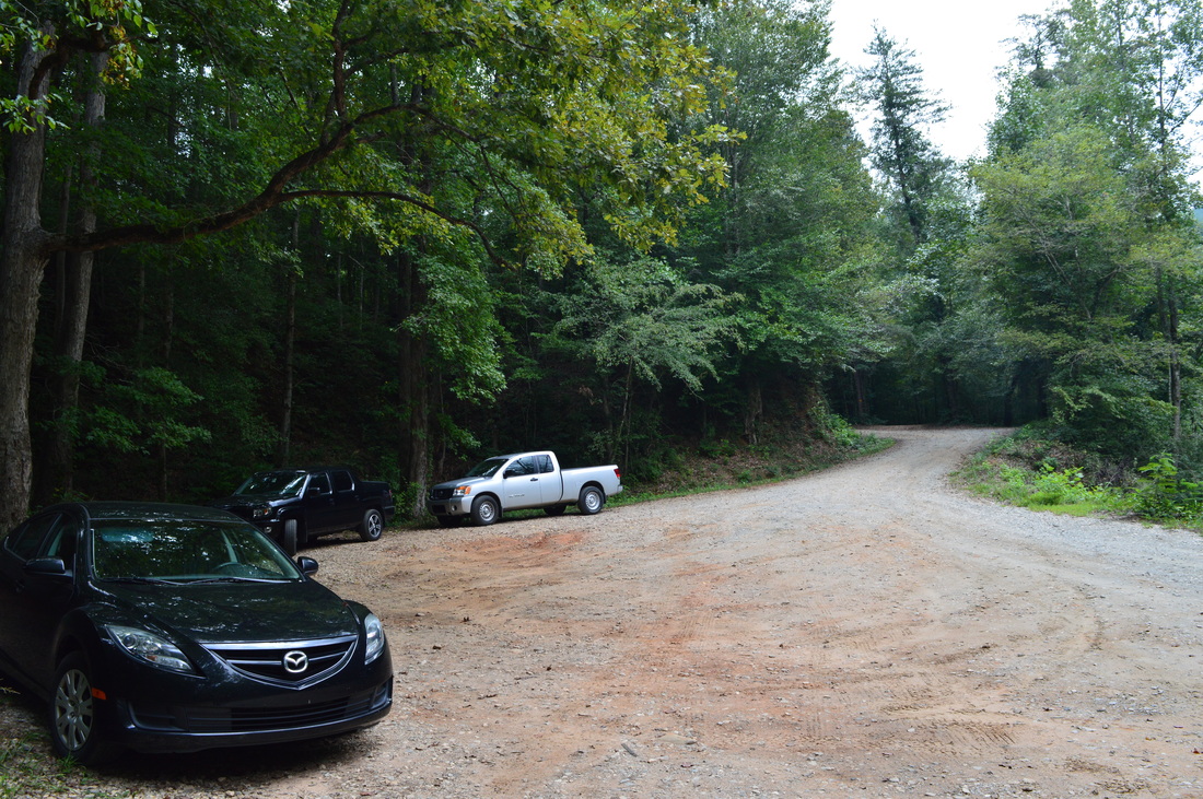
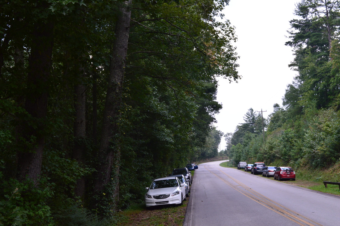
Duration of Hike: 9:15​
Type of Hike: Out and Back​
Difficulty Rating: 8 out of 10
Pros: Western half of the trail is easy to follow
Cons: Eastern half of the trail is in bad condition with caved-in and poorly-built stretches of trail; very crowded western half of trail
Points of Interest: Panther Creek Falls - 7 out of 10; Upper Panther Creek Falls - 4 stars
Trail Blaze Color(s): Panther Creek Trail - Both Blue and Green Blazes
Best Season(s) to Hike: Year-round (there will likely be more solitude in winter)
Beginning Point: Yonah Dam Trailhead (Panther Creek Trail East Terminus)
Directions: From Toccoa, GA: Follow GA State Route 184 North for 5.2 miles. Then, continue straight onto Yonah Dam Road. Continue on Yonah Dam Road for 4.4 miles, and then, keep left onto Panther Creek Road. In another 0.6 miles, take a slight left onto the now gravel Panther Creek Road. The road is suitable for most passenger vehicles. Continue to follow Panther Creek Road for 1.6 miles to its terminus at a large turnaround and parking area. This is the trailhead.

​Map

​Details

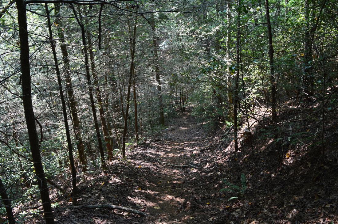
The first time I hiked on the Panther Creek Trail several years ago, I did the typical easy day hike - a roundtrip of 7 miles from the west terminus to Panther Creek Falls and back. However, for my return hike to Panther Creek Falls, I decided to hike the full trail. Hiking the full trail proved to be significantly harder - the lesser-travelled east segment of the trail is in need of repairs and makes for very slow and tiring hiking, in addition to a steep uphill segment both on the way in and on the way back. I'd go as far as saying that this might have been one of the hardest hikes I've done in Georgia.

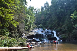
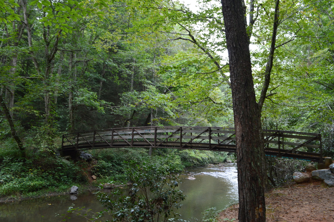
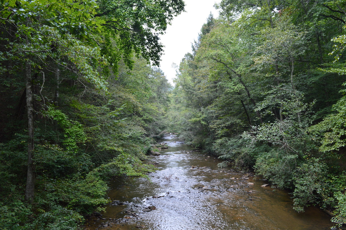
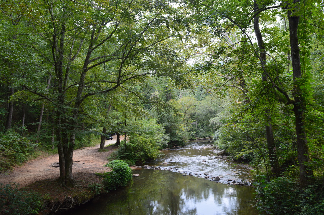
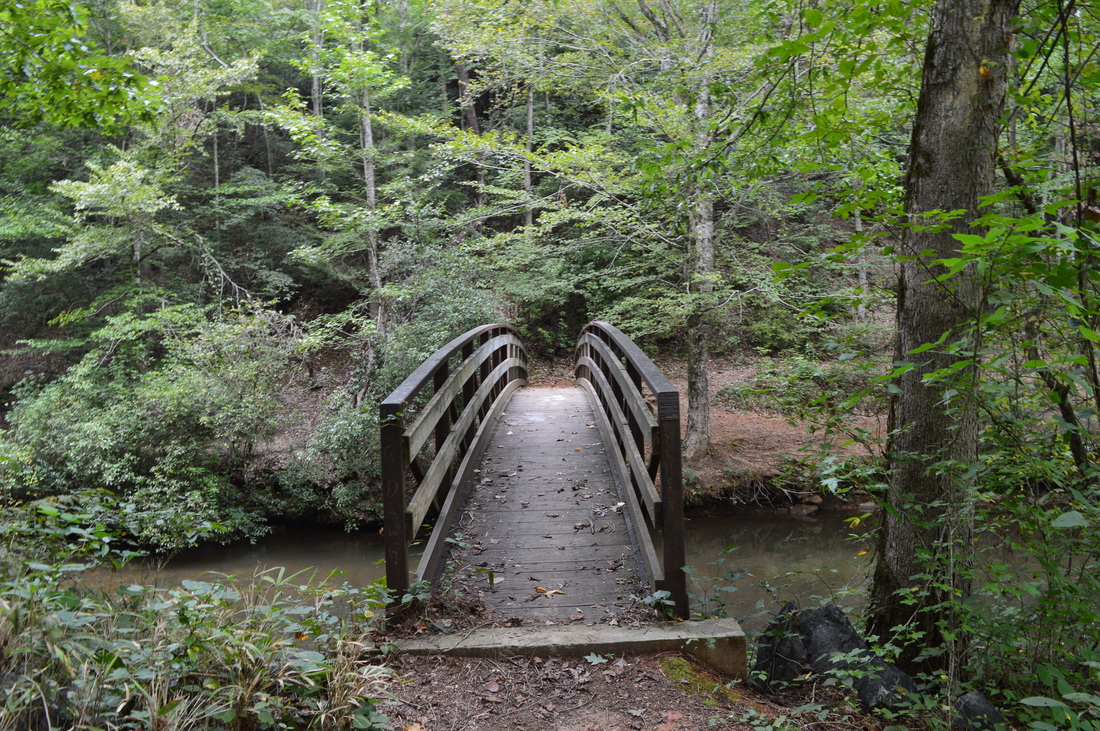
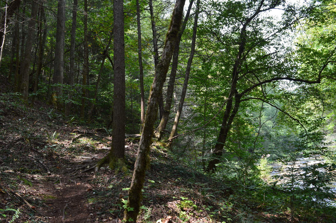
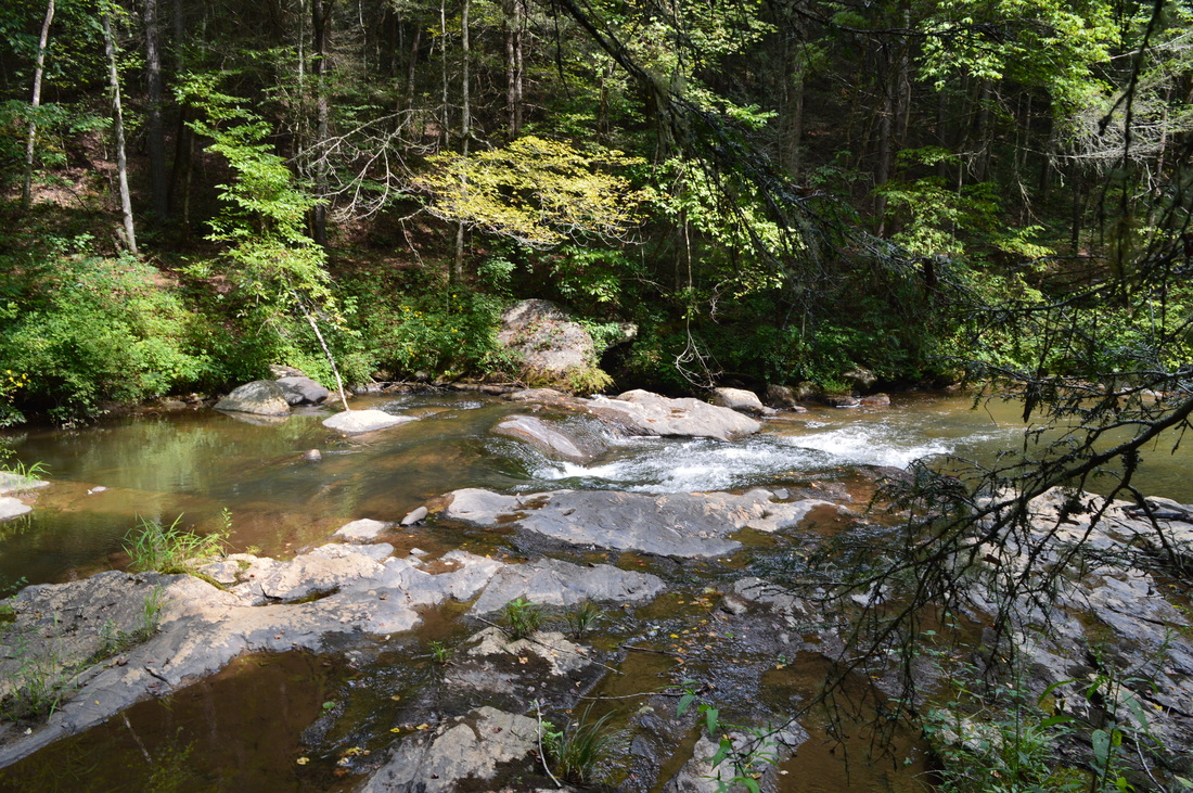
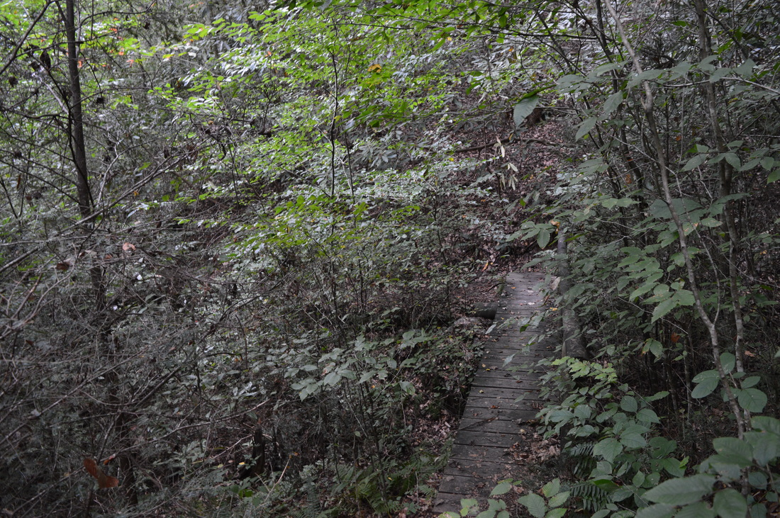
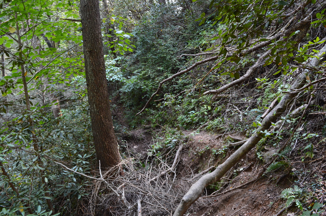
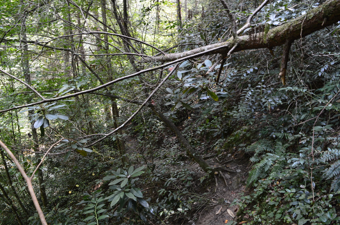
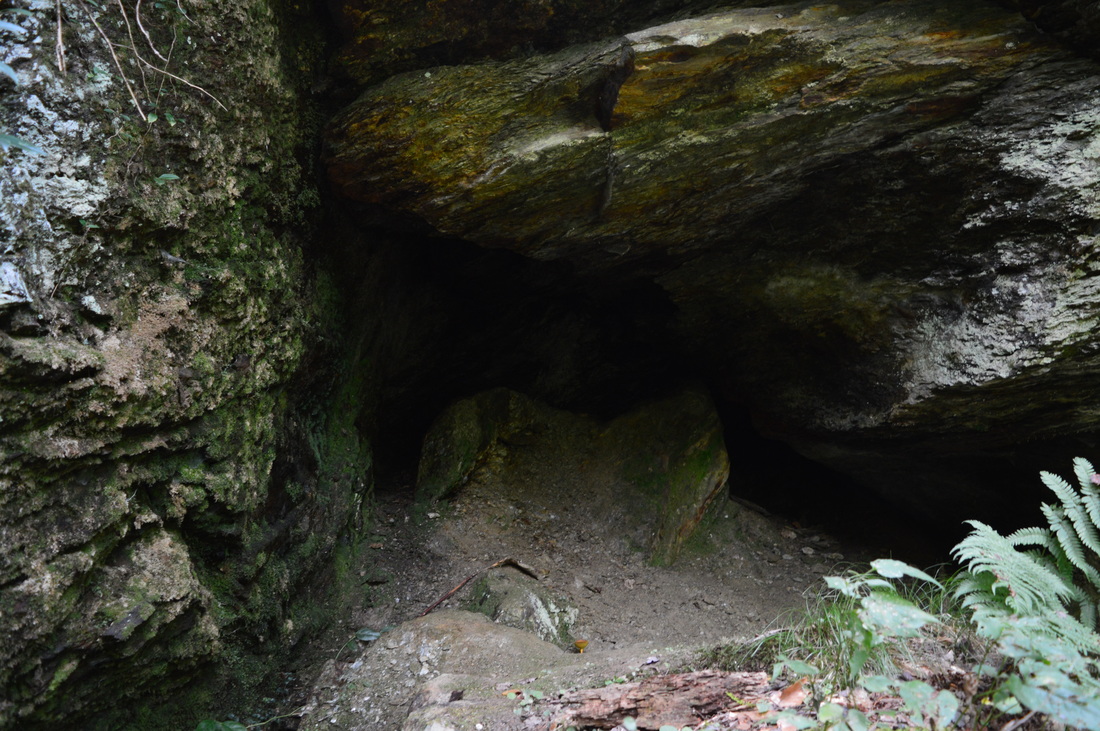
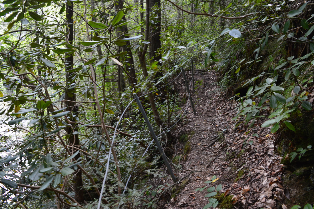
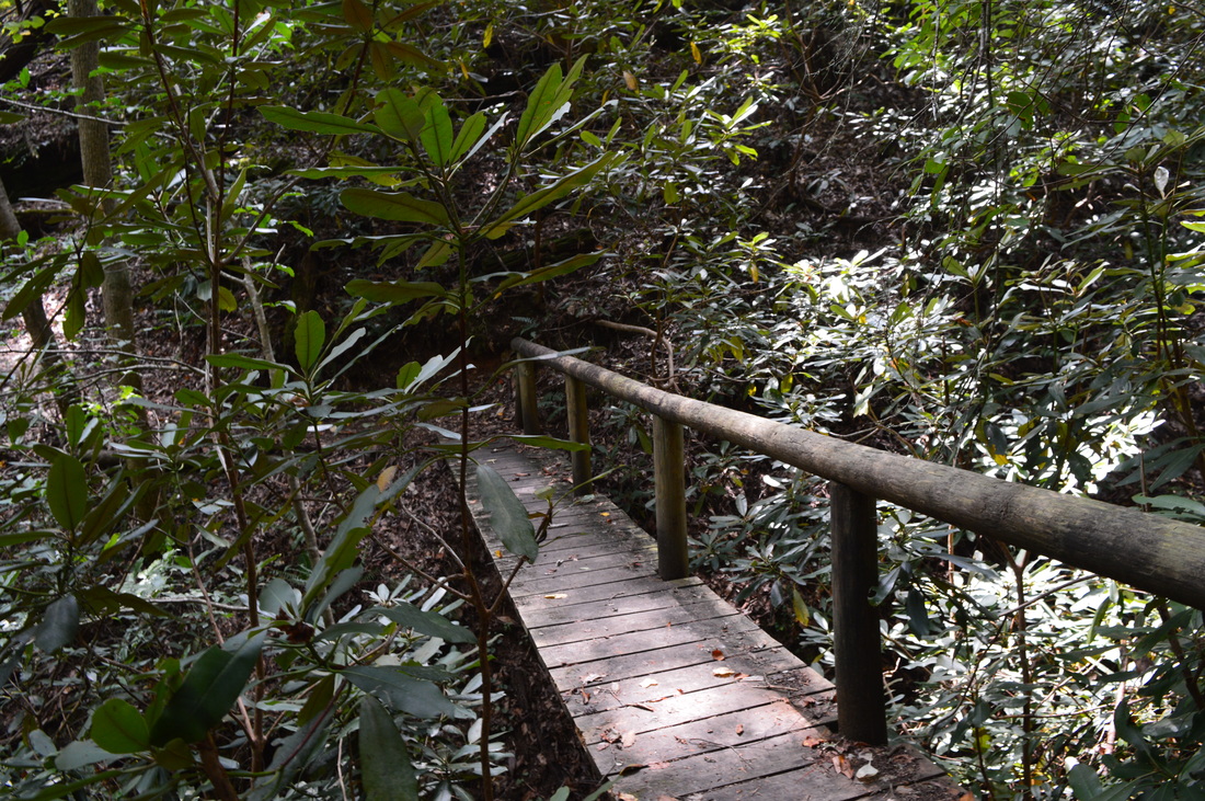
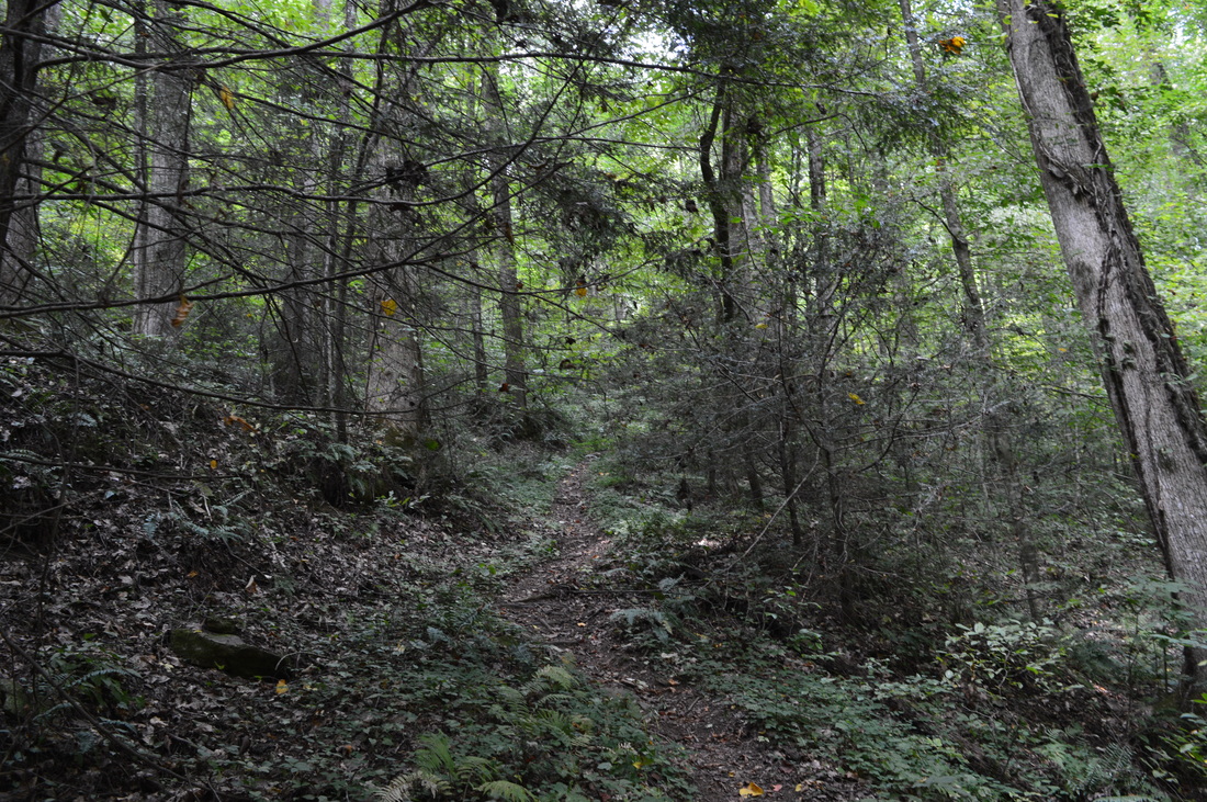
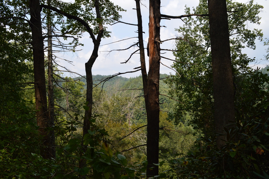
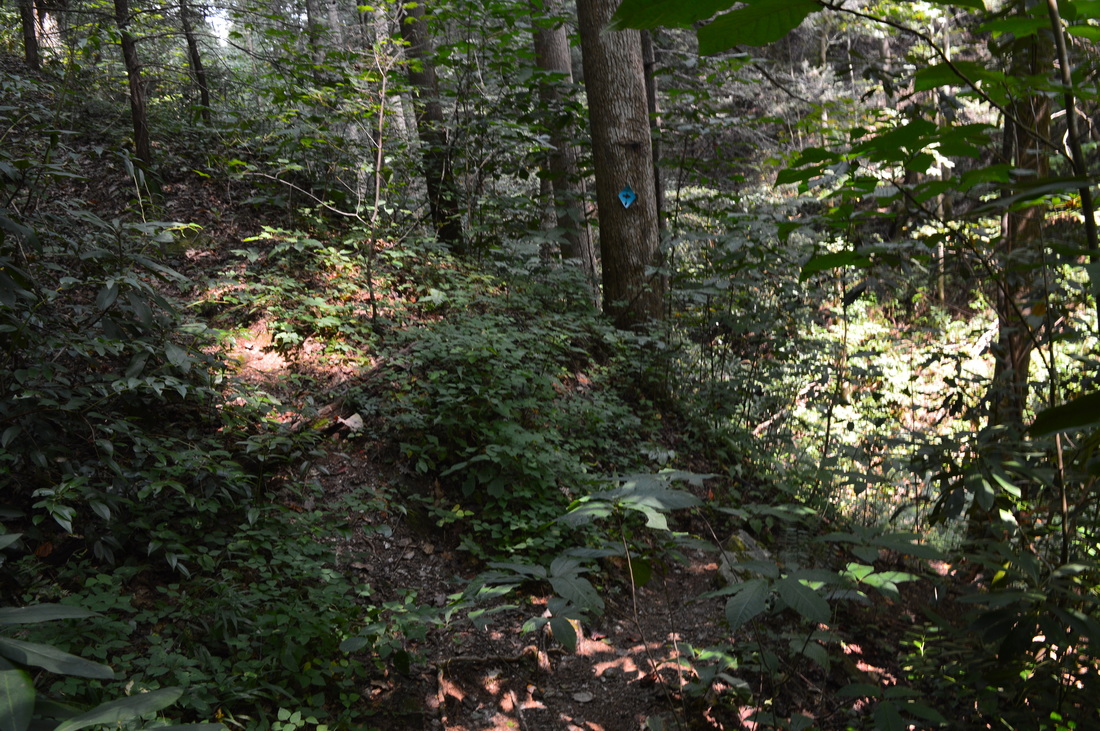
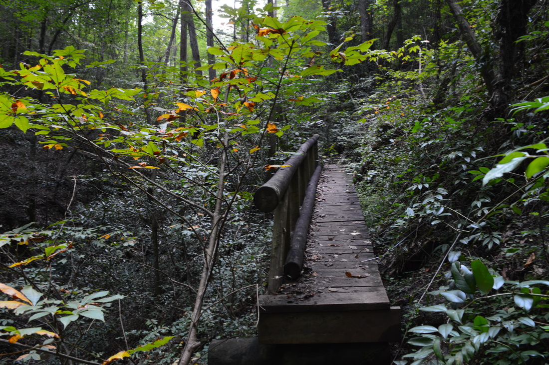
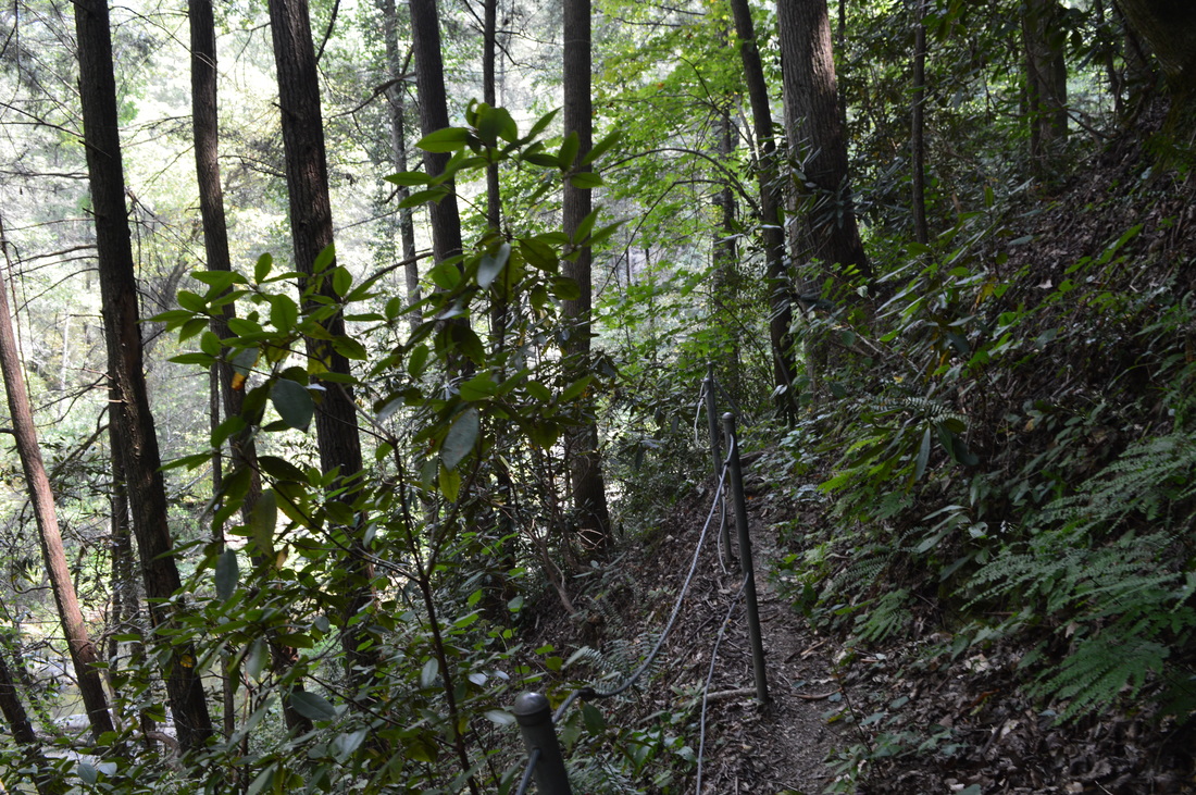
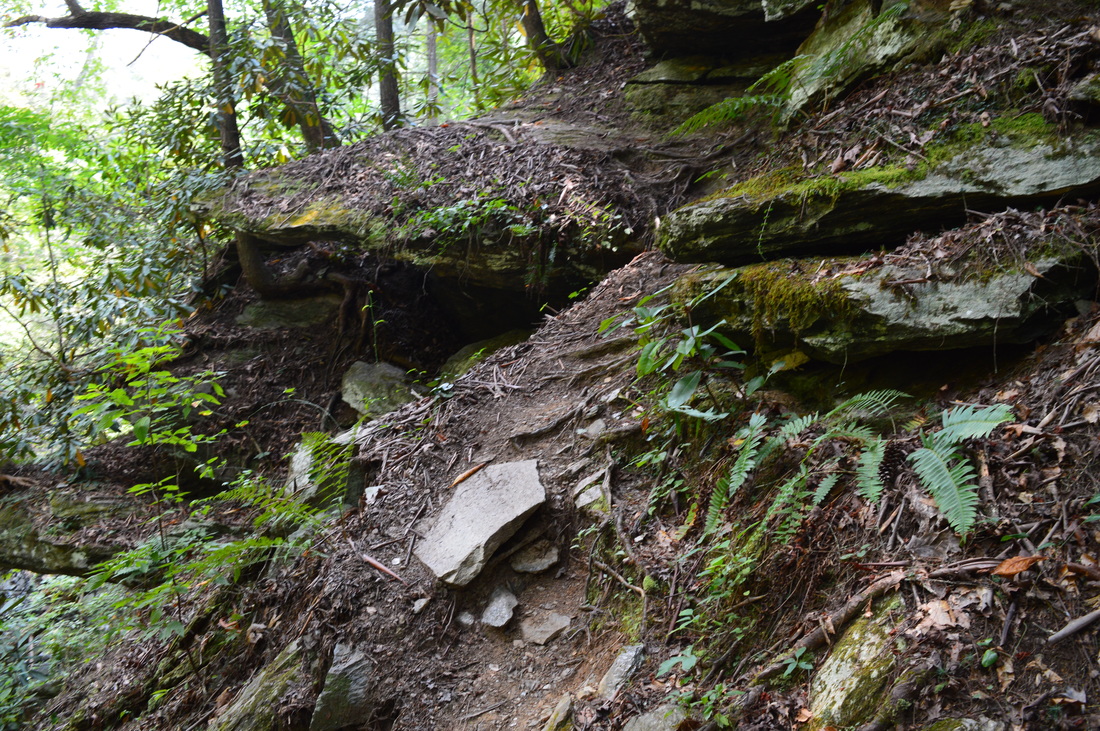
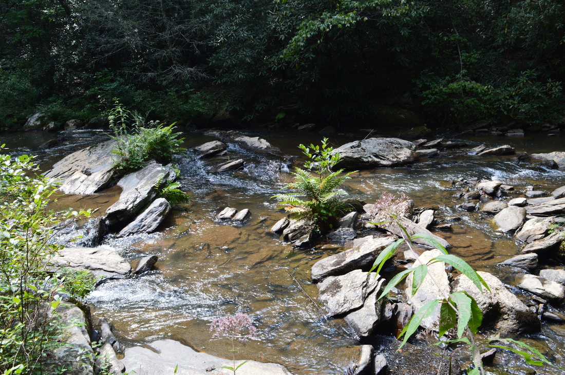
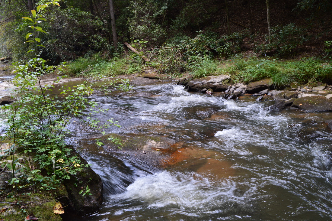
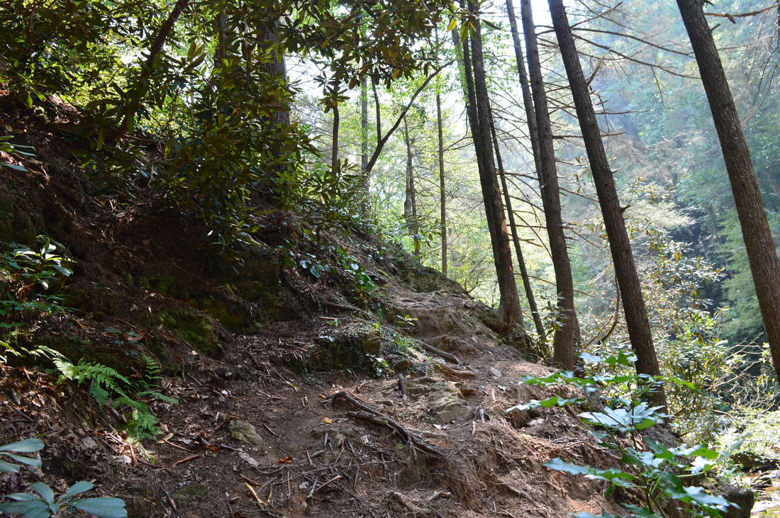
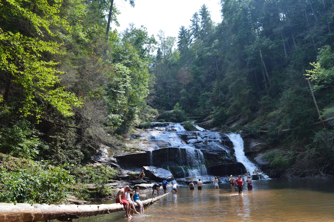
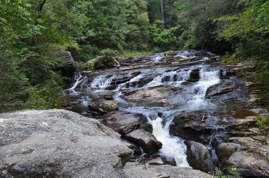
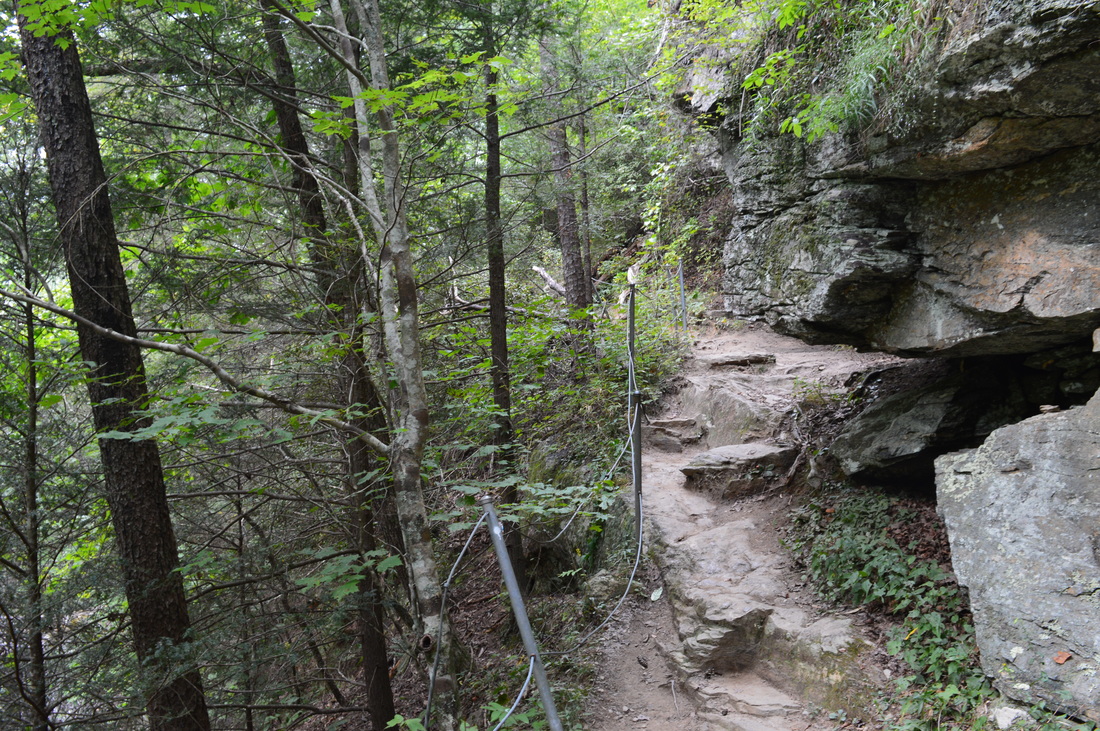
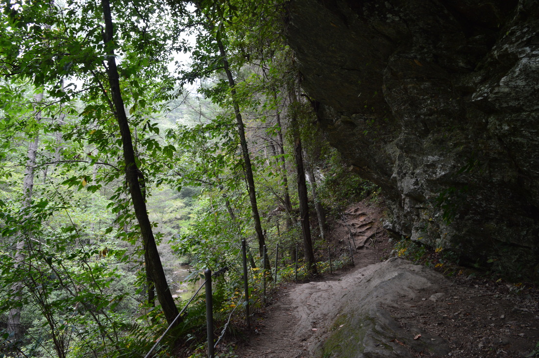
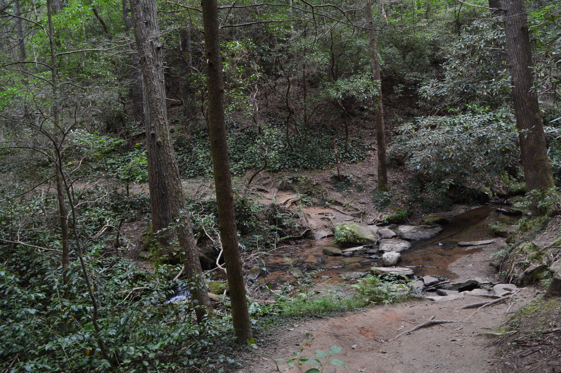
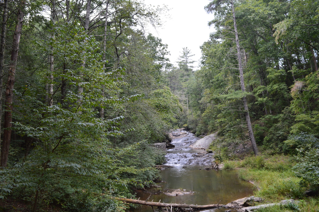
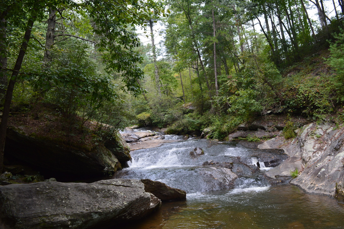
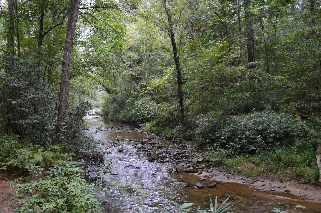
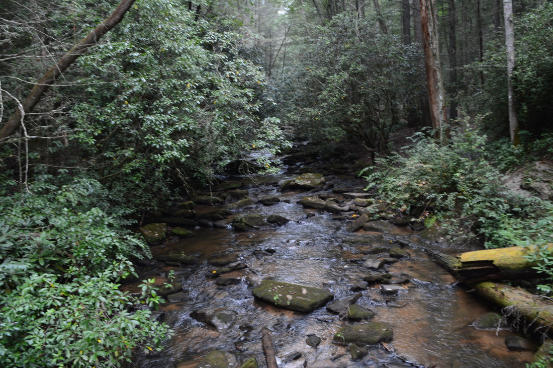
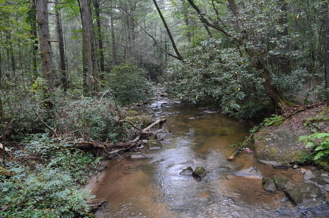
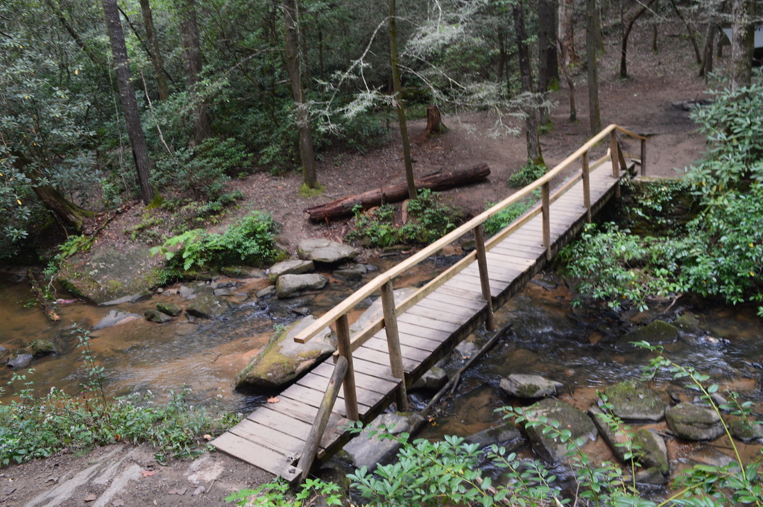
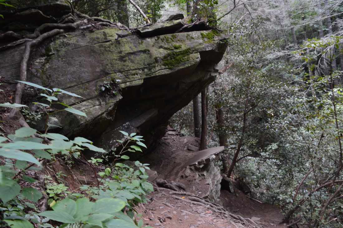
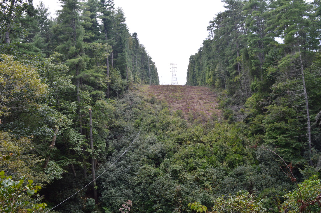
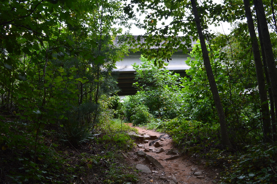
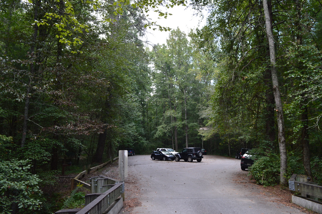
The hike starts at the Yonah Dam Trailhead, located just above the confluence of Davidson Creek and Panther Creek. Technically, this is the start of the Panther Creek Gorge, although a wider gorge still exists below the Davidson Creek confluence. The start of the rail is unmarked, but there's no other trail here - this is the right one. At the parking area, an old road extension fords Panther Creek to an old parking area on the opposite side. That is where the original trailhead was, but ever since the footbridge over Panther Creek was built, the old parking area was gated. The trail crosses Panther Creek on the new, well-constructed footbridge near the trailhead, and on the opposite side of the creek, turns right onto an old road that continues from the old parking area. Straight away, an uphill begins. This uphill section isn't long, but it is steep and literally at the very beginning of the hike so you may feel some tension - a sign of things to come. At 0.1 miles, the trail levels off and begins to head back downhill towards Panther Creek. As the trail stays close to Panther Creek in the first half-mile, you will be crossing numerous coves by footbridges as well as traversing hills all the time. Not far from the beginning, however, the trail becomes quite rough as the slopes of the Panther Creek gorge steepen. When I said the trail became rough, I meant that the trail slopes down, constantly has caved-in areas where you have to do some pretty tiring scrambling to continue on the trail, and also, there are lots of fallen trees in places where it takes  long time to maneuver across them. The worst section comes at 0.7 miles, after you pass a rockhouse on the left. The gorge's slopes are extremely steep here, and the trail is quite rough, so take your time - do not hurry on this section. At some point, there'll be some cables on the right side of the trail, protecting you from the drop-off. Then, at 0.8 miles, with some help from the cables, scramble up a steep section of trail.

The trail then veers away from Panther Creek and begins a 0.8-mile long, ultra-steep ascent. You will ascend 500 feet during these 0.6 miles, and the ascent is without any switchbacks - just straight up the slope. At 1.3 miles, there is a vista on the right that looks into the Panther Creek gorge northwestward. This vista is best seen in winter. The steepest section of the uphill is after this vista. At 1.6 miles, the ascent finally ends at the top of the ridge at an elevation of around 1400 feet. A path leads left here, and it probably ends at a dirt road a couple hundred feet higher. Meanwhile, the Panther Creek Trail continues straight and hastily begins a descent that rivals the steepness of the ascent. Luckily, the trail actually descends less than it just ascended, so on the way back, the ascent is slightly easier. ​The trail soon descends to a cove with a small stream and crosses the stream on a footbridge. The descent moderates as the trail heads down the cove. There is a long footbridge ta helps the trail to navigate across the steep valley slope. At 2 miles, reach Panther Creek again. A small waterfall is located here - a steep side trail may potentially lead to a better view of the waterfall, but I didn't try it. For most of the rest of the hike, the trail closely parallels Panther Creek, and sometimes, it requires rough scrambles and slow travel. From this "lower falls" to Panther Creek Falls, the trail is very slow, rugged, and sometimes confusing. There are only very occasional blazes here, so try to just follow the main path - often, you will be brought to small beaches on the shores of Panther Creek, and the trail will simply follow the shores of the creek - at other times, the trail will navigate over rock outcrops just above the creek with the help of cables. 

After what seems to take forever, the trail reaches a large flat by the creek, the camping areas just below Panther Creek Falls. Continue straight through the camping areas and reach Panther Creek Falls at 2.8 miles. Panther Creek Falls may be one of the most popular if not the most popular waterfalls in north Georgia. Personally, I do not believe it to be one of the most beautiful - in my opinion, it is a classical waterfall, just like any other. In summer, the large pool below the falls is crowded with swimmers. And year-round, no matter when you do this hike (except maybe if you do it on some really rainy day), your solitude is over from Panther Creek Falls and beyond until you return back to this spot, The western section of the trail is considerably more popular than the eastern section, because despite that the western approach to Panther Creek Falls is longer, it is significantly easier. 

From Panther Creek Falls, scramble steeply up the side of the gorge to rise above the falls at 2.9 miles. There are cables to help here. Once you top the scramble, you will pass above Panther Creek Falls and reach a rock outcrop with an excellent view of cascades above the main falls. From here, continue on the still rugged but popular trail above Panther Creek. There are a lot of rock outcrops to navigate across - cables will aid you in the harder spots. At 3.4 miles, the trail descends to creek level, crosses a footbridge over a tributary, and stays flat and even a bit sandy for a while. At around 4 miles, the trail reaches a rock outcrop next to Panther Creek with a view of what is known as "Upper Panther Creek Falls". Shortly afterwards, a spur trail on the right that leads to a campsite also leads to a close view of the Upper Falls. The main trail ascends over a small rise with another view of Panther Creek and then descends back to creek level. There's nothing much to describe about the trail as it meanders along Panther Creek and its floodplain until a footbridge over Panther Creek near a campsite at 5 miles. This footbridge had signs of recent repairs. Cross the footbridge and pick up the trail on the east side of the creek. The flat part is over; from here pretty much all the way to the end is a slight but steady uphill that becomes quite tiring after the difficulty of the first part of the hike. The trail ascends along the steep-sided gorge that forms here, and soon, Panther Creek can be heard far below. There are numerous campsites along this section of trail. At 5.5 miles, the trail reaches a large rock outcrop and goes around it. Panther Creek is in sight again, but still below the trail. Stay with the green blazes - there have been reroutes to the trail in this area. At 5.9 miles, the trail crosses a powerline cut. Panther Creek can be seen to the left. At 6.3 miles, the uphill finally ends as the trail goes under two bridges that carry US-441 across Panther Creek. Panther Creek is just below the trail to the left. At 6.4 miles, the Panther Creek Trail ends at the Panther Creek Recreation Area on Old US-441.

The Panther Creek recreation Area, aka the Old US-441 Trailhead, is the western terminus of the Panther Creek Trail. ​​From here, you will have to retrace your steps to Yonah Dam Trailhead for a roundtrip hike of 12.8 miles, unless you have a shuttle waiting for you at the western terminus. The eastern section of the trail will feel even harder on the way back when you've hiked around 10 miles - take your time on it. This is a great hike but quite strenuous so I wouldn't suggest for novice hikers to do the whole trail at once.

​Variations

Panther Creek Trail from Yonah Dam Trailhead to Panther Creek Falls and back - 5.6 Miles
Panther Creek Trail from Panther Creek Recreation Area to Panther Creek Falls and back - 7.2 Miles

​Bonus Stops

​Toccoa Falls in Toccoa Falls College near Toccoa

​Pictures

​Videos

2 Comments
E
6/15/2022 12:13:53 pm

Hey there. I keep hearing that some main bridge across a deep-water creek along the main trail for Panther Creek has been out for a while and the park service has "closed" this trail... Spring 2022 ... got an update? THANKS.

Reply
Joseph A
6/20/2022 08:49:20 pm

I haven't been myself, but from what i've seen online, the main trailhead for panther creek was closed for some time due to the 3 main bridges being washed out by storms. Since then, they've apparently reopened the trailhead to the public, but with the sidenote that there are still no bridges to cross the creek and you still have to ford. However, if you hike only the harder section from yonah dam to the falls, a total of around 5 miles, you don't have to do any stream crossings. If anyone would like to correct me, feel free.

Reply


Leave a Reply.

    About Me

    Mark Oleg Ozboyd
    I'm an avid outdoor explorer and a hobbyist landscape photographer. I'm 21 years old and have been hiking since 2011. Originally based out of Atlanta, Georgia, I started out by occasionally hiking short trails throughout well-known Georgia State Parks. During 2012 and 2013, I began to expand my trips into adjacent states, as well as into the wilder National Forest areas rather than just State Parks. Throughout the years that followed, as I slowly ran out of popular hiking trails in my area, I began to search for and hike in more seldom-visited areas. Today, you can find me out in the woods every weekend, whether it's on an official trail or bushwhacking through cross-country terrain without any paths. I now attend Washington & Lee University and am exploring Virginia and West Virginia. My other hobbies include chess, science, old music, and meteorology. I have 3 years of amateur weather forecasting experience, having studied a lot of meteorology basics over the years. I am also a student at European School of Music where I learned that music and nature have a lot in common. Listening to good music inspires me to capture nature's beauty on the camera in different aspects that also make me recall many beautiful music pieces that I've heard.​


    Dear readers: I have invested a tremendous amount of time and effort in this website and the Georgia Waterfalls Database the past five years. All of the work that has gone in keeping these websites updated with my latest trip reports has almost been like a full-time job. This has not allowed me to pick up a paid job to save up money for college, and therefore, I I've had to take out loans. If you find the information on this website interesting, helpful, or time-saving, you can say "thanks" and help me out by clicking the button above and making a contribution. I will be very grateful for any amount of support you give, as all of it will apply toward my college tuition. Thank you! 

    Enter your email address to subscribe for trail reports:

    Delivered by FeedBurner


    Picture
    Coming in 2022-2023?

    Other Hiking Websites

    DWHike's Adventures
    Florida's Natural Wonders
    Florida Trailblazer
    Meanderthals
    Mountain Images
    by Bernie Boyer

    North Carolina Waterfalls with
    ​Kevin Adams
    Take-a-Hike!
    Tennessee Landforms
    Waterfall Page
    Waterfall Adventurer
    Zach's Mild Adventures

    Miles Hiked

    Year 1: 540.0 Miles
    Year 2: 552.3 Miles
    ​Year 3: 518.4 Miles
    Year 4: 482.4 Miles
    Year 5: 259.9 Miles

    Archives

    March 2021
    February 2021
    January 2021
    November 2019
    October 2019
    September 2019
    August 2019
    July 2019
    June 2019
    February 2019
    January 2019
    December 2018
    November 2018
    October 2018
    August 2018
    July 2018
    June 2018
    May 2018
    April 2018
    March 2018
    February 2018
    January 2018
    December 2017
    November 2017
    October 2017
    September 2017
    August 2017
    July 2017
    June 2017
    May 2017
    April 2017
    March 2017
    February 2017
    January 2017
    December 2016
    November 2016
    October 2016
    September 2016
    August 2016
    June 2016
    May 2016
    April 2016
    March 2016
    January 2016
    December 2015
    November 2015
    October 2015
    September 2015
    August 2015
    July 2015
    June 2015
    May 2015
    April 2015
    March 2015
    February 2015
    January 2015
    December 2014
    November 2014
    October 2014
    September 2014
    August 2014
    July 2014
    June 2014
    May 2014
    April 2014
    March 2014
    February 2014

    Categories

    All
    Adel
    Adirondack Park
    Alabama
    Alfred A. Ring Park
    Allegheny Trail
    Amicalola Falls State Park
    Anniston Area
    Apalachicola Bluffs And Ravines Preserve
    Apalachicola National Forest
    Apalachicola/Port St. Joe Area
    Apopka
    Appalachian Trail
    Appling
    Art Loeb Trail
    Aska Trail System
    Bakersville
    Balm-Boyette Scrub Preserve
    Balsam Lake Recreation Area
    Bankhead National Forest
    Bartow County Parks
    Bartram Trail
    Basinger
    Beersheba Springs
    Benton
    Benton Mackaye Trail
    Berry College Trail System
    Best Hike
    Big South Fork National Recreation Area
    Black Bear Wilderness
    Black Rock Mountain State Park
    Blairsville
    Blakely
    Blood Mountain Wilderness
    Blowing Rock
    Blue Ridge
    Blue Ridge Parkway
    Boone
    Bradenton
    Bradenton Beach
    Brasstown Bald
    Brasstown Wilderness
    Brevard
    Bryson City
    Buchanan
    Bucks Pocket State Park
    Bulow Creek State Park
    Bulow Plantation Ruins State Park
    Caesars Head State Park
    Caladesi Island State Park
    Calhoun
    Camel's Hump State Park
    Cashiers
    Caspersen Beach Park
    Catfish Creek State Park
    Caves
    CC Putnam State Forest
    Cedar Point Environmental Park
    Chatsworth
    Chattahoochee National Forest
    Chattanooga
    Chattanooga Valley
    Chattooga National Wild And Scenic River
    Cheaha Wilderness
    Cherohala Skyway
    Cherokee
    Cherokee National Forest
    Chiefland Area
    Chillhowee Recreation Area
    Chipley
    Chunky Gal Trail
    Circle B Bar Reserve
    Citico Creek Wilderness
    Citrus Wildlife Management Area
    Clarkesville
    Clayton
    Cleevland
    Cleveland
    Cloudland Canyon State Park
    Cohutta Wilderness
    Collier-Seminole State Park
    Cordele
    Cornelia
    Covington
    Crestview Area
    Crew-land-and-water-trust
    Cullowhee
    Cumberland Trail
    Dahlonega
    Dalton
    Dawson Forest Wildlife Management Area
    Dawsonville
    Dayton
    De Soto National Memorial
    DeSoto State Park
    Dillard
    Double Springs
    Ducktown
    Duncan Ridge Trail
    Dunlap
    Eagle's Rest Park
    Eastpoint
    Econfina Creek Wildife Management Area
    Eglin Air Force Base
    Elizabethton
    Elkins
    Elk Knob Game Lands
    Elk Park
    Ellicott Rock Wilderness
    Ellijay
    Emerson Point Preserve
    Englewood Area
    Enota Retreat
    Erwin
    Falling Waters State Park
    Fayetteville
    Fires Creek Recreation Area
    Fire Tower
    Flint River
    Florence Area
    Florida
    Florida Caverns State Park
    Florida Trail
    Foothills Trail
    Fort Mountain State Park
    Fort Myers Area
    Fort Payne
    Fort Payne Area
    Fort Yargo State Park
    Franklin
    Franklin Delano Roosevelt State Park
    Franklin-Marion State Forest
    Frozen Head State Park
    Gainesville
    Gainesville Area
    Gatlinburg
    George Washington National Forest
    Georgia
    Georgia Veterans Memorial State Park
    Glasgow
    Gorges State Park
    Grandfather Mountain State Park
    Great Smoky Mountains National Park
    Greeneville
    Green River Game Lands
    Gruetli-Laager
    Grundy Forest State Natural Area
    GTM Reserve
    Guana River Wildlife Management Area
    Hayesville
    Helen
    Hiawassee
    High Falls State Park
    Highlands
    Highlands Scenic Highway
    Hillsborough River State Park
    Hinson Conservation & Recreation Area
    Historic Sites
    Honeymoon Island State Park
    Hot Springs
    Huntington
    Inverness Area
    Jackson
    Jasper
    Jefferson National Forest
    Joan M. Durante Park
    Jonathan Dickinson State Park
    Jones Gap State Park
    Joyce Kilmer Slickrock Wilderness
    Joyce Kilmer - Slickrock Wilderness
    Juniper Prairie Wilderness
    Kelly Park
    Keown Falls Recreation Area
    Kolomoki Mounds State Park
    LaFayette
    Lake City Area
    Lake George Wild Forest
    Lake June-in-Winter State Park
    Lakeland Area
    Lake Placid
    Lake Russell Wildlife Management Area
    Lake Wales Ridge State Forest
    Laurel Fork North Wilderness
    Leffis Key Preserve
    Leon Sinks Geological Area
    Lexington
    Lineville
    Linville
    Linville Gorge Wilderness
    Lithia Springs
    Little Frog Wilderness
    Little Manatee River State Park
    Little River Canyon National Preserve
    Longboat Key
    Long Trail
    Lookout Mountain
    Lookout Mountain Battlefield
    Lovingston
    Lula Lake Land Trust
    Lumpkin
    Maggie Valley
    Manatee Springs State Park
    Marianna Area
    Mark Trail Wilderness
    Marlinton
    Mccaysville
    McMinville
    Mentone
    Middlesex
    Mistletoe State Park
    Monongahela National Forest
    Montreat
    Mountain Bridge Wilderness Area
    Mountain City
    Mountains To Sea Trail
    Mountains-to-Sea Trail
    Mount Rogers National Recreation Area
    Myakka River State Park
    Myron B. Hodge City Park
    Nantahala National Forest
    Naples
    Naples Area
    Natural Bridge State Park
    Neal Preserve
    New Castle
    Newport
    New River Gorge National Park
    New York
    North Carolina
    Ocala Area
    Ocala National Forest
    Ocean-to-Lake Trail
    Oconee State Park
    Oconee Station Historic Site
    Okaloacoochee Slough State Forest
    Oldsmar
    Oneida
    Orlando Area
    Ormond Beach
    Oscar Scherer State Park
    Oxford
    Palatka
    Palmetto Trail
    Panama City Area
    Panthertown Valley
    Parrish
    Paynes Creek Historic State Park
    Peaks Of Otter Recreation Area
    Pigeon Crockford Mountain Wildlife Management Area
    Pigeon-Crockford Mountain Wildlife Management Area
    Pigeon-Crockford Wildlife Management Area
    Pine Mountain
    Pinhoti Trail
    Pinnacle Park
    Pisgah Civitan Park
    Pisgah National Forest
    Pittman Center
    Pond Mountain Wilderness
    Ponds/Lakes
    Prentice Cooper State Forest
    Providence Canyon State Park
    Pumpkintown
    Quick Point Nature Preserve
    Raven Cliffs Wilderness
    Reed Bingham State Park
    Reliance
    Rice Creek Conservation Area
    Riverview Pointe Preserve
    Robbinsville
    Robinson Preserve
    Rock Creek Gorge Scenic Area
    Rock Island State Park
    Rome
    Rosman
    Sale Creek
    Salem
    Salt Springs
    Saluda
    Santa Rosa Beach
    Sarasota
    Sarasota Area
    Savage Gulf State Natural Area
    Scenic Views
    Scottsboro Area
    Sebring Area
    Sewanee
    Sheltowee Trace Trail
    Shining Rock Wilderness
    Signal Mountain
    Sipsey Wilderness
    Sky Valley
    Smithgall Woods State Park
    Snowbird Backcountry Area
    Soddy Daisy
    Soddy-Daisy
    Sopchoppy
    South Carolina
    South Cumberland State Park
    Southeastern Cave Conservancy
    Southern Nantahala Wilderness
    Sparta
    Sprewell Bluff Park
    Spring City
    Spring Hill
    Springs
    Spruce Pine
    Standing Indian Backcountry Area
    St. Augustine
    St. George Island State Park
    St. Joseph Bay State Buffer Preserve
    St. Marks Area
    St. Marks National Wildlife Refuge
    Stone Mountain
    Stone Mountain Park
    Suches
    Sumatra
    Sumter National Forest
    Suwannee River
    Swallow Creek Wildlife Management Area
    Sweetwater Creek State Park
    Sylva
    Talladega National Forest
    Tallahassee Area
    Tallulah Falls
    Tallulah Gorge State Park
    Tampa Bay Area
    Tate City
    Tate's Hell State Forest
    Tea Creek Wildlife Management Area
    Tellico Plains
    Tennessee
    Thomaston
    Toccoa
    Topsail Hill State Park
    Torreya State Park
    Townsend
    Tracy City
    Tray Mountain Wilderness
    Trenton
    Triple Creek Preserve
    Troutdale
    Unaka Mountain Wilderness
    Upper Tampa Bay County Park
    Venice
    Vermont
    Virgin Falls State Natural Area
    Virginia
    Virginia Outdoors Foundation
    Vogel State Park
    Wakulla Springs State Park
    Waleska
    Walhalla
    Wartburg
    Water Features
    Waynesville
    Weedon Island Preserve
    Weeki Wachee Preserve
    Wekiwa Springs State Park
    West Palm Beach Area
    West Virginia
    Whitehall
    White Springs
    Winder
    Withlacoochee State Forest
    Young Harris

    RSS Feed

TRAIL REPORTS

Hikes in Alabama
​Hikes in Florida
Hikes in Georgia
Hikes in North Carolina
Hikes in South Carolina
Hikes in Tennessee
Hikes in Virginia

Hiking Resources

Alabama Resources
​
Florida Resources
Georgia Resources
North Carolina Resources
​South Carolina Resources
​
Tennessee Resources

Other

Contact
Map of Hikes
Alphabetical List of Hikes
Southeast Nature Society
© COPYRIGHT 2014-2018
​ALL RIGHTS RESERVED.
Important: I disclaim any responsibility for any damage or personal injury that may occur as a result of the activities and information found on this website. All outdoor activities, especially off-trail hiking, are done at your own risk. Never hike or head into that area that may be above your fitness or experience level.
  • Home
  • Trail Reports
    • Best Hikes
    • Hikes with Scenic Views
    • Hikes with Water Features
    • Alabama
    • Georgia
    • Florida
    • North Carolina
    • South Carolina
    • Tennessee
    • Vermont
    • Virginia
  • Map
  • Hike List
  • Testimonials
  • Resources
  • Contact Us
  • Southeast Nature Society
    • Our Team
  • Georgia Waterfalls Database