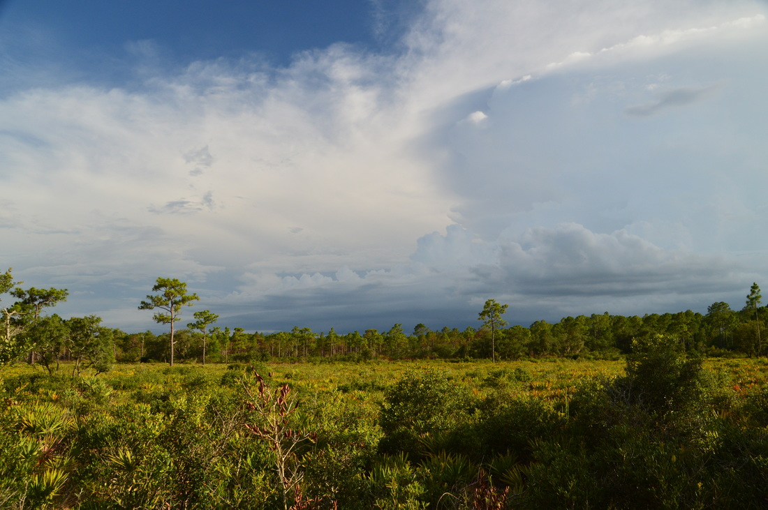
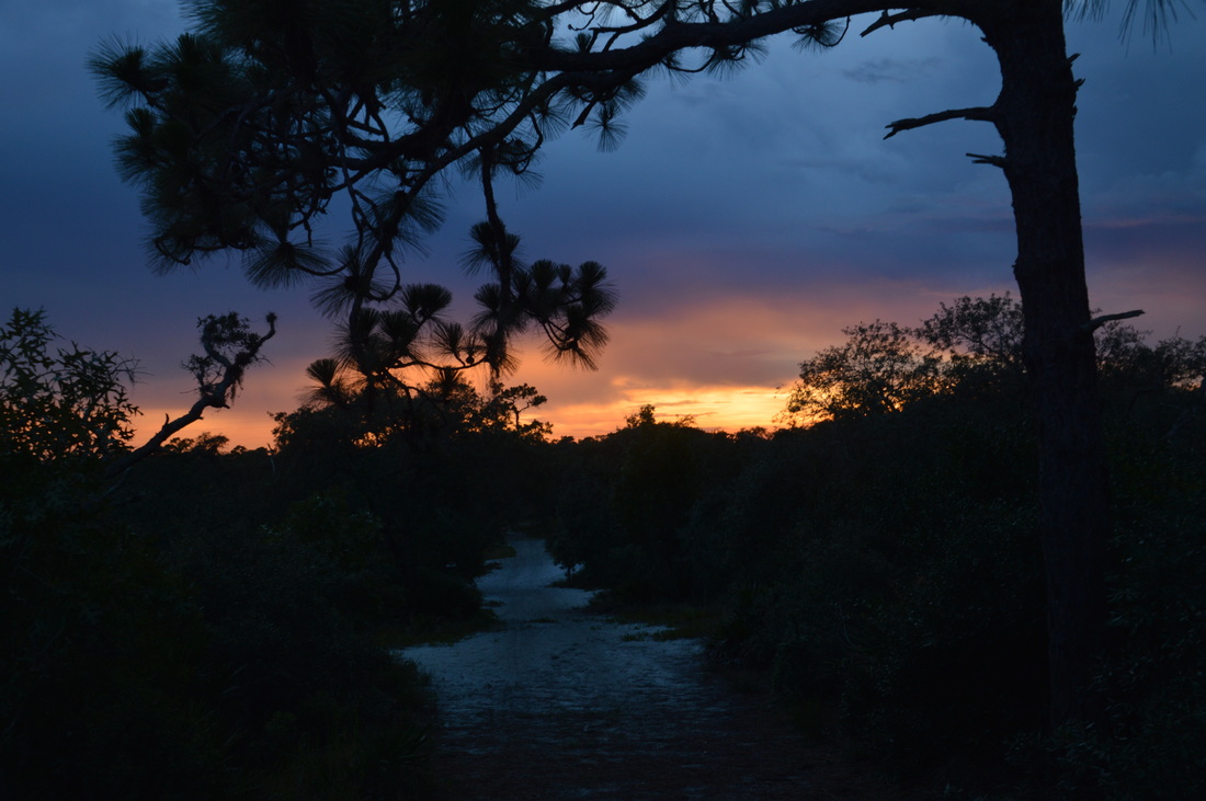
Catfish Creek State Park is in an area of Florida called the Lake Wales Ridge: a long elevated strip of land in central Florida with elevation peaking at 312 feet on Sugarloaf Mountain. Originally, the ridge was a series of "sand islands" over a million years ago, when most of the rest of Florida was actually underwater. Much of the Lake Wales Ridge has unaltered, conserved scrub habitat, which is essential for the areas dozens of endangered plants and animals, such as the sand skink, gopher tortoise, and scrub jay. On this hike, you'll scramble up to some of the region's highest hills, with their dazzling bright sand, as well as drop down into shady depressions where lakes abound. Additionally, you'll visit the site of an old sod farm and get to see some of the remaining structures - if they're still there by the time you're reading this. This hike occurred on Saturday, July 16th, 2016. My plan was to begin hiking the long loop counter-clockwise, before taking the medium loop connector across to the other side of the loop. From there, I would begin hiking the long loop in the clockwise direction, but not for long - I would then hike out and back the side trail to the sod farm ruins. After this, I would hike the long loop to the medium loop connector, and after hiking the connector for a second time, I would hike the remaining section of the long loop.
Summary
R/T Length of Trail: 13.0 Miles
Duration of Hike: 6:30 Type of Hike: Double Loop with Side Trip Difficulty Rating: 5 out of 10 Total Elevation Gain: Minimal, but there are several short climbs up sandy hills Pros: One of the best hikes in Florida for panoramic views Cons: Much of the hike is open overhead and could prove to be hot; this is a relatively harder hike due to the sugar sand that is found along much of the way Points of Interest: Numerous lakes on the loop portion of the hike; several hills with panoramic views; sod farm ruins Trail Blaze Color(s): Long Loop - White; Cross-trails - Blue; Horse Trail - Red; Side Trail to Farm Ruins - None Best Season(s) to Hike: Winter Fees: None Beginning Point: Catfish Creek State Park Trailhead Directions from Dundee, FL: From the intersection of Center Street and Main Street, follow Center Street North. This is also Florida State Route 17. In 1.3 miles, turn right onto Lake Hatchineha Road. Continue for 8 miles, and then, turn right onto Firetower Road. Continue for 3.1 miles until you reach the fenced-in gravel parking area at the trailhead to the left. If you have passed the fire tower to the left, you have driven too far - turn around and return to the parking area. Map
Click here for more information and to download this trail map to view in Garmin Basecamp.
Details
The trail system at Catfish Creek State Park is widely known as one of the best hikes in central Florida. Being a mountain guy, I wasn't as impressed as some natives, but it is certainly unique for Florida, as the trail tops some of the state's highest hills, providing relatively-to-Florida great panoramic views. The park isn't all about the main trail system though - there's a newer tract to the east, known as the Rolling Meadows Tract, and it connects to the Western Tract via an old forest road. Much of the newer tract still has to be restored, and currently, it is home to an old sod farm with several abandoned structures. On this hike, I not only hiked the bulk of the main hiking trail system in the park, but I also visited the old farm. The park has plans to demolish the farm structures, so if you're interested in seeing them, you might as well do it while they're still standing!
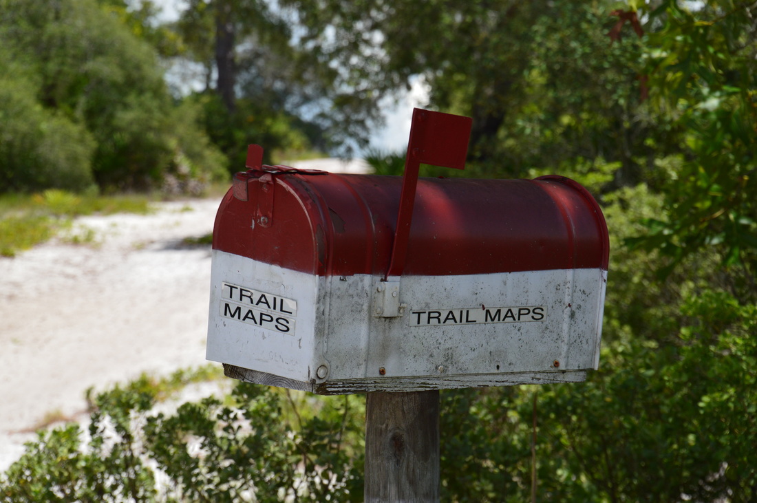
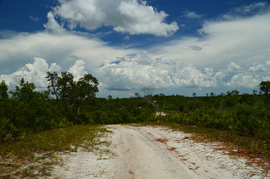
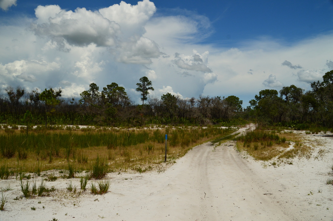
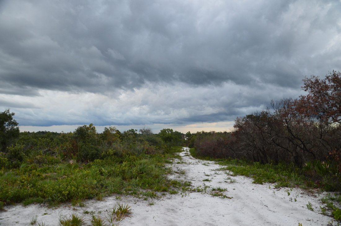
All of the park's trails begin at the trailhead on Firetower Road. There are few amenities at this location, as Catfish Creek State Park is one of the least developed state parks in Florida. It is also one of Florida's only two free state parks, with the other being Hontoon Island State Park. Take the broad sandy trail that begins at the southeast corner of the trailhead parking area. A trailhead kiosk and a break in the fence line mark the beginning of the trail. It became obvious to me right away that this wasn't going to be one of my easiest hikes in Florida - the rather deep and churned up sugar sand on the trail was slowing things down. In under a tenth of a mile from the trailhead, the trail reaches the first junction, where a red-and-white mailbox with trail maps stands. Here, the hiking trail turns right, while the horse trail continues straight. The horse trail reconnects with the north side of the outer hiking loop later, and I had actually preferred to take the horse trail by the end of the hike. More on that later though. For now, turn right onto the hiking trail. And one more note: every junction in the Western Tract of the park, whether the junction is a trail junction or a service road junction, is marked by a post with a number. This junction has Marker 2. 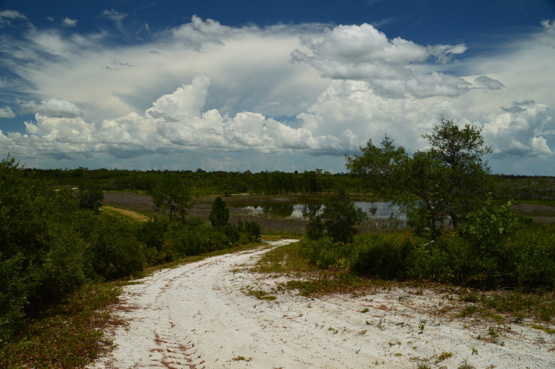
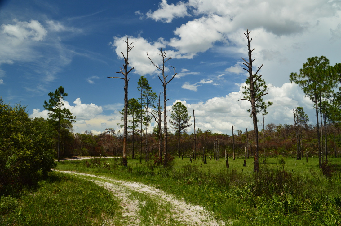
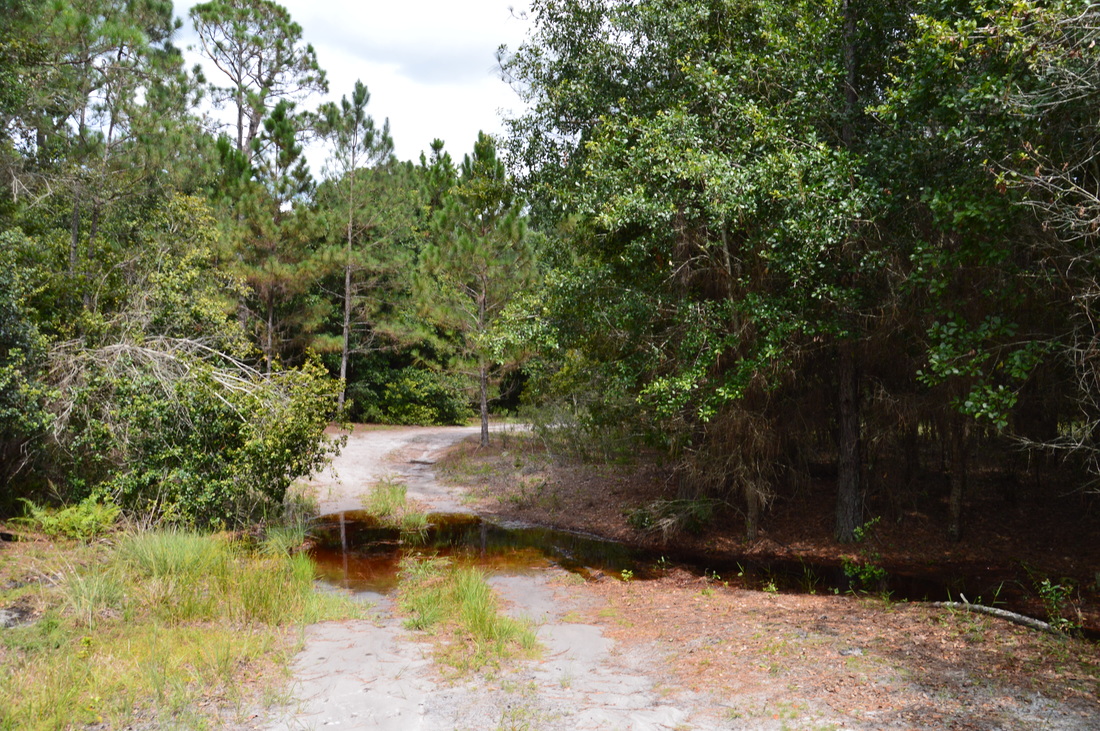
The hiking trails at Catfish Creek State Park cross a handful of sandy hills and pass by several lakes, such as this one
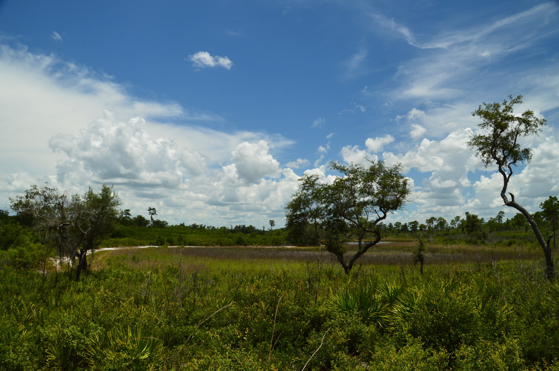
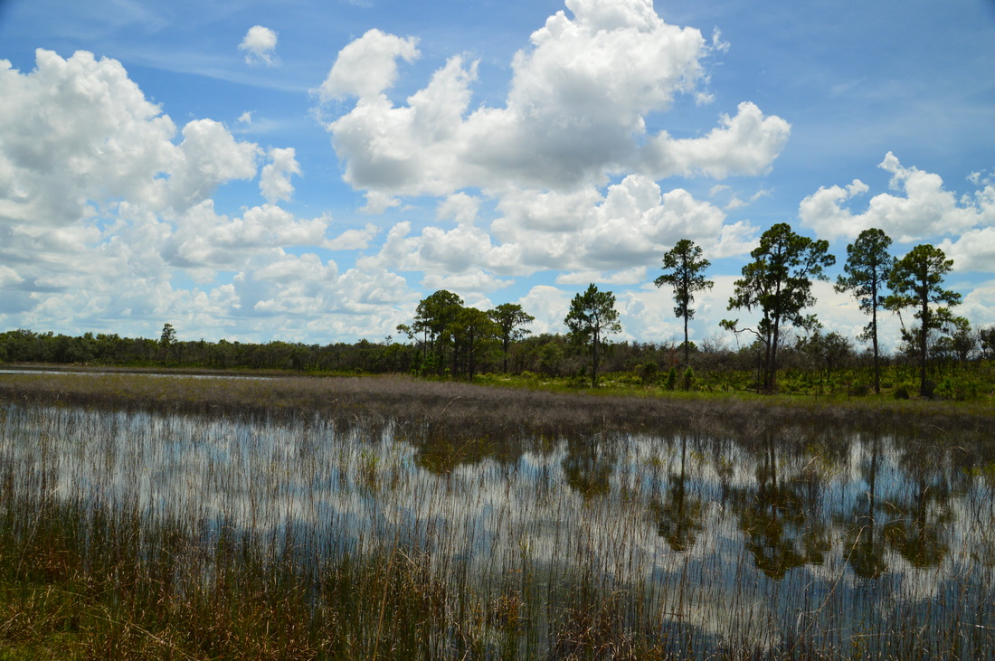
The trail arrives at Marker 3 at 0.15 miles, where it turns left, while a service road continues straight. After this, the trail ascends over the first hill, and on the other side of the hill is a marsh to the right and Marker 4. This is where the official hiking loop trail begins. I continued straight onto the north side of the outer loop. here, the trail ascended to the top of a second, higher hill, where Marker 6 was located. From here, there was a nice view of a sandhill lake ahead. The sandy trail descends the other side of the hill to a junction at 0.6 miles, Marker 7. Here, the short loop shortcut/cross-trail takes off to the right. My plan was to follow it back to the south side of the outer loop. The reason I had chosen this route instead of following the south side of the loop right away was to see the picturesque chain of sandhill lakes that was located along this cross-trail.
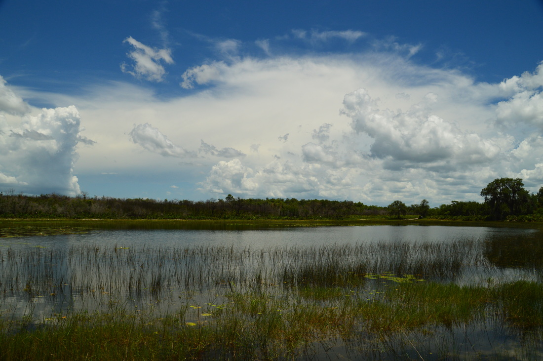
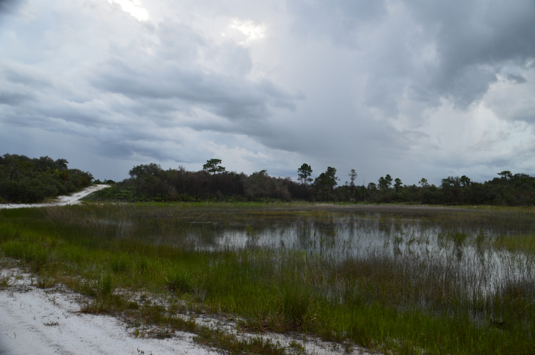
Turn right onto the cross-trail and observe the still waters of the first lake. On this day, the blue sky was full of small, puffy cumulus clouds (that would turn into thunderstorms later) that were reflected perfectly in the lake, providing a particularly photogenic scene. Over the next 0.4 miles, the trail passes three more sandhill lakes, all very similar to each other. It is interesting how they all lie in a chain, tucked in a narrow depression between two sandy ridges. At 1 mile, the cross-trail ends at the south side of the outer loop, where Marker 9 is placed. Turn left onto the outer loop and follow the west and then south shore of a fifth lake, the second-to-last lake in this chain of lakes (the sixth lake is not visible from any trail). At the southeast corner of lake, there is a four-way intersection at Marker 24. A service road crosses the trail from left to right, but the hiking trail continues straight, ascending a ridge. I found it interesting how the vegetation on the ridges differed drastically from the vegetation in the depressions and around the lakes, even though the elevation changes were minor. 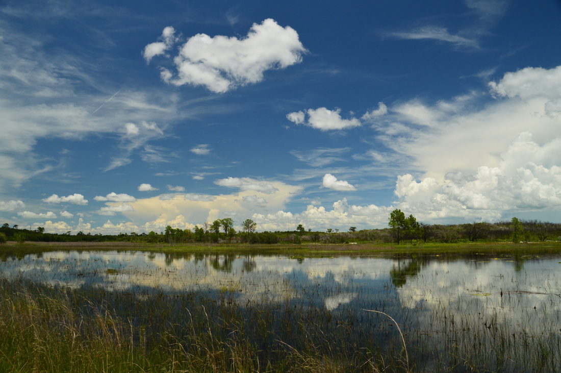
The short loop cross-trail follows a photogenic chain of lakes, which includes this one
After the chain of lakes, the trail ascends to a ridge and at 1.3 miles and Marker 23, there is a junction, where the outer loop turns right while the medium loop cross-trail continues straight. There are several ways to hike the trail system, but since my plan was to hike both the majority of the outer loop and the medium loop connector, I ended up hiking the connector once. To follow my route, continue straight onto the connector. A sign indicates that campsite #1 lies ahead.
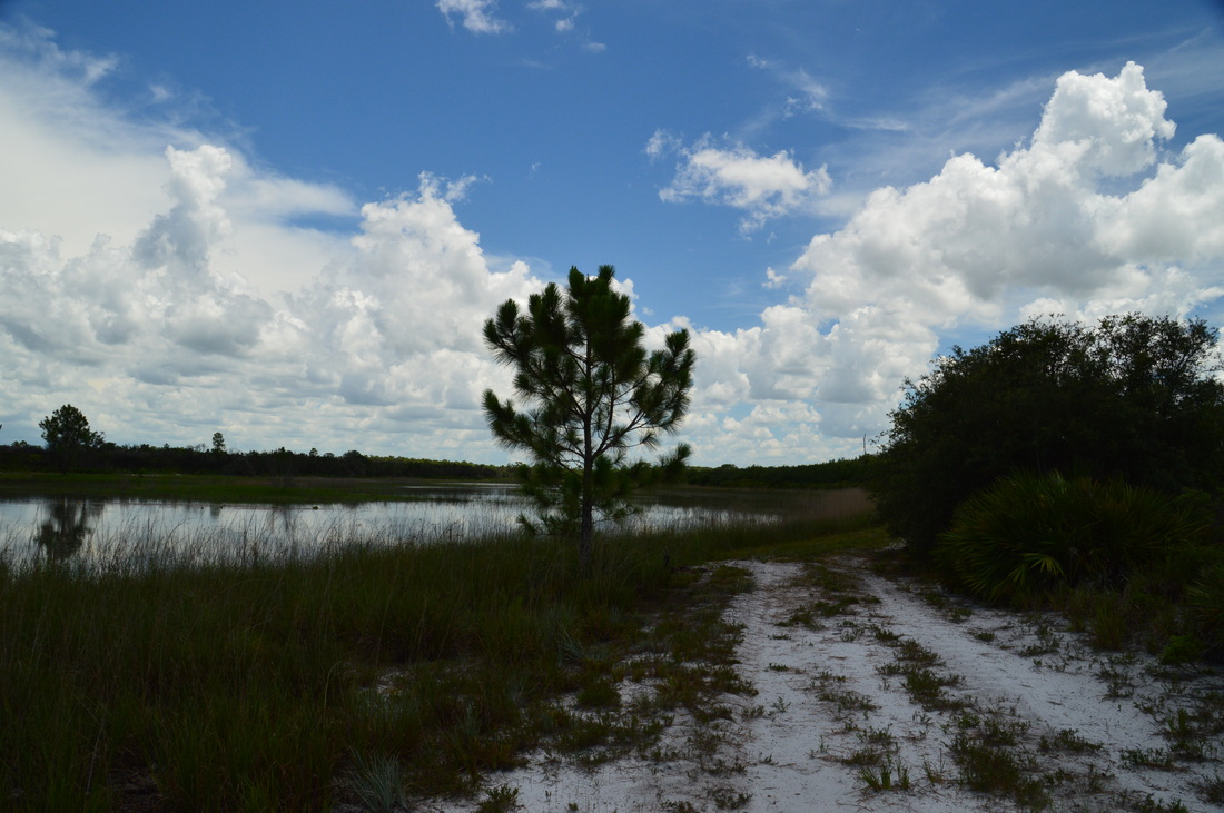
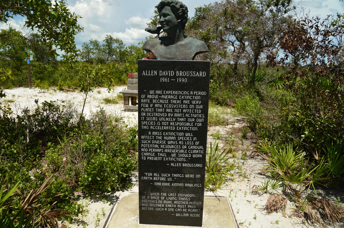
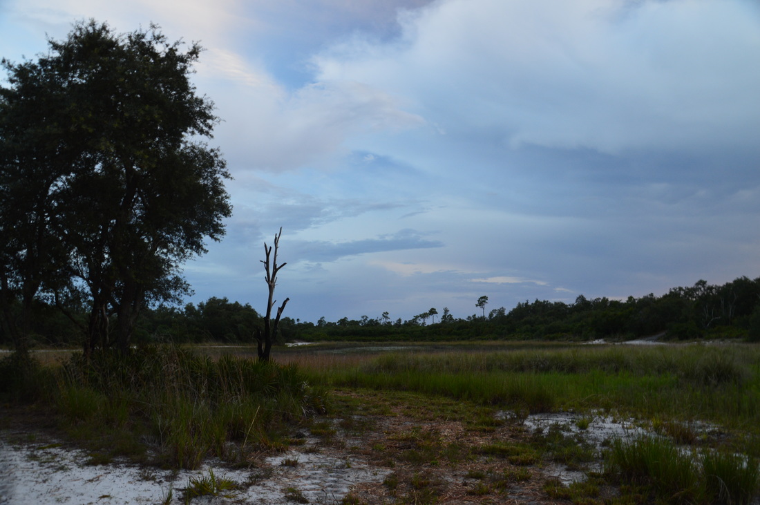
Next, the now blue-blazed cross-trail descends into a small depression where a dried-up marsh lies to the left. Topping a slight rise, the trail reaches a picturesque pine-lined lake at 1.4 miles. This is one of the largest lakes along the hike. On the other side of the lake, you can see a particularly steep sandy hill with the trail going straight up it. That is actually one of the highest hills in the park, and it has a great panoramic vista. The trail rounds the north side of the lake, passing Marker 22 where a service road splits off to the north. Then, the trail reaches the base of the hill at 1.6 miles and Marker 21. Here, a faint side trail continues straight to Campsite #1, while the main trail turns left and ascends the sandy hill fairly steeply. At the top of the hill, there is a sculpture that commemorates Allen David Broussard, an environmentalist who unfortunately died from cancer at the young age of 29. A bench stands at the sculpture, and from the top of the hill, there is a great panorama looking back to the west. You can see the lake back down below and the trail snaking its way up the opposite ridge. 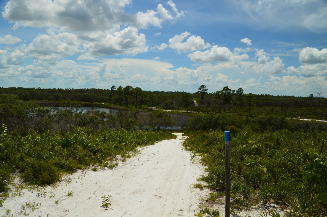
Several hills in Catfish Creek State Park provide panoramic views
As you cross the narrow ridge, note the interesting stunted trees. In the mountains, such trees are common the highest ridges and peaks, but it was fascinating for me to see a similar scenario in mostly flat Florida. The trail descends the east side of the ridge just as steeply, before coming to a marsh and Marker 18 at 1.7 miles. This is the end of the medium loop cross-trail. The outer loop continues straight and to the right. For now, turn right onto it, but later, when you will hike the cross-trail a second time, you will continue straight.
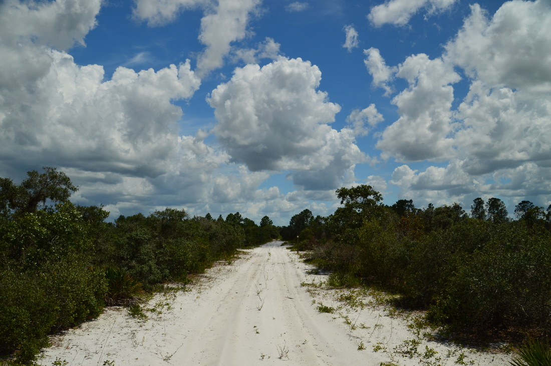
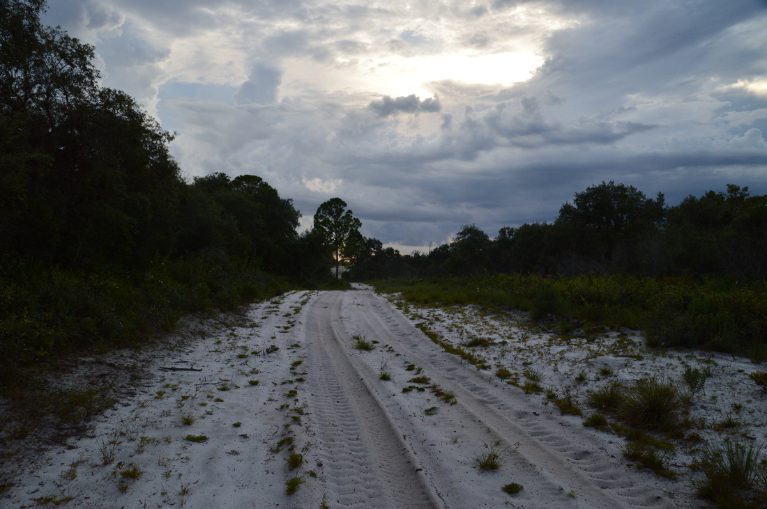
After turning right, I knew I had cleared (for now) the more beautiful section of the park, as its eastern portions are much flatter and less picturesque. Over the next three-quarters of a mile, the trail travels near several marshes and across a few low hills, before an abrupt south turn occurs at 2.4 miles at Marker 31. Here, the trail delves into an area of pine flatwoods, and I was surprised to see some sections of the trail underwater (although there was a bypass at the moment). I was confident that I would not get wet on this hike, although I was far from right, as this hike turned out to be the wettest of the entire summer! As the trail continued south, it passed Marker 30, where a service road turned off to the left. Continue on the trail until Marker 29 at 2.9 miles. This is a decision point. The official hiking trail turns right diagonally here, and the horse trail continues straight. However, the service road that leaves to the left is a route that leads into the park's Rolling Meadows Tract, where you can see the remains of an old sod farm. Much of the side trip to the ruins is not very interesting, as it follows berms along old farmland. Furthermore, the ruins may be demolished soon, according to the park's management plan. I will try to provide an update on this blog post of when that happens. It is your decision. If you want to do the side trip, keep in mind that it adds 6.6 miles to the hike. Also, I do have to note that the first section of the side trip passes through quiet unaltered floodplain forest north of Catfish Creek, before the old farmlands begin. My plan was to do this side trip to investigate the ruins, so the trail report will include this side trip. The service road goes due east from Marker 29. At first, the service road is very sandy, and since it is also rarely-traveled, the sand may be harder to walk in. The service road passes through scrub habitat (where I saw several scrub jays) until Marker 86, where a north-south service road seems to follow the scrub boundary. Cross the forest road, pass Marker 85 and another service road, and enter the floodplain forest north of Catfish Creek. Don't let the name of the ecosystem confuse you - this section of the trail is dry and should not be flooded. 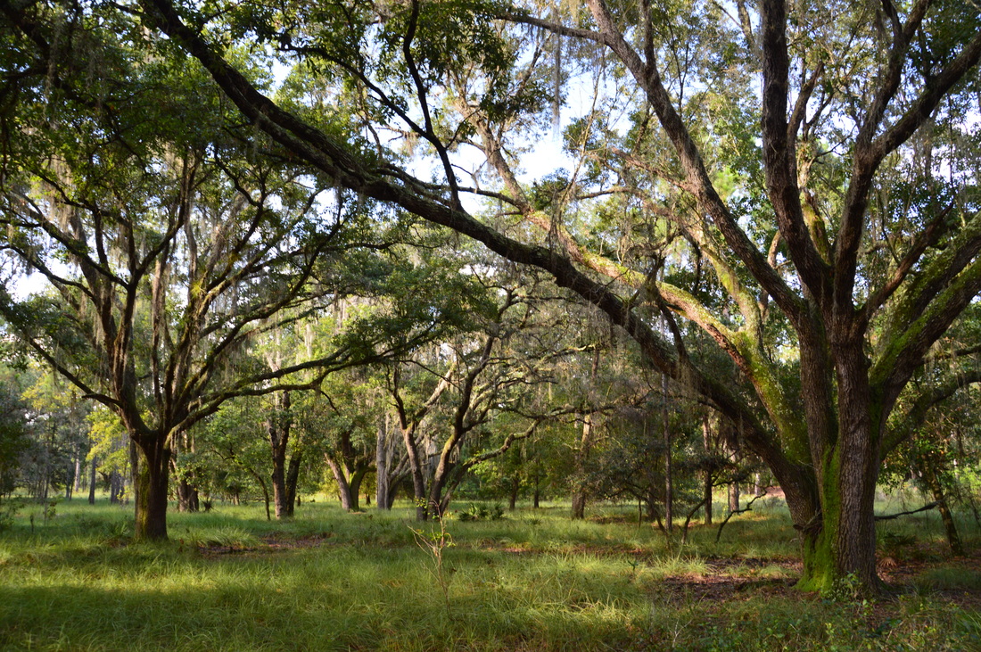
The floodplain forest north of Catfish Creek is pretty.
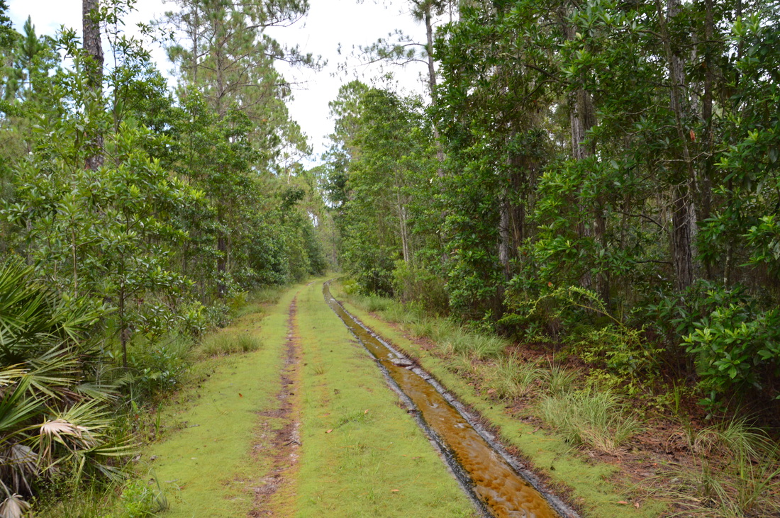
The forest is quite remote here, and I was pleasantly surprised by how nice this section of the hike was, as I didn't expect it to be very interesting. Soon a small stream came in from the forest and joined the service road for some time. There was one particular area in the forest where an open grassy understory stretched off to the left, with a number of grand live oaks. I found this to provide a particularly good photo opportunity.
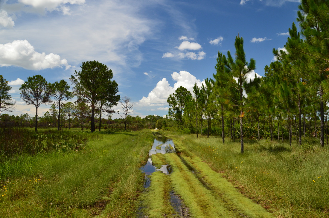
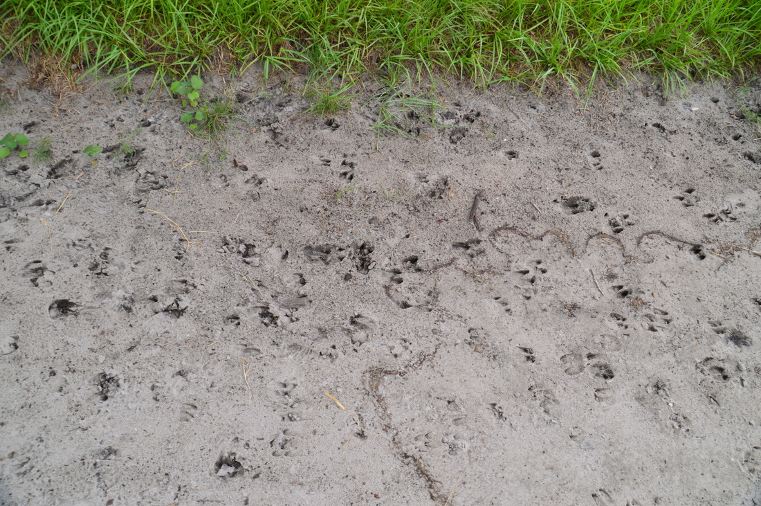
At 3.95 miles, the service road reaches and crosses a small stream. It is easy to hop across the stream just to the right of the road. After this, the service road bears to the right slightly and begins following a levee as the forest on both sides gets increasingly wetter near Catfish Creek. My maps show that at some point, the road actually crossed Catfish Creek, but I did not see this, and I think that the water of Catfish Creek was diverted into the canals around the farmlands (although there are plans to revert this). As the levee approaches the old farmland, the grass gets increasingly taller on the service road, slowing down the hiking pace. At 4.55 miles, the levee-road reaches the edge of the old farmlands, and immediately, the landscape takes on a much uglier character. A number of canals meet at this location, and it seems to me that all of these canals had irrigation purposes for the old sod farm. An area of development can be seen across the canal to the right. The levee crosses a canal to the left via a culvert, after which it continues eastward along a second canal and along the edge of the old farm. I saw an incredible amount of hog tracks in the sand and mud on the road here, and in fact, I actually saw a hog on my way back, although he ran away too fast for me to take a picture. At 4.9 miles, the main levee makes a turn to the north (left), while another service road crosses Catfish Creek via a culvert and continues east. Continue on the main levee now northward, though, which is now headed into the heart of the old sod farm's territory. Soon, the levee-road passed an area of demolished material to the right, perhaps the remains of another structure in relation to the farm. At 5.8 miles, there is an intersection. Here, a wide service road goes to the right - turn onto it. After this, enter a forested area where the land has not been cleared for farming, and at 6.0 miles, arrive at the main farm ruins. 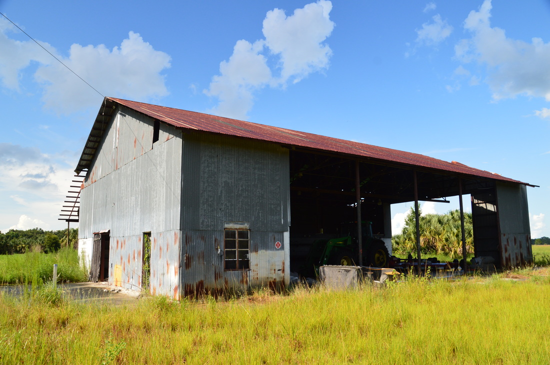
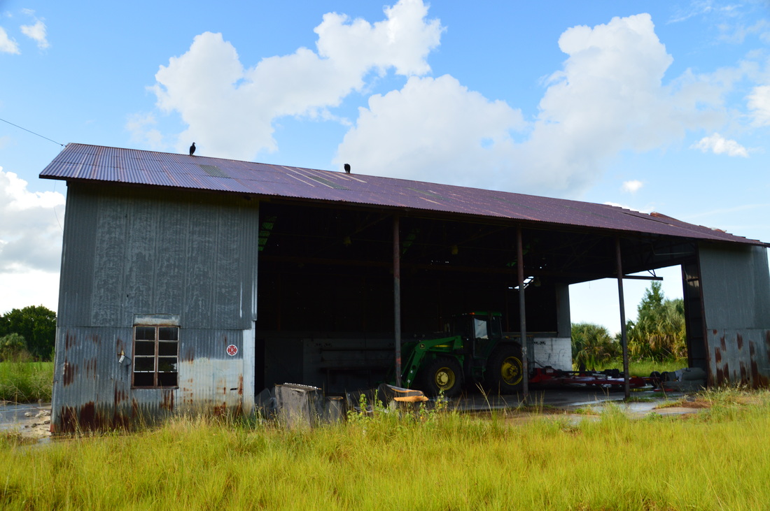
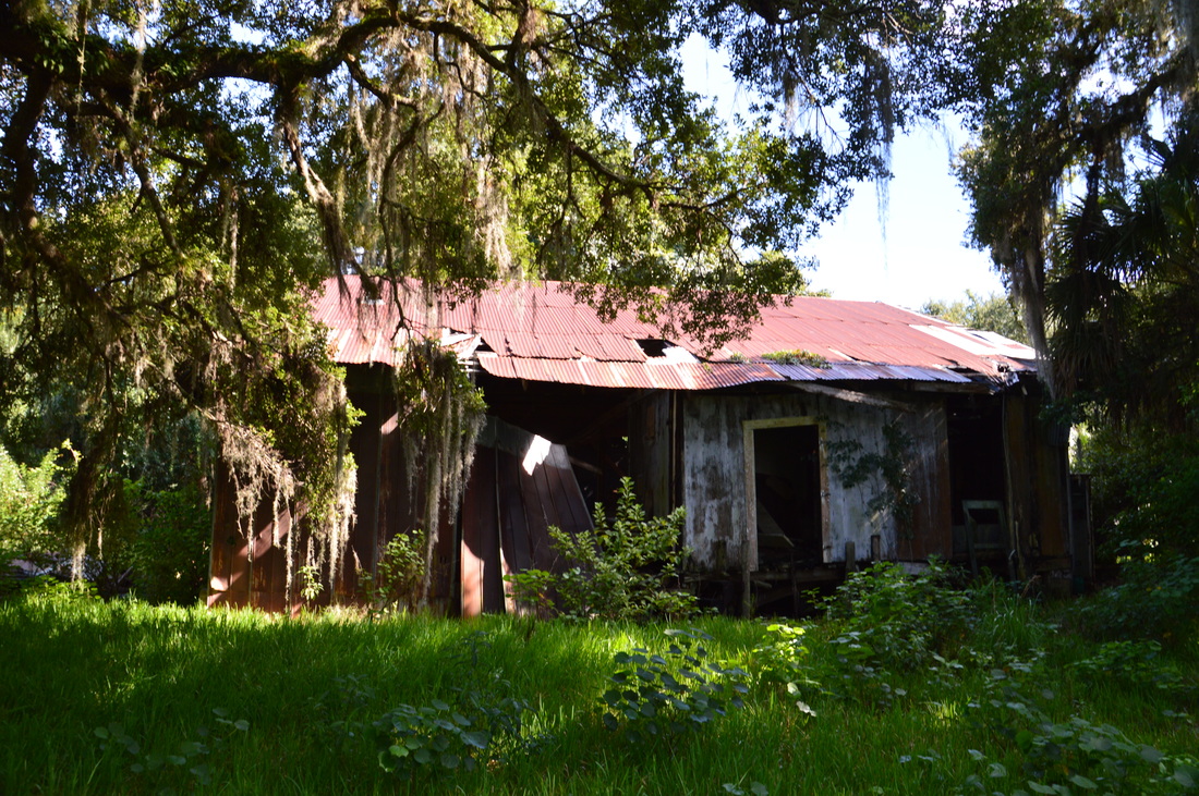
One of the several remaining buildings at the old sod farm in Catfish Creek State Park
The main ruins consist of two buildings. The one in better shape appears to be as a sort of storage house, where at the time I was here, a tractor was still housed. In fact, I found a bunch of abandoned instruments and materials, and yet in good shape, in the storage house, which is surprising. The other building is falling apart, but it was likely the main house. Take your time to explore these ruins, for it is likely that they will be demolished at some point as the park becomes more developed.
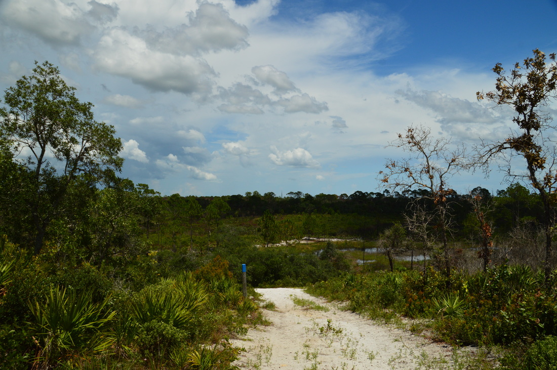
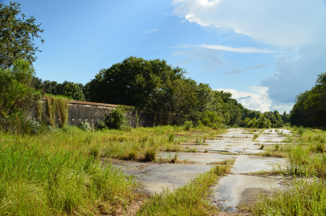
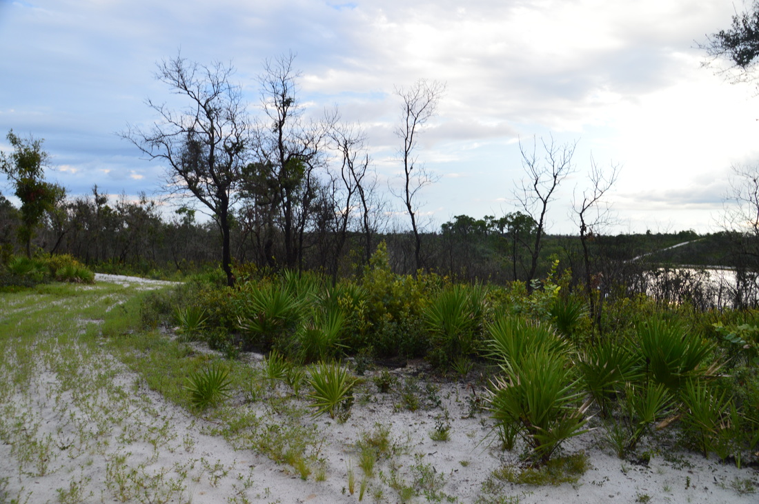
There is also another feature in the vicinity of ruins. Continue on the old road for another tenth of a mile until you see a bizarre concrete structure to the left. It is a long, rectangular concrete pad, and the area's two long sides are bordered by tall concrete walls. It appears to me that this was an area where sod was stored, and the walls prevented debris from reaching sod. However, I am not positive, so if anyone has any ideas, I'll be glad to hear them. From the farm ruins, retrace your steps back to the official hiking trail in the park's western tract. You'll return to the trail at 9.5 miles. From here, bear left (southwest) onto the outer hiking trail. I was getting a little bit tired by now, and I absolutely didn't expect what came next: a half-mile stretch of water up to knee-deep! I was confident that the entire hike would be dry, due to the hilly and sandy terrain. However, this stretch is in a low, flat area, and while I suspect that this part of the trail is wet only during the wet season or after heavy rain, it is still something that you must keep in mind. At Marker 28, the horse trail rejoins the hiking trail by coming in from the left, and the low wet area ends. After this, the trail enters the sandhills. At Marker 27, a north-south forest road crosses the trail. If you turn right and follow the road, you will reach Marker 18 (where you were earlier). If you turn left, you will reach Campsite #2. There are future plans to construct another hiking trail in this area and extend it southward to Catfish Creek and then along the western fringes of the park. Regardless, continue straight in a generally westward direction, ascending a couple of hills and passing a lake, until Marker 26 at 10.35 miles. The wide horse trail continues straight here, but the hiking trail actually turns right onto an inconspicuous slightly overgrown double-track path that follows a sandy ridge northward. Turn right onto this path. I found this stretch of the trail to be particularly scenic, because due to the sharpness of the ridge, which offered great views of a lake to the east. 
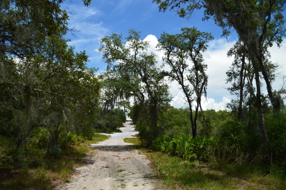
Catfish Creek State Park is in Florida's "high country"
At Marker 25, a service road takes off to the right. Continue straight to a T-intersection at Marker 23 at 10.9 miles. You were here before. You have another choice here: if you're tired, you can turn left and return the same way as you came in, reaching the trailhead in just another 1.3 miles. If you have remaining energy, you can turn right and hike the medium loop cross-trail again, in order to hike the northern section of the outer loop. I decided to do the latter, in order to hike the trail system in its entirety.
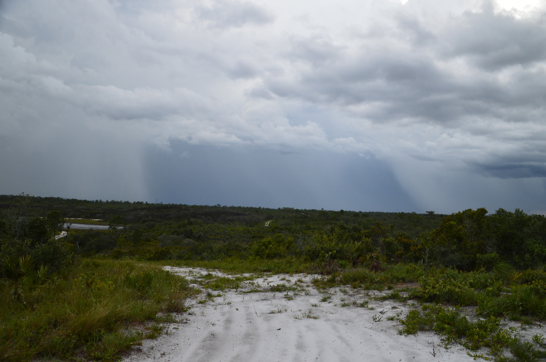
Turn right and follow the same stretch of trail that you followed earlier in the day, passing a lake and the Allen David Broussard monument, before reaching the junction at Marker 18 at 11.3 miles. However, the difference is that this time, you will actually continue straight (north) on the outer loop trail. This trail begins to ascend gradually along a sandy track to the summit of another tall hill, reaching it at 11.7 miles and at Marker 17, where a service road leaves downhill to the left. There is a bench here and a great panoramic view to the west, looking across nearly the entire park. I could see storm clouds and rain shafts under them in the distance, but luckily, I never got rained upon. From the hill, the trail descended to a junction at Marker 16 at the park boundary. A service road turns right; however, turn left to continue following the trail. Just ahead, Marker 15 marks the point where a loop of the horse trail leaves off to the right. Continue straight past a couple of small lakes and onto a low ridge past Marker 14 (where a service road leaves off to the left) to Marker 13 at 12.35 miles, where there is a junction. The hiking trail bears left, while the horse trail continues straight. Both routes reach the trailhead in about the same distance, but I prefer the horse trail, as it passes by one more lake. Thus, continue straight on the horse trail. At Marker 43, a loop of the horse trail comes in from the right. At Marker 42, the trail reaches the shore of a large but marshy lake. Turn right and bend around the lake. At Marker 41, the horse trail turns right, making one last steep ascent to a small hill. After this, a gradual downhill brings the trail to the end of the loop and the trail maps mailbox at Marker 2 at 12.95 miles. Continue straight and shortly afterwards, reach the trailhead at 13 miles, concluding this hike through the sandy hills of the Lake Wales Ridge. Mileage
0.0 - Catfish Creek Trailhead
0.6 to 1.0 - Chain of lakes 1.4 - Another lake 1.65 - Hill with panoramic views and Allen David Broussard Monument 2.9 - Beginning of side trip to old sod farm 6.0 to 6.1 - Main farm ruins 9.5 - End of side trip 11.7 - Hill with panoramic views 13.0 - Catfish Creek Trailhead Variations
Just the Short Loop - 1.9 Miles
Just the Medium Loop - 3.4 Miles Just the Outer Hiking Loop - 5.5 Miles Just the Outer Hiking Loop including Medium Loop Cross-Trail - 6.3 Miles Pictures
1 Comment
William Rodriguez
11/5/2018 05:47:02 pm
Awesome photos Leave a Reply. |
About MeMark Oleg Ozboyd Dear readers: I have invested a tremendous amount of time and effort in this website and the Georgia Waterfalls Database the past five years. All of the work that has gone in keeping these websites updated with my latest trip reports has almost been like a full-time job. This has not allowed me to pick up a paid job to save up money for college, and therefore, I I've had to take out loans. If you find the information on this website interesting, helpful, or time-saving, you can say "thanks" and help me out by clicking the button above and making a contribution. I will be very grateful for any amount of support you give, as all of it will apply toward my college tuition. Thank you!

Coming in 2022-2023?
Other Hiking WebsitesMiles HikedYear 1: 540.0 Miles
Year 2: 552.3 Miles Year 3: 518.4 Miles Year 4: 482.4 Miles Year 5: 259.9 Miles Archives
March 2021
Categories
All
|


 RSS Feed