
The Chattooga Wild & Scenic River is known for its lengthy and very beautiful gorge, full of rapids and waterfalls. The Canyon of Five Falls is the cream of the crop, the king of them all, perhaps one of the Chattooga River's most beautiful sections. In this 0.1-mile stretch, the river rushes over five significant Class IV or Class V rapids through a gorge full of house-sized boulders. Perhaps the most notable rapid of all is the Crack-in-the-Rock Rapid, where the mighty Chattooga River roars through three tiny slots in a line of huge boulders. In the hot weather and lower water levels of summer, this short but time-consuming hike is perfect. This hike occurred on Saturday, March 18th, 2017. My plan was to hike the Watergauge Trail, also known as the Camp Creek Trail, from the end of Watergauge Road to the trail terminus at the confluence of Camp Creek with the Chattooga River. From there, I would rock hop and wade along the Chattooga River to the Canyon of Five Falls. I would return the same way.
Summary
R/T Length of Trail: 1.9 Miles
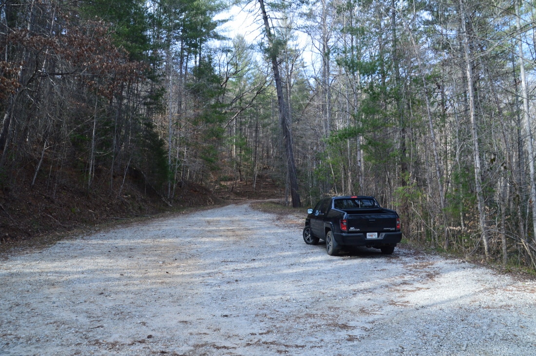
Duration of Hike: 3:00 Type of Hike: Out and Back Difficulty Rating: 4 out of 10 Total Elevation Gain: 358 Feet Pros: Numerous good campsites along Chattooga River Cons: Lack of trail for last portion of the hike to the Canyon of Five Falls Points of Interest: Canyon of Five Falls (Entrance Rapid, Corkscrew Rapid, Crack-in-the-Rock Rapid, Jawbone Rapid, and Sock-em-Dog Rapid) Trail Blaze Colors: Watergauge Trail - Lime Green Best Seasons to Hike: Summer, Fall Fees: None Beginning Point: End of Watergauge Road Directions from Tallulah Falls, GA: From the Tallulah Gorge/Tallulah Falls Lake Dam Bridge on US 23/441 in Tallulah Falls, follow US 23/441 North for 2.9 miles. Then, turn right onto Camp Creek Road. In 1.4 miles, turn left onto Watergauge Road - sometimes referred to as Camp Creek Road as well - which shortly turns into unpaved Forest Road 511. From the turn-off, continue for 4.0 miles to the end of Watergauge Road. There is a large turnaround and parking area at the end of the road, where the marked trailhead is located. Map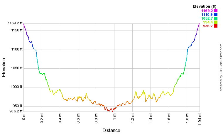
Click here to download a track of this hike.
Details
The Canyon of Five Falls is one of the best-known sets of rapids in the Southeast US. This series of five rapids has many legends about it, and all of the rapids are among the most difficult to navigate by kayak. In situations like this, kayakers usually have the best opportunity to view the rapids and gorge, but in this case - luckily for hikers - a trail leads to within 0.35 miles of the the entrance of the canyon, and the rest of the way can be navigated by foot if the water levels are below a certain point. After I had learned about the relatively easy access to the Canyon of Five Falls, I decided to make the hike to it, following two other hikes on the same day (to two waterfalls on Stekoa Creek and to Cliff Creek Falls).
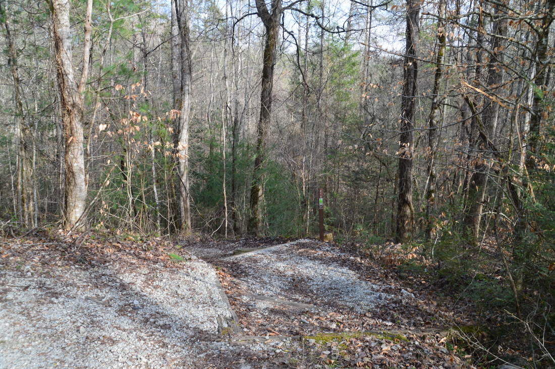
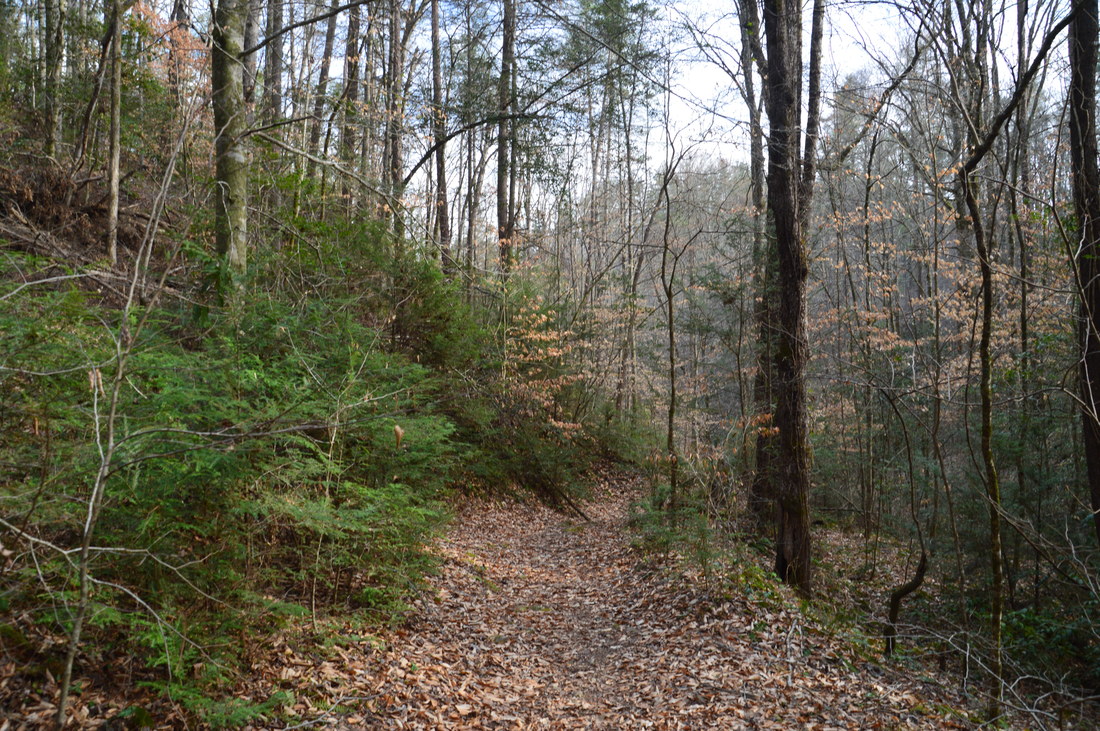
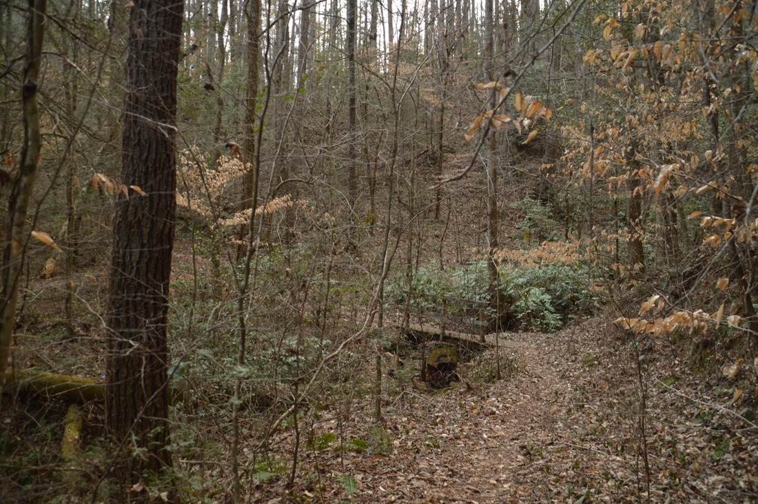
The easiest route to the rapids begins at the Watergauge Trailhead, at the far end of the turnaround at the terminus of Watergauge Road. The end of the road (and the trailhead) is located at the Chattooga Wild & Scenic River boundary, because vehicles are not allowed inside the boundary. A carsonite stake marks the beginning of Watergauge Trail #210. The trail is also known as the Camp Creek Trail. The trail begins along a set of broad steps and descends two pairs of switchbacks. There are well-used shortcuts across both switchbacks, and if anything, they look more obvious than the main trail - please do not use the shortcuts! After the third switchback, the trail joins an old roadbed and continues descending gradually along it into the Chattooga River Gorge. The trail is well-marked with lime green blazes. 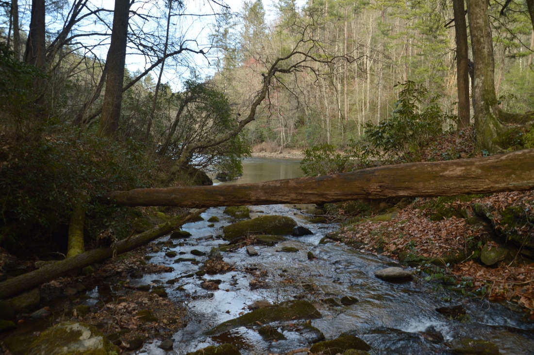
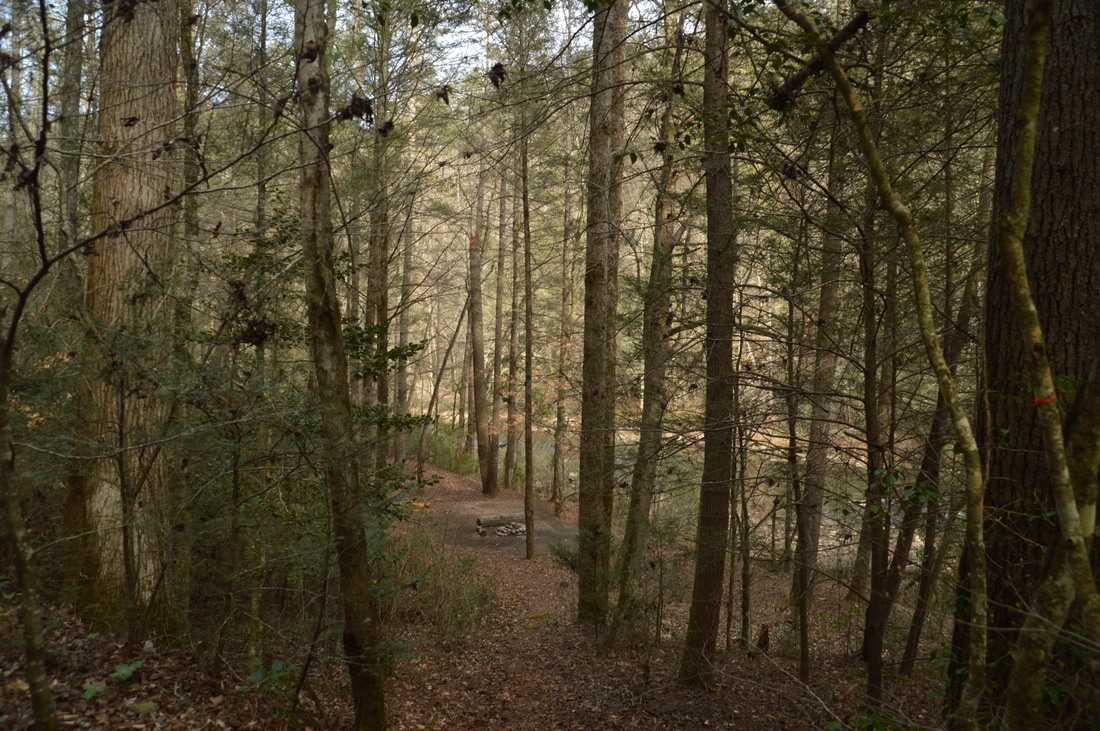
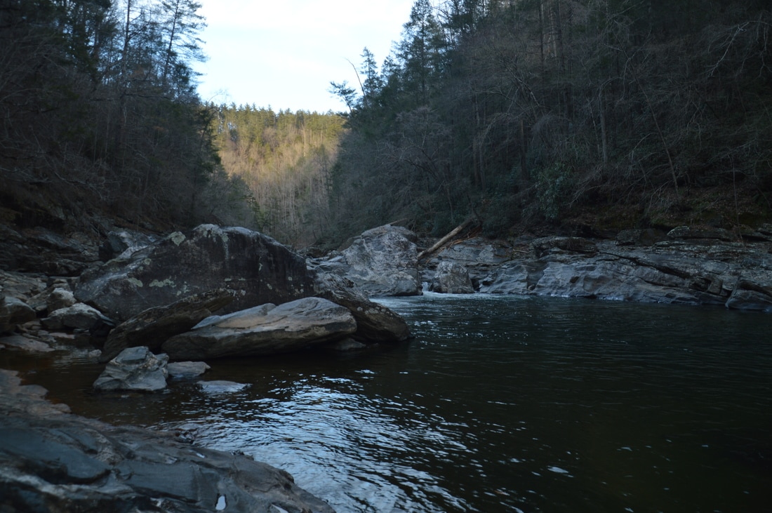
The Watergauge Trail terminates at the confluence of Camp Creek with the Chattooga Wild & Scenic River, where an array of pretty campsites are positioned.
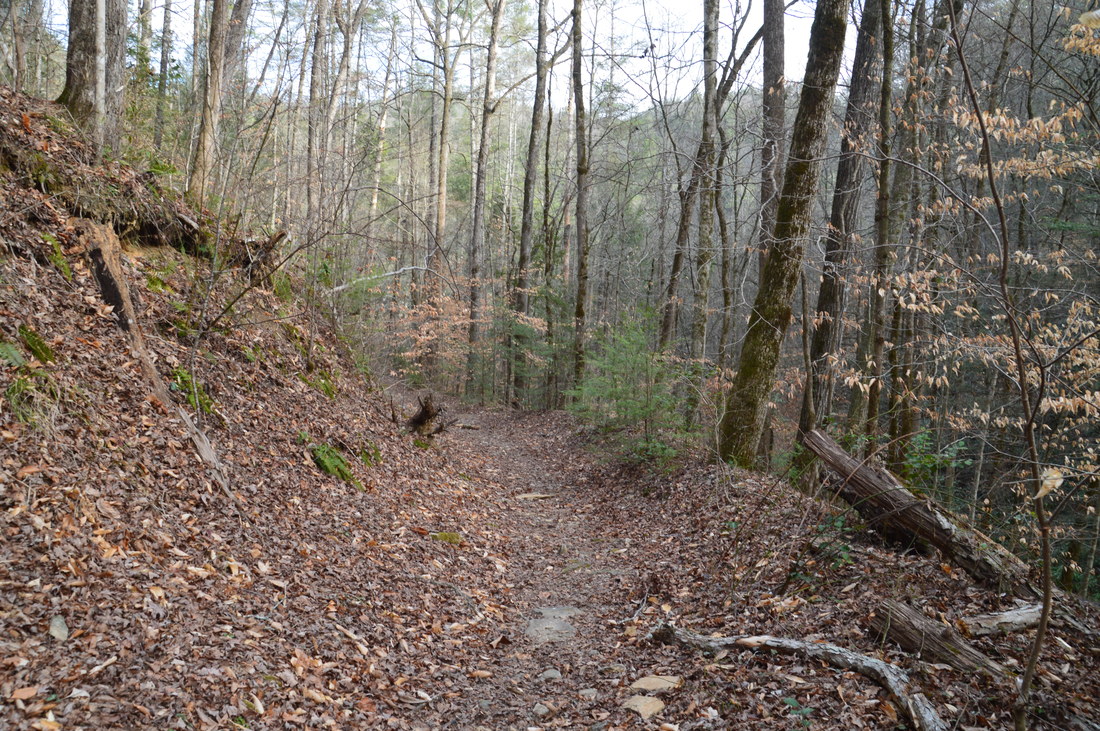
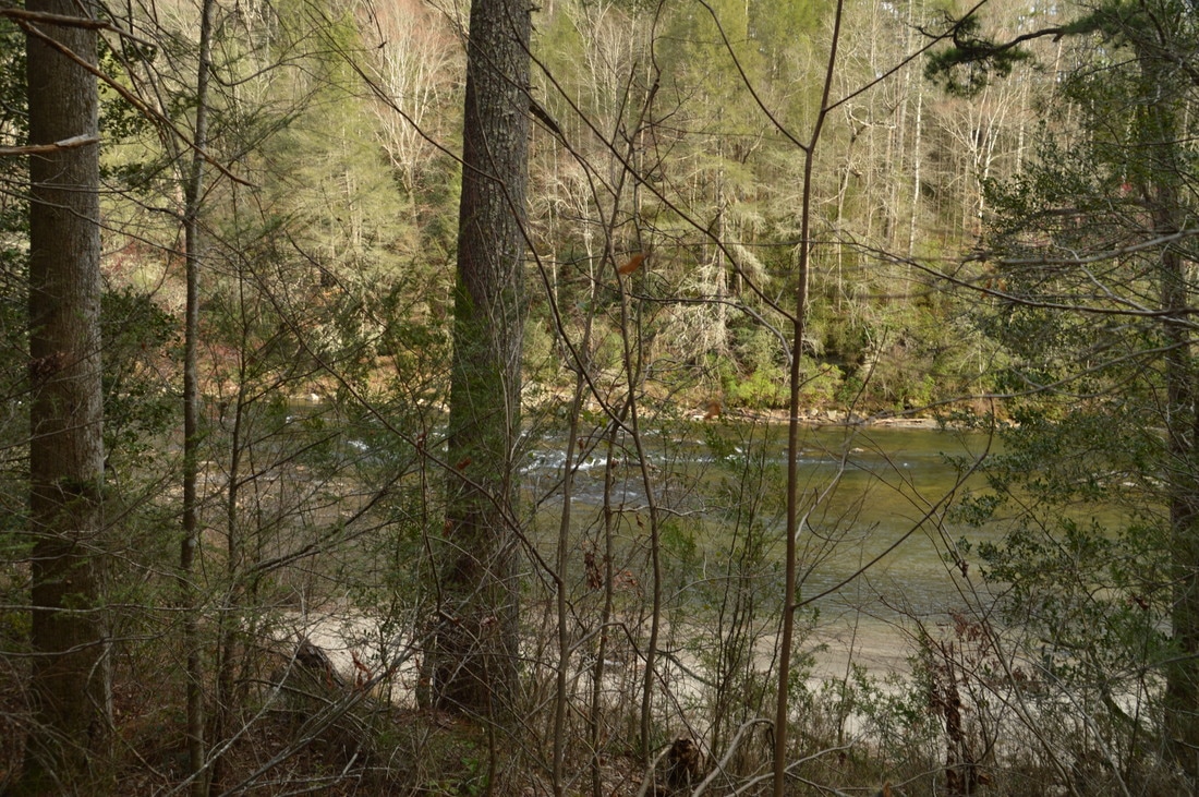
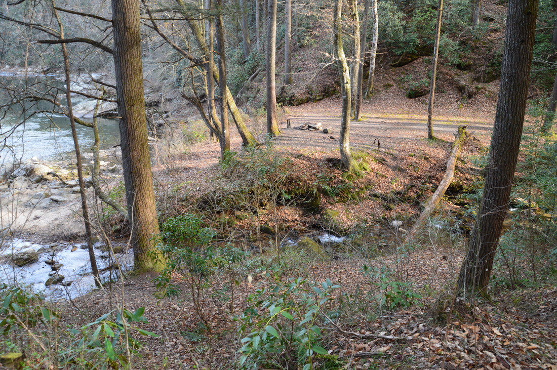
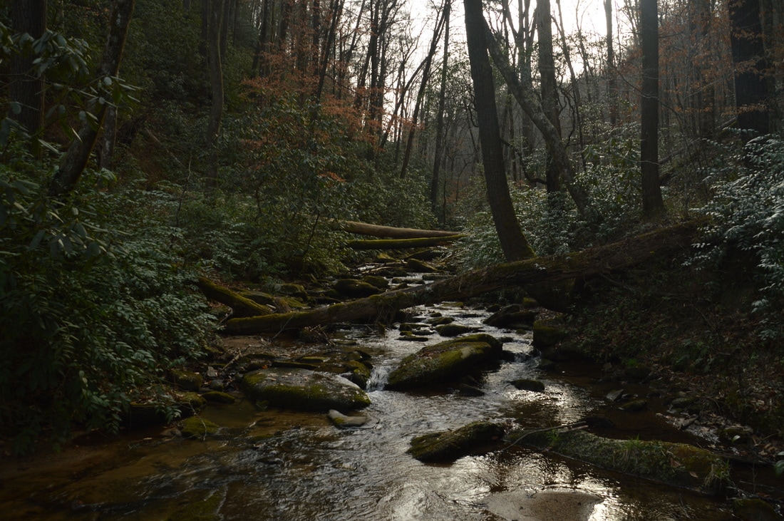
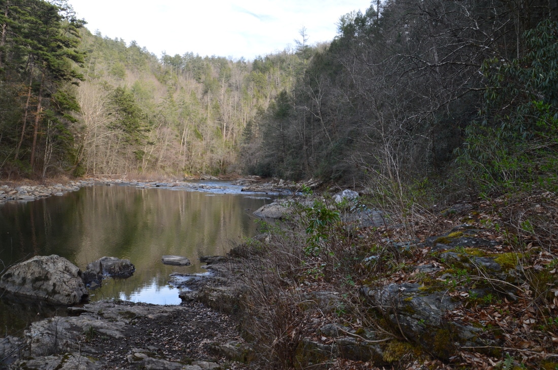
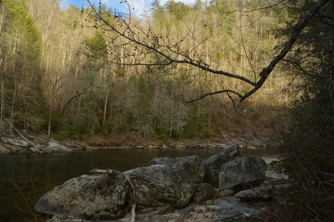
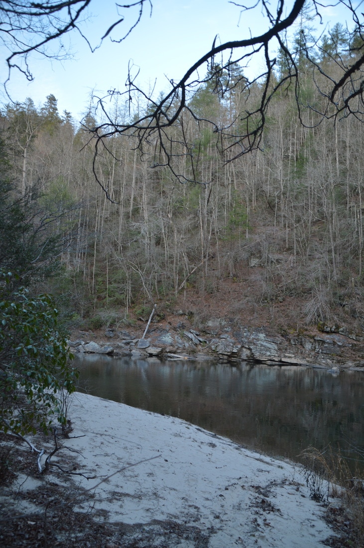
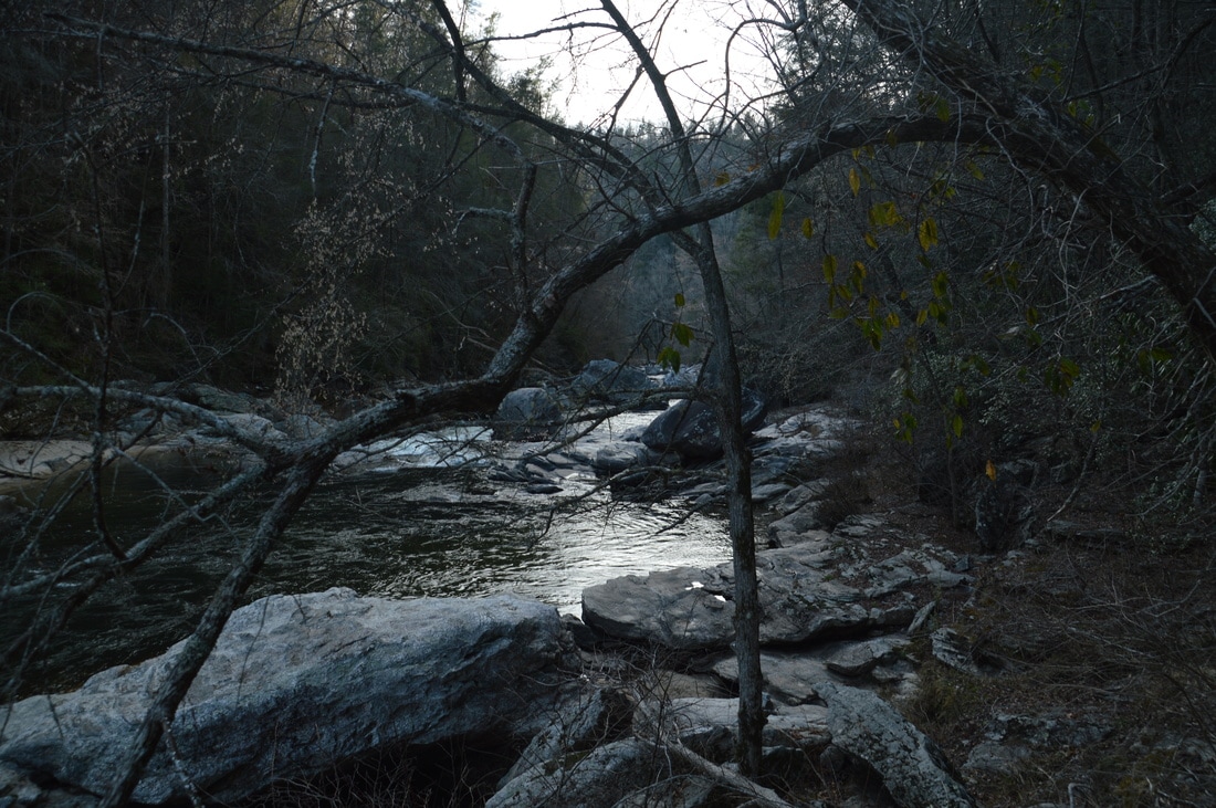
At 0.2 miles, the Watergauge Trail curves toward the Chattooga River, with the river coming into view through the trees, and at a sharp switchback at 0.3 miles, the trail reaches river level. While the main trail switchbacks to the right (southward and downstream), an unmaintained but very established side trail leaves to the left (northward and upstream) here to reach a sandy beach known as Little Woodall Beach in 0.3 miles and Little Woodall Rapid 0.5 miles from the main trail. On this day, I did not hike the side trail though, and instead, I continued along the main trail downstream, passing a campsite on a side trail to the left. At 0.4 miles, there is a trailside campsite with views of the placid Chattooga River, and shortly afterwards, the trail crosses a small stream via a footbridge. At 0.5 miles, reach a crossing of Camp Creek. While during today's drought conditions I was able to rock hop across the stream, this will be a wade in higher water levels (although the hike is best during water levels such as the ones that were in place on this day, nearly normal for summer).
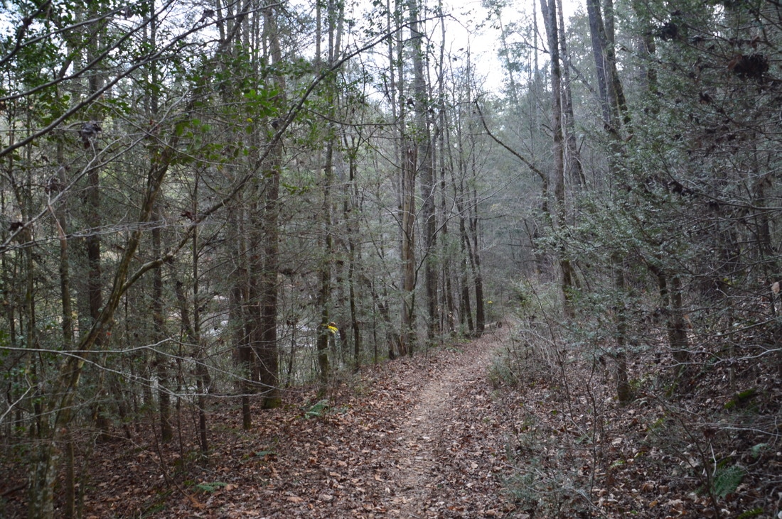
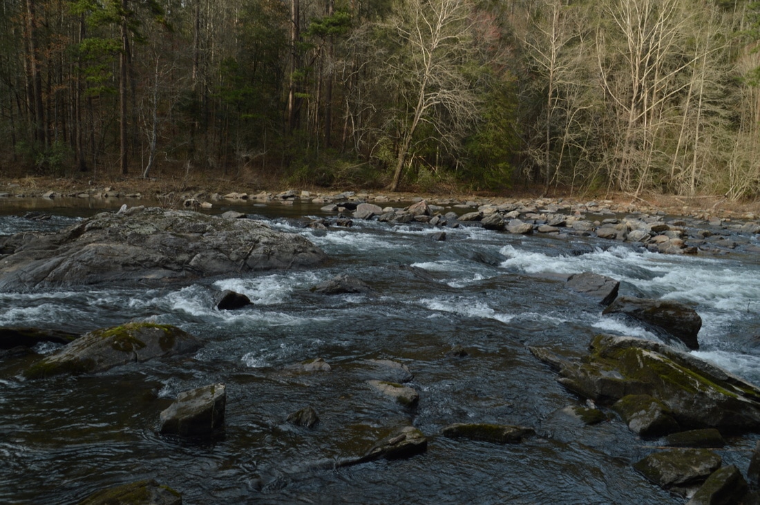
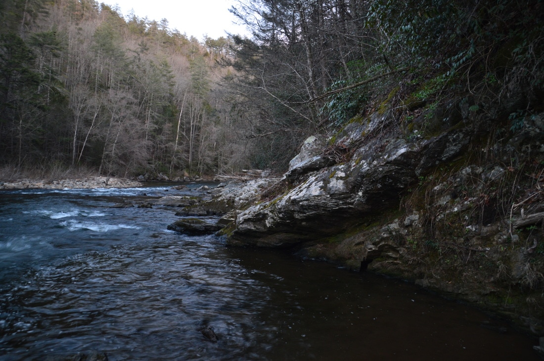
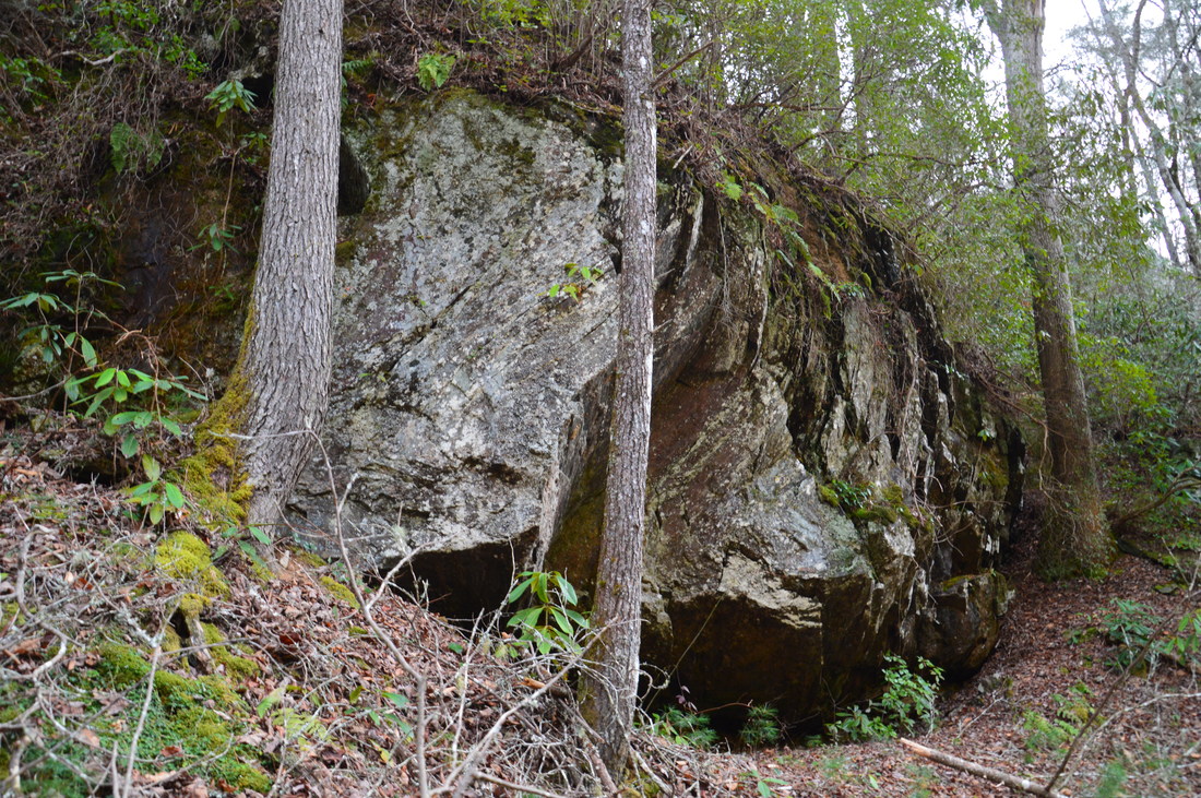
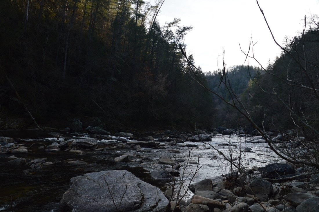
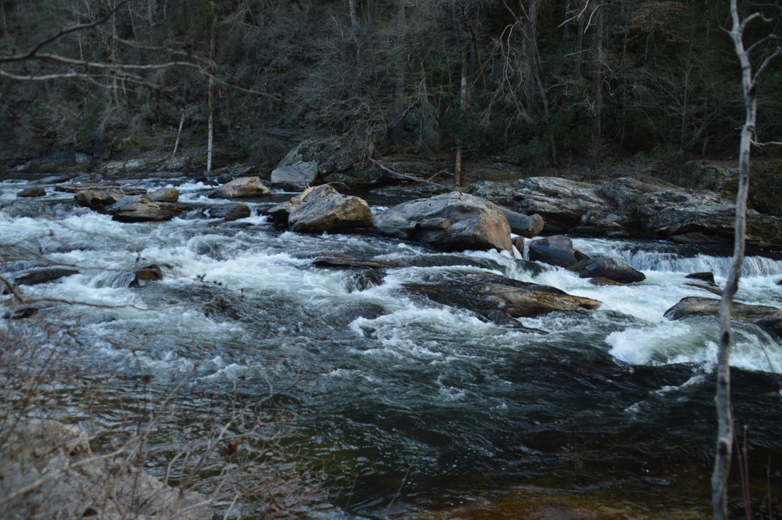
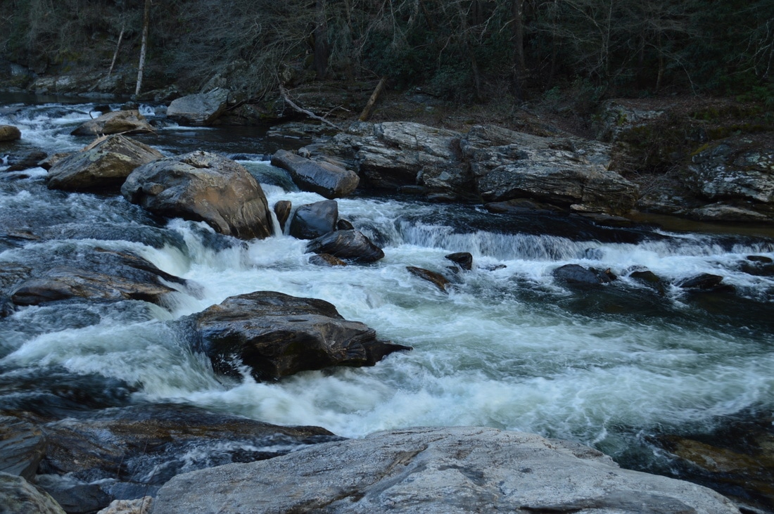
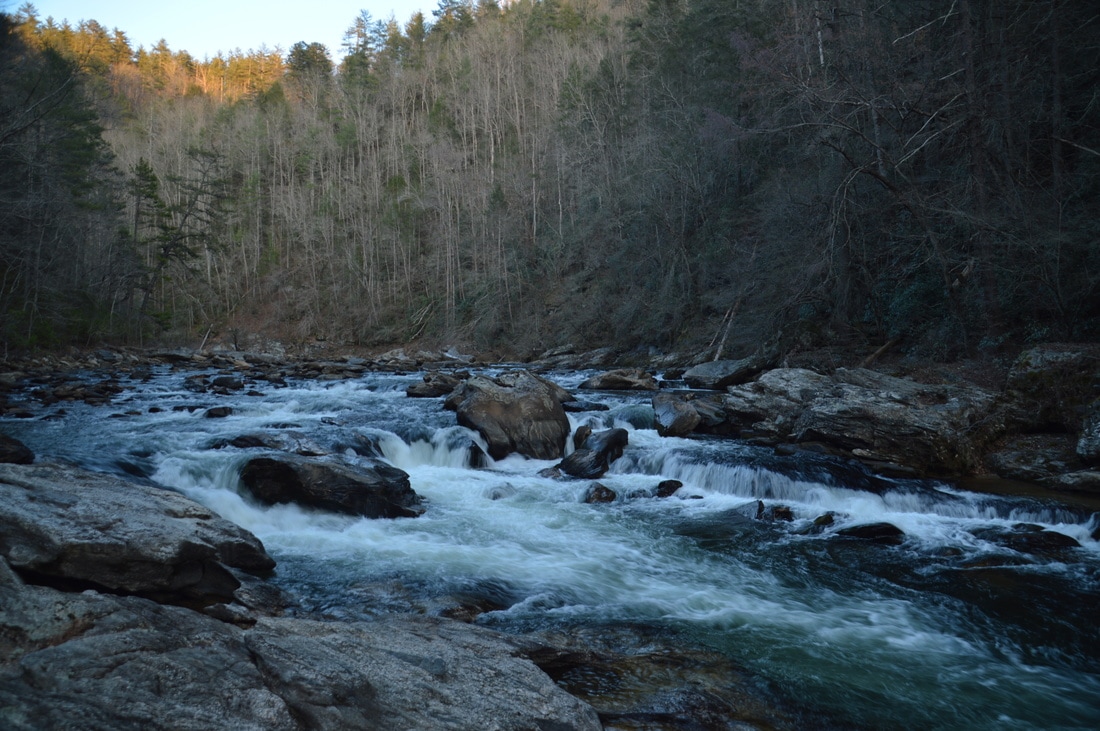
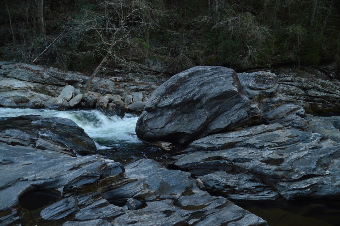
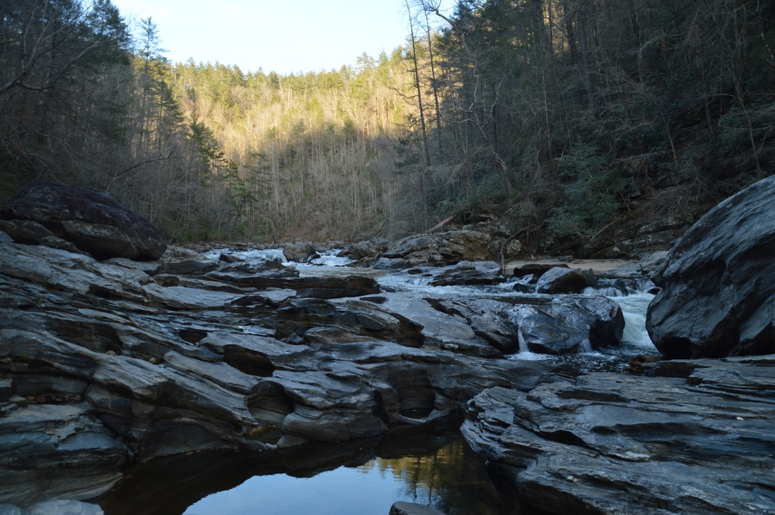
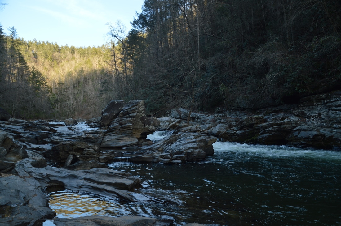
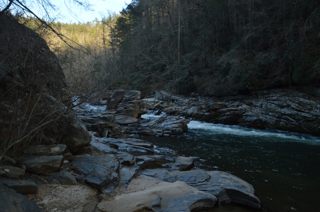
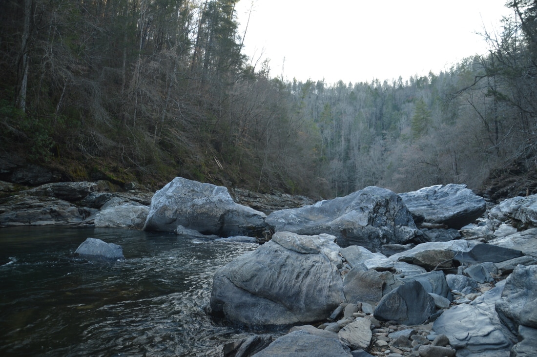
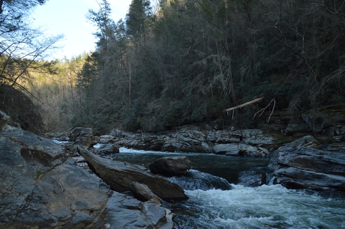
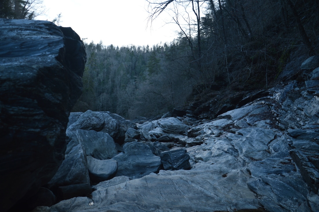
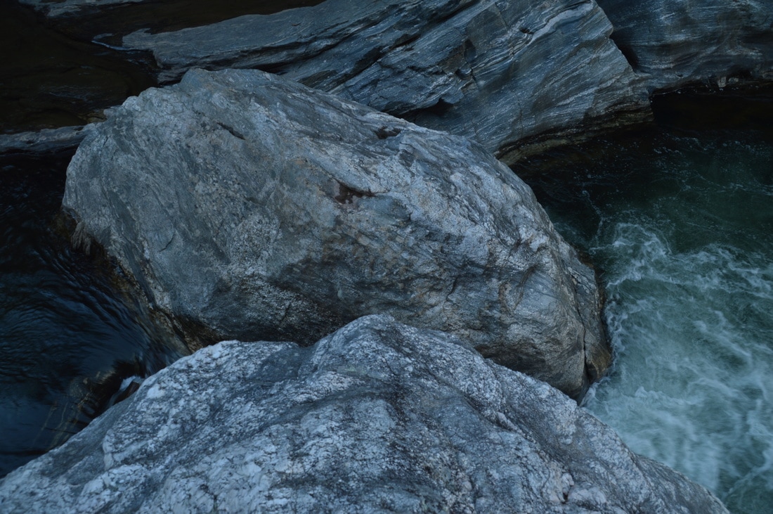
On the other side of the Camp Creek, the Watergauge Trail ends in a large flat with another campsite. From here, the rest of the route to the Canyon of Five Falls is not on a trail, although it is not a bushwhack, because the broad bank of the Chattooga River is rocky and mostly vegetation-free. Continue on a slim fishing path that follows the immediate shore of the Chattooga River downstream. The Canyon of Five Falls is located around the bend in the river visible in the distance. The path soon ends and you must begin scrambling among rocks along the shore. Progress is slow but relatively straightforward - no navigational skills are required for this hike. At approximately 0.6 miles, the rock-hopping progress is stymied by a large cliff right at the river. The easiest and most efficient route from here is to wade along the cliff at the edge of the river. The water was mid-thigh-deep on this day, and it likely gets deeper, but I think that it is still passable most of the time except after heavy rain, and that is when you don't want to be doing this hike anyway. It looked like there is also a dry scramble route around the cliff, but it looked more difficult and time-consuming than the short wade. After the wade, most of the rest of the route is dry, although I did wade briefly again a short distance farther. At one point, I briefly left the immediate riverbank and passed through an open spot next to a large rock overhang to avoid a rough spot at the river. At 0.75 miles, reach a pair of sandy beaches that line the bend in the river just before the Canyon of Five Falls. Continue following the same side of the Chattooga River downstream. A thundering roar comes from the rapids ahead. The progress becomes slightly faster on the less rocky bank. At 0.85 miles, reach the first of the five rapids: Entrance Rapid. This Class IV rapid is broad but powerful and photogenic, rushing among large boulders. The next rapid is the Corkscrew Rapid at 0.9 miles. This is a Class V rapid that forms a sort of chute between very picturesque rock formations of all shapes and sizes. The boulder-strewn river gorge here, pictured in the cover photo for this trail report, is especially beautiful. 
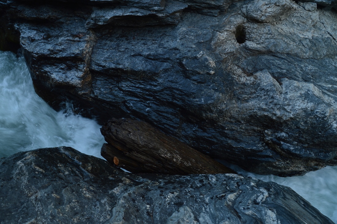
The Class V Crack-in-the-Hole Rapid is perhaps the most amazing rapid in the Canyon of Five Falls, where the mighty Chattooga River rushes through three tiny slots in a row of huge boulders.
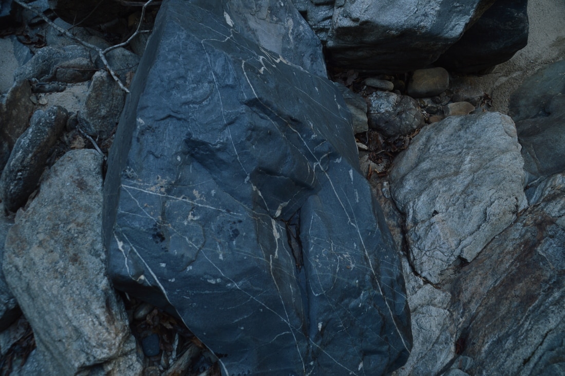
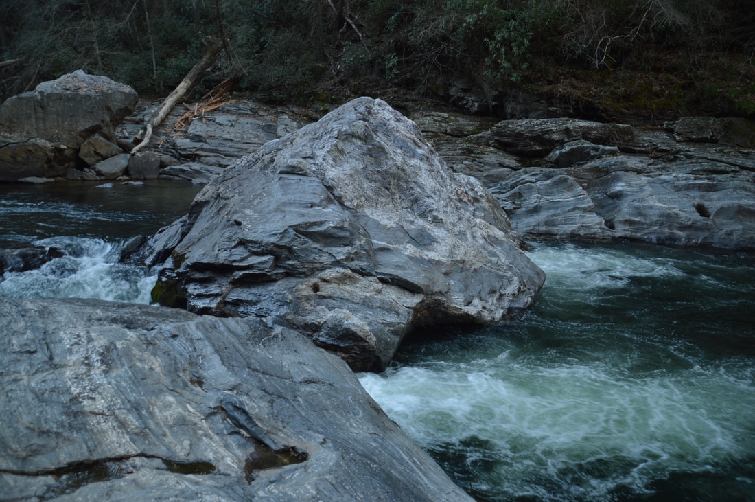
From Corkscrew Rapid, it is still fairly easy to get to the next rapid. In another 250 feet, at 0.95 miles, reach Crack-in-the-Rock Rapid among a group of house-sized boulders. This Class V rapid, which is frequently portaged by kayakers, is very unique and the most beautiful rapid in the canyon, in my opinion. At this rapid, the Chattooga River rushes through three narrow slots in a line of huge boulders that stretches across the gorge. It is incredible how the huge river gets squashed into these tiny passages! At least some of the slots (cracks) are often filled with wood, and today, a piece of wood was wedged in the Rught Crack. From the west side of the river, where you're standing (kayakers call it River Right), it is possible to jump across the Right Crack - depending on the water level, of course - and scramble up the tall boulder in the middle of the river. From the top of the boulder, the Middle Crack and Left Crack are visible, and there is also a commanding view of the Chattooga River upstream and downstream. There are deep pools just below the "cracks in the rocks".
Reaching the final two rapids of the Canyon of Five Falls (Jawbone Rapid and Sock-em-Dog Rapid) requires significantly more effort. The river bank becomes impassable a short distance downstream from Crack-in-the-Rock Rapid, requiring either a very deep wade or a tough scramble around a tall cliff. It was getting late by now, so I decided that Crack-in-the-Rock was a good place to turn around. The first three rapids and the gorge are still absolutely worth seeing, but if you wish to continue further, keep in mind that Jawbone Rapid is another 250 feet farther and Sock-em-Dog Rapid is 500 feet farther. Otherwise, simply retrace your steps from Crack-in-the-Rock Rapid back to the trailhead, concluding the hike at 1.9 miles. Mileage
0.0 - Watergauge Trailhead
0.3 - Chattooga River 0.5 - Camp Creek; Trail Terminus 0.85 - Entrance Rapid 0.9 - Corkscrew Rapid 0.95 - Crack-in-the-Rock Rapid 1.9 - Watergauge Trailhead Variations
Include the side trip to Little Woodall Rapid - 2.9 Miles
Include the extension to Jawbone Rapid and Sock-em-Dog Rapid - 2.1 Miles Bonus Stops
The Raven Rock Trail, which leads to the Raven Rock Cliffs on the Chattooga River, can be accessed off FS 511B. Also, Cliff Creek Falls can be accessed off FS 511.
PicturesVideos
4 Comments
Alex
10/6/2018 10:36:18 am
If anyone has any recent tips for this hike, I'd appreciate them! I don't find the rock hopping along the river easy or straightforward and i believe the landscape has changed since this writing. Although i can see 5 falls just ahead, I can't reach it! Perhaps I must commit to swimming. Attempting a 2nd time today. Thanks for the excellent trail report, Mark!
Sara
6/19/2022 03:22:51 pm
My husband and I attempted this hike yesterday and only got as far as the section where you have to get down in the water around a car-sized boulder below a small rapid. The water level was higher than when the original trip report was written and we were not willing to get into water that deep or fast. This hike is probably more easily done at lower water levels in early spring or early fall, but then the water temperature will be a factor. I don't know how the author could bear the water temperatures in March!!
Matt
5/8/2020 05:18:06 pm
Thanks for the report. I 've been to water gauge road before and hoped i could hike down to the rapids. Might make a trip this weekend to try your route.
Sara
6/19/2022 03:24:35 pm
Note that this hike is much more challenging (maybe impossible) at the higher water levels that are typical during the summer. We were not able to make it around the bend to the falls; or at least were not willing to brave the deep water and fast currents to get there when we went yesterday. Check gauge levels. When this post was made, discharge in the Chattooga River at Clayton was 150-200 cfs. When we went yesterday it was ~300 cfs. Leave a Reply. |
About MeMark Oleg Ozboyd Dear readers: I have invested a tremendous amount of time and effort in this website and the Georgia Waterfalls Database the past five years. All of the work that has gone in keeping these websites updated with my latest trip reports has almost been like a full-time job. This has not allowed me to pick up a paid job to save up money for college, and therefore, I I've had to take out loans. If you find the information on this website interesting, helpful, or time-saving, you can say "thanks" and help me out by clicking the button above and making a contribution. I will be very grateful for any amount of support you give, as all of it will apply toward my college tuition. Thank you!

Coming in 2022-2023?
Other Hiking WebsitesMiles HikedYear 1: 540.0 Miles
Year 2: 552.3 Miles Year 3: 518.4 Miles Year 4: 482.4 Miles Year 5: 259.9 Miles Archives
March 2021
Categories
All
|


 RSS Feed