Black Rock Mountain State Park is the highest state park in Georgia. The main attractions of the park are its numerous vistas, a small lake, and a strenuous trail system. While one of the hardest hikes in Georgia, hiking the entire trail system in a day will present many rewards, including four vistas, three water features, and several different ecosystems. This hike occurred on Saturday, May 30th, 2015. My plan was to hike the entire trail system of Black Rock Mountain State Park as follows, with the starting point at the Black Rock Lake Trailhead. First, I would hike the Black Rock Lake Loop counter-clockwise. Then, I would continue to the James Edmond Backcountry Trail, and take the West Fork up Black Rock Mountain past Greasy Creek Falls to the upper trailhead. From here, I would hike the Tennessee Rock Loop clockwise past Tennessee Rock Overlook and then cross Black Rock Mountain Parkway to hike the Springhouse Trail to the Trading Post. Then, I would hike the short but steep trail to Ada-Hi Falls (a mere trickle most of the time) and also hike the short Norma Campbell Cove Trail. Before descending the mountain, I would also hike the Visitor Center Connector to Blue Ridge Overlook and Black Rock Overlook. Following this, I would retrace my steps to the upper trailhead. Finally, I would take the East Fork of the James Edmond Trail down to Taylors Creek and its cascades and then up and over Lookoff Mountain (with the side trip to Lookoff Mountain Overlook) to the hike's terminus at Black Rock Lake.
R/T Length of Trail: 12.3 Miles
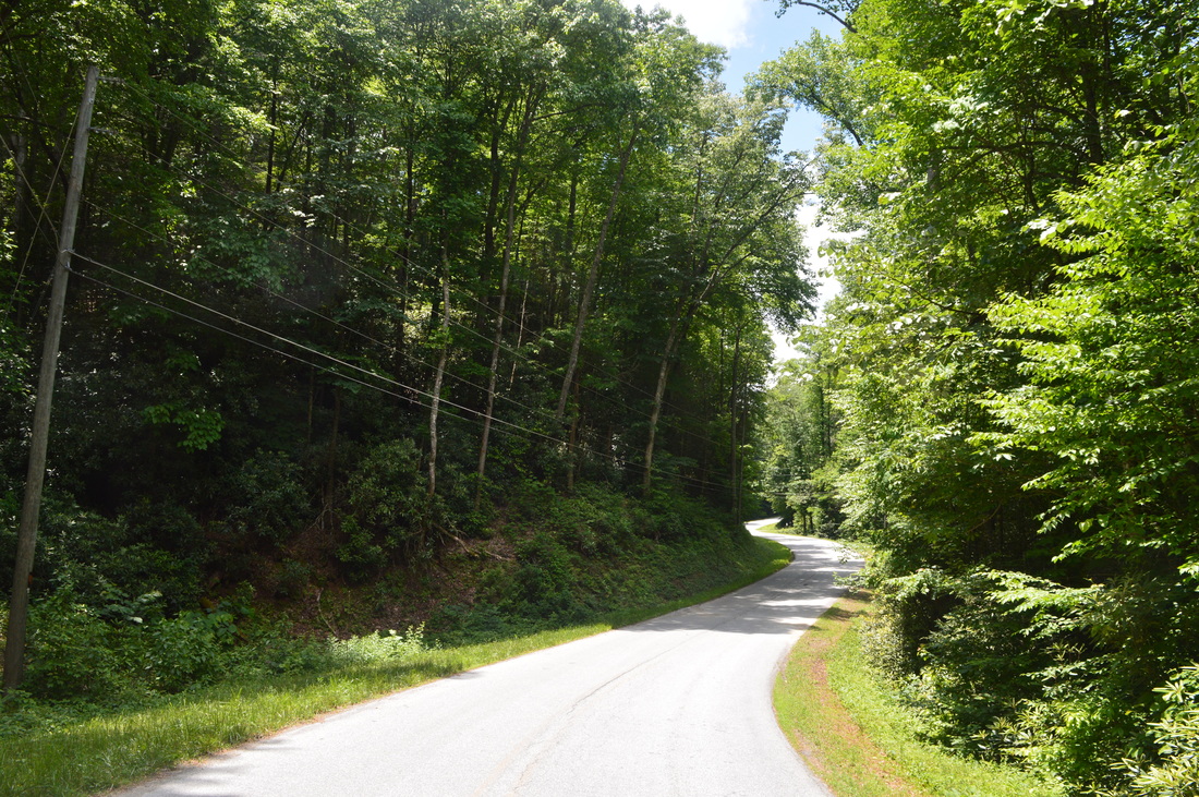
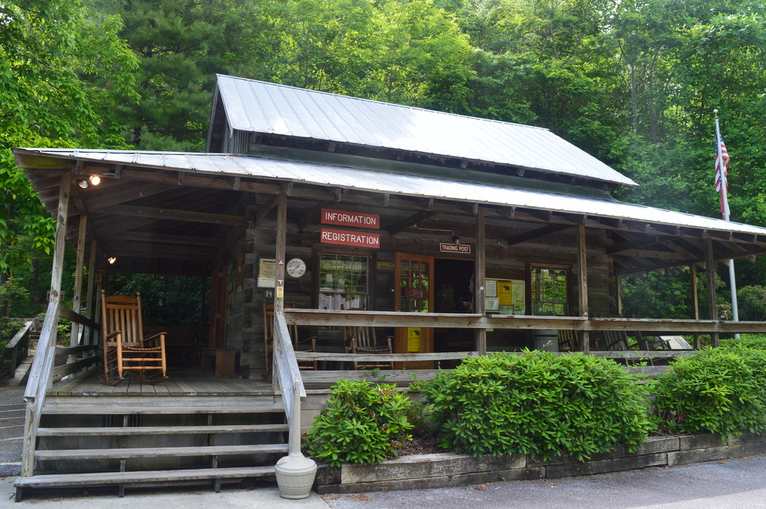
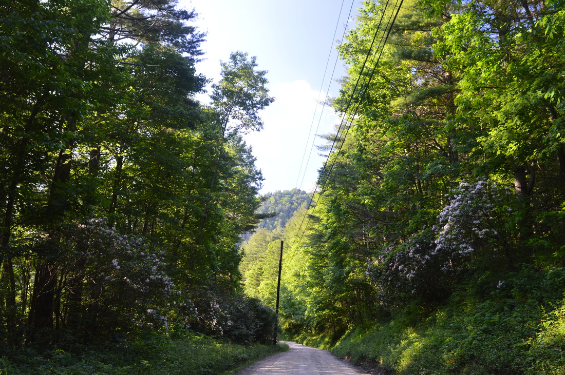
Duration of Hike: 9:15 Type of Hike: Triple Loop with Spurs Difficulty Rating: 9 out of 10 Pros: Many points of interest; generally well-maintained trails; many access points and potential shortcuts Cons: Steep to sometimes very steep grades on most of the elevation changes Scenic Views: Lookoff Mountain Overlook - 8 stars; Tennessee Rock Overlook - 8 stars; Black Rock Overlook - 6 stars; Blue Ridge Overlook - 5 stars Water Features: Cascade on Taylor Creek - 3 stars; Greasy Creek Falls - 3 stars; Ada-Hi Falls - 1 star Trail Blaze Color(s): James Edmond Backcountry Trail - Orange; Tennessee Rock Loop - Yellow; Springhouse Trail - None; Ada-Hi Falls Trail - None; Visitor Center Connector - None; Black Rock Lake Loop - None Best Season(s) to Hike: Spring Beginning Point: Black Rock Lake Trailhead Directions: From Mountain City, GA: From US Route 23/441, take Black Rock Mountain Parkway westward for 1.1 miles. Then, turn sharply right onto unpaved Taylors Chapel Road and follow it for 0.7 miles. The parking area will be below the main road just to the left, marked by a sign "Black Rock Lake Trailhead".
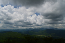
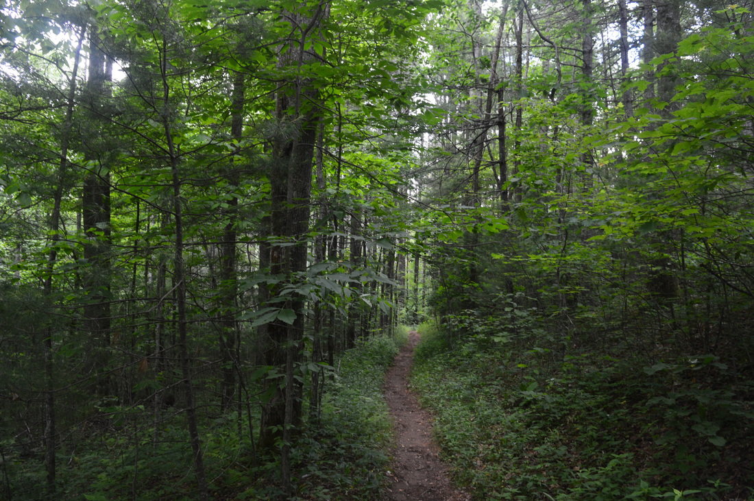
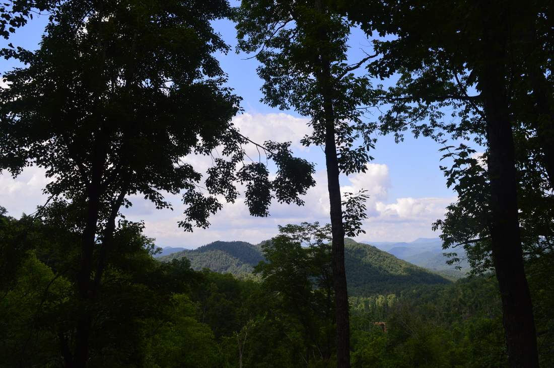
When you're thinking about Georgia hiking, most of the time the hikes will never be too difficult, with notable exceptions in the Cohutta Wilderness. However, despite the anticipation of the easiest hikes being in state parks, the hike described here is on of the hardest I have done in Georgia. The reason for this is that the state park has taken few efforts to make the trails easier, and the lack of switchbacks nearly everywhere is a big problem on this hike. Wherever the elevation is changing on this hike, it's going to be steep - and that means nearly everywhere. It doesn't matter if it's up or down, because both will wear you out pretty fast.
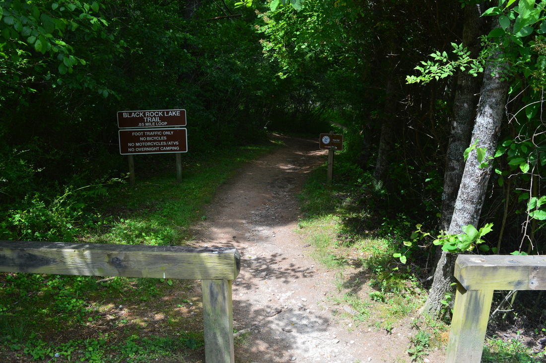
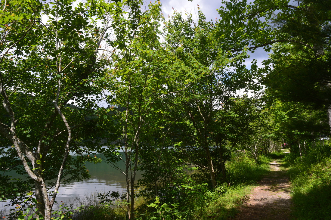
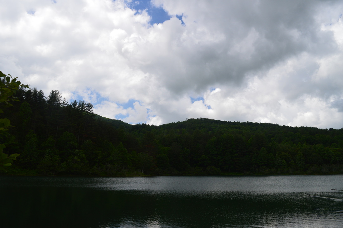
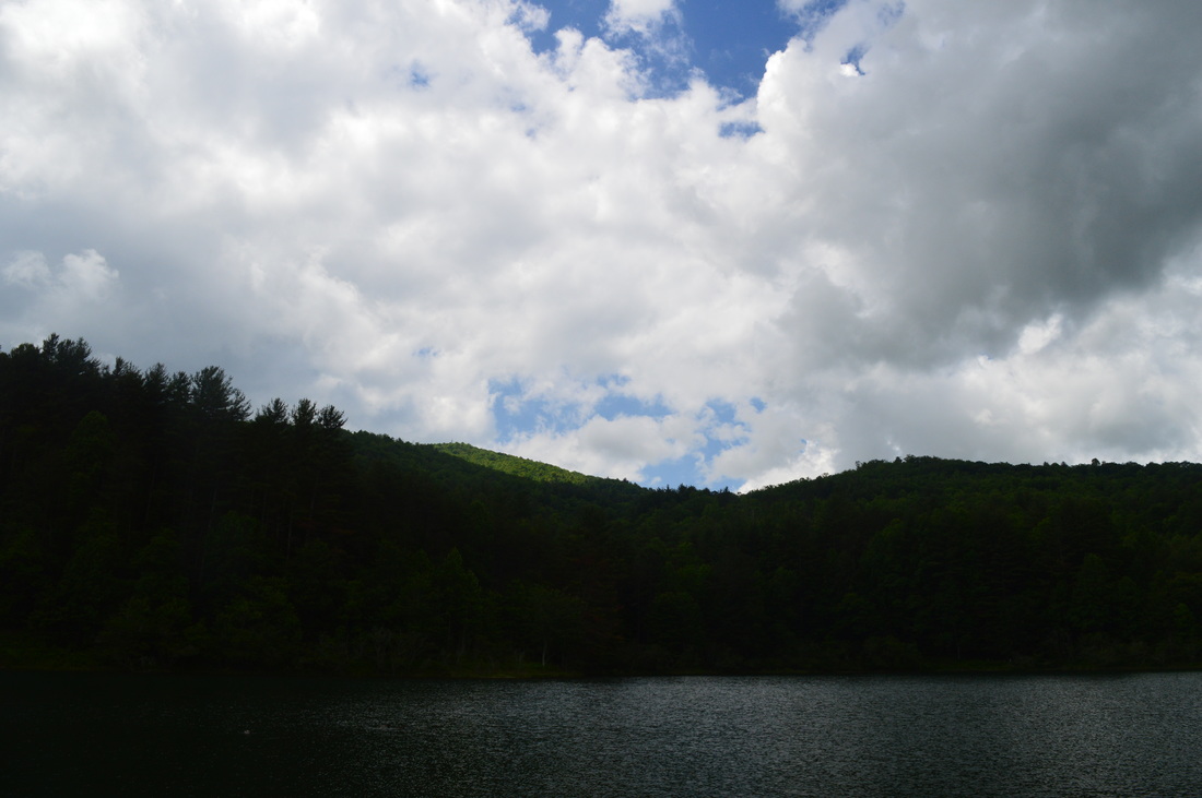
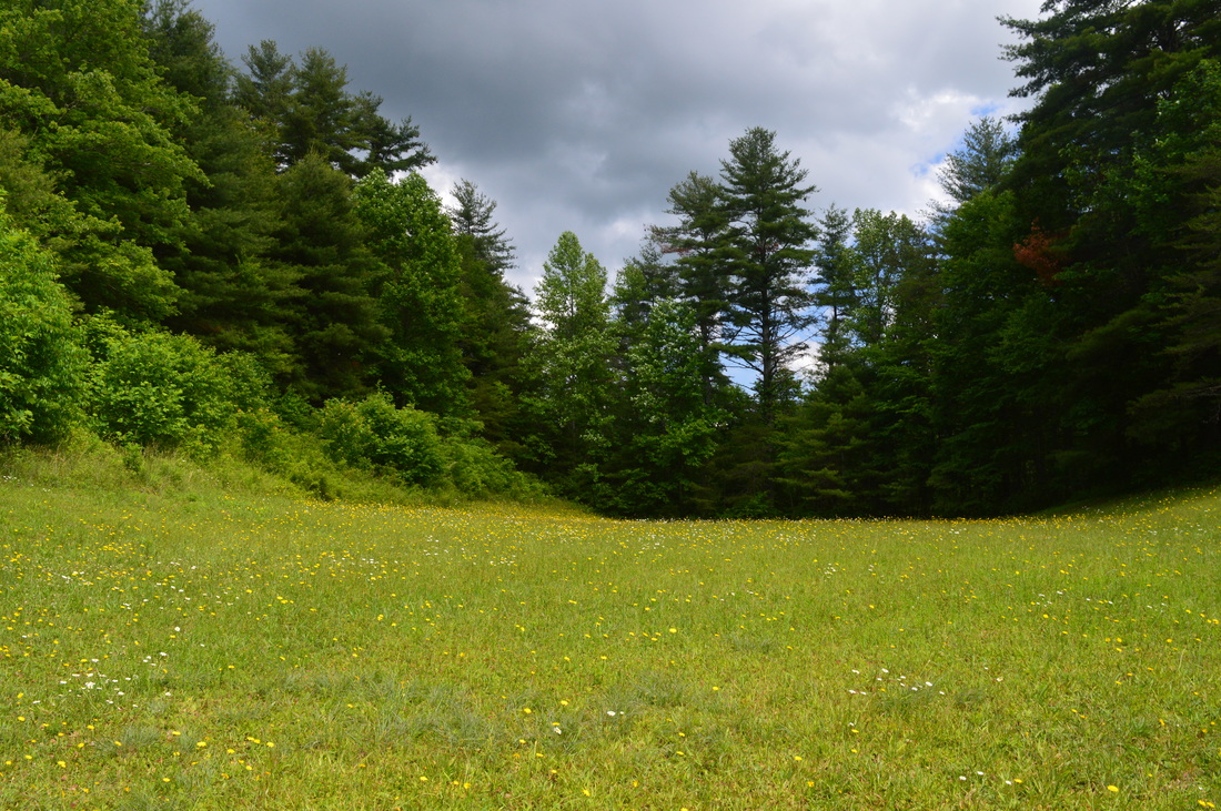
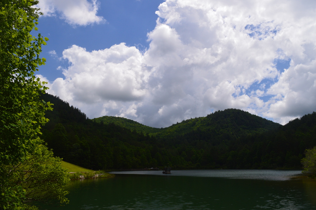
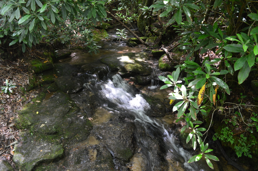
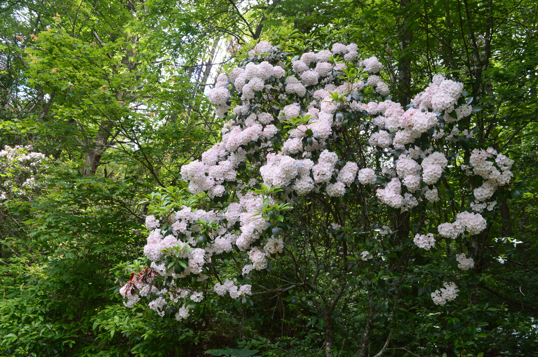
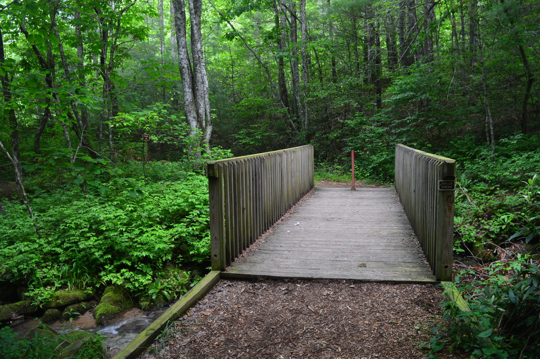
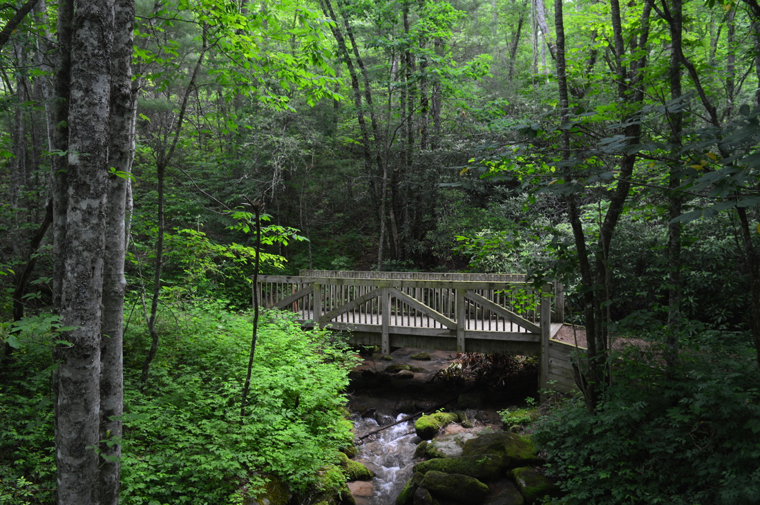
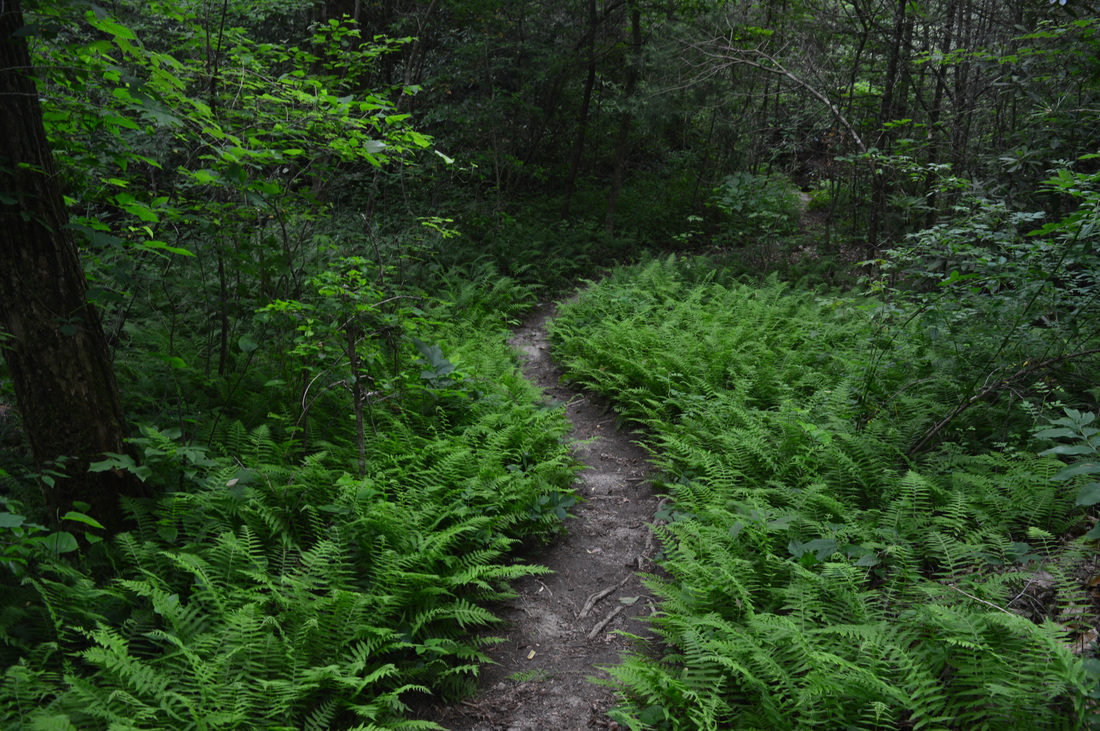
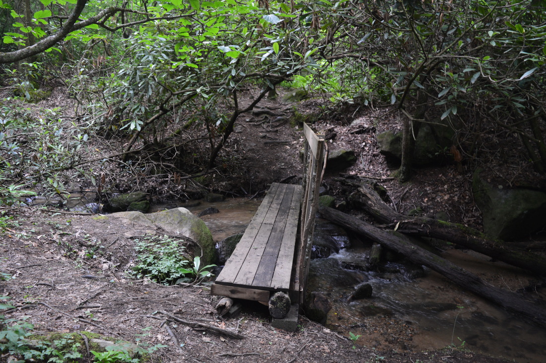
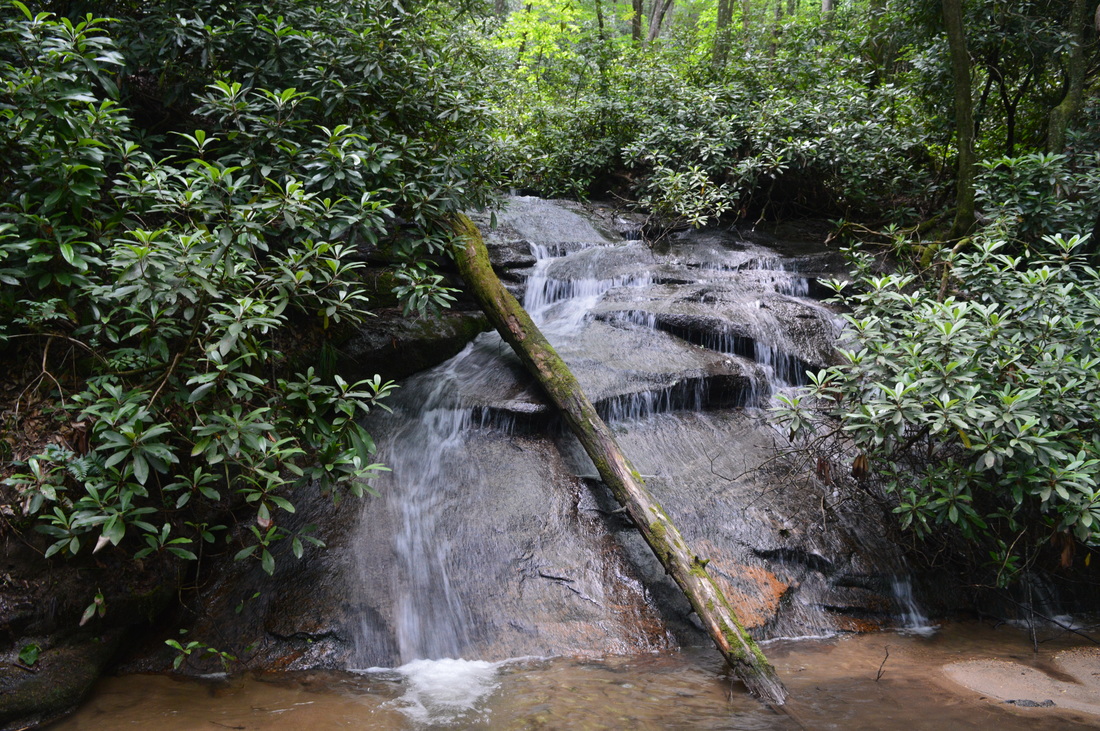
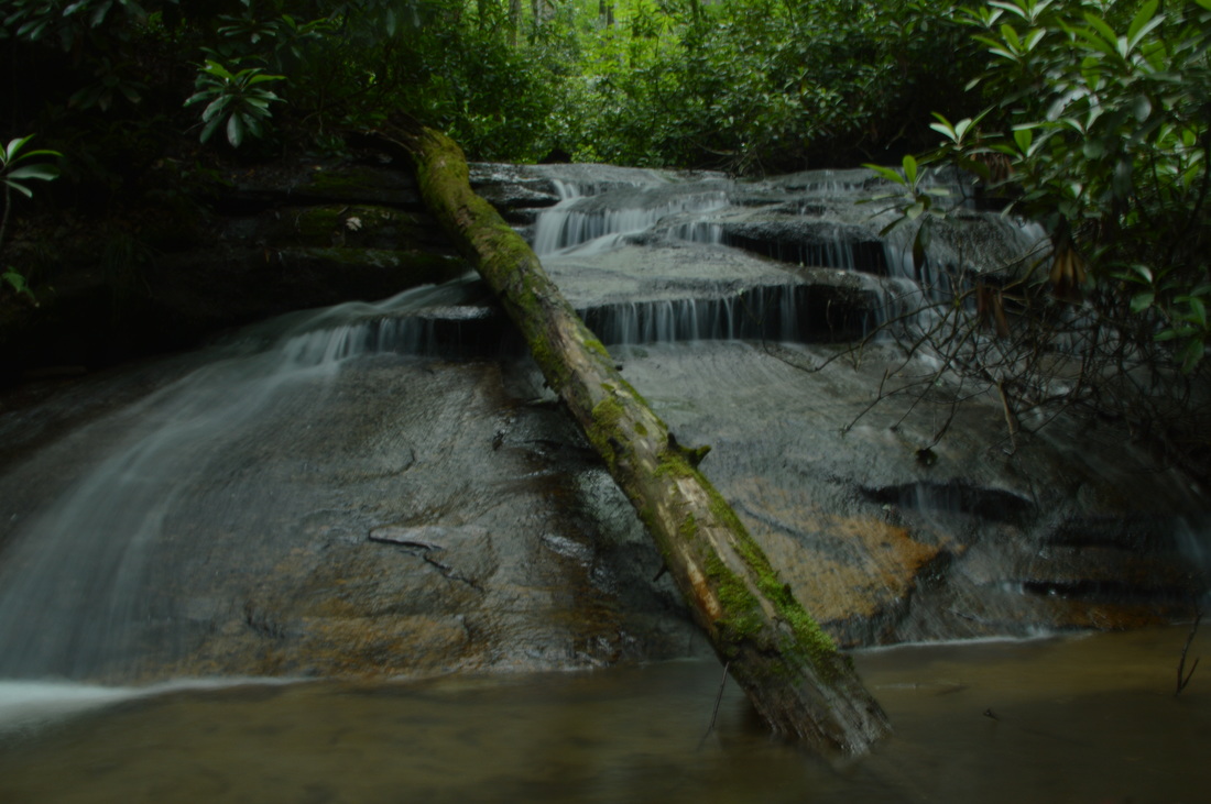
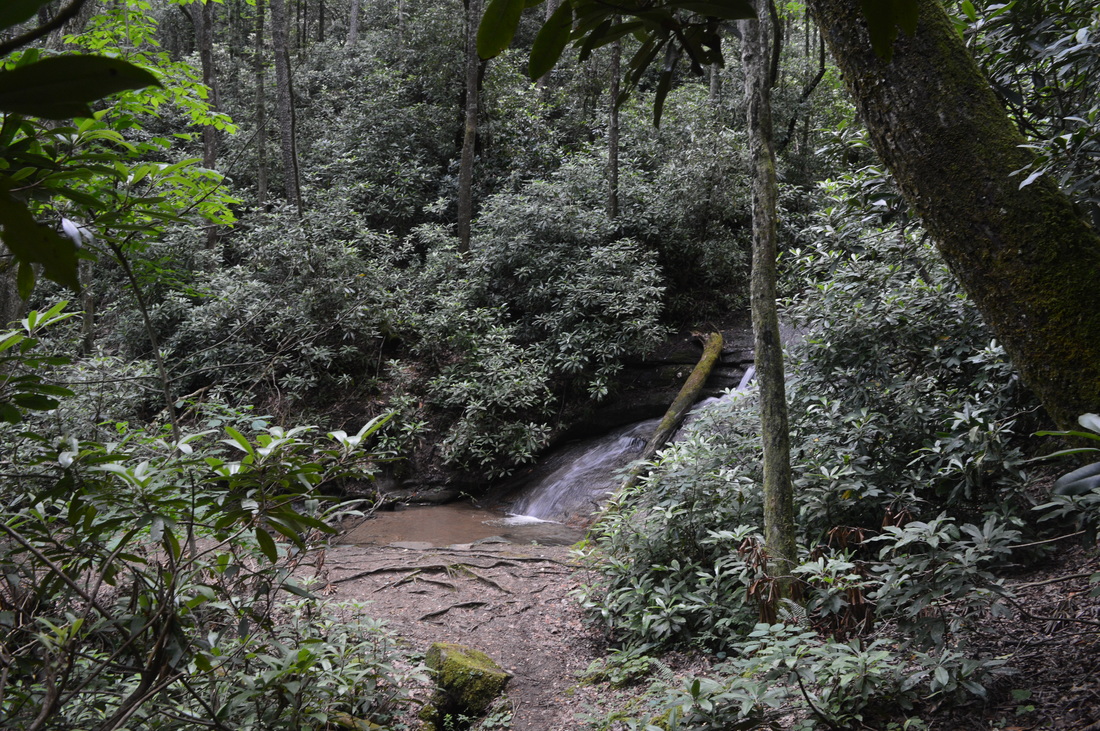
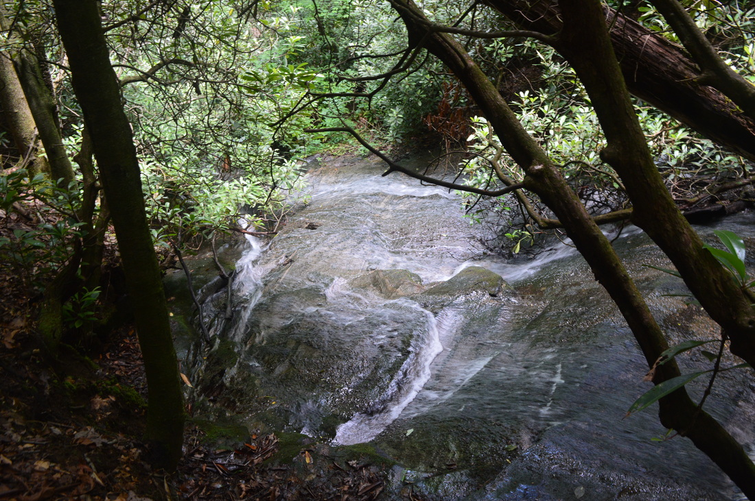
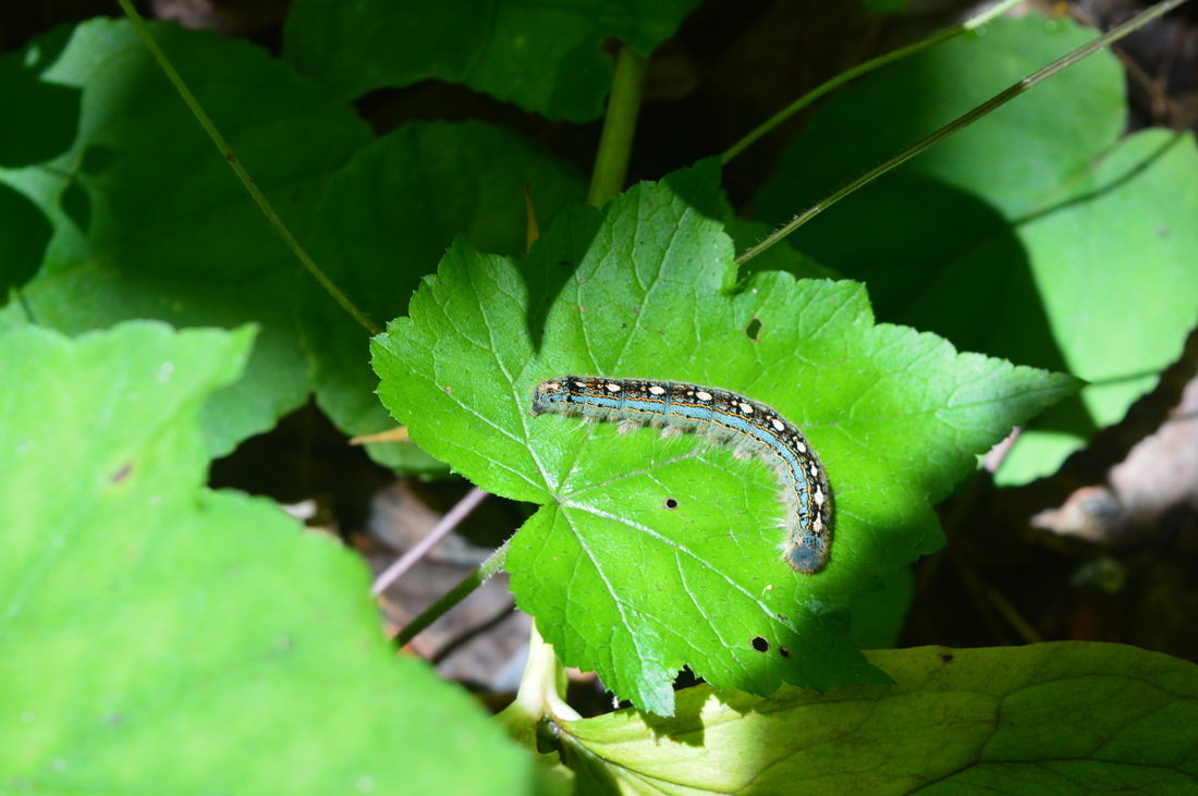
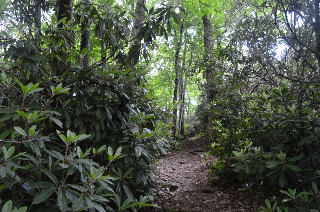
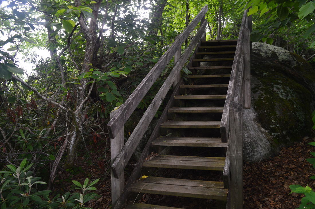
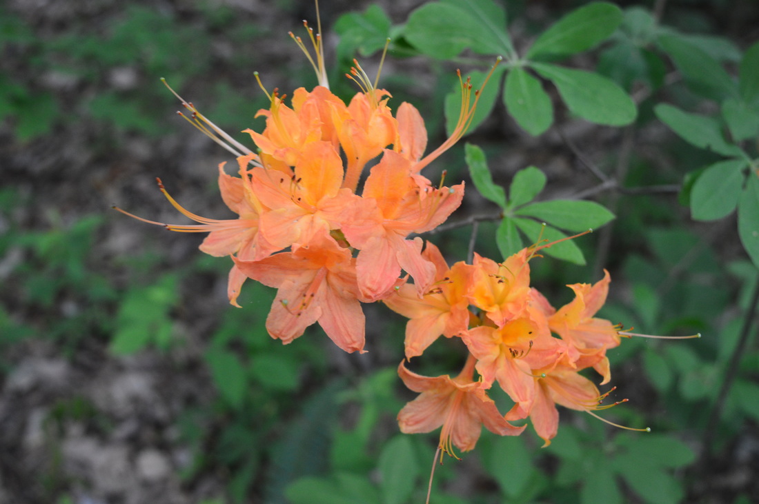
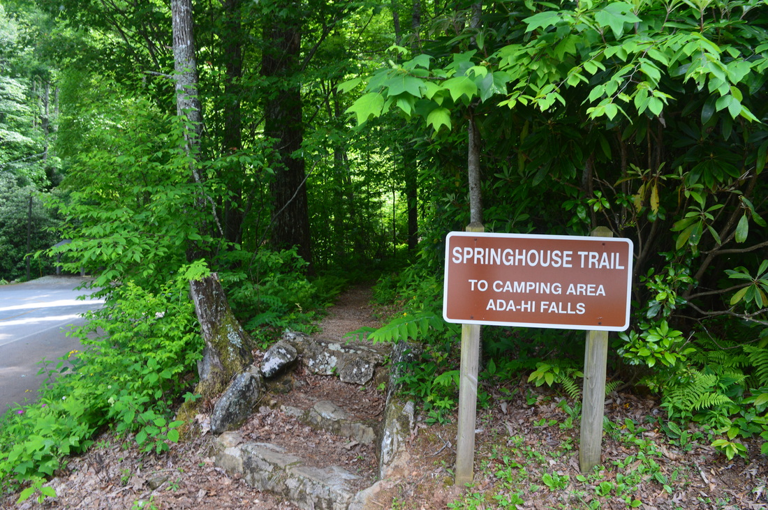
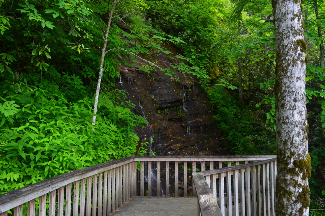
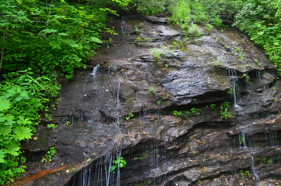
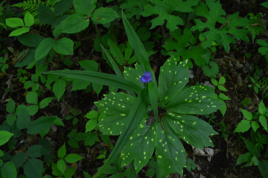
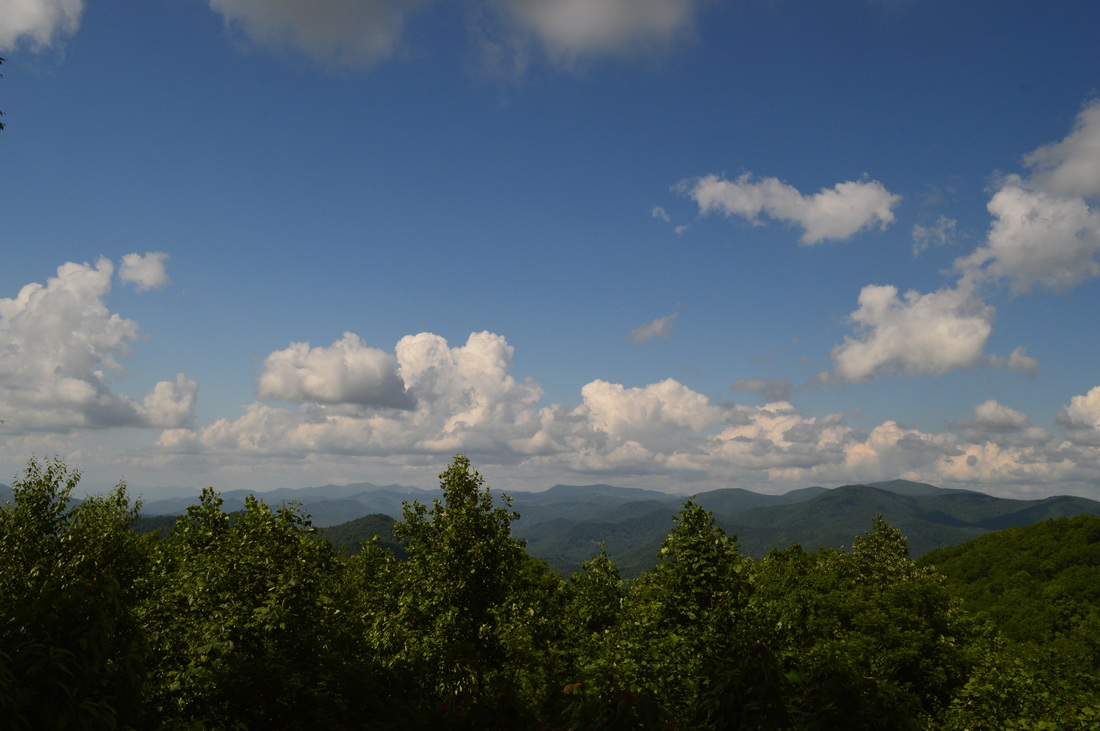
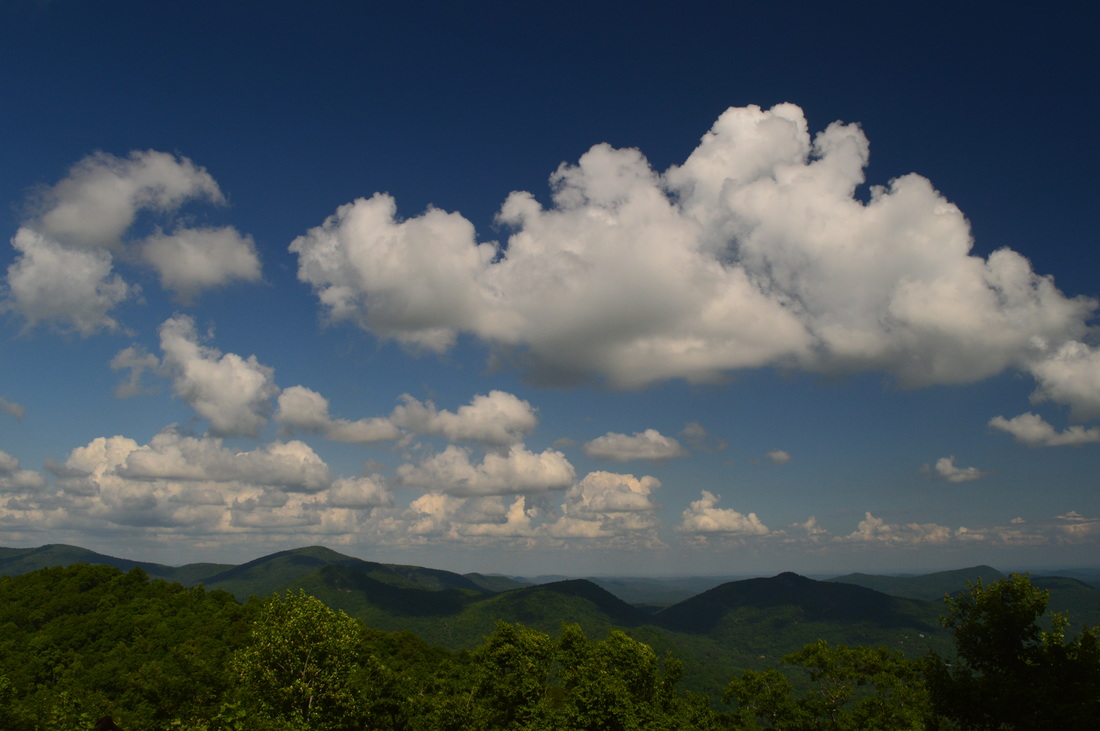
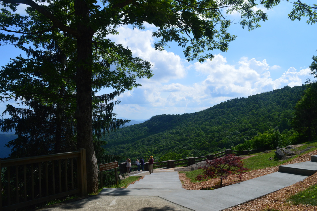
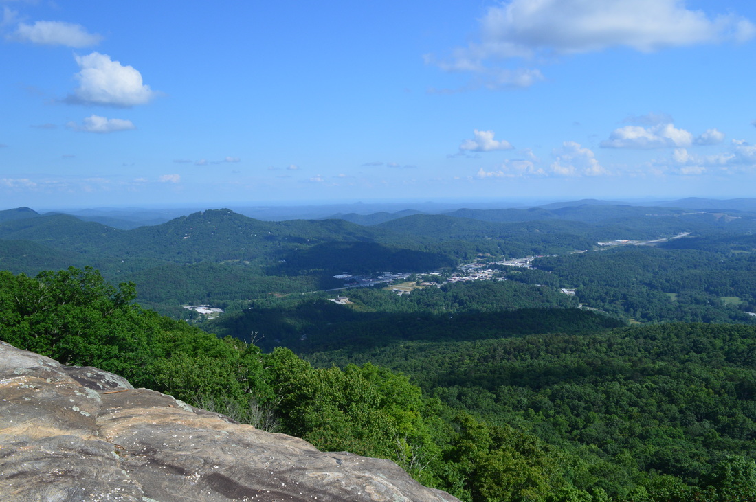
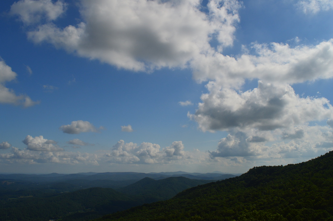
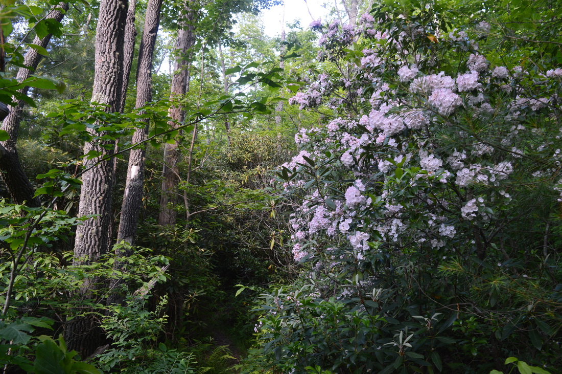
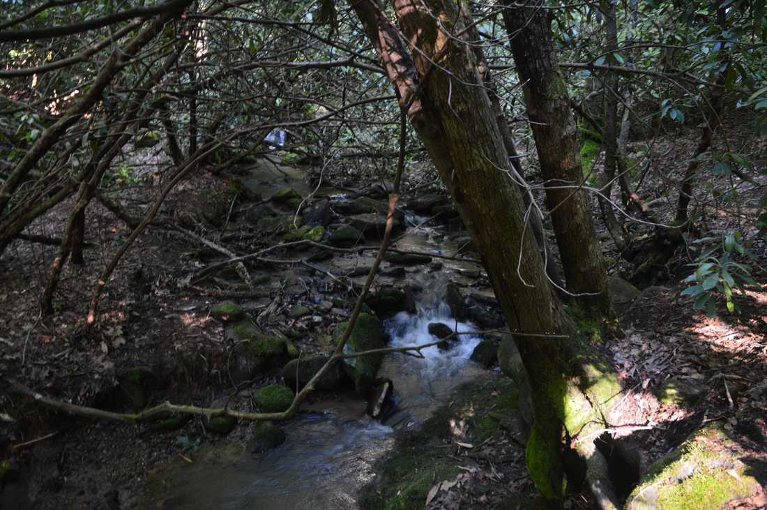
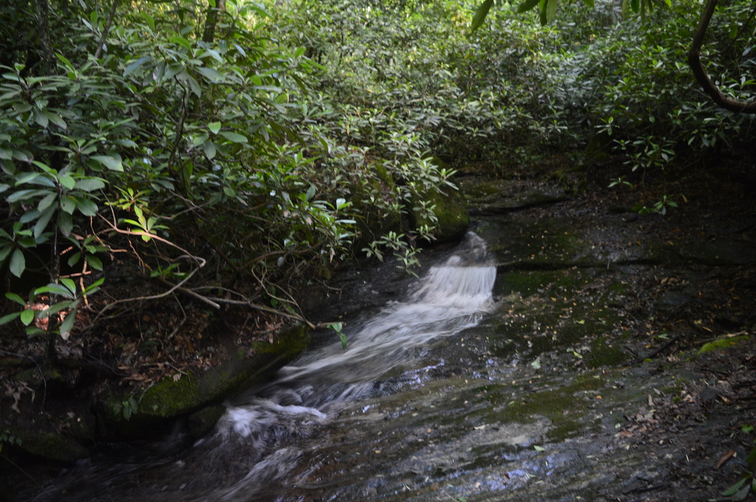
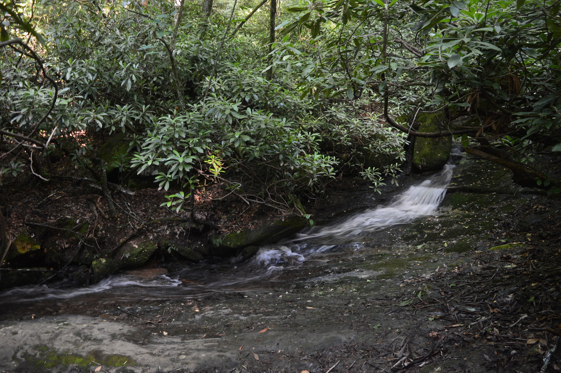
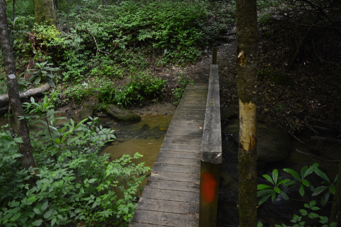
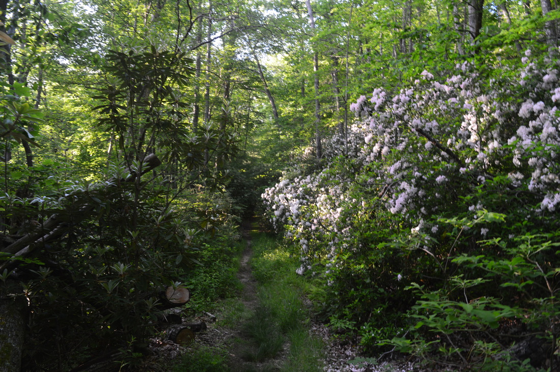
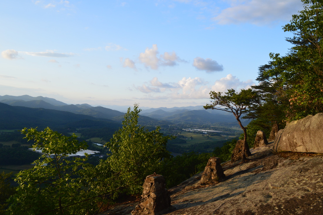
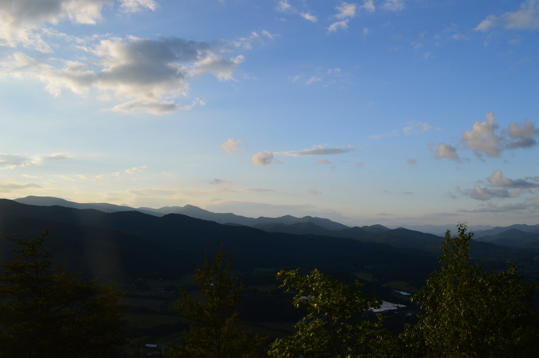
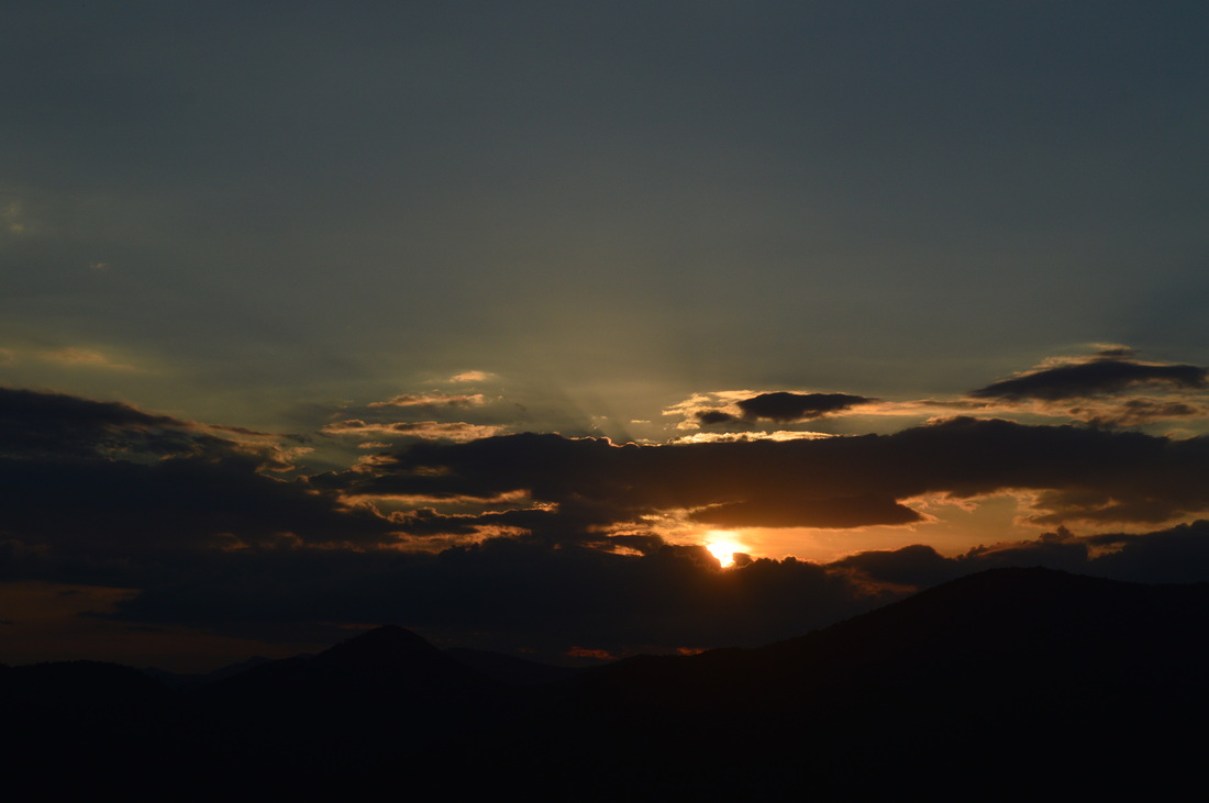
The best way to start this difficult hike is to hike the loop around Black Rock Lake for a leg-stretcher, because I don't think you would want to by the time you're done! The total length of the lake loop is 0.95 miles. Take the wide trail on the lower end of the parking lot. Shortly, reach a split. Turn right to follow the loop counter-clockwise. The path follows the lakeshore closely, before reaching the second parking area at the lake. There is an observation deck here with a great view of the lake, although my favorite viewpoint of the lake is further down near the dam. After this parking lot, take a boardwalk-type footbridge over a corner of the lake and continue onto a ravel path along the dam of the lake. There are great views to be found here. From left to right, you are looking at Lookoff Mountain, Marsen Knob, Scruggs Knob, and Black Rock Mountain, although the last one is better visible earlier. After rounding the dam, cross another boardwalk-type footbridge and continue to Greasy Creek, which has a small footbridge over it. Greasy Creek has some small cascades here. Around here I saw some mountain laurel in full bloom. There was going to be TONS more of mountain laurel throughout the hike. I've never seen so much of it on one hike. After Greasy Creek, following some more lakeshore hiking, cross Taylors Creek on another footbridge, and reach the parking area at 0.95 miles. There is a small connecting trail somewhere in the Taylors Creek vicinity that leads to James Edmond Trail, but I missed it, so I just roadwalked up the road to the first James Edmond Trail crossing at 1 mile. Turn right onto the James Edmond Trail, and descend to Taylors Creek amidst a sea of ferns. Cross Taylors Creek on a footbridge at 1.1 miles, and start a gradual ascent up Black Rock Mountain. The lake is visible through the trees on the right. At 1.5 miles, reach Greasy Creek following a brief downhill. Cross it on a footbridge, and follow the creek upstream. Shortly afterwards, reach Greasy Creek Falls. It's a large waterslide slightly on the low-flow side. Following Greasy Creek Falls, make two switchbacks, at the second of which a spur trail leads right 100 yards to the Creek/Ridge Campsite. After this spur trail, pass another waterslide on the left. A short scramble will put you near the top of the waterslide. Continue to closely follow Greasy Creek, crossing it on another footbridge at 1.8 miles. Cross Germany Valley Road at 1.9 miles and ascend steps to begin a steeper ascent up Black Rock Mountain. After some moderately steep grades and mountain laurel blooms, reach the junction at 2.1 miles with the out-and-back section of the James Edmond Trail that leads to the upper trailhead. The loop turns acutely left here, but don't take the loop - you will take it later. For now, bear right to continue following my hiking route, unless you think that you want to skip the upper portions of the hike. The trail starts steeply ascending with few switchbacks up a lead. However, after some climbing, the trail turns left, crosses the lead, and stays nearly level or slightly uphill along the contours of the hill. This easier uphill continues all the way to the upper trailhead. After crossing a seep, make two switchbacks and reach a major junction just before the upper trailhead at 2.5 miles. Here, the James Edmond Trail bears left to reach the trailhead in about 50 yards. You'll go there later. For now, turn right onto the Tennessee Rock Loop. The Tennessee Rock Loop switchbacks two times before reaching a junction. This is where the loop splits. Turn left here to hike the loop clockwise. It is the better direction, as your ascent will be shorter that way. The trail ascends moderately, before reaching Black Rock Mountain Parkway at 3.1 miles. Across the road, there is a Tennessee Valley Divide sign. Do not cross the road - the trail goes back into the woods on the same side of the road on its way to the summit of Black Rock Mountain. After passing some rhododendron and a couple small breaks in the trees, reach Tennessee Rock Overlook at 3.3 miles. This spectacular vista faces northward with a breathtaking 180-degree panorama of dozens of mountains and ridges similar to sandhills. On the far left are the Tusquitee Mountains; straight ahead are the Nantahala Mountains; and to the right are the Cowee Mountains and Franklin. A hiking book mentioned a view into Georgia as well. There is no Georgia view here in the summer, although there can be one potentially in winter. Following the vista, the trail descends a staircase into a small gap and then gradually ascends along the ridge to the wooded summit of Black Rock Mountain at 3.5 miles. There is a stone marker on the right here. From here, the trail becomes slightly more overgrown and begins a moderate descent with some switchbacks. At 3.8 miles, reach an unmarked trail on the left. This wide trail connects to the cottages. The Tennessee Rock Trail also widens here and bears right. A gentle downhill continues, which eventually turns into a mainly level trail with occasional short uphill stretches. At 4.3 miles, cross a lead and the Tennessee Valley Divide and make a short ascent. At 4.6 miles, a short spur trail on the right leads 100 yards to a boulder field, although this boulder field may not be visible well in summer. The spur trail reconnects to the main trail. Reach the end of the loop and the upper trailhead at 5.1 miles. Most folks start their hike here, although it would be harder if starting here. Carefully cross the road and continue onto the well-signed Springhouse Trail (it is also marked Ada-Hi Falls). The trail stays level and passes above a springhouse (hence the name). After this level stretch, a short but steep ascent (that's a theme of the hike) will bring you to a gap at 5.5 miles. Here, the Visitor Center Connector turns right. You'll go there later. For now, continue straight down a very steep descent to the Trading Post, reaching it at 5.55 miles. The Springhouse Trail terminates here, but there's two other short trails that leave the Trading Post. The first one is Ada-Hi Falls Trail. Turn left onto the road, pass in front of the Trading Post, and reach the start of the Ada-Hi Falls on the right. The sign that indicates the trail being a quarter-mile long doesn't mean much - the steepness, especially on the way back up, will make it feel like it's longer than that. Begin descending down a set of steps and then moderately down a wide dirt trail. There are several more sets of steps on the way down, and to me, this was like a miniature version of the Waterfalls Trail in Cloudland Canyon State Park. Near the end of the trail, there will be a decent vista of Marsen Knob, Scruggs Knob, and Lookoff Mountain to the north. The trail ends at 5.8 miles at an observation area of Ada-Hi "Falls". Out of the three waterfalls on this hike, this is the only officially named one, and it is also the worst one. The falls cascade in small trickles down a large rock cliff. While I have seen a few pictures of it with very good flow, I cannot imagine the type of conditions needed for it to look like that, especially because my visit was after nearly a week of intermittent rain. Now time for the good part - a steep uphill back from Ada-Hi Falls. Reach the Trading Post again at 6.05 miles. The next trail is the only part of this hike I would suggest to skip: Norma Campbell Cove Trail. This unmarked trail starts near one of the buildings behind the Trading Post. This trail seems to be a nature trail, but it is short and descends some elevation uselessly only to end in a dead-end at a fallen tree and a bench at 6.2 miles. According to the map, there is a small loop here, but I walked around and didn't find anything. The result was I had to climb back up moderately. Unless you simply want to hike all trails in the park or add mileage, then this trail should probably be skipped. From the Trading Post, continue back up the Springhouse Trail to the Visitor Center Connector at 6.4 miles. Turn left onto the connector here. After a feverishly steep one tenth of a mile, reach Blue Ridge Overlook at 6.5 miles. This is a mainly eastward view towards upstate South Carolina and the Highlands area. This vista is similar to Tennessee Rock Overlook, although it isn't as good. From here, cross Black Rock Mountain Parkway and continue slightly uphill. Reach the Visitor Center area at 6.7 miles, follow the road past the visitor center, and reach Black Rock Overlook down some steps on the left. This wide overlook is the only one on this hike with a good view into Georgia. Clayton and the Chattooga River area is on the left, and the Chattahoochee National Forest (with the exception of the US 441 corridor) covers the rest of the view. After you've enjoyed the view at Black Rock Overlook, retrace your steps down the road and then down the Visitor Center Connector to he Springhouse Trail at 7 miles. Turn left, and follow this trail back to the upper trailhead, reaching it at 7.4 miles. Cross he parking area and continue down the James Edmond Trail to the loop junction of East and West Fork mentioned earlier at 7.8 miles. Instead of turning left, bear right to continue the loop. The trail stays level and then reaches a small stream at 8 miles. Here, a spur trail on the right leads 40 yards to Fern Cove Campsite. The trail briefly ascends via a switchback but then levels out in thickets of mountain laurel. There are good winter views here, and amazing mountain laurel blooms in spring. The best time to see the mountain laurel show would be late May or early June. The trail stays nearly level for some time following the slopes of a lead, but at 8.4 miles, begin a very steep descent into the Taylors Creek valley. First it follows the lead rather steeply down, and then, the trail swings off the lead and becomes even steeper. At 8.7 miles, cross Germany Valley Road and continue descending steeply. As you descend, the lake will be visible through the trees on the left. At 9.2 miles, reach Taylors Creek. The descent ends here, and the trail now begins to gradually ascend along the creek. There are numerous small cascades. Soon, the trail becomes rougher and steeper. At 9.3 miles, reach a picturesque chute-type cascade/waterfall on Taylors Creek. While unnamed, to me this is the best water feature on the hike. Following this waterfall, continue a moderately steep and somewhat rough ascent along the creek. At 9.5 miles, turn left, cross a footbridge over Taylors Creek, and then ascend on steps to Taylors Chapel Road and cross the road. Note: if you are worn out by now, then turning left on the road is only 0.3 miles to the parking area - a fairly strenuous ascent still lays ahead along with a very steep descent. If you are feeling like you can make it, your reward will be a breathtaking vista on top of Lookoff Mountain, which to me, is the highlight of the hike. After the road crossing, you will be ascending moderately along an old road. Make a switchback, and continue the moderate ascent. There will be winter views of Black Rock Mountain and Black Rock Lake on the left. Scrugg Knob's summit is to your right, but you never actually reach the summit. Instead, you bypass it and reach a ridgeline with great winter views on both sides. The bulk of the ascent is now over. At 10.3 miles, reach Scrugg Gap. An old road comes in from the right and the trail joins it. The trail continues a gentle uphill along the slopes of Marsen Knob, although it never visits the summit just like with Scrugg Knob. At 10.5 miles, reach a junction. Here the West Fork and East Fork of the James Edmond Trail meet (or end). The main trail turns acutely left and downhill, but don't go there yet - a spur trail continues straight to Lookoff Mountain and its amazing vista. Take the spur trail and reach Gibson Gap at 10.6 miles. Then, begin a steep uphill to Lookoff Mountain. Shortly after the gap, reach a junction. Keep right here - both routes lead to the summit and the vista, but the one on the left up the old road is insanely steep. The gentler route on the right ascends along the slope of the mountain, bends a lead and then stays level on its north side. There are good winter views here. At 10.9 miles, just below the summit of Lookoff Mountain, rejoin the old road. Continue straight, steeply down a rock face for 100 yards to the Lookoff Mountain vista on the right. Lookoff Mountain Overlook is probably the best vista on this hike, although Tennessee Rock Overlook is very close. This elevation feels like a low-elevation one compared to the tall mountains all around, but it is still a very beautiful view. Far on the left, a long valley ends at Hightower Bald. Straight ahead Albert Mountain and Standing Indian Mountain stand high. To the right, Franklin can be seen and the mountains of the Blue Ridge Parkway's route are visible in the distance. Once you have received your fill of the view, continue back up the mountain. The path that continues from the overlook leads a tenth of a mile to Laurel Ridge Campsite, so unless you want to check it out, continue to the summit of Lookoff Mountain. This time, instead of taking the route around the summit, continue straight onto the wooded summit. The Lookoff Mountain Campsite is right at the summit. Once at the summit, take the old road leaving the summit on the right. This old road is very steep and eroded as it descends straight off the mountain. The descent moderates at the junction with the bypass. At 11.3 miles, rejoin the main trail. Bear right to continue following the loop. The next mile to the trailhead is easily the steepest on the entire hike - luckily, it's downhill, although as tired as you are by now, it won't be much better. The first 0.2 miles are extremely steep and eroded. Water likes this route, and there were no efforts made to prevent erosion control. At 10.5 miles, the descent suddenly stops, and the trail turns right onto the remnants of an old roadbed. This change isn't for long though. At 11.6 miles, cross a small stream and continue to descend steeply along it. The descent eventually moderates, and you will cross over a small lead, before you start descending somewhat steeply again. The steepest is over, but it is still pretty steep all the way to Taylors Chapel Road. Reach the road at 12.2 miles. Turn right here, and reach the parking area at 12.3 miles. To summarize, this is a strenuous hike but with great rewards at the vistas. If you're interested in seeing the mountain laurel blooms and the waterfalls at their best, go in spring. Winter may provide its own rewards with additional winter views. Below are my pictures and videos.
1 Comment
8/3/2022 05:39:47 pm
Edirne ECA servisi en uygun fiyat ve en hızlı servis garantisi ile sizlerle. https://www.edirneklimaservisi.com/edirne-eca-servisi/ Leave a Reply. |
About MeMark Oleg Ozboyd Dear readers: I have invested a tremendous amount of time and effort in this website and the Georgia Waterfalls Database the past five years. All of the work that has gone in keeping these websites updated with my latest trip reports has almost been like a full-time job. This has not allowed me to pick up a paid job to save up money for college, and therefore, I I've had to take out loans. If you find the information on this website interesting, helpful, or time-saving, you can say "thanks" and help me out by clicking the button above and making a contribution. I will be very grateful for any amount of support you give, as all of it will apply toward my college tuition. Thank you!

Coming in 2022-2023?
Other Hiking WebsitesMiles HikedYear 1: 540.0 Miles
Year 2: 552.3 Miles Year 3: 518.4 Miles Year 4: 482.4 Miles Year 5: 259.9 Miles Archives
March 2021
Categories
All
|


 RSS Feed