Chattahoochee National Forest: Big Thunder Falls & Canyon on Clear Creek, Sky Valley, Georgia8/29/2017 
Overflow Creek in extreme northeast Rabun County is well known for its spectacular kayaking opportunities due to the creek's numerous powerful rapids and cascades. Overflow Creek has few major tributaries until it ties into the West Fork Chattooga River at Three Forks. The largest Georgia tributary is Clear Creek, a sizable stream on its own that flows from an adjacent North Carolina valley. Between the point where it enters Georgia and where it joins Overflow Creek, Clear Creek drops down two large waterfalls - the second of which is perhaps the most unique waterfall in the state. Accurately named Big Thunder Falls, this waterfall consists of a 35-foot drop hidden in an extremely narrow canyon, and while you may hear the waterfall long before you get to the canyon, you will find it very difficult to get any decent view of the falls itself. But even if you can't put your eye on Big Thunder Falls proper, the destination - an incredible very rare slot canyon in a pristine setting - is well worth the effort required to get there. The hike to Big Thunder Falls is absolutely not for beginners, as it consists of a long cross-country trek without the benefit of trails, but experienced waterfall enthusiasts and hikers seeking adventure will enjoy it immensely. This hike occurred on Friday, August 18th, 2017. My plan was to hike along a very overgrown gated forest road from the end of Billingsley Creek Road (FS 86B) to the vicinity of Clear Creek, where I would find a way to travel upstream to Big Thunder Falls. I would also make a brief detour to see Put-In Falls on Overflow Creek near the trailhead.
Summary
R/T Length of Trail: 4.9 or 5.1 Miles (see details)
Duration of Hike: 6:50 (with about 2 hours of break) Type of Hike: Out and Back Difficulty Rating: 9 out of 10 (tough off-trail trek), 10+ if you try to get into the canyon (dangerous, see details) Total Elevation Gain: 1084 Feet Pros: Pristine destination Cons: Difficult off-trail hike with strenuous bushwhacking and creek-walking - for experienced hikers only Points of Interest: Big Thunder Falls & Canyon - 10 stars; Put-In Falls - 4 stars Trail Blaze Colors: None, no official trails Best Seasons to Hike: Late Fall or Early Spring (when vegetation is thinner but when it is warm enough to wade creeks) Fees: None Beginning Point: End of Billingsley Creek Road (FS 86B) Directions from Sky Valley, GA: From the intersection of Bald Mountain Road and Hale Ridge Road just east of Sky Valley, follow Hale Ridge Road East - which turns into unpaved FS 7 - for 3.6 miles. Then, continue straight onto Overflow Creek Road (FS 86) where Hale Ridge Road turns right. In another 2.4 miles, bear left onto Billingsley Creek Road (FS 86B). Follow Billingsley Creek Road for 3.7 miles to a dead-end and turnaround area in front of a gate. There is plenty of parking space here. The roads along the route to the trailhead should be passable by most passenger vehicles. Map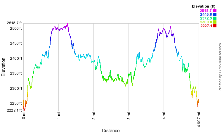
Click the link below to download a .GPX file with a track of this hike.
Details
Big Thunder Falls on Clear Creek may be the most unique waterfall I've ever stumbled upon in Georgia, especially for such a little-known location. Hardcore waterfaller Bernie Boyer discovered two waterfalls on Clear Creek in 2010 that were unknown to the hiking community. He christened the lower waterfall Big Thunder Falls, due to how loud yet hard-to-see it is. The upper waterfall on Clear Creek is simply known as Clear Creek Falls or Upper Clear Creek Falls. Upper Clear Creek Falls is a lot smaller but it is still very scenic. This trail report covers the hike to only the spectacular Big Thunder Falls. However, it is worth noting that a quick side trip to Put-In Falls is highly recommended when you do this hike.
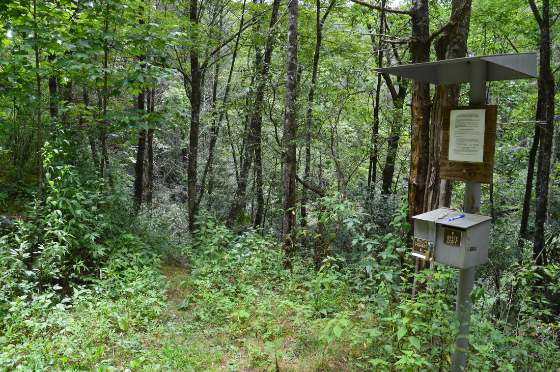
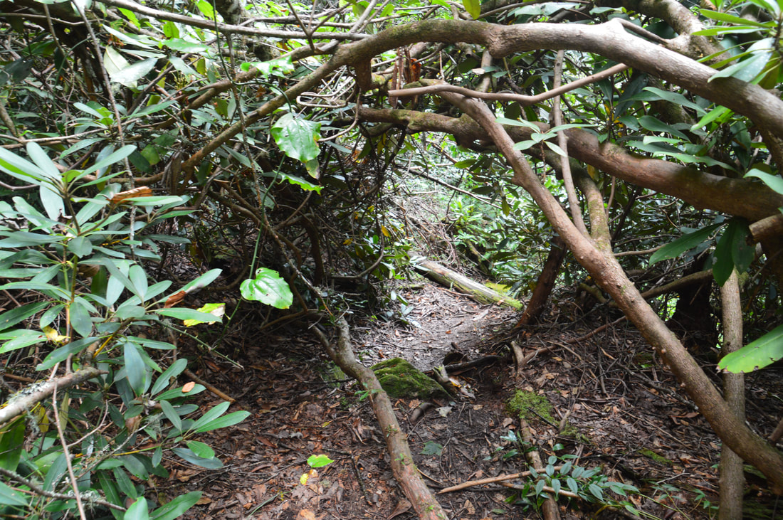
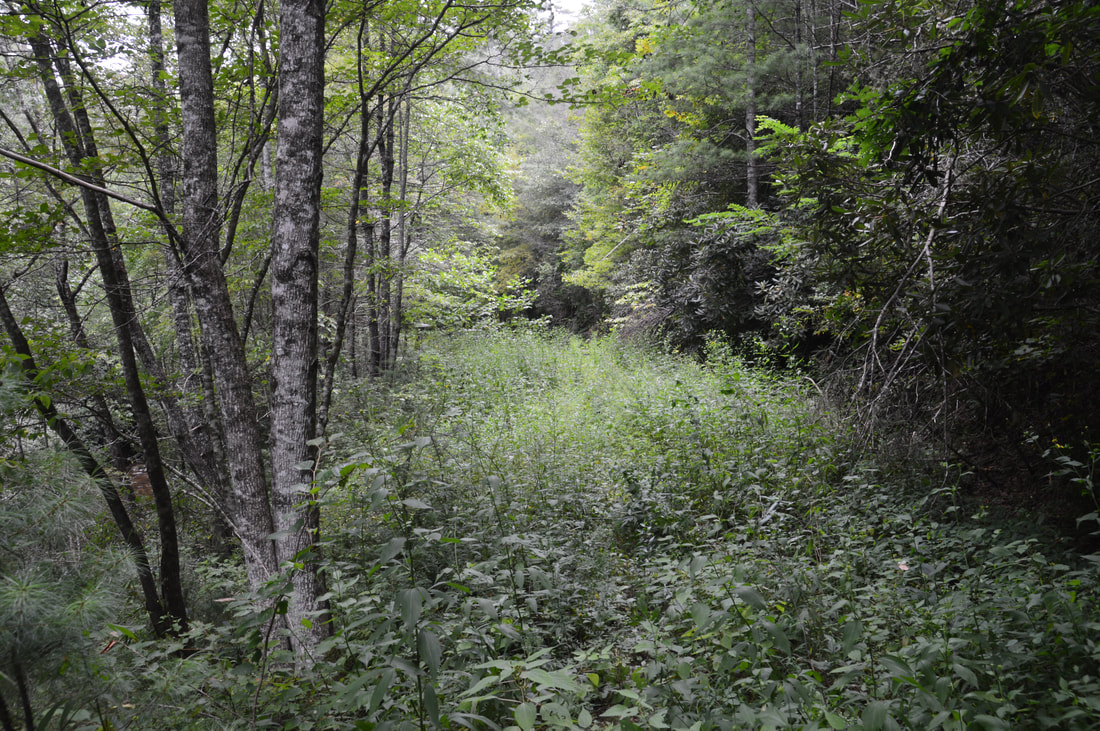
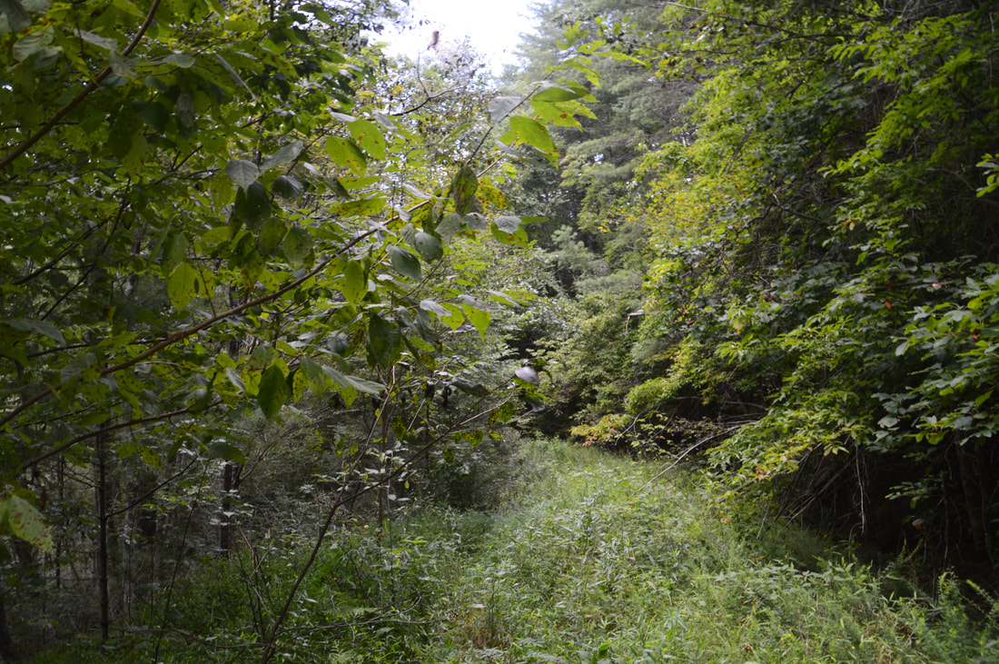
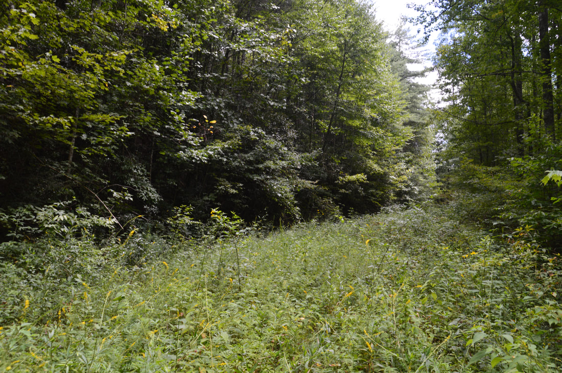
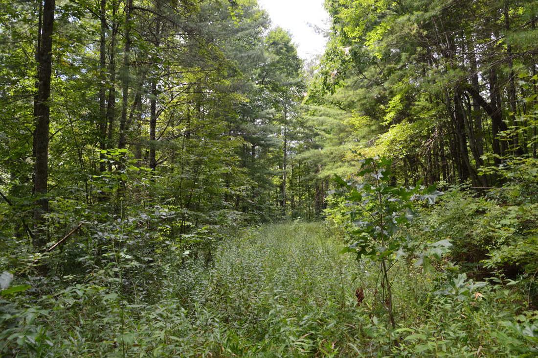
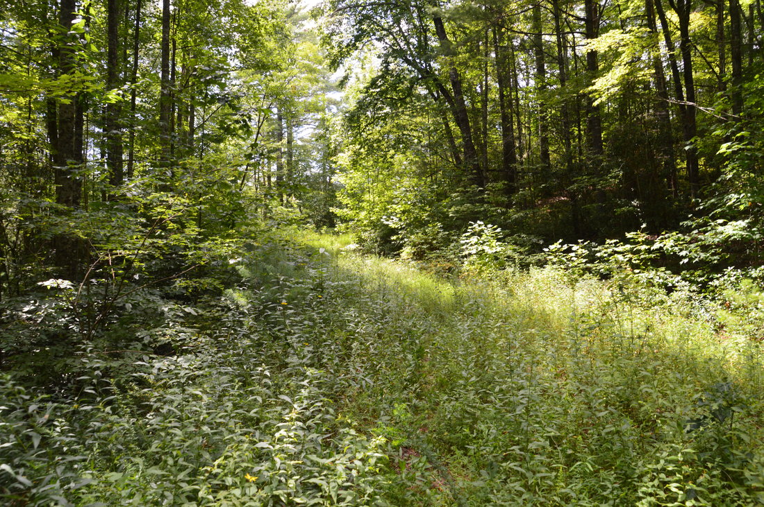
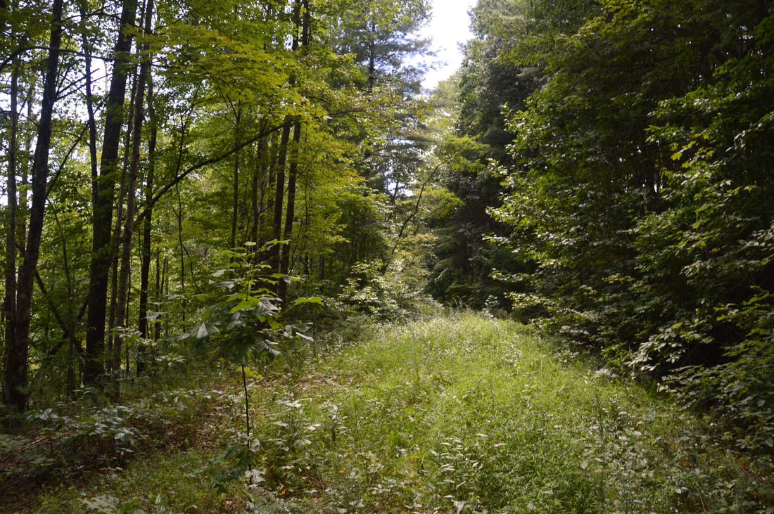
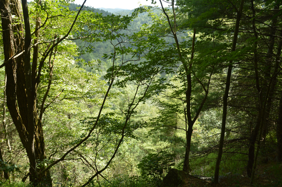
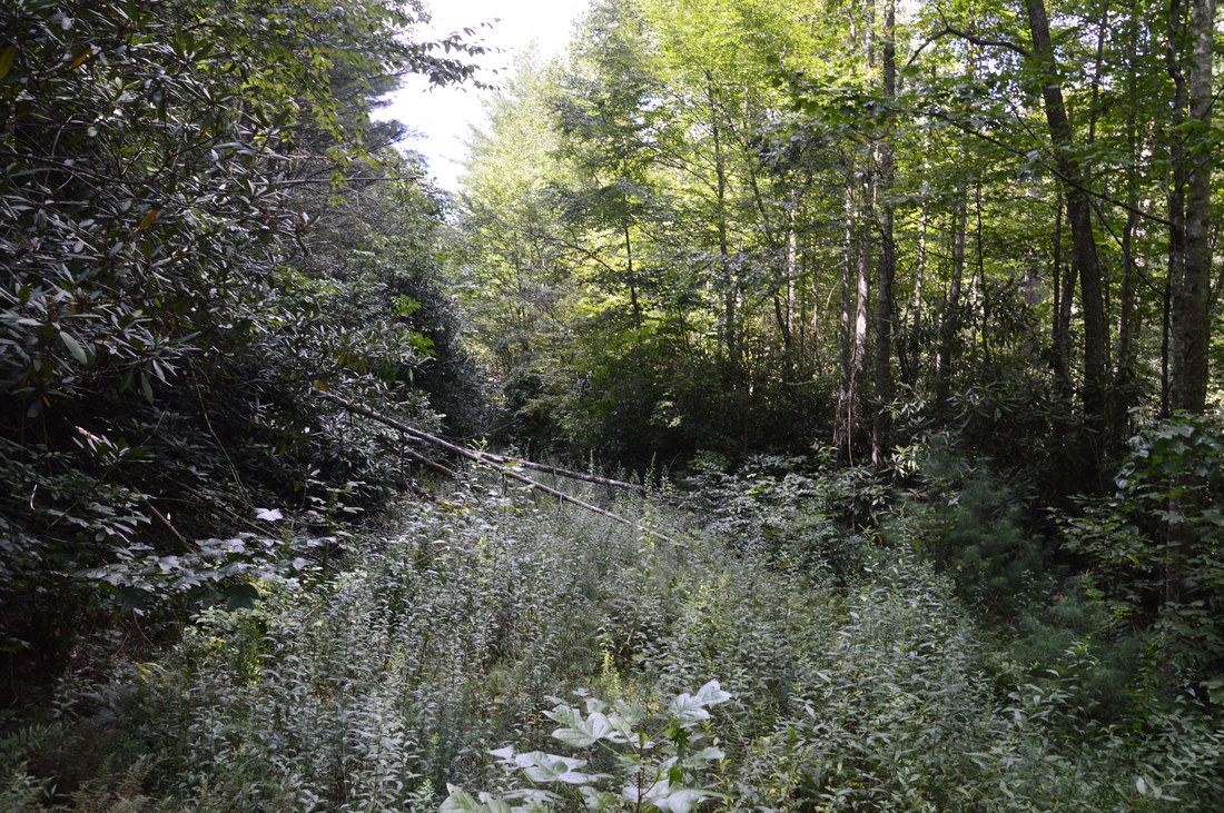
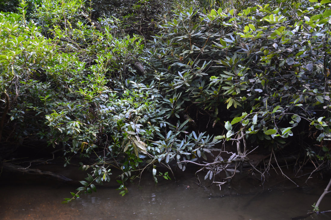
From the end of Billingsley Creek Road, a very overgrown but broad forest road continues straight past the gate. It is the now-closed continuation of Billingsley Creek Road. To the right, a narrow but distinct path begins next to a kiosk where kayakers sign in. The path leads down to Put-In Falls. Take the path first, which crosses a pipe and becomes a slightly steep scramble at the end. The path ends at Overflow Creek just below Put-In Falls in about 200 feet. Put-In Falls is a small but scenic 15-foot cascade on Overflow Creek. The mossy rock slabs on the right side of the waterfall make the waterfall more scenic. The waterfall ends with a small pool surrounded by low rock walls. Downstream, Overflow Creek broadens and flattens out. This is the point where kayakers "put in" for a wild ride down the rapids of Overflow Creek when the water levels are high enough. Return to the trailhead area. While the walk down to Put-In Falls was pretty easy, the rest of the hike is vastly different. For Big Thunder Falls, walk around the gate and begin walking up the overgrown gated road. In summer, the grass and weeds along the road were often between ankle and knee-level and sometimes even up to the waist! Fortunately, at the time of my hike, there were few green briars or fallen trees along the road, but that can change with the years. In general, it is much easier and safer to hike the road in the wintertime, but since you will get your feet wet later on, it may be tricky to time the hike well. The first 1.1 miles of the hike along the road are a very gradual ascent away from Overflow Creek near the rim of the gorge. Along the way, the road curves in and out of several small hollows. At 1.1 miles, the road curves northeast into the Clear Creek gorge. At the curve, a very faint path leaves to the right. The path, whuch descends down a steep ridge to the confluence of Clear Creek with Overflow Creek, is occasionally used by kayakers. Several open rock outcrops are located just west of the trail and ridge, but they provide only limited views of the Overflow Creek gorge. 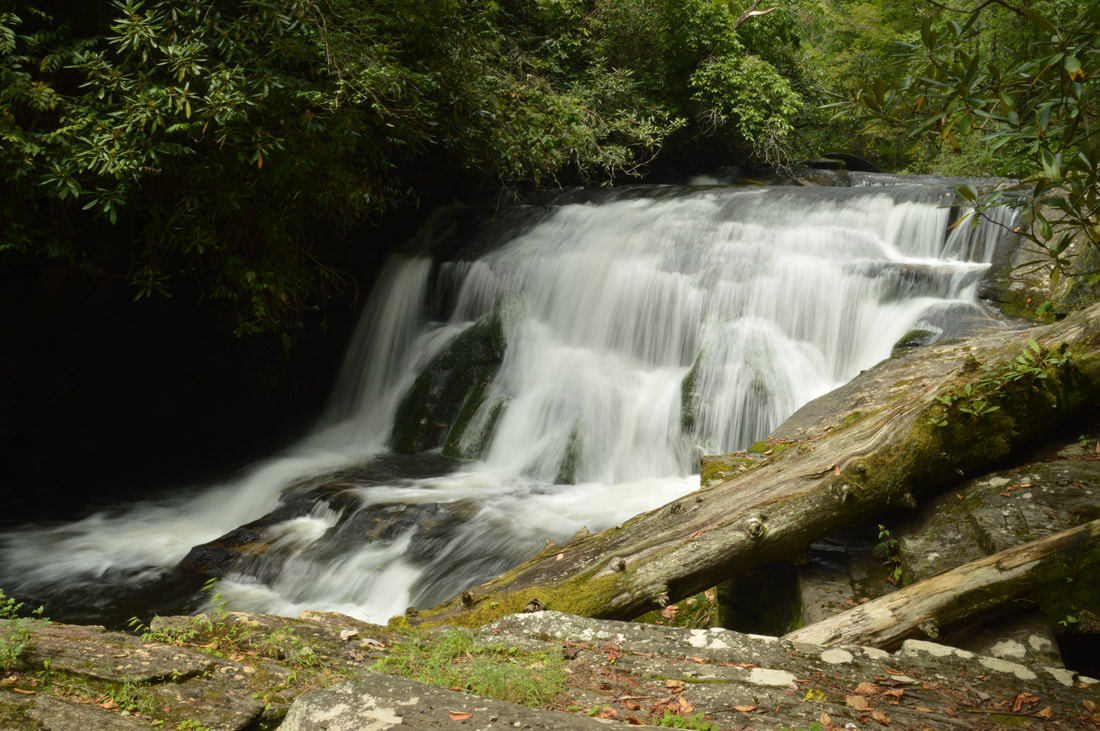
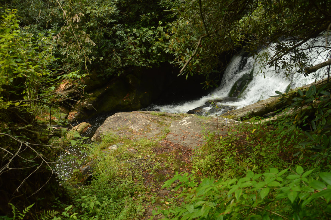
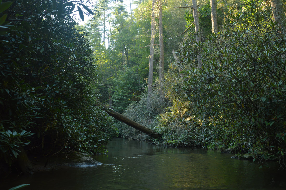
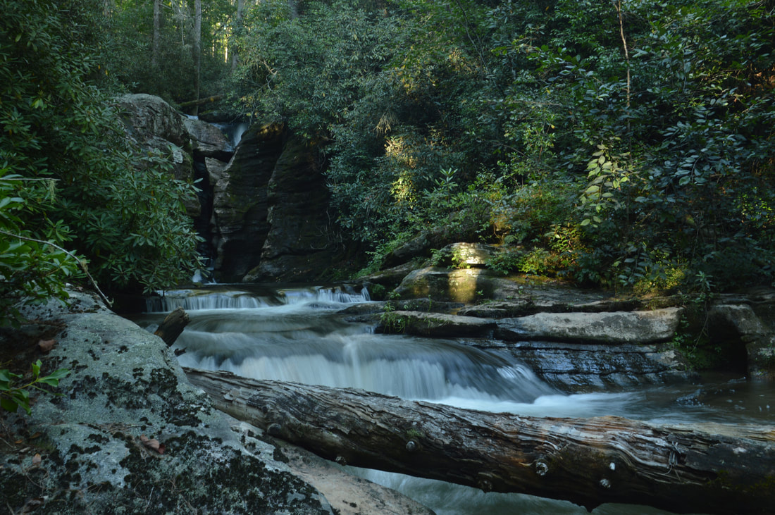
Put-In Falls on Overflow Creek is a bonus waterfall that is easy to see with a short walk from the end of Billingsley Creek Road.
The old road passes several cliffs and rock outcrops as it begins a slow descent into the Clear Creek gorge. At 1.3 miles, the road temporarily turns north, making a long curve around a tributary of Clear Creek. After passing a few small blowdowns, the road begins to parallel Clear Creek at 1.95 miles, and you can hear the creek's whitewater down to the right quite well. In another tenth of a mile at 2.05 miles, you will reach a decision point. There is another small blowdown on the road here. There are two ways to reach Big Thunder Falls from here. I used one on my way in and the other on my way out, and I can tell you right away that neither is pleasant.
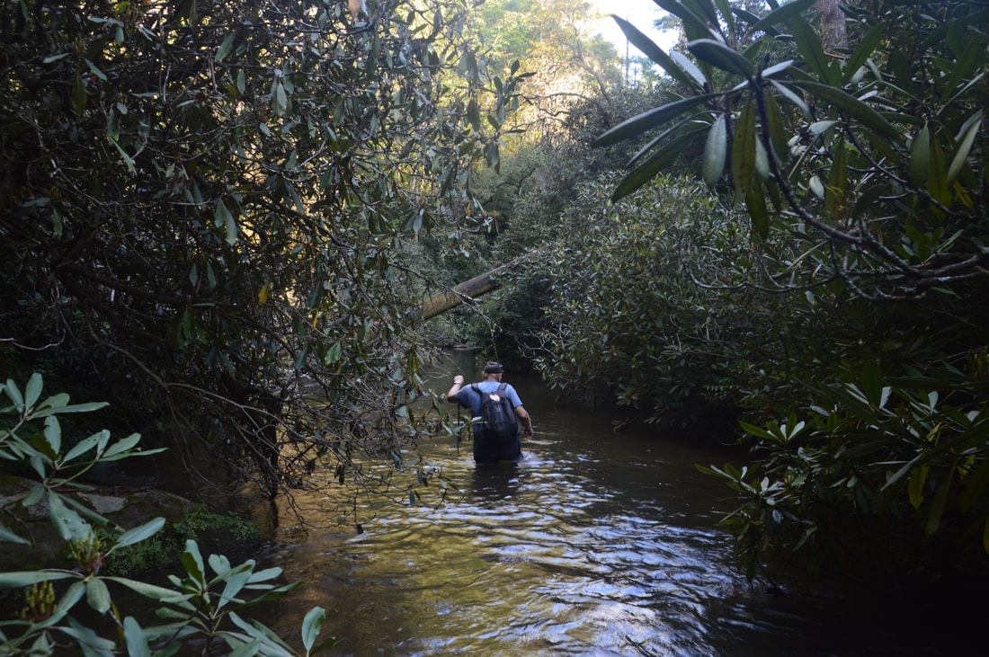
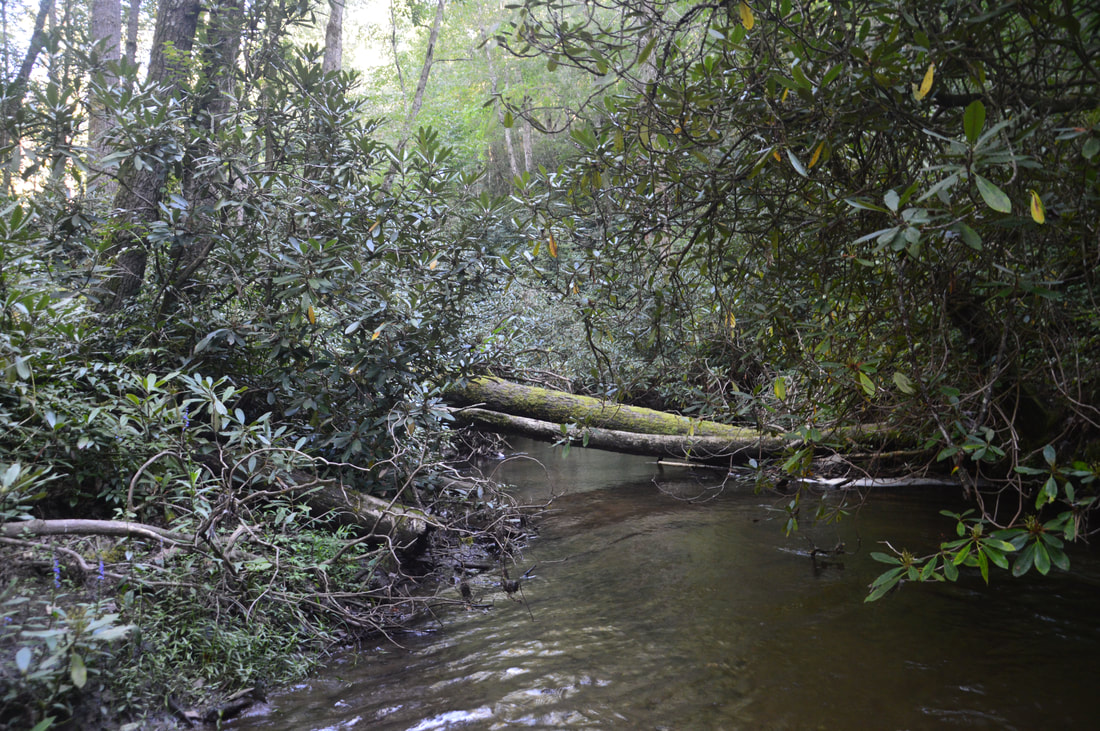
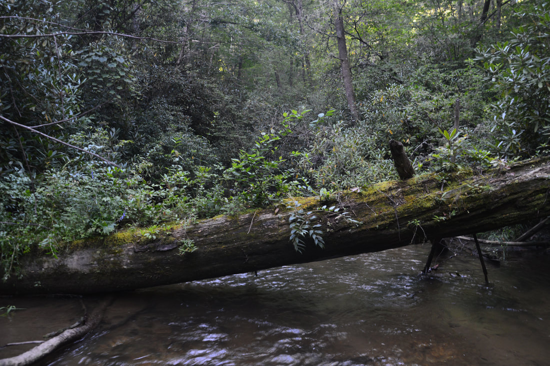
The first way is to turn left just past the blowdown, leave the road, and bushwhack nearly due north across a ridge and down to Clear Creek (Clear Creek makes a 180-degree bend around the ridge). Initially, I thought that this option would be easier, and indeed, the first part of the bushwhack up to the crest of the ridge is easy through semi-open woods. However, the situation undergoes a complete flip once you start descending the north side of the low ridge. The route I took, which generally headed north-northeast from the ridge to the creek and stayed in the vicinity of a gully, was a complete rhododendron jungle. A good part of the bushwhack was easily the thickest I've seen, and in a few places, I was crawling on my hands and feet through the rhododendron and deadfall. An individual who visited Big Thunder Falls in June 2017 says that a more north-northwest route from the crest of the ridge to the creek will be a much easier bushwhack, but unfortunately, I cannot confirm this. If you choose this route, you will reach Clear Creek between 0.15 and 0.2 miles after leaving the road. The second way is to continue along the overgrown road for another 350 feet or so. The road will then cross Clear Creek via the most enormous culvert I've ever seen - a bridge of sorts. The top of the culvert is overgrown, so you may not notice that you're approaching a crossing of Clear Creek until you're right on top of it. Past the bridge, the old road continues for about 0.4 miles before entering developed private property north of Three Forks. To reach Big Thunder Falls, find an easy spot to get down to Clear Creek in the vicinity of the culvert. I did this on the left side of the road about 50 feet before the bridge, where the rhododendron was a bit more open. Once at the creek, the rest of the route is simple: walk the creek upstream for about 0.45 miles. Sounds simple, eh? But no creek-walk is easy, and this one certainly isn't. In the first 0.15 miles, there are several very tricky places in the form of rushing cascades running down slippery rock slabs in the creek. It is probably easier to bushwhack on the right side of the creek around the trickiest spots unless the water levels are very low. One of the cascades has a fairly deep pool below it with several underwater rock fins that are a major tripping hazard. If the water levels are up, you can forget this approach to Big Thunder Falls. After the cascades, you will enter a long calm but deep stretch of Clear Creek (above knee-level in places on this day). About a quarter-mile from the Clear Creek culvert, you will pass the area where you would have come out to Clear Creek had you taken the first route. Both routes are challenging in their own ways, although in general, the creek-walk route is probably less physically demanding. In high water, only the first route will be an option. 
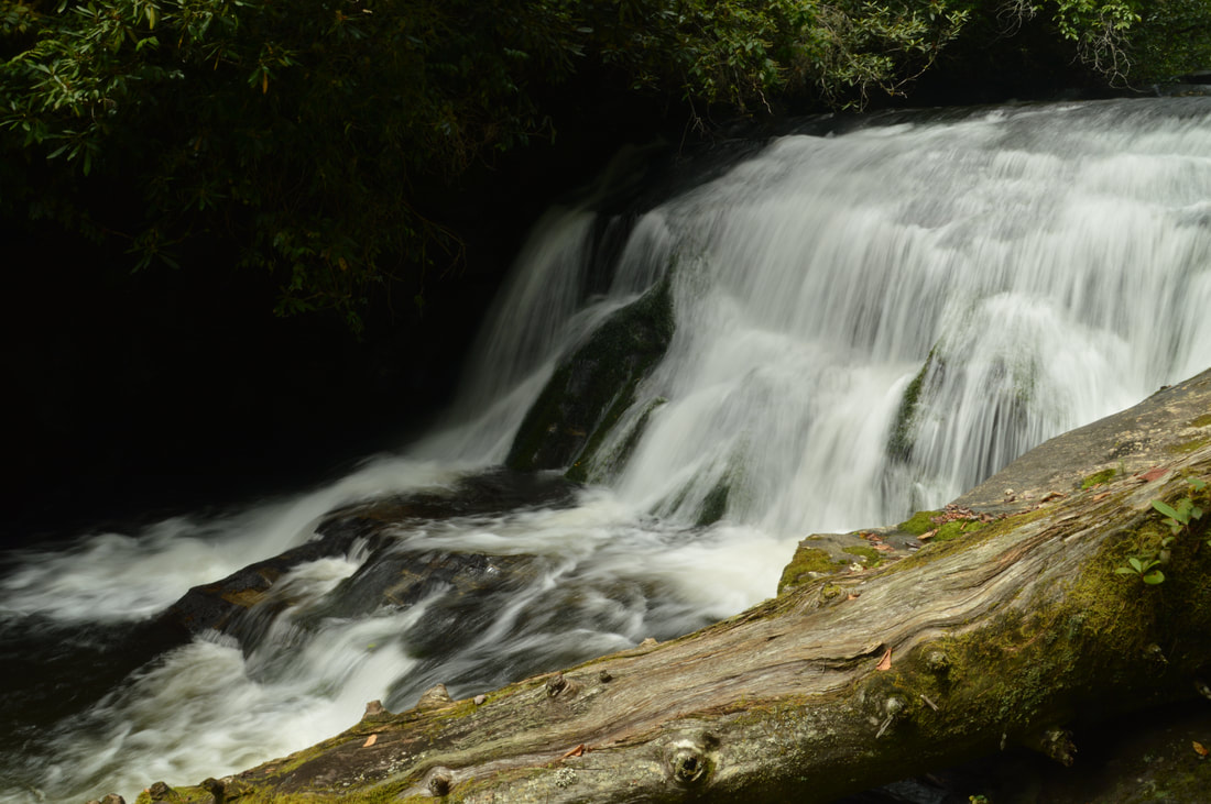
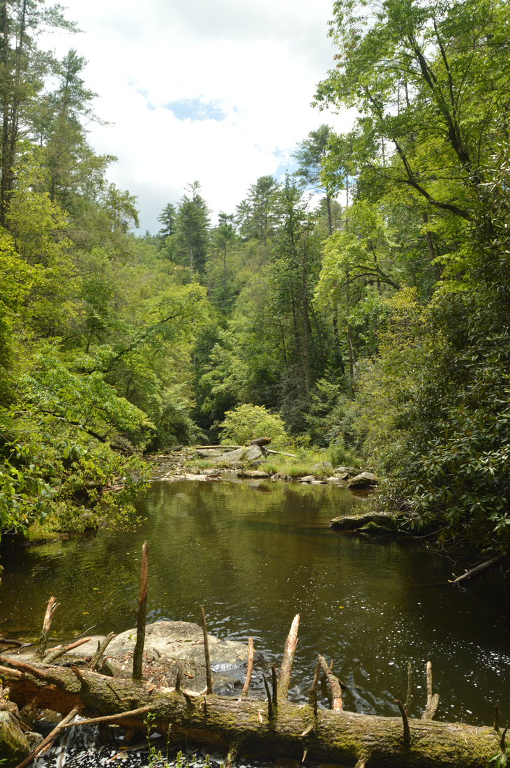
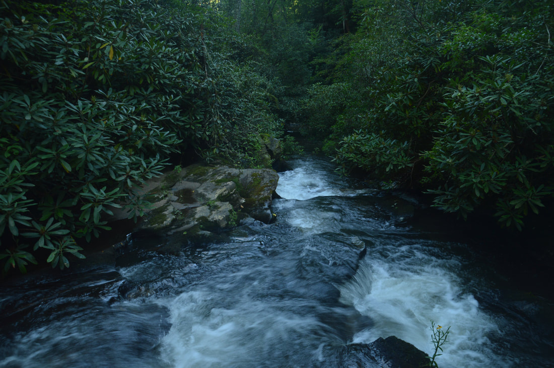
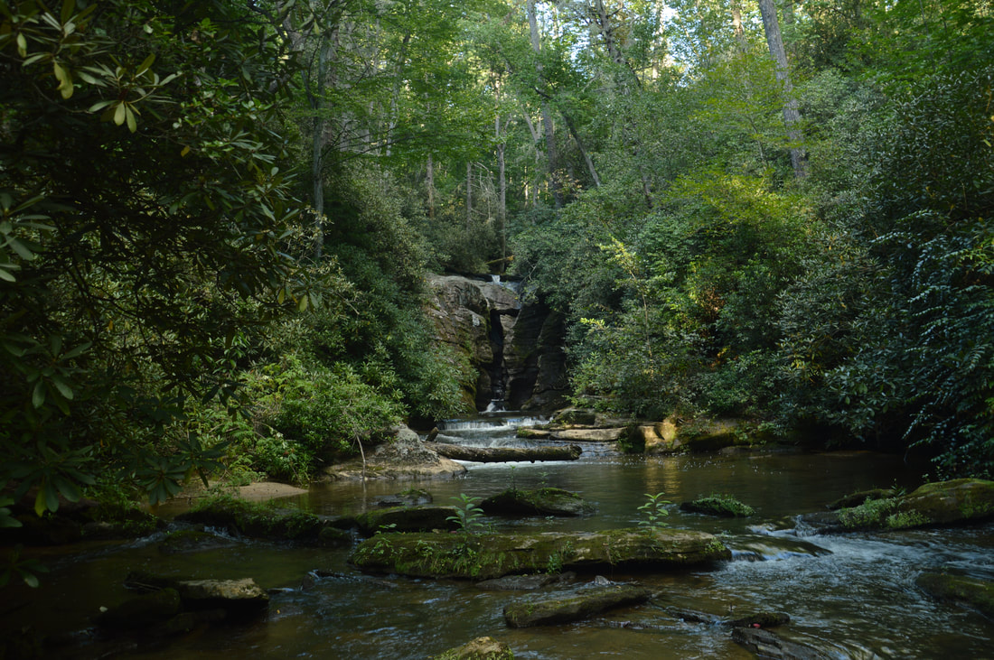
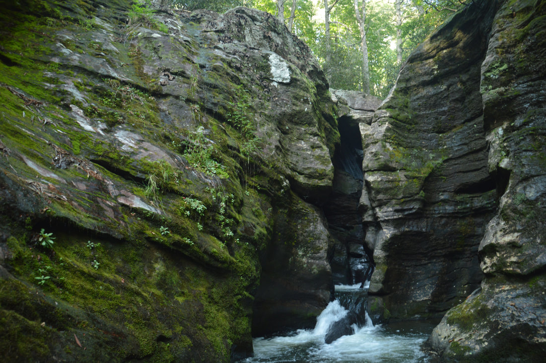
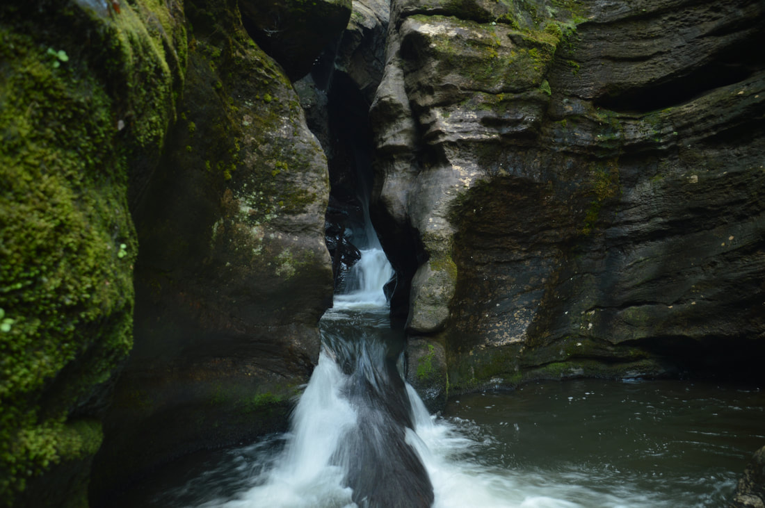
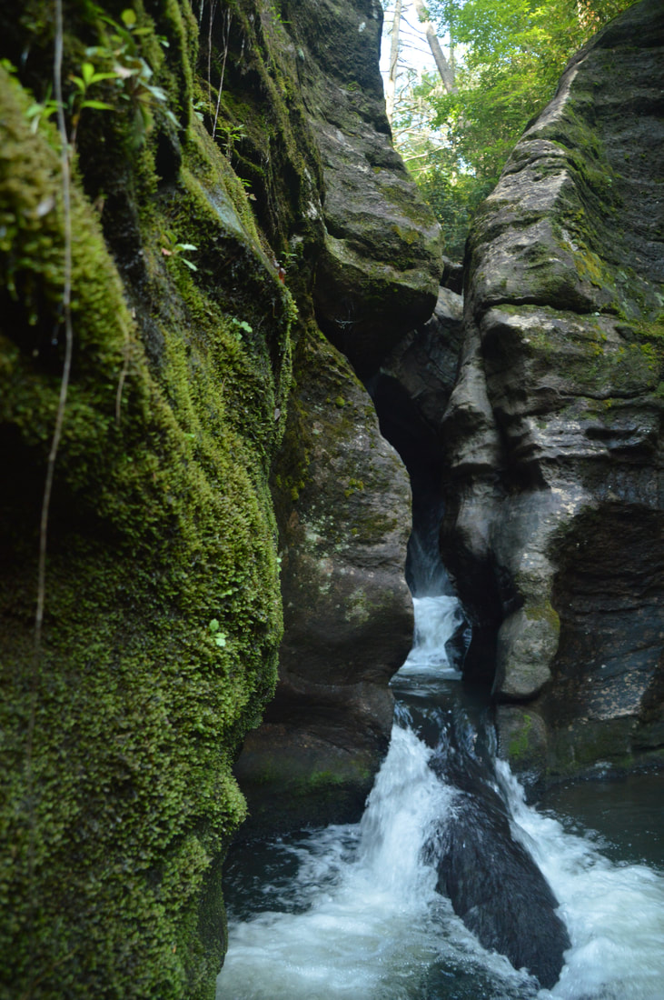
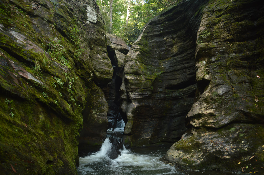
The first view of Big Thunder Falls and its canyon on Clear Creek reveals a spectacle unlike any other in Georgia.
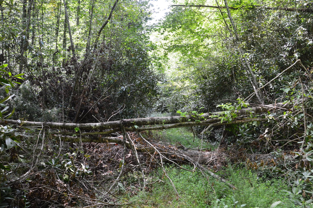
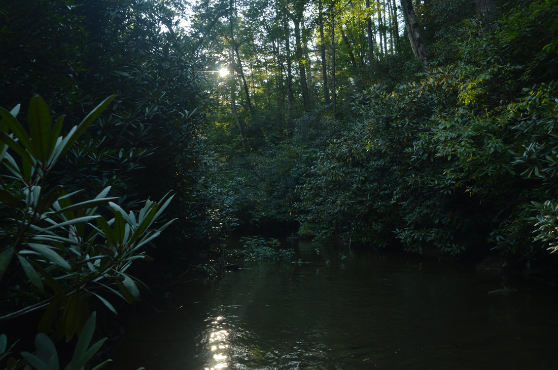
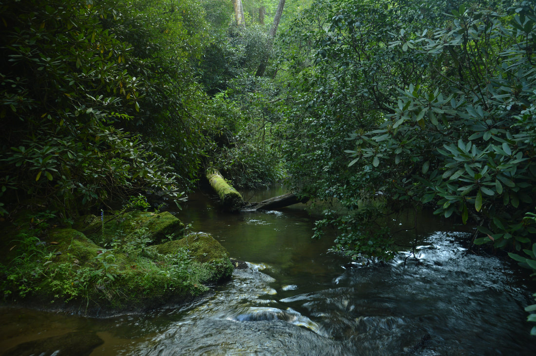
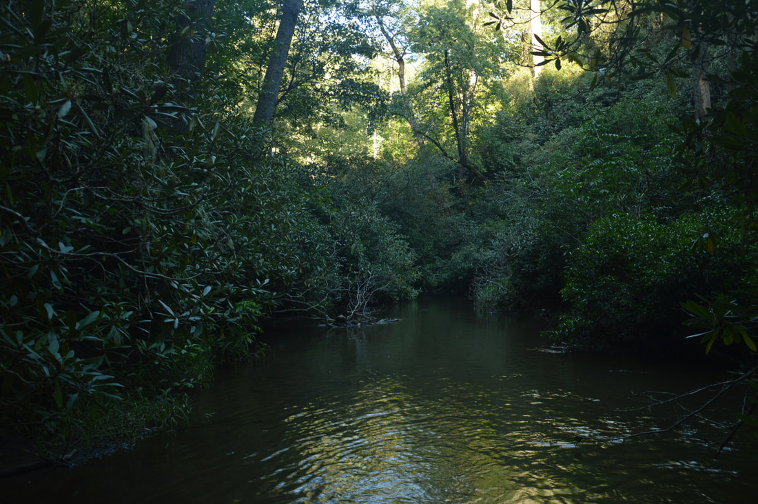
Regardless, continue walking the creek upstream for about 0.2 more miles. Even though the rest of the creek is mostly calm, the obstacle course continues - now in the form of several gigantic blowdowns stretching across the full width of the creek. Unless a major flood somehow disposes of the trees, travel along this part of the creek will remain slow. At the time of my hike, there was one especially memorable blowdown that consisted of four trees - two of which were stacked with a small gap in between! Just past the final blowdown, the creek makes a slight curve where it splits with a small island in the middle. Walking up the right branch appears easier. You may be able to hear Big Thunder Falls by now. Just as the twin water channels converge, the sheer walls of Big Thunder Falls come into view ahead. What a sight! The final walk to the canyon is fairly easy. At the final cascade just below the canyon, there is a deep pool. It is best to bypass the pool on the right and scramble up the rocks on the bank. You will arrive at the canyon at 2.5 miles or 2.6 miles, depending on which route you used.
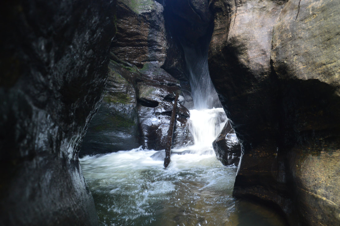
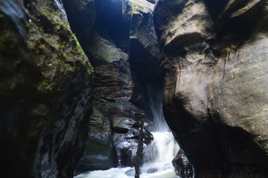
The view of the slot canyon is nothing short of spectacular. You can hear the rumble of the 35-foot Big Thunder Falls inside the crack. The distance between the two walls is only a few feet at the narrowest point! Slot canyons like this are very uncommon in the Southeast. You're much more likely to see a similar canyon somewhere in Utah, although perhaps it won't have so much water in it! From the rocks on the east (right-hand) side of the creek just below the canyon, only the very top of Big Thunder Falls is visible in the form of a steeply sliding cascade. Still, this is a very good view, but if you're interested in a closer view, read carefully the following information. Getting a good view of Big Thunder Falls inside the canyon was very difficult and potentially dangerous when I was here and it may become even more treacherous in the future if the log gets washed away. The pool at the mouth of the canyon appears to be at least eight feet deep at its deepest points during normal spring and early summer water levels. Later into the summer and fall, the water levels will get lower, but either way, you will likely be swimming in the pool. Just above the pool is a small cascade at the very end of the slot canyon. As of this writing, a long log is stuck in the water and stretches from the small cascade to near the lower end of the pool. Most of the log will be underwater during normal water levels. While this log is still here, it provides the only slightly feasible way into the canyon without swimming, but there is no guarantee that the log will be there when you visit. But walking up the log is still very dangerous and extreme caution must be taken - you must be sure of your abilities before you attempt to scramble up the log! Absolutely keep in mind that if you happen to slip off the log, you'll fall straight into a deep pool where the water may be over your head. The log is close enough to the canyon wall that you can hold on to the wall with both hands while walking up. Despite being so wet, the log is less slippery than it looks. At the top of the log, a wide step will get you onto the tiny rock outcrop at the top of the cascade and end of the canyon. Again, I cannot stress enough how challenging and risky this maneuver is. Try it at your own risk. If you manage to make it up the log, what you will see will be an even more breathtaking spectacle. At Big Thunder Falls, Clear Creek actually splits into two separate channels of flow as it drops into the canyon. On the left side, one part of Big Thunder Falls falls through a miniature cave and then slides down the canyon wall at a near 90-degree angle to the bottom. On the right side, the other part of Big Thunder Falls cascades and free-falls down. Just below where the waters converge, Clear Creek roars down one final cascade and drops into a churning pool in the very heart of the canyon. It may potentially be possible to get into the pool for a grand full view of both sides of the falls, but it looked extremely sketchy, and with the depth of the pool currently being unknown, I strongly discourage you to try advancing any further. If you manage to even get as far as this point, you win a Georgia Waterfalls gold medal! :-) 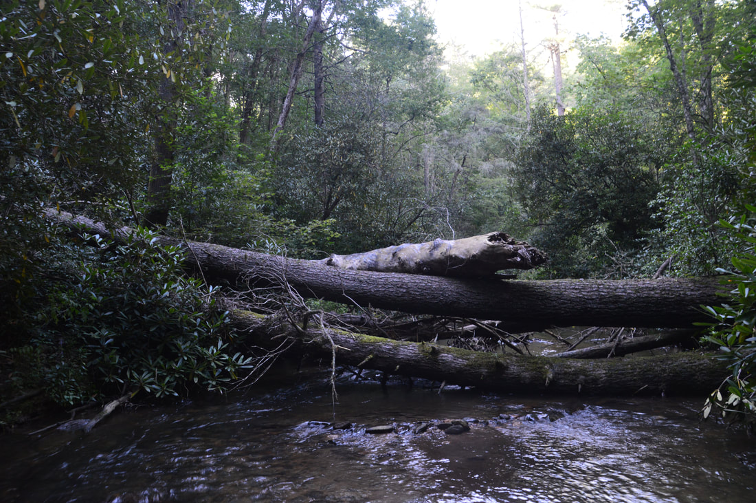
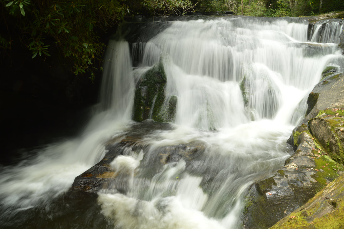
Blowdowns like these are just one of several types of obstacles along the creek-walk to Big Thunder Falls.
From Big Thunder Falls, retrace your steps along the same route back to the trailhead. Once again, depending on what route you used, you will return to the trailhead at 4.9 or 5.1 miles. One final note: I suggest returning along the same route you went in on instead of thinking that the other might be better, because once you've used it one time, you will likely find it easier on the way back.
Mileage
0.0 - FS 86B
0.05 - Put-In Falls 2.05 - Exit Point for Route 1 2.1 - Clear Creek Culvert, Exit Point for Route 2 2.5 or 2.6 - Big Thunder Falls 4.9 or 5.1 - FS 86B Variations
None
Bonus Stops
There are several other hiking possibilities in the area. An official loop trail under 2 miles from Overflow Creek Road leads past Holcomb Creek Falls and Ammons Creek Falls. A second trail off Overflow Creek Road leads from John Teague Gap down to another waterfall on Holcomb Creek and to Three Forks. You can also drive down to Warwoman Road and up Highway 28 for a short hike to a pretty but little-known waterfall called Talley Mill Creek Falls.
PicturesVideos
2 Comments
Kelley
10/9/2017 08:16:08 pm
Would you recommend wearing a PFD to this location? Just in case you were to slip while trying to get up the log?
Brian
4/16/2021 11:09:54 pm
Did this hike today (04/16/2021) and by going North West we were able to bypass much of the river walking and the rhododendron jungle. Thank you so much for this guide we loved this hike and the waterfall at the end was amazing. The log going into the falls has broken up since and seems to be sticking out of the canyon instead of going into it. Leave a Reply. |
About MeMark Oleg Ozboyd Dear readers: I have invested a tremendous amount of time and effort in this website and the Georgia Waterfalls Database the past five years. All of the work that has gone in keeping these websites updated with my latest trip reports has almost been like a full-time job. This has not allowed me to pick up a paid job to save up money for college, and therefore, I I've had to take out loans. If you find the information on this website interesting, helpful, or time-saving, you can say "thanks" and help me out by clicking the button above and making a contribution. I will be very grateful for any amount of support you give, as all of it will apply toward my college tuition. Thank you!

Coming in 2022-2023?
Other Hiking WebsitesMiles HikedYear 1: 540.0 Miles
Year 2: 552.3 Miles Year 3: 518.4 Miles Year 4: 482.4 Miles Year 5: 259.9 Miles Archives
March 2021
Categories
All
|
||


 RSS Feed