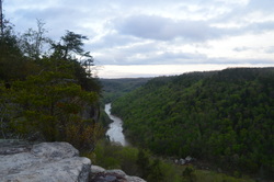
The Big South Fork of the Cumberland River is one of the biggest to bisect the Cumberland Plateau. It flows through a rugged gorge in extreme northern Tennessee and then into Kentucky, before flowing into the Cumberland River near Somerset. This hike is one of the best for your first visit to the area, as it encompasses the shear beauty of the gorge and surroundings, culminating in one of the most beautiful overlooks I have ever encountered anywhere - Angel Falls Overlook - making this one of the best hikes in Tennessee. This hike occurred on Thursday, April 16, 2015. My plan was to start my hike at the East Rim Trailhead. I'd first see East Rim Overlook and do the short hike to Sunset Overlook. And then, I would do the Leatherwood Loop and follow the John Muir Trail to Angel Falls Overlook and back.
R/T Length of Trail: 13.1 Miles
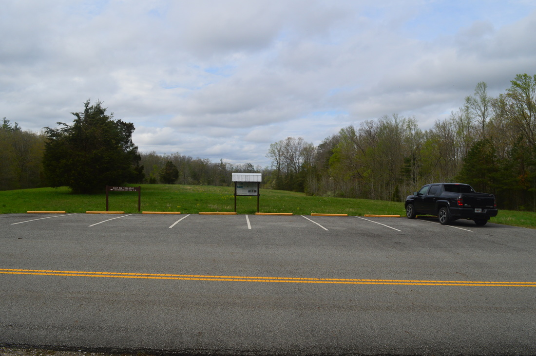
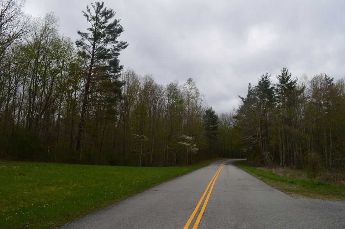
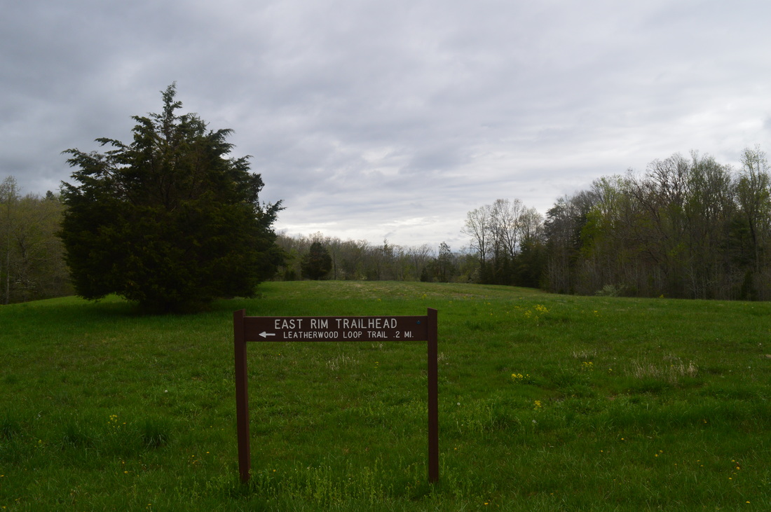
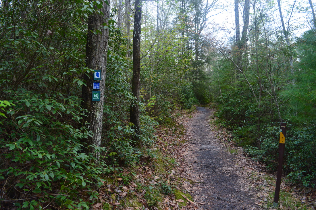
Duration of Hike: 7:20 Type of Hike: Out-and-Back with Small Loop Difficulty Rating: 7 out of 10 Pros: Many great vistas of Big South Fork River Gorge; good campsites near Leatherwood Ford; numerous small water features after periods of rain Cons: Pedestrian bridge is out at Leatherwood Ford; somewhat dangerous (although fun if treated with care) stretches of trail below Angel Falls Overlook Scenic Views: Angel Falls Overlook - 10+ stars; East Rim Overlook - 8 stars; Sunset Overlook - 5 stars; Leatherwood Ford Overlook - 4 stars Water Features: None worth mentioning Trail Blaze Color(s): Sunset Overlook Trail - Dark wooden squares nailed to trees; Leatherwood Loop - Dark wooden squares nailed to trees; John Muir Trail - Square with blue head nailed to trees; Grand Gap Loop - Squares with bicycle symbol nailed to trees Best Season(s) to Hike: Year-round; possibly winter to be able to see Angel Falls from Angel Falls Overlook Beginning Point: East Rim Trailhead Directions: From Oneida, TN: Follow TN State Route 297 West for 9.5 miles until East Rim Road. Turn left onto East Rim Road, and follow it for 0.2 miles until the parking area, on the right. Another 0.5 miles will bring you to a turnaround and a short, paved trail to East Rim Overlook. It is well worth the additional drive and short walk, perhaps as a post-hike bonus or as a pre-hike leg stretcher.
Being new to the Big South Fork National Recreation Area, it took me a while what would be my best first hike there. The Yellow Creek Loop brought my attention more than once. So did the Yahoo Falls area and several trails in the Pickett State Park sector of the NRA. Eventually, though, I settled it down a bit by deciding that I would spend as much time as possible in the immediate area of the gorge and the gorge itself. Combining three popular hikes - Angel Falls Overlook via the John Muir Trail, Leatherwood Ford Loop, and Sunset Overlook Trail - seemed like the best option, and it probably was, since this was my first hike here. the other hikes focus on specific areas and features, while this one encompassed all of what you would typically see on a hike in the Big South Fork NRA. Especially worth mentioning is the stunning view from Angel Falls Overlook. It might be my most favorite overlook on the Cumberland Plateau (that I have visited so far).
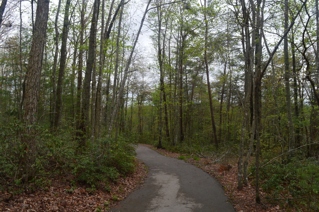
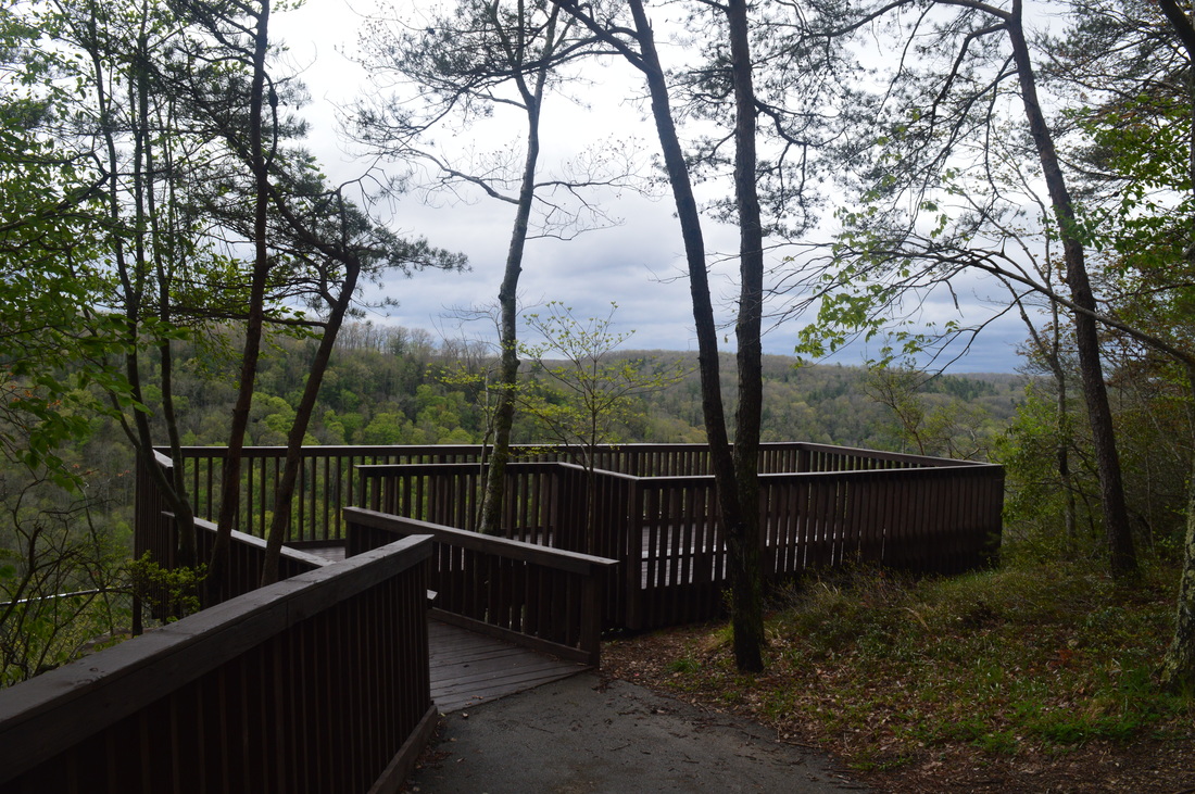
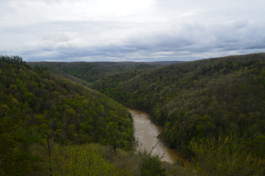
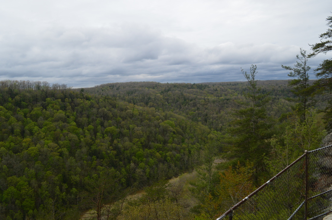
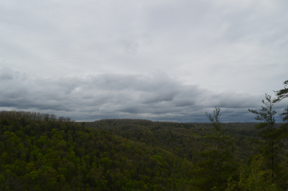
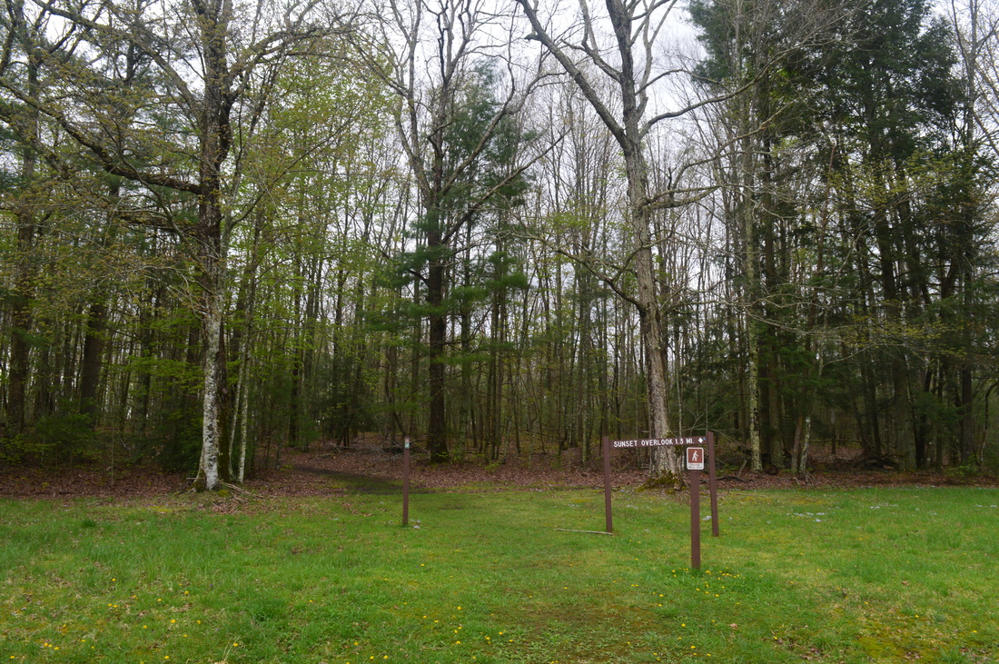
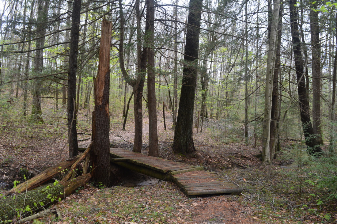
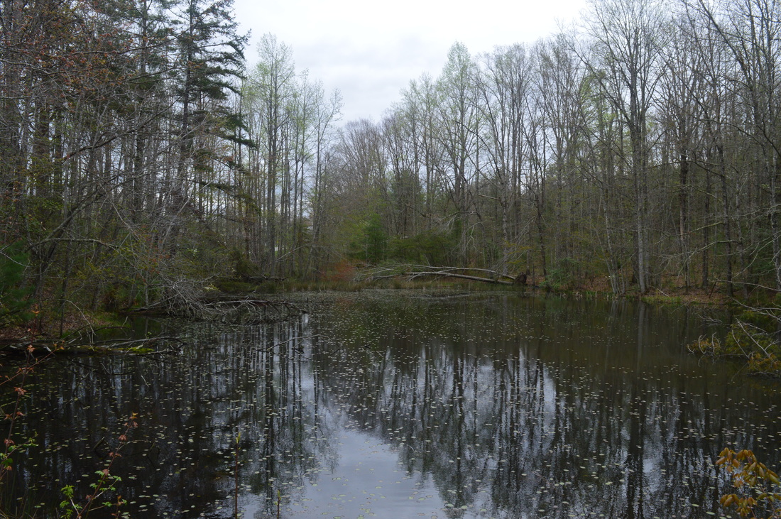
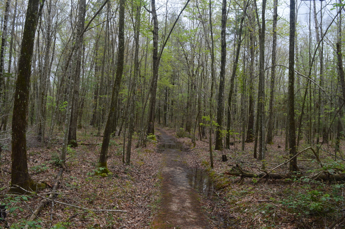
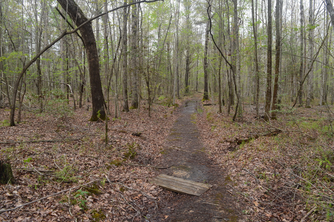
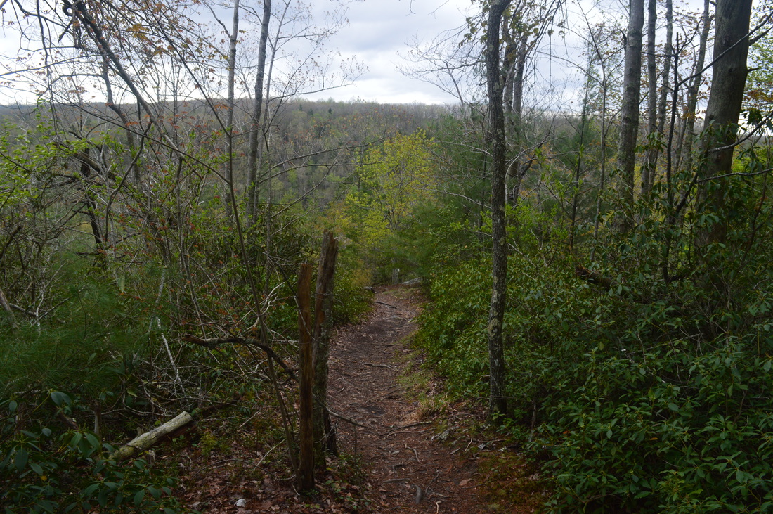
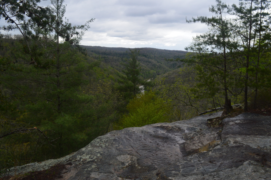
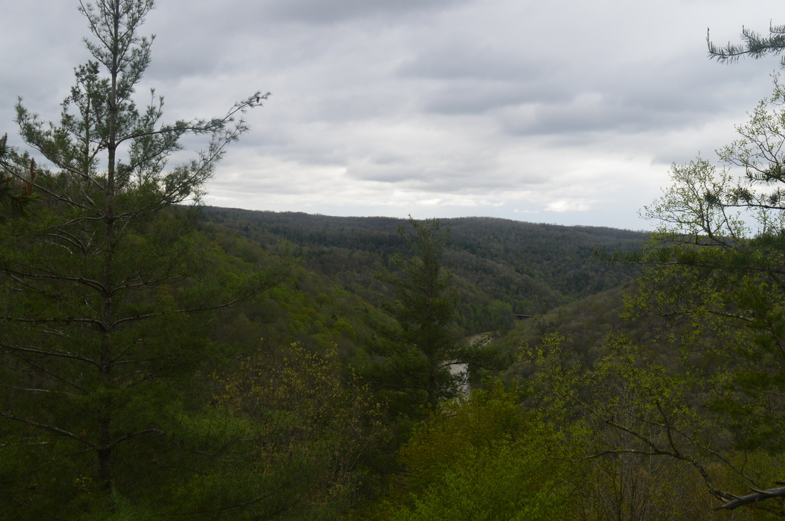
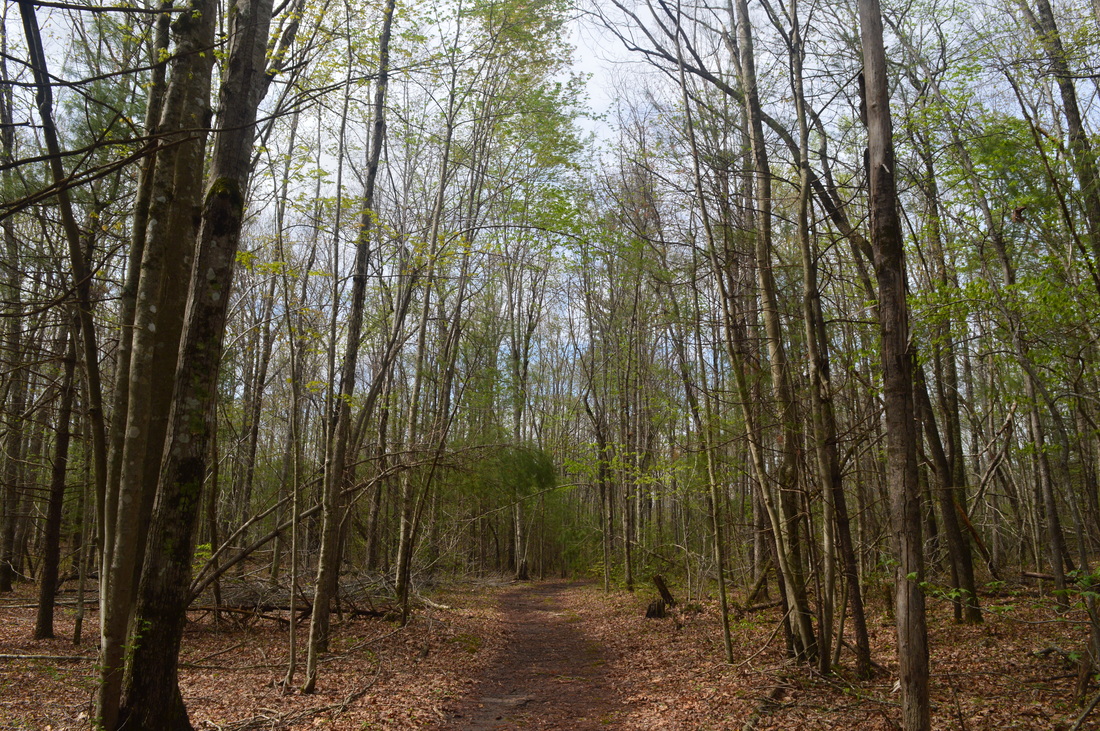
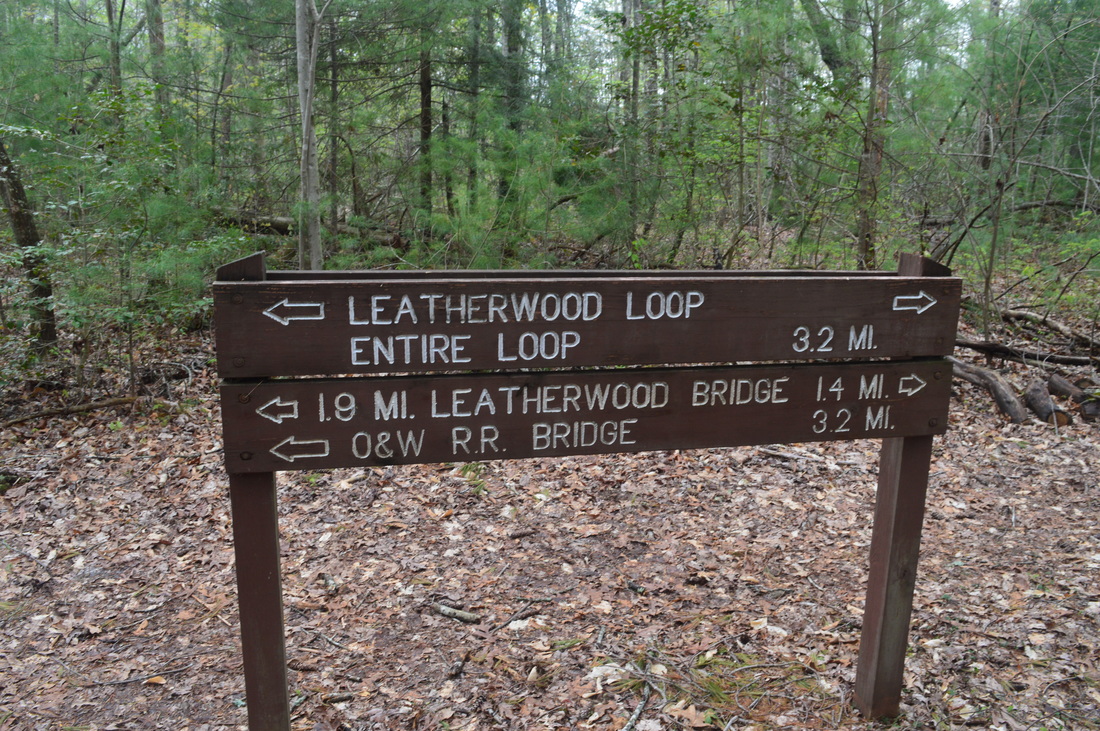
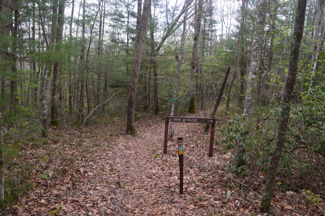
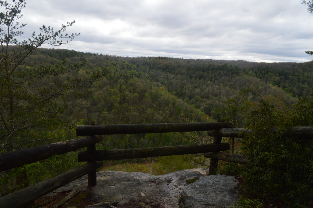
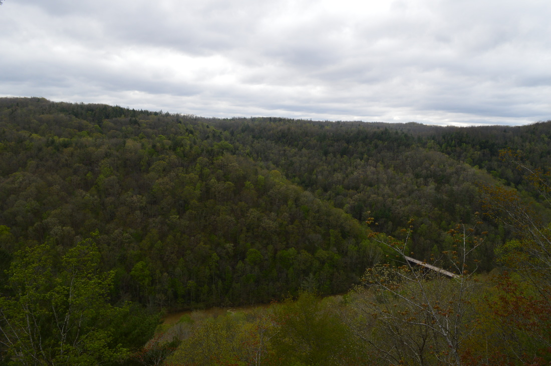
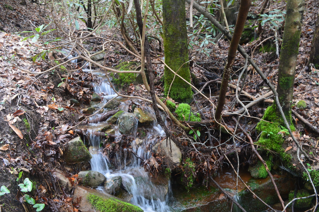
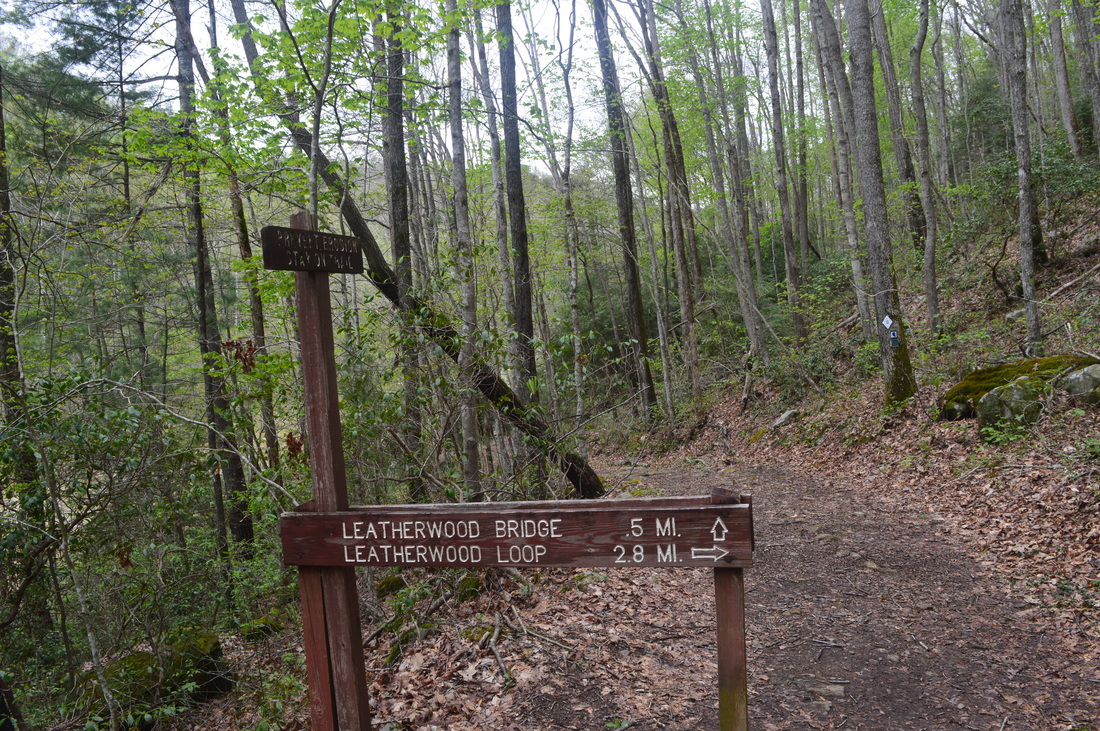
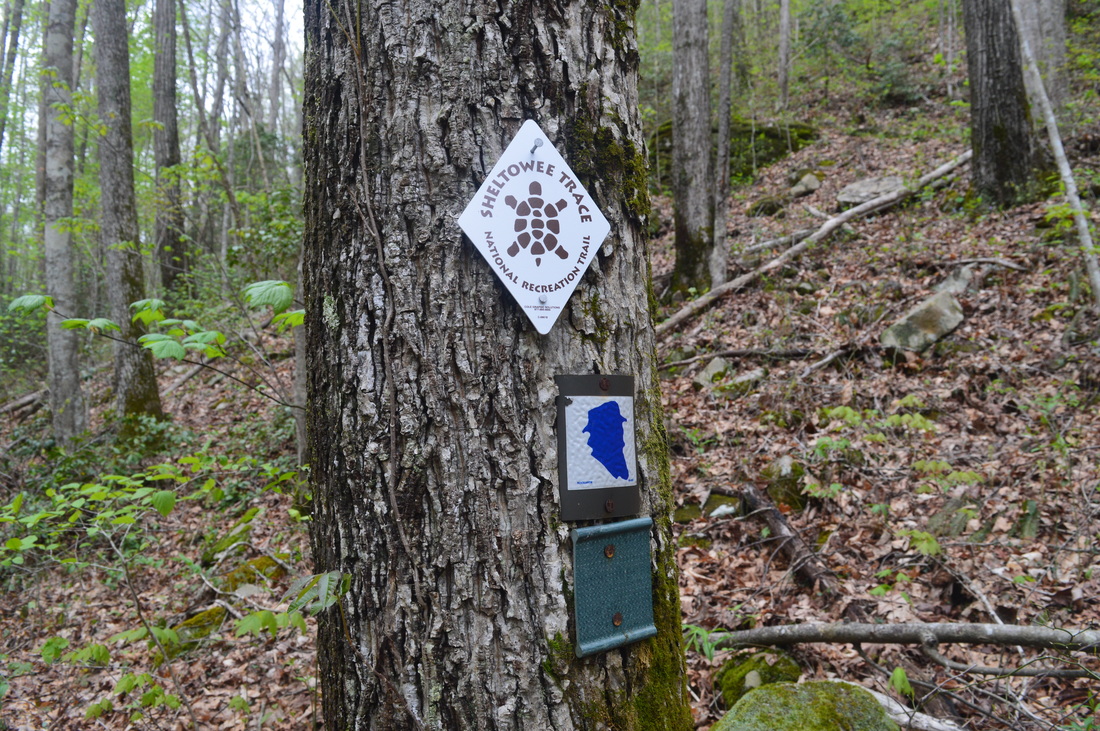
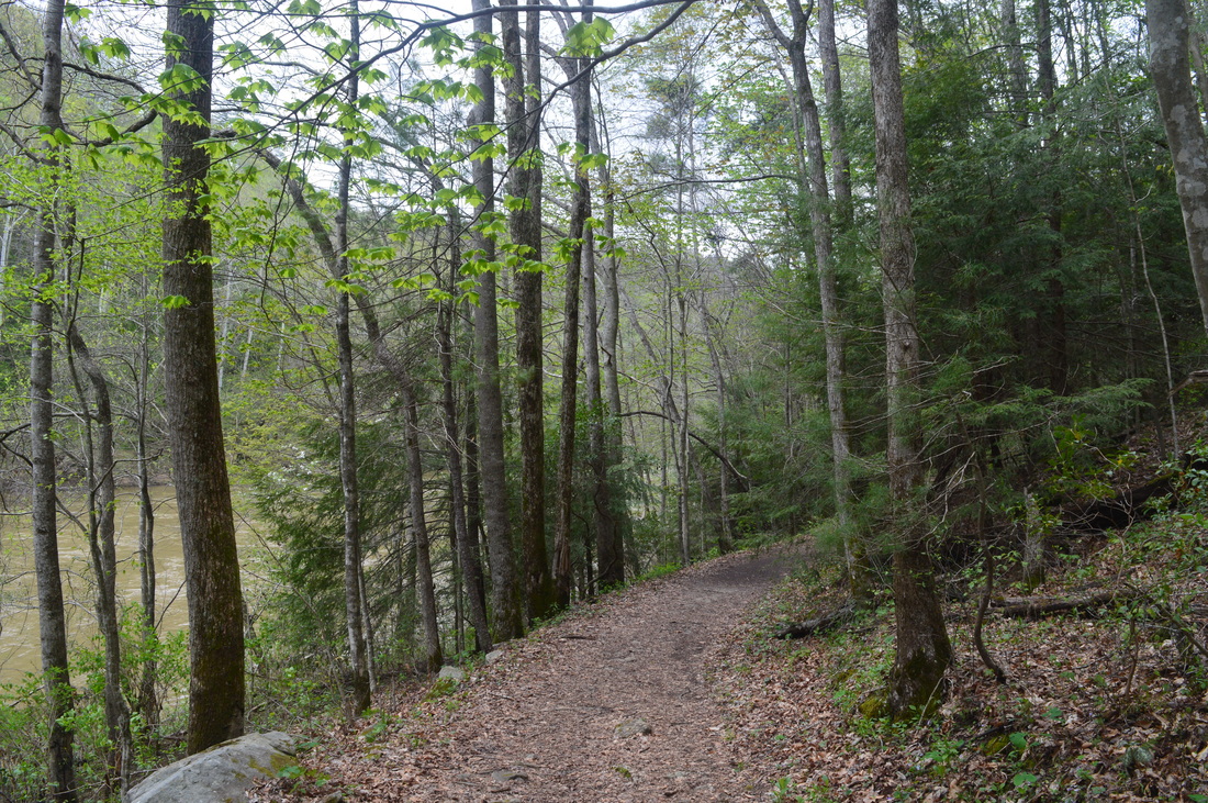
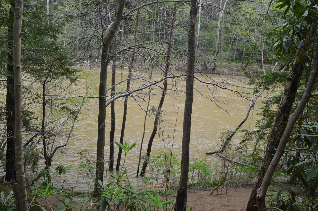
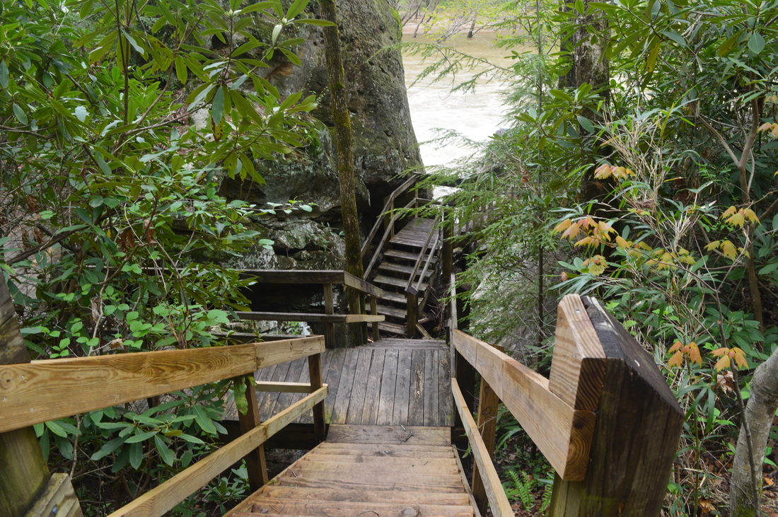
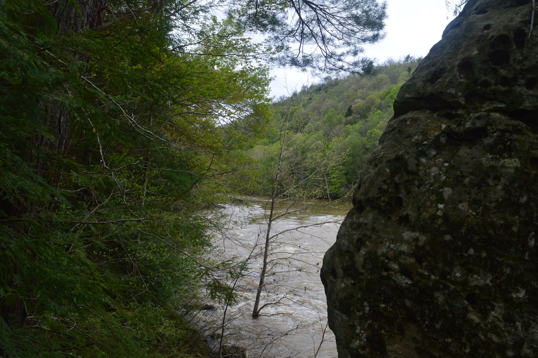
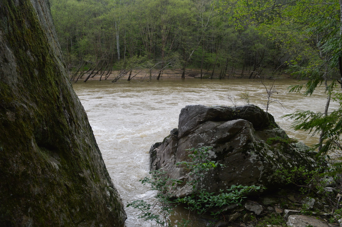
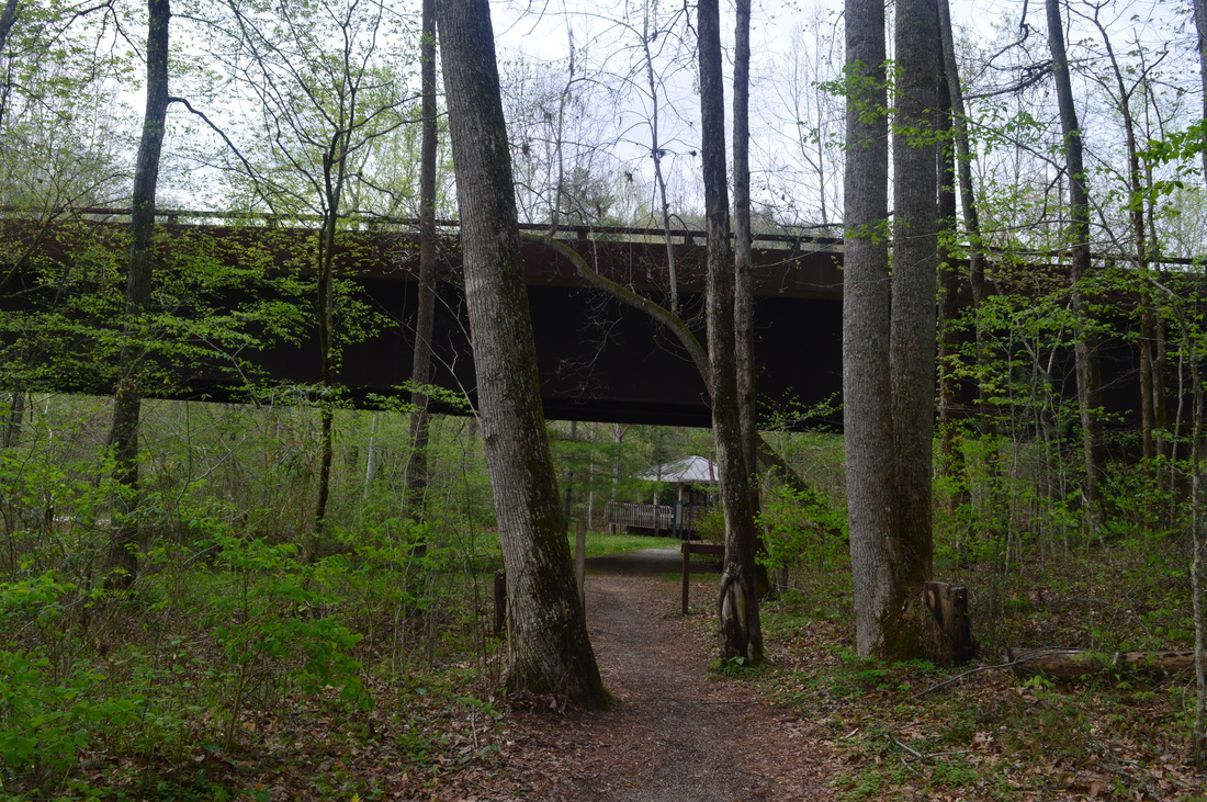
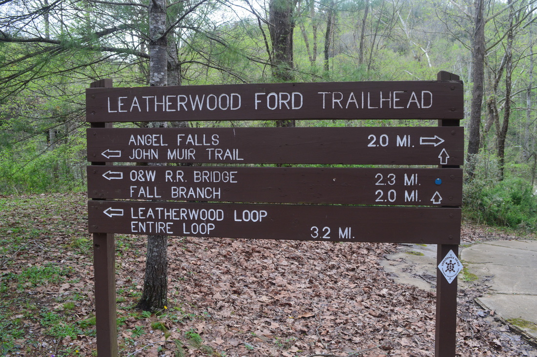
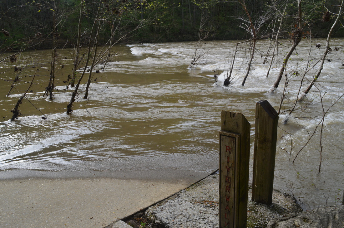
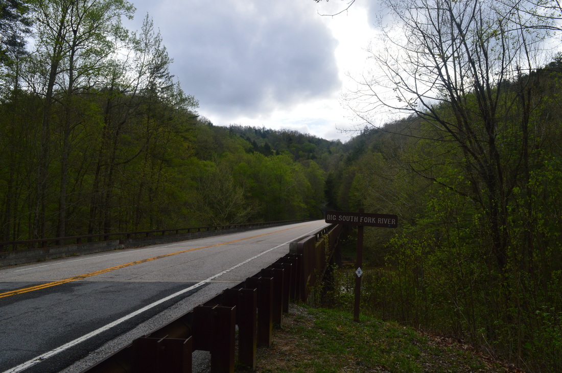
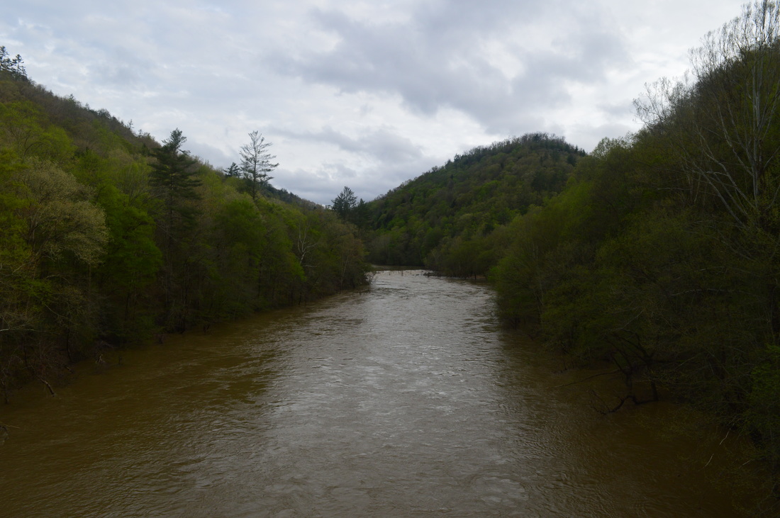
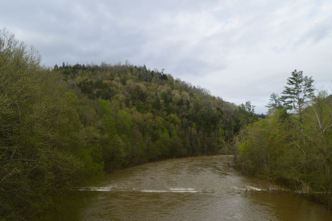
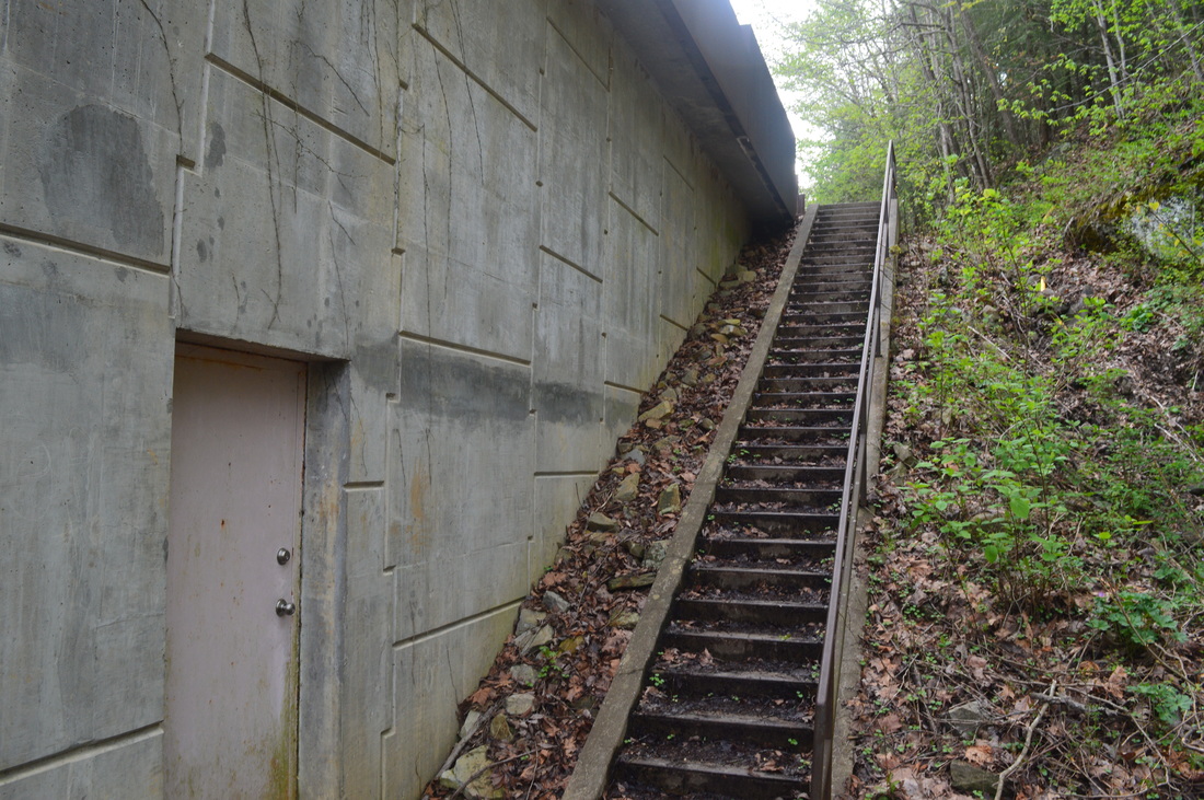
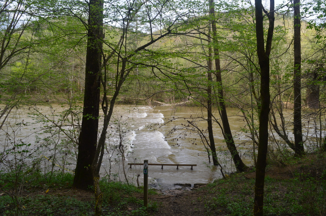
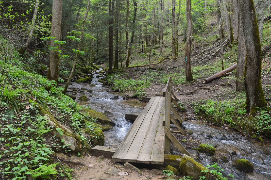
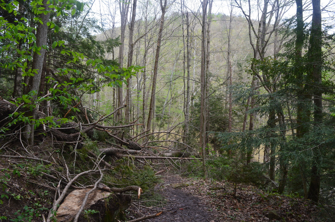
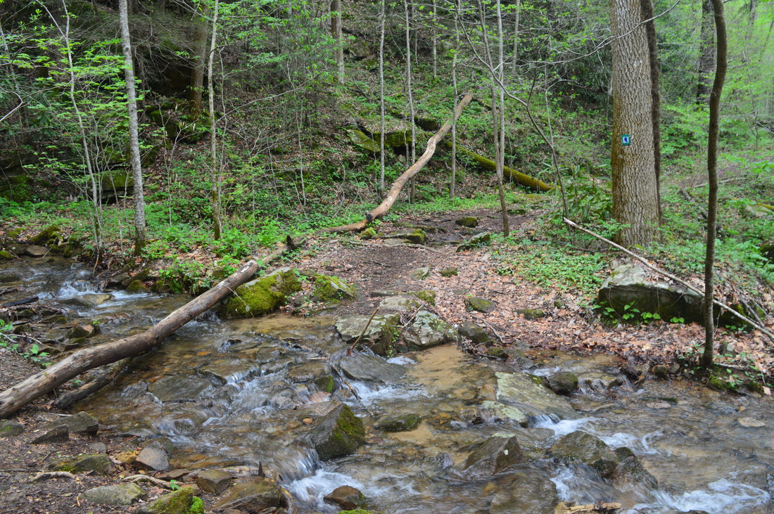
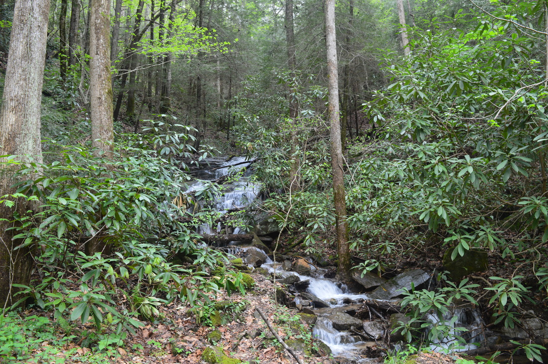
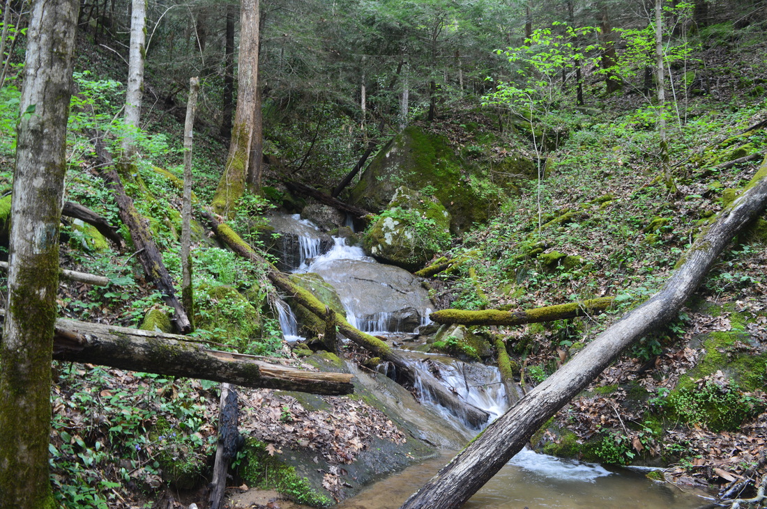
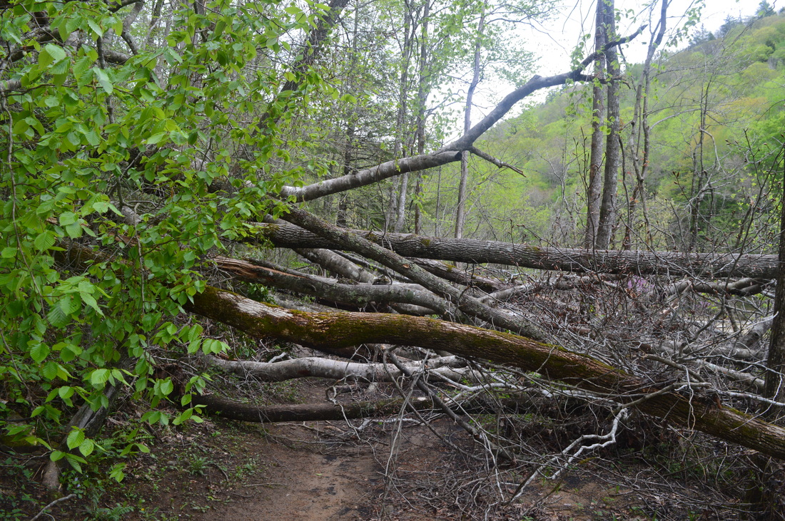
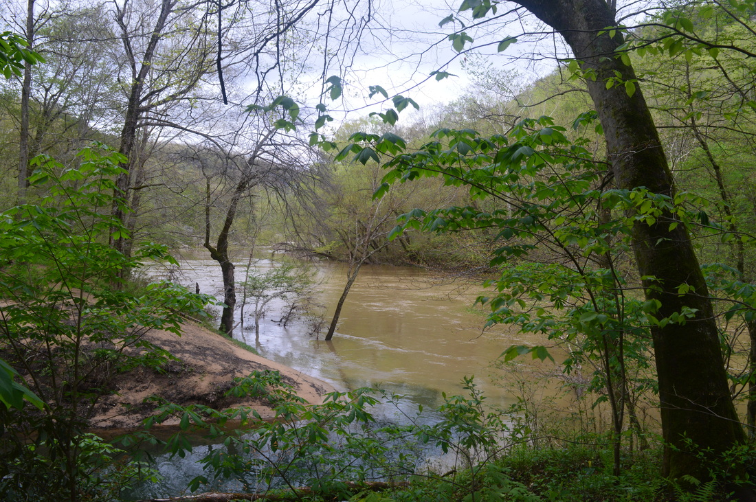
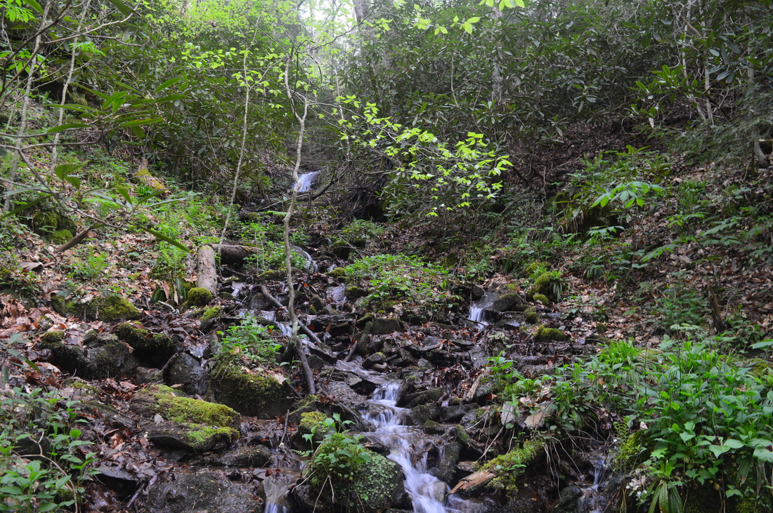
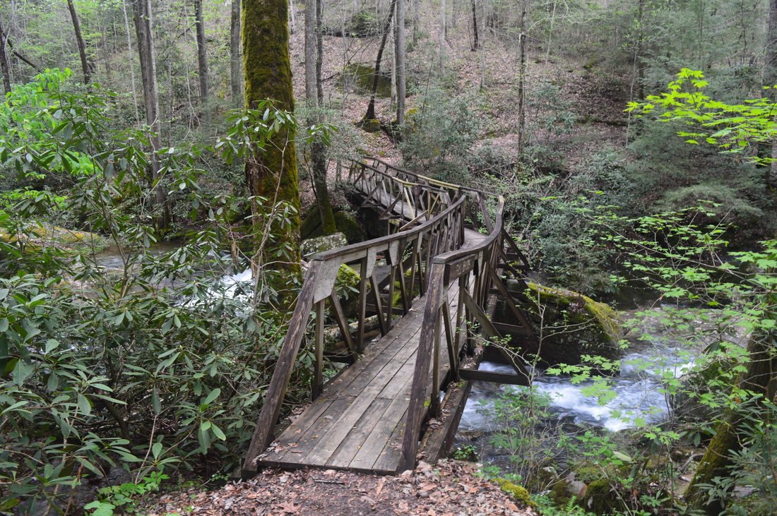
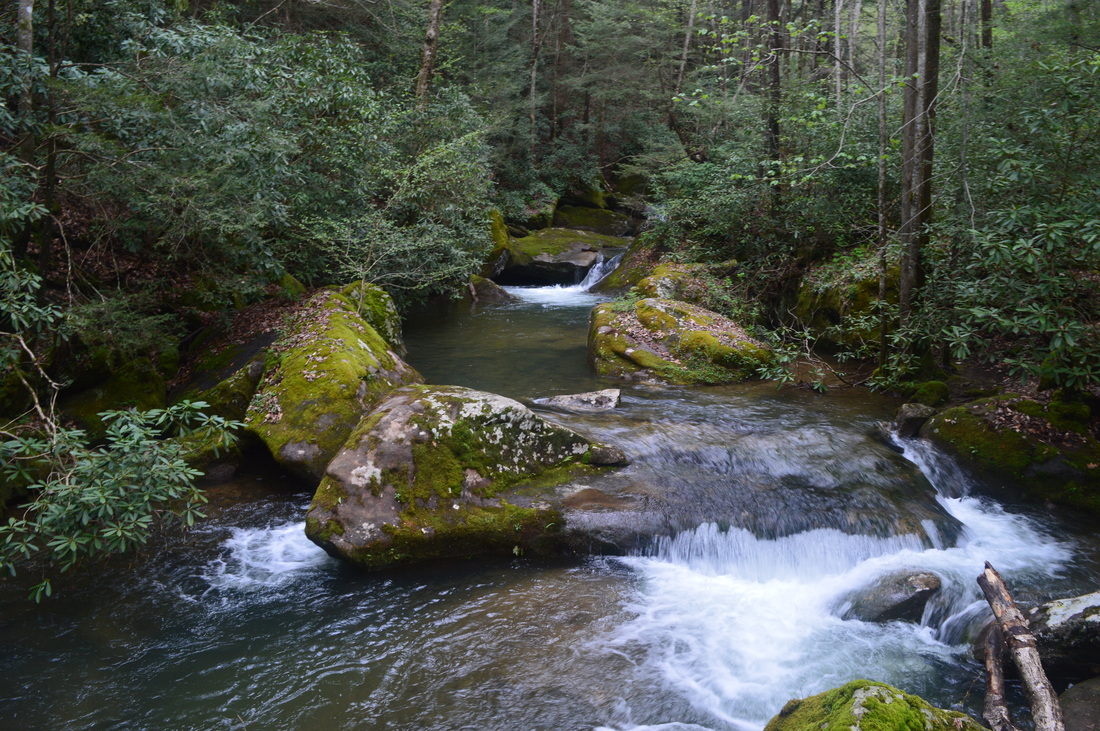
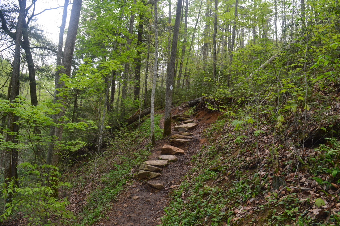
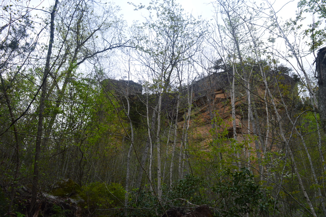
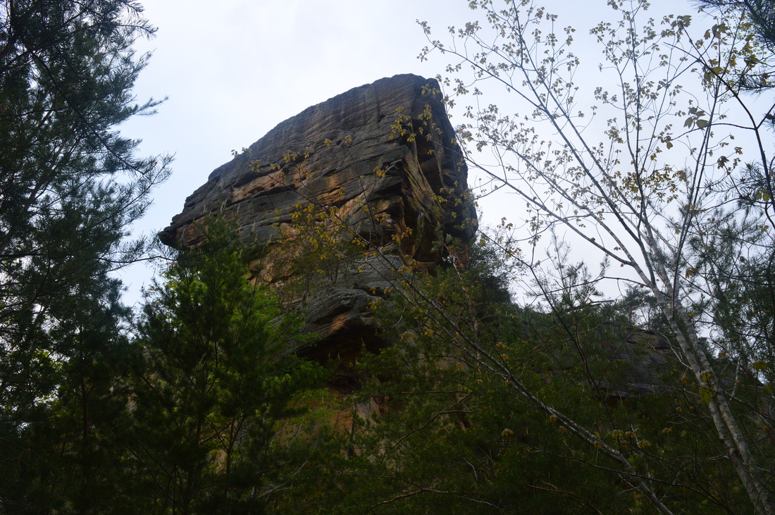
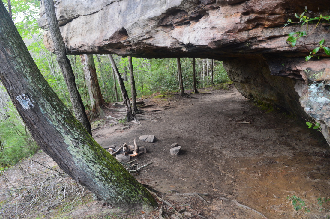
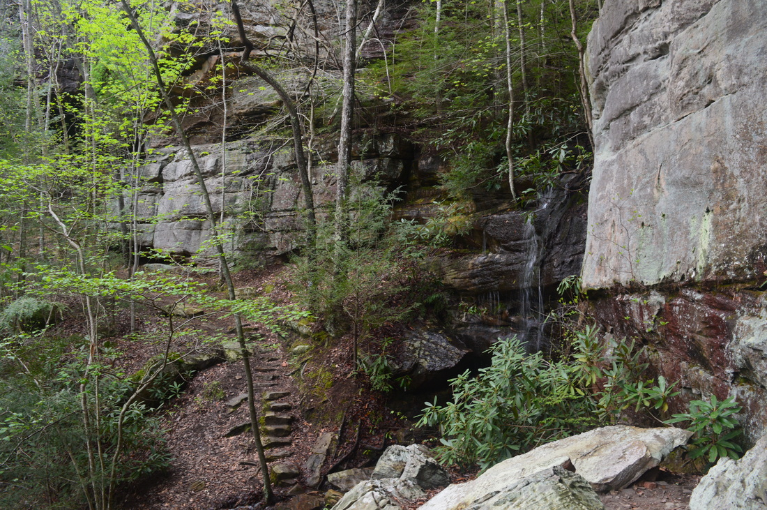
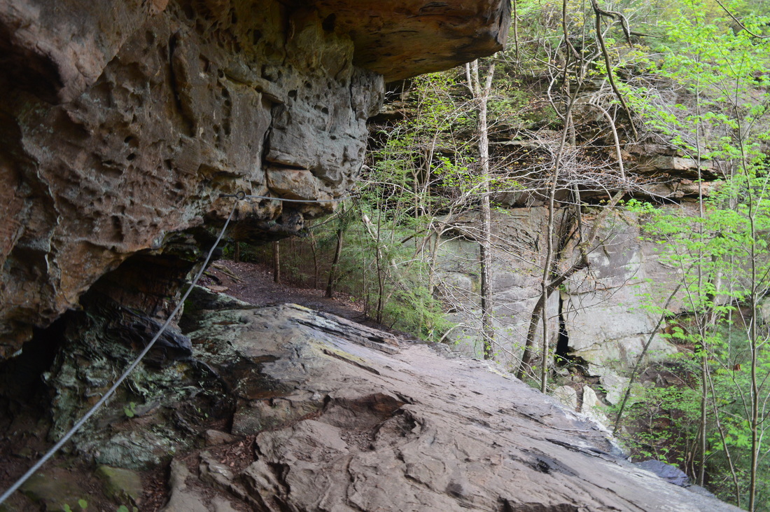
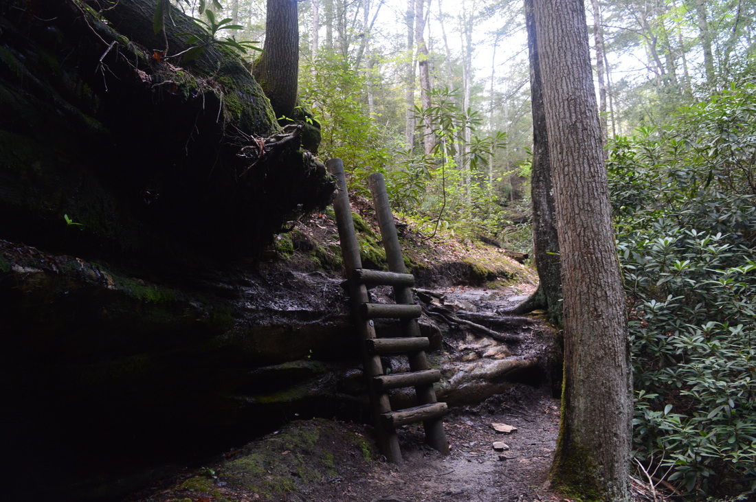
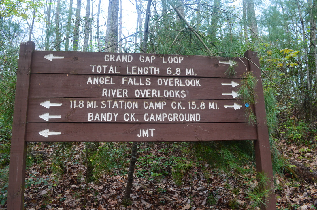
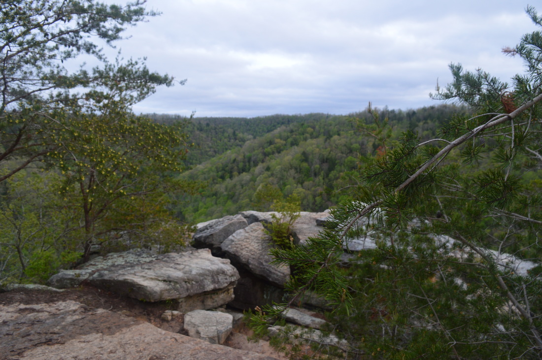
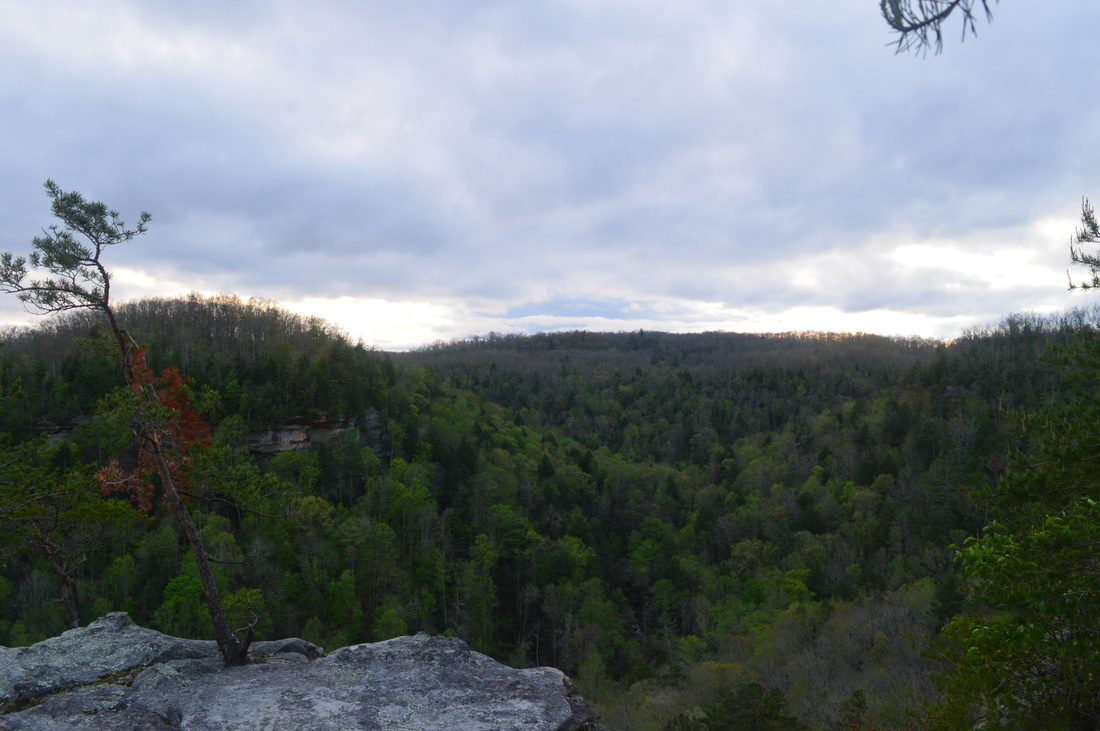
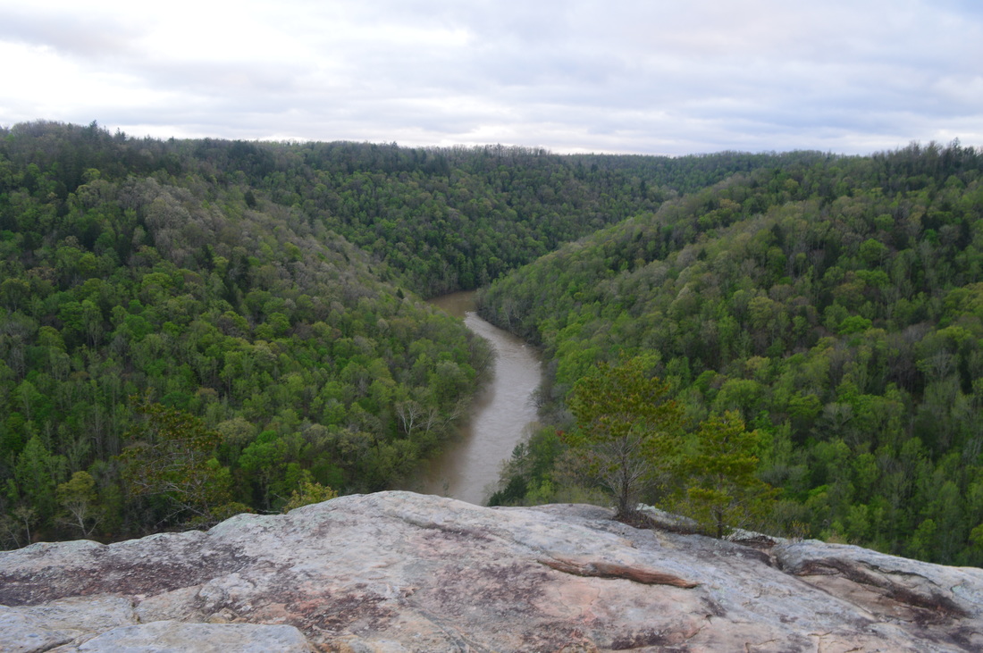
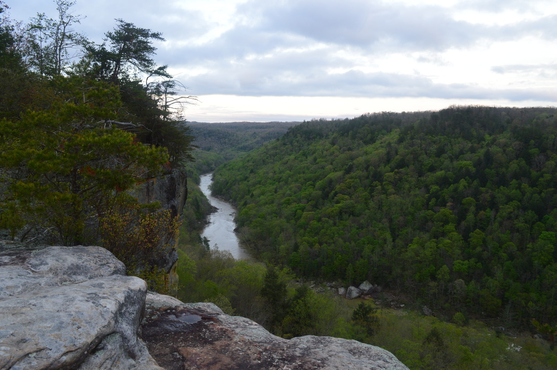
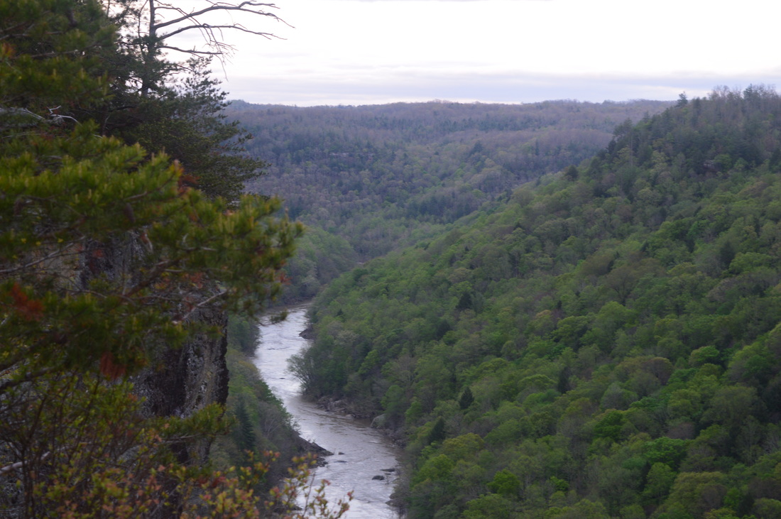
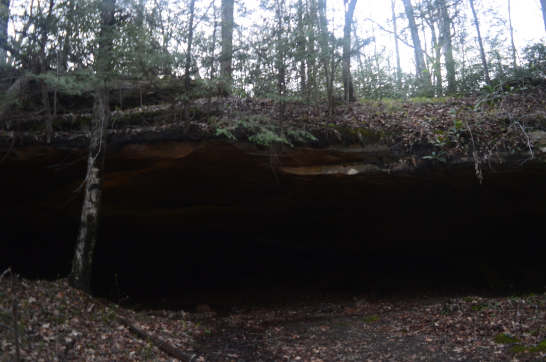
Before you start your hike (or after you finish it), I highly recommend driving to East Rim Overlook, located at the end of East Rim Road. A short loop, half-paved, about 0.1 miles long, leads to the overlook. The overlook is not as good as Angel Falls Overlook, but it still provides a commanding view of the gorge upstream into an area you won't see throughout most of the hike. Following this, drive back to the trailhead and start the hike. You may notice two trails - Sunset Overlook Trail and Leatherwood Loop Trail - leaving the parking area. You'll do both. Sunset Overlook Trail is a relatively short out-and-back stub, 2.6 miles long roundtrip, so you'll be back at the parking area later. I decided to do the short trail first, and then get to the main, bigger hike. The trail starts across from the parking area and quickly enters thin woods. At 0.1 miles, descend to and cross a gated gravel road. A building with an unknown to me purpose stands on the right. Following the road, the trail continues to gradually descend. Reach a small pond at 0.4 miles, and take the trail across the pond's dam. From here, the trail stays mainly flat with a couple short ascents until it begins to approach the rim of the gorge at 1.2 miles. Winter views abound both upstream and downstream. Make a short but steep descent and reach a rock outcrop at 1.9 miles, facing downstream. This is Sunset Overlook. the view is somewhat limited by growth and trees, but it is still a nice panorama downstream. Leatherwood Ford can be seen from here. I doubt the sunset from this overlook can be well seen, though. From here, retrace your steps to East Rim Trailhead, reaching it at 2.6 miles. You are now facing a large field and the start of Leatherwood Loop. The trail turns left from the trailhead and follows the edge of the field and the road. Enter the woods and reach the start of the loop section at 2.8 miles. For now, turn left - I was planning to eventually return from the right. Once you turn left, the trail follows a ridge, and then drops off it via switchbacks to reach a junction at 3.2 miles. Here, a short spur trail continues straight to Leatherwood Ford Overlook, while the main trail turns left. I took the spur trail, which ended at a small rock outcrop, guarded by a fence, at 3.3 miles. This is Leatherwood Ford Overlook. The view is limited, but you can still see your immediate surroundings, including the Big South Fork, Leatherwood Ford, and TN-297. After seeing the view, return to the main trail at 3.4 miles, and continue following it into the gorge. This is where the main descent starts. Drop into a stream hollow with some wet-weather cascades, and step over the stream. Continue the descent on a well-graded trail via switchbacks. There may be winter views of the gorge here. At 4.3 miles, reach the John Muir Trail/Sheltowee Trace Trail and the base of the gorge. Straight ahead, the Big South Fork was quite swollen and flowing swiftly. If turning left, you will reach the Oneida & Western Bridge in 1.8 miles. Meanwhile, turning right will bring you to Leatherwood Ford and TN-297 in 0.5 miles. Turn right. This section of trail is easy, as it stays just above the river. At 4.6 miles, reach a short side trail to an observation deck at the river. Some steps lead down to a lower deck, and there is also an upper deck. Both don't have a great view, but it was good enough for me to clearly see the power of the swollen river. There were some trees well into the water onto the other side of the river - clear proof of how powerful this flood was! Following this river vista, the easy, wide trail continues to follow the river. There was one nice campsite here. Even though it's near the river, it's good as it's not right at river level. Shortly pass another one that is closer to the edge of the river. At 4.8 miles, reach an important point on this hike. The Leatherwood Loop Trail turns right back up the gorge. You'll take this on your way back. A short connector trail continues straight, under the TN-297 bridge, to the Leatherwood Ford Trailhead, which is one of the most important trailheads in Big South Fork NRA. 4 trails leave the trailhead: Leatherwood Loop Trail, John Muir Trail/Sheltowee Trace Trail South, John Muir Trail/Sheltowee Trace Trail North, and Angel Falls Trail. I had already come from the direction of the first two, but I still had an option to choose between the other two. I considered adding on roughly 4 miles for Angel Falls. In the end, I decided not to, as the falls is not very impressive and I was more interested in seeing what the John Muir Trail on the opposite bank had to offer. Thus, I decided to start on that part of the hike, and worked my way past the Gazebo to the river on a paved walkway, reaching the place where the footbridge is. Except, the footbridge wasn't there. The paved path went straight into the water, surrounded by small half-submerged trees. I could see a pair of rapids, which was likely at the bridge - it meant that the bridge was underwater Hard to imagine how high the water must've been for that to happen. At least I had another option - to cross the Big South Fork on the TN-297 and then pick up the trail on the opposite side. There is a paved riverwalk where the footbridge was supposed to be, but I didn't bother with it, and proceeded straight to the road bridge. I got a great view of the fast waters from the bridge. More trees standing in the water were visible in the distance. On the other side of the bridge, at 4.9 miles, there were a stone staircase on the right leading to the main trail. I took this staircase down. At the river turn left and take the riverside trail. Shortly pass the other end of the underwater bridge. The trail was quite muddy here in several areas. At 5 miles, veer left into a small stream hollow and cross the stream on a footbridge. After periods of rain, there may be some nice cascades above the bridge. Over the next 1.7 miles, the trail generally stays right at the river, following it. It does cross two branches, both of which have wet-weather cascades. These crossings are easily done even in wet times. There will also be several large blowdowns. At 6.7 miles, the trail reaches Fall Branch, and starts following it upstream. This was an extremely muddy section. At 6.8 miles, cross a wooden footbridge over all Branch. This normally small stream was roaring on this day, and there were some nice cascades here. On the other side of the footbridge, take the trail downstream for a bit, and then begin ascending in earnest to the rim of the gorge. The ascent is only 0.8 miles long, but it consists of moderate grades. Ample switchbacks make things easier. At 7 miles, pass along the base of the huge cliff that has Angel Falls Overlook. At this point, I was wondering "how in the world do you get up there?". My answer was soon revealed. Pass under a large rock overhang on the trail and cross a small stream. A wet-weather waterfall lies upstream. At 7.2 miles, reach an interesting section of trail. Scramble acutely right up a steep slope onto a large rock outcrop. Follow the edge of the rock outcrop with the help of a cable. Treat this section of trail with caution. The section is short, though. At 7.3 miles, recross the small stream and shortly afterwards climb up a small wooden ladder. Following a series of wooden steps, reach a junction with the Grand Gap Loop at 7.4 miles. The John Muir Trail turns left, and it is also the shortest way to Alfred Smith Trailhead, 1.3 miles. Straight ahead, a small path continues that is not marked on my maps. It appears that it could be a shortcut to somewhere up the Grand Gap Loop. Meanwhile, the long section of the Grand Gap Loop turns right. This is where you need to go in order to reach Angel Falls Overlook. Follow a flat trail along the rim with good views. At 7.6 miles, reach a sign "carry your bike". Shortly afterwards, reach a large rock outcrop on the right, as the trail bears left. This is Angel Falls Overlook. Step out onto the outcrop, and intake the view... and what a view it is. The view focuses on three areas, in respective order from worst to best.
From this overlook, I could even see some trees engulfed in the flooded river, and its brown, fast waters were clearly outlined. It was an amazing view, and I would have stayed here for many hours, if I didn't have to continue. From the overlook, I continued for my last destination of the day, a small natural arch just 0.2 miles farther. The trail stays mainly flat, and eventually dips downhill, before reaching what looks like a small rock overhang on the left at 7.8 miles. This is actually a natural arch. Look closely for an opening on the back of the overhang - a ray of light shines through. Originally, I had the idea of hiking the entire Grand Gap Loop, but I definitely didn't have time for that on this day with the fading daylight. I decided to retrace my steps. Return back all the way to TN-297, reaching Leatherwood Ford Trailhead at 10.8 miles. From here, I had plans to change up my return route slightly. Since I meant to continue following Leatherwood Loop, I turned left at the sign you passed when you hiked here earlier. The trail ascends up a streambed and shortly comes out on TN-297 at 10.9 miles. This is a confusing spot. Continue up TN-297 for a couple hundred feet, reaching a sign for the trail on the right shortly. Take the path back into the woods from the road and continue ascending. This ascent is generally not steep, with several well-placed switchbacks. Then, you'll come alongside a small stream and make a short steep pitch, followed by a steady climb in old roads. You'll intersect more old roads, so pay attention to where you're going. My GPS seemed to be a bit off here, so the mileage may be a bit less than I am saying. Hopefully it's not though. If my GPS is right, reach the end of the loop at 12.9 miles, after passing a marshy area and the lower edge of the field that is at the trailhead. At the end of the loop, turn left onto the connector trail back to the trailhead, reaching the end of the hike at the parking area at 13.1 miles. To summarize, this is an absolutely spectacular hike. I'd say it's one of the best I've done in Tennessee. It might be one of the best hikes in Tennessee. All the river views are beautiful, and the final overlook and the climb to it absolutely kills it, so to speak. I rate this hike a Best Hike. Below are my pictures and videos.
0 Comments
Leave a Reply. |
About MeMark Oleg Ozboyd Dear readers: I have invested a tremendous amount of time and effort in this website and the Georgia Waterfalls Database the past five years. All of the work that has gone in keeping these websites updated with my latest trip reports has almost been like a full-time job. This has not allowed me to pick up a paid job to save up money for college, and therefore, I I've had to take out loans. If you find the information on this website interesting, helpful, or time-saving, you can say "thanks" and help me out by clicking the button above and making a contribution. I will be very grateful for any amount of support you give, as all of it will apply toward my college tuition. Thank you!

Coming in 2022-2023?
Other Hiking WebsitesMiles HikedYear 1: 540.0 Miles
Year 2: 552.3 Miles Year 3: 518.4 Miles Year 4: 482.4 Miles Year 5: 259.9 Miles Archives
March 2021
Categories
All
|
 RSS Feed