
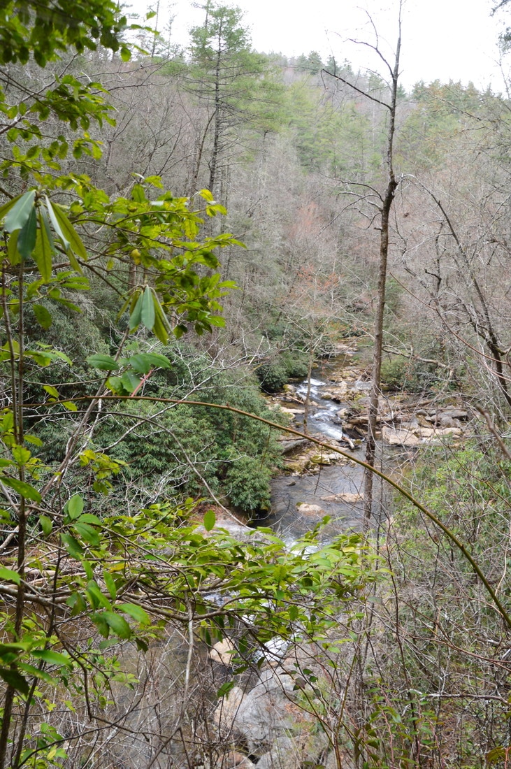
Deep in Rabun County is a spot known as Three Forks, where three major mountain waterways - Big Creek, Overflow Creek, and Holcomb Creek - come together to form the West Fork of the Chattooga River. Three Forks is a unique and pristine location that can only be reached by foot, but while Three Forks alone would be a hiking destination as worthwhile as any, the three creeks that tie into Three Forks are loaded with waterfalls that come in all shapes and sizes. Perhaps the most incredible one of them all is Thunder Dome Falls on Big Creek, a monster waterfall that falls 70 feet in multiple tiers through a slot canyon and into a deep pool. It can safely be assumed that Thunder Dome Falls is among Georgia's most jaw-dropping natural sights. Thunder Dome Falls is not matched in size by the other waterfalls on this hike, but even though they're smaller, all of them are just as picturesque. This hike occurred Saturday, March 11th, 2017. My plan was to hike the Big Creek Circuit clockwise from Highway 28, hiking the Big Creek Trail first and then the Three Forks Trail. Along the way, I would make side trips to each of the four waterfalls on Big Creek, to Three Forks and the Holcomb Creek slot canyon, and to Singley's Falls on Overflow Creek.
Summary
R/T Length of Trail: 8.9 Miles
Duration of Hike: 10:00 Type of Hike: Lasso Difficulty Rating: 7 out of 10 Total Elevation Gain: 2362 Feet Pros: Solitude; pristine and beautiful mountain streams Cons: Portions of the hike are on very faint goat paths; the side trail to 4th Falls on Big Creek (Holy Shit Falls) is extremely steep, dangerous, difficult, and is recommended only for the most experienced hikers Points of Interest: 4th Falls on Big Creek (Holy Shit Falls) - 7 stars; 3rd Falls on Big Creek (Thunder Dome Falls) - 10+ stars; 2nd Falls on Big Creek (Horsetail Falls) - 4 stars; 1st Falls on Big Creek - 4 stars; Three Forks; Holcomb Creek Slot Canyon; Singley's Falls on Overflow Creek - 5 stars Trail Blaze Colors: None, as these are not official trails Best Seasons to Hike: Winter (or Spring if you're planning on wading at Three Forks to see Holcomb Creek) Fees: None Beginning Point: Three Forks Trailhead on Highway 28 near Big Creek Bridge Directions from Clayton, GA: From the intersection of Rickman Drive and US 23/441 in downtown Clayton, follow Rickman Drive East. In 0.5 miles, turn diagonally right onto Warwoman Road, and continue for 13.4 miles. At the T-intersection with GA 28, turn acutely left onto GA 28 and continue for 4.4 miles to an outside bend in the road, where the trailhead is. A forest road leaves to the left and into the woods at the large clearing where the trailhead is at. The trailhead is located just north of the bridge across Big Creek. Map
Click here to download a track of this hike.
Details
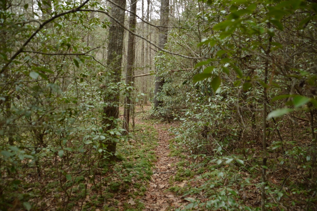
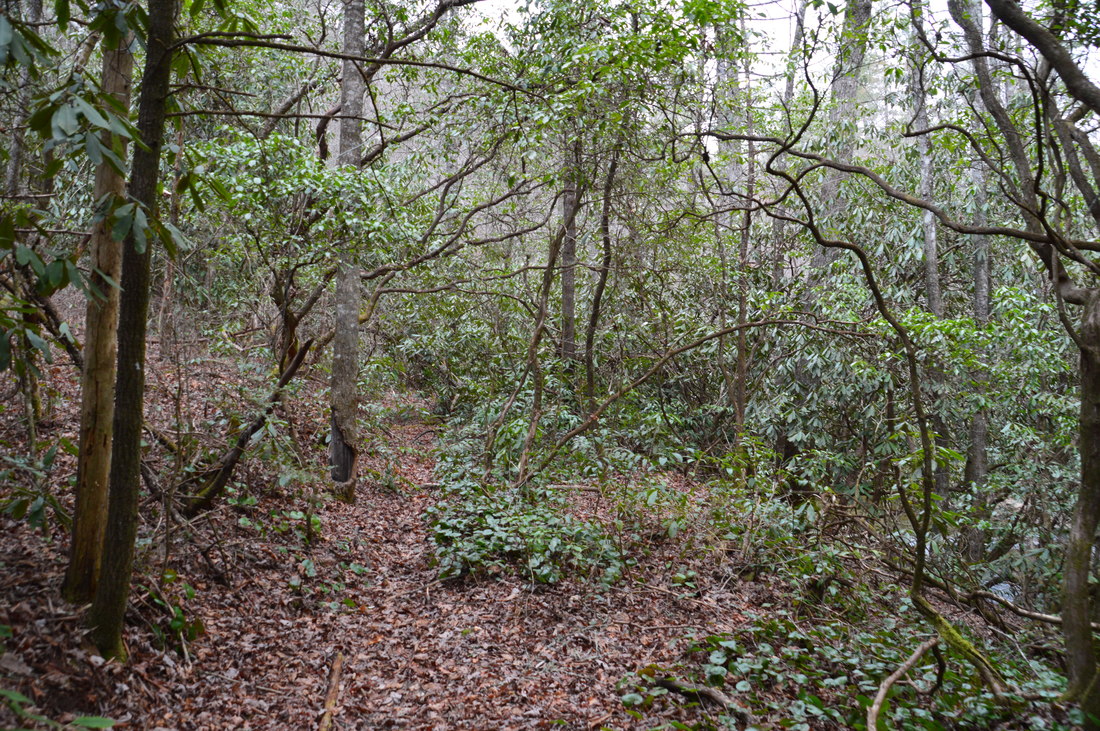
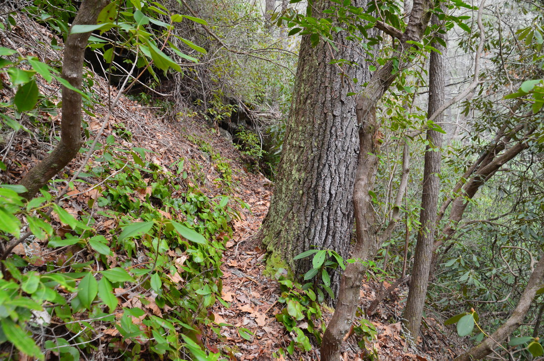
The first thing that may have jumped out at you upon reading the summary of this hike is that the average pace was under 1 MPH. Indeed, that comes to show that this hike is rather difficult, although excessive elevation gain is not the reason. The reason for the difficulty is that extended portions of the hike follow "goat paths" of varying quality, all of which are unmaintained, rugged, and slow. In particular, the goat path to 4th Falls on Big Creek took me 1 hour and 37 minutes to hike out and back, and this spur trail is absolutely not recommended for casual hikers. I will discuss this in detail farther below, but while none of the other goat paths are as difficult, they are still quite time-consuming.
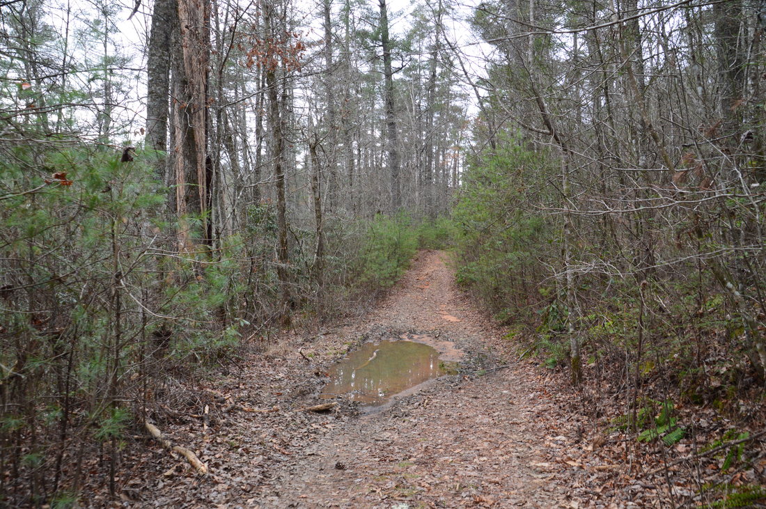
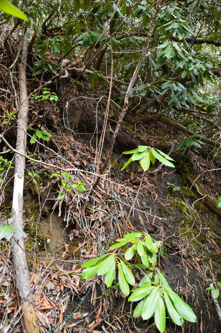
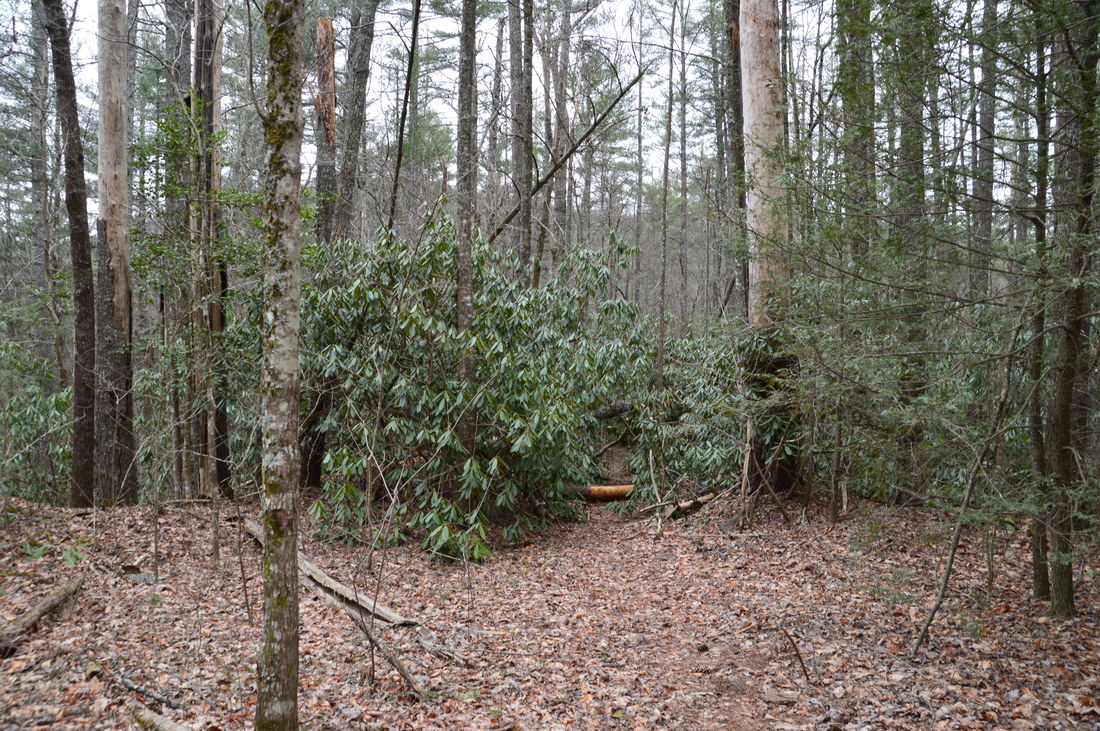
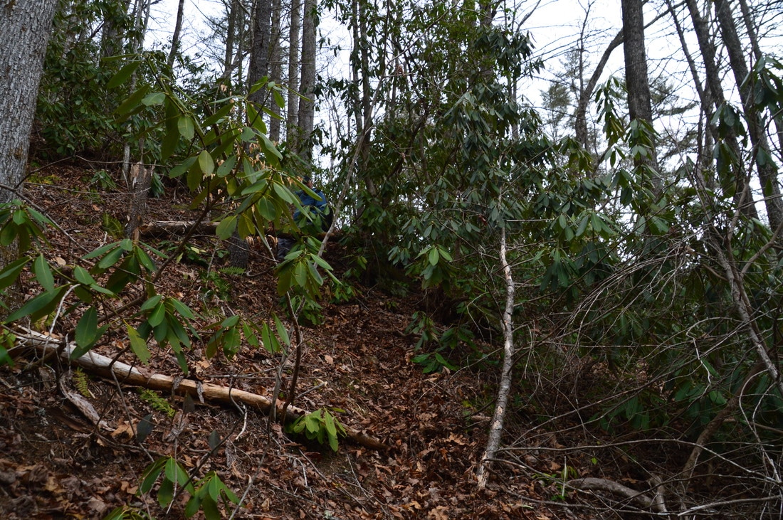
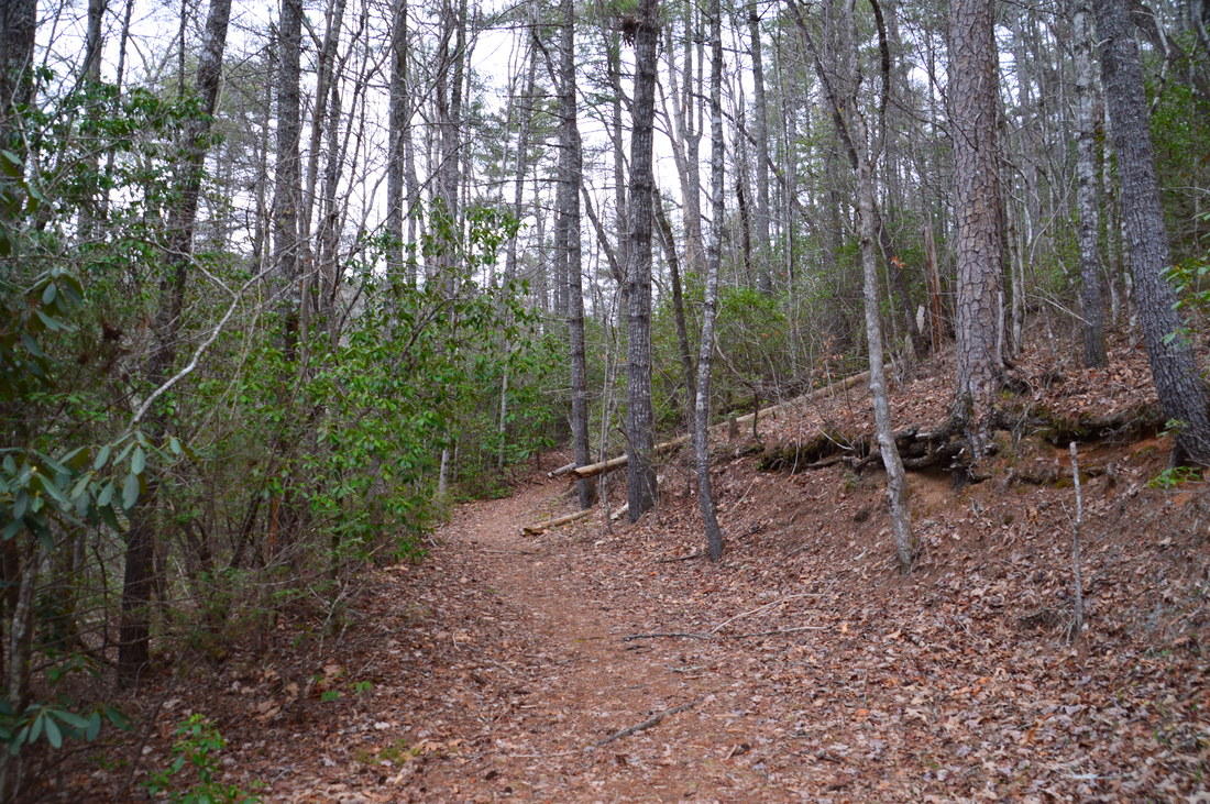
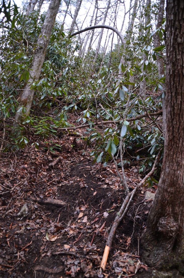
The traditional hike to Three Forks involves hiking the Three Forks Trail from John Teague Gap on Overflow Creek Road. The Big Creek Circuit is the alternate route to Three Forks that is longer and more difficult, but it is unquestionably much more scenic, due to all of the waterfalls seen along the way. The trailhead for the Big Creek Circuit is at Highway 28 near the bridge across Big Creek. From the parking area, walk down a forest road westward that shortly enters the woods and reaches Talley Mill Creek. Most of the time, it is possible to rock hop the stream using large stepping stones just to the right of where the road crosses the creek, but during high water, expect to get wet feet here. A carsonite marker indicates that this is FS 650, which is actually drivable by high clearance vehicles with four-wheel drive for the first 0.7 miles. However, there are some very muddy areas where there usually is standing water, so in general, it is better to just park at the official trailhead and walk the road. After crossing Talley Mill Creek, FS 650 makes a gentle ascent and then levels out, contouring along the upper reaches of the Big Creek gorge, with the creek thundering far below. After passing several of the aforementioned "mud holes", the drivable portion of FS 650 ends at the first jeep-blocking mound at 0.7 miles. The Three Forks Trail continues straight ahead, passing slightly to the left of the mound. At this same spot, a narrow footpath leaves left to the 4th Falls on Big Creek, which is heard very well in the gorge below. This is where a word of caution is required. The goat path to 4th Falls on Big Creek is extremely steep and difficult, as it descends 200 feet in 0.1 mile. Furthermore, there are several technical spots on it, including a long stretch with a rope (hopefully it is still there when you read this!), where foot traffic on the trail has literally erased the soil to bedrock, causing the path to become extremely slick. On my way back up, I had to rely on the rope to get up, and even then, I still needed help from another person. Judge wisely if you can get all the way down and back up, but it is absolutely not for everyone and not for casual hikers without question. If you do get down the path, the reward is a stunning waterfall. Below is a brief description of the path. 
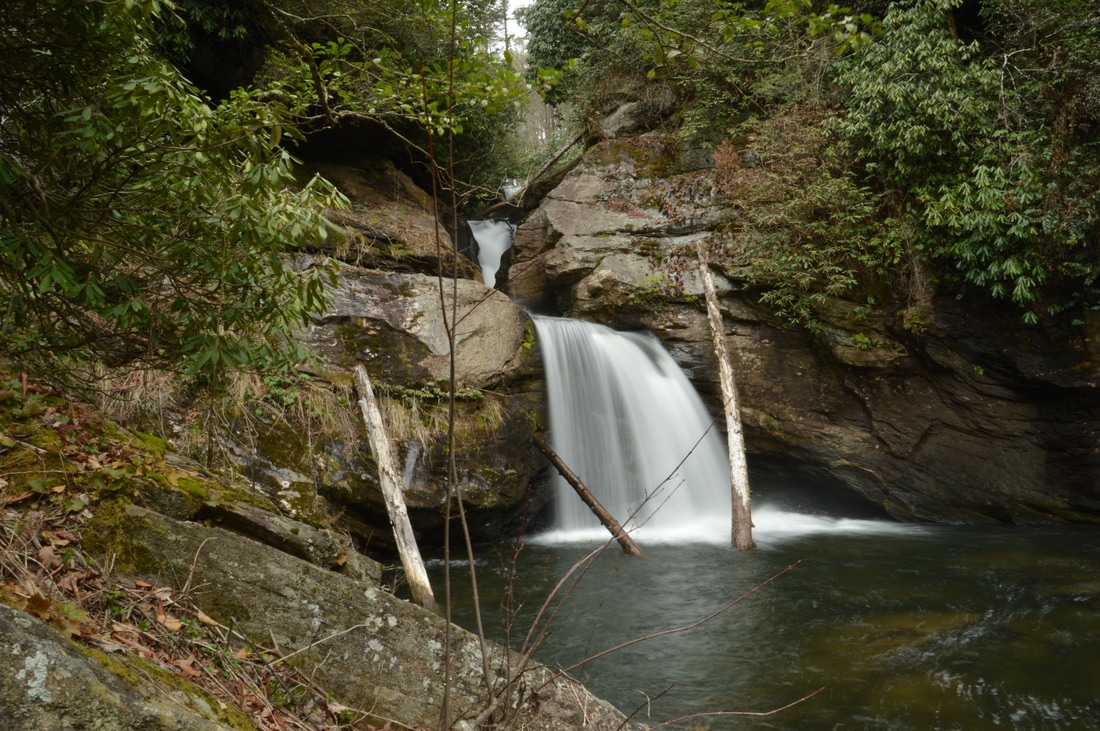
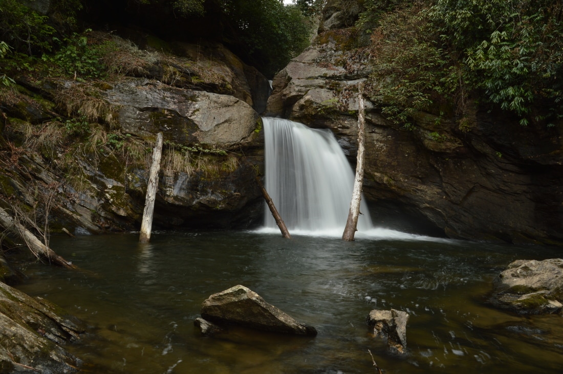
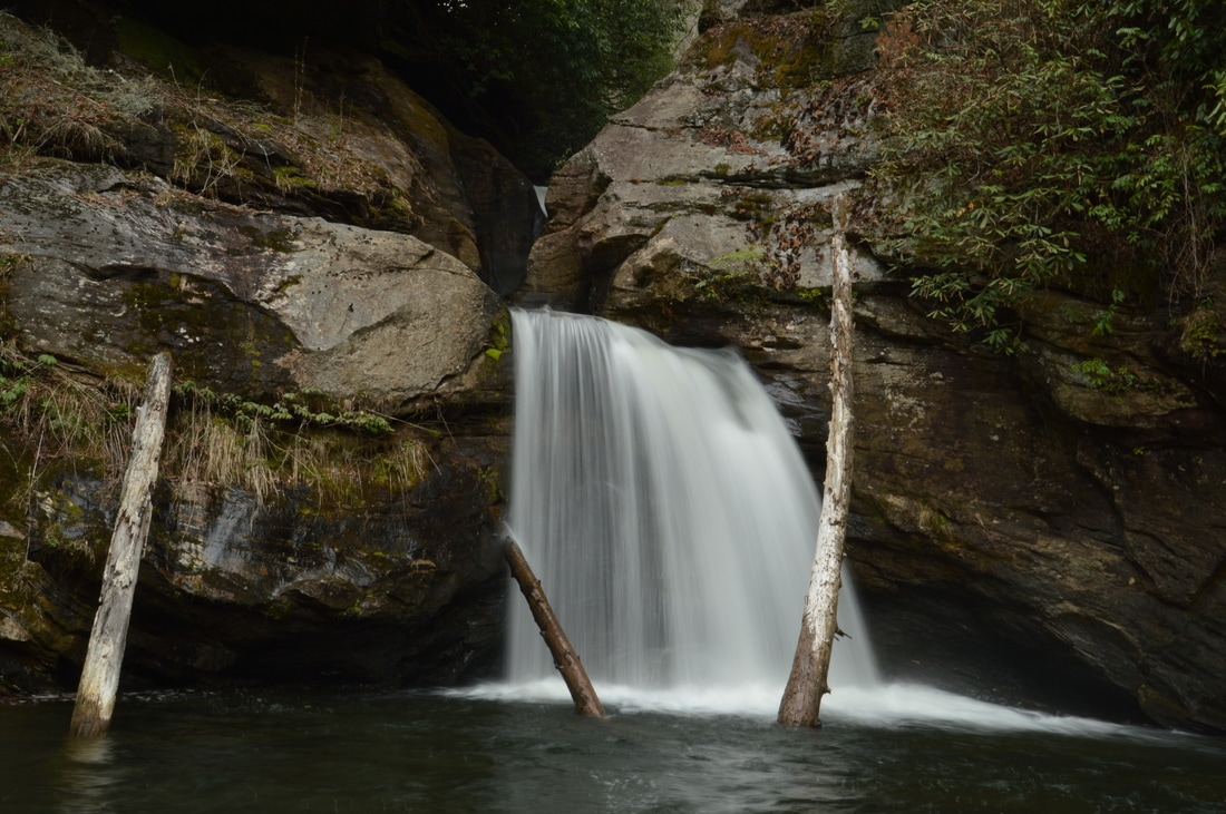
The 4th Falls on Big Creek, appropriately named "Holy Shit" by kayakers, is a stunning and unique waterfall that drops about 20 feet into a short but deep slot canyon.
The well-used path begins as a steep but manageable descent. In about 150 feet, reach the first technical spot. There is a small ledge here, but using the tree to the left as a handhold, it is possible to get down the ledge, which is only an appetizer. Perhaps 100 feet farther, reach the toughest section of the goat path. Here, the "path" descends down an insanely steep slope that is very slick and muddy. At the time I did this hike, there were ropes placed here to aid with the return. Even with the ropes, it is extremely difficult to scramble back up, so judge your abilities carefully. Beyond the rope, there is a split with a wet ledge just below. The more obvious path bears right and passes another rope before descending to Big Creek where the mouth of the slot canyon just below the 4th Falls is located. However, this vantage point doesn't provide a view of the 4th Falls. To see the actual waterfall, bear left at the split. After scrambling over a large fallen tree, bear left and stay at about the same elevation on the slope just above the creek until the waterfall comes into view. This is where it is possible to descend to a small shelf below the falls with enough space for two people (or one person and a tripod), reaching the end of the side trail at 0.8 miles. 4th Falls on Big Creek is a very unique waterfall - what it lacks in size it gains in its remoteness and wild beauty. The waterfall is about 20 feet high, as Big Creek spills down a steep rock ledge and into a short but deep slot canyon. Logs fallen across the waterfall help to contribute to the remote setting. There is a separate 20-foot drop just upstream from this spot, although it is out of sight. Kayakers have named 4th Falls on Big Creek "Holy Shit Falls", presumably due to this expression resonating from anyone who has decided to go for the wild ride in a kayak down the falls.
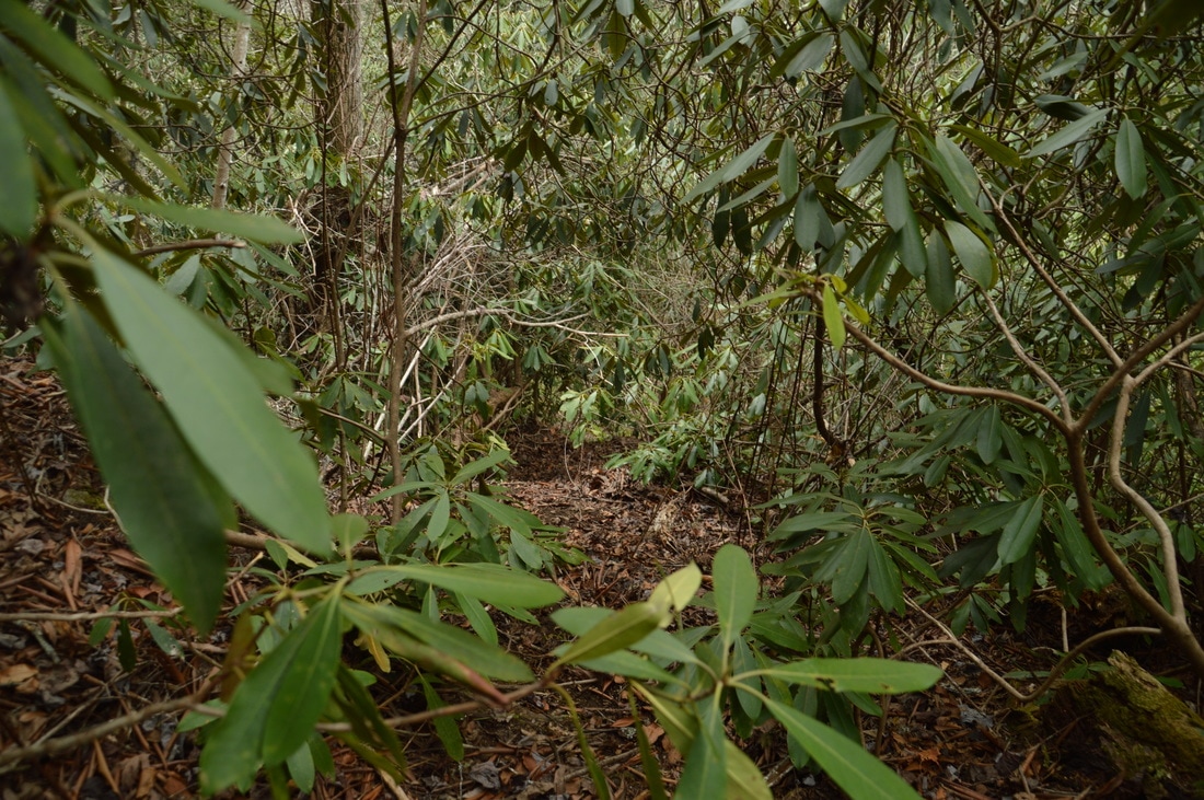
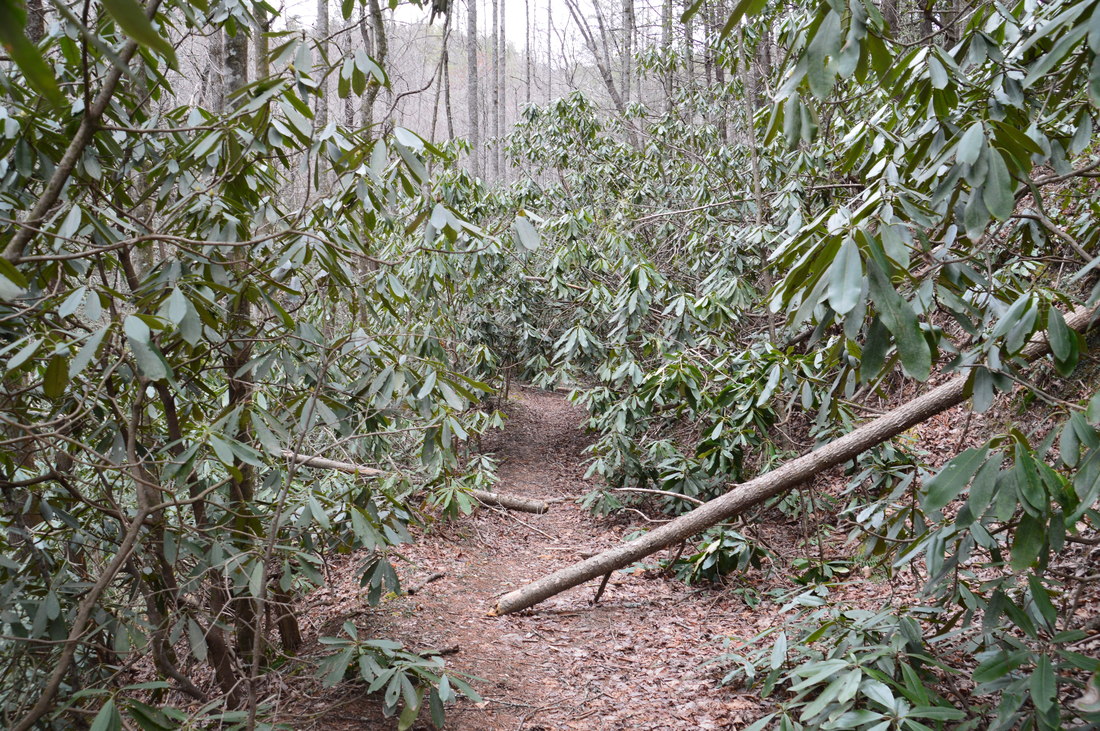
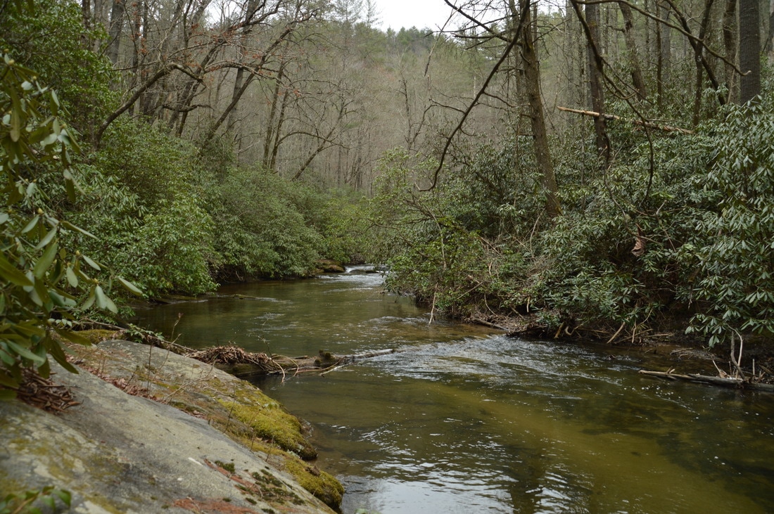
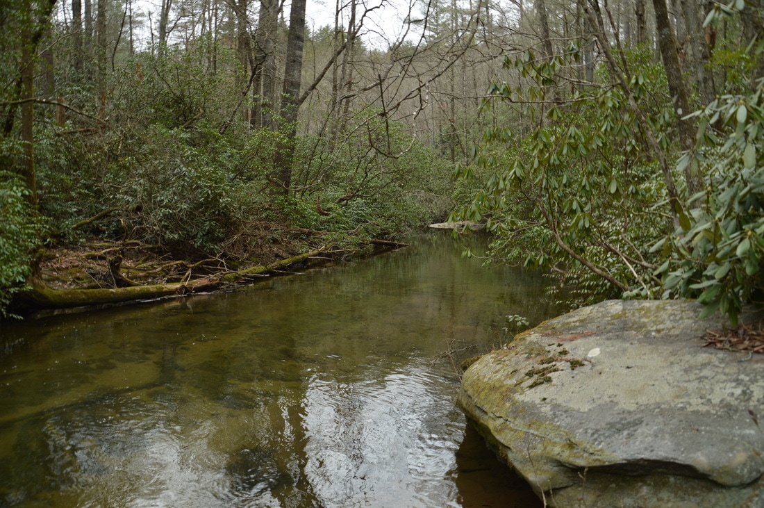
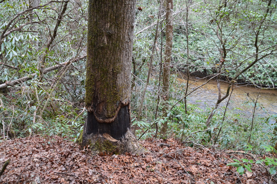
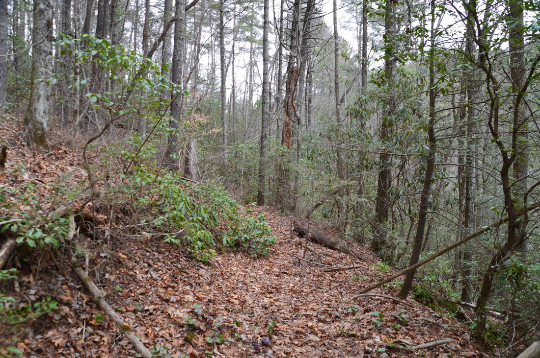
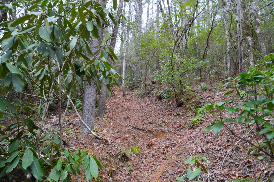
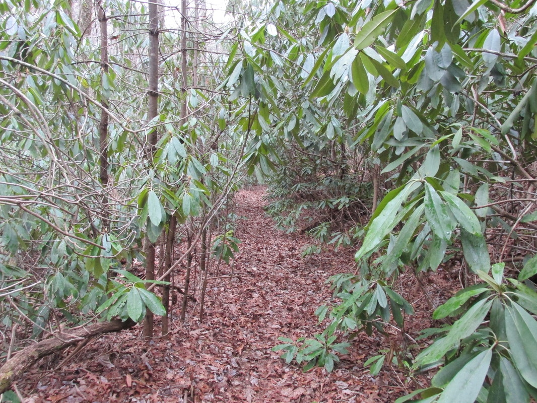
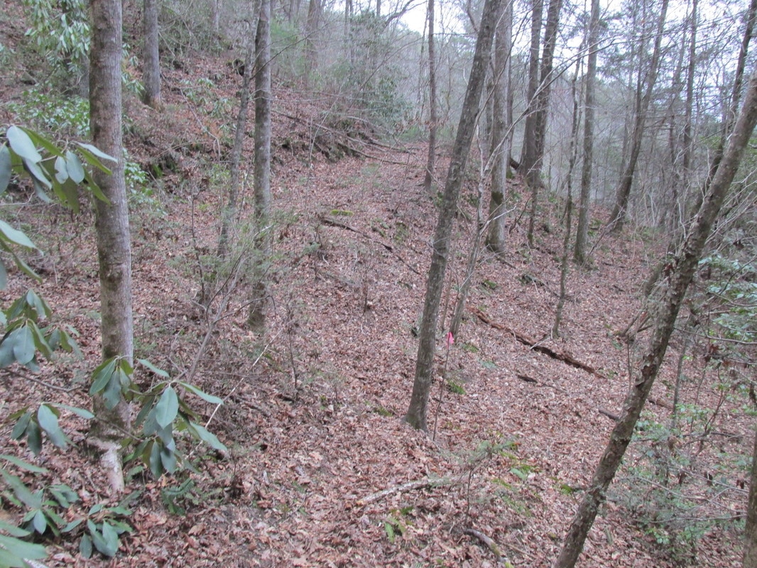
From 4th Falls on Big Creek, retrace your steps to the Three Forks Trail and turn left onto it continue the hike. After passing some rock outcrops to the right, the trail - which follows an old roadbed (the continuation of FS 650) - remains nearly level and distinct, although occasionally, low-hanging rhododendron branches can cause slight slowdowns. At 1.2 miles, the trail crosses a small stream, and at 1.5 miles - at the top of a small rise - there is an unmarked but very important intersection with the Big Creek Trail, which leaves to the left. This signifies the beginning of the loop. The Three Forks Trail continues to Three Forks, passing the spur trail to Singley's Falls along the way. Meanwhile, the Big Creek Trail also leads to Three Forks, passing three waterfalls on Big Creek along the way. It is important to hike the loop clockwise by following the Big Creek Trail, because undoubtedly, the Big Creek Trail is more difficult than the Three Forks Trail, due to the rugged and obscure nature of the pathway. It is best to get this trail out of the way first and then relax on the relatively easy Three Forks Trail for the second portion of the hike. Thus, turn left onto the Big Creek Trail. This trail quickly begins descending down the nose of a lead toward Big Creek. The pathway is initially easily followed, with the only obstacles being the occasional fallen tree. At 1.85 miles, the trail reaches Big Creek at a photogenic spot. The rhododendron-lined creek's clear waters are tranquil here, although a small shoal lies upstream. Based on how quiet the creek is here, you would never know that a 70-foot waterfall lies less than a half-mile away! After reaching Big Creek, the trail crosses Stooping White Oak Branch and passes numerous signs of beaver activity. This is where the trail steadily begins to turn more rugged, as the sides of the gorge steepen and the trees fallen across the trail increase in quantity. 
Portions of the unofficial and unmaintained Big Creek Trail are very rugged, with numerous downed trees and steep slopes.
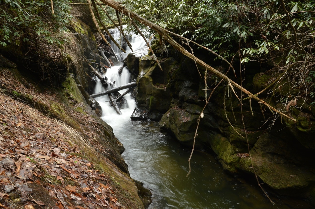
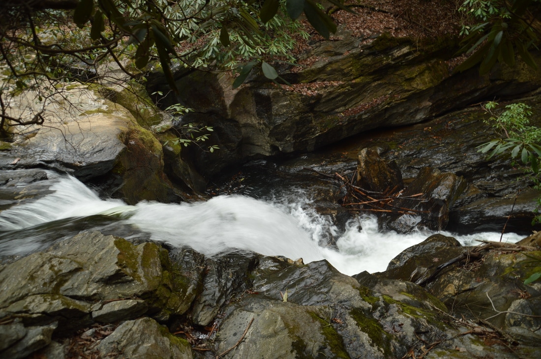
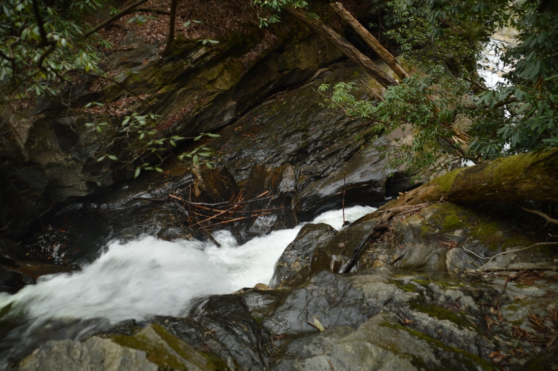
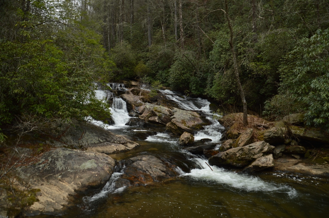
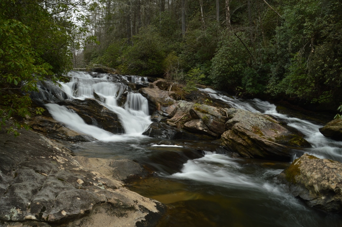
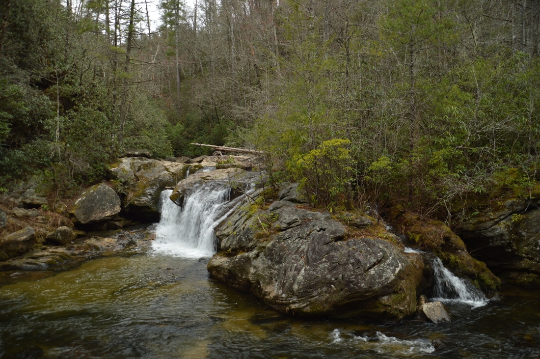
At 2.2 miles, the trail approaches the top of 3rd Falls on Big Creek (Thunder Dome Falls). A 50-foot side path leads to the area at the top of the falls. The view is stunning, but I cannot stress enough that you must exercise extreme caution here, as one slip will send you straight into the slot canyon in the middle of the falls! That said, this view of Thunder Dome Falls is spectacular, as it shows the upper tier and the slot canyon that separates it from the lower tiers. It is not possible to see this section well from the base of the falls. After seeing the view, return to the trail. Just afterwards, it is important to bear right on the main trail as a well-used dead-end path continues straight to a bluff with a rope at the falls. After a short but rugged traverse along the steep slopes above the falls, reach a junction with the spur trail to the base of Thunder Dome Falls at 2.3 miles. Turn left onto this spur trail. While steep, is it not dangerous at all and presents only a minor challenge to follow. 150 feet later, you will reach the base of 3rd Falls on Big Creek/Thunder Dome Falls (it is known by both of these names). What a sight! Big Creek spills down 70 feet in three tiers through a tight slot canyon and into a dark pool. Massive cliffs line the pool and the gorge as a whole. Without a question, this is one of the most spectacular and photogenic waterfalls that I have seen in Georgia (and pictures don't fully convey the beauty of the setting). I can only imagine what this waterfall would look like after heavy rain or even in normal winter flow!
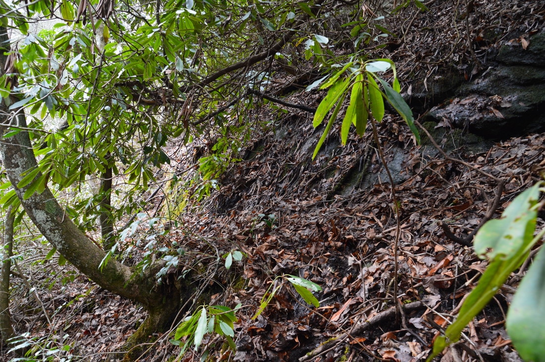
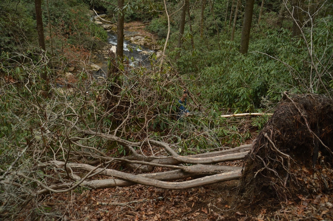
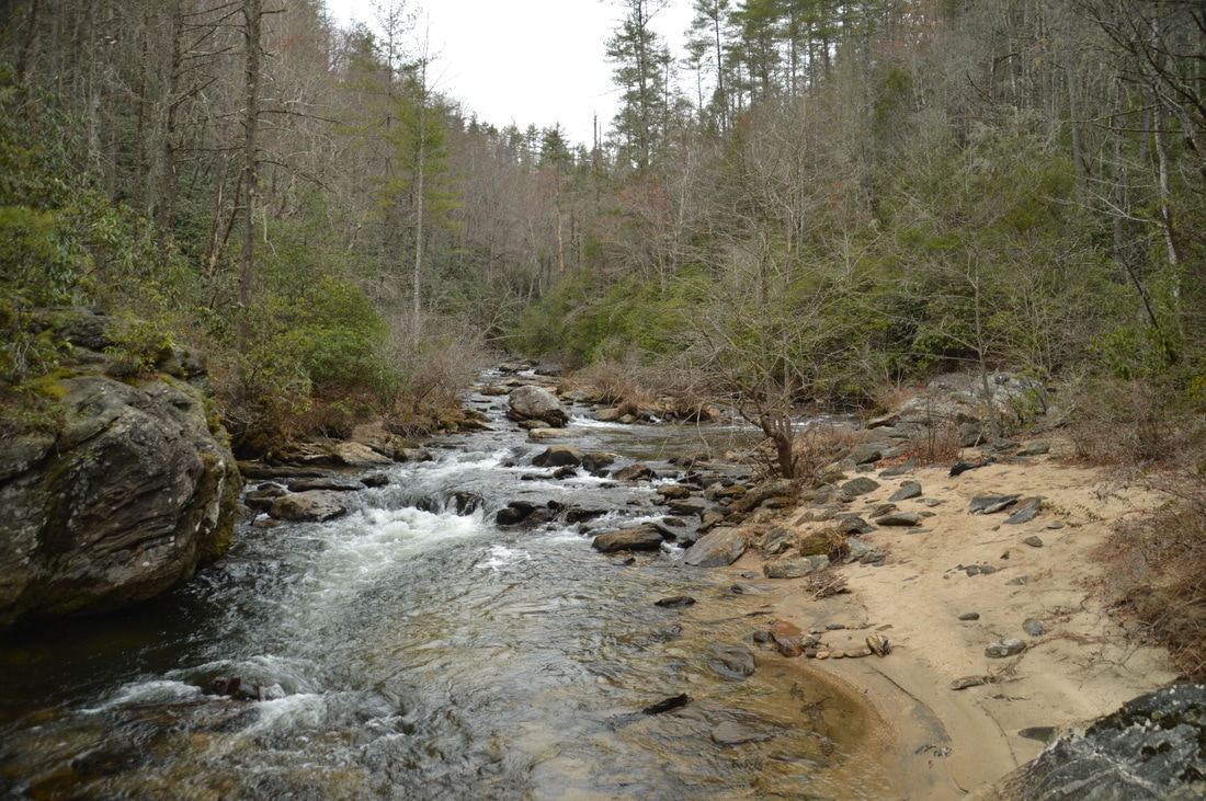
From Thunder Dome Falls, return to the main trail at 2.35 miles and turn left onto it to continue the hike to Three Forks. At 2.4 miles, the trail reaches an old roadbed on which you must turn left. Following the trail along the old roadbed high above Big Creek is fairly easy. At 2.65 miles, the trail dips into and crosses a small drainage. Then, at 2.7 miles, there is an intersection with the side trail to the left that leads to 2nd Falls on Big Creek. Begin following this spur trail south into the gorge. While not dangerous, this spur trail is quite steep and is also obscured by a set of major blowdowns about halfway down that require a time-consuming scramble. The base of 2nd Falls on Big Creek is reached at 2.75 miles. This waterfall is also known as Horsetail Falls, due to its structure. Horsetail Falls is only 25 feet high, but it is scenic, and a large, flat rock slab provides a great place to view the falls. At Horsetail Falls, Big Creek fans out across a rock face before dropping into a pool. Boulders surround the falls as well as litter the gorge below. From Horsetail Falls, return to the main trail and turn left onto it, once again. Between this point and the end of the Big Creek Trail near Three Forks, the trail is significantly fainter and very confusing in places. You should be able to pick up a faint path heading south from the intersection. Before long, the path skirts a small drainage and then begins descending steeply. Along the descent, I noticed an arrow carved into a tree, pointing the way. After the steep descent ends at 3.0 miles, you will encounter a very large double blowdown. After this, the path becomes noticeably more distinct, and at 3.1 miles, the Big Creek Trail ends in a clearing, where there is an intersection with the Three Forks Trail. Straight ahead, the wide Three Forks Trail follows an old roadbed back toward the trailhead. To the left, the Three Forks Trail makes the final descent to Three Forks. While your route will eventually continue straight, the side trip to Three Forks must not be skipped beforehand. Turn left onto the well-used trail, which descends moderately and ends at Three Forks at 3.2 miles. 
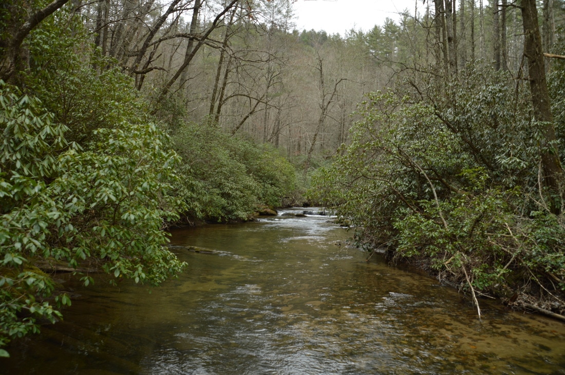
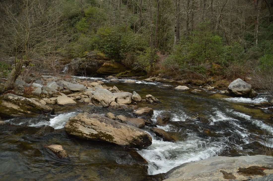
At Three Forks, three wild mountain streams - Holcomb Creek, Overflow Creek, and Big Creek - join to form the West Fork of the Chattooga River. In this picture, Overflow Creek (middle) and Big Creek (right) are visible at their confluence, while Holcomb Creek is outside of the picture near the bottom left.
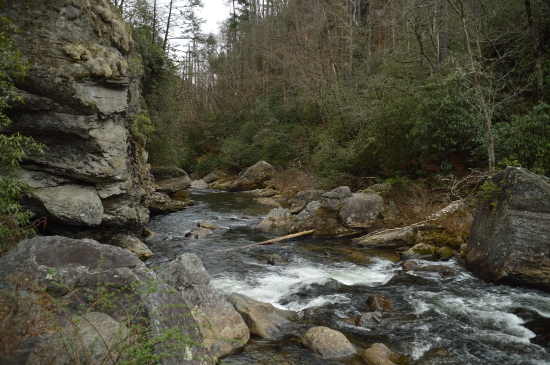
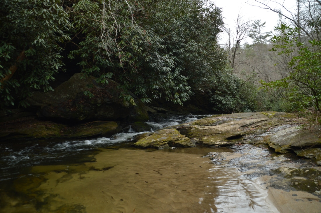
Three Forks is a very special spot: it is the site of the confluence of three large creeks. To the left, Big Creek flows into Overflow Creek that joins from the right, and only a hundred feet downstream, Holcomb Creek makes its contribution from the right, forming the West Fork of the CHattooga River. First, before exploring Three Forks more extensively, scramble upstream along Big Creek for a short distance to 1st Falls on Big Creek. This block-type sliding waterfall is about 17 feet high. It consists of a broad rock slab that Big Creek cascades and slides down. After seeing this waterfall up-close, I suggest fording Big Creek and hiking downstream along Overflow Creek for a short distance down to a huge boulder that stands directly in front of the Holcomb Creek confluence. Holcomb Creek culminates with a small 10-foot waterfall among large boulders before dumping into Overflow Creek, forming the West Fork of the Chattooga River, which flows past a towering cliff and out of sight. It is worth spending as much as an hour exploring this beautiful location.
From Three Forks, you can return to the Three Forks Trail, but there is also an interesting side trip to the Holcomb Creek slot canyon available, which is included in this trail report. Unfortunately, I did not find a way to the mouth of the canyon (only to the top of it), but I will be back, as I know that there is such a way. To reach the top of the Holcomb Creek slot canyon, ford Overflow Creek just above the Big Creek confluence. This ford could be waist-deep or even deeper, depending on recent rainfall. On the other side of the creek, there is a small island with a well-used campsite. Cross the island and cross a small drainage area (usually with water) that creates the island. On the other side of the drainage channel, at 3.3 miles (this mileage includes exploring around Three Forks). the Holcomb Creek Trail (known as the Three Forks Trail as well) begins behind a sawed log. The trail quickly begins an extremely steep ascent up the side of the gorge. You will have to use your hands as well as your feet in some places here, as the steepness of the path rivals the steepness of the 4th Falls on Big Creek path, although this one isn't dangerous. The first steep pitch ends at 3.4 miles at what looks like a four-way intersection. In reality, the left path and straight path form a dead-end loop that is difficult and affords no views of the canyon. To continue on the main trail, turn right here and continue ascending steeply. The trail finally levels out near the top of the canyon at 3.45 miles. In these 0.15 miles, the trail ascends 120 feet! As the trail follows Holcomb Creek, you can see through the trees how the creek turns into a narrow channel of rushing whitewater as it crashes through the slot canyon. At 3.55 miles, the trail reaches a ford of Holcomb Creek. To gain the best view of the slot canyon from the top, it is necessary to ford the creek. However, in high water, this is a dangerous crossing, as a waterfall at the head of the canyon lies only a few feet downstream. While the view from the top is only decent at best, this is still quite a unique spot, adding on to an already spectacular hike. I do have to find a way to the mouth of the canyon though! I believe that it would be possible to reach its mouth by staying in or immediately next to the creek right from Three Forks. 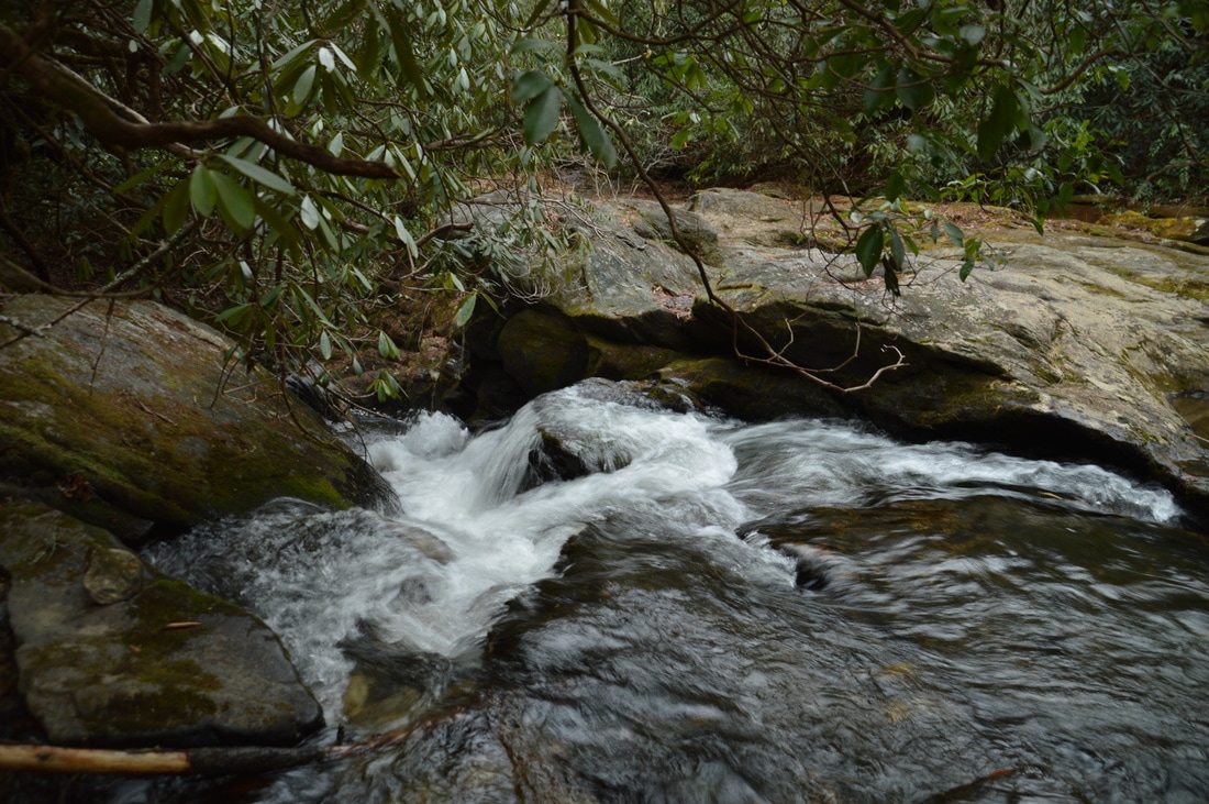
The Holcomb Creek slot canyon is a unique location, where the creek turns into a narrow rushing torrent as it rushes into the slot.
From the top of the slot canyon, retrace your steps to Three Forks, reaching it at 3.8 miles. From here, return along the Three Forks spur trail to the junction you were at earlier in the large clearing. To continue the loop,turn left onto the Three Forks Trail. If you've made it this far, congratulations! The rest of the hike is on well-defined trails and old roadbeds, and even though the biggest ascent of the hike is now beginning, it is fairly easy when compared to the rugged and slow hiking along faint paths near Big Creek. As the ascent begins, the trail makes a switchback at 4.05 miles, just as an overgrown old roadbed continues straight. If this roadbed was not overgrown, it would have been a shorter and more level route to Singley's Falls; however, I have read reports that the roadbed becomes very difficult to follow. Thus, continue following the main trail, which continues to ascend at an easy to moderate grade up a ridge toward Salt Log Knob. At 4.8 miles, near the top of the knob, there is an intersection with the side trail to Singley's Falls on Overflow Creek. While unmarked, the intersection is hard to miss, as a wide old road leaves to the left. It is worth taking this side trail to see one more waterfall.
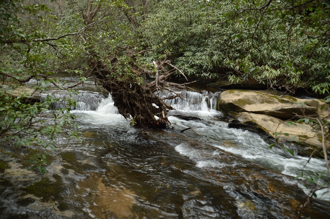
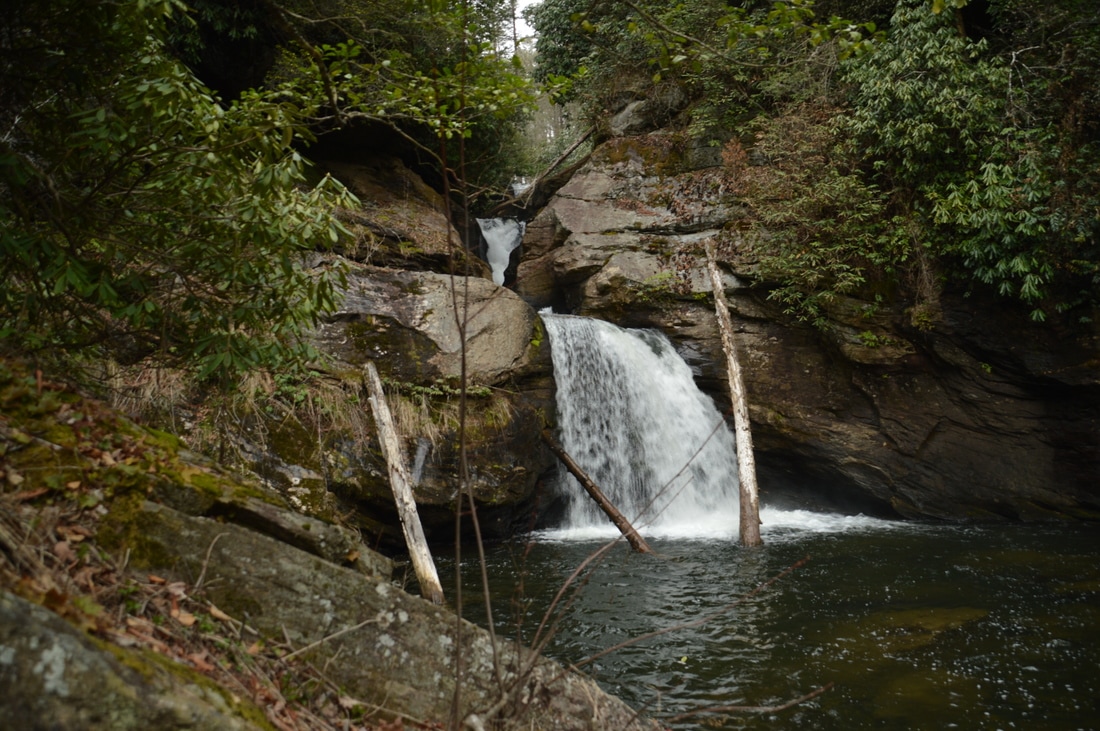
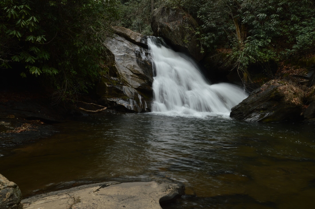
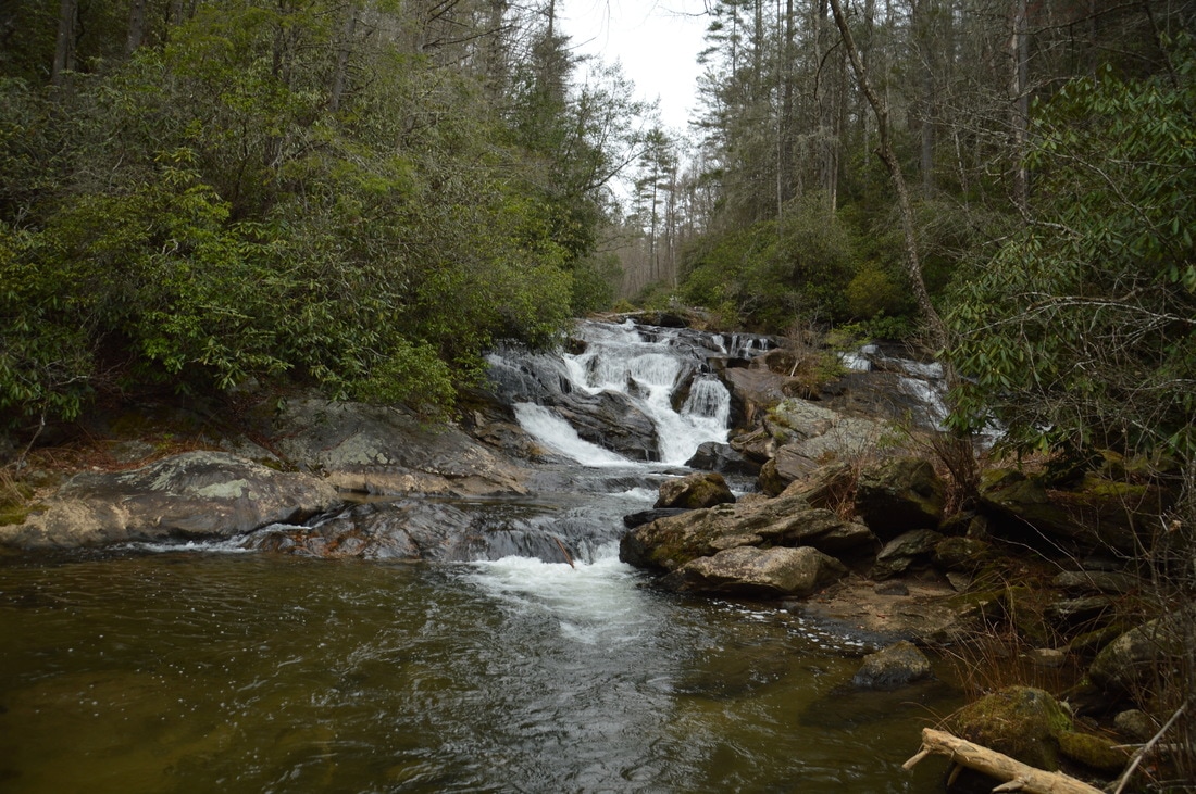
Turn left onto the Singley's Falls Trail, which quickly begins descending moderately into the Overflow Creek gorge. In 0.4 miles, the trail levels out as rapids on Overflow Creek can be heard far below, and at 5.4 miles, there is an important junction. To reach Singley's Falls, make sure to bear left onto a narrower trail here that seems to enter a drainage ditch, just as the old road bears right and down off the ridge it has been on toward a different point on Overflow Creek. Meanwhile, the narrower trail that you should have taken leaves the drainage ditch and makes a 180-degree turn to the east. Continue following the nearly level trail until 5.5 miles, when an overgrown trail continues straight while the main trail to Singley's Falls turns right and steeply downhill toward the creek. The trail shortly reaches the top of Singley's Falls. From here, follow a scramble route down and beside the falls to its base, reaching it at 5.6 miles. Singley's Falls is only 25 feet high, but it has an interesting photogenic structure that is evident best at lower water flow. All of the creek's water collects near the top and gets funneled into one tight and powerful drop into a pool, while a huge rock outcrop is positioned to the right of the falls. During higher water, the rock outcrops around the falls get covered with water, and the funneled drop in the middle becomes less distinct, which is why Singley's Falls is more photogenic at low water. Singley's Falls is named in honor of Alan Singley, who was the first person to descend the waterfall in a kayak, way back in 1978. Another name for Singley's Falls is Overflow Falls, although this name is easy to misinerpret, as there are many more waterfalls on Overflow Creek besides Singley's Falls. Two such waterfalls are Gravity Falls and Blind Falls, both of which are less than a quarter-mile upstream from Singley's Falls (although they are harder to access as there is no well-defined trail to them). 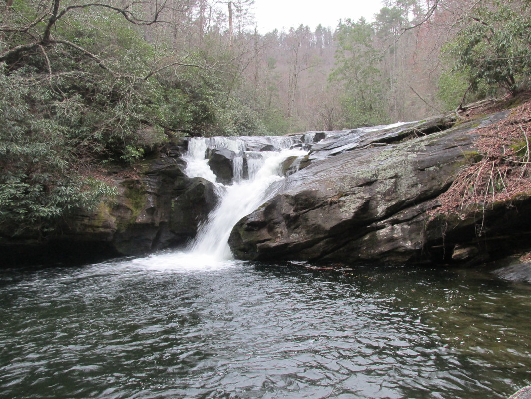
Singley's Falls on Overflow Creek - the fifth notable waterfall seen on the Big Creek Circuit hike - is relatively small but photogenic, as the creek gets funneled into a tight and powerful drop lined by large rock outcrops. Credits: Robert Shaw
From Singley's Falls, retrace your steps back to the Three Forks Trail, returning to it at 6.4 miles. For the shortest route back to the trailhead, turn left onto the Three Forks Trail and continue following it as it skirts Salt Log Knob to the east. After a brief downhill stretch, there is an important intersection at 6.5 miles in Sandy Gap. To continue following the correct trail, you must bear right onto what looks like a less-used forest road (but it really isn't). Straight ahead, the bigger forest road continues to private property north of Sandy Gap. This forest road is blocked off by two huge jeep mounds, so when you reach this junction, remember that you must take the road to the right and the road that is without jeep mounds. A landmark that will further help to identify this turn is a piece of piping attached to a tree at the junction. After the right turn at Sandy Gap, the rest of the route is fairly straight-forward. The trail dips in and out of several drainages, including the Stooping White Oak Branch drainage at 7.25 miles, but the trail stays nearly level throughout the entire time. At 7.4 miles, reach the end of the loop at the Big Creek Trail junction. From here, simply continue straight for an easy walk back to the trailhead, concluding the hike at 8.9 miles.
The Big Creek Circuit hike to Three Forks undoubtedly deserves a "Best Hike" classification. In addition to visiting one of the best waterfalls in Georgia, you will also pass four other waterfalls on this hike, and you will also see a slot canyon and Three Forks - a spot that is quite beautiful in its own right. With all of these attractions seen in less than 9 miles, the hike to Three Forks from Highway 28 is surely one of the best hikes in the state. Mileage
0.0 - Big Creek Trailhead
0.8 - 4th Falls on Big Creek (Holy Shit Falls) 2.3 - 3rd Falls on Big Creek (Thunder Dome Falls) 2.75 - 2nd Falls on Big Creek (Horsetail Falls) 3.2 - Three Forks and 1st Falls on Big Creek 3.55 - Top of Holcomb Creek Slot Canyon 3.8 - Three Forks 5.6 - Singley's Falls on Overflow Creek 6.5 - Sandy Gap 8.9 - Big Creek Trailhead Bonus Stops
If you're interested in adding another waterfall to the day, then making the quick and easy hike to Talley Mill Creek Falls is a good idea, assuming that you still have energy after completing the main hike.
PicturesVideos
6 Comments
Hiking Diva
4/6/2017 12:44:44 pm
I always carry a 25ft throw rope when hiking it is small and lightweight. I have used it to scramble down or tie off to have something sturdy to scale back up. Never know when an established rope has deteriorated or been cut.
Robert Marshall
4/21/2017 08:07:49 pm
My Baby Girl Bella and I made this hike a week back. I took the faint trail to Singley Falls and back to the Three Forks Trail to reach the Talley Creek trailhead. Four day earlier Bella and I hiked to Swiss Cheese. This was my second hike to Three Forks from Talley Creek Trailhead. Your write up on your hike is awesome. I had a 100 rope when I went down to Talley Creek. Big has a special meaning for me as my grandmother, her sister and four brothers were born above Big Creek and Walking Stick Road The brother's in 1888-1890 and grandma Essie McCall in 1898 and her sister Lathe McCall in 1896.
Clarence
7/7/2018 09:54:13 am
These names you guys have for the waterfalls on big creek are hilarious!!! I have lived in satolah all my life and generations before me also lived here. I don’t know who named these on the map but they should have spoke to the locals. The waterfalls around here have had names that were known for hundreds of years here and it sounds like some outsider river rat idiot came here and decided he had the right to change their name!!
David Ladner
8/4/2020 10:26:24 am
Hi Clarence. What are the names the locals use?
Craig Keller
11/6/2019 09:24:50 pm
Hiked the complete loop over a 2 day trip. Camped at the Three Forks clearing. THe Big Creek side of the loop was covered with deadfall and we bushwacked for 3/4 of our hike. Without your fantastic instructions we would have made several wrong turns and most likely missed seeing some of the waterfalls. Also saved us from a wrong turn on the Three Forks side of the loop. You did a great job and this turned out to be one of the best waterfall hikes I have taken
Zhili Zhan
4/19/2020 12:29:11 pm
Thank you for the excellent writeup. We did the the complete loop hike yesterday. There are numerous places on the big creek trail destroyed by deadfalls completely. In one particular case, I managed to see the faint opening by climbing ontop of the deadfalls. It is the most hilarious hike we ever had. Leave a Reply. |
About MeMark Oleg Ozboyd Dear readers: I have invested a tremendous amount of time and effort in this website and the Georgia Waterfalls Database the past five years. All of the work that has gone in keeping these websites updated with my latest trip reports has almost been like a full-time job. This has not allowed me to pick up a paid job to save up money for college, and therefore, I I've had to take out loans. If you find the information on this website interesting, helpful, or time-saving, you can say "thanks" and help me out by clicking the button above and making a contribution. I will be very grateful for any amount of support you give, as all of it will apply toward my college tuition. Thank you!

Coming in 2022-2023?
Other Hiking WebsitesMiles HikedYear 1: 540.0 Miles
Year 2: 552.3 Miles Year 3: 518.4 Miles Year 4: 482.4 Miles Year 5: 259.9 Miles Archives
March 2021
Categories
All
|


 RSS Feed