
When you imagine a place with five spectacular waterfalls in one hike, the lowest region of the North Carolina mountains in the Green River valley - elevation 1000' - hardly comes to mind. And yet, the Green River Game Lands and adjacent areas surrounding Saluda are home to a variety of excellent water features. Perhaps the most breathtaking waterfall in the area is 75-foot Big Bradley Falls, a sheer twin drop on Cove Creek that forcefully crashes down through a cleft in an amphitheater of enormous cliffs. Less than a mile from Cove Creek, the off-trail hike up Little Cove Creek, and later its tributary, culminates in the remarkably unique Cavern Falls, where part of the 30-foot waterfall shoots through a perpetually wet and dark cavern. What's more, the hike to Cavern Falls passes three other waterfalls - all very beautiful and picturesque. This hike consists of two starkly different sections: one half along Little Cove Creek is a difficult bushwhack and creek-walk that is suitable for experienced off-trail adventurers only, whereas the other half along Cove Creek is a relatively easy stroll along a well-defined trail to an outstanding waterfall accessible to most hikers. This hike occurred on Saturday, May 5th, 2018. My plan was to begin the hike at the trailhead by Wilderness Cove Tubing and follow old farm roads to Little Cove Creek, where I would hike off-trail upstream along the creek and its tributary to Milton Bradley Falls, Bradley Cooper Falls, Marilou Bradley Falls, and Cavern Falls. On my return trip, I would take a side trail along Cove Creek to Big Bradley Falls.
Note: In late May 2018, two weeks after my hike to Big Bradley Falls and Cavern Falls, the Green River valley was hit by a historic, devastating flood due to extremely high amounts of rain. Although many of the area's roads have reopened as of mid-June 2018, the flooding may have altered the landscape surrounding Little Cove Creek and Cove Creek on this hike. I have not visited this area following the flooding, and thus, the trail report is based off conditions present before the flood. If you know of updated hiking conditions for these waterfalls, I'd love to hear from you! Please leave a comment if you have anything to share.
Summary
R/T Length of Trail: 8.5 Miles
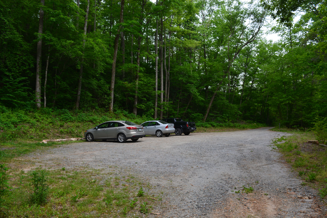
Duration of Hike: 6:30 plus 4 hours and 30 minutes of stopping and photography Type of Hike: Double Out and Back Difficulty Rating: 9 out of 10 for Little Cove Creek (strenuous, technical off-trail); 4 out of 10 for Big Bradley Falls Total Elevation Gain: 1730 Feet Pros: Solitude along Little Cove Creek; Well-defined path to Big Bradley Falls Cons: The hike to Cavern Falls involves several very tricky, technical scramble sections; a portion of the hike through the old Walcott Farm fields can get overgrown in summer Points of Interest: Milton Bradley Falls - 7 stars; Bradley Cooper Falls - 5 stars; Marilou Bradley Falls - 5 stars; Cavern Falls; 9 stars; Big Bradley Falls - 10+ stars Trail Blaze Colors: None - not an official trail Best Seasons to Hike: Spring Fees: None Beginning Point: Green River Game Lands Access Point near Wilderness Cove Tubing Directions from Saluda, NC: From the intersection of Main Street (US 176) and Ozone Drive near downtown Saluda, follow Ozone Drive North for 1.3 miles. Immediately after the I-26 underpass, turn left on Green River Cove Road. Follow the extremely curvy Green River Cove Road for 3.6 miles to a bridge across the Green River. Right before the bridge, turn right onto an unpaved road that enters the group of shacks comprising Wilderness Cove Tubing. Bear left on the main gravel road and follow it 0.1 mile to a gate and parking area, where the hike starts. Map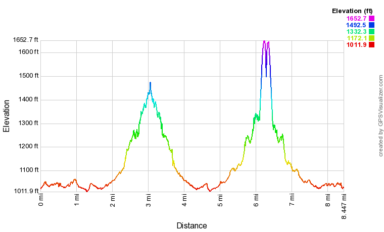
Click the link below to download a .GPX file with a track of this hike.
Details
Cavern Falls jumped onto my waterfall wish list as soon as I saw photos of it on social media. Its structure looked quite unusual, and it definitely lived up to its expectations. What was even more exciting about the Cavern Falls hike was that it it would pass three other beautiful waterfalls in the Little Cove Creek watershed. In addition, I sought to add on a stunning waterfall on nearby Cove Creek: Big Bradley Falls. Ultimately, Big Bradley Falls has entered my top 10 waterfall list, and that's impressive given that I've been to nearly 400 waterfalls! I'm so glad to have done the hike when I did, because just two weeks later, the area underwent devastating flooding following extreme rainfall amounts.
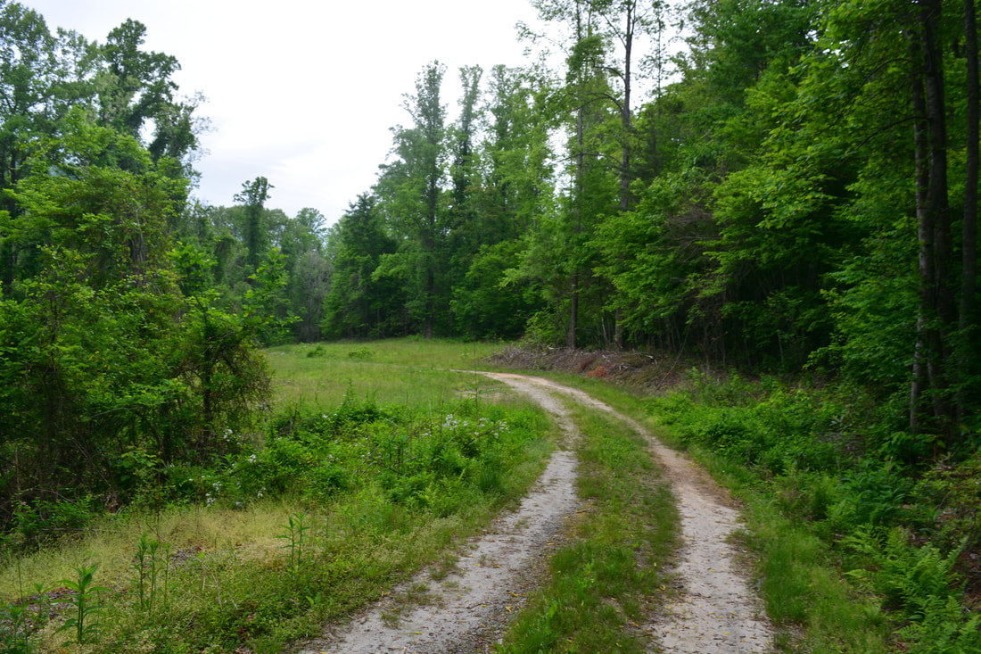
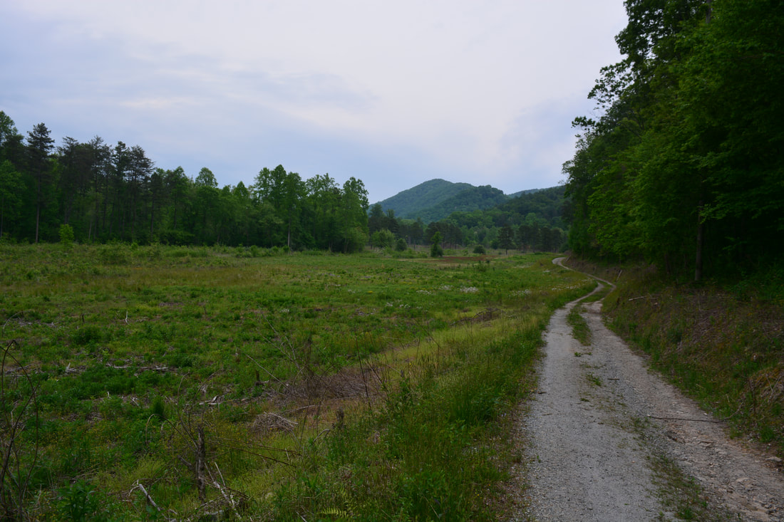
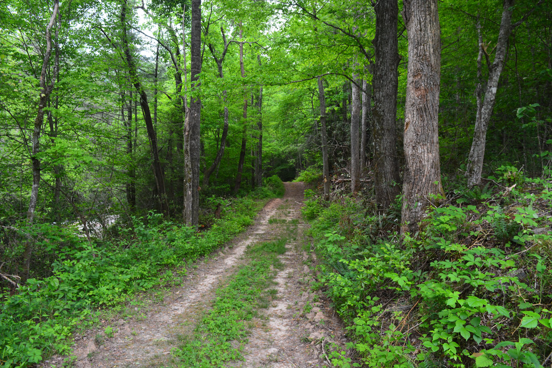
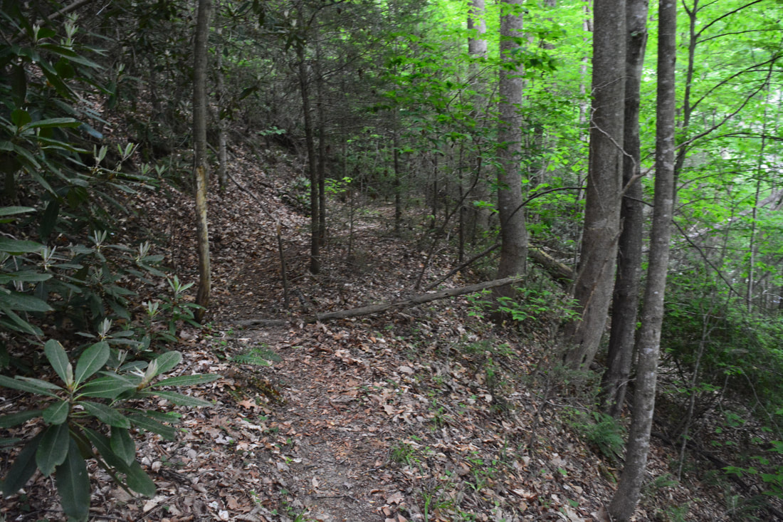
The hike begins behind the gate by the kiosk in the parking area at the back of Wilderness Cove Tubing. Initially, you will be following a very obvious, flat forest road through the fields of the old Walcott Farm, now part of the Green River Game Lands. At 1.0 miles, the old road approaches Cove Creek and curves to the left. At this point, an old cabin stands to the right, and a shed used to occupy the space on the left, until it was recently destroyed. The trail to Big Bradley Falls splits off right through the grass past the cabin, while the hike to Cavern Falls and the other Little Cove Creek waterfalls bears left on the old forest road. These two hikes have very different difficulties, so I decided to split up the description below. If you would only like to learn how to get to Big Bradley Falls, then scroll down to its section farther down the page. With that said, if you're an experienced waterfaller and you want to see the Little Cove Creek waterfalls, I highly recommend to see Big Bradley Falls the same day as well, as I did - it's an absolutely incredible waterfall. Little Cove Creek (Milton Bradley Falls, Bradley Cooper Falls, Marilou Bradley Falls, and Cavern Falls)
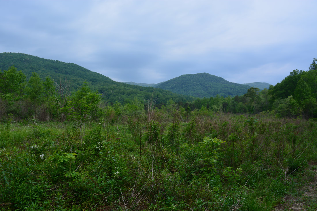
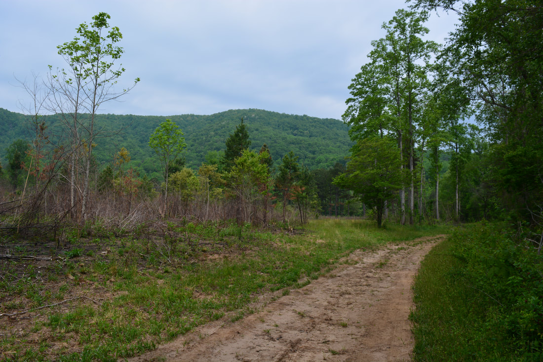
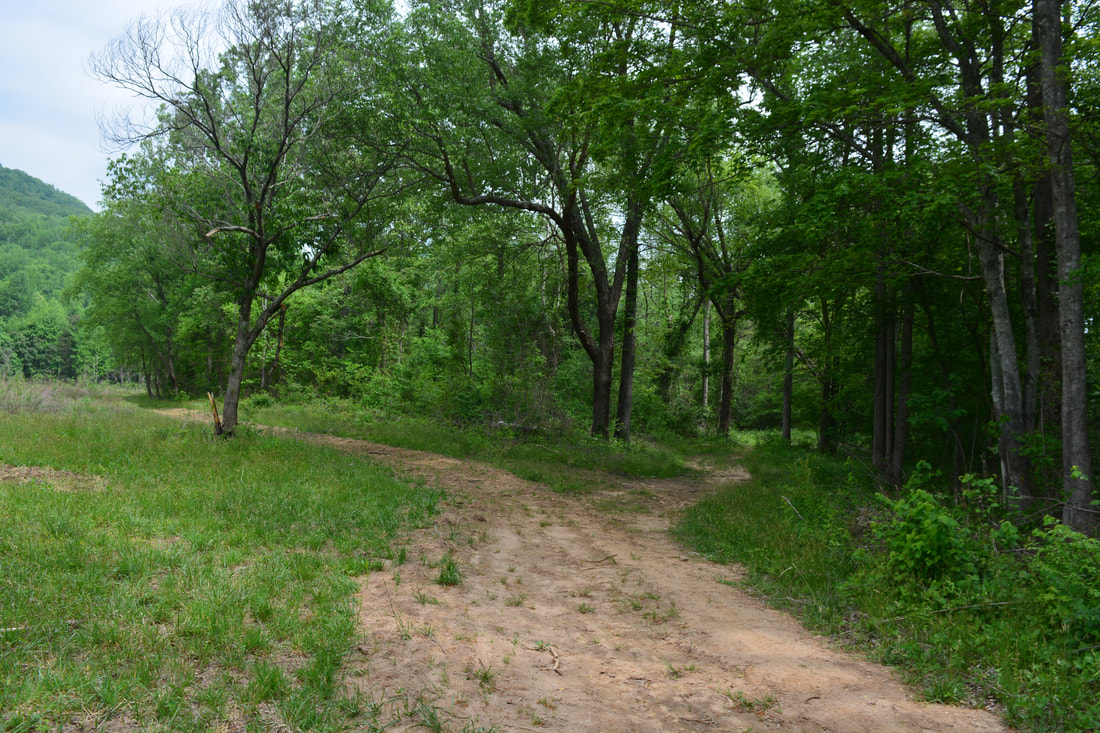
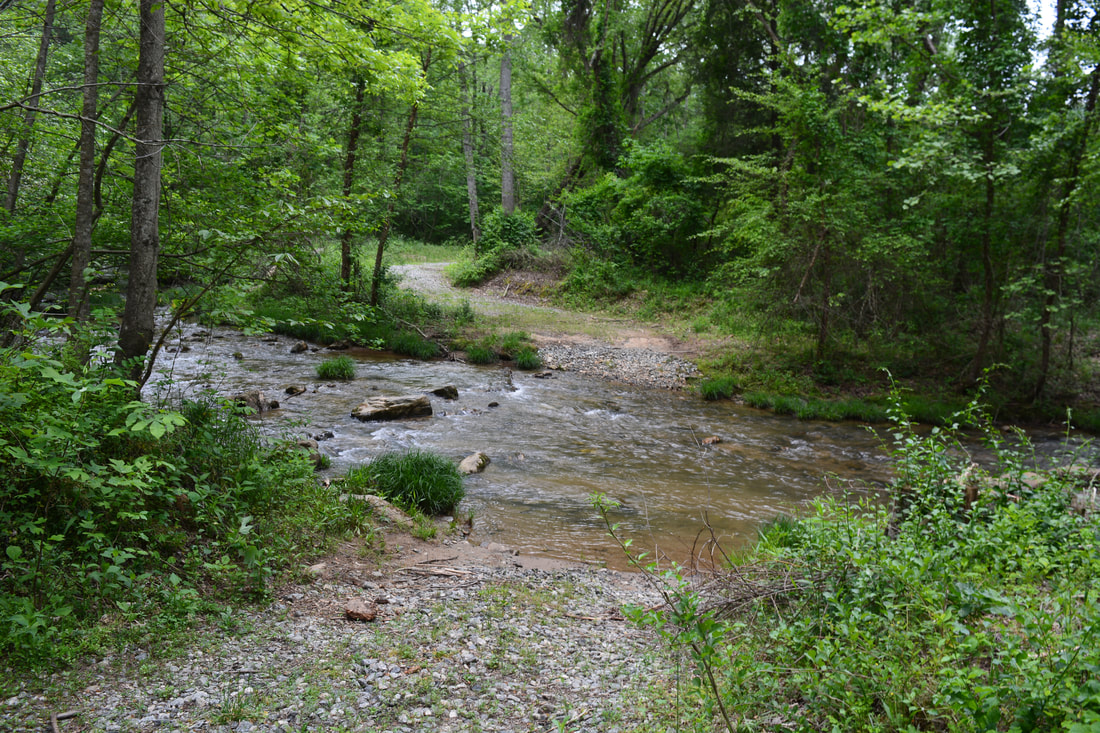
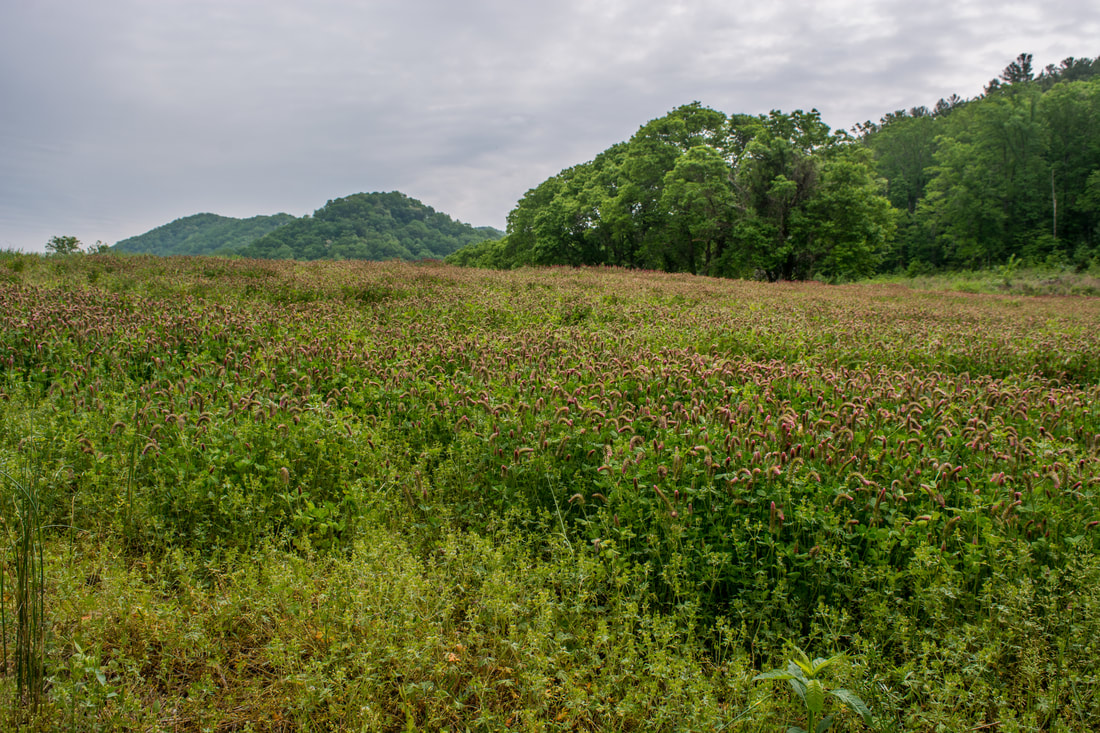
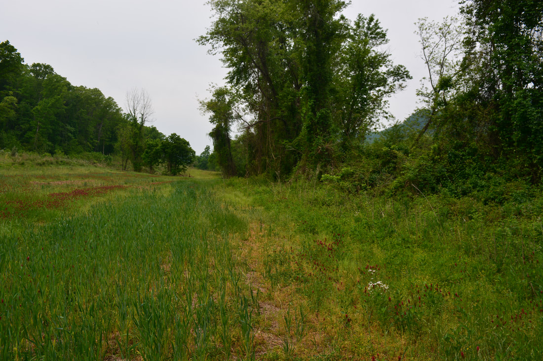
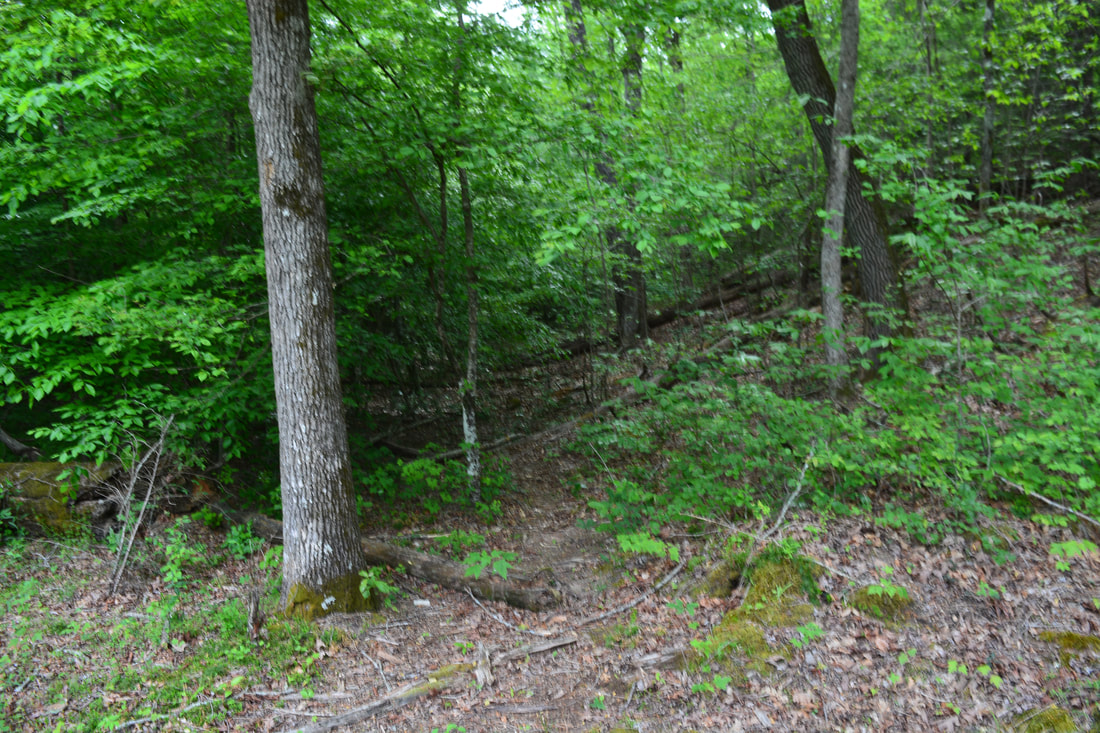
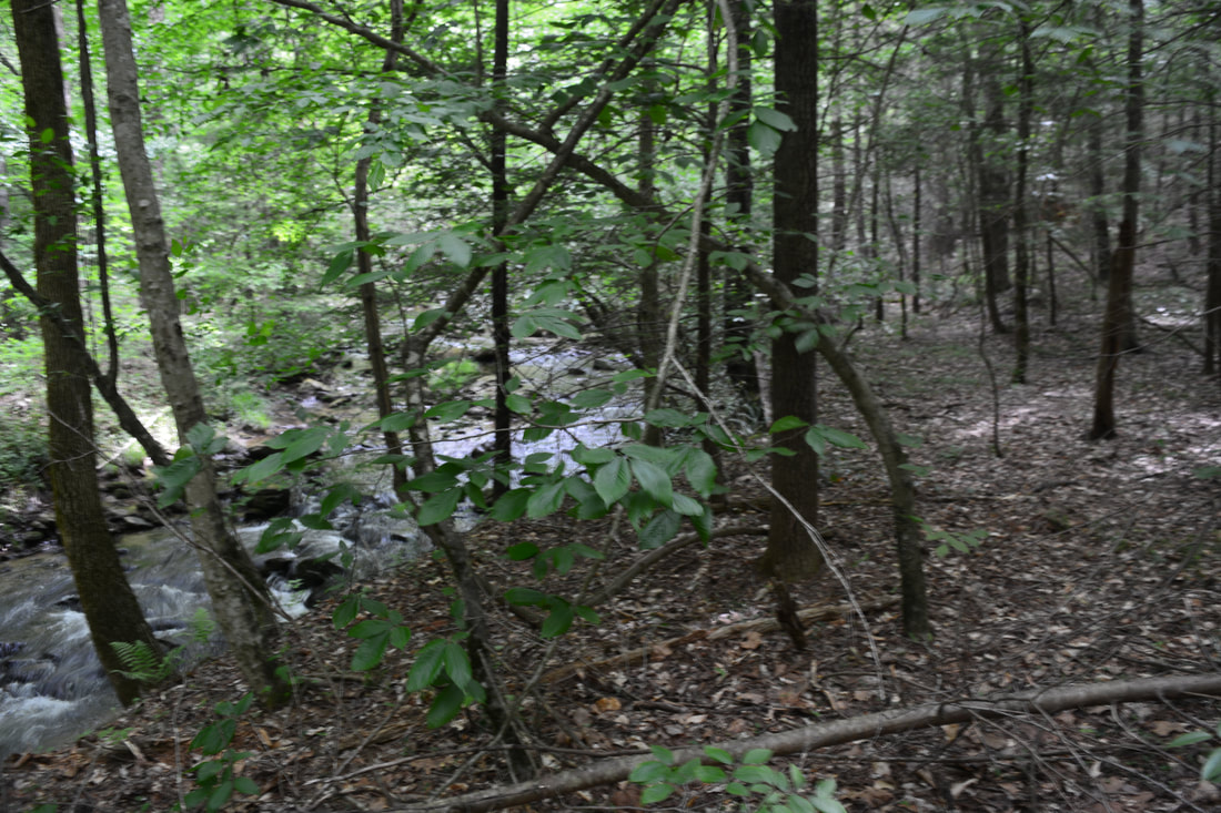
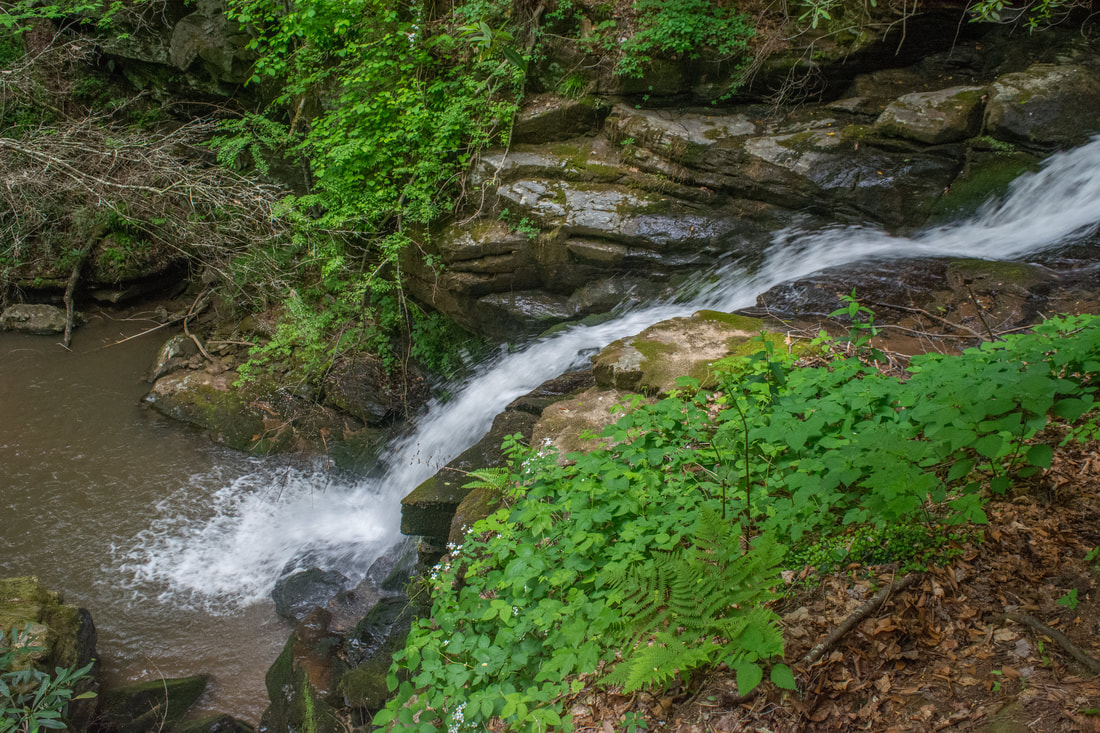
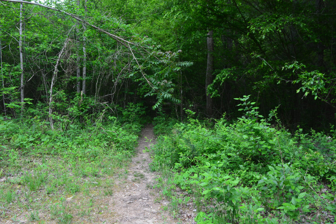
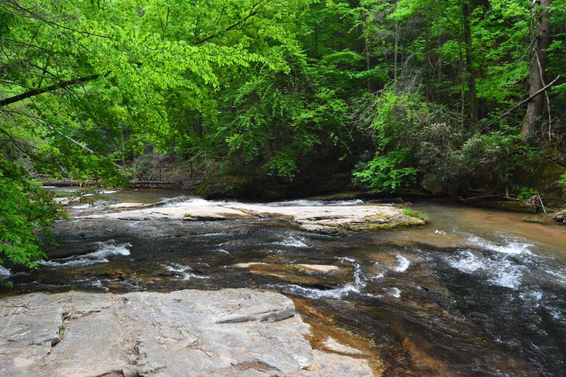
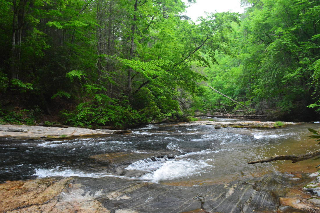
Stay left on the forest road at 1 mile toward the Little Cove Creek waterfalls. In the next 0.3 miles, there are two forks in the road - stay right at both. The fields you're hiking through feature nice views across the Green River valley toward Long Ridge and Raccoon Mountain. Arrive at a crossing of Cove Creek at 1.3 miles. This will usually be an easy, shallow wade. The forest road continues on the other side, but it turns more overgrown in the next field. You'll pass a historic vine-choked chimney on the left near the start of the field. At 1.5 miles, by a large tree in the middle of the vast field, the road appears to dissipate. Stay right here, aiming for the edge of the field. On my way in, I continued straight ahead and had to make a nasty bushwhack to the right, so don't repeat my mistake! Reach the end of the field at 1.6 miles. Assuming you're at its southeast end, look for a very faint path entering the woods and aiming east-southeast toward Little Cove Creek.
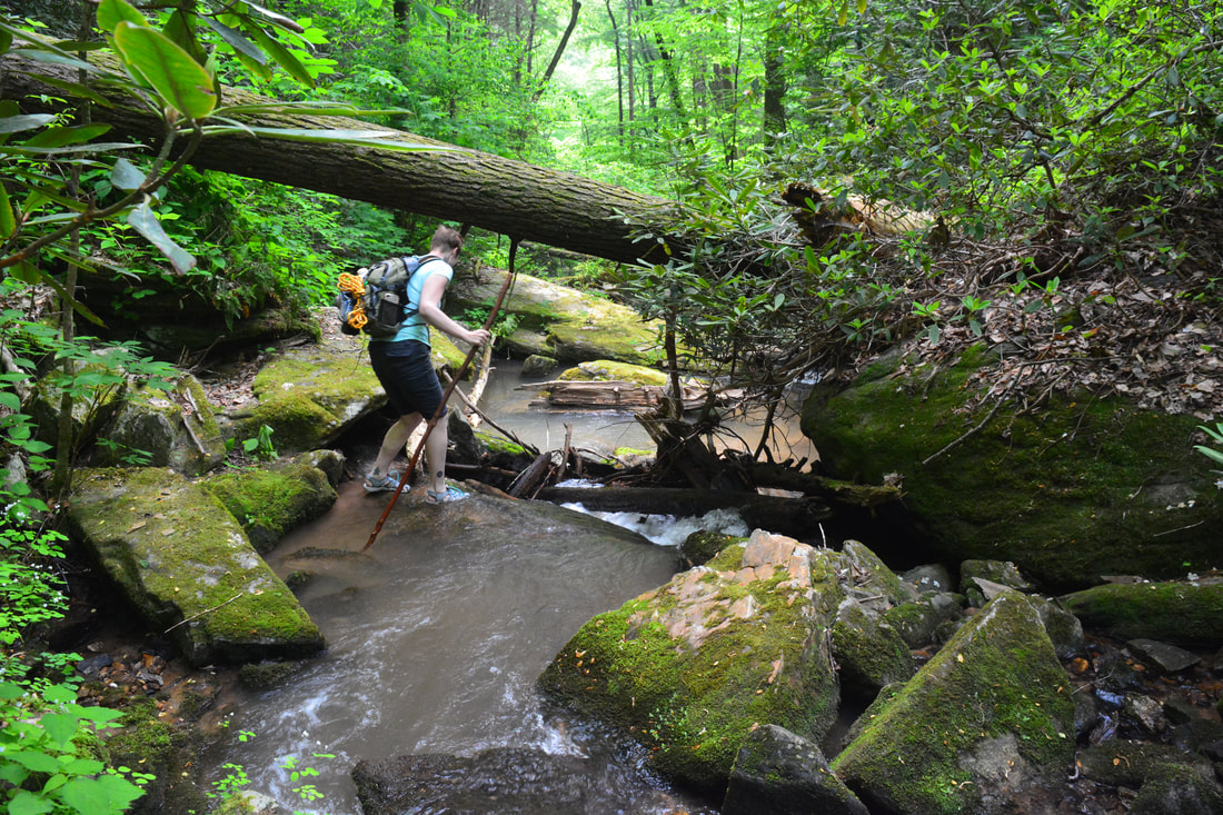
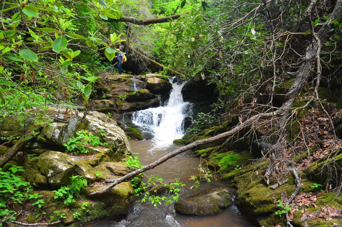
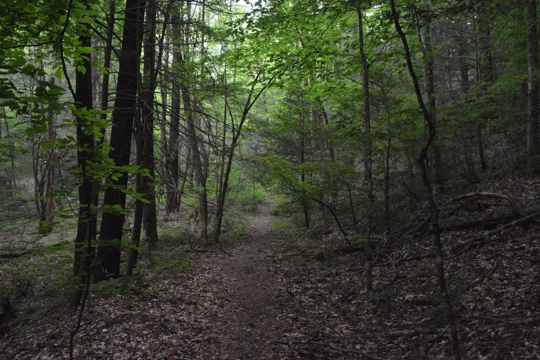
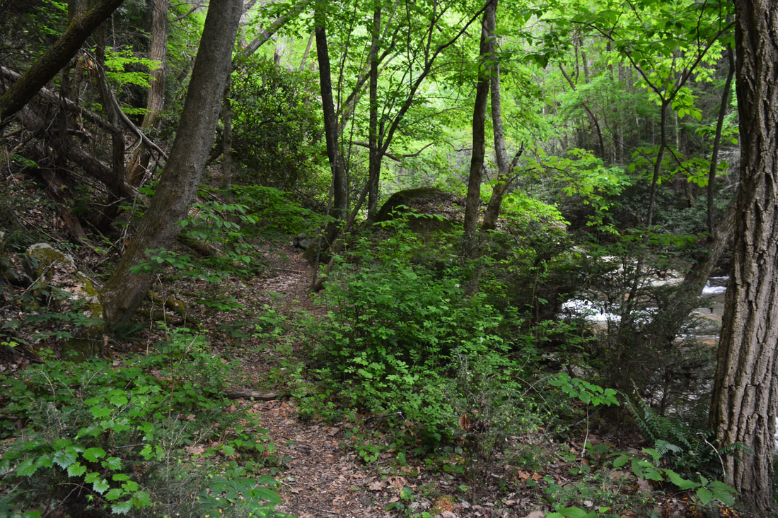
Follow the path to Little Cove Creek as best you can. As you approach the creek side, the path gradually fades away and turns into a bushwhack of easy difficulty. For now, stay on the same side of the creek, because the first part of the creek's north side (River Right) is private property. On the south side (River Left), you'll run into several rhododendron thickets but nothing too bad. Around 2.1 miles is a good place to cross Little Cove Creek, now that the north side is public. The best way to recognize this spot is the more overgrown and steeper slope that appears ahead on the south side here. This is likely to be a wet crossing. On the other side, the path upstream is pretty obvious and open. It's also marked by flagging tape. Another path shortly ties in from private property to the left - stay right on the main path. The path reaches Milton Bradley Falls at 2.35 miles. 
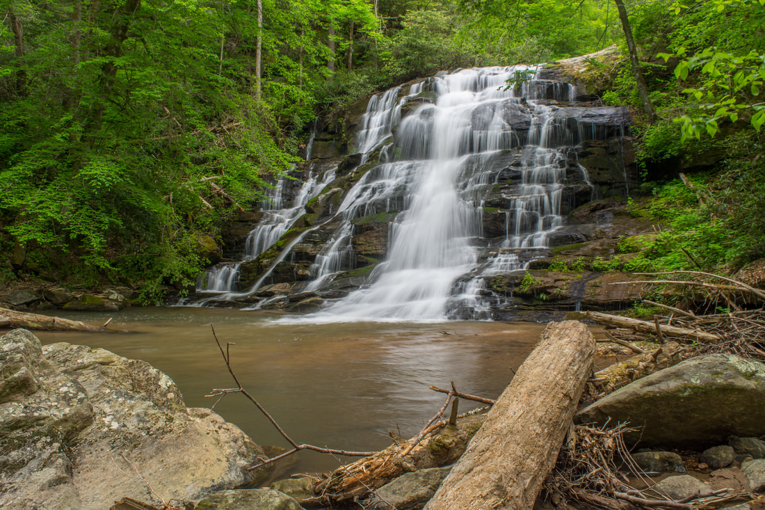
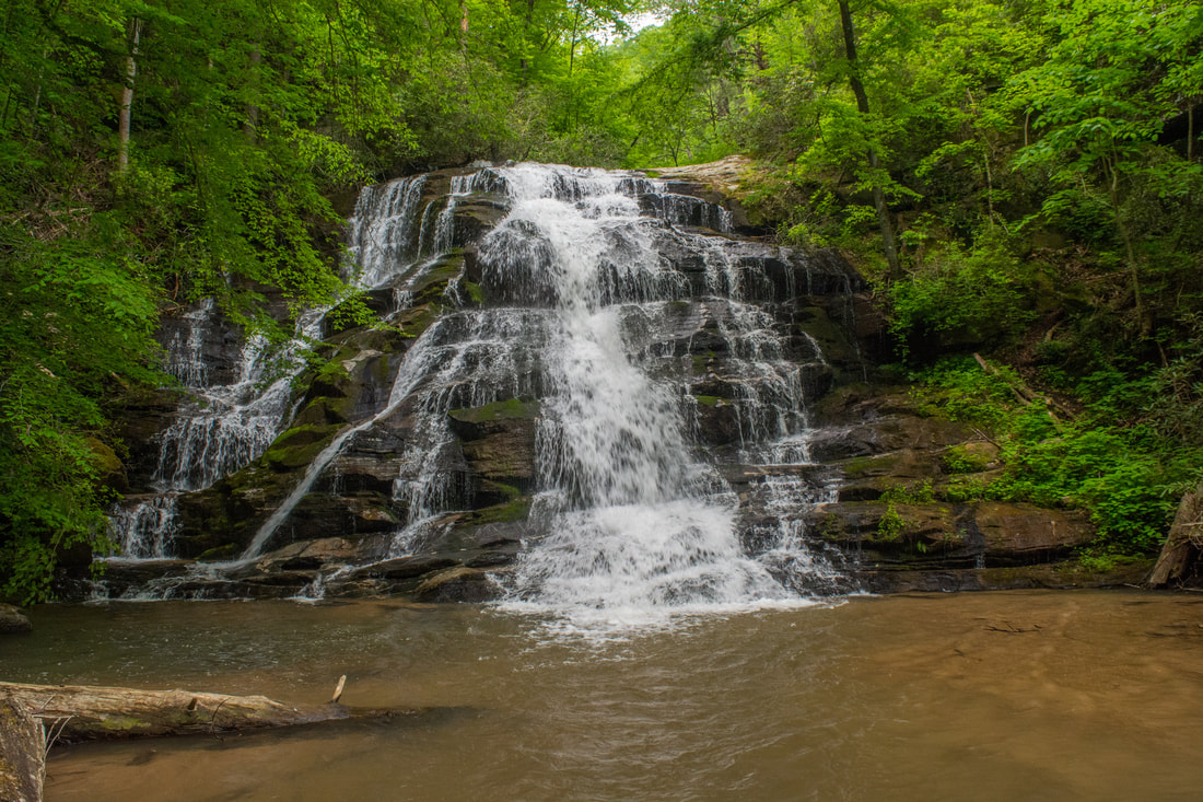
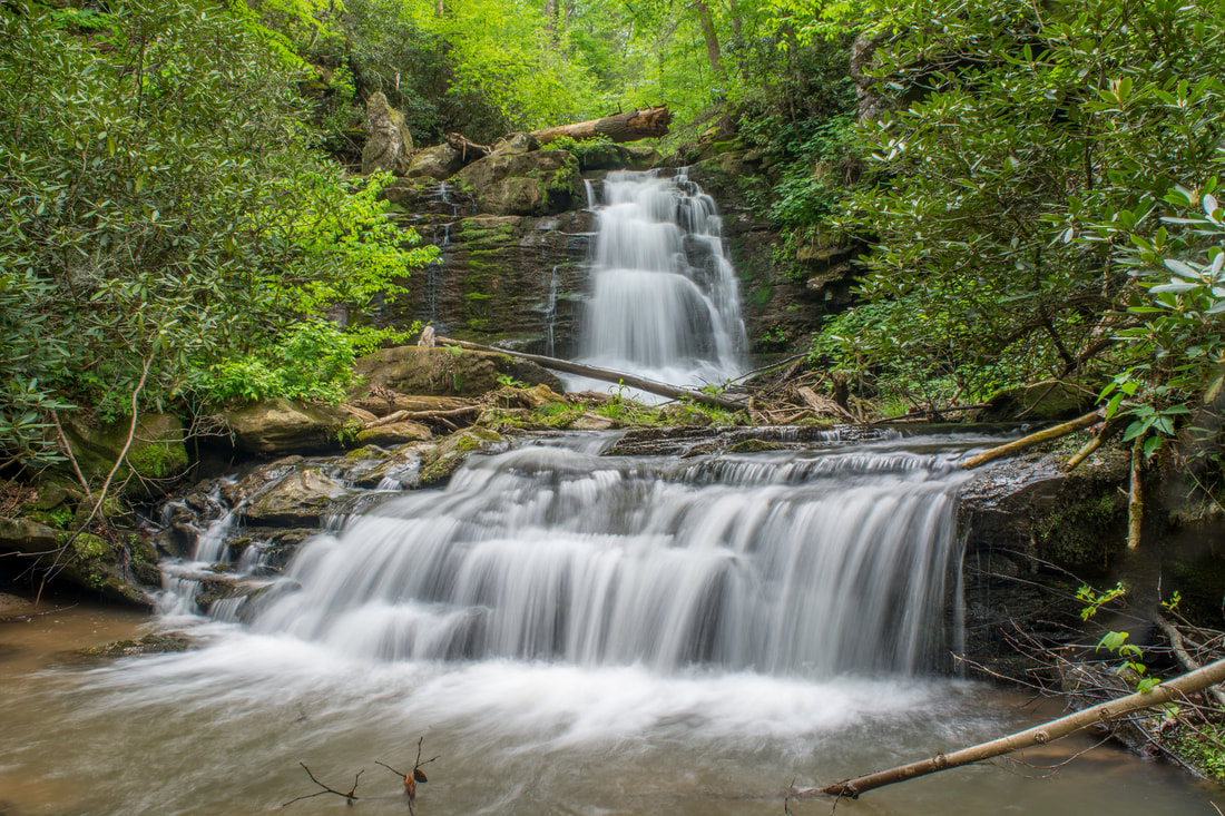
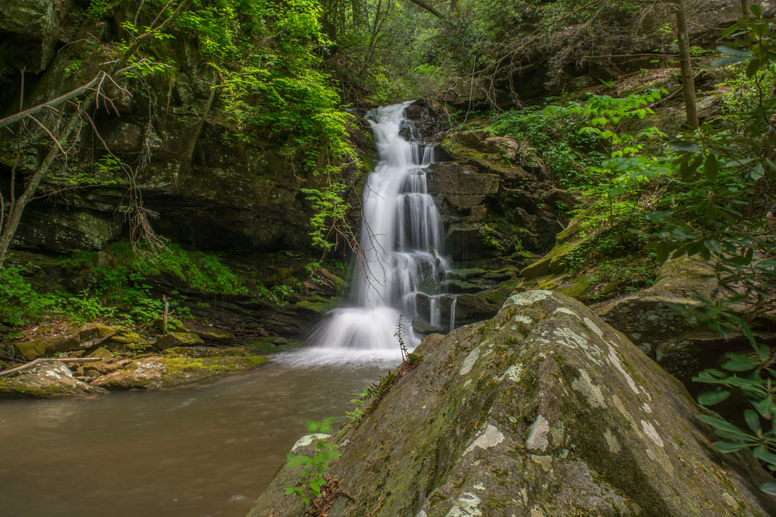
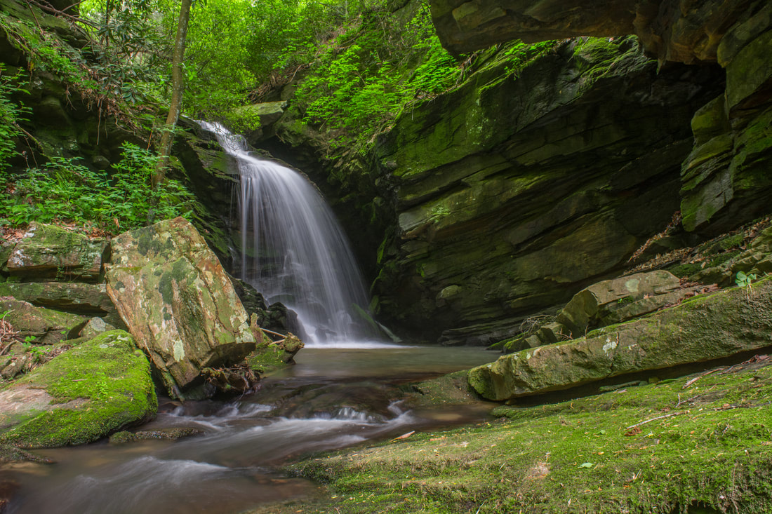
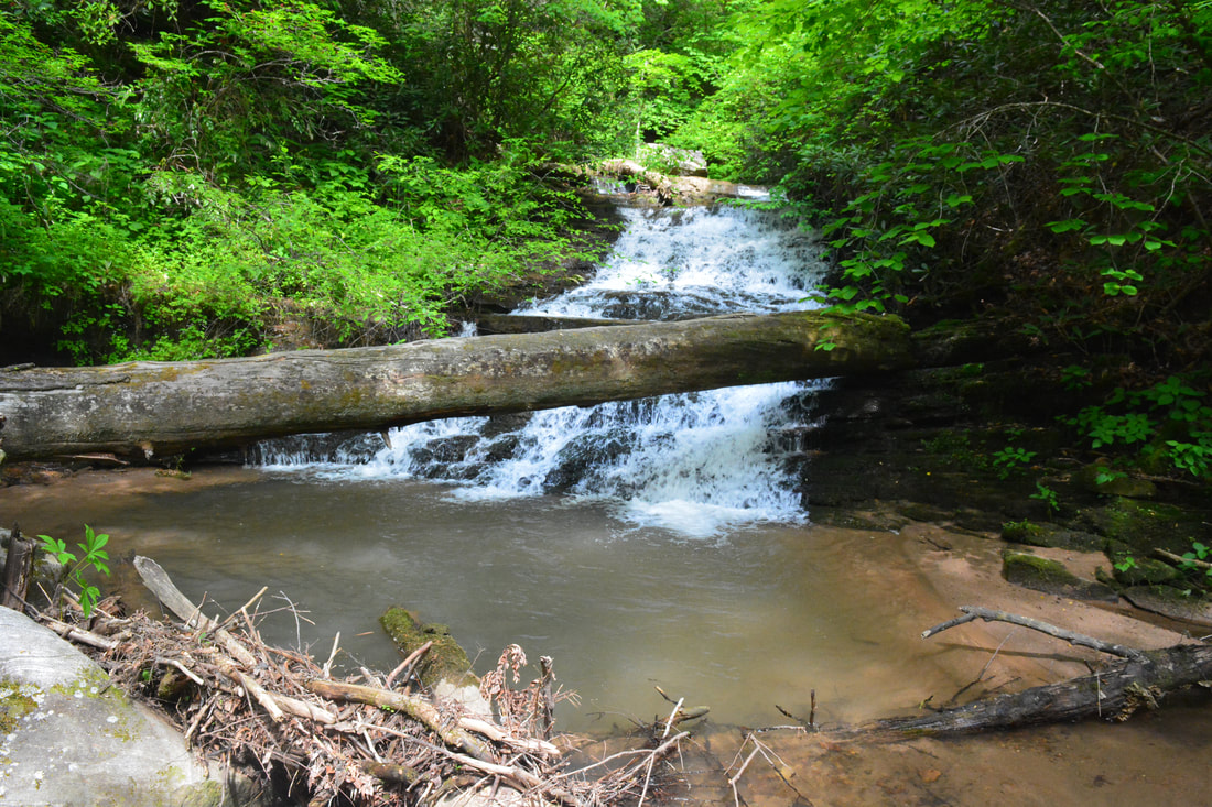
40-foot Milton Bradley Falls, a scenic stairstep cascade, is the first waterfall you come to on Little Cove Creek.
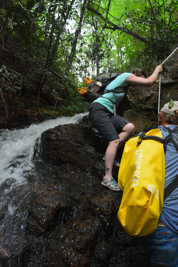
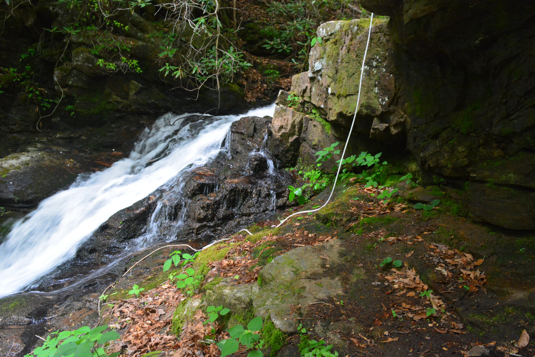
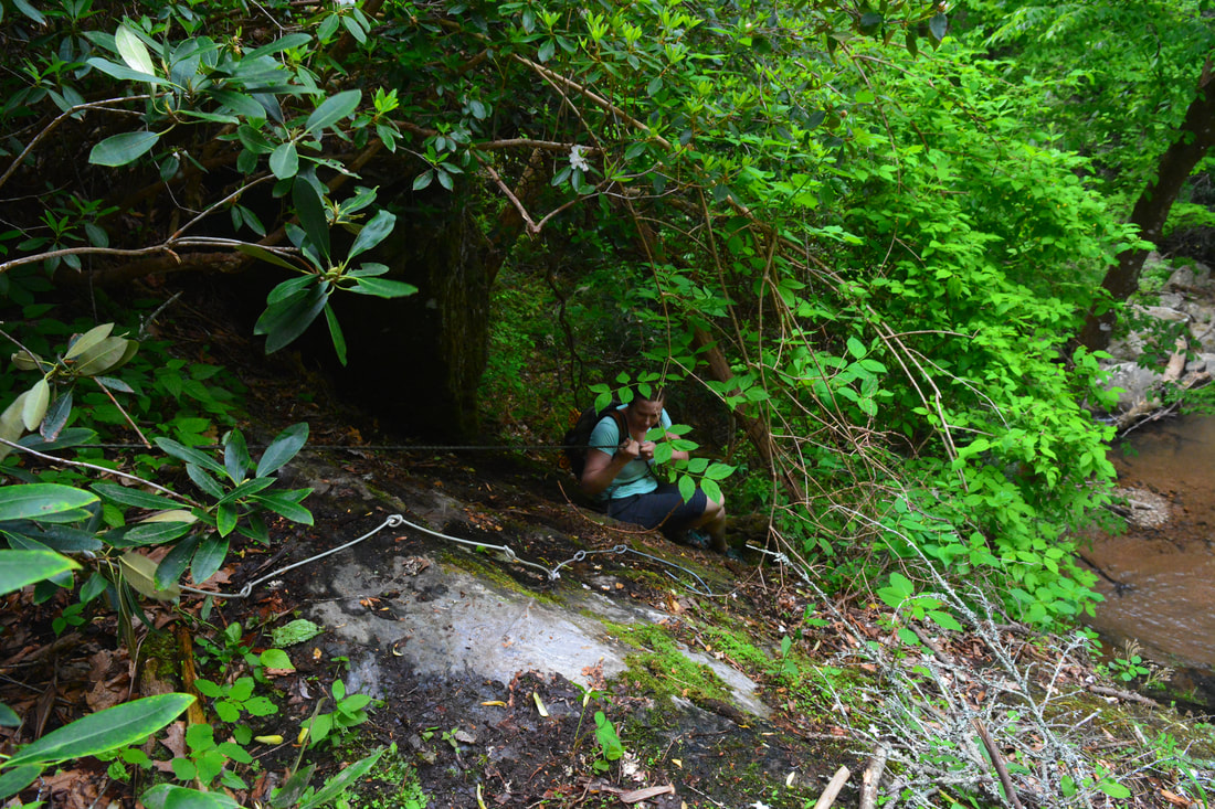
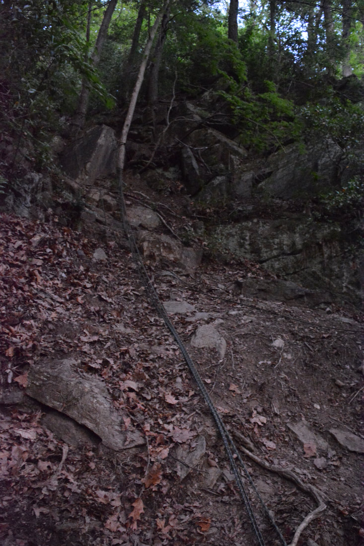
I believe that Milton Bradley Falls takes second place in beauty for waterfalls in the Little Cove Creek watershed (after Cavern Falls). It also happens to be the easiest one to reach. Milton Bradley Falls is a wonderful stairstep waterfall with numerous cascades and trickles spreading out evenly across the entire mossy rock face. A collection of deadfall atop rock outcrops in front of the waterfall's pool makes for a great, open viewing area. The question is: how do you get past this 40-foot drop and proceed to the other waterfalls? The best route is probably on the River Left (south) side, directly alongside the waterfall. There's a recognizable path with ropes the entire way. The main challenge comes at the uppermost section, where you need to climb up a 15-foot rock slab. You'll come out on dry, flat rocks at the top of the falls. This scramble is always tricky, especially on the return trip. You'll need to decide if you think you can make it back down before committing yourself to the climb. At the time of my visit, a new rope was in place, but there's no guarantee it'll still be in good condition or if it will even be there when you go. If you think the climb on River Left is too tough for you, you can try bypassing Milton Bradley Falls on River Right, but I'm told that it's a long, nasty bushwhack.
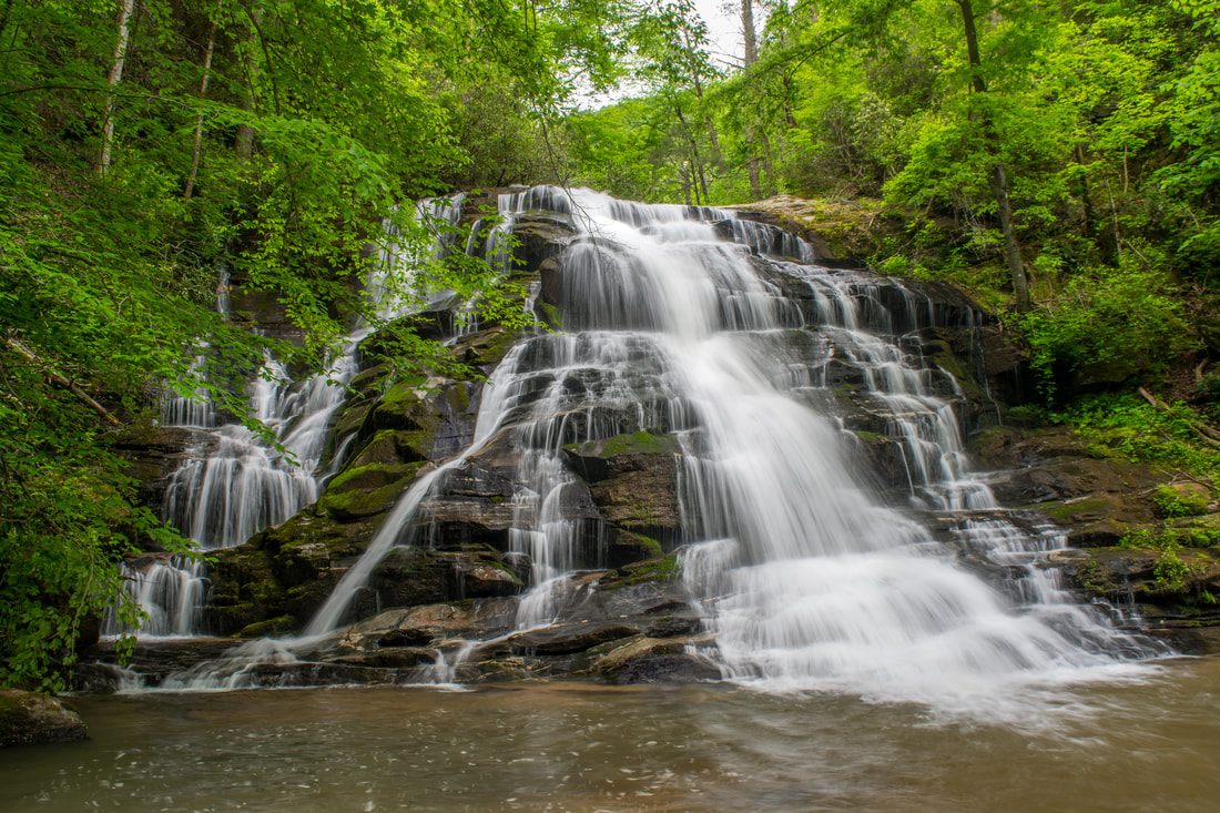
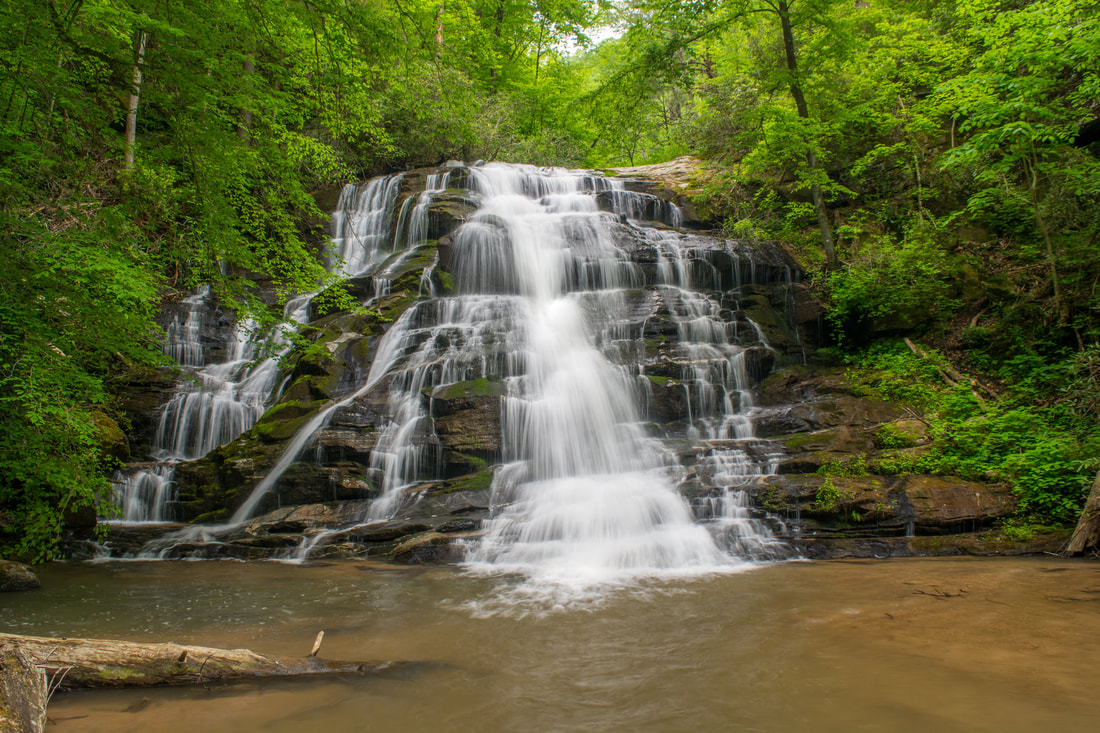
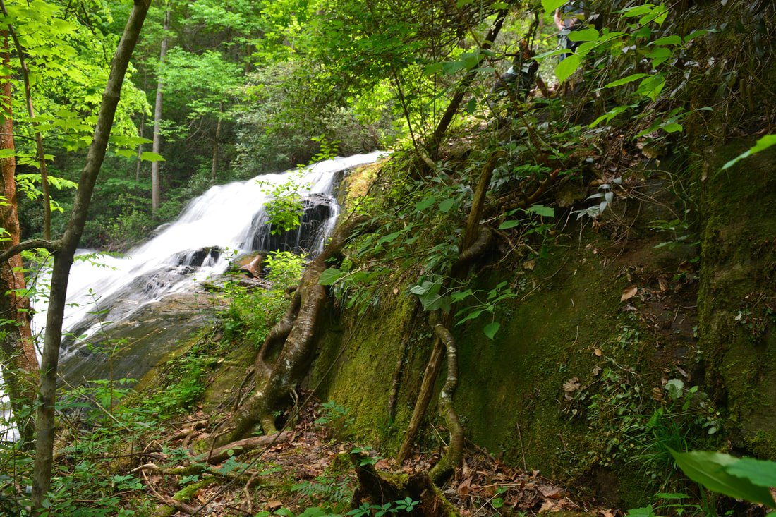
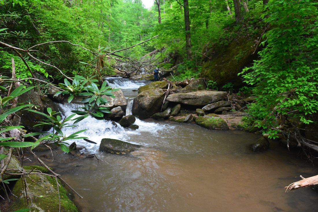
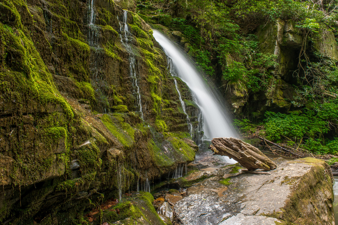
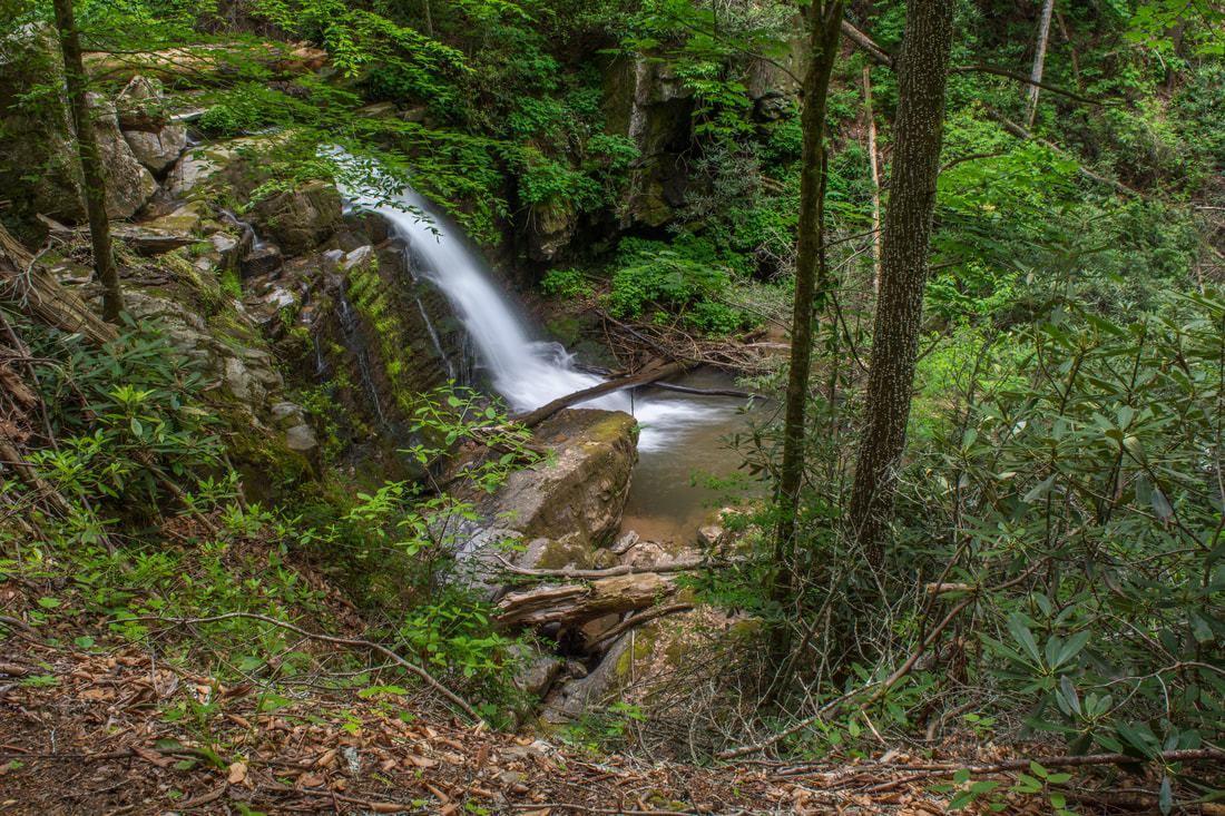
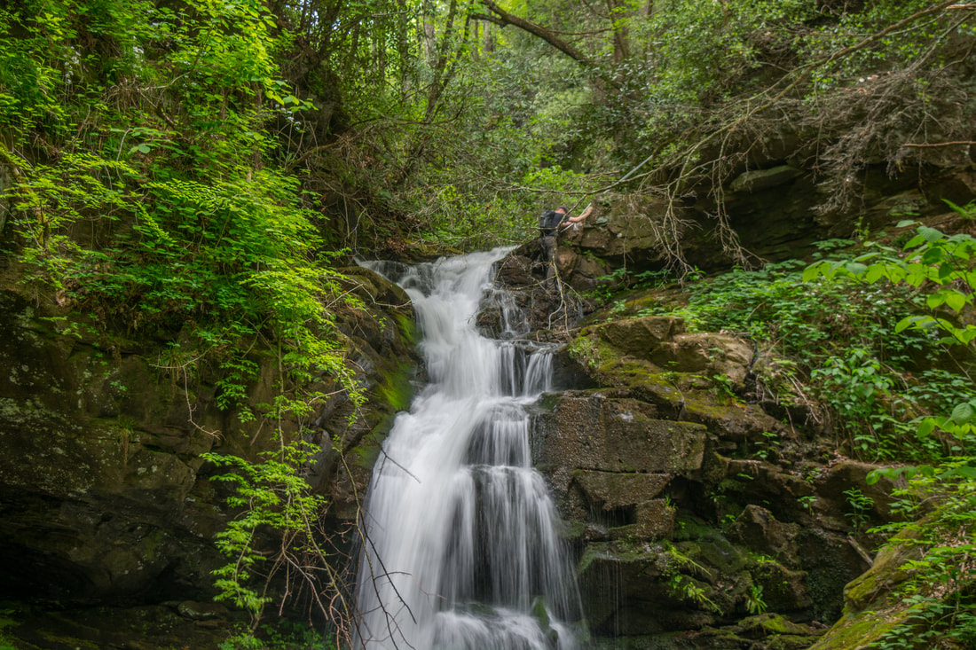
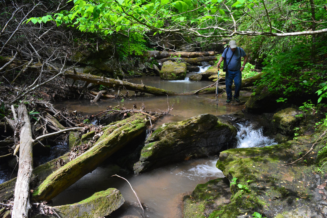
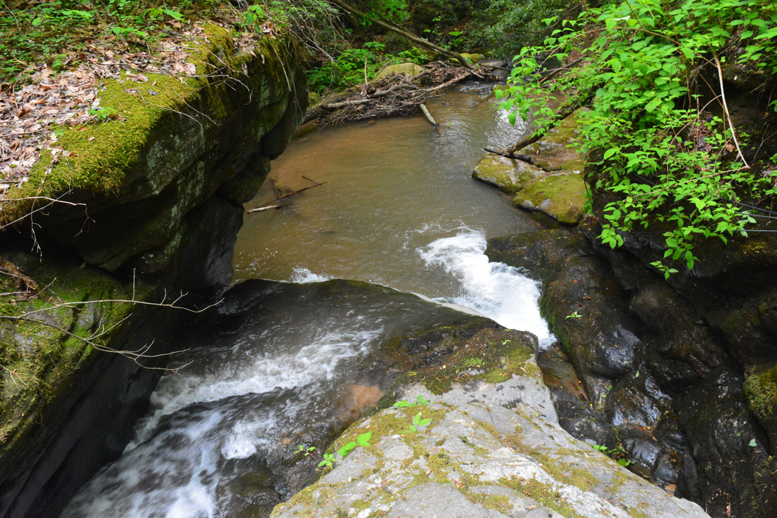
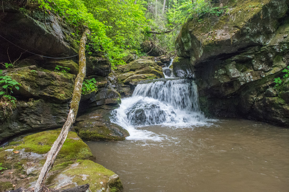
Regardless, once you get above Milton Bradley Falls, the best way to Bradley Cooper Falls is to simply stay in the creekbed as much as possible. A path on River Left bypasses a large cascade near the start, passing a bizarre sign for "Karl's Climb" pointing nowhere. You won't find any paths after this though. Most of the wading and scrambling in this section is fairly easy by creek-walking standards even in above average flow. At 2.65 miles, reach a confluence with a large, unnamed tributary on the left - this is the stream with Marilou Bradley Falls and Cavern Falls. Just a few yards farther up Little Cove Creek is Bradley Cooper Falls, within sight of the confluence. Bradley Cooper Falls is a scenic single-tier waterfall about 20 feet high. The bluff it falls over features a coating of lush, delicate moss. Just below is a picture-perfect creek-wide cascade that makes for a great foreground to photos of this falls. Although Bradley Cooper Falls isn't as spectacular as Milton Bradley Falls or Cavern Falls, it is well worth seeing and photographing along the way. From here on, you will begin following the tributary instead of Little Cove Creek. Marilou Bradley Falls is just upstream from the confluence along the tributary. To get there, look for the path that begins between the tributary and the main creek. In a few feet, the main path bears right and travels toward the top of Marilou Bradley Falls - to see the falls from its base, stay left on a fainter path. Reach Marilou Bradley Falls at 2.7 miles. This is a scenic part free-falling drop about 25 feet high surrounded by large, jagged cliffs. 
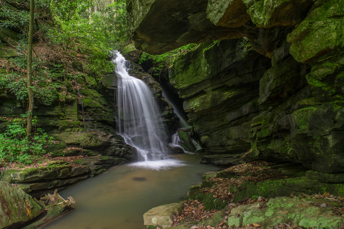
20-foot Bradley Cooper Falls is a scenic falls on Little Cove Creek along the way to Cavern Falls.
Getting past Marilou Bradley Falls presents the biggest, most difficult challenge on the Cavern Falls hike. Start out along the well-defined path between Marilou Bradley Falls and Bradley Cooper Falls. You may find a rope that assists you up a steep section. At the top, by the base of a cliff, there is a nice elevated view of Bradley Cooper Falls to the right. Turn left, and follow the shelf toward the top of Marilou Bradley Falls. This is a place where you must exercise extreme caution. Proceeding further requires scrambling up a 10-foot rock outcrop at the top of the falls on the River Left side. I never recommend scrambling around waterfalls. With that said, an experienced waterfaller will make the scramble just fine, as none of the rocks are slippery, and handholds are plenty. All others should stay away - a fall here could lead to serious injury or death.
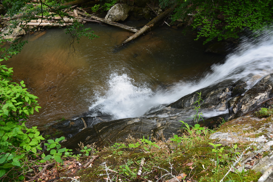
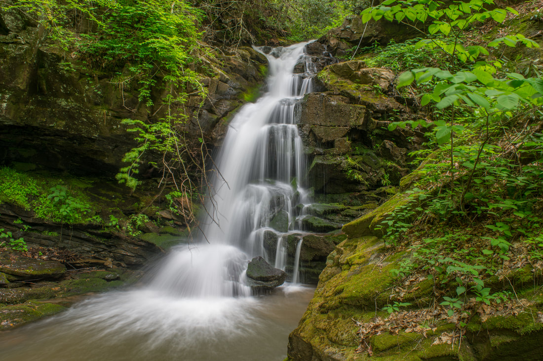
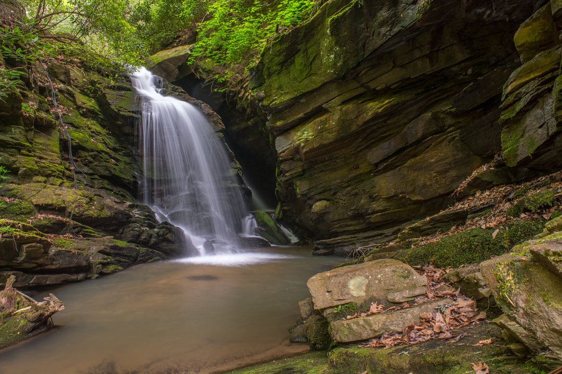
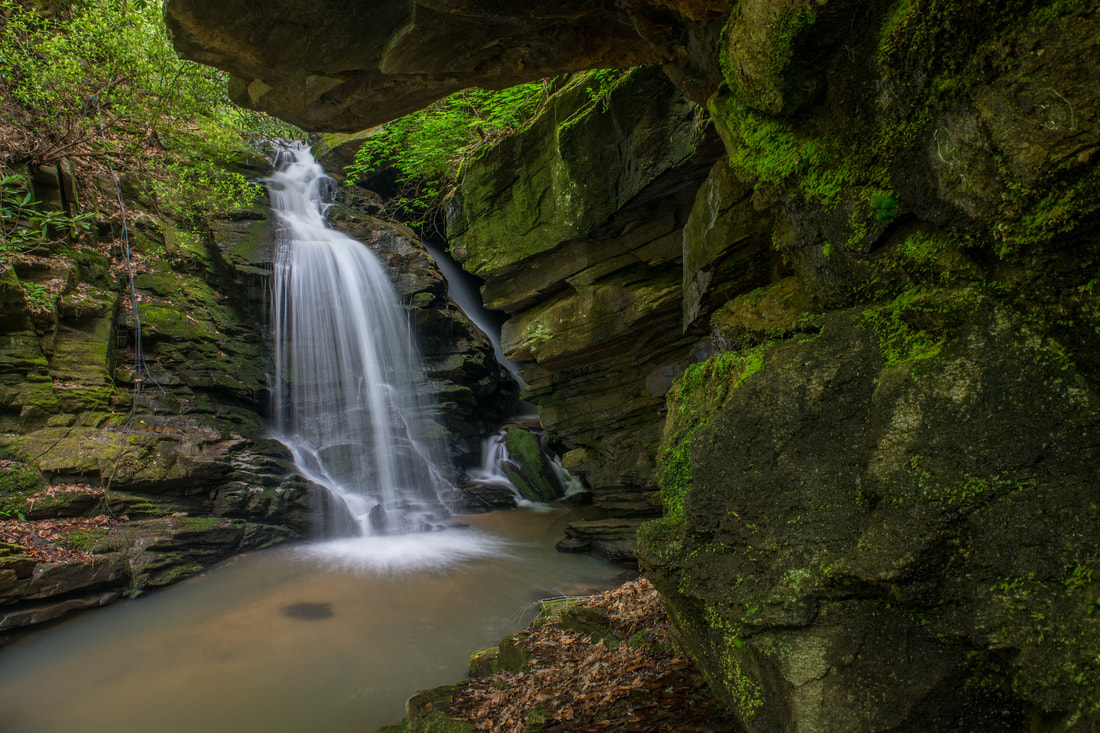
If you manage to get past the Marilou Bradley Falls scramble, you'll discover that the route regains sanity. However, the remaining creek-walk between Marilou Bradley Falls and Cavern Falls is much more difficult than the section between Milton Bradley Falls and Bradley Cooper Falls - the tributary is much steeper. You'll shortly reach a large cascade that is best to bypass along the narrow rock shelf on River Right. Beyond this, you'll be continuously climbing up small cascades and rock outcrops. At 3.0 miles, a stream on River Right joins the main stream at a twin cascade just before Cavern Falls. Stay right on the main stream, climbing directly up the cascade. Reach Cavern Falls at 3.05 miles. Cavern Falls is a stunning waterfall. It's only 30 feet high, but it's very unique and sits in a spectacular setting. An impressive overhanging cliff stands on the River Left side at Cavern Falls. Another cliff hems in the falls on River Right. One half of Cavern Falls is a free-fall, while the other half shoots through a narrow shadowy slit in the cliffs - a real cave! Both sides of the falls converge in a small but deep pool. Not only is Cavern Falls unique and picturesque, but it's also a fun waterfall for exploration. If you tiptoe along the rocks on the River Left edge of the pool, you can get inside the cave (please tread lightly). You'll get waist-deep into water along the way. It's very wet inside the cave, but it's still neat to look up at the section of the falls hidden entirely in the the cave's dark confines. There is also a nice view out of the cave toward the rest of the waterfall, the pool, and the cliffs. 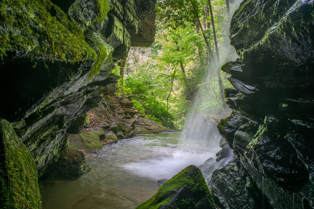
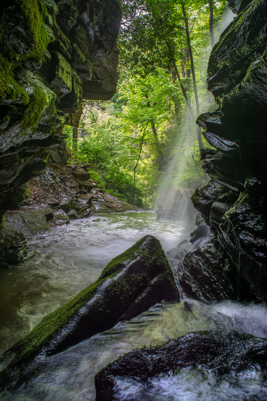
The cave at Cavern Falls provides interesting perspectives of this unique waterfall.
From Cavern Falls, simply retrace your steps back along Little Cove Creek and to the Big Bradley Falls split at 5.0 miles. If you are interested in just concluding the hike, then keep retracing your steps, returning to the parking area at 6.0 miles. However, if you include Big Bradley Falls - as I highly recommend you to do - then turn left at the old cabin and read the next section below.
Big Bradley Falls on Cove Creek
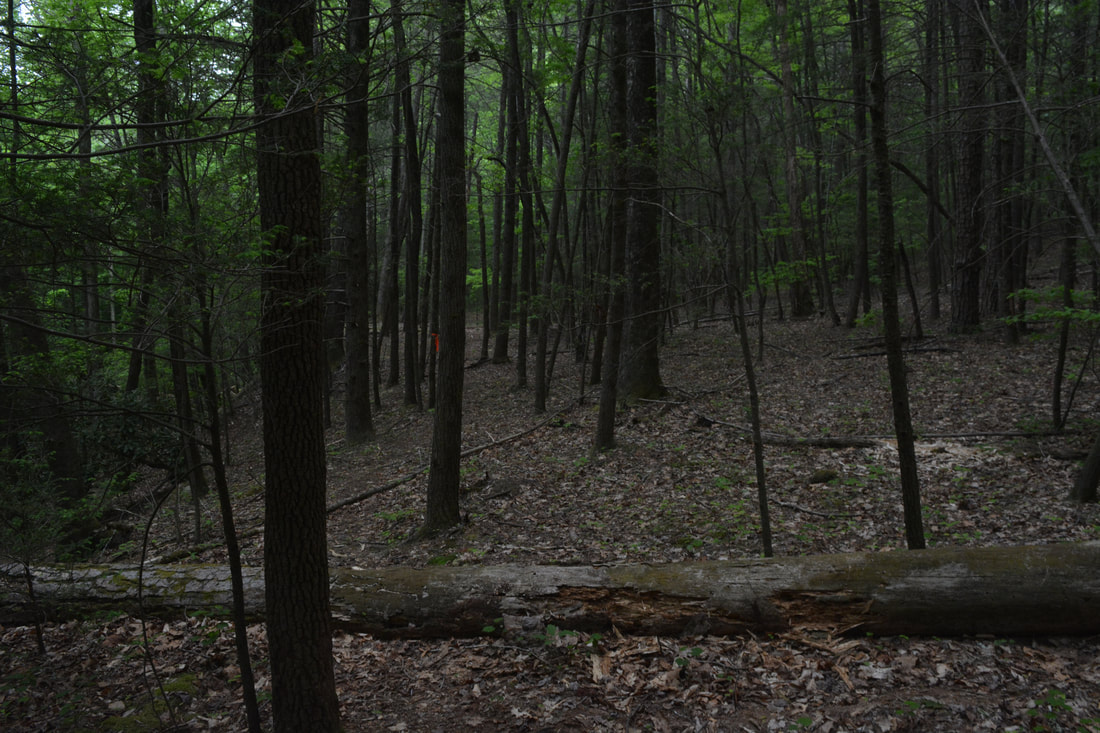
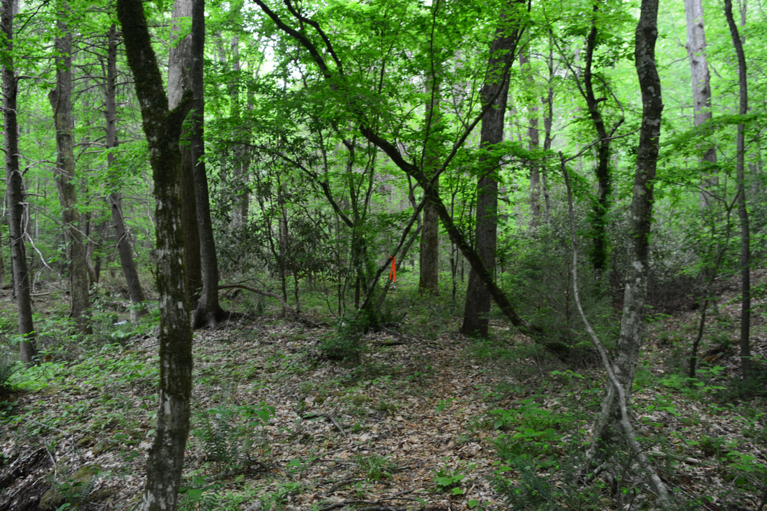
The trail to Big Bradley Falls splits off along a grassy double-track near Cove Creek and the old cabin. The cabin has kudzu and vines growing all over it! Beyond the cabin, the obvious trail enters the forest. At 5.2 miles (the mileage count begins with 5.0 miles at the Little Cove Creek split), the trail enters a Y-shaped wildlife clearing - stay right into the clearing's right-hand section. Take the distinct path entering the woods at the end. The path stays on a nearly level track, passes over a few downed trees, and reaches a crossing of Cove Creek at 5.6 miles. In typical flow, this is an ankle-deep wade. Although the dark rock slabs at the crossing may look slippery, they actually aren't. If you don't feel comfortable crossing at this point, you can cross at a deeper spot a little upstream.
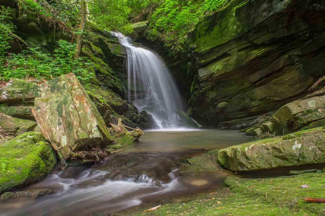
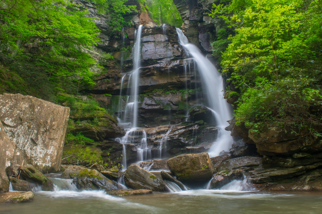
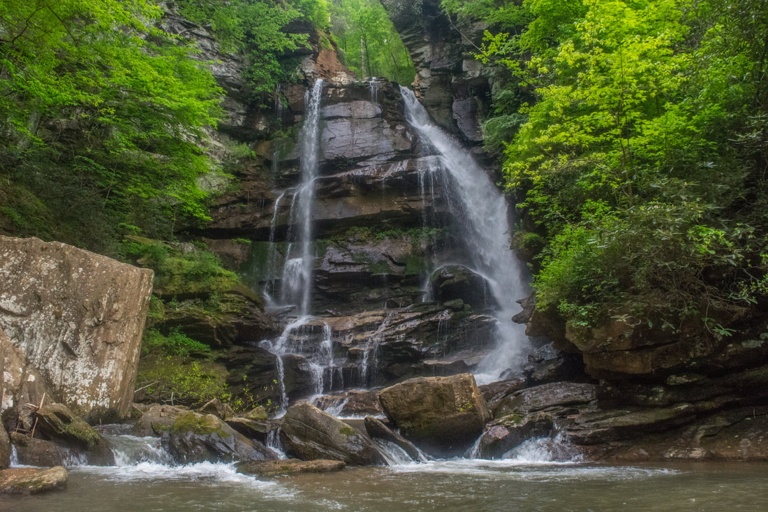
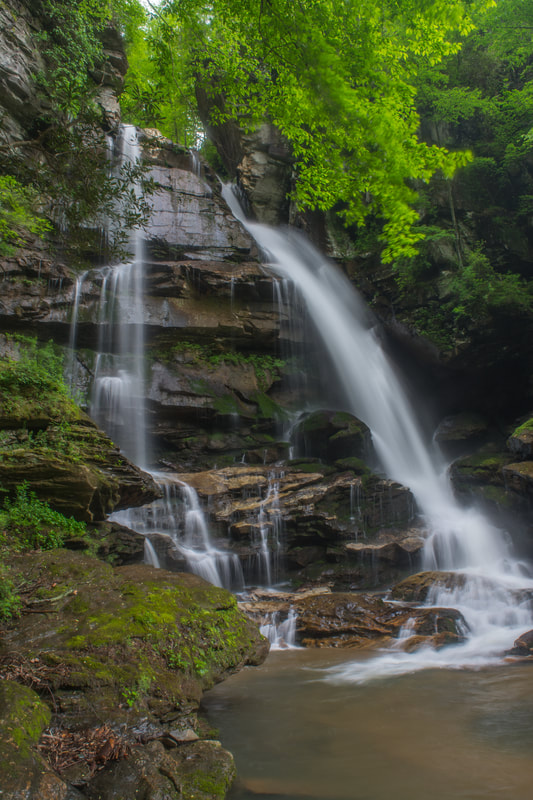
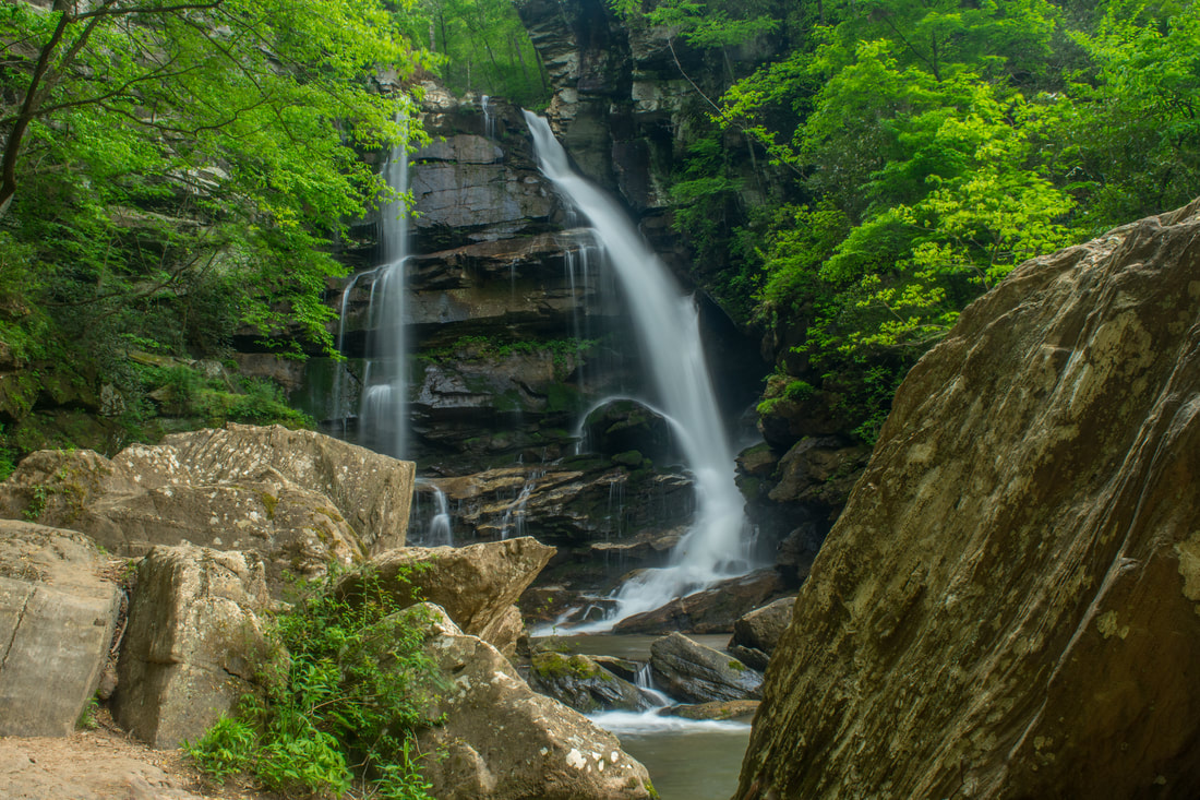
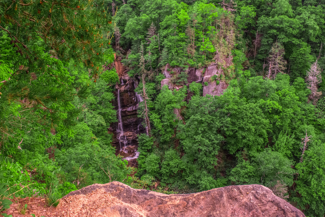
On the other side, the trail becomes a bit fainter as it ascends moderately above Cove Creek. At 5.9 miles, reach a small campsite. Here, a side path to a large cascade below Big Bradley Falls bears right, while the main trail turns left and ascends up a steep hill. The trail then clings to the hillside along a narrow pathway, while Cove Creek thunders down below - this is the hardest part of the hike to Big Bradley Falls. At 6.0 miles, an extremely steep path with ropes leaves left up a gully. This path provides access to the Big Bradley Falls Overlook - which you can optionally check out on your way back - as well as the upper Big Bradley Falls Trailhead and the Little Bradley Falls Trail. For now, continue straight across the gully toward the base of Big Bradley Falls. The path comes alongside a massive cliff, the base of which it follows straight to the falls at 6.05 miles. Big Bradley Falls is a very sensational waterfall, among the most stunning I've ever seen in the Southeast. Cove Creek thunders over the massive cliff in spectacular twin drops about 75 feet high. The main water volume is on the River Left side, where the water passes through a long cleft before free-falling to the base. The River Right side is a thin free-fall. The River Right side of the falls can go dry during periods without rain. Since it greatly enhances the waterfall's beauty, I would recommend seeing Big Bradley Falls in a wetter period. Even with only one side flowing, however, it will still always be spectacular. As you explore the falls, note the massive cliffs - taller than the waterfall itself - that form a semicircular rock amphitheater, closing in the falls on both sides. 
Big Bradley Falls is an absolutely spectacular 75-foot waterfall on Cove Creek.
From Big Bradley Falls, retrace your steps to the junction with the extremely steep gully path. Here, you can decide if you want to see the Big Bradley Falls Overlook or not. Although the view is unique and beautiful, it's tough to say whether it's worth the effort involved in ascending over 300 feet in 0.15 miles! If you have plenty of time, you can extend the hike beyond the overlook to Little Bradley Falls, in which case it's definitely worth the effort. Regardless, if you decide to head up, what you'll find is an insanely steep rock scramble that will require the use of your hands and feet in multiple places. There isn't anything particularly dangerous, but it's not an easy climb - and the downhill will actually feel harder!
At 6.25 miles, reach a T-intersection with a level trail running above the gorge. Turn right here. In 150 feet, turn right again on the steeply-descending side path to the overlook. Reach the overlook atop the cliffs at 6.3 miles. Stay away from the edge, as it's a sheer drop of 100+ feet! Multiple people have fallen to their death here. The rock outcrop provides a beautiful view of Big Bradley Falls far below and its surroundings. The main drawback is that part of the River Left side of the falls is obscured by a dead hemlock and another tree. The view is best seen in flow high enough to keep the River Right side of the falls flowing. If you wish to continue to Little Bradley Falls, then keep following the main trail above the gorge to Holbert Cove Road (there is one crossing of Cove Creek along the way). Then, cross Cove Creek along the road and follow the trail to Little Bradley Falls near Cove Creek (with one more creek crossing). In total, the hike is a little under 2 miles one way from the Big Bradley Falls Overlook. Return from the overlook to the Cove Creek trail and retrace your earlier steps back to the old cabin. From there, return along the access trail to the parking area, concluding the hike at 8.5 miles. Mileage
0.0 - Big Bradley Falls/Little Cove Creek Trailhead
1.0 - Big Bradley Falls Split 2.35 - Milton Bradley Falls 2.65 - Bradley Cooper Falls 2.7 - Marilou Bradley Falls 3.05 - Cavern Falls 5.0 - Big Bradley Falls Split 6.05 - Big Bradley Falls 6.3 - Big Bradley Falls Overlook 8.5 - Big Bradley Falls/Little Cove Creek Trailhead Variations
Hike out and back to Cavern Falls - 6.0 Miles
Hike out and back to Big Bradley Falls - 4.1 Miles Hike out and back to Big Bradley Falls, Overlook, and Little Bradley Falls - 8.5 Miles Bonus Stops
White Oak Mountain Road near Columbus, just down the road from Saluda and the Green River Game Lands, features a beautiful roadside waterfall known as Shunkawauken Falls. During a good flow, it's definitely worth a quick stop before or after a hike in the area.
Pictures & Videos
4 Comments
Brandi Elliott
6/14/2018 11:30:06 pm
Fantastic write-up, Mark!!! This took me right back to that day with excitement!! This was so much fun! One of my favorite hikes to date. Excellent descriptions of everything and what had to be done to get there! I wanna go back now! Haha! Two thumbs up 👍🏻 👍🏻
Erica Ponder
2/5/2022 06:08:49 am
Gee how do I not know you 4/30/2019 09:21:24 pm
Hiked this route today (4/30/19)... blowdown and landslides from recent flooding and storms made the route nearly impassable in places. Overall, the waterfalls were not obscured. A fun, challenging bushwhack overall.
Erica Ponder
2/5/2022 06:09:04 am
Truth time Leave a Reply. |
About MeMark Oleg Ozboyd Dear readers: I have invested a tremendous amount of time and effort in this website and the Georgia Waterfalls Database the past five years. All of the work that has gone in keeping these websites updated with my latest trip reports has almost been like a full-time job. This has not allowed me to pick up a paid job to save up money for college, and therefore, I I've had to take out loans. If you find the information on this website interesting, helpful, or time-saving, you can say "thanks" and help me out by clicking the button above and making a contribution. I will be very grateful for any amount of support you give, as all of it will apply toward my college tuition. Thank you!

Coming in 2022-2023?
Other Hiking WebsitesMiles HikedYear 1: 540.0 Miles
Year 2: 552.3 Miles Year 3: 518.4 Miles Year 4: 482.4 Miles Year 5: 259.9 Miles Archives
March 2021
Categories
All
|
||


 RSS Feed