The Arkaquah Trail has always been one of Georgia's most famous trails thanks to its difficulty and its approach to the tallest peak in the state. Of the three different trails that summit Brasstown Bald, the Arkaquah Trail is undoubtedly the most scenic. In fact, whereas the crowded summit of Brasstown Bald with its large observation tower may not be alluring to wilderness hikers, three other vistas can be found near the Arkaquah Trail. The view from Chimneytop Mountain in particular is arguably one of the state's most jaw-dropping views with its 180-degree panorama! Even more remarkable is that this view remains largely unknown to the hiking community despite its proximity to the Arkaquah Trail. With the two other beautiful overlooks plus the Brasstown Bald summit accessible via the trail, the Arkaquah Trail is one of the most scenic hikes in North Georgia. This hike occurred on Saturday, October 21st, 2017. My plan was to hike out and back along the Arkaquah Trail to the summit of Brasstown Bald, making side trips to the three views along the way.
Summary
R/T Length of Trail: 12.4 Miles
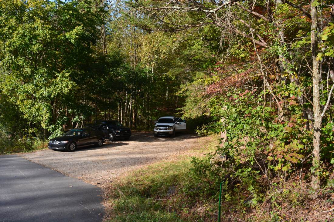
Duration of Hike: 8:00 plus about 3 hours of stopping Type of Hike: Out and Back Difficulty Rating: 9 out of 10 Total Elevation Gain: 4319 Feet Pros: Beautiful ridge-top trail with continuous views in winter Cons: All of the views near the trail require short side trips without the benefit of defined routes; the area around the summit of Brasstown Bald is usually very crowded Points of Interest: Buzzard Roost Ridge View - 7 stars; Rattlesnake Bluff View near Low Gap - 5 stars; Chimneytop Mountain View - 10+ stars; Brasstown Bald Summit and Views Trail Blaze Colors: Arkaquah Trail - Blue (Old) Best Seasons to Hike: Fall; Winter Fees: None Beginning Point: Trackrock Gap Trailhead Directions from Young Harris, GA: From the intersection of US 76 and GA 66 in downtown Young Harris, follow US 76 West for 2.0 miles. Then, turn left onto Trackrock Gap Road and continue south for 2.2 miles. The signed parking area will be on the right just past the gap. The Arkaquah Trail will begin to the left across the road right before the parking area. Map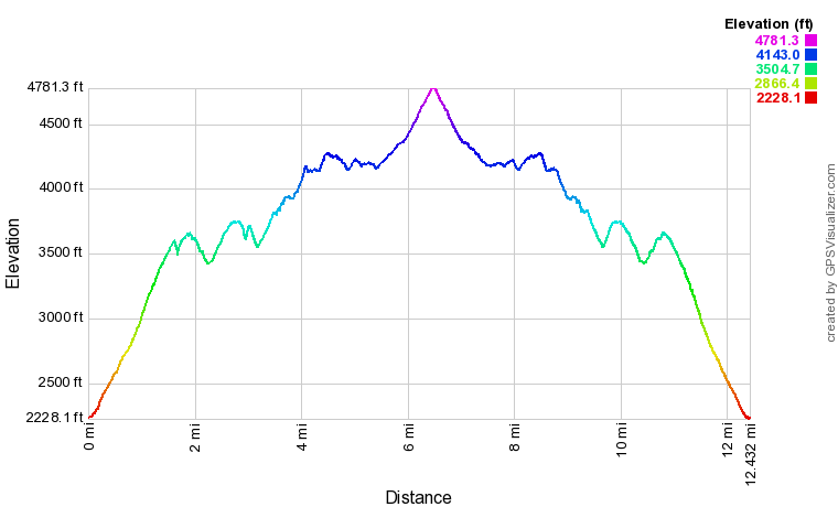
Click the link below to download a .GPX file with a track of this hike.
Details
I'd hiked the Arkaquah Trail a couple of times prior to this post, but both times I missed something. The first time, I didn't even get all the way to the end due to approaching darkness. I did get to the end the second time, but I had no clue about three great views just off the trail that make it so much more worthwhile. On this trip, I finally got to visit all three of the off-trail views. The Arkaquah Trail is not the same without these views! I have to credit Ben Smith for discovering the first view on the west side of Buzzard Roost Ridge and Greg Ford for discovering the second view on the south side of Locust Log Ridge near Low Gap and naming it Rattlesnake Bluff. The third and best view off the west knob of Chimneytop Mountain was not publicized or undocumented prior to my visit. I hope that my discussion of that view here will alert more Arkaquah Trail hikers of it, as it is one of the most incredible overlooks I have seen in Georgia.
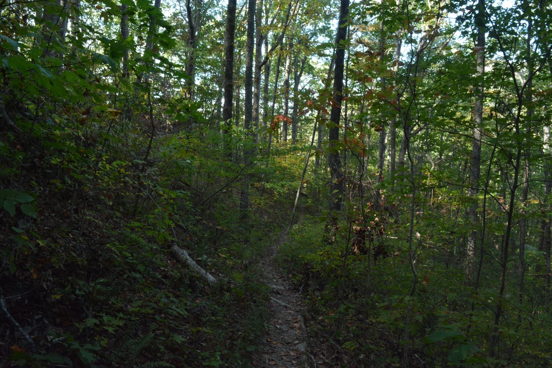
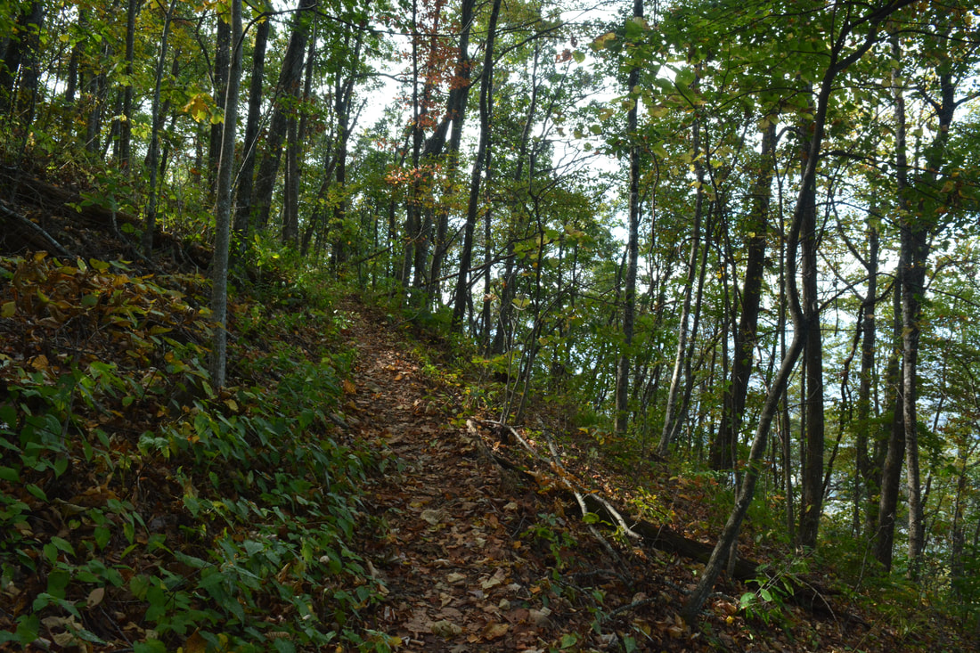
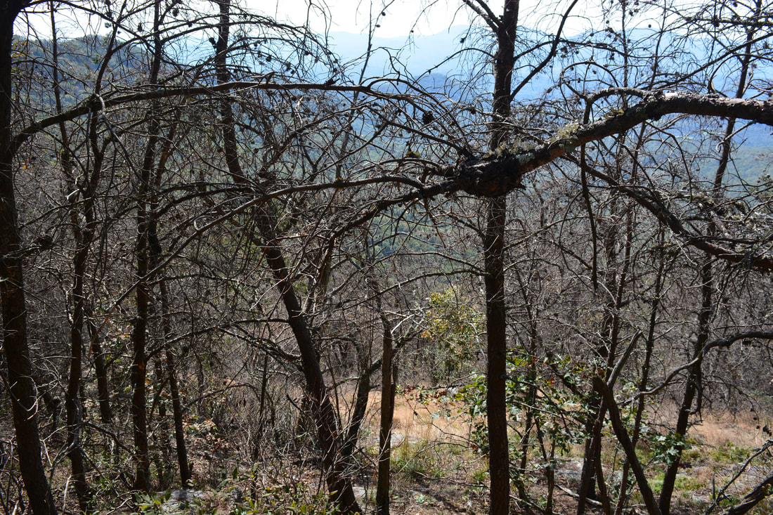
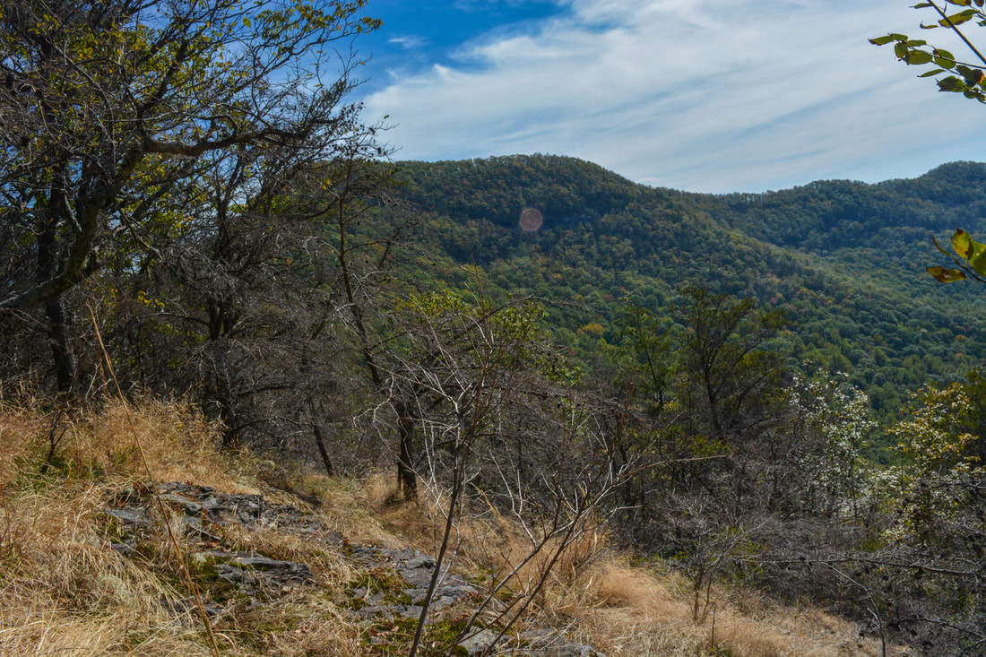
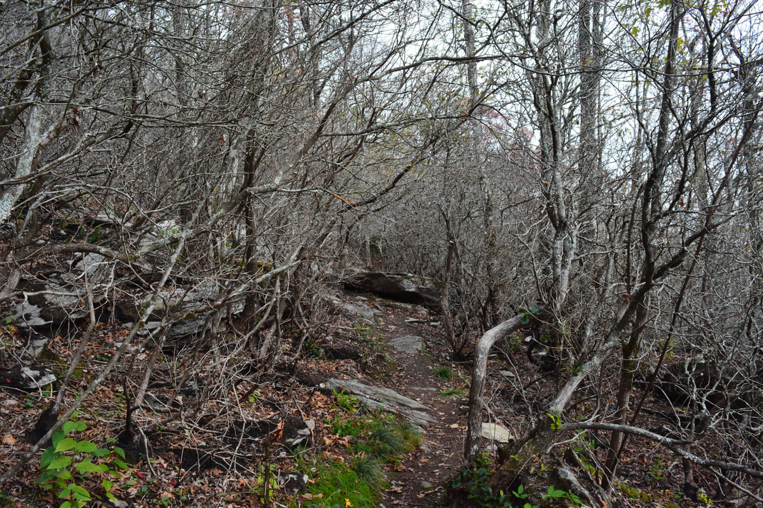
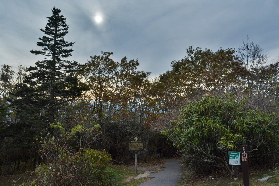
Begin the hike by taking the signed Arkaquah Trail (#29) east from Trackrock Gap Road diagonally across from the parking area. The trail loses no time in beginning a moderate ascent of Buzzard Roost Ridge as it instantly enters the Brasstown Wilderness. The trail initially curves around some hollows but does not ascend with switchbacks for a while. As the Arkaquah Trail steadily gains elevation and approaches the crest of Buzzard Roost Ridge, the grade becomes steeper and steeper. In fact, the trail ascends about 1370 feet in the first 1.6 miles! This makes it one of North Georgia's steepest extended grades. Around the steepest part of the slope below the ridge at 1.1 miles, the trail begins a series of 12 switchbacks, passing impressive cliffs and rock formations along the way. The hardwood forest along this part of the trail is conducive for excellent fall color. The Arkaquah Trail finally reaches the crest of Buzzard Roost Ridge at 1.6 miles and makes the final twelfth switchback to the left here, in order to follow the ridge. This is the exact spot that you must leave the trail and turn right down the ridge to see the first view. The coordinates for this spot are N34° 52.764' W83° 51.845'. There is no defined path to the view, but the bushwhack through open woods is very easy. The biggest challenge comes in locating the exact location of the rock outcrop with the view, because it is quite small and not visible well from a distance. If you follow the ridge for about 250 feet from the trail, you should see a small opening in the forest down to the right. Scramble for another 150 feet in the direction of the opening. On the far end of the opening is a small set of rock outcrops and cliffs that provides the surprisingly broad view. The view is at N34° 52.731' W83° 51.886'. 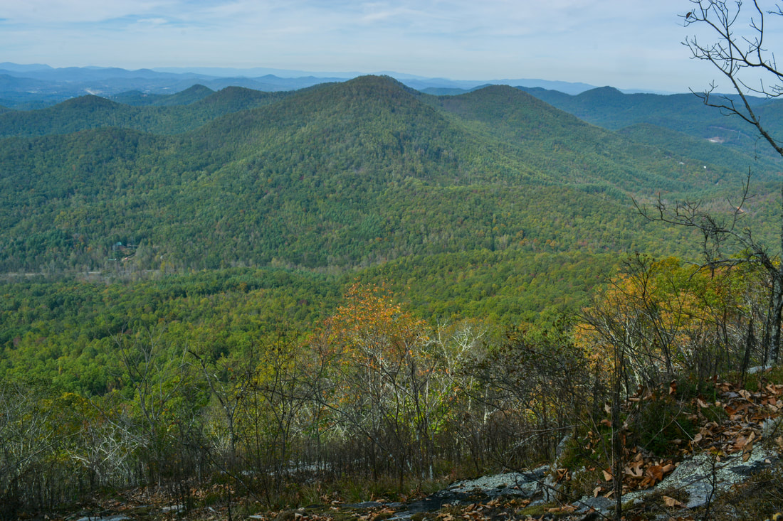
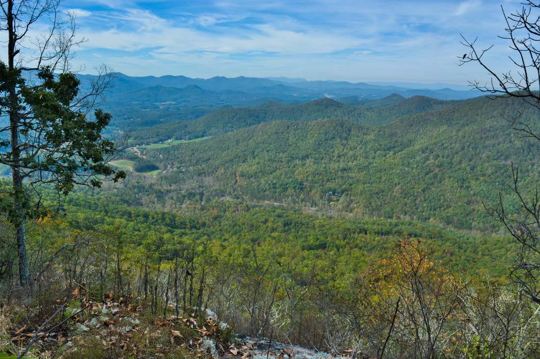
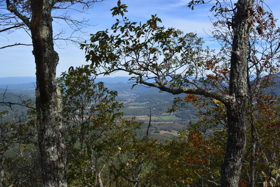
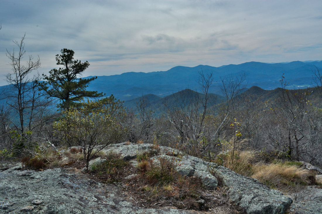
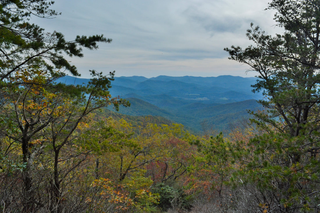
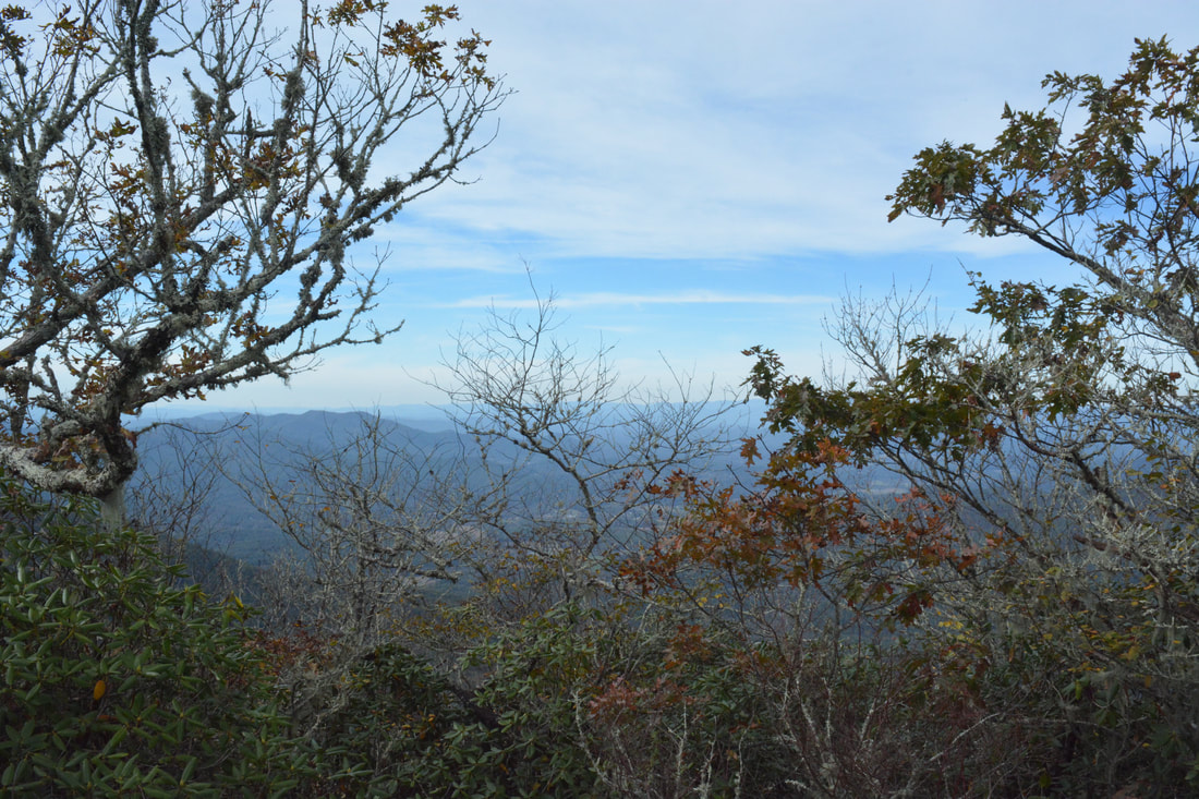
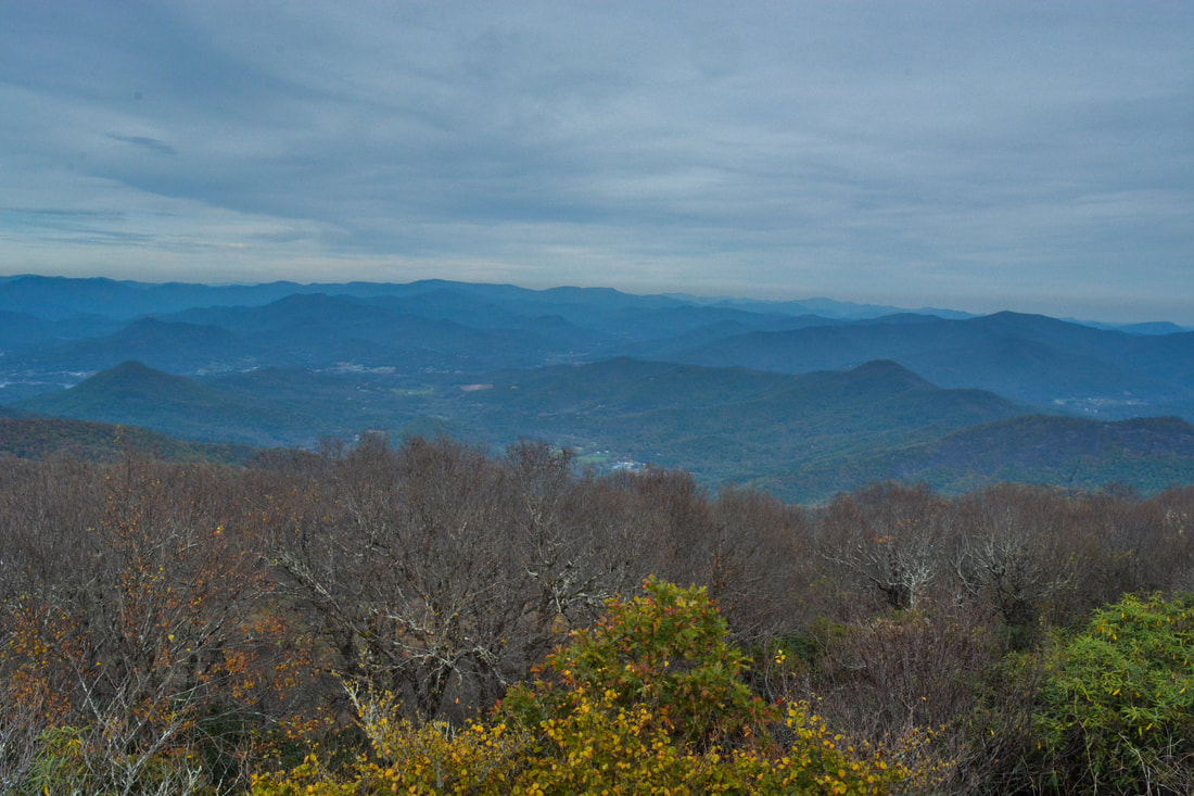
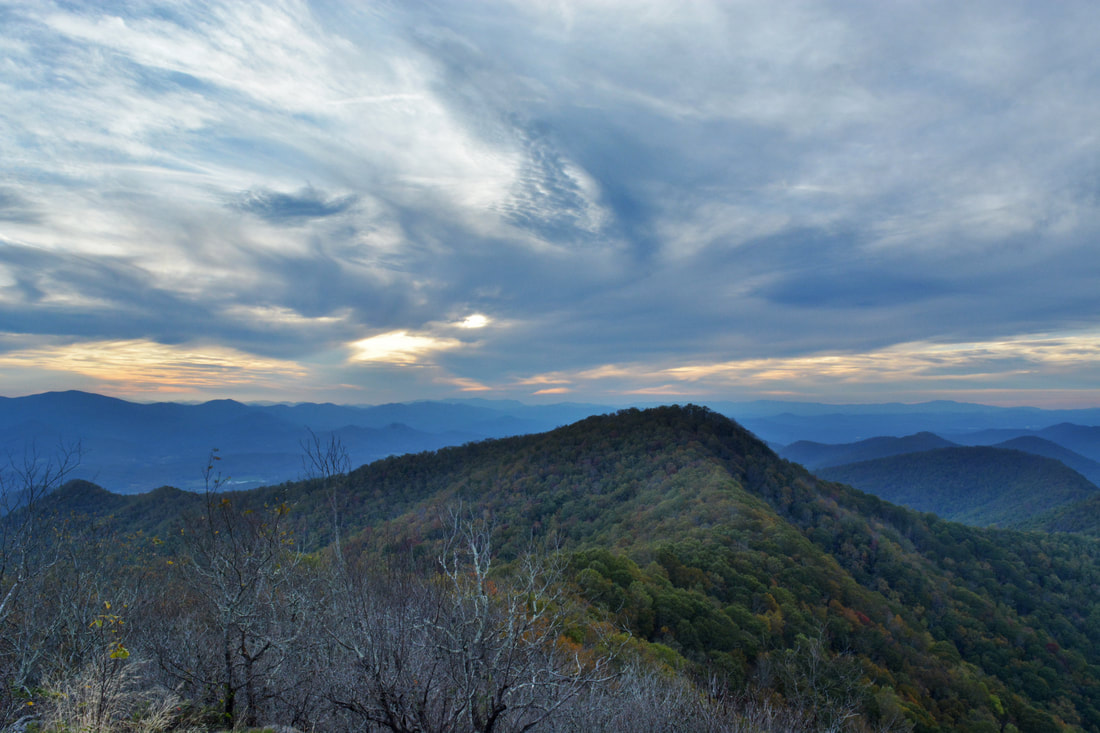
The cliffs on the west side of Buzzard Roost Ridge provide an excellent 180-degree panoramic view.
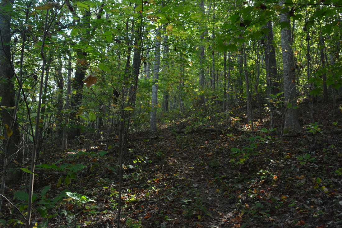
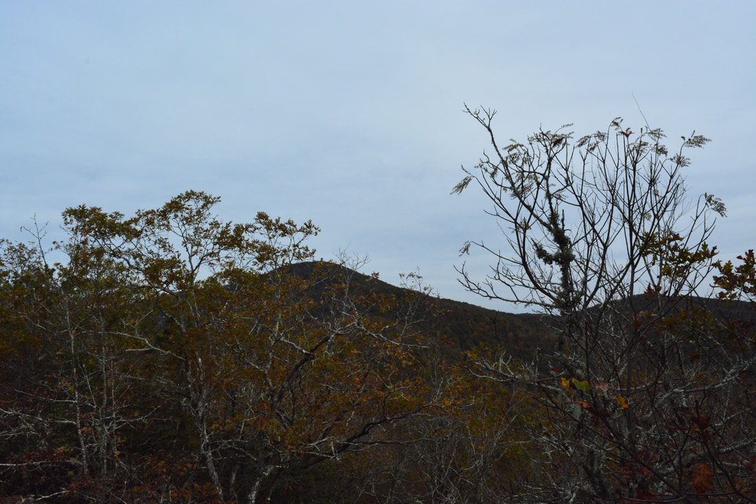
The view from Buzzard Roost Ridge encompasses 180 degrees and is quite beautiful. Trackrock Gap is straight ahead with Thunder-struck Mountain rising up on the other side. Many other mountains and ridges circle the viewing range from the rock outcrop, including Duncan Ridge to the southwest. The main drawback of this view is that it is at a low elevation relative to the surrounding peaks, but it's still well worth a visit - even a simple out and back hike from Trackrock Gap. Return to the Arkaquah Trail at 1.75 miles and continue following as it traces the ridge and reaches the Buzzard Roost Ridge high point at 1.9 miles at an elevation of 3650 feet. You have finished the first ascent but get ready for a rollercoaster hike along Locust Log Ridge (with more uphill than downhill on the way in). A small rock outcrop about 250 feet past the high point provides limited views into Brasstown Valley to the north. At the same time, there are great winter views of Locust Log Ridge and Rocky Knob. The Arkaquah Trail descends moderately into Cove Gap and reaches an unnamed knob on the ridge after a short but steep ascent at 2.75 miles.
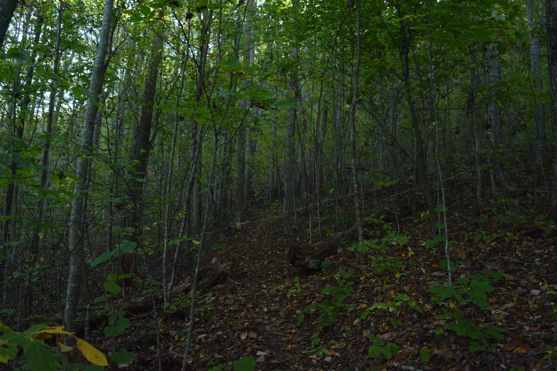
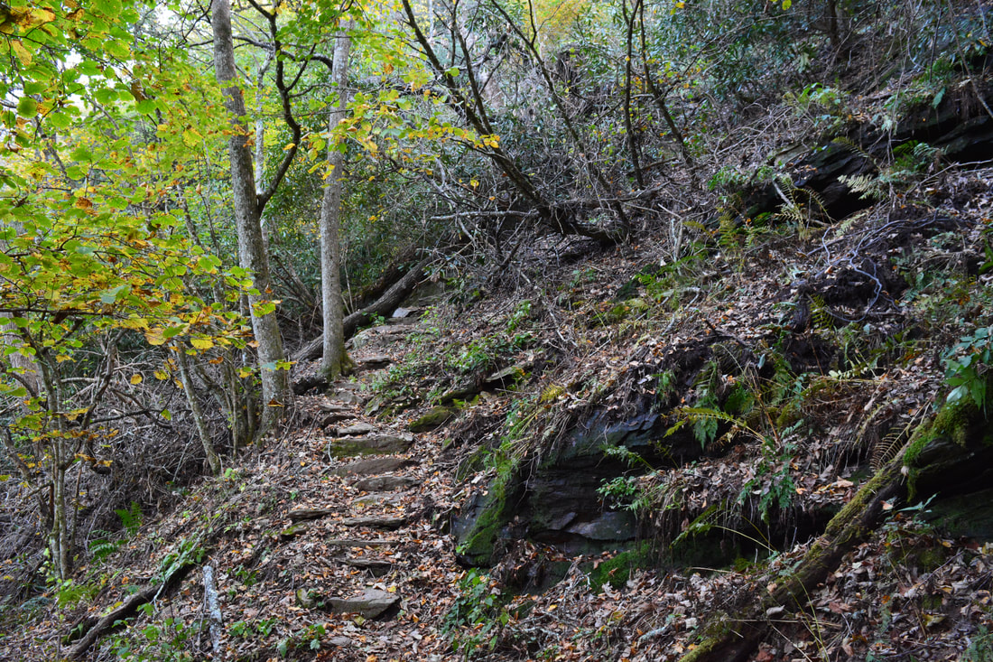
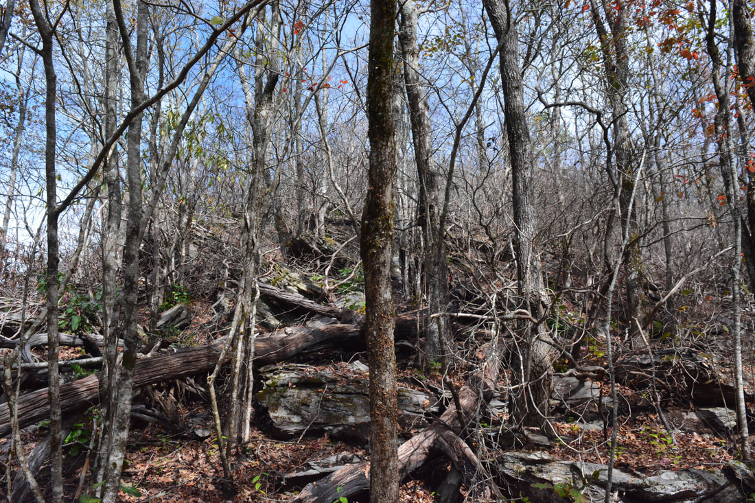
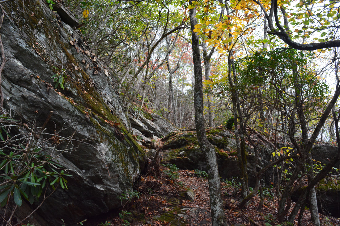
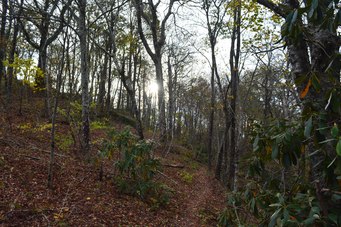
Rattlesnake Bluff View is on the southeast side of this knob. Continue following the Arkaquah Trail for about 0.15 miles past the summit of the knob. You must leave the trail to the right for the view about halfway down to Low Gap. There is absolutely zero indication of the spot that you must leave the trail, and you may never find the view if you don't leave at that particular spot, because there is a wall of mountain laurel just out of sight of the trail through which there is only one decent path. For this reason, I do not recommend going to Rattlesnake Bluff without a GPS. If you do not find it, you won't miss too much as this view is the least impressive of the three. The exact place that you must turn right off the trail for Rattlesnake Bluff is N34° 52.733' W83° 50.888'. If you do so, start heading in the southwest direction and a phantom trail should form in about 100 feet. Follow the faint path down through the mountain laurel thicket, past a few small rock outcrops, and to the bluff. At the bluff, turn left and follow it for a short distance to the best view (near its far end) at 2.95 miles. The exact coordinates of the best view from Rattlesnake Bluff at N34° 52.693' W83° 50.901'. The view from Rattlesnake Bluff is noticeably narrower than from Buzzard Roost Ridge, but it remains beautiful. The main area encompassed by the view is Choestoe Valley to the south with the mountains of the Tennessee Valley Divide lining the horizon. A notable landmark in the view is the Blue Bluff cliffs to the east (left) on the side of Rocky Knob and Locust Log Ridge. When Greg Ford found this vista, he named it Rattlesnake Bluff because he found the bluff teeming with rattlesnakes! I did not see any on my visit in cool conditions, but that certainly does not mean they aren't present. Return to the Arkaquah Trail and follow it as it drops into Low Gap and then begins an ascent of the next knob on Locust Log Ridge. After 0.3 miles of moderately steep ascent, the trail suddenly levels out, leaves the ridge, and begins contouring along the north side of the ridge instead of ascending the knob. This is one of the most rugged parts of the hike, and there are many rock outcrops and boulders along the trail in this area. Also, between 3.6 and 3.7 miles, the trail makes two short rock scrambles. Finally, at 3.75 miles, the trail rejoins the ridge and begins heading toward Chimneytop Mountain. 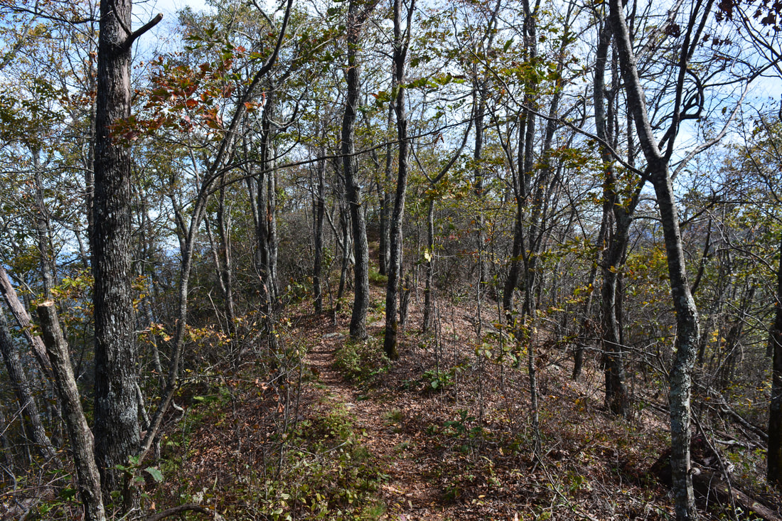
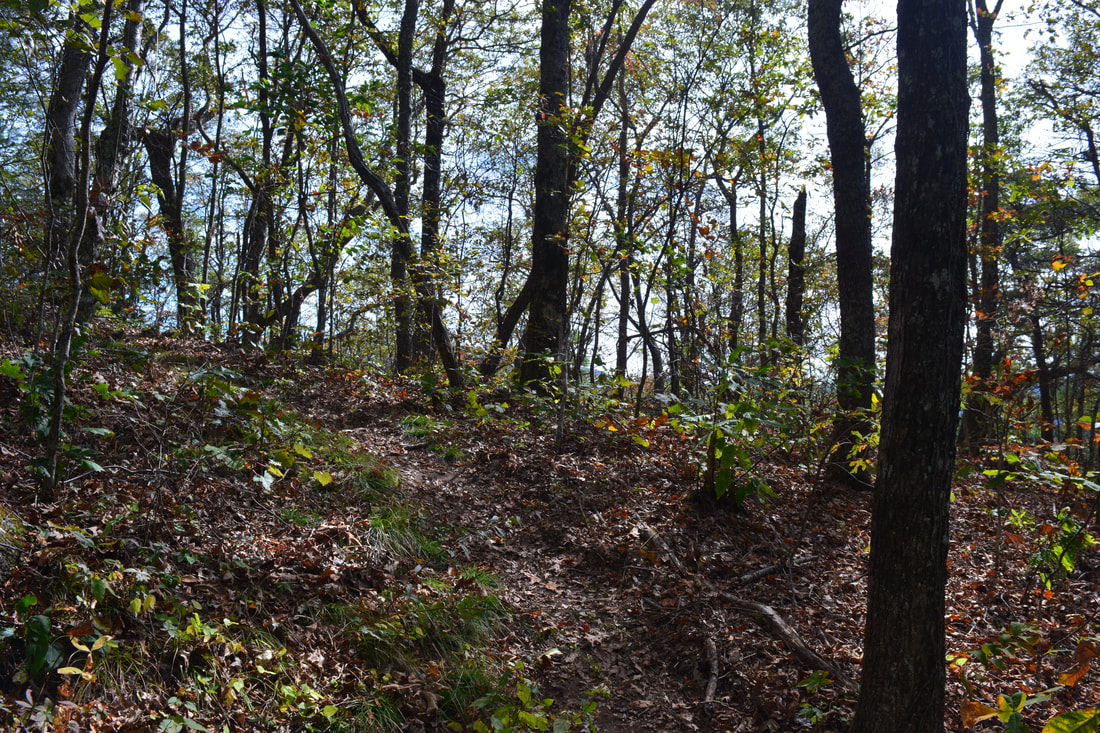
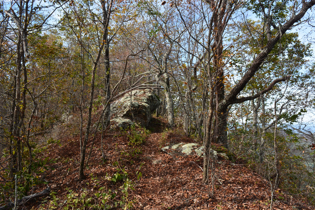
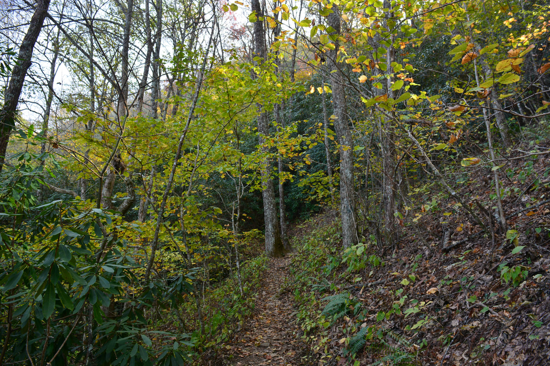
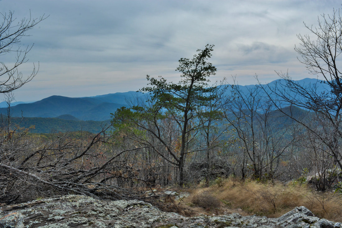
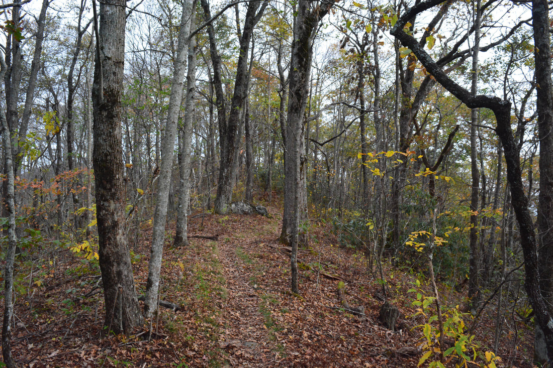
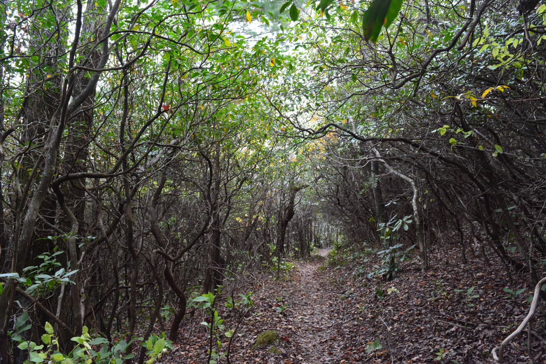
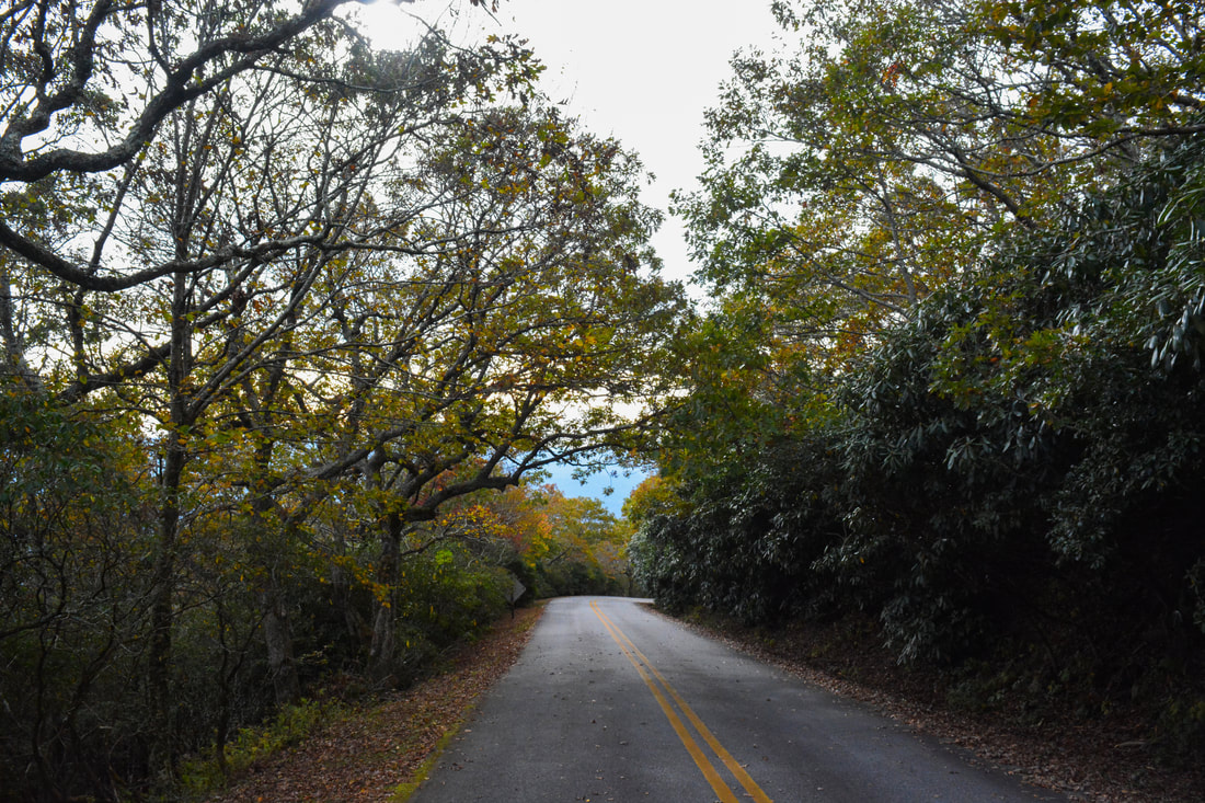
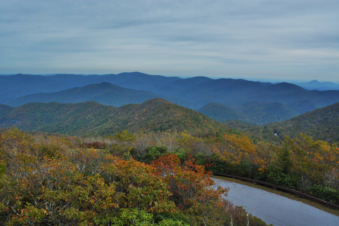
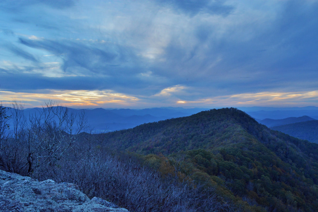
The scenic Arkaquah Trail frequently follows the ridgeline with great winter views.
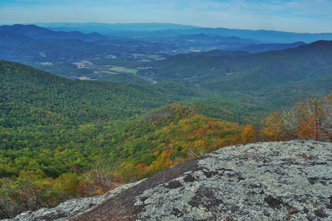
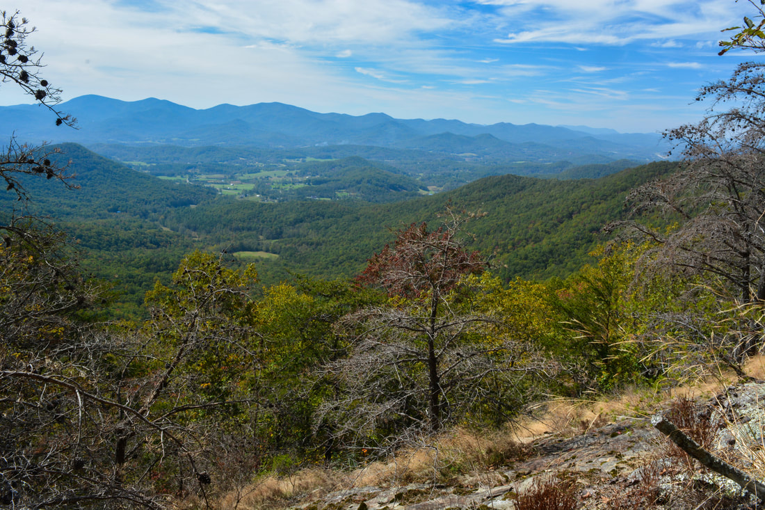
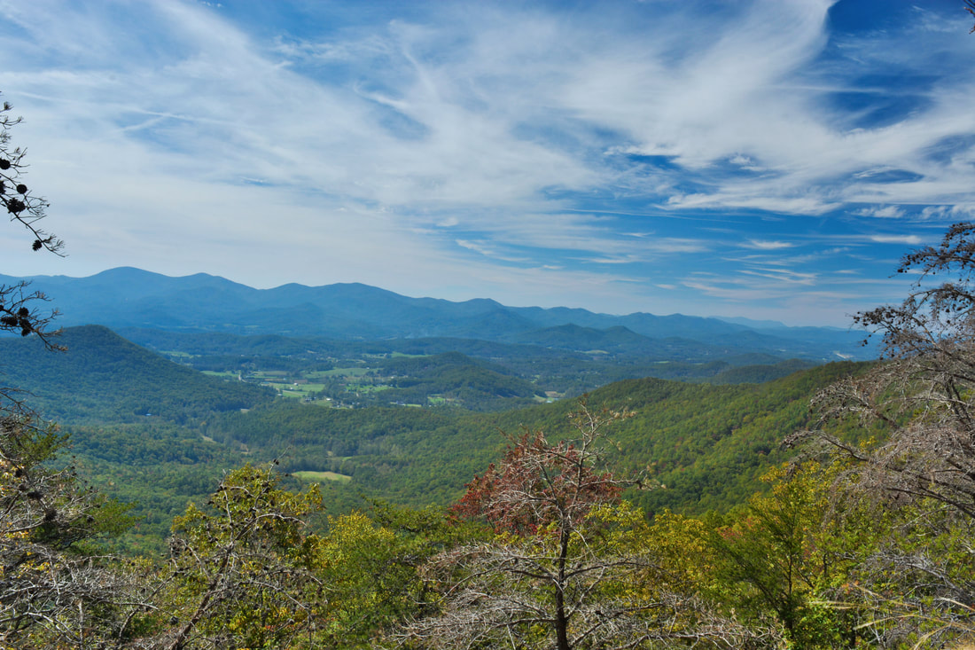
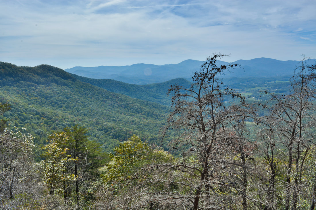
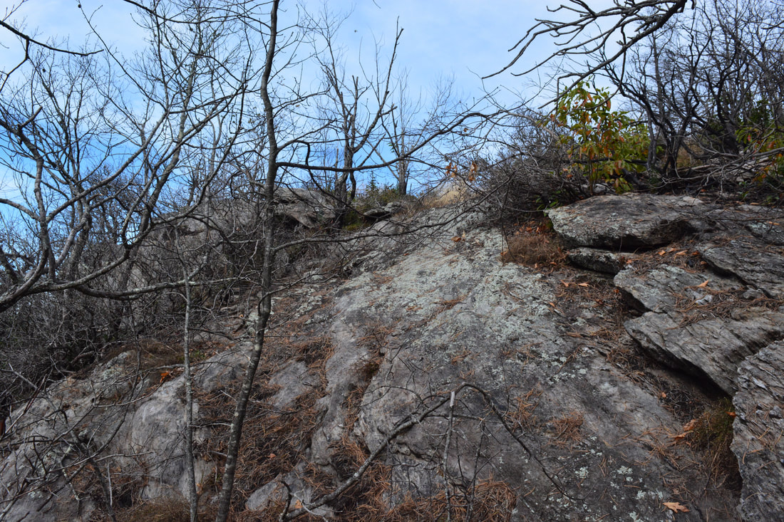
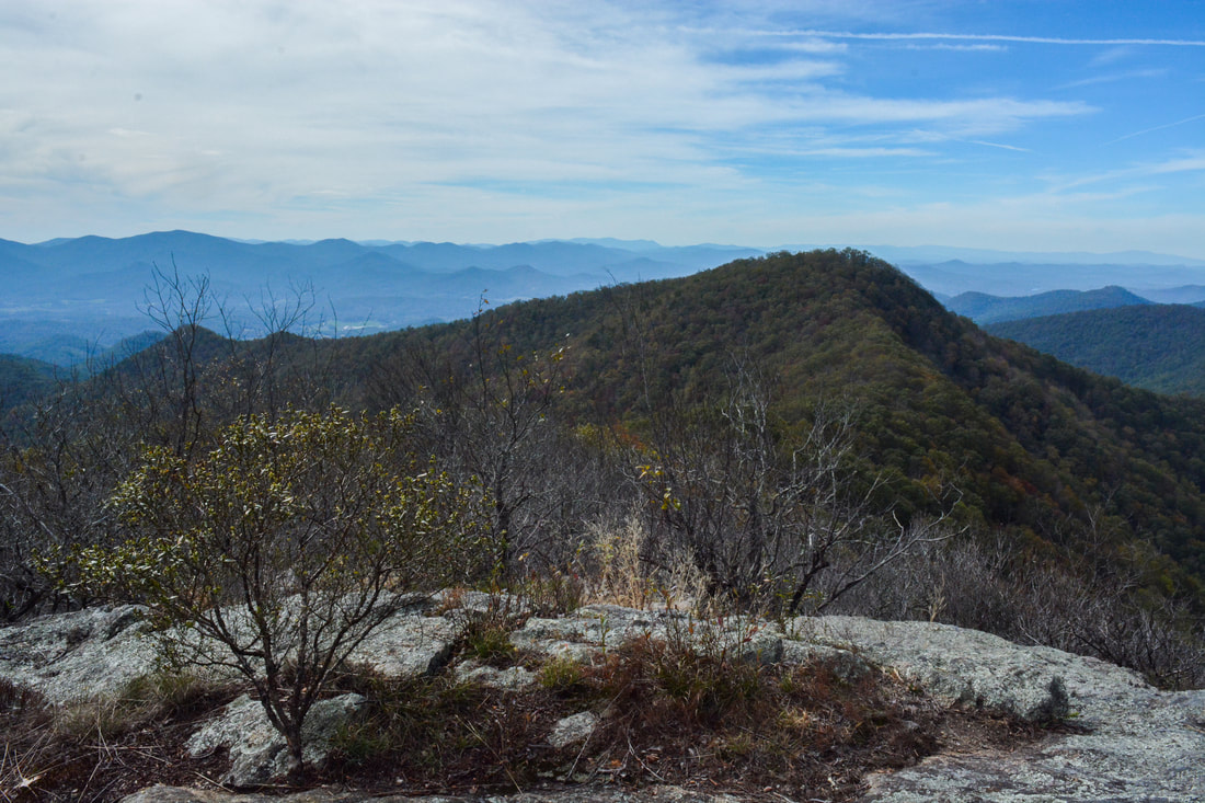
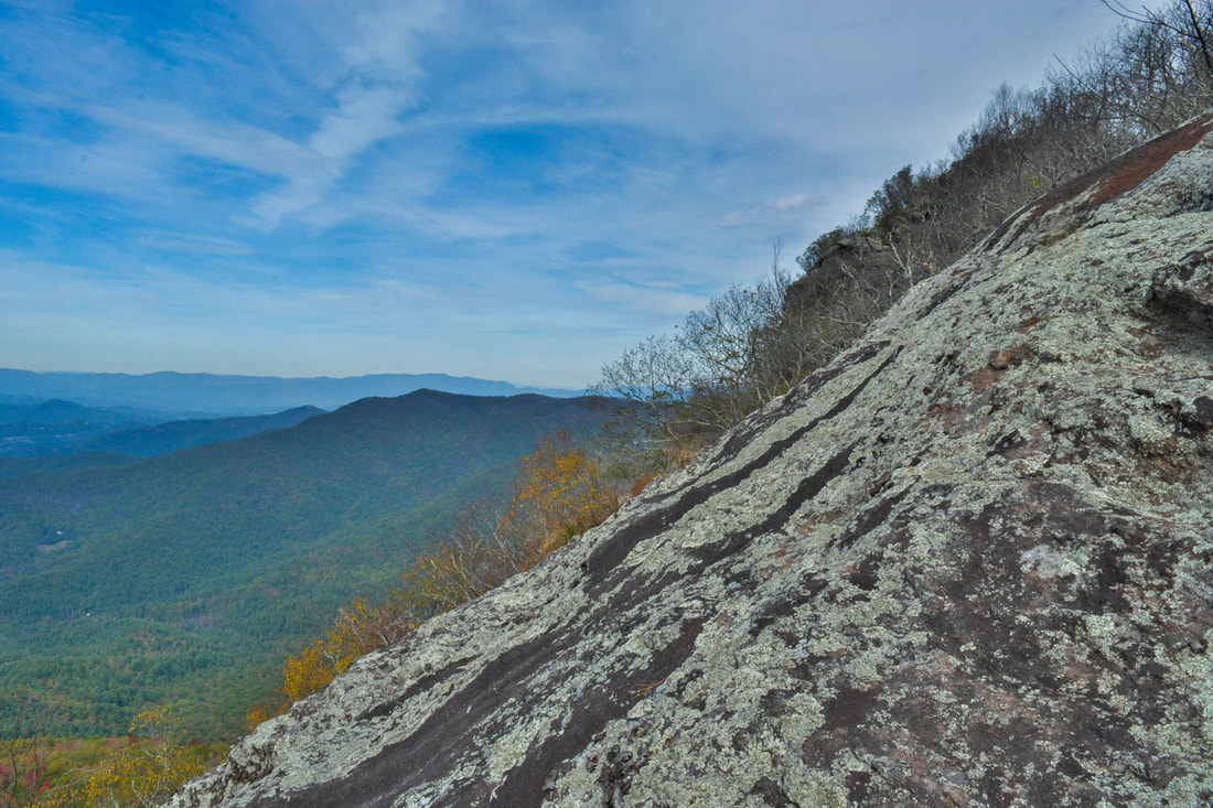
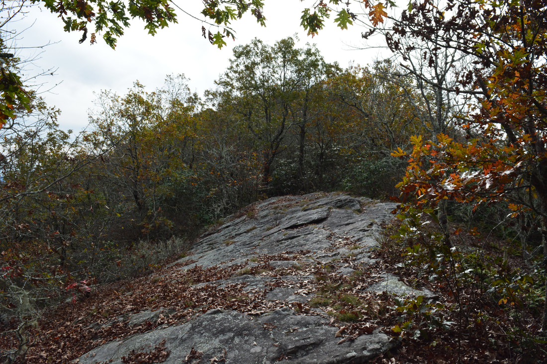
After passing through a gap and beginning another moderate ascent of the west peak of Chimneytop Mountain, the Arkaquah Trail suddenly enters a burned area at 4.0 miles. This is the site of the small Chimney Top Fire, part of a devastating series of fires that swept through North Georgia in November 2016. Take close note of the location where the trail enters the burned area, as the Chimneytop Mountan View is close by. About 250 feet after the burned area begins is where you should turn left off the trail to see the view. It looks like there is actually a faint semblance of a fire-damaged path at this spot. The numerous large boulders to the left of the trail will also help you to recognize the spot to leave it. The coordinates for this spot are N34° 52.416' W83° 50.060'. After leaving the trail, follow the route of least resistance through the burn area, heading toward the highest point you see. You'll run into a series of steep rock slabs shortly - the vista is at the top of the highest rock. It is not difficult to scramble up the rock slabs, but of course, basic rock scrambling abilities will help. You'll reach the top of the rocks and the Chimneytop Mountain Vista at 4.1 miles. The exact coordinates for it are N34° 52.437' W83° 50.046'.
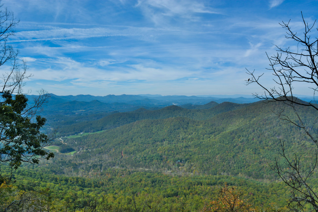
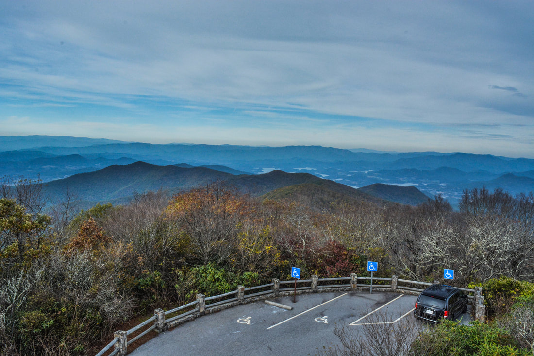
I barely caught my breath after the scramble to the top of rock when it became clear to me that this was no ordinary view. The simply outstanding panorama from the rock outcrop on the west peak of Chimneytop Mountain provides unobstructed views to the north, west, and south. The long-range view to the north from the top of the 40-foot cliff encompasses much of Brasstown Valley and Young Harris and stretches all the way to the Tusquitee Mountains at the horizon in North Carolina. To the west, the full extent of Locust Log Ridge is in full view, allowing you to trace most of your route up to this point. Nottely Lake sparkles in the distance. The mountains of the Tennessee Valley Divide line the horizon to the south, including well-known landmarks like Cowrock Mountain and Blood Mountain. I am being totally honest here: the view from Chimneytop Mountain is one of the most astonishing views I have ever seen in Georgia. Anyone who hikes the Arkaquah Trail must absolutely stop by this view, which is so close to the trail and not hard at all to reach. Keep in mind that the view is on the small knob immediately west of the Chimneytop Mountain on the map, but since the unnamed knob is so close and nearly the same height, it is appropriate to refer to it as the west peak of Chimneytop Mountain and its view as the Chimneytop Mountain View. There is a small second rock outcrop a yards east of the main view that provides a slightly obstructed view to the south and east, including Tray Mountain and more of the Tennessee Valley Divide. Return to the Arkaquah Trail at 4.15 miles and continue following it toward Brasstown Bald. The trail quickly leaves the small burn area and passes a path to a narrow but pretty view facing south at 4.2 miles. The trail circles the knob and then makes an ascent of Chimneytop Mountain itself. A huge boulder with an overhang faces the trail at 4.45 miles, after which it passes through a small rock notch. The Arkaquah Trail crosses the summit of Chimneytop Mountain at 4.5 miles with great winter views to the north. The ridge-walk continues from here as the trail drops down two switchbacks and comes out onto a small open rock slab with nice views of Brasstown Bald and its observation tower at 4.6 miles. The trail bypasses the knob on the ridge, for once going through a fairly easy segment contouring along the slope. 
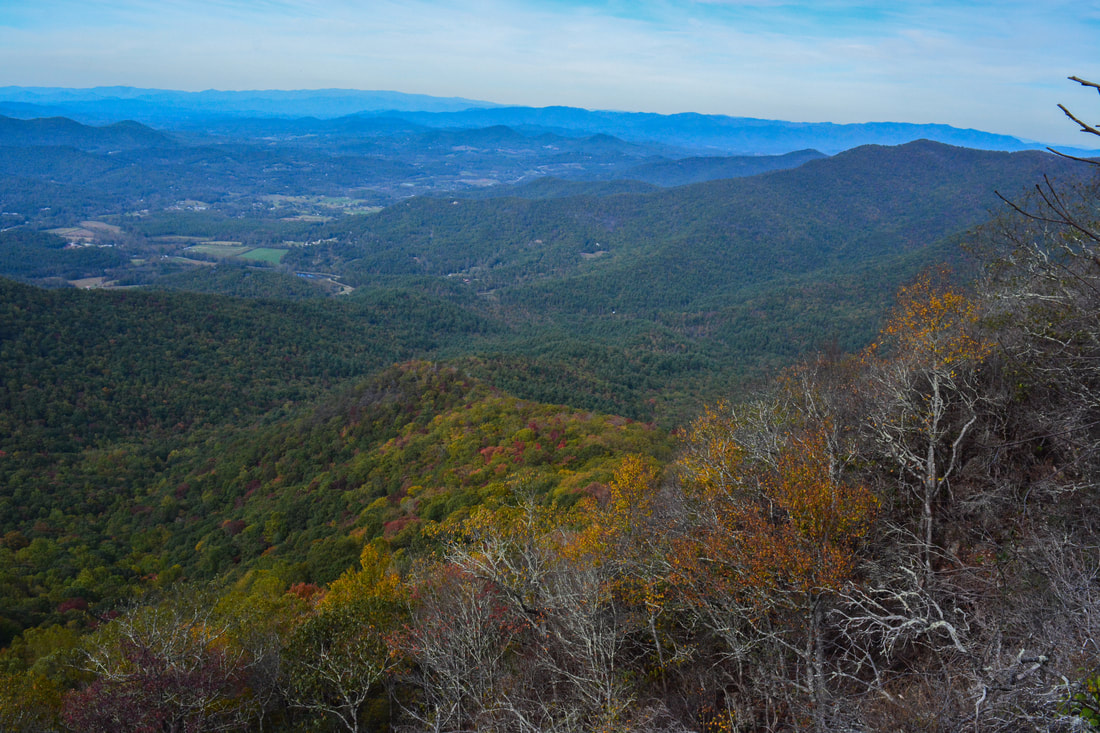
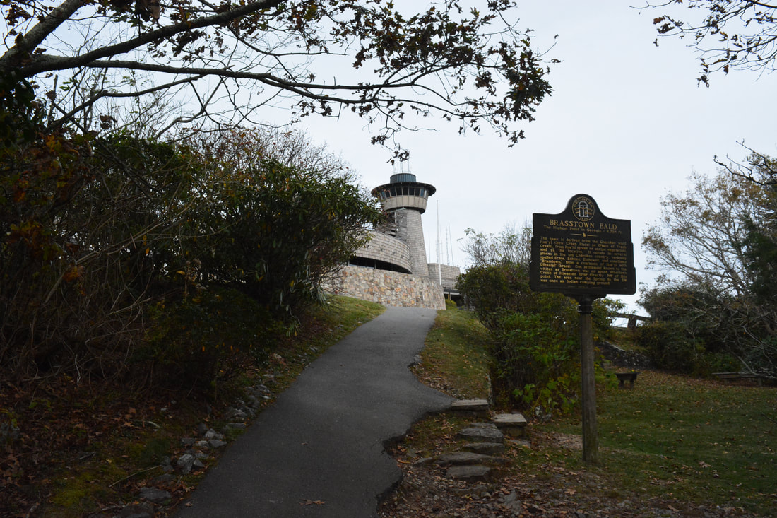
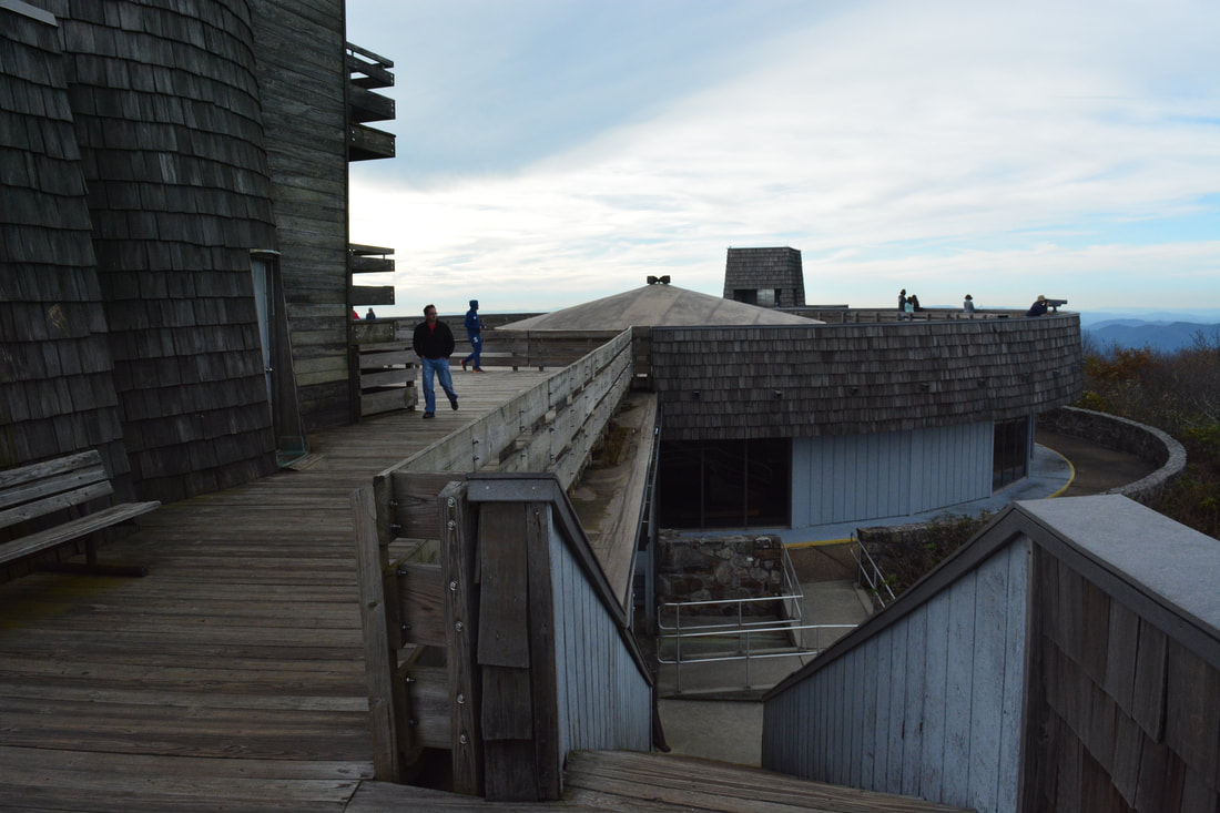
The observation tower atop Brasstown Bald, the highest point in Georgia, provides a 360-degree panoramic view.
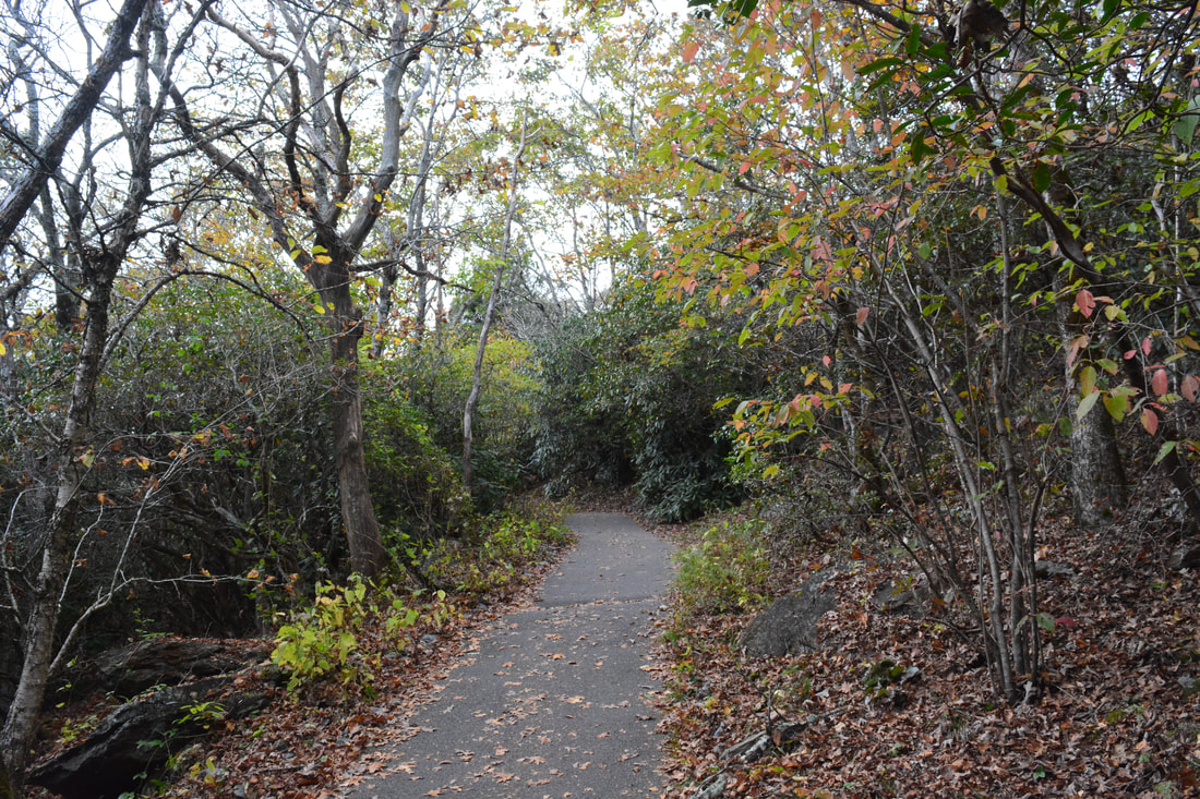
The Arkaquah Trail reaches one final gap just below Brasstown Bald at 5.2 miles. This is where the final section of the trail begins as the trail contours along the slope with only gentle ascent on its way to the Brasstown Bald parking area. After so much rugged hiking along the ridgeline, this nearly flat stretch comes as a welcome sight. The Arkaquah Trail exits the Brasstown Wilderness at 5.8 miles and ends at the Brasstown Bald Parking area at 5.9 miles. This parking area is the starting point for most people who hike to Brasstown Bald the easy way. If you wish to continue to the summit, bear left across the near end of the parking area and pick up the paved path to the summit. At 6.0 miles, the Wagon Train Trail - another Brasstown Bald approach trail - leaves right and eventually reaches a different trailhead in Young Harris College. The paved path continues a rather steep ascent, gaining 400 feet in elevation during the 0.6 miles to the summit. After two switchbacks, the paved path crosses a road at 6.4 miles. This is the road that shuttle vehicles use to take people to the summit from the parking. Finally, the paved trail ends at the summit of Brasstown Bald at 6.5 miles.
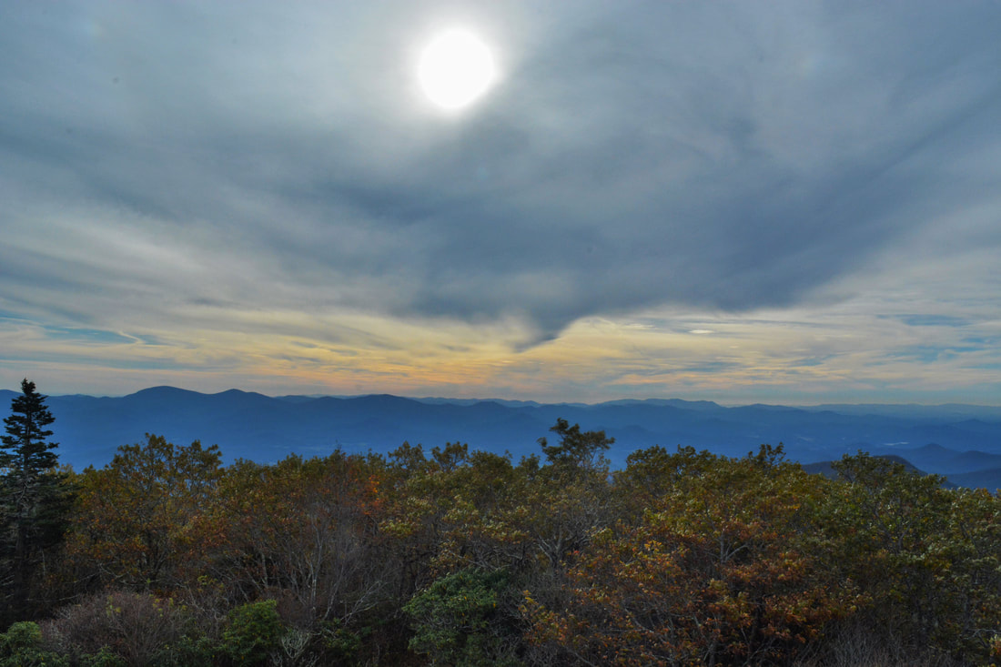
At a height of 4783 feet, Brasstown Bald is well-known as the highest mountain in Georgia. A wooden observation deck and tower at the top provides 360-degree views, although unfortunately, the tall fire tower itself is closed to the public. While the panoramic view from the deck is stunning, it is usually crowded except during January, February, and early March when the road to the parking area is closed. All of the structures at the summit make the overlook less notable in my opinion, but it is still well worth a visit, especially if you've made it all the way up the Arkaquah Trail. From Brasstown Bald, retrace your steps through the Brasstown Wilderness along the Arkaquah Trail back to Track Rock Gap. You will conclude the hike at 12.4 miles. I have decided to rate the Arkaquah Trail a "Best Hike" due to the numerous spectacular views found along the trail. Mileage
0.0 - Trackrock Gap Trailhead
1.7 - Buzzard Roost Ridge Vista 2.95 - Rattlesnake Bluff Vista 4.1 - Chimneytop Mountain Vista 4.6 - View of Brasstown Bald 5.9 - Brasstown Bald Parking Area 6.5 - Brasstown Bald Summit & Views 12.4 - Trackrock Gap Trailhead Variations
Hike out and back to Buzzard Roost Ridge Vista from Trackrock Gap - 3.4 Miles
Hike out and back to Chimneytop Mountain Vista from Brasstown Bald Parking - 3.6 Miles Hike out and back to Buzzard Roost Ridge Vista and Chimneytop Mountain Vista from Trackrock Gap - 8.0 Miles Bonus Stops
After the hike on the Arkaquah Trail, consider stopping by the very easily-accessible Cupid Falls - a small waterfall right in Young Harris.
Pictures & Videos
2 Comments
Greg Ford
11/14/2017 11:07:53 am
Fantastic travel report Mark! I can't wait to explorer that new Bluff that you found!
JEFFREY MCDUFFIE
6/17/2020 05:05:05 pm
Nice report! I hiked with my daughter this past weekend but realize I missed a lot of great views after reading your report. thanks a lot. I will try again soon. Leave a Reply. |
About MeMark Oleg Ozboyd Dear readers: I have invested a tremendous amount of time and effort in this website and the Georgia Waterfalls Database the past five years. All of the work that has gone in keeping these websites updated with my latest trip reports has almost been like a full-time job. This has not allowed me to pick up a paid job to save up money for college, and therefore, I I've had to take out loans. If you find the information on this website interesting, helpful, or time-saving, you can say "thanks" and help me out by clicking the button above and making a contribution. I will be very grateful for any amount of support you give, as all of it will apply toward my college tuition. Thank you!

Coming in 2022-2023?
Other Hiking WebsitesMiles HikedYear 1: 540.0 Miles
Year 2: 552.3 Miles Year 3: 518.4 Miles Year 4: 482.4 Miles Year 5: 259.9 Miles Archives
March 2021
Categories
All
|
||


 RSS Feed