
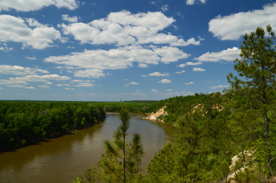
Located near the Apalachicola River, the Apalachicola Bluffs and Ravines Preserve protects one of the most unique habitats in Florida. The preserve has a number of steep ravines with streams flowing through them, and in fact, the preserve's hiking trail provides some of the biggest elevation changes to be found in the state. En route to the Apalachicola River, this hike passes through lush ravines as well as sandhill uplands with some longleaf pines. The highlight of the hike is at Alum Bluff. Positioned 135 feet above the Apalachicola River, this interesting geological formation provides a grand view of the river northward. The hike also makes a short loop through more ravines near the river and past additional sandy bluffs. This hike occurred on Sunday, April 24, 2016. My plan was to hike the Eden of Garden Trail out and back, At the far end of the trail, I would hike the short river loop counter-clockwise.
Summary
R/T Length of Trail: 4.2 Miles
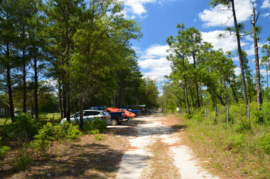
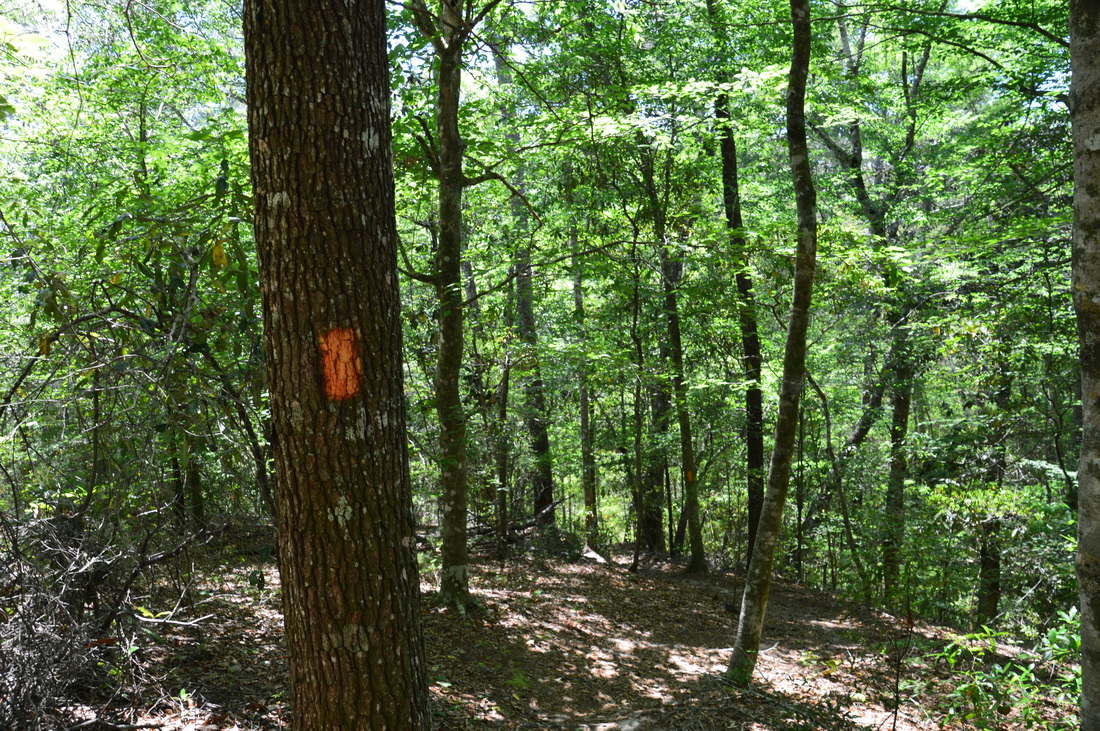
Duration of Hike: 2:20 Type of Hike: Out and Back with a Small Loop Difficulty Rating: 3 out of 10 Total Elevation Gain: 762 Feet (This may not be fully accurate, because my GPS makes some bizarre elevation recording jumps, when I hike in Florida. However, I suspect that the total elevation gain was still between 500 and 700 feet). Pros: Very interesting and unique scenery for Florida Cons: None Points of Interest: The several ravines encountered on the hike; Alum Bluff View of the Apalachicola River - 6 stars (relatively to the mountains, this is not the best vista, but for Florida, this could be one of the best elevation vistas in the state); Other views of the Apalachicola River from the River Loop Trail Blaze Color(s): Garden of Eden Trail - Orange Best Season(s) to Hike: Summer Fees: None Beginning Point: Garden of Eden Trailhead in Apalachicola Bluffs and Ravines Preserve Directions: From Bristol, FL: Follow Florida State Route 12 North. 1.4 miles from FL State Route 20, you will see two roads to the left. The first road, a dirt road, is marked by a sign "<--- Skyland Ranch Smokehouse Wild Game Processing". The second road, a paved road, is marked by a sign "Apalachicola Bluffs and Ravines Preserve <--- Garden of Eden Trail". Turn left onto the second road. Continue for 0.2 miles and then continue straight onto a dirt road. The dead-end parking area for this trail lies straight ahead. Map
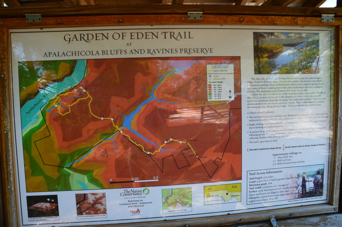
Click here for more information and to download this trail map to view in Garmin Basecamp.
Details
When hiking in Florida, I expect little if any elevational variation. In fact, Florida's highest point - Britton Hill - is only 312 feet above sea level. There are some exceptions to the mostly flat hiking in Florida, though. The area on the east side of the Apalachicola River in portions of Liberty County and Gadsden County - mainly north of the town of Bristol and south of the town of Chattahoochee - is unique to Florida, with many ravines that house tributaries of the Apalachicola River. Tall sandy bluffs line the east bank of the Apalachicola River in this area. Apalachicola Bluffs and Ravines Preserve, Torreya State Park, and a couple of local parks in the town of Chattahoochee provide hiking access to the unique ecosystems that are found along the east side of the Apalachicola River. The Garden of Eden Trail is the only hiking trail in the 6294-acre Apalachicola Bluffs and Ravines Preserve. Owned by The Nature Conservancy, this is truly one beautiful piece of land. I was about to embark on a Florida adventure like no other as I began the hike on the Garden of Eden Trail.
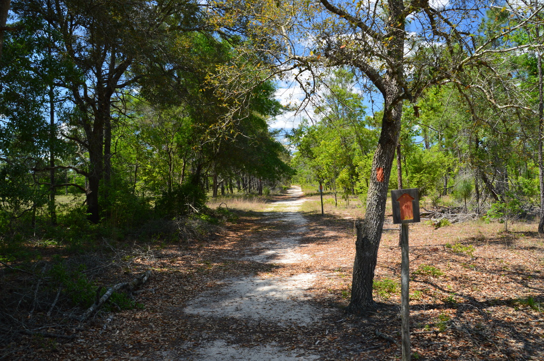
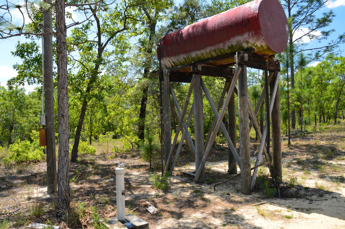
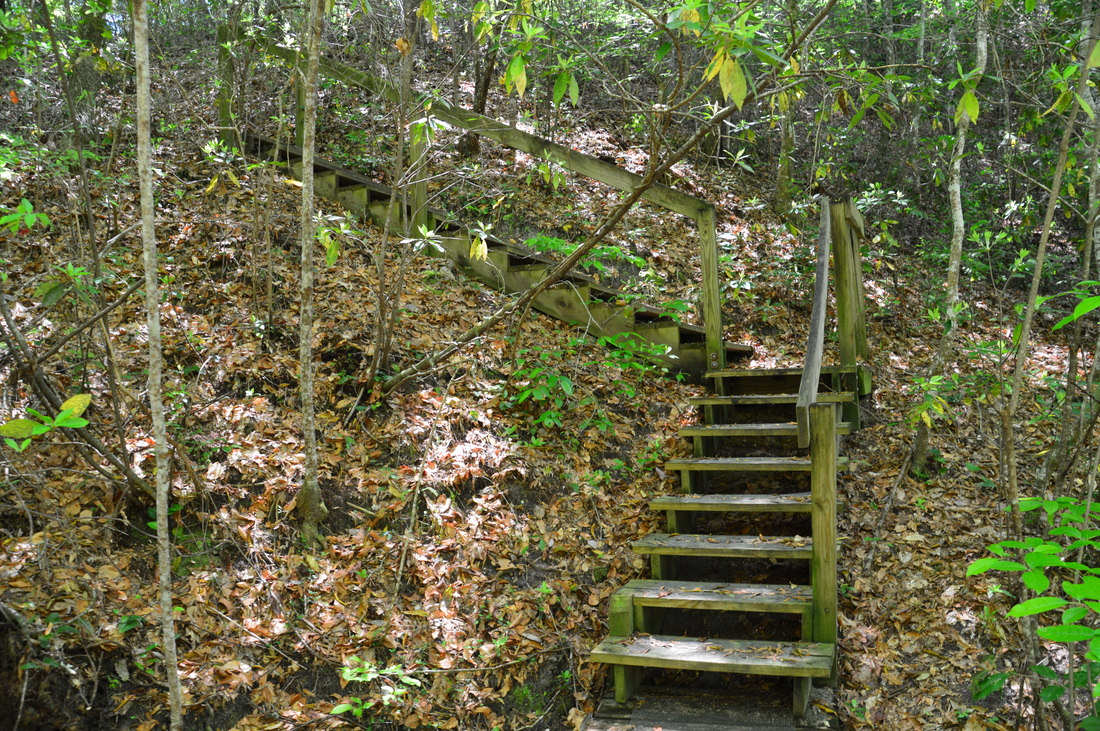
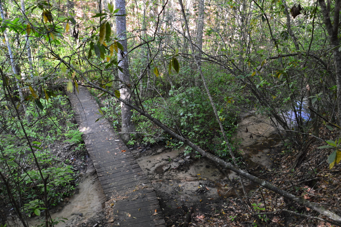
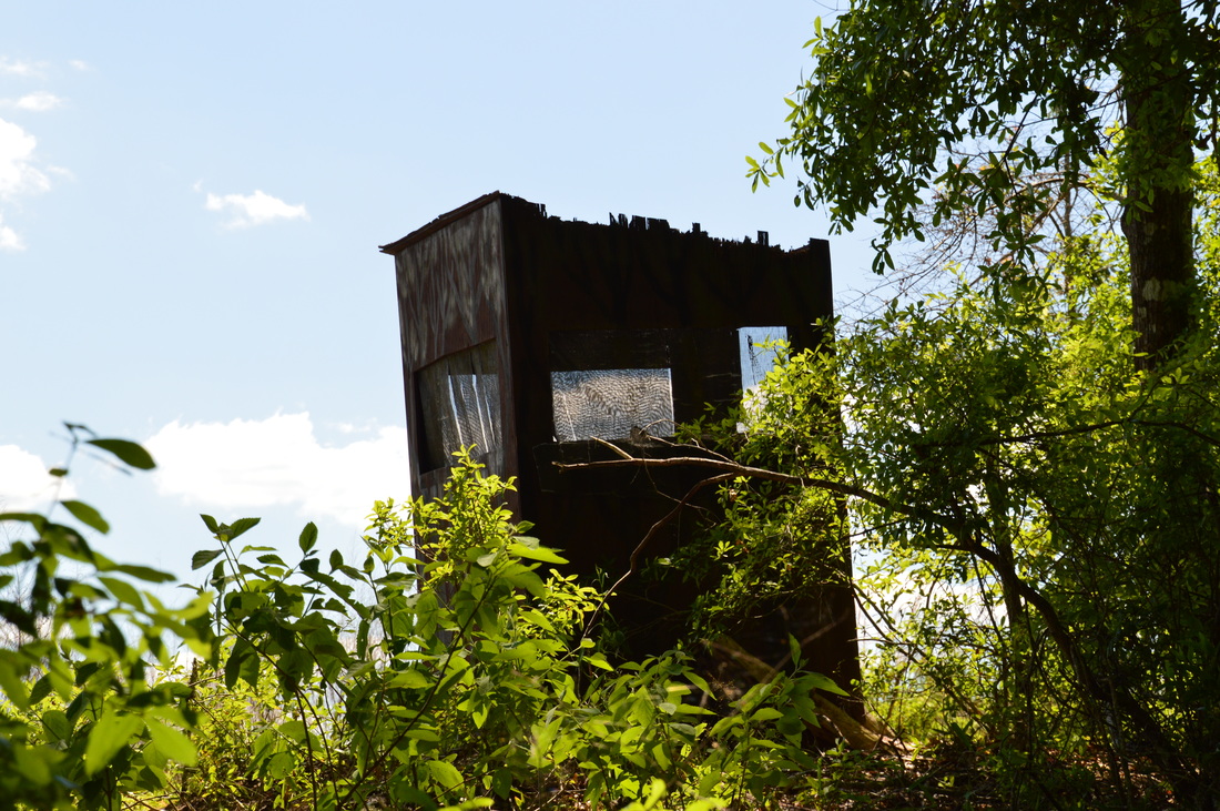
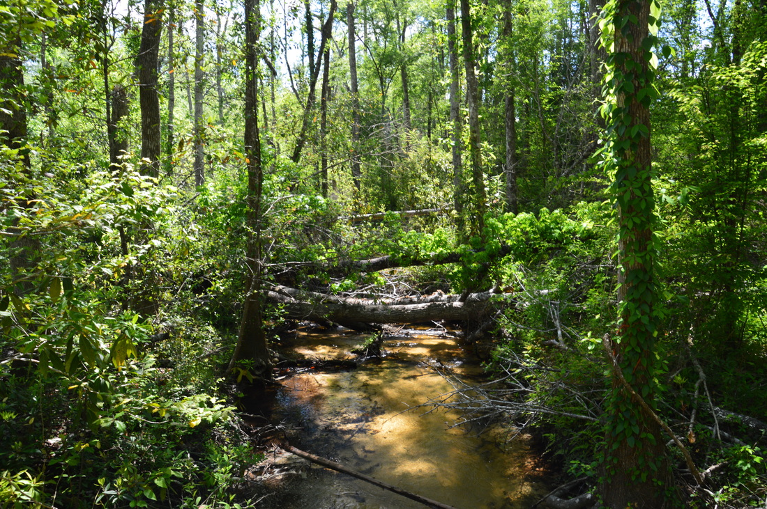
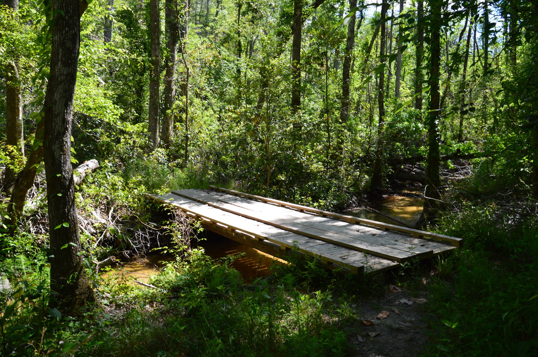
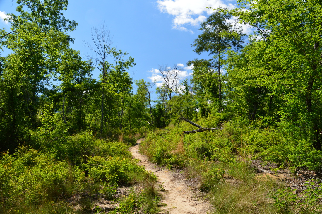
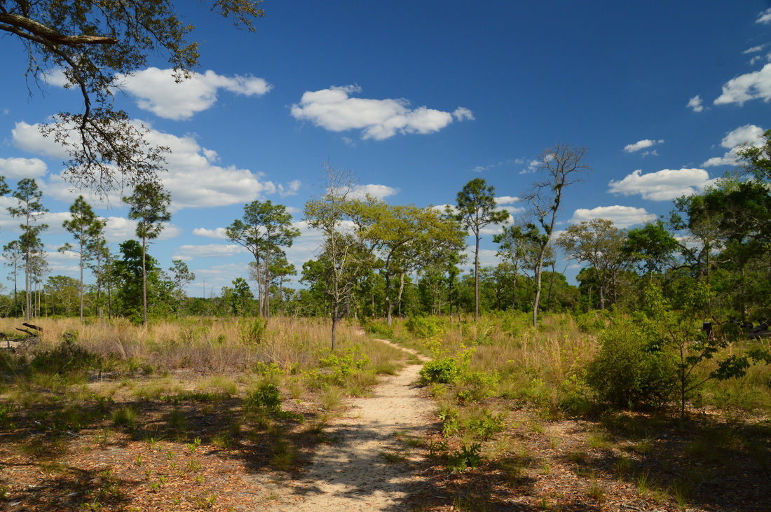
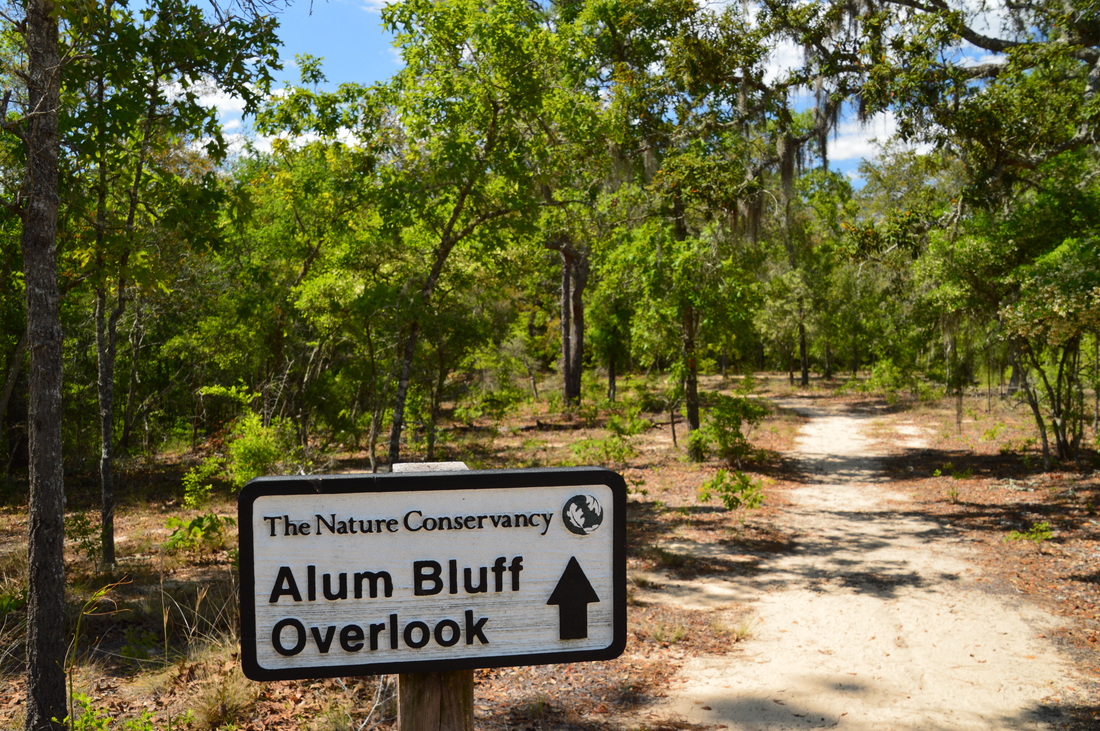
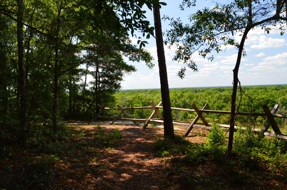
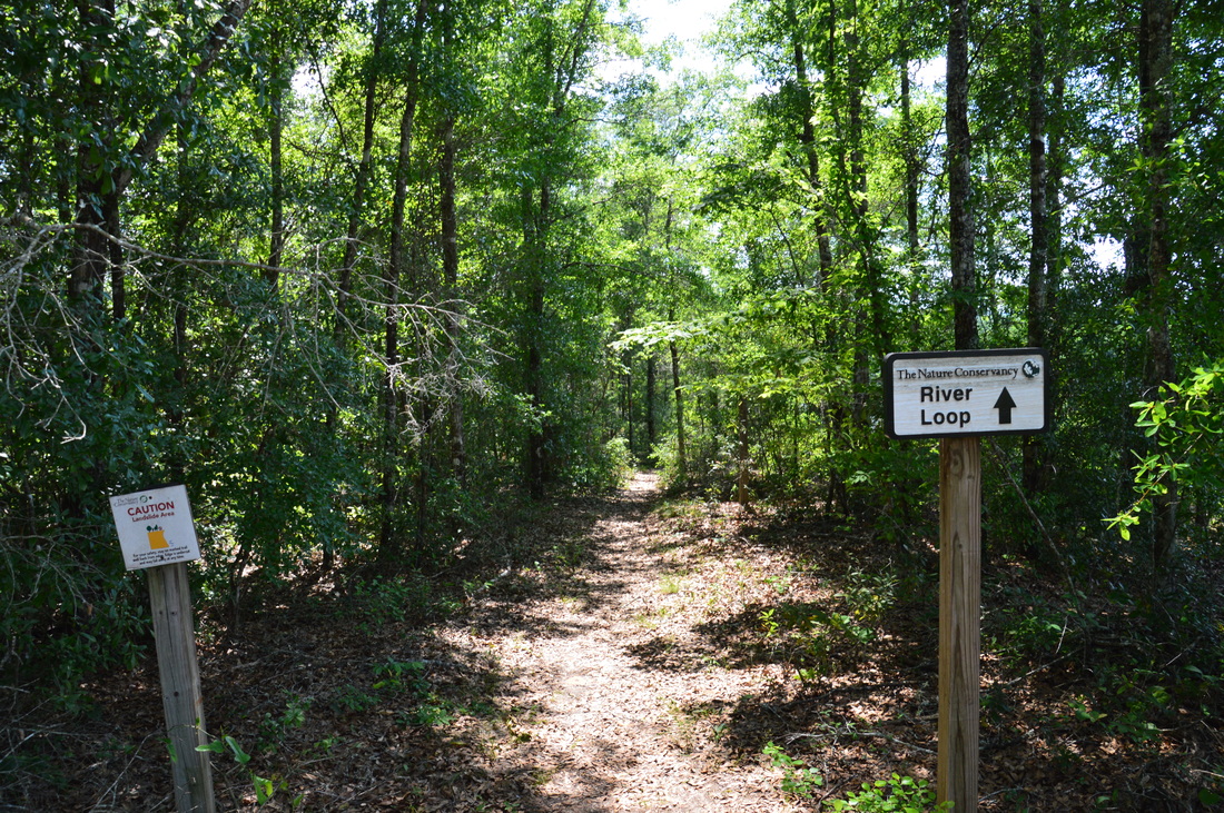
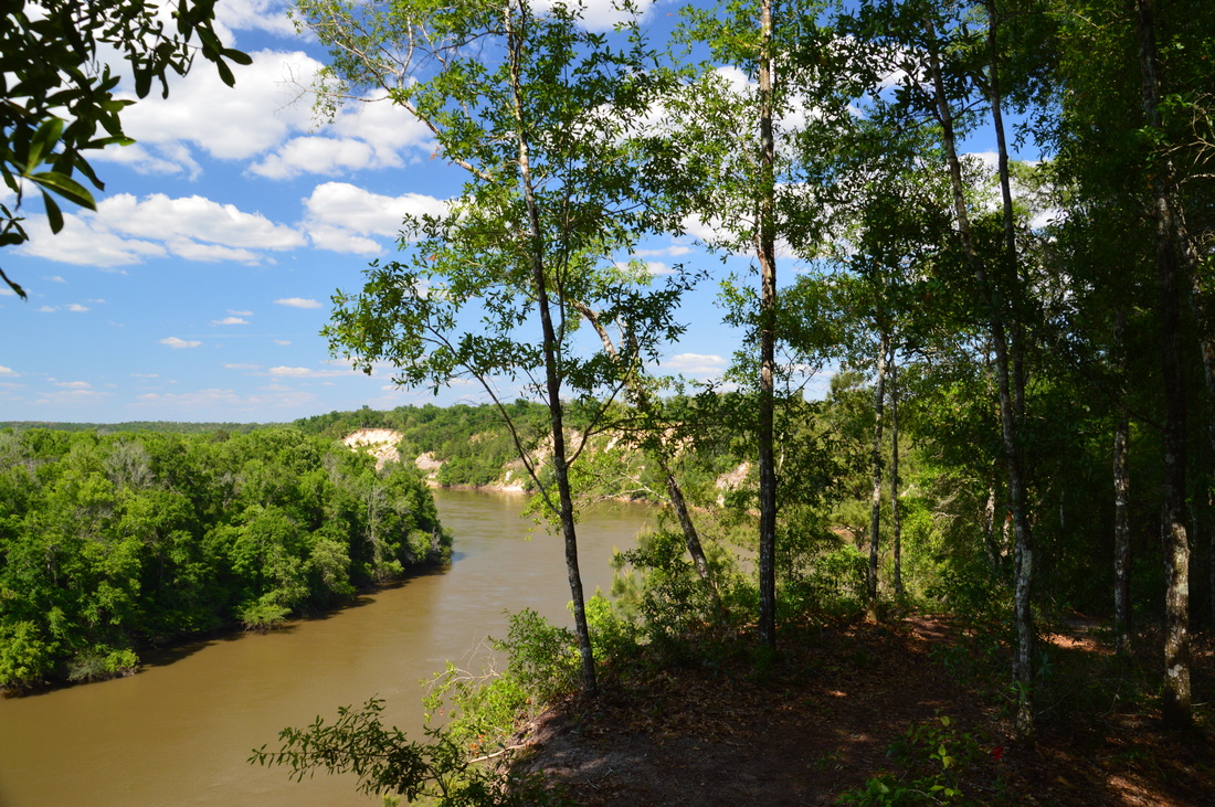
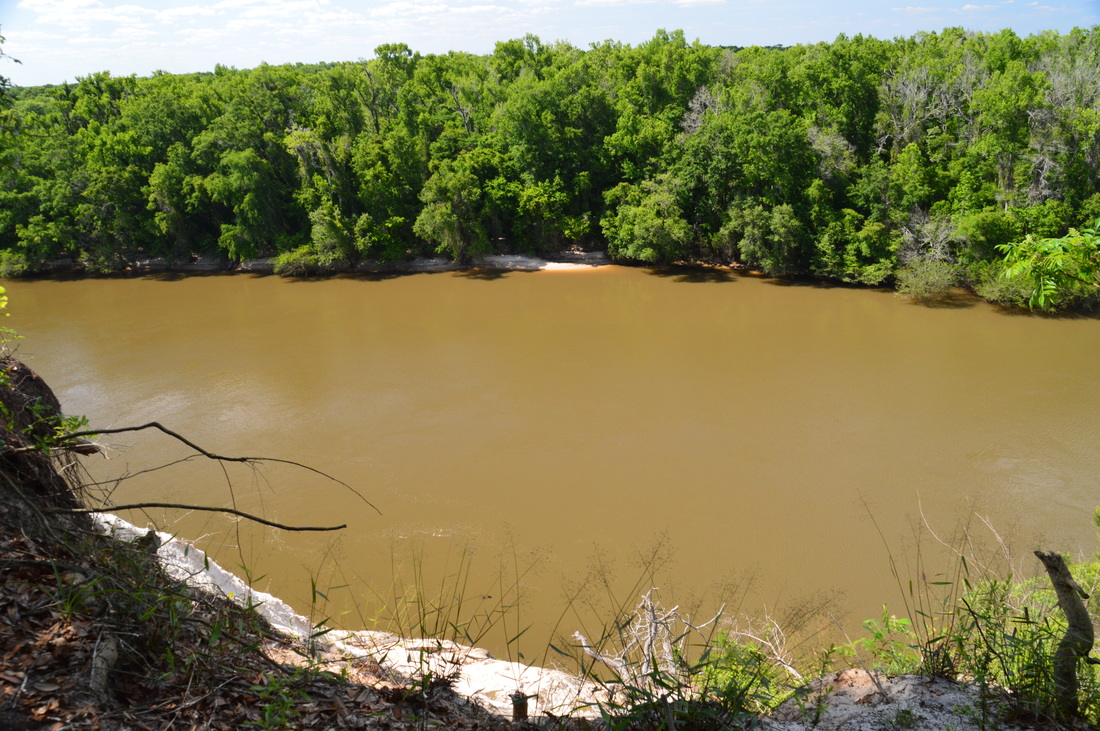
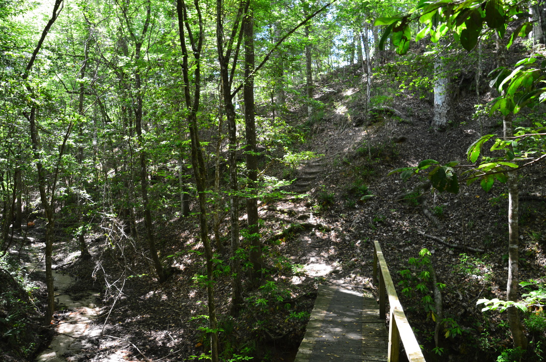
The Garden of Eden Trail begins at the far end of the sandy parking area. There is a gate to block vehicle access to a service road that the trail first follows, but a footpath was built around the gate. Take a look at the trailhead kiosk. On the kiosk, there is some useful information about the hike, including a detailed topographical trail map. From the kiosk, the trail follows an old sandy forest road through a sandhill habitat. At 0.2 miles, a water tank is located to the left of the trail. It seems to be used as a source of drinking water. Beyond the water tank, a sign points the trail to bear left, off the road and onto a nice single-track path. At 0.4 miles, the trail bears left as it leaves the sandhill area. The trail enters a hardwood forest and begins descending, and before long, you'll realize that there is some elevational variation around you, with a deep-looking ravine visible through the trees to the trail's right. Before long, the descent steepens until the trail bottoms out in the first ravine at 0.5 miles. Here, the trail crosses a boardwalk-type footbridge across a clear stream. Lush ravines like this are often a lot cooler than surrounding areas - these ravines are home to many very rare plants, some of which cannot be found anywhere else on Earth. On the other side of the footbridge, the trail begins to ascend out of the ravine by an impressive wooden staircase. Beyond the staircase, the trail continues to ascend steeply out of the ravine. At about 0.6 miles, the trail levels out on the flat rim of the ravine and follows the rim. The hardwood forest here is very green. Forests such as this are hard to find in Florida. In fact, there are places where it is hard to tell that you're hiking in Florida. The ravine is forested very heavily, so it's hard to truly see the size of the ravine, but you can still feel that it's there to your right. At 0.75 miles, the trail passes a clearing to the left. I suspect that this clearing is still in the process of being restored to classic sandhill habitat. Also, you will see to the left a bizarre structure that looks like the ruin of a hunter's booth, although I really have no clue what it could be. At 0.9 miles, the trail begins a descent into the ravine that is home to Kelley Branch. This ravine is the largest ravine that is encountered on this hike. As the descent begins, some views open up and you can see the depth of the ravine straight ahead and to the right. This side of the ravine seems to have received tornado damage, causing the openings with the small views. The descent into the ravine is very steep and somewhat rugged. My GPS recorded a maximum grade of -57% on this short stretch of trail! Near the bottom, the trail makes two switchbacks. At 1.05 miles, at the bottom of the ravine, the trail crosses Kelley Branch on a wide footbridge. After this, the trail - en route to Alum Bluff - quickly leaves the lush streamside and begins ascending out of the second ravine, although the ascent is a lot more gradual than the descent. At 1.15 miles, the trail crosses a jeep road. Continue straight across the road onto a trail that continues uphill into a sandhill habitat. The trail tops out in sandhills at 1.3 miles. You will see a lot of more typical Florida forest for the rest of the way to Alum Bluff. The trail stays for a while in a wiregrass field with a number of pines spaced throughout it. The trail will gradually curve right to follow the edge of the field. As I looked across the field, I was reminded of some of the hikes that I've done in the Apalachicola National Forest - there are lots of similar ecosystems in the area, unlike the ravines, which are very hard to find outside of this area of the Apalachicola River. At 1.6 miles, the trail reaches a sandy forest road. The main trail turns right onto the forest road, although it would be interesting to find out where the road goes southwest to the left. According to maps, the Apalachicola River makes a bend in that area, and there also appear to be some more ravines. Assuming that there is no private property between the trail and the river (I do not know if there is), I suspect that the forest road may eventually reach the river near the mouth of Kelley Branch. If there is some extra time remaining, it could be worth some exploration. To follow the official trail, though, turn right onto the road and continue to hike along the edge of the wiregrass-pine field. Just after you turn onto the road, pass the end of the River Loop to the left and begin the loop section of the hike. Continue straight on the sandy road for the most direct route to Alum Bluff. At 1.7 miles, the trail turns left, off the road and onto a wide sandy trail into the forest. There is a sign that says "Alum Bluff Overlook ^". At 1.8 miles, the trail reaches Alum Bluff and its vista of the Apalachicola River. Alum Bluff is a place like no other. From what I have read, Alum Bluff is the largest exposed section of the earth's crust in Florida. The critically endangered Florida Torreya tree is known to grow in the area around Alum Bluff. Considered as one of the rarest trees in the world, the Florida Torreya is an evergreen tree that can grow to heights ranging from about 45 to 65 feet. The tree is best recognized by its stiff and sharp leaves that resemble pine needles. According to a local legend, the Torreya tree is the gopher wood that Noah built the ark from. Also, there is a lot of history that is associated with Alum Bluff. There was a writer from Bristol, named E.E. Callaway, who seemed to have come up with evidence that supported that Alum Bluff is a possible site of the original Garden of Eden. Locally, Callaway's ideas grabbed quite a bit of attention and continued to attract people to the area, and this is why the trail was named the Garden of Eden Trail, but it is still widely supported by most scholars that the true Garden of Eden is in the Middle East. Also, Alum Bluff played a role during the Civil War. The confederate forces placed their artillery at Alum Bluff to protect the Apalachicola River from the union forces. Most of the earthworks have become eroded, but their traces can still be seen as you hike the Garden of Eden Trail. I learned much of the historical information about Alum Bluff from an article at ExploreSouthernHistory.com. Click here, if you would like to read more about Alum Bluff. The view from Alum Bluff is nothing short of spectacular. You can see a bend in the Apalachicola River to the north, with its floodplain stretching far to the horizon. The east bank of the river is lined by a row of bluffs. Further north, the row of bluffs actually lines the eastern edge of the river's floodplain, while the river snakes its way through the floodplain. From the vista at Alum Bluff, a portion of the river southbound is seen as well. It will be hard to tear yourself away from this view, but eventually, you'll have to get going. Many people choose to retrace their steps from Alum Bluff, but the River Loop is worth the extra mileage. From Alum Bluff, bear left onto a single-track path that is signed as the River Loop. There are some views of the Apalachicola River southward, as well as some more eroded sandy bluffs. Make sure to stay strictly on the trail, as this is very sensitive terrain. Before long, the trail begins descending. You will pass a "trail rerouted" sign. The trail makes a couple of switchbacks as it descends to a small ravine. On the other side, the trail raises back up quickly. At 2 miles, the trail reaches another bluff with a good vista of the Apalachicola River. This vista rivals Alum Bluff, but this vista is at a slightly lower elevation than Alum Bluff, so the view is not as long-distance as the one from Alum Bluff. Still, it's a beautiful view where tall sandy bluffs are visible upstream along the river. After this vista, the trail follows the rim of the bluff line for just a little bit farther, before beginning to descend steeply into a ravine via a set of steps. At the bottom, at 2.15 miles, the trail crosses a footbridge across a small stream. Then, using switchbacks, the trail ascends back out of the ravine and onto a sort of ridge that appeared to be between two ravines. As the trail curves left at the rim of the ravine, the wiregrass clearing becomes visible through the trees to the right. At 2.6 miles, reach the end of the River Loop. From here, turn right onto the Garden of Eden Trail and retrace your steps along the main trail back to the trailhead. You'll have two more ascents along your return route. I am sure that you'll feel the steep uphill out of the Kelley Branch ravine. By the time I was approaching the final ravine, I was getting very thirsty, as on this hot late spring day, I didn't bring any water, thinking that the hike wouldn't be long. It turned out to be longer than I expected, and the weather was hotter than I expected. As I finally arrived back at the trailhead at 4.2 miles, I concluded that this was one of the most unique and interesting hikes that I have done in Florida to date. It was difficult for me to decide if I should rate the hike a Best Hike, but eventually, I decided that the rare and unusual scenery on this hike warrants a Best Hike rating. This hike became the third Best Hike that I have completed in Florida - all three Best Hikes were in the Florida Panhandle. Mileage
0.0 - Garden of Eden Trailhead
0.5 - First ravine; Small unnamed stream 1.05 - Second ravine; Kelley Branch 1.6 - Sandy forest road; River Loop begins 1.8 - Alum Bluff 1.95 - Third ravine 2.0 - Another bluff with a good vista 2.15 - Fourth ravine; Small unnamed stream 2.6 - End of River Loop; Turn right onto the main trail 4.2 - Garden of Eden Trailhead Variations
Hike out and back to Alum Bluff - 3.6 Miles
Bonus Stops
The Chattahoochee Nature Trails in the town of Chattahoochee or Angus Gholson Nature Park (also in Chattahoochee) are both good bonus stops to the north of this hike. Both short hikes are located near the Apalachicola River.
PicturesVideos
3 Comments
6/10/2016 11:52:31 am
I was recently at Torreya State Park and was impressed by the steepness of much of the terrain. There's even a waterfall in that park!
Mark Oleg
6/10/2016 12:24:58 pm
Yeah, I've heard about Torreya State Park. Many people say the Garden of Eden Trail is even more beautiful than the Torreya trail system. I'll check out Torreya some day as well.
Pat
8/11/2018 12:27:16 pm
The directions say: Continue for 0.2 miles and then continue straight onto a dirt road. The dead-end parking area for this trail lies straight ahead. Leave a Reply. |
About MeMark Oleg Ozboyd Dear readers: I have invested a tremendous amount of time and effort in this website and the Georgia Waterfalls Database the past five years. All of the work that has gone in keeping these websites updated with my latest trip reports has almost been like a full-time job. This has not allowed me to pick up a paid job to save up money for college, and therefore, I I've had to take out loans. If you find the information on this website interesting, helpful, or time-saving, you can say "thanks" and help me out by clicking the button above and making a contribution. I will be very grateful for any amount of support you give, as all of it will apply toward my college tuition. Thank you!

Coming in 2022-2023?
Other Hiking WebsitesMiles HikedYear 1: 540.0 Miles
Year 2: 552.3 Miles Year 3: 518.4 Miles Year 4: 482.4 Miles Year 5: 259.9 Miles Archives
March 2021
Categories
All
|


 RSS Feed